Integrating DHS Geospatial Tools, Infrastructure Data, and Standardized Symbology
September 13-14, 2016
www.napsgfoundation.org | @napsgfoundation
napsgfoundation.org | @napsgfoundation 1
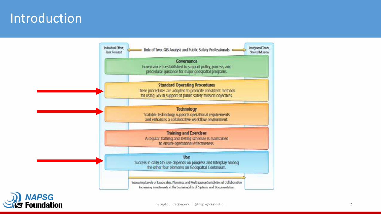
Introduction
napsgfoundation.org | @napsgfoundation 2
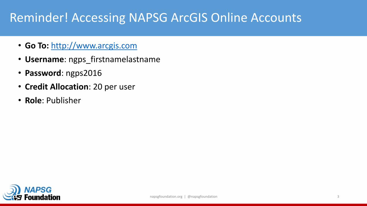
Reminder! Accessing NAPSG ArcGIS Online Accounts
• Go To: http://www.arcgis.com
• Username: ngps_firstnamelastname
• Password: ngps2016
• Credit Allocation: 20 per user
• Role: Publisher
napsgfoundation.org | @napsgfoundation 3

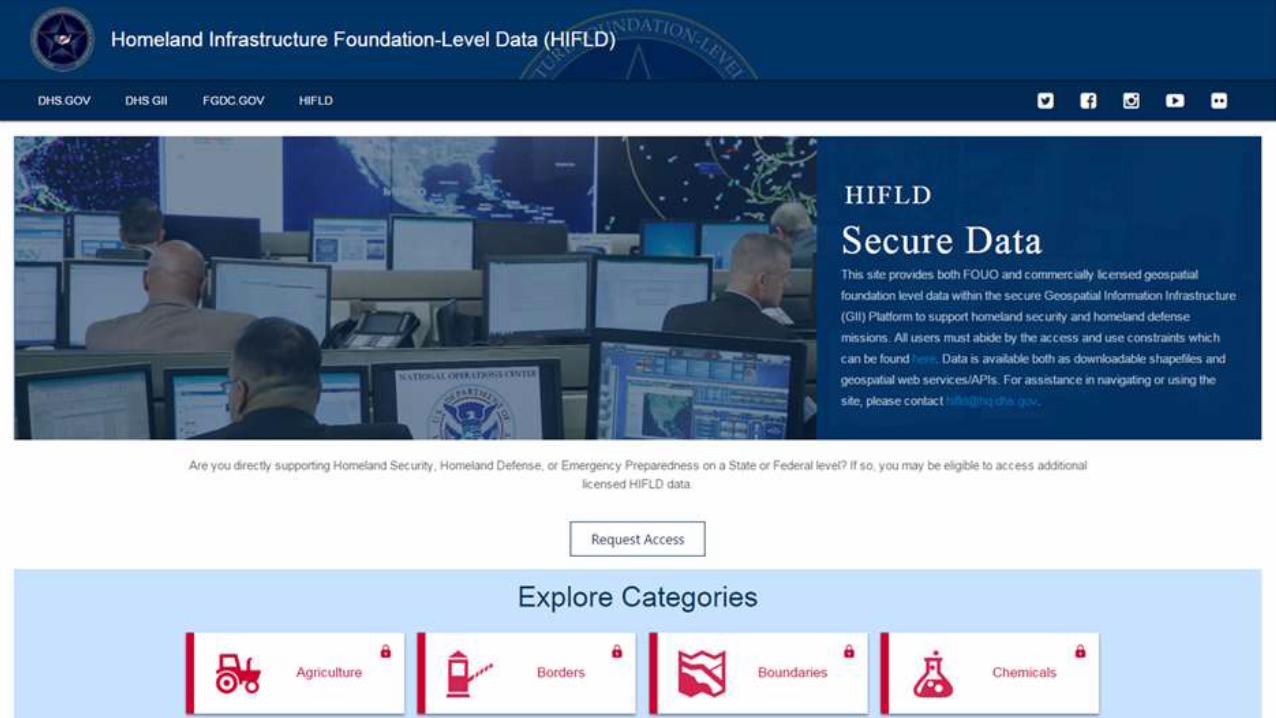
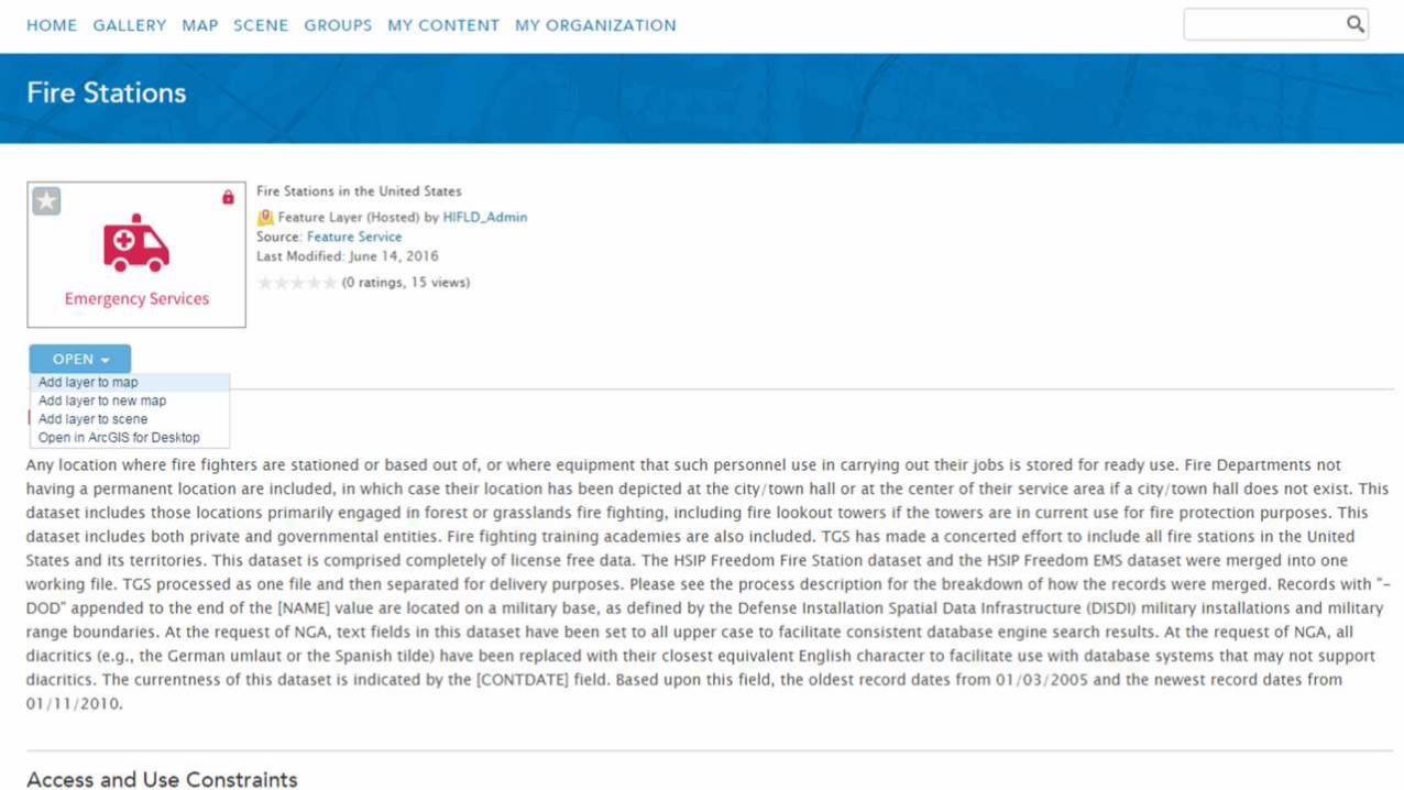
Homeland Infrastructure Foundation-Level Data (HIFLD)
13 Sep 2016
Michael Donnelly
Geospatial Data Architect
DHS GMO
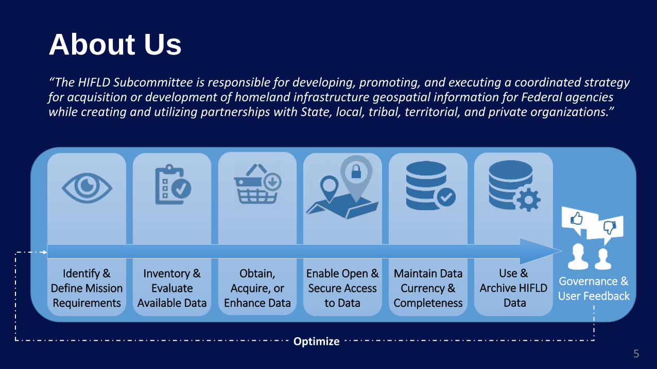
About Us
5
“The HIFLD Subcommittee is responsible for developing, promoting, and executing a coordinated strategy for acquisition or development of homeland infrastructure geospatial information for Federal agencies while creating and utilizing partnerships with State, local, tribal, territorial, and private organizations.”
Identify & Define Mission Requirements
Inventory & Evaluate
Available Data
Obtain, Acquire, or
Enhance Data
Enable Open & Secure Access
to Data
Maintain Data Currency &
Completeness
Use & Archive HIFLD
Data
Governance & User Feedback
Optimize
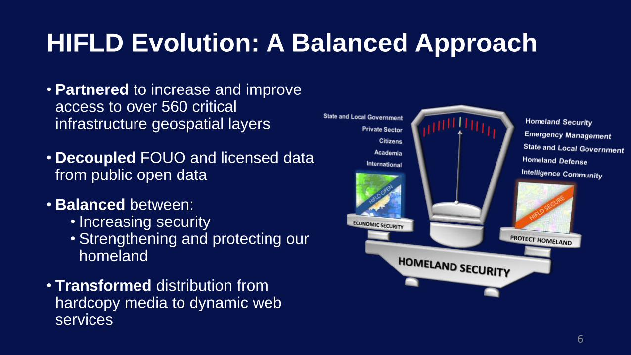
HIFLD Evolution: A Balanced Approach
6
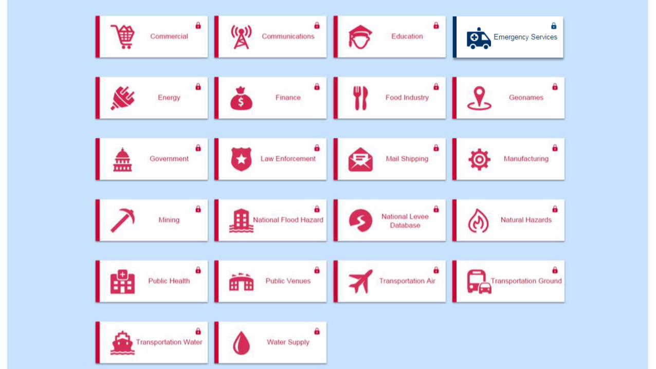
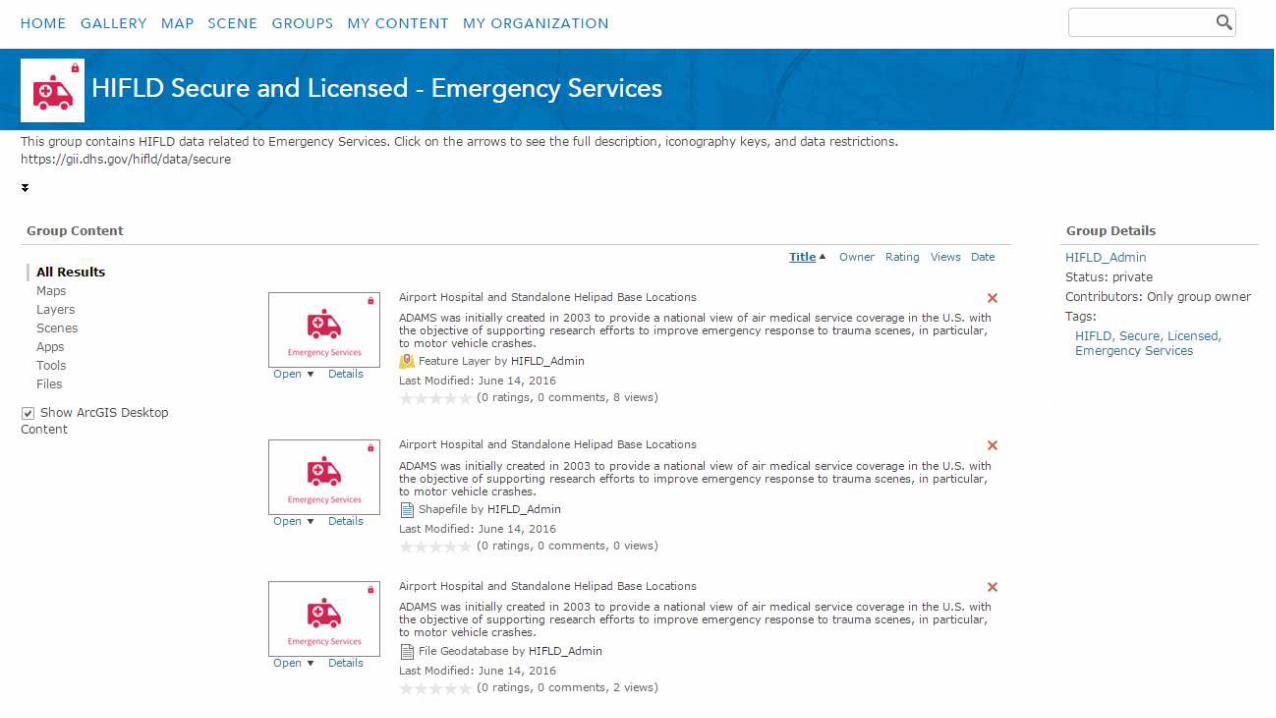
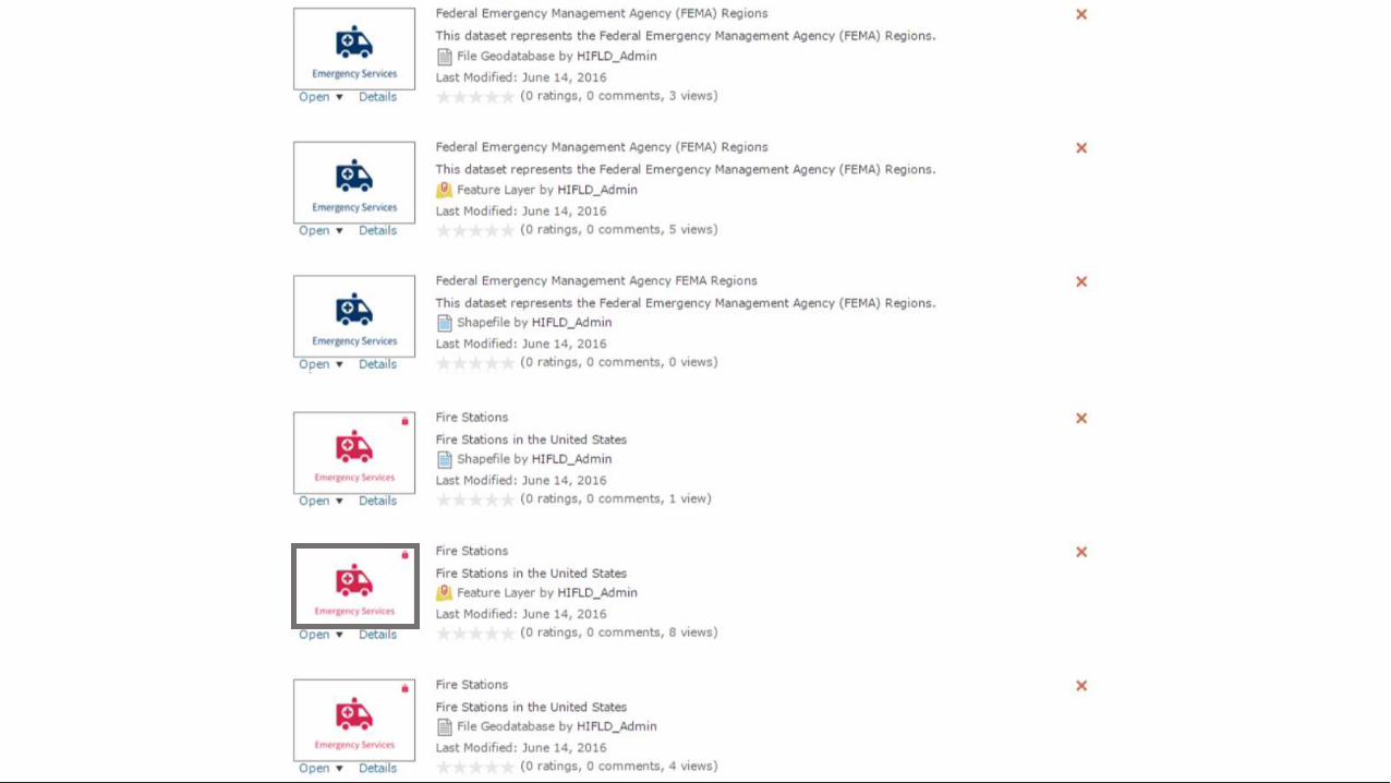
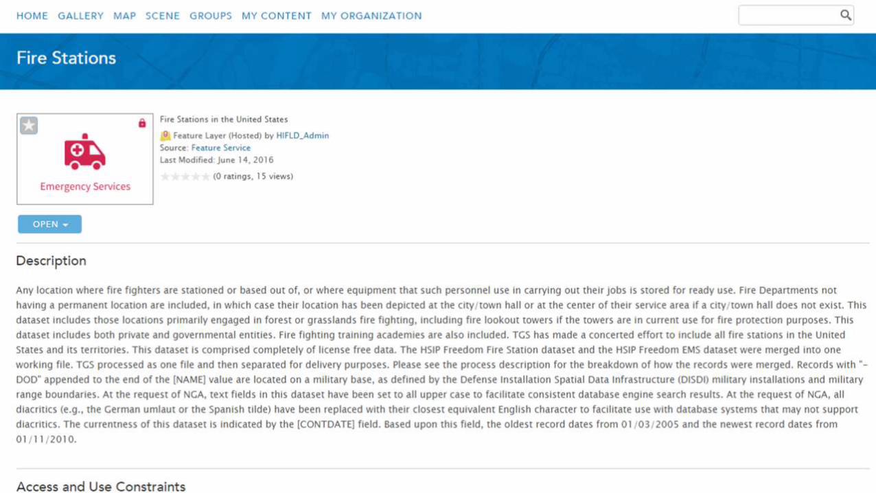
• Partnered to increase and improve access to over 560 critical infrastructure geospatial layers
• Decoupled FOUO and licensed data from public open data
• Balanced between:• Increasing security• Strengthening and protecting our
homeland
• Transformed distribution from hardcopy media to dynamic web services
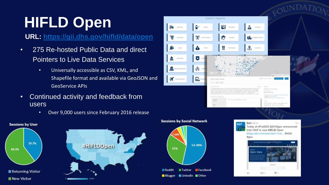
HIFLD OpenURL: https://gii.dhs.gov/hifld/data/open
• 275 Re-hosted Public Data and direct
Pointers to Live Data Services
• Universally accessible as CSV, KML, and
Shapefile format and available via GeoJSON and
GeoService APIs
• Continued activity and feedback from users
• Over 9,000 users since February 2016 release
#HIFLDOpen
10

Questions?
20
Come visit the HIFLD Booth in the Government Neighborhood!
Contact the HIFLD Support Team at [email protected]
Or
Thank you!
Geospatial Information Infrastructure (GII)
2016 National Geospatial Preparedness Summit (NGPS)
Prepared by Lewis Summers - GMO
13 September 2016
Edit Master / TimesNewRoman 38 pts
| | |
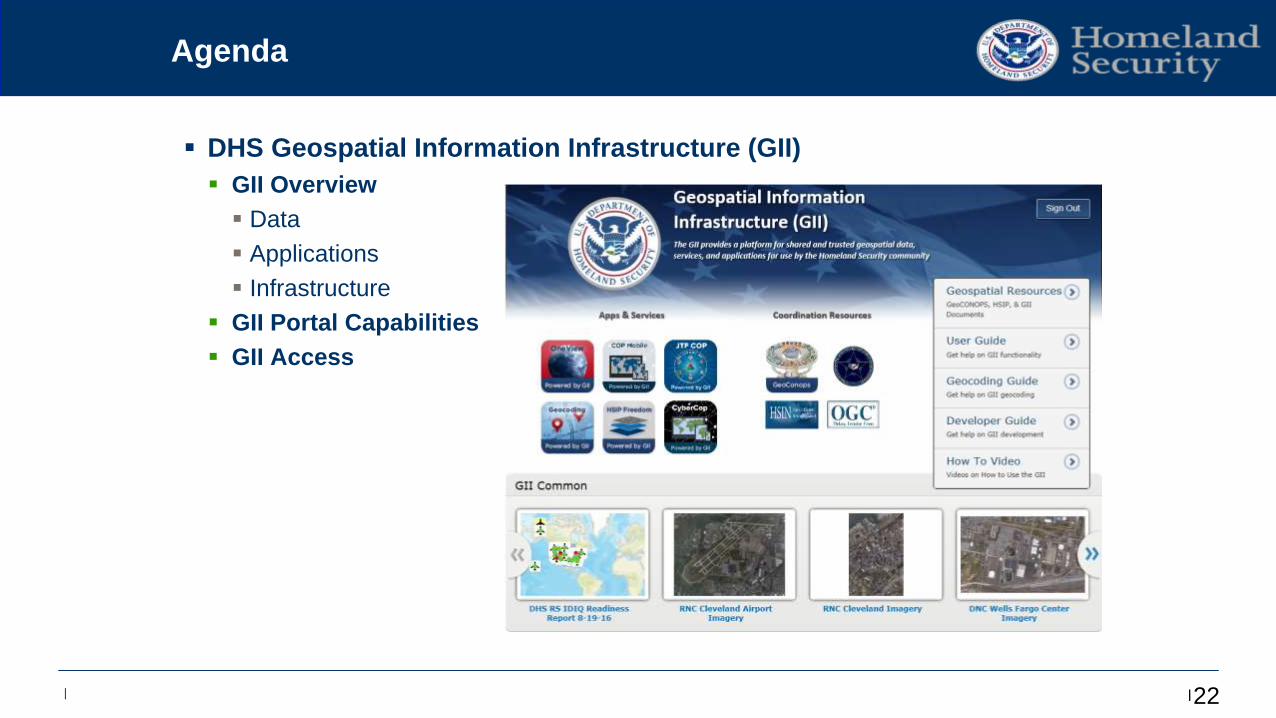
Agenda
DHS Geospatial Information Infrastructure (GII)
GII Overview
Data
Applications
Infrastructure
GII Portal Capabilities
GII Access
22
Edit Master / TimesNewRoman 38 pts
| | | 2
3
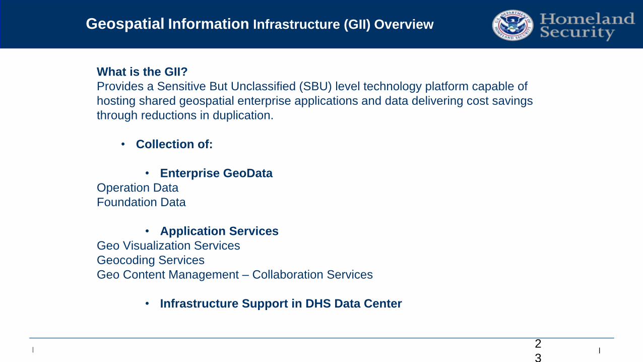
Geospatial Information Infrastructure (GII) Overview
What is the GII?
Provides a Sensitive But Unclassified (SBU) level technology platform capable of
hosting shared geospatial enterprise applications and data delivering cost savings
through reductions in duplication.
• Collection of:
• Enterprise GeoData
Operation Data
Foundation Data
• Application Services
Geo Visualization Services
Geocoding Services
Geo Content Management – Collaboration Services
• Infrastructure Support in DHS Data Center
Edit Master / TimesNewRoman 38 pts
| | |
GII Overview Continued…
24
• Available to all users across the entire Homeland Security/Defense
enterprise (Federal, State, Local, Tribal and Territories)
• Enables operators and analysts to:
• Securely search, discover and access:
• Imagery & Base Maps
• DHS Operational Data
• Foundational Data
• Store and share geospatial information
• Private or public based on your requirements
• Create and share derived products
• Access existing common applications and tools
• Geocoding, DHS COP, etc.
• Easily build interactive maps and customized apps
• Field Collection, Story Maps, Heat Maps
Edit Master / TimesNewRoman 38 pts
| | | 2
5
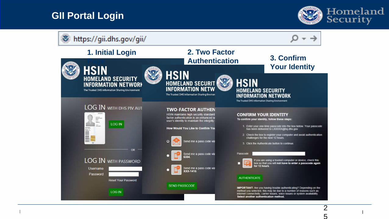
GII Portal Login
1. Initial Login
Page
2. Two Factor
Authentication 3. Confirm
Your Identity
Edit Master / TimesNewRoman 38 pts
| | |
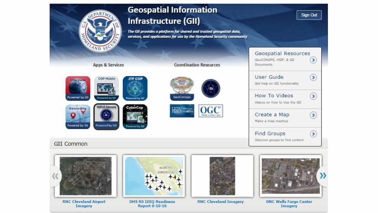
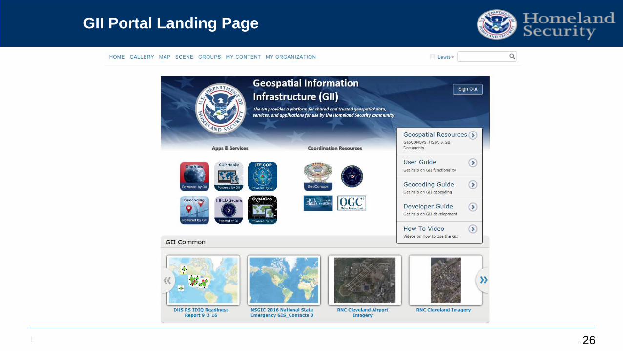
GII Portal Landing Page
26
Edit Master / TimesNewRoman 38 pts
| | |
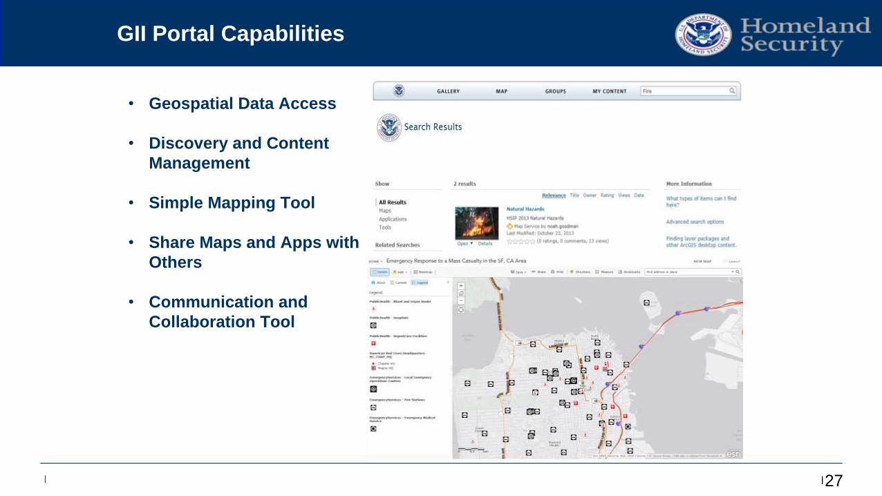
GII Portal Capabilities
27
• Geospatial Data Access
• Discovery and Content
Management
• Simple Mapping Tool
• Share Maps and Apps with
Others
• Communication and
Collaboration Tool
Edit Master / TimesNewRoman 38 pts
| | |
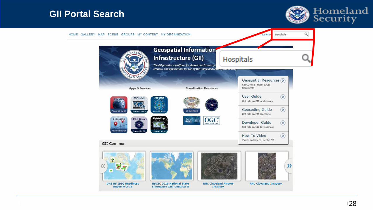
GII Portal Search
28
Edit Master / TimesNewRoman 38 pts
| | | 29
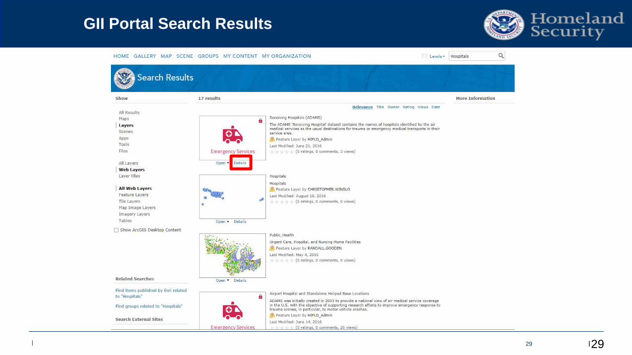
GII Portal Search Results
29
Edit Master / TimesNewRoman 38 pts
| | | 3030
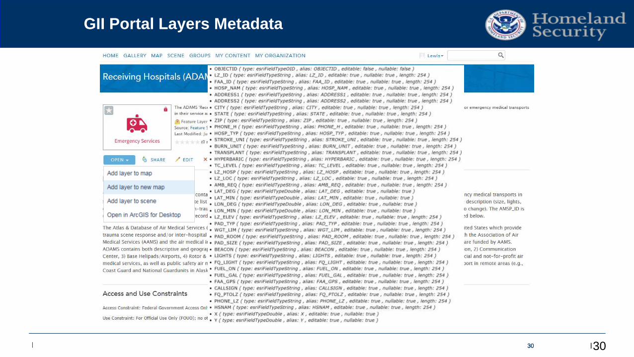
GII Portal Layers Metadata
30
Edit Master / TimesNewRoman 38 pts
| | | 31
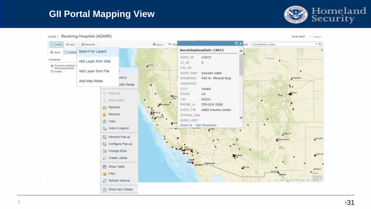
GII Portal Mapping View
Edit Master / TimesNewRoman 38 pts
| | | 32
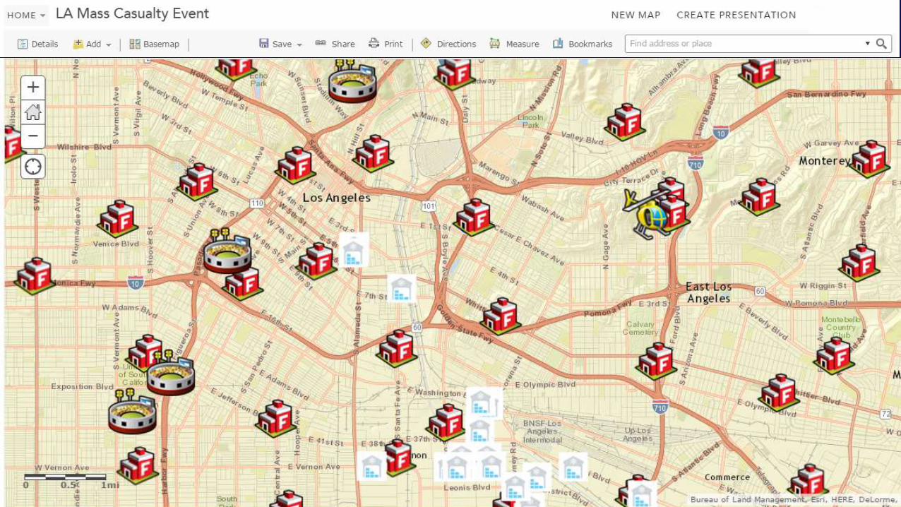
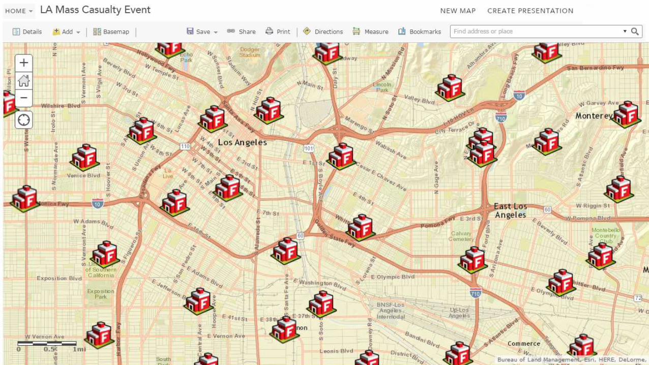
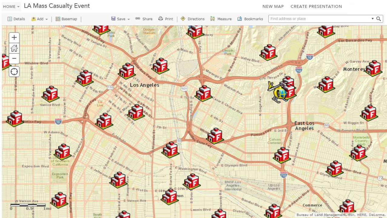
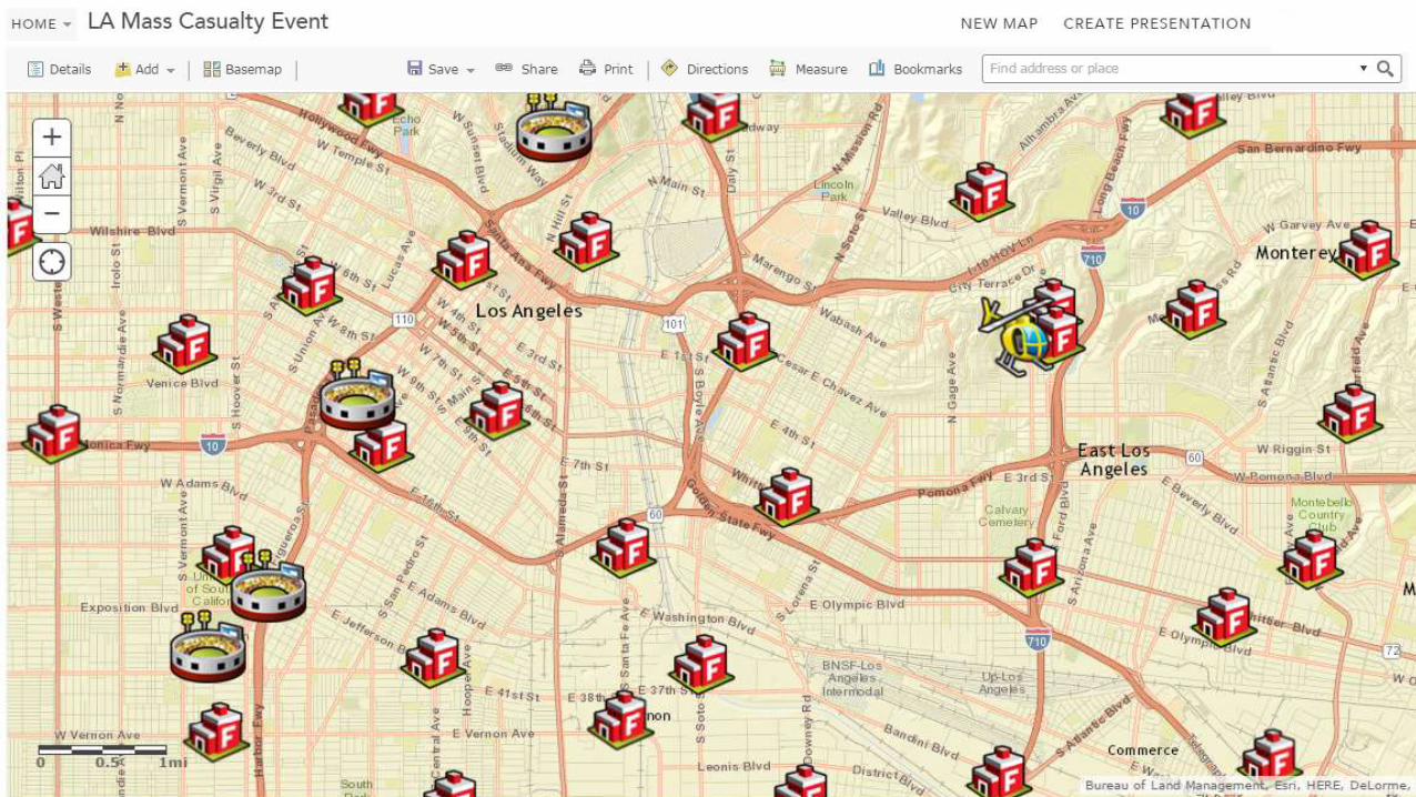
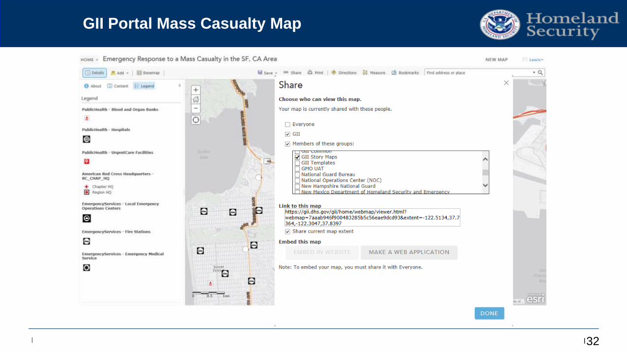
GII Portal Mass Casualty Map
Edit Master / TimesNewRoman 38 pts
| | | 33
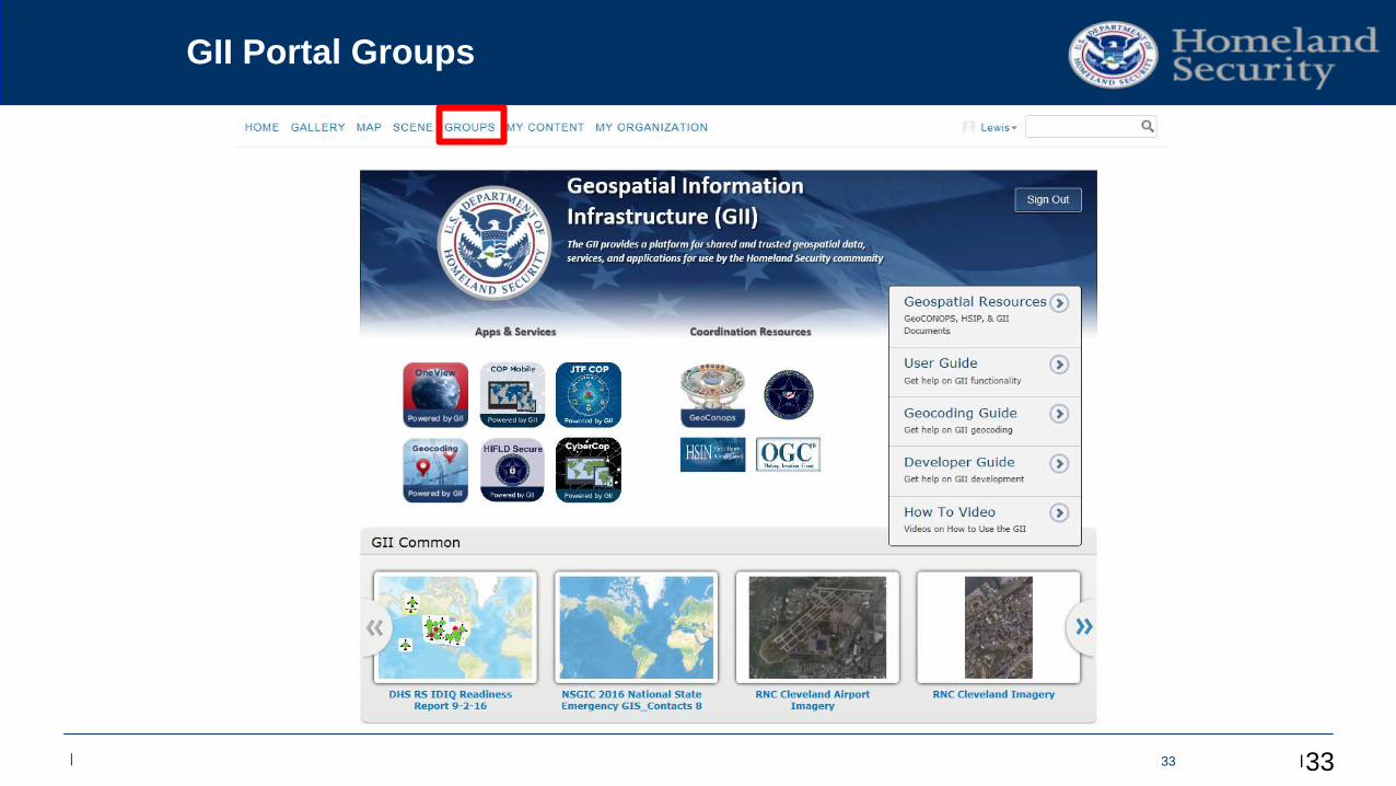
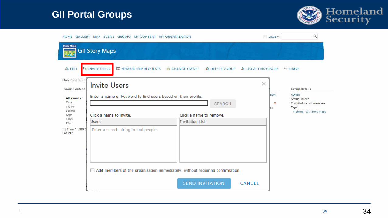
GII Portal Groups
33
Edit Master / TimesNewRoman 38 pts
| | | 3434
GII Portal Groups
34
Edit Master / TimesNewRoman 38 pts
| | | 353535
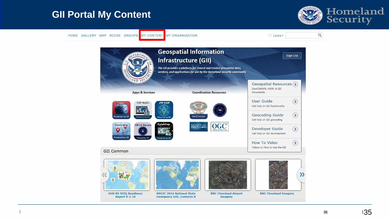
GII Portal My Content
35
Edit Master / TimesNewRoman 38 pts
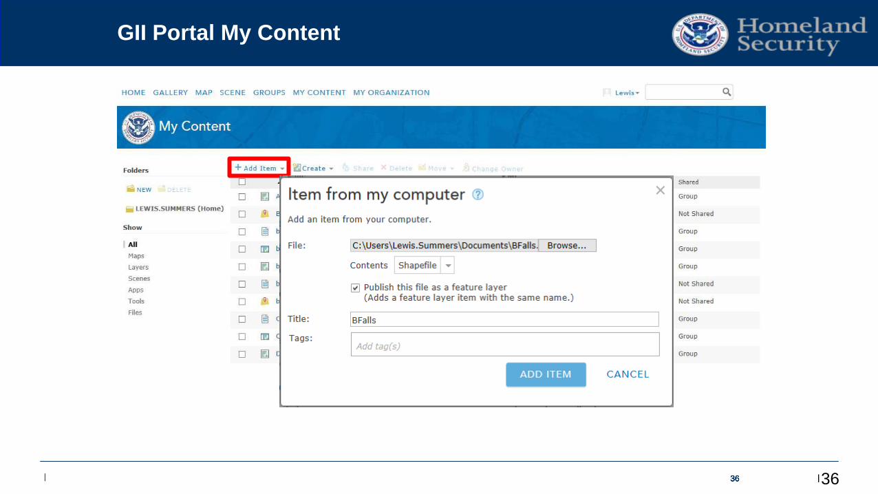
| | | 36363636
GII Portal My Content
36
Edit Master / TimesNewRoman 38 pts
| | | 3737373737
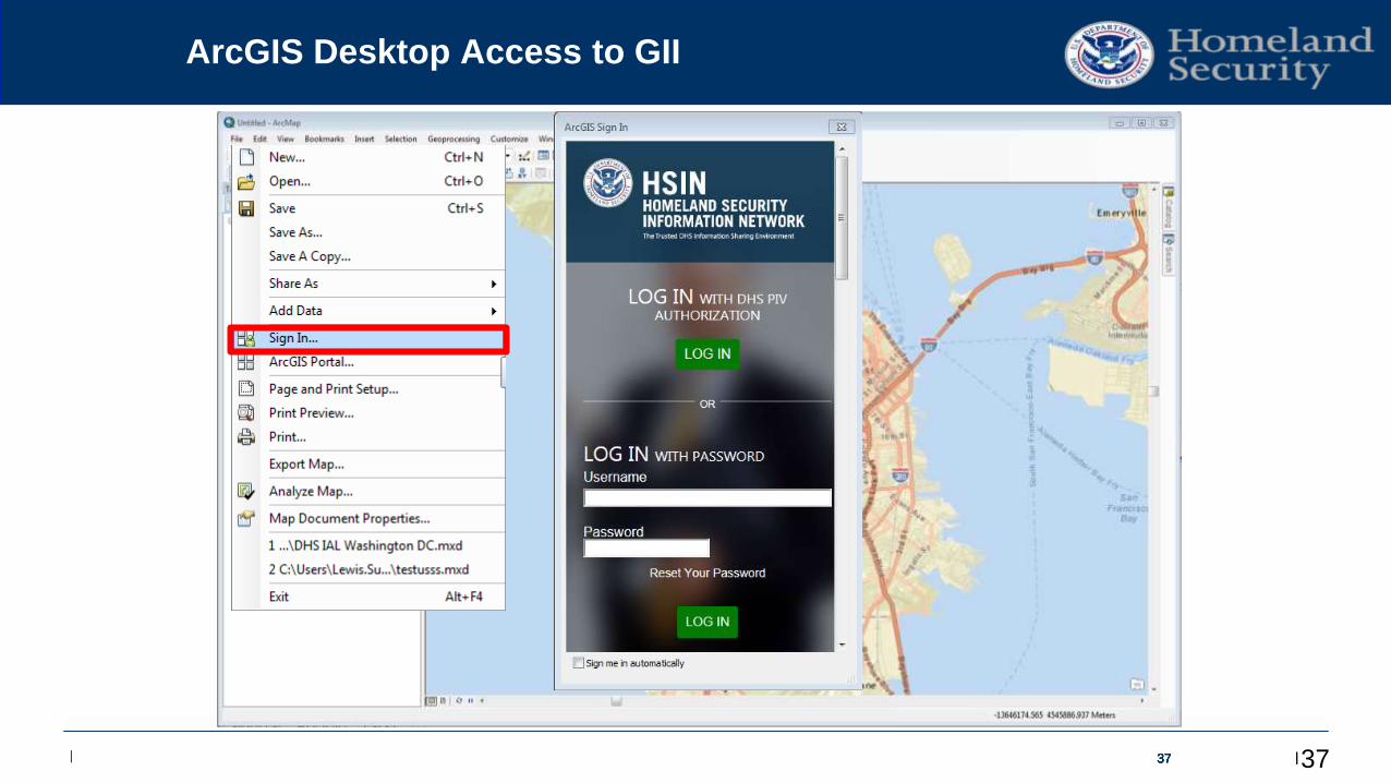
ArcGIS Desktop Access to GII
37
Edit Master / TimesNewRoman 38 pts
| | | 383838383838
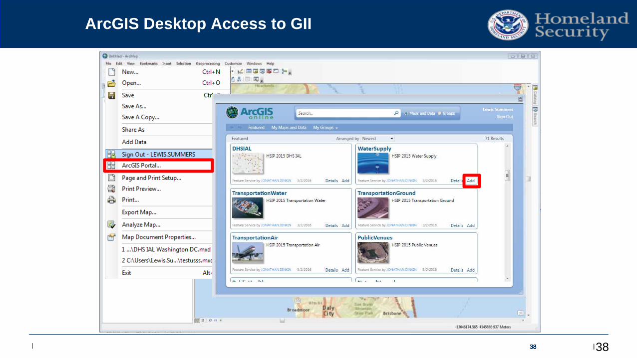
ArcGIS Desktop Access to GII
38
Edit Master / TimesNewRoman 38 pts
| | | 39393939393939
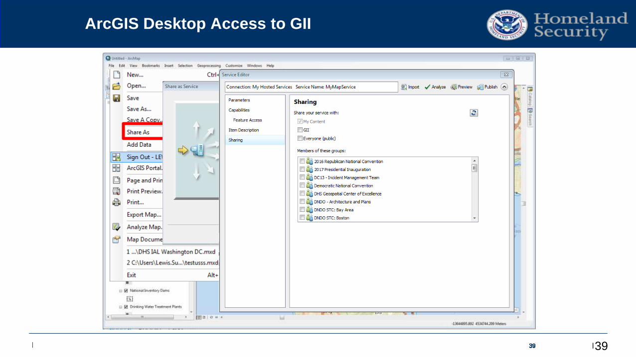
ArcGIS Desktop Access to GII
39
Edit Master / TimesNewRoman 38 pts
| | | 4040404040404040
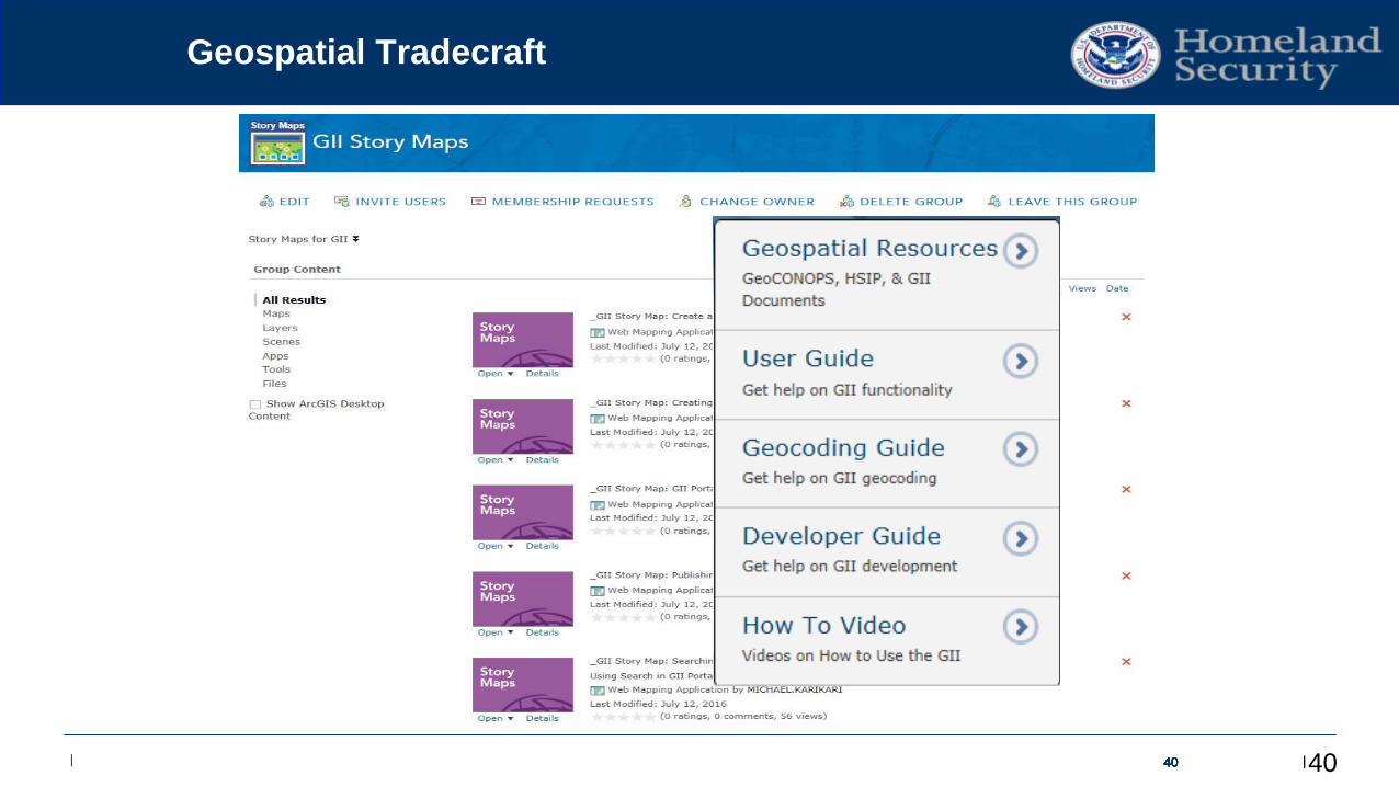
Geospatial Tradecraft
40
Edit Master / TimesNewRoman 38 pts
| | | 41
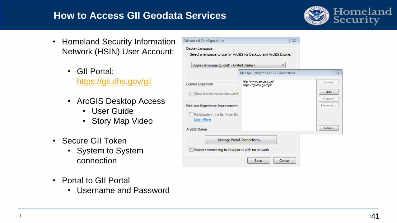
How to Access GII Geodata Services
• Homeland Security Information
Network (HSIN) User Account:
• GII Portal:
https://gii.dhs.gov/gii
• ArcGIS Desktop Access
• User Guide
• Story Map Video
• Secure GII Token
• System to System
connection
• Portal to GII Portal
• Username and Password
Edit Master / TimesNewRoman 38 pts
| | |
Contacts and Questions?
For general GII inquiries:
Request HSIN account to access GII services:
Include First Name, Last Name, Organization,
and Email Address
Access to GII Portal:
https://gii.dhs.gov/gii
Lewis Summers
GII Program Manager
42
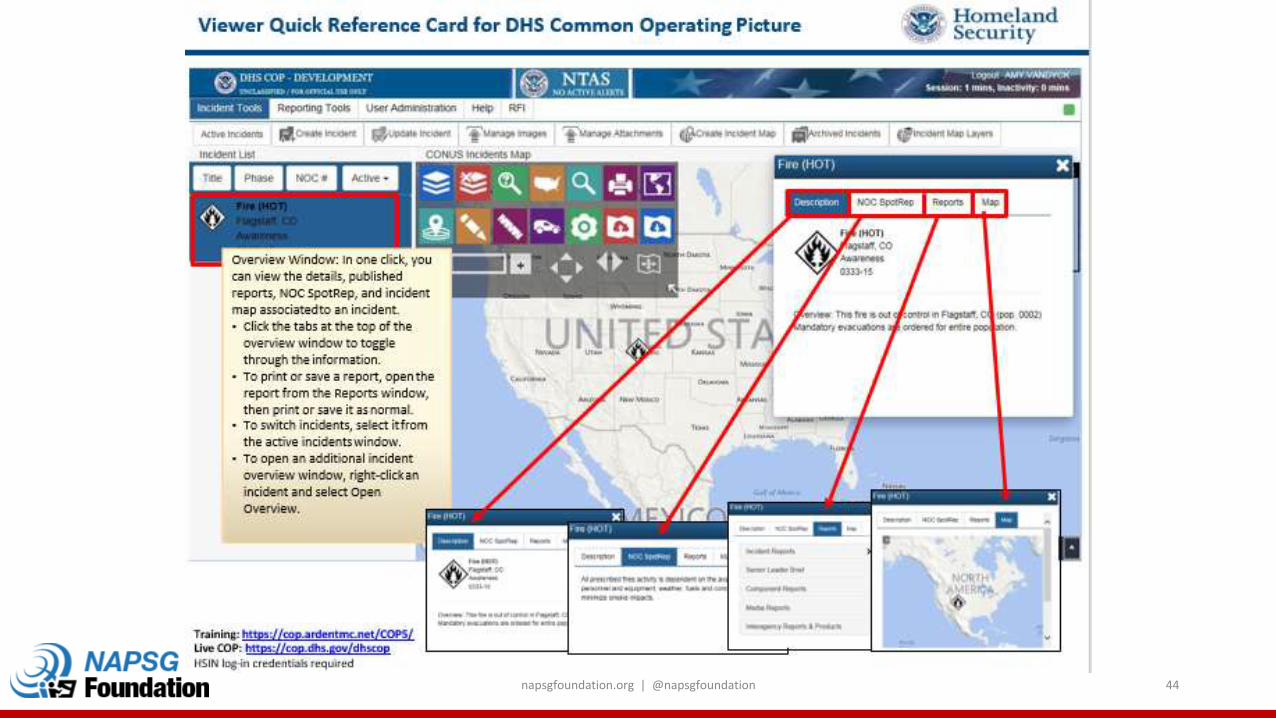
napsgfoundation.org | @napsgfoundation 43
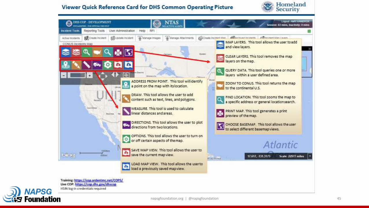
napsgfoundation.org | @napsgfoundation 44
napsgfoundation.org | @napsgfoundation 45

napsgfoundation.org | @napsgfoundation 46
Incident SymbologyQuick Overview and Update of the NAPSG/DHS Incident Symbology Framework
Chris Rogers, Lt. Kirkland Fire Department (WA)
Background
• NAPSG started developing the Incident Symbols Guideline in 2010
• Tested and vetted by a large community of responders, geospatial professionals, and emergency management personnel
• Developed over 400 symbols that are consistent with many other guidelines, standards, or community examples
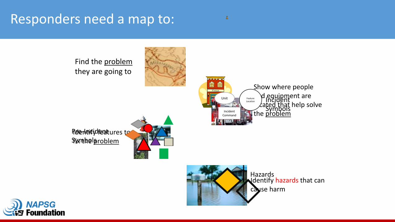
Responders need a map to:
Find the problemthey are going to
Identify hazards that can cause harm
Show where people and equipment are located that help solve the problem
Identify features to fix the problem
Unit
Incident Command
Feature Location Incident
Symbols
Pre-Incident Symbols
Hazards
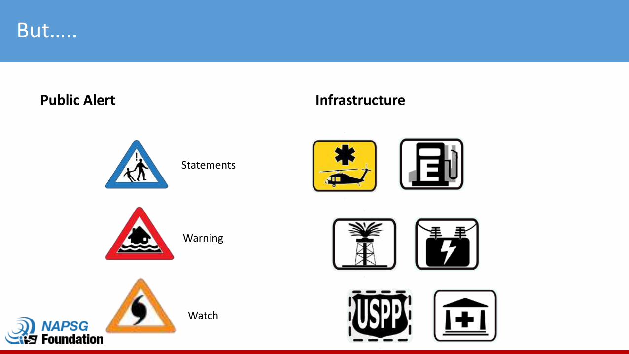
But…..
Public Alert Infrastructure
Statements
Watch
Warning
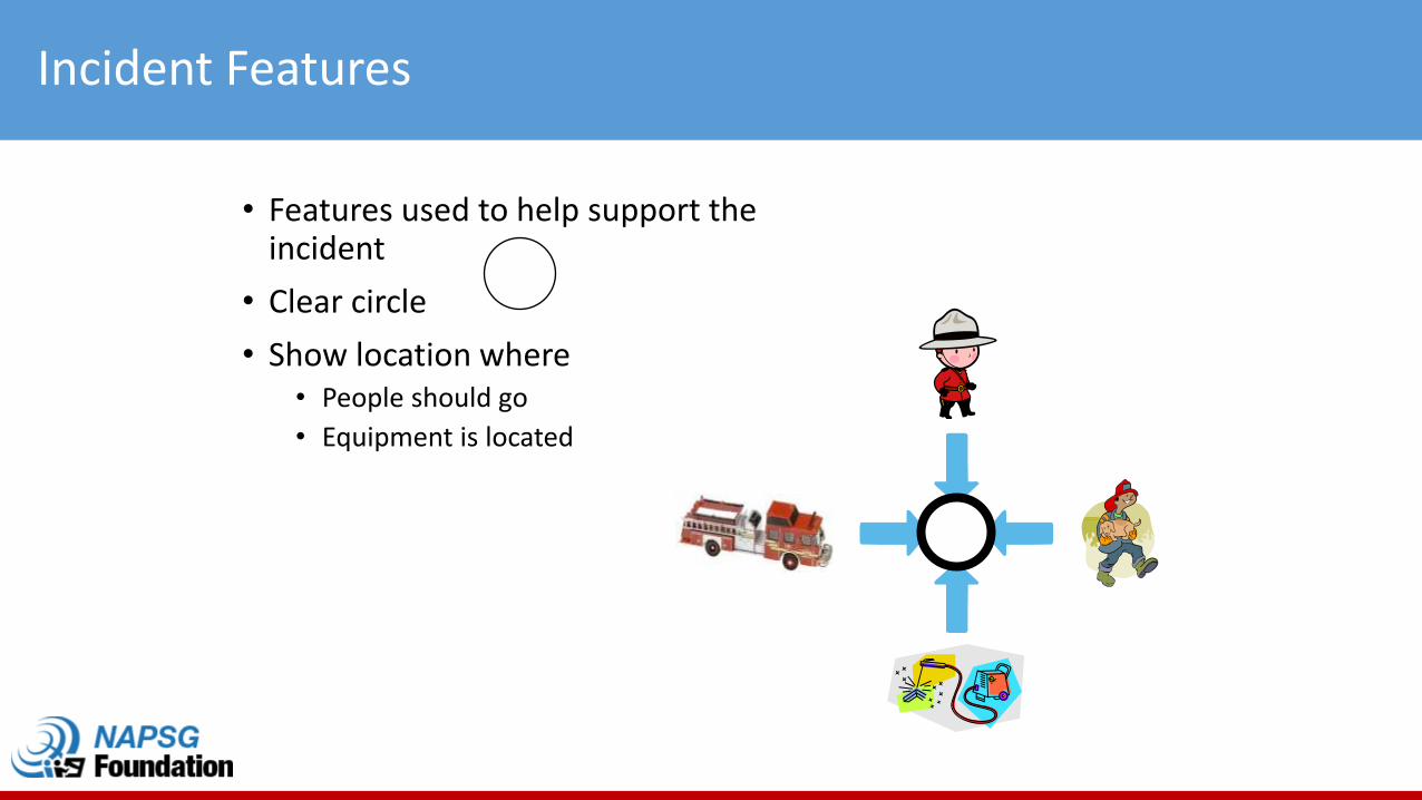
Incident Features
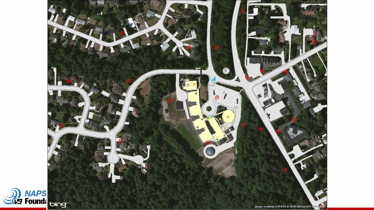
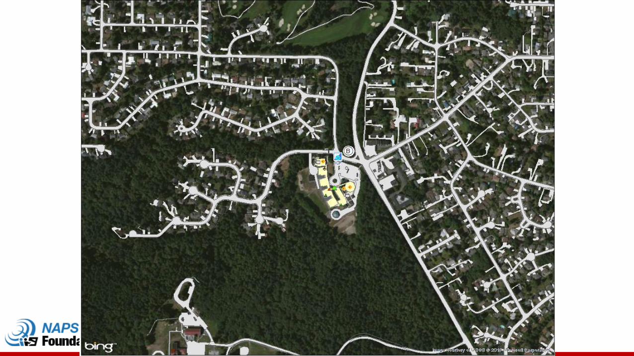
• Features used to help support the incident
• Clear circle
• Show location where • People should go
• Equipment is located
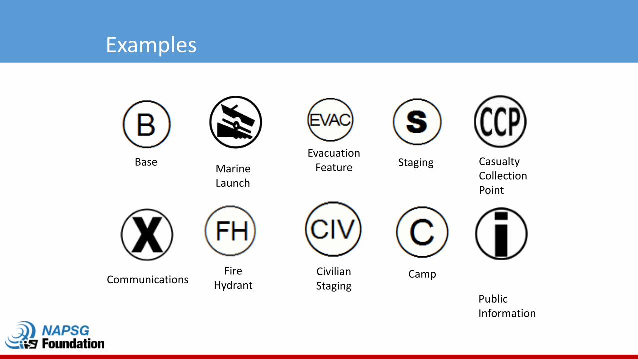
Examples
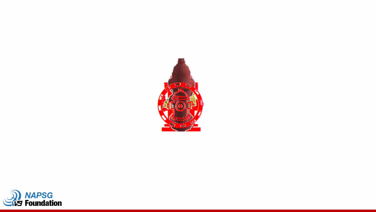
Base
Fire Hydrant
Civilian Staging
Evacuation Feature
Camp
Staging
Communications
Marine Launch
Casualty Collection Point
Public Information
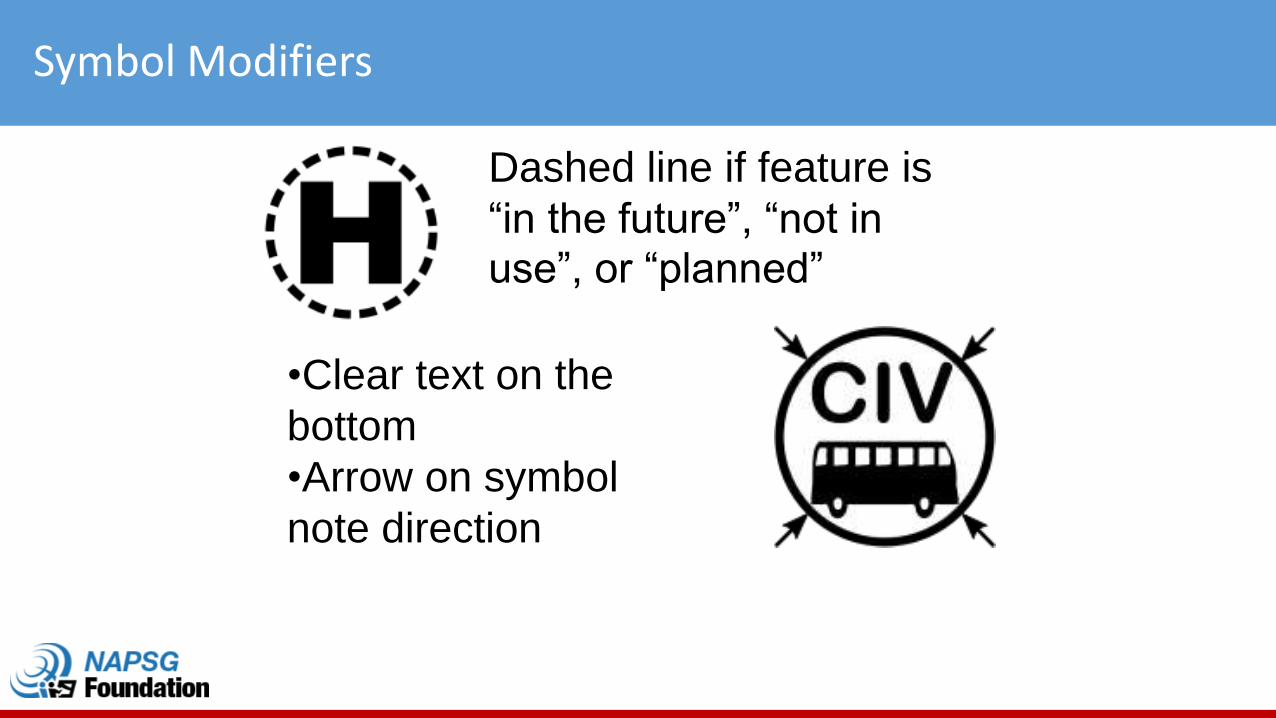
Symbol Modifiers
Dashed line if feature is
“in the future”, “not in use”, or “planned”
•Clear text on the
bottom
•Arrow on symbol
note direction
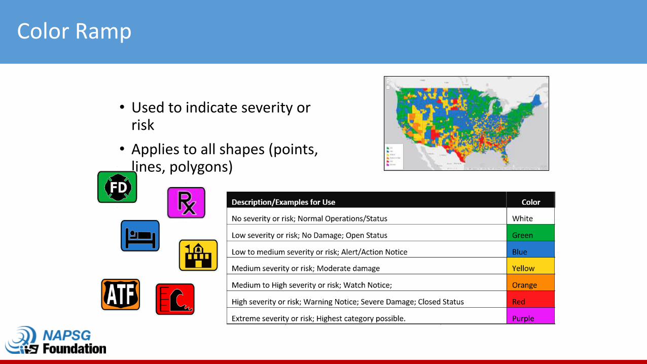
Color Ramp
• Used to indicate severity or risk
• Applies to all shapes (points, lines, polygons)
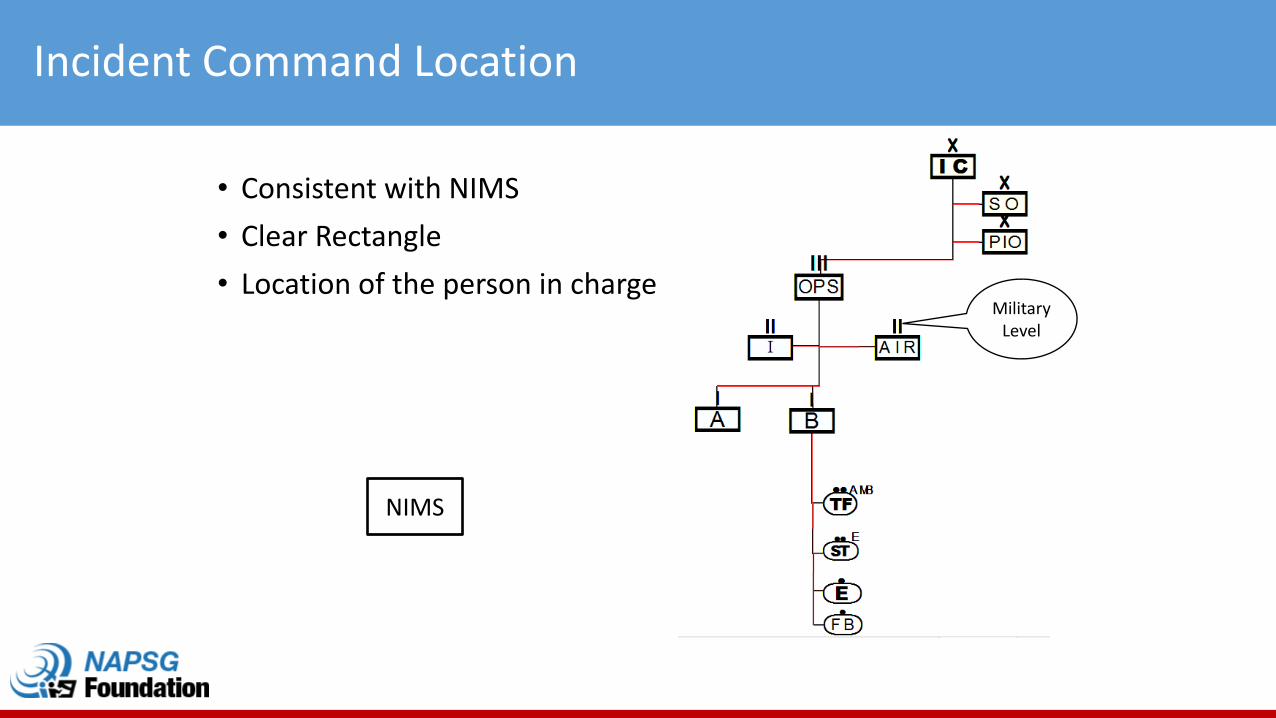
Incident Command Location
• Consistent with NIMS
• Clear Rectangle
• Location of the person in charge
NIMS
Military Level
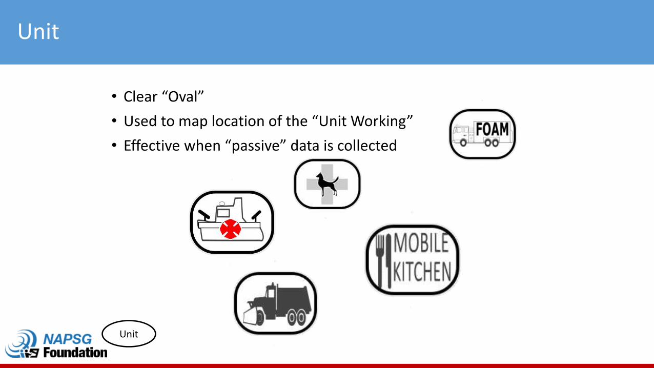
Unit
• Clear “Oval”
• Used to map location of the “Unit Working”
• Effective when “passive” data is collected
Unit
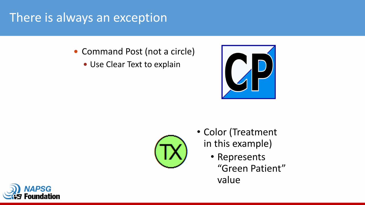
There is always an exception
• Color (Treatment in this example)
• Represents “Green Patient” value
Command Post (not a circle)
Use Clear Text to explain
If it looks like it?
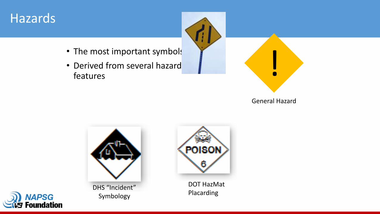
Hazards
• The most important symbols
• Derived from several hazard features !
DOT HazMatPlacarding
General Hazard
DHS “Incident” Symbology
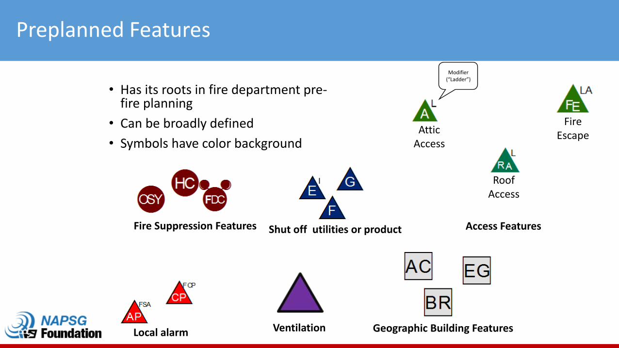
Preplanned Features
• Has its roots in fire department pre-fire planning
• Can be broadly defined
• Symbols have color background
Roof Access
Fire EscapeAttic
Access
Modifier (“Ladder”)
Access Features
Geographic Building Features
Shut off utilities or productFire Suppression Features
Local alarm Ventilation

EVAC
SHELTER
EVAC
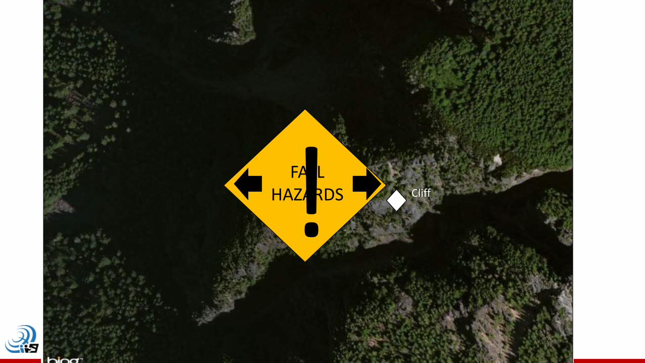
FALLHAZARDS! Cliff
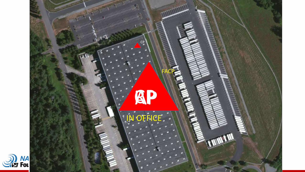
CP
FACP
CP
RPAPIN OFFICE
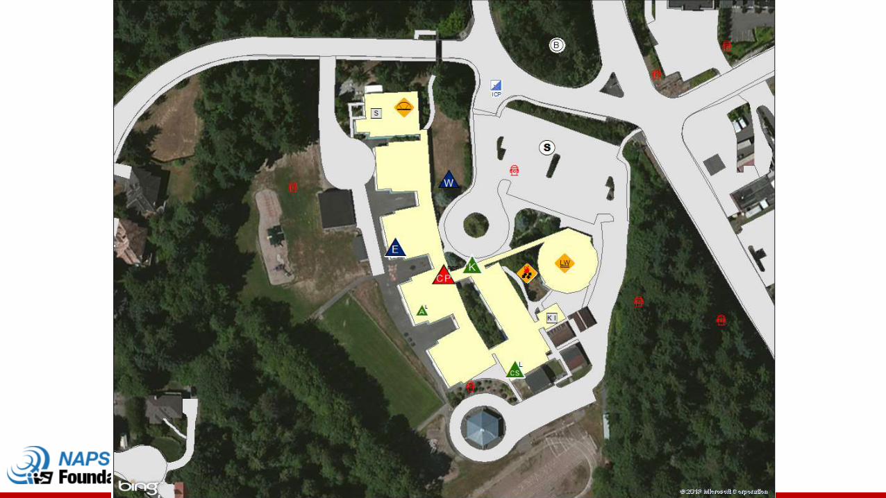
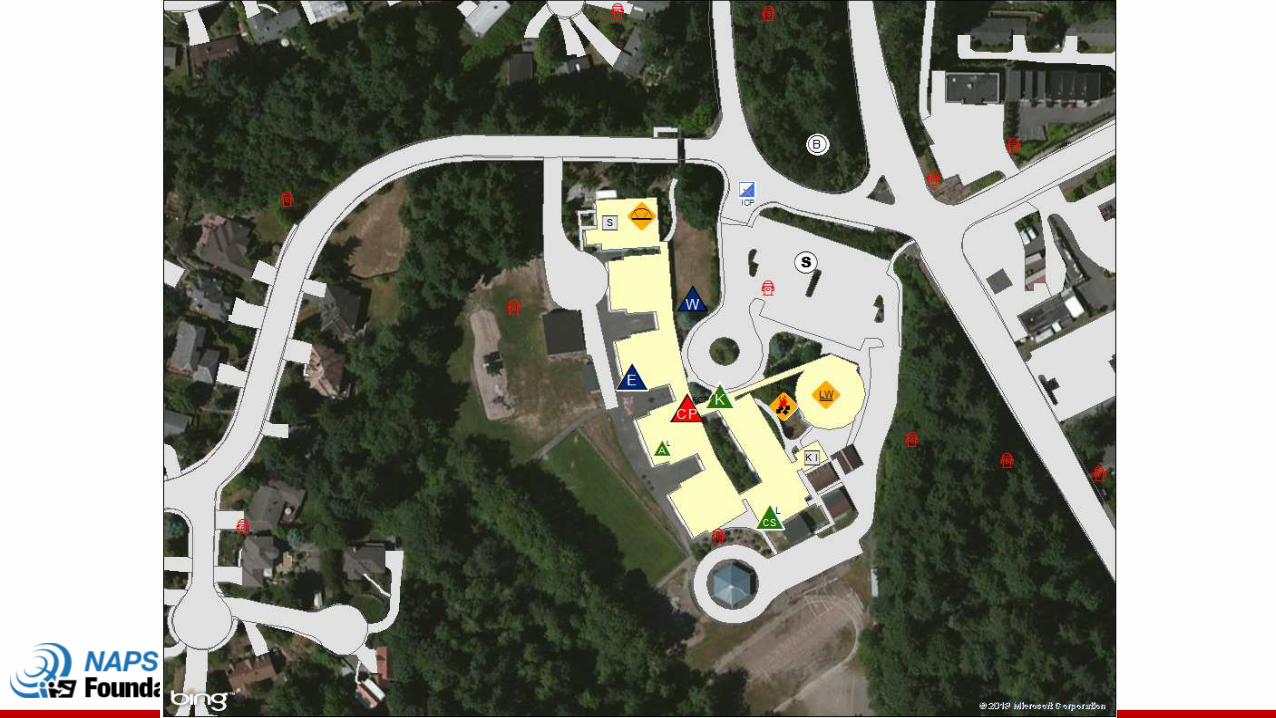
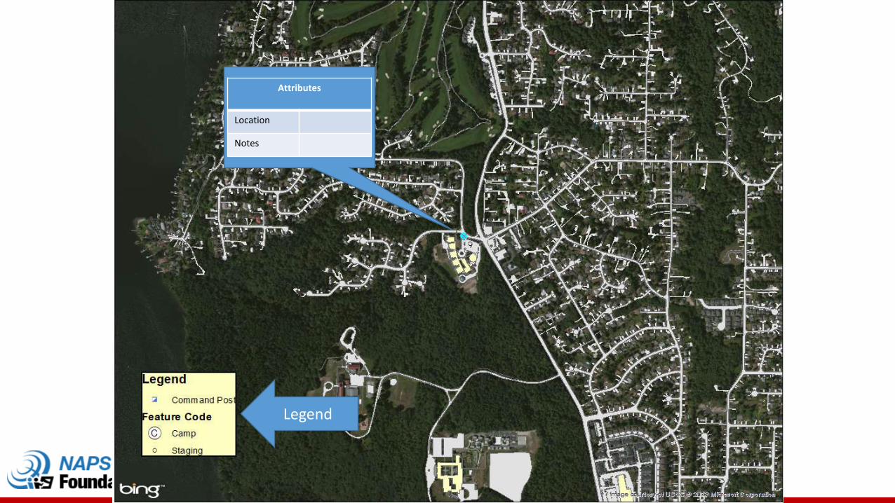
Legend
Attributes
Location
Notes
Public Alert & Warning and Infrastructure
69
Background
• 2014 NAPSG began developing set of standardized symbols for IPAWS Event Codes
• Key partnerships with DHS GMO and FEMA IPAWS
• Applies and is consistent with NAPSG’s Incident Symbology Guideline• Flexible and scalable framework for use in developing and applying map
symbols for public safety
• Result - Group of specific symbols for IPAWS event codes that achieve standardization and are publically available for use nationwide
• Outcomes:• When applied in public safety decision support tools, aids in consistently
communicating public alert and warning information on maps• When used in alerts and warnings, aids in optimizing message content for
people with disabilities and limited English proficiency
napsgfoundation.org | @napsgfoundation 70
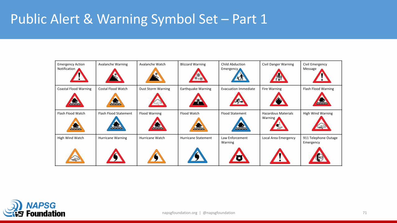
Public Alert & Warning Symbol Set – Part 1
Emergency Action Notification
Avalanche Warning Avalanche Watch Blizzard Warning Child AbductionEmergency
Civil Danger Warning Civil Emergency Message
Coastal Flood Warning Costal Flood Watch Dust Storm Warning Earthquake Warning Evacuation Immediate Fire Warning Flash Flood Warning
Flash Flood Watch Flash Flood Statement Flood Warning Flood Watch Flood Statement Hazardous Materials Warning
High Wind Warning
High Wind Watch Hurricane Warning Hurricane Watch Hurricane Statement Law Enforcement Warning
Local Area Emergency 911 Telephone Outage Emergency
napsgfoundation.org | @napsgfoundation 71
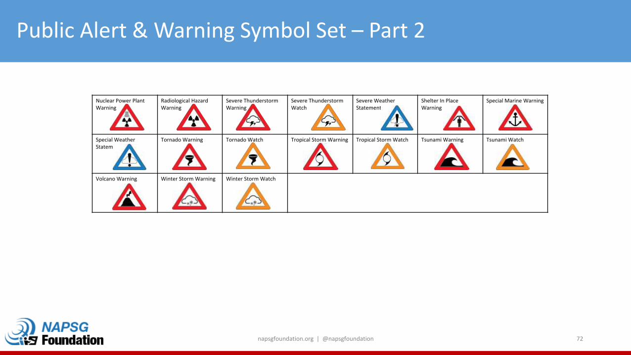
Public Alert & Warning Symbol Set – Part 2
napsgfoundation.org | @napsgfoundation 72
Nuclear Power Plant Warning
Radiological Hazard Warning
Severe Thunderstorm Warning
Severe ThunderstormWatch
Severe Weather Statement
Shelter In Place Warning
Special Marine Warning
Special Weather Statement
Tornado Warning Tornado Watch Tropical Storm Warning Tropical Storm Watch Tsunami Warning Tsunami Watch
Volcano Warning Winter Storm Warning Winter Storm Watch
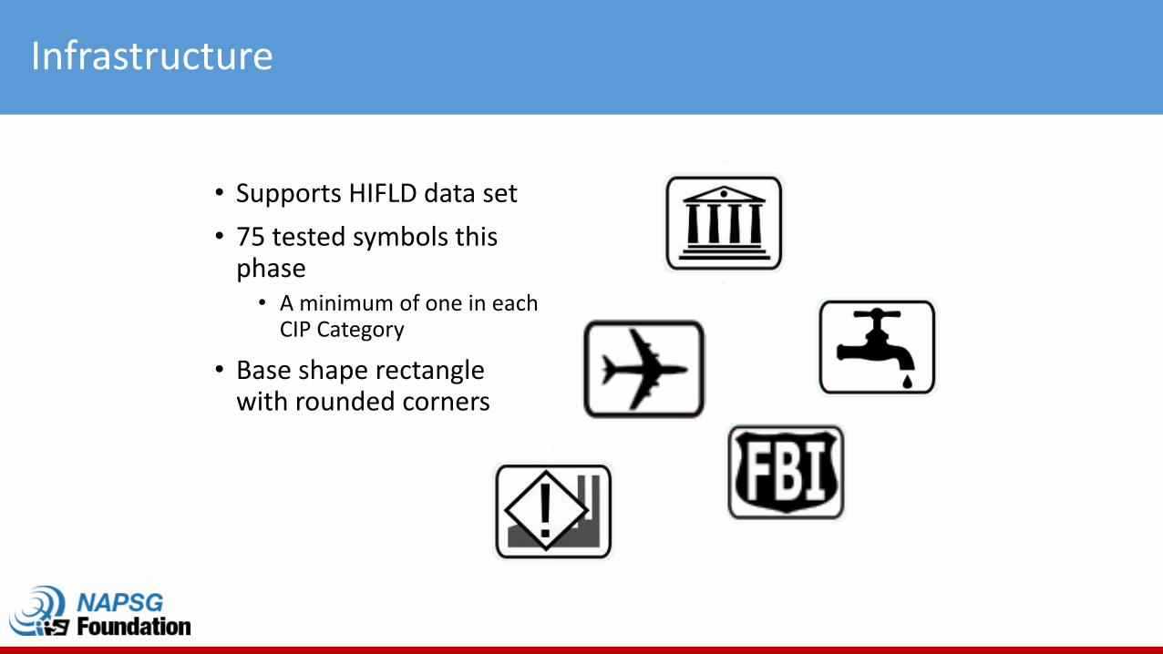
Infrastructure
• Supports HIFLD data set
• 75 tested symbols this phase
• A minimum of one in each CIP Category
• Base shape rectangle with rounded corners
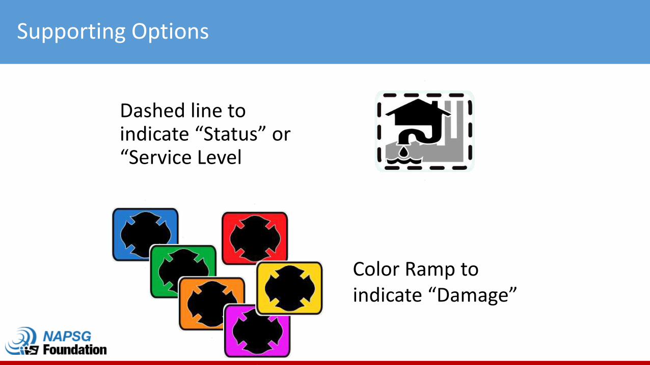
Supporting Options
Dashed line to indicate “Status” or “Service Level
Color Ramp to indicate “Damage”
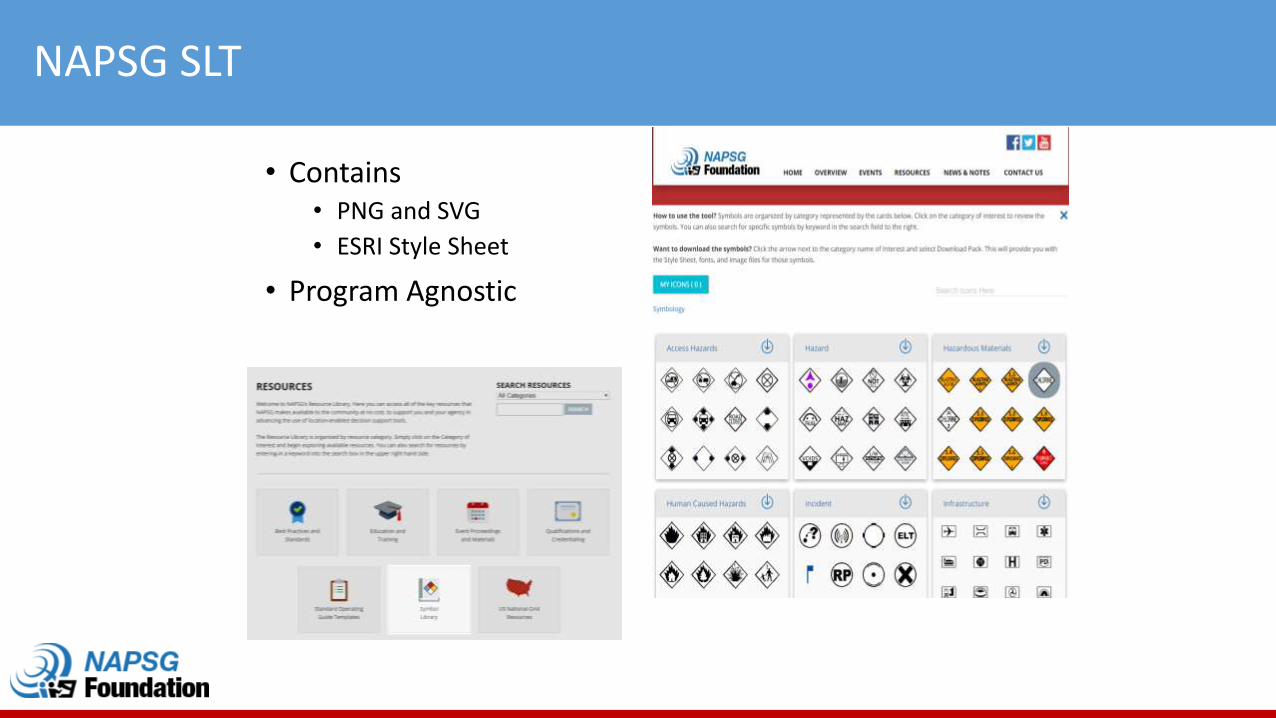
NAPSG SLT
• Contains• PNG and SVG
• ESRI Style Sheet
• Program Agnostic
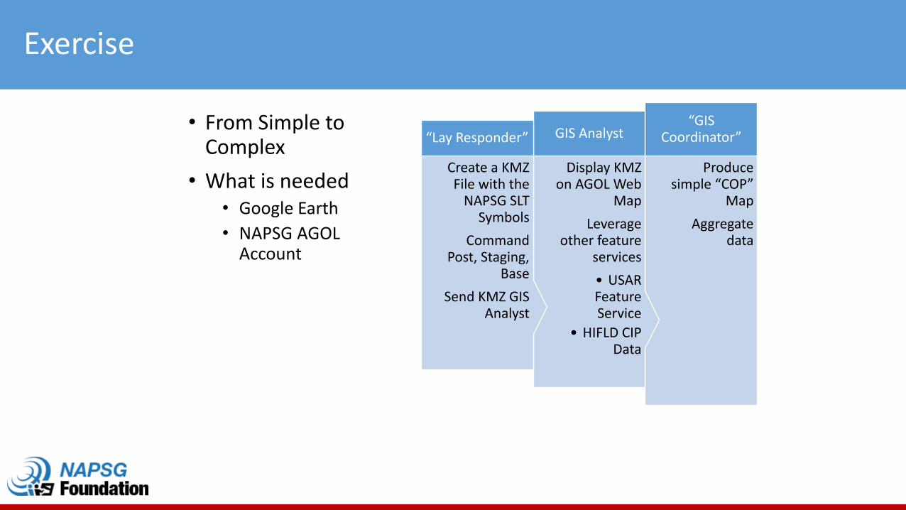
Exercise
• From Simple to Complex
• What is needed• Google Earth
• NAPSG AGOL Account
Produce simple “COP”
Map
Aggregate data
“GIS Coordinator”
Display KMZ on AGOL Web
Map
Leverage other feature
services
• USAR Feature Service
• HIFLD CIP Data
GIS Analyst
Create a KMZ File with the
NAPSG SLT Symbols
Command Post, Staging,
Base
Send KMZ GIS Analyst
“Lay Responder”
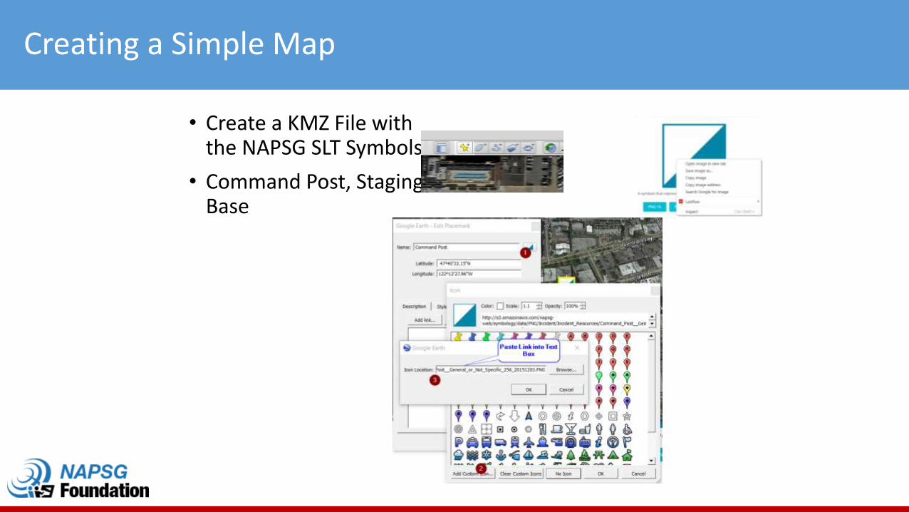
Creating a Simple Map
• Create a KMZ File with the NAPSG SLT Symbols
• Command Post, Staging, Base
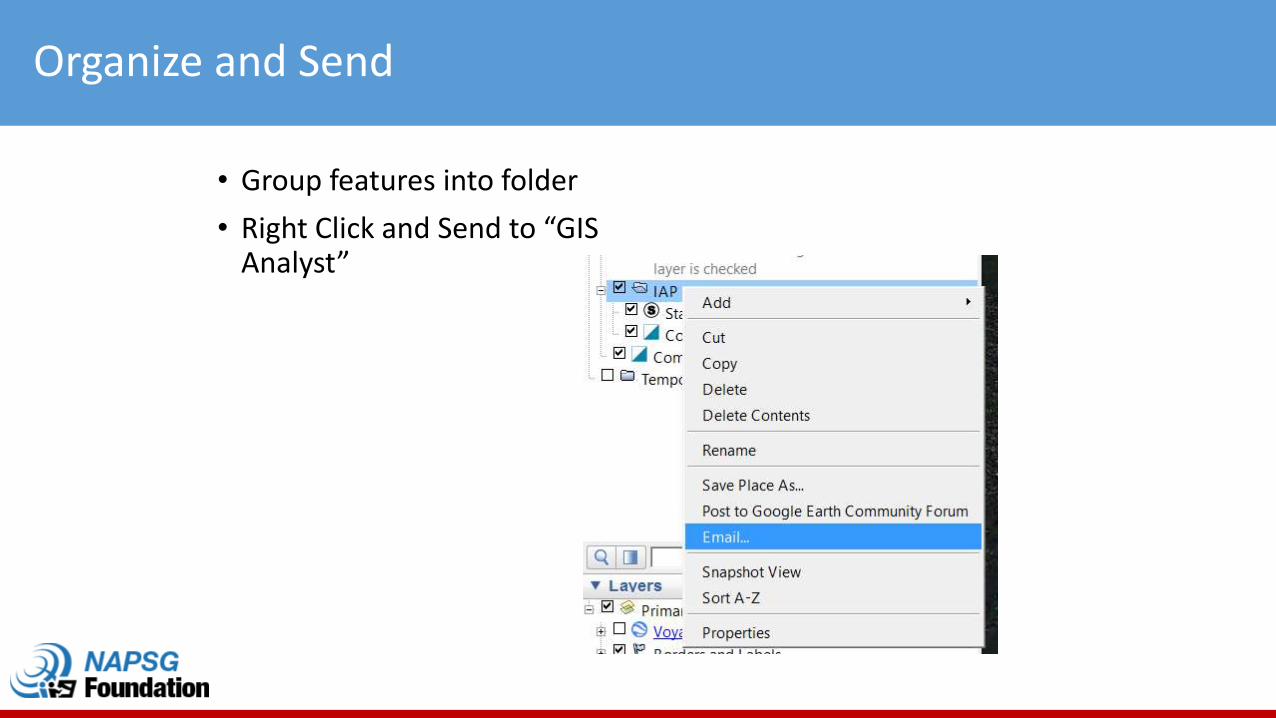
Organize and Send
• Group features into folder
• Right Click and Send to “GIS Analyst”
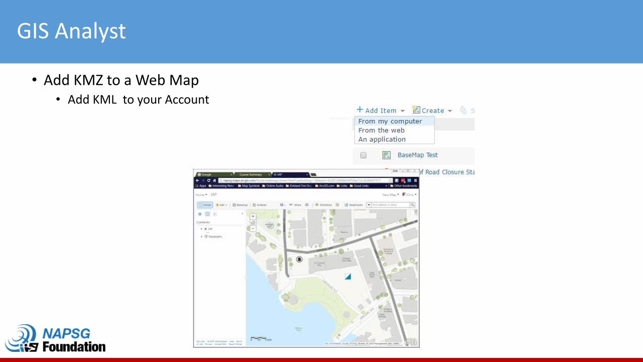
GIS Analyst
• Add KMZ to a Web Map• Add KML to your Account
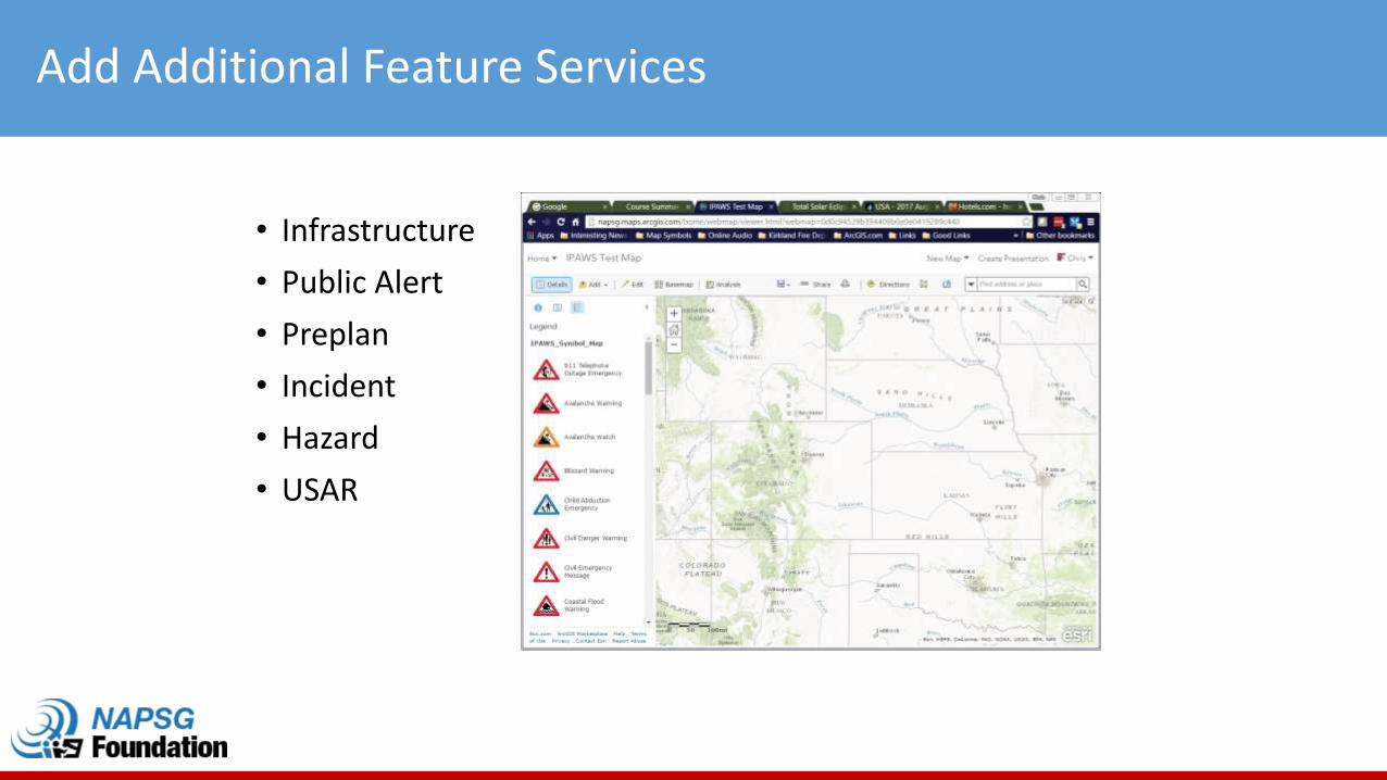
Add Additional Feature Services
• Infrastructure
• Public Alert
• Preplan
• Incident
• Hazard
• USAR
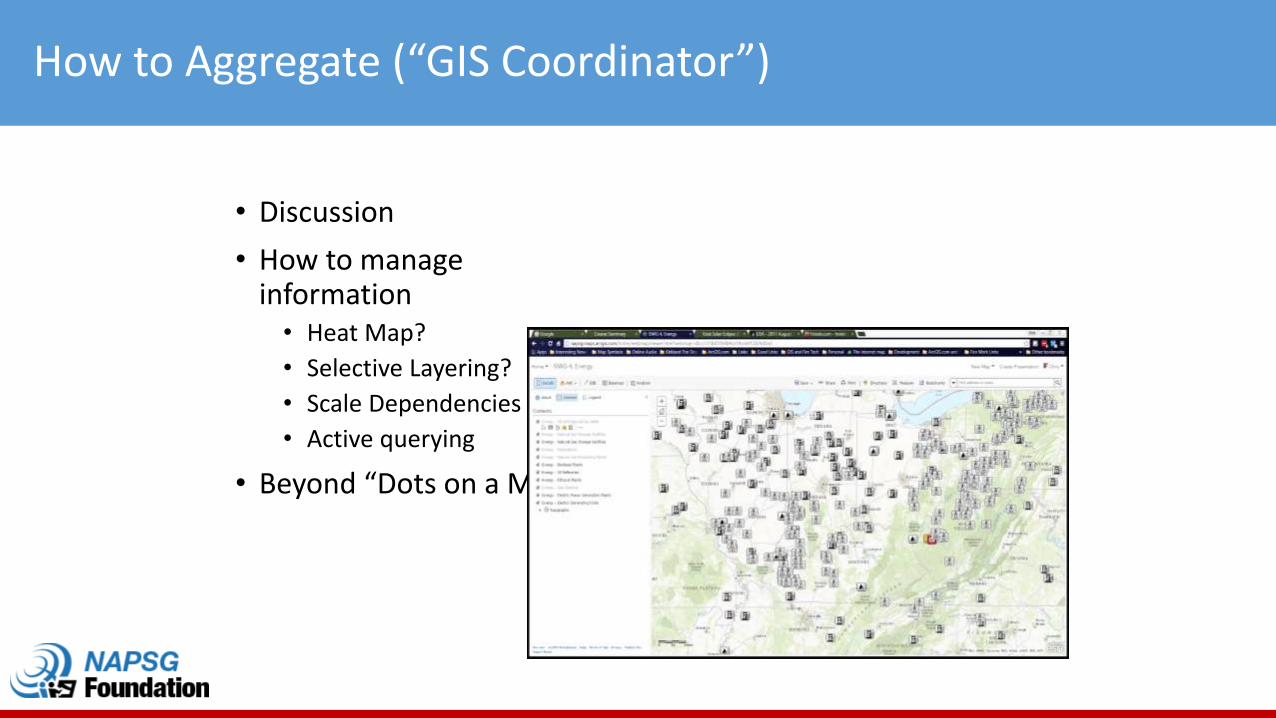
How to Aggregate (“GIS Coordinator”)
• Discussion
• How to manage information
• Heat Map?
• Selective Layering?
• Scale Dependencies
• Active querying
• Beyond “Dots on a Map”
Summary
• Improved and expanded the ISWG Symbol Guideline
• Work on supporting a standardized framework for IPAWS and Infrastructure Symbols
• Continued the work on combining these workflows together.
Recommended