Geospatial OverviewGeospatial Overview
GoalsGoals What is a Geospatial Database?What is a Geospatial Database? Onshore Order No. 1 Geospatial Onshore Order No. 1 Geospatial
RequirementsRequirements
Geospatial Database Geospatial Database GoalsGoals
Support operator’s submission of GIS-Support operator’s submission of GIS-based (map depicted) APD information based (map depicted) APD information using electronic meansusing electronic means
Improve the geographic locational Improve the geographic locational accuracy of proposed APD-related accuracy of proposed APD-related actions and infrastructureactions and infrastructure
Utilize APD geospatial data with BLM’s Utilize APD geospatial data with BLM’s GIS data to enhance the “on-the-GIS data to enhance the “on-the-ground” decision making processingground” decision making processing
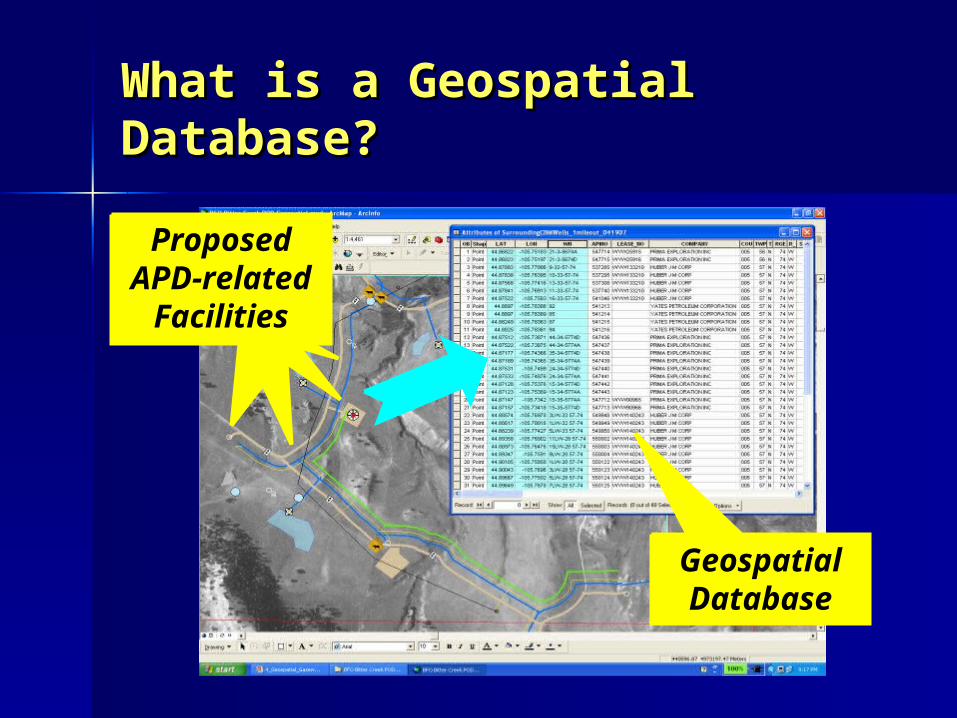
What is a Geospatial What is a Geospatial Database?Database?
APD Map Feature
APD Map Feature
APD Map Features
Proposed APD-related
Facilities
Geospatial Database
Onshore Order No. 1 Geospatial Onshore Order No. 1 Geospatial Database RequirementsDatabase Requirements
A new requirement of the OrderA new requirement of the Order Applies to two specific APD Applies to two specific APD
components:components:– Well survey platWell survey plat– Surface use plan of operations (SUPO)Surface use plan of operations (SUPO)
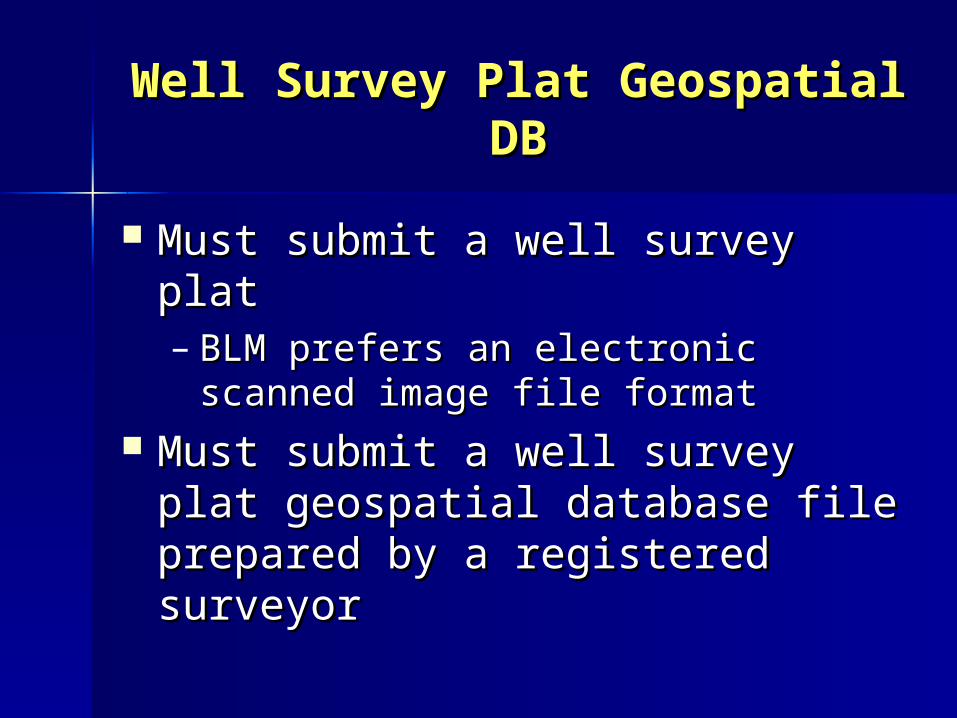
Well Survey Plat Geospatial Well Survey Plat Geospatial DBDB
Must submit a well survey platMust submit a well survey plat– BLM prefers an electronic scanned BLM prefers an electronic scanned
image file formatimage file format Must submit a well survey plat Must submit a well survey plat
geospatial database file prepared geospatial database file prepared by a registered surveyorby a registered surveyor
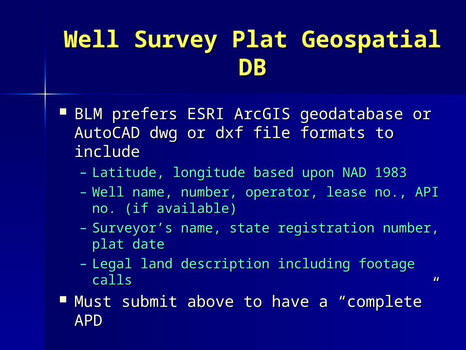
Well Survey Plat Geospatial Well Survey Plat Geospatial DBDB
BLM prefers ESRI ArcGIS geodatabase or BLM prefers ESRI ArcGIS geodatabase or AutoCAD dwg or dxf file formats to AutoCAD dwg or dxf file formats to includeinclude– Latitude, longitude based upon NAD 1983Latitude, longitude based upon NAD 1983– Well name, number, operator, lease no., API Well name, number, operator, lease no., API
no. (if available)no. (if available)– Surveyor’s name, state registration number, Surveyor’s name, state registration number,
plat dateplat date– Legal land description including footage callsLegal land description including footage calls
Must submit above to have a “complete” Must submit above to have a “complete” APDAPD
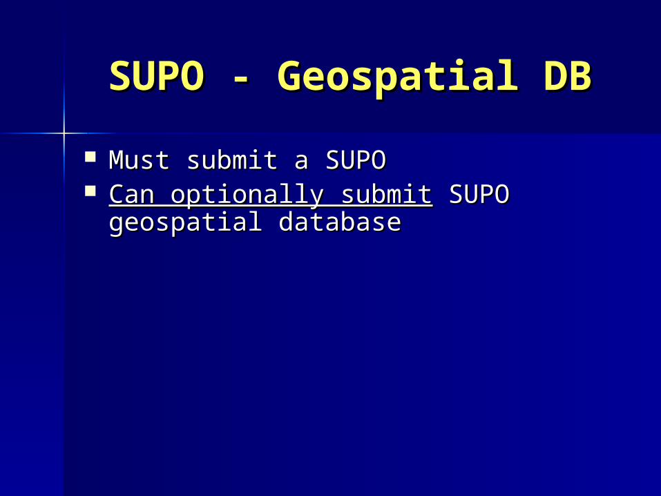
SUPO - Geospatial DBSUPO - Geospatial DB
Must submit a SUPOMust submit a SUPO Can optionally submitCan optionally submit SUPO geospatial SUPO geospatial
databasedatabase
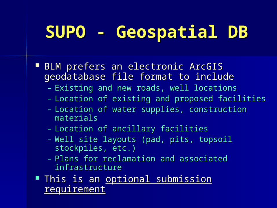
SUPO - Geospatial DBSUPO - Geospatial DB
BLM prefers an electronic ArcGIS BLM prefers an electronic ArcGIS geodatabase file format to includegeodatabase file format to include– Existing and new roads, well locations Existing and new roads, well locations – Location of existing and proposed facilitiesLocation of existing and proposed facilities– Location of water supplies, construction Location of water supplies, construction
materialsmaterials– Location of ancillary facilitiesLocation of ancillary facilities– Well site layouts (pad, pits, topsoil stockpiles, Well site layouts (pad, pits, topsoil stockpiles,
etc.)etc.)– Plans for reclamation and associated Plans for reclamation and associated
infrastructureinfrastructure This is an This is an optional submission requirementoptional submission requirement
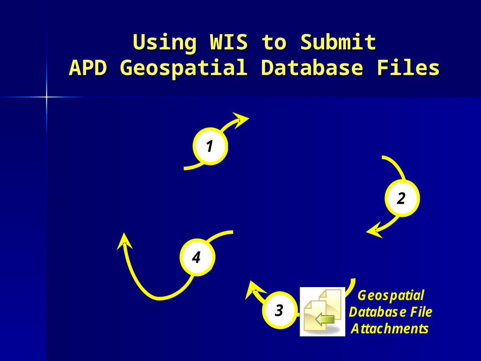
Using WIS to SubmitUsing WIS to SubmitAPD Geospatial Database FilesAPD Geospatial Database Files
2
1
3
2
1
4
3Geospatial
Database FileAttachments
Geospatial SummaryGeospatial Summary
GoalsGoals What is a Geospatial Database?What is a Geospatial Database? Onshore Order No. 1 Geospatial Onshore Order No. 1 Geospatial
RequirementsRequirements– Well survey plat GD - Well survey plat GD - requiredrequired– SUPO GD – SUPO GD – optional requirementoptional requirement
Recommended