Geo‐Seas A pan‐European infrastructure for
the management of marine geological and geophysical data
Colin Graham (BGS), Dick Schaap (MARIS), Paolo Diviacco (OGS) & Helen Glaves (BGS)
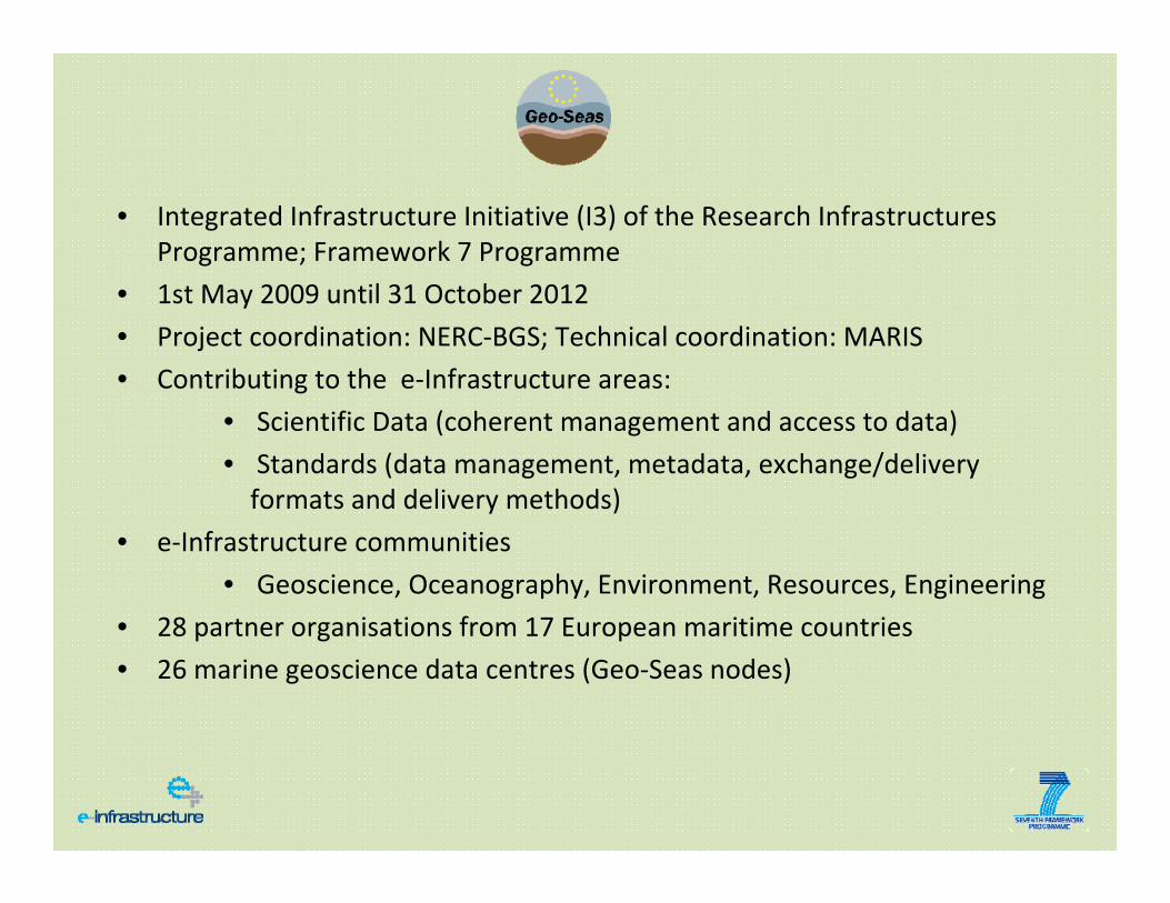
• Integrated Infrastructure Initiative (I3) of the Research Infrastructures Programme; Framework 7 Programme
• 1st May 2009 until 31 October 2012
• Project coordination: NERC‐BGS; Technical coordination: MARIS
• Contributing to the e‐Infrastructure areas:
• Scientific Data (coherent management and access to data)
• Standards (data management, metadata, exchange/delivery formats and delivery methods)
• e‐Infrastructure communities
• Geoscience, Oceanography, Environment, Resources, Engineering
• 28 partner organisations from 17 European maritime countries
• 26 marine geoscience data centres (Geo‐Seas nodes)
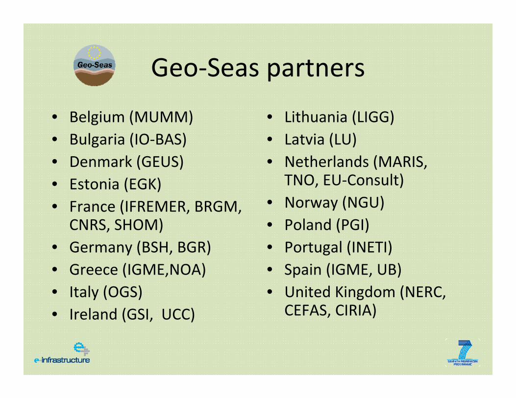
Geo‐Seas partners
• Belgium (MUMM)• Bulgaria (IO‐BAS)• Denmark (GEUS)• Estonia (EGK)• France (IFREMER, BRGM,
CNRS, SHOM)• Germany (BSH, BGR)• Greece (IGME,NOA)• Italy (OGS)• Ireland (GSI, UCC)
• Lithuania (LIGG)• Latvia (LU)• Netherlands (MARIS,
TNO, EU‐Consult)• Norway (NGU)• Poland (PGI)• Portugal (INETI)• Spain (IGME, UB)• United Kingdom (NERC,
CEFAS, CIRIA)
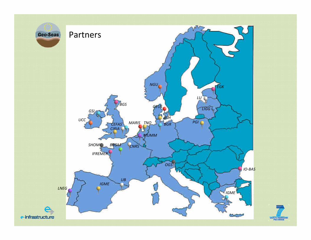
BGS
GSI
LNEG
MARIS
BRGM
TNO
OGS
NGU
GEUS
IGME
Partners
BSH
IGME
EGK
BGR PGI
LIGG
IO‐BAS
LU
CEFASCIRIA
UB
UCC
IFREMER
SHOM
MUMM
CNRS
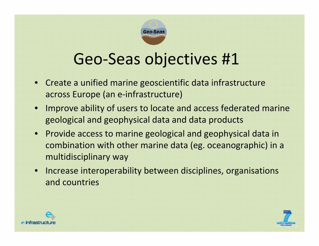
Geo‐Seas objectives #1• Create a unified marine geoscientific data infrastructure
across Europe (an e‐infrastructure)
• Improve ability of users to locate and access federated marine geological and geophysical data and data products
• Provide access to marine geological and geophysical data in combination with other marine data (eg. oceanographic) in a multidisciplinary way
• Increase interoperability between disciplines, organisations and countries
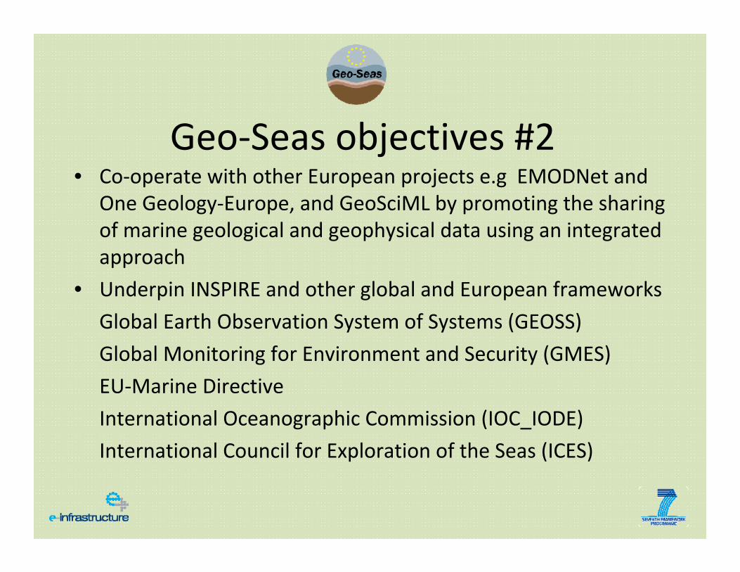
Geo‐Seas objectives #2• Co‐operate with other European projects e.g EMODNet and
One Geology‐Europe, and GeoSciML by promoting the sharing of marine geological and geophysical data using an integrated approach
• Underpin INSPIRE and other global and European frameworks
Global Earth Observation System of Systems (GEOSS)
Global Monitoring for Environment and Security (GMES)
EU‐Marine Directive
International Oceanographic Commission (IOC_IODE)
International Council for Exploration of the Seas (ICES)
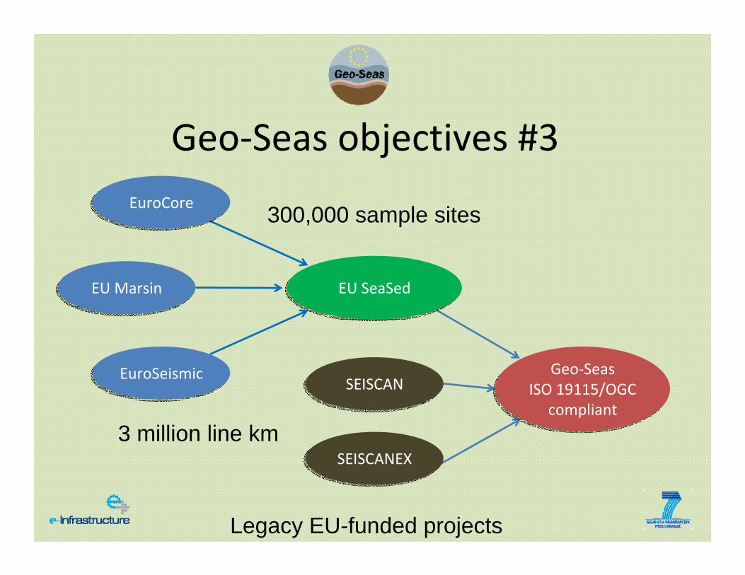
Geo‐Seas objectives #3
EuroCoreEuroCore
EuroSeismicEuroSeismic
EU SeaSedEU SeaSed
Geo‐SeasISO 19115/OGC
compliant
Geo‐SeasISO 19115/OGC
compliantSEISCANSEISCAN
SEISCANEXSEISCANEX
EU MarsinEU Marsin
300,000 sample sites
3 million line km
Legacy EU-funded projects
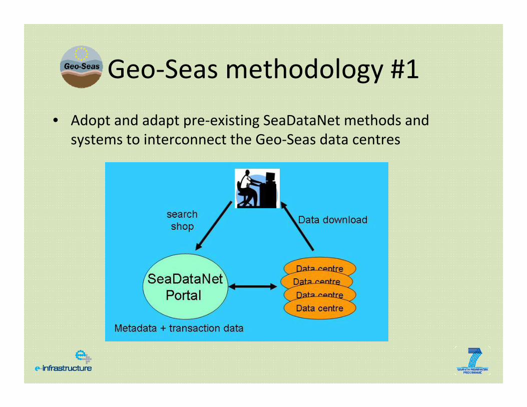
Geo‐Seas methodology #1
• Adopt and adapt pre‐existing SeaDataNet methods and systems to interconnect the Geo‐Seas data centres
Geo‐Seas methodology #2
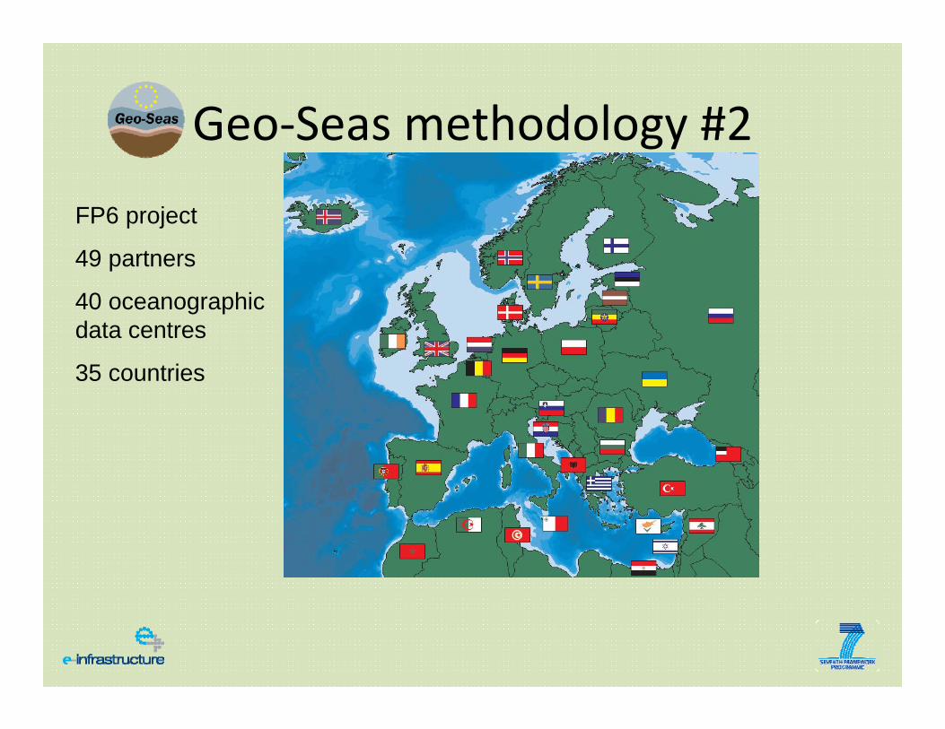
FP6 project
49 partners
40 oceanographic data centres
35 countries
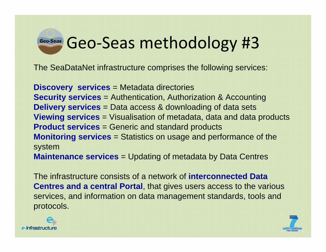
Geo‐Seas methodology #3The SeaDataNet infrastructure comprises the following services:
Discovery services = Metadata directoriesSecurity services = Authentication, Authorization & AccountingDelivery services = Data access & downloading of data setsViewing services = Visualisation of metadata, data and data products Product services = Generic and standard products Monitoring services = Statistics on usage and performance of the system Maintenance services = Updating of metadata by Data Centres
The infrastructure consists of a network of interconnected Data Centres and a central Portal, that gives users access to the various services, and information on data management standards, tools and protocols.
Geo‐Seas methodology #4
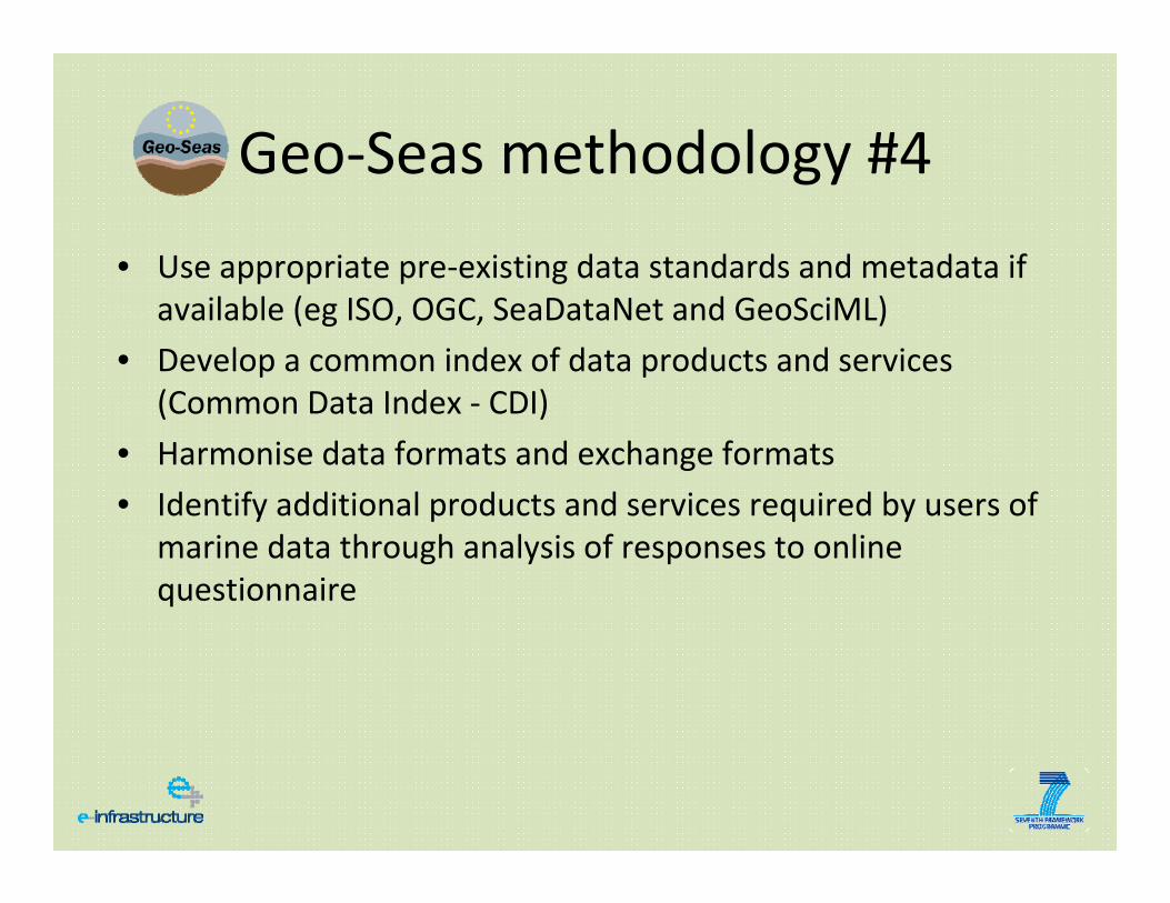
• Use appropriate pre‐existing data standards and metadata if available (eg ISO, OGC, SeaDataNet and GeoSciML)
• Develop a common index of data products and services (Common Data Index ‐ CDI)
• Harmonise data formats and exchange formats
• Identify additional products and services required by users of marine data through analysis of responses to online questionnaire
Geo‐Seas methodology #5
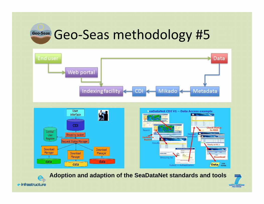
Adoption and adaption of the SeaDataNet standards and tools
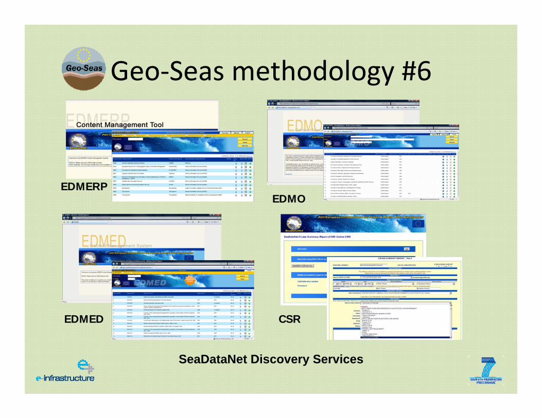
Geo‐Seas methodology #6
SeaDataNet Discovery Services
EDMERPEDMO
EDMED CSR
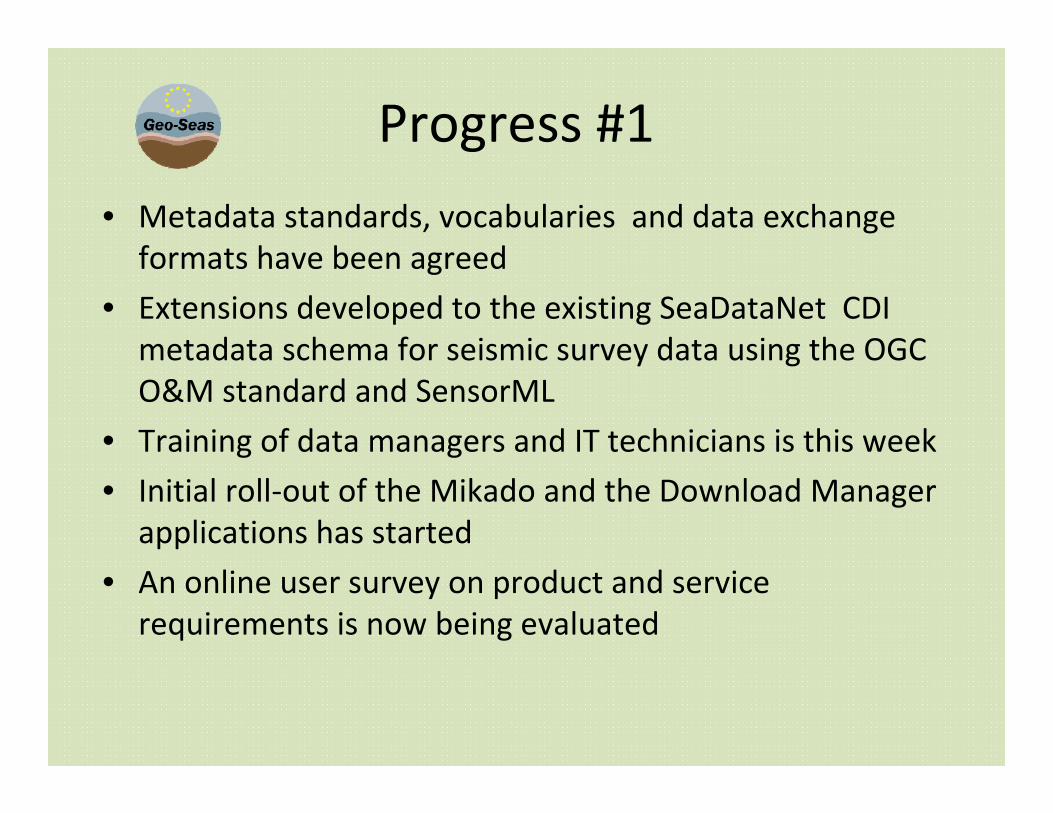
Progress #1
• Metadata standards, vocabularies and data exchange formats have been agreed
• Extensions developed to the existing SeaDataNet CDI metadata schema for seismic survey data using the OGC O&M standard and SensorML
• Training of data managers and IT technicians is this week
• Initial roll‐out of the Mikado and the Download Manager applications has started
• An online user survey on product and service requirements is now being evaluated
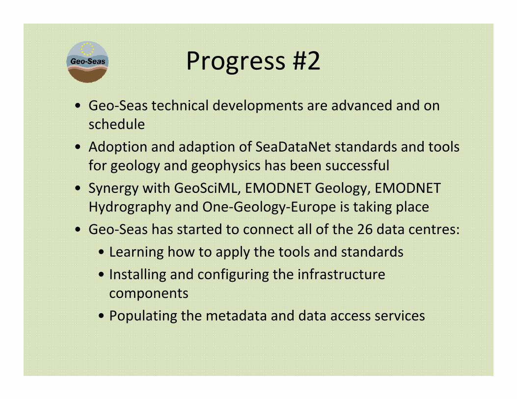
Progress #2• Geo‐Seas technical developments are advanced and on schedule
• Adoption and adaption of SeaDataNet standards and tools for geology and geophysics has been successful
• Synergy with GeoSciML, EMODNET Geology, EMODNET Hydrography and One‐Geology‐Europe is taking place
• Geo‐Seas has started to connect all of the 26 data centres:
• Learning how to apply the tools and standards
• Installing and configuring the infrastructure components
• Populating the metadata and data access services
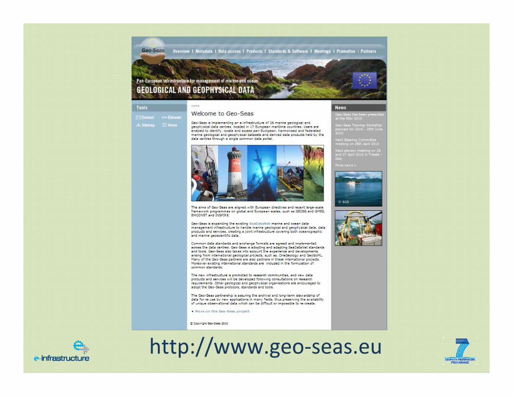
http://www.geo‐seas.eu
Questions?
Recommended