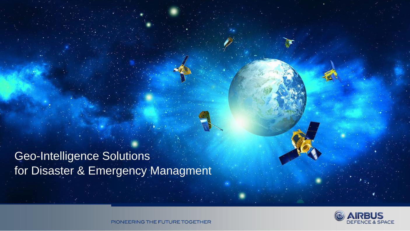
Geo-Intelligence Solutions
for Disaster & Emergency Managment
March 2015 – 2
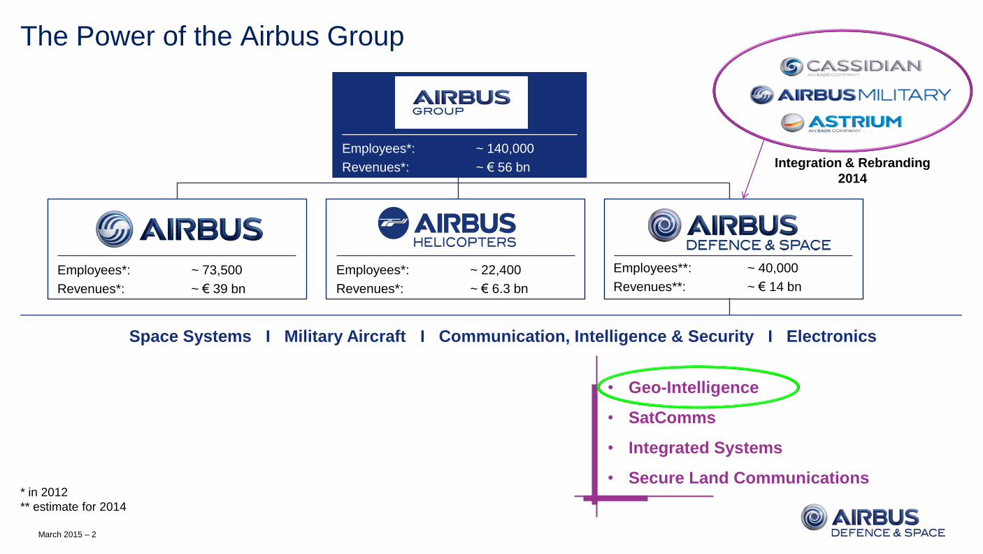
The Power of the Airbus Group
• Geo-Intelligence
• SatComms
• Integrated Systems
• Secure Land Communications
Employees*: ~ 140,000
Revenues*: ~ € 56 bn
Employees*: ~ 73,500
Revenues*: ~ € 39 bn
Employees*: ~ 22,400
Revenues*: ~ € 6.3 bn
Employees**: ~ 40,000
Revenues**: ~ € 14 bn
* in 2012
** estimate for 2014
Integration & Rebranding
2014
Space Systems I Military Aircraft I Communication, Intelligence & Security I Electronics
March 2015 – 3
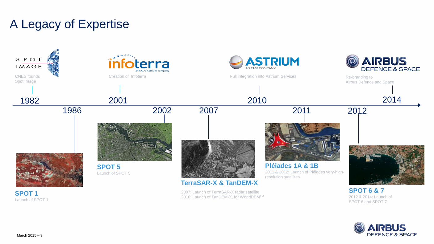
A Legacy of Expertise
3
1982
Pléiades 1A & 1B 2011 & 2012: Launch of Pléiades very-high-
resolution satellites
SPOT 6 & 7 2012 & 2014: Launch of
SPOT 6 and SPOT 7
CNES founds
Spot Image
Full integration into Astrium Services
SPOT 1 Launch of SPOT 1
Creation of Infoterra
SPOT 5 Launch of SPOT 5
2002 2010
2012
2001 2007 1986
TerraSAR-X & TanDEM-X
2011
2007: Launch of TerraSAR-X radar satellite
2010: Launch of TanDEM-X, for WorldDEMTM
Re-branding to
Airbus Defence and Space
2014
March 2015 – 4
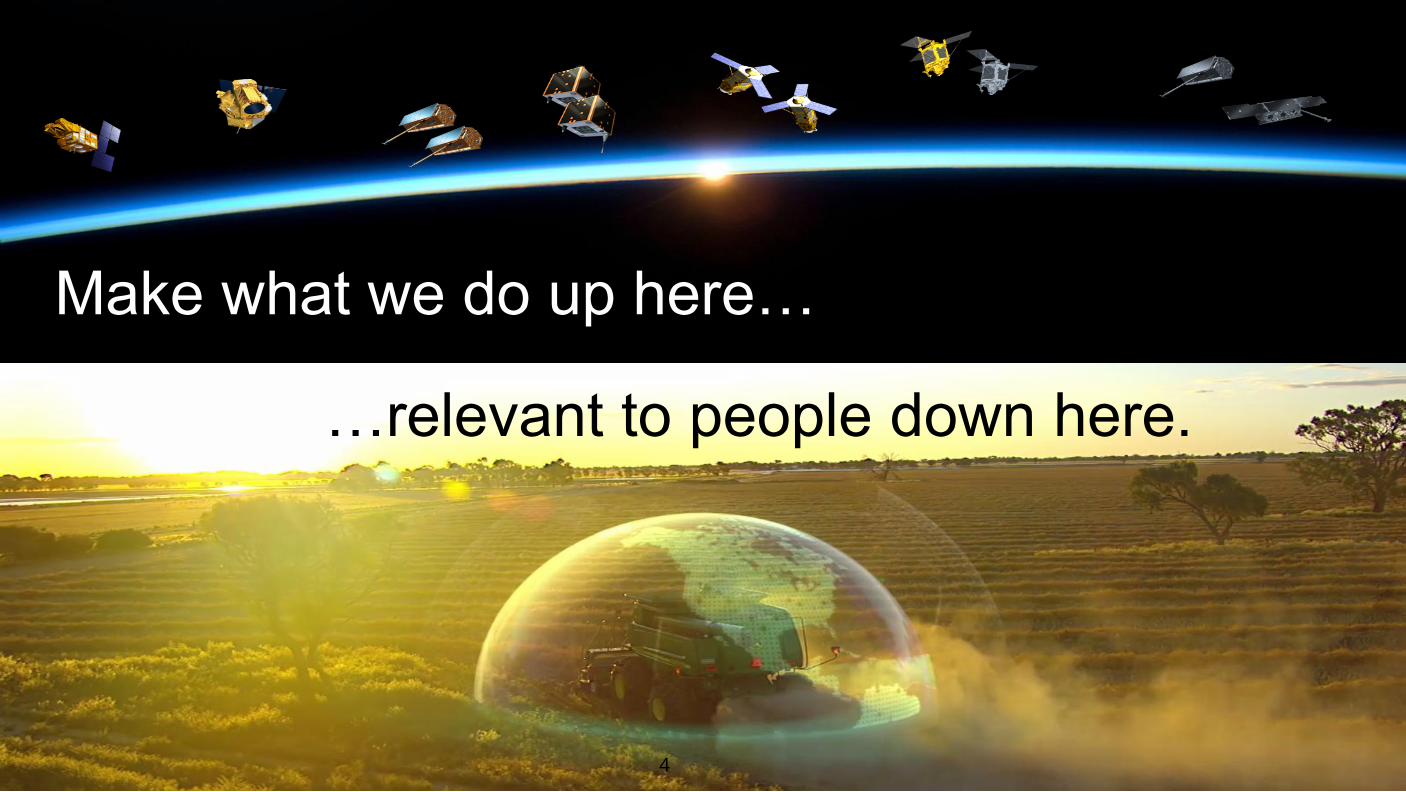
GEO-INTELLIGENCE SALES 2014
4
Make what we do up here…
…relevant to people down here.
March 2015 – 5
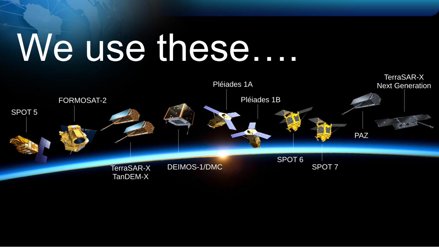
We use these….
SPOT 5
SPOT 6 SPOT 7
Pléiades 1B
TerraSAR-X TanDEM-X
FORMOSAT-2
DEIMOS-1/DMC
PAZ
TerraSAR-X Next Generation Pléiades 1A
March 2015 – 6
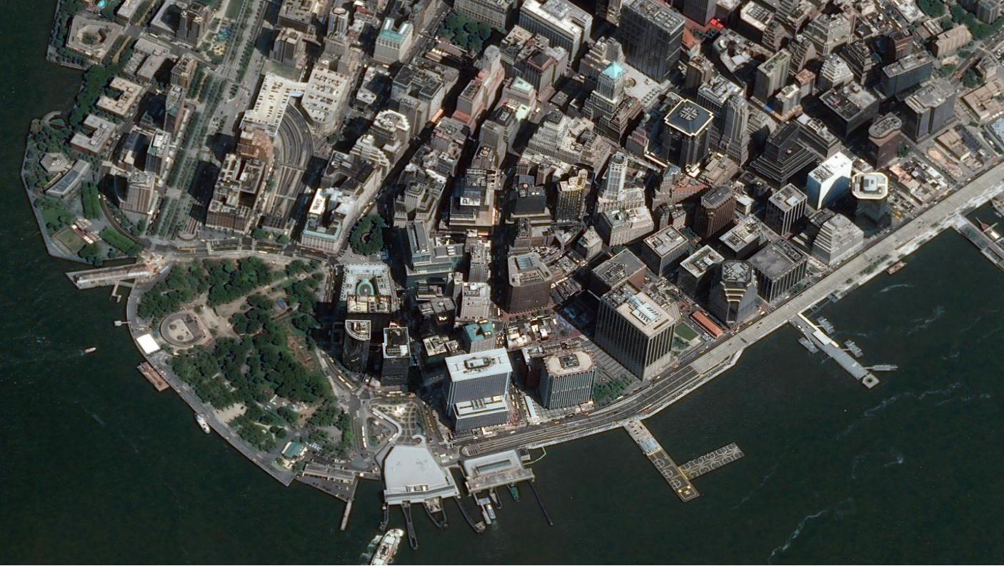
….to take these
6 DEIMOS-1 - Poyang Lake - China TerraSAR-X – Mount Taranaki – New Zealand SPOT 6 - Doha - Qatar Pléiades - Suez - Egypt
March 2015 – 7
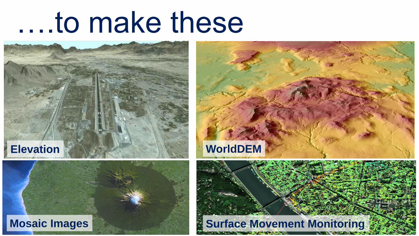
….to make these
Mosaic Images
Elevation
Surface Movement Monitoring
WorldDEM
March 2015 – 8
Ma
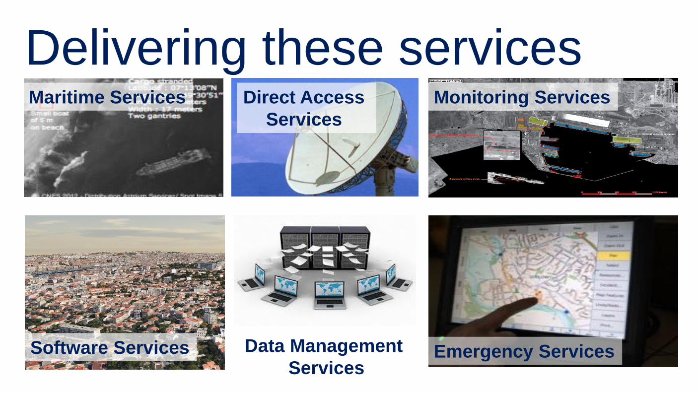
Delivering these services Maritime Services Direct Access
Services
Emergency Services
Monitoring Services
Data Management
Services Software Services
March 2015 – 9 9
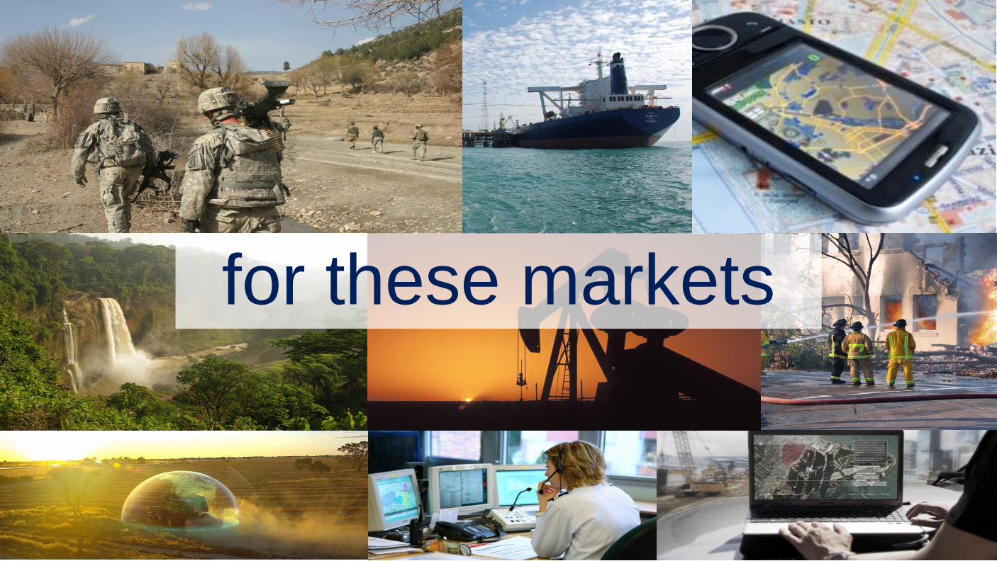
for these markets
March 2015 – 10
Case Study: Emergency Response Challenge
During summer 2012, torrential rain fell over Africa for weeks, causing
severe flooding of the Niger River. About 485,000 people were affected
and Niamey, Agadez and Dosso were the hardest-hit cities.
The French Civil Protection activated the International Charter ‘Space
and Major Disasters’ (Charter) on 28th August to help in organizing an
evaluation and recognition mission to assess the state of infrastructure
in Niger (bridge, roads…).
As the French member of the Charter, the CNES (French Space Agency)
was responsible for the coordination of the different data suppliers and
the delivery of information to the end user.
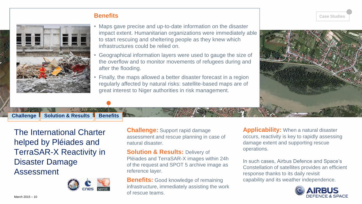
The International Charter
helped by Pléiades and
TerraSAR-X Reactivity in
Disaster Damage
Assessment
Challenge: Support rapid damage
assessment and rescue planning in case of
natural disaster.
Solution & Results: Delivery of
Pléiades and TerraSAR-X images within 24h
of the request and SPOT 5 archive image as
reference layer.
Benefits: Good knowledge of remaining
infrastructure, immediately assisting the work
of rescue teams.
Applicability: When a natural disaster
occurs, reactivity is key to rapidly assessing
damage extent and supporting rescue
operations.
In such cases, Airbus Defence and Space’s
Constellation of satellites provides an efficient
response thanks to its daily revisit
capability and its weather independence.
Solution & Results
On 29th August at 13:07, CNES issued a Pléiades tasking request. At
12:16 on 30th August, the first Pléiades images were acquired and
delivered to SERTIT four hours later. The same day, a TerraSAR-X
StripMap scene was acquired and delivered, providing an accurate
situation overview, despite the heavy cloud cover.
SERTIT extracted the flood extent, mapped the road network and
highlighted points of interest for emergency services such as hospitals,
airports and passable roads. These damage assessment maps were
issued less than 5h after image delivery.
The maps were distributed the same day, supporting emergency
operations planning and management. A SPOT 5 archive image was
delivered as a reference image.
Solution & Results Benefits Challenge
Benefits
• Maps gave precise and up-to-date information on the disaster
impact extent. Humanitarian organizations were immediately able
to start rescuing and sheltering people as they knew which
infrastructures could be relied on.
• Geographical information layers were used to gauge the size of
the overflow and to monitor movements of refugees during and
after the flooding.
• Finally, the maps allowed a better disaster forecast in a region
regularly affected by natural risks: satellite-based maps are of
great interest to Niger authorities in risk management.
Case Studies
March 2015 – 11
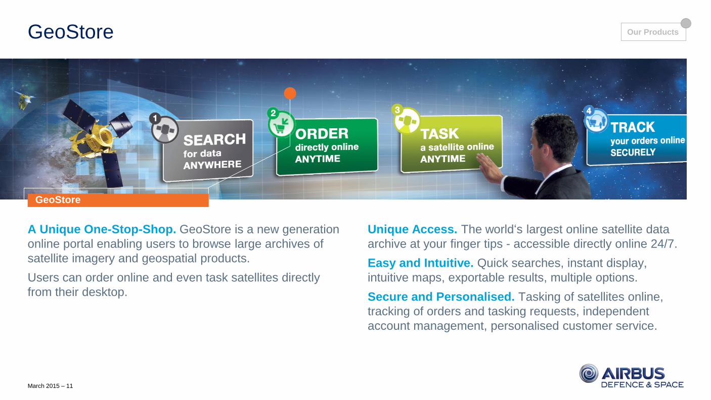
GeoStore
A Unique One-Stop-Shop. GeoStore is a new generation
online portal enabling users to browse large archives of
satellite imagery and geospatial products.
Users can order online and even task satellites directly
from their desktop.
Unique Access. The world‘s largest online satellite data
archive at your finger tips - accessible directly online 24/7.
Easy and Intuitive. Quick searches, instant display,
intuitive maps, exportable results, multiple options.
Secure and Personalised. Tasking of satellites online,
tracking of orders and tasking requests, independent
account management, personalised customer service.
GeoStore
Our Products
March 2015 – 13
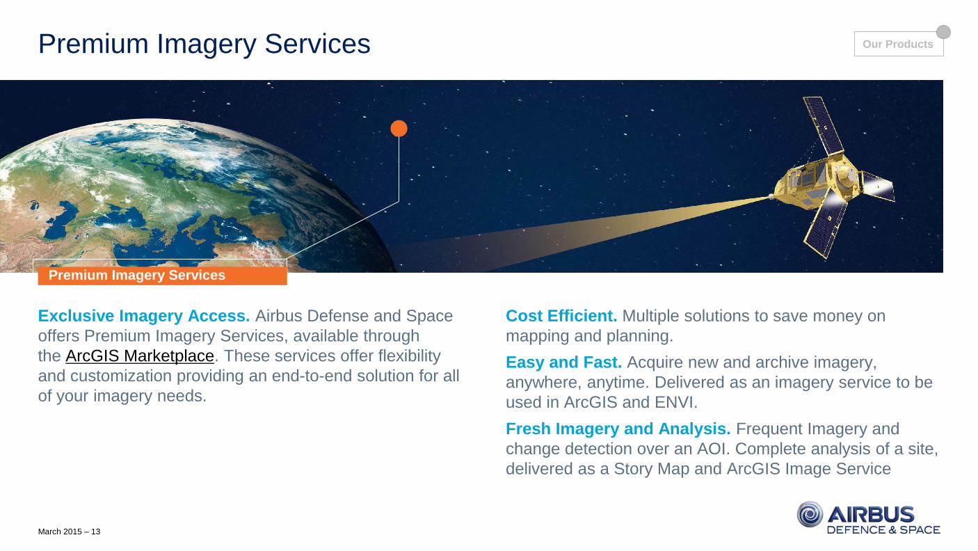
Premium Imagery Services
Exclusive Imagery Access. Airbus Defense and Space
offers Premium Imagery Services, available through
the ArcGIS Marketplace. These services offer flexibility
and customization providing an end-to-end solution for all
of your imagery needs.
Cost Efficient. Multiple solutions to save money on
mapping and planning.
Easy and Fast. Acquire new and archive imagery,
anywhere, anytime. Delivered as an imagery service to be
used in ArcGIS and ENVI.
Fresh Imagery and Analysis. Frequent Imagery and
change detection over an AOI. Complete analysis of a site,
delivered as a Story Map and ArcGIS Image Service
Premium Imagery Services
Our Products
March 2015 – 14
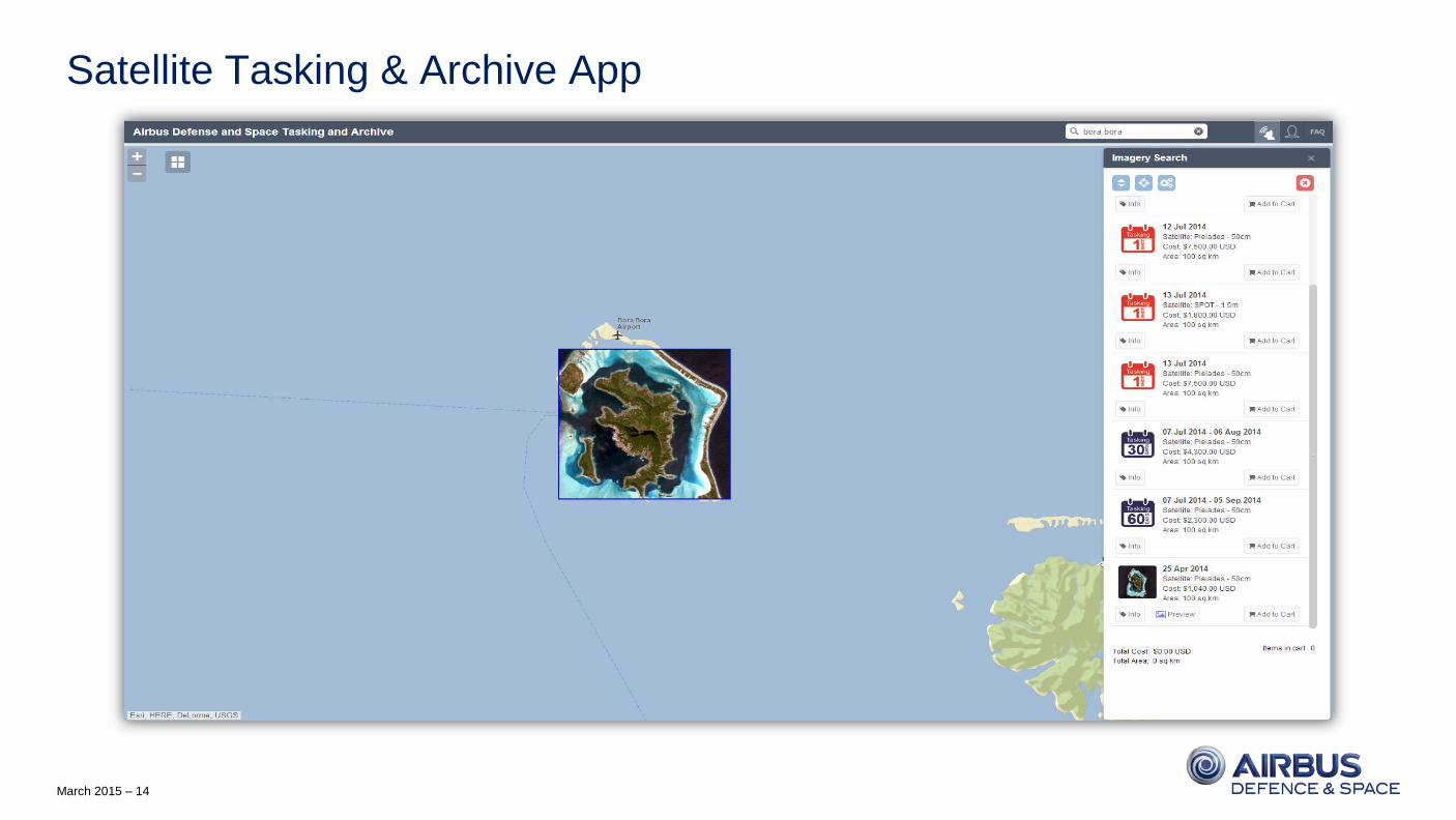
Satellite Tasking & Archive App
March 2015 – 15
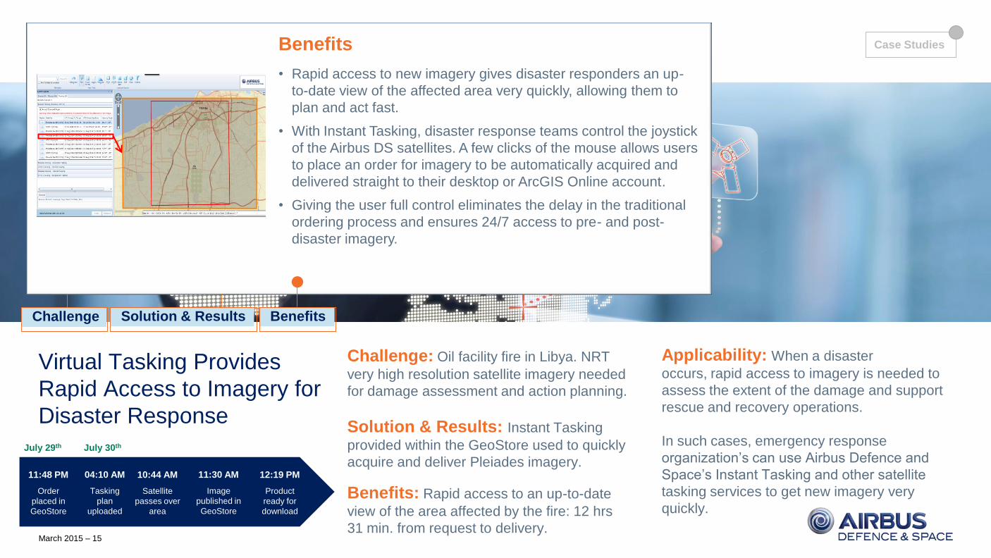
Case Study: Emergency Response
Challenge: Oil facility fire in Libya. NRT
very high resolution satellite imagery needed
for damage assessment and action planning.
Solution & Results: Instant Tasking
provided within the GeoStore used to quickly
acquire and deliver Pleiades imagery.
Benefits: Rapid access to an up-to-date
view of the area affected by the fire: 12 hrs
31 min. from request to delivery.
Applicability: When a disaster
occurs, rapid access to imagery is needed to
assess the extent of the damage and support
rescue and recovery operations.
In such cases, emergency response
organization’s can use Airbus Defence and
Space’s Instant Tasking and other satellite
tasking services to get new imagery very
quickly.
Solution & Results Benefits Challenge
Case Studies
Virtual Tasking Provides
Rapid Access to Imagery for
Disaster Response
04:10 AM
Tasking
plan
uploaded
11:30 AM
Image
published in
GeoStore
12:19 PM
Product
ready for
download
11:48 PM
Order
placed in
GeoStore
July 29th
10:44 AM
Satellite
passes over
area
July 30th
Challenge
In July 2014, a fire broke out at Libya’s largest fuel storage facility in
Tripoli. Firefighters had almost put out the fire when shrapnel hit and
ignited a second tank.
Residents living within 2-3 miles of the facility where urged to evacuate
due to possible explosions; however, fighting by rival militias in the area
made this difficult.
After the fire was extinguished, the damage needed to be assessed.
Solution & Results
The easiest, fastest and safest way to get a good overall view of the
damage was to use Airbus DS’s Instant Tasking service.
With full user access to the satellites and imagery collected as soon
as the next satellite pass, Instant Tasking is the absolute fastest way
to acquire and receive new imagery over an area.
On July 29th, an order was placed in GeoStore for Instant Tasking
over the fuel storage facility in Tripoli. A little over 12 hours later, the
imagery was ready for download and use by disaster responders.
1:2500 scale, July 30th (10:44 AM)
Benefits
• Rapid access to new imagery gives disaster responders an up-
to-date view of the affected area very quickly, allowing them to
plan and act fast.
• With Instant Tasking, disaster response teams control the joystick
of the Airbus DS satellites. A few clicks of the mouse allows users
to place an order for imagery to be automatically acquired and
delivered straight to their desktop or ArcGIS Online account.
• Giving the user full control eliminates the delay in the traditional
ordering process and ensures 24/7 access to pre- and post-
disaster imagery.
March 2015 – 16
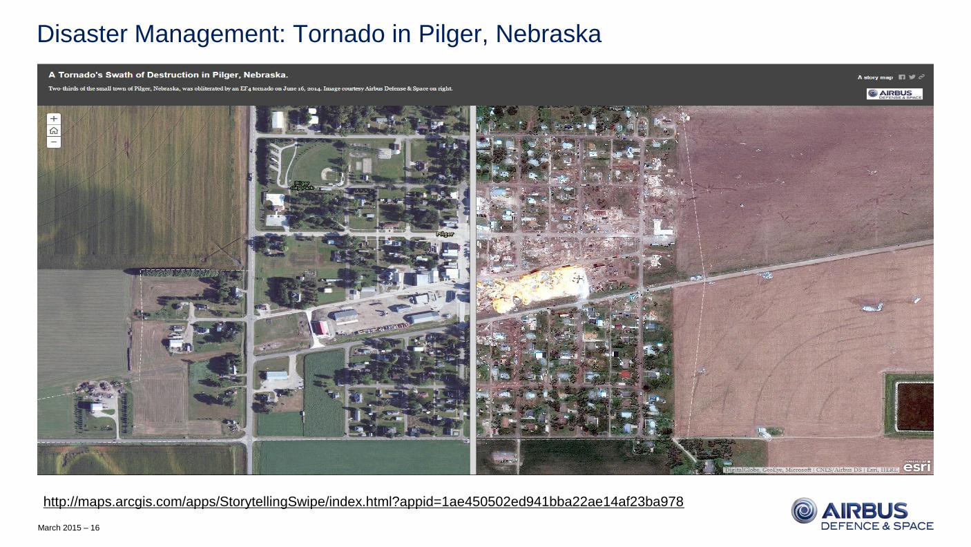
Disaster Management: Tornado in Pilger, Nebraska
http://maps.arcgis.com/apps/StorytellingSwipe/index.html?appid=1ae450502ed941bba22ae14af23ba978
March 2015 – 17
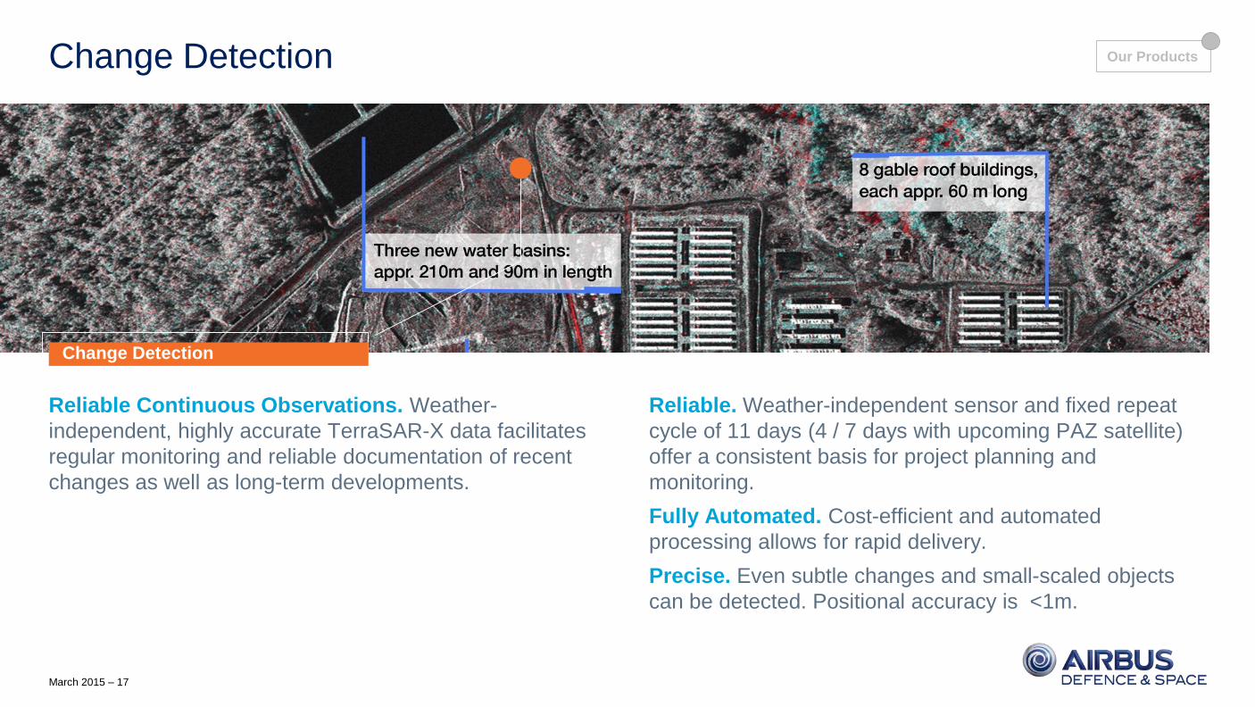
Change Detection
Reliable Continuous Observations. Weather-
independent, highly accurate TerraSAR-X data facilitates
regular monitoring and reliable documentation of recent
changes as well as long-term developments.
Reliable. Weather-independent sensor and fixed repeat
cycle of 11 days (4 / 7 days with upcoming PAZ satellite)
offer a consistent basis for project planning and
monitoring.
Fully Automated. Cost-efficient and automated
processing allows for rapid delivery.
Precise. Even subtle changes and small-scaled objects
can be detected. Positional accuracy is <1m.
Change Detection
Our Products
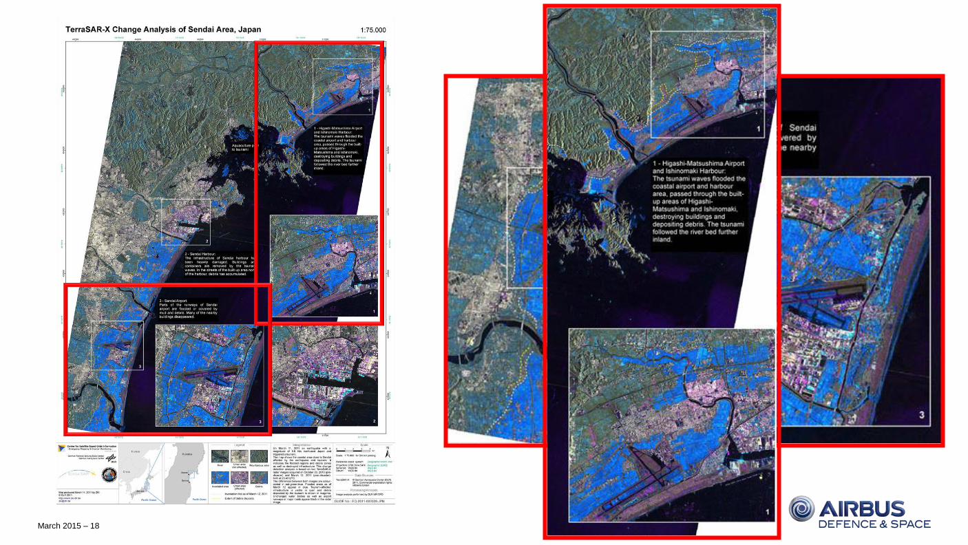
March 2015 – 18
March 2015 – 19
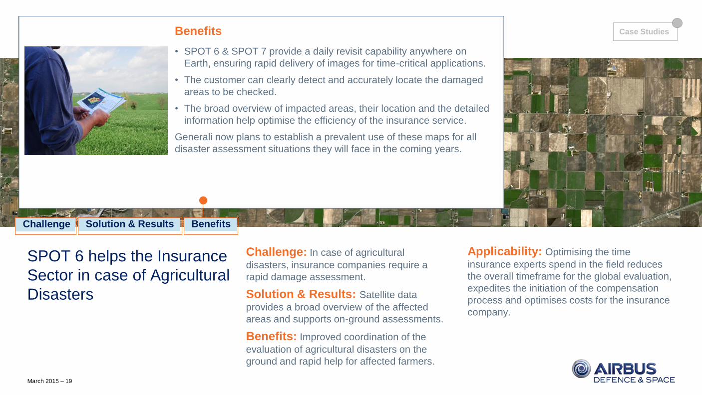
Case Study: Agriculture Disaster Management
SPOT 6 helps the Insurance
Sector in case of Agricultural
Disasters
Challenge: In case of agricultural
disasters, insurance companies require a
rapid damage assessment.
Solution & Results: Satellite data
provides a broad overview of the affected
areas and supports on-ground assessments.
Benefits: Improved coordination of the
evaluation of agricultural disasters on the
ground and rapid help for affected farmers.
Applicability: Optimising the time
insurance experts spend in the field reduces
the overall timeframe for the global evaluation,
expedites the initiation of the compensation
process and optimises costs for the insurance
company.
Challenge
Each year, farmers protect their harvest by contracting a multi-risk
insurance to cover potential losses from hazards such as frost, hail or
floods. In case of an agricultural disaster, insurance companies need to
detect and assess the damage on the ground rapidly to facilitate the
initiation of the compensation process.
The global insurance company Generali contracted Airbus Defence and
Space for the delivery of biophysical maps (canopy description) to assist
loss adjusters to better scout damaged fields and target priority areas to
be appraised.
Solution & Results
To support the assessment of fields that have suffered damage, Airbus
Defence and Space provided Generali with biophysical maps derived
from SPOT 6 images acquired at decisive agronomic periods.
After digitalization of the fields on the SPOT 6 images and collecting
information on the crop, biophysical processing was done using
OverlandTM.
A map representing the share of green vegetation cover was produced
for each field and delivered to Generali within just one week.
Solution & Results Benefits Challenge
Benefits
• SPOT 6 & SPOT 7 provide a daily revisit capability anywhere on
Earth, ensuring rapid delivery of images for time-critical applications.
• The customer can clearly detect and accurately locate the damaged
areas to be checked.
• The broad overview of impacted areas, their location and the detailed
information help optimise the efficiency of the insurance service.
Generali now plans to establish a prevalent use of these maps for all
disaster assessment situations they will face in the coming years.
Case Studies
March 2015 – 20
Case Study: Improved Construction Safety
TerraSAR-X-based Surface
Movement Monitoring for
Improved Safety in Urban
Areas
Challenge: Prevent endangerment of
infrastructure and human lives due to surface
movements.
Solution & Results: Space-based
monitoring with TerraSAR-X complements
terrestrial measurement campaigns.
Benefits: Improved understanding of the
surface movement and support of the
implementation of countermeasures.
Applicability: TerraSAR-X-based surface
movement monitoring can complement
terrestrial measurements and hence supports
authorities and engineering companies with
the timely detection of risks to human lives and
infrastructure.
Subsequently TerraSAR-X can be used to
monitor the effects of countermeasures taken
by the authorities.
Challenge
Ground subsidence due to over-extraction of underground water has
become a serious problem in Beijing, China. The ensuing surface
movement endangers the local population and infrastructure.
A terrestrial surveying programme was established to monitor the
subsidence and highlight potential risk areas. However, due to restricted
budgets this levelling network can only provide point information about
subsidence, it does not deliver a continuous and sufficiently extended
understanding of the entire deformation area.
Solution & Results
Airbus Defence and Space conducted a monitoring campaign using
TerraSAR-X data. The study verified surface subsidence of up to 150mm
per year, which correlates strongly with the levelling results.
Additionally, the overall subsidence phenomena could be derived:
the surface movement extends over a large area, but subsidence
distribution is inhomogeneous with parts of very strong horizontal
surface displacement. These areas face an increased risk of damages to
infrastructure due to inhomogeneous structural stress - valuable
information for initialising counteractions.
Solution & Results Benefits Challenge
Benefits
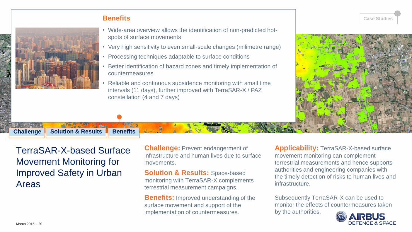
• Wide-area overview allows the identification of non-predicted hot-
spots of surface movements
• Very high sensitivity to even small-scale changes (milimetre range)
• Processing techniques adaptable to surface conditions
• Better identification of hazard zones and timely implementation of
countermeasures
• Reliable and continuous subsidence monitoring with small time
intervals (11 days), further improved with TerraSAR-X / PAZ
constellation (4 and 7 days)
Case Studies
March 2015 – 21
SAFEcommand™
Powerful Integrated Software. SAFEcommandTM is an
innovative software solution specifically designed to
address the modern challenges faced by public safety and
emergency organisations.
Duty of Care. The SAFEcommandTM systems and
software suite addresses four essential areas:
data management, asset tracking, mobile information
retrieval and communications, and emergency preparation
and response.
They help public safety and emergency organisations
deliver on their critical Duty of Care objectives.
SAFEcommand
Our Products
March 2015 – 22
PIONEERING THE FUTURE TOGETHER
Contact:
Name: Jessi Dick
Title: Sr. Marketing Manager, Online & Software Partnerships
E-mail: [email protected]
Recommended