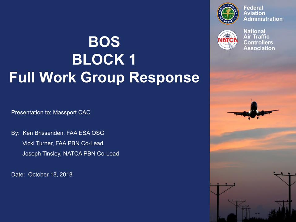
FederalAviation Administration
National Air TrafficControllers AssociationBOS
BLOCK 1Full Work Group Response
Presentation to: Massport CAC
By: Ken Brissenden, FAA ESA OSG
Vicki Turner, FAA PBN Co-Lead
Joseph Tinsley, NATCA PBN Co-Lead
Date: October 18, 2018

The concepts in this presentation do not constitute, or imply, a reopening of the Boston Logan Airport Noise Study (BLANS)
Any designs identified for further development must go through the environmental process

How Did We Get Here?

v An MOU was signed between Massport and FAA September, 2016
v Formation of 7100.41A PBN Full Working Group (FWG)
Ø May, 2018 FAA formed PBN FWG via FAA Order 7100.41A
Ø FWG consists of Industry, Air Traffic Facilities, and Massport/MIT
Ø Reviewed BOS BLOCK 1 recommendations to determine operational feasibility
Ø Designed procedures in an attempt to mitigate BOS BLOCK 1 concerns and address FAA procedural requirements

FAA JO 7100.41A
The Performance Based Navigation (PBN) Implementation Process

Performance Based Navigation (PBN) Procedures
Ø Area Navigation (RNAV) Procedureso RNAV SIDSo RNAV STARSo Q and Y Routeso T Routes o TK Routes
Ø Required Navigation Performance (RNP) Procedureso RNAV RNP Approacheso RNAV RNP SIDs
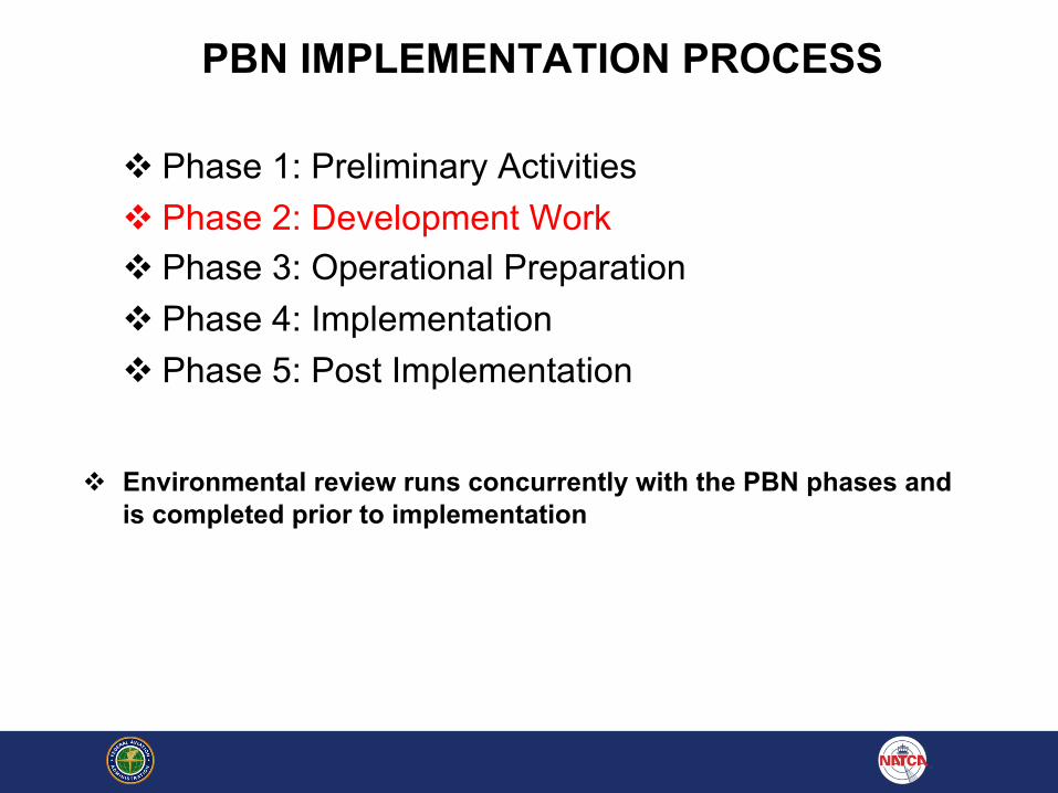
PBN IMPLEMENTATION PROCESS
v Phase 1: Preliminary Activitiesv Phase 2: Development Workv Phase 3: Operational Preparationv Phase 4: Implementation v Phase 5: Post Implementation
v Environmental review runs concurrently with the PBN phases and is completed prior to implementation
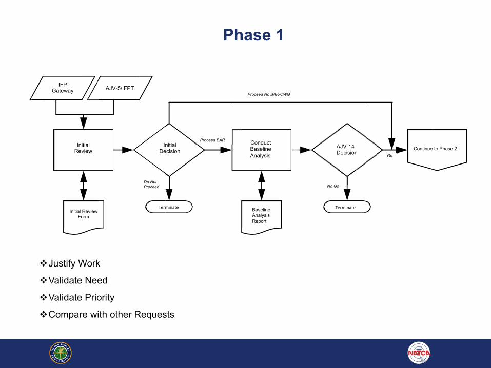
Phase 1
IFPGateway AJV-5/ FPT
Proceed No BAR/CWG
Initial Review
Initial Decision
Proceed BAR ConductBaselineAnalysis
AJV-14Decision Go
Continue to Phase 2
Do Not Proceed No Go
Initial Review Form
Terminate BaselineAnalysisReport
Terminate
vJustify Work
vValidate Need
vValidate Priority
vCompare with other Requests
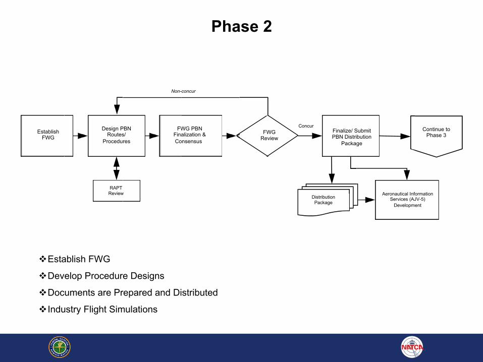
Non-concur
Establish FWG
Design PBN Routes/
Procedures
FWG PBNFinalization & Consensus
r
FWGReview
Finalize/ Submit PBN Distribution
Package
Continue to Phase 3
RAPTReview
Distribution Package
Aeronautical Information Services (AJV-5)
Development
Phase 2
vEstablish FWG
vDevelop Procedure Designs
vDocuments are Prepared and Distributed
vIndustry Flight Simulations
Concur
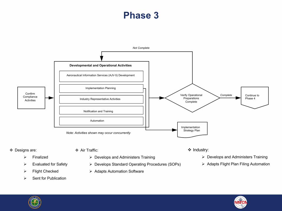
Phase 3
Developmental and Operational Activities
Aeronautical Information Services (AJV-5) Development
Implementation Planning
Confirm Compliance
Activities
Verify Operational Preparations
Complete
CompleteIndustry Representative Activities
Continue to Phase 4
Notification and Training
Automation
ImplementationStrategy Plan
Not Complete
Note: Activities shown may occur concurrently
v Designs are:
Ø Finalized
Ø Evaluated for Safety
Ø Flight Checked
Ø Sent for Publication
v Air Traffic:
Ø Develops and Administers Training
Ø Develops Standard Operating Procedures (SOPs)
Ø Adapts Automation Software
v Industry:
Ø Develops and Administers Training
Ø Adapts Flight Plan Filing Automation
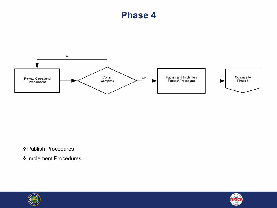
Phase 4
No
Review Operational Preparations
Confirm Complete
Yes Publish and Implement Routes/ Procedures
Continue to Phase 5
vPublish Procedures
vImplement Procedures
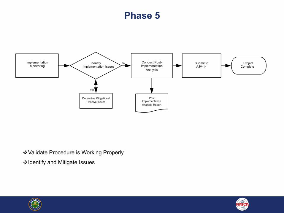
Phase 5
Identify NoImplementation Issues
Implementation Monitoring
Conduct Post-Implementation
Analysis
Submit to AJV-14
Project Complete
Yes
Determine Mitigations/ Resolve Issues
Post Implementation Analysis Report
vValidate Procedure is Working Properly
vIdentify and Mitigate Issues

BOS Block 1Status Update
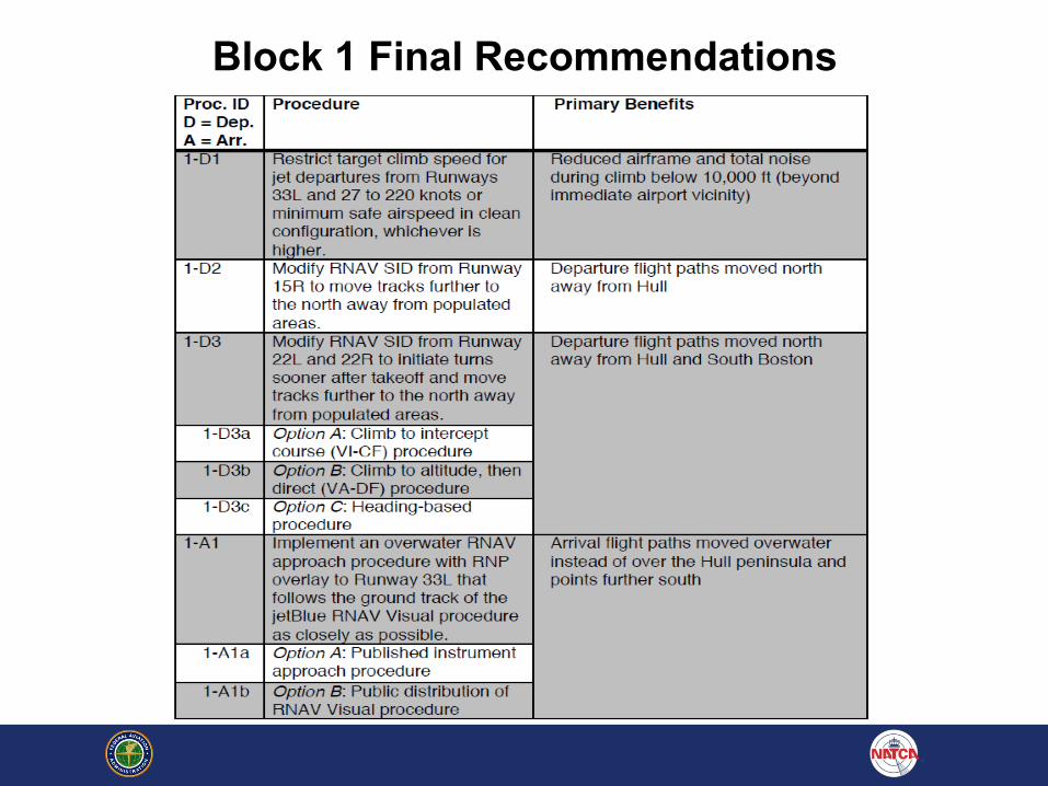
Block 1 Final Recommendations
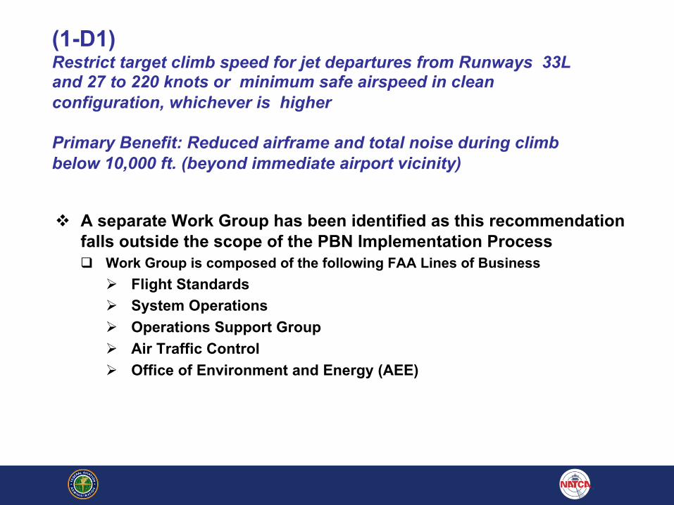
(1-D1) Restrict target climb speed for jet departures from Runways 33L and 27 to 220 knots or minimum safe airspeed in clean configuration, whichever is higher
Primary Benefit: Reduced airframe and total noise during climb below 10,000 ft. (beyond immediate airport vicinity)
v A separate Work Group has been identified as this recommendation falls outside the scope of the PBN Implementation Processq Work Group is composed of the following FAA Lines of Business
Ø Flight StandardsØ System OperationsØ Operations Support GroupØ Air Traffic ControlØ Office of Environment and Energy (AEE)

(1-D2) Modify RNAV SID from Runway 15R to move tracks further to the north away from populated areas.
Primary Benefit: Departure flight paths moved north away from Hull
Notional design by Full Work Group as of October 4, 2018Design recommended by MIT
Current ProcedureNotional Procedure
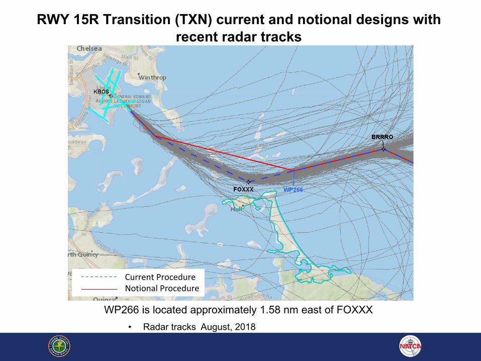
RWY 15R Transition (TXN) current and notional designs with recent radar tracks
WP266 is located approximately 1.58 nm east of FOXXX• Radar tracks August, 2018
Current ProcedureNotional Procedure

(1-D2) MIT Estimates RWY 15R TXN ModificationB737-800 60dB LA,max Noise Exposure
Population Exposure (LA,MAX)
B737-800
FOXXX WP266
60dB
Current RNAV 5,838
.41 RNAV 4,815
Difference (Current RNAV – .41 RNAV)
1,023
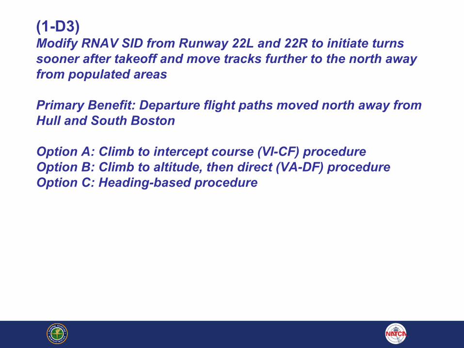
(1-D3) Modify RNAV SID from Runway 22L and 22R to initiate turns sooner after takeoff and move tracks further to the north away from populated areas
Primary Benefit: Departure flight paths moved north away from Hull and South Boston
Option A: Climb to intercept course (VI-CF) procedureOption B: Climb to altitude, then direct (VA-DF) procedureOption C: Heading-based procedure
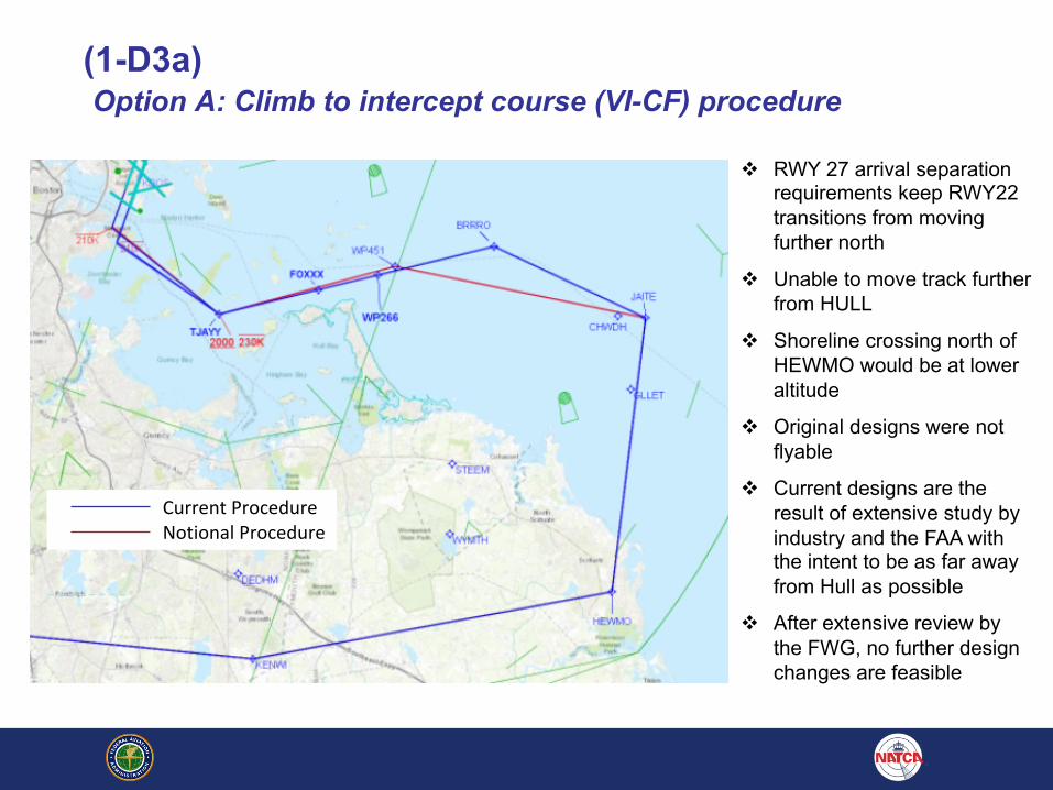
(1-D3a)Option A: Climb to intercept course (VI-CF) procedure
v RWY 27 arrival separation requirements keep RWY22 transitions from moving further north
v Unable to move track further from HULL
v Shoreline crossing north of HEWMO would be at lower altitude
v Original designs were not flyable
v Current designs are the result of extensive study by industry and the FAA with the intent to be as far away from Hull as possible
v After extensive review by the FWG, no further design changes are feasible
Current ProcedureNotional Procedure
(1-D3b) Option B: Climb to altitude, then direct (VA-DF) procedure
v Aircraft navigational limitations resulted in termination of the earlier VA-DF procedure in 2011q 2011 MITRE study confirmed aircraft navigational limitations
q Meetings with Industry resulted in recommendation of VI-CF procedures
q VI-CF procedures were developed and currently in use
v Wide splay of aircraft tracks were rejected by community q There were numerous community complaints from South Boston and Hull that
aircraft were too close/overflying the communities q 2011 HMMH study commissioned by Massport confirmed wide splay of aircraft
tracks; Recommended VI-CF procedures to correct q VI-CF procedures were developed and currently in use
v The current Work Group reviewed the VA-DF option and determined Runway heading to 520ft prior to turning to the first waypoint is not feasibleq Would cause heavy/low performing aircraft to fly over Hull due to delayed turns
because of slower climb rates

(1-D3c)Option C: Heading-based procedure
v Increases verbiage between Local Control, Departure Control and pilots
v Increases probability of readback/hearback errors, a safety issue
v Shortening departure paths cause conflicts with ROBUC STAR, particularly with heavy/low performing aircraft
v Current procedures from 4R, 9, 15R, 22R/22L provided noise benefits to shoreline communities
v Logan CAC requested RNAV SID departures in lieu of vector based procedures* Vector based procedures are in direct conflict with BLANS (BLANS Table 3-2)
(1-A1) Implement an over water RNAV approach procedure with RNP overlay to Runway 33L that follows the ground track of the JetBlue RNAV Visual procedure as closely as possible
Primary Benefit: Arrival flight paths moved over water instead of over the Hull peninsula and points further south
* The following designs are intended for use when operational conditions allow, primarily when Nocturnal Procedures are in use during periods of very low traffic volume
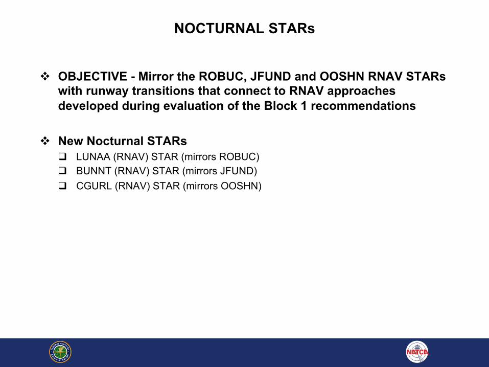
NOCTURNAL STARs
v OBJECTIVE - Mirror the ROBUC, JFUND and OOSHN RNAV STARs with runway transitions that connect to RNAV approaches developed during evaluation of the Block 1 recommendations
v New Nocturnal STARsq LUNAA (RNAV) STAR (mirrors ROBUC)q BUNNT (RNAV) STAR (mirrors JFUND)q CGURL (RNAV) STAR (mirrors OOSHN)
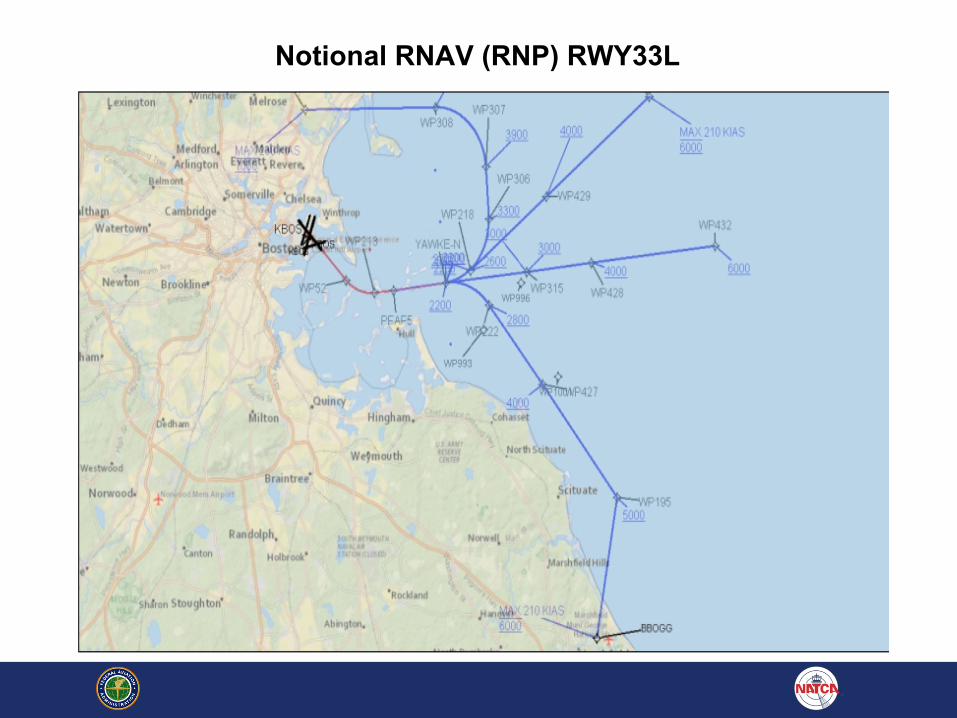
Notional RNAV (RNP) RWY33L
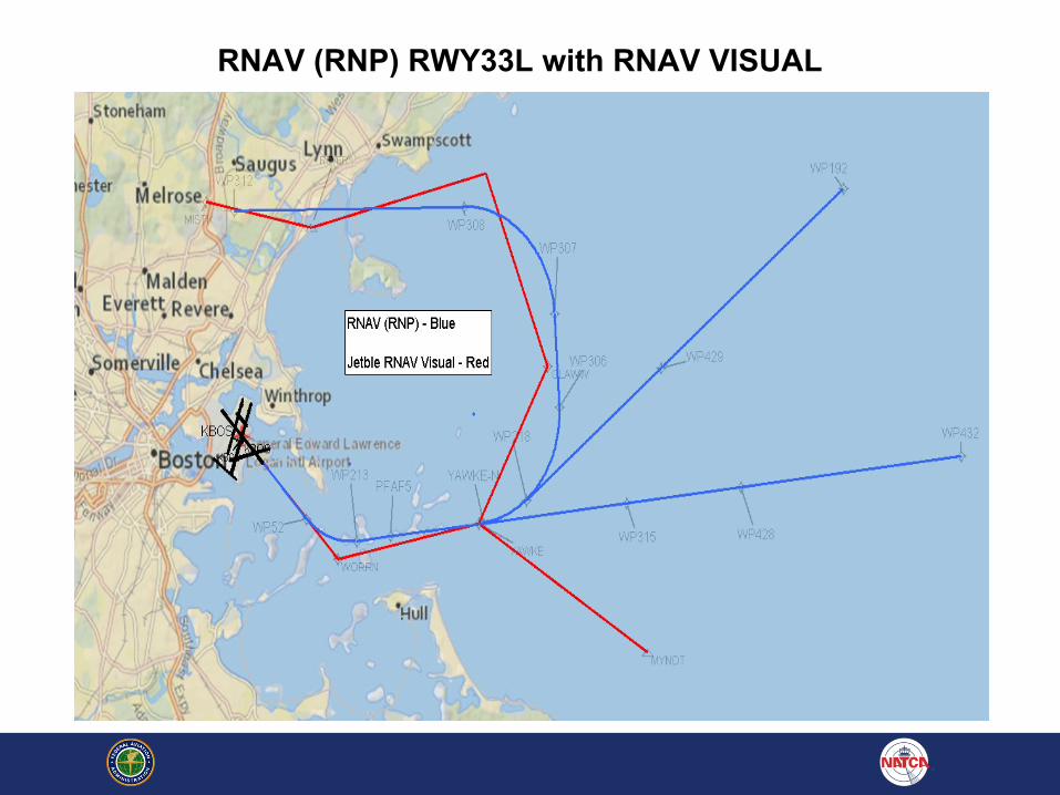
RNAV (RNP) RWY33L with RNAV VISUAL
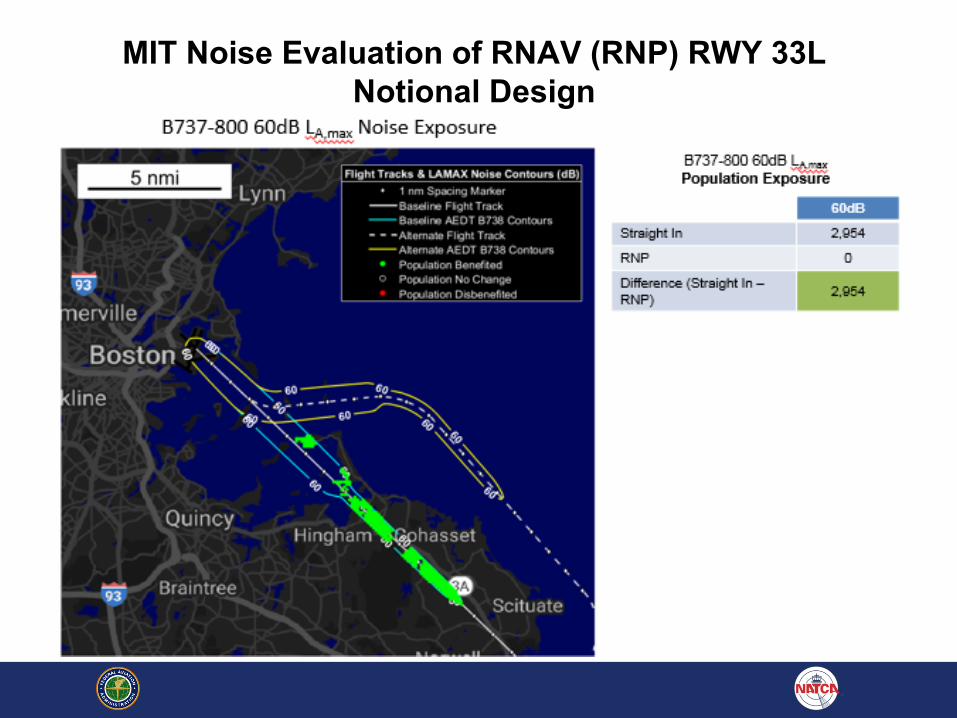
MIT Noise Evaluation of RNAV (RNP) RWY 33L Notional Design
RNAV (GPS) RWY 33L Recommendations

RNAV (GPS) RWY 33L - Introduction
v Development tasked to overlay to the extent possible
JetBlue RNAV Visual Rwy 33L Approach
v OSG-FPT has designed 7 designated versions of the
procedure
v All 7 had issues identified by either Industry, CAC or failed
safety criteria
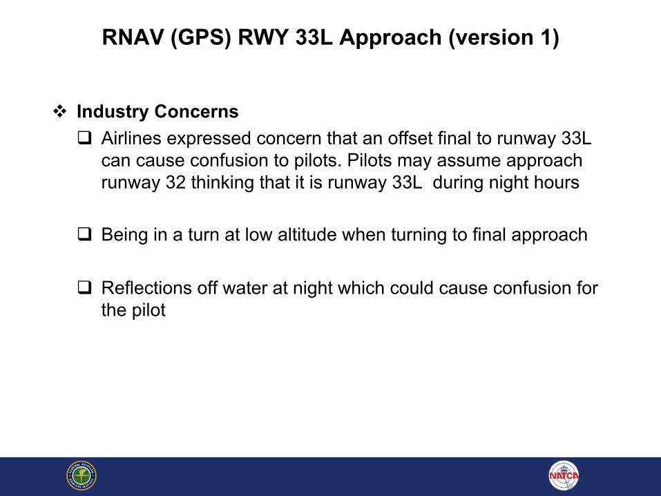
RNAV (GPS) RWY 33L Approach (version 1)
v Industry Concernsq Airlines expressed concern that an offset final to runway 33L
can cause confusion to pilots. Pilots may assume approach runway 32 thinking that it is runway 33L during night hours
q Being in a turn at low altitude when turning to final approach
q Reflections off water at night which could cause confusion for the pilot
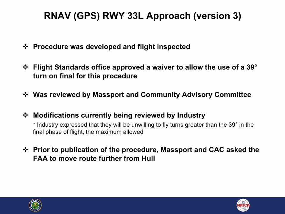
RNAV (GPS) RWY 33L Approach (version 3)
v Procedure was developed and flight inspected
v Flight Standards office approved a waiver to allow the use of a 39°turn on final for this procedure
v Was reviewed by Massport and Community Advisory Committee
v Modifications currently being reviewed by Industry* Industry expressed that they will be unwilling to fly turns greater than the 39° in the final phase of flight, the maximum allowed
v Prior to publication of the procedure, Massport and CAC asked the FAA to move route further from Hull
RNAV (GPS) RWY 33L Approach (version 2,4,5)
v Version 2,4,& 5: Concept of a straight-in final approach segment based on an initial segment that overflies the Nahant Causeway – while maintaining additional lateral separation from Hull
v Concepts included various final approach fix altitudes, segment lengths, and descent gradients greater than safety standards allow
RNAV (GPS) RWY 33L Approach Versions 6 and 7
v Both version were proposed by Industry during collaborative Work Group meetings
v Were attempts to mimic Jet Blue Special RNAV Visual while meeting safety standards for RNAV GPS public procedures
v The tracks moved close to or over Hull (version 6)
v Moving the tracks created safety issues with obstructions (version 7)
Traffic Flow Implications
v Use of RNP RWY33L will be limited when all traffic is not able to accept clearance
v RNP RWY 33L and ILS RWY 33L are not able to be used simultaneously due to dissimilar tracks and lack of sequencing tool
v RNP RYW33L and GPS RWY 33L can be used simultaneously due to similarity of track paths

RNAV (GPS) RWY 33L (version 3)
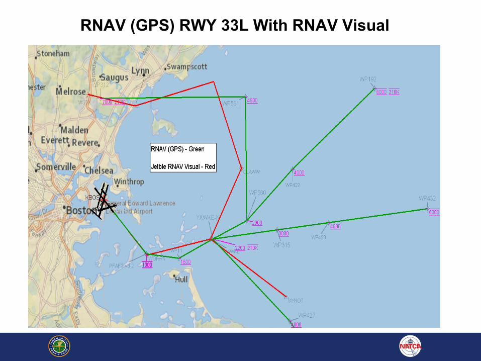
RNAV (GPS) RWY 33L With RNAV Visual
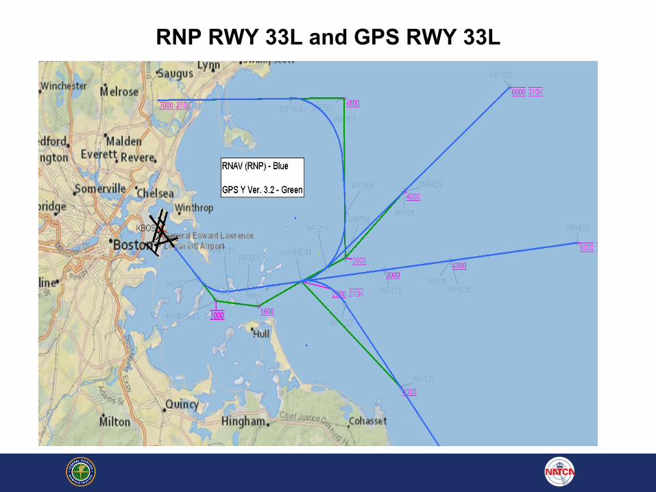
RNP RWY 33L and GPS RWY 33L

RNP RWY 33L and GPS RWY 33L with RNAV Visual

(1-A1b) Option B: Public distribution of RNAV Visual procedure
The recommendation will be resolved by (1-A1)

QUESTIONS?
Recommended