Feasibility Study Overview
Louisiana Coastal AreaEcosystem Restoration
19 September 2000
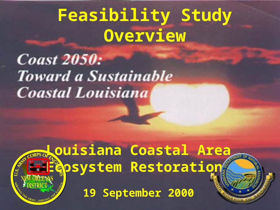
• USACE Recon Report:USACE Recon Report:– Supports Coast 2050 PlanSupports Coast 2050 Plan– Approved for feasibility study start May 99Approved for feasibility study start May 99
• General Investigations study authorization General Investigations study authorization – LCA: 1967 multi-purpose authorityLCA: 1967 multi-purpose authority– Current use: ecosystem restoration (no B/C ratio)Current use: ecosystem restoration (no B/C ratio)– LA Dept. of Natural Resources non-Fed SponsorLA Dept. of Natural Resources non-Fed Sponsor– Feb 00 study start: 50/50 cost shareFeb 00 study start: 50/50 cost share
• Project authorization and funding vehicle: Water Project authorization and funding vehicle: Water Resources Development Act (WRDA)Resources Development Act (WRDA)
Louisiana Coastal Area (LCA) Louisiana Coastal Area (LCA) Feasibility StudyFeasibility Study
Mis
siss
ipp
i
Tex
as
Gulf of Mexico
I-10
I-10
I-10I-12
Cau
sew
ay
Hw
y 1H
wy 301
Hwy 90
Hwy 90
Hwy 46Hwy 82
Hwy 23
Hw
y 1
Mississippi River
Bayou Lafourche
Hw
y 27
Hw
y 27
Louisiana
Red River
Atchafalya R
iver
GIWWGIWW
GIWW
GIWW
GIWW
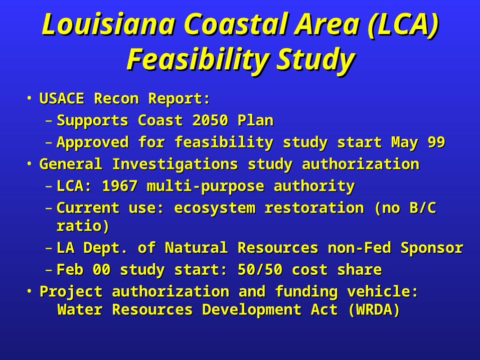
Louisiana Coastal Area (LCA)Authorized Study Area
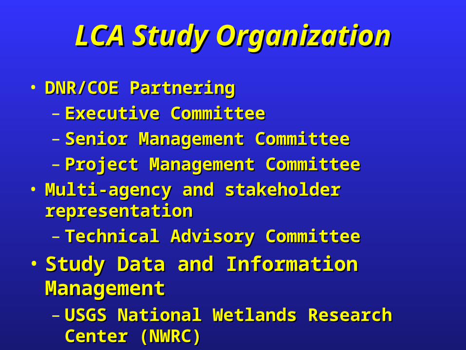
• DNR/COE PartneringDNR/COE Partnering– Executive CommitteeExecutive Committee– Senior Management CommitteeSenior Management Committee– Project Management CommitteeProject Management Committee
• Multi-agency and stakeholder representation Multi-agency and stakeholder representation – Technical Advisory CommitteeTechnical Advisory Committee
• Study Data and Information ManagementStudy Data and Information Management– USGS National Wetlands Research Center USGS National Wetlands Research Center
(NWRC)(NWRC)
LCA Study OrganizationLCA Study Organization
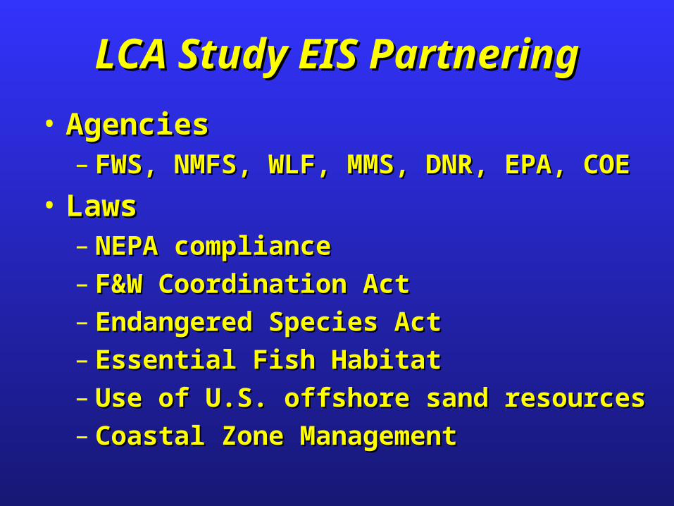
• AgenciesAgencies– FWS, NMFS, WLF, MMS, DNR, EPA, COE FWS, NMFS, WLF, MMS, DNR, EPA, COE
• LawsLaws– NEPA complianceNEPA compliance– F&W Coordination ActF&W Coordination Act– Endangered Species ActEndangered Species Act– Essential Fish HabitatEssential Fish Habitat– Use of U.S. offshore sand resourcesUse of U.S. offshore sand resources– Coastal Zone ManagementCoastal Zone Management
LCA Study EIS PartneringLCA Study EIS Partnering
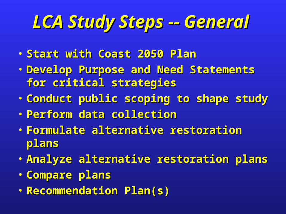
• Start with Coast 2050 PlanStart with Coast 2050 Plan
• Develop Purpose and Need Statements for Develop Purpose and Need Statements for critical strategiescritical strategies
• Conduct public scoping to shape studyConduct public scoping to shape study
• Perform data collectionPerform data collection
• Formulate alternative restoration plansFormulate alternative restoration plans
• Analyze alternative restoration plansAnalyze alternative restoration plans
• Compare plansCompare plans
• Recommendation Plan(s)Recommendation Plan(s)
LCA Study Steps -- General LCA Study Steps -- General
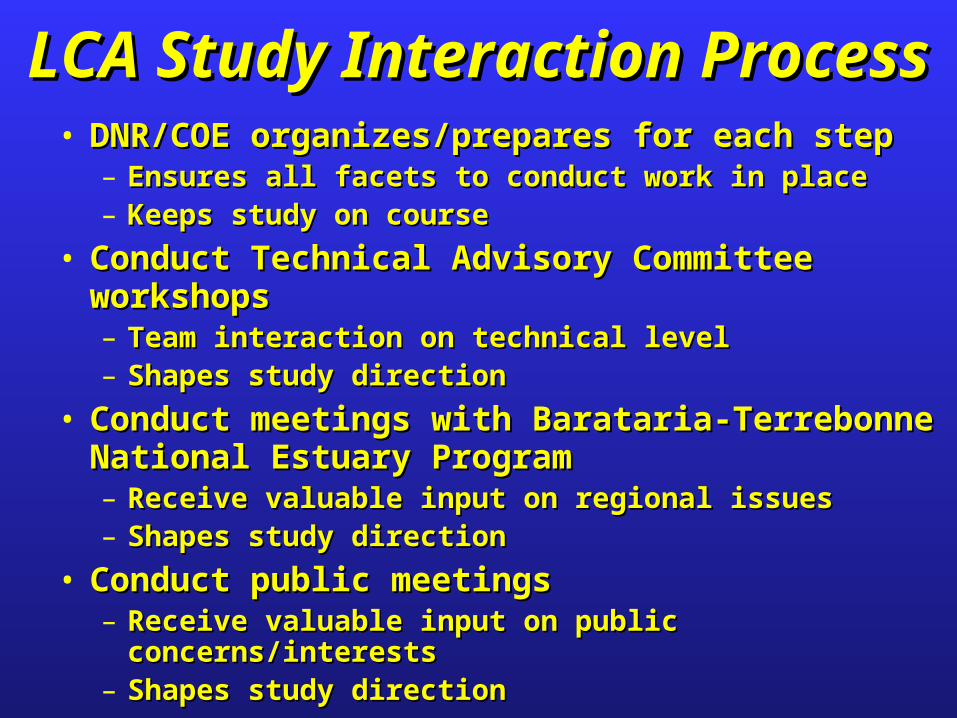
• DNR/COE organizes/prepares for each stepDNR/COE organizes/prepares for each step– Ensures all facets to conduct work in placeEnsures all facets to conduct work in place– Keeps study on courseKeeps study on course
• Conduct Technical Advisory Committee workshopsConduct Technical Advisory Committee workshops– Team interaction on technical level Team interaction on technical level – Shapes study directionShapes study direction
• Conduct meetings with Barataria-Terrebonne Conduct meetings with Barataria-Terrebonne National Estuary ProgramNational Estuary Program– Receive valuable input on regional issuesReceive valuable input on regional issues– Shapes study directionShapes study direction
• Conduct public meetingsConduct public meetings– Receive valuable input on public concerns/interestsReceive valuable input on public concerns/interests– Shapes study directionShapes study direction
LCA Study Interaction ProcessLCA Study Interaction Process
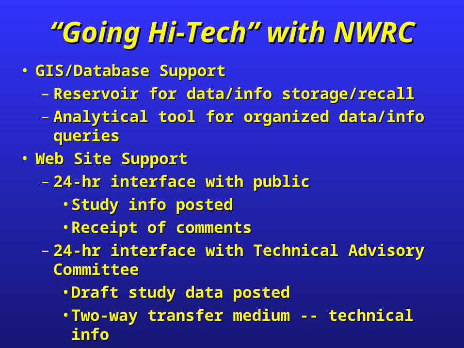
• GIS/Database SupportGIS/Database Support– Reservoir for data/info storage/recallReservoir for data/info storage/recall– Analytical tool for organized data/info queriesAnalytical tool for organized data/info queries
• Web Site SupportWeb Site Support– 24-hr interface with public24-hr interface with public
• Study info postedStudy info posted• Receipt of commentsReceipt of comments
– 24-hr interface with Technical Advisory 24-hr interface with Technical Advisory CommitteeCommittee• Draft study data postedDraft study data posted• Two-way transfer medium -- technical infoTwo-way transfer medium -- technical info
““Going Hi-Tech” with NWRCGoing Hi-Tech” with NWRC
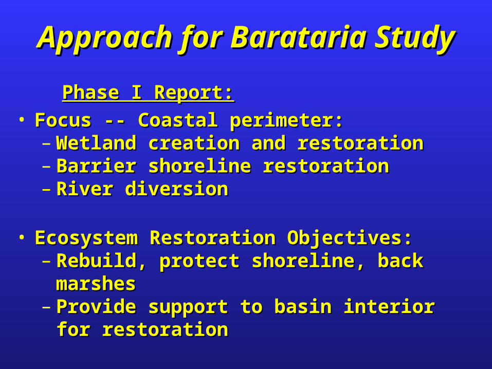
Approach for Barataria StudyApproach for Barataria Study
Phase I Report:Phase I Report:• Focus -- Coastal perimeter:Focus -- Coastal perimeter:
– Wetland creation and restorationWetland creation and restoration– Barrier shoreline restorationBarrier shoreline restoration– River diversionRiver diversion
• Ecosystem Restoration Objectives:Ecosystem Restoration Objectives:– Rebuild, protect shoreline, back marshesRebuild, protect shoreline, back marshes– Provide support to basin interior for restorationProvide support to basin interior for restoration
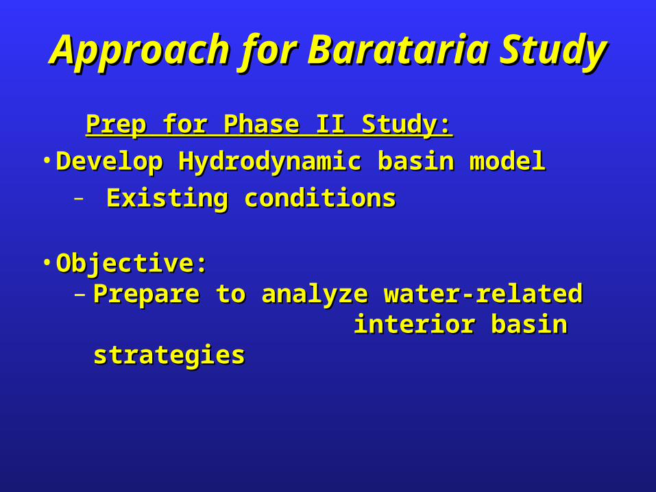
Approach for Barataria StudyApproach for Barataria Study
Prep for Phase II Study:Prep for Phase II Study:• Develop Hydrodynamic basin modelDevelop Hydrodynamic basin model
– Existing conditionsExisting conditions
• Objective:Objective:– Prepare to analyze water-related Prepare to analyze water-related
interior basin strategiesinterior basin strategies
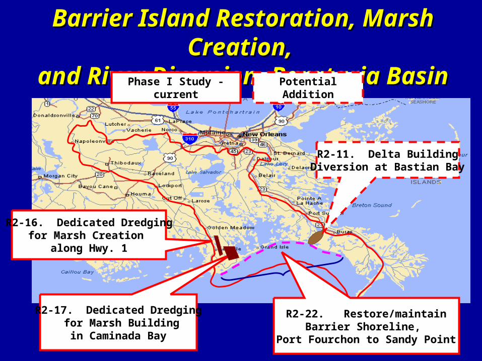
Barrier Island Restoration, Marsh Creation, Barrier Island Restoration, Marsh Creation, and River Diversion, Barataria Basinand River Diversion, Barataria Basin
R2-16. Dedicated Dredgingfor Marsh Creation
along Hwy. 1
R2-17. Dedicated Dredging for Marsh Buildingin Caminada Bay
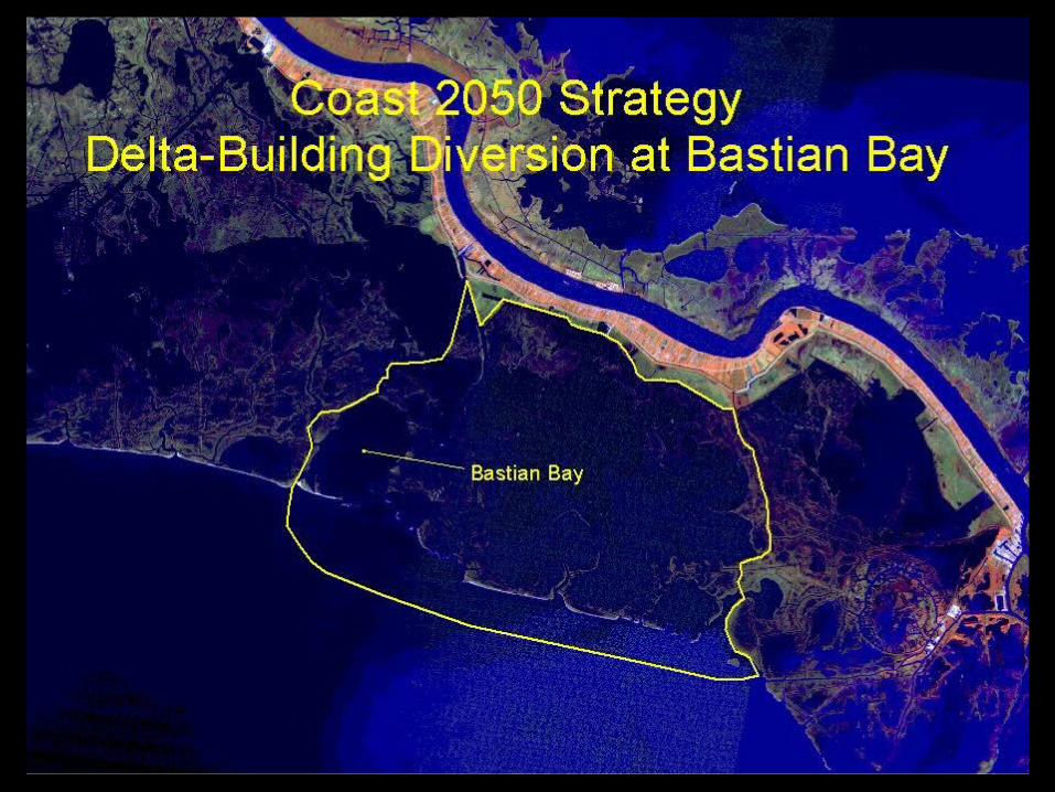
R2-11. Delta BuildingDiversion at Bastian Bay
R2-22. Restore/maintainBarrier Shoreline,
Port Fourchon to Sandy Point
Phase I Study - current Potential Addition
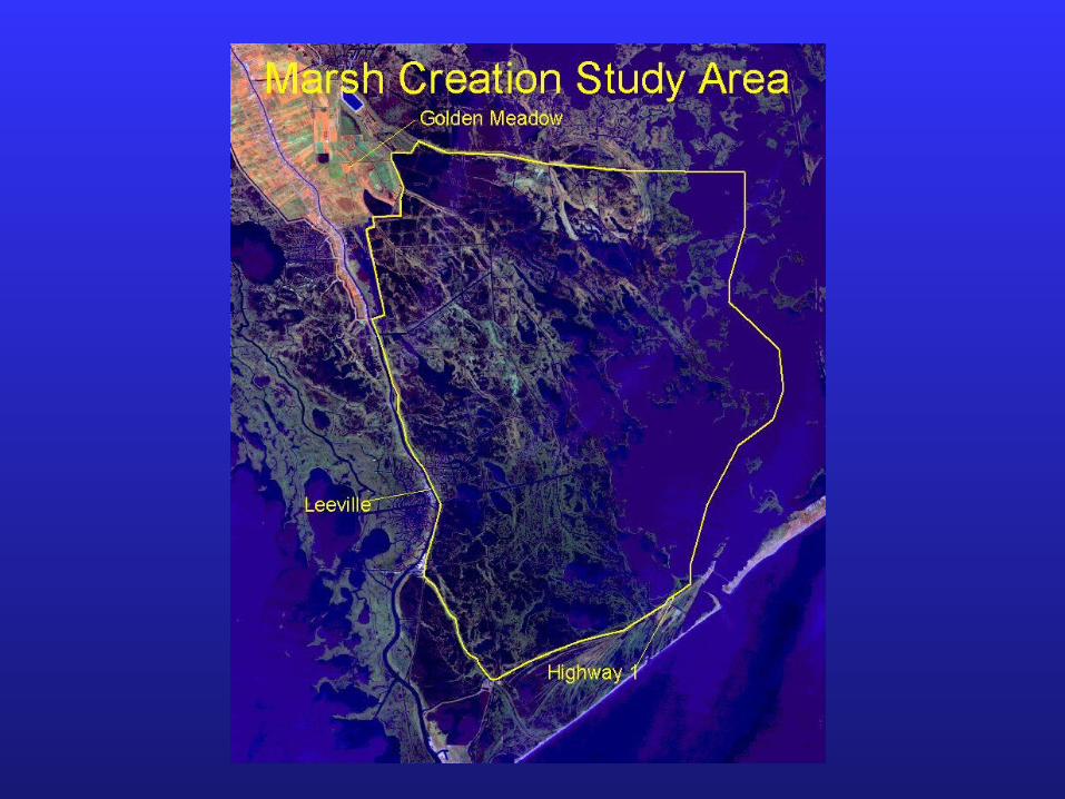
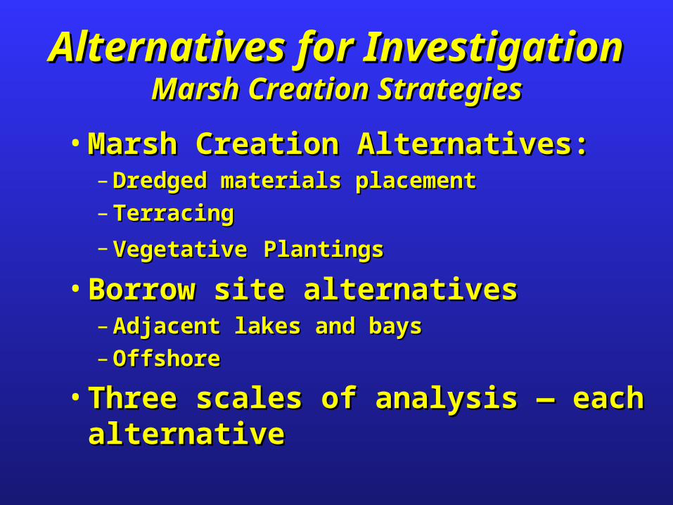
Alternatives for InvestigationAlternatives for InvestigationMarsh Creation StrategiesMarsh Creation Strategies
• Marsh Creation Alternatives:Marsh Creation Alternatives:– Dredged materials placementDredged materials placement
– TerracingTerracing
– VegetativeVegetative PlantingsPlantings
• Borrow site alternativesBorrow site alternatives– Adjacent lakes and baysAdjacent lakes and bays
– OffshoreOffshore
• Three scales of analysis Three scales of analysis —— each alternative each alternative
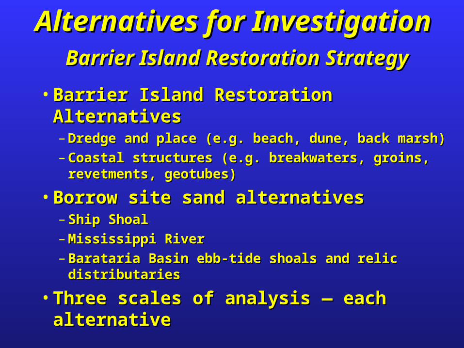
Alternatives for InvestigationAlternatives for Investigation Barrier Island Restoration StrategyBarrier Island Restoration Strategy
• Barrier Island Restoration AlternativesBarrier Island Restoration Alternatives– Dredge and place (e.g. beach, dune, back marsh)Dredge and place (e.g. beach, dune, back marsh)
– Coastal structures (e.g. breakwaters, groins, revetments, Coastal structures (e.g. breakwaters, groins, revetments, geotubes)geotubes)
• Borrow site sand alternativesBorrow site sand alternatives– Ship ShoalShip Shoal
– Mississippi RiverMississippi River
– Barataria Basin ebb-tide shoals and relic distributariesBarataria Basin ebb-tide shoals and relic distributaries
• Three scales of analysis Three scales of analysis —— each alternative each alternative
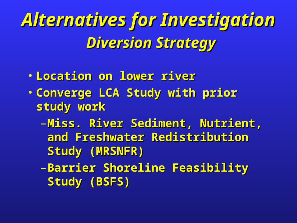
Alternatives for InvestigationAlternatives for Investigation Diversion StrategyDiversion Strategy
• Location on lower riverLocation on lower river• Converge LCA Study with prior study work Converge LCA Study with prior study work
– Miss. River Sediment, Nutrient, and Miss. River Sediment, Nutrient, and Freshwater Redistribution Study (MRSNFR)Freshwater Redistribution Study (MRSNFR)
– Barrier Shoreline Feasibility Study (BSFS)Barrier Shoreline Feasibility Study (BSFS)
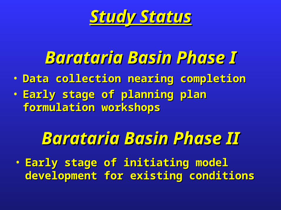
• Data collection nearing completionData collection nearing completion• Early stage of planning plan formulation workshopsEarly stage of planning plan formulation workshops
Study StatusStudy Status
Barataria Basin Phase IBarataria Basin Phase I
• Early stage of initiating model development for Early stage of initiating model development for existing conditionsexisting conditions
Barataria Basin Phase IIBarataria Basin Phase II

Study Website:Study Website:www.coast2050.govwww.coast2050.gov
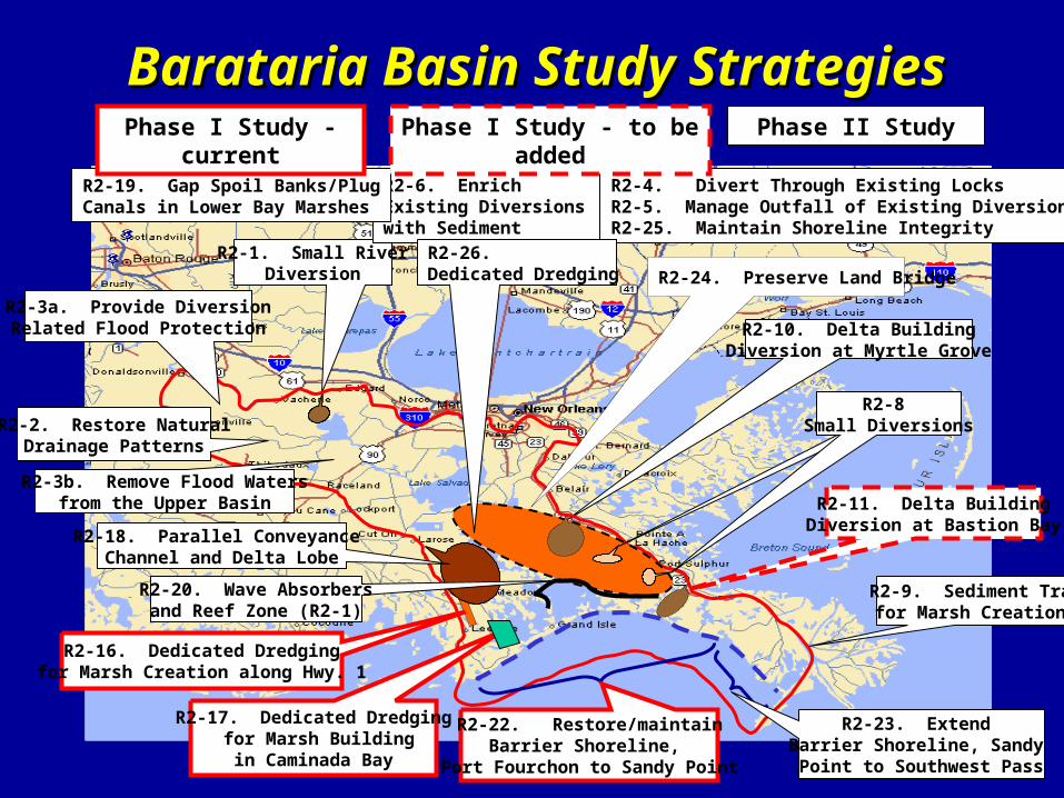
Barataria Basin Study StrategiesBarataria Basin Study Strategies
R2-10. Delta BuildingDiversion at Myrtle Grove
R2-1. Small RiverDiversion
R2-6. Enrich Existing Diversions with Sediment
R2-19. Gap Spoil Banks/PlugCanals in Lower Bay Marshes
R2-16. Dedicated Dredgingfor Marsh Creation along Hwy. 1
R2-24. Preserve Land Bridge
R2-8 Small Diversions
Phase II Study
R2-17. Dedicated Dredging for Marsh Buildingin Caminada Bay
R2-11. Delta BuildingDiversion at Bastion Bay
R2-2. Restore NaturalDrainage Patterns
R2-3b. Remove Flood Watersfrom the Upper Basin
R2-22. Restore/maintainBarrier Shoreline,
Port Fourchon to Sandy Point
R2-9. Sediment Trapfor Marsh Creation
R2-4. Divert Through Existing LocksR2-5. Manage Outfall of Existing DiversionsR2-25. Maintain Shoreline Integrity
R2-26. Dedicated Dredging
Phase I Study - current
R2-3a. Provide DiversionRelated Flood Protection
R2-23. Extend Barrier Shoreline, Sandy Point to Southwest Pass
Phase I Study - to be added
R2-20. Wave Absorbersand Reef Zone (R2-1)
R2-18. Parallel Conveyance Channel and Delta Lobe
Recommended