Esri UC 2014 | Technical Workshop |
Caching Imagery Using ArcGISHong Xu, Hua Wei
Esri UC 2014 | Technical Workshop |
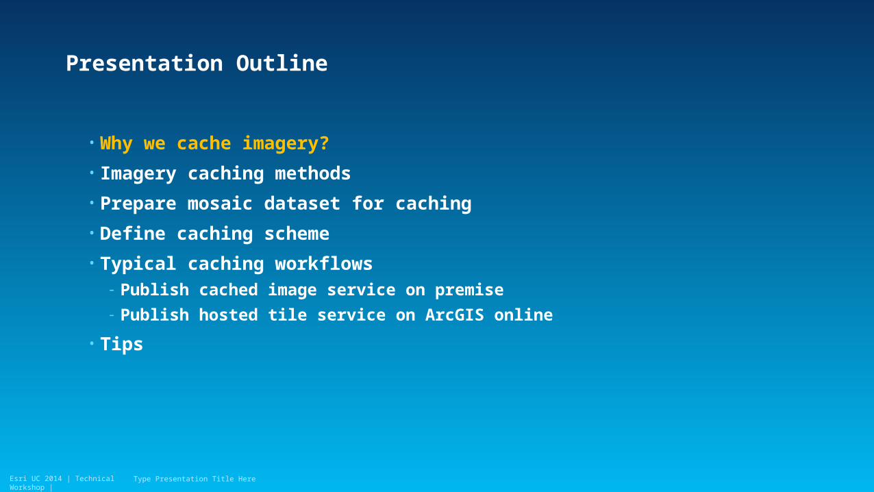
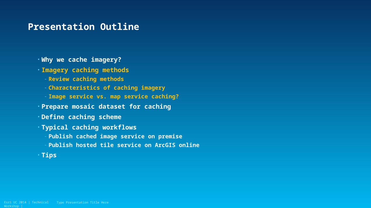
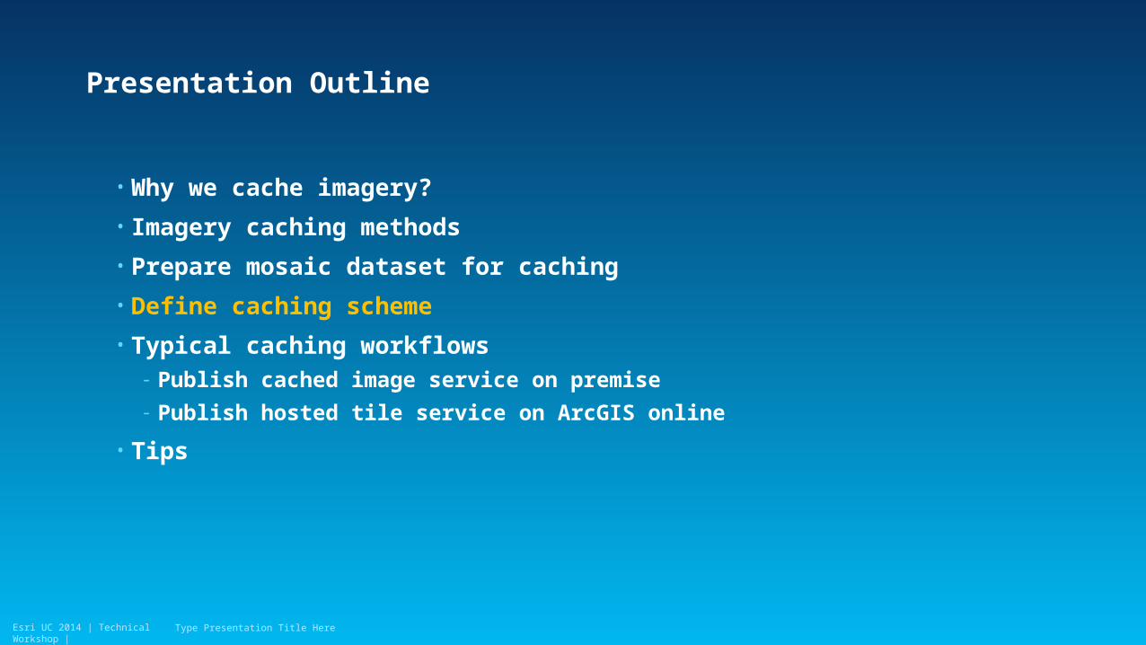
Presentation Outline
• Why we cache imagery?
• Imagery caching methods
• Prepare mosaic dataset for caching
• Define caching scheme
• Typical caching workflows- Publish cached image service on premise
- Publish hosted tile service on ArcGIS online
• Tips
Type Presentation Title Here
Esri UC 2014 | Technical Workshop |
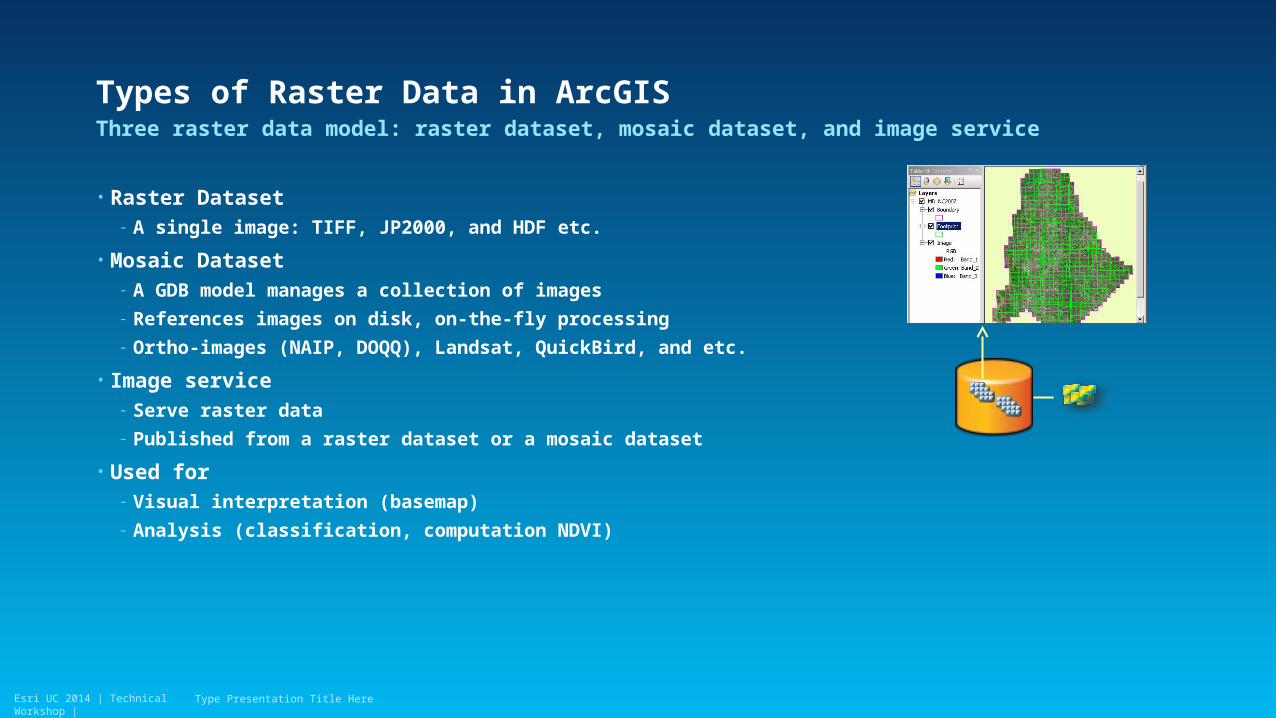
Types of Raster Data in ArcGIS
• Raster Dataset- A single image: TIFF, JP2000, and HDF etc.
• Mosaic Dataset- A GDB model manages a collection of images
- References images on disk, on-the-fly processing
- Ortho-images (NAIP, DOQQ), Landsat, QuickBird, and etc.
• Image service- Serve raster data
- Published from a raster dataset or a mosaic dataset
• Used for - Visual interpretation (basemap)
- Analysis (classification, computation NDVI)
Three raster data model: raster dataset, mosaic dataset, and image service
Type Presentation Title Here
Esri UC 2014 | Technical Workshop |
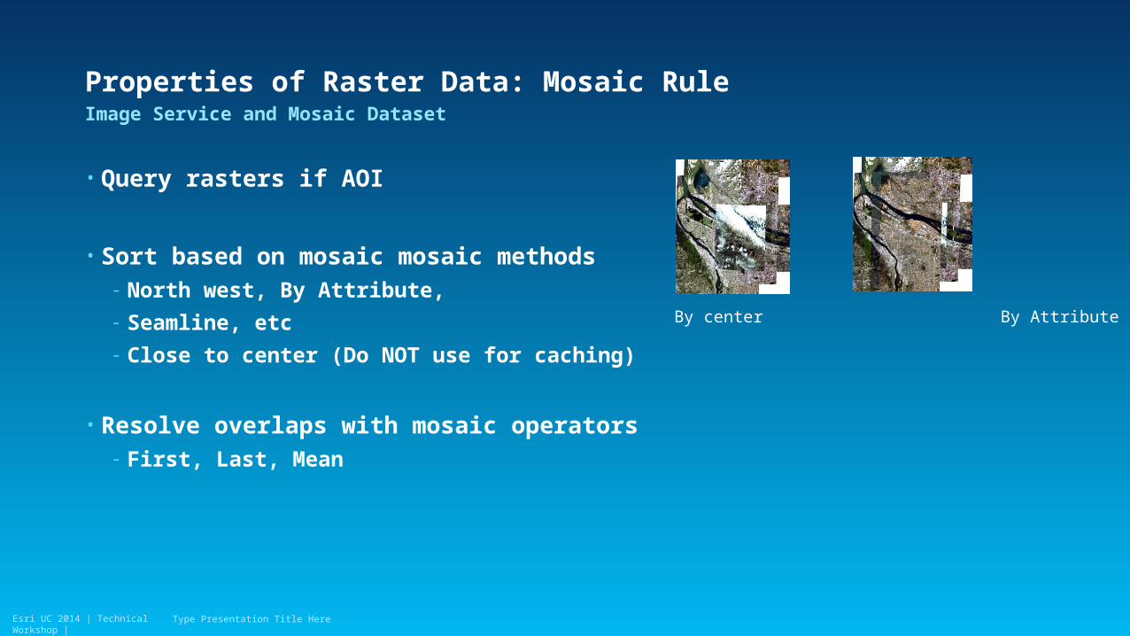
Properties of Raster Data: Mosaic Rule
• Query rasters if AOI
• Sort based on mosaic mosaic methods- North west, By Attribute,
- Seamline, etc
- Close to center (Do NOT use for caching)
• Resolve overlaps with mosaic operators- First, Last, Mean
Image Service and Mosaic Dataset
Type Presentation Title Here
By center By Attribute
Esri UC 2014 | Technical Workshop |
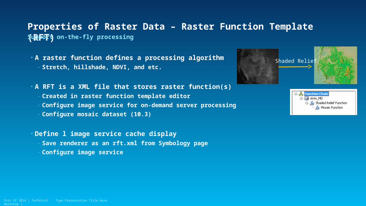
Properties of Raster Data – Raster Function Template (RFT)
• A raster function defines a processing algorithm- Stretch, hillshade, NDVI, and etc.
• A RFT is a XML file that stores raster function(s)- Created in raster function template editor
- Configure image service for on-demand server processing
- Configure mosaic dataset (10.3)
• Define l image service cache display- Save renderer as an rft.xml from Symbology page
- Configure image service
Support on-the-fly processing
Type Presentation Title Here
Shaded Relief
Esri UC 2014 | Technical Workshop |
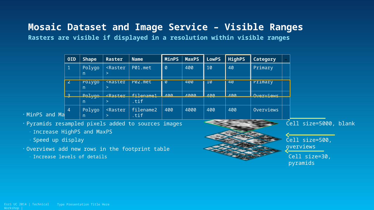
Mosaic Dataset and Image Service – Visible Ranges
• MinPS and MaxPS define the visible ranges
• Pyramids resampled pixels added to sources images- Increase HighPS and MaxPS
- Speed up display
• Overviews add new rows in the footprint table- Increase levels of details
Rasters are visible if displayed in a resolution within visible ranges
Type Presentation Title Here
Cell size=500, overviews
Cell size=5000, blank
Cell size=30, pyramids
OID Shape Raster Name MinPS MaxPS LowPS HighPS Category …
1 Polygon <Raster> P01.met 0 400 10 40 Primary
2 Polygon <Raster> P02.met 0 400 10 40 Primary
3 Polygon <Raster> filename1.tif 400 4000 400 400 Overviews
4 Polygon <Raster> filename2.tif 400 4000 400 400 Overviews
Esri UC 2014 | Technical Workshop |
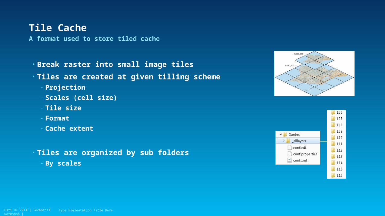
Tile Cache
• Break raster into small image tiles
• Tiles are created at given tilling scheme- Projection
- Scales (cell size)
- Tile size
- Format
- Cache extent
• Tiles are organized by sub folders- By scales
A format used to store tiled cache
Type Presentation Title Here
Esri UC 2014 | Technical Workshop |
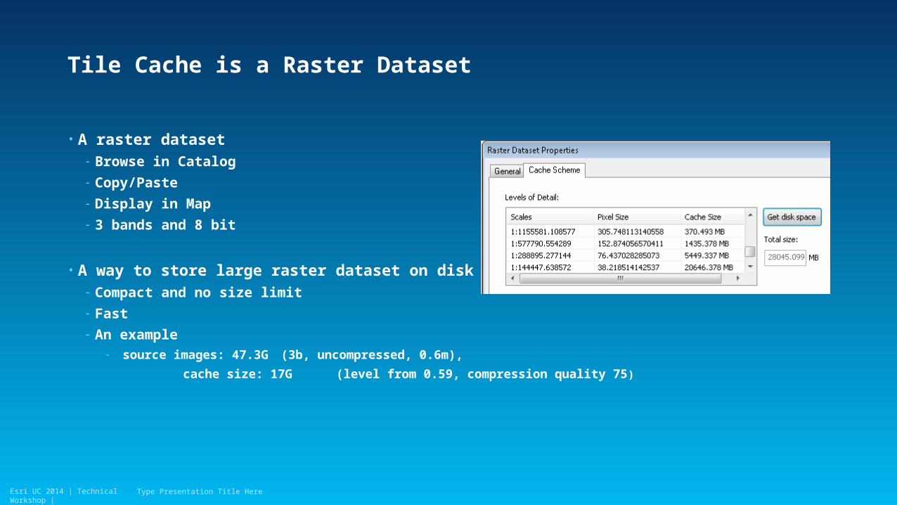
Tile Cache is a Raster Dataset
• A raster dataset- Browse in Catalog
- Copy/Paste
- Display in Map
- 3 bands and 8 bit
• A way to store large raster dataset on disk- Compact and no size limit
- Fast
- An example- source images: 47.3G (3b, uncompressed, 0.6m),
cache size: 17G (level from 0.59, compression quality 75)
Type Presentation Title Here
Esri UC 2014 | Technical Workshop |
Why We Cache?
• Speed up display- Burn process chain in cache tiles
- Retrieve and draw image tiles directly, no additional process
• Reduce storage- Store tile in compressed/fast performed format
• Cache is a snapshot- Given mosaic method
- Given renderer
- Used for applications of less change
Type Presentation Title Here
Esri UC 2014 | Technical Workshop |Esri UC 2014 | Technical Workshop |
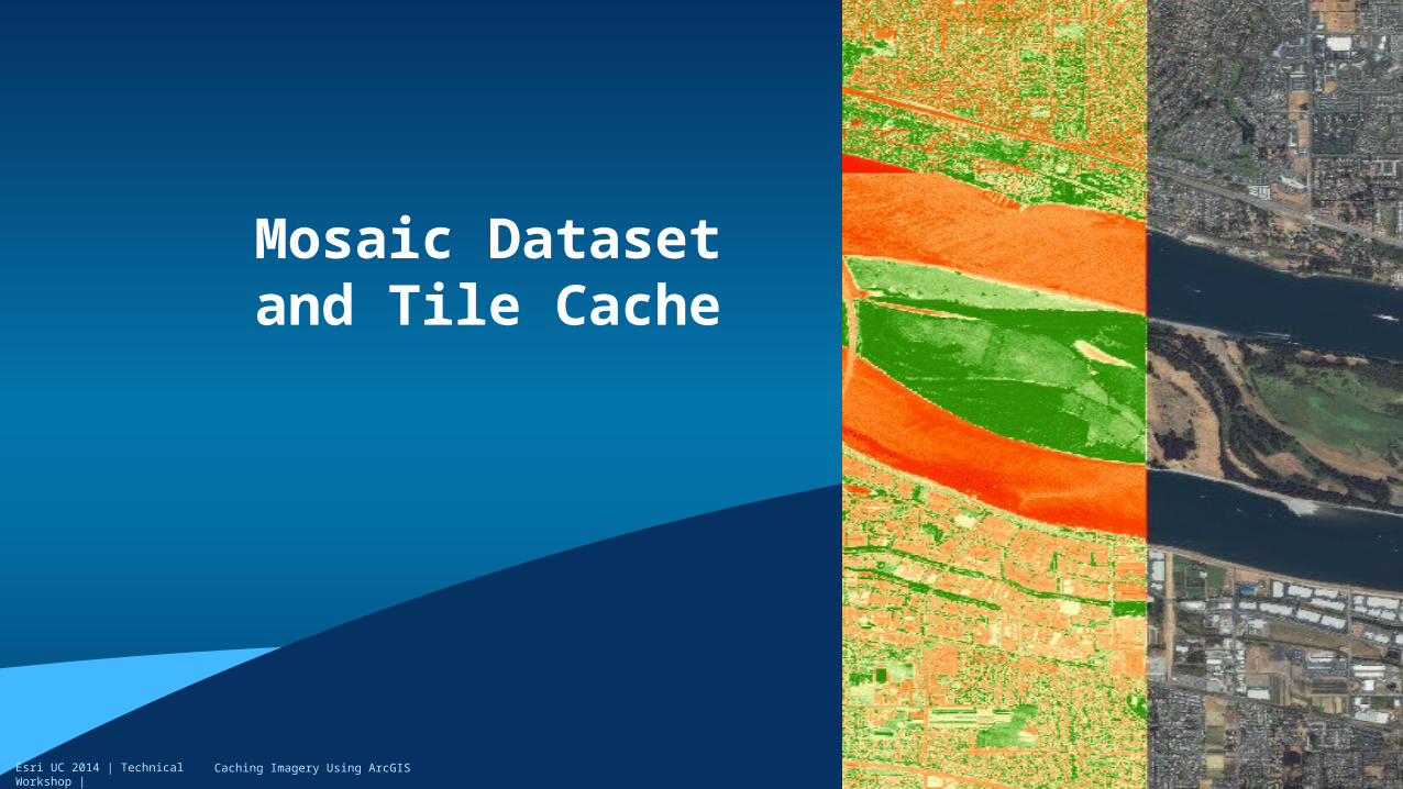
Mosaic Dataset and Tile Cache
Caching Imagery Using ArcGIS
Esri UC 2014 | Technical Workshop |
Presentation Outline
• Why we cache imagery?
• Imagery caching methods- Review caching methods
- Characteristics of caching imagery
- Image service vs. map service caching?
• Prepare mosaic dataset for caching
• Define caching scheme
• Typical caching workflows- Publish cached image service on premise
- Publish hosted tile service on ArcGIS online
• Tips
Type Presentation Title Here
Esri UC 2014 | Technical Workshop |
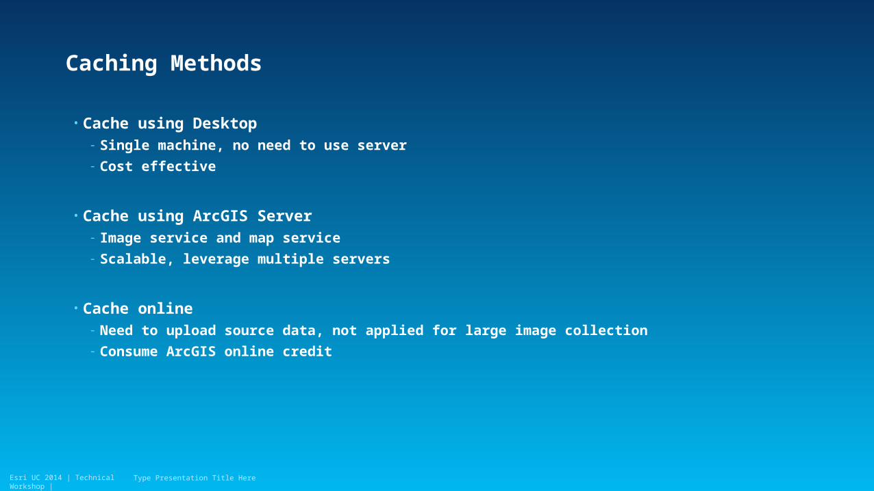
Caching Methods
• Cache using Desktop- Single machine, no need to use server
- Cost effective
• Cache using ArcGIS Server- Image service and map service
- Scalable, leverage multiple servers
• Cache online- Need to upload source data, not applied for large image collection
- Consume ArcGIS online credit
Type Presentation Title Here
Esri UC 2014 | Technical Workshop |
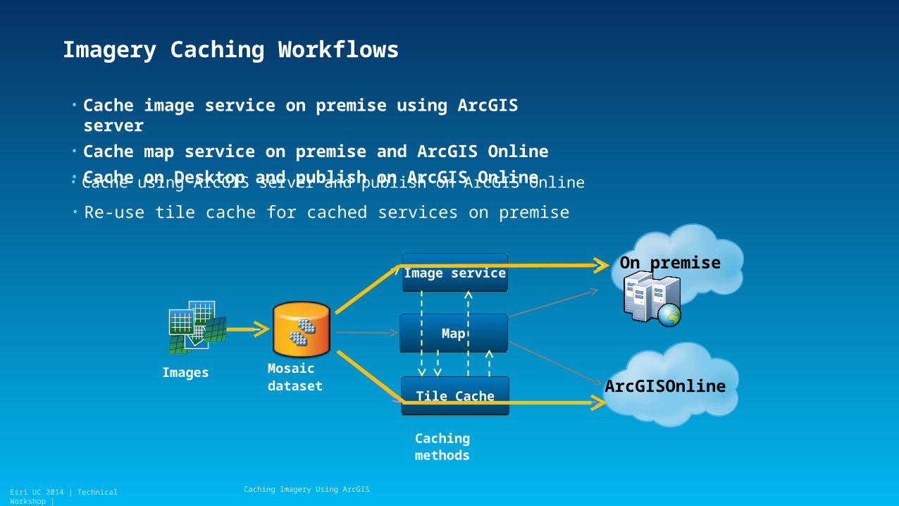
Imagery Caching Workflows
• Cache image service on premise using ArcGIS server
• Cache map service on premise and ArcGIS Online
• Cache on Desktop and publish on ArcGIS Online
Caching Imagery Using ArcGIS
MapMap
Image serviceImage service
Tile CacheTile CacheArcGISOnline
On premise
Mosaic dataset
Caching methods
Images
• Cache using ArcGIS server and publish on ArcGIS Online
• Re-use tile cache for cached services on premise
Esri UC 2014 | Technical Workshop |
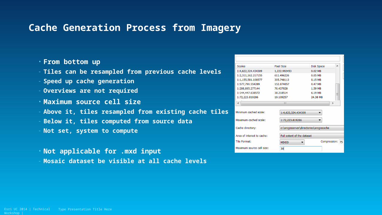
Cache Generation Process from Imagery
• From bottom up- Tiles can be resampled from previous cache levels
- Speed up cache generation
- Overviews are not required
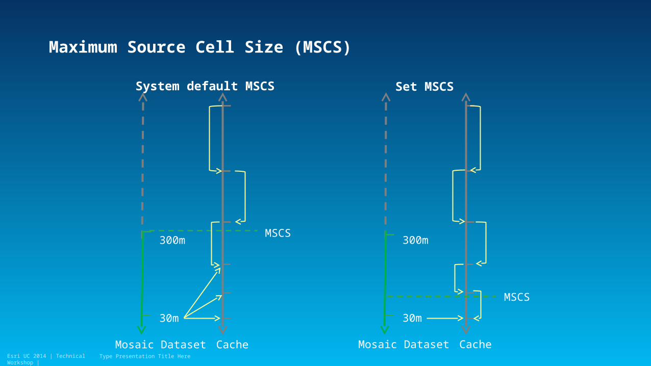
• Maximum source cell size- Above it, tiles resampled from existing cache tiles
- Below it, tiles computed from source data
- Not set, system to compute
• Not applicable for .mxd input- Mosaic dataset be visible at all cache levels
Type Presentation Title Here
Esri UC 2014 | Technical Workshop |
Maximum Source Cell Size (MSCS)
Type Presentation Title Here
System default MSCS Set MSCS
300m
30m
CacheMosaic Dataset
300m
30m
CacheMosaic Dataset
MSCS
MSCS
Esri UC 2014 | Technical Workshop |
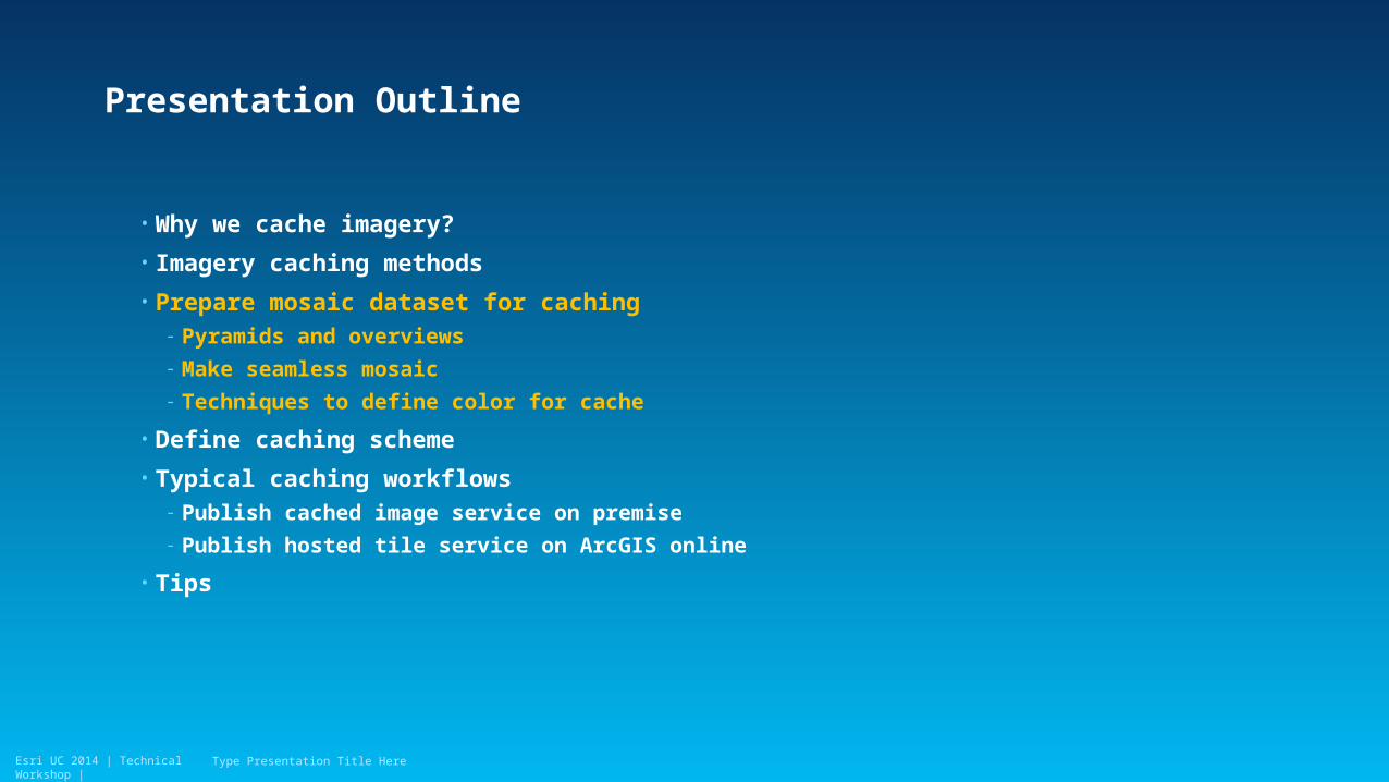
Presentation Outline
• Why we cache imagery?
• Imagery caching methods
• Prepare mosaic dataset for caching- Pyramids and overviews
- Make seamless mosaic
- Techniques to define color for cache
• Define caching scheme
• Typical caching workflows- Publish cached image service on premise
- Publish hosted tile service on ArcGIS online
• Tips
Type Presentation Title Here
Esri UC 2014 | Technical Workshop |
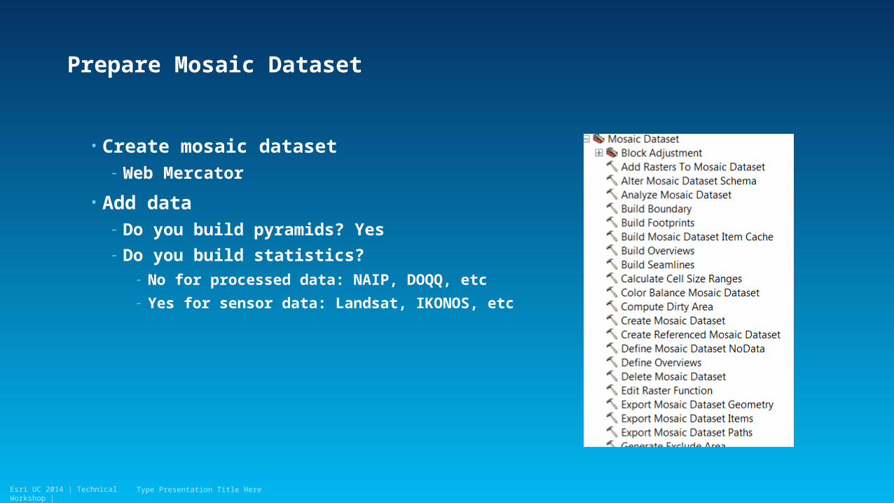
Prepare Mosaic Dataset
• Create mosaic dataset- Web Mercator
• Add data- Do you build pyramids? Yes
- Do you build statistics? - No for processed data: NAIP, DOQQ, etc
- Yes for sensor data: Landsat, IKONOS, etc
Type Presentation Title Here
Esri UC 2014 | Technical Workshop |
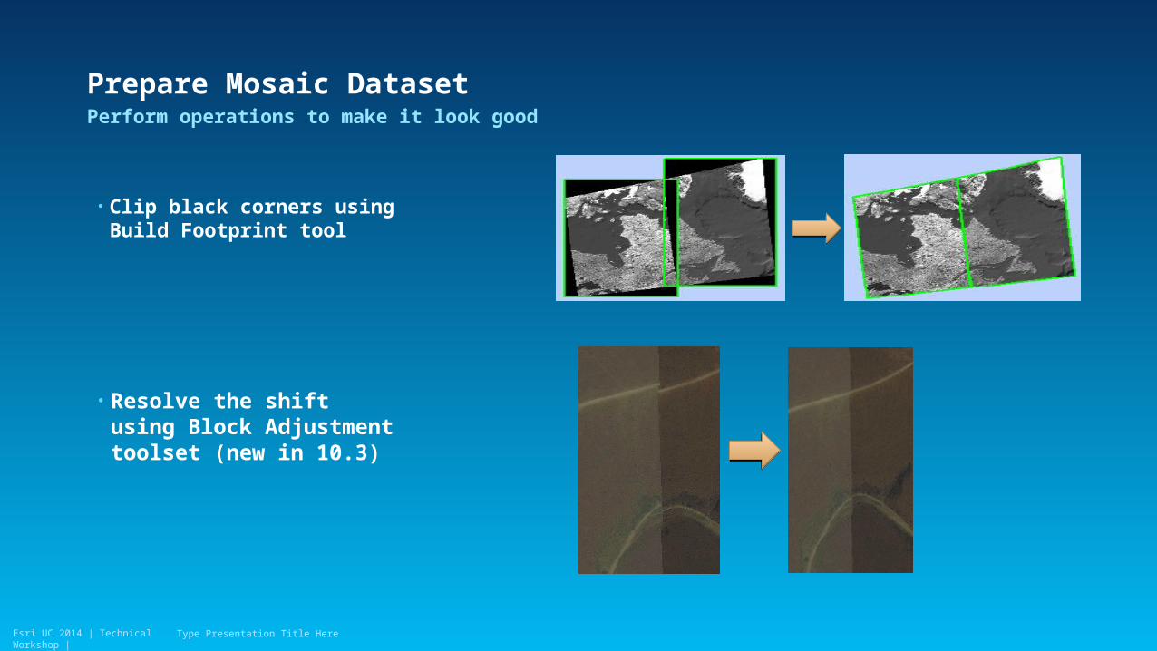
Prepare Mosaic Dataset
• Clip black corners using Build Footprint tool
Perform operations to make it look good
Type Presentation Title Here
• Resolve the shift using Block Adjustment toolset (new in 10.3)
Esri UC 2014 | Technical Workshop |
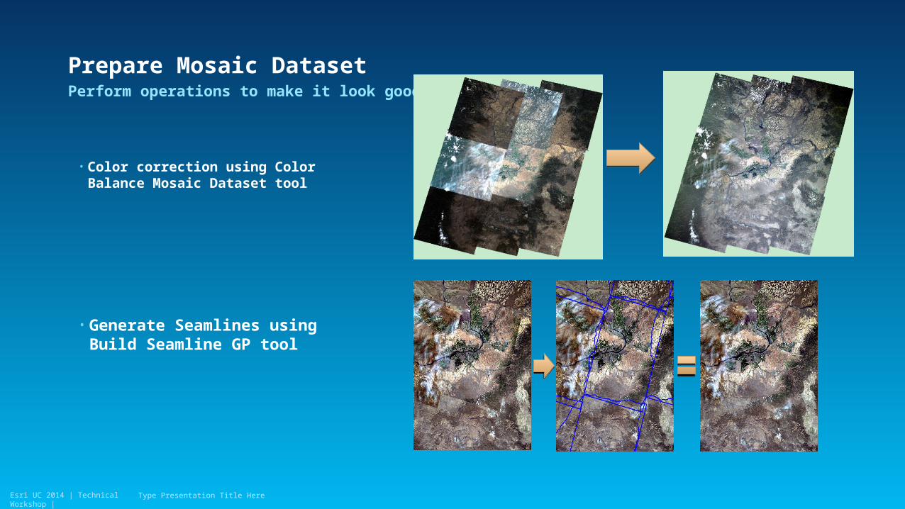
Prepare Mosaic DatasetPerform operations to make it look good
Type Presentation Title Here
• Color correction using Color Balance Mosaic Dataset tool
• Generate Seamlines using Build Seamline GP tool
Esri UC 2014 | Technical Workshop |
Prepare Mosaic Dataset
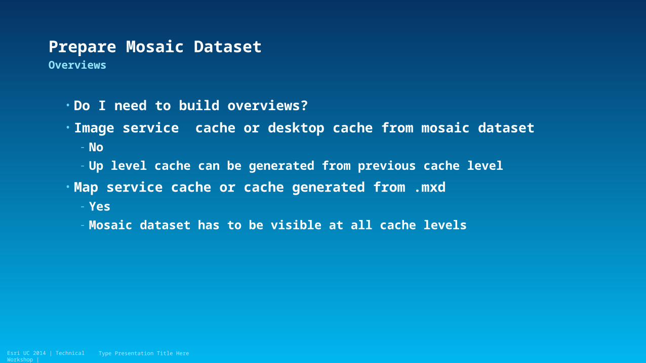
• Do I need to build overviews?
• Image service cache or desktop cache from mosaic dataset- No
- Up level cache can be generated from previous cache level
• Map service cache or cache generated from .mxd- Yes
- Mosaic dataset has to be visible at all cache levels
Overviews
Type Presentation Title Here
Esri UC 2014 | Technical Workshop |
Prepare Mosaic Dataset
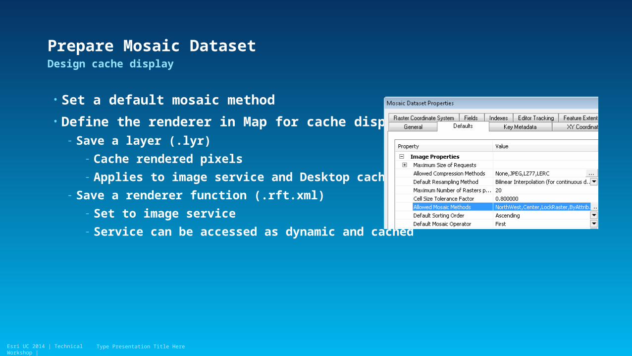
• Set a default mosaic method
• Define the renderer in Map for cache display- Save a layer (.lyr)
- Cache rendered pixels
- Applies to image service and Desktop cache
- Save a renderer function (.rft.xml)
- Set to image service
- Service can be accessed as dynamic and cached
Design cache display
Type Presentation Title Here
Esri UC 2014 | Technical Workshop |Esri UC 2014 | Technical Workshop |
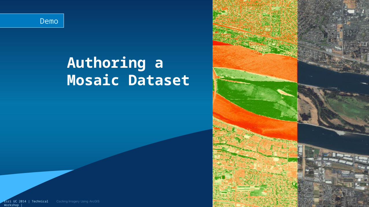
Authoring a Mosaic Dataset
Demo
Esri UC 2014 | Technical Workshop |
Presentation Outline
• Why we cache imagery?
• Imagery caching methods
• Prepare mosaic dataset for caching
• Define caching scheme
• Typical caching workflows- Publish cached image service on premise
- Publish hosted tile service on ArcGIS online
• Tips
Type Presentation Title Here
Esri UC 2014 | Technical Workshop |
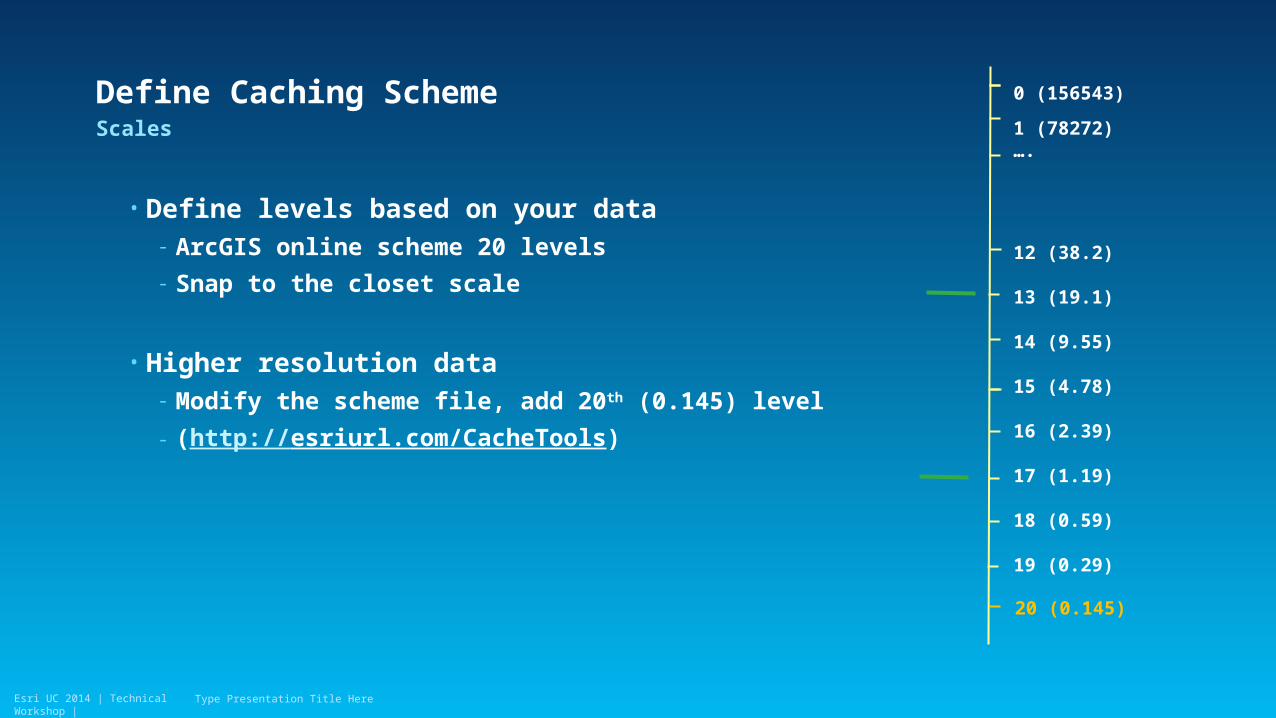
• Define levels based on your data- ArcGIS online scheme 20 levels
- Snap to the closet scale
• Higher resolution data - Modify the scheme file, add 20th (0.145) level
- (http://esriurl.com/CacheTools)
Scales
Type Presentation Title Here
Define Caching Scheme 0 (156543)
1 (78272)….
12 (38.2)
13 (19.1)
14 (9.55)
15 (4.78)
16 (2.39)
17 (1.19)
18 (0.59)
19 (0.29)
20 (0.145)
Esri UC 2014 | Technical Workshop |
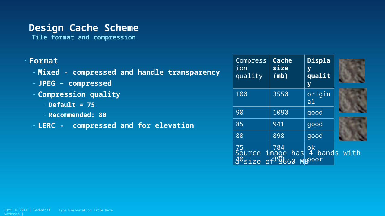
Design Cache Scheme
• Format - Mixed - compressed and handle transparency
- JPEG – compressed
- Compression quality- Default = 75
- Recommended: 80
- LERC - compressed and for elevation
Tile format and compression
Type Presentation Title Here
Compression quality
Cache size (mb)
Display quality
100 3550 original
90 1090 good
85 941 good
80 898 good
75 784 ok
40 398 poor
Source image has 4 bands with a size of 3660 MB
Esri UC 2014 | Technical Workshop |
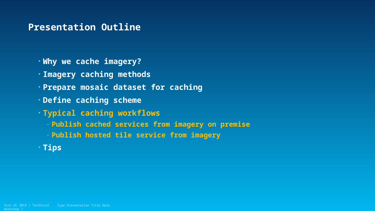
Presentation Outline
• Why we cache imagery?
• Imagery caching methods
• Prepare mosaic dataset for caching
• Define caching scheme
• Typical caching workflows- Publish cached services from imagery on premise
- Publish hosted tile service from imagery
• Tips
Type Presentation Title Here
Esri UC 2014 | Technical Workshop |
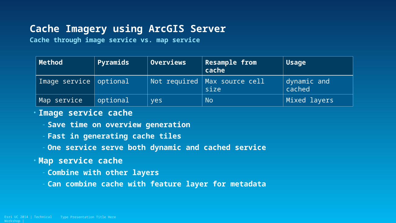
Cache Imagery using ArcGIS Server
• Image service cache- Save time on overview generation
- Fast in generating cache tiles
- One service serve both dynamic and cached service
• Map service cache- Combine with other layers
- Can combine cache with feature layer for metadata
Cache through image service vs. map service
Type Presentation Title Here
Method Pyramids Overviews Resample from cache Usage
Image service optional Not required Max source cell size dynamic and cached
Map service optional yes No Mixed layers
Esri UC 2014 | Technical Workshop |
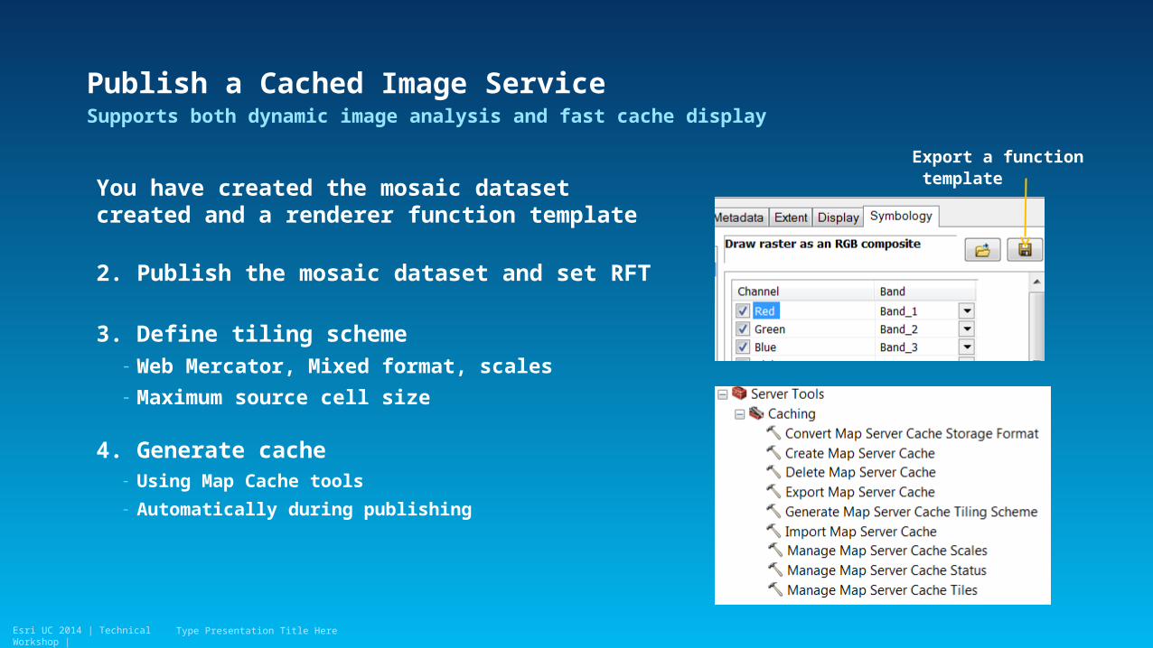
Publish a Cached Image Service
You have created the mosaic dataset created and a renderer function template
2. Publish the mosaic dataset and set RFT
3. Define tiling scheme- Web Mercator, Mixed format, scales
- Maximum source cell size
4. Generate cache - Using Map Cache tools
- Automatically during publishing
Supports both dynamic image analysis and fast cache display
Type Presentation Title Here
Export a function template
Esri UC 2014 | Technical Workshop |
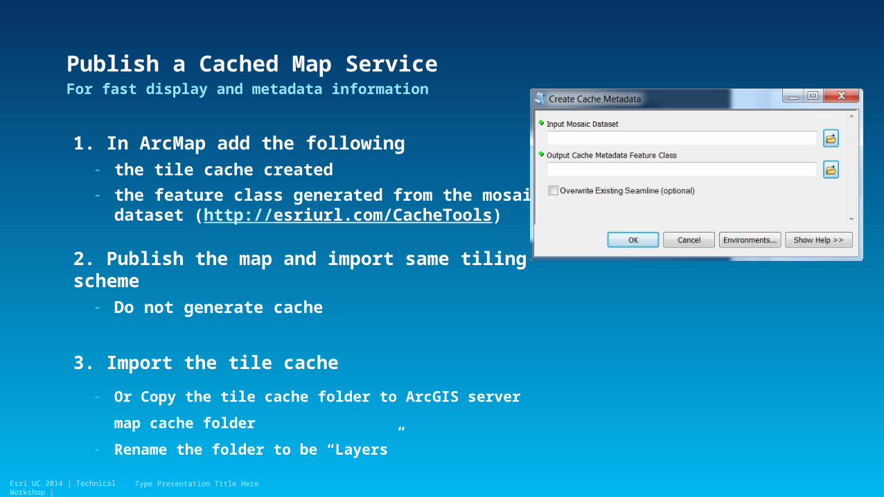
Publish a Cached Map Service
1. In ArcMap add the following- the tile cache created
- the feature class generated from the mosaic dataset (http://esriurl.com/CacheTools)
2. Publish the map and import same tiling scheme- Do not generate cache
3. Import the tile cache
- Or Copy the tile cache folder to ArcGIS server map cache
folder
- Rename the folder to be “Layers”
For fast display and metadata information
Type Presentation Title Here
Esri UC 2014 | Technical Workshop |Esri UC 2014 | Technical Workshop |
Create an image service cache
Demo
Esri UC 2014 | Technical Workshop |
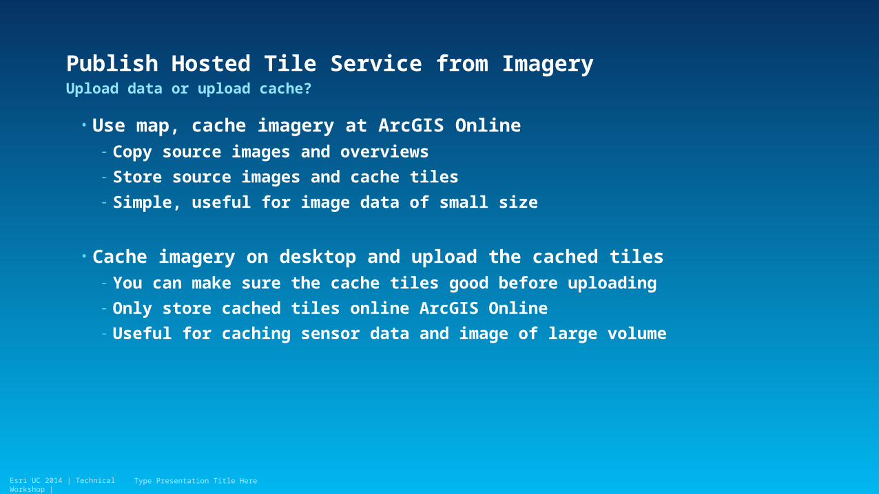
Publish Hosted Tile Service from Imagery
• Use map, cache imagery at ArcGIS Online- Copy source images and overviews
- Store source images and cache tiles
- Simple, useful for image data of small size
• Cache imagery on desktop and upload the cached tiles- You can make sure the cache tiles good before uploading
- Only store cached tiles online ArcGIS Online
- Useful for caching sensor data and image of large volume
Upload data or upload cache?
Type Presentation Title Here
Esri UC 2014 | Technical Workshop |
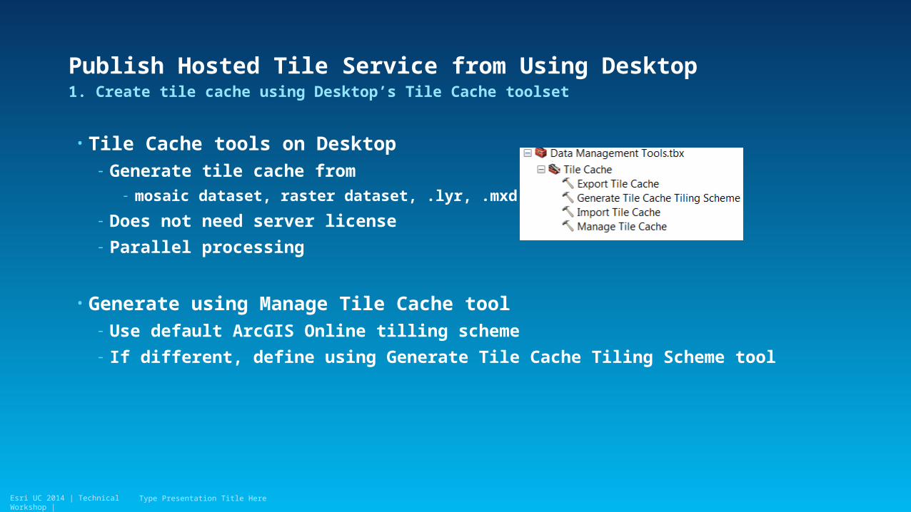
Publish Hosted Tile Service from Using Desktop
• Tile Cache tools on Desktop- Generate tile cache from
- mosaic dataset, raster dataset, .lyr, .mxd (10.2)
- Does not need server license
- Parallel processing
• Generate using Manage Tile Cache tool- Use default ArcGIS Online tilling scheme
- If different, define using Generate Tile Cache Tiling Scheme tool
1. Create tile cache using Desktop’s Tile Cache toolset
Type Presentation Title Here
Esri UC 2014 | Technical Workshop |
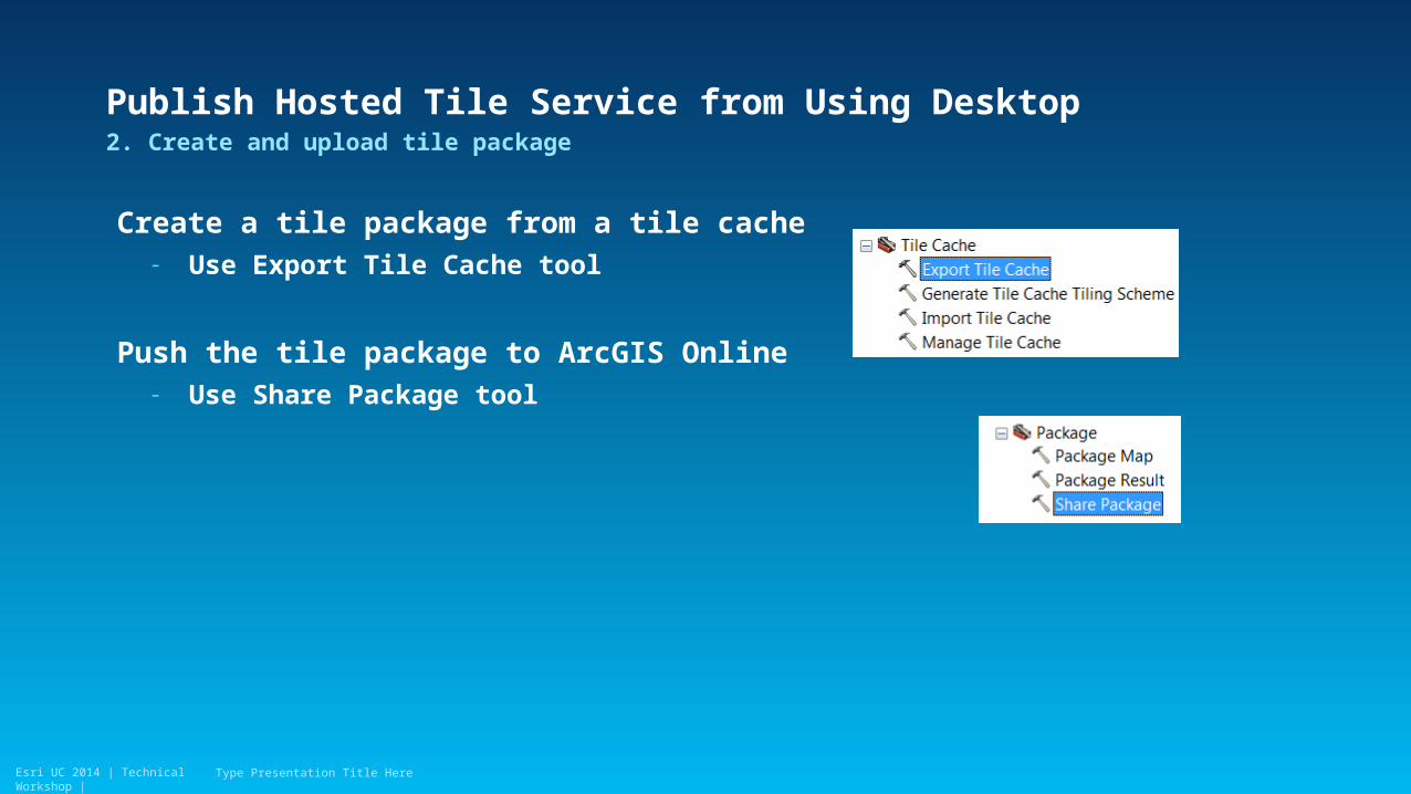
Publish Hosted Tile Service from Using Desktop
Create a tile package from a tile cache- Use Export Tile Cache tool
Push the tile package to ArcGIS Online- Use Share Package tool
2. Create and upload tile package
Type Presentation Title Here
Esri UC 2014 | Technical Workshop |
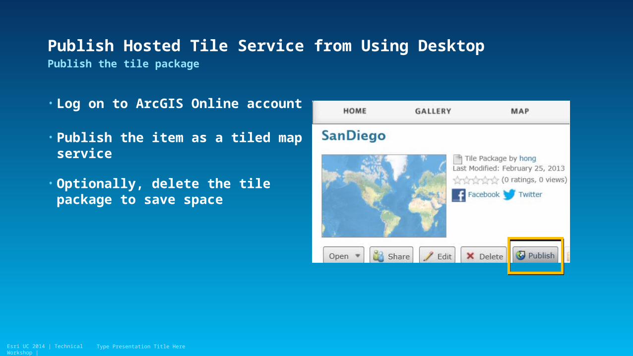
Publish Hosted Tile Service from Using Desktop
• Log on to ArcGIS Online account
• Publish the item as a tiled map service
• Optionally, delete the tile package to save space
Publish the tile package
Type Presentation Title Here
Esri UC 2014 | Technical Workshop |Esri UC 2014 | Technical Workshop |
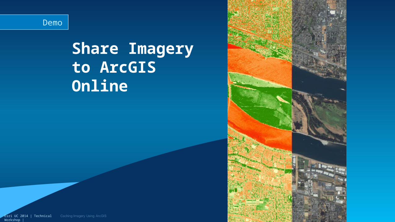
Share Imagery to ArcGIS Online
Demo
Esri UC 2014 | Technical Workshop |
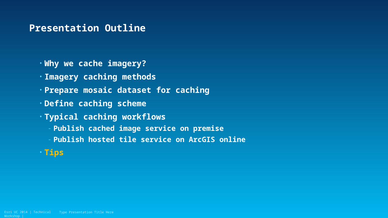
Presentation Outline
• Why we cache imagery?
• Imagery caching methods
• Prepare mosaic dataset for caching
• Define caching scheme
• Typical caching workflows- Publish cached image service on premise
- Publish hosted tile service on ArcGIS online
• Tips
Type Presentation Title Here

Esri UC 2014 | Technical Workshop |
Tip #1 Update Cache
• Use Generate Dirty Area tool to produce the AOI polygon from mosaic dataset
• Generate cache for AOI- Desktop: Manage Tile Cache
- Image service cache/Map cache: Manage Map Service Cache tools
Update existing cache
Type Presentation Title Here
Esri UC 2014 | Technical Workshop |
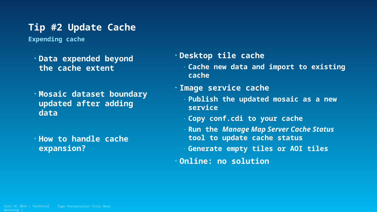
Tip #2 Update Cache
• Data expended beyond the cache extent
• Mosaic dataset boundary updated after adding data
• How to handle cache expansion?
Expending cache
Type Presentation Title Here
• Desktop tile cache- Cache new data and import to existing cache
• Image service cache- Publish the updated mosaic as a new service
- Copy conf.cdi to your cache
- Run the Manage Map Server Cache Status tool to update cache status
- Generate empty tiles or AOI tiles
• Online: no solution
Esri UC 2014 | Technical Workshop |
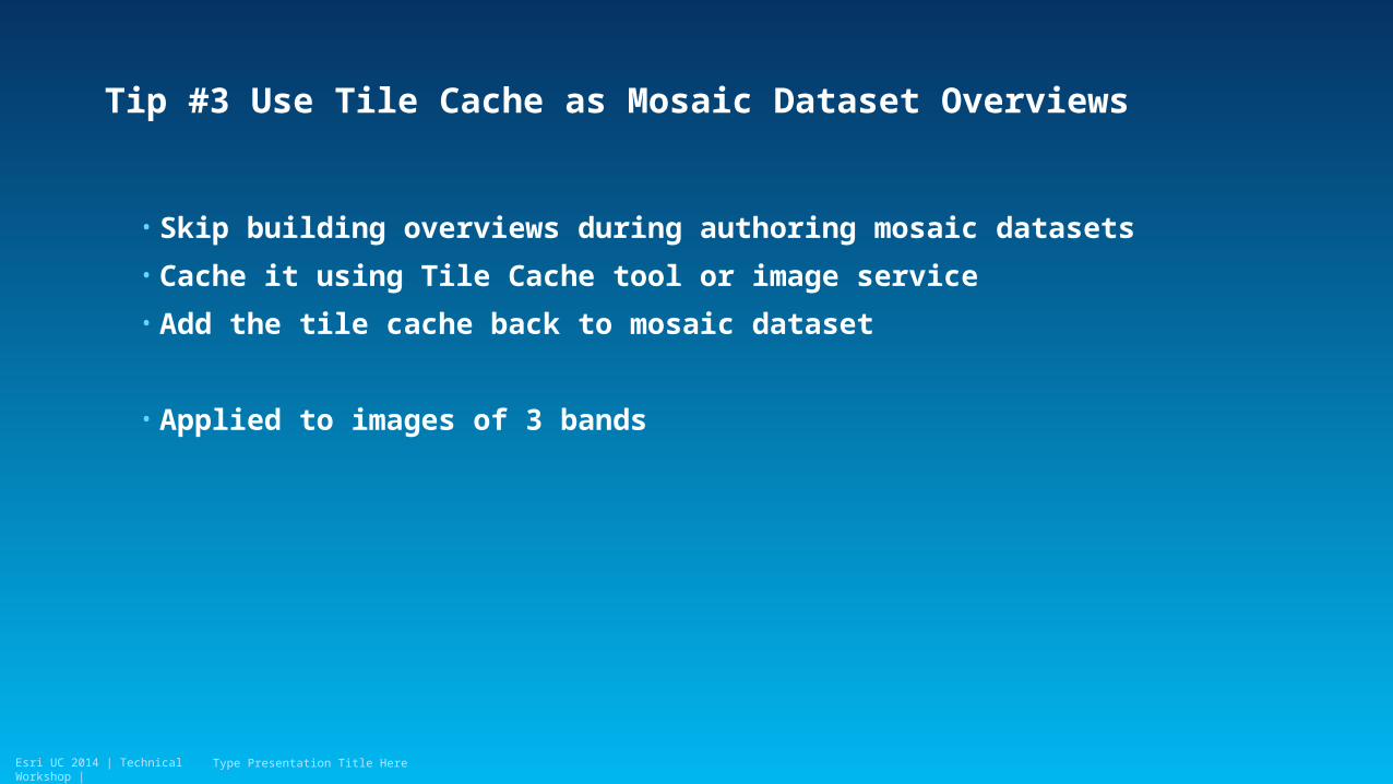
Tip #3 Use Tile Cache as Mosaic Dataset Overviews
• Skip building overviews during authoring mosaic datasets
• Cache it using Tile Cache tool or image service
• Add the tile cache back to mosaic dataset
• Applied to images of 3 bands
Type Presentation Title Here
Esri UC 2014 | Technical Workshop |
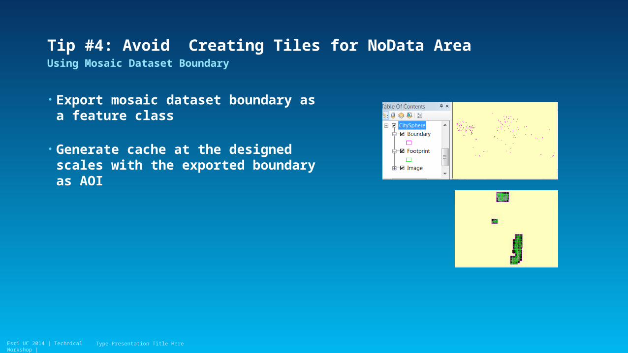
Tip #4: Avoid Creating Tiles for NoData Area
• Export mosaic dataset boundary as a feature class
• Generate cache at the designed scales with the exported boundary as AOI
Using Mosaic Dataset Boundary
Type Presentation Title Here
Esri UC 2014 | Technical Workshop |
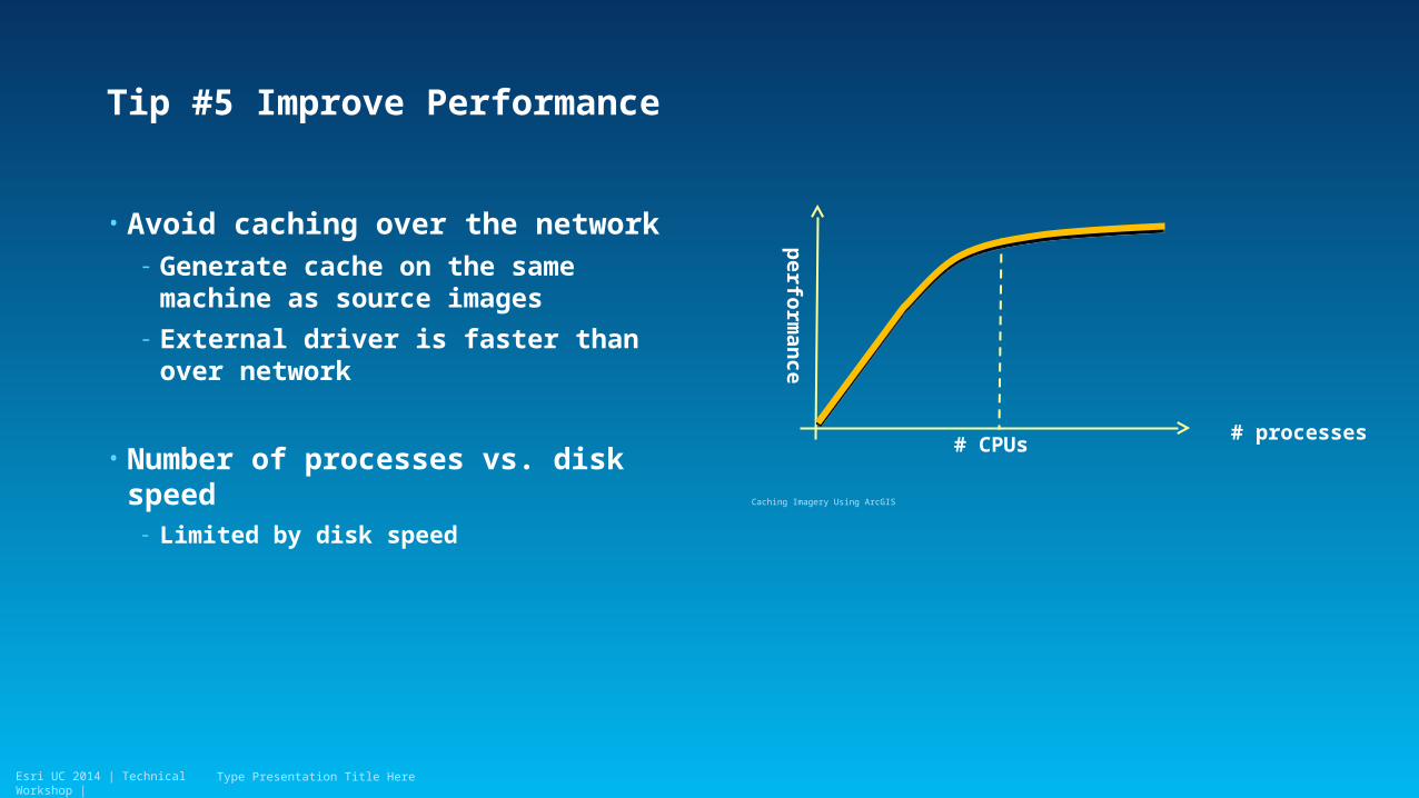
Tip #5 Improve Performance
• Avoid caching over the network - Generate cache on the same machine as
source images
- External driver is faster than over network
• Number of processes vs. disk speed- Limited by disk speed
Type Presentation Title Here
# processes
perfo
rman
ce
# CPUs
Caching Imagery Using ArcGIS

Esri UC 2014 | Technical Workshop |Esri UC 2014 | Technical Workshop |
Demo of Large AGS Online Service
Caching Imagery Using ArcGIS
Esri UC 2014 | Technical Workshop |
Summary
• Author mosaic dataset for caching
• Generate cache from image service or mosaic dataset is faster- Leverage maximum source cell size setting
• Generate Tile cache on Desktop is recommended way to publish hosted tile service from imagery
• Additional Help- CACHE tools: http://esriurl.com/CacheTools
- LTS for image caching is at http://esriurl.com/ImageCacheLTS
Type Presentation Title Here
Esri UC 2014 | Technical Workshop |
Thank you…
• Please fill out the session survey:
Offering ID: 1149
Online – www.esri.com/ucsessionsurveys
Paper – pick up and put in drop box
Type Presentation Title Here

Esri UC 2014 | Technical Workshop | Type Presentation Title Here
Recommended