Pric
e:IN
R 1
50 /
US
$ 15
S
ubsc
riber
’s c
opy.
Not
for S
ale
R.N
.I N
o -
UP
EN
G/2
01
0/3
41
53
Re
gis
tra
tio
n n
o:
UP
/GB
D-1
36
/20
11-1
3P
ub
lic
ati
on
: 1
0th
of
eve
ry m
on
th
I P
os
tin
g:
15
th/
20
tho
f e
very
mo
nth
ISSN 2277 - 3134
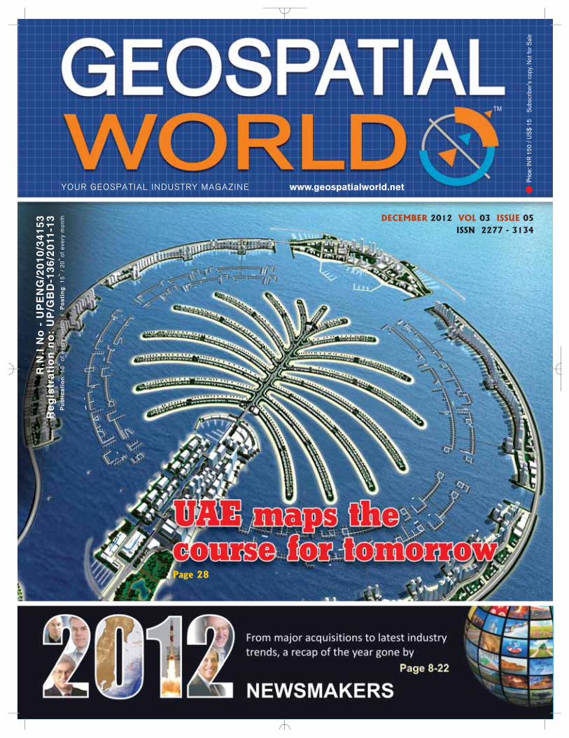
Page 28
DECEMBER 2012 VOL 03 ISSUE 05
www.geospatialworld.netYOUR GEOSPATIAL INDUSTRY MAGAZINE
For more information visithttp://di.leica-geosystems.com
www.leica-geosystems.com
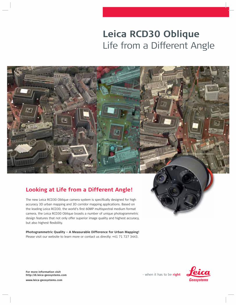
Looking at Life from a Different Angle!
The new Leica RCD30 Oblique camera system is specifically designed for high
accuracy 3D urban mapping and 3D corridor mapping applications. Based on
the leading Leica RCD30, the world’s first 60MP multispectral medium format
camera, the Leica RCD30 Oblique boasts a number of unique photogrammetric
design features that not only offer superior image quality and highest accuracy,
but also highest flexibility.
Photogrammetric Quality – A Measurable Difference for Urban Mapping!
Please visit our website to learn more or contact us directly: +41 71 727 3443.
Leica RCD30 ObliqueLife from a Different Angle
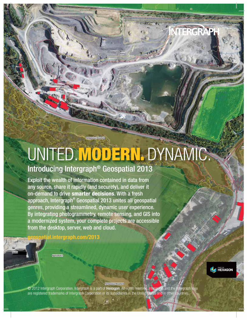
UNITED.MODERN. DYNAMIC.Introducing Intergraph® Geospatial 2013Exploit the wealth of information contained in data from any source, share it rapidly (and securely), and deliver it on-demand to drive smarter decisions. With a fresh approach, Intergraph® Geospatial 2013 unites all geospatial genres, providing a streamlined, dynamic user experience. By integrating photogrammetry, remote sensing, and GIS into a modernized system, your complete projects are accessible from the desktop, server, web and cloud.
geospatial.intergraph.com/2013
© 2012 Intergraph Corporation. Intergraph is a part of Hexagon. All rights reserved. Intergraph and the Intergraph logo are registered trademarks of Intergraph Corporation or its subsidiaries in the United States and in other countries.
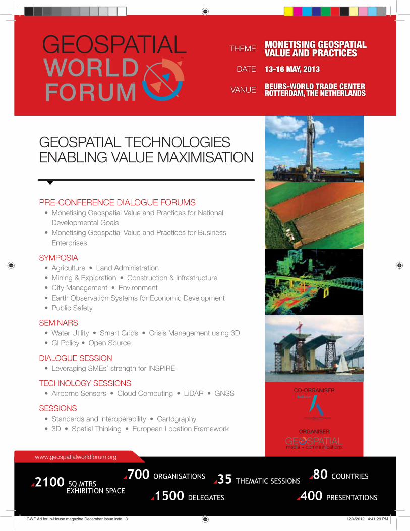
DATE
THEME
VANUE
13-16 MAY, 2013
MONETISING GEOSPATIAL VALUE AND PRACTICES
BEURS-WORLD TRADE CENTER ROTTERDAM, THE NETHERLANDS
CO-ORGANISER
ORGANISER
www.geospatialworldforum.org
1500 DELEGATES
700 ORGANISATIONS 80 COUNTRIES35 THEMATIC SESSIONS
400 PRESENTATIONS
2100 SQ MTRSEXHIBITION SPACE
PRE-CONFERENCE DIALOGUE FORUMS• Monetising Geospatial Value and Practices for National
Developmental Goals • Monetising Geospatial Value and Practices for Business
Enterprises
SYMPOSIA• Agriculture • Land Administration • Mining & Exploration • Construction & Infrastructure • City Management • Environment• Earth Observation Systems for Economic Development • Public Safety
SEMINARS• Water Utility • Smart Grids • Crisis Management using 3D• GI Policy • Open Source
DIALOGUE SESSION• Leveraging SMEs’ strength for INSPIRE
TECHNOLOGY SESSIONS• Airborne Sensors • Cloud Computing • LiDAR • GNSS
SESSIONS• Standards and Interoperability • Cartography• 3D • Spatial Thinking • European Location Framework
GEOSPATIAL TECHNOLOGIES ENABLING VALUE MAXIMISATION
GWF Ad for In-House magazine Decembar Issue.indd 3GWF Ad for In-House magazine Decembar Issue.indd 3 12/4/2012 4:41:29 PM12/4/2012 4:41:29 PM

Geospatial World I December 2012
Geospatial WorldGeospatial Media and Communications Pvt. Ltd.(formerly GIS Development Pvt. Ltd.)A - 145, Sector - 63, Noida, India Tel + 91-120-4612500 Fax +91-120-4612555 / 666
Inside...
Inside...
PRICE: INR 150/US$ 15
07 Editorial 49 Events 50 Picture this
ARTICLES
OGC Standards
Value multiplier
Carl Reed
Governance
Riding on cloud to touch the grassroots
Murahari Ponugoti, Kailash Agarwal
Oceanic Domain Awareness
An imperative
RAdm Dr S Kulshrestha (Retd.)
Canada
The parcel puzzle
NEWS
Newsmakers 2012: The year that was
28
36
40
5
Abbas Rajabifard President,GSDI Association
Jack DangermondPresident, Esri
Shailesh Nayak SecretaryMinistry of Earth SciencesGovernment of India
Mark ReichardtPresident and CEOOpen Geospatial Consortium, Inc.
Aida Opoku Mensah Director - ICT DivisionUN Economic Commission for Africa
Josef StroblDirector, Centre for Geoinformatics,University of Salzburg, Austria
Vanessa Lawrence CBDirector General and CEO,Ordnance Survey, UK
Matthew M O'ConnellPresident and CEO GeoEye
Bryn FosburghVice PresidentTrimble
Juergen DoldPresident, Hexagon Geosystems
Preetha PulusaniChief Strategy Officer,Rolta Group
Derek Clarke Chief Director-Survey and Mapping & National Geospatial InformationDepartment of Rural Development & Land Reform, South Africa
Kamal K SinghChairman and CEORolta Group
Greg BentleyCEO, Bentley Systems
Prof Ian DowmanFirst Vice PresidentISPRS
DISCLAIMER
Geospatial World does not necessarily subscribe to the views expressed in the publication. All views expressed in this issue are those of the contributors. GeospatialWorld is not responsible for any loss to anyone due to the information provided.
OWNER, PUBLISHER & PRINTER Sanjay Kumar PRINTED AT M. P. Printers B - 220,
Phase-II, Noida - 201 301, Gautam Budh Nagar (UP) INDIA PUBLICATION ADDRESS A - 92,
Sector - 52, Gautam Budh Nagar, Noida, India
CHAIRMAN M P Narayanan
PUBLISHER Sanjay Kumar
PUBLICATIONS TEAMManaging Editor Prof. Arup DasguptaBusiness Editor Bob M. SamborskiEditor - Latin America (Honorary) Tania Maria SausenSr. Associate Editor (Honorary) Dr. Hrishikesh SamantExecutive Editor Bhanu RekhaDeputy Executive Editor Anusuya DattaProduct Manager Harsha Vardhan MadirajuAssistant Editors Deepali Roy, Vaibhav Arora Sub-Editor Ridhima Kumar
DESIGN TEAMSr. Creative Designer Deepak Kumar
CIRCULATION TEAMCirculation Manager Amit Shahi
Ad
vis
ory
B
oa
rd
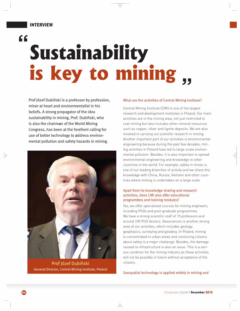
Prof Jozef Dubinski
General Director, Central Mining Institute, Poland
"Sustainability is key to mining"
24
08
INTERVIEW
CASE STUDY
Powering growth, empowering economy Vaibhav Arora
COVER STORY
45
43
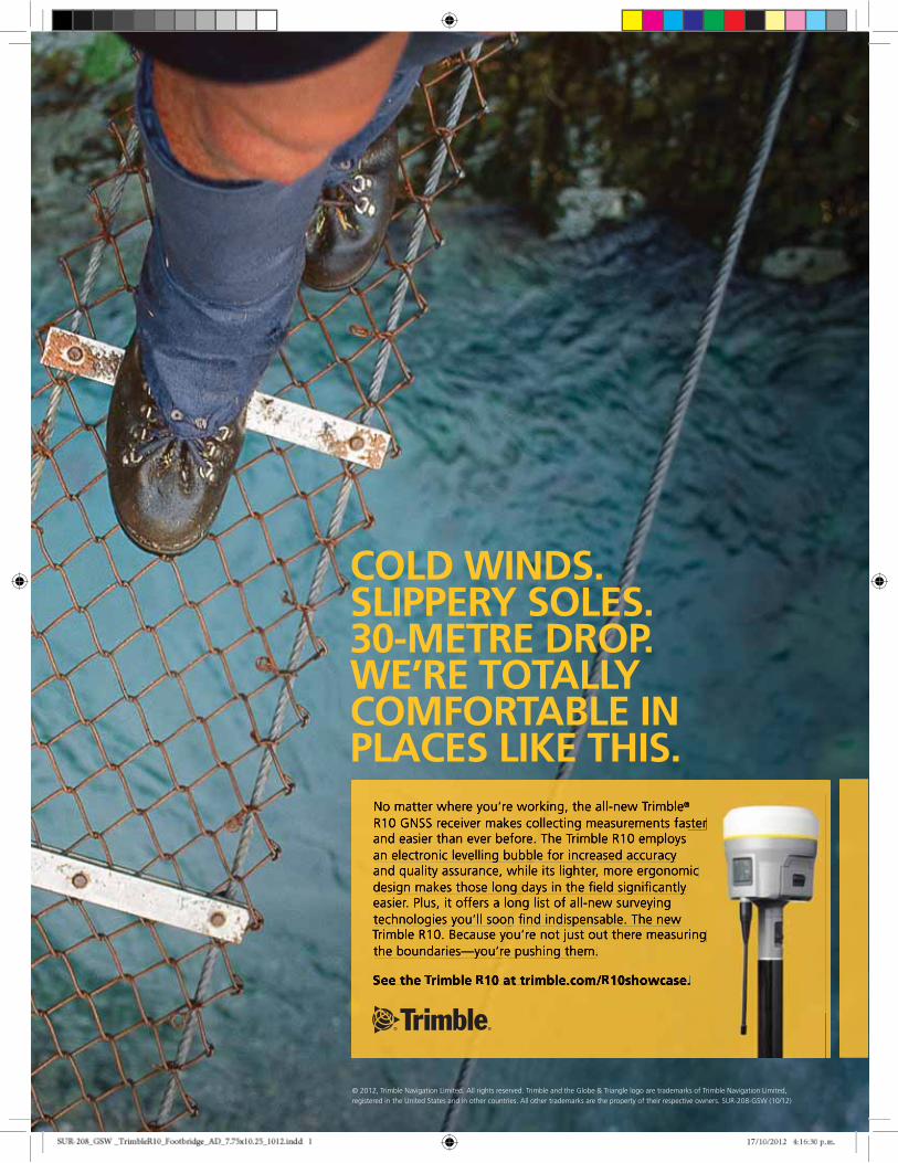
COLD WINDS.SLIPPERY SOLES.30-METRE DROP.WE’RE TOTALLY COMFORTABLE IN PLACES LIKE THIS.
© 2012, Trimble Navigation Limited. All rights reserved. Trimble and the Globe & Triangle logo are trademarks of Trimble Navigation Limited, registered in the United States and in other countries. All other trademarks are the property of their respective owners. SUR-208-GSW (10/12)
17/10/2012 4:16:30 p.m.17
ecember is the time to look back on the year that was and take stock of the 12-month-old predictions. In January 2012, I had ended my editorial musings as follows: the timehas come for the earth observation industry to take a closer look at itself. In particular,
it has to find out why it remains the preserve of governments. Short-term quick fixes are notthe answer. It requires some out-of-the-box thinking.
Looking back, we see that there have been some very significant events in the area of earthobservation in 2012. An NRC report warned of the decline in US EOS capabilities; at the sametime Forecast International estimated the remote sensing market to cross USD 17 billion by2021. UK gave a significant boost to its space industry and so did the European Union after ahiccup to its EO plans. India launched its 100th mission and also itsmost complex state of the art EO satellite, RISAT. The DigitalGlobe-GeoEye pasodoble ended with DigitalGlobe acquiring the latter forUSD 900 million; an indirect result of the US government's decisionto cut its spending on EO data. Clearly, governments continue tohave a direct say in the investment decisions related to earth obser-vation. Further, there is no sign of any significant out-of-the-boxthinking in the industry.
Rio+20 saw some significant moves. For the first time, earth obser-vation and geospatial technology obtained a strong political backingat the international level. The final document of the conference men-tions the importance of geospatial systems. It is up to the geospatialcommunity to rise to the challenge of helping to realise 'The WorldWe Want.' The UN-GGIM is now tasked with seeing through some ofthe recommendations. There are many opportunities for the geospa-tial industry; but the start-up seems to have been hit, as have manyother activities, by the persistent downturn in the markets due torecession in the US and Europe. The silver lining is a predicted CAGRof 9.2 per cent for GIS and related technologies in the first half of this decade.
The technological elements that hold promise for geospatial data analysis, storage and delivery are big data analysis, the cloud and mobile devices. These technologieshave evolved very rapidly and have made their mark in other IT areas. Their assimilation ingeospatial systems have begun and is picking up speed. These technologies require arethinking of deployment and application strategies in SDI but most governments are contin-uing to support older technologies and models. It is therefore no wonder that SDIs continueto stutter along over budget government projects.
The regulatory regime also experienced some turmoil as the call for open data became morevociferous. Most countries, including India, relaxed norms for data access but technologycontinued to confound lawmakers. The lesson that denial in the age of Internet, social mediaand personal computing does not work is yet to sink in.
Will 2013 be a breakthrough year for geospatial systems? Will we come to terms with Geospa-tial Artha?
7Geospatial World I December 2012
DOf promises and rethinking
EditorSpeak
Prof. Arup DasguptaManaging Editor
8
NEWSMAKERS 2012
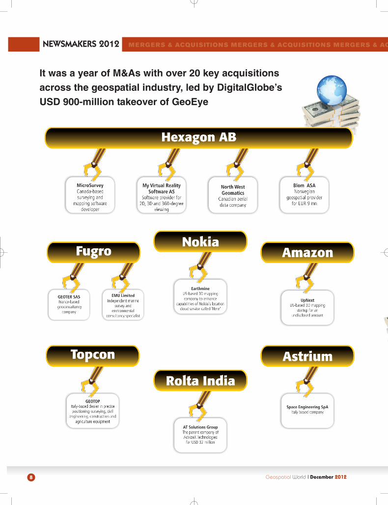
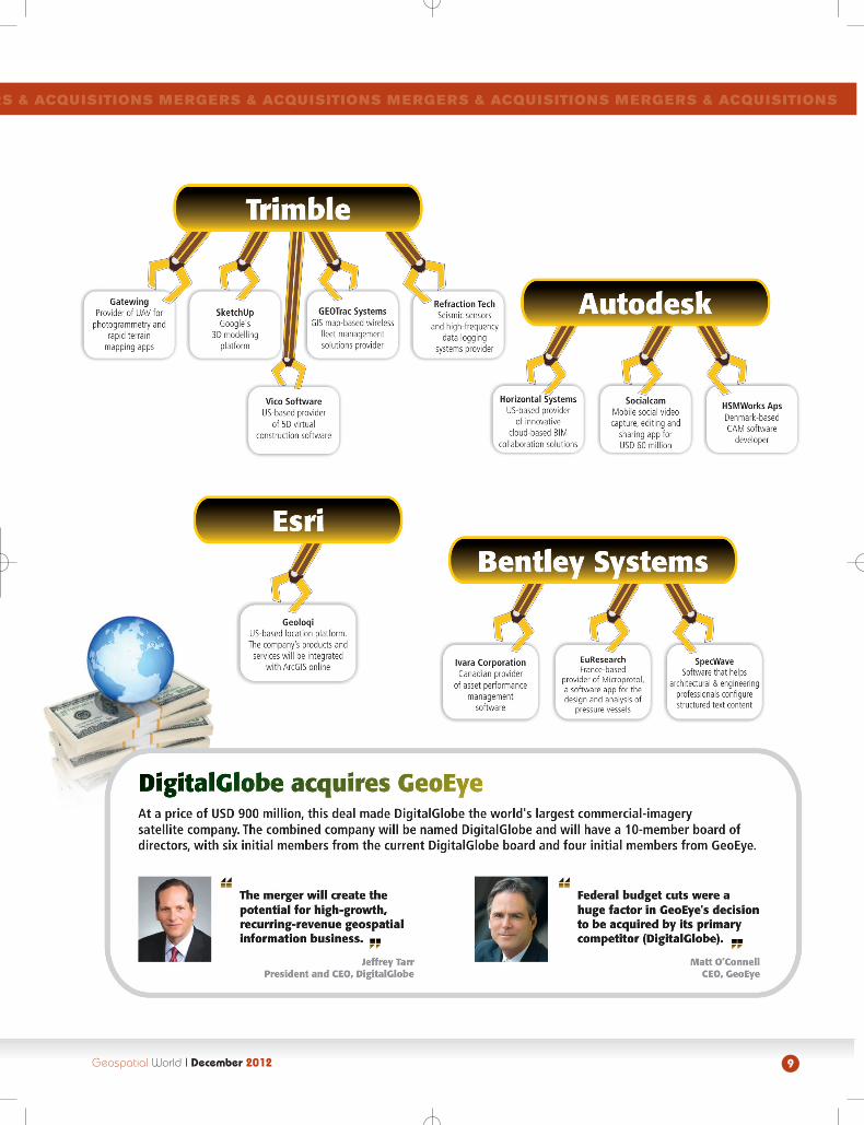
It was a year of M&As with over 20 key acquisitions across the geospatial industry, led by DigitalGlobe’s USD 900-million takeover of GeoEye
MERGERS & ACQUISITIONS MERGERS & ACQUISITIONS MERGERS & AC
Geospatial World II December 2012
9
RS & ACQUISITIONS MERGERS & ACQUISITIONS MERGERS & ACQUISITIONS MERGERS & ACQUISITIONS
Geospatial World II December 2012
INDUSTRY TRENDS
Technology genres like cartography, remote sensing, GIS and GPS are growing individually but they need to come together to create geospatial music.
Ola Rollen, President and CEO, Hexagon
Geospatial World I December 201210
Setback to EO industry, Envisat goes silent
In a big blow to earth observation (EO) industry, ESA'sEnvisat, the world's largest earth-watching satellitefor civilian use, stopped sending data to earth in Aprilthis year. The EO satellite was declared dead by theESA on May 9. Realising the urgency, scientists areplanning to launch the GMES Sentinel satellites,which are planned to replace Envisat, as soon as pos-sible. The landmark Envisat mission has been in orbittwice as long as it was designed for. Also, ESAannounced the retirement of its GIOVE-B experimentalnavigation satellite. Paving way for Europe's Galileoconstellation, GIOVE-B is gradually raising its orbit atthe end of its four-year mission. "Since the firstGalileo satellites have joined them in orbit and haveproven to be operating extremely well there is nolonger any role left for these experimental satellites,"said Valter Alpe, managing the GIOVE satellites forESA.
US EO missions hit by budgetshortfalls, launch failures
Budget shortfalls, launch failures and end of long running missions have caused a decline in US earthobservation (EO) capabilities over the last five years, atrend that could undermine the nation's ability tomonitor natural disasters and climate change. Areport, published by the National Research Council(NRC), says that lack of satellite-based earth monitor-ing technologies "will have profound consequences onscience and society." As a consequence, the ability tomeasure and understand changes in earth's climateand life support systems will also degrade. The newreport finds that although NASA responded favorablyand aggressively to the survey, the required budgetwas not achieved, greatly slowing progress.
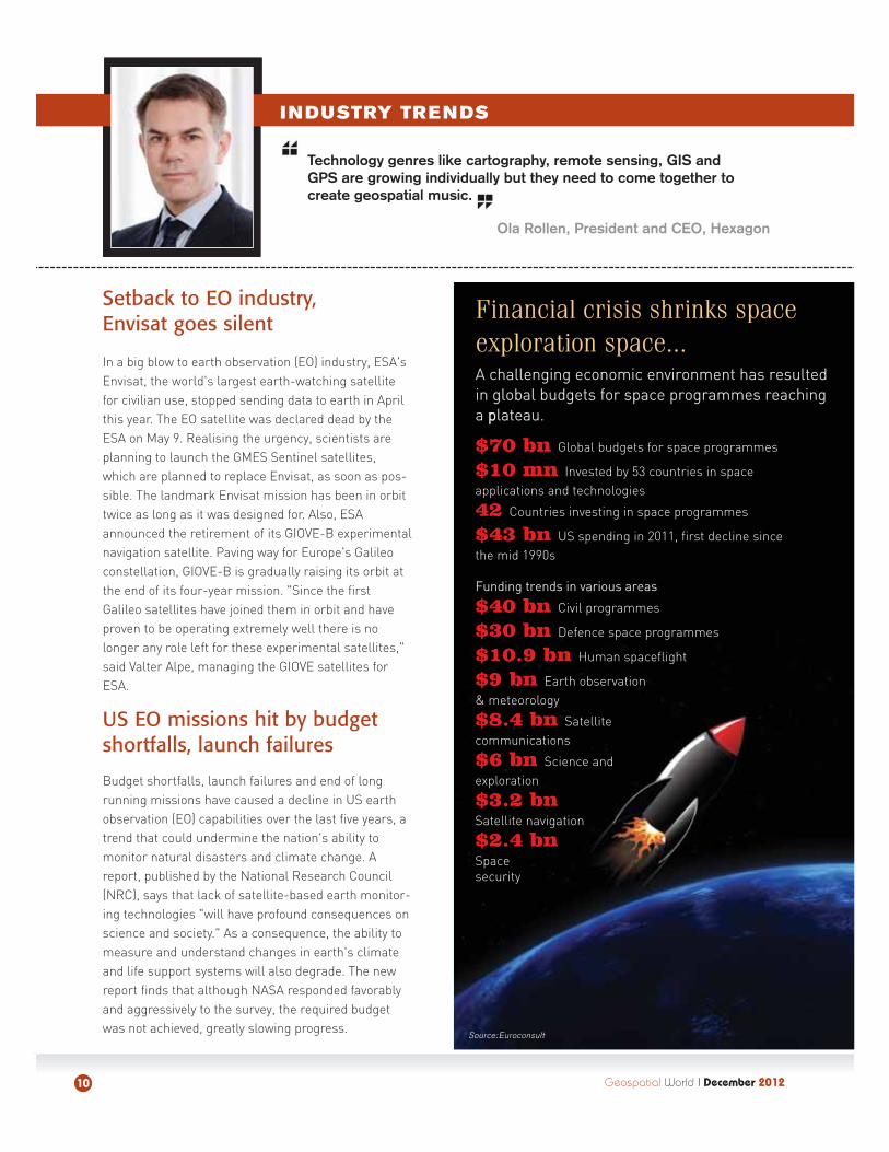
Financial crisis shrinks spaceexploration space...A challenging economic environment has resulted in global budgets for space programmes reaching a pplateau.
$70 bn Global budgets for space programmes
$10 mn Invested by 53 countries in space applications and technologies
42 Countries investing in space programmes
$43 bn US spending in 2011, first decline since the mid 1990s
Funding trends in various areas
$40 bn Civil programmes
$30 bn Defence space programmes
$10.9 bn Human spaceflight
$9 bn Earth observation & meteorology
$8.4 bn Satellite communications
$6 bn Science andexploration
$3.2 bn
Satellite navigation
$2.4 bn
Space security
Source: Euroconsult
Countries are increasingly being mapped by their people, with 187 out of 192 countries being mapped by their people. Phone is becoming the computer of tomorrow.
Michael Jones, Chief Technology Advocate, Google
Geospatial World I December 2012 11
Euro 10-bn boost to Europeanspace activities
In an environment of budget constraints and eco-nomic crisis, the European space activities and pro-grammes got a big a breather of EUR 10 billion inNovember. Ministers from the European SpaceAgency's 20 member states and Canada securedinvestments for the detailed definition studies of thenew launcher Ariane 6 and the continuation of thedevelopment of Ariane 5 ME adapted, with the goal todevelop as many commonalities as possible betweenthe two launchers. These activities are funded for twoyears with a decision on the continuation of bothlaunchers to be taken in 2014. Britain's contributionto the ESA will increase by around 30 per cent to EUR240 million a year over the next five years, as the gov-ernment seeks to spur growth in the space sector.
US defence dept’s use of g-techto touch USD 3.2-bn by 2017
The dependence of the US military on GIS technologyis increasing more than ever. The US military isincreasingly using geospatial products and servicesto make quick decisions about operations order,placement of installations and gathering of intelligence. A new research from Frost & Sullivanestimates that Department of Defense (DoD) spend-ing on geospatial products and research will reachUSD 3.21 billion by 2017. This amount would be significantly higher if classified spending were publicly accessible. However, geospatial datarequires exploitation by qualified intelligence analystswho are being inundated with large quantities of rawdata. The Defense Advanced Research ProjectsAgency is developing technologies that will automateand streamline some initial analysis functions tospeed up the exploitation process.
INDUSTRY TRENDS
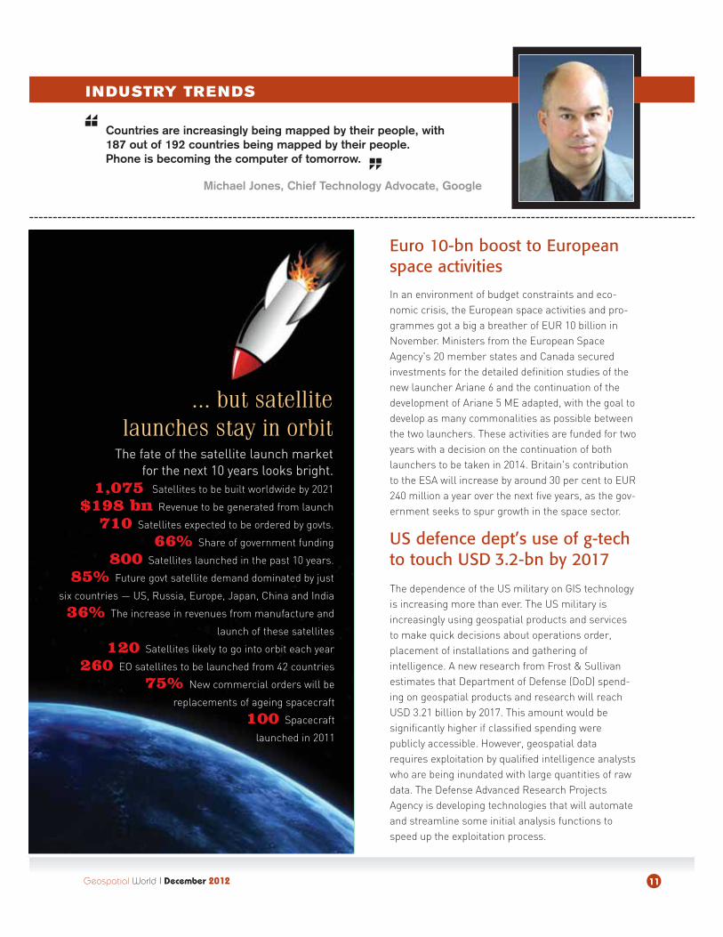
... but satellitelaunches stay in orbit
The fate of the satellite launch market for the next 10 years looks bright.
1,075 Satellites to be built worldwide by 2021
$198 bn Revenue to be generated from launch
710 Satellites expected to be ordered by govts.
66% Share of government funding
800 Satellites launched in the past 10 years.
85% Future govt satellite demand dominated by just
six countries — US, Russia, Europe, Japan, China and India
36% The increase in revenues from manufacture and
launch of these satellites
120 Satellites likely to go into orbit each year
260 EO satellites to be launched from 42 countries
75% New commercial orders will be
replacements of ageing spacecraft
100 Spacecraft
launched in 2011
12 Geospatial World I December 2012
NEWSMAKERS
2012
INDUSTRY TRENDS
GIS is evolving into a new platform: cloud GIS. This is making geographic understanding pervasive. Cloud GIS integrates all types of geospatial data, models, and applications and makes them available as web maps. The cloud is agile and flexible.
Jack Dangermond, President, Esri
Remote sensing tech breaksout of defence, intelligenceThe remote sensing technology has been witness-ing increasing interest from various industries eventhough defence, intelligence and security sectorscontinue to be a key growth driver for the market,say analysts at market research firm TechNavio.Consumer electronics and automobile industries
are increasingly adopting RStechnology to enhance their
offerings with advancedfeatures. TechNaviohas even forecastedthat the global RS tech-nology market will growat a CAGR of 6.74 percent over the period2011-2015. One of thekey factors contributingto this market growth isthe need for improvedunderstanding of the
earth system. As a result,the government sector is the major
end-user of remote sensors.
Big data creating bigger opportunitiesBig data is just getting bigger. Today, it has become as essential to businesses as land, labour and capital, says areport by Capgemini. The use of big data has improved businesses' performance, on an average, by 26 per cent and the impact will grow to 41 per cent over the next three years. As majority of companies (58 per cent) claim they willmake a bigger investment in big data over the next three years, the area is expected to create 4.4 million IT jobs global-ly, of which 1.9 million will be in the US, says a study by analyst firm Gartner. “Every big data related role in the US willcreate employment for three people outside of IT, so over the next four years a total of 6 million jobs in the US will begenerated by the information economy,” said Peter Sondergaard, Senior VP and global head of research, Gartner.
Global slowdown gives anupward push to GIS
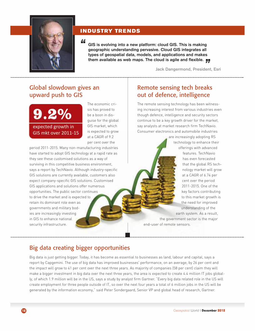
The economic cri-sis has proved tobe a boon in dis-guise for the globalGIS market, whichis expected to growat a CAGR of 9.2per cent over the
period 2011-2015. Many non-manufacturing industrieshave started to adopt GIS technology at a rapid rate asthey see these customised solutions as a way of surviving in this competitive business environment,says a report by TechNavio. Although industry-specificGIS solutions are currently available, customers alsoexpect company-specific GIS solutions. CustomisedGIS applications and solutions offer numerousopportunities. The public sector continuesto drive the market and is expected toretain its dominant role even asgovernments and military bod-ies are increasingly investingin GIS to enhance nationalsecurity infrastructure.

GIS
www.UltraCamEagle.com
APAC Sales:
Singapore:
Beijing:
Jorge Mauro Barja Arteiro,
Topocart
Visit iFlyUltraCam.comto see the Topocart video.
Geospatial World I December 201214
The US will join Europe and other nations in developing an international code of conduct for space operations. A code of conduct will help maintain the long-term sustainability, safety, stability and security of space by establishing guidelines for theresponsible use of space.
Hillary Clinton, US Secretary of State
POLICY
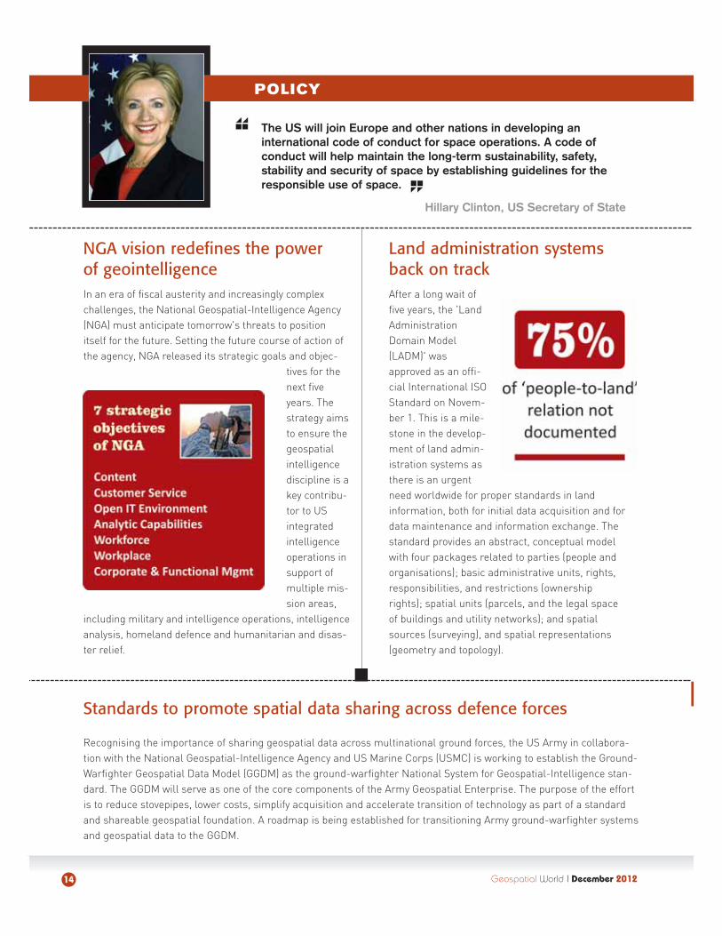
Land administration systems back on trackAfter a long wait offive years, the 'LandAdministrationDomain Model(LADM)' wasapproved as an offi-cial International ISOStandard on Novem-ber 1. This is a mile-stone in the develop-ment of land admin-istration systems asthere is an urgentneed worldwide for proper standards in land information, both for initial data acquisition and fordata maintenance and information exchange. Thestandard provides an abstract, conceptual modelwith four packages related to parties (people andorganisations); basic administrative units, rights,responsibilities, and restrictions (ownershiprights); spatial units (parcels, and the legal spaceof buildings and utility networks); and spatialsources (surveying), and spatial representations(geometry and topology).
Standards to promote spatial data sharing across defence forces
Recognising the importance of sharing geospatial data across multinational ground forces, the US Army in collabora-tion with the National Geospatial-Intelligence Agency and US Marine Corps (USMC) is working to establish the Ground-Warfighter Geospatial Data Model (GGDM) as the ground-warfighter National System for Geospatial-Intelligence stan-dard. The GGDM will serve as one of the core components of the Army Geospatial Enterprise. The purpose of the effortis to reduce stovepipes, lower costs, simplify acquisition and accelerate transition of technology as part of a standardand shareable geospatial foundation. A roadmap is being established for transitioning Army ground-warfighter systemsand geospatial data to the GGDM.
NGA vision redefines the power of geointelligenceIn an era of fiscal austerity and increasingly complexchallenges, the National Geospatial-Intelligence Agency(NGA) must anticipate tomorrow's threats to positionitself for the future. Setting the future course of action ofthe agency, NGA released its strategic goals and objec-
tives for thenext fiveyears. Thestrategy aimsto ensure thegeospatialintelligencediscipline is akey contribu-tor to USintegratedintelligenceoperations insupport ofmultiple mis-sion areas,
including military and intelligence operations, intelligenceanalysis, homeland defence and humanitarian and disas-ter relief.
Geospatial World I December 2012 15
POLICY
Maps are becoming apps. Today, data is a commodity andapps must be readily available to users; for users nowadaysare tech-savvy customers, collaborators, contributors andcreators.
Barry Barlow, Director, Online Geoint Services, NGA
Galileo, EGNOS missions get a lifeline
At a time when governments are reeling under tremendous space budgetconstraints, the European Commissionearmarked around EUR 7.9 billion to complete the EU's satellite navigationinfrastructure over a seven-year period.The industry committee members of theEuropean parliament approved the newlegislation in September to ensure Galileo and the EGNOS programmes could be funded and operated from 2014 to 2020. The EU wants to ensure that from 2014 key services such as
police and ambulance services continue to operate in times of crisis and are free. So must the Safety of Life Service, a European Geostationary NavigationOverlay Service (EGNOS) programme, which will be fully available later and will make air navigation safer.
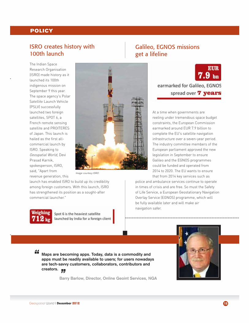
ISRO creates history with 100th launch
The Indian SpaceResearch Organisation(ISRO) made history as itlaunched its 100thindigenous mission onSeptember 9 this year.The space agency's PolarSatellite Launch Vehicle(PSLV) successfullylaunched two foreignsatellites, SPOT 6, aFrench remote sensingsatellite and PROITERESof Japan. This launch ishailed as the first all-commercial launch byISRO. Speaking toGeospatial World, DeviPrasad Karnik,spokesperson, ISRO,said, "Apart from revenue generation, thislaunch has enabled ISRO to build up its credibilityamong foreign customers. With this launch, ISROhas strengthened its position as a sought-after commercial launcher."
Image courtesy: ISRO
Geospatial World I December 201216
INNOVATIVE TECHNOLOGIES
Cloud, mobile and social technologies are reshaping design work-flows. We are moving to a world where the computing centre of theworld is really where you are. I'll never [again] be in the position ofsaying I'll email you those files when I get back to the office.
Carl Bass, President and CEO, Autodesk
Keeping an eye from the sky onvolcanoes
Hope is here on volcanoes too. Interferometric Syn-thetic Aperture Radar (InSAR) data can be used tomonitor volcanoes. Tiny changes on the groundcause changes in the radar signal and lead to rain-bow-coloured interference patterns in the combinedimage, known as a 'SAR interferogram'. Movement ofmagma underground may cause deformation of thesurface above, thus enabling InSAR to monitor volcanoes. An article, 'Monitoring Volcanoes', pub-lished in Science refers to a study of over 440 active
volcanoes in 16developing coun-tries and revealsthat 384 haverudimentary or nomonitoring,including 65 vol-canoes identifiedas posing a high
risk to large populations. In response, the EuropeanSpace Agency claimed that earth-observing satellites such as Envisat can detect unrest on currentlyunmonitored volcanoes.
New system measures quakescale in minutes
Aftershocks and delay inprompt evacuation after ahuge earthquake oftenleads to more casualtiesand damages. To addressthis, the Geospatial Infor-mation Authority of Japan,in association with TohokuUniversity, has developed anew GPS-based quake scaleestimation system whichcan estimate the scale ofcrustal movement withinminutes. This is much fasterthan the system widely usednow that takes more thanfive hours to do so. Forinstance, at the time of the March 11, 2011 earthquakeand tsunami, the Japan Meteorological Agency initiallyannounced its magnitude was 7.9, but drasticallyrevised it to 9.0 two days later. The new system couldhave estimated the preliminary magnitude of thequake at 8.7 and helped save lives.
Off-the-shelf smartphone to help soldiers on battlefieldSmartphones just got smarter this year. University of Missouri (MU) researchers have developed a new software usingsmartphone GPS and imaging abilities that determine the exact location of distant objects as well as monitor the speedand direction of moving objects. The software could eventually allow smartphone-armed soldiers to target the locationof their enemies. "On the battlefield, a soldier needs a rangefinder, compass, GPS and other tools to do reconnais-sance before calling in an air strike. With our software, the soldier can have all those instruments in one device thatcan be purchased off the shelf. When the soldier returns from war, he can use the same software to protect their familyby clocking a speeder near his children's school," says Qia Wang from MU.
Image courtesy: NASA
Some 20 quakes of magnitude6 or greater rocked Japan afterMarch 11, 2011 quake. Thelargest aftershock was a magnitude 7.1 quake thatstruck less than an hour afterthe main shock.
Geospatial World I December 2012 17
INNOVATIVE TECHNOLOGIES
More and more content is getting geo-referenced and displayed on a map. So, there is enormous growth in theusage of geographical information systems and data. We arelicensing our content to smartphone makers and developingour own mobile applications.
Harold Goddijn, Founder & CEO, TomTom
EU plans to map Internetcensorship around the world
Keeping track of reports about denial of Internetfreedom and surveillance initiatives could be a
difficult task. But soon there could be a solution athand. The European Union (EU) will launch a globalmonitoring system that will help chart digital repression by mapping the Internet's 'cyber geography' in near real-time. The European Corpo-rate Security Association (ECSA) will attempt to visu-alise up-to-date intelligence about the state of theInternet across the world. It will show content filter-ing, blocking, or other disruptions to the Web, amongother things. ECSA could prove to be a vital resource, particularly if it is opened up for free public use.
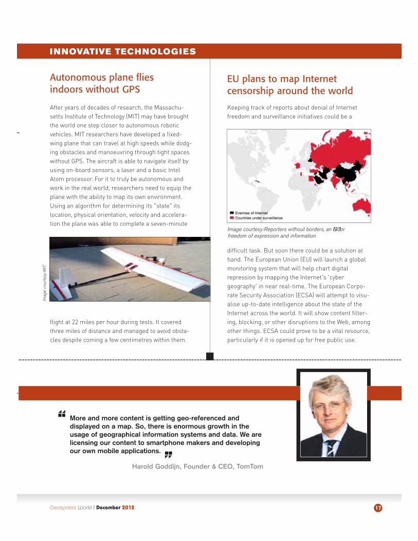
Autonomous plane flies indoors without GPS
After years of decades of research, the Massachu-setts Institute of Technology (MIT) may have broughtthe world one step closer to autonomous robotic vehicles. MIT researchers have developed a fixed-wing plane that can travel at high speeds while dodg-ing obstacles and manoeuvring through tight spaceswithout GPS. The aircraft is able to navigate itself byusing on-board sensors, a laser and a basic IntelAtom processor. For it to truly be autonomous andwork in the real world, researchers need to equip theplane with the ability to map its own environment.Using an algorithm for determining its "state" itslocation, physical orientation, velocity and accelera-tion the plane was able to complete a seven-minute
flight at 22 miles per hour during tests. It coveredthree miles of distance and managed to avoid obsta-cles despite coming a few centimetres within them.
Imag
e co
urte
sy: M
IT
Image courtesy: Reporters without borders, an NGO for freedom of expression and information
The question I keep asking myself is with all of this technology have wereally taken the steps forward that we should have? Simply being fasterand simply being cheaper is not enough. The idea is to use the technolo-gy and be transformational and be better than we have been before.
Steve Berglund, President & CEO, Trimble
Geospatial World I December 201218
INNOVATIVE TECHNOLOGIES
Phones in space: Nanosatellites to ride Android
In a technological breakthrough, NASA's team of engineers at Ames Research Center have developed nanosatellitespowered by Android smartphones. Expected to be launched this year itself, the devices are cube-shaped miniaturesatellites — smaller and lighter, measuring about 4 inches and weighing less than 4 pounds. Being built with off-the-shelf hardware, which is reducing the cost of each prototype to USD 3,500, the nanosatellites can be operated by cellphones, which provide the operating system and the communications capabilities. NASA says it has already builttwo types of these smartphone satellites.
Wear a gadget, map yoursurroundings
Sandy-like hurri-canes can stillwreak havoc butrelief may comequicker and easiernow. To help emer-gency responderscoordinate disasterresponse,researchers at theMassachusettsInstitute of Tech-nology (MIT) havebuilt a wearablesensor system thatautomatically cre-ates a digital map
of the environment through which the wearer is mov-ing. In experiments, a student wearing the sensorsystem wandered the MIT halls and the sensorswirelessly relayed data to a laptop in a distant confer-ence room. Observers in the conference room wereable to track the student's progress on a map thattracked movements. The prototype sensor alsoincludes a stripped-down Microsoft Kinect cameraand a laser rangefinder.
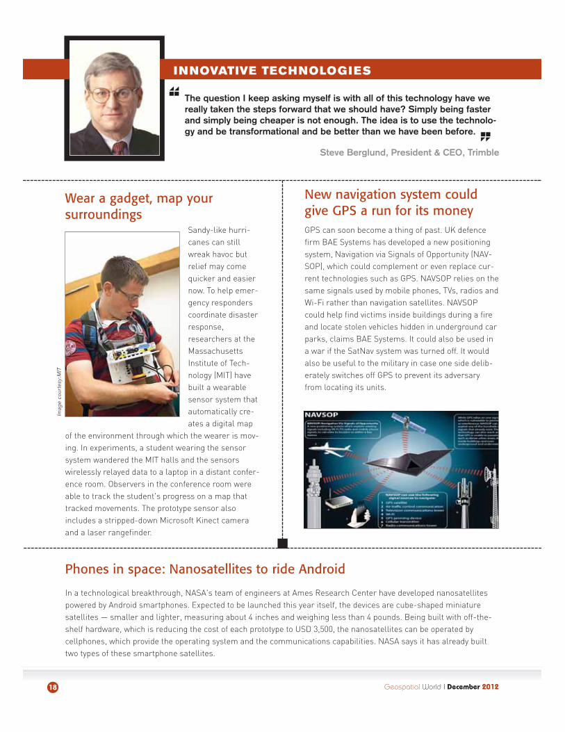
New navigation system couldgive GPS a run for its money GPS can soon become a thing of past. UK defencefirm BAE Systems has developed a new positioningsystem, Navigation via Signals of Opportunity (NAV-SOP), which could complement or even replace cur-rent technologies such as GPS. NAVSOP relies on thesame signals used by mobile phones, TVs, radios andWi-Fi rather than navigation satellites. NAVSOPcould help find victims inside buildings during a fireand locate stolen vehicles hidden in underground carparks, claims BAE Systems. It could also be used ina war if the SatNav system was turned off. It wouldalso be useful to the military in case one side delib-erately switches off GPS to prevent its adversaryfrom locating its units.
Imag
e co
urte
sy: M
IT
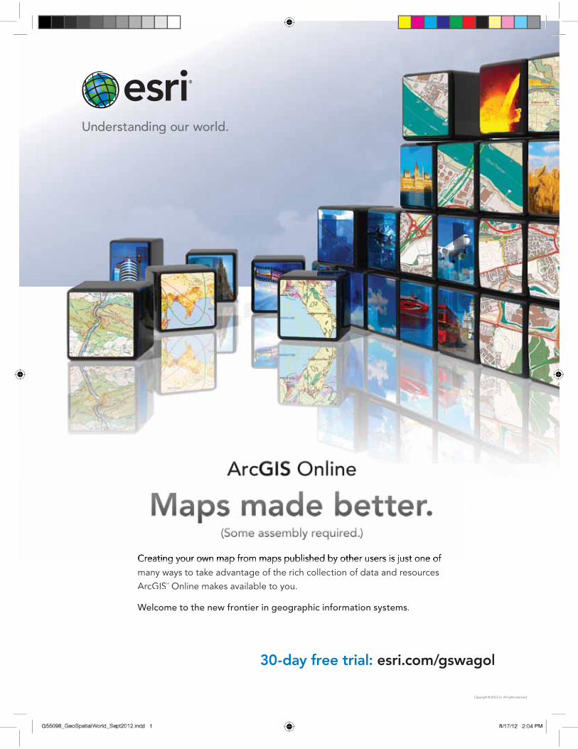
Creating your own map from maps published by other users is just one of many ways to take advantage of the rich collection of data and resourcesArcGISSM Online makes available to you.
Welcome to the new frontier in geographic information systems.
30-day free trial: esri.com/gswagol
Copyright © 2012 Esri. All rights reserved.
G55098_GeoSpatialWorld_Sept2012.indd 155098_GeoSpatialWorld_Sept2012.inddG d 1 8/17/12 2:04 PM8 PM

Geospatial World I December 201220
FOR A BETTER WORLD
Basic essential data which emerges from Planet Earth must be available free of cost across the board to anybody who wishes to useit. This is one thing that needs to be agreed upon if we really want tomake use of data in a substantial way.
Kapil Sibal, Union Minister for Communication and IT, India
NASA tries to penetrate the thickand thin of oil spill
Two years andbillions of dol-lars in clean-up operationsafter the BP oilspill in the Gulfof Mexico, thecoast is farfrom clear. In abid to improveresponse opera-tions to such environmental disasters in future,researchers at NASA's Jet Propulsion Laboratory andthe California Institute of Technology have developed amethod to use specialised NASA 3D imaging radar tocharacterise the oil in case of spills. The team usedUninhabited Aerial Vehicle Synthetic Aperture Radarwhich characterises an oil spill by detecting variationsin the roughness of its surface and, for thick slicks,changes in the electrical conductivity of its surfacelayer. UAVSAR's high sensitivity and other capabilitiesenabled the team to separate thick and thin oil for thefirst time using a radar system.
Global mineral map to aid in mining explorationsThis could be handy for mining companies reeling under soaring exploration costs. Scientists at Australia's Common-wealth Scientific and Industrial Research Organisation (CSIRO), in collaboration with those from Japan and USA, havedeveloped the world's first continent-wide suite of mineral maps. The new suite of maps will enable mining companiesto increase the efficiency and viability of their exploration efforts. The mineral maps show information about rock andsoil mineral components and provide a Google-like zoom to view images from thousands of kilometres wide to just afew kilometres. The maps were generated from a 10-year archive of raw Advanced Spaceborne Thermal Emission andReflection data collected by the US National Aeronautics and Space Administration and the Japanese government'sSpace Systems.
A network of networks for crisis response
Online technology communities step up to gather,process and share crucial information resources tohelp aid agencies on the ground in times of emergen-cies such as the 2010 Haiti earthquake or HurricaneSandy. In view of the fact that volunteer communitiesoften are adept at exploiting online technologies andcrowdsourcing methods to turn new sources of rawdata into useful intelligence, MapAction, CrisisMappersand GISCorps have teamed up with the United Nationsto form DigitalHumanitarian Network(DHN). The Networkaims to provide a bet-ter linkage betweenformal humanitarianorganisations and theonline technologycommunities in disaster situations. For example,blending analysis of satellite imagery with mobilephone traffic data may offers ways to detect movementof displaced people across a disaster zone. DHN isaimed at reducing "data noise" and providing betteraccess to priority information for aid agencies.
BP was fined USD 4.5 bn for Gulf of Mexico oil spill
Image courtesy: DigitalGlobe
Geospatial World I December 2012 21
FOR A BETTER WORLD
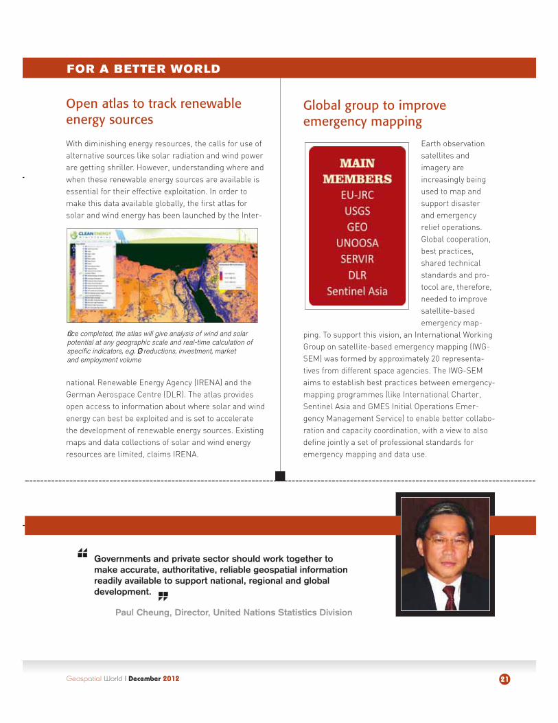
Open atlas to track renewableenergy sources
With diminishing energy resources, the calls for use ofalternative sources like solar radiation and wind powerare getting shriller. However, understanding where andwhen these renewable energy sources are available isessential for their effective exploitation. In order tomake this data available globally, the first atlas forsolar and wind energy has been launched by the Inter-
national Renewable Energy Agency (IRENA) and theGerman Aerospace Centre (DLR). The atlas providesopen access to information about where solar and windenergy can best be exploited and is set to acceleratethe development of renewable energy sources. Existingmaps and data collections of solar and wind energyresources are limited, claims IRENA.
Governments and private sector should work together tomake accurate, authoritative, reliable geospatial informationreadily available to support national, regional and globaldevelopment.
Paul Cheung, Director, United Nations Statistics Division
Global group to improveemergency mapping
Earth observationsatellites andimagery areincreasingly beingused to map andsupport disasterand emergencyrelief operations.Global cooperation,best practices,shared technicalstandards and pro-tocol are, therefore,needed to improvesatellite-basedemergency map-
ping. To support this vision, an International WorkingGroup on satellite-based emergency mapping (IWG-SEM) was formed by approximately 20 representa-tives from different space agencies. The IWG-SEMaims to establish best practices between emergency-mapping programmes (like International Charter,Sentinel Asia and GMES Initial Operations Emer-gency Management Service) to enable better collabo-ration and capacity coordination, with a view to alsodefine jointly a set of professional standards foremergency mapping and data use.
Once completed, the atlas will give analysis of wind and solarpotential at any geographic scale and real-time calculation ofspecific indicators, e.g. CO2 reductions, investment, marketand employment volume
Geospatial World I December 201222
FOR A BETTER WORLD
We need to explore how geospatial technology can help the bottom of the pyramid. Creating a sustainable development modelfor the 3 billion rural people involves linking data, informationexchange and proper dissemination."
Dr A P J Abdul Kalam, former President of India
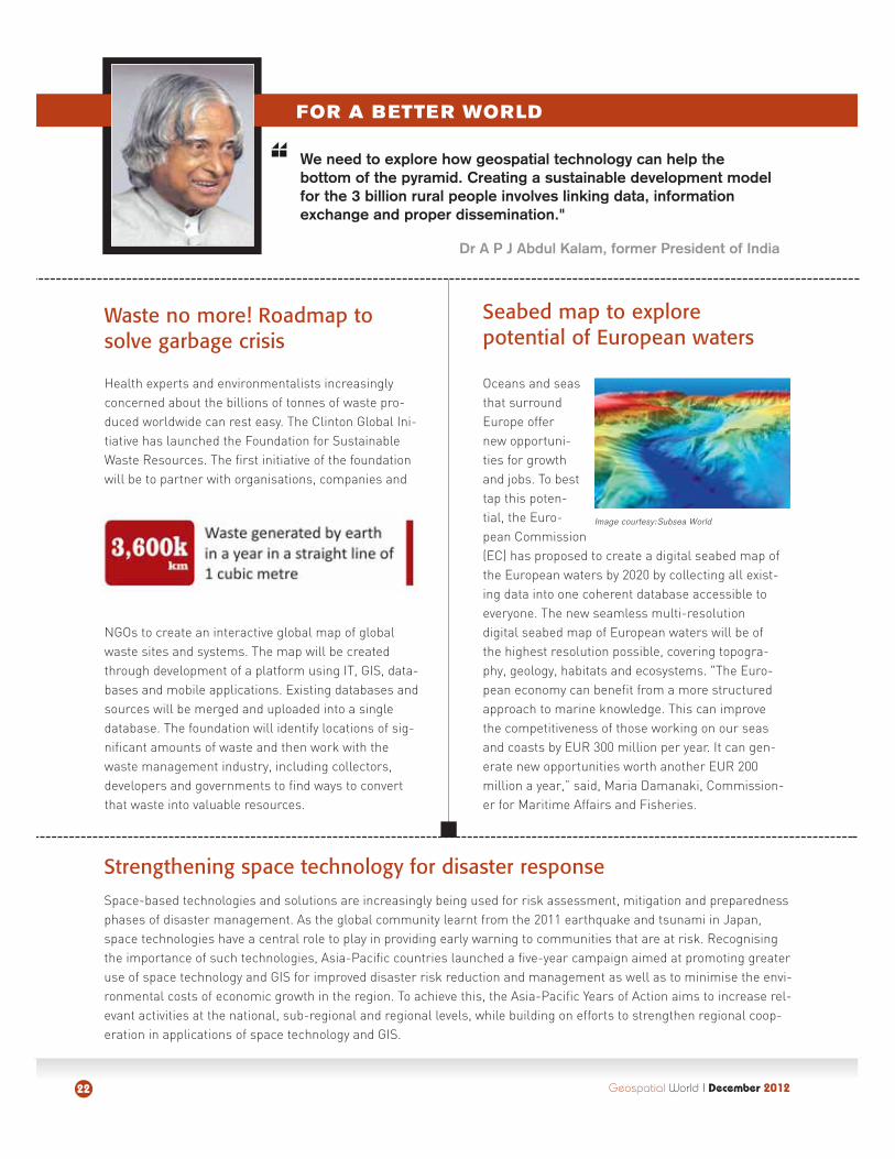
Seabed map to explorepotential of European waters
Oceans and seasthat surroundEurope offernew opportuni-ties for growthand jobs. To besttap this poten-tial, the Euro-pean Commission(EC) has proposed to create a digital seabed map ofthe European waters by 2020 by collecting all exist-ing data into one coherent database accessible toeveryone. The new seamless multi-resolution digital seabed map of European waters will be ofthe highest resolution possible, covering topogra-phy, geology, habitats and ecosystems. "The Euro-pean economy can benefit from a more structuredapproach to marine knowledge. This can improvethe competitiveness of those working on our seasand coasts by EUR 300 million per year. It can gen-erate new opportunities worth another EUR 200million a year,” said, Maria Damanaki, Commission-er for Maritime Affairs and Fisheries.
Waste no more! Roadmap tosolve garbage crisis
Health experts and environmentalists increasinglyconcerned about the billions of tonnes of waste pro-duced worldwide can rest easy. The Clinton Global Ini-tiative has launched the Foundation for SustainableWaste Resources. The first initiative of the foundationwill be to partner with organisations, companies and
NGOs to create an interactive global map of globalwaste sites and systems. The map will be createdthrough development of a platform using IT, GIS, data-bases and mobile applications. Existing databases andsources will be merged and uploaded into a singledatabase. The foundation will identify locations of sig-nificant amounts of waste and then work with thewaste management industry, including collectors,developers and governments to find ways to convertthat waste into valuable resources.
Strengthening space technology for disaster response
Space-based technologies and solutions are increasingly being used for risk assessment, mitigation and preparednessphases of disaster management. As the global community learnt from the 2011 earthquake and tsunami in Japan,space technologies have a central role to play in providing early warning to communities that are at risk. Recognisingthe importance of such technologies, Asia-Pacific countries launched a five-year campaign aimed at promoting greateruse of space technology and GIS for improved disaster risk reduction and management as well as to minimise the envi-ronmental costs of economic growth in the region. To achieve this, the Asia-Pacific Years of Action aims to increase rel-evant activities at the national, sub-regional and regional levels, while building on efforts to strengthen regional coop-eration in applications of space technology and GIS.
Image courtesy: Subsea World
What are the activities of Central Mining Institute?
Central Mining Institute (CMI) is one of the largestresearch and development institutes in Poland. Our mainactivities are in the mining area, not just restricted tocoal mining but also includes other mineral resourcessuch as copper, silver and lignite deposits. We are alsoinvolved in carrying out scientific research in mining.Another important part of our activities is environmentalengineering because during the past few decades, min-ing activities in Poland have led to large-scale environ-mental pollution. Besides, it is also important to spreadenvironmental engineering and knowledge to othercountries in the world. For example, safety in mines isone of our leading branches of activity and we share thisknowledge with China, Russia, Vietnam and other coun-tries where mining is undertaken on a large scale.
Apart from its knowledge sharing and researchactivities, does CMI also offer educationalprogrammmes and training modules?
Yes, we offer specialised courses for mining engineers,including PhDs and post-graduate programmes. We have a strong scientific staff of 15 professors andaround 100 PhD doctors. Geosciences is another strongarea of our activities, which includes geology, geophysics, surveying and geodesy. In Poland, mining is concentrated in urban areas and convincing citizensabout safety is a major challenge. Besides, the damagecaused to infrastructure is also an issue. This is a seri-ous condition for the mining industry as these activitieswill not be possible in future without acceptance of thecitizens.
Geospatial technology is applied widely in mining and
Prof Józef DubiñskiGeneral Director, Central Mining Institute, Poland
INTERVIEW
Geospatial World I December 201224
“
Prof Józef Dubiñski is a professor by profession,
miner at heart and environmentalist in his
beliefs.. A strong propagator of the idea
sustainability in mining, Prof. Dubiñski, who
is also the chairmaan of the World Mining
Congress, has been at the forefront calling for
use of better technology to aaddress environ-
mental pollution and safety hazards in mining.
Sustainability
is key to mining
”
related activities. How is CMI trying to encourage theuse of this technology?
Spatial technology is an integral part of our activitiesbecause mining as an activity creates different types ofdata. This data not only includes geological problems butevery measurement made in the mining process createssome kind of data. The database needs to be visualisedand analysed as it plays a vital role in making decisionsfor managing various processes. In Poland, mining geo-physics is not only used for the preliminary recognition ofdeposits in geological conditions but also in classifyingmining seismicity, because there are mines with strongseismicity due to high-level depths. Gathering data about shocks is extremely important to prevent a catastrophe. This is an area where geospatial knowledgeis widely used.
CMI is actively involved in international projects. Whatare the various kinds of activities undertaaken withyour international partners?
We have signed agreements with various institutions andorganisations around the world. For example, China hasbeen our partner for more than 30 years. We have signedagreements with the China Research Coal Institute andthe China University of Mining and Technology in Beijingwhere our main area of activity is mining safety. Chinahas been at the receiving end of a number of mine-relat-ed disasters in the past, and thus we are trying to buildstrong cooperation in this regard. We produce a seismo-logical apparatus that China is buying. A new area of ouractivity is underground classification as the use of classi-cal methods of exploration is very expensive. Besides,classical methods also result in low efficiency ofresources.
Safety is a major aspect in mining activities. Do yousee the role of geospatial technology in ensurringgreater safety?
Safety is an extremely important aspect, particularly incountries where underground mining is conductedbecause it is a rather dangerous activity. There are manykinds of data, such as data about seismicity and missioncontrol, which should be elaborated in a form that per-mits quick decision making. Certain analysis about min-ing safety should be based on very reliable data obtainedfrom measurements and this can be elaborated bygeospatial technology.
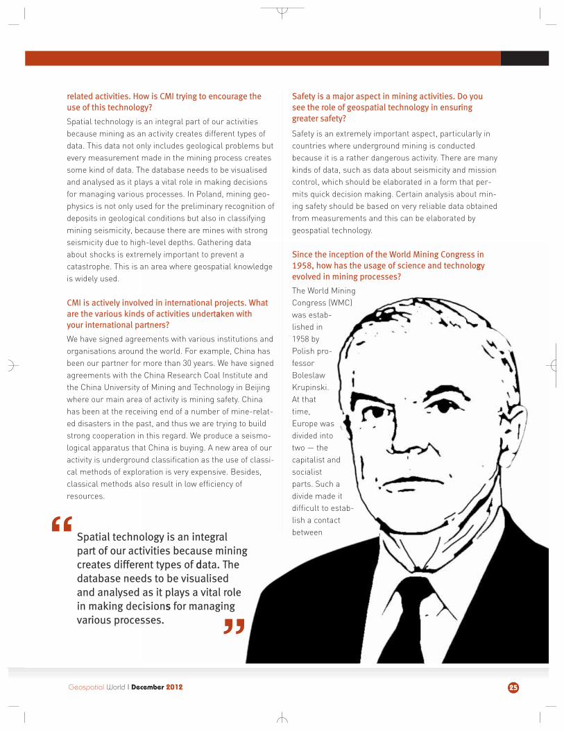
Since the inception of the World Mining Congress in1958, how has the usage of science and technologgyevolved in mining processes?
The World MiningCongress (WMC)was estab-lished in1958 byPolish pro-fessorBoleslawKrupinski.At thattime,Europe wasdivided intotwo — thecapitalist andsocialistparts. Such adivide made itdifficult to estab-lish a contactbetween
Geospatial World I December 2012 25
Spatial technology is an integralpart of our activities because miningcreates different types of ddata. Thedatabase needs to be visualisedand analysed as it plays a vital rolein making decisionss for managingvarious processes.
“
”
mining engineers and technicians.Therefore, the idea to establishWMC was aimed at removing thisgap and also to share mining knowl-edge, particularly in the area ofhigher efficiency of mining technolo-gies. Another objective was tospread mining knowledge to coun-tries where such knowledge waslow. For example, while GreatBritain, France, Germany andPoland had very high knowhow ofmining operations, China, Ukraineand India were just beginning togather such knowledge. Thirdly, italso worked to develop solidaritybetween members of the miningsociety as it was very important tocreate a regional institution beforemining could develop around theworld. Each meeting of the WMChas a motto, which aims to imple-ment something new in the miningactivity. For example, the next meet-ing is scheduled in Montreal, Cana-da in August 2013 and is aimed atmapping the future advances inmining.
Over the past 50 years, howsuccessful has WMC been inspreading awareness about thelatest advancees in science andtechnology?
For the past several years, eachmeeting of the WMC has concludedwith a declaration that directs min-ing activities in not only the hostcountry but also in the 50-odd par-ticipating countries.
Firstly, there is the problem ofrationale exploitation of resources.Secondly, we have to ensure envi-ronmental protection to obtainsocial acceptance of mining activity.Besides, education is another majorchallenge because there is a severeshortage of mining engineers inmany countries around the world.Apart from this, we also promoteinnovation in mining as it is veryimportant for future mining to besmart and intelligent so thatprocesses can be automated andminers do not have to undertakedangerous tasks. Each meeting ofthe WMC is followed by a meeting ofthe International Organising Com-mittee where each participatingcountry makes a short report aboutexecution and fulfilment of the WMCdeclaration.
Information exchange is onebasic needs to ensure coopera-tion between nations. Is WMClooking in tthis direction?
There is a proposal to publish a
separate newsletter of the WMC to ensure adequate informationexchange.
However, this is a little difficult to accomplish because a number of countries around the worldalready have their own specialisedjournals and participation of WMCmembers is very important in thisregard. For example, before theCongress in New Delhi, a journalwas published by an engineers'society in India, which was dedicatedto the problems of WMC and thenew technologies in Poland, Indiaand China. Besides, the WMC publishes the proceedings of theeach meeting, which are also avail-able on its website.
As the chairman of WMC, what isyour advice for the mining sectorin the backdrop of an ecosystemwhhich is getting fragile and at atime when environmental securityand safety are getting moreimportaant than before?
I think the mining industry is set totake off in future and there are a lotof factors that support this notion.However, mining managers and themining society should take greatcare for sustainability as it is one bigchallenge for us.
Economy, in my opinion, doesnot dominate the environmental andsocial aspects because societiesaround the world will not accept thisactivity if the safety level is low orwhen there are damages on the sur-face. Therefore, I think that sustain-ability in mining is a big challengebecause raw mineral resources arenon-renewable and will get exhaust-ed if exploited without any rationalreasons.
26 Geospatial World I December 2012

Geospatial World II December 201228
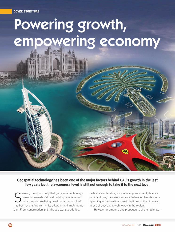
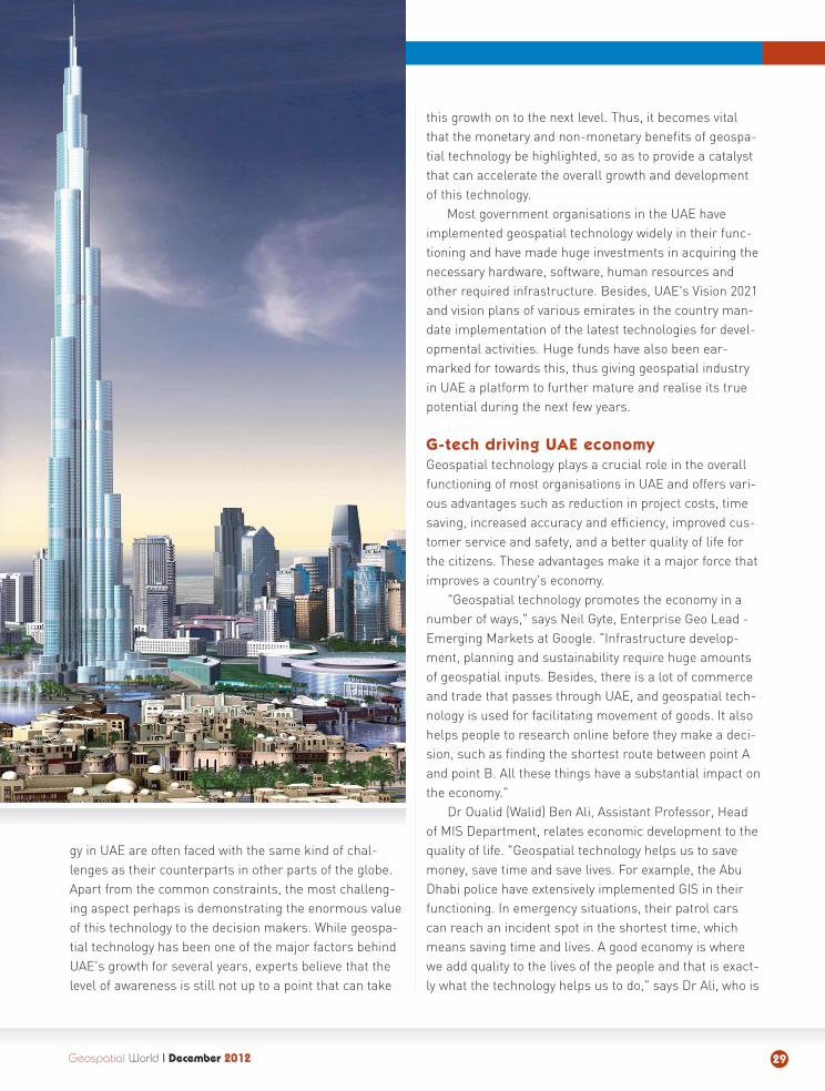
COVER STORY/UAE
Sensing the opportunity that geospatial technologypresents towards national building, empoweringindustries and realising development goals, UAE
has been at the forefront of its adoption and implementa-tion. From construction and infrastructure to utilities,
cadastre and land registry to local government, defenceto oil and gas, the seven-emirate federation has its usersspanning across verticals, making it one of the pioneersin use of geospatial technology in the region.
However, promoters and propagators of the technolo-
Powering growth,empowering economy
GGeeoossppaattiiaall tteecchhnnoollooggyy hhaass bbeeeenn oonnee ooff tthhee mmaajjoorr ffaaccttoorrss bbeehhiinndd UUAAEE''ss ggrroowwtthh iinn tthhee llaassttffeeww yyeeaarrss bbuutt tthhee aawwaarreenneessss lleevveell iiss ssttiillll nnoott eennoouugghh ttoo ttaakkee iitt ttoo tthhee nneexxtt lleevveell
gy in UAE are often faced with the same kind of chal-lenges as their counterparts in other parts of the globe.Apart from the common constraints, the most challeng-ing aspect perhaps is demonstrating the enormous valueof this technology to the decision makers. While geospa-tial technology has been one of the major factors behindUAE's growth for several years, experts believe that thelevel of awareness is still not up to a point that can take
this growth on to the next level. Thus, it becomes vitalthat the monetary and non-monetary benefits of geospa-tial technology be highlighted, so as to provide a catalystthat can accelerate the overall growth and developmentof this technology.
Most government organisations in the UAE haveimplemented geospatial technology widely in their func-tioning and have made huge investments in acquiring thenecessary hardware, software, human resources andother required infrastructure. Besides, UAE's Vision 2021and vision plans of various emirates in the country man-date implementation of the latest technologies for devel-opmental activities. Huge funds have also been ear-marked for towards this, thus giving geospatial industryin UAE a platform to further mature and realise its truepotential during the next few years.
G-tech driving UAE economy
Geospatial technology plays a crucial role in the overallfunctioning of most organisations in UAE and offers vari-ous advantages such as reduction in project costs, timesaving, increased accuracy and efficiency, improved cus-tomer service and safety, and a better quality of life forthe citizens. These advantages make it a major force thatimproves a country's economy.
"Geospatial technology promotes the economy in anumber of ways," says Neil Gyte, Enterprise Geo Lead -Emerging Markets at Google. "Infrastructure develop-ment, planning and sustainability require huge amountsof geospatial inputs. Besides, there is a lot of commerceand trade that passes through UAE, and geospatial tech-nology is used for facilitating movement of goods. It alsohelps people to research online before they make a deci-sion, such as finding the shortest route between point Aand point B. All these things have a substantial impact onthe economy."
Dr Oualid (Walid) Ben Ali, Assistant Professor, Headof MIS Department, relates economic development to thequality of life. "Geospatial technology helps us to savemoney, save time and save lives. For example, the AbuDhabi police have extensively implemented GIS in theirfunctioning. In emergency situations, their patrol carscan reach an incident spot in the shortest time, whichmeans saving time and lives. A good economy is wherewe add quality to the lives of the people and that is exact-ly what the technology helps us to do," says Dr Ali, who is
Geospatial World II December 2012 29
also the founder and director of theGIS centre at the University of Sharjah.
G-tech in user organisations
According to the book Fundamentalsof Spatial Information Systems, "about80 per cent of all urban decisionsmade by state and local governmentsinvolve a spatial component eitherdirectly or implicitly, demanding aprocess based on geographical data."This only highlights the importance ofgeospatial technology and reiteratesits role as a major driver for userorganisations.
Describing how geospatial tech-nology plays a crucial role in dealingwith environmental issues, AnilKumar, Director, Environment Infor-mation Management, EnvironmentAgency, Abu Dhabi, says, "This tech-nology has enabled us to achieve costefficiency in much of its activities. Ithas been quite pervasive and allows usto make better decisions." He pointsout that his organisation looks at thevalue of this technology from an over-all perspective of providing a clean andsafe environment to Abu Dhabi's cur-rent and future generations. "Anydamage caused to the environmentcould have huge cost implications andGIS helps us to take adequate meas-ures to mitigate or minimise theharmful impact on the environment."
Nader Assad Bin Taher, Asset Per-formance Department Manager, AbuDhabi Sewerage Services Company (ADSSC), is alsoupbeat about the role of geospatial technology in theoverall functioning of his organisation. "This technology isa major driver as it is sustaining the very existence ofADSSC and improving our business reputation immense-ly. There are several factors such as automation ofprocesses, paperless data storage, improvement in pro-ductivity and efficiency that work in this direction." Admit-
ting that it can sometimes get a bit challenging to imple-ment, Bin Taher says geospatial technology is the future.
Ibrahim Seif, Senior Software Specialist at Etisalatexplains how one of the largest telecom companies in theregion is using this technology to improve its functioning:"Our applications are helping Etisalat in automating thebusiness process, speeding the planning process andproviding critical information for the decision makers to
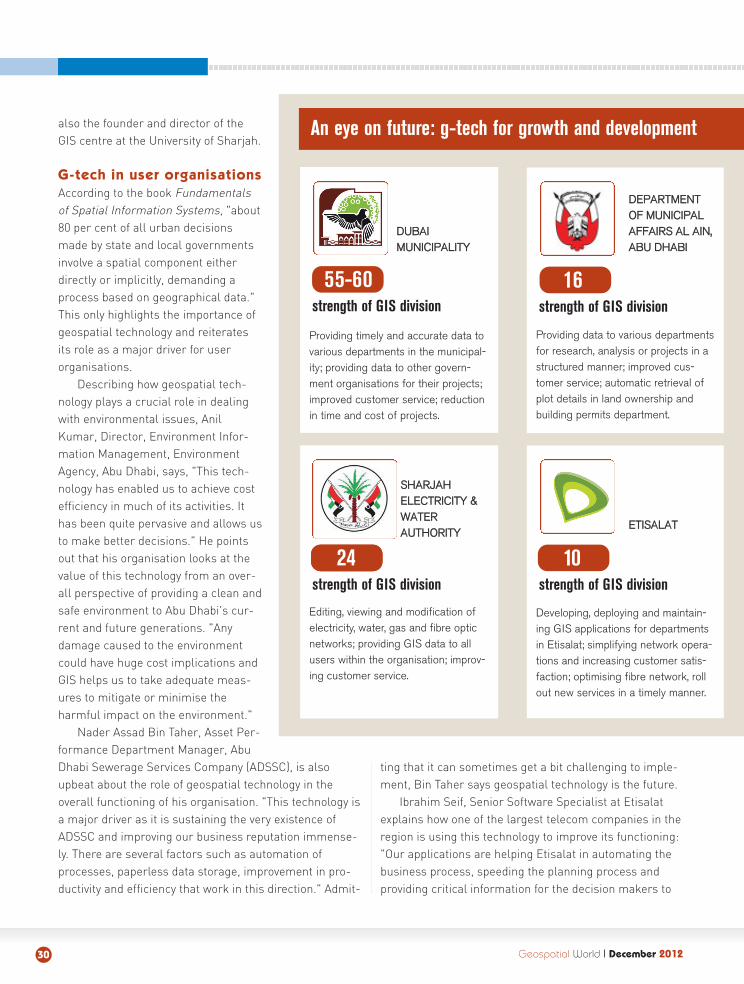
Geospatial World II December 201230
16 strength of GIS division
10 strength of GIS division
Developing, deploying and maintain-ing GIS applications for departmentsin Etisalat; simplifying network opera-tions and increasing customer satis-faction; optimising fibre network, rollout new services in a timely manner.
Providing data to various departmentsfor research, analysis or projects in astructured manner; improved cus-tomer service; automatic retrieval ofplot details in land ownership andbuilding permits department.
24strength of GIS division
Editing, viewing and modification ofelectricity, water, gas and fibre opticnetworks; providing GIS data to allusers within the organisation; improv-ing customer service.
55-60strength of GIS division
Providing timely and accurate data tovarious departments in the municipal-ity; providing data to other govern-ment organisations for their projects;improved customer service; reductionin time and cost of projects.
DDUUBBAAII MMUUNNIICCIIPPAALLIITTYY
DDEEPPAARRTTMMEENNTTOOFF MMUUNNIICCIIPPAALLAAFFFFAAIIRRSS AALL AAIINN,,AABBUU DDHHAABBII
EETTIISSAALLAATT
An eye on future: g-tech for growth and development
SSHHAARRJJAAHH EELLEECCTTRRIICCIITTYY &&WWAATTEERRAAUUTTHHOORRIITTYY
help them in taking wise and effective decisions for net-work development based on customer information."
Town planning and municipal authorities are usingthis technology to the fullest. "Planning department plansvarious facilities based on demographic information, forexample, building mosques in areas with the highestdensity of Muslim population," says Adib Al Madani, Headof GIS Data Section at Dubai Municipality. The building
department relies on soil informationfor different types of building permitssuch as villas, towers or high-risebuildings. Drainage, sewerage and irrigation departments have their complete networks standardised by theGIS department which will help themmaintain their pipes and avoid any crisis, he points out.
Hurdles on the road
There are several challenges thathamper the growth of geospatial tech-nology in the country.
LLaacckk ooff aawwaarreenneessss:: While UAE hasno scarcity of resources, lack of aware-ness among the users and policy mak-ers often proves to be a big hindrancein getting the right resources at theright time and right place. It is thismajor issue which gives rise to associ-ated challenges such as lack of trainedstaff, budget constraints, lack of coop-eration and software/hardware issues.
Dr Ali accepts that lack of aware-ness is the biggest challenge. Whilegeospatial technology has been imple-mented in various departments acrossUAE, not everyone is aware of its bene-fits. "There is no dearth of facilities inthe UAE, so awareness is by far thebiggest challenge. For geospatial tech-nology to realise its full potential, theneed is to create more awarenessamongst users, developers and policymakers," he says.
LLaacckk ooff ttrraaiinneedd ssttaaffff:: It is a problemplaguing most user organisations in the UAE. More spe-cialised courses in the field could improve the situation atthe grassroots level. "We have a lot of universities in UAEbut only a handful have started courses to educate thestudents about this technology. This has to change. InCanada, US and the European countries, GIS is a part ofthe curriculum," says Dr Ali. Nader Bin Taher of theADSSC feels one of the most important challenges facing
Geospatial World II December 2012 31
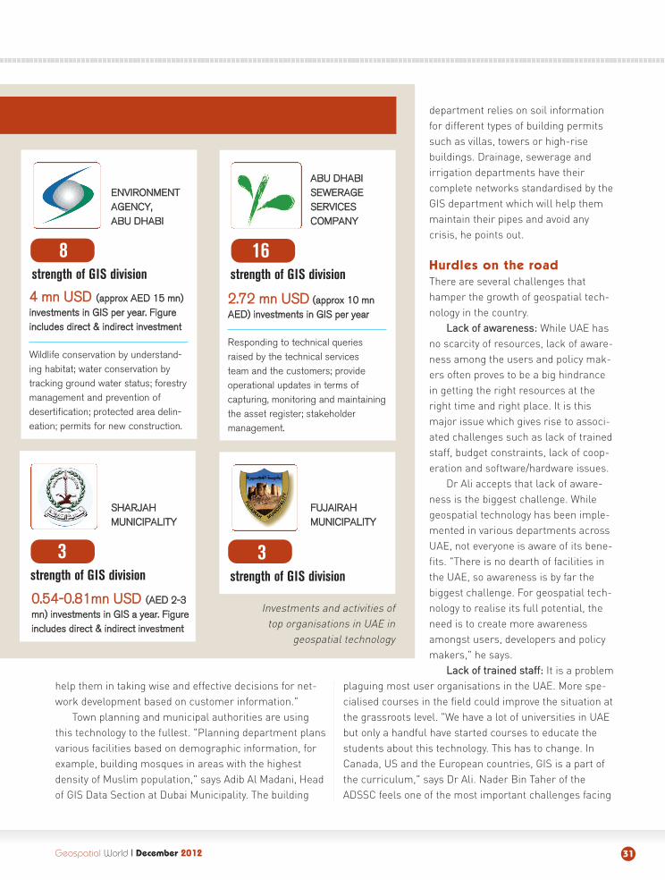
16strength of GIS division
3strength of GIS division
22..7722 mmnn UUSSDD ((aapppprrooxx 1100 mmnnAAEEDD)) iinnvveessttmmeennttss iinn GGIISS ppeerr yyeeaarr
Responding to technical queriesraised by the technical services team and the customers; provideoperational updates in terms of capturing, monitoring and maintainingthe asset register; stakeholder management.
00..5544--00..8811mmnn UUSSDD ((AAEEDD 22--33mmnn)) iinnvveessttmmeennttss iinn GGIISS aa yyeeaarr.. FFiigguurreeiinncclluuddeess ddiirreecctt && iinnddiirreecctt iinnvveessttmmeenntt
8 strength of GIS division
44 mmnn UUSSDD ((aapppprrooxx AAEEDD 1155 mmnn))iinnvveessttmmeennttss iinn GGIISS ppeerr yyeeaarr.. FFiigguurreeiinncclluuddeess ddiirreecctt && iinnddiirreecctt iinnvveessttmmeenntt
Wildlife conservation by understand-ing habitat; water conservation bytracking ground water status; forestrymanagement and prevention ofdesertification; protected area delin-eation; permits for new construction.
3strength of GIS division
Investments and activities of top organisations in UAE in
geospatial technology
EENNVVIIRROONNMMEENNTTAAGGEENNCCYY,,AABBUU DDHHAABBII
AABBUU DDHHAABBIISSEEWWEERRAAGGEESSEERRVVIICCEESS CCOOMMPPAANNYY
SSHHAARRJJAAHHMMUUNNIICCIIPPAALLIITTYY
FFUUJJAAIIRRAAHHMMUUNNIICCIIPPAALLIITTYY
Geospatial World II December 201232
his organisation is the internal capacity of the GIS team."A lot of our staff is coming from non-GIS background,which presents us with the challenge of taking them froma nascent stage to a professional level."
Agrees Abdulhakim Abdulkarim Malik, Director of theGIS section at Dubai Municipality. "Lack of qualityemployees is a major challenge. You can find plenty ofpeople who are IT experts but it is extremely difficult tofind people who are well versed in GIS."
Another issue is a majority of GIS people belong tothe expatriate community. When these people leave at theend of a project, it creates a void that is sometimesextremely hard to fill. Besides, there is also aproblem of migration of trained staff to theprivate sector for better pay packages.
DDaattaa:: Data is the fundamentalrequisite for all kinds of geospatialactivity and is another area thatconcerns the champions of thetechnology in UAE. While thedata available may sometimesbe outdated or incomplete, datasharing mechanisms also needto be strengthened a great deal.Besides, the openness of data isanother aspect that needs immedi-ate attention.
Google's Gyte says there is still notenough data that is open and availableto the public. Although progress hasbeen made in the last 2-3 years on this front, a lot of it isstill kept by the government and it often takes weeks oreven months for users to get their hands on data "If youmake data available to the people easily, it enables moreinnovation and openness," he says.
BBuuddggeett ccoonnssttrraaiinnttss:: Lack of funding has resulted indelays or cancellation of a number of geospatial projectsin the recent past. While funds have been hard to come byin some cases owing to the economic downturn, lack ofawareness has been the actual reason on most occasionsas funds were diverted to other less-important areas.Lack of budget is especially a problem for some of thesmaller emirates, and the provision of low-cost data andother resources will help a great deal in consolidatingtheir GIS infrastructure. An important aspect behindarranging the budget required for a GIS project is thesupport of the decision makers. Therefore, it becomesvital that the top management be educated about thebenefits of geospatial technology in numerous areas ofeconomic development, planning, infrastructure, citymanagement etc.
SSooffttwwaarree:: Different departments in the UAE use dif-ferent kinds of GIS software. This gives rise to the issueof compatibility between various software and the result-ing wastage of time, efforts and money. Incompatibilityissue also gives rise to the problem of data exchangebetween various organisations. A third aspect of the chal-lenge is the low level of software penetration at the uni-
versity level where students can get a hands-onexperience even before landing up a job. In a
lot of developed countries, geospatialsoftware is provided to educational
institutes at low prices but that ismissing in UAE.
LLaacckk ooff ccooooppeerraattiioonn:: Non-cooperation issue may arisebetween two organisations oramongst various departments in
an organisation and leads to theproblem of sharing of data and
information. All this results inwastage of time and delays a project.
Capacity development
A study conducted by a private firm acouple of years ago concluded that
there is an acute shortage of geospatial professionals inUAE and the government/private sector in the countryrequires around 800-1,000 GIS experts to bridge thisdivide. While there is a need to strengthen the skills ofexisting staff, new geospatial professionals should also
““WWee nneeeedd tthhee ggeeoossppaattiiaall ccoommmmuunniittyyttoo ccoollllaabboorraattee wwiitthh tthhee uunniivveerrssiittiieess..SSoo,, wwhhiillee wwee pprreeppaarree ffuuttuurree ggeeoossppaa--ttiiaall pprrooffeessssiioonnaallss,, tthhee iinndduussttrryy ccaannssuuppppoorrtt uuss iinn tthhee ffoorrmm ooff hhaarrddwwaarree,,ssooffttwwaarree,, ddaattaa aanndd oorrggaanniissiinnggggeeoossppaattiiaall eevveennttss..””
DDrr OOuuaalliidd ((WWaalliidd)) BBeenn AAlliiUUnniivveerrssiittyy ooff SShhaarrjjaahh
Hurdles for growth of geospatial technology in UAE

Geospatial World II December 2012 33
be groomed by empowering the education system.Besides, positive government policies in this directioncan also help to fill the void.
"There are some good university programmes alreadyin the UAE. The need is to provide education and aware-ness to the business leaders around the benefits ofgeospatial technology," explains Gyte. Capacity buildinghas to be at two levels: at the grassroots level in terms ofeducation in schools and universities; and in terms ofmaking businesses and decision makers aware of thebenefits of geospatial data and technology so that therecould be more investment in people, skills etc. Besides,the industry should also partner with universities to pro-mote the technology at the basic level. "Companiesaround the world have internships. Ithelps students bridge the gap betweenacademic GIS and business GIS and turnsthem into real professionals," adds Gyte.
Most educational institutes do nothave the necessary funding to acquire the infrastructure required for impartingquality GIS education and help the students in the form of scholarships.Funding from private companies in theform of free software and on-the-jobtraining opportunities for students canhelp tackle this challenge and thus cre-ate real geospatial professionals.
"We need the geospatial community to collaboratewith the universities," says Dr Ali. "This way, while weprepare future geospatial professionals, the industry cansupport us in the form of hardware, software, data andorganising events and seminars related to geospatialtechnology." Having free software licences for the univer-sities will not only be good marketing for the companies
but will also help the students in familiarising themselveswith the latest technology. "While the government is sup-porting us by providing the required data, it is impossible
to teach GIS without software and hard-ware," adds Dr Ali.
Government initiatives
While there is little support in terms ofcapacity building from the private sec-tor, the government is doing its bit in theform of creating favourable policies andorganising training sessions. The UAEgovernment's Emiratisation Schemeencourages local people to take up keypositions and also rewards departmentswith the highest number of Emiratis. Forexample, 99 per cent of employees in
the GIS department at ADSSC are UAE nationals.Highlighting the government's favourable policies for
the promotion of geospatial technology, Dr Ali says, "Lastyear, the Abu Dhabi government asked a private companyto organise a free training seminar for the locals. Anotherinitiative is to send the locals abroad for GIS training. Thegovernment spends a lot of money for training people."However, a policy to push software providers to providefree software licences to universities and schools woulddo a world of good for the overall growth and develop-ment of the technology in the region.
The way forward
While there are a lot of problems facing the growth ofgeospatial technology in UAE, most of those challengescan be met by implementing simple strategies. Commer-cial geospatial companies can contribute to the promo-tion of the technology by conducting joint research proj-
““AAwwaarreenneessss iiss ccrriittiiccaall ttoo eennssuurreesspprreeaadd ooff ggeeoossppaattiiaall tteecchhnnoollooggyy..SSttrroonnggeerr ccooooppeerraattiioonn iiss rreeqquuiirreeddbbeettwweeeenn ggoovveerrnnmmeenntt oorrggaanniissaattiioonnssbbeeccaauussee eevveerryyoonnee hhaass ddiiffffeerreennttttyyppeess ooff ddaattaa,, wwhhiicchh sshhoouulldd bbeeeexxcchhaannggeedd sseeaammlleessssllyy..””
AAbbdduullhhaakkiimm AAbbdduullkkaarriimm MMaalliikkDDuubbaaii MMuunniicciippaalliittyy
““EEnnvviirroonnmmeennttaall ddaammaaggee ccoouulldd hhaavveehhuuggee ccoosstt iimmpplliiccaattiioonnss aanndd ggeeoossppaattiiaall tteecchhnnoollooggyy hheellppss uuss ttoottaakkee aaddeeqquuaattee mmeeaassuurreess ttoo mmiittiiggaatteetthhee hhaarrmmffuull iimmppaacctt..””
AAnniill KKuummaarrEEnnvviirroonnmmeenntt AAggeennccyy,, AAbbuu DDhhaabbii
8800%% ooff aallll uurrbbaann
ddeecciissiioonnss mmaaddeebbyy ssttaattee aanndd llooccaall
ggoovveerrnnmmeennttssiinnvvoollvvee aa ssppaattiiaall
ccoommppoonneenntt eeiitthheerr ddiirreeccttllyy oorr
iimmpplliicciittllyy
ects with schools, higher education institutes and government departments.
Gyte lists access to data, lack of awareness at theexecutive level and Internet connectivity in terms of dataspeeds as some of the major obstacles facing the growthof geospatial technology in UAE. "A majorstep forward towards overcoming thesechallenges would be to allow more com-mercial data providers to cooperate in theregion. Most of the western countries havecommercial data providers and productscan be built on top of that data collection.This is still limited in this part of theworld," he says.
Nader Bin Taher explains how ADSSCcountered the challenge of shortage oftrained personnel. "We started an internaleducation system and also organised special trainingsessions with official training providers. We also send ouremployees to exhibitions and conferences where they canlearn about the latest technology. However, the bestapproach is to put them through actual projects."
Abdulhakim Abdukarim Malik shares his experienceon how Dubai Municipality tackled the issue of budgetconstraints and non-cooperation. "We divided a particular
project in many phases instead of doing it at one go. Wehave also decided to cancel or put on hold projects thatwere not critical. On non-cooperation issues, weapproached higher authorities."
Anil Kumar of Abu Dhabi Environment Agency is ofthe opinion that the technology has to be simplified inorder to ensure its penetration to the basic level. "GIS is atechnology for the specialists as you need to have a cer-tain level of expertise to be able to operate GIS applica-tions. It needs to be simplified like what Google Maps hasdone by bringing GIS to the layman." He says the lack ofadvanced data visualisation capability also needs to belooked into. Another major drawback is the ability to han-dle real-time data — most of the GIS software currentlyavailable is unable to manage data from real-time moni-
toring networks.
Conclusion
Although spatial technology in UAE is at afairly advanced stage, it is still a fair wayshort of realising its true potential. Lack ofawareness is a key challenge and evengovernment organisations that have imple-mented the technology in every part offunctioning are not using it in the mostoptimal way with the latest technologiesand standards. Another aspect that needs
attention is the spread of the technology, which is unevenacross the country. While Dubai and Abu Dhabi are oper-ating at an advanced stage, some of the other emiratesare lagging behind and need to act fast to catch up. How-ever, the challenges facing the growth of geospatial tech-nology in UAE are in no way impenetrable and can beovercome by private sector cooperation and implementa-tion of favourable policies by the government. Strongcooperation and coordination is required between govern-ment organisations because everyone has different typesof data, which should be exchanged between all thedepartments.
"Awareness is critical for both users and policy mak-ers, and we are still way behind in comparison to citieslike Singapore and Taiwan and need a lot of hard work toreach there," signs off Abdulhakim Abdukarim Malik.
VVaaiibbhhaavv AArroorraa
Assistant Editor, [email protected]
Geospatial World II December 201234
““OOnnee ooff tthhee iimmppoorrttaanntt cchhaalllleennggeessffaacciinngg uuss iiss tthhee iinntteerrnnaall ccaappaacciittyy oofftthhee GGIISS tteeaamm.. AA lloott ooff oouurr ssttaaffff iissffrroomm nnoonn--GGIISS bbaacckkggrroouunndd,, aanndd wweehhaavvee ttoo ttaakkee tthheemm ffrroomm aa nnaasscceennttssttaaggee ttoo aa pprrooffeessssiioonnaall lleevveell..””
NNaaddeerr AAssssaadd BBiinn TTaahheerrAAbbuu DDhhaabbii SSeewweerraaggee SSeerrvviicceess CCoommppaannyy
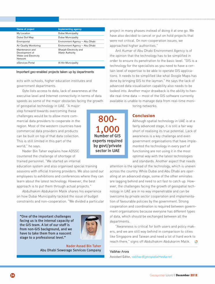
880000--11,,000000
NNuummbbeerr ooff GGIISSeexxppeerrttss rreeqquuiirreeddbbyy ggoovvtt//pprriivvaatteesseeccttoorr iinn UUAAEE
NNaammee ooff pprroojjeecctt IImmpplleemmeennttiinngg aaggeennccyy
My Location Dubai Municipality
Dubai Soil Map Dubai Municipality
Enviroportal Environment Agency — Abu Dhabi
Air Quality Monitoring Environment Agency — Abu Dhabi
Maintenance and Sharjah Electricity and Development of Water AuthorityWater and Electricity Network
eServices Portal Al Ain Municipality
IImmppoorrttaanntt ggeeoo--eennaabblleedd pprroojjeeccttss ttaakkeenn uupp bbyy ddeeppaarrttmmeennttss

Create your own GIS-readyorthophotos and DSMs
Fast and with survey accuracy
Safe and fully automatic
Aerial mapping in your hands!
The X100 revolutionary mapping
HIGH RESOLUTION ORTHOPHOTOS
The raw images are digitally processed and geo-referenced into the highest quality orthophotos.
ACCURATE DIGITAL SURFACE MODELS
The XYZ point clouds are LiDAR-like
INTERESTED?
[email protected] www.gatewing.com
Geospatial World I December 201236
OGC STANDARDS
Cloud computing bringstogether server farms (datacentres), Software-as-a-
service (SaaS), platform-as-a-serv-ice (PaaS), virtualisation, big data,mobile devices, apps and analytics.The use of international standards isthe "glue" that allows the integrationof all of these technologies. Virtually,every cloud transaction uses TCP/IP
and almost every transaction usesthe Web standard http. Many otheropen standard encodings and inter-faces as well as proprietary encod-ings and interfaces provide themeans by which services in the cloudcan be requested and delivered.
Service-oriented architectures(SOA) evolved from client-servercomputing in the 1970s. Client-serv-
er applications utilise a networkarchitecture in which the compo-nents can be geographically "distrib-uted". There are providers of servic-es called servers and servicerequesters called clients. Typically,clients and servers run on separatecomputer systems that communi-cate over a network (as in cloudcomputing), but both the client and
Geospatial standards enable integ ration of geospatial services into IT infrastructures and solutions, reducin g costs, adding flexibility and
speed and making way for innovation in the process
VALUE MULTIPLIER
server may reside in the same sys-tem. A client initiates a session witha server, invoking a software pro-gramme, and the server runs theprogramme and returns a result.
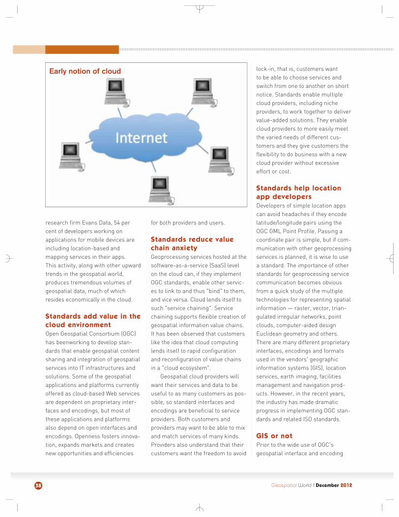
With the advent of the Web,clients such as Mosaic and Netscapebegan offering access to ordinaryusers — via open standards — toapplications (Web services) runningon servers. Users don't need to knowor care where the servers are locat-ed. Web services are accessiblethrough a simple http request. Aslong as users have Internet access,they have access to these applica-tions. Open standards such asHTML, http, and URIs enabled thisleap into the cloud.
As the US National Institute ofStandards and Technology pointsout, cloud computing provides "con-venient, on-demand access to ashared pool of configurable comput-ing resources (e.g., networks,servers, storage, applications, andservices) that can be rapidly provi-sioned and released with minimalmanagement effort or serviceprovider interaction".
The key driver for cloud comput-ing is economies of scale. The mod-ern day, very large data centres offeran advantage of at least six timesover small data centres in terms ofeconomies of scale. Cloud comput-ing is not so much a technology as itis a business model designed to pro-vide customers with the maximumamount of storage, transaction pro-cessing and analysis at minimal cost,while also relieving customers ofexpensive and time-consuming tasksrelated to purchasing and maintain-ing computing resources. And thebargain includes new capabilities
and trends, such as a proliferation ofmobile devices and apps that haveaccess to virtually unlimited storageand processing. In addition to financial savings, cloud computing'sefficiencies translate into reducedcarbon footprints and naturalresource use.
Why put geospatial
processing in the cloud
Two key aspects of cloud computingthat are especially relevant togeospatial cloud computing areresource pooling and elasticity. Incloud computing, resources arepooled to serve multiple consumerswith resources that are dynamicallyassigned and reassigned accordingto consumer demand. A consumermight, for example, work in a munic-ipal planning office in a suburb of alarge city. The city might have a GISand many layers of data "in thecloud" and the planner has access tothese through aWeb browser.The city mighthost the GISmodules anddata layers in itsown data centreor it might hostthem with acompany thatowns and main-tains data centres. The planningoffice doesn't need to own the soft-ware and no one in the planningoffice needs to know the location orownership of the servers providingthe resources. Perhaps the citymakes its services available to all ofits suburbs, and the suburbs pooltheir (much reduced) GIS budgets tohelp pay for the shared resource.
They reduce their costs and they arefreed from maintenance andupgrade responsibilities. Together,they can afford to acquire new capa-bilities, perhaps apps that run on anunlimited number of mobile devices.
Elasticity means that the capabil-ities can be rapidly and elasticallyprovisioned. For example, what if allthe planning department workers ina region suddenly sat at their desksor picked up their notebook comput-ers to perform the same task on thesame data layer. Assuming the datacentre has thousands of computersavailable and is perhaps able tospillover demand to a partner datacenter, the planning departmentworkers will experience no slownessin response.
Geo-apps and the
geo-cloud
Cloud plays an important role ininnovation, because the time to mar-
ket for ideas ismuch fasterwhen new com-panies do notneed to investtime and moneyin providing basiccomputing infra-structure. A pro-fusion of Web-based map
browsers, GPS-enabled applications,in-car navigation services, high reso-lution earth imaging systems andmobile smart phone location appli-cations have tremendously expandedthe geospatial market and the aver-age person's awareness of "maps incomputers". According to a recentsurvey of more than 400 mobiledevelopers by IT industry market
Geospatial World I December 2012 37
Two key aspectsof cloud computingthat are especially
relevant to geospatialcloud computing areeresource pooling and
elasticity
research firm Evans Data, 54 percent of developers working on applications for mobile devices areincluding location-based and mapping services in their apps. This activity, along with other upwardtrends in the geospatial world, produces tremendous volumes ofgeospatial data, much of whichresides economically in the cloud.
Standards add value in the
cloud environment
Open Geospatial Consortium (OGC)has beenworking to develop stan-dards that enable geospatial contentsharing and integration of geospatialservices into IT infrastructures andsolutions. Some of the geospatialapplications and platforms currentlyoffered as cloud-based Web servicesare dependent on proprietary inter-faces and encodings, but most ofthese applications and platformsalso depend on open interfaces andencodings. Openness fosters innova-tion, expands markets and createsnew opportunities and efficiencies
for both providers and users.
Standards reduce value
chain anxiety
Geoprocessing services hosted at thesoftware-as-a-service (SaaS) levelon the cloud can, if they implementOGC standards, enable other servic-es to link to and thus "bind" to them,and vice versa. Cloud lends itself tosuch "service chaining". Servicechaining supports flexible creation ofgeospatial information value chains.It has been observed that customerslike the idea that cloud computinglends itself to rapid configurationand reconfiguration of value chainsin a "cloud ecosystem".
Geospatial cloud providers willwant their services and data to beuseful to as many customers as pos-sible, so standard interfaces andencodings are beneficial to serviceproviders. Both customers andproviders may want to be able to mixand match services of many kinds.Providers also understand that theircustomers want the freedom to avoid
lock-in, that is, customers want to be able to choose services andswitch from one to another on shortnotice. Standards enable multiplecloud providers, including nicheproviders, to work together to delivervalue-added solutions. They enablecloud providers to more easily meetthe varied needs of different cus-tomers and they give customers theflexibility to do business with a newcloud provider without excessiveeffort or cost.
Standards help location
app developers
Developers of simple location appscan avoid headaches if they encodelatitude/longitude pairs using theOGC GML Point Profile. Passing acoordinate pair is simple, but if com-munication with other geoprocessingservices is planned, it is wise to usea standard. The importance of otherstandards for geoprocessing servicecommunication becomes obviousfrom a quick study of the multipletechnologies for representing spatialinformation — raster, vector, trian-gulated irregular networks, pointclouds, computer-aided designEuclidean geometry and others.There are many different proprietaryinterfaces, encodings and formatsused in the vendors' geographicinformation systems (GIS), locationservices, earth imaging, facilitiesmanagement and navigation prod-ucts. However, in the recent years,the industry has made dramaticprogress in implementing OGC stan-dards and related ISO standards.
GIS or not
Prior to the wide use of OGC'sgeospatial interface and encoding
Geospatial World I December 201238
Early notion of cloud
standards, most geospatial informa-tion was confined within GIS andearth imaging systems, their spe-cialised spatial databases and thenetworks of users who used soft-ware from the same vendor. Now,there is an exploding need for spatialdata and simple kinds of spatialservices, such as "Get a map","Where am I?", "Where is the nearestpizza shop?", and "Is it safe to dighere?" These services are now typi-cally provided without a GIS, and theyare well served by cloud servicesthat can immediately scale to handlea large number of transaction.Through widespread implementationof standards, geospatial data andgeospatial processing have become,to a considerable degree, just anoth-er part of the world's informationinfrastructure.
What is needed now
The cloud is based on a standardsframework for service-orientedarchitectures that provides for "pub-lish availability of service, find serv-ice, bind to (invoke) service". What ismissing here are a few other steps,such as "Get data provenance","Agree", "Authenticate", and"Encrypt/Decrypt". The growth of themarket and social utility of geospa-tial technology depend on stakehold-ers working together to developstandard ways of communicating thiskind of information.
The "Publish" activity needs to beable to provide metadata describing,for a particular service or dataresource, details about authentica-tion, authorisation, confidentiality,integrity, non-repudiation, protectionand privacy. Servers need to beequipped to manage these issues,
and owners of data and servicesneed the tools and understandingnecessary to configure controlsbased on the yet-to-be-developedstandards.
The OGC Geo Rights Manage-ment Domain Working Group(GeoRM DWG) has produced theGeospatial Digital Rights Manage-ment Reference Model, which pro-vides the foundation for "agreementmanagement" that will bring uscloser to full realisation of geospatialcloud applications. The mission ofthe GeoRM Working Group is tocoordinate, and mature the develop-ment and validation of work beingdone on digital rights managementfor the geospatial community. TheOGC Security Domain Working Groupand the OGC GeoXACML StandardsWorking Group are forums for dis-cussing topics and developing stan-dards related to authentication,access control and secure communi-cation. The OGC Workflow DomainWorking Group addresses geospatialworkflow issues, including security
and licensing issues such as dataencryption, authentication, andprovenance tracking.
In the OGC, users of spatial technologies define interoperabilityrequirements like those above andusers work with providers of spatialtechnologies to turn those interoper-ability requirements into encodingand interface standards and alsobest practice documents that provideguidance in using the standards.Member organisations from the public and private sectors eachassign one or more experts to partic-ipate in the testbeds, interoperabilityexperiments and working groupsthat contribute to the development of standards.
From the standpoint of the indi-vidual member organisation and theworld community, this is anextremely efficient way to reducecosts, develop new business andaccomplish societal goals.
Carl ReedExecutive Director, Standards Program andCTO, Open Geospatial Consortium
Geospatial World I December 2012 39
Today's geospatial cloud
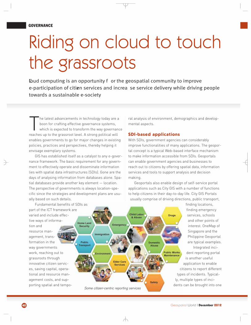
GOVERNANCE
The latest advancements in technology today are aboon for crafting effective governance systems,which is expected to transform the way governance
reaches up to the grassroot level. A strong political willenables governments to go for major changes in existingpolicies, practices and perspectives, thereby helping itenvisage exemplary systems.
GIS has established itself as a catalyst to any e-gover-nance framework. The basic requirement for any govern-ment to effectively operate and disseminate informationlies with spatial data infrastructures (SDIs). Gone are thedays of analysing information from databases alone. Spa-tial databases provide another key element — location.The perspective of governments is always location-spe-cific since the strategies and development plans are usu-ally based on such details.
Fundamental benefits of SDIs aspart of the ICT framework arevaried and include effec-tive ways of informa-tion andresource man-agement, trans-formation in theway governmentswork, reaching out tograssroots throughinnovative citizen servic-es, saving capital, opera-tional and resource man-agement costs, and sup-porting spatial and tempo-
ral analysis of environment, demographics and develop-mental aspects.
SDI-based applications
With SDIs, government agencies can considerablyimprove functionalities of many applications. The geopor-tal concept is a typical Web-based interface mechanismto make information accessible from SDIs. Geoportalscan enable government agencies and businesses toreach out to citizens by offering spatial data, informationservices and tools to support analysis and decision making.
Geoportals also enable design of self-service portalapplications such as City GIS with a number of functionsto help citizens in their day-to-day life. City GIS Portalsusually comprise of driving directions, public transport,
finding locations,finding emergencyservices, schoolsand other points ofinterest. OneMap ofSingapore and thePhilippine Geoportalare typical examples.
Integrated inci-dent reporting portalis another useful
application to enablecitizens to report different
types of incidents. Typical-ly, multiple types of inci-
dents can be brought into one
40 Geospatial World I December 2012
Riding on cloud to touch
the grassroots
Cloud computing is an opportunity f or the geospatial community to improve
e-participation of citizen services and increa se service delivery while driving people
towards a sustainable e-society
Some citizen-centric reporting services
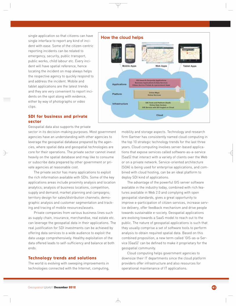
single application so that citizens can havesingle interface to report any kind of inci-dent with ease. Some of the citizen-centricreporting incidents can be related toemergency, security, public transport,public works, child labour etc. Every inci-dent will have spatial reference, hencelocating the incident on map always helpsthe respective agency to quickly respond toand address the incident. Mobile andtablet applications are the latest trendsand they are very convenient to report inci-dents on the spot along with evidence,either by way of photographs or videoclips.
SDI for business and private
sector
Geospatial data also supports the privatesector in its decision-making purposes. Most governmentagencies have an understanding with other agencies toleverage the geospatial database prepared by the agen-cies, where spatial data and geospatial technologies arecore for their operations. The private sector cannot investheavily on the spatial database and may like to consumeor subscribe data prepared by other government or pri-vate agencies at reasonable cost.
The private sector has many applications to exploitthe rich information available with SDIs. Some of the keyapplications areas include proximity analysis and locationanalytics; analysis of business locations, competition,supply and demand; market planning and campaigns;territory design for sales/distribution channels; demo-graphic analysis and customer segmentation and track-ing and tracing of mobile resources/assets.
Private companies from various business lines suchas supply chain, insurance, merchandise, real estate etc.can leverage the geospatial data in their applications. Thereal justification for SDI investments can be achieved byoffering data services to a wide audience to exploit thedata usage comprehensively. Healthy exploitation of thedata offered leads to self-sufficiency and balance at bothends.
Technology trends and solutions
The world is evolving with sweeping improvements intechnologies connected with the Internet, computing,
mobility and storage aspects. Technology and researchfirm Gartner has consistently named cloud computing inthe top 10 strategic technology trends for the last threeyears. Cloud computing involves server-based applica-tions that expose services called software-as-a-service(SaaS) that interact with a variety of clients over the Webor on a private network. Service-oriented architecture(SOA) is being used for enterprise applications, and com-bined with cloud hosting, can be an ideal platform todeploy SDI kind of applications.
The advantage of the powerful GIS server softwareavailable in the industry today, combined with rich fea-tures available in Web 2.0 and complying with opengeospatial standards, gives a great opportunity toimprove e-participation of citizen services, increase serv-ice delivery, offer feedback mechanism and drive peopletowards sustainable e-society. Geospatial applicationsare evolving towards a SaaS model to reach out to thepublic. The nature of geospatial applications is such thatthey usually comprise a set of software tools to performanalysis to obtain required spatial data. Based on thiscombined proposition, a new term called 'GIS-as-a-Ser-vice (GaaS)' can be defined to make it proprietary for thegeospatial community.
Cloud computing helps government agencies todownsize their IT departments since the cloud platformproviders offer infrastructure and also resources foroperational maintenance of IT applications.
Geospatial World I December 2012 41
How the cloud helps
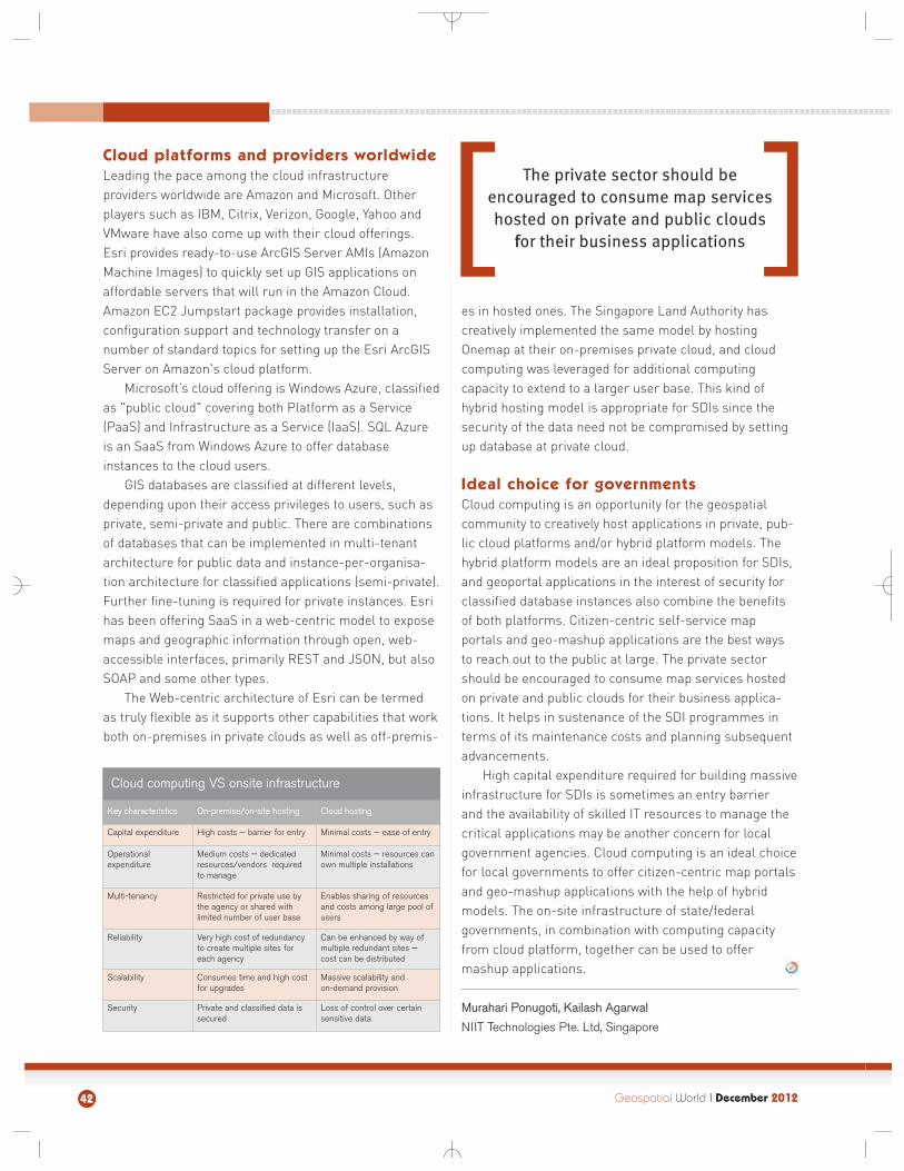
Cloud platforms and providers worldwide
Leading the pace among the cloud infrastructureproviders worldwide are Amazon and Microsoft. Otherplayers such as IBM, Citrix, Verizon, Google, Yahoo andVMware have also come up with their cloud offerings.Esri provides ready-to-use ArcGIS Server AMIs (AmazonMachine Images) to quickly set up GIS applications onaffordable servers that will run in the Amazon Cloud.Amazon EC2 Jumpstart package provides installation,configuration support and technology transfer on a number of standard topics for setting up the Esri ArcGISServer on Amazon's cloud platform.
Microsoft’s cloud offering is Windows Azure, classifiedas "public cloud" covering both Platform as a Service(PaaS) and Infrastructure as a Service (IaaS). SQL Azureis an SaaS from Windows Azure to offer databaseinstances to the cloud users.
GIS databases are classified at different levels,depending upon their access privileges to users, such asprivate, semi-private and public. There are combinationsof databases that can be implemented in multi-tenantarchitecture for public data and instance-per-organisa-tion architecture for classified applications (semi-private).Further fine-tuning is required for private instances. Esrihas been offering SaaS in a web-centric model to exposemaps and geographic information through open, web-accessible interfaces, primarily REST and JSON, but alsoSOAP and some other types.
The Web-centric architecture of Esri can be termedas truly flexible as it supports other capabilities that workboth on-premises in private clouds as well as off-premis-
es in hosted ones. The Singapore Land Authority has creatively implemented the same model by hostingOnemap at their on-premises private cloud, and cloudcomputing was leveraged for additional computingcapacity to extend to a larger user base. This kind ofhybrid hosting model is appropriate for SDIs since thesecurity of the data need not be compromised by settingup database at private cloud.
Ideal choice for governments
Cloud computing is an opportunity for the geospatialcommunity to creatively host applications in private, pub-lic cloud platforms and/or hybrid platform models. Thehybrid platform models are an ideal proposition for SDIs,and geoportal applications in the interest of security forclassified database instances also combine the benefitsof both platforms. Citizen-centric self-service map portals and geo-mashup applications are the best waysto reach out to the public at large. The private sectorshould be encouraged to consume map services hostedon private and public clouds for their business applica-tions. It helps in sustenance of the SDI programmes interms of its maintenance costs and planning subsequentadvancements.
High capital expenditure required for building massiveinfrastructure for SDIs is sometimes an entry barrier and the availability of skilled IT resources to manage thecritical applications may be another concern for localgovernment agencies. Cloud computing is an ideal choicefor local governments to offer citizen-centric map portalsand geo-mashup applications with the help of hybridmodels. The on-site infrastructure of state/federal governments, in combination with computing capacityfrom cloud platform, together can be used to offermashup applications.
Murahari Ponugoti, Kailash Agarwal
NIIT Technologies Pte. Ltd, Singapore
42 Geospatial World I December 2012
Key characteristics On-premise/on-site hosting Cloud hosting
Capital expenditure High costs — barrier for entry Minimal costs — ease of entry
Operationalexpenditure
Medium costs — dedicatedresources/vendors requiredto manage
Minimal costs — resources canown multiple installations
Multi-tenancy Restricted for private use bythe agency or shared with limited number of user base
Enables sharing of resourcesand costs among large pool ofusers
Reliability Very high cost of redundancyto create multiple sites foreach agency
Can be enhanced by way ofmultiple redundant sites — cost can be distributed
Scalability Consumes time and high costfor upgrades
Massive scalability and on-demand provision
Security Private and classified data issecured
Loss of control over certainsensitive data
Cloud computing VS onsite infrastructure
The private sector should beencouraged to consume map serviceshosted on private and public clouds
ffor their business applications
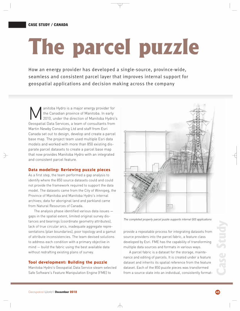
Manitoba Hydro is a major energy provider forthe Canadian province of Manitoba. In early2010, under the direction of Manitoba Hydro's
Geospatial Data Services, a team of consultants fromMartin Newby Consulting Ltd and staff from EsriCanada set out to design, develop and create a parcelbase map. The project team used multiple Esri datamodels and worked with more than 850 existing dis-parate parcel datasets to create a parcel base mapthat now provides Manitoba Hydro with an integratedand consistent parcel feature.
Data modeling: Reviewing puzzle pieces
As a first step, the team performed a gap analysis toidentify where the 850 source datasets could and couldnot provide the framework required to support the datamodel. The datasets came from the City of Winnipeg, theProvince of Manitoba and Manitoba Hydro's internalarchives; data for aboriginal land and parkland camefrom Natural Resources of Canada.
The analysis phase identified various data issues —gaps in the spatial extent, limited original survey dis-tances and bearings (coordinate geometry attributes),lack of true circular arcs, inadequate aggregate repre-sentations (plan boundaries), poor topology and a gamutof attribute inconsistencies. The team devised solutionsto address each condition with a primary objective inmind — build the fabric using the best available datawithout redrafting existing plans of survey.
Tool development: Building the puzzle
Manitoba Hydro's Geospatial Data Service steam selectedSafe Software's Feature Manipulation Engine (FME) to
provide a repeatable process for integrating datasets fromsource providers into the parcel fabric, a feature classdeveloped by Esri. FME has the capability of transformingmultiple data sources and formats in various ways.
A parcel fabric is a dataset for the storage, mainte-nance and editing of parcels. It is created under a featuredataset and inherits its spatial reference from the featuredataset. Each of the 850 puzzle pieces was transformedfrom a source state into an individual, consistently format-
How an energy provider has developed a single-source, province-wide,
seamless and consistent parcel layer that improves internal support for
geospatial applications and decision making across the company
The parcel puzzle
Geospatial World I December 2012 43
CASE STUDY / CANADA
The completed property parcel puzzle supports internal GIS applications
Case Study
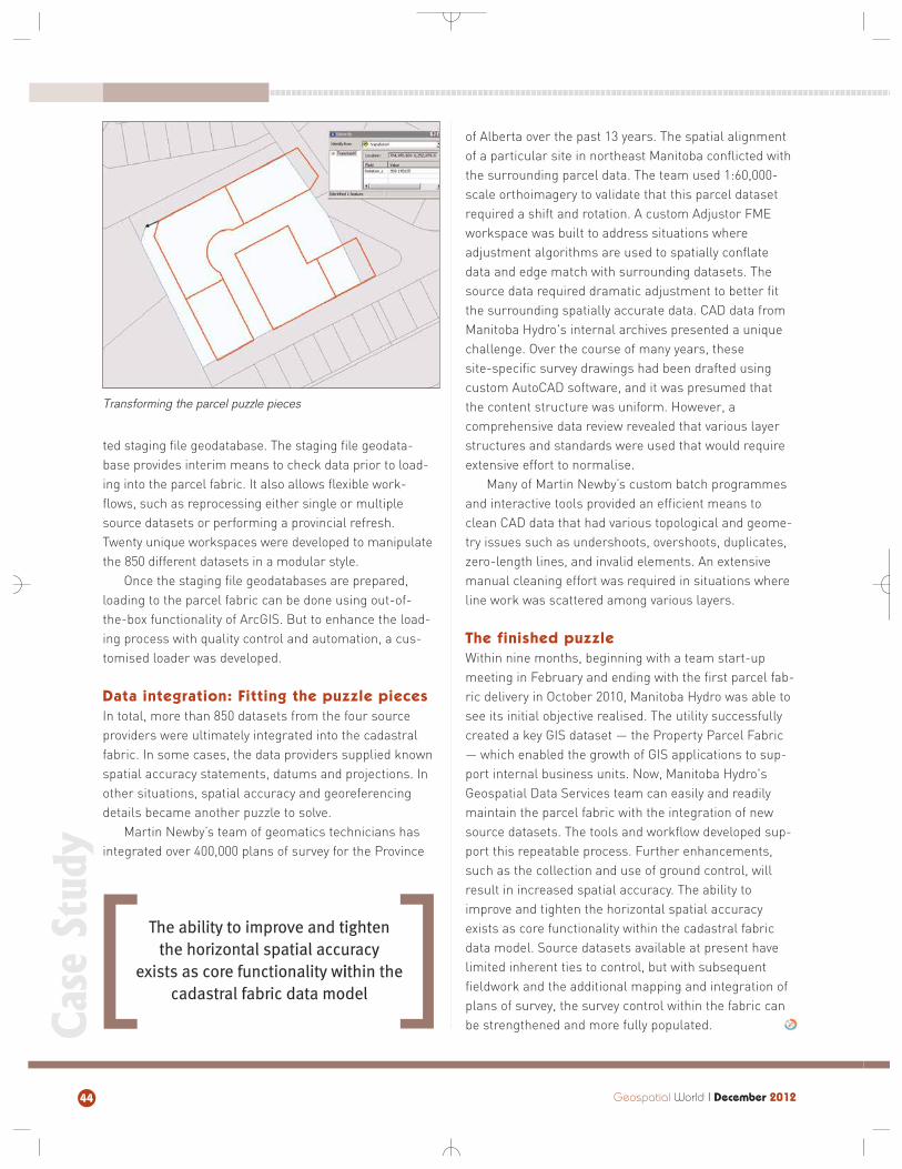
ted staging file geodatabase. The staging file geodata-base provides interim means to check data prior to load-ing into the parcel fabric. It also allows flexible work-flows, such as reprocessing either single or multiplesource datasets or performing a provincial refresh.Twenty unique workspaces were developed to manipulatethe 850 different datasets in a modular style.
Once the staging file geodatabases are prepared,loading to the parcel fabric can be done using out-of-the-box functionality of ArcGIS. But to enhance the load-ing process with quality control and automation, a cus-tomised loader was developed.
Data integration: Fitting the puzzle pieces
In total, more than 850 datasets from the four sourceproviders were ultimately integrated into the cadastralfabric. In some cases, the data providers supplied knownspatial accuracy statements, datums and projections. Inother situations, spatial accuracy and georeferencingdetails became another puzzle to solve.
Martin Newby’s team of geomatics technicians hasintegrated over 400,000 plans of survey for the Province
of Alberta over the past 13 years. The spatial alignmentof a particular site in northeast Manitoba conflicted withthe surrounding parcel data. The team used 1:60,000-scale orthoimagery to validate that this parcel datasetrequired a shift and rotation. A custom Adjustor FMEworkspace was built to address situations where adjustment algorithms are used to spatially conflatedata and edge match with surrounding datasets. Thesource data required dramatic adjustment to better fitthe surrounding spatially accurate data. CAD data fromManitoba Hydro's internal archives presented a uniquechallenge. Over the course of many years, these site-specific survey drawings had been drafted usingcustom AutoCAD software, and it was presumed that the content structure was uniform. However, a comprehensive data review revealed that various layerstructures and standards were used that would requireextensive effort to normalise.
Many of Martin Newby’s custom batch programmesand interactive tools provided an efficient means toclean CAD data that had various topological and geome-try issues such as undershoots, overshoots, duplicates,zero-length lines, and invalid elements. An extensivemanual cleaning effort was required in situations whereline work was scattered among various layers.
The finished puzzle
Within nine months, beginning with a team start-upmeeting in February and ending with the first parcel fab-ric delivery in October 2010, Manitoba Hydro was able tosee its initial objective realised. The utility successfullycreated a key GIS dataset — the Property Parcel Fabric— which enabled the growth of GIS applications to sup-port internal business units. Now, Manitoba Hydro'sGeospatial Data Services team can easily and readilymaintain the parcel fabric with the integration of newsource datasets. The tools and workflow developed sup-port this repeatable process. Further enhancements,such as the collection and use of ground control, willresult in increased spatial accuracy. The ability toimprove and tighten the horizontal spatial accuracyexists as core functionality within the cadastral fabricdata model. Source datasets available at present havelimited inherent ties to control, but with subsequentfieldwork and the additional mapping and integration ofplans of survey, the survey control within the fabric canbe strengthened and more fully populated.
Geospatial World I December 201244
Transforming the parcel puzzle pieces
The ability to improve and tightenthe horizontal spatial accuracy
exists as core functionality wiithin thecadastral fabric data model
Case Study
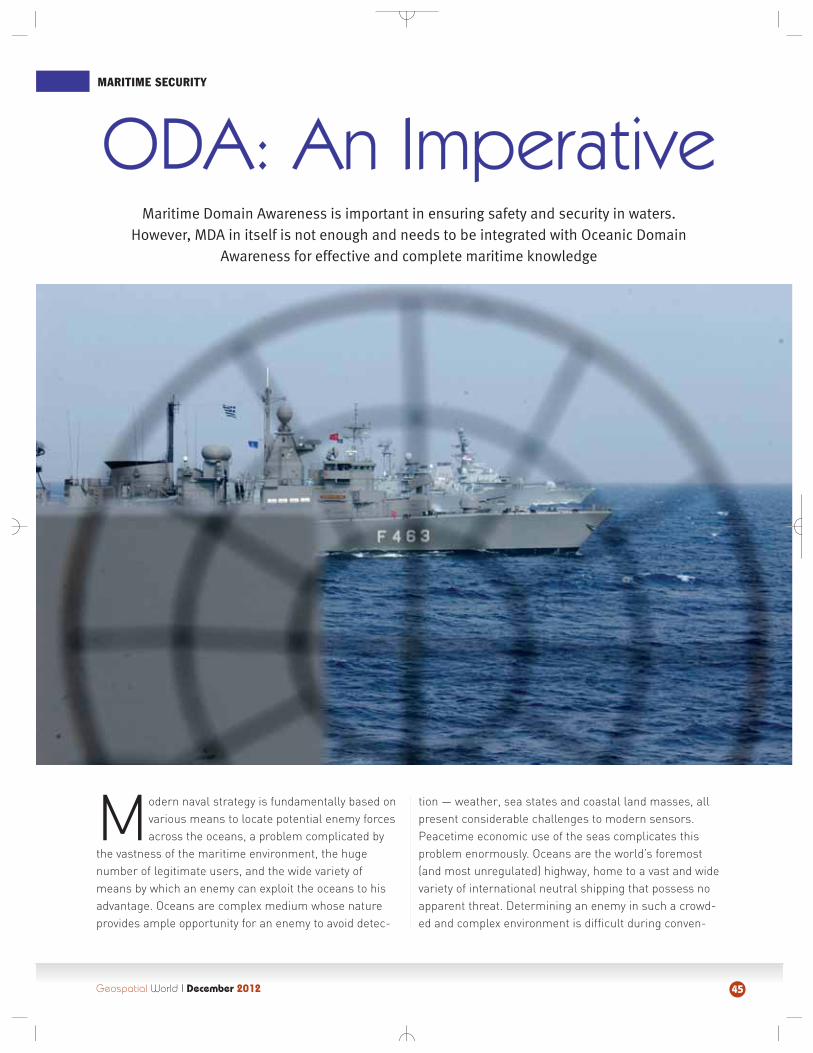
Geospatial World I December 2012
MARITIME SECURITY
45
Modern naval strategy is fundamentally based onvarious means to locate potential enemy forcesacross the oceans, a problem complicated by
the vastness of the maritime environment, the hugenumber of legitimate users, and the wide variety ofmeans by which an enemy can exploit the oceans to hisadvantage. Oceans are complex medium whose natureprovides ample opportunity for an enemy to avoid detec-
tion — weather, sea states and coastal land masses, allpresent considerable challenges to modern sensors.Peacetime economic use of the seas complicates thisproblem enormously. Oceans are the world’s foremost(and most unregulated) highway, home to a vast and widevariety of international neutral shipping that possess noapparent threat. Determining an enemy in such a crowd-ed and complex environment is difficult during conven-
Maritime Domain Awareness is important in ensuring safety and security in waters. However, MDA in itself is not enough and needs to be integrated with Oceanic Domain
Awareness for effective and complete maritime knowledge
ODA: An Imperative
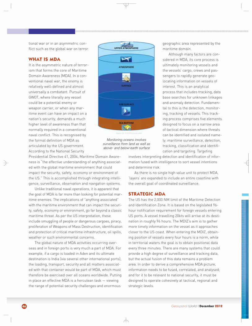
Geospatial World I December 201246
tional war or in an asymmetric con-flict such as the global war on terror.
WHAT IS MDA
It is the asymmetric nature of terror-ism that forms the core of MaritimeDomain Awareness (MDA). In a con-ventional naval war, the enemy isrelatively well-defined and almostuniversally a combatant. Pursuit ofGWOT, where literally any vesselcould be a potential enemy orweapon carrier, or when any mar-itime event can have an impact on anation’s security, demands a muchhigher level of awareness than thatnormally required in a conventionalnaval conflict. This is recognised bythe formal definition of MDA asarticulated by the US government.According to the National SecurityPresidential Directive 41, 2004, Maritime Domain Aware-ness is “the effective understanding of anything associat-ed with the global maritime environment that couldimpact the security, safety, economy or environment ofthe US.” This is accomplished through integrating intelli-gence, surveillance, observation and navigation systems.
Unlike traditional naval operations, it is apparent thatthe goal of MDA is far more than looking for potential mar-itime enemies. The implications of “anything associated”with the maritime environment that can impact the securi-ty, safety, economy or environment, go far beyond a classicmaritime threat. As per the US interpretation, theseinclude smuggling of people or dangerous cargoes, piracy,proliferation of Weapons of Mass Destruction, identificationand protection of critical maritime infrastructure, oil spills,weather or such environmental concerns.
The global nature of MDA activities occurring over-seas and in foreign ports is very much a part of MDA. Forexample, if a cargo is loaded in Aden and its ultimatedestination is India (via several other international ports),the loading, transport, security and all matters associat-ed with that container would be part of MDA, which musttherefore be exercised over all oceans worldwide. Puttingin place an effective MDA is a herculean task — viewingthe range of potential security challenges and enormous
geographic area represented by themaritime domain.
Although many factors are con-sidered in MDA, its core process isultimately monitoring vessels andthe vessels’ cargo, crews and pas-sengers to rapidly generate geo-locating information on vessels ofinterest. This is an analyticalprocess that includes tracking, database searches for unknown linkagesand anomaly detection. Fundamen-tal to this is the detection, monitor-ing, tracking of vessels. This track-ing process comprises five elementsdesigned to focus on a narrow areaof tactical dimension where threatscan be identified and isolated name-ly; maritime surveillance, detection,tracking, classification and identifi-cation and targeting. Targeting
involves interpreting detection and identification of infor-mation fused with intelligence to sort vessel intentionsand determine risk.
As there is no single high value unit to protect MDA,‘layers’ are expanded to include an entire coastline withthe overall goal of coordinated surveillance.
STRATEGIC MDA
The US has the 2,000 NM limit of the Maritime Detectionand Identification Zone. It is based on the legislated 96-hour notification requirement for foreign vessels enteringUS ports. A vessel travelling 20kts will arrive at its desti-nation in roughly 96 hours. The MDIZ’s aim is to gathermore timely information on the vessel as it approachescloser to the US coast. When entering the MDIZ, obtain-ing position of vessels every four hours is a norm, whilein territorial waters the goal is to obtain positional dataevery three minutes. There are many systems that couldprovide a high degree of surveillance and tracking data,but the actual fusion of this data remains a problem area. In order to derive a comprehensive MDA picture,information needs to be fused, correlated, and analysed;and for it to be relevant to national security, it must bedesigned to operate cohesively at tactical, regional andstrategic levels.
Monitoring oceans involves surveillance from land as well asabove- and below-earth surface
At the national level, maritime strategy is critical forlong-term planning, operational insight and providingnational decision makers with support to establish priori-ties, determine strategies of interdependent organisa-tions, allocate national resources and determine level ofoverall maritime threat.
Strategic MDA requires a broad perspective and capabilities at the highest levels of analysis, intelligenceand policy. It requires the realignment of bureaucracy andthe re-tasking of national assets towards the overall goalof global awareness. A centre for strategic MDA musthave experience in multi-organisation operations andprocedures that can transcend the gap between the military, law enforcement and regulatory agencies thatare a part of MDA.
OCEANIC DOMAIN AWARENESS
Scientific study of the oceans originated in the US essen-tially as a function of national security. Navy operationssuccessfully addressed many challenging naval require-ments; but oceanographic inquiry in support of navalneeds also triggered unexpected results. In manyinstances the knowledge of the oceans that was acquiredthrough directed studies - and through complementarylines of inquiry that were enabled by tools developed fornaval oceanographic research - further impacted nationalsecurity in ways that were not anticipated and which tran-
scended tactical and operational significance and couldbe considered of more strategic consequence.
The primary impetus to the rapid development ofoceanography during its 20th century days as a science iswithout doubt the submarine and the fundamentalchanges that occurred when naval warfare became trulythree-dimensional. Prosecuting submarines was feasibleprincipally through the transmission of underwater sound,actively by sonar to echo-locate targets and passively byhydrophones and triangulation. The scope of oceanograph-ic efforts in the pursuit of submarine opened all oceano-graphic disciplines (physical, chemical, biological and geo-logical oceanography) to increased investment, researcheffort and importantly, to integration. Twentieth-centuryoceanography was fundamentally a security-basedendeavour to reduce the opacity of the oceans to anti-sub-marine warfare in WWI, WWII and the cold war, and har-ness that opacity for offensive submarine operations alongwith a host of other security based naval concerns.
Fundamental progress in basic knowledge of theocean sciences has occurred due to advances in sensortechnologies. Understanding of plate tectonics and seafloor spreading was discovered during large scale map-ping of the sea floor after the World War II. This led to therevamping of theories of evolution and structure of theearth. Subsequently, the investigation of mid-oceanridges carried out by submersibles and towed deep sea
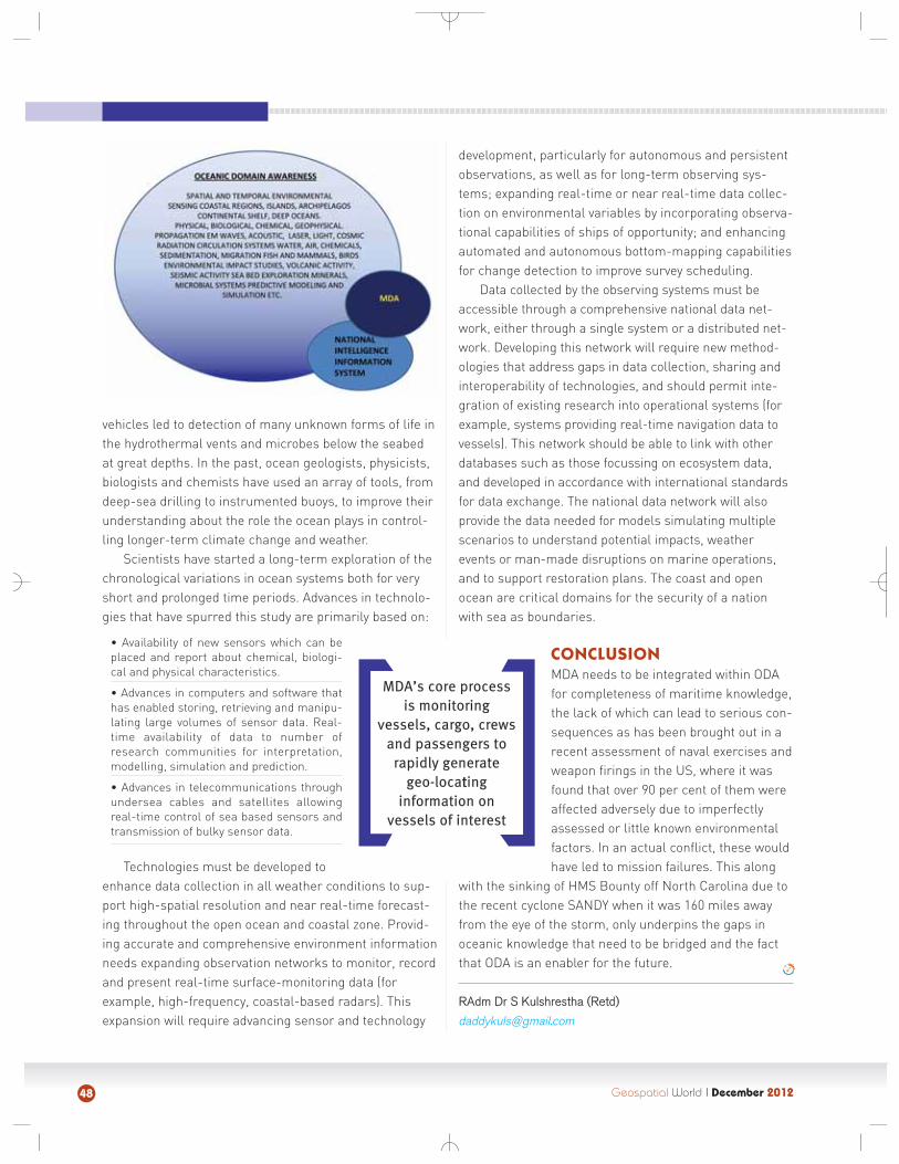
Geospatial World I December 201248
vehicles led to detection of many unknown forms of life inthe hydrothermal vents and microbes below the seabedat great depths. In the past, ocean geologists, physicists,biologists and chemists have used an array of tools, fromdeep-sea drilling to instrumented buoys, to improve theirunderstanding about the role the ocean plays in control-ling longer-term climate change and weather.
Scientists have started a long-term exploration of thechronological variations in ocean systems both for veryshort and prolonged time periods. Advances in technolo-gies that have spurred this study are primarily based on:
• Availability of new sensors which can beplaced and report about chemical, biologi-cal and physical characteristics.
• Advances in computers and software thathas enabled storing, retrieving and manipu-lating large volumes of sensor data. Real-time availability of data to number ofresearch communities for interpretation,modelling, simulation and prediction.
• Advances in telecommunications throughundersea cables and satellites allowingreal-time control of sea based sensors andtransmission of bulky sensor data.
Technologies must be developed toenhance data collection in all weather conditions to sup-port high-spatial resolution and near real-time forecast-ing throughout the open ocean and coastal zone. Provid-ing accurate and comprehensive environment informationneeds expanding observation networks to monitor, recordand present real-time surface-monitoring data (forexample, high-frequency, coastal-based radars). Thisexpansion will require advancing sensor and technology
development, particularly for autonomous and persistentobservations, as well as for long-term observing sys-tems; expanding real-time or near real-time data collec-tion on environmental variables by incorporating observa-tional capabilities of ships of opportunity; and enhancingautomated and autonomous bottom-mapping capabilitiesfor change detection to improve survey scheduling.
Data collected by the observing systems must beaccessible through a comprehensive national data net-work, either through a single system or a distributed net-work. Developing this network will require new method-ologies that address gaps in data collection, sharing andinteroperability of technologies, and should permit inte-gration of existing research into operational systems (forexample, systems providing real-time navigation data tovessels). This network should be able to link with otherdatabases such as those focussing on ecosystem data,and developed in accordance with international standardsfor data exchange. The national data network will alsoprovide the data needed for models simulating multiplescenarios to understand potential impacts, weatherevents or man-made disruptions on marine operations,and to support restoration plans. The coast and openocean are critical domains for the security of a nationwith sea as boundaries.
CONCLUSION
MDA needs to be integrated within ODAfor completeness of maritime knowledge,the lack of which can lead to serious con-sequences as has been brought out in arecent assessment of naval exercises andweapon firings in the US, where it wasfound that over 90 per cent of them wereaffected adversely due to imperfectlyassessed or little known environmentalfactors. In an actual conflict, these wouldhave led to mission failures. This along
with the sinking of HMS Bounty off North Carolina due tothe recent cyclone SANDY when it was 160 miles awayfrom the eye of the storm, only underpins the gaps inoceanic knowledge that need to be bridged and the factthat ODA is an enabler for the future.
RAdm Dr S Kulshrestha (Retd)
MDA’s core processis monitoring
vessels, cargo, crewsand passengers to
rapidly generategeo-locatting
information onvessels of interest

FEB
RU
AR
YM
AR
CHJA
NU
AR
Y
Geospatial World I September 2012
Mark your calendar 2013
January 22 - 24India Geospatial Forum 2013Hyderabad, India
www.indiageospatialforum.org
January 21 - 22Workshop on CityGMLParis, Francehttp://goo.gl/UitFz
January 21 - 23DGI Conference 2013London, UKhttp://goo.gl/Fcl6c
January 24 - 25Geodesign SummitCalifornia, UShttp://geodesignsummit.com
February 4 - 6Second high level forum on GGIMDoha, Qatarhttp://ggim.un.org
February 11 - 13International LiDAR MappingForumDenver, UShttp://www.lidarmap.org/ILMF.aspx
February 25 - 27Esri Federal GIS ConferenceWashington DC, USwww.esri.com/events/federal/index.html
March 5 - 7Mekong Environmental Symposium 2013Ho Chi Minh City, Vietnamhttp://goo.gl/JRemK
March 9Land Surveyors ConferenceMarysville, UShttp://lsaw.org/calendar_details.php?eventid=101
March 11 - 12European Smart Grid CyberLondon, UKhttp://goo.gl/gY2Nf
March 13 - 14Middle East Geospatial Forum 2013Doha, Qatarhttp://www.megf.org
March 13 - 15GEOINFORMATIK 2013Heidelberg, Germanyhttp://geoinformatik2013.de/index.php/en
March 14 - 16IGU Conference on Geoinformatics for Biodiversity Haryana, Indiahttp://goo.gl/ch81M
March 24 - 28ASPRS 2013 Annual ConferenceBaltimore, UShttp://goo.gl/jXxEy
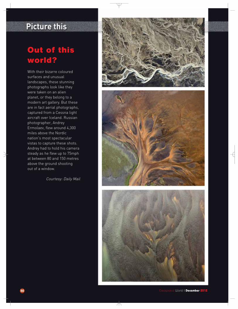
Out of thisworld? With their bizarre colouredsurfaces and unusual landscapes, these stunningphotographs look like theywere taken on an alien planet, or they belong to amodern art gallery. But theseare in fact aerial photographs,captured from a Cessna lightaircraft over Iceland. Russianphotographer, Andrey Ermolaev, flew around 4,300miles above the Nordicnation's most spectacular vistas to capture these shots.Andrey had to hold his camerasteady as he flew up to 75mphat between 80 and 150 metresabove the ground shooting out of a window.
Courtesy: Daily Mail
50 Geospatial World I December 2012
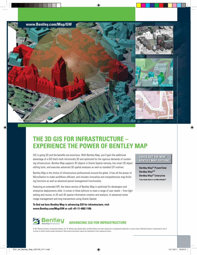
THE 3D GIS FOR INFRASTRUCTURE – EXPERIENCE THE POWER OF BENTLEY MAPGIS is going 3D and the benefits are enormous. With Bentley Map, you’ll gain the additional advantage of a GIS that’s both intrinsically 3D and optimized for the rigorous demands of sustain-ing infrastructure. Bentley Map supports 3D objects in Oracle Spatial natively, has smart 3D object editing tools, and executes advanced 3D spatial analyses as well as standard 2D routines.
Bentley Map is the choice of infrastructure professionals around the globe. It has all the power of MicroStation to make workflows efficient, and includes innovative and comprehensive map finish-ing functions as well as advanced parcel management functionality.
Featuring an extended API, the latest version of Bentley Map is optimized for developers and enterprise deployments alike. It comes in three editions to meet a range of user needs – from light editing and review, to 2D and 3D spatial information creation and analysis, to advanced raster image management and long transactions using Oracle Spatial.
To find out how Bentley Map is advancing GIS for infrastructure, visit www.Bentley.com/Map/GW or call +91-11-4902 1100.
© 2011 Bentley Systems, Incorporated. Bentley, the “B” Bentley logo, Bentley Map, and MicroStation are either registered or unregistered trademarks or service marks of Bentley Systems, Incorporated or one of its direct or indirect wholly owned subsidiaries. Other brands and product names are trademarks of their respective owners.
www.Bentley.com/Map/GW
ADVANCING GIS FOR INFRASTRUCTURE
CHECK OUT THE NEWBENTLEY MAP EDITIONS
Data courtesy City of Quebec
7281_Ad_Bentley_Map_GW-EN_0711.indd 181_Ad_Bentley_Map_GW-EN_0711.indd 1 14-7-2011 16:26:311
Recommended