Disclaimer The Massachusetts Department of Environmental Protection (MassDEP) provides this file for download from its Web site for the convenience of users only. Please be aware that the OFFICIAL versions of all state statutes and regulations (and many of the MassDEP policies) are only available through the State Bookstore or from the Secretary of State’s Code of Massachusetts Regulations (CMR) Subscription Service.
When downloading regulations and policies from the MassDEP Web site, the copy you receive may be different from the official version for a number of reasons, including but not limited to:
• The download may have gone wrong and you may have lost important information. • The document may not print well given your specific software/ hardware setup. • If you translate our documents to another word processing program, it may
miss/skip/lose important information. • The file on this Web site may be out-of-date (as hard as we try to keep everything
current).
If you must know that the version you have is correct and up-to-date, then purchase the document through the state bookstore, the subscription service, and/or contact the appropriate MassDEP program.
310 CMR: DEPARTMENT OF ENVIRONMENTAL PROTECTION
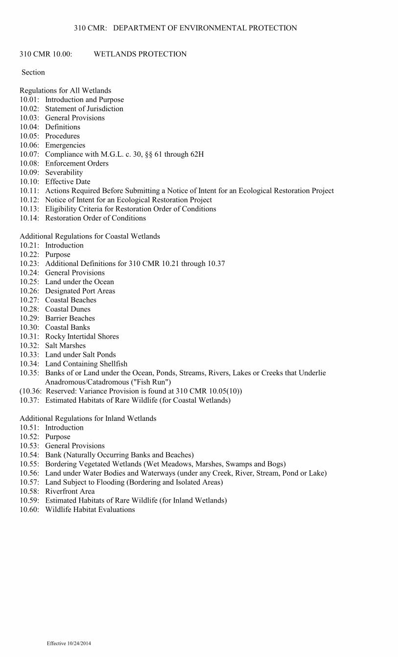
310 CMR 10.00: WETLANDS PROTECTION
Section
Regulations for All Wetlands10.01: Introduction and Purpose10.02: Statement of Jurisdiction10.03: General Provisions10.04: Definitions10.05: Procedures10.06: Emergencies10.07: Compliance with M.G.L. c. 30, §§ 61 through 62H10.08: Enforcement Orders10.09: Severability10.10: Effective Date10.11: Actions Required Before Submitting a Notice of Intent for an Ecological Restoration Project10.12: Notice of Intent for an Ecological Restoration Project10.13: Eligibility Criteria for Restoration Order of Conditions10.14: Restoration Order of Conditions
Additional Regulations for Coastal Wetlands10.21: Introduction10.22: Purpose10.23: Additional Definitions for 310 CMR 10.21 through 10.3710.24: General Provisions10.25: Land under the Ocean10.26: Designated Port Areas10.27: Coastal Beaches10.28: Coastal Dunes10.29: Barrier Beaches10.30: Coastal Banks10.31: Rocky Intertidal Shores10.32: Salt Marshes10.33: Land under Salt Ponds10.34: Land Containing Shellfish10.35: Banks of or Land under the Ocean, Ponds, Streams, Rivers, Lakes or Creeks that Underlie Anadromous/Catadromous ("Fish Run")(10.36: Reserved: Variance Provision is found at 310 CMR 10.05(10))10.37: Estimated Habitats of Rare Wildlife (for Coastal Wetlands)
Additional Regulations for Inland Wetlands10.51: Introduction10.52: Purpose10.53: General Provisions10.54: Bank (Naturally Occurring Banks and Beaches)10.55: Bordering Vegetated Wetlands (Wet Meadows, Marshes, Swamps and Bogs)10.56: Land under Water Bodies and Waterways (under any Creek, River, Stream, Pond or Lake)10.57: Land Subject to Flooding (Bordering and Isolated Areas)10.58: Riverfront Area10.59: Estimated Habitats of Rare Wildlife (for Inland Wetlands)10.60: Wildlife Habitat Evaluations
Effective 10/24/2014
310 CMR: DEPARTMENT OF ENVIRONMENTAL PROTECTION
Appendices: Prefaces to Previous Regulatory Revisions Protection of Wildlife Habitat; 1987 Rights of Way Management; 1987 1983 Regulatory Revisions Fees; 1989 Technical Changes; 1992 Maintenance and Improvement of Land in Agricultural Use; 1993 Preface to Wetlands Regulatory Revisions Effective January 1, 1994
Effective 10/24/2014
310 CMR: DEPARTMENT OF ENVIRONMENTAL PROTECTION
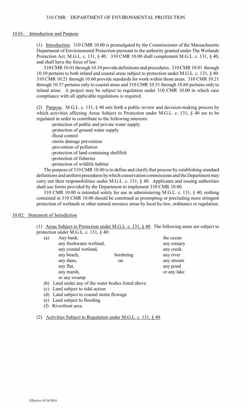
10.01: Introduction and Purpose
(1) Introduction. 310 CMR 10.00 is promulgated by the Commissioner of the MassachusettsDepartment of Environmental Protection pursuant to the authority granted under The WetlandsProtection Act, M.G.L. c. 131, § 40. 310 CMR 10.00 shall complement M.G.L. c. 131, § 40,and shall have the force of law.
310 CMR 10.01 through 10.10 provide definitions and procedures. 310 CMR 10.01 through10.10 pertains to both inland and coastal areas subject to protection under M.G.L. c. 131, § 40.310 CMR 10.21 through 10.60 provide standards for work within those areas. 310 CMR 10.21through 10.37 pertains only to coastal areas and 310 CMR 10.51 through 10.60 pertains only toinland areas. A project may be subject to regulation under 310 CMR 10.00 in which casecompliance with all applicable regulations is required.
(2) Purpose. M.G.L. c. 131, § 40 sets forth a public review and decision-making process bywhich activities affecting Areas Subject to Protection under M.G.L. c. 131, § 40 are to beregulated in order to contribute to the following interests:
-protection of public and private water supply-protection of ground water supply-flood control-storm damage prevention-prevention of pollution-protection of land containing shellfish-protection of fisheries-protection of wildlife habitat
The purpose of 310 CMR 10.00 is to define and clarify that process by establishing standarddefinitions and uniform procedures by which conservation commissions and the Department maycarry out their responsibilities under M.G.L. c. 131, § 40. Applicants and issuing authoritiesshall use forms provided by the Department to implement 310 CMR 10.00.
310 CMR 10.00 is intended solely for use in administering M.G.L. c. 131, § 40; nothingcontained in 310 CMR 10.00 should be construed as preempting or precluding more stringentprotection of wetlands or other natural resource areas by local by-law, ordinance or regulation.
10.02: Statement of Jurisdiction
(1) Areas Subject to Protection under M.G.L. c. 131, § 40. The following areas are subject toprotection under M.G.L. c. 131, § 40:
(a) Any bank, the oceanany freshwater wetland, any estuaryany coastal wetland, any creekany beach, bordering any riverany dune, on any streamany flat, any pondany marsh, or any lakeor any swamp
(b) Land under any of the water bodies listed above(c) Land subject to tidal action(d) Land subject to coastal storm flowage(e) Land subject to flooding(f) Riverfront area.
(2) Activities Subject to Regulation under M.G.L. c. 131, § 40.
Effective 10/24/2014
310 CMR: DEPARTMENT OF ENVIRONMENTAL PROTECTION
(a) Activities Within the Areas Subject to Protection under M.G.L. c. 131, § 40. Anyactivity proposed or undertaken within an area specified in 310 CMR 10.02(1), which willremove, fill, dredge or alter that area, is subject to Regulation under M.G.L. c. 131, § 40 andrequires the filing of a Notice of Intent except:
1. minor activities within the riverfront area meeting the requirement of 310 CMR10.02(2)(b)1. and 2.; and
Effective 10/24/2014
310 CMR: DEPARTMENT OF ENVIRONMENTAL PROTECTION
10.02: continued
2. activities conducted to maintain, repair or replace, but not substantially change orenlarge an existing and lawfully located structure or facility used in the service of thepublic and used to provide electric, gas, water, sewer, telephone, telegraph and othercommunication services, provided said work utilizes the best practical measures to avoidor minimize impacts to wetland resource areas outside the footprint of said structure orfacility. A project proponent claiming that work to remove, fill, dredge or alter an areaspecified in 310 CMR 10.02(1) does not require the filing of a Notice of Intent has theburden of establishing that the work is not subject to Regulation under M.G.L. c. 131,§ 40.
(b) Activities Within the Buffer Zone. Any activity other than minor activities identifiedin 310 CMR 10.02(2)(b)2. proposed or undertaken within 100 feet of an area specified in310 CMR 10.02(1)(a) (hereinafter called the Buffer Zone) which, in the judgment of theissuing authority, will alter an Area Subject to Protection under M.G.L. c. 131, § 40 is subjectto regulation under M.G.L. c. 131, § 40 and requires the filing of a Notice of Intent. (See also310 CMR 10.05(3)(a)2.). The areas subject to jurisdiction identified in 310 CMR10.02(1)(b) through (f) do not have a buffer zone.
1. Minor activities, as described in 310 CMR 10.02(2)(b)2., within the buffer zone andoutside any areas specified in 310 CMR 10.02(1)(a) through (e) are not otherwise subjectto regulation under M.G.L. c. 131, § 40 provided that the work is performed: solelywithin the buffer zone, as prescribed in 310 CMR 10.02(2)(b)2.a. through q., in a mannerso as to reduce the potential for any adverse impacts to the resource area duringconstruction, and with post-construction measures implemented to stabilize any disturbedareas. Factors to consider when measuring the potential for adverse impacts to resourceareas include the extent of the work, the proximity to the resource area, the need forerosion controls, and the measures employed to prevent adverse impacts to resource areasduring and following the work.2. The following minor activities, provided that they comply with 310 CMR10.02(2)(b)1., are not otherwise subject to regulation under M.G.L. c. 131, § 40:
a. Unpaved pedestrian walkways less than 30 inches wide for private use and lessthan three feet wide for public access on conservation property;b. Fencing, provided it will not constitute a barrier to wildlife movement;stonewalls; stacks of cordwood;c. Vista pruning, provided the activity is located more than 50 feet from the meanannual high water line within a Riverfront Area or from Bordering VegetatedWetland, whichever is farther. (Pruning of landscaped areas is not subject tojurisdiction under 310 CMR 10.00.);d. Plantings of native species of trees, shrubs, or groundcover, but excluding turflawns;e. The conversion of lawn to uses accessory to residential structures such as decks,sheds, patios, pools, replacement of a basement bulkhead and the installation of aramp for compliance with accessibility requirements, provided the activity, includingmaterial staging and stockpiling is located more than 50 feet from the mean annualhigh-water line within the Riverfront Area, Bank or from Bordering VegetatedWetland, whichever is farther, and erosion and sedimentation controls areimplemented during construction. The conversion of such uses accessory to existingsingle family houses to lawn is also allowed. (Mowing of lawns is not subject tojurisdiction under 310 CMR 10.00);f. The conversion of impervious to vegetated surfaces, provided erosion andsedimentation controls are implemented during construction;g. Activities that are temporary in nature, have negligible impacts, and are necessary
Effective 10/24/2014

310 CMR: DEPARTMENT OF ENVIRONMENTAL PROTECTION
for planning and design purposes (e.g., installation of monitoring wells, exploratoryborings, sediment sampling and surveying and percolation tests for septic systemsprovided that resource areas are not crossed for site access);h. Installation of directly embedded utility poles and associated anchors, push bracesor grounding mats/rods along existing paved or unpaved roadways and privateroadways/driveways, and their existing maintained shoulders, or within existingrailroad rights-of-way, provided that all work is conducted within ten feet of the roador driveway shoulder and is a minimum of ten feet from the edge of the Bank orBordering Vegetated Wetland and as far away from resource areas as practicable,with no additional tree clearing or substantial grading within the buffer zone, andprovided that all vehicles and machinery are located within the roadway surfaceduring work;
Effective 10/24/2014
310 CMR: DEPARTMENT OF ENVIRONMENTAL PROTECTION
10.02: continued
i. Installation of underground utilities (e.g., electric, gas, water) within existingpaved or unpaved roadways and private roadways/driveways, provided that all workis conducted within the roadway or driveway and that all trenches are closed at thecompletion of each workday;j. Installation and repair of underground sewer lines within existing paved orunpaved roadways and private roadways/driveways, provided that all work isconducted within the roadway or driveway and that all trenches are closed at the endof completion of each workday;k. Installation of new equipment within existing or approved electric or gas facilitieswhen such equipment is contained entirely within the developed/disturbed existingfenced yard;l. Installation of access road gates at public or private road entrances to existingutility right-of-way access roads, provided that all vehicles and machinery are locatedwithin the roadway surface during work;m. Removal of existing utility equipment (poles, anchors, lines) along existing orapproved roadways or within existing or approved electric, water or gas facilities,provided that all vehicles and machinery are located within the roadway surfaceduring work;n. Vegetation cutting for road safety maintenance, limited to the following:
i. Removal of diseased or damaged trees or branches that pose an immediate andsubstantial threat to driver safety from falling into the roadway;ii. Removal of shrubbery or branches to maintain clear guardrails; such removalshall extend no further than six feet from the rear of the guardrail;iii. Removal of shrubbery or branches to maintain sight distances at existingintersections; such removal shall be no farther than five feet beyond the "sighttriangles" established according to practices set forth in American Association ofState Highway and Transportation Officials (AASHTO) A Policy on GeometricDesign of Highways and Streets, 2011, 6th edition, and such removal is aminimum of ten feet from a resource area, other than Riverfront Area; andiv. Removal of shrubbery, branches, or other vegetation required to maintain thevisibility of road signs and signals.
Cuttings of shrubs and branches from mature trees will be performed withsuitable horticultural equipment and methods that do not further damage thetrees. To prevent the possible export of invasive plants, cut vegetation should bechipped and evenly spread on site, provided the chips are spread outside thebuffer zone, and raked to a depth not to exceed three inches, clear of all drainageways. Alternatively, all cuttings and slash shall be removed from the site andproperly disposed;
o. Installation, repair, replacement or removal of signs, signals, sign and signal postsand associated supports, braces, anchors, and foundations along existing pavedroadways and their shoulders, provided that work is conducted as far from resourceareas as practicable, and is located a minimum of ten feet from a resource area, anyexcess soil is removed from the project location, and any disturbed soils arestabilized as appropriate;p. Pavement repair, resurfacing, and reclamation of existing roadways within theright-of-way configuration provided that the roadway and shoulders are not widened,no staging or stockpiling of materials, all disturbed road shoulders are stabilizedwithin 72 hours of completion of the resurfacing or reclamation, and no work on thedrainage system is performed, other than adjustments and/or repairs to respective
Effective 10/24/2014
310 CMR: DEPARTMENT OF ENVIRONMENTAL PROTECTION
structures within the roadway;q. The repair or replacement of an existing and lawfully located driveway servicingnot more than two dwelling units provided that all work remains within the existinglimits of the driveway and all surfaces are permanently stabilized within 14 days offinal grade.
3. Activities within the buffer zone which do not meet the requirements of 310 CMR10.02(2)(b)1. and 2. are subject to preconstruction review through the filing of aDetermination of Applicability to clarify jurisdiction or a Notice of Intent under theprovisions of 310 CMR 10.05(4) and 10.53(1).
Effective 10/24/2014
310 CMR: DEPARTMENT OF ENVIRONMENTAL PROTECTION
10.02: continued
(c) Notwithstanding the provisions of 310 CMR 10.02(1) and (2)(a) and (b), stormwatermanagement systems designed, constructed, installed, operated, maintained, and/or improvedas defined in 310 CMR 10.04 in accordance with the Stormwater Management Standards asprovided in the Stormwater Management Policy (1996) or 310 CMR 10.05(6)(k) through (q)do not by themselves constitute Areas Subject to Protection under M.G.L. c. 131, § 40 orBuffer Zone provided that:
1. the system was designed, constructed, installed, and/or improved as defined in310 CMR 10.04 on or after November 18, 1996; and2. if the system was constructed in an Area Subject to Protection under M.G.L. c. 131,§ 40 or Buffer Zone, the system was designed, constructed, and installed in accordancewith all applicable provisions in 310 CMR 10.00.
(d) Activities Outside the Areas Subject to Protection under M.G.L. c. 131, § 40 and theBuffer Zone. Any activity proposed or undertaken outside the areas specified in 310 CMR10.02(1) and outside the Buffer Zone is not subject to regulation under M.G.L. c. 131, § 40and does not require the filing of a Notice of Intent unless and until that activity actuallyalters an Area Subject to Protection under M.G.L. c. 131, § 40. In the event that the issuingauthority determines that such activity has in fact altered an Area Subject to Protection underM.G.L. c. 131, § 40, it may require the filing of a Notice of Intent and/or issuance of anEnforcement Order and shall impose such conditions on the activity or any portion thereofas it deems necessary to contribute to the protection of the interests identified inM.G.L. c. 131, § 40.
(3) Notwithstanding the provisions of 310 CMR 10.02(1) and (2), the maintenance of astormwater management system constructed and/or improved as defined in 310 CMR 10.04 fromNovember 18, 1996 through January 1, 2008, in accordance with the Stormwater ManagementStandards, as provided in the Massachusetts Stormwater Policy, issued by the Department onNovember 18, 1996 or on or after January 2, 2008, in accordance with the StormwaterManagement Standards as provided in 310 CMR 10.05(6)(k) through (q) is not subject toregulation under M.G.L. c. 131, § 40 provided that:
(a) if the system was constructed in an Area Subject to Protection under M.G.L. c. 131, § 40or associated Buffer Zone, the system was constructed in accordance with all applicableprovisions of 310 CMR 10.00;(b) the work to maintain the stormwater management system is limited to maintenance ofa stormwater management system as defined in 310 CMR 10.04; and(c) said work utilizes best practical measures to avoid and minimize impacts to wetlandresource area outside the footprint of the stormwater management system.
Notwithstanding the provisions of 310 CMR 10.02(1) and (2), any bordering vegetatedwetland, bank, land under water, land subject to flooding, or riverfront area created solelyfor the purpose of stormwater management shall not require the filing of a Notice of Intentto maintain the stormwater management system, provided that:
1. the work to maintain the stormwater management system is limited to themaintenance of a stormwater management system as defined in 310 CMR 10.04;2. the stormwater management system was proposed in a Notice of Intent filed beforeJanuary 2, 2008, and conforms to an Order of Conditions issued after April 1, 1983;3. the area is not altered for other purposes; and4. said work utilizes best practical measures to avoid and minimize impacts to wetlandresource areas outside the footprint of the stormwater management system.
(4) Notwithstanding anything to the contrary in 310 CMR 10.00, work other than maintenancethat may alter or affect a stormwater management system (including work to repair or replace
Effective 10/24/2014
310 CMR: DEPARTMENT OF ENVIRONMENTAL PROTECTION
the stormwater management system, and any change to the site that increases the total or peakvolume of stormwater managed by the system, directs additional stormwater to the system,and/or increases the volume of stormwater exposed to land uses with higher potential pollutantloads) that was designed, constructed, installed and/or improved after November 18, 1996, asdefined in 310 CMR 10.04, and if constructed in an Area Subject to Protection underM.G.L. c. 131, § 40 or Buffer Zone, as described in 310 CMR 10.02(1) and (2)(a) through (d),the system was constructed in accordance with all applicable provisions of 310 CMR 10.00,solely for the purpose of stormwater management, in accordance with the StormwaterManagement Standards as provided in the Stormwater Management Policy (1996) or 310 CMR10.05(6)(k) through (q), may be permitted through an Order of Conditions, or NegativeDetermination of Applicability provided that the work:
Effective 10/24/2014
310 CMR: DEPARTMENT OF ENVIRONMENTAL PROTECTION
10.02: continued
(a) at a minimum provides the same capacity as the original design to attenuate peakdischarge rates, recharge the ground water, and remove total suspended solids;(b) complies with the Stormwater Management Standards as provided in 310 CMR10.05(6)(k) through (q); and(c) meets all the applicable performance standards for any work that expands the existingstormwater management system into an Area Subject to Protection under M.G.L. c. 131, § 40or Buffer Zone as described in 310 CMR 10.02(1) and (2)(a) through (d).
(5) For purposes of 310 CMR 10.02(2)(c) and (4), the applicant has the burden of proving thatthe proposed project involves a stormwater management system designed, constructed, installed,operated, maintained and/or improved as defined at 310 CMR 10.04 in accordance with theStormwater Management Standards as provided in the Stormwater Management Policy (1996)or 310 CMR 10.05(6)(k) through (q) and that the system was designed, constructed, installedand/or improved on or after November 18, 1996. The applicant also has the burden ofestablishing whether said stormwater management system was installed in an Area Subject toProtection under M.G.L. c. 131, § 40 or associated Buffer Zone, and, if so, that the system wasconstructed in accordance with all applicable provisions of 310 CMR 10.00. An applicant shalluse the best evidence available to meet the burden of proof required. For purposes of 310 CMR10.02(2)(c) and (4), the best evidence is the Order of Conditions, Order of Resource AreaDelineation or Determination of Applicability for the project served by the stormwatermanagement system together with the plans referenced in and accompanying such Order orDetermination, and, if applicable, the Certificate of Compliance. If the best evidence isavailable, the date the system was designed shall be the date the Notice of Intent, Request forDetermination or Notice of Resource Area Delineation was filed. If the best evidence is notavailable, the applicant shall rely on other credible evidence to meet the required burden of proofsuch as local approval of the stormwater management system along with the plans referenced inand accompanying said approval and any wetland conservancy maps and wetland change mapsfor the relevant time period published by the Department on MassGIS.
CommentaryThe Department has determined that activities within Areas Subject to Protection under
M.G.L. c. 131, § 40 are so likely to result in the removing, filling, dredging or altering of thoseareas that preconstruction review is always justified, and that the issuing authority shall thereforealways require the filing of a Notice of Intent for said activities.
The Department has determined that activities within 100 feet of those areas specified in310 CMR 10.02(1)(a) are sufficiently likely to alter said areas that preconstruction review maybe necessary. Therefore, a request for a Determination of Applicability must be filed for someactivities within the Buffer Zone. The issuing authority shall then make a determination as towhether the activity so proposed will alter an Area Subject to Protection under M.G.L. c. 131,§ 40 and, if so, shall require the filing of a Notice of Intent for said activities. The issuingauthority shall not require the filing of a Notice of Intent if it determines that the activityproposed within the Buffer Zone will not alter an Area Subject to Protection underM.G.L. c. 131, § 40.
The Department has determined that activities outside the Areas Subject to Protection underM.G.L. c. 131, § 40 and outside the Buffer Zone are so unlikely to result in the altering of AreasSubject to Protection under M.G.L. c. 131, § 40 that preconstruction review is not required, andtherefore the issuing authority shall not regulate said activities unless and until they actuallyresult in the altering of an Area Subject to Protection under M.G.L. c. 131, § 40.
Effective 10/24/2014
310 CMR: DEPARTMENT OF ENVIRONMENTAL PROTECTION
10.03: General Provisions
(1) Burden of Proof.(a) Any person who files a Notice of Intent to perform any work within an Area Subject toProtection under M.G.L. c. 131, § 40 or within the Buffer Zone has the burden ofdemonstrating to the issuing authority:
1. that the area is not significant to the protection of any of the interests identified inM.G.L. c. 131, § 40; or2. that the proposed work within a resource area will contribute to the protection of theinterests identified in M.G.L. c. 131, § 40 by complying with the general performancestandards established by 310 CMR 10.00 for that area.
Effective 10/24/2014
310 CMR: DEPARTMENT OF ENVIRONMENTAL PROTECTION
10.03: continued
3. that proposed work within the buffer zone will contribute to the protection of theinterests identified in M.G.L. c. 131, § 40, except that proposed work which lies bothwithin the riverfront area and within all or a portion of the buffer zone to anotherresource area shall comply with the performance standards for riverfront areas at310 CMR 10.58. For minor activities as specified in 310 CMR 10.02(2)b.1. within theriverfront area or the buffer zone to another resource area, the Department hasdetermined that additional conditions are not necessary to contribute to the protection ofthe interests identified in M.G.L. c. 131, § 40.
(b) Any person who requests the issuing authority to regulate work taking place outside anArea Subject to Protection under M.G.L. c. 131, § 40 and outside the Buffer Zone has theburden of demonstrating to the satisfaction of the issuing authority that the work has in factaltered an Area Subject to Protection under M.G.L. c. 131, § 40.
(2) Burden of Going Forward. The burden of going forward means having to produce at leastsome credible evidence from a competent source in support of the position taken. This burdenshall be upon the person contesting the Department's position when the Department has beenrequested to hold an adjudicatory hearing. In the event that under the provisions of 310 CMR10.03 two or more persons have the burden of going forward, said burden may be placed on allor any number of them, in the discretion of the hearing officer.
(3) Presumption Concerning 310 CMR 15.000: The State Environmental Code, Title 5:Standard Requirements for the Siting, Construction, Inspection, Upgrade and Expansion ofOn-site Sewage Treatment and Disposal Systems and for the Transport and Disposal of Septage.A subsurface sewage disposal system that is to be constructed in compliance with therequirements of 310 CMR 15.000: The State Environmental Code, Title 5: StandardRequirements for the Siting, Construction, Inspection, Upgrade and Expansion of On-siteSewage Treatment and Disposal Systems and for the Transport and Disposal of Septage, or morestringent local board of health requirements, shall be presumed to protect the eight interestsidentified in M.G.L. c. 131, § 40, but only if none of the components of said system is locatedwithin the following resource areas:
(a) Coastal.1. coastal bank;2. coastal beach;3. coastal dune;4. salt marsh.
(b) Inland.1. wet meadows creek;2. marsh bordering river;3. swamp on any stream;4. bog pond;
lake.
and only if the soil absorption system of said system is set back at least 50 feet horizontally fromthe boundary of said areas, as required by 310 CMR 15.211: Minimum Setback Distances, ora greater distance as may be required by more stringent local ordinance, by-law or regulation.To protect wildlife habitat within riverfront areas, the soil absorption system shall not be locatedwithin 100 feet of the mean annual high-water line unless there is no alternative location on thelot which conforms to 310 CMR 15.000: The State Environmental Code, Title 5: StandardRequirements for the Siting, Construction, Inspection, Upgrade and Expansion of On-site
Effective 10/24/2014

310 CMR: DEPARTMENT OF ENVIRONMENTAL PROTECTION
Sewage Treatment and Disposal Systems and for the Transport and Disposal of Septage withoutrequiring a variance as determined by the local Board of Health, with less adverse effects onresource areas.
This presumption, however, shall apply only to impacts of the discharge from a sewagedisposal system, and not to the impacts from construction of that system, such as erosion andsiltation from the excavation, placement of fill, or removal of vegetation. Impacts fromconstruction shall be minimized by the placement of erosion and sedimentation controls duringexcavation, limiting the placement of fill, confining the removal of vegetation to that necessaryfor the footprint of the system, and taking other measures deemed necessary by the issuingauthority.
Effective 10/24/2014
310 CMR: DEPARTMENT OF ENVIRONMENTAL PROTECTION
10.03: continued
The setback distance specified above shall be determined by measuring from the boundaryof the area in question, from the contour at the mean annual flood elevation in inland areas, orfrom the top of a coastal bank or the contour at the highest spring tide elevation in coastal areas,whichever is further from the water body.
The setback distance specified above shall not be required for the renovation or replacement(but is required for the substantial enlargement) of septic systems constructed prior to theeffective date of 310 CMR 10.00, provided no alternative location is available on the lot andsuch work has been approved by the local board of health or the Department, as required by law.
This presumption may be overcome only by credible evidence from a competent source thatcompliance with 310 CMR 15.000: The State Environmental Code, Title 5: StandardRequirements for the Siting, Construction, Inspection, Upgrade and Expansion of On-siteSewage Treatment and Disposal Systems and for the Transport and Disposal of Septage or morestringent local requirements will not protect the interests identified in M.G.L. c. 131, § 40.
(4) Presumption Concerning Point-source Discharges. If the Department has issued a permitpursuant to M.G.L. c. 21, § 43, in conjunction with a federal NPDES (National PollutantDischarge Elimination System) permit for any new point-source discharge of pollutants, or willissue such a permit, prior to commencement of the discharge, the effluent limitations establishedin the permit shall be presumed to protect the eight interests identified in M.G.L. c. 131, § 40with respect to the effects of the discharge on water quality. The permit and any subsequentamendments thereto shall be referenced in the Order and deemed incorporated therein.
This presumption shall apply only to impacts of the discharge from the source, and not toimpacts from construction of the source.
This presumption may be overcome only by credible evidence from a competent source thatsaid effluent limitations will not protect the interests identified in M.G.L. c. 131, § 40.
(5) Presumption of Significance. Each Area Subject to Protection under M.G.L. c. 131, § 40is presumed to be significant to one or more of the interests identified in M.G.L. c. 131, § 40.These presumptions are rebuttable and are set forth in 310 CMR 10.21 through 10.60.
For riverfront areas, the issuing authority may find that the presumptions of significance arepartially rebutted as provided in 310 CMR 10.58(3).
(6) Presumption Concerning Application of Herbicides.(a) Any application of herbicides within any Area Subject to Protection underM.G.L. c. 131, § 40 or the Buffer Zone associated with a structure or facility which is:
1. existing and lawfully located;2. used in the service of the public; and3. used to provide electric, gas, water, sewer, telephone, telegraph and othertelecommunication services
shall be presumed to constitute work performed in the course of maintaining such structureor facility, and shall be accorded the exemption of such work under M.G.L. c. 131, § 40, onlyif the application of herbicides to that structure or facility is performed in accordance withsuch plans as are required by the Department of Food and Agriculture pursuant to 333 CMR11.00: Rights of Way Management, effective July 10, 1987.(b) Any application of herbicides within the Buffer Zone, other than as provided in310 CMR 10.03(6)(a), shall be presumed not to alter an Area Subject to Protection underM.G.L. c. 131, § 40, only if the work is performed in accordance with such plans as arerequired by the Department of Food and Agriculture pursuant to 333 CMR 11.00: Rightsof Way Management, effective July 10, 1987. This presumption shall apply only if the
Effective 10/24/2014

310 CMR: DEPARTMENT OF ENVIRONMENTAL PROTECTION
person proposing such activity has requested and obtained a determination of the boundariesof the Buffer Zone and Areas Subject to Protection under M.G.L. c. 131, § 40 in accordancewith 310 CMR 10.05(3)(a)1. and 2.; and has submitted that determination as part of theVegetation Management Plan.(c) Any application of herbicides for management of rights of way within a riverfront areanot subject to 310 CMR 10.03(6)(a) or (b), provided the area is outside any other resourcearea and qualifies under the provisions of 310 CMR 10.58(6)(a), shall be accorded anexemption of such work under M.G.L. c. 131, § 40, provided that the application ofherbicides is performed in accordance with such plans as are required by the Department ofFood and Agriculture pursuant to 333 CMR 11.00: Rights of Way Management.
Effective 10/24/2014
310 CMR: DEPARTMENT OF ENVIRONMENTAL PROTECTION
10.03: continued
(7) Fees.(a) General Fee Provisions.
1. Notices of Intent. All Notices of Intent filed pursuant to 310 CMR 10.00 shall beaccompanied by a filing fee, the amount of which shall be determined by 310 CMR4.00: Timely Action Schedule and Fee Provisions and a brief statement indicating howthe applicant calculated the fee. 50% of any filing fee in excess of $25.00 shall be madepayable, by check or money order, to the Commonwealth of Massachusetts and shall besent to the DEP Lock Box accompanied by the Notice of Intent Fee Transmittal Form.The remainder of said fee shall be made payable, by check or money order, to the city ortown in which the work is proposed.2. Requests for Action by the Department. Any person who files a Request for aSuperseding Determination of Applicability (310 CMR 10.05(3)(c)), a Request forSuperseding Order of Conditions or superseding Order of Resource Area Delineation(310 CMR 10.05(7)(a)), a Request for Adjudicatory Hearing (310 CMR 10.05(7)(j)), aRequest to Intervene in any Adjudicatory Hearing (310 CMR 1.01(9)(a)), or a Requestfor a Variance, (310 CMR 10.05(10)), (see also 310 CMR 10.03(7)(e)), shallsimultaneously submit a filing fee, in the amount specified by 310 CMR 4.00: TimelyAction Schedule and Fee Provisions. All such fees shall be paid by check or moneyorder payable to the Commonwealth of Massachusetts and shall be sent to the DEP LockBox, accompanied by the Request for Departmental Action Fee Transmittal Form. Acopy of the Request for Departmental Action Fee Transmittal Form and a copy of thecheck shall accompany the request for Departmental action.
(b) Specific Provisions for Notice of Intent Fees. In accordance with General Instructionsfor Completing a Notice of Intent and Abbreviated Notice of Intent, the minimum submittalrequirements shall include payment of the filing fee specified in 310 CMR 10.03(7)(c). Aconservation commission shall notify, in writing, the appropriate Department RegionalOffice and the applicant when the correct filing fee has not been paid to the city or town andthe filing is therefore incomplete. Said notification shall specify the correct fee amount. TheDepartment shall also notify, in writing, the applicant and the conservation commission whenthe fee due to the Department has not been paid to the Department and the filing is thereforeincomplete. Said notification shall specify the fee due to the Department. The fee will bebased on the initial project design as proposed in the Notice of Intent.
1. Disputes over Notice of Intent Filing Fees. Whenever the conservation commissionor the Department determines that an inadequate fee has been paid, the time period forthe conservation commission or the Department to act shall be stayed until the balanceof the fee is paid.
a. Where, in the opinion of the conservation commission or the Department, lessthan the full filing fee has been included with the Notice of Intent, the Notice shallbe deemed complete (assuming all other minimum submittal requirements have beenmet), and the stay shall be lifted, upon payment of the additional fee specified by theDepartment or the conservation commission. If the applicant has disputed all or apart of the balance of the fee, after issuance of a Final Order which resolves the feedispute, in favor or the applicant any disputed funds paid by the applicant in excessof the filing fee as determined in the Final Order shall be paid to the applicant by theCommonwealth and the city or town.b. In lieu of paying any disputed amount of the filing fee, the applicant may file aRequest for Determination of Applicability under 310 CMR 10.05(3)(a), withsufficient information to enable the conservation commission to determine the extentof the area, or the type and extent of the activity, subject to protection under
Effective 10/24/2014
310 CMR: DEPARTMENT OF ENVIRONMENTAL PROTECTION
M.G.L. c. 131, § 40.When a Request for Determination of Applicability is filed by an Applicant to
resolve a dispute over the filing fee, all proceedings under the Notice of Intent shallbe stayed until all appeal periods for the Determination have elapsed or, if theDetermination is appealed until all proceedings before the Department have beencompleted.
A Final Determination of Applicability as to the area, or the type and extent ofthe activity, subject to protection under M.G.L. c. 131, § 40 shall be binding on allparties and shall be used in calculating the fee.
Effective 10/24/2014
310 CMR: DEPARTMENT OF ENVIRONMENTAL PROTECTION
10.03: continued
(c) Activities Subject to Notice of Intent Fees. The following activity descriptions areintended to include all activities subject to filing of a Notice of Intent under M.G.L. c. 131,§ 40. The fees imposed by 310 CMR 10.03 are applicable only to those activities subject tojurisdiction under M.G.L. c. 131, § 40. The fee for work proposed under a single Notice ofIntent that involves more than one activity noted below, shall be determined by adding thefees for each of the proposed activities. When the work involves activities within theriverfront area as well as another resource area or the buffer zone, the fee shall be determinedby adding an additional 50% of the fee calculated for activities in another resource area(s)or the buffer zone to another resource area for each of the proposed activities within theriverfront area. When the work involves activities within the riverfront area but no otherresource area, the fee shall be determined by adding the fees for each of the proposedactivities within the riverfront area.
1. Category 1.a. Any work on a single family residential lot including a house addition, deck,garage, garden, pool, shed, or driveway. Activities excluded from Category 1 includedriveways reviewable under 310 CMR 10.53(3)(e) (See Category 2f.); constructionof an unattached single family house; and construction of a dock, pier, or othercoastal engineering structure.b. Site preparation of each single family house lot, including removal of vegetation,excavation and grading, where actual construction of the house is not proposed underthe Notice of Intent.c. Control of nuisance vegetation by removal, herbicide treatment or other means,from a resource area, on each single family lot, as allowable under 310 CMR10.53(4).d. Resource improvement allowed under 310 CMR 10.53(4), other than removal ofaquatic nuisance vegetation, as allowed under 310 10.53(4).e. Construction, repair, replacement or upgrading of a subsurface septic system orany part of such a system.f. Activities associated with installation of a monitoring well, other thanconstruction of an access roadway thereto.g. New agriculture, including forestry on land in forest use (310 CMR 10.53(3)(r)and (s)), and aquacultural projects.
2. Category 2.a. Construction of each single family house (including single family houses in asubdivision), any part of which is in a buffer zone or resource area. Any activitiesassociated with the construction of said house(s), including associated sitepreparation and construction of retention/detention basins, utilities, septic systems,roadways and driveways other than those roadways or driveways reviewable under310 CMR 10.53(3)(e) (See Category 2f.), shall not be subject to additional fees if allsaid activities are reviewed under a single Notice of Intent. (Forapartment/condominium type buildings See Category 3.)b. Parking lot of any size.c. The placement of sand for purposes of beach nourishment.d. Any projects reviewable under 310 CMR 10.24(7)(a) through (c).e. Any activities reviewable under 310 CMR 10.53(3)(d) and (f) through (l), exceptfor those subject to 310 CMR 10.03(7)(c)4.b. Where more than one activity isproposed within an identical footprint (e.g., construction of a sewer within thefootprint of a new roadway), only one fee shall be payable.f. Construction of each crossing for a driveway associated with an unattached single
Effective 10/24/2014
310 CMR: DEPARTMENT OF ENVIRONMENTAL PROTECTION
family house, reviewable under 310 CMR 10.53(3)(e).g. Any point source discharge.h. Control of nuisance vegetation, other than on a single family lot, by removal,herbicide treatment or other means, reviewable under 310 CMR 10.53(4).i. Raising or lowering of surface water levels for flood control or any other purpose.j. Any other activity not described in Categories 1, 3, 4, 5 or 6 (e.g., thedetermination of whether a stream is perennial or intermittent).k. The exploration for (but not development, construction, expansion, maintenance,operation or replacement of) public water supply wells or wellfields derived fromgroundwater, reviewable under 310 CMR 10.53(3)(o).l. Test projects pursuant to 310 CMR 10.05(11).
Effective 10/24/2014
310 CMR: DEPARTMENT OF ENVIRONMENTAL PROTECTION
10.03: continued
3. Category 3.a. Site preparation, for any development other than an unattached single familyhouse(s), including the removal of vegetation, excavation and grading, where actualconstruction is not proposed in the Notice of Intent.b. Construction of each building for any commercial, industrial, institutional, orapartment/condominium/townhouse-type development, any part of which is in abuffer zone or resource area. Any activities associated with the construction of saidbuilding, including associated site preparation and construction of retention/detentionbasins, septic systems, parking lots, utilities, point source discharges, package sewagetreatment plants, and roadways and driveways other than those roadways ordriveways reviewable under 310 CMR 10.53(3)(e), shall not be subject to additionalfees if all said activities are reviewed under a single Notice of Intent.c. Construction of each roadway or driveway, not reviewable under 310 CMR10.53(3)(e), and not associated with construction of an unattached single familyhouse.d. Any activity associated with the clean up of hazardous waste, except as otherwisenoted in Category 4, including excavation, destruction of vegetation, change insubsurface hydrology, placement of collection wells or other structures for collectionand treatment of contaminated soil and/or water.e. The development, construction, expansion, maintenance, operation, orreplacement of (but not exploration for) public water supply wells or wellfieldsderived from groundwater, reviewable under 310 CMR 10.53(3)(o).
4. Category 4.a. Construction of each crossing for a limited project access roadway or drivewayreviewable under 310 CMR 10.53(3)(e) associated with a commercial, industrial, orinstitutional development or with any residential construction (other than a roadwayor driveway associated with construction of an unattached single family house).b. Construction, modification, or repair of a flood control structure such as a dam,reservoir, tidegate, sluiceway, or appurtenant works.c. Creation, operation, maintenance or expansion of a public or private landfill.d. Creation, operation, maintenance or expansion of a public or private sand and/orgravel operation including but not limited to excavation, filling, and stockpiling.e. Construction of new railroad lines or extensions of existing lines, includingballast area, placement of track, signals and switches and other related structures.f. Construction, reconstruction, expansion, or maintenance of any bridge, except togain access to a single family house lot.g. Any alteration of a resource area(s) to divert water for the clean up of a hazardouswaste site, for non-exempt mosquito control projects, or for any other purpose notexpressly identified elsewhere in this fee schedule.h. Any activities, including the construction of structures, associated with a dredgingoperation conducted on land under a waterbody, waterway, or the ocean. If thedredging is directly associated with the construction of a new dock, pier or otherstructure identified in Category 5, only the Category 5 fee shall apply.i. Construction of, or the discharge from, a package sewage treatment plant.j. Airport vegetation removal projects reviewable under 310 CMR 10.24(7)(c)5. and10.53(3)(n).k. Landfill closure projects reviewable under 310 CMR 10.24(7)(c)4. and10.53(3)(p).l. Any activities, including the construction of structures, associated with theassessment, monitoring, containment, mitigation, and remediation of, or other
Effective 10/24/2014
310 CMR: DEPARTMENT OF ENVIRONMENTAL PROTECTION
response to, a release or threat of release of oil and/or hazardous material reviewableunder 310 CMR 10.24(7)(c)6. or 10.53(3)(q).
5. Category 5. Construction, reconstruction, repair or replacement of docks, piers,revetments, dikes, or other engineering structures on coastal or inland resource areas,including the placement of rip rap or other material on coastal or inland resource areas.6. Category 6. The linear delineation (e.g. bordering vegetated wetland, riverfront area,bordering land subject to flooding) of each resource area under an Abbreviated Noticeof Resource Area Delineation constitutes a separate activity. The fee associated with eachresource area delineation proposed under an Abbreviated Notice of Resource AreaDelineation shall be determined by adding the fees for each type of resource areadelineation.
Effective 10/24/2014
310 CMR: DEPARTMENT OF ENVIRONMENTAL PROTECTION
10.03: continued
(d) Requests for Action by the Department. Any person's request for action by theDepartment will not be deemed complete and time periods, if any, shall not commence,unless the person making the request has paid the appropriate filing fee specified in801 CMR 4.02: Fees of Licenses, Permits, and Services to Be Charged by State Agencies(310).(e) Fees for Requests for Action by Department. The following requests for action by theDepartment are subject to the fees established in 310 CMR 4.00: Timely Action Scheduleand Fee Provisions.
1. Request for a Superseding Determination of Applicability.2. Request for a Superseding Order of Conditions.3. Request for an Adjudicatory Hearing or for a Variance which is necessary to avoidan unconstitutional taking.4. Request to Intervene in an Adjudicatory Proceeding.5. Request for a Variance, except where necessary to avoid an unconstitutional taking.
(f) Waivers and Exemptions. See 310 CMR 4.00: Timely Action Schedule and FeeProvisions for provisions concerning waivers or exemptions from the requirements of310 CMR 10.03(7).
10.04: Definitions
Abutter means the same as owner of land abutting the activity.
Act means the Wetlands Protection Act, M.G.L. c. 131, § 40.
Activity means any form of draining, dumping, dredging, damming, discharging, excavating,filling or grading; the erection, reconstruction or expansion of any buildings or structures; thedriving of pilings; the construction or improvement of roads and other ways; the changing ofrun-off characteristics; the intercepting or diverging of ground or surface water; the installationof drainage, sewage and water systems; the discharging of pollutants; the destruction of plantlife; and any other changing of the physical characteristics of land.
Aggrieved means the same as person aggrieved.
Agriculture. For the purposes of 310 CMR 10.04 the following words and phrases have thefollowing meanings:
(a) Land in Agricultural Use means land within resource areas or the Buffer Zone presentlyand primarily used in producing or raising one or more of the following agriculturalcommodities for commercial purposes:
1. animals, including but not limited to livestock, poultry, and bees;2. fruits, vegetables, berries, nuts, maple sap, and other foods for human consumption;3. feed, seed, forage, tobacco, flowers, sod, nursery or greenhouse products, and orna-mental plants or shrubs; and4. forest products on land maintained in forest use, including but not limited to biomass,sawlogs, and cordwood, but not including the agricultural commodities described in310 CMR 10.04: Agriculture(a)1. through 3.
Additionally, land in agricultural use means land within resource areas or the Buffer Zonepresently and primarily used in a manner related to, and customarily and necessarily used in,producing or raising such commodities, including but not limited to: existing access roads andlivestock crossings; windbreaks; hedgerows; field edges; bee yards; sand pits; landings for forestproducts; fence lines; water management projects such as reservoirs, farm ponds, irrigation
Effective 10/24/2014

310 CMR: DEPARTMENT OF ENVIRONMENTAL PROTECTION
systems, field ditches, cross ditches, canals/channels, grass waterways, dikes, sub-surfacedrainage systems, watering facilities, water transport systems, and water storage systems;agricultural composting sites; agricultural storage and work areas; and land under farmstructures.
Land in agricultural use may lie inactive for up to five consecutive years unless it is undera United States Department of Agriculture (USDA) contract for a longer term pursuant to theConservation Reserves Program (the Food Securities Act of 1985, as amended by the Food,Agriculture, Conservation and Trade Act of 1990; and 7 CFR 1410), or it is used for the forestrypurposes described in 310 CMR 10.04: Agriculture(b)14. through 17. The issuing authority mayrequire appropriate documentation, such as a USDA Farm Plan or aerial photography, todemonstrate agricultural use.
Effective 10/24/2014
310 CMR: DEPARTMENT OF ENVIRONMENTAL PROTECTION
10.04: continued
(b) Normal Maintenance of Land in Agricultural Use, which in all cases does not includeplacing substantial amounts of fill in Bordering Land Subject to Flooding or filling ordredging a Salt Marsh, means the following activities, without enlargement as togeographical extent, that are occurring on land in agricultural use, when directly related toproduction or raising of the agricultural commodities referenced in 310 CMR10.04: Agriculture(a), when undertaken in such a manner as to prevent erosion and siltationof adjacent water bodies and wetlands, and when conducted in accordance with federal andstate laws:
1. all crop management practices, not to include drainage in a Bordering VegetatedWetland, customarily employed to enhance existing growing conditions, including butnot limited to: tillage, trellising, pruning, mulching, shading, and irrigating; and allcustomary harvesting practices such as digging, picking, combining, threshing,windrowing, baling, curing, and drying;2. the use of fertilizers, manures, compost materials, and other soil amendments;pesticides and herbicides; traps; and other such materials;3. the repair or replacement of existing access roads and livestock crossings;4. the maintenance of:
a. existing forest boundary lines up to five feet wide limited to cutting vegetationwithin the existing boundary lines;b. windbreaks;c. hedgerows; andd. fire breaks on land maintained in forest use and owned by the MetropolitanDistrict Commission, the Department of Environmental Management, or theDepartment of Fisheries, Wildlife, and Environmental Law Enforcement;
5. the management of existing field edges, limited to within 100 feet from the land inproduction, including the following practices:
a. mowing;b. burning;c. brush cutting; andd. removing trees.The management of any field edge that falls within a Bordering Vegetated Wetland
is not intended to allow the conversion of Bordering Vegetated Wetland into cropland.Therefore, the field management practices described in 310 CMR 10.04: Agriculture(b)(5)a. through d. may occur in a Bordering Vegetated Wetland provided that:
i. the cutting or removal of trees and understory vegetation shall not occurwithin 25 feet of the bank of a water body that is not managed within the land inproduction (field ditches, cross ditches, grass waterways, irrigation systems, andfarm ponds are examples of managed water bodies) unless the trees or understoryvegetation are removed to control alternative hosts but no more than 50% of thecanopy may be removed, or except to maintain existing dikes;ii. slash, branches, and limbs resulting from the cutting and removal operationsshall not be placed within 25 feet of the bank of a water body that is not managedwithin the land in production; andiii. no tilling, filling, excavation, or other change in the existing topographyshall occur within the field edge;
6. the maintenance and repair of existing fences and the management of temporary fencelines;7. the cleaning, clearing, grading, repairing, dredging, or restoring of existing man-madeor natural water management systems such as reservoirs, farm ponds, irrigation systems,
Effective 10/24/2014
310 CMR: DEPARTMENT OF ENVIRONMENTAL PROTECTION
field ditches, cross ditches, canals/channels, grass waterways, dikes, sub-surface drainagesystems, watering facilities, water transport systems, vents, and water storage systems,all in order to provide drainage, prevent erosion, provide more effective use of water, orprovide for efficient use of equipment, and all for the purpose of maintaining favorableconditions for ongoing growing or raising of agricultural commodities;8. the maintenance and repair of ongoing agricultural composting sites, storage areas,and work areas and the storage of fertilizers, pesticides, manures, compost materials, andother soil amendments, provided that such storage occurs only in the Buffer Zone orBordering Land Subject to Flooding;9. the repair and maintenance of existing farm structures;
Effective 10/24/2014
310 CMR: DEPARTMENT OF ENVIRONMENTAL PROTECTION
10.04: continued
10. the seeding of eroded or disturbed areas;11. maintaining the flow of existing natural waterways;12. the keeping of livestock and poultry and the management of beehives;13. the cultivation of cranberries, including the following practices:
a. the activities described in 310 CMR 10.04: Agriculture(b)1. through 11.;b. the application of sand to existing bogs and the excavation of sand from sand pits;c. the repair and reconstruction of water control structures including flumes, pumps,dikes, and piping above and below the ground;d. the regrading, including modification of drainage, and replanting of existingcranberry bogs;e. the repair and replacement of dikes;f. water harvesting activities; andg. flooding and flood release;
14. the cutting and removal of trees for the purpose of selling the trees or any productsderived therefrom, when carried out in accordance with a Forest Cutting Plan approvedby the Department of Environmental Management (DEM) under the provisions ofM.G.L. c. 132, §§ 40 through 46, and subject to the following:
a. the cutting and removal of trees within Bordering Vegetated Wetland shall belimited to no more than 50% of the basal area of the area to be cut and the work shallbe conducted when the soil is frozen, dry or otherwise stable to support theequipment used;b. except for the construction or maintenance of access described in 310 CMR10.04(b)16., there shall be no filling, excavation, or other change in topography orhydrology of resource areas;c. all soils that are exposed during or after any work described in 310 CMR10.04: Agriculture(b)14. shall be stabilized to prevent the soils from eroding intoBordering Vegetated Wetlands beyond the work area or into open water bodies, inaccordance with the Massachusetts Forestry Best Management Practices Manual;d. the person claiming the exemption shall submit by certified mail or hand deliveryat the same time to the conservation commission and the appropriate DEM RegionalOffice not less than ten days prior to the commencement of the activity, a copy of theForest Cutting Plan that describes the proposed cutting and removal of trees and anyactivity within resource areas or the Buffer Zone. The conservation commission shallhave the opportunity to comment to DEM on the plan;e. landings for forest products shall not be located in Bordering Vegetated Wetlandor Bank; andf. any Forest Cutting Plan that is not affirmatively approved by DEM underM.G.L. c. 132, §§ 40 through 46 but instead is deemed approved due to theexpiration of some period of time following the submittal of the plan to DEM forapproval shall not be considered "approved" by DEM for the purposes of 310 CMR10.04.
15. notwithstanding the use of the words "for commercial purposes" in the first sentenceof 310 CMR 10.04: Agriculture(a), the cutting of trees within resource areas and theBuffer Zone by owners for their own use, not to exceed 5,000 board feet or ten cords ofwood during any 12 month period without an approved Forest Cutting Plan or the cuttingof trees within resources areas of greater than 5,000 board feet or ten cords but less than10,000 board feet or 20 cords of wood during any 12 month period with an approvedForest Cutting Plan, provided that:
a. after the cutting, the remaining trees in the resource area (and the Buffer Zone,
Effective 10/24/2014
310 CMR: DEPARTMENT OF ENVIRONMENTAL PROTECTION
if the activity is being conducted without an approved Forest Cutting Plan) shall beevenly distributed throughout the area where cutting occurred and the crown covershall not be less than 50%. Crown cover is determined as the percent of the ground'ssurface that would be covered by a vertical projection of foliage from trees with adiameter at breast height of five inches or greater, where minor gaps betweenbranches are disregarded and areas of overlapping foliage are counted only once;b. the cutting and removal of trees shall occur only during those periods when theground is sufficiently frozen, dry, or otherwise stable to support the equipment used;
Effective 10/24/2014
310 CMR: DEPARTMENT OF ENVIRONMENTAL PROTECTION
10.04: continued
c. the cutting, removal, or other destruction of trees and understory vegetationwithout a Forest Cutting Plan shall not occur within 25 feet of the Bank, except forthe purpose of providing access for the activities described in 310 CMR10.04: Agriculture(b)15.;d. the placement of slash, branches, and limbs resulting from the cutting andremoval operations shall not occur within 25 feet of Bank;e. no filling, excavation, or other change shall occur in the existing topography orhydrology of a resource area;f. landings for forest products shall not be located in Bordering Vegetated Wetlandor Bank; andg. any Forest Cutting Plan that is not affirmatively approved by DEM underM.G.L. c. 132, §§ 40 through 46, but instead is deemed approved due to theexpiration of some period of time following the submittal of the plan to DEM forapproval shall not be considered "approved" by DEM for the purposes of 310 CMR10.04.
16. the construction of new temporary access or the maintenance of existing legallyconstructed access for forestry activities described in 310 CMR 10.04: Agriculture(b)14.or 15. provided that:
a. every practicable effort shall be made to avoid access, including stream crossings,and the construction of landings through and in resource areas;b. where access, including stream crossings, through resource areas cannot beavoided, every practicable effort shall be made to minimize impacts resulting fromconstruction of new access including, but not limited to, maintaining and improving(but not enlarging) existing access. Activities shall be conducted when the soil isfrozen, dry, or otherwise stable to support the equipment used;c. where DEM has determined through its review and approval of the Forest CuttingPlan that access is impracticable without constructing new access or streamcrossings:
i. access shall be designed, constructed, and maintained in accordance with theMassachusetts Forestry Best Management Practices Manual;ii. stream crossings shall be stabilized to prevent erosion using methods describ-ed in the Massachusetts Forestry Best Management Practices Manual. Whencrossings involve fill, culverts or other structures that will obstruct flow, theyshall be designed, constructed, and maintained in accordance with theMassachusetts Forestry Best Management Practices Manual to allow theunobstructed passage of existing flows for at least the 25 year storm;iii. access or stream crossings shall be removed within one year of completionof the work described in the approved Forest Cutting Plan;iv. following removal of access, the topography and site conditions shall besubstantially restored to allow pre-existing vegetation to be reestablished; andv. activities shall be conducted when the soil is frozen, dry, or otherwise stableto support the equipment used.
17. non-harvest management practices for forest products on land maintained in forestuse limited to pruning, pre-commercial thinning or planting of tree seedlings.
(c) Normal Improvement of Land in Agricultural Use, which in all cases does not includefilling or dredging a Salt Marsh, includes but is not limited to:
1. the following activities when they occur on land in agricultural use or when theyoccur within the Buffer Zone or Bordering Land Subject to Flooding that is not land inagricultural use, when they are directly related to production or raising of the agricultural
Effective 10/24/2014

310 CMR: DEPARTMENT OF ENVIRONMENTAL PROTECTION
commodities referenced in 310 CMR 10.04: Agriculture(a), and when they areundertaken in such a manner as to prevent erosion and siltation of adjacent water bodiesand wetlands and the activity is conducted in accordance with federal and state laws:
a. the installation of permanent fencing, windbreaks, hedgerows, or the cutting ofvegetation to create forest boundaries up to five feet wide;b. the installation of dikes within a cranberry bog;c. the construction of farm structures, not including habitable dwellings, providedthat the footprint of the farm structure does not exceed 4,000 square feet and nofilling of Bordering Land Subject to Flooding occurs beyond the footprint of thebuilding;
Effective 10/24/2014
310 CMR: DEPARTMENT OF ENVIRONMENTAL PROTECTION
10.04: continued
d. the squaring-off of fields and bogs, provided that the activity does not alter aBordering Vegetated Wetland, there is no increase in the amount of land inproduction beyond the minimum increase necessarily resulting from making theboundary of any field or bog more regular, and no fill is placed within BorderingLand Subject to Flooding;e. the construction of by-pass canals/channels and tail water recovery systems;f. a change in commodity other than from maple sap production or forest productsto any other commodity, provided that there is no filling of Bordering VegetatedWetland and drainage ditches or the subsurface drainage system are not increased orenlarged;g. the construction of a water management system such as a reservoir, farm pond,irrigation system, field ditch, cross ditch, canal/channel, grass waterway, dike,sub-surface drainage system, watering facility, water transport system, vent, or waterstorage system, or of a livestock access; andh. the construction of composting and storage areas.For the activities described in 310 CMR 10.04: Agriculture(c)(1)d. through h. there
shall be no net loss of flood storage capacity; and2. the reconstruction of existing dikes, the reconstruction and expansion of existingponds and reservoirs, and the construction of tailwater recovery ponds and by-passcanals/channels occurring partly or entirely within a Bordering Vegetated Wetland, whendirectly related to production or raising of the agricultural commodities referenced in310 CMR 10.04: Agriculture(a), in accordance with the following:
a. Prior to performing the work, the person claiming the exemption shall submit tothe conservation commission for its review at a public meeting that portion of acertified farm Conservation Plan (CP) which relates to the work to be conducted ina Bordering Vegetated Wetland. The CP must be prepared in cooperation with theU.S.D.A. Natural Resource Conservation Service (NRCS), Memorandum ofUnderstanding (MOU) between the Department and NRCS concerning CPs;b. The conservation commission may, within 21 days of receiving the CP, providethe person claiming the exemption with written notification containing specificcomments detailing the manner in which the CP has not been prepared in compliancewith the terms of the MOU;c. The person claiming the exemption shall provide SCS with a complete copy ofthe notification;d. All revisions to the CP that relate to the delineation of Bordering VegetatedWetlands shall be submitted to the conservation commission in accordance with310 CMR 10.04: Agriculture(c)2.;e. All work shall be done in accordance with the CP; andf. The maximum amount of Bordering Vegetated Wetland which may be altered bythe above activities is:
i. 5,000 square feet for reconstruction of an existing dike;ii. 10,000 square feet for expansion of an existing pond or reservoir;iii. 10,000 square feet for construction of a tailwater recovery pond; andiv. 5,000 square feet for construction of a by-pass canal/channel.
Alter means to change the condition of any Area Subject to Protection under M.G.L. c. 131,§ 40. Examples of alterations include, but are not limited to, the following:
(a) the changing of pre-existing drainage characteristics, flushing characteristics, salinitydistribution, sedimentation patterns, flow patterns and flood retention areas;
Effective 10/24/2014
310 CMR: DEPARTMENT OF ENVIRONMENTAL PROTECTION
(b) the lowering of the water level or water table;(c) the destruction of vegetation;(d) the changing of water temperature, biochemical oxygen demand (BOD), and otherphysical, biological or chemical characteristics of the receiving water.
Provided, that when the provisions of 310 CMR 10.03(6) and 10.05(3) or 333 CMR11.03(9) have been met, the application of herbicides in the Buffer Zone in accordance withsuch plans as are required by the Department of Food and Agriculture pursuant to 333 CMR11.00: Right of Way Management, effective July 10, 1987, is not an alteration of any AreaSubject to Protection under M.G.L. c. 131, § 40.
Effective 10/24/2014
310 CMR: DEPARTMENT OF ENVIRONMENTAL PROTECTION
10.04: continued
Applicant means any person who files a Notice of Intent, or on whose behalf such a notice isfiled.
Aquaculture.(a) Land in Aquacultural Use means land presently and primarily used in the growing ofaquatic organisms under controlled conditions, including one or more of the following uses:raising, breeding or producing a specified type of animal or vegetable life including, but notlimited to, municipal shellfish propagation, finfish such as carp, catfish, black bass,flatfishes, herring, salmon, shad, smelt, sturgeon, striped bass, sunfishes, trout, whitefish, eel,tilapia; shellfish such as shrimp, crabs, lobster, crayfish, oysters, clams, periwinkles, scallops,mussels, squid; amphibians such as frogs; reptiles such as turtles; seaweeds such as irishmoss and dulse; and edible freshwater plants.(b) Normal Maintenance or Improvement of land in aquacultural use means the followingactivities, when done in connection with the production of aquatic organisms as definedabove: draining, flooding, heating, cooling, removing, filling, grading, compacting, raking,tilling, fertilizing, seeding, harvesting, filtering, rafting, culverting or applying chemicals inconformance with all state and federal laws; provided, however, that such activities areclearly intended to improve and maintain land in aquacultural use and that best availablemeasures are utilized to ensure that there will be no adverse effect on wetlands outside thearea in aquacultural use, and further provided that removing, filling, dredging or altering ofa salt marsh is not to be considered normal maintenance or improvement of land inaquacultural use.
Area Subject to Protection under M.G.L. c. 131, § 40 means any area specified in 310 CMR10.02(1). It is used synonymously with Resource Area, each one of which is defined in greaterdetail in 310 CMR 10.21 through 10.66.
Bank (Coastal) is defined in 310 CMR 10.30(2).
Bank (Inland) is defined in 310 CMR 10.54(2).
Beach (Barrier) is defined in 310 CMR 10.29(2).
Beach (Coastal) is defined in 310 CMR 10.27(2).
Beach (Inland), a naturally occurring inland beach, means an unvegetated bank as defined in310 CMR 10.54(2).
Best Available Measures means the most up-to-date technology or the best designs, measuresor engineering practices that have been developed and that are commercially available.
Best Practical Measures means technologies, designs, measures or engineering practices that arein general use to protect similar interests.
Bordering means touching. An area listed in 310 CMR 10.02(1)(a) is bordering on a waterbody listed in 310 CMR 10.02(1)(a) if some portion of the area is touching the water body or ifsome portion of the area is touching another area listed in 310 CMR 10.02(1)(a) some portionof which is in turn touching the water body.
Effective 10/24/2014
310 CMR: DEPARTMENT OF ENVIRONMENTAL PROTECTION
Bordering Vegetated Wetland is defined in 310 CMR 10.55(2).
Boundary means the boundary of an Area Subject to Protection under M.G.L. c. 131, § 40. Adescription of the boundary of each area is found in the appropriate section of 310 CMR 10.00.For coastal areas, see 310 CMR 10.21 through 10.37; for inland areas, see 310 CMR 10.51through 10.60.
Breeding Areas mean areas used by wildlife for courtship, mating, nesting or other reproductiveactivity, and rearing of young.
Effective 10/24/2014
310 CMR: DEPARTMENT OF ENVIRONMENTAL PROTECTION
10.04: continued
Buffer Zone means that area of land extending 100 feet horizontally outward from the boundaryof any area specified in 310 CMR 10.02(1)(a).
Certificate of Compliance means a written determination by the issuing authority that work ora portion thereof has been completed in accordance with an Order. It shall be made on Form 8.
Coastal Wetlands are defined in M.G.L. c. 131, § 40, para. 6.
Cold-water Fishery means waters in which the mean of the maximum daily temperature over aseven day period generally does not exceed 68ºF (20ºC) and, when other ecological factors arefavorable (such as habitat) are capable of supporting a year round population of cold-waterstenothermal aquatic life such as trout. Waters designated as cold-water fisheries by theDepartment in 314 CMR 4.00: Massachusetts Surface Water Quality Standards and watersdesignated as cold-water fishery resources by the Division of Fisheries and Wildlife are cold-water fisheries. Waters where there is evidence based on a fish survey that a cold-water fishpopulation and habitat exist are also cold-water fisheries. Cold-water fish include but are notlimited to brook trout (Salvelinus fontanilis), rainbow trout (Oncorhynchus mykiss), brown trout(Salmo trutta), creek chubsucker (Erimyzon oblongus) and fallfish (semotilus corporalis).
Combined Application means an application that may serve as a Notice of Intent pursuant to310 CMR 10.00, an application for a 401 Water Quality Certification pursuant to 314 CMR9.00: 401 Water Quality Certification for Discharge of Dredged or Fill Material, Dredging, andDredged Material Disposal in Waters of the United States Within the Commonwealth, and/or anapplication for a Chapter 91 license, permit or other written approval for a water-dependent use,pursuant to 310 CMR 9.00: Waterways. Notwithstanding the foregoing, a CombinedApplication may not serve as an application for an annual permit for a mooring, float, raft orsmall structure accessory to a residence in accordance with 310 CMR 9.07: Activities Subjectto Annual Permit, an application for a Chapter 91 license for a small structure accessory to aresidence in accordance with the simplified process set forth in 310 CMR 9.10: SimplifiedProcedures for Small Structures Accessory to Residences or the certification submitted as anapplication for a General License in accordance with 310 CMR 9.29: Permitting of TestProjects.
Combined Permit means a decision issued in response to a Combined Application that servesas two or more of the following: a Superseding Order of Conditions issued pursuant to 310 CMR10.00; a 401 Water Quality Certification issued pursuant to 314 CMR 9.00: 401 Water QualityCertification for Discharge of Dredged or Fill Material, Dredging, and Dredged MaterialDisposal in Waters of the United States Within the Commonwealth; and/or a Chapter 91 permit,license or other written approval issued pursuant to 310 CMR 9.00: Waterways.
Commissioner means the Commissioner of the Department of Environmental Protectionpursuant to St. 1989, c. 240, § 101.
Conditions means those requirements set forth in a written Order issued by a conservationcommission or the Department for the purpose of permitting, regulating or prohibiting anyactivity that removes, fills, dredges or alters an Area Subject to Protection under M.G.L. c. 131,§ 40. (See also 310 CMR 10.05(6).)
Confined Disposal Facility means a facility created in open water or wetlands consisting of
Effective 10/24/2014

310 CMR: DEPARTMENT OF ENVIRONMENTAL PROTECTION
confinement walls or berms built up or extending into existing land and is a “confined disposalfacility” as defined in 314 CMR 9.02: Definitions.
Conservation Commission means that body comprised of members lawfully appointed pursuantto M.G.L. c. 40, § 8C. For the purposes of M.G.L. c. 131, § 40 and 310 CMR 10.00, it shall alsomean a mayor or board of selectmen, where no conservation commission has been establishedunder M.G.L. c. 40, § 8C.
Creek means the same as a stream, as defined in 310 CMR 10.04
Effective 10/24/2014
310 CMR: DEPARTMENT OF ENVIRONMENTAL PROTECTION
10.04: continued
Critical Areas mean Outstanding Resource Waters as designated in 314 CMR 4.00, SpecialResource Waters as designated in 314 CMR 4.00: Massachusetts Surface Water QualityStandards recharge areas for public water supplies as defined in 310 CMR 22.02: Definitions(Zone Is, Zone IIs, and Interim Wellhead Protection Areas for ground water sources and ZoneAs for surface water sources), bathing beaches as defined in 105 CMR 445.000: MinimumStandards for Bathing Beaches (State Sanitary Code: Chapter VII), cold-water fisheries andshellfish growing areas.
Dam means for the purposes of 310 CMR 10.11 through 310 CMR 10.14, 310 CMR 10.24(8),and 10.53(4) any artificial barrier placed across a watercourse that raises or has the potential toraise the level of water or which impounds and/or diverts water.
Date of Issuance means the date an Order is mailed, as evidenced by a postmark, or the date itis hand delivered.
Date of Receipt means the date of delivery to an office, home or usual place of business by mailor hand delivery.
Densely Developed Area means a riverfront area that has been designated by the Secretary of theExecutive Office of Energy and Environmental Affairs at the request of a city or town, limitedto an area of ten acres or more that is being utilized, or includes existing vacant structures orvacant lots formerly utilized as of January 1, 1944 or sooner, for intensive industrial,commercial, institutional, or residential activities or combinations of such activities, including,but not limited to the following: manufacturing, fabricating, wholesaling, warehousing, or othercommercial or industrial activities; retail trade and service activities; medical and educationalinstitutions; residential dwelling structures at a density of three or more per two acres; and mixedor combined patterns of the above. Land which is zoned for intensive use but is not utilized forsuch use as of January 1, 1997 shall not be designated as a densely developed area. Riverswithin the municipalities identified in 310 CMR 10.58(2)(a)3.a. also have 25 foot riverfrontareas.
Department means the Department of Environmental Protection, and shall include theCommissioner and any other person employed by said Department, pursuant to St. 1989, c. 240,§ 101.
Designated Port is defined in 310 CMR 10.26(2).
Determination.(a) a Determination of Applicability means a written finding by a conservation commissionor the Department as to whether a site or the work proposed thereon is subject to thejurisdiction of M.G.L. c. 131, § 40. It shall be made on Form 2.(b) a Determination of Significance means a written finding by a conservation commission,after a public hearing, or by the Department, that the area on which the proposed work is tobe done, or which the proposed work will alter, is significant to one or more of the interestsidentified in M.G.L. c. 131, § 40. It shall be made as part of the Order, on Form 5.(c) a Notification of Non-significance means a written finding by a conservationcommission, after a public hearing, or by the Department, that the area on which theproposed work is to be done, or which the proposed work will alter, is not significant to anyof the interests of M.G.L. c. 131, § 40. It shall be made on Form 6.
Effective 10/24/2014
310 CMR: DEPARTMENT OF ENVIRONMENTAL PROTECTION
Direct Case means the evidence that a party seeks to introduce in support of its position, as wellas any legal argument the party wishes to provide. The Direct Case may include, but is notlimited to, statements under oath by lay witnesses and expert witnesses, technical reports,studies, memoranda, maps, plans, and other information that a party seeks to have the PresidingOfficer review as part of the adjudicatory proceeding.
Disposal Site means a structure, well, pit, pond, lagoon, impoundment, ditch, landfill, or otherplace or area, excluding ambient air or surface water, where uncontrolled oil or hazardousmaterial has come to be located as a result of any spilling, leaking, pouring, ponding, emitting,emptying, discharging, injecting, escaping, leaching, dumping, discarding or otherwise disposingof such oil or hazardous material and is a “disposal site” as defined in M.G.L. c. 21E.
Effective 10/24/2014
310 CMR: DEPARTMENT OF ENVIRONMENTAL PROTECTION
10.04: continued
Dredge means to deepen, widen or excavate, either temporarily or permanently, land below themean high tide line in coastal waters and below the high water mark for inland waters. The termdredge shall not include activities in Bordering or isolated vegetated wetlands.
Dune means coastal dune, as defined in 310 CMR 10.28(2).
Ecological Restoration Project means a project whose primary purpose is to restore or otherwiseimprove the natural capacity of a Resource Area(s) to protect and sustain the interests identifiedin M.G.L. c. 131, § 40, when such interests have been degraded or destroyed by anthropogenicinfluences. The term Ecological Restoration Project shall not include projects specificallyintended to provide mitigation for the alteration of a Resource Area authorized by a Final Orderor Variance issued pursuant to 310 CMR 10.00 or a 401 Water Quality Certification issuedpursuant to 314 CMR 9.00: 401 Water Quality Certification for Discharge of Dredged or FillMaterial, Dredging, and Dredged Material Disposal in Waters of the United States Within theCommonwealth other than projects implemented pursuant to a US Army Corps of Engineers-approved in-lien fee program.
Ecological Restoration Limited Project means an Ecological Restoration Project that meets theeligibility criteria set forth in 310 CMR 10.24(8) or 10.53(4).
Estimated Habitat Map of State-listed Rare Wetlands Wildlife means the map of the estimatedhabitats of state-listed rare wetlands wildlife published by the Natural Heritage and EndangeredSpecies Program (the Program or NHESP) in accordance with 321 CMR 10.12: Delineation ofPriority Habitat of State-listed Species.
Environmentally Sensitive Site Design means design that incorporates low impact developmenttechniques to prevent the generation of stormwater and non-point source pollution by reducingimpervious surfaces, disconnecting stormwater sheet flow paths and treating stormwater at itssource, maximizing open space, minimizing disturbance, protecting natural features andprocesses, and/or enhancing wildlife habitat.
Estuary means:(a) any area where fresh and salt water mix and tidal effects are evident; or(b) any partially enclosed coastal body of water where the tide meets the current of anystream or river.
Extension Permit means a written extension of time within which the authorized work shall becompleted. It shall be made on Form 7.
Fill means to deposit any material so as to raise an elevation, either temporarily or permanently.
Final Order means the Order issued by the Commissioner after an adjudicatory hearing or, if norequest for hearing has been filed, the Superseding Order or, if no request for a SupersedingOrder has been filed, the Order of Conditions.
Flat (Tidal) is defined in 310 CMR 10.27(2)(b).
Flood Control means the prevention or reduction of flooding and flood damage.
Effective 10/24/2014
310 CMR: DEPARTMENT OF ENVIRONMENTAL PROTECTION
Formerly or Presently Owned means owned by the same owner at any time on or afterAugust 1, 1996.
Freshwater Wetlands are defined in M.G.L. c. 131, § 7, para. 7.
General Performance Standards means those requirements established by 310 CMR 10.00 foractivities in or affecting each of the Areas Subject to Protection under M.G.L. c. 131, § 40. Theyare found in 310 CMR 10.25 through 10.35, 10.37, and 10.54 through 10.60.
Effective 10/24/2014
310 CMR: DEPARTMENT OF ENVIRONMENTAL PROTECTION
10.04: continued
Ground Water Supply means water below the earth's surface in the zone of saturation.
Historic Mill Complex means the mill complexes in, but not limited to, Holyoke, Taunton,Fitchburg, Haverhill, Methuen, and Medford in existence prior to 1946 and situated landwardof the waterside facade of a retaining wall, building, sluiceway, or other structure existing onAugust 7, 1996. An historic mill complex also means any historic mill included on theMassachusetts Register of Historic Places. An historic mill complex includes only the footprintof the area that is or was occupied by interrelated buildings (manufacturing buildings, housing,utilities, parking areas, and driveways) constructed before and existing after 1946, used for anytype of manufacturing or mechanical processing and including associated structures to providewater for processing, to generate water power, or for water transportation.
Illicit Discharge means a discharge that is not entirely comprised of stormwater.Notwithstanding the foregoing, an illicit discharge does not include discharges from thefollowing activities or facilities: firefighting, water line flushing, landscape irrigation,uncontaminated ground water, potable water sources, foundation drains, air conditioningcondensation, footing drains, individual resident car washing, flows from riparian habitats andwetlands, dechlorinated water from swimming pools, water used for street washing and waterused to clean residential buildings without detergents.
Important Wildlife Habitat Functions mean important food, shelter, migratory or overwinteringareas, or breeding areas for wildlife.
Innovative Technology means technology that has not been commercially deployed or is inlimited deployment in Massachusetts, and includes, but is not limited to, energy technology thatobtains energy from the ocean, waterway, or conditions associated with the ocean or waterway,or other forms of renewable energy technology.
Interests Identified in M.G.L. c. 131, § 40 means public or private water supply, ground watersupply, flood control, storm damage prevention, prevention of pollution, protection of landcontaining shellfish, protection of fisheries, and protection of wildlife habitat.
Issuing Authority means a conservation commission, mayor, the selectmen or the Department,whichever is applicable.
Lake means any open body of fresh water with a surface area of ten acres or more, and shallinclude great ponds.
Land Containing Shellfish is defined in 310 CMR 10.34(2).
Land Subject to Coastal Storm Flowage means land subject to any inundation caused by coastalstorms up to and including that caused by the 100-year storm, surge of record or storm of record,whichever is greater.
Land Subject to Flooding is defined in 310 CMR 10.57(2).
Land Subject to Tidal Action means land subject to the periodic rise and fall of a coastal waterbody, including spring tides.
Effective 10/24/2014
310 CMR: DEPARTMENT OF ENVIRONMENTAL PROTECTION
Land under Salt Ponds is defined in 310 CMR 10.33(2).
Land under Water Bodies and Waterways means the bottom of, or land under, the surface of theocean or any estuary, creek, river, stream, pond, or lake. Land under the ocean and estuaries isfurther defined in 310 CMR 10.25(2); land under inland water bodies is further defined in310 CMR 10.56(2).
Effective 10/24/2014
310 CMR: DEPARTMENT OF ENVIRONMENTAL PROTECTION
10.04: continued
Land Uses with Higher Potential Pollutant Loads mean the following land uses: land usesidentified in 310 CMR 22.20B(2), 22.20C(2)(a) through (k) and (m), 22.21(2)(a)1. through 8.,and (b)1. through 6.; areas within a site that are the location of activities that are subject to anindividual National Pollutant Discharge Elimination System (NPDES) permit or the NPDESMulti-sector General Permit; auto fueling facilities (gas stations); exterior fleet storage areas;exterior vehicle service and equipment cleaning areas; marinas and boatyards; parking lots withhigh intensity use; confined disposal facilities and disposal sites.
Landowner means the owner of record of land or an interest in land that is subject of aReviewable Decision.
Linear-shaped Project, for purposes of 310 CMR 10.05(4), means a project that is substantiallylonger than it is wide and is a project for the construction, reconstruction, or substantialenlargement of facilities that will be used in the service of the public to provide electric, gas,sewer, water, telephone, telegraph and other communication services, a project by a publicagency or authority for the construction, reconstruction, expansion, repair or maintenance ofpublic roads, bike paths or other paths for pedestrians, or public railways.
Lot means an area of land in one ownership, with definite boundaries.
Low Impact Development Techniques mean innovative stormwater management systems thatare modeled after natural hydrologic features. Low impact development techniques managerainfall at the source using uniformly distributed decentralized micro-scale controls. Low impactdevelopment techniques use small cost-effective landscape features located at the lot level.
Maintenance of a Stormwater Management System means the work to keep a stormwatermanagement system functional and in good repair so that it may continue to operate as originallydesigned. Maintenance of a stormwater management system does not include work that:
(a) reduces the capacity of the system to treat stormwater, provide recharge or attenuatepeak flow;(b) increases the total and peak volume of the stormwater managed by the system;(c) directs additional stormwater discharges to the system; or(d) results in reduced use of above ground stormwater best management practices.
Major or Complex means an appeal of a Reviewable Decision issued for work in a resource areathat will be so designated due to the complexity or novelty of the issues, the magnitude of theproject, the potential for environmental harm or benefit, significant public interest or publicfinancing or other relevant consideration, as determined by the Commissioner or a PresidingOfficer.
Majority means more than half of the members of the conservation commission then in office.
Marsh is defined in M.G.L. c. 131, § 40, para. 10.
Massachusetts Erosion and Sediment Control Guidelines means the Massachusetts Erosion andSediment Control Guidelines for Urban and Suburban Areas originally prepared by the Franklin,Hampden, and Hampshire Conservation Districts in 1997, for the Massachusetts ExecutiveOffice of Environmental Affairs State Commission for Conservation of Soil, Water and RelatedResources, the Massachusetts Department of Environmental Protection, the U.S. Environmental
Effective 10/24/2014
310 CMR: DEPARTMENT OF ENVIRONMENTAL PROTECTION
Protection Agency, Region I, and the Natural Resources Conservation Service, United StatesDepartment of Agriculture and reprinted in May 2003.
Massachusetts River and Stream Crossing Standards or the Stream Crossing Standards meansthe standards developed by the River and Stream Continuity Partnership as corrected onMarch 8, 2012.
Meadow (or Wet Meadow) is defined in M.G.L. c. 131, § 40, para. 9.
Mean Annual High-water Line is defined at 310 CMR 10.58(2).
Effective 10/24/2014
310 CMR: DEPARTMENT OF ENVIRONMENTAL PROTECTION
10.04: continued
MEPA means the Massachusetts Environmental Policy Act, M.G.L. c. 30, §§ 6 through 62H,and 301 CMR 11.00: General Application and Administration Environmental Code, Title 1.
Migratory Areas mean those areas used by wildlife moving from one habitat to another, whetherseasonally or otherwise.
Mitigation means rectifying an adverse impact by repairing, rehabilitating or restoring theaffected resource area or compensating for an adverse impact by enhancing or providingreplacement resource areas.
Notice of Intent means the written notice filed by any person intending to remove, fill, dredgeor alter an Area Subject to Protection under M.G.L. c. 131, § 40. It shall be made on Form 3 or4.
Ocean means the Atlantic Ocean and all contiguous waters subject to tidal action.
Openness Ratio means the cross-sectional area of a structure opening divided by crossing lengthwhen measured in consistent units. For a box culvert, the openness ratio equals (height xwidth)/length. For crossing structures with multiple cells or barrels openness is calculatedseparately for each cell or barrel. The embedded portion of a culvert is not included in thecalculation of the cross-sectional area.
Order means an Order of Conditions, Order of Resource Area Delineation, Superseding, Orderor Final Order, whichever is applicable.
Order of Conditions means the document issued by a conservation commission containingconditions which regulate or prohibit an activity. It shall be made on Form 5.
Outstanding Resource Water means a surface water of the Commonwealth so designated in theMassachusetts Surface Water Quality Standards at 314 CMR 4.00: Massachusetts Surface WaterQuality Standards.
Owner of Land Abutting the Activity means the owner of land sharing a common boundary orcorner with the site of the proposed activity in any direction, including land located directlyacross a street, way, creek, river, stream, brook or canal.
Party to any proceeding before the Department means the applicant, the conservationcommission and the Department, and pursuant to 310 CMR 10.05(7)(a) may include the ownerof the site, any abutter, any person aggrieved, any ten residents of the city or town where the landis located and any ten persons pursuant to M.G.L. c. 30A, § 10A.
Person Aggrieved means any person who, because of an act or failure to act by the issuingauthority, may suffer an injury in fact which is different either in kind or magnitude from thatsuffered by the general public and which is within the scope of the interests identified inM.G.L. c. 131, § 40. Such person must specify in writing sufficient facts to allow theDepartment to determine whether or not the person is in fact aggrieved.
Plans means such data, maps, engineering drawings, calculations, specifications, schedules andother materials, if any, deemed necessary by the issuing authority to describe the site and/or the
Effective 10/24/2014
310 CMR: DEPARTMENT OF ENVIRONMENTAL PROTECTION
work, to determine the applicability of M.G.L. c. 131, § 40 or to determine the impact of theproposed work upon the interests identified in M.G.L. c. 131, § 40. (See also GeneralInstructions for Completing Notice of Intent (Form 3) and Abbreviated Notice of Intent(Form 4).)
Pond (Coastal) means Salt Pond as defined in 310 CMR 10.33(2).
Effective 10/24/2014
310 CMR: DEPARTMENT OF ENVIRONMENTAL PROTECTION
10.04: continued
Pond (Inland) means any open body of fresh water with a surface area observed or recordedwithin the last ten years of at least 10,000 square feet. Ponds may be either naturally occurringor human-made by impoundment, excavation, or otherwise. Ponds shall contain standing waterexcept for periods of extended drought. Periods of extended drought for purposes of 310 CMR10.00 shall be those periods, in those specifically identified geographic locations, determined tobe at the “Advisory” or more severe drought level by the Massachusetts Drought ManagementTask Force, as established by the Executive Office of Energy and Environmental Affairs and theMassachusetts Emergency Management Agency in 2001, in accordance with the MassachusettsDrought Management Plan (MDMP).
Notwithstanding the above, the following human-made bodies of open water shall not beconsidered ponds:
(a) basins or lagoons which are part of wastewater treatment plants;(b) swimming pools or other impervious human-made basins; and(c) individual gravel pits or quarries excavated from upland areas unless inactive for fiveor more consecutive years.
Practicable means available and capable of being done after taking into consideration costs,existing technology, proposed use, logistics and potential adverse consequences (e.g.,degradation of Rare Species habitat, increased flood impacts to the built environment) in lightof the overall project purposes and is permittable under existing federal and state statutes andregulations.
Prevention of Pollution means the prevention or reduction of contamination of surface or groundwater.
Primary Frontal Dune or Primary Dune means a continuous or nearly continuous mound or ridgeof sediment with relatively steep seaward and landward slopes immediately landward andadjacent to the beach and subject to erosion and overtopping from high tides and waves duringcoastal storms. The Primary Frontal Dune is the dune closest to the beach. The inland limit ofthe Primary Frontal Dune occurs at the point where there is a distinct change from a relativelysteep slope to a relatively mild slope.
Private Water Supply means any source or volume of surface or ground water demonstrated tobe in any private use or demonstrated to have a potential for private use.
Project Locus means the lot on which an applicant proposes to perform an activity subject toregulation under M.G.L. c. 131, § 40.
Project Purpose means the general, functional description of an activity proposed within theriverfront area (e.g., construction of a single family house, expansion of a commercialdevelopment).
Project Site means the area within the Project Locus that comprises the limit of work foractivities, including but not limited to, the dredging, excavating, filling, grading, the erection,reconstruction or expansion of a building or structure, the driving of pilings, the construction orimprovement of roads or other ways, and the installation of drainage, stormwater treatment,environmentally sensitive site design practices, sewage and water systems.
Protection of Fisheries means protection of the capacity of an Area Subject to Protection under
Effective 10/24/2014
310 CMR: DEPARTMENT OF ENVIRONMENTAL PROTECTION
M.G.L. c. 131, § 40:(a) to prevent or reduce contamination or damage to fish; and(b) to serve as their habitat and nutrient source. Fish includes all species of fresh and saltwater finfish and shellfish.See also the definition of Marine Fisheries contained in 310 CMR 10.23(15).
Protection of Land Containing Shellfish means protection of the capacity of an Area Subject toProtection under M.G.L. c. 131, § 40:
(a) to prevent or reduce contamination or damage to shellfish; and(b) to serve as their habitat and nutrient source.See also the definitions of Shellfish and Land Containing Shellfish in 310 CMR 10.34(2).
Effective 10/24/2014
310 CMR: DEPARTMENT OF ENVIRONMENTAL PROTECTION
10.04: continued
Public Water Supply means any source or volume of surface or ground water demonstrated tobe in public use or approved for water supply pursuant to M.G.L. c. 111, § 160 by the Divisionof Water Supply of the Department, or demonstrated to have a potential for public use.
Rare Species mean those vertebrate and invertebrate animal species officially listed asendangered, threatened, or of special concern by the Massachusetts Division of Fisheries andWildlife under 321 CMR 10.60.
Redevelopment means replacement, rehabilitation, or expansion of existing structures, improve-ment of existing roads or reuse of degraded or previously developed areas for purposes of310 CMR 10.58, governing work in the riverfront area. For purpose of the StormwaterManagement Standards as provided in 310 CMR 10.05(6)(k) through (q), redevelopment isdefined to include the following projects:
(a) maintenance and improvement of existing roadways including widening less than asingle lane, adding shoulders, correcting substandard intersections, improving existingdrainage systems and repaving;(b) development, rehabilitation, expansion and phased projects on previously developedsites provided the redevelopment results in no net increase in impervious area; and(c) remedial projects specifically designed to provide improved stormwater managementsuch as projects to separate storm drains and sanitary sewers and stormwater retrofit projects.
Remove means to take away any type of material, thereby changing an elevation, eithertemporarily or permanently.
Request for Determination of Applicability means a written request made by any person to aconservation commission or the Department for a determination as to whether a site or workthereon is subject to M.G.L. c. 131, § 40. It shall be submitted on Form 1.
Resource Area means any of the areas specified in 310 CMR 10.25 through 10.35 and 10.54through 10.58. It is used synonymously with Area Subject to Protection under M.G.L. c. 131,§ 40, each one of which is enumerated in 310 CMR 10.02(1).
Restoration Order of Conditions means an Order of Conditions issued pursuant to 310 CMR10.05(6) and 10.14 for a project that meets the eligibility criteria set forth in 310 CMR 10.13.
Reviewable Decision means a MassDEP decision that is a superseding order of condition orsuperseding denial of an order of conditions, a superseding determination of applicability, and/ora superseding order of resource area delineation, or a variance.
River means any natural flowing body of water that empties to any ocean, lake, pond, or otherriver and which flows throughout the year. River is defined further at 310 CMR 10.58(2).
Riverfront Area is defined at 310 CMR 10.58(2).
Rocky Intertidal Shore is defined in 310 CMR 10.31(2).
Salt Marsh is defined in 310 CMR 10.32(2).
Severe Weather Emergency Declaration is a declaration issued by the Commissioner, following
Effective 10/24/2014
310 CMR: DEPARTMENT OF ENVIRONMENTAL PROTECTION
a destructive weather event, which authorizes widespread emergency recovery, debris cleanup,or roadway or utility repair, necessary for the protection of the health or safety of the residentsof the Commonwealth, without filing a Notice of Intent or requesting an emergency certificationor authorization pursuant to 310 CMR 10.06(1) through (7).
Sediment, for the purpose of dredging, means all inorganic or organic matter including detritussituated under tidal waters below the mean high water line as defined in 310 CMR 10.23, andfor inland waters, below the upper boundary of a bank, as defined in 310 CMR 10.54(2).
Effective 10/24/2014
310 CMR: DEPARTMENT OF ENVIRONMENTAL PROTECTION
10.04: continued
Shellfish Growing Area means land under the ocean, tidal flats, rocky intertidal shores andmarshes and land under salt ponds when any such land contains shellfish. Shellfish growingareas include land that has been identified and shown on a map published by the Division ofMarine Fisheries as a shellfish growing area including any area identified on such map as an areawhere shellfishing is prohibited. Shellfish growing areas shall also include land designated bythe Department in 314 CMR 4.00: Massachusetts Surface Water Quality Standards as suitablefor shellfish harvesting with or without depuration. In addition, shellfish growing areas shallinclude shellfish growing areas designated by the local shellfish constable as suitable forshellfishing based on the density of shellfish, the size of the area and the historical and currentimportance of the area for recreational and commercial shellfishing.
Shellfish Suitability Area means an area located within land containing shellfish and identifiedon maps prepared in May 2011 by the Massachusetts Division of Marine Fisheries with inputfrom local Shellfish Constables and commercial fishermen as suitable for shellfish. The areascovered include sites where shellfish have been observed since the mid 1970s but may notcurrently support shellfish and thus represent both existing and potential shellfish habitat areas.
Shelter means protection from the elements or predators.
Significant means plays a role. A resource area is significant to an interest identified inM.G.L. c. 131, § 40 when it plays a role in the provision or protection, as appropriate, of thatinterest. Within the context of the protection of the riverfront area, no significant adverse impactmeans the level of protection of the performance standards provided under 310 CMR 10.58.
Special Flood Hazard Area means the area of land in the flood plain that is subject to a 1%chance of flooding in any given year as determined by the best available information, including,but not limited to, the currently effective or preliminary Federal Emergency Management Agency(FEMA) Flood Insurance Study or Rate Map (except for any portion of a preliminary map thatis the subject of an appeal to FEMA) for Land Subject to Coastal Storm Flowage, the VelocityZone as defined in 310 CMR 10.04, and the Flood Insurance Study for Bordering Land Subjectto Flooding as defined in 310 CMR 10.57.
Spring Tides means those tides which occur with the new and full moons, and which areperceptibly higher and lower than other tides.
State-listed Species mean the same as rare species, as defined in 310 CMR 10.04.
Storm Damage Prevention means the prevention of damage caused by water from storms,including, but not limited to, erosion and sedimentation, damage to vegetation, property orbuildings, or damage caused by flooding, water-borne debris or water-borne ice.
Stormwater Best Management Practice means a structural or nonstructural technique formanaging stormwater to prevent or reduce non-point source pollutants from entering surfacewaters or ground waters. A structural stormwater best management practice includes a basin,discharge outlet, swale, rain garden, filter or other stormwater treatment practice or measureeither alone or in combination including without limitation any overflow pipe, conduit, weircontrol structure that:
(a) is not naturally occurring;(b) is not designed as a wetland replication area; and
Effective 10/24/2014
310 CMR: DEPARTMENT OF ENVIRONMENTAL PROTECTION
(c) has been designed, constructed, and installed for the purpose of conveying, collecting,storing, discharging, recharging or treating stormwater.Nonstructural stormwater best management practices include source control and pollution
prevention measures.
Stormwater Management System means a system for conveying, collecting, storing, discharging,recharging or treating stormwater on-site including stormwater best management practices andany pipes and outlets intended to transport and discharge stormwater to the ground water, asurface water or a municipal separate storm sewer system.
Effective 10/24/2014
310 CMR: DEPARTMENT OF ENVIRONMENTAL PROTECTION
10.04: continued
Stormwater Management System Improvement means:(a) expansion of a stormwater management system beyond its existing geographic footprintto provide treatment for additional stormwater volume, provide additional groundwaterrecharge or enhance groundwater recharge or pollutant removal capability such as theaddition of treatment train components; or(b) modification to, or addition of, features within the existing geographic footprint of astormwater management system to enhance groundwater recharge or pollutant removalcapability, such as modifying outlet control structures.
Stream means a body of running water, including brooks and creeks, which moves in a definitechannel in the ground due to a hydraulic gradient, and which flows within, into or out of an AreaSubject to Protection under M.G.L. c. 131, § 40. A portion of a stream may flow through aculvert or beneath a bridge. Such a body of running water which does not flow throughout theyear (i.e., which is intermittent) is a stream except for that portion upgradient of all bogs,swamps, wet meadows and marshes.
Superseding Determination means a determination of applicability, of significance or ofnon-significance, as the case may be, issued by the Department. It shall be made on Form 2.
Superseding Order means a document issued by the Department containing conditions whichregulate or prohibit an activity. It shall be made on Form 5.
Surface Waters means all waters other than ground water within the jurisdiction of theCommonwealth including, without limitation, rivers, streams, lakes, ponds, springs,impoundments, estuaries, wetlands, and coastal waters.
Swamp is defined in M.G.L. c. 131, § 40, para. 8.
Test Project means the installation or deployment of water dependent Innovative Technologyin situ for purposes of evaluating its performance and environmental effects.
Velocity Zone or V-zone also known as the Coastal High Hazard Area means an area within theSpecial Flood Hazard Area that is subject to high velocity wave action from storms or seismicsources. The Velocity Zone Boundaries are determined by reference to the currently effectiveor preliminary Flood Insurance Rate Map (FIRM) prepared by the Federal EmergencyManagement Agency (FEMA), whichever is more recent (except for any portion of a preliminarymap that is the subject of an appeal to FEMA), or at a minimum to the inland limit of thePrimary Frontal Dune, whichever is farther landward.
Vernal Pool Habitat means confined basin depressions which, at least in most years, hold waterfor a minimum of two continuous months during the spring and/or summer, and which are freeof adult fish populations, as well as the area within 100 feet of the mean annual boundaries ofsuch depressions, to the extent that such habitat is within an Area Subject to Protection underM.G.L. c. 131, § 40 as specified in 310 CMR 10.02(1). These areas are essential breedinghabitat, and provide other extremely important wildlife habitat functions during non breedingseason as well, for a variety of amphibian species such as wood frog (Rana sylvatica) and thespotted salamander (Ambystoma macultum), and are important habitat for other wildlife species.
Vista Pruning means the selective thinning of tree branches or understory shrubs to establish a
Effective 10/24/2014
310 CMR: DEPARTMENT OF ENVIRONMENTAL PROTECTION
specific "window" to improve visibility. Vista pruning does not include the cutting of treeswhich would reduce the leaf canopy to less than 90% of the existing crown cover and does notinclude the mowing or removal of understory brush.
Wastewater Residuals Landfill means a facility or part of a facility approved by the Departmentfor the disposal of wastewater residuals into or on land, but not including a site where wastewaterresiduals are land applied in accordance with 310 CMR 32.00: Land Application of Sludge andSeptage.
Effective 10/24/2014
310 CMR: DEPARTMENT OF ENVIRONMENTAL PROTECTION
10.04: continued
Water-dependent Uses mean those uses and facilities which require direct access to, or locationin, marine, tidal or inland waters and which therefore cannot be located away from said waters,including but not limited to: marinas, public recreational uses, navigational and commericalfishing and boating facilities, water-based recreational uses, navigation aids, basins, andchannels, industrial uses dependent upon waterborne transportation or requiring large volumesof cooling or process water which cannot reasonably be located or operated at an upland site,crossings over or under water bodies or waterways (but limited to railroad and public roadwaybridges, tunnels, culverts, as well as railroad tracks and public roadways connecting theretowhich are generally perpendicular to the water body or waterway), and any other uses andfacilities as may further hereafter be defined as water-dependent in 310 CMR 9.00: Waterways.
Waters of the Commonwealth means all waters within the jurisdiction of the Commonwealth,including without limitation, rivers, streams, lakes, ponds, springs, impoundments, estuaries,wetlands, coastal waters and ground waters.
Wildlife means all mammals, birds, reptiles and amphibians and, for the purposes of 310 CMR10.37 and 10.59, all vertebrate and invertebrate animal species which are officially listed in321 CMR 8.00: Endangered Wildlife and Wild Plants as endangered, threatened, or of specialconcern.
Wildlife Habitat means an Area Subject to Protection under M.G.L. c. 131, § 40, which due toits plant community, composition and structure, hydrologic regime or other characteristicsprovides important food, shelter, migratory or overwintering areas or breeding areas for wildlife.
Wildlife Specialist means an individual with at least a masters degree in wildlife biology orecological science from an accredited college or university, or other competent professional withat least two years experience in wildlife habitat evaluation.
Work means the same as activity.
10.05: Procedures
(1) Time Periods. All time periods of ten days or less specified in M.G.L. c. 131, § 40 and310 CMR 10.00 shall be computed using business days only. In the case of a determination orOrder, such period shall commence on the first day after the date of issuance and shall end at theclose of business on the tenth business day thereafter. All other time periods specified inM.G.L. c. 131, § 40 and 310 CMR 10.00 shall be computed on the basis of calendar days, unlessthe last day falls on a Saturday, Sunday or legal holiday, in which case the last day shall be thenext business day following.
(2) Actions by Conservation Commission. Where M.G.L. c. 131, § 40 states that a particularaction (except receipt of a request or notice) is to be taken by the conservation commission, thataction is to be taken by more than half the members present at a meeting of at least a quorum.A quorum is defined as a majority of the members then in office.
Where M.G.L. c. 131, § 40 states that an order or notification shall be signed by a majorityof the conservation commission, that action is to be taken by a majority of the members then inoffice, who need not convene as a body in order to sign, provided they met pursuant to the openmeeting law, M.G.L. c. 39, §§ 23A through 23C, when voting on the matter.
Where M.G.L. c. 131, § 40 states that the conservation commission is to receive a request
Effective 10/24/2014
310 CMR: DEPARTMENT OF ENVIRONMENTAL PROTECTION
or notice, conservation commission means a member of the conservation commission or anindividual designated by the conservation commission to receive such request or notice.
(3) Determinations of Applicability.(a) Requests for Determination of Applicability.
1. Any person who desires a determination as to whether M.G.L. c. 131, § 40 appliesto land, or to work that may affect an Area Subject to Protection under M.G.L. c. 131,§ 40, may submit to the conservation commission by certified mail or hand delivery aRequest for a Determination of Applicability, Form 1. To obtain confirmation of adelineated boundary of bordering vegetated wetlands and other resource areas on the siteto establish the extent of the buffer zone and resource areas prior to filing a Notice of
Effective 10/24/2014
310 CMR: DEPARTMENT OF ENVIRONMENTAL PROTECTION
10.05: continued
Intent for proposed work, an applicant generally should file an Abbreviated Notice ofResource Area Delineation. Alternatively, the boundary of bordering vegetated wetland(or other resource areas) may be determined through the filing of a Notice of Intent. Forwork within riverfront areas, an applicant may submit to the conservation commissionby certified mail or hand delivery a Request for Determination of Applicability to identifythe scope of alternatives to be evaluated under 310 CMR 10.58(4)(c)2., includingsufficient information to enable the conservation commission to determine the applicablescope.2. Any person who proposes to perform work within the Buffer Zone shall submit to theconservation commission either a Notice of Intent for such work or a Request forDetermination of Applicability. Said request shall include sufficient information, asrequired on Form 1, to enable the conservation commission to find and view the area andto determine whether the proposed work will alter an Area Subject to Protection underM.G.L. c. 131, § 40. Applicants may use the Abbreviated Notice of Resource AreaDelineation to confirm the boundaries of resource areas and the buffer zone.
Any person who proposes to apply herbicides in the Buffer Zone pursuant to thepresumption of 310 CMR 10.03(6)(b) shall be required only to submit a request fordetermination of the boundaries of the Buffer Zone and the Areas Subject to Protectionunder M.G.L. c. 131, § 40. Such Request for Determination shall be submitted prior tothe filing of the Vegetation Management Plan, as required by 333 CMR 11.00: Rightsof Way Management, on maps of a scale which will enable the issuing authority to findand delineate those Areas Subject to Protection under M.G.L. c. 131, § 40 identified in310 CMR 10.02(1)(a) through (c) and the Buffer Zone identified in 310 CMR 10.02(2)within the vicinity of the project area.3. A request for a Determination of Applicability shall include certification that theDepartment and the owner of the area subject to the request, if the person making therequest is not the owner, have been notified that a determination is being requested underM.G.L. c. 131, § 40.
(b) Determination of Applicability.1. Within 21 days after the date of receipt of the Request for a Determination ofApplicability, the conservation commission shall issue a Determination of Applicability,Form 2. Notice of the time and place of the public meeting at which the determinationwill be made shall be given by the conservation commission at the expense of the personmaking the request not less than five days prior to such meeting, by publication in anewspaper of general circulation in the city or town in which the land is located, and bymailing a notice to the person making the request, the owner, the board of health and theplanning board of said city or town. Notice shall also be given in accordance with theopen meeting law, M.G.L. c. 39, § 23B. Said determination shall be signed by a majorityof the conservation commission, and copies thereof shall be sent by the conservationcommission to the Department, to the person making the request, and to the owner.Delivery of the copy to the person making the request shall be by hand delivery orcertified mail, return receipt requested. Said determination shall be valid for three yearsfrom the date of issuance, except that a determination of the boundaries of the AreasSubject to Protection under M.G.L. c. 131, § 40 and the Buffer Zone which are to applyto such plans as are required by the Department of Food and Agriculture pursuant to333 CMR 11.00: Rights of Way Management, effective July 10, 1987, shall be validthroughout the effective duration of the Vegetation Management Plan.2. The conservation commission shall find that M.G.L. c. 131, § 40 applies to the land,or a portion thereof, if it is an Area Subject to Protection under M.G.L. c. 131, § 40 as
Effective 10/24/2014
310 CMR: DEPARTMENT OF ENVIRONMENTAL PROTECTION
defined in 310 CMR 10.02(1). The conservation commission shall find thatM.G.L. c. 131, § 40 applies to the work, or portion thereof, if it is an Activity Subject toRegulation under M.G.L. c. 131, § 40 as defined in 310 CMR 10.02(2). Theconservation commission shall identify the scope of alternatives to be evaluated, ifrequested, for work within riverfront areas under 310 CMR 10.58(4)(c)2.3. A Notice of Intent which is filed as a result of a positive determination, whether suchdetermination is made by the Department or a conservation commission, shall be filedwith the conservation commission, and all of the procedures set forth in 310 CMR10.05(4) shall apply.
Effective 10/24/2014
310 CMR: DEPARTMENT OF ENVIRONMENTAL PROTECTION
10.05: continued
(c) Appeal to the Department. Following a positive or negative Determination ofApplicability, the identification of the scope of alternatives for work within the riverfrontarea, or the failure of a conservation commission to make a determination within 21 days,any person specified in 310 CMR 10.05(7) may, within ten days, request the Department toissue a Superseding Determination of Applicability pursuant to the procedures set forth in310 CMR 10.05(7). The Department shall issue its determination within 35 days fromreceipt of such request.(d) Work Pending Appeal of Determination.
1. Upon a positive Determination of Applicability by a conservation commission, workmay not proceed until the Department or the Commissioner issues a negativedetermination, or until a Notice of Intent has been filed, a final order has been issued andrecorded, and all administrative appeal periods have elasped, except that a Notice ofIntent shall not be required for the application of herbicides in accordance with 310 CMR10.03(6).2. Upon a positive Determination of Applicability by the Department, work may notproceed until the Commissioner issues a negative determination or until a Notice ofIntent has been filed, a final order has been issued and recorded, and all administrativeappeal periods have elapsed.3. Upon a positive Determination of Applicability by the Commissioner, work may notproceed until a judicial determination is made that the proposed work is not subject toM.G.L. c. 131, § 40 or until a Notice of Intent has been filed and a final order has beenissued and recorded, and all administrative appeal periods have elapsed.4. Upon a negative Determination of Applicability by a conservation commission orupon the failure of a conservation commission to act within the 21 day time period, andwhere the Department has been requested to issue a Superseding Determination ofApplicability but has failed to do so within 35 days, work may proceed at the owner's riskupon notice to the Department and to the conservation commission.5. Upon a negative Determination of Applicability by the Department, work mayproceed at the owner's risk even if a request for an adjudicatory hearing has been made.6. Upon a negative Determination of Applicability by the Commissioner after anadjudicatory hearing, work may proceed at the owner's risk even if a petition for judicialreview has been filed.7. Upon a positive Determination of Applicability by a conservation commission, theDepartment, or the Commissioner which identifies the scope of alternatives to beevaluated under 310 CMR 10.58(4)(c)2. for work within the riverfront area, work maynot proceed until a Notice of Intent has been filed and a final Order has been issued andrecorded and all administrative appeal periods have elapsed.
(4) Notices of Intent.(a) Any person who proposes to do work that will remove, fill, dredge or alter any AreaSubject to Protection under M.G.L. c. 131 § 40 shall file a Notice of Intent on Form 3 andother application materials in accordance with the submittal requirements set forth in theGeneral Instructions for Completing Notice of Intent (Form 3). If the applicant is not alandowner of the Project Locus, the applicant shall obtain written permission from alandowner(s) prior to filing a Notice of Intent for proposed work, except for work proposedon Great Ponds or Commonwealth tidelands. Two copies of the completed Notice of Intentwith supporting plans and documents shall be sent by certified mail or hand delivery to theconservation commission, and one copy of the same shall be sent concurrently in like mannerto the Department. If the project requires a 401 Water Quality Certification pursuant to
Effective 10/24/2014
310 CMR: DEPARTMENT OF ENVIRONMENTAL PROTECTION
314 CMR 9.00: 401 Water Quality Certification for Discharge of Dredged or Fill Material,Dredging, and Dredged Material Disposal in Waters of the United States Within theCommonwealth and/or is a water-dependent use project that requires a permit, license orwritten approval pursuant to 310 CMR 9.00: Waterways the applicant may file a Notice ofIntent that is a Combined Application. In that event, an additional copy of the CombinedApplication shall be sent to the Department's Boston Office.
Effective 10/24/2014
310 CMR: DEPARTMENT OF ENVIRONMENTAL PROTECTION
10.05: continued
Concurrent with the filing of the Notice of Intent, the applicant shall provide notificationto all Abutters. Notwithstanding the foregoing, the requirement to provide Abutternotification is subject to the following limits. An applicant is required to provide notificationto an Abutter whose Lot is separated from the Project Locus by a public or private street orbody of water only if the Abutter's Lot is within 100 feet from the property line of the ProjectLocus. An applicant who proposes work solely within Land under Water Bodies orWaterways, or solely within a Lot with an area greater than50 acres, is required to providenotification only to Abutters whose Lot is within one hundred feet from the Project Site. Anapplicant proposing a Linear- shaped Project greater than 1,000 feet in length is required toprovide notification only to Abutters whose Lot is within 1,000 feet from the Project Site.Abutter notification is not required for projects proposed by the Massachusetts Departmentof Transportation Highway Division pursuant to St. 1993, c. 472 as approved on January 13,1994. The applicant shall provide notification at the mailing addresses shown on the mostrecent applicable tax list from the municipal assessor. Notification shall be at the applicant'sexpense. The notification shall state where within the municipality copies of the Notice ofIntent may be examined or obtained and where information on the date, time, and locationof the public hearing may be obtained. To ensure compatibility with local procedures,applicants must comply with any rules of the local conservation commission pertaining tothe location for examining or obtaining the Notice of Intent and information about thehearing. The applicant shall provide written notification to all Abutters required to benotified by hand delivery or certified mail, return receipt requested, or by certificates ofmailing. Mailing at least seven days prior to the public hearing shall constitute timely notice.The applicant shall present either the certified mail receipts or certificate of mailing receiptsfor all Abutters at the beginning of the public hearing. The presentation of the receipts forall abutters required to be notified as identified on the tax list shall constitute compliancewith Abutter notification requirements. The conservation commission shall determinewhether the applicant has complied with Abutter notification requirements. The Departmentwill dismiss Requests for Action based on allegations of failure to comply with Abutternotification requirements, absent a clear showing by an Abutter seeking Department actionthat the applicant failed to notify the Abutter. An applicant submitting a Notice of Intent fora project that is also subject to 310 CMR 9.00: Waterways and/or 314 CMR 9.00: 401Water Quality Certification for Discharge of Dredged or Fill Material, Dredging, andDredged Material Disposal in Waters of the United States Within the Commonwealth mayprovide joint public notice by appending to the public notice required by 310 CMR9.13: Public Notice and Participation Requirements and/or 314 CMR 9.05: Submission ofan Application, as applicable, notification that a Notice of Intent is pending before the issuingauthority, provided the notification complies with 310 CMR 10.05(4). An applicant mayprovide a joint public notice, even if the Notice of Intent is not a Combined Application.(b) For certain purposes, other forms of Notices may be used.
1. For certain projects, applicants may at their option use the Abbreviated Notice ofIntent. This latter form may only be used when all three of the following circumstancesexist:
a. the proposed work is within the Buffer Zone, as defined in 310 CMR 10.04, orwithin Land Subject to Flooding, as defined in 310 CMR 10.57(2) or within theRiverfront Area, as defined in 310 CMR 10.58.b. the proposed work will disturb less than 1,000 square feet of surface area withinthe Buffer Zone and/or Land Subject to Flooding or less than 1000 square feet ofriverfront area, provided the work conforms to 310 CMR 10.58(4)(c)2.a.c. the proposed work will not require U.S. Army Corps of Engineer Section 10 or
Effective 10/24/2014
310 CMR: DEPARTMENT OF ENVIRONMENTAL PROTECTION
Section 404 permits, or a license from the Division of Waterways pursuant toM.G.L. c. 91.
2. To establish the extent of bordering vegetated wetland and/or other resource areas onland subject to protection under M.G.L. c. 131, § 40, applicants may use the AbbreviatedNotice of Resource Area Delineation for the confirmation of a delineated boundary ofbordering vegetated wetlands and/or other resource areas on the site, prior to filing aNotice of Intent for proposed work. Alternatively, the boundary of bordering vegetatedwetland or other resource areas may be determined through the filing of a Notice ofIntent.
Effective 10/24/2014
310 CMR: DEPARTMENT OF ENVIRONMENTAL PROTECTION
10.05: continued
3. To confirm the boundaries of resource areas applicants shall use the AbbreviatedNotice of Resource Area Delineation.
(c) Upon receipt of the application materials referred to in 310 CMR 10.05(4)(a), theDepartment shall issue a file number. The designation of a file number shall not imply thatthe plans and supporting documents have been judged adequate for the issuance of an Order,but only that copies of the minimum submittal requirements contained in the GeneralInstructions have been filed.(d) In the event that only a portion of a proposed project or activity lies within an AreaSubject to Protection under M.G.L. c. 131, § 40 or within the Buffer Zone, and the remainderof the project or activity lies outside those areas, only that portion within those areas mustbe described in the detail called for by the General Instructions and Form 3 and 4; provided,however, that in such circumstances the Notice of Intent shall also contain a description andcalculation of peak flow and estimated water quality characteristics of discharge from a pointsource (both closed and open channel) when the point of discharge falls within an AreaSubject to Protection under M.G.L. c. 131, § 40 or within the Buffer Zone.
Notwithstanding the foregoing, when the issuing authority has determined that an activityoutside the Areas Subject to Protection under M.G.L. c. 131, § 40 and outside the BufferZone has in fact altered an Area Subject to Protection under M.G.L. c. 131, § 40, it mayrequire such plans, supporting calculations and other documentation as are necessary todescribe the entire activity.(e) The requirement under M.G.L. c. 131, § 40 to obtain or apply for all obtainable permits,variances and approvals required by local by-law with respect to the proposed activity shallmean only those which are feasible to obtain at the time the Notice of Intent is filed. Permits,variances, and approvals required by local by-law may include, among others, zoningvariances, permits from boards of appeals, permits required under floodplain or wetlandzoning by-laws and gravel removal permits. They do not include, among others, buildingpermits under the State Building Code, M.G.L. c. 23B, § 16, or subdivision control approvalsunder the State Subdivision Control Law, M.G.L. c. 41, §§ 81K through 81GG, which areissued by local authorities. When an applicant for a comprehensive permit (underM.G.L. c. 40B, §§ 20 through 23) from a board of appeals has received a determination fromthe board granting or denying the permit and, in the case of a denial, has appealed to theHousing Appeals Committee (established under M.G.L. c. 23B, § 5A), said applicant shallbe deemed to have applied for all permits obtainable at the time of filing.(f) If the issuing authority rejects a Notice of Intent because of a failure to obtain or applyfor all permits, variances and approvals required by local by-law, it shall specify in writingthe permit, variance or approval that has not been applied for. A ruling by the municipalagency within whose jurisdiction the issuance of the permit, variance or approval lies, or bythe town counsel or city solicitor, concerning the applicability or obtainability of such permit,variance or approval shall be accepted by the issuing authority. In the absence of such aruling, other evidence may be accepted.(g) A Notice of Intent shall expire where the applicant has failed to diligently pursue theissuance of a Final Order in proceedings under 310 CMR 10.00. A Notice of Intent shall bepresumed to have expired two years after the date of filing unless the applicant submitsinformation showing that (a) good cause exists for the delay of proceedings under 310 CMR10.00; and (b) the applicant has continued to pursue the project diligently in other forums inthe intervening period; provided, however, that unfavorable financial circumstances shall notconstitute good cause for delay. No Notice of Intent shall be deemed expired under310 CMR 10.05 when an adjudicatory hearing is pending and when the applicant hasprovided all information necessary to continue with the prosecution of the case.
Effective 10/24/2014

310 CMR: DEPARTMENT OF ENVIRONMENTAL PROTECTION
Notwithstanding the provisions contained in 310 CMR 10.10, 310 CMR 10.05(4)(g) shallapply to any Notice of Intent whenever filed.
Effective 10/24/2014
310 CMR: DEPARTMENT OF ENVIRONMENTAL PROTECTION
10.05: continued
(h) The issuing authority may require that supporting plans and calculations be prepared andstamped by a registered professional engineer (PE) when, in its judgment, the complexity ofthe proposed work warrants this professional certification. The issuing authority may alsorequire the preparation of supporting materials by other professionals including, but notlimited to, registered landscape architect, registered land surveyor, environmental scientist,geologist or hydrologist when in its judgment the complexity of the proposed work warrantsthe relevant specialized expertise. The issuing authority may require a delineation in anAbbreviated Notice of Resource Area Delineation to be performed by a professional withrelevant specialized expertise. If the Notice of Intent is a Combined Application, thesupporting plans and calculations shall also conform to the requirements of 310 CMR9.11(3)(b) and 314 CMR 9.05(1): Application Requirements to the extent they areapplicable.
(5) Public Hearings by Conservation Commissions.(a) A public hearing shall be held by the conservation commission within 21 days of receiptof the minimum submittal requirements set forth in the General Instructions for CompletingNotice of Intent (Form 3), Abbreviated Notice of Intent (Form 4) and Abbreviated Notice ofResource Area Delineation, and shall be advertised in accordance with M.G.L. c. 131, § 40and the requirements of the open meeting law, M.G.L. c. 39, § 23B.(b) Public hearings may be continued as follows:
1. without the consent of the applicant to a date, announced at the hearing, within 21days, of receipt of the Notice of Intent;2. with the consent of the applicant, to an agreed-upon date, which shall be announcedat the hearing; or3. with the consent of the applicant for a period not to exceed 21 days after thesubmission of a specified piece of information or the occurrence of a specified action.The date, time and place of said continued hearing shall be publicized in accordance withM.G.L. c. 131, § 40, and notice shall be sent to any person at the hearing who so requestsin writing.
(6) Orders of Conditions Regulating Work and Orders of Resource Area Delineation.(a) Within 21 days of the close of the public hearing, the conservation commission shalleither:
1. make a determination that the area on which the work is proposed to be done, orwhich the proposed work will remove, fill, dredge or alter, is not significant to any of theinterests identified in M.G.L. c. 131, § 40, and shall so notify the applicant and theDepartment on Form 6;2. make a determination that the area on which the work is proposed to be done, orwhich the proposed work will remove, fill, dredge or alter, is significant to one or moreof the interests identified in M.G.L. c. 131, § 40, and shall issue an Order of Conditionsfor the protection of said interest(s), on Form 5. If the issuing authority also determinesthat the project meets the eligibility criteria for issuance of a Restoration Order ofConditions set forth in the applicable provisions of 310 CMR 10.00, the Order ofConditions for the project shall be a Restoration Order of Conditions; or3. make a determination that bordering vegetated wetland and other resource areassubject to jurisdiction have been identified and delineated according to the definitions in310 CMR 10.00 and shall issue an Order of Resource Area Delineation to confirm ormodify the delineations submitted. The Order of Resource Area Delineation shall beeffective for three years.
Effective 10/24/2014

310 CMR: DEPARTMENT OF ENVIRONMENTAL PROTECTION
The standards and presumptions to be used by the issuing authority in determiningwhether an area is significant to the interests identified in M.G.L. c. 131, § 40, are found in310 CMR 10.21 through 10.37 (for coastal wetlands) and 10.51 through 10.60 (for inlandwetlands).(b) The Order of Conditions shall impose such conditions as are necessary to meet theperformance standards set forth in 310 CMR 10.21 through 10.60 for the protection of thoseareas found to be significant to one or more of the interests identified in M.G.L. c. 131, § 40and the Stormwater Management Standards provided in 310 CMR 10.05(6)(k) through (q).The Order shall prohibit any work or any portion thereof that cannot be conditioned to meetsaid standards.
Effective 10/24/2014
310 CMR: DEPARTMENT OF ENVIRONMENTAL PROTECTION
10.05: continued
The Order shall impose conditions only upon work or the portion thereof that is to beundertaken within an Area Subject to Protection under M.G.L. c. 131, § 40 or within theBuffer Zone. The Order shall impose conditions to control erosion and sedimentation withinresource areas and the Buffer Zone. The Order shall impose conditions setting limits on thequantity and quality of discharge from a point source (both closed and open channel), whensaid limits are necessary to protect the interests identified in M.G.L. c. 131, § 40; provided,however, that the point of discharge falls within an Area Subject to Protection underM.G.L. c. 131, § 40 or within the Buffer Zone, and further provided that said conditions areconsistent with the limitations set forth in 310 CMR 10.03(4).
Notwithstanding the foregoing, when the issuing authority has determined that anActivity outside the Areas Subject to Protection under M.G.L. c. 131, § 40 and outside theBuffer Zone has in fact altered an Area Subject to Protection under M.G.L.c. 131,§ 40, itshall impose such conditions on any portion of the activity as are necessary to contribute tothe protection of the interests identified in M.G.L.c. 131, § 40.
When the issuing authority determines that a project meets the eligibility criteria for aRestoration Order of Conditions, the issuing authority shall impose only the conditions setforth in the applicable provisions of 310 CMR 10.00 for that Restoration Order ofConditions. A Restoration Order of Conditions may reference the plans and specificationsapproved by the issuing authority. If the Department issues a Combined Permit, theDepartment may append to the Restoration Order of Conditions any conditions that theDepartment has authority to impose pursuant to 310 CMR 9.00: Waterways and 314 CMR9.00: 401 Water Quality Certification for Discharge of Dredged or Fill Material, Dredging,and Dredged Material Disposal in Waters of the United States Within the Commonwealthto the extent they are applicable. The requirement that an Order shall impose conditions onlyupon work or the portion thereof that is to be undertaken within an Area Subject toProtection under M.G.L. c. 131, § 40, or within the Buffer Zone does not restrict theauthority of the Department to append to a Combined Permit any conditions that theDepartment has the authority to impose under 310 CMR 9.00: Waterways and 314 CMR9.00: 401 Water Quality Certification for Discharge of Dredged or Fill Material, Dredging,and Dredged Material Disposal in Waters of the United States Within the Commonwealthto the extent they are applicable.(c) If the conservation commission finds that the information submitted by the applicant isnot sufficient to describe the site, the work or the effect of the work on the interests identifiedin M.G.L. c. 131, § 40, it may issue an Order prohibiting the work. The Order shall specifythe information which is lacking and why it is necessary.(d) Except as provided in M.G.L. c. 131, § 40 for maintenance dredging, an Order ofConditions, Order of Resource Area Delineation, or Notification of Non-significance shallbe valid for three years from the date of its issuance; provided, however, that the issuingauthority may issue an Order for up to five years where special circumstances warrant andwhere those special circumstances are set forth in the Order. An Order of Resource AreaDelineation shall be valid for three years, and may be extended by the issuing authority forone or more years up to three years each under 310 CMR 10.05(8) upon written confirmationby a professional with relevant expertise that the resource area delineations remain accurate.(e) The Order or Notification of Non-significance shall be signed by a majority of theconservation commission and shall be mailed by certified mail (return receipt requested) orhand delivered to the applicant or his or her agent or attorney, and a copy mailed or handdelivered at the same time to the Department. If the Order imposes conditions necessary tomeet any performance standard contained in 310 CMR 10.37 or 10.59, a copy shall be mailedor hand delivered at the same time to the Massachusetts Natural Heritage and Endangered
Effective 10/24/2014
310 CMR: DEPARTMENT OF ENVIRONMENTAL PROTECTION
Species Program.(f) A copy of the plans describing the work and the Order shall be kept on file by theconservation commission and by the Department, and shall be available to the public atreasonable hours.
Effective 10/24/2014
310 CMR: DEPARTMENT OF ENVIRONMENTAL PROTECTION
10.05: continued
(g) Prior to the commencement of any work permitted or required by the Final Order,including a Final Order of Resource Area Delineation, or Notification of Non-significance,the Order or Notification shall be recorded in the Registry of Deeds or the Land Court for thedistrict in which the land is located, within the chain of title of the affected property. In thecase of recorded land, the final order shall also be noted in the Registry's Grantor Index underthe name of the owner of the land upon which the proposed work is to be done. In the caseof registered land, the final order shall also be noted on the Land Court Certificate of Titleof the owner of the land upon which the proposed work is to be done. Certification ofrecording shall be sent to the issuing authority on the form at the end of Form 5. If work isundertaken without the applicant first recording the Order, the issuing authority may issuean Enforcement Order (Form 9) or may itself record the Order of Conditions.(h) Notwithstanding the provisions contained in 310 CMR 10.10(1) and (3), any Order ofConditions not containing an expiration date, issued for work proposed in a Notice of Intentfiled under M.G.L. c. 131, § 40 prior to November 18, 1974, shall expire on April 17, 1986.(i) An Order of Conditions does not grant any property rights or any exclusive privileges;it does not authorize any injury to private property or invasion of property rights.(j) Failure to comply with conditions stated in the Order and with all related statutes andother regulatory measures shall be deemed cause to revoke or modify the Order ofConditions.(k) No Area Subject to Protection under M.G.L. c. 131, § 40 other than bordering landsubject to flooding, isolated land subject to flooding, land subject to coastal storm flowage,or riverfront area may be altered or filled for the impoundment or detention of stormwater,the control of sedimentation or the attenuation of pollutants in stormwater discharges, andthe applicable performance standards shall apply to any such alteration or fill. Except asexpressly provided, stormwater runoff from all industrial, commercial, institutional, office,residential and transportation projects that are subject to regulation under M.G.L. c. 131, § 40including site preparation, construction, and redevelopment and all point source stormwaterdischarges from said projects within an Area Subject to Protection under M.G.L. c. 131, § 40or within the Buffer Zone shall be provided with stormwater best management practices toattenuate pollutants and to provide a setback from the receiving waters and wetlands inaccordance with the following Stormwater Management Standards as further defined andspecified in the Massachusetts Stormwater Handbook:
1. No new stormwater conveyances (e.g. outfalls) may discharge untreated stormwaterdirectly to or cause erosion in wetlands or waters of the Commonwealth.2. Stormwater management systems shall be designed so that post-development peakdischarge rates do not exceed pre-development peak discharge rates. This Standard maybe waived for discharges to land subject to coastal storm flowage as defined in 310 CMR10.04.3. Loss of annual recharge to ground water shall be eliminated or minimized throughthe use of infiltration measures including environmentally sensitive site design, lowimpact development techniques, stormwater best management practices and goodoperation and maintenance. At a minimum, the annual recharge from the post-development site shall approximate the annual recharge from the pre-developmentconditions based on soil type.
This Standard is met when the stormwater management system is designed toinfiltrate the required recharge volume as determined in accordance with theMassachusetts Stormwater Handbook.4. Stormwater management systems shall be designed to remove 80% of the averageannual post-construction load of Total Suspended Solids (TSS). This Standard is met
Effective 10/24/2014

310 CMR: DEPARTMENT OF ENVIRONMENTAL PROTECTION
when:a. Suitable practices for source control and pollution prevention are identified in along-term pollution prevention plan and thereafter are implemented and maintained;b. Structural stormwater best management practices are sized to capture the requiredwater quality volume determined in accordance with Massachusetts StormwaterHandbook; andc. Pretreatment is provided in accordance with the Massachusetts StormwaterHandbook.
Effective 10/24/2014
310 CMR: DEPARTMENT OF ENVIRONMENTAL PROTECTION
10.05: continued
5. For land uses with higher potential pollutant loads, source control and pollutionprevention shall be implemented in accordance with the Massachusetts StormwaterHandbook to eliminate or reduce the discharge of stormwater runoff from such land usesto the maximum extent practicable. If through source control and/or pollutionprevention, all land uses with higher potential pollutant loads cannot be completelyprotected from exposure to rain, snow, snow melt and stormwater runoff, the proponentshall use the specific structural stormwater BMPs determined by the Department to besuitable for such use as provided in the Massachusetts Stormwater Handbook.Stormwater discharges from land uses with higher potential pollutant loads shall alsocomply with the requirements of the Massachusetts Clean Waters Act, M.G.L. c. 21,§§ 26 through 53, and the regulations promulgated thereunder at 314 CMR 3.00: SurfaceWater Discharge Permit Program, 314 CMR 4.00: Massachusetts Surface WaterQuality Standards and 314 CMR 5.00: Ground Water Discharge Permit Program.6. Stormwater discharges within the Zone II or Interim Wellhead Protection Area of apublic water supply and stormwater discharges near or to any other critical area requirethe use of the specific source control and pollution prevention measures and the specificstructural stormwater best management practices determined by the Department to besuitable for managing discharges to such area as provided in the MassachusettsStormwater Handbook. A discharge is near a critical area, if there is a strong likelihoodof a significant impact occurring to said area, taking into account site-specific factors.Stormwater discharges to Outstanding Resource Waters and Special Resource Watersshall be removed and set back from the receiving water or wetland and receive thehighest and best practical method of treatment. A “storm water discharge” as defined in314 CMR 3.04(2)(a) or (b) to an Outstanding Resource Water or Special Resource Watershall comply with 314 CMR 3.00: Surface Water Discharge Permit Program and314 CMR 4.00: Massachusetts Surface Water Quality Standards. Stormwaterdischarges to a Zone I or Zone A are prohibited, unless essential to the operation of thepublic water supply.7. A redevelopment project is required to meet the following Stormwater ManagementStandards only to the maximum extent practicable: Standard 2, Standard 3, and thepretreatment and structural stormwater best management practice requirements ofStandards 4, 5 and 6. Existing stormwater discharges shall comply with Standard 1 onlyto the maximum extent practicable. A redevelopment project shall also comply with allother requirements of the Stormwater Management Standards and improve existingconditions.8. A plan to control construction related impacts including erosion, sedimentation andother pollutant sources during construction and land disturbance activities (constructionperiod erosion, sedimentation and pollution prevention plan) shall be developed andimplemented.9. A long-term operation and maintenance plan shall be developed and implemented toensure that the stormwater management system functions as designed.10. All illicit discharges to the stormwater management system are prohibited.
(l) The Stormwater Management Standards shall not apply to:1. A single-family house;2. Housing development and redevelopment projects comprised of detached single-family dwellings on four or fewer lots, provided that there are no stormwater dischargesthat may potentially affect a critical area;3. Multi-family housing development and redevelopment projects, with four or fewerunits, including condominiums, cooperatives, apartment buildings and townhouses,
Effective 10/24/2014
310 CMR: DEPARTMENT OF ENVIRONMENTAL PROTECTION
provided that there are no stormwater discharges that may potentially affect a criticalarea; and4. Emergency repairs to roads or their drainage systems.
(m) The Stormwater Management Standards shall apply to the maximum extent practicableto the following:
1. Housing development and redevelopment projects comprised of detached single-family dwellings on four or fewer lots that have a stormwater discharge that maypotentially affect a critical area;2. Multi-family housing developments and redevelopment projects with four or fewerunits, including condominiums, cooperatives, apartment buildings, and townhouses, thathave a stormwater discharge that may potentially affect a critical area;
Effective 10/24/2014
310 CMR: DEPARTMENT OF ENVIRONMENTAL PROTECTION
10.05: continued
3. Housing development and redevelopment projects comprised of detached single-family dwellings, on five to nine lots, provided there is no stormwater discharge that maypotentially affect a critical area; and4 Multi-family housing development and redevelopment projects, with five to nineunits, including condominiums, cooperatives, apartment buildings and townhouses,provided there is no stormwater discharge that may potentially affect a critical area.5. Marinas and boatyards provided that the hull maintenance, painting and service areasare protected from exposure to rain, snow, snowmelt, and stormwater runoff; and6. Footpaths bikepaths and other paths for pedestrian and/or nonmotorized vehicleaccess.
(n) For phased projects the determination of whether the Stormwater ManagementStandards apply is made on the entire project as a whole including all phases. Whenproposing a development or redevelopment project subject to the Stormwater ManagementStandards, proponents shall consider environmentally sensitive site design that incorporateslow impact development techniques in addition to stormwater best management practices.(o) Project proponents seeking to demonstrate compliance with some of all of theStormwater Management Standards to the maximum extent practicable shall demonstratethat:
1. They have made all reasonable efforts to meet each of the Standards;2. They have made a complete evaluation of possible stormwater management measuresincluding environmentally sensitive site design and low impact development techniquesthat minimize land disturbance and impervious surfaces, structural stormwater bestmanagement practices, pollution prevention, erosion and sedimentation control andproper operation and maintenance of stormwater best management practices; and3. If full compliance with the Standards cannot be achieved, they are implementing thehighest practicable level of stormwater management.
(p) Notwithstanding anything to the contrary in 310 CMR 10.00, stormwater runoff fromall industrial, commercial, institutional, office, residential and transportation projects subjectto regulation under M.G.L. c. 131, § 40, including site preparation, construction, andredevelopment, and all point source stormwater discharges from said projects within an AreaSubject to Protection under M.G.L. c. 131, § 40, or within the Buffer Zone, for which aNotice of Intent or Notice of Resource Area Delineation has been filed prior toJanuary 2, 2008 shall be managed according to the Stormwater Management Standards asset forth in the Stormwater Policy issued by the Department on November 18, 1996.(q) Compliance with the Stormwater Management Standards set forth in 310 CMR10.05(6)(k) through (q) does not relieve a discharger of the obligation to comply with allapplicable Federal, State, and local laws, regulations and permits including without limitationall applicable provisions of 310 CMR 10.00, 314 CMR 3.00: Surface Water DischargePermit Program, 4.00: Massachusetts Surface Water Quality Standards, 5.00: GroundWater Discharge Permit Program, 9.00: 401 Water Quality Certification for Discharge ofDredged or Fill Material, Dredging, and Dredged Material Disposal in Waters of the UnitedStates Within the Commonwealth, local land use controls adopted to comply with 310 CMR22.21: Ground Water Supply Protection or the NPDES General Permit for Small MunicipalSeparate Storm Sewer Systems, the requirements of the NPDES General Stormwater permitssuch as the Construction General Permit, and the Multi-sector General Permit.
(7) Requests for Actions by the Department (Appeals).(a) The following persons may request the Department to act:
1. the applicant;
Effective 10/24/2014
310 CMR: DEPARTMENT OF ENVIRONMENTAL PROTECTION
2. the owner, if not the applicant;3. any person aggrieved by a Determination or an Order;4. any owner of land abutting the land on which the work is to be done;5. any ten residents of the city or town where the land is located; and6. the Department.
(b) Any person(s) permitted to request the Department to act under 310 CMR 10.05(7)(a)may request the Department to issue a Superseding Determination of Applicability or to issuea Superseding Order, whichever is appropriate, whenever a conservation commission has:
1. issued a Determination of Applicability (Form 2);
Effective 10/24/2014
310 CMR: DEPARTMENT OF ENVIRONMENTAL PROTECTION
10.05: continued
2. issued a Notification that an area is not significant to any interest identified inM.G.L. c. 131, § 40 (Form 6);3. issued an Order of Conditions allowing, conditioning or prohibiting work (Form 5)or an Order of Resource Area Delineation; or4. failed to hold a public hearing or issue an Order, Notification or Determination withinthe time period required by M.G.L. c. 131, § 40.Where the Department is requested to issue a Superseding Determination or Order of
Conditions, the conservation commission shall be a party to all agency proceedings andhearings before the Department.(c) A request for a Superseding Order or Determination shall be made in writing and shallbe sent by certified mail or hand delivered within ten days of issuance of the Order,Determination or Notification which is being appealed. When the basis of such request isthe conservation commission's failure to act, the request may be made at any time up to 70days after the expiration of the period within which the conservation commission was to haveacted. Said request shall state clearly and concisely the objections to the Order,Determination or Notification which is being appealed and, in the case of a request for aSuperseding Order, how the Order of Conditions or Notification of Non-significance issuedby the conservation commission is inconsistent with 310 CMR 10.00 and does not contributeto the protection of the interests identified in M.G.L. c. 131, § 40. When the Order is aRestoration Order of Conditions, the basis of the request is limited to claim(s) that theapplicant did not comply with one or more of the applicable procedural requirements of310 CMR 10.05 and/or the conservation commission issued the Restoration Order ofConditions in contravention of one or more of the applicable eligibility criteria. The requestfor Department action shall specifically identify any procedural requirements and eligibilitycriteria that the person requesting Department action alleges have not been met.(d) All requests for the Department to act shall be sent to the appropriate Regional Officeof the Department. A copy of the request shall at the same time be sent by certified mail orhand delivered to the conservation commission and the applicant, if he is not the appellant.(e) Within 35 days from receipt of such a request, the Department shall issue a SupersedingDetermination of Applicability (Form 2) or a Notification that an area is not significant toany interest identified in M.G.L. c. 131, § 40 (Form 6).(f) Within 70 days from receipt of such a request, the Department shall issue a SupersedingOrder unless either of the following apply, or in the event that both apply, whichever is later:
1. compliance with M.G.L. c. 30, §§ 61 through 62H and 301 CMR 11.00 is required,in which case the Department shall issue a Superseding Order within 40 days of theissuance of a statement by the Secretary of the Executive Office of Energy andEnvironmental Affairs that the applicant has complied with M.G.L. c. 30, §§ 6 through62H and 301 CMR 11.00: MEPA Regulations;2. the Department has requested additional plans, information or documentationpursuant to 310 CMR 10.05(7)(g), in which case the Department shall issue aSuperseding Order within 40 days of receipt of such plans, information, ordocumentation, or of the failure of the applicant to comply with such request.
(g) The Department shall notify the applicant within 30 days of receipt of a request for theDepartment to act if additional information or documentation is necessary to make itsdetermination; provided, however, that further information may be requested should theinformation supplied in response to the original notification so require. When requested toissue a Superseding Order of Resource Area Delineation, the Department shall limit itsreview to the resource area delineations. The Department shall consider the objections to theresource area delineations stated in the request. The Department may affirm an Order of
Effective 10/24/2014

310 CMR: DEPARTMENT OF ENVIRONMENTAL PROTECTION
Resource Area Delineation based upon a conclusion that the Order of Resource AreaDelineation substantially conforms to the locations identified by the Department through asite inspection.(h) When the request for a Superseding Order concerns an Order prohibiting work andissued pursuant to 310 CMR 10.05(6)(c), the Department shall limit its review to theinformation submitted to the conservation commission. If the Department determines thatinsufficient information was submitted, it shall affirm the denial and instruct the applicantto refile with the conservation commission and include the appropriate information. If theDepartment determines that sufficient information was submitted, it shall so inform theapplicant and the conservation commission, and shall proceed to issue a Superseding Orderas provided in 310 CMR 10.05.
Effective 10/24/2014
310 CMR: DEPARTMENT OF ENVIRONMENTAL PROTECTION
10.05: continued
(i) After receipt of a request for a Superseding Determination or Order, the Department mayconduct an informal meeting and may conduct an inspection of the site. In the event aninspection is conducted, all parties shall be invited in order to present any informationnecessary or useful to a proper and complete review of the proposed activity and its effectsupon the interests identified in M.G.L. c. 131, § 40. Any party presenting information as aresult of such a meeting shall provide copies to the other parties.
Based upon its review of the Notice of Intent, the Order, any informal meeting or siteinspection, and any other additional plans, information, or documentation submitted under310 CMR 10.05(7)(f) or (g), the Department shall issue a Superseding Order for theprotection of the interests identified in M.G.L. c. 131, § 40. The Superseding Order shallimpose such conditions as are necessary to meet the performance standards set forth in310 CMR 10.21 through 10.60 and stormwater standards set forth at 301 CMR 10.05(6)(k)for the protection of those interests. The Superseding Order shall prohibit any work or anyportions thereof that cannot be conditioned to protect such interests. The Department mayissue a Superseding Order which affirms the Order issued by the conservation commission.The Department shall issue a Restoration Order of Conditions as the Superseding Order ofConditions in the event it determines that the project meets the eligibility criteria for aRestoration Order of Conditions. If the applicant submitted a Combined Application for aproject that requires a 401 Water Quality Certification pursuant to 314 CMR 9.00: 401Water Quality Certification for Discharge of Dredged or Fill Material, Dredging, andDredged Material Disposal in Waters of the United States Within the Commonwealth, or awater-dependent use project that requires a Chapter 91 license, permit or other writtenapproval pursuant to 310 CMR 9.00: Waterways, the Department may issue a CombinedPermit that serves as the Superseding Order of Conditions, the 401 Water QualityCertification, and/or the Chapter 91 permit, license or other written approval, whichever isapplicable, provided the Department determines that the project meets the requirements forobtaining such Order, Certification, permit, license or other written approval.(j) Administrative Hearings.
1. Timely Filings. Papers required or permitted to be filed under 310 CMR 10.05 mustbe filed with the Department, at the address designated in the Reviewable Decision,within the timelines specified in 310 CMR 10.05. Papers shall be considered filed as setforth in 310 CMR 1.01(3): Time.2. Appeal Notice.
a. Any applicant, landowner, aggrieved person if previously a participant in thepermit proceedings, conservation commission, or any ten residents of the city or townwhere the land is located, if at least one resident was previously a participant in thepermit proceeding may request review of a Reviewable Decision by filing an AppealNotice no later than ten business days after the issuance of the Reviewable Decision.Previously participating in the permit proceeding means the submission of writteninformation to the conservation commission prior to close of the public hearing,requesting an action by the Department that would result in a Reviewable Decision,or providing written information to the Department prior to issuance of a ReviewableDecision. The Appeal Notice must be filed with the Department with a copy sent tothe appropriate regional Department office by certified mail or hand delivered withinten days after the date of issuance of the Reviewable Decision, and a copy thereofmust at the same time be sent by certified mail or hand delivered to the conservationcommission (if not filed by the conservation commission) and to the applicant (if notfiled by the applicant). The Appeal Notice shall also be served by certified mail orhand delivered on any person that requested the action by the Department that
Effective 10/24/2014
310 CMR: DEPARTMENT OF ENVIRONMENTAL PROTECTION
resulted in the Reviewable Decision. In the event that the entity that requested theaction is a ten resident group, the Appeal Notice shall be served on the designatedrepresentative of the ten resident group, whose name and contact information shallbe included in the Reviewable Decision. Any party listed in 310 CMR10.05(7)(j)2.a. that fails to timely file an Appeal Notice pursuant to 310 CMR 10.05,shall be deemed to have waived its right to appeal the Reviewable Decision.b. The Appeal Notice shall include all of the following:
i. the Petitioner's complete name, address, phone number, fax number and emailaddress and, if represented, counsel’s name, address, phone number, fax numberand email address, and if a ten resident group, the same information for thegroup’s designated representative.
Effective 10/24/2014
310 CMR: DEPARTMENT OF ENVIRONMENTAL PROTECTION
10.05: continued
ii. the department’s wetlands file number, if applicable, the name of applicantand address of the project.iii. if filed by an aggrieved person, demonstration of participation in previousproceedings, in accordance with 310 CMR 10.05(7)(j)3.a. and sufficient writtenfacts to demonstrate status as a person aggrieved;iv. if filed by a ten resident group, demonstration of participation in previousproceedings, in accordance with 310 CMR 10.05(7)(j)(3)(a);v. a clear and concise statement of the alleged errors contained in theReviewable Decision and how each alleged error is inconsistent with 310 CMR10.00 and does not contribute to the protection of the interests identified in theWetlands Protection Act, M.G.L. c. 131, § 40, including reference to the statutoryor regulatory provisions the Party alleges has been violated by the ReviewableDecision, and the relief sought, including specific changes desired in theReviewable Decision. In the event that the Reviewable Decision is a SupersedingOrder of Conditions that is a Restoration Order of Conditions, the appeal islimited to a claim that the applicant did not comply with one or more of theapplicable procedural requirements of 310 CMR 10.05 and/or the Departmentissued the Reviewable Decision in contravention of one or more of the applicableeligibility criteria. The notice of claim shall specifically identify the proceduralrequirements and eligibility criteria that the person requesting an adjudicatoryhearing alleges have not been met;vi. a copy of the Reviewable Decision appealed and a copy of the underlyingConservation Commission decision if the Reviewable Decision affirms theConservation Commission decision; andvii. if asserting that a matter is Major or Complex, a statement requesting thatthe Presiding Officer make a designation of Major or Complex, with specificreasons supporting the request.
c. An Appeal Notice that does not contain all of the information required in310 CMR 10.05(7)(j)1.b. may be dismissed.d. Within five business days of receipt of a written request by any potential party,the applicant shall make all documents submitted to the department in support of theReviewable Decision, including but not limited to the notice of intent, plan of record,or other information, available to any person who states that they intend to appeal orintervene. In the case of a ten resident group, or a group intervening pursuant toM.G.L. c. 30A, the applicant need only make one copy available to the group’sdesignated representative.e. Within five days of the receipt by the applicant and/or property owner of awritten request by any person who has filed an appeal or intervened, and/or suchperson’s consultants, attorneys, or other representatives, shall be allowed to visit thesite with the property owner, upon reasonable conditions of the applicant and/orproperty owner. The purpose of a site visit shall be related solely to the ReviewableDecision under appeal and shall be specifically identified by the requesting party. Theperson requesting the site visit may request a later date for the site visit, which shallbe reasonably accommodated by the applicant and/or property owner.f. The Department, the conservation commission, the petitioner, the applicant, andany interveners pursuant to 310 CMR 10.05(7)(j) shall be deemed to be parties to theproceeding and are entitled to service of all documents filed in the proceeding, andshall be included in a certificate of service to accompany all filings in accordancewith 310 CMR 1.01(4)(f).
Effective 10/24/2014

310 CMR: DEPARTMENT OF ENVIRONMENTAL PROTECTION
g. No work shall be undertaken until all administrative appeal periods from aReviewable Decision have elapsed, or if such an appeal has been taken, until allprocedures before the Department have been completed.h. The Presiding Officer may rule on the timeliness, standing and compliance withthe requirements of 310 CMR 10.05(7)(j)3.b., sua sponte, and provide a promptruling to the parties; or if in response to a motion, within ten days of the filing of suchmotion.
3. Petitioner’s Direct Case.a. A Party who has timely filed an Appeal Notice must file with the Department andserve a copy on all parties its Direct Case no later than 45 days after the PrescreeningConference.
Effective 10/24/2014
310 CMR: DEPARTMENT OF ENVIRONMENTAL PROTECTION
10.05: continued
b. The Petitioner has the burden of going forward pursuant to 310 CMR 10.03(2),and proving its direct case by a preponderance of the evidence.c. In its Direct Case, the Petitioner must establish the legal and factual basis for itsposition on the issues identified by the Presiding Officer in the pre-screening report.Failure to do so will result in a waiver of Petitioner’s Direct Case for that issue. Inaddition, the Direct Case at a minimum shall include:
i. a description of the subject matter of the Reviewable Decision;ii. credible evidence from a competent source in support of each claim of factualerror, including any relevant expert report(s), plan(s), or photograph(s).
4. Respondents’ Direct Case. A party that seeks to support or defend the ReviewableDecision shall file and serve on all parties a Direct Case within 30 days of the filing ofthe Petitioner’s Direct Case. A responding party shall be deemed to be a “Respondent”.
a. Response Content: The response shall at a minimum include:i. A rebuttal to the Petitioner’s Direct Case setting forth the legal and factualbasis supporting the Reviewable Decision, including relevant statutory andregulatory citations and evidentiary support consisting of credible evidence froma competent source;ii. any affirmative defenses and evidentiary support for them, including but notlimited to the defense of lack of standing; andiii. if asserting that a matter is Major or Complex, a statement requesting that thePresiding Office make designation of Major or Complex, with specific reasonssupporting the request.
5. Intervention and Intervenors’ Direct Case.a. Pursuant to M.G.L. c. 30A, § 10A, a group of ten citizens may intervene in aproceeding by filing and serving on all parties a Motion to Intervene within 21 daysof the filing of the Appeal Notice. The Motion to Intervene shall provide the names,addresses, phone and fax numbers and email address of each of the members of theten citizens group, and a certification under oath by each member that they consentto the Motion to Intervene, and authorize the group representative to act for themember. The Motion shall also designate a representative who shall represent thegroup and receive documents on its behalf. Upon filing a Motion in conformancewith 310 CMR 10.05(7)(j)5.a., the ten citizen group shall be deemed a party, subjectto disqualification if the Presiding Officer determines that the group does not consistof at least ten consenting citizens.b. A person who claims that he or she is substantially and specifically affected bythe proceeding, may intervene by filing and serving on all parties a Motion toIntervene within 21 days of the filing of the Appeal Notice. The Motion mustinclude a statement demonstrating that the moving party is substantially andspecifically affected, in accordance with 310 CMR 1.01(7)(d): Intervenors. Uponfiling a Motion in conformance with 310 CMR 10.05(7)(j)5., the moving party shallbe deemed a party, subject to disqualification if the Presiding Officer determines thatthe moving party is not substantially and specifically affected.c. An intervenor that contests the Reviewable Decision shall file a Direct Case thatconforms to 310 CMR 10.05(7)(j)3. no later than the due date of Petitioner’s DirectCase. An intervenor that supports the Reviewable Decision shall file a Direct Casethat conforms to 310 CMR 10.05(7)(j)4. no later than the due date of theRespondent’s Direct Case.d. The Presiding Officer may rule on the timeliness, standing and compliance withthe requirements of 310 CMR 10.05(7)(j)5., sua sponte, and provide a prompt ruling
Effective 10/24/2014

310 CMR: DEPARTMENT OF ENVIRONMENTAL PROTECTION
to the parties, or if in response to a motion within ten days of the filing of suchmotion.
6. Rebuttal. The Petitioner or an Intervenor aligned with the Petitioner may file andserve on all parties rebuttal evidence no later than seven days after the filing of the DirectCase by the Respondent or any Intervenor aligned with the Respondent. The rebuttalevidence shall be limited to countering evidence submitted in a Respondent’s orIntervenor’s Direct Case in support of the Reviewable Decision.
Effective 10/24/2014
310 CMR: DEPARTMENT OF ENVIRONMENTAL PROTECTION
10.05: continued
7. Pre-screening and Hearinga. Upon receipt of the Appeal Notice, the Presiding Officer will schedule aprescreening conference to be conducted pursuant to 310 CMR 1.01(5)(a)15., andwill send notice to all parties. Such prescreening conference will presumptivelyoccur not more than 30 days after the Appeal Notice is filed. As used in thisregulation, “presumptively” means that the time-line is binding, absent extraordinarycircumstances in which case the Presiding Officer has authority to extend the time-line.b. Upon receipt of the Appeal Notice, the Department will schedule a hearing andwill send notice to all parties. A hearing will be presumptively held within 120 daysafter the Appeal Notice is filed.c. Intervenors who subsequently intervene shall promptly receive the notice, butintervention shall not change the schedule of the pre-screening conference or thehearing.d. Parties may file motions regarding jurisdictional defects such as standing ortimeliness by a date set by the presiding officer before the prescreening. Motions fordirected verdict or summary decision may be filed by a date set by the presidingofficer at the prescreening. Motions will not change the schedule of the prescreeningconference or the hearing.e. Upon notice to the parties, the Presiding Officer may provide an opportunity fora simplified hearing conducted pursuant to 310 CMR 1.01(8)(a): Simplified Hearing.f. If the Presiding Officer determines an appeal to be Major or Complex, she willadjust the schedule either by extending it up to 30 days, or by taking the matter aheadof other cases.g. All parties must attend and be prepared to discuss settlement and the narrowingof issues at the pre-screening conference. At the conclusion of the pre-screeningconference or shortly thereafter, the Presiding Officer shall prepare and circulate aprescreening conference report, for any appeal not resolved in prescreening. Theprescreening conference report shall contain a list of issues that are in dispute andwhich are legally relevant, and that are to be addressed in the parties’ direct andrebuttal cases.h. The Presiding Officer shall conduct a hearing. At the hearing, the parties’ DirectCases shall consist of, and be limited to, the evidence contained in their respectiveDirect Cases and rebuttal evidence, subject to evidentiary rulings of the PresidingOfficer. The primary function of the hearing shall be cross-examination of witnessesand, at the Presiding Officer’s discretion an oral closing argument. The hearing shallbe limited to one day, unless the Presiding Officer finds that there is good cause fora longer hearing.
8. Final Action. The Presiding Officer shall issue a written recommended decision, notmore than 30 days after the close of hearing, that shall include findings on the contestedissues. The Commissioner shall issue a final written decision consistent with 310 CMR1.01(14)(b), presumptively within six months of the Reviewable Decision, or in the caseof an appeal deemed Major or Complex in which the schedule was extended, withinseven months of the Reviewable Decision. Should a party request a tentative decision,the request shall be governed by 310 CMR 1.01(14)(a).9. Relationship to Other Rules of Adjudicatory Proceedings.
a. To the extent there is conflict between the regulations governing wetland appealsset forth in 310 CMR 10.04 and 10.05(7)(j), on the one hand, and the Rules ofAdjudicatory Proceedings set forth in 310 CMR 1.01: Adjudicatory Proceeding
Effective 10/24/2014

310 CMR: DEPARTMENT OF ENVIRONMENTAL PROTECTION
Rules for the Department of Environmental Protection, on the other hand, the formershall prevail.b. The following regulations shall apply to wetland appeals: 310 CMR 1.01(1)through (5), (6)(c), (f) through (k); (8); (10); (12)(a), (c), (d); (13)(a) through (c), (e)through (h), (j), (l) through (n); (14)(b) through (g) and 1.03: MiscellaneousProvisions Applicable to All Adjudicatory Proceedings.
10. Coordination of Appeals. The Department may coordinate adjudicatory hearingsunder 310 CMR 10.05(7)(j), 310 CMR 9.17: Appeals, and 314 CMR 9.10: Appeals orother administrative appeals.
Effective 10/24/2014
310 CMR: DEPARTMENT OF ENVIRONMENTAL PROTECTION
10.05: continued
a. If a 401 Water Quality Certification been issued pursuant to 314 CMR 9.00: 401Water Quality Certification for Discharge of Dredged or Fill Material, Dredging,and Dredged Material Disposal in Waters of the United States Within theCommonwealth and/or a permit, license or other written approval has been issuedpursuant to 310 CMR 9.00: Waterways, the Department may exclude issues solelywithin the jurisdiction of 314 CMR 9.00: 401 Water Quality Certification forDischarge of Dredged or Fill Material, Dredging, and Dredged Material Disposalin Waters of the United States Within the Commonwealth and/or 310 CMR9.00: Waterways at an adjudicatory hearing held under 310 CMR 10.05(7)(j).b. If an adjudicatory hearing has been requested in accordance with 310 CMR9.17: Appeals and/or 314 CMR 9.10: Simplified Procedures for Small StructuresAccessory to Residences, or another administrative appeal, the Department mayconsolidate the proceedings.c. In the event that the Department has issued a Combined Permit that serves as aSuperseding Order of Conditions and/or a 401 Water Quality Certification issuedpursuant to 314 CMR 9.00: 401 Water Quality Certification for Discharge ofDredged or Fill Material, Dredging, and Dredged Material Disposal in Waters ofthe United States Within the Commonwealth and/or a permit, license or other writtenapproval issued pursuant to 310 CMR 9.00: Waterways, the appeal may includeissues solely within the jurisdiction of 314 CMR 9.00: 401 Water QualityCertification for Discharge of Dredged or Fill Material, Dredging, and DredgedMaterial Disposal in Waters of the United States Within the Commonwealth and/or310 CMR 9.00: Waterways only as follows: The appeal may include issues solelywithin the jurisdiction of 314 CMR 9.00: 401 Water Quality Certification forDischarge of Dredged or Fill Material, Dredging, and Dredged Material Disposalin Waters of the United States Within the Commonwealth, only if the appeal has beenrequested in accordance with the requirements of 314 CMR 9.10: SimplifiedProcedures for Small Structures Accessory to Residences. The appeal may includeissues solely within the jurisdiction of 310 CMR 9.00: Waterways, only if the appealhas been requested in accordance with the requirements of 310 CMR 9.17: Appeals.
(k) No work shall be undertaken until all administrative appeal periods from an Order orNotification of Non-significance have elapsed or, if such an appeal has been taken, until allproceedings before the Department have been completed.
(8) Extensions of Orders of Conditions and Orders of Resource Area Delineations.(a) The issuing authority may extend an Order for one or more periods of up to three yearseach, except as otherwise provided in 310 CMR 10.05(11)(f) (extensions for Test Projects).Any extension granted by the issuing authority shall be made on Form 7. The request for anextension shall be made to the issuing authority at least 30 days prior to expiration of theOrder.(b) The issuing authority may deny the request for an extension and require the filing of anew Notice of Intent for the remaining work or a new Abbreviated Notice of Resource AreaDelineation in the following circumstances:
1. where no work has begun on the project, except where such failure is due to anunavoidable delay, such as appeals, in the obtaining of other necessary permits;2. where new information, not available at the time the Order was issued, has becomeavailable and indicates that the Order is not adequate to protect the interests identifiedin M.G.L. c. 131, § 40; or3. where incomplete work is causing damage to the interests identified in M.G.L. c. 131,§ 40;
Effective 10/24/2014
310 CMR: DEPARTMENT OF ENVIRONMENTAL PROTECTION
4. where work has been done in violation of the Order or 310 CMR 10.00; or5. where a resource area delineation or certification under 310 CMR 10.02 (2)(b)2. inan Order of Resource Delineation is no longer accurate.
(c) If issued by the conservation commission, the Extension Permit shall be signed by amajority of the commission. A copy of the Extension Permit shall be sent to the conservationcommission or the Department, whichever is appropriate, by the issuing authority.(d) The Extension Permit shall be recorded in the Land Court or the Registry of Deeds,whichever is appropriate. Certification of recording shall be sent to the issuing authority onthe form at the end of Form 7. If work is undertaken without the applicant so recording theExtension Permit, the issuing authority may issue an Enforcement Order (Form 9) or mayitself record the Extension Permit.
Effective 10/24/2014
310 CMR: DEPARTMENT OF ENVIRONMENTAL PROTECTION
10.05: continued
(9) Certificates of Compliance.(a) Upon completion of the work described in a Final Order of Conditions, but not later thanthe three year term of an Order of Resource Area Delineation or any extension thereunder,the applicant shall request in writing the issuance of a Certificate of Compliance stating thatthe work has been satisfactorily completed. Upon written request by the applicant, aCertificate of Compliance shall be issued by the issuing authority within 21 days of receiptthereof, and shall certify on Form 8 that the activity or portions thereof described in theNotice of Intent and plans has been completed in compliance with the Order. If issued bythe Conservation Commission, the Certificate of Compliance shall be signed by a majorityof the commission. A copy of the Certificate of Compliance shall be sent to the conservationcommission or the Department, whichever is appropriate, by the issuing authority.(b) Prior to the issuance of a Certificate of Compliance, a site inspection shall be made bythe issuing authority, in the presence of the applicant or the applicant's agent. If theDepartment is the issuing authority, it shall notify the conservation commission of the requestand the date of the site inspection.(c) If the issuing authority determines, after review and inspection, that the work has notbeen done in compliance with the Order, it may refuse to issue a Certificate of Compliance.Such refusal shall be issued within 21 days of receipt of a request for a Certificate ofCompliance, shall be in writing and shall specify the reasons for denial.(d) If a project has been completed in accordance with plans stamped by a registeredprofessional engineer, architect, landscape architect or land surveyor, a written statement bysuch a professional person certifying substantial compliance with the plans and setting forthwhat deviation, if any, exists from the plans approved in the Order shall accompany therequest for a Certificate of Compliance.(e) If the final order contains conditions which continue past the completion of the work,such as maintenance or monitoring, the Certificate of Compliance shall specify which, if any,of such conditions shall continue. The Certificate shall also specify to what portions of thework it applies, if it does not apply to all the work regulated by the Order.(f) The Certificate of Compliance shall be recorded in the Land Court or Registry of Deeds,whichever is appropriate. Certification of recording shall be sent to the issuing authority onthe form at the end of Form 8. Upon failure of the applicant to so record, the issuingauthority may do so.
(10) Variance.(a) The Commissioner may waive the application of any regulation(s) in 310 CMR 10.21through 10.60 when he or she finds that:
1. there are no reasonable conditions or alternatives that would allow the project toproceed in compliance with 310 CMR 10.21 through 10.60;2. that mitigating measures are proposed that will allow the project to be conditionedso as to contribute to the protection of the interests identified in M.G.L. c. 131, § 40; and3. that the variance is necessary to accommodate an overriding community, regional,state or national public interest; or that it is necessary to avoid an Order that so restrictsthe use of property as to constitute an unconstitutional taking without compensation.
(b) Procedure. A request for a variance shall be made in writing and shall include, at aminimum, the following information:
1. a description of alternatives explored that would allow the project to proceed incompliance with 310 CMR 10.21 through 10.60 and an explanation of why each isunreasonable;2. a description of the mitigating measures to be used to contribute to the protection of
Effective 10/24/2014
310 CMR: DEPARTMENT OF ENVIRONMENTAL PROTECTION
the interests identified in M.G.L. c. 131, § 40; and3. evidence that an overriding public interest is associated with the project whichjustifies waiver of 310 CMR 10.21 through 10.60, or evidence that the SupersedingOrder so restricts the use of the land that it constitutes an unconstitutional taking withoutcompensation.The request for a variance shall be sent to the Department by certified mail or hand
delivered and a copy thereof shall at the same time be sent by certified mail or hand deliveredto the conservation commission and any other parties.
Effective 10/24/2014
310 CMR: DEPARTMENT OF ENVIRONMENTAL PROTECTION
10.05: continued
The Department will place a notice in the Environmental Monitor published by theMassachusetts Environmental Policy Act Office of the Executive Office of Energy andEnvironmental Affairs to solicit public comments on the request. The Department shallconduct a public hearing on a request for a variance. After reviewing the informationsubmitted with the request for a variance and any other information submitted by any partywithin the public comment period, the Commissioner shall issue a decision as to whether togrant the variance. Within ten days of the date of issuance of the Commissioner’s decisionon the variance, any person who submitted comments during the public comment periodmay, according to the procedures specified in 310 CMR 10.05(7)(j), request an adjudicatoryhearing on the decision. On a request for a variance based on overriding public interest, theCommissioner may dismiss the request to hold an adjudicatory hearing if the request repeatsmatters adequately considered in the variance decision, renews claims or argumentspreviously raised, or attempts to raise new claims or arguments not raised during the publiccomment period. On a request for a variance to avoid restrictions that would constitute anunconstitutional taking, the Commissioner shall hold an adjudicatory hearing. If anadjudicatory hearing is held, the applicant has the burden of demonstrating that the projectmeets the criteria necessary for a variance. Other parties to the adjudicatory hearing mayintroduce evidence either in favor of or opposing the request for a variance.
For projects in which all of the proposed work will be undertaken on land within theboundaries of one city or town, the request for a variance shall not be filed until the applicantfirst files a Notice of Intent with the Conservation Commission. The Commission shallreview the project in accordance with the procedures set forth in 310 CMR 10.01 through10.10 and issue an Order of Conditions consistent with 310 CMR 10.21 through 10.60.Within ten days of the issuance of the Order of Conditions, the applicant may request theDepartment to issue a Superseding Order. The Department staff shall review the project inaccordance with the procedures set forth in 310 CMR 10.01 through 10.10 and shall issuea Superseding Order consistent with the provisions of 310 CMR 10.21 through 10.60.Within ten days of the issuance of the Superseding Order, the applicant may request anadjudicatory hearing on that order and/or a variance under 310 CMR 10.05(10) according tothe procedure previously described.
For projects in which the proposed work will be undertaken on land within theboundaries of more than one city or town, the applicant may file a request for a variancedirectly with the Commissioner, with a copy to each affected conservation commission. If,after public notice, the Commissioner finds that a project meets the variance criteria, he shallspecify which regulation(s) has been waived and what general requirements or conditionsmust be met to satisfy the variance criteria listed in 310 CMR 10.05(10)(a). The applicantshall then file a Notice of Intent with the appropriate conservation commissions inaccordance with the procedures contained in 310 CMR 10.01 through 10.10. Theconservation commissions shall issue Orders of Conditions consistent with all provisions of310 CMR 10.21 through 10.60 except those waived by the Commissioner and containing anyadditional conditions or requirements imposed by the Commissioner in the variance. Theusual procedures contained in 310 CMR 10.01 through 10.10 for requesting SupersedingOrders and adjudicatory hearings remain applicable.
Commentary
310 CMR 10.05(10), which provides that the Commissioner may waive the application ofone or more of the regulations on the basis of overriding public benefit is intended to beemployed only in rare and unusual cases. The provision authorizing a variance request directly
Effective 10/24/2014
310 CMR: DEPARTMENT OF ENVIRONMENTAL PROTECTION
to the Commissioner for projects on land within more than one city or town is intended to applyto projects that involve functionally related work in several contiguous towns (e.g., transportationand energy transmission facilities) and to provide for a single uniform determination concerningalternative locations and the other variance criteria.
Effective 10/24/2014
310 CMR: DEPARTMENT OF ENVIRONMENTAL PROTECTION
10.05: continued
(11) Permitting of Test Projects.(a) General. The purpose of 310 CMR 10.05(11) is to establish procedures for permittingTest Projects to promote the development of potential new renewable energy technologiesand other Innovative Technologies. Innovative Technologies must be proven through fieldtesting before any large scale commercial deployment can occur in order to develop the dataand information needed to support siting and full-scale deployment in a cost-effectivemanner. 310 CMR 10.05(11) will facilitate and encourage the development, testing anddemonstration of Innovative Technologies, including water dependent renewable energytechnologies, through review procedures for Test Projects. Given their limited scope andduration, these projects are expected to have minimal adverse environmental impacts and,therefore, are permittable under 310 CMR 10.05(11), provided that the applicant providesfor adequate post-installation monitoring to identify any unanticipated adverse environmentalimpacts that occur in the course of the project. The issuing authority may require thealteration or removal of the project if the monitoring study or other information indicates thatthe project has unexpected or more than minimal adverse environmental impacts.Pre-application consultation with the issuing authority is recommended. Proposed TestProjects that do not meet the eligibility criteria in 310 CMR 10.05(11)(b) may be permittedprovided they meet all applicable requirements of 310 CMR 10.24 through 10.35 for projectsin coastal resource areas and 310 CMR 10.54 through 10.58 and 10.60 for projects in inlandresource areas.(b) Eligibility Criteria. Notwithstanding the provisions of 310 CMR 10.24 through 10.35,10.53 through 10.58, and 10.60, the issuing authority may issue an Order of Conditions, andimpose such conditions as will contribute to the interests identified in M.G.L. c. 131, § 40,to permit Test Projects (although no such project may be permitted which will have anyadverse effect on specified habitat sites of Rare Species, as identified by proceduresestablished under 310 CMR 10.37 and 10.59) provided:
1. the applicant documents the readiness of the device or technology for in situ testingwith the results of laboratory testing, modeling, technical evaluations, or similar formsof supporting material;2. the structures associated with the project will not be located in specified habitat sitesof Rare Species located within a resource area or Buffer Zone;3. the structures associated with the project are not located within a salt marsh orseagrass bed; and4. any structures associated with the project can be easily and quickly removed withminimal disruption to resource areas.
(c) Application Requirements. For the purpose of authorizing eligible Test Projectspursuant to 310 CMR 10.05(11), the following provisions shall apply:
1. In lieu of plans prepared by a Registered Professional Engineer or Registered LandSurveyor a Notice of Intent for a Test Project may include documentation thatappropriate laboratory testing and/or modeling has occurred and show the proposedlocation of the project on a plan designating all project components by coordinatesreferenced to the Massachusetts State Plane Coordinate System.2. In addition to the documentation provided in 310 CMR 10.11(c)1., a Notice of Intentfor a Test Project shall include the following:
a. a description of the device or technology to be tested and the purpose of theproject;b. a description of the installation process and schedule for installation, testing, andremoval of the devices, technologies and associated equipment;c. a demonstration that the project complies with the eligibility requirements of
Effective 10/24/2014
310 CMR: DEPARTMENT OF ENVIRONMENTAL PROTECTION
310 CMR 10.05(11)(b)1. through 4.;d. a plan for the restoration of all disturbed resource areas to pre-existing conditionsand a schedule for completing the restoration before the Order of Conditions expires;e. an environmental monitoring plan sufficiently broad to ensure the project meetsall applicable regulatory standards; andf. a plan for prompt removal of the components of the project if the Department orconservation commission determines that the project threatens public health, safetyor the environment.
Effective 10/24/2014
310 CMR: DEPARTMENT OF ENVIRONMENTAL PROTECTION
10.05: continued
(d) Order of Conditions. At a minimum, the Order of Conditions authorizing a Test Projectpursuant to 310 CMR 10.05(11) shall require the applicant to implement the monitoring planand the restoration plan submitted with the Notice of Intent as approved by the issuingauthority. The Order of Conditions shall also provide that if the Department or theconservation commission determines that the Test Project threatens the public health, safetyor the environment, the applicant shall implement the removal plan submitted with theNotice of Intent as approved by the issuing authority, or modify the project as directed by theconservation commission or the Department.(e) Term. Notwithstanding the provisions of 310 CMR 10.05(6)(b), an Order of Conditionsfor a Test Project issued under 310 CMR 10.05(11) shall be valid for no more than one year.(f) Extension Permits. An Order of Conditions for a Test Project issued in accordance with310 CMR 10.05(11) may be extended for one additional year upon written application by theapplicant in accordance with 310 CMR 10.05(8)(a), The issuing authority may deny arequest for an extension, if it determines that: the project objectives have not been advancedduring the initial term; the continuation of the project would not adequately protect publichealth, safety, or the environment; or the extension should be denied based on the one ormore of the circumstances identified in 310 CMR 10.05(8)(c). An extension permit issuedfor a Test Project in accordance with 310 CMR 10.05(11) is subject to the provisions of310 CMR 10.05(8)(d) and (e).(g) Appeals. The provisions governing Department action and adjudicatory hearings setforth in 310 CMR 10.05(7) shall apply to decisions authorizing Test Projects pursuant to310 CMR 10.05(11). In the event that the Department issues a Superseding Order ofConditions denying a Test Project on the ground that it does not meet the eligibility criteriaset forth in 310 CMR 10.05(11)(b), the applicant may file a Notice of Intent seekingauthorization for the Test Project under the applicable provisions of 310 CMR 10.24 through10.37, 10.53 through 10.58 and 10.60 in lieu of requesting an adjudicatory hearing.
10.06: Emergencies
(1) Unless authorized by a Severe Weather Emergency Declaration issued by the Commissionerpursuant to 310 CMR 10.06(8), any person requesting permission to do an emergency projectshall specify why the project is necessary for the protection of the health or safety of the citizensof the Commonwealth and what agency of the Commonwealth or subdivision thereof is toperform the project or has ordered the project to be performed. If the project is certified to bean emergency by the conservation commission or the Commissioner, the certification shallinclude a description of the work which is to be allowed and shall not include work beyond thatnecessary to abate the emergency. A site inspection shall be made prior to certification.
(2) An emergency certification shall be issued only for the protection of public health or safety.
(3) The time limitation for performance of emergency work shall not exceed 30 days, or 60 daysfor Immediate Response Actions approved by the Bureau of Waste Site Cleanup (BWSC) of theDepartment of Environmental Protection in accordance with the provisions of 310 CMR40.0410: Immediate Response Actions, unless written approval of the Commissioner is obtained.
(4) A copy of an emergency certification shall be sent to the Department when it is issued bya conservation commission, and to the conservation commission when it is issued by theDepartment.
(5) The Department may, on its own motion or at the request of any person, review: anemergency certification issued by a conservation commission and any work permittedthereunder; a denial by a conservation commission of a request for emergency certification; or
Effective 10/24/2014
310 CMR: DEPARTMENT OF ENVIRONMENTAL PROTECTION
the failure by a conservation commission to act within 24 hours of a request for emergencycertification. Such review shall not operate to stay the work permitted by the emergencycertification unless the Department specifically so orders. The Department's review shall beconducted within seven days of: issuance by a conservation commission of the emergencycertification; denial by a conservation commission of the emergency certification; or failure bya conservation commission to act within 24 hours of a request for emergency certification. Ifcertification was improperly granted, or the work allowed thereunder is excessive or not requiredto protect the health and safety of citizens of the Commonwealth, the Department may revokethe emergency certification, condition the work permitted thereunder, or take such other actionas it deems appropriate.
Effective 10/24/2014
310 CMR: DEPARTMENT OF ENVIRONMENTAL PROTECTION
10.06: continued
(6) Agricultural Emergencies(a) Notwithstanding the provisions of 310 CMR 10.06(1) through (4), any person mayundertake work for the emergency agricultural activities described in 310 CMR 10.06(6)(g)when necessary to:
1. eliminate an imminent threat to land in agricultural use;2. restore land in agricultural use that has been damaged due to a storm or other sudden,unforeseen event; or3. provide an emergency agricultural water source when the existing agricultural watersource suddenly and unforeseeably has been rendered unusable or unavailable.4. eradicate an infestation of Asian longhorned beetles (Anoplophora glabripennis) inresponse to an order or regulation issued by the United States Department of Agriculture(USDA) pursuant to 7 USC §§ 7701 et seq. (the Plant Protection Act), or the Departmentof Conservation and Recreation (DCR) pursuant to M.G.L. c. 132, § 11.
(b) Written notice of any work undertaken as an emergency activity under 310 CMR10.06(6) must be received by the conservation commission and mailed to the Departmentwithin three days after the work has commenced or within three days after the end of theemergency event, whichever is sooner. Such notice shall state the name of the personperforming the work, the name of the property owner (if different), the property and thelocation on the property where the work is to be performed, the exact nature of theemergency and of the work which is to be performed, and when the work was begun andwhen it is expected to be completed. The commission may, at its discretion, conduct a sitevisit to view the work being performed under such notice and to confirm that the informationin the notice is correct.(c) When an emergency is caused by a storm, any work undertaken as an emergency activityunder 310 CMR 10.06(6) must commence within 30 days following the storm event whichcaused the agricultural emergency.(d) Any work undertaken as an emergency activity under 310 CMR 10.06(6) shall becompleted within 30 days from the commencement of such work unless written approval fora later completion date is given by the Commissioner.(e) No work under 310 CMR 10.06(6) shall be allowed within estimated habitat which isindicated on the most recent Estimated Habitat Maps of State-listed Rare Wetlands Wildlifepublished by the Natural Heritage and Endangered Species Program of the MassachusettsDivision of Fisheries and Wildlife.(f) Work under 310 CMR 10.06(6) shall not fill or dredge a Salt Marsh.(g) Only the following emergency activities are allowed under 310 CMR 10.06(6)(a):
1. The installation of stream bank stabilization measures, provided that:a. such activity is carried out in accordance with Soil Conservation Service bestmanagement practices;b. no more than 100 linear feet of bank are altered per storm event, and no morethan 200 linear feet of new rip rap or gabions are placed on the bank of a streamunder 310 CMR 10.06(6) cumulatively; andc. after the 200 foot threshold has been reached the placement of additional rip rapor gabions following future storm events shall require the filing of a Notice of Intent.
2. The removal of storm debris, including trees, brush, branches, and cobbles, that weredeposited in a stream channel during the storm event, provided that:
a. after the material is removed it is not placed on a bank or in a BorderingVegetated Wetland;b. Soil Conservation Service best management practices are followed; andc. removal of material from a stream is limited to 100 linear feet per storm event.
Effective 10/24/2014

310 CMR: DEPARTMENT OF ENVIRONMENTAL PROTECTION
3. The development of an emergency agricultural water source where the existingagricultural water source suddenly has been rendered unusable because of contamination,sudden diversion, or other unforeseen circumstances. Where an emergency agriculturalwater supply is required:
a. the work shall be conducted so that impacts to Bordering Vegetated Wetland areminimized and all impacts, including excavation, access, and any other alterationsto Bordering Vegetated Wetland, shall not exceed 2,000 square feet;b. the size of the water supply shall be limited to that necessary to provide theamount of water required to abate the emergency, but not to exceed 2,000 square feet;
Effective 10/24/2014
310 CMR: DEPARTMENT OF ENVIRONMENTAL PROTECTION
10.06: continued
c. a Notice of Intent shall be filed if the agricultural water supply is to be used formore than 60 days, in which case the agricultural water supply shall comply withexisting performance standards under 310 CMR 10.53(3)(a), (b), and (g); andd. all work shall comply with the Water Management Act, M.G.L. c. 21G.
4. The removal of trees, including stumps, and the application of pesticides to trees andsoil within an area defined by USDA or DCR in an order or regulation to eradicate aninfestation of Asian longhorned beetles, notwithstanding the provisions of 310 CMR10.06(6)(d) or (e), provided that the work is conducted as follows:
a. The provisions of 310 CMR 10.06(6)(g)4. shall apply to USDA or DCR, if thoseagencies are performing eradication work, or to other persons if authorized or orderedby DCR to undertake eradication activity, in areas subject to regulation underM.G.L. c. 131, § 40. For the purposes of 310 CMR 10.06(6)(g)4., these agencies orpersons shall be defined as authorized persons. At least 14 days prior to beginningwork in any municipality, an authorized person shall submit to the conservationcommission and MassDEP’s regional office a GIS orthographic photo or mapshowing all resource areas in which work is to be conducted within the municipalboundaries, including wetland or stream crossings to gain access to work areas orEstimated Habitats for State-listed Rare Wetlands Wildlife, along with a proposedschedule or phasing plan for the eradication activities. If work is proposed within anEstimated Habitat, an authorized person shall provide the above described photo ormap to the Natural Heritage and Endangered Species Program (NHESP) at the sametime it is submitted to the conservation commission and MassDEP.b. At least three days before beginning work at a specific site, an authorized personshall submit to the conservation commission and MassDEP’s regional office a planon a USGS or other map of at least 1=5:000 scale showing the work in the designatedarea as well as skid roads, stream and wetland crossings, landings and the generallocation of erosion control measures. An authorized person shall provide the nameand contact information of an on-site supervisor responsible for compliance with thewetland related requirements of the harvest, including maintenance of the erosioncontrol measures. MassDEP, a designated representative of the conservationcommission and the authorized person shall conduct a site inspection at least 48hours before beginning the work, to explore access options, proposed activity inresource areas, erosion controls, and final stabilization with the intent to minimizewetland impacts, unless MassDEP and the designated representative of theconservation commission determine, after a review of the plan, that a site visit is notnecessary. If work is proposed within an Estimated Habitat, USDA, DCR or anyperson authorized or ordered by DCR to undertake eradication activity shall providethe above described map to the NHESP and the contact information for an on-sitesupervisor at the same time the information is provided to the conservationcommission and MassDEP and shall also provide the NHESP with reasonableadvance notice of any site inspection of the proposed work area.c. Storage of materials and equipment shall be on paved surface or otherwise stablesurface, outside resource areas, buffer zones, vernal pools, and the Zone I and ZoneA of public water supply sources. Fuels, lubricants or hazardous materials shall notbe stored, transferred between containers or mixed, and machinery shall not berefueled, in or within 100 feet of a resource area, vernal pool or the Zone I or ZoneA of a public water supply.d. Landings, access roads, and skid roads shall be located carefully to avoid steepslopes, resource areas, vernal pools, and stream crossings whenever possible. Accessroads shall be stable and minimize site disturbance including impacts to vegetation,
Effective 10/24/2014
310 CMR: DEPARTMENT OF ENVIRONMENTAL PROTECTION
soil, topography, hydrology and soils.e. Stream crossings shall be avoided whenever possible. If temporary crossings areunavoidable, the crossing structures shall be removed at the end of the operation, andthe site, banks, and approaches shall be stabilized. All crossings shall be made atright angles to the channel, and the approaches to a stream crossing shall be stabilizedcontinuously both during the logging operation and after completion. At least onewater bar shall be installed directly uphill from a crossing to prevent water movingdown a skid road from reaching a stream. The water bar shall be reinforced asneeded during the course of the work. The approaches may be corduroyed with polesto prevent rutting and the churning of soil. Erosion controls shall be placed in theskid road at the approach to a stream crossing at the end of the day.
Effective 10/24/2014
310 CMR: DEPARTMENT OF ENVIRONMENTAL PROTECTION
10.06: continued
f. When operating in a resource area, harvesters shall concentrate skidding in a fewwell-defined corridors, use cable and winch as much as possible, and fell trees awayfrom resource areas to facilitate winching them out. Harvesters shall use best effortsto avoid damaging non-targeted trees during eradication efforts. Harvesters shall usebrush or corduroy to minimize ground pressure and rutting, shall reduce hitchvolumes to minimize rutting, and shall use Best Management Practices (BMPs) tominimize sediment transport. Machinery shall not operate in a resource area unlessthe ground is dry, frozen, or otherwise stable enough to support it. In some limitedsituations where work is proposed in less than stable conditions and where, subjectto approval by the conservation commission or the Department, tree removal requiresheavy equipment operation in wetlands, the equipment shall either have low groundpressure (<3 psi), or shall not be located directly on wetland soils and vegetation.Equipment shall be placed on swamp mats that are adequate to support the equipmentin such a way as to minimize disturbance of wetland soil and vegetation.g. Vehicles and heavy equipment shall not be operated on the banks of water-bodies. For all work along a stream bank, minimize disturbance and discharge of soilto the waterway. Stabilization measures shall be implemented including placementof rock, mulch, seed, erosion control fabric, re-plantings, and/or other measures asappropriate based upon the area of disturbance. Rip-rap shall not be used unlessMassDEP and the conservation commission determine that other means ofstabilization are not practicable. If stump removal results in bank destabilization,then a means to stabilize the bank shall be performed.h. Effective erosion controls (BMPs) shall be utilized to prevent discharge ofsediments to resource areas, including silt fencing, temporary berms, stone dikes, andrip-rap. Brush or slash shall be placed on skid roads and seed where vulnerable toerosion. Landings shall be smoothed and graded. Exposed soils shall be seeded ormulched to prevent erosion. Tire tracks and ruts shall be smoothed along the accesspath.i. Upon completion of harvesting, temporary skidder bridges shall be removed, andthe authorized person shall ensure that fords and other stream crossings are left in astable and free-flowing condition. All temporary structures (e.g., culverts, bridges)shall be removed from resource areas. All unnatural debris generated by theeradication activity such as cans, papers, discarded tires and metal parts shall beremoved. An authorized person shall not be responsible for the removal of any solidwaste or trash that was on the site prior to the eradication effort. Incidental,remaining wood debris shall be left in place to promote rapid decay. Restore originalgrade of disturbed areas.j. Bare soil in buffer zones shall be reseeded with a fast-growing non-invasive grassand disturbed wetland soils shall be reseeded with a wetland native seed mix andwetland species saplings to prevent establishment of invasive species. Reseedingshall take place within ten days of grading in spring, summer and fall months, or ifgrading activity takes place in winter, at the beginning of the following spring.Erosion control barriers shall be removed as soon as possible once the site isstabilized, but stabilization and removal shall occur no later than after the firstgrowing season following completion of the work.k. MassDEP and a designated representative of the conservation commission mayinspect sites to ensure the effectiveness of erosion control and revegetation andreseeding efforts. Within one year of eradication efforts, individual sites shall beinspected by the authorized person, MassDEP and the conservation commission to
Effective 10/24/2014

310 CMR: DEPARTMENT OF ENVIRONMENTAL PROTECTION
determine the adequacy of erosion control and revegetation and reseeding efforts ifa conservation commission and/or MassDEP have reason to believe that erosioncontrol, reseeding and revegetation efforts at that site have been unsuccessful.l. Pesticides shall be handled and applied in accordance with the provisions of333 CMR 12.00: Protection of Groundwater Sources of Public Drinking WaterSupplies from Non-point Source Pesticide Contamination and 13.00: Standards forApplication.
Effective 10/24/2014
310 CMR: DEPARTMENT OF ENVIRONMENTAL PROTECTION
10.06: continued
(7) Notwithstanding any other requirement of 310 CMR 10.06, Immediate Response Actionsreceiving oral approval from the Bureau of Waste Site Cleanup (BWSC) of the Department ofEnvironmental Protection pursuant to 310 CMR 40.0420(2), or initiated up to 24 hours prior tonotification to and oral approval by BWSC pursuant to 310 CMR 40.0420(7) and (8), maycommence before requesting the conservation commission to issue an emergency certificationunder 310 CMR 10.06, so long as such request is made within 24 hours after BWSC has orallyapproved commencement of the Immediate Response Action. Once a request for emergencycertification has been made pursuant to 310 CMR 10.06(7), work that commenced before suchfiling may continue pending a decision on the request by the conservation commission. Suchwork may also continue pending a decision on a request for Departmental review unless therequest has not been filed with the Department within one business day of: issuance by theconservation commission of the emergency certification; denial by a conservation commissionof the emergency certification; or failure by a conservation commission to act within 24 hoursof a request for emergency certification.
(8) In the event of a destructive weather event requiring widespread recovery efforts, debriscleanup or roadway or utility repair, the Commissioner may issue a Severe Weather EmergencyDeclaration that allows emergency-related work necessary for the protection of the health orsafety of the residents of the Commonwealth to occur without filing a Notice of Intent or arequest for an emergency certification or authorization pursuant to 310 CMR 10.06(1) through(7). The Severe Weather Emergency Declaration shall describe:
(a) the types of work allowed without filing a notice of intent;(b) any general mitigating measures to condition the work that may be required inperforming such work;(c) any notification or reporting requirements;(d) the geographic area of the Declaration's effect; and(e) the period of time the Declaration shall be in effect which shall not be longer than 90days, unless extended by the Commissioner.The Declaration may include other conditions or limitations as deemed appropriate by the
Commissioner. The Commissioner may revise or revoke the Severe Weather EmergencyDeclaration as he or she deems appropriate to further recovery efforts and protect public healthand safety. If the Commissioner deems it necessary for the completion of recovery efforts, heor she may extend the duration of a Severe Weather Emergency Declaration for a period not toexceed 90 days. An extension may include a revision of the elements listed in 310 CMR10.06(8)(a) through (d) as deemed appropriate to further recovery efforts. A Severe WeatherEmergency Declaration and any extension, revision, or revocation thereof, shall be sentelectronically to all conservation commissions in the geographic area of the Declaration's effect,shall be posted on the Department’s website at hhtp://www.mass.gov/eea/agencies/massdep andshall be made widely available to the general public through appropriate channels for emergencycommunications. A Declaration shall not affect the Department's ability to enforce any generalor special law or regulation that is not altered by a Severe Weather Emergency Declaration, orenforce the terms of such a Declaration.
10.07: Compliance with M.G.L. c. 30, §§ 61 through 62H
(1) The Massachusetts Environmental Policy Act, M.G.L. c. 30, §§ 61 through 62H, mayrequire an applicant to file an Environmental Notification Form (ENF) and possibly anEnvironmental Impact Report (EIR) for the proposed work, prior to the Department's issuanceof a Superseding Order. See 301 CMR 11.00: MEPA Regulations.
Effective 10/24/2014
310 CMR: DEPARTMENT OF ENVIRONMENTAL PROTECTION
(2) If said filing is required, the Department shall so notify the applicant upon receipt of therequest for the Department to act. If within 70 days of the request for the Department to act theapplicant has not filed an ENF, the Department may issue a Superseding Order prohibiting theproject; provided, however, that such an order shall not issue if the Executive Office of Energyand Environmental Affairs determines that the filing of an ENF is not required.
(3) In determining total surface area for purposes of M.G.L. c. 30, §§ 6 through 62H wetlandsthreshold set forth in 301 CMR 11.25(2) and 11.26(7)(a), only those portions of the AreasSubject to Protection under M.G.L. c. 131, § 40 specified in 310 CMR 10.02(1), not includingthe Buffer Zone, which will be removed, filled, dredged or altered shall be considered.
Effective 10/24/2014
310 CMR: DEPARTMENT OF ENVIRONMENTAL PROTECTION
10.08: Enforcement Orders
(1) When the conservation commission, the Department or the Office of Law Enforcement ofthe Executive Office of Energy and Environmental Affairs determines that an activity is inviolation of M.G.L. c. 131, § 40, 310 CMR 10.00 or a Final Order, the conservation commission,Department or the Office of Law Enforcement may issue an Enforcement Order. Violationsinclude:
(a) failure to comply with a Final Order, Final Determination, Emergency Declaration, orEmergency Certification, such as failure to observe a particular condition or time periodspecified in the Order, Declaration, or Certification;(b) failure to complete work described in a Final Order or Final Determination, EmergencyDeclaration, or Emergency Certification when such failure causes damage to the interestsidentified in M.G.L. c. 131, § 40;(c) failure to obtain a valid Final Order or Extension Permit prior to conducting an ActivitySubject to Regulation under M.G.L. c. 131, § 40 as defined in 310 CMR 10.02(2);(d) making any false, inaccurate, or misleading statements in any certification filed under310 CMR 10.00, including any certification that the requirements of 310 CMR 10.02(2)(b)2.will be met.(e) failure to comply with any certification on project plans or eligibility under 310 CMR10.02(2)(b)2.(f) leaving in place unauthorized fill or otherwise fail to restore illegally altered land to itsoriginal condition, or the continuation of any other activity in violation of M.G.L. c. 131,§ 40.The conservation commission, its members and agents, and Department employees may
enter upon privately owned land for the purpose of performing their duties under M.G.L. c. 131,§ 40, subject to constitutional limitations.
(2) A Final Order, Emergency Declaration, or Emergency Certification may be enforced byeither the conservation commission or the Department regardless of which is the issuingauthority. The members, officers, employees and agents of the conservation commission and theDepartment may enter upon privately owned land for the purpose of performing their dutiesunder M.G.L. c. 131, § 40, and 310 CMR 10.00.
(3) An Enforcement Order issued by a conservation commission shall be signed by a majorityof the commission. In a situation requiring immediate action, an Enforcement Order may besigned by a single member or agent of the commission, if said Order is ratified by a majority ofthe members at the next scheduled meeting of the commission.
10.09: Severability
If any provision of any part of 310 CMR 10.00 or the application thereof, is held to beinvalid, such invalidity shall not affect any other provision of 310 CMR 10.00.
10.10: Effective Date
(1) 310 CMR 10.01 through 10.10 and 10.51 through 10.60 shall take effect on April 1, 1983and shall apply to all Notices of Intent filed on or after that date and any subsequent proceduresrelated to such filings made on or after that date. 310 CMR 10.01 through 10.10 and 10.51through 10.60 shall not apply to any Notice of Intent filed prior to the effective date of 310 CMR10.00, or to any extensions of any Order of Conditions the Notice of Intent for which was filedprior to said effective date, except as otherwise provided in 310 CMR 10.05(4)(g) and (h).
Effective 10/24/2014
310 CMR: DEPARTMENT OF ENVIRONMENTAL PROTECTION
(2) The effective date of 310 CMR 10.21 through 10.37 is August 10, 1978. 310 CMR 10.21through 10.37 shall not apply to any Notice of Intent filed prior to August 10, 1978, or to anyextensions to an Order of Conditions when the Notice of Intent upon which such Order wasbased was filed prior to August 10, 1978.
(3) All proceedings and actions commenced under M.G.L. c. 131, § 40 prior to the effectivedate of 310 CMR 10.00 shall remain in full force and effect under the prior applicableregulations, except as otherwise provided in 310 CMR 10.05(4)(g) and (6)(h).
Effective 10/24/2014
310 CMR: DEPARTMENT OF ENVIRONMENTAL PROTECTION
10.10: continued
(4) The amendments to 310 CMR 10.00 concerning application of herbicides to rights of waycontained in 310 CMR 10.03(6), 10.04: Alter, 10.05(3)(a)2., (b)1. and (d)1. shall be effectiveon July 10, 1987.
(5) The amendments to 310 CMR 10.00 published in the Massachusetts Register onOctober 16, 1987, concerning primarily the protection of wildlife habitat, shall take effect onNovember 1, 1987, and shall apply to all Notices of Intent filed on or after that date and anysubsequent procedures related to such filing made on or after that date. The amendments to310 CMR 10.00, concerning primarily the protection of wildlife habitat, shall not apply to anyNotice of Intent filed prior to November 1, 1987, or to any extensions of any Order of Conditionsthe Notice of Intent for which was filed prior to November 1, 1987, except as otherwise providedin 310 CMR 10.05(4)(g) and (6)(h). All proceedings and actions commenced underM.G.L. c. 131, § 40 prior to November 1, 1987, and shall remain in full force and effect underthe prior applicable regulations, except as otherwise provided in 310 CMR 10.05(4)(g) and(6)(h).
(6) The amendment to 310 CMR 10.55 concerning work in Bordering Vegetated Wetlands thatare within an Area of Critical Environmental Concern contained in 310 CMR 10.55(4)(e) shallbe effective on April 23, 1993, and shall not apply to any Notice of Intent filed prior to theeffective date.
(7) The amendments to 310 CMR 10.00 concerning normal maintenance and improvement ofland in agricultural use contained in 310 CMR 10.04: Agriculture10.06(6), and 10.53(5) shallbe effective on May 21, 1993, and shall not apply to any Notice of Intent filed prior to theeffective date.
(8) The provisions of 310 CMR 10.03(7)(c)2.k., 3.e., and 4.j. through l., 10.06(7), 10.24(7)(c)4.through 6., 10.53(3)(m) through (q), and the revisions to 310 CMR 10.03(7)(c)2.e., and 4.b.,10.06(3) and (5), and 10.53(3)(i) promulgated on December 3, 1993, shall take effect onJanuary 1, 1994. They shall not apply to any Notice of Intent filed before January 1, 1994, norto any extensions to an Order of Conditions when the Notice of Intent upon which such Orderwas based was filed prior to that date.
(9) The effective date of 310 CMR 10.55(1) and (2) is June 30, 1995.
(10) The revisions to 310 CMR 10.02 through 10.05, 10.21, 10.53, 10.58, and 10.60 toincorporate St. 1996, c. 258 amendments to M.G.L. c. 131, § 40, and the deletion of 310 CMR10.99, shall be effective on October 6, 1997 and shall apply to Requests for Determination ofApplicability and Notices of Intent filed after that date. Applicants who have received an Orderof Conditions before August 7, 1996 or filed a Notice of Intent before August 7, 1996 andreceived a Final Order of Conditions before August 7, 1997, or later pending resolution of anadjudicatory hearing, shall not be subject to the requirements of 310 CMR 10.58 for the workpermitted by the Order. A Determination of Applicability issued before August 7, 1996 is validonly for the resource areas specified in the Determination and not for the riverfront area.
(11) The amendments to 310 CMR 10.00 concerning drought (found at 310 CMR 10.04: Pond;310 CMR 10.58(2)(a)1.f.) and perennial and intermittent streams (found at 310 CMR10.58(2)(a)) shall take effect on December 20, 2002 and shall not apply to any Request forDetermination of Applicability, Abbreviated Notice of Resource Area Delineation, Abbreviated
Effective 10/24/2014
310 CMR: DEPARTMENT OF ENVIRONMENTAL PROTECTION
Notice of Intent, or Notice of Intent filed prior to the effective date.
(12) The provisions of 310 CMR 10.00 promulgated in 2005 shall take effect on March 1, 2005.They shall not apply to any Notice of Intent or and Notice of Resource Area Delineation filedprior to March 1, 2005.
(13) The revised procedures for wetland appeals set forth 310 CMR 10.05(7)(j) take effect onOctober 31, 2007 and shall apply to all wetland appeals for which a notice of claim is filed onor after October 31, 2007.
Effective 10/24/2014
310 CMR: DEPARTMENT OF ENVIRONMENTAL PROTECTION
10.10: continued
(14) The amendments to 310 CMR 10.00 concerning Combined Applications, CombinedPermits, Restoration Order of Conditions, Ecological Restoration Limited Projects andprocedures for filing a Notice of Intent shall apply to Notices of Intent filed on or afterOctober 24, 2014.
10.11: Actions Required Before Submitting a Notice of Intent for an Ecological Restoration Project
An applicant shall take the following actions before filing a Notice of Intent for an EcologicalRestoration Project that meets the eligibility criteria for a Restoration Order of Conditions setforth in 310 CMR 10.13 or for approval as an Ecological Restoration Limited Project pursuantto 310 CMR 10.24(8) or 10.53(4).
(1) At least 14 days prior to the filing a Notice of Intent for an Ecological Restoration Project,the applicant shall submit written notification of the proposed filing for publication in theEnvironmental Monitor. At a minimum, the written notification shall contain a brief descriptionof the proposed project, the anticipated date of submission of the Notice of Intent, the name andaddress of the conservation commission that will review the Notice of Intent and shall statewhere copies of the Notice of Intent may be examined or obtained and where information on thedate, time, and location of the public hearing may be obtained.
(2) If the project will impact an area located within estimated habitat which is indicated on themost recent Estimated Habitat Map of State-listed Rare Wetlands Wildlife published by theNatural Heritage and Endangered Species Program (the Program), the applicant shall obtain awritten preliminary determination from the Program as to whether the Rare Species identifiedon the aforementioned map are likely to continue to be located on or near the project and, if so,whether the Resource Area to be altered by the proposed project is in fact part of the habitat ofthe Rare Species. If the Program issues a preliminary determination that the Resource Area thatwould be altered by the proposed project is in fact within the habitat of a Rare Species, thepreliminary determination shall identify the Rare Species whose habitat would be altered andrecommend any changes or conditions that are necessary to ensure that the project will have noshort or long term adverse effect on the habitat of the local population of the Rare Species or theproject will be carried out in accordance with a habitat management plan that has been approvedin writing by the Natural Heritage and Endangered Species Program and submitted with theNotice of Intent.
(3) If the project will occur within a coastal waterbody with a restricted Time of Year, asidentified in Appendix B of the Division of Marine Fisheries Technical Report TR 47 MarineFisheries Time of Year Restrictions (TOYs) for Coastal Alteration Projects dated April 2011,the applicant shall obtain a written determination from the Division of Marine Fisheries as towhether the proposed work requires a TOY restriction, and if so, the written determination shallspecify the recommended TOY restriction and any other recommended conditions on theproposed work.
(4) If the project may affect a diadromous fish run as identified in the Division of MarineFisheries Technical Reports TR 15 through 18, dated 2004, the applicant shall obtain a writtendetermination from the Division of Marine Fisheries as to whether the design specifications andoperational plan for the project are compatible with the passage requirements of the fish run.
(5) If the project involves silt-generating, in-water work that will impact a non-tidal perennial
Effective 10/24/2014

310 CMR: DEPARTMENT OF ENVIRONMENTAL PROTECTION
river or stream, the in-water work shall either occur between May 1 and August 30 or thest th
applicant shall obtain a determination from the Division of Fisheries and Wildlife as to whetherthe proposed work requires a TOY restriction, and if so, the written determination shall specifythe recommended TOY restriction and any other recommended conditions on the proposed work.
(6) If the Ecological Restoration Project involves dredging of 100 cubic yards or more in aResource Area or dredging of any amount in an Outstanding Resource Water, the applicant shallobtain a Water Quality Certification pursuant to 314 CMR 9.00: 401 Water Quality Certificationfor Discharge of Dredged or Fill Material, Dredging, and Dredged Material Disposal in Watersof the United States Within the Commonwealth prior to submitting a Notice of Intent.
Effective 10/24/2014
310 CMR: DEPARTMENT OF ENVIRONMENTAL PROTECTION
10.12: Notice of Intent for an Ecological Restoration Project
A Notice of Intent for an Ecological Restoration Project that meets the eligibility criteria fora Restoration Order of Conditions set forth in 310 CMR 10.13, or for approval as an EcologicalRestoration Limited Project in accordance with 310 CMR 10.24(8) or 10.53(4), shall complywith the requirements of 310 CMR 10.12(1) and (2).
(1) At a minimum, a Notice of Intent for an Ecological Restoration Project shall include thefollowing:
(a) the project's ecological restoration goals;(b) the location of the Ecological Restoration Project;(c) the construction sequence for completing the project;(d) a map of the Areas Subject to Protection under M.G.L. c. 131, § 40, that will betemporarily or permanently altered by the project or include habitat for Rare Species, Habitatof Potential Regional and Statewide Importance, eel grass beds, or Shellfish SuitabilityAreas;(e) an evaluation of any flood impacts that may affect the built environment, includingwithout limitation, buildings, wells, septic systems, roads or other man-made structures orinfrastructure as well as any proposed flood impact mitigation measures;(f) a plan for invasive species prevention and control;(g) any preliminary written determinations obtained from the Natural Heritage andEndangered Species Program in accordance with 310 CMR 10.11(2);(h) any Time of Year restrictions and/or other conditions recommended by the Division ofMarine Fisheries or the Division of Fisheries and Wildlife in accordance with 310 CMR10.11(3) through (5);(i) proof that notice was published in the Environmental Monitor as required by 310 CMR10.11(1);(j) a certification by the applicant under the penalties of perjury that the project meets theeligibility criteria set forth in 310 CMR 10.13, 10.24(8) or 10.53(4), whichever is applicable;(k) if the Ecological Restoration Project involves the construction, repair, replacement orexpansion of infrastructure, an operation and maintenance plan to ensure that theinfrastructure will continue to function as designed;(l) If the project involves dredging of 100 cubic yards or more or dredging of any amountin an Outstanding Resource Water, a Water Quality Certification issued by the Departmentpursuant to 314 CMR 9.00: 401 Water Quality Certification for Discharge of Dredged orFill Material, Dredging, and Dredged Material Disposal in Waters of the United StatesWithin the Commonwealth;(m) if the Ecological Restoration Project involves work on a stream crossing, informationsufficient to make the showing required by 310 CMR 10.24(10) for work in a coastalresource area and 310 CMR 10.53(8) for work in an inland resource area; and(n) if the Ecological Restoration Project involves work on a stream crossing, baselinephoto-points that capture longitudinal views of the crossing inlet, the crossing outlet and theupstream and downstream channel beds during low flow conditions. The latitude andlongitude coordinates of the photo-points shall be included in the baseline data.
(2) If the Notice of Intent for an Ecological Restoration Project is a Combined Application thatserves as the application for a license, permit or other written approval for a water-dependentuse project pursuant to 310 CMR 9.00: Waterways, the Notice of Intent shall also state:
(a) whether the project has the potential to impact any docks, piers or boat ramps and, if so,describe the nature of those impacts and any necessary mitigation;(b) whether the project involves any structures that have been authorized under Chapter 91;
Effective 10/24/2014
310 CMR: DEPARTMENT OF ENVIRONMENTAL PROTECTION
and(c) whether the project has the potential to impact private water supply wells includingagricultural or aquacultural wells or surface water withdrawal points.
(3) Notwithstanding the provisions of 310 CMR 10.54(4)(a)5., 10.56(4)(a)4., and 10.60, aperson submitting a Notice of Intent for an Ecological Restoration Project that meets therequirements of 310 CMR 10.12(1) and (2) is exempt from the requirement to perform a wildlifehabitat evaluation in accordance with 310 CMR 10.60.
Effective 10/24/2014
310 CMR: DEPARTMENT OF ENVIRONMENTAL PROTECTION
10.13: Eligibility Criteria for Restoration Order of Conditions
Notwithstanding the provisions of 310 CMR 10.25 through 10.35, 10.54 through 10.58, and10.60, an Ecological Restoration Project shall be permitted by a Restoration Order of Conditionsprovided that the project meets all applicable eligibility criteria in 310 CMR 10.13. EcologicalRestoration Projects permitted by a Restoration Order of Conditions may result in the temporaryor permanent loss of Resource Areas and/or the conversion of one Resource Area to anotherwhen such loss and/or conversion is necessary to the achievement of the project's ecologicalrestoration goals.
(1) An Ecological Restoration Project shall be permitted by a Restoration Order of Conditionsif it meets all of the following eligibility criteria:
(a) The project is an Ecological Restoration Project as defined in 310 CMR 10.04, is aproject type listed in 310 CMR 10.13(2) through (7), and the applicant has submitted aNotice of Intent that meets all applicable requirements of 310 CMR 10.12.(b) The project will further at least one of the interests identified in M.G.L. c. 131, § 40.(c) The project will not have any short-term or long-term adverse effect, as identified by theprocedures established by 310 CMR 10.11, on specified habitat sites of Rare Species locatedwithin the Resource Areas that may be affected by the project or will be carried out inaccordance with a habitat management plan that has been approved in writing by the NaturalHeritage and Endangered Species Program and submitted with the Notice of Intent.(d) To the maximum extent practicable, the project will:
1. avoid adverse impacts to Resource Areas and the interests identified inM.G.L. c. 131, § 40, that can be avoided without impeding the achievement of theproject's ecological restoration goals;2. minimize adverse impacts to Resource Areas and the interests identified inM.G.L. c. 131, § 40, that are necessary to the achievement of the project's ecologicalrestoration goals; and3. utilize best management practices such as erosion and siltation controls and properconstruction sequencing to prevent and minimize adverse construction impacts toResource Areas and the interests identified in M.G.L. c. 131, § 40
(e) The project will not have significant adverse effects on the interests of flood control andstorm damage prevention in relation to the built environment (i.e., the project will not resultin a significant increase in flooding or storm damage affecting buildings, wells, septicsystems, roads or other human-made structures or infrastructure).(f) If the project will involve the dredging of 100 cubic yards of sediment or more ordredging of any amount in an Outstanding Resource Water, the Notice of Intent includes aWater Quality Certification issued by the Department in accordance with 314 CMR9.00: 401 Water Quality Certification for Discharge of Dredged or Fill Material, Dredging,and Dredged Material Disposal in Waters of the United States Within the Commonwealth.(g) The project will not substantially reduce the capacity of a Resource Area to serve thehabitat functions identified in 310 CMR 10.60(2). A project will be presumed to meet thiseligibility criteria if the project as proposed in the Notice of Intent will be carried out inaccordance with any time of year restrictions or other conditions recommended by theDivision of Marine Fisheries for coastal waters, and by the Division of Fisheries and Wildlifefor inland waters in accordance with 310 CMR 10.11(3) through (5). As set forth in310 CMR 10.12(3), a person submitting a Notice of Intent for an Ecological RestorationProject that meets the requirements of 310 CMR 10.12(1) and (2) is exempt from therequirement to perform a wildlife habitat evaluation in accordance with 310 CMR 10.60.(h) If the Ecological Restoration Project involves work on a stream crossing, the streamcrossing has been designed in accordance with 310 CMR 10.24(10) for work in coastal
Effective 10/24/2014

310 CMR: DEPARTMENT OF ENVIRONMENTAL PROTECTION
resource areas and 310 CMR 10.53(8) for work in inland resource areas, as applicable.(i) The Ecological Restoration Project will not result in a discharge of dredged or fillmaterial within 400 feet of the high water mark of a Class A surface water (exclusive of itstributaries) unless the project is conducted by a public water system under 310 CMR22.00: Drinking Water or a public agency or authority for the maintenance or repair ofexisting public roads or railways in accordance with 314 CMR 4.06(1)(d)1.(j) The Ecological Restoration Project will not result in a discharge of dredged or fillmaterial to a vernal pool certified by the Division of Fisheries and Wildlife.(k) The Ecological Restoration Project will not result in a point source discharge to anOutstanding Resource Water.
Effective 10/24/2014
310 CMR: DEPARTMENT OF ENVIRONMENTAL PROTECTION
10.13: continued
(l) The Ecological Restoration Project will not involve the armoring of a Coastal Dune orBarrier Beach.
(2) Additional Eligibility Criteria for Dam Removal Projects. If the Ecological RestorationProject is a dam removal project, the project shall be presumed to meet the eligibility criteria setforth in 310 CMR 10.13(1)(d), if the project is consistent with the Department's guidance entitledDam Removal and the Wetlands Regulations, dated December 2007. If the EcologicalRestoration Project is a dam removal project, the Ecological Restoration Project shall beapproved by a Restoration Order of Conditions, provided that in addition to the eligibility criteriaset forth in 310 CMR 10.13(1), the project meets all of the following eligibility criteria:
(a) The project will not involve the removal of a dam that was constructed or is managedfor flood control by a municipal, state or federal agency(b) The project will not adversely impact public water supply wells or water withdrawalspermitted or registered under the Water Management Act, M.G.L. c. 21G, and 310 CMR36.00: Massachusetts Water Resources Management Program within the reach of the streamimpacted by the impoundment.(c) The project will not adversely impact private water supply wells including agriculturalor aquacultural wells or surface water withdrawal points.(d) The project provides for the removal of the full vertical extent of the dam such that noremnant of the dam will remain at or below the streambed as determined prior tocommencement of the dam removal project, or if such determination cannot be made at thattime, as determined during construction of the project.(e) The project provides for the removal of enough of the horizontal extent of the dam suchthat after removal no water will be impounded during the 500 year flood event.(f) The project will not involve a hydroelectric facility requiring a Federal EnergyRegulatory Commission (FERC) license or an amendment to a FERC license.(g) The applicant has obtained from the Department of Conservation and Recreation Officeof Dam Safety a written determination that the dam is not subject to the jurisdiction of theOffice under 302 CMR 10.00: Dam Safety, a written determination that the dam removaldoes not require a permit under 302 CMR 10.00: Dam Safety or a permit authorizing thedam removal in accordance with 302 CMR 10.00: Dam Safety has been issued.(h) If the project is exempt from the requirement to obtain a license or permit under310 CMR 9.05(3)(n), the project will not have an adverse effect on navigation or on anydocks, piers or boat ramps authorized under 310 CMR 9.00: Waterways.
(3) Additional Eligibility Criteria for Freshwater Stream Crossing Repair and ReplacementProjects. If the Ecological Restoration Project is a freshwater stream crossing repair orreplacement project, the Ecological Restoration Project shall be approved by a Restoration Orderof Conditions, provided that in addition to the eligibility criteria set forth in 310 CMR 10.13(1),the project meets all of the following eligibility criteria:
(a) The width of the structure will be at least 1.2 times bankfull width to facilitate themovement of fish and other aquatic organisms and wildlife species that may utilize ripariancorridors.(b) The structure will be an open-bottom span where practicable or if an open-bottom spanis not practicable, the structure bottom will be embedded in a substrate that matches thesubstrate of the stream channel and that shall be designed to maintain continuity of aquaticand benthic elements of the stream including appropriate substrates and hydrauliccharacteristics within the culvert (water depths, turbulence, velocities, and flow patterns).(c) The structure will have an Openness Ratio of at least 0.82 feet, or as close to 0.82 feet
Effective 10/24/2014

310 CMR: DEPARTMENT OF ENVIRONMENTAL PROTECTION
as is practicable.
(4) Additional Eligibility Criteria for Stream Daylighting Projects. If the Ecological RestorationProject is a stream daylighting project, the Ecological Restoration Project shall be approved bya Restoration Order of Conditions, provided that in addition to the eligibility criteria set forth in310 CMR 10.13(1), the project meets all of the following eligibility criteria:
Effective 10/24/2014
310 CMR: DEPARTMENT OF ENVIRONMENTAL PROTECTION
10.13: continued
(a) The project will meet the applicable performance standards for Bank, 310 CMR 10.54,and Land under Water Bodies and Waterways, 310 CMR 10.56. As set forth in 310 CMR10.12(3), a person submitting a Notice of Intent that meets the requirements of 310 CMR10.12 (1) and (2) for a stream daylighting project is exempt from the requirement to performa wildlife habitat evaluation in accordance with 310 CMR 10.60, notwithstanding theprovisions of 310 CMR10.54(4)(a)5., 10.56(4)(a)4., and 10.60.(b) To the maximum extent practicable, the project is designed to include the revegetationof all disturbed areas with noninvasive indigenous species appropriate to the site.
(5) Additional Eligibility Criteria for Tidal Restoration Projects. If the Ecological RestorationProject is a Tidal Restoration Project designed to restore tidal flow that has been restricted orblocked by a man-made structure, the Ecological Restoration Project shall be approved by aRestoration Order of Conditions, provided that in addition to the eligibility criteria set forth in310 CMR 10.13(1), the project meets all of the following eligibility criteria:
(a) If the project will involve work in a Coastal Dune and/or a Coastal Beach, the projectmeets the applicable performance standard(s) at 310 CMR 10.27 and/or 10.28.(b) The project will not include a new or relocated tidal inlet/breach through a Barrier Beachor additional armoring of a Barrier Beach, but may include the modification, replacement orenlargement of an existing culvert or inlet through a Barrier Beach.(c) The project will not involve installation of new water control devices (i.e., tide gates,flash boards and adjustable weirs) or a change in the management of existing water controldevices, when the existing or proposed function of said devices is to prevent flooding orstorm damage impacts to the built environment, including without limitation, buildings,wells, septic systems, roads or other human-made structures or infrastructure.(d) The project's physical specifications are compatible with passage requirements fordiadromous fish runs identified at the project location by the Division of Marine Fisheries.
(6) Additional Eligibility Criteria for Rare Species Habitat Restoration. If the EcologicalRestoration Project is a Rare Species habitat restoration project, the Ecological RestorationProject shall be approved by a Restoration Order of Conditions, provided that in addition to theeligibility criteria set forth in 310 CMR 10.13(1), the project meets all of the following eligibilitycriteria:
(a) The project is exempt from review under 321 CMR 10.00: Massachusetts EndangeredSpecies Act Regulations as a project that involves the active management of Rare Specieshabitat for the purpose of maintaining or enhancing the habitat for the benefit of RareSpecies. A project that involves the active management of Rare Species habitat and isexempt from review under 321 CMR 10.00: Massachusetts Endangered Species ActRegulations may include without limitation the mowing, cutting, burning or pruning ofvegetation or the removal of exotic or invasive species.(b) The project is carried out in accordance with a Habitat Management Plan that has beenapproved in writing by the Natural Heritage and Endangered Species Program and submittedwith the Notice of Intent.
(7) Additional Eligibility Criteria for Restoring Fish Passageways. If the Ecological RestorationProject involves the restoration or repair of a fish passageway as identified by the Division ofMarine Fisheries in its Marine Fisheries Technical Reports, TR 15 through 18, dated 2004, theEcological Restoration Project shall be approved by a Restoration Order of Conditions, providedthat in addition to the eligibility criteria set forth in 310 CMR 10.13(1), the applicant hassubmitted a Fishway Permit Application to the Division of Marine Fisheries, pursuant to M.G.L.
Effective 10/24/2014

310 CMR: DEPARTMENT OF ENVIRONMENTAL PROTECTION
c. 130, §§ 1 and 19, and 322 CMR 7.01(4)(f) and (14)(m), and the fish passageway will beoperated and maintained in accordance with an Operation and Maintenance Plan approved bythe Division of Marine Fisheries.
Effective 10/24/2014
310 CMR: DEPARTMENT OF ENVIRONMENTAL PROTECTION
10.14: Restoration Order of Conditions
If after reviewing a Notice of Intent for an Ecological Restoration Project, the issuingauthority determines that the Ecological Restoration Project meets the eligibility criteria in310 CMR 10.13(1) and the applicable provisions of 310 CMR 10.13(2) through (7), the issuingauthority shall issue a Restoration Order of Conditions that contains the general conditions setforth in 310 CMR 10.14(1), and all applicable special conditions set forth in 310 CMR 10.14(2)through (7). The Restoration Order of Conditions may reference the plans and specifications forthe Ecological Restoration Project approved by the issuing authority. If the Restoration Orderof Conditions is issued in response to a Combined Application for an Order of Conditionspursuant to 310 CMR 10.00, a 401 Water Quality Certification pursuant to 314 CMR 9.00: 401Water Quality Certification for Discharge of Dredged or Fill Material, Dredging, and DredgedMaterial Disposal in Waters of the United States Within the Commonwealth, and/or a Chapter91 license, permit or other written approval pursuant to 310 CMR 9.00: Waterways, theDepartment may append to the Restoration Order of Conditions any conditions that theDepartment has authority to impose pursuant to 310 CMR 9.00: Waterways and/or 314 CMR9.00: 401 Water Quality Certification for Discharge of Dredged or Fill Material, Dredging, andDredged Material Disposal in Waters of the United States Within the Commonwealth. ARestoration Project Order of Conditions is subject to the provisions of 310 CMR 10.05 that applyto any Order of Conditions except as expressly provided otherwise in 310 CMR 10.00.
(1) General Conditions Applicable to all Ecological Restoration Projects. The RestorationOrder of Conditions shall contain the following general conditions:
(a) Failure to comply with all conditions stated herein and with all related statutes and otherregulatory measures shall be deemed cause to revoke or modify this Restoration Order ofConditions.(b) This Restoration Order of Conditions does not grant any property rights or any exclusiveprivileges; it does not authorize any injury to private property or invasion of private rights.(c) This Restoration Order of Conditions does not relieve the permittee or any other personof the necessity of complying with all applicable federal, state or local statutes, ordinances,bylaws or regulations.(d) The work authorized under this Restoration Order of Conditions shall be completedwithin three years from the date of issuance of this General Order unless the General Orderis extended in accordance with 310 CMR 10.05(6)(d) or by operation of law.(e) This Restoration Order of Conditions may be extended by the issuing authority for oneor more periods of up to three years upon application to the issuing authority at least 30 daysprior to the expiration date of this Restoration Order.(f) Any fill used in connection with this project shall be clean fill. Any fill shall contain notrash, refuse, rubbish or debris, including but not limited to lumber, bricks, plaster, wire, lath,paper, cardboard, pipe, trees, ashes, refrigerators, motor vehicles or parts of any of theforegoing.(g) This Restoration Order of Conditions is not final until all administrative appeal periodsfrom this Restoration Order have elapsed or if such an appeal has been taken, until allproceedings before the Department have been completed.(h) No work shall be undertaken until the Restoration Order of Conditions has become finaland has been recorded in the Registry of Deeds or the Land Court for the district in whichthe land is located within the chain of title to the affected property. In the case of recordedland, the Final Restoration Order of Conditions shall also be noted in the Registry's Grantorindex under the name of the owner of the land upon which the proposed work is done. Therecording information shall be submitted to the Issuing Authority prior to commencementof the work.
Effective 10/24/2014
310 CMR: DEPARTMENT OF ENVIRONMENTAL PROTECTION
(i) A sign that is not less than two square feet or more than three square feet shall bedisplayed at the site. The sign shall bear the words "Massachusetts Department ofEnvironmental Protection" and include the File Number.(j) Where the Department is requested to issue a Superseding Order, the ConservationCommission shall be a party to all agency proceedings and hearings before the Department.(k) Upon completion of the work described herein, the applicant shall submit a Request fora Certificate of Compliance to the issuing authority.(l) The work shall conform to the plans and special conditions referenced in this RestorationOrder of Conditions.
Effective 10/24/2014
310 CMR: DEPARTMENT OF ENVIRONMENTAL PROTECTION
10.14: continued
(m) Any change to the plans approved in this Restoration Order of Conditions shall requirethe applicant to inquire of the Issuing Authority in writing whether the change is significantenough to require the filing of a new Notice of Intent.(n) Representatives of the Conservation Commission and the Department of EnvironmentalProtection shall have the right to enter and inspect the area subject to this Restoration Orderof Conditions at reasonable hours to evaluate compliance with the conditions set forth in thisRestoration Order of Conditions and may require the submittal of any data deemed necessaryby the Conservation Commission or the Department for that evaluation.(o) This Restoration Order of Conditions shall apply to any successor in interest orsuccessor in control of the property subject to this Restoration Order of Conditions and toany contractor or other person performing work conditioned by this Order.(p) Prior to the start of work, and if the project involves work adjacent to a BorderingVegetated Wetland or Salt Marsh, the boundary of the wetland in the vicinity of the proposedwork area shall be marked by wooden stakes or flagging. Once in place, the wetlandboundary markers shall be maintained until a Certificate of Compliance has been issued bythe issuing authority.(q) All sedimentation barriers shall be maintained in good repair, until all disturbed areashave been fully stabilized with vegetation or other means. During construction, the applicantor his or her designee shall inspect the erosion controls on a daily basis and shall removeaccumulated sediments as needed. The applicant shall immediately control any erosionproblems that occur at the site and shall also immediately notify the issuing authority. TheIssuing Authority reserves the right to require any additional erosion and/or damageprevention controls it deems necessary. Sedimentation barriers shall serve as the limit ofwork unless another limit of work line has been approved by this Order.(r) The project shall be conducted in accordance with any preliminary written determinationobtained from the Natural Heritage and Endangered Species Program as set forth in310 CMR 10.11(2) and any time of year restrictions or other conditions recommended inwriting by the Division of Marine Fisheries (for projects in coastal Resource Areas) and theDivision of Fisheries and Wildlife (for projects in inland Resource Areas) as set forth in310 CMR 10.11(3) through (5).(s) The applicant shall implement the plan submitted with the Notice of Intent as approvedby the Issuing Authority to prevent and control invasive species.(t) If the project involves the dredging of 100 cubic yards or more in a Resource Area ordredging of any amount in an Outstanding Resource Water, the dredging and DredgedMaterial management shall be performed in accordance with the Water Quality Certificationsubmitted with the Notice of Intent.(u) If the project involves infrastructure, the owner shall operate and maintain theinfrastructure in accordance with the operation and maintenance plan submitted with theNotice of Intent as approved by the Issuing Authority. Implementation of the operation andmaintenance plan as approved by the Issuing Authority shall be a continuing condition thatshall be set forth in the Certificate of Compliance.
(2) Special Conditions for Dam Removal Projects. If the Ecological Restoration Projectinvolves dam removal, the Restoration Order of Conditions shall contain the following specialconditions in addition to the general conditions set forth in 310 CMR 10.14(1):
(a) An as-built plan and a written statement from a registered professional engineer or otherenvironmental professional expert in ecological restoration certifying substantial compliancewith the design plan and construction specifications approved in the Restoration Order ofConditions shall be submitted to the Issuing Authority within 90 days of completion of thedam removal.
Effective 10/24/2014

310 CMR: DEPARTMENT OF ENVIRONMENTAL PROTECTION
(b) The applicant shall monitor the dam removal site during the first two years followingcompletion of the dam removal. Said monitoring shall include a topographic survey of thelongitudinal profile and stream cross-sections from downstream of the former dam throughthe upstream end of the former impoundment. The survey reference point shall comprise apermanent marker or recoverable survey point with known coordinates, such as a fixed pointshown on the as-built plan, an existing bench mark, or a new benchmark. That markershould be identified or referenced on the plans and on the as-built plans. The applicant shallestablish at least two photo-points for pre- and post-restoration monitoring at the damremoval site. At least one photo-point location shall be chosen to document a view of thedam pre-restoration and to document the same site after the dam is removed. A secondlocation shall be chosen to document a view of the impoundment pre- and post-restoration.Photos shall be taken for two years after the dam removal is completed.
Effective 10/24/2014
310 CMR: DEPARTMENT OF ENVIRONMENTAL PROTECTION
10.14: continued
(c) The applicant shall submit a report detailing the results of this monitoring within sixmonths of the completion of the two year post-construction monitoring period, or within 30months after the dam removal is complete whichever is sooner. The report shall include acomparison of post-restoration survey data with pre-restoration survey data as illustrated bythe photos taken during the monitoring period.
(3) Special Conditions for Freshwater Stream Crossing Repair and Replacement Projects. Ifthe Ecological Restoration Project involves freshwater crossing repair or replacement, theRestoration Order of Conditions shall contain the following special conditions in addition to thegeneral conditions set forth in 310 CMR 10.14(1):
(a) An as-built plan and/or a written statement from a registered professional engineer orother environmental professional expert in ecological restoration certifying substantialcompliance with the design plans and construction specifications approved in the RestorationOrder of Conditions shall be completed within 90 days of completion of construction. Theas-built plan shall include the dimensions of the structure, the invert elevation of theupstream and downstream ends of the structure and the road or other surface elevation abovethe structure.(b) The applicant shall monitor the site by collecting sufficient data within 12 months afterconstruction is complete to evaluate the effect of the structure. At a minimum, when aCertificate of Compliance is requested, the applicant shall provide post-constructionphoto-points that capture longitudinal views of the crossing inlet, the crossing outlet and theupstream and downstream channel beds during low flow conditions. The photo-points shallbe located at the same geographic photo-point latitude and longitude coordinates as requiredin the Notice of Intent per 310 CMR 10.12(1)(n). The applicant shall submit a report to theIssuing Authority detailing the results of this monitoring within 18 months after constructionis complete. The report shall include a comparison of the post-restoration data withpre-restoration data.
(4) Special Conditions for Stream Daylighting Projects. If the Ecological Restoration Projectinvolves stream daylighting, the Restoration Order of Conditions shall include the followingspecial conditions in addition to the general conditions set forth in 310 CMR 10.14(1):
(a) An as-built plan and a written statement from a registered professional engineer or otherenvironmental professional expert in ecological restoration certifying substantial compliancewith the design plan and construction specifications approved in the Restoration Order ofConditions shall be submitted to the Issuing Authority within 90 days of completion of theproject. At a minimum, when a Certificate of Compliance is requested, the applicant shallprovide post-construction photo-points that capture longitudinal views of the upstream anddownstream channel beds of the daylighted reach during low flow conditions.(b) The applicant shall conduct photo-point monitoring by establishing at least threephoto-points for pre- and post-restoration monitoring at the stream daylighting site. Onephoto-point location shall be chosen to document the upstream end of the site and onephoto-point location shall be chosen to document the downstream end of the site. A thirdphoto-point shall be chosen to document conditions in the restored channel. Photos shall betaken during high flow and low (summer) flow of each year during the two years followingcompletion of the project.(c) Within 30 months after the completion of the project, the applicant shall submit a reportdescribing the ecological changes observed at the project site during the two years followingcompletion of the project, as illustrated by the photos.
Effective 10/24/2014
310 CMR: DEPARTMENT OF ENVIRONMENTAL PROTECTION
(5) Special Conditions for Tidal Restoration Projects. If the Ecological Restoration Projectinvolves restoration of tidal influence, the Restoration Order of Conditions shall contain thefollowing special conditions in addition to the general conditions set forth in 310 CMR 10.14(1):
(a) If the project is a culvert or bridge replacement or repair project, an as-built plan and awritten statement from a registered professional engineer or other environmental professionalexpert in ecological restoration certifying substantial compliance with the design plans andconstruction specifications approved in the Restoration Order of Conditions shall besubmitted to the Issuing Authority within 90 days of completion of construction. Theas-built plan shall include the dimensions of the structure, the invert elevation of theupstream and downstream ends of the structure and the road or other surface elevation abovethe structure.
Effective 10/24/2014
310 CMR: DEPARTMENT OF ENVIRONMENTAL PROTECTION
10.14: continued
(b) The applicant shall monitor pre- and post-construction tidal conditions upstream anddownstream of the tidal restriction with water level readings measured at an interval nogreater than every ten minutes over a minimum of a one-week period that includes a springtide. Pre- and post-construction water level readings shall be taken at approximately thesame locations and shall be referenced to the same vertical elevation datum. The applicantshall prepare a report detailing the results of this monitoring within 12 months afterconstruction is complete. The report shall include and compare pre- and post-constructiontidal elevation monitoring data to assess attainment of the project's predicted post-restorationtidal conditions.
(6) Special Conditions for Rare Species Habitat Restoration. If the Ecological RestorationProject is a Rare Species Habitat Restoration Project, the Restoration Order of Conditions shallin addition to the general conditions set forth in 310 CMR 10.14(1) include the following specialconditions:
(a) An as-built plan and a written statement from a registered professional engineer or otherenvironmental professional expert in ecological restoration certifying substantial compliancewith the design plan, construction specifications, and the Habitat Management Plansubmitted with the Notice of Intent as approved in the Restoration Order of Conditions shallbe submitted to the Issuing Authority within 90 days of completion of the project.(b) The applicant shall establish at least two photo-points for pre- and post-restorationmonitoring at the project site. Photos shall be taken for two years after construction iscomplete. Within 30 months of completion of the project, the applicant shall submit to theIssuing Authority a report describing the ecological changes observed at the project site asillustrated by the photos.
(7) Special Conditions for Fish Passageway Restoration Projects. If the Ecological RestorationProject involves the repair or replacement of a fish passageway, the Restoration Order ofConditions shall in addition to the general conditions set forth in 310 CMR 10.14(1) contain thefollowing special conditions:
(a) The property owner is responsible for maintaining and repairing the fishway in goodcondition so that it will support safe and efficient fish passage in accordance with anoperation and maintenance plan approved by the Division of Marine Fisheries. Thisrequirement is a continuing condition that shall be set forth in the Certificate of Compliance.(b) A post-construction project summary using surveys, a narrative and photographs asneeded, that confirm the fishway slope and entrance and exit elevations shall be submittedto and approved by the Division of Marine Fisheries, prior to submittal of a request for aCertificate of Compliance.
10.21: Introduction
310 CMR 10.21 through 10.37 apply to all work subject to M.G.L. c. 131, § 40,M.G.L. c. 131, § 40, which will alter, dredge, fill, or remove any coastal beach, coastal dune,tidal flat, coastal wetland, land subject to coastal storm flowage, coastal bank, land subject totidal action, or land under an estuary, under a salt pond, under the ocean or under certain streams,ponds, rivers, lakes or creeks within the coastal zone that are anadromous/catadromous fish runs.This Part is in addition to and does not change the provisions set forth in 310 CMR 10.01through 10.10. 310 CMR 10.21 through 10.37 are intended to ensure that development alongthe coastline is located, designed, built and maintained in a manner that protects the publicinterests in the coastal resources listed in M.G.L. c. 131, § 40. The proponent of the work must
Effective 10/24/2014
310 CMR: DEPARTMENT OF ENVIRONMENTAL PROTECTION
submit sufficient information to enable the issuing authority to determine whether the proposedwork will comply with 310 CMR 10.21 through 10.37. Any proposed work may be subject tothe requirements of sections concerning coastal beaches, coastal dunes and land containingshellfish. Thus, in order to determine which provisions apply to a proposed project, 310 CMR10.00 must be read in its entirety. 310 CMR 10.21 through 10.37 are divided into 16 sections,44 of which deal with specific coastal resources. Each coastal resource section begins with apreamble. In addition, the requirements for protection of the riverfront area in 310 CMR 10.58apply within the coastal resource areas. The riverfront area may overlap other coastal resourceareas and the performance standards for each resource area must be met. 310 CMR 10.24(7)applies to riverfront areas within coastal resource areas. The Preamble identifies the interests
Effective 10/24/2014
310 CMR: DEPARTMENT OF ENVIRONMENTAL PROTECTION
10.21: continued
of M.G.L. c. 131, § 40 to which that resource is or is likely to be significant and describes thecharacteristics or factors of the resource which are critical to the protection of the interest towhich the resource is significant. 310 CMR 10.21 through 10.37 are in the form of performancestandards and shall be interpreted to protect those characteristics and resources to the maximumextent permissible under M.G.L. c. 131, § 40.
The performance standards are intended to identify the level of protection the issuingauthority must impose in order to contribute to the protection of the interests of M.G.L. c. 131,§ 40. It is the responsibility of the issuing authority to order specific measures and requirementsfor each proposed project which will ensure that the project is designed and carried out consistentwith the required level of protection. Such authority must then issue an Order of Conditionswhich is understandable and enforceable.
10.22: Purpose
310 CMR 10.21 through 10.37 are promulgated pursuant to M.G.L. c. 131, § 40 and areintended to implement it. They are further intended to establish criteria and standards for theuniform and coordinated administration of the provisions of M.G.L. c. 131, § 40; to ensurecoordination between the Department and other Executive Office of Energy and EnvironmentalAffairs agencies; and to ensure consideration by the Department of relevant policies, laws orprograms of other Executive Office of Energy and Environmental Affairs agencies. 310 CMR10.21 through 10.37 is, in addition, intended to be consistent with and form a part of theCommonwealth's Coastal Zone Management Program as it has been promulgated and definedby 301 CMR 21.00: Coastal Zone Management Program Federal Consistency ReviewProcedures. 310 CMR 10.21 through 10.37, however, are adopted independently underM.G.L. c. 131, § 40 and would remain in full force and effect in the absence of 301 CMR20.00: Coastal Zone Management Program.
The interpretation and application of 310 CMR 10.21 through 10.37 shall be consistent withthe policies of 301 CMR 20.00: Coastal Zone Management Program to the maximum extentpermissible under M.G.L. c. 131, § 40. M.G.L. c. 21A, § 2 establishes the CZM policies as partof 301 CMR 20.00, and the Department recognizes these policies as state environmental policy,which it will carry out in accordance with M.G.L. c. 21A, § 2. Specifically, 301 CMR20.99: Severability, Coastal Hazards Policy #1, and #2, Energy Policy #1, Habitat Policy #1,Ocean Resources Policy #1, Ports and Harbors Policy #1, #2 and #3, Protected Areas Policy #1and Water Quality Policy #1 and #2 are applicable to the administration of M.G.L. c. 21A, § 2,but the provisions of the more specific regulations contained in the following sections shallgovern, unless the Secretary, pursuant to the conflict resolution procedures of M.G.L. c. 21A,301 CMR 20.00 of the CZM Regulations, has resolved any conflict and has determined that theCZM policies should or should not apply.
10.23: Additional Definitions for 310 CMR 10.21 through 10.37
The definitions contained in 310 CMR 10.23 apply to and are valid for 310 CMR 10.21through 10.37. The following definitions are for terms used throughout 310 CMR 10.21 through10.37. Other terms that are used only in specific sections of 310 CMR 10.21 through 10.37 aredefined in those sections.
Act means the Wetlands Protection Act, M.G.L. c. 131, § 40.
Adverse Effect means a greater than negligible change in the resource area or one of its
Effective 10/24/2014
310 CMR: DEPARTMENT OF ENVIRONMENTAL PROTECTION
characteristics or factors that diminishes the value of the resource area to one or more of thespecific interests of M.G.L. c. 131, § 40, as determined by the issuing authority. Negligiblemeans small enough to be disregarded.
Applicant means any person giving notice of intention to remove, fill, dredge or alter underM.G.L. c. 131, § 40.
Area of Critical Environmental Concern (ACEC) means an area which has been so designatedby the Secretary in accordance with 301 CMR 12.00: Areas of Critical Environmental Concern.The term Area for Preservation or Restoration (APR) shall be synonymous with ACEC, asprovided in the CZM Regulations.
Effective 10/24/2014
310 CMR: DEPARTMENT OF ENVIRONMENTAL PROTECTION
10.23: continued
Building means any residential, commercial, industrial, recreational or other similar structure.For the purposes of 310 CMR 10.00, building may be interpreted to include a large, substantialstructure such as a utility tower.
Coastal Engineering Structure means, but is not limited to, any breakwater, bulkhead, groin,jetty, revetment, seawall, weir, riprap or any other structure that is designed to alter wave, tidalor sediment transport processes in order to protect inland or upland structures from the effectsof such processes.
Coastal Zone means that area defined in 301 CMR 20.02: Definitions.
DMF means the Division of Marine Fisheries.
Grain Size means a measure of the size of a material or rock particle that makes up sediment.
Improvement Dredging means any dredging under a license in an area which has not previouslybeen dredged or which extends the original dredged width, depth, length or otherwise alters theoriginal boundaries of a previously dredged area.
Interests of the Act means the following eight interests specified in M.G.L. c. 131, § 40: publicor private water supply, ground water supply, flood control, storm damage prevention,prevention of pollution, protection of land containing shellfish and protection of fisheries andwildlife habitat.
Issuing Authority means either a conservation commission or the Department, as appropriate.
Littoral Processes means the movement of sediment, including gravel, sand or cobbles, along thecoast caused by waves or currents.
Maintenance Dredging means dredging under a license in any previously dredged area whichdoes not extend the originally-dredged depth, width, or length but does not mean improvementdredging or backfilling.
Marine Fisheries means any animal life inhabiting the ocean or its adjacent tidal waters or theland thereunder that is utilized by man in a recreational and/or commercial manner or that is partof the food chain for such animal life.
Mean High Water Line means the line where the arithmetic mean of the high water heightsobserved over a specific 19-year metonic cycle (the National Tidal Datum Epoch) meets theshore and shall be determined using hydrographic survey data of the National Ocean Survey ofthe U.S. Department of Commerce.
Mean Low Water Line means the line where the arithmetic mean of the low water heightsobserved over a specific 19-year metonic cycle (the National Tidal Datum Epoch) meets theshore and shall be determined using hydrographic survey data of the National Ocean Survey ofthe U.S. Department of Commerce.
Minimize means to achieve the least amount of adverse effect that can be attained using bestavailable measures or best practical measures, whichever is referred to in the pertinent section.
Effective 10/24/2014
310 CMR: DEPARTMENT OF ENVIRONMENTAL PROTECTION
"Best available measures" means the most up-to-date technology or the best designs, measuresor engineering practices that have been developed and that are commercially available. "BestPractical Measures" means technologies, designs, measures or engineering practices that are ingeneral use to protect similar interests.
NPDES (National Pollutant Discharge Elimination System) Permit means the permit issuedjointly by the federal and state governments, in accordance with 33 U.S.C. 1342 andM.G.L. c. 21, § 43, regulating liquid discharges from a point source.
Productivity means the rate of biomass production over a period of time.
Effective 10/24/2014
310 CMR: DEPARTMENT OF ENVIRONMENTAL PROTECTION
10.23: continued
Resource Area means any coastal bank; coastal wetland; coastal beach; coastal dune; tidal flat;or any land under the ocean or under an estuary or under a salt pond; land subject to tidal actionor coastal 100 year storm flowage; or land under certain streams, ponds, rivers, lakes, or creekswithin the coastal zone that are anadromous/catadromous fish runs.
Secretary means the Secretary of Energy and Environmental Affairs.
Significant. A resource area shall be found to be significant to an interest of M.G.L. c. 131, § 40when such resource area plays a role in the provision or protection, as appropriate, of public orprivate water supply, ground water supply, flood control, storm damage prevention, preventionof pollution, land containing shellfish, fisheries, and/or wildlife habitat.
Turbidity means the amount of particulate matter suspended in water.
Water Circulation means the pattern of water movement in coastal waters.
10.24: General Provisions
(1) If the issuing authority determines that a resource area is significant to an interest identifiedin M.G.L. c. 131, § 40 for which no presumption is stated in the Preamble to the applicablesection, the issuing authority shall impose such conditions as are necessary to contribute to theprotection of such interests. For work in the buffer zone subject to review under 310 CMR10.02(2)(b)3., the issuing authority shall impose conditions to protect the interests of the Actidentified for the adjacent resource area. The potential for adverse impacts to resource areasfrom work in the buffer zone may increase with the extent of the work and the proximity to theresource area. The issuing authority may consider the characteristics of the buffer zone, such asthe presence of steep slopes, that may increase the potential for adverse impacts on resourceareas. Conditions may include limitations on the scope and location of work in the buffer zoneas necessary to avoid alteration of resource areas. The issuing authority may require erosion andsedimentation controls during construction, a clear limit of work, and the preservation of naturalvegetation adjacent to the resource area and/or other measures commensurate with the scope andlocation of the work within the buffer zone to protect the interests of M.G.L. c. 131, § 40. Wherea buffer zone has already been developed, the issuing authority may consider the extent ofexisting development in its review of subsequent proposed work and, where prior developmentis extensive, may consider measures such as the restoration of natural vegetation adjacent to theresource area to protect the interests of M.G.L. c. 131, § 40. The purpose of preconstructionreview of work in the buffer zone is to ensure that adjacent resource areas are not adverselyaffected during or after completion of the work.
(2) When the issuing authority determines that a project in one resource area would adverselyaffect another resource area, the issuing authority shall impose such conditions as will protectthe interest to which each resource are significant to the same degree as required in 310 CMR10.00 concerning each resource area.
(3) A determination which finds that a resource area is not significant to an interest to whichit is presumed in 310 CMR 10.21 through 10.37 to be significant, or is significant to an interestto which it is presumed to be not significant, shall be made on Form 7. No such determinationshall be effective unless a copy of this form and the accompanying written explanation for thedetermination required by 310 CMR 10.00 is sent on the day of issuance to the appropriateregional office of the Department.
Effective 10/24/2014
310 CMR: DEPARTMENT OF ENVIRONMENTAL PROTECTION
(4) (a) 310 CMR 10.21 through 10.37 do not change the requirement of any other Massachu-setts statute or by-law. A proposed project must comply with all applicable requirements ofother federal, state and local statutes and by-laws, in addition to meeting the requirementsof 310 CMR 10.00. Examples of such laws which may be applicable are the CoastalRestrictions Act (M.G.L. c. 130, § 105), the Ocean Sanctuaries Act (M.G.L. c. 132A, §§ 13through 16 and 18), the Mineral Resources Act (M.G.L. c. 21, §§ 54 through 58), theMassachusetts Clean Water Act (M.G.L. c. 21, §§ 26 through 53), the Waterways laws(M.G.L. c. 91), the Massachusetts Environmental Policy Act (M.G.L. c. 30, §§ 61 through62H), the act establishing the Martha's Vineyard Commission (St. 1974, c. 637) and theScenic Rivers Act (M.G.L. c. 21, § 2. 17B).
Effective 10/24/2014
310 CMR: DEPARTMENT OF ENVIRONMENTAL PROTECTION
10.24: continued
(b) When the site of a proposed project is subject to a Restriction Order which has beenduly recorded under the provisions of M.G.L. c. 130, § 105, such a project shall conform to310 CMR 10.21 through 10.37.(c) If an NPDES permit for any new point-source discharge has or will be obtained priorto the commencement of the discharge, the effluent limitations established in such permitshall be deemed to satisfy the water quality standards established in any section of 310 CMR10.21 through 10.37 relative to the effects of the new point-source discharge on waterquality. Such effluent limitations shall be incorporated or shall be deemed to be incorporatedinto the Order of Conditions.
(5) (a) When any area subject to 310 CMR 10.21 through 10.37 has been designated an Areaof Critical Environmental Concern by the Secretary of Energy and Environmental Affairspursuant to 301 CMR 20.00: Coastal Zone Management Program, and when the Secretaryhas made a finding of the significance of the area to one or more interests of M.G.L. c. 131,§ 40, the issuing authority shall presume that such area is significant to those interests.(b) When any portion of a designated Area of Critical Environmental Concern is determinedby the Issuing Authority to be significant to any of the interests of M.G.L. c. 131, § 40, anyproposed project in or impacting that portion of the Area of Critical Environmental Concernshall have no adverse effect upon those interests, except as provided under 310 CMR10.25(4) for maintenance dredging, under 310 CMR 10.11 through 10.14, 10.24(8) and10.53(4) for Ecological Restoration Projects, and under 310 CMR 10.25(3) for improvementdredging conducted by a public entity for the sole purpose of the maintenance o r restorationof historic, safe navigation channels or turnaround basins of a minimum length, width, anddepth consistent with a Resource Management Plan adopted by the municipality(ies) andapproved by the Secretary of the Executive Office of Energy and Environmental Affairs.
(6) Where any section of 310 CMR 10.00 provides that a proposed project "may be permitted"in certain circumstances, no such project shall be undertaken until all of the usual proceduresrequired by M.G.L. c. 131, § 40 and 310 CMR 10.21 through 10.37 have been followed and aFinal Order has been issued approving the work. The Issuing Authority shall impose suchconditions on such projects as may be necessary to contribute to the protection of the interestsof M.G.L. c. 131, § 40. Notwithstanding the foregoing, when the Issuing Authority determinesthat a project meets the eligibility criteria for a Restoration Order of Conditions, the IssuingAuthority shall impose only the conditions set forth in the applicable provisions of 310 CMR10.00. As set forth in 310 CMR 10.05(6)(b)., a Restoration Order of Conditions may referencethe plans and specifications approved by the Issuing Authority. If the Department is the IssuingAuthority for a project that is the subject of a Combined Application, the Department may attachto the Restoration Order of Conditions any conditions that the Department has authority toimpose pursuant to 310 CMR 9.00: Waterways and 314 CMR 9.00: 401 Water QualityCertification for Discharge of Dredged or Fill Material, Dredging, and Dredged MaterialDisposal in Waters of the United States Within the Commonwealth to the extent they areapplicable.
(7) Notwithstanding the provisions of 310 CMR 10.25 through 10.35, the Issuing Authoritymay issue an Order of Conditions and impose such conditions as will contribute to the interestsidentified in M.G.L. c. 131, § 40, permitting the limited projects listed in 310 CMR 10.24(7)(a)through (c), although no such project may be permitted which will have any adverse effect onspecified habitat sites of Rare Species, as identified by procedures established under 310 CMR10.37. In determining whether to exercise its discretion to approve the limited projects listed in310 CMR 10.24(7)(a) through (c), the Issuing Authority shall consider the following factors: the
Effective 10/24/2014
310 CMR: DEPARTMENT OF ENVIRONMENTAL PROTECTION
magnitude of the alteration and the significance of the project to the interests identified inM.G.L. c. 131, § 40, the availability of reasonable alternatives to the proposed activity, and theextent to which adverse impacts are minimized and the extent to which mitigation measuresincluding replication or restoration are provided to contribute to the protection of the interestsidentified in M.G.L. c. 131, § 40. Adverse effects to be minimized include without limitationany adverse impacts on the relevant interests of M.G.L. c. 131, § 40, due to changes in waveaction or sediment transport or adjacent coastal banks, coastal beaches, coastal dunes, saltmarshes or barrier beaches. The provisions of 310 CMR 10.24(7)(a) through (c) are not intendedto prohibit the Issuing Authority from imposing such additional conditions as are necessary tocontribute to the interests of M.G.L. c. 131, § 40 where the indicated minimizing measures arenot sufficient.
Effective 10/24/2014
310 CMR: DEPARTMENT OF ENVIRONMENTAL PROTECTION
10.24: continued
(a) The construction, reconstruction, operation and maintenance of the following structuresassociated with and essential to an electric generating facility may be permitted as a limitedproject pursuant to 310 CMR 10.24(7) provided the project is proposed to be constructed andoperated in accordance with all applicable provisions of 310 CMR 10.24(1) through (6),(7)(a)1. through 6., and (9) and (10):
1. Conduits for cooling water intake or discharge, which may be emplaced by trenchingwith a minimum depth of four feet of cover below original grade, except where theytraverse salt ponds, salt marshes and barrier beaches, in which cases they may beemplaced only by tunneling;2. Headwalls and other essential structures appurtenant to 310 CMR 10.24(7)(a)1.,except that these structures may not be constructed in salt marshes, salt ponds or barrierbeaches;3. Pipelines or other conduits for the transmission of utilities essential to the facility(water, fuel, sewage, and power), which may be emplaced by trenching with a minimumdepth of four feet of cover below original grade, or which may be carried above grade onpilings or similar supports, but only if the applicant demonstrates that there will be noadverse effect on the resource area by the construction, operation, and maintenance ofsuch pipelines or other conduits. If such pipelines or conduits are emplaced through aresource area which adverse effects are required to be minimized by 310 CMR 10.25through 10.35, then that standard shall be applied, except that in no case shall fuel orsewage lines be operated or be designed to be operated so that they will have an adverseeffect on the resource area.4. Structures necessary for navigation, berthing and protection of such vessels andvessel movements as may be necessary to the operation of the facility, but only on coastalbanks, coastal beaches, rocky intertidal shores or land under the ocean;5. Structures for maritime dependent accessory activities essential to the facility, butonly on coastal banks, coastal beaches, rock intertidal shores or land under the ocean;6. Coastal engineering structures necessary to the protection of such other structures asmay be permitted under 310 CMR 10.24, but only on coastal banks, coastal beaches,rocky intertidal shores, or land under the ocean;
(b) The construction, reconstruction, operation and maintenance of underground andoverhead public utilities, limited to electrical distribution or transmission lines, orcommunication, sewer, water and natural gas lines, may be permitted as a limited projectpursuant to 310 CMR 10.24(7) provided that the project complies with all applicableprovisions of 310 CMR 10.24(1) through (6), (9) and (10), and (7)(b)1. through 9.:
1. For local distribution or connecting lines not reviewed by the Energy Facilities SitingCouncil, the Issuing Authority determines that alternative routes with fewer adverseeffects are not physically or legally feasible;2. Adverse effects during construction are minimized using the best available measures,which may include such equipment as Bailey bridges and helicopters;3. The surface vegetation and contours of the area are substantially restored;4. When a trench is made in a Salt Marsh, all spoil is removed from the Salt Marsh uponexcavation. Clean sand or other appropriate material shall be used to restore the level ofthe trench to that of the surrounding undisturbed Salt Marsh. The surface vegetationshall be restored substantially to its original condition by immediately transplantingappropriate marsh plant nursery stock once construction is completed. Baffles ofconcrete, clay or other non porous material shall be placed in the trench, if necessary, toprevent groundwater excursion. During the first growing season, periodic maintenanceof the marsh restoration area shall be required and shall include at least the replacementof non surviving transplants and the removal of all deposits of debris and organic litter.
Effective 10/24/2014

310 CMR: DEPARTMENT OF ENVIRONMENTAL PROTECTION
During construction, equipment such as Bailey bridges and helicopters shall be used tominimize, using best available measures, the adverse effects of construction on the SaltMarsh. All vehicles shall be used only on swamp mats or in such a way as to prevent tiremarks, trenches, or ruts;5. No utility shall traverse a Salt Marsh unless the applicant has shown that any thermalinfluence on the Salt Marsh of such line subsequent to the project being completed willnot alter the natural freezing and thawing patterns of the top 24 inches of the Salt Marshsurface. Thermal sand, concrete or other suitable material may be used to backfill thetrench to a point no less than 24 inches below grade. Above this level, clean sand shallbe used to restore the level of the trench to that of the surrounding undisturbed SaltMarsh;
Effective 10/24/2014
310 CMR: DEPARTMENT OF ENVIRONMENTAL PROTECTION
10.24: continued
6. No permanent access roads shall be permitted except in Designated Port Areas; and7. All sewer lines shall be constructed so as to be watertight so as to prevent inflow andleakage.8. All fuel lines shall be double cased and watertight so as to prevent inflow andleakage.9. The conduits or structures shall be designed to minimize, using the best availablemeasures, adverse effects on the relevant interests of M.G.L. c. 131, § 40 due to changesin wave action or sediment transport or adjacent coastal banks, coastal beaches, coastaldunes, salt marshes or barrier beaches.
(c) The following projects may be permitted as a limited project pursuant to 310 CMR10.24(7) provided the project complies with all applicable provisions of 310 CMR 10.24(1)through (6) and (9) and (10):
1. Maintenance and improvement of existing public roadways, but limited to wideningless than a single lane, adding shoulders, correcting substandard intersections, andimproving drainage systems.2. The maintenance, repair and improvement (but not substantial enlargement exceptwhen necessary to reduce or eliminate a tidal restriction) of structures, includingbuildings, piers, towers, headwalls, bridges and culverts which existed onNovember 1, 1987.3. The routine maintenance and repair of road drainage structures including culverts andcatch basins, drainage easements, ditches, watercourses and artificial water conveyancesto insure flow capacities which existed on November 1, 1987.4. The closure of landfills when undertaken to comply with the requirements of310 CMR 19.000: Solid Waste Management; provided, however, that:
a. a project design alternative analysis shall be prepared in accordance with310 CMR 19.150: Landfill Assessment Requirements; andb. such projects shall be designed, constructed, implemented, operated, andmaintained to avoid or, where avoidance is not practicable, to minimize impacts toresource areas, and to meet the following standards to the maximum extentpracticable:
i. hydrological changes to resource areas shall be minimized;ii. best management practices shall be used to minimize adverse impacts duringconstruction, including prevention of erosion and siltation of adjacent waterbodies and wetlands in accordance with standard U.S.D.A. Soil ConservationService methods;iii. mitigating measures shall be implemented that contribute to the protectionof the interests identified in M.G.L. c. 131, § 40;iv. no access road, assessment or monitoring device, or other structure oractivity shall restrict flows so as to cause an increase in flood stage or velocity;v. temporary structures and work areas in resource areas, such as access roadsand assessment and monitoring devices, shall be removed within 30 days of theDepartment's written determination that the closure of the facility has beencompleted in accordance with the closure permit. Temporary alterations toresource areas shall be substantially restored to preexisting hydrology andtopography. At least 75% of the surface of any area of disturbed vegetation shallbe reestablished with indigenous wetland plant species within two growingseasons and prior to said vegetative reestablishment any exposed soil in the areaof disturbed vegetation shall be temporarily stabilized to prevent erosion inaccordance with standard U.S.D.A. Soil Conservation Service methods.
Effective 10/24/2014
310 CMR: DEPARTMENT OF ENVIRONMENTAL PROTECTION
Temporary structures, work areas, and alterations to resource areas are those thatno longer are necessary to fulfill the requirements of 310 CMR 19.000: SolidWaste Management;vi. except for direct impacts to resource areas caused by the final cap and coveron the landfill, no changes in the existing topography or the existing soil andsurface water levels shall be permitted, except for those resulting from temporaryaccess roads;vii. work in resource areas shall occur only when the ground is sufficientlyfrozen, dry, or otherwise stable to support the equipment used; andviii. such projects shall not include the construction of new landfills or theexpansion or modification of existing landfills.
Effective 10/24/2014
310 CMR: DEPARTMENT OF ENVIRONMENTAL PROTECTION
10.24: continued
5. Airport vegetation removal projects; provided, however, that:a. such projects must be undertaken in order to comply with Federal AviationAdministration (FAA) Regulation Part 77 (14 CFR Part 77), FAA Advisory Circular150/5300-13 (Navigational Aids and Approach Light Systems), and FAA Order6480.4 (Air Traffic Control Tower Siting Criteria), all as amended, or to comply withthe airport approach regulations set forth in M.G.L. c. 90, §§ 40A through 40I;b. such projects must be undertaken at airports that are managed by theMassachusetts Port Authority (Massport) or that are subject to certification by theMassachusetts Aeronautics Commission (MAC);c. the requirement outlined in 310 CMR 10.24(7)(c)5.a. must be certified in writingby the FAA or by the MAC;d. such projects shall not include the construction of new airport facilities or theexpansion or relocation of existing airport uses;e. notices of Intent filed for such projects shall:
i. delineate the vegetation requiring removal;ii. delineate the affected resource areas;iii. identify the proposed method for removal of vegetation and analyzealternatives. At a minimum, the alternatives analysis shall include: an alternative(based on a Federal Aviation Administration waiver or airport operation changes)that does not alter resource areas, which will provide baseline data for evaluatingother alternatives; an assessment of impacts to resource areas resulting frommechanical methods of vegetation removal, including the use of both large andsmall equipment; and an assessment of impacts to resource areas resulting fromchemical methods of vegetation removal;iv. quantify the likely impacts to wildlife habitat and water quality;v. evaluate possible mitigation measures, including but not limited to anassessment of erosion and sedimentation controls, wetland restoration, wetlandreplication, on-site and off-site wetland enhancement, herbicide applicationguidelines, spill containment plans, development restrictions and monitoring; andvi. propose a five-year airport vegetation management plan. The vegetationmanagement plan shall, at minimum, contain a purpose and goals statement,identify all airport protective zones, identify proposed vegetation managementareas within the protective zones, and identify and prioritize future vegetationremoval projects. Updated vegetation management plans shall be provided foreach Notice of Intent filed after the expiration of the most recent five-yearvegetation management plan period;
f. where such projects require the filing of a Notice of Intent in more than onemunicipality, the Notice of Intent filed in each municipality shall describe the totalimpacts to resource areas proposed for the entire project;g. in addition to existing notice requirements contained in 310 CMR 10.00, forprojects pursuant to 310 CMR 10.24(7)(c)5. copies of each Notice of Intent shall befiled simultaneously with the Massachusetts Department of Food and Agriculture, theMassachusetts Historical Commission, the Massachusetts Department ofEnvironmental Management (Areas of Critical Environmental Concern Program),and the Division of Water Supply in the Department of Environmental Protection;andh. such projects shall be designed, constructed, implemented, operated, andmaintained to avoid or, where avoidance is not practicable, to minimize impacts toresource areas, and to meet the following standards to the maximum extent
Effective 10/24/2014

310 CMR: DEPARTMENT OF ENVIRONMENTAL PROTECTION
practicable:i. hydrological changes to resource areas shall be minimized;ii. best management practices shall be used to minimize adverse impacts duringconstruction, including prevention of erosion and siltation of adjacent waterbodies and wetlands in accordance with standard U.S.D.A. Soil ConservationService methods;iii. mitigating measures shall be implemented that contribute to the protectionof the interests identified in M.G.L. c. 131, § 40;iv. no access road or other structure or activity shall restrict flows so as to causean increase in flood stage or velocity;
Effective 10/24/2014
310 CMR: DEPARTMENT OF ENVIRONMENTAL PROTECTION
10.24: continued
v. no change in the existing surface topography or the existing soil and surfacewater levels shall occur except for temporary access roads;vi. temporary structures and work areas in resource areas, such as access roads,shall be removed within 30 days of completion of the work. Temporaryalterations to resource areas shall be substantially restored to preexistinghydrology and topography. At least 75% of the surface of any area of disturbedvegetation shall be reestablished with indigenous wetland plant species withintwo growing seasons and prior to said vegetative reestablishment any exposedsoil in the area of disturbed vegetation shall be temporarily stabilized to preventerosion in accordance with standard U.S.D.A. Soil Conservation Servicemethods;vii. work in resource areas shall occur only during those periods when theground is sufficiently frozen, dry, or otherwise stable to support the equipmentbeing used; andviii. slash, branches, and limbs resulting from cutting and removal operationsshall not be placed within 25 feet of the bank of any water body.
6. Assessment, monitoring, containment, mitigation, and remediation of, or otherresponse to, a release or threat of release of oil and/or hazardous material in accordancewith the provisions of 310 CMR 40.0000: Massachusetts Contingency Plan and thefollowing general conditions (although no such measure may be permitted which isdesigned in accordance with the provisions of 310 CMR 40.1020: Background Levelsof Oil and Hazardous Material solely to reduce contamination to a level lower than thatwhich is needed to achieve "No Significant Risk" as defined in 310 CMR 40.0006(12)):
a. There are no practicable alternatives to the response action being proposed thatare consistent with the provisions of 310 CMR 40.0000: MassachusettsContingency Plan and that would be less damaging to resource areas. Thealternatives analysis shall include the following:
i. an alternative that does not alter resource areas, which will provide baselinedata for evaluating other alternatives; andii. an assessment of alternatives to both temporary and permanent impacts toresource areas.
A "Comprehensive Remedial Action Alternative" that is selected in accordance withthe provisions of 310 CMR 40.0851 through 40.0869 shall be deemed to have metthe requirements of 310 CMR 10.24(7)(c)6.a.; andb. Such projects shall be designed, constructed, implemented, operated, andmaintained to avoid or, where avoidance is not practicable, to minimize impacts toresource areas, and to meet the following standards to the maximum extentpracticable:
i. hydrological changes to resource areas shall be minimized;ii. best management practices shall be used to minimize adverse impacts duringconstruction, including prevention of erosion and siltation of resource areas inaccordance with standard U.S.D.A. Soil Conservation Service methods;iii. mitigating measures shall be implemented that contribute to the protectionof the interests identified in M.G.L. c. 131, §40;iv. no access road, assessment or monitoring device, or other structure oractivity shall restrict flows so as to cause an increase in flood stage or velocity;v. temporary structures and work areas in resource areas, such as access roadsand assessment and monitoring devices, shall be removed within 30 days ofcompletion of the work. Temporary alterations to resource areas shall be
Effective 10/24/2014
310 CMR: DEPARTMENT OF ENVIRONMENTAL PROTECTION
substantially restored to preexisting hydrology and topography. At least 75% ofthe surface of any area of disturbed vegetation shall be reestablished withindigenous wetland plant species within two growing seasons and prior to saidvegetative reestablishment any exposed soil in the area of disturbed vegetationshall be temporarily stabilized to prevent erosion in accordance with standardU.S.D.A. Soil Conservation Service methods. Temporary structures, work areas,and alterations to resource areas are those that no longer are necessary to fulfillthe requirements of 310 CMR 40.0000: Massachusetts Contingency Plan; andvi. work in resource areas shall occur only when the ground is sufficientlyfrozen, dry, or otherwise stable to support the equipment being used.
Effective 10/24/2014
310 CMR: DEPARTMENT OF ENVIRONMENTAL PROTECTION
10.24: continued
7. The construction of a new access roadway, or the improvement, repair and/orreplacement of an existing access roadway, needed to transport equipment to a renewableenergy project site, provided that it is carried out in accordance with the followinggeneral conditions and any additional conditions deemed necessary by the issuingauthority. Such projects shall be designed, constructed, implemented, operated, andmaintained to meet all of the following standards to the maximum extent practicable:
a. The work is limited to the following coastal resource areas or portions thereof:the portion of Land Subject to Coastal Storm Flowage that is outside the VelocityZone, Designated Port Areas, and Banks of or Land under the Ocean, Ponds,Streams, Rivers, Lakes or Creeks that Underlie an Anadromous/Catadromous FishRun.b. Hydrological changes to resource areas shall be minimized.c. Best management practices shall be used to minimize adverse impacts duringconstruction. An applicant shall be presumed to use best management practices tominimize adverse impacts during construction if he or she implements erosion andsediment controls in accordance with the Massachusetts Erosion and SedimentControl Guidelines. This presumption may be rebutted by credible evidence froma competent source.d. No access road or other structure or activity shall restrict flows so as to cause anincrease in flood stage or velocity.e. No change in the existing surface topography or the existing soil and surfacewater levels shall occur except for temporary access roads.f. Temporary structures and work areas in resource areas shall be removed within30 days of completion of the work. Temporary alterations to resource areas shall besubstantially restored to preexisting hydrology and topography. At least 75% of thesurface of any area of disturbed vegetation shall be reestablished with indigenouswetland plant species within two growing seasons and prior to said vegetativereestablishment any exposed soil in the area of disturbed vegetation shall betemporarily stabilized to prevent erosion. Surface areas shall be presumed to bestabilized to prevent erosion if the applicant implements the procedures set forth inthe Massachusetts Erosion and Sediment Control Guidelines. This presumption maybe rebutted by credible evidence from a competent source.g. Work in resource areas shall occur only during those periods when the ground issufficiently frozen, dry, or otherwise stable to support the equipment being used.h. Slash, branches, and limbs resulting from cutting and removal operations shallnot be placed within 25 feet of the bank of any water body.
(8) Ecological Restoration Limited Project.(a) Notwithstanding the requirements of 310 CMR 10.25 through 10.35, 10.54 through10.58, and 10.60, the Issuing Authority may issue an Order of Conditions permitting anEcological Restoration Project listed in 310 CMR 10.24(8)(e) as an Ecological RestorationLimited Project and impose such conditions as will contribute to the interests identified inM.G.L. c. 131, § 40, provided that:
1. The Issuing Authority determines that the project is an Ecological Restoration Projectas defined in 310 CMR 10.04;2. If the project will impact an area located within estimated habitat which is indicatedon the most recent Estimated Habitat Map of State-listed Rare Wetlands Wildlifepublished by the Natural Heritage and Endangered Species Program (Program), theapplicant has obtained a preliminary written determination from the Program in
Effective 10/24/2014
310 CMR: DEPARTMENT OF ENVIRONMENTAL PROTECTION
accordance with 310 CMR 10.11(2) that the project will not have any adverse long-termand short-term effects on specified habitat sites of Rare Species or the project will becarried out in accordance with a habitat management plan that has been approved inwriting by the Natural Heritage and Endangered Species Program and submitted with theNotice of Intent;3. The applicant demonstrates that the project will be carried out in accordance with anytime of year restrictions or other conditions recommended by the Division of MarineFisheries for coastal waters and the Division of Fisheries and Wildlife in accordance with310 CMR 10.11(3);
Effective 10/24/2014
310 CMR: DEPARTMENT OF ENVIRONMENTAL PROTECTION
10.24: continued
4. If the project is located in a Coastal Dune or Barrier Beach, the applicant hasdemonstrated that s/he has avoided and minimized armoring of the Coastal Dune orBarrier Beach to the maximum extent practicable; and5. The applicant demonstrates that the project complies with all applicable provisionsof 310 CMR 10.24(1) through (6) and (9) and (10).
(b) An Ecological Restoration Project permitted as an Ecological Restoration LimitedProject in accordance with 310 CMR 10.24(8) may result in the temporary or permanent lossof Resource Areas and/or the conversion of one Resource Area to another when such loss isnecessary to the achievement of the project's ecological restoration goals.(c) As set forth in 310 CMR 10.12(3), a person submitting a Notice of Intent for anEcological Restoration Limited Project in accordance with 310 CMR 10.12(1) and (2) isexempt from the requirement to perform a wildlife habitat evaluation in accordance with therequirements of 310 CMR 10.60, notwithstanding the provisions of 310 CMR 10.54(4)(a)5.,10.56(4)(a)4., and 10.60.(d) In determining whether to approve a project as an Ecological Restoration LimitedProject, the issuing authority shall consider the following:
1. the condition of existing and historic Resource Areas proposed for restorationincluding evidence of the extent and severity of the impairment(s) that reduce thecapacity of said Resource Areas to protect and sustain the interests identified inM.G.L. c. 131, § 40;2. the magnitude and significance of the benefits of the Ecological Restoration Projectin improving the capacity of the affected Resource Areas to protect and sustain the otherinterests identified in M.G.L. c. 131, § 40; and3. the magnitude and significance of the impacts of the Ecological Restoration Projecton existing Resource Areas that may be modified, converted and/or lost and the interestsfor which said Resource Areas are presumed significant in 310 CMR 10.00, and theextent to which the applicant will:
a. avoid adverse impacts to Resource Areas and the interests identified inM.G.L. c. 131, § 40, that can be avoided without impeding the achievement of theproject's ecological restoration goals;b. minimize adverse impacts to Resource Areas and the interests identified inM.G.L. c. 131, § 40, that are necessary to the achievement of the project's ecologicalrestoration goals; andc. utilize best management practices such as erosion and siltation controls andproper construction sequencing to avoid and minimize adverse construction impactsto resource areas and the interests identified in M.G.L. c. 131, § 40.
(e) Types of Ecological Restoration Limited Projects. The following projects may bepermitted as Ecological Restoration Limited Projects in accordance with 310 CMR10.24(8)(a) through (d):
1. Tidal Restoration Project. A project that will restore tidal flow and that does notmeet all the eligibility criteria set forth in 310 CMR 10.13 may be permitted as anEcological Restoration Limited Project provided that in addition to the criteria set forthin 310 CMR 10.24(8)(a) through (d), the project including any proposed flood mitigationmeasures will not significantly increase flooding or storm damage impacts to the builtenvironment, including without limitation, buildings, wells, septic systems, roads orother human-made structures or infrastructure.2. Shellfish Habitat Restoration Project. A project to emplace cultch or other substratefor the purpose of restoring shellfish habitat may be permitted as an EcologicalRestoration Limited Project provided that in addition to the criteria set forth in 310 CMR
Effective 10/24/2014

310 CMR: DEPARTMENT OF ENVIRONMENTAL PROTECTION
10.24(8)(a) through (d) the following criteria are met:a. The applicant has received a Special Projects Permit from the Division of MarineFisheries or, if a municipality, has received a shellfish propagation permit; andb. The project is made of cultch (e.g., shellfish shells from oyster, surf or oceanclam) or is a structure manufactured specifically for shellfish enhancement (e.g., reefblocks, reef balls, racks, floats, rafts, suspended gear).
Effective 10/24/2014
310 CMR: DEPARTMENT OF ENVIRONMENTAL PROTECTION
10.24: continued
3. Other Ecological Restoration Projects. An Ecological Restoration Project that is notlisted in 310 CMR 10.24(8)(e)1. and 2. may be permitted as an Ecological RestorationLimited Project provided the project meets the criteria set forth in 310 CMR 10.24(8)(a)through (d). Such projects include but are not limited to the restoration, enhancement,or management of Rare Species habitat, the restoration of hydrologic and habitatconnectivity, the removal of aquatic nuisance vegetation to impede eutrophication, thethinning or planting of vegetation to improve habitat value, fill removal and regrading,riparian corridor re-naturalization, river floodplain re-connection, in-stream habitatenhancement, remediation of historic tidal wetland ditching, eel grass restoration,invasive species management, and the installation of fish passage structures.
(9) The Notice of Intent for any projects involving the construction, repair, replacement orexpansion of public or private infrastructure shall include an operation and maintenance plan toensure that the infrastructure will continue to function as designed. Implementation of theoperation and maintenance plan as approved by the issuing authority shall be a continuingcondition that shall be set forth in the Order of Conditions and the Certificate of Compliance.
(10) Any person proposing replacement of an existing stream crossing shall demonstrate to theissuing authority that the impacts of the crossing have been avoided where possible, and whennot possible, have been minimized and that mitigation measures have been provided tocontribute to the protection of the interests identified in M.G.L. c. 131, § 40. An applicant willbe presumed to have made this showing if the project is designed as follows:
(a) If the project includes replacement of an existing non-tidal crossing that is part of anAnadromous/Catadromous Fish Run, pursuant to 310 CMR 10.35, the applicantdemonstrates to the satisfaction of the issuing authority that the crossing complies with theMassachusetts Stream Crossing Standards to the maximum extent practicable.(b) If the project includes replacement of an existing tidal crossing that restricts tidal flow,the applicant demonstrates to the satisfaction of the issuing authority that tidal restriction willbe eliminated to the maximum extent practicable.
This presumption may be rebutted by credible evidence from a competent source that theimpacts of the project have not been avoided, minimized or mitigated to the maximum extentpracticable.
At a minimum, in evaluating the potential to comply with the standards to the maximumextent practicable the applicant shall consider site constraints in meeting the standard,undesirable effects or risk in meeting the standard, and the environmental benefit of meetingthe standard compared to the cost, by evaluating the following:
• The potential for downstream flooding;• Upstream and downstream habitat (in-stream habitat, wetlands);• Potential for erosion and head-cutting;• Stream stability;• Habitat fragmentation caused by the crossing;• The amount of stream mileage made accessible by the improvements;• Storm flow conveyance;• Engineering design constraints specific to the crossing;• Hydrologic constraints specific to the crossing;• Impacts to wetlands that would occur by improving the crossing;• Potential to affect property and infrastructure; and• Cost of replacement.
Effective 10/24/2014
310 CMR: DEPARTMENT OF ENVIRONMENTAL PROTECTION
For regulations concerning land containing shellfish, see 310 CMR 10.34.1
10.25: Land under the Ocean
(1) Preamble. Land under the ocean is likely to be significant to the protection of marinefisheries and, where there are shellfish, to protection of land containing shellfish. Nearshore1
areas of land under the ocean are likely to be significant to storm damage prevention, floodcontrol, and protection of wildlife habitat.
Land under the ocean provides feeding areas, spawning and nursery grounds and shelter formany coastal organisms related to marine fisheries. Nearshore areas of land under the ocean helpreduce storm damage and flooding by diminishing and buffering the high energy effects ofstorms. Submerged bars dissipate storm wave energy. Such areas provide a source of sedimentfor seasonal rebuilding of coastal beaches and dunes. Nearshore areas of land under the oceanalso provide important food for birds. For example, waterfowl feed heavily on vegetation (suchas eel grass, widgeon grass, and macrophytic algae) and invertebrates (such as polychaetes andmollusks) found in estuaries and other shallow submerged land under the ocean.
When a proposed project involves the dredging, removing, filling or altering of a nearshorearea of land under the ocean, the issuing authority shall presume that the area is significant to theinterests specified above.
When a proposed project involves the dredging, removing, filling or altering of land underthe ocean beyond the nearshore area, the issuing authority shall presume that such land issignificant to the protection of marine fisheries and, where there are shellfish, to the protectionof land containing shellfish and that it is not significant to storm damage prevention, floodcontrol or protection of wildlife habitat.
These presumptions may be overcome only upon a clear showing that the area or land doesnot play a role in the protection of marine fisheries or wildlife habitat, land containing shellfish,storm damage prevention or flood control, as appropriate, and if the issuing authority makes awritten determination to such effect.
When land under the ocean underlies an anadromous/catadromous fish run, 310 CMR10.35(1) through (4) shall apply. When land under the ocean is in a designated port area,310 CMR 10.26(1) through (4) shall apply. When land under the ocean is land containingshellfish, 310 CMR 10.34(1) through (7) shall apply.
When nearshore areas of land under the ocean are significant to storm damage prevention orflood control, the bottom topography of such land is critical to the protection of those interests.
When nearshore areas or other land under the ocean is significant to the protection of marinefisheries or wildlife habitat, the following factors are critical to the protection of such interests:
(a) water circulation;(b) distribution of sediment grain size;(c) water quality;(d) finfish habitat; and(e) important food for wildlife.
(2) Definitions.
Land under the Ocean means land extending from the mean low water line seaward to theboundary of the municipality's jurisdiction and includes land under estuaries.
Nearshore Areas of land under the ocean means that land extending from the mean low waterline to the seaward limit of a municipality's jurisdiction, but in no case beyond the point wherethe land is 80 feet below the level of the ocean at mean low water. However, the nearshore area
Effective 10/24/2014
310 CMR: DEPARTMENT OF ENVIRONMENTAL PROTECTION
shall extend seaward only to that point where the land is 30 feet below the level of the ocean atmean low water for municipalities bordering Buzzard's Bay and Vineyard Sound (west of a linebetween West Chop, Martha's Vineyard and Nobska Point, Falmouth), 40 feet below the levelof the ocean at mean low water for Provincetown's land in Cape Cod Bay, and 50 feet below thelevel of the ocean at mean low water for Truro's and Wellfleet's land in Cape Cod Bay.
WHEN LAND UNDER THE OCEAN OR NEARSHORE AREAS OF LAND UNDER THEOCEAN ARE FOUND TO BE SIGNIFICANT TO THE PROTECTION OF MARINEFISHERIES, PROTECTION OF WILDLIFE HABITAT, STORM DAMAGE PREVENTIONOR FLOOD CONTROL, 310 CMR 10.25(3) THROUGH (7) SHALL APPLY:
Effective 10/24/2014
310 CMR: DEPARTMENT OF ENVIRONMENTAL PROTECTION
10.25: continued
(3) Improvement dredging for navigational purposes affecting land under the ocean shall bedesigned and carried out using the best available measures so as to minimize adverse effects onsuch interests caused by changes in:
(a) bottom topography which will result in increased flooding or erosion caused by anincrease in the height or velocity of waves impacting the shore;(b) sediment transport processes which will increase flood or erosion hazards by affectingthe natural replenishment of beaches;(c) water circulation which will result in an adverse change in flushing rate, temperature,or turbidity levels; or(d) marine productivity which will result from the suspension or transport of pollutants, thesmothering of bottom organisms, the accumulation of pollutants by organisms, or thedestruction of marine fisheries habitat or wildlife habitat.
(4) Maintenance dredging for navigational purposes affecting land under the ocean shall bedesigned and carried out using the best available measures so as to minimize adverse effects onsuch interests caused by changes in marine productivity which will result from the suspensionor transport of pollutants, increases in turbidity, the smothering of bottom organisms, theaccumulation of pollutants by organisms, or the destruction of marine fisheries habitat or wildlifehabitat.
(5) Projects not included in 310 CMR 10.25(3) or (4) which affect nearshore areas of land underthe ocean shall not cause adverse effects by altering the bottom topography so as to increasestorm damage or erosion of coastal beaches, coastal banks, coastal dunes, or salt marshes.
(6) Projects not included in 310 CMR 10.25(3) which affect land under the ocean shall ifwater-dependent be designed and constructed, using best available measures, so as to minimizeadverse effects, and if non-water-dependent, have no adverse effects, on marine fisheries habitator wildlife habitat caused by:
(a) alterations in water circulation;(b) destruction of eelgrass (Zostera marina) or widgeon grass (Rupia maritina) beds;(c) alterations in the distribution of sediment grain size;(d) changes in water quality, including, but not limited to, other than natural fluctuationsin the level of dissolved oxygen, temperature or turbidity, or the addition of pollutants; or(e) alterations of shallow submerged lands with high densities of polychaetes, mollusks ormacrophytic algae.
(7) Notwithstanding the provisions of 310 CMR 10.25(3) through (6), no project may bepermitted which will have any adverse effect on specified habitat sites of rare vertebrate orinvertebrate species, as identified by procedures established under 310 CMR 10.37.
10.26: Designated Port Areas
(1) Preamble. Land under the ocean in designated port areas is likely to be significant to marinefisheries, storm damage prevention and flood control. In designated port areas, salt marshes,coastal dunes, land under salt ponds, coastal beaches, tidal flats, barrier beaches, rocky intertidalshores and land containing shellfish are not likely to be significant to marine fisheries, stormdamage prevention or flood control.
Many species of marine fisheries, including anadromous fish, may inhabit port areas.Anadromous fish may need to be able to pass through port areas to inland spawning areas or to
Effective 10/24/2014
310 CMR: DEPARTMENT OF ENVIRONMENTAL PROTECTION
the sea. Other species frequently feed in designated port areas due to high nutrientconcentrations in the waters and the tidelands.
Designated port areas, which are portions of developed harbors, are usually located inestuaries. Relatively high concentrations of contaminants, from vessel discharges and point andnon-point source discharges, are likely to occur in port areas. Water circulation patterns tend todistribute pollution throughout the estuary, and to other areas which are likely to be significantto other interests of M.G.L. c. 131, § 40. Land forms in designated port areas have been greatlyaltered from their natural shape, and coastal engineering structures often have replaced naturalprotection for upland areas from storm damage and flooding.
Effective 10/24/2014
310 CMR: DEPARTMENT OF ENVIRONMENTAL PROTECTION
10.26: continued
Land under the ocean often provides support for such structures. Some proposed activitiesmay alter wave and current patterns so as to affect the stability of such structures or the depthsor configurations of navigation channels.
Where a proposed project involves dredging, filling, removing, or altering land under theocean in designated port areas, the issuing authority shall presume that the area is significant tomarine fisheries, storm damage prevention and flood control. These presumptions may beovercome only upon a clear showing that land under the ocean in designated port areas does notplay a role in the protection of marine fisheries, storm damage prevention or flood control, or thata salt marsh, coastal dune, land under a salt pond, coastal beach, tidal flat, barrier beach, rockyintertidal shore or land containing shellfish, in designated port areas, does play a role in marinefisheries, storm damage prevention or flood control, and if the issuing authority makes a writtendetermination to such effect.
When a proposed project in a designated port area is on land under the ocean which isdetermined to be significant to marine fisheries, the following factors are critical to the protectionof such interests:
(a) water circulation; and(b) water quality.When a proposed project in a designated port area is on land under the ocean which is
determined to be significant to storm damage prevention or flood control, the ability of such landto provide support for adjacent coastal or human-made structures is critical to the protection ofsuch interests.
(2) Definition.
Designation of Port Areas means those areas designated in 301 CMR 25.00: Designation ofPort Areas.
WHEN LAND UNDER THE OCEAN IN DESIGNATED PORT AREAS IS FOUND TOBE SIGNIFICANT TO THE PROTECTION OF MARINE FISHERIES, STORM DAMAGEPREVENTION OR FLOOD CONTROL, 310 CMR 10.26(3) AND (4) SHALL APPLY:
(3) Projects shall be designed and constructed, using best practical measures, so as to minimizeadverse effects on marine fisheries caused by changes in:
(a) water circulation;(b) water quality, including, but not limited to, other than natural fluctuations in the levelof dissolved oxygen, temperature or turbidity, or the addition of pollutants.
(4) Projects shall be designed and constructed, using the best practical measures, so as tominimize, adverse effects on storm damage prevention or flood control caused by changes insuch land's ability to provide support for adjacent coastal banks or adjacent coastal engineeringstructures.
10.27: Coastal Beaches
(1) Preamble. Coastal beaches, which are defined to include tidal flats, are significant to stormdamage prevention, flood control and the protection of wildlife habitat. In addition, tidal flatsare likely to be significant to the protection of marine fisheries and where there are shellfish, to
Effective 10/24/2014
310 CMR: DEPARTMENT OF ENVIRONMENTAL PROTECTION
For regulations concerning land containing shellfish see 310 CMR 10.34.2
land containing shellfish.2
Coastal beaches dissipate wave energy by their gentle slope, their permeability and theirgranular nature, which permit changes in beach form in response to changes in wave conditions.
Coastal beaches serve as a sediment source for dunes and subtidal areas. Steep storm wavescause beach sediment to move offshore, resulting in a gentler beach slope and greater energydissipation. Less steep waves cause an onshore return of beach sediment, where it will beavailable to provide protection against future storm waves.
A coastal beach at any point serves as a sediment source for coastal areas downdrift from thatpoint. The oblique approach of waves moves beach sediment alongshore in the general directionof wave action. Thus, the coastal beach is a body of sediment which is moving along the shore.
Effective 10/24/2014
310 CMR: DEPARTMENT OF ENVIRONMENTAL PROTECTION
10.27: continued
Coastal beaches serve the purposes of storm damage prevention and flood control bydissipating wave energy, by reducing the height of storm waves, and by providing sediment tosupply other coastal features, including coastal dunes, land under the ocean and other coastalbeaches. Interruptions of these natural processes by human-made structures reduce the abilityof the coastal beach to perform these functions.
A number of birds also nest in the coastal berm, between the toe of a dune and the high tideline. In addition, isolated coastal beaches on small islands are important as haul out areas forharbor seals.
Tidal flats are likely to be significant to the protection of marine fisheries and wildlife habitatbecause they provide habitats for marine organisms such as polychaete worms and mollusks,which in turn are food sources for fisheries and migratory and wintering birds. Coastal beachesare extremely important in recycling of nutrients derived from storm drift and tidal action.Vegetative debris along the drift line is vital for resident and migratory shorebirds, which feedlargely on invertebrates which eat the vegetation. Below the drift line in the lower intertidal zoneare infauna (invertebrates such as mollusks and crustacea) which are also eaten by shore birds.
Tidal flats are also sites where organic and inorganic materials may become entrapped andthen returned to the photosynthetic zone of the water column to support algae and other primaryproducers of the marine food web.
When a proposed project involves the dredging, filling, removing, or altering of a coastalbeach, the issuing authority shall presume that the coastal beach is significant to the interestsspecified above. This presumption may be overcome only upon a clear showing that a coastalbeach does not play a role in storm damage prevention, flood control, or protection of wildlifehabitat, or that tidal flats do not play a role in the protection of marine fisheries or landcontaining shellfish, and if the issuing authority makes a written determination to such effect.
When coastal beaches are determined to be significant to storm damage prevention or floodcontrol, the following characteristics are critical to the protection of those interests:
(a) volume (quantity of sediments) and form; and(b) the ability to respond to wave action.When coastal beaches are significant to the protection of marine fisheries or wildlife habitat,
the following characteristics are critical to the protection of those interests:(a) distribution of sediment grain size;(b) water circulation;(c) water quality; and(d) relief and elevation.When tidal flats are in a designated port area, 310 CMR 10.26(1) through (4) shall apply.
When tidal flats are significant to land containing shellfish, 310 CMR 10.34(1) through (8) shallapply.
(2) Definitions.
Coastal Beach means unconsolidated sediment subject to wave, tidal and coastal storm actionwhich forms the gently sloping shore of a body of salt water and includes tidal flats. Coastalbeaches extend from the mean low water line landward to the dune line, coastal bankline or theseaward edge of existing human-made structures, when these structures replace one of the abovelines, whichever is closest to the ocean.
Tidal Flat means any nearly level part of a coastal beach which usually extends from the meanlow water line landward to the more steeply sloping face of the coastal beach or which may beseparated from the beach by land under the ocean.
Effective 10/24/2014
310 CMR: DEPARTMENT OF ENVIRONMENTAL PROTECTION
WHEN A COASTAL BEACH IS DETERMINED TO BE SIGNIFICANT TO STORMDAMAGE PREVENTION, FLOOD CONTROL, OR PROTECTION OF WILDLIFEHABITAT, 310 CMR 10.27(3) THROUGH (7) SHALL APPLY:
(3) Any project on a coastal beach, except any project permitted under 310 CMR 10.30(3)(a),shall not have an adverse effect by increasing erosion, decreasing the volume or changing theform of any such coastal beach or an adjacent or downdrift coastal beach.
Effective 10/24/2014
310 CMR: DEPARTMENT OF ENVIRONMENTAL PROTECTION
10.27: continued
(4) Any groin, jetty, solid pier, or other such solid fill structure which will interfere with littoraldrift, in addition to complying with 310 CMR 10.27(3), shall be constructed as follows:
(a) It shall be the minimum length and height demonstrated to be necessary to maintainbeach form and volume. In evaluating necessity, coastal engineering, physical oceanographicand/or coastal geologic information shall be considered.(b) Immediately after construction any groin shall be filled to entrapment capacity in heightand length with sediment of grain size compatible with that of the adjacent beach.(c) Jetties trapping littoral drift material shall contain a sand by-pass system to transfersediments to the downdrift side of the inlet or shall be periodically redredged to providebeach nourishment to ensure that downdrift or adjacent beaches are not starved of sediments.
(5) Notwithstanding 310 CMR 10.27(3), beach nourishment with clean sediment of a grain sizecompatible with that on the existing beach may be permitted.
WHEN A TIDAL FLAT IS DETERMINED TO BE SIGNIFICANT TO MARINEFISHERIES OR THE PROTECTION OF WILDLIFE HABITAT, 310 CMR 10.27(6) SHALLAPPLY:
(6) In addition to complying with the requirements of 310 CMR 10.27(3) and (4), a project ona tidal flat shall if water-dependent be designed and constructed, using best available measures,so as to minimize adverse effects, and if non-water-dependent, have no adverse effects, onmarine fisheries and wildlife habitat caused by:
(a) alterations in water circulation;(b) alterations in the distribution of sediment grain size; and(c) changes in water quality, including, but not limited to, other than natural fluctuations inthe levels of dissolved oxygen, temperature or turbidity, or the addition of pollutants.
(7) Notwithstanding the provisions of 310 CMR 10.27(3) through (6), no project may bepermitted which will have any adverse effect on specified habitat sites or rare vertebrate orinvertebrate species, as identified by procedures established under 310 CMR 10.37.
10.28: Coastal Dunes
(1) Preamble. All coastal dunes are likely to be significant to storm damage prevention andflood control, and all coastal dunes on barrier beaches and the coastal dune closest to the coastalbeach, also known as the Primary Frontal Dune as defined in 310 CMR 10.04, in any area areper se significant to storm damage prevention and flood control. The Coastal High Hazard Areaor Velocity Zone extends at a minimum to the inland limit of the Primary Frontal Dune alongthe open coast. Coastal dunes are also often significant to the protection of wildlife habitat.
Coastal dunes aid in storm damage prevention and flood control by supplying sand to coastalbeaches. Coastal dunes protect inland coastal areas from storm damage and flooding by stormwaves and storm elevated sea levels because such dunes are higher than the coastal beacheswhich they border. In order to protect this function, coastal dune volume must be maintainedwhile allowing the coastal dune shape to conform to natural wind and water flow patterns.
Vegetation cover contributes to the growth and stability of coastal dunes by providingconditions favorable to sand deposition.
On retreating shorelines, the ability of the coastal dunes bordering the coastal beach to movelandward at the rate of shoreline retreat allows these dunes to maintain their form and volume,which in turn promotes their function of protecting against storm damage or flooding.
Effective 10/24/2014
310 CMR: DEPARTMENT OF ENVIRONMENTAL PROTECTION
A number of birds, most commonly terns and gulls, nest at the base or sides of dunes. Insome dune systems other birds also nest in the interdunal area, the species being determined bythe plant community structure, topography, and hydrologic regime of the area. In a few dunesystems, wet meadows or vernal pool habitats occur, which serve as important feeding areas fora wide variety of bird species.
When a proposed project involves the dredging, filling, removal or alteration of a coastaldune, the issuing authority shall presume that the area is significant to the interests of stormdamage prevention, flood control and the protection of wildlife habitat. This presumption maybe overcome only upon a clear showing that a coastal dune does not play a role in storm damageprevention, flood control or the protection of wildlife habitat, and if the issuing authority makesa written determination to that effect.
Effective 10/24/2014
310 CMR: DEPARTMENT OF ENVIRONMENTAL PROTECTION
10.28: continued
When a coastal dune is significant to storm damage prevention, flood control or theprotection of wildlife habitat, the following characteristics are critical to the protection of thoseinterest(s):
(a) the ability of the dune to erode in response to coastal beach conditions;(b) dune volume;(c) dune form, which must be allowed to be changed by wind and natural water flow;(d) vegetative cover;(e) the ability of the dune to move landward or laterally; or(f) the ability of the dune to continue serving as bird nesting habitat.
(2) Definition.
Coastal Dune means any natural hill, mound or ridge of sediment landward of a coastal beachdeposited by wind action or storm overwash. Coastal dune also means sediment deposited byartificial means and serving the purpose of storm damage prevention or flood control.
WHEN A COASTAL DUNE IS DETERMINED TO BE SIGNIFICANT TO STORMDAMAGE PREVENTION, FLOOD CONTROL OR THE PROTECTION OF WILDLIFEHABITAT, 310 10.28(3) THROUGH (6) SHALL APPLY:
(3) Any alteration of, or structure on, a coastal dune or within 100 feet of a coastal dune shallnot have an adverse effect on the coastal dune by:
(a) affecting the ability of waves to remove sand from the dune;(b) disturbing the vegetative cover so as to destabilize the dune;(c) causing any modification of the dune form that would increase the potential for stormor flood damage;(d) interfering with the landward or lateral movement of the dune;(e) causing removal of sand from the dune artificially; or(f) interfering with mapped or otherwise identified bird nesting habitat.
(4) Notwithstanding the provisions of 310 CMR 10.28(3), when a building already exists upona coastal dune, a project accessory to the existing building may be permitted, provided that suchwork, using the best commercially available measures, minimizes the adverse effect on thecoastal dune caused by the impacts listed in 310 CMR 10.28(3)(b) through (e). Such anaccessory project may include, but is not limited to, a small shed or a small parking area forresidences. It shall not include coastal engineering structures.
(5): The following projects may be permitted, provided that they adhere to the provisions of310 CMR 10.28(3):
(a) pedestrian walkways, designed to minimize the disturbance to the vegetative cover andtraditional bird nesting habitat;(b) fencing and other devices designed to increase dune development; and(c) plantings compatible with the natural vegetative cover.
(6) Notwithstanding the provisions of 310 CMR 10.28(3) through (5), no project may bepermitted which will have any adverse effect on specified habitat sites of Rare Species, asidentified by procedures established under 310 CMR 10.37.
10.29: Barrier Beaches
Effective 10/24/2014
310 CMR: DEPARTMENT OF ENVIRONMENTAL PROTECTION
For regulations concerning land containing shellfish see 310 CMR 10.34.3
(1) Preamble. Barrier beaches are significant to storm damage prevention and flood control andare likely to be significant to the protection of marine fisheries and wildlife habitat and, wherethere are shellfish, the protection of land containing shellfish.3
Effective 10/24/2014
310 CMR: DEPARTMENT OF ENVIRONMENTAL PROTECTION
10.28: continued
Barrier beaches protect landward areas because they provide a buffer to storm waves and tosea levels elevated by storms. Barrier beaches protect from wave action such highly productivewetlands as salt marshes, estuaries, lagoons, salt ponds and fresh water marshes and ponds,which are in turn important to marine fisheries and protection of wildlife habitat. Barrierbeaches and the dunes thereon are also important to the protection of wildlife habitat in the waysdescribed in 310 CMR 10.27(1) (Coastal Beaches) and 10.28(1) (Coastal Dunes).
Barrier beaches are maintained by the alongshore movement of beach sediment caused bywave action. The coastal dunes and tidal flats on a barrier beach consist of sediment suppliedby wind action, storm wave overwash and tidal inlet deposition. Barrier beaches inMassachusetts undergo a landward migration caused by the landward movement of sediment bywind, storm wave overwash and tidal current processes. The continuation of these processesmaintains the volume of the landform which is necessary to carry out the storm and flood bufferfunction.
When a proposed project involves removal, filling, dredging or altering of a barrier beach,the issuing authority shall presume that the barrier beach, including all of its coastal dunes, issignificant to the interest(s) specified above. This presumption may be overcome only upon aclear showing that a barrier beach, including all of its coastal dunes, does not play a role in stormdamage prevention, flood control, or the protection of marine fisheries, wildlife habitat, or landcontaining shellfish, and if the issuing authority makes a written determination to such effect.
When a barrier beach is significant to storm damage prevention and flood control, thecharacteristics of coastal beaches, tidal flats and coastal dunes listed in 310 CMR 10.27(1) and10.28(1) and their ability to respond to wave action, including storm overwash sedimenttransport, are critical to the protection of the interests specified in 310 CMR 10.29.
(2) Definition.
Barrier Beach means a narrow low-lying strip of land generally consisting of coastal beaches andcoastal dunes extending roughly parallel to the trend of the coast. It is separated from themainland by a narrow body of fresh, brackish or saline water or a marsh system. A barrier beachmay be joined to the mainland at one or both ends.
(3) When a Barrier Beach Is Determined to Be Significant to Storm Damage Prevention, FloodControl, Marine Fisheries or Protection of Wildlife Habitat. 310 CMR 10.27(3) through (6)(coastal beaches) and 10.28(3) through (5) (coastal dunes) shall apply to the coastal beaches andto all coastal dunes which make up a barrier beach.
(4) Notwithstanding the provisions of 310 CMR 10.29(3), no project may be permitted whichwill have any adverse effect on specified habitat sites of rare vertebrate or invertebrate species,as identified by procedures established under 310 CMR 10.37.
10.30: Coastal Banks
(1) Preamble. Coastal banks are likely to be significant to storm damage prevention and floodcontrol. Coastal banks that supply sediment to coastal beaches, coastal dunes and barrier beachesare per se significant to storm damage prevention and flood control. Coastal banks that, becauseof their height, provide a buffer to upland areas from storm waters are significant to stormdamage prevention and flood control.
Coastal banks composed of unconsolidated sediment and exposed to vigorous wave actionserve as a major continuous source of sediment for beaches, dunes, and barrier beaches (as wellas other land forms caused by coastal processes). The supply of sediment is removed from banks
Effective 10/24/2014
310 CMR: DEPARTMENT OF ENVIRONMENTAL PROTECTION
by wave action, and this removal takes place in response to beach and sea conditions. It is anaturally occurring process necessary to the continued existence of coastal beaches, coastal dunesand barrier beaches which, in turn, dissipate storm wave energy, thus protecting structures ofcoastal wetlands landward of them from storm damage and flooding.
Coastal banks, because of their height and stability, may act as a buffer or natural wall, whichprotects upland areas from storm damage and flooding. While erosion caused by wave actionis an integral part of shoreline processes and furnishes important sediment to downdriftlandforms, erosion of a coastal bank by wind and rain runoff, which plays only a minor role inbeach nourishment, should not be increased unnecessarily. Therefore, disturbances to a coastalbank which reduce its natural resistance to wind and rain erosion cause cuts and gullys in thebank, increase the risk of its collapse, increase the danger to structures at the top of the bank anddecrease its value as a buffer.
Effective 10/24/2014
310 CMR: DEPARTMENT OF ENVIRONMENTAL PROTECTION
10.30: continued
Bank vegetation tends to stabilize the bank and reduce the rate of erosion due to wind andrain runoff. Pedestrian and vehicular traffic damages the protective vegetation and frequentlyleads to gully erosion or deep "blowouts" on unconsolidated banks. Therefore, any projectpermitted by 310 CMR 10.30 should incorporate, when appropriate, elevated walkways.
A particular coastal bank may serve both as a sediment source and as a buffer, or it may serveonly one role.
When a proposed project involves dredging, removing, filling, or altering a coastal bank, theissuing authority shall presume that the area is significant to storm damage prevention and floodcontrol. This presumption may be overcome only upon a clear showing that a coastal bank doesnot play a role in storm damage prevention or flood control, and if the issuing authority makesa written determination to that effect.
When issuing authority determines that a coastal bank is significant to storm damageprevention or flood control because it supplies sediment to coastal beaches, coastal dunes orbarrier beaches, the ability of the coastal bank to erode in response to wave action is critical tothe protection of that interest(s).
When the issuing authority determines that a coastal bank is significant to storm damageprevention or flood control because it is a vertical buffer to storm waters, the stability of thebank, i.e., the natural resistance of the bank to erosion caused by wind and rain runoff, is criticalto the protection of that interest(s).
(2) Definition.
Coastal Bank means the seaward face or side of any elevated landform, other than a coastal dune,which lies at the landward edge of a coastal beach, land subject to tidal action, or other wetland.
WHEN A COASTAL BANK IS DETERMINED TO BE SIGNIFICANT TO STORMDAMAGE PREVENTION OR FLOOD CONTROL BECAUSE IT SUPPLIES SEDIMENT TOCOASTAL BEACHES, COASTAL DUNES OR BARRIER BEACHES, 310 CMR 10.30(3)THROUGH (5) SHALL APPLY:
(3) No new bulkhead, revetment, seawall, groin or other coastal engineering structure shall bepermitted on such a coastal bank except that such a coastal engineering structure shall bepermitted when required to prevent storm damage to buildings constructed prior to the effectivedate of 310 CMR 10.21 through 10.37 or constructed pursuant to a Notice of Intent filed priorto the effective date of 310 CMR 10.21 through 10.37 (August 10, 1978), includingreconstructions of such buildings subsequent to the effective date of 310 CMR 10.21 through10.37, provided that the following requirements are met:
(a) a coastal engineering structure or a modification thereto shall be designed andconstructed so as to minimize, using best available measures, adverse effects on adjacent ornearby coastal beaches due to changes in wave action, and(b) the applicant demonstrates that no method of protecting the building other than theproposed coastal engineering structure is feasible.(c) protective planting designed to reduce erosion may be permitted.
(4) Any project on a coastal bank or within 100 feet landward of the top of a coastal bank, otherthan a structure permitted by 310 CMR 10.30(3), shall not have an adverse effect due to waveaction on the movement of sediment from the coastal bank to coastal beaches or land subject totidal action.
Effective 10/24/2014

310 CMR: DEPARTMENT OF ENVIRONMENTAL PROTECTION
(5) The Order of Conditions and the Certificate of Compliance for any new building within 100feet landward of the top of a coastal bank permitted by the issuing authority under M.G.L. c. 131,§ 40 shall contain the specific condition: 310 CMR 10.30(3), promulgated under M.G.L. c. 131,§ 40, requires that no coastal engineering structure, such as a bulkhead, revetment, or seawallshall be permitted on an eroding bank at any time in the future to protect the project allowed bythis Order of Conditions.
WHEN A COASTAL BANK IS DETERMINED TO BE SIGNIFICANT TO STORMDAMAGE PREVENTION OR FLOOD CONTROL BECAUSE IT IS A VERTICAL BUFFERTO STORM WATERS, 310 CMR 10.30(6) THROUGH (8) SHALL APPLY:
Effective 10/24/2014
310 CMR: DEPARTMENT OF ENVIRONMENTAL PROTECTION
For regulations concerning land containing shellfish, see 310 CMR 10.34.4
10.30: continued
(6) Any project on such a coastal bank or within 100 feet landward of the top of such coastalbank shall have no adverse effects on the stability of the coastal bank.
(7) Bulkheads, revetments, seawalls, groins or other coastal engineering structures may bepermitted on such a coastal bank except when such bank is significant to storm damageprevention or flood control because it supplies sediment to coastal beaches, coastal dunes, andbarrier beaches.
(8) Notwithstanding the provisions of 310 CMR 10.30(3) through (7), no project may bepermitted which will have any adverse effect on specified habitat sites of rare vertebrate orinvertebrate species, as identified by procedures established under 310 CMR 10.37.
10.31: Rocky Intertidal Shores
(1) Preamble. Rocky intertidal shores are likely to be significant to storm damage prevention,flood control, protection of marine fisheries and wildlife habitat and where there are shellfish,protection of land containing shellfish.4
Rocky shore environments are habitats for macroalgae and marine invertebrates and provideprotection to and food for, larger marine organisms such as crabs, lobsters, and such fish speciesas winter flounder, as well as a number of birds. Most marine plants and animals found in rockyshore environments are uniquely adapted to survive there and cannot survive elsewhere. Harborseals also use rocky intertidal shores, such as rock outcroppings or isolated shores of smallislands, as haul out areas.
When a proposed project involves the filling, removing or altering of a rocky intertidal shore,the issuing authority shall presume that such shore is significant to the interests specified above.This presumption may be overcome only upon a clear showing that a rocky intertidal shore doesnot play a role in storm damage prevention, flood control, protection of marine fisheries orwildlife habitat, and where there are shellfish, protection of land containing shellfish and if theissuing authority makes a written determination to such effect.4
When a rocky intertidal shore is determined to be significant to storm damage prevention,flood control, or protection of wildlife habitat the form and volume of exposed intertidal bedrockand boulders are critical to the protection of those interests.
When a rocky intertidal shore is significant to the protection of marine fisheries or wildlifehabitat, water circulation and water quality are critical to the protection of those interests.
(2) Definition.
Rocky Intertidal Shores means naturally occurring rocky areas, such as bedrock or boulder-strewn areas between the mean high water line and the mean low water line.
(3) When a Rocky Intertidal Shore Is Determined to Be Significant to Storm DamagePrevention, Flood Control, or Protection of Wildlife Habitat, any proposed project shall bedesigned and constructed, using the best practical measures, so as to minimize adverse effectson the form and volume of exposed intertidal bedrock and boulders.
Effective 10/24/2014
310 CMR: DEPARTMENT OF ENVIRONMENTAL PROTECTION
(4) When a Rocky Intertidal Shore is Determined to Be Significant to the Protection of MarineFisheries or Wildlife Habitat, any proposed project shall if water-dependent be designed andconstructed, using best available measures, so as to minimize adverse effects, and ifnon-water-dependent, have no adverse effects, on water circulation and water quality. Waterquality impacts include, but are not limited to, other than natural fluctuations in the levels ofdissolved oxygen, temperature or turbidity, or the addition of pollutants.
(5) Notwithstanding the provisions of 310 CMR 10.31(3) and (4), no project may be permittedwhich will have any adverse effect on specified habitat sites of rare vertebrate or invertebratespecies, as identified by procedures established under 310 CMR 10.37.
Effective 10/24/2014
310 CMR: DEPARTMENT OF ENVIRONMENTAL PROTECTION
10.32: Salt Marshes
(1) Preamble. Salt marshes are significant to protection of marine fisheries, wildlife habitat,and where there are shellfish, to protection of land containing shellfish, and prevention ofpollution and are likely to be significant to storm damage prevention and ground water supply.
A salt marsh produces large amounts of organic matter. A significant portion of this materialis exported as detritus and dissolved organics to estuarine and coastal waters, where it providesthe basis for a large food web that supports many marine organisms, including finfish andshellfish as well as many bird species. Salt marshes also provide a spawning and nursery habitatfor several important estuarine forage finfish as well as important food, shelter, breeding areas,and migratory and overwintering areas for many wildlife species.
Salt marsh plants and substrate remove pollutants from surrounding waters. The network ofsalt marsh vegetation roots and rhizomes binds sediments together.
The sediments absorb chlorinated hydrocarbons and heavy metals such as lead, copper, andiron. The marsh also retains nitrogen and phosphorous compounds, which in large amounts canlead to algal blooms in coastal waters.
The underlying peat also serves as a barrier between fresh ground water landward of the saltmarsh and the ocean, thus helping to maintain the level of such ground water.
Salt marsh cord grass and underlying peat are resistant to erosion and dissipate wave energy,thereby providing a buffer that reduces wave damage.
When a proposed project involves the dredging, filling, removing or altering of a salt marsh,the issuing authority shall presume that such area is significant to the interests specified above.This presumption may be overcome only upon a clear showing that a salt marsh does not playa role in the protection of marine fisheries or wildlife habitat, prevention of pollution, groundwater supply, or storm damage prevention, and if the issuing authority makes a writtendetermination to such effect.
When a salt marsh is significant to one or more of the interests specified above, the followingcharacteristics are critical to the protection of such interest(s):
(a) the growth, composition and distribution of salt marsh vegetation, (protection of marinefisheries and wildlife habitat, prevention of pollution, storm damage prevention);(b) the flow and level of tidal and fresh water (protection of marine fisheries and wildlifehabitat, prevention of pollution); and(c) the presence and depth of peat (ground water supply, prevention of pollution, stormdamage prevention).
(2) Definitions.
Salt Marsh means a coastal wetland that extends landward up to the highest high tide line, thatis, the highest spring tide of the year, and is characterized by plants that are well adapted to orprefer living in, saline soils. Dominant plants within salt marshes typically include salt meadowcord grass (Spartina patens) and/or salt marsh cord grass (Spartina alterniflora), but may alsoinclude, without limitation, spike grass (Distichlis spicata), high-tide bush (Iva frutescens), blackgrass (Juncus gerardii), and common reedgrass (Phragmites). A salt marsh may contain tidalcreeks, ditches and pools.
Spring Tide means the tide of the greatest amplitude during the approximately 14-day tidal cycle.It occurs at or near the time when the gravitational forces of the sun and the moon are in phase(new and full moons).
WHEN A SALT MARSH IS DETERMINED TO BE SIGNIFICANT TO THEPROTECTION OF MARINE FISHERIES, THE PREVENTION OF POLLUTION, STORM
Effective 10/24/2014

310 CMR: DEPARTMENT OF ENVIRONMENTAL PROTECTION
DAMAGE PREVENTION OR GROUND WATER SUPPLY, 310 CMR 10.32(3) THROUGH(6) SHALL APPLY:
(3) A proposed project in a salt marsh, on lands within 100 feet of a salt marsh, or in a body ofwater adjacent to a salt marsh shall not destroy any portion of the salt marsh and shall not havean adverse effect on the productivity of the salt marsh. Alterations in growth, distribution andcomposition of salt marsh vegetation shall be considered in evaluating adverse effects onproductivity. 310 CMR 10.32(3) shall not be construed to prohibit the harvesting of salt hay.
Effective 10/24/2014
310 CMR: DEPARTMENT OF ENVIRONMENTAL PROTECTION
For regulations concerning land containing shellfish, see 310 CMR 10.34.5
10.32: continued
(4) Notwithstanding the provisions of 310 CMR 10.32(3), a small project within a salt marsh,such as an elevated walkway or other structure which has no adverse effects other than blockingsunlight from the underlying vegetation for a portion of each day, may be permitted if such aproject complies with all other applicable requirements of 310 CMR 10.21 through 10.37.
(5) Notwithstanding the provisions of 310 CMR 10.32(3), a project which will restore orrehabilitate a salt marsh, or create a salt marsh, may be permitted in accordance with 310 CMR10.11 through 10.14, 10.24(8), and/or 10.53(4).
(6) Notwithstanding the provisions of 310 CMR 10.32(3) through (5), no project may bepermitted which will have any adverse effect on specified habitat sites of Rare Species, asidentified by procedures established under 310 CMR 10.37.
10.33: Land under Salt Ponds
(1) Preamble. Land under salt ponds is significant to the protection of marine fisheries andwildlife habitat and, where there are shellfish, to the protection of land containing shellfish.5
Land under salt ponds provides an excellent habitat for marine fisheries. The highproductivity of plants in salt ponds provides food for shellfish, crustaceans and larval andjuvenile fish. Salt ponds also provide spawning areas for shellfish and are nursery areas for crabsand fish. In addition to the many birds which feed on fish found in salt ponds, waterfowl alsoeat invertebrates such as mollusks and crustaceans, which in turn depend on bottom sedimentand vegetation. Some bird species also eat rupia and eel grass which may be rooted in landunder salt ponds.
When a proposed project involves the dredging, filling, removing or altering of land undera salt pond, the issuing authority shall presume that such land is significant to the protection ofmarine fisheries and wildlife habitat and, where there are shellfish, to the protection of landcontaining shellfish. This presumption may be overcome only upon a clear showing that landunder a salt pond does not play a role in the protection of marine fisheries or wildlife habitat orland containing shellfish, and if the issuing authority makes a written determination to sucheffect.
When land under a salt pond is significant to the protection of marine fisheries or wildlifehabitat, the following factors are critical to the protection of that interest:
(a) water circulation;(b) distribution of sediment grain size;(c) freshwater inflow;(d) productivity of plants; and(e) water quality.
(2) Definition.
Salt Pond means a shallow enclosed or semi-enclosed body of saline water that may be partiallyor totally restricted by barrier beach formation. Salt ponds may receive freshwater from smallstreams emptying into their upper reaches and/or springs in the salt pond itself.
WHEN LAND UNDER A SALT POND IS DETERMINED TO BE SIGNIFICANT TO THE
Effective 10/24/2014
310 CMR: DEPARTMENT OF ENVIRONMENTAL PROTECTION
PROTECTION OF MARINE FISHERIES OR WILDLIFE HABITAT, 310 CMR 10.33(3)THROUGH (5) SHALL APPLY:
(3) Any project on land under a salt pond, on lands within 100 feet of the mean high water lineof a salt pond, or on land under a body of water adjacent to a salt pond shall not have an adverseeffect on the marine fisheries or wildlife habitat of such a salt pond caused by:
(a) alterations of water circulation;(b) alterations in the distribution of sediment grain size and the relief or elevation of thebottom topography;(c) modifications in the flow of fresh and/or salt water;(d) alterations in the productivity of plants, or
Effective 10/24/2014

310 CMR: DEPARTMENT OF ENVIRONMENTAL PROTECTION
10.33: continued
(e) alterations in water quality, including, but not limited to, other than normal fluctuationsin the level of dissolved oxygen, nutrients, temperature or turbidity, or the addition ofpollutants.
(4) Notwithstanding the provisions of 310 CMR 10.33(3), activities specifically required andintended to maintain the depth and the opening of the salt pond to the ocean in order to maintainor enhance the marine fisheries or for the specific purpose of fisheries management, may bepermitted.
(5) Notwithstanding the provisions of 310 CMR 10.33(3) and (4), no project may be permittedwhich will have any adverse effect on specified habitat sites of rare vertebrate or invertebratespecies, as identified by procedures established under 310 CMR 10.37.
10.34: Land Containing Shellfish
(1) Preamble. Land containing shellfish is found within certain of the resource areas under thejurisdiction of M.G.L. c. 131, § 40. "Land containing shellfish" is also specifically one of theinterests of M.G.L. c. 131, § 40. The purpose of 310 CMR 10.34 is to identify those resourceareas likely to contain shellfish, to provide criteria for determining the significance of landcontaining shellfish, and to establish regulations for projects which will affect such land.
Land containing shellfish is, under 310 CMR 10.34(3), significant to the protection of marinefisheries as well as to the protection of the interest of land containing shellfish.
Shellfish are a valuable renewable resource. The maintenance of productive shellfish bedsnot only assures the continuance of shellfish themselves, but also plays a direct role in supportingfish stocks by providing a major food source. The young shellfish in the planktonic larval stagethat are produced in large quantities during spring and summer are an important source of foodfor the young stages of marine fishes and many crustaceans.
When a resource area is found to be significant to the protection of land containing shellfishunder 310 CMR 10.34(3), and is, therefore, also significant to marine fisheries the followingfactors are critical to the protection of those interests:
(a) shellfish;(b) water quality;(c) water circulation; and(d) the natural relief, evaluation or distribution of sediment grain size of such land.
(2) Definitions.
Land Containing Shellfish means land under the ocean, tidal flats, rocky intertidal shores, saltmarshes and land under salt ponds when any such land contains shellfish.
Shellfish means the following species: Bay scallop (Argopecten irradians); Blue mussel(Mytilus edulis); Ocean quahog (Arctica islandica); Oyster (Crassostrea virginica); Quahog(Mercenaria merceneria); Razor clam (Ensis directus); Sea clam (Spisula solidissima); Seascallop (Placopecten magellanicus); Soft shell clam (Mya arenaria).
Shellfish Constable means the official in a city or town, whether designated a constable, warden,natural resources officer, or by some other name, in charge of enforcing the laws regulating theharvest of shellfish.
Effective 10/24/2014
310 CMR: DEPARTMENT OF ENVIRONMENTAL PROTECTION
(3) Significance. Land containing shellfish shall be found significant to the protection of landcontaining shellfish and to the protection of marine fisheries when it has been identified andmapped as follows:
(a) by the conservation commission or the Department in consultation with the Division ofMarine Fisheries and based upon maps and designations of the Division of Marine Fisheries;or(b) by the conservation commission or the Department, based upon maps and writtendocumentation of the shellfish constable or the Department. In making such identificationand maps the following factors shall be taken into account and documented: the density ofshellfish, the size of the area and the historical and current importance of the area torecreational or commercial shellfishing.
Effective 10/24/2014
310 CMR: DEPARTMENT OF ENVIRONMENTAL PROTECTION
10.34: continued
WHEN A RESOURCE AREA, INCLUDING LAND UNDER THE OCEAN, TIDALFLATS, ROCKY INTERTIDAL SHORES, SALT MARSHES, OR LAND UNDER SALTPONDS IS DETERMINED TO BE SIGNIFICANT TO THE PROTECTION OF LANDCONTAINING SHELLFISH AND THEREFORE TO THE PROTECTION OF MARINEFISHERIES, 310 CMR 10.34(4) THROUGH (8) SHALL APPLY:
(4) Except as provided in 310 CMR 10.34(5), any project on land containing shellfish shall notadversely affect such land or marine fisheries by a change in the productivity of such land causedby:
(a) alterations of water circulation;(b) alterations in relief elevation;(c) the compacting of sediment by vehicular traffic;(d) alterations in the distribution of sediment grain size;(e) alterations in natural drainage from adjacent land; or(f) changes in water quality, including, but not limited to, other than natural fluctuations inthe levels of salinity, dissolved oxygen, nutrients, temperature or turbidity, or the additionof pollutants.
(5) Notwithstanding the provisions of 310 CMR 10.34(4), projects which temporarily have anadverse effect on shellfish productivity but which do not permanently destroy the habitat maybe permitted if the land containing shellfish can and will be returned substantially to its formerproductivity in less than one year from the commencement of work, unless an extension of theOrder of Conditions is granted, in which case such restoration shall be completed within one yearof such extension.
(6) In the case of land containing shellfish defined as significant in 310 CMR 10.34(3)(b) (i.e.,those areas identified on the basis of maps and designations of the Shellfish Constable), exceptin Areas of Critical Environmental Concern, the issuing authority may, after consultation withthe Shellfish Constable, permit the shellfish to be moved from such area under the guidelines of,and to a suitable location approved by, the Division of Marine Fisheries, in order to permit aproposed project on such land. Any such project shall not be commenced until after the movingand replanting of the shellfish have been commenced.
(7) Notwithstanding 310 CMR 10.34(4) through (6), projects approved by the Division ofMarine Fisheries that are specifically intended to increase the productivity of land containingshellfish may be permitted. Aquaculture projects approved by the appropriate local and stateauthority may also be permitted.
(8) Notwithstanding the provisions of 310 CMR 10.34(4) through (7), no project may bepermitted which will have any adverse effect on specified habitat of rare vertebrate orinvertebrate species, as identified by procedures established under 310 CMR 10.37.
10.35: Banks of or Land under the Ocean, Ponds, Streams, Rivers, Lakes, or Creeks that Underlie an Anadromous/Catadromous Fish Run ("Fish Run")
(1) Preamble. The banks of and land under the ocean, ponds, streams, rivers, lakes or creeksthat underlie an anadromous/catadromous fish run are significant to protection of marinefisheries.
Anadromous and catadromous fish ("the fish") are renewable protein resources that provide
Effective 10/24/2014
310 CMR: DEPARTMENT OF ENVIRONMENTAL PROTECTION
recreational, aesthetic and commercial benefits. In addition, throughout their life cycle such fishare important components of freshwater, estuarine, and marine environments and are foodsources for other organisms.
The spawning migrations of such fish also provide a direct link between marine andfreshwater ecosystems. This link plays a role in maintaining the productivity of fisheries.
When a proposed project involves the dredging, filling, removing or altering of a bank of afish run, or land under the ocean, or under a pond, stream, river, lake or creek which is a fish run,the issuing authority shall presume that such bank or land is significant to the protection ofmarine fisheries. This presumption is rebuttable and may be overcome only upon a clearshowing that such bank or land does not play a role in the protection of marine fisheries, and ifthe issuing authority makes a written determination to that effect.
Effective 10/24/2014
310 CMR: DEPARTMENT OF ENVIRONMENTAL PROTECTION
10.35: continued
When such a bank of a fish run, or land under the ocean or under a pond, stream, river, lakeor creek which is a fish run is significant to the protection of marine fisheries, the followingfactors are critical to the protection of such interest:
(a) the fish;(b) accessibility of spawning areas;(c) the volume or rate of the flow of water within spawning areas and migratory routes; and(d) spawning and nursery grounds.
(2) Definitions.
Anadromous Fish means fish that enter fresh water from the ocean to spawn, such as alewives,shad and salmon.
Anadromous/Catadromous Fish Run means that area within estuaries, ponds, streams, creeks,rivers, lakes or coastal waters, which is a spawning or feeding ground or passageway foranadromous or catadromous fish and which is identified by the Division of Marine Fisheries orhas been mapped on the Coastal Atlas of the Coastal Zone Management Program. Such fish runsshall include those areas which have historically served as fish runs and are either being restoredor are planned to be restored at the time the Notice of Intent is filed. For the purposes of310 CMR 10.21 through 10.37, such fish runs shall extend inland no further than the inlandboundary of the coastal zone.
Catadromous Fish means fish that enter salt water from fresh water to spawn, such as eels.
WHEN SUCH LAND OR BANK IS DETERMINED TO BE SIGNIFICANT TO THEPROTECTION OF MARINE FISHERIES, 310 CMR 10.35(3) THROUGH (5) SHALL APPLY:
(3) Any project on such land or bank shall not have an adverse effect on the anadromous orcatadromous fish run by:
(a) impeding or obstructing the migration of the fish, unless DMF has determined that suchimpeding or obstructing is acceptable, pursuant to its authority under M.G.L. c. 130, § 19;(b) changing the volume or rate of flow of water within the fish run; or(c) impairing the capacity of spawning or nursery habitats necessary to sustain the variouslife stages of the fish.
(4) Unless otherwise allowed by DMF pursuant to M.G.L. c. 130, § 19, dredging, disposal ofDredged Material or filling in a fish run shall be prohibited between March 15 and June 15 inth th
any year.
(5) Notwithstanding the provisions of 310 CMR 10.35(3), no project may be permitted whichwill have any adverse effect on specified habitat sites of rare vertebrate or invertebrate species,as identified by procedures established under 310 CMR 10.37.
(6) Any person proposing a new stream crossing of a Fish Run shall demonstrate to the issuingauthority that there are no practicable alternatives to the crossing, that the impacts of the crossinghave been minimized and that mitigation measures have been provided to contribute to theprotection of the interests identified in M.G.L. c. 131, § 40. An applicant will be presumed tohave made this showing if the project is designed as follows:
(a) If the project includes the construction of a new non-tidal crossing, the applicant
Effective 10/24/2014
310 CMR: DEPARTMENT OF ENVIRONMENTAL PROTECTION
demonstrates to the satisfaction of the issuing authority that the crossing complies with theMassachusetts Stream Crossing Standards by consisting of a span or embedded culvert inwhich, at a minimum, the top of the structure is above the elevation of the top of the bankand the structure spans the channel width by a minimum of 1.2 times the bankfull width.(b) If the project includes the construction of a new tidal crossing, the applicantdemonstrates to the satisfaction of the issuing authority that the project is designed in amanner that does not restrict tidal flow over the full natural tidal range by consisting of aspan or embedded culvert in which, at a minimum, the top of the structure is above theelevation of the top of the bank and the structure spans the channel width by a minimum of1.2 times the bankfull width.
Effective 10/24/2014
310 CMR: DEPARTMENT OF ENVIRONMENTAL PROTECTION
10.35: continued
This presumption that the impacts of the crossing have been avoided, minimized and thatmitigation measures have been provided to contribute to the protection of the interests identifiedin M.G.L. c. 131, § 40 may be rebutted by credible evidence from a competent source.
(10.36: Reserved. Variance Provision is Found at 310 CMR 10.05(10))
10.37: Estimated Habitats of Rare Wildlife (for Coastal Wetlands)
If a project is within estimated habitat which is indicated on the most recent EstimatedHabitat Map of State-listed Rare Wetlands Wildlife (if any) published by the Natural Heritageand Endangered Species Program (hereinafter referred to as the Program), a fully completed copyof the Notice of Intent (including all plans, reports, and other materials required under 310 CMR10.05(4)(a) and (b)) for such project shall be sent to the Program via the U.S. Postal Service byexpress or priority mail (or otherwise sent in a manner that guarantees delivery within two days).Such copy shall be sent no later than the date of the filing of the Notice of Intent with the issuingauthority. Proof of timely mailing or other delivery to the Program of the copy of such Noticeof Intent shall be included in the Notice of Intent which is submitted to the issuing authority andsent to the Department's regional office.
Estimated Habitat Maps shall be based on the estimated geographical extent of the habitatsof all state-listed vertebrate and invertebrate animal species for which a reported occurrencewithin the last 25 years has been accepted by the Program and incorporated into its official database.
Within 30 days of the filing of such a Notice of Intent with the issuing authority, the Programshall determine whether any state-listed species identified on the aforementioned map are likelyto continue to be located on or near the site of the original occurrence and, if so, whether the areato be altered by the proposed project is in fact part of such species' habitat. Such determinationshall be presumed by the issuing authority to be correct. Any proposed project which would altera resource area that is not located on the most recent Estimated Habitat Map (if any) providedto the conservation commission, shall be presumed not to be within a rare species' habitat. Bothof these presumptions are rebuttable and may be overcome upon a clear showing to the contrary.If the issuing authority fails to receive a response from the Program within 30 days of the filingof such a Notice of Intent, a copy of which was received by the Program in a timely manner, itshall issue its Order of Conditions based on available information; however, the fact that aproposed project would alter a resource area that is located on an Estimated Habitat Map shallnot be considered sufficient evidence in itself that such project is in fact within the habitat of arare species.
If the Program determines that a resource area which would be altered by a proposed projectis in fact within the habitat of a state-listed species, it shall provide in writing to the applicant andto the Conservation Commission and the Department, the identification of the species whosehabitat would be altered by the proposed project, and all other relevant information which theProgram has regarding the species' location and habitat requirements, insofar as such informationmay assist the applicant and the issuing authority to determine whether the project is or can bedesigned so as to meet the performance standard set in 310 CMR 10.37.
Notwithstanding 310 CMR 10.24(7) and 10.25 and 10.27 through 10.35, if a proposedproject is found by the issuing authority to alter a resource area which is part of the habitat of astate-listed species, such project shall not be permitted to have any short or long term adverseeffects on the habitat of the local population of that species. A determination of whether or nota proposed project will have such an adverse effect shall be made by the issuing authority.However, a written opinion of the Program on whether or not a proposed project will have such
Effective 10/24/2014
310 CMR: DEPARTMENT OF ENVIRONMENTAL PROTECTION
an adverse effect shall be presumed by the issuing authority to be correct. This presumption isrebuttable and may be overcome upon a clear showing to the contrary.
The conservation commission shall not issue an Order of Conditions under 310 CMR10.05(6) regarding any such project for at least 30 days after the filing of the Notice of Intent,unless the Program before such time period has elapsed has either determined that the resourcearea(s) which would be altered by the project is not in fact within the habitat of a state-listedspecies or, if it has determined that such resource area(s) is in fact within rare species habitat,rendered a written opinion as to whether the project will have an adverse effect on that habitat.
Effective 10/24/2014
310 CMR: DEPARTMENT OF ENVIRONMENTAL PROTECTION
10.37: continued
Notwithstanding any other provision of 310 CMR 10.37, should an Environmental ImpactReport be required for a proposed project under the M.G.L. c. 60, §§ 6 through 62H, asdetermined by 301 CMR 11.00: MEPA Regulations the performance standard established under310 CMR 10.37 shall only apply to proposed projects which would alter the habitat of a rarespecies for which an occurrence has been entered into the official data base of the MassachusettsNatural Heritage and Endangered Species Program prior to the time that the Secretary of theExecutive Office of Energy and Environmental Affairs has determined, in accordance with theprovisions of 301 CMR 11.09(4), that a final Environmental Impact Report for that projectadequately and properly complies with the M.G.L. c. 30, §§ 6 through 62H (unless, subsequentto that determination, the Secretary requires supplemental information concerning state-listedspecies, in accordance with the provisions of 301 CMR 11.17: Transition Rules).
10.51: Introduction
310 CMR 10.51 through 10.60 applies to all work which will remove, fill, dredge or alter anybank, bordering vegetated wetland, land under water bodies and waterways, land subject toflooding or riverfront area. 310 CMR 10.51 through 10.60 pertains to inland (as opposed tocoastal) wetlands, and is promulgated in addition to 310 CMR 10.01 through 10.10 and 10.21through 10.37. A project may be subject to regulation under both 310 CMR 10.01 through 10.10and 10.21 through 10.37, in which case compliance with all applicable regulations is required.
310 CMR 10.51 through 10.60 is grouped into five resource areas. Each section begins witha Preamble which specifies the interests identified in M.G.L. c. 131, § 40 to which that resourcearea is or is likely to be significant. The next subsection defines the resource area and describesthe characteristics of that area which are critical to the protection of the interests so identified.The next subsection sets forth the presumptions concerning the significance of the resource area.The last subsection contains the general performance standards to be applied to any work thatwill remove, fill, dredge or alter the resource area.
10.52: Purpose
310 CMR 10.51 through 10.60 is intended to establish criteria and standards for the uniformand coordinated administration of the provisions of M.G.L. c. 131, § 40. It is intended to ensurethat development in and near inland wetlands is sited, designed, constructed and maintained ina manner that protects the public interests identified in M.G.L. c. 131, § 40 and served by theseresource areas.
310 CMR 10.51 through 10.60 is intended to ensure coordination between the divisions ofthe Department and between the Department and other Executive Office of Energy andEnvironmental Affairs agencies; and to ensure consideration by the Department of relevantpolicies, laws or programs of other Executive Office of Energy and Environmental Affairsagencies. 310 CMR 10.51 through 10.60 is, in addition, intended to be consistent with and forma part of the Commonwealth's Coastal Zone Management Program as it has been promulgatedand defined by 301 CMR 20:00: Coastal Zone Management Program issued pursuant to M.G.L.c. 21A. 310 CMR 10.51 through 10.60, however, is adopted independently under M.G.L. c. 131,§ 40 and would remain in full force and effect in the absence of 301 CMR 20.00.
310 CMR 10.51 through 10.60 is intended to notify both persons proposing work in AreasSubject to Protection Under M.G.L. c. 131, § 40 and those regulating that work as to theperformance standards that should be applied. These standards are intended to identify the levelof protection that the issuing authority must impose in order to contribute to the protection of theinterests identified in M.G.L. c. 131, § 40. It is the responsibility of the person proposing work
Effective 10/24/2014

310 CMR: DEPARTMENT OF ENVIRONMENTAL PROTECTION
to design and complete his project in conformance with these performance standards. It is theresponsibility of the issuing authority to impose such conditions on a proposed project as toensure that the project is designed and completed in a manner consistent with these standards.
Effective 10/24/2014
310 CMR: DEPARTMENT OF ENVIRONMENTAL PROTECTION
10.53: General Provisions
(1) If the Issuing Authority determines that a Resource Area is significant to an interestidentified in M.G.L. c. 131, § 40 for which no presumption is stated in the Preamble to theapplicable section, the Issuing Authority shall impose such conditions as are necessary tocontribute to the protection of such interests. For work in the Buffer Zone subject to reviewunder 310 CMR 10.02(2)(b)3., the Issuing Authority shall impose conditions to protect theinterests of the Act identified for the adjacent Resource Area. The potential for adverse impactsto Resource Areas from work in the Buffer Zone may increase with the extent of the work andthe proximity to the Resource Area. The Issuing Authority may consider the characteristics ofthe Buffer Zone, such as the presence of steep slopes, that may increase the potential for adverseimpacts on Resource Areas. Conditions may include limitations on the scope and location ofwork in the Buffer Zone as necessary to avoid alteration of Resource Areas. The IssuingAuthority may require erosion and sedimentation controls during construction, a clear limit ofwork, and the preservation of natural vegetation adjacent to the Resource Area and/or othermeasures commensurate with the scope and location of the work within the Buffer Zone toprotect the interests of M.G.L. c. 131, § 40. Where a Buffer Zone has already been developed,the Issuing Authority may consider the extent of existing development in its review ofsubsequent proposed work and, where prior development is extensive, may consider measuressuch as the restoration of natural vegetation adjacent to a Resource Area to protect the interestof M.G.L. c. 131, § 40. The purpose of preconstruction review of work in the Buffer Zone is toensure that adjacent Resource Areas are not adversely affected during or after completion of thework.
(2) When the site of a proposed project is subject to a Restriction Order which has been dulyrecorded under the provisions of M.G.L. c. 131, § 40A, such a project shall conform to both theprovisions contained in that Order and 310 CMR 10.51 through 10.60.
(3) Notwithstanding the provisions of 310 CMR 10.54 through 10.58 and 10.60, the IssuingAuthority may issue an Order of Conditions and impose such conditions as will contribute to theinterests identified in M.G.L. c. 131, § 40 permitting the following limited projects (although nosuch project may be permitted which will have any adverse effect on specified habitat sites ofRare Species, as identified by procedures established under 310 CMR 10.59). In determiningwhether to exercise its discretion to approve the limited projects listed in 310 CMR 10.53(3), theIssuing Authority shall consider the following factors: the magnitude of the alteration and thesignificance of the project site to the interests identified in M.G.L. c. 131, § 40, the availabilityof reasonable alternatives to the proposed activity, the extent to which adverse impacts areminimized, and the extent to which mitigation measures, including replication or restoration, areprovided to contribute to the protection of the interests identified in M.G.L. c. 131, § 40.
(a) Work on land to be used primarily and directly in the raising of animals, including butnot limited to dairy cattle, beef cattle, poultry, sheep, swine, horses, ponies, mules, goats,bees and fur-bearing animals or on land to be used in a related manner which is incidentalthereto and represents a customary and necessary use in raising such animals; and work onland to be used primarily and directly in the raising of fruits, vegetables, berries, nuts andother foods for human consumption, feed for animals, tobacco, flowers, sod, trees, nurseryor greenhouse products, and ornamental plants and shrubs; or on land to be used in a relatedmanner which is incidental thereto and represents a customary and necessary use in raisingsuch products, provided they are carried out in accordance with the following generalconditions and any additional conditions deemed necessary by the issuing authority:
1. there shall occur no change in the existing topography or the existing soil and surfacewater levels of the area;
Effective 10/24/2014
310 CMR: DEPARTMENT OF ENVIRONMENTAL PROTECTION
2. all fertilizers, pesticides, herbicides and other such materials shall be used inaccordance with all applicable state and federal laws and regulations governing their use;and3. all activities shall be undertaken in such a manner as to prevent erosion and siltationof adjacent water bodies and wetlands as specified by the U.S.D.A. Soil ConservationService, Guidelines for Soil and Water Conservation. A plan prepared by the U.S.D.A.Soil Conservation Service through a county conservation district for the improvement ofland for agriculture shall be deemed adequate to prevent erosion and siltation.
Effective 10/24/2014
310 CMR: DEPARTMENT OF ENVIRONMENTAL PROTECTION
10.53: continued
(b) Work on land to be used primarily and directly in the raising of cranberries or on landto be used in a related manner which is incidental thereto and represents a customary andnecessary use in raising such products, provided it is carried out in accordance with thefollowing general conditions and any additional conditions deemed necessary by the issuingauthority:
1. all fertilizers, pesticides, herbicides and other such materials shall be used inaccordance with all applicable state and federal laws and regulations governing their use;and2. all activities shall be undertaken in such a manner as to prevent erosion and siltationof adjacent water bodies and wetlands as specified by the U.S.D.A. Soil ConservationService, Guidelines for Soil and Water Conservation.
(c) Work on land to be used primarily and directly in the raising of forest products undera planned program to improve the quantity and quality of a continuous crop or on land to beused in a related manner which is incidental thereto and represents a customary and necessaryuse in raising such products, provided it is carried out in accordance with the followinggeneral conditions and any additional conditions deemed necessary by the issuing authority:
1. there shall occur no change in the existing topography or the existing soil and surfacewater levels of the area except for temporary access roads;2. the removal of trees shall occur only during those periods when the ground issufficiently frozen, dry or otherwise stable to support the equipment used; and3. all activities shall be undertaken in such a manner as to prevent erosion and siltationof adjacent water bodies and wetlands as specified by the U.S.D.A. Soil ConservationService, Guidelines for Soil and Water Conservation.4. the placement of slash, branches and limbs resulting from the cutting and removaloperations shall not occur within 25 feet of the bank of a water body.
(d) The construction, reconstruction, operation and maintenance of underground andoverhead public utilities, such as electrical distribution or transmission lines, orcommunication, sewer, water and natural gas lines, may be permitted, in accordance with thefollowing general conditions and any additional conditions deemed necessary by the issuingauthority:
1. the issuing authority may require a reasonable alternative route with fewer adverseeffects for a local distribution or connecting line not reviewed by the Energy FacilitiesSiting Council;2. best available measures shall be used to minimize adverse effects duringconstruction;3. the surface vegetation and contours of the area shall be substantially restored; and4. all sewer lines shall be constructed to minimize inflow and leakage.
(e) The construction and maintenance of a new roadway or driveway of minimum legal andpractical width acceptable to the planning board, where reasonable alternative means ofaccess from a public way to an upland area of the same owner is unavailable. Such roadwayor driveway shall be constructed in a manner which does not restrict the flow of water.Reasonable alternative means of access may include any previously or currently availablealternatives such as realignment or reconfiguration of the project to conform to 310 CMR10.54 through 10.58 or to otherwise minimize adverse impacts on resource areas. Theissuing authority may require the applicant to utilize access over an adjacent parcel of landcurrently or formerly owned by the applicant, or in which the applicant has, or can obtain,an ownership interest. The applicant shall design the roadway or driveway according to theminimum length and width acceptable to the Planning Board, and shall present reasonablealternative means of access to the Board. The applicant shall provide replication of
Effective 10/24/2014
310 CMR: DEPARTMENT OF ENVIRONMENTAL PROTECTION
bordering vegetated wetlands and compensatory flood storage to the extent practicable. Inthe Certificate of Compliance, the issuing authority may continue a condition imposed in theOrder of Conditions to prohibit further activities under 310 CMR 10.53(3)(e).(f) Maintenance and improvement of existing public roadways, but limited to widening lessthan a single lane, adding shoulders, correcting substandard intersections, and improvinginadequate drainage systems.(g) The excavation of wildlife impoundments, farm ponds and ponds for fire protection.The above uses are allowed provided that no fill or other material is placed upon the wetlandexcept as may be necessary to construct said impoundments or ponds, to provide accessthereto, and to provide bank stabilization.
Effective 10/24/2014
310 CMR: DEPARTMENT OF ENVIRONMENTAL PROTECTION
10.53: continued
(h) The maintenance of beaches and boat launching ramps which existed on the effectivedate of 310 CMR 10.51 through 10.60 (April 1, 1983).(i) The maintenance, repair and improvement (but not substantial enlargement except whennecessary to meet the Massachusetts Stream Crossing Standards) of structures, includingdams and reservoirs and appurtenant works to such dams and reservoirs, buildings, piers,towers, headwalls, bridges, and culverts which existed on the effective date of 310 CMR10.51 through 10.60 (April 1, 1983). When water levels are drawn down for themaintenance, repair, or improvement of dams or reservoirs or appurtenant works to suchdams or reservoirs under 310 CMR 10.53(3)(i), water levels that existed immediately priorto such projects being undertaken shall be restored upon completion of the work, and a newNotice of Intent need not be filed for such restoration. If the Department of Conservation andRecreation Office of Dam Safety determines that it would not be safe to restore the waterlevel existing prior to the project being undertaken, the applicant shall submit a new Noticeof Intent within ninety days of the date of the determination describing the measuresnecessary with a schedule for repairing or replacing the dam and returning water levels to theprevious condition, or removing the dam and restoring the riparian habitat.(j) The construction and maintenance of catwalks, footbridges, wharves, docks, piers,boathouses, boat shelters, duck blinds, skeet and trap shooting decks and observation decks;provided, however, that such structures are constructed on pilings or posts so as to permit thereasonably unobstructed flowage of water and adequate light to maintain vegetation.(k) The routine maintenance and repair of road drainage structures including culverts andcatch basins, drainage easements, ditches, watercourses and artificial water conveyances toinsure flow capacities which existed on the effective date of 310 CMR 10.51 through 10.60(April 1, 1983).(l) The construction, reconstruction, operation or maintenance of water dependent uses;provided, however that:
1. any portion of such work which alters a bordering vegetated wetland shall remainsubject to the provisions of 310 CMR 10.55,2. such work in any other resource area(s) found to be significant to flood control orprevention of storm damage shall meet the performance standards for that interest(s), and3. adverse impacts from such work in any other resource area(s) shall be minimizedregarding the other statutory interests for which that resource area(s) is found to besignificant.
(m) Lake drawdown projects (except those related to the breaching of a dam or a reservoiror an appurtenant work to such dam or reservoir) undertaken in response to written Ordersor Recommendation Letters issued by the Department of Conservation and Recreation Officeof Dam Safety (DCR). The issuing authority shall, in the Order of Conditions, limit theduration of the drawdown based on information contained in the written finding orsuperseding finding by DCR pursuant to M.G.L. c. 253, §§ 44 through 50, concerning thetime required to repair the dam and the economic practicability of repairing the dam. In noevent shall the drawdown continue longer than three years without a new or extended Orderof Conditions being obtained permitting the drawdown. Water levels that existedimmediately prior to such drawdowns shall be restored no later than the expiration date ofthe Order of Conditions or any new or extended Order of Conditions, and a new Notice ofIntent need not be filed for such restoration.(n) Airport vegetation removal projects; provided, however, that:
1. such projects must be undertaken in order to comply with Federal AviationAdministration (FAA) Regulation Part 77 (14 CFR Part 77), FAA Advisory Circular150/5300-13 (Navigational Aids and Approach Light Systems), and FAA Order 6480.4
Effective 10/24/2014
310 CMR: DEPARTMENT OF ENVIRONMENTAL PROTECTION
(Air Traffic Control Tower Siting Criteria), all as amended, or to comply with the airportapproach regulations set forth in M.G.L. c. 90, §§ 40A through 40I;2. such projects must be undertaken at airports that are managed by the MassachusettsPort Authority (Massport) or that are subject to certification by the MassachusettsAeronautics Commission (MAC);3. the requirement outlined in 310 CMR 10.53(3)(n)1. must be certified in writing bythe FAA or by the MAC;4. such projects shall not include the construction of new airport facilities or theexpansion or relocation of existing airport uses;5. Notices of Intent filed for such projects shall:
a. delineate the vegetation requiring removal;
Effective 10/24/2014
310 CMR: DEPARTMENT OF ENVIRONMENTAL PROTECTION
10.53: continued
b. delineate the affected resource areas;c. identify the proposed method for removal of vegetation and analyze alternatives.At a minimum, the alternatives analysis shall include:
i. an alternative (based on a Federal Aviation Administration waiver or airportoperation changes) that does not alter resource areas, which will provide baselinedata for evaluating other alternatives;ii. an assessment of impacts to resource areas resulting from mechanicalmethods of vegetation removal, including the use of both large and smallequipment; andiii. an assessment of impacts to resource areas resulting from chemical methodsof vegetation removal;
d. quantify the likely impacts to wildlife habitat and water quality;e. evaluate possible mitigation measures, including but not limited to an assessmentof erosion and sedimentation controls, wetland restoration, wetland replication,on-site and off-site wetland enhancement, herbicide application guidelines, spillcontainment plans, development restrictions, monitoring, and compensatory floodstorage; andf. propose a five-year airport vegetation management plan. The vegetationmanagement plan shall, at minimum, contain a purpose and goals statement, identifyall airport protective zones, identify proposed vegetation management areas withinthe protective zones, and identify and prioritize future vegetation removal projects.Updated vegetation management plans shall be provided for each Notice of Intentfiled after the expiration of the most recent five-year vegetation management planperiod;
6. where such projects require the filing of a Notice of Intent in more than onemunicipality, the Notice of Intent filed in each municipality shall describe the totalimpacts to resource areas proposed for the entire project;7. in addition to existing notice requirements contained in 310 CMR 10.00, for projectspursuant to 310 CMR 10.53(3)(n) copies of each Notice of Intent shall be filedsimultaneously with the Massachusetts Department of Food and Agriculture, theMassachusetts Historical Commission, the Massachusetts Department of Conservationand Recreation (Areas of Critical Environmental Concern Program), and the Division ofWater Supply in the Department of Environmental Protection; and8. such projects shall be designed, constructed, implemented, operated, and maintainedto avoid or, where avoidance is not practicable, to minimize impacts to resource areas,and to meet the following standards to the maximum extent practicable:
a. hydrological changes to resource areas shall be minimized;b. best management practices shall be used to minimize adverse impacts duringconstruction, including prevention of erosion and siltation of adjacent water bodiesand wetlands in accordance with standard U.S.D.A. Soil Conservation Servicemethods;c. mitigating measures shall be implemented that contribute to the protection of theinterests identified in M.G.L. c. 131, § 40;d. compensatory storage shall be provided in accordance with the standards of310 CMR 10.57(4)(a)1. for all flood storage volume that will be lost;e. no access road or other structure or activity shall restrict flows so as to cause anincrease in flood stage or velocity;f. no change in the existing surface topography or the existing soil and surface waterlevels shall occur except for temporary access roads;g. temporary structures and work areas in resource areas, such as access roads, shall
Effective 10/24/2014
310 CMR: DEPARTMENT OF ENVIRONMENTAL PROTECTION
be removed within 30 days of completion of the work. Temporary alterations toresource areas shall be substantially restored to preexisting hydrology andtopography. At least 75% of the surface of any area of disturbed vegetation shall bereestablished with indigenous wetland plant species within two growing seasons andprior to said vegetative reestablishment any exposed soil in the area of disturbedvegetation shall be temporarily stabilized to prevent erosion in accordance withstandard U.S.D.A. Soil Conservation Service methods;h. work in resource areas shall occur only during those periods when the ground issufficiently frozen, dry, or otherwise stable to support the equipment being used; andi. slash, branches, and limbs resulting from cutting and removal operations shall notbe placed within 25 feet of the bank of any water body.
Effective 10/24/2014
310 CMR: DEPARTMENT OF ENVIRONMENTAL PROTECTION
10.53: continued
(o) The exploration, development, construction, expansion, maintenance, operation, andreplacement of public water supply wells or wellfields (including necessary associated roads,ways, structures, and underground and overhead utility lines) derived from groundwater,provided, however, that:
1. approval for the water supply has been granted under the Public Water Supply SourceApproval Process pursuant to 310 CMR 22.21: Ground Water Supply Protection and/orthe Water Management Act, M.G.L. c. 21G. This general condition shall not apply toexploration; and2. such projects shall be designed, constructed, implemented, operated, and maintainedto avoid or, where avoidance is not practicable, to minimize impacts to resource areas,and to meet the following standards to the maximum extent practicable:
a. hydrological changes to resource areas shall be minimized;b. best management practices shall be used to minimize adverse impacts duringconstruction, including prevention of erosion and siltation of adjacent water bodiesand wetlands in accordance with standard U.S.D.A. Soil Conservation Servicemethods;c. mitigating measures shall be implemented that contribute to the protection of theinterests identified in M.G.L. c. 131, § 40;d. compensatory storage shall be provided in accordance with the standards of310 CMR 10.57(4)(a)1. for all flood storage volume that will be lost;e. no access road or other structure or activity shall restrict flows so as to cause anincrease in flood stage or velocity;f. temporary structures and work areas in resource areas, including access roads,shall be removed within 30 days of completion of the work. Temporary alterationsto resource areas shall be substantially restored to preexisting hydrology andtopography. At least 75% of the surface of any area of disturbed vegetation shall bereestablished with indigenous wetland plant species within two growing seasons andprior to said vegetative reestablishment any exposed soil in the area of disturbedvegetation shall be temporarily stabilized to prevent erosion in accordance withstandard U.S.D.A. Soil Conservation Service methods; andg. work in resource areas shall occur only when the ground is sufficiently frozen,dry, or otherwise stable to support the equipment being used.
(p) The closure of landfills when undertaken to comply with the requirements of 310 CMR19.000: Solid Waste Management; provided, however, that:
1. a project design alternative analysis shall be prepared in accordance with 310 CMR19.150: Landfill Assessment Requirements; and2. such projects shall be designed, constructed, implemented, operated, and maintainedto avoid or, where avoidance is not practicable, to minimize impacts to resource areas,and to meet the following standards to the maximum extent practicable:
a. hydrological changes to resource areas shall be minimized;b. best management practices shall be used to minimize adverse impacts duringconstruction, including prevention of erosion and siltation of adjacent water bodiesand wetlands in accordance with standard U.S.D.A. Soil Conservation Servicemethods;c. mitigating measures shall be implemented that contribute to the protection of theinterests identified in M.G.L. c. 131, § 40;d. compensatory storage shall be provided in accordance with the standards of310 CMR 10.57(4)(a)1. for all flood storage volume that will be lost;e. no access road, assessment or monitoring device, or other structure or activityshall restrict flows so as to cause an increase in flood stage or velocity;
Effective 10/24/2014
310 CMR: DEPARTMENT OF ENVIRONMENTAL PROTECTION
f. temporary structures and work areas in resource areas, such as access roads andassessment and monitoring devices, shall be removed within 30 days of theDepartment's written determination that the closure of the facility has been completedin accordance with the closure permit. Temporary alterations to resource areas shallbe substantially restored to preexisting hydrology and topography. At least 75% ofthe surface of any area of disturbed vegetation shall be reestablished with indigenouswetland plant species within two growing seasons and prior to said vegetativereestablishment any exposed soil in the area of disturbed vegetation shall betemporarily stabilized to prevent erosion in accordance with standard U.S.D.A. SoilConservation Service methods. Temporary structures, work areas, and alterations toresource areas are those that no longer are necessary to fulfill the requirements of310 CMR 19.000: Solid Waste Management;
Effective 10/24/2014
310 CMR: DEPARTMENT OF ENVIRONMENTAL PROTECTION
10.53: continued
g. except for direct impacts to resource areas caused by the final cap and cover onthe landfill, no changes in the existing topography or the existing soil and surfacewater levels shall be permitted, except for those resulting from temporary accessroads;h. work in resource areas shall occur only when the ground is sufficiently frozen,dry, or otherwise stable to support the equipment used; andi. such projects shall not include the construction of new landfills or the expansionor modification of existing landfills.
(q) Assessment, monitoring, containment, mitigation, and remediation of, or other responseto, a release or threat of release of oil and/or hazardous material in accordance with theprovisions of 310 CMR 40.0000: Massachusetts Contingency Plan and the followinggeneral conditions (although no such measure may be permitted which is designed inaccordance with the provisions of 310 CMR 40.1020: Background Levels of Oil andHazardous Material solely to reduce contamination to a level lower than that which isneeded to achieve "No Significant Risk" as defined in 310 CMR 40.0006(12)):
1. there are no practicable alternatives to the response action being proposed that areconsistent with the provisions of 310 CMR 40.0000: Massachusetts Contingency Planand that would be less damaging to resource areas. The alternatives analysis shallinclude, at a minimum, the following:
a. an alternative that does not alter resource areas, which will provide baseline datafor evaluating other alternatives; andb. an assessment of alternatives to both temporary and permanent impacts toresource areas.
A "Comprehensive Remedial Action Alternative" that is selected in accordance with theprovisions of 310 CMR 40.0851 through 40.0869 shall be deemed to have met therequirements of 310 CMR 10.53(3)(q)1.; and2. such projects shall be designed, constructed, implemented, operated, and maintainedto avoid or, where avoidance is not practicable, to minimize impacts to resource areas,and shall meet the following standards to the maximum extent practicable:
a. hydrological changes to resource areas shall be minimized;b. best management practices shall be used to minimize adverse impacts duringconstruction, including prevention of erosion and siltation of adjacent water bodiesand wetlands in accordance with standard U.S.D.A. Soil Conservation Servicemethods;c. mitigating measures shall be implemented that contribute to the protection of theinterests identified in M.G.L. c. 131, § 40;d. compensatory storage shall be provided in accordance with the standards of310 CMR 10.57(4)(a)1. for all flood storage volume that will be lost;e. no access road, assessment or monitoring device, or other structure or activityshall restrict flows so as to cause an increase in flood stage or velocity;f. temporary structures and work areas in resource areas, such as access roads andassessment and monitoring devices, shall be removed within 30 days of completionof the work. Temporary alterations to resource areas shall be substantially restoredto preexisting hydrology and topography. At least 75% of the surface of any area ofdisturbed vegetation shall be reestablished with indigenous wetland plant specieswithin two growing seasons and prior to said vegetative reestablishment any exposedsoil in the area of disturbed vegetation shall be temporarily stabilized to preventerosion in accordance with standard U.S.D.A. Soil Conservation Service methods.Temporary structures, work areas, and alterations to resource areas are those that no
Effective 10/24/2014
310 CMR: DEPARTMENT OF ENVIRONMENTAL PROTECTION
longer are necessary to fulfill the requirements of 310 CMR 40.0000: MassachusettsContingency Plan; andg. work in resource areas shall occur only when the ground is sufficiently frozen,dry, or otherwise stable to support the equipment being used.
(r) The construction of a new access for forestry, including leaving in place an accessconstructed in accordance with 310 CMR 10.04(Agriculture)(b)14.d., or the enlargement ofan existing access for forestry, provided that:
1. the access is constructed:a. in accordance with a Forest Cutting Plan approved by the Department ofEnvironmental Management (DEM) under the provisions of M.G.L. c. 132, §§ 40through 46; or
Effective 10/24/2014
310 CMR: DEPARTMENT OF ENVIRONMENTAL PROTECTION
10.53: continued
b. on land subject to a permanent, recorded conservation restriction that has beencreated in accordance with M.G.L. c. 184, §§ 31 through 33 and maintains the landin perpetual forest use;
2. the access is of the minimum practicable width that is required for the cutting andremoval of trees;3. practicable alternative access across upland in not available;4. the number of access ways located within resource areas is minimized;5. activities shall be conducted when the soil is frozen, dry, or otherwise stable tosupport the equipment used;6. the access does not increase flood stage or velocity;7. the design and installation of the access complies with the Massachusetts ForestryBest Management Practices Manual. When the access involves fill, culverts or otherstructures that will obstruct flow, it shall be designed, constructed, and maintained inaccordance with the Massachusetts Forestry Best Management Practices Manual. Whencrossings involve fill, culverts or other structures that will obstruct flow, they shall bedesigned, constructed, and maintained in accordance with the Massachusetts ForestryBest Management Practices Manual to allow the unobstructed passage of existing flowsfor at least the 25 year storm; and
(s) The cutting of trees by owners for their own use of more than 10,000 board feet or 20cords but less than 25,000 board feet or 50 cords during any 12 month period, provided that:
1. after the cutting, the remaining trees in the resource area shall be evenly distributedthroughout the area where cutting occurred and the crown cover shall not be less than50%. Crown cover is determined as the percent of the ground's surface that would becovered by a vertical projection of foliage from trees with a diameter at breast height offive inches or greater, where minor gaps between branches are disregarded and areas ofoverlapping foliage are counted only once;2. the cutting and removal of trees shall occur only during those periods when theground is sufficiently frozen, dry, or otherwise stable to support the equipment used;3. the cutting, removal, or other destruction of trees and understory vegetation shall beminimized within 25 feet of the bank of a water body, except for the purpose ofproviding access for the activities described in 310 CMR 10.04(Agriculture)(b)15.;4. the placement of slash, branches, and limbs resulting from cutting and removaloperations shall not occur within 25 feet of the bank of a water body;5. no filling, excavation, or other change shall occur in the existing topography orhydrology of a resource area; and6. landings for forest products shall not be located in Bordering Vegetated Wetland orBank.
(t) The construction of a new access roadway, or the improvement, repair and/orreplacement of an existing access roadway, needed to transport equipment to a renewableenergy project site, where reasonable alternative means of access to an upland area isunavailable, provided that it is carried out in accordance with the following generalconditions and any additional conditions deemed necessary by the issuing authority.Reasonable alternative means of access may include any previously or currently availablealternatives such as realignment or reconfiguration of the project to conform to 310 CMR10.54 through 10.58 or to otherwise minimize adverse impacts on resource areas. Theissuing authority may require the applicant to utilize access over an adjacent parcel of landcurrently or formerly owned by the applicant, or in which the applicant has, or can obtain,an ownership interest. Such projects shall be designed, constructed, implemented, operated,and maintained to meet all of the following standards to the maximum extent practicable:
Effective 10/24/2014
310 CMR: DEPARTMENT OF ENVIRONMENTAL PROTECTION
1. Hydrological changes to resource areas shall be minimized.2. Best management practices shall be used to minimize adverse impacts duringconstruction. An applicant shall be presumed to use best management practices tominimize adverse impacts during construction if s/he implements erosion and sedimentcontrols in accordance with the Massachusetts Erosion and Sediment Control Guidelines.This presumption may be rebutted by credible evidence from a competent source.3. No access road or other structure or activity shall restrict flows so as to cause anincrease in flood stage or velocity.4. No change in the existing surface topography or the existing soil and surface waterlevels shall occur except for temporary access roads.
Effective 10/24/2014
310 CMR: DEPARTMENT OF ENVIRONMENTAL PROTECTION
10.53: continued
5. Temporary structures and work areas in resource areas shall be removed within 30days of completion of the work. Temporary alterations to resource areas shall besubstantially restored to preexisting hydrology and topography. At least 75% of thesurface of any area of disturbed vegetation shall be reestablished with indigenous wetlandplant species within two growing seasons and prior to said vegetative reestablishment anyexposed soil in the area of disturbed vegetation shall be temporarily stabilized to preventerosion. Surface area shall be presumed to be stabilized to prevent erosion if the applicantimplements the procedures set forth in the Massachusetts Erosion and Sediment ControlGuidelines. This presumption may be rebutted by credible evidence from a competentsource.6. Work in resource areas shall occur only during those periods when the ground issufficiently frozen, dry, or otherwise stable to support the equipment being used.7. Slash, branches, and limbs resulting from cutting and removal operations shall notbe placed within 25 feet of the bank of any water body.8. The applicant shall provide replication of bordering vegetated wetlands andcompensatory flood storage to the extent practicable.9. The applicant demonstrates to the satisfaction of the Issuing Authority that anystream crossings meet the general performance standards in 310 CMR 10.54(4)a. and10.56(4)a.
(4) Ecological Restoration Limited Projects.(a) Notwithstanding the requirements of any other provision of 310 CMR 10.25 through10.35, 10.54 through 10.58, and 10.60, the Issuing Authority may issue an Order ofConditions permitting an Ecological Restoration Project listed in 310 CMR 10.53(4)(e) asan Ecological Restoration Limited Project and impose such conditions as will contribute tothe interests identified in M.G.L. c. 131, § 40, provided that:
1. the Issuing Authority determines that the project is an Ecological Restoration Projectas defined in 310 CMR 10.04;2. if the project will impact an area located within estimated habitat which is indicatedon the most recent Estimated Habitat Map of State-listed Rare Wetlands Wildlifepublished by the Natural Heritage and Endangered Species Program (Program), theapplicant has obtained a preliminary written determination from the Program inaccordance with 310 CMR 10.11(2) that the project will not have any adverse long-termand short-term effects on specified habitat sites of Rare Species, or the project will becarried out in accordance with a habitat management plan that has been approved inwriting by the Natural Heritage and Endangered Species Program and submitted with theNotice of Intent;3. the applicant demonstrates that the project will be carried out in accordance with anytime of year restrictions or other conditions recommended by the Division of MarineFisheries for coastal waters and the Division of Fisheries and Wildlife in accordance with310 CMR 10.11(3);4. if the project involves the dredging of 100 cubic yards of sediment or more ordredging of any amount in an Outstanding Resource Water, the applicant has applied foror obtained a Water Quality Certification by the Department; and5. the project complies with all applicable provisions of 310 CMR 10.53(1), (2), (7),and (8).
(b) An Ecological Restoration Project permitted as an Ecological Restoration LimitedProject in accordance with 310 CMR 10.53(4) may result in the temporary or permanent lossof Resource Areas and/or the conversion of one Resource Area to another when such loss is
Effective 10/24/2014

310 CMR: DEPARTMENT OF ENVIRONMENTAL PROTECTION
necessary to the achievement of the project's ecological restoration goals.(c) As set forth in 310 CMR 10.12(3), a person submitting a Notice of Intent for anEcological Restoration Limited Project in accordance with 310 CMR 10.12(1) and (2) isexempt from the requirement to perform a wildlife habitat evaluation in accordance with therequirements of 310 CMR 10.60, notwithstanding the provisions of 310 CMR 10.54(4)(a)5.,10.56(4)(a)4., and 10.60.(d) In determining whether to approve a project as an Ecological Restoration LimitedProject, the issuing authority shall consider the following:
Effective 10/24/2014
310 CMR: DEPARTMENT OF ENVIRONMENTAL PROTECTION
10.53: continued
1. the condition of existing and historic coastal Resource Areas proposed forrestoration including evidence of the extent and severity of the impairment(s) that reducethe capacity of said Resource Areas to protect and sustain the interests identified inM.G.L. c. 131, § 40;2. the magnitude and significance of the benefits of the Ecological Restoration Projectin improving the capacity of the affected Resource Areas to protect and sustain the otherinterests identified in M.G.L. c. 131, § 40; and3. the magnitude and significance of the impacts of the Ecological Restoration Projecton existing Resource Areas that may be modified, converted and/or lost and the interestsfor which said Resource Areas are presumed significant in 310 CMR 10.00, and theextent to which the applicant will:
a. void adverse impacts to Resource Areas and the interests identified inM.G.L. c. 131, § 40, that can be avoided without impeding the achievement of theproject's ecological restoration goals;b. minimize adverse impacts to Resource Areas and the interests identified inM.G.L. c. 131, § 40, that are necessary to the achievement of the project's ecologicalrestoration goals; andc. utilize best management practices such as erosion and siltation controls andproper construction sequencing to avoid and minimize adverse construction impactsto Resource Areas and the interests identified in M.G.L. c. 131, § 40.
(e) Types of Ecological Restoration Limited Projects. The issuing authority may permit thefollowing projects as Ecological Restoration Limited Projects in accordance with 310 CMR10.53(4)(a) through (d).
1. Dam Removal Projects. A dam removal project, that does not meet all of theeligibility criteria set forth in 310 CMR 10.13, may be permitted as an EcologicalRestoration Limited Project provided that in addition to meeting the eligibility criteriaset forth in 310 CMR 10.53(4)(a) through (d), the project as proposed furthers at leastone of the interests identified in M.G.L. c. 131, § 40. In considering the factors set forthin 310 CMR 10.53(4)(d)3., the Issuing Authority shall consider whether the project asproposed is consistent with the Department's 2007 Guidance entitled Dam Removal andthe Wetlands Regulations.2. Freshwater Stream Crossing Repair and Replacement Projects. A freshwater streamcrossing repair or replacement project that does not meet all of the eligibility criteria setforth in 310 CMR 10.13 may be permitted as an Ecological Restoration Limited Projectprovided that in addition to meeting the eligibility criteria set forth in 310 CMR10.53(4)(a) through (d), the project meets all of the following eligibility criteria:
a. the applicant demonstrates to the satisfaction of the Issuing Authority thatmeeting the eligibility criteria set forth in 310 CMR 10.13 would result in significantstream instability or flooding hazard that cannot otherwise be mitigated, and siteconstraints make it impossible to meet said criteria;b. the project is designed to ensure that the project will not impair the stability of theBank;c. to the maximum extent practicable, the project provides for the restoration of thestream upstream and downstream of the structure as needed to restore streamcontinuity and eliminate barriers to aquatic organism movement; and the projectcomplies with the requirements of 310 CMR 10.53(7) and (8).
3. Stream Daylighting Projects. A stream daylighting project that does not meet all theeligibility criteria set forth in 310 CMR 10.13 may be permitted as an EcologicalRestoration Limited Project provided that in addition to the eligibility criteria set forth
Effective 10/24/2014

310 CMR: DEPARTMENT OF ENVIRONMENTAL PROTECTION
in 10.53(4)(a) through (d), the proposed project meets to the maximum extentpracticable, consistent with the project's ecological restoration goals, all the performancestandards for Bank and Land under Water Bodies and Waterways. As set forth in310 CMR 10.12(3), a person submitting a Notice of Intent for a Stream DaylightingProject that meets the requirements of 310 CMR 10.12(1) and (2) is exempt from therequirement to perform a wildlife habitat evaluation in accordance with the requirementsof 310 CMR 10.60, notwithstanding the provisions of 310 CMR 10.54(4)(a)5.,10.56(4)(a)4., and 10.60.
Effective 10/24/2014
310 CMR: DEPARTMENT OF ENVIRONMENTAL PROTECTION
10.53: continued
4. Tidal Restoration Projects. A project that will restore tidal flow and that does notmeet all the eligibility criteria set forth in 310 CMR 10.13 may be permitted as anEcological Restoration Limited Project provided that in addition to the eligibility criteriaset forth in 310 CMR 10.53(4)(a) through (d), the project, including any proposed floodmitigation measures, will not significantly increase flooding or storm damage to the builtenvironment, including without limitation, buildings, wells, septic systems, roads orother man-made structures or infrastructure,5. Other Restoration Projects. An Ecological Restoration Project that is not listed in310 CMR 10.54(4)(e)2. through 4., that will improve the natural capacity of a ResourceArea(s) to protect the interests identified in M.G.L. c. 131, § 40, may be permitted as anEcological Restoration Limited Project provided that the project meets the eligibilitycriteria set forth in 310 CMR 10.54(4)(a) though (d). Such projects include, but are notlimited to, the restoration, enhancement or management of Rare Species habitat, therestoration of hydrologic and habitat connectivity, the removal of aquatic nuisancevegetation to retard pond and lake eutrophication, the thinning or planting of vegetationto improve habitat value, riparian corridor re-naturalization, river floodplainreconnection, in-stream habitat enhancement, fill removal and regrading, flowrestoration, and the installation of fish passage structures.
(5) Notwithstanding the provisions of 310 CMR 10.53(1), 10.54 through 10.58, and 10.60, theissuing authority shall issue an Order of Conditions permitting as a limited project for the supportof existing agricultural production the reconstruction of existing dikes, the construction of newponds or reservoirs, the expansion of existing ponds or reservoirs, and the construction oftailwater recovery systems and by pass canals/channels, provided that the following criteria aremet:
(a) The Notice of Intent shall include all relevant portions of the farm Conservation Plan(CP) covering the work which has been prepared for the property and the applicant incooperation with the United States Soil Conservation Service (SCS) pursuant to theJanuary 20, 1993, Memorandum of Understanding (MOU) between the Department and SCSconcerning CPs. At a minimum, the Notice of Intent shall include a description of theproject, the number of square feet of each type of resource area that will be altered, and thealternatives that were considered in order to avoid alterations of wetland resource areas.(b) There shall be a rebuttable presumption, which may be overcome upon a clear showingto the contrary, that:
1. work described in the CP avoids impacts to wetland resource areas or minimizesimpacts where they are unavoidable; and2. construction specifications and mitigation measures contained in the CP minimizeimpacts where impacts are unavoidable and adequately protect the interests ofM.G.L. c. 131, § 40.
(c) If any presumption set forth in 310 CMR 10.53(5)(b) is overcome upon a clear showingto the contrary, the issuing authority shall impose such conditions on the work as arenecessary to restore the presumption.(d) The project will not have any adverse effect on specified habitat sites of Rare Species,as identified by procedures established under 310 CMR 10.59.(e) The maximum amount of Bordering Vegetated Wetland which may be altered by theabove activities is:
1. 20,000 square feet for the construction or expansion of a pond or reservoir;2. 20,000 square feet for the construction of a tailwater recovery system;3. 20,000 square feet for the construction of a by-pass canal/channel; and4. 10,000 square feet for the reconstruction of an existing dike.
Effective 10/24/2014
310 CMR: DEPARTMENT OF ENVIRONMENTAL PROTECTION
(f) There shall not be any filling or dredging of a Salt Marsh.
(6) Notwithstanding the provisions of 310 CMR 10.58, the Issuing Authority may issue anOrder of Conditions permitting as a limited project the construction, rehabilitation, andmaintenance of footpaths, bikepaths, and other pedestrian or nonmotorized vehicle access to oralong riverfront areas but outside other resource areas, provided that adverse impacts from thework are minimized and that the design specifications are commensurate with the projected useand are compatible with the character of the riverfront area. Generally, the width of the accessshall not exceed ten feet of pavement, except within an area that is already altered (e.g., railroadbeds within rights of way). Access shall not be located in vernal pools or fenced in a mannerwhich would impede the movement of wildlife.
Effective 10/24/2014
310 CMR: DEPARTMENT OF ENVIRONMENTAL PROTECTION
10.54: continued
(7) The Notice of Intent for any projects involving the construction, repair, replacement orexpansion of public or private infrastructure shall include an operation and maintenance plan toensure that the infrastructure will continue to function as designed. Implementation of theoperation and maintenance plan as approved by the Issuing Authority shall be a continuingcondition that shall be set forth in the Order of Conditions and the Certificate of Compliance.
(8) Any person proposing the replacement of an existing stream crossing shall demonstrate tothe Issuing Authority that the impacts of the crossing have been avoided where possible, andwhen not possible have been minimized and that mitigation measures have been provided tocontribute to the protection of the interests identified in M.G.L. c. 131, § 40. An applicant willbe presumed to have made this showing if the project is designed as follows:
(a) If the project includes replacement of an existing non-tidal crossing, the applicantdemonstrates to the satisfaction of the Issuing Authority that the crossing complies with theMassachusetts Stream Crossing Standards to the maximum extent practicable.(b) If the project includes replacement of an existing tidal crossing that restricts tidal flow,the applicant demonstrates to the satisfaction of the Issuing Authority that tidal restrictionwill be eliminated to the maximum extent practicable.This presumption may be rebutted by credible evidence from a competent source that the
impacts of the project have not been avoided, minimized or mitigated to the maximum extentpracticable.
At a minimum, in evaluating the potential to comply with the standards to the maximumextent practicable the applicant shall consider site constraints in meeting the standard,undesirable effects of risk in meeting the standard and the environmental benefit of meeting thestandard compared to the cost by evaluating the following:
• The potential for downstream flooding;• Upstream and downstream habitat (in-stream habitat, wetlands);• Potential for erosion and head-cutting;• Stream stability;• Habitat fragmentation caused by the crossing;• The amount of stream mileage made accessible by the improvements;• Storm flow conveyance;• Engineering design constraints specific to the crossing;• Hydrologic constraints specific to the crossing;• Impacts to wetlands that would occur by improving the crossing;• Potential to affect property and infrastructure; and• Cost of replacement.
10.54: Bank (Naturally Occurring Banks and Beaches)
(1) Preamble. Banks are likely to be significant to public or private water supply, to groundwater supply, to flood control, to storm damage prevention, to the prevention of pollution andto the protection of fisheries and wildlife habitat. Where Banks are composed of concrete,asphalt or other artificial impervious material, said Banks are likely to be significant to floodcontrol and storm damage prevention.
Banks are areas where ground water discharges to the surface and where, under somecircumstances, surface water recharges the ground water.
Where Banks are partially or totally vegetated, the vegetation serves to maintain the Banks'stability, which in turn protects water quality by reducing erosion and siltation.
Banks may also provide shade that moderates water temperatures, as well as providing
Effective 10/24/2014

310 CMR: DEPARTMENT OF ENVIRONMENTAL PROTECTION
breeding habitat, escape cover and food, all of which are significant to the protection of fisheries.Banks which drop off quickly or overhang the water's edge often contain numerous undercutswhich are favorite hiding spots for important game species such as largemouth bass (Micropterussalmoides).
Effective 10/24/2014
310 CMR: DEPARTMENT OF ENVIRONMENTAL PROTECTION
10.54: continued
The topography, plant community composition and structure, and soil structure of bankstogether provide important food, shelter, migratory and overwintering areas, and breeding areasfor wildlife. Topography plays a role in determining the suitability of banks to serve asburrowing or feeding habitat. Soil structure also plays a role in determining the suitability forburrowing, hibernation and other cover. Bank topography and soil structure impact the bank'svegetative structure, as well. Bushes and other undergrowth, trees, vegetation extending fromthe bank into the water, and vegetation growing along the water's edge are also important to awide variety of wildlife. A number of tubers and berry bushes also grow in banks and serve asimportant food for wildlife. Finally, banks may provide important shelter for wildlife whichneeds to move between wetland areas.
Banks act to confine floodwaters during the most frequent storms, preventing the spread ofwater to adjacent land. Because Banks confine water during such storms to an establishedchannel they maintain water temperatures and depths necessary for the protection of fisheries.The maintenance of cool water temperatures during warm weather is critical to the survival ofimportant game species such as brook trout (Salvelinus frontinalis), rainbow trout(Oncorhynchus Mykiss) and brown trout (Salmo trutta). An alteration of a Bank that permitswater to frequently and consistently spread over a large and more shallow area increases theamount of property which is routinely flooded, as well as elevating water temperature andreducing fish habitat within the main channel, particularly during warm weather.
(2) Definition, Critical Characteristics and Boundary.(a) A Bank is the portion of the land surface which normally abuts and confines a waterbody. It occurs between a water body and a vegetated bordering wetland and adjacent floodplain, or, in the absence of these, it occurs between a water body and an upland.
A Bank may be partially or totally vegetated, or it may be comprised of exposed soil,gravel or stone.(b) The physical characteristics of a Bank, as well as its location, as described in 310 CMR10.54(2)(a), are critical to the protection of the interests specified in 310 CMR 10.54(1).(c) The upper boundary of a Bank is the first observable break in the slope or the meanannual flood level, whichever is lower. The lower boundary of a Bank is the mean annuallow flow level.
(3) Presumption. Where a proposed activity involves the removing, filling, dredging or alteringof a Bank, the issuing authority shall presume that such area is significant to the interestsspecified in 310 CMR 10.54(1). This presumption is rebuttable and may be overcome upon aclear showing that the Bank does not play a role in the protection of said interests. In the eventthat the presumption is deemed to have been overcome, the issuing authority shall make a writtendetermination to this effect, setting forth its grounds (Form 6).
(4) General Performance Standard.(a) Where the presumption set forth in 310 CMR 10.54(3) is not overcome, any proposedwork on a Bank shall not impair the following:
1. the physical stability of the Bank;2. the water carrying capacity of the existing channel within the Bank;3. ground water and surface water quality;4. the capacity of the Bank to provide breeding habitat, escape cover and food forfisheries;5. the capacity of the Bank to provide important wildlife habitat functions. A projector projects on a single lot, for which Notice(s) of Intent is filed on or after November 1,
Effective 10/24/2014
310 CMR: DEPARTMENT OF ENVIRONMENTAL PROTECTION
1987, that (cumulatively) alter(s) up to 10% or 50 feet (whichever is less) of the lengthof the bank found to be significant to the protection of wildlife habitat, shall not bedeemed to impair its capacity to provide important wildlife habitat functions. In the caseof a bank of a river or an intermittent stream, the impact shall be measured on each sideof the stream or river. Additional alterations beyond the above threshold may bepermitted if they will have no adverse effects on wildlife habitat, as determined byprocedures contained in 310 CMR 10.60.
Effective 10/24/2014
310 CMR: DEPARTMENT OF ENVIRONMENTAL PROTECTION
10.54: continued
6. Work on a stream crossing shall be presumed to meet the performance standard setforth in 310 CMR 10.54(4)(a) provided the work is performed in compliance with theMassachusetts Stream Crossing Standards by consisting of a span or embedded culvertin which, at a minimum, the bottom of a span structure or the upper surface of anembedded culvert is above the elevation of the top of the bank, and the structure spansthe channel width by a minimum of 1.2 times the bankfull width. This presumption isrebuttable and may be overcome by the submittal of credible evidence from a competentsource. Notwithstanding the requirement of 310 CMR 10.54(4)(a)5., the impact on bankcaused by the installation of a stream crossing is exempt from the requirement toperform a habitat evaluation in accordance with the procedures contained in 310 CMR10.60.
(b) Notwithstanding the provisions of 310 CMR 10.54(4)(a), structures may be permittedin or on a Bank when required to prevent flood damage to facilities, buildings and roadsconstructed prior to the effective date of 310 CMR 10.51 through 10.60 or constructedpursuant to a Notice of Intent filed prior to the effective date of 310 CMR 10.51 through10.60 (April 1, 1983), including the renovation or reconstruction (but not substantialenlargement) of such facilities, buildings and roads, provided that the following requirementsare met:
1. The proposed protective structure, renovation or reconstruction is designed andconstructed using best practical measures so as to minimize adverse effects on thecharacteristics and functions of the resource area;2. The applicant demonstrates that there is no reasonable method of protecting,renovating or rebuilding the facility in question other than the one proposed.
(c) Notwithstanding the provisions of 310 CMR 10.54(4)(a) or (b), no project may bepermitted which will have any adverse effect on specified habitat sites of Rare Species, asidentified by procedures established under 310 CMR 10.59.
10.55: Bordering Vegetated Wetlands (Wet Meadows, Marshes, Swamps and Bogs)
(1) Preamble. Bordering Vegetated Wetlands are likely to be significant to public or privatewater supply, to ground water supply, to flood control, to storm damage prevention, toprevention of pollution, to the protection of fisheries and to wildlife habitat.
The plants and soils of Bordering Vegetated Wetlands remove or detain sediments, nutrients(such as nitrogen and phosphorous) and toxic substances (such as heavy metal compounds) thatoccur in run-off and flood waters.
Some nutrients and toxic substances are detained for years in plant root systems or in thesoils. Others are held by plants during the growing season and released as the plants decay inthe fall and winter. This latter phenomenon delays the impacts of nutrients and toxins until thecold weather period, when such impacts are less likely to reduce water quality.
Bordering Vegetated Wetlands are areas where ground water discharges to the surface andwhere, under some circumstances, surface water discharges to the ground water.
The profusion of vegetation in Bordering Vegetated Wetlands acts to slow down and reducethe passage of flood waters during periods of peak flows by providing temporary flood waterstorage and by facilitating water removal through evaporation and transpiration. This processreduces downstream flood crests and resulting damage to private and public property. Duringdry periods the water retained in Bordering Vegetated Wetlands is essential to the maintenanceof base flow levels in rivers and streams, which in turn is important to the protection of waterquality and water supplies.
The Act defines freshwater wetlands by hydrology and vegetation. Hydrology is the drivingforce which creates wetlands, but it is a transient, temporal parameter. The presence of water
Effective 10/24/2014
310 CMR: DEPARTMENT OF ENVIRONMENTAL PROTECTION
at or near the ground surface during a significant portion of the year supports, and in factpromotes, the growth of wetland indicator plants. Prolonged or frequent saturation or inundationalso produces hydric soils, and creates anaerobic conditions that favor the growth of wetlandindicator plants. Hydric soils are direct indicators of long-term hydrologic conditions and arepresent throughout the year.
Wetland vegetation supports a wide variety of insects, reptiles, amphibians, small mammalsand birds which are a source of food for important game fish. Bluegills (Lepomis macrochirus),pumpkinseeds (Lepomis gibbosus), yellow perch (Perca flavescens), rock bass (Ambloplitesrupestris) and all trout species feed upon nonaquatic insects. Large-mouth bass (Micropterussalmoides), chain pickerel (Esox niger) and northern pike (Esox lucius) feed upon smallmammals, snakes, nonaquatic insects, birds and amphibians.
Effective 10/24/2014
310 CMR: DEPARTMENT OF ENVIRONMENTAL PROTECTION
10.55: continued
Wetland vegetation provides shade which moderates water temperatures important to fishlife. Wetlands flooded by adjacent water bodies and waterways provide food, breeding habitatand cover for fish. Fish populations in the larval stage are particularly dependent upon foodprovided by over-bank flooding which occurs during peak flow periods (extreme storms) becausemost river and stream channels do not provide sufficient quantities of the microscopic plant andanimal life required for food.
Bordering vegetated wetlands are probably the Commonwealth's most important inlandhabitat for wildlife. The hydrologic regime, plant community composition and structure, soilcomposition and structure, topography, and water chemistry of bordering vegetated wetlandsprovide important food, shelter, migratory and overwintering areas, and breeding areas for manybirds, mammals, amphibians and reptiles. A wide variety of vegetated wetland plants, the natureof which are determined in large part by the depth and duration of water, as well as soil andwater composition, are utilized by varied species as important areas for mating, nesting, broodrearing, shelter and food (directly and indirectly). The diversity and interspersion of thevegetative structure is also important in determining the nature of its wildlife habitat. Differenthabitat characteristics are used by different wildlife species during summer, winter and migratoryseasons.
Although the vegetational community can often be analyzed to establish an accurate wetlandboundary, sole reliance on the presence of wetland indicator plants can be misleading becausesome species thrive in both uplands and wetlands. Gently sloping areas often produce largetransitional zones where the vegetational boundary is difficult to delineate. Hydrology cansupplement vegetative criteria to enhance the technical accuracy, consistency, and credibility ofwetland boundary delineations, and are especially useful for analyzing disturbed sites.
(2) Definition, Critical Characteristics and Boundary.(a) Bordering Vegetated Wetlands are freshwater wetlands which border on creeks, rivers,streams, ponds and lakes. The types of freshwater wetlands are wet meadows, marshes,swamps and bogs. Bordering Vegetated Wetlands are areas where the soils are saturatedand/or inundated such that they support a predominance of wetland indicator plants. Theground and surface water regime and the vegetational community which occur in each typeof freshwater wetland are specified in M.G.L. c. 131, § 40.(b) The physical characteristics of Bordering Vegetated Wetlands, as described in 310 CMR10.55(2)(a), are critical to the protection of the interests specified in 310 CMR 10.55(1).(c) The boundary of Bordering Vegetated Wetlands is the line within which 50% or moreof the vegetational community consists of wetland indicator plants and saturated or inundatedconditions exist. Wetland indicator plants shall include but not necessarily be limited tothose plant species identified in the Act. Wetland indicator plants are also those classifiedin the indicator categories of Facultative, Facultative+, Facultative Wetland-, FacultativeWetland, Facultative Wetland+, or Obligate Wetland in the National List of Plant SpeciesThat Occur in Wetlands: Massachusetts (Fish & Wildlife Service, U.S. Department of theInterior, 1988) or plants exhibiting physiological or morphological adaptations to life insaturated or inundated conditions.
1. Areas containing a predominance of wetland indicator plants are presumed to indicatethe presence of saturated or inundated conditions. Therefore, the boundary as determinedby 50% or more wetland indicator plants shall be presumed accurate when:
a. all dominant species have an indicator status of obligate, facultative wetland+,facultative wetland, or facultative wetland- and the slope is distinct or abrupt betweenthe upland plant community and the wetland plant community;b. the area where the work will occur is clearly limited to the buffer zone; orc. the issuing authority determines that sole reliance on wetland indicator plants will
Effective 10/24/2014
310 CMR: DEPARTMENT OF ENVIRONMENTAL PROTECTION
yield an accurate delineation.2. When the boundary is not presumed accurate as described in 310 CMR10.55(2)(c)1.a. through c. or to overcome the presumption, credible evidence shall besubmitted by a competent source demonstrating that the boundary of BorderingVegetated Wetlands is the line within which 50% or more of the vegetational communityconsists of wetland indicator plants and saturated or inundated conditions exist. Theissuing authority must evaluate vegetation and indicators of saturated or inundatedconditions if submitted by a credible source, or may require credible evidence ofsaturated or inundated conditions when determining the boundary. Indicators of saturatedor inundated conditions sufficient to support wetland indicator plants shall include oneor more of the following:
Effective 10/24/2014
310 CMR: DEPARTMENT OF ENVIRONMENTAL PROTECTION
10.55: continued
a. groundwater, including the capillary fringe, within a major portion of the rootzone;b. observation of prolonged or frequent flowing or standing surface water;c. characteristics of hydric soils.
3. Where an area has been disturbed (e.g. by cutting, filling, or cultivation), theboundary is the line within which there are indicators of saturated or inundatedconditions sufficient to support a predominance of wetland indicator plants, apredominance of wetland indicator plants, or credible evidence from a competent sourcethat the area supported or would support under undisturbed conditions a predominanceof wetland indicator plants prior to the disturbance.
(3) Presumption. Where a proposed activity involves the removing, filling, dredging or alteringof a Bordering Vegetated Wetland, the issuing authority shall presume that such area issignificant to the interests specified in 310 CMR 10.55(1). This presumption is rebuttable andmay be overcome upon a clear showing that the Bordering Vegetated Wetland does not play arole in the protection of said interests. In the event that the presumption is deemed to have beenovercome, the issuing authority shall make a written determination to this effect, setting forthits grounds (Form 6).
(4) General Performance Standards.(a) Where the presumption set forth in 310 CMR 10.55(3) is not overcome, any proposedwork in a Bordering Vegetated Wetland shall not destroy or otherwise impair any portion ofsaid area.(b) Notwithstanding the provisions of 310 CMR 10.55(4)(a), the issuing authority may issuean Order of Conditions permitting work which results in the loss of up to 5000 square feetof Bordering Vegetated Wetland when said area is replaced in accordance with the followinggeneral conditions and any additional, specific conditions the issuing authority deemsnecessary to ensure that the replacement area will function in a manner similar to the areathat will be lost:
1. the surface of the replacement area to be created ("the replacement area") shall beequal to that of the area that will be lost ("the lost area");2. the ground water and surface elevation of the replacement area shall beapproximately equal to that of the lost area;3. The overall horizontal configuration and location of the replacement area with respectto the bank shall be similar to that of the lost area;4. the replacement area shall have an unrestricted hydraulic connection to the samewater body or waterway associated with the lost area;5. the replacement area shall be located within the same general area of the water bodyor reach of the waterway as the lost area;6. at least 75% of the surface of the replacement area shall be reestablished withindigenous wetland plant species within two growing seasons, and prior to saidvegetative reestablishment any exposed soil in the replacement area shall be temporarilystabilized to prevent erosion in accordance with standard U.S. Soil Conservation Servicemethods; and7. the replacement area shall be provided in a manner which is consistent with all otherGeneral Performance Standards for each resource area in Part III of 310 CMR 10.00.In the exercise of this discretion, the issuing authority shall consider the magnitude of the
alteration and the significance of the project site to the interests identified in M.G.L. c. 131,§ 40, the extent to which adverse impacts can be avoided, the extent to which adverse
Effective 10/24/2014

310 CMR: DEPARTMENT OF ENVIRONMENTAL PROTECTION
impacts are minimized, and the extent to which mitigation measures, including replicationor restoration, are provided to contribute to the protection of the interests identified inM.G.L. c. 131, § 40.(c) Notwithstanding the provisions of 310 CMR 10.55(4)(a), the issuing authority may issuean Order of Conditions permitting work which results in the loss of a portion of BorderingVegetated Wetland when;
1. said portion has a surface area less than 500 square feet;2. said portion extends in a distinct linear configuration ("finger-like") into adjacentuplands; and
Effective 10/24/2014
310 CMR: DEPARTMENT OF ENVIRONMENTAL PROTECTION
10.55: continued
3. in the judgment of the issuing authority it is not reasonable to scale down, redesignor otherwise change the proposed work so that it could be completed without loss of saidwetland.
(d) Notwithstanding the provisions of 310 CMR 10.55(4)(a),(b) and (c), no project may bepermitted which will have any adverse effect on specified habitat sites of rare vertebrate orinvertebrate species, as identified by procedures established under 310 CMR 10.59.(e) Any proposed work shall not destroy or otherwise impair any portion of a BorderingVegetated Wetland that is within an Area of Critical Environmental Concern designated bythe Secretary of Energy and Environmental Affairs under M.G.L. c. 21A, § 2(7) and301 CMR 12.00: Areas of Critical Environmental Concern. 310 CMR 10.55(4)(e):
1. supersedes the provisions of 310 CMR 10.55(4)(b) and (c);2. shall not apply if the presumption set forth at 310 CMR 10.55(3) is overcome;3. shall not apply to work proposed under 310 CMR 10.53(3)(l); and4. shall not apply to maintenance of stormwater detention, retention, or sedimentationponds, or to maintenance of stormwater energy dissipating structures, that have beenconstructed in accordance with a valid order of conditions.
10.56: Land under Water Bodies and Waterways (under any Creek, River, Stream, Pond or Lake)
(1) Preamble. Land under Water Bodies and Waterways is likely to be significant to public andprivate water supply, to ground water supply, to flood control, to storm damage prevention, toprevention of pollution and to protection of fisheries and wildlife habitat. Where such land iscomposed of concrete, asphalt or other artificial impervious material, said land is likely to besignificant to flood control and storm damage prevention.
Where Land under Water Bodies and Waterways is composed of pervious material, such landrepresents a point of exchange between surface and ground water.
The physical nature of Land under Water Bodies and Waterways is highly variable, rangingfrom deep organic and fine sedimentary deposits to rocks and bedrock. The organic soils andsediments play an important role in the process of detaining and removing dissolved andparticulate nutrients (such as nitrogen and phosphorous) from the surface water above. They alsoserve as traps for toxic substances (such as heavy metal compounds).
Land under Water Bodies and Waterways, in conjunction with banks, serves to confinefloodwater within a definite channel during the most frequent storms. Filling within this channelblocks flows which in turn causes backwater and overbank flooding during such storms. Analteration of Land under Water Bodies and Waterways that causes water to frequently spread outover a larger area at a lower depth increases the amount of property which is routinely flooded.Additionally, it results in an elevation of water temperature and a decrease in habitat in the mainchannel, both of which are detrimental to fisheries, particularly during periods of warm weatherand low flows.
Land under rivers, streams and creeks that is composed of gravel allows the circulation ofcold, well oxygenated water necessary for the survival of important game fish species such asbrook trout (Salvelinus frontinalis), rainbow trout (Oncorhynchus mykiss), brown trout (Salmotrutto) and atlantic salmon (Salmon salar). River, stream and creek bottoms with a diversestructure composed of gravel, large and small boulders and rock outcrops provides escape coverand resting areas for the above mentioned game fish species (salmonids). Such bottom type alsoprovides areas for the production of aquatic insects essential to fisheries.
Land under ponds and lakes is vital to a large assortment of warm water fish during spawningperiods. Species such as large mouth bass (Micropterus salmoides), smallmouth bass(Micropterus dolomieui), blue gills (Lepomis macrochirus), pumpkinseeds (Lepomis gibbosus),black crappie (Pomoxis nigromaculatus) and rock bass (Ambloplites rupestris) build nests on the
Effective 10/24/2014
310 CMR: DEPARTMENT OF ENVIRONMENTAL PROTECTION
lake and bottom substrates within which they shed fertilize their eggs.The plant community composition and structure, hydrologic regime, topography, soil
composition and water quality of land under water bodies and waterways provide importantfood, shelter, migratory and overwintering areas, and breeding areas for wildlife. Certainsubmerged, rooted vegetation is eaten by water fowl and some mammals. Some amphibians (aswell as some invertebrate species eaten by vertebrate wildlife) attach their eggs to suchvegetation. Some aquatic vegetation protruding out of the water is also used for nesting, andmany species use dead vegetation resting on land under water but protruding above the surfacefor feeding and basking Soil composition is also important for hibernation and for animalswhich begin to burrow their tunnels under water. Hydrologic regime, topography, and waterquality not only affect vegetation, but also determine which species feed in an area.
Effective 10/24/2014
310 CMR: DEPARTMENT OF ENVIRONMENTAL PROTECTION
10.56: continued
(2) Definition, Critical Characteristics and Boundaries.(a) Land under Water Bodies and Waterways is the land beneath any creek, river, stream,pond or lake. Said land may be composed of organic muck or peat, fine sediments, rocks orbedrock.(b) The physical characteristics and location of Land under Water Bodies and Waterwaysspecified in 310 CMR 10.56(2)(a) are critical to the protection of the interests specified in310 CMR 10.56(1).(c) The boundary of Land under Water Bodies and Waterways is the mean annual low waterlevel.
(3) Presumption. Where a project involves removing, filling, dredging or altering of Landunder Water Bodies and Waterways, the issuing authority shall presume that such area issignificant to the interests specified in 310 CMR 10.56(1). This presumption is rebuttable andmay be overcome upon a clear showing that said land does not play a role in the protection ofsaid interests. In the event that the presumption is deemed to have been overcome, the issuingauthority shall make a written determination to this effect, setting forth the grounds (Form 6).
(4) General Performance Standards.(a) Where the presumption set forth in 310 CMR 10.56(3) is not overcome, any proposedwork within Land under Water Bodies and Waterways shall not impair the following:
1. The water carrying capacity within the defined channel, which is provided by saidland in conjunction with the banks;2. Ground and surface water quality;3. The capacity of said land to provide breeding habitat, escape cover and food forfisheries; and4. The capacity of said land to provide important wildlife habitat functions. A projector projects on a single lot, for which Notice(s) of intent is filed on or afterNovember 1, 1987, that (cumulatively) alter(s) up to 10% or 5,000 square feet(whichever is less) of land in this resource area found to be significant to the protectionof wildlife habitat, shall not be deemed to impair its capacity to provide importantwildlife habitat functions. Additional alterations beyond the above threshold may bepermitted if they will have no adverse effects on wildlife habitat, as determined byprocedures established under 310 CMR 10.60.5. Work on a stream crossing shall be presumed to meet the performance standard setforth in 310 CMR 10.56(4)(a) provided the work is performed in compliance with theMassachusetts Stream Crossing Standards by consisting of a span or embedded culvertin which, at a minimum, the bottom of a span structure or the upper surface of anembedded culvert is above the elevation of the top of the bank, and the structure spansthe channel width by a minimum of 1.2 times the bankfull width. This presumption isrebuttable and may be overcome by the submittal of credible evidence from a competentsource. Notwithstanding the requirements of 310 CMR 10.56(4)(a)4., the impact onLand under Water Bodies and Waterways caused by the installation of a stream crossingis exempt from the requirement to perform a habitat evaluation in accordance with theprocedures established under 310 CMR 10.60.
(b) Notwithstanding the provisions of 310 CMR 10.56(4)(a), the issuing authority may issuean Order in accordance with M.G.L. c. 131, § 40 to maintain or improve boat channels withinLand under Water Bodies and Waterways when said work is designed and carried out usingthe best practical measures so as to minimize adverse effects such as the suspension ortransport of pollutants, increases in turbidity, the smothering of bottom organisms, the
Effective 10/24/2014
310 CMR: DEPARTMENT OF ENVIRONMENTAL PROTECTION
accumulation of pollutants by organisms or the destruction of fisheries habitat or nutrientsource areas.(c) Notwithstanding the provisions of 310 CMR 10.56(4)(a) or (b), no project may bepermitted which will have any adverse effect on specified habitat sites of rare vertebrate orinvertebrate species, as identified by procedures established under 310 CMR 10.59.
Effective 10/24/2014
310 CMR: DEPARTMENT OF ENVIRONMENTAL PROTECTION
10.57: Land Subject to Flooding (Bordering and Isolated Areas)
(1) Preamble.(a) Bordering Land Subject to Flooding:
1. Bordering Land Subject to Flooding is an area which floods from a rise in a borderingwaterway or water body. Such areas are likely to be significant to flood control andstorm damage prevention.2. Bordering Land Subject to Flooding provides a temporary storage area for floodwater which has overtopped the bank of the main channel of a creek, river or stream orthe basin of a pond or lake. During periods of peak run-off, flood waters are bothretained (i.e., slowly released through evaporation and percolation) and detained (slowlyreleased through surface discharge) by Bordering Land Subject to Flooding. Over time,incremental filling of these areas causes increases in the extent and level of flooding byeliminating flood storage volume or by restricting flows, thereby causing increases indamage to public and private properties.3. Certain portions of Bordering Land Subject to Flooding are also likely to besignificant to the protection of wildlife habitat. These include all areas on the ten yearfloodplain or within 100 feet of the bank or bordering vegetated wetland (whichever isfurther from the water body or waterway, so long as such area is contained within the 100year floodplain), and all vernal pool habitat on the 100 year floodplain, except for thoseportions of which have been so extensively altered by human activity that their importantwildlife habitat functions have been effectively eliminated (such "altered" areas includepaved and gravelled areas, golf courses, cemeteries, playgrounds, landfills, fairgrounds,quarries, gravel pits, buildings, lawns, gardens, roadways (including median strips, areasenclosed within highway interchanges, shoulders, and embankments), railroad tracks(including ballast and embankments), and similar areas lawfully existing onNovember 1, 1987 and maintained as such since that time).
The hydrologic regime, plant community composition and structure, topography, soilcomposition and proximity to water bodies and bordering vegetated wetlands of theseportions of bordering land subject to flooding provide important food, shelter, migratoryand overwintering areas, and breeding areas for wildlife. Nutrients from flood waters,as well as the inundation of floodplain soil, create important wildlife habitatcharacteristics, such as richness and diversity of soil and vegetation. A great manyspecies require or prefer habitat which is as close as possible to water and/or has moistconditions, characteristics generally present on lower floodplains. Similarly, lowerfloodplains, because of their proximity to water and vegetated wetlands, can provideimportant shelter for wildlife which needs to migrate between such areas, or betweensuch areas and uplands. The "edge" where floodplain habitat borders vegetated wetlandsor water bodies is frequently very high in wildlife richness and diversity. Similar "edges"may be found elsewhere the lower floodplain, where differences in topography andfrequency of flooding have created varied soil and plant community composition andstructure.
Finally, vernal pool habitat is found at various locations throughout the 100 yearfloodplain, the pool itself generally formed by meander scars, or sloughs left after themain water channel has changed course. These pools are essential breeding sites forcertain amphibians which require isolated areas that are generally flooded for at least twocontinuous months in the spring and/or summer and are free from fish predators. Mostof these amphibians remain near the breeding pool during the remainder of their lifecyle.Many reptiles, birds and mammals also feed here.
(b) Isolated Land Subject to Flooding:1. Isolated Land Subject to Flooding is an isolated depression or a closed basin which
Effective 10/24/2014
310 CMR: DEPARTMENT OF ENVIRONMENTAL PROTECTION
serves as a ponding area for run-off or high ground water which has risen above theground surface. Such areas are likely to be locally significant to flood control and stormdamage prevention. In addition, where such areas are underlain by pervious material theyare likely to be significant to public or private water supply and to ground water supply.Where such areas are underlain by pervious material covered by a mat of organic peatand muck, they are also likely to be significant to the prevention of pollution. Finally,where such areas are vernal pool habitat, they are significant to the protection of wildlifehabitat.
Effective 10/24/2014
310 CMR: DEPARTMENT OF ENVIRONMENTAL PROTECTION
10.57: continued
2. Isolated Land Subject to Flooding provides a temporary storage area where run-offand high ground water pond and slowly evaporate or percolate into the substrate. Fillingcauses lateral displacement of the ponded water onto contiguous properties, which mayin turn result in damage to said properties.3. Isolated Land Subject to Flooding, where it is underlain by pervious material,provides a point of exchange between ground and surface waters. Contaminantsintroduced into said area, such as septic system discharges and road salts, find easyaccess into the ground water and neighboring wells. Where these conditions occur anda mat of organic peat or muck covers the substrate of the area, said mat serves to detainand remove contaminants which might otherwise enter the ground water and neighboringwells.4. Isolated Land Subject to Flooding, where it is vernal pool habitat, is an essentialbreeding site for certain amphibians which require isolated areas that are generallyflooded for at least two continous months in the spring and/or summer and are free fromfish predators. Most of these amphibians remain near the breeding pool during theremainder of their lifecycle. Many reptiles, birds and mammals also feed here.
(2) Definitions, Critical Characteristics and Boundaries.(a) Bordering Land Subject to Flooding.
1. Bordering Land Subject to Flooding is an area with low, flat topography adjacent toand inundated by flood waters rising from creeks, rivers, streams, ponds or lakes. Itextends from the banks of these waterways and water bodies; where a borderingvegetated wetland occurs, it extends from said wetland.2. The topography and location of Bordering Land Subject to Flooding specified in theforegoing 310 CMR 10.57(2)(a)1. are critical to the protection of the interests specifiedin 310 CMR 10.57(1)(a). Where Bordering Land Subject to Flooding is significant tothe protection of wildlife habitat, the physical characteristics as described in theforegoing 310 CMR 10.57(1)(a)(3) are critical to the protection of that interest.3. The boundary of Bordering Land Subject to Flooding is the estimated maximumlateral extent of flood water which will theoretically result from the statistical 100-yearfrequency storm. Said boundary shall be that determined by reference to the mostrecently available flood profile data prepared for the community within which the workis proposed under the National Flood Insurance Program (NFIP, currently administeredby the Federal Emergency Management Agency, successor to the U.S. Department ofHousing and Urban Development). Said boundary, so determined, shall be presumedaccurate. This presumption is rebuttable and may be overcome only by credible evidencefrom a registered professional engineer or other professional competent in such matters.
Where NFIP Profile data is unavailable, the boundary of Bordering Land Subject toFlooding shall be the maximum lateral extent of flood water which has been observedor recorded. In the event of a conflict, the issuing authority may require the applicant todetermine the boundary of Bordering Land Subject to Flooding by engineeringcalculations which shall be:
a. based upon a design storm of seven inches of precipitation in 24 hours (i.e., aType III Rainfall, as defined by the U.S. Soil Conservation Service);b. based upon the standard methodologies set forth in U.S. Soil ConservationService Technical Release No. 55, Urban Hydrology for Small Watersheds andSection 4 of the U.S. Soil Conservation Service, National Engineering HydrologyHandbook; andc. prepared by a registered professional engineer or other professional competent in
Effective 10/24/2014

310 CMR: DEPARTMENT OF ENVIRONMENTAL PROTECTION
such matters.4. The boundary of the ten year floodplain is the estimated maximum lateral extent ofthe flood water which will theoretically result from the statistical ten-year frequencystorm. Said boundary shall be determined as specified under 310 CMR 10.57(2)(a)3.,except that where NFIP Profile data is unavailable, the boundary shall be the maximumlateral extent of flood water which has been observed or recorded during a ten yearfrequency storm and, in the event of conflict, engineering calculations under 310 CMR10.57(2)(a)3.a. shall be based on a design storm of 4 /10 (4.8) inches of precipitation in8
24 hours.
Effective 10/24/2014
310 CMR: DEPARTMENT OF ENVIRONMENTAL PROTECTION
10.57: continued
5. The only portions of this resource area which shall be presumed to be vernal poolhabitat are those that have been certified as such by the Massachusetts Division ofFisheries and Wildlife, where said Division has forwarded maps and other informationneeded to identify the location of such habitat to the Conservation Commission and DEPprior to the filing of each Notice of Intent or Abbreviated Notice of Intent regarding thatportion. Such presumption is rebuttable, and may be overcome upon a clear showing tothe contrary. However, notwithstanding any other provision of 310 CMR 10.57, shouldan Environmental Impact Report be required for a proposed project as determined by301 CMR 11.00: MEPA Regulations the performance standard established under thisSection regarding vernal pool habitat shall only apply to proposed projects which wouldalter such habitats as have been identified prior to the time that the Secretary of theExecutive Office of Energy and Environmental Affairs has determined, in accordancewith the provisions of 301 CMR 11.09(4): Eligible Projects, that a final EnvironmentalImpact Report for that project adequately and properly complies with the M.G.L. c. 30,§ 6 through 62H (unless, subsequent to that determination, the Secretary requiressupplemental information concerning vernal pool habitat, in accordance with theprovisions of 301 CMR 11.17: Transition Rules).6. The boundary of vernal pool habitat is that certified by the Massachusetts Divisionof Fisheries and Wildlife. In the event of a conflict of opinion, or the lack of a clearboundary delineation certified by the Division of Fisheries and Wildlife, the applicantmay submit an opinion certified by a registered professional engineer, supported byengineering calculations, as to the probable extent of said habitat. Said calculations shallbe prepared in accordance with the general requirements set forth in 310 CMR10.57(2)(a)3.a. through c., except that the maximum extent of said water shall be basedupon the total volume (rather than peak rate) of run-off from the drainage area contri-buting to the vernal pool and shall be further based upon a design storm of 2 /10 (2.6)6
inches (rather than seven inches) of precipitation in 24 hours. Vernal pool habitat shallinclude the area within 100 feet of the boundary of the vernal pool itself, insofar as sucharea is contained within the boundaries of this resource area.
(b) Isolated Land Subject to Flooding.1. Isolated Land Subject to Flooding is an isolated depression or closed basin withoutan inlet or an outlet. It is an area which at least once a year confines standing water toa volume of at least ¼ acre-feet and to an average depth of at least six inches.
Isolated Land Subject to Flooding may be underlain by pervious material, which inturn may be covered by a mat of organic peat or muck.2. The characteristics specified in the foregoing 310 CMR 10.57(2)(b)1. are critical tothe protection of the interests specified in 310 CMR 10.57(1)(b).3. The boundary of Isolated Land Subject to Flooding is the perimeter of the largestobserved or recorded volume of water confined in said area.
In the event of a conflict of opinion regarding the extent of water confined in anIsolated Land Subject to Flooding, the applicant may submit an opinion certified by aregistered professional engineer, supported by engineering calculations, as to theprobable extent of said water. Said calculations shall be prepared in accordance with thegeneral requirements set forth in 310 CMR 10.57(2)(a)3.a. through c., except that themaximum extent of said water shall be based upon the total volume (rather than peakrate) of run-off from the drainage area contributing to the Isolated Land Subject toFlooding and shall be further based upon the assumption that there is no infiltration ofsaid run-off into the soil within the Isolated Land Subject to Flooding.4. The only portions of this resource area which shall be presumed to be vernal pool
Effective 10/24/2014
310 CMR: DEPARTMENT OF ENVIRONMENTAL PROTECTION
habitat are those determined under procedures established in 310 CMR 10.57(2)(a)5.5. The boundary of vernal pool habitat is that determined under procedures establishedin 310 CMR 10.57(2)(a)6.
(3) Presumption. Where a project involves removing, filling, dredging or altering of LandSubject to Flooding (both Bordering and Isolated Areas) the issuing authority shall presume thatsuch an area is significant to, and only to, the respective interests specified in 310 CMR10.57(1)(a) and (b). This presumption is rebuttable and may be overcome only upon a clearshowing that said land does not play a role in the protection of said interests. In the event thatthe presumption is deemed to have been overcome, the issuing authority shall make a writtendetermination to this effect, setting forth its grounds (Form 6).
Effective 10/24/2014
310 CMR: DEPARTMENT OF ENVIRONMENTAL PROTECTION
10.57: continued
(4) General Performance Standards.(a) Bordering Land Subject to Flooding.
1. Compensatory storage shall be provided for all flood storage volume that will be lostas the result of a proposed project within Bordering Land Subject to Flooding, when inthe judgment of the issuing authority said loss will cause an increase or will contributeincrementally to an increase in the horizontal extent and level of flood waters during peakflows.
Compensatory storage shall mean a volume not previously used for flood storage andshall be incrementally equal to the theoretical volume of flood water at each elevation,up to and including the 100-year flood elevation, which would be displaced by theproposed project. Such compensatory volume shall have an unrestricted hydraulicconnection to the same waterway or water body. Further, with respect to waterways,such compensatory volume shall be provided within the same reach of the river, streamor creek.2. Work within Bordering Land Subject to Flooding, including that work required toprovide the above-specified compensatory storage, shall not restrict flows so as to causean increase in flood stage or velocity.3. Work in those portions of bordering land subject to flooding found to be significantto the protection of wildlife habitat shall not impair its capacity to provide importantwildlife habitat functions. Except for work which would adversely affect vernal poolhabitat, a project or projects on a single lot, for which Notice(s) of Intent is filed on orafter November 1, 1987, that (cumulatively) alter(s) up to 10% or 5,000 square feet(whichever is less) of land in this resource area found to be significant to the protectionof wildlife habitat, shall not be deemed to impair its capacity to provide importantwildlife habitat functions. Additional alterations beyond the above threshold, or alteringvernal pool habitat, may be permitted if they will have no adverse effects on wildlifehabitat, as determined by procedures contained in 310 CMR 10.60.
(b) Isolated Land Subject to Flooding. A proposed project in Isolated Land Subject toFlooding shall not result in the following:
1. Flood damage due to filling which causes lateral displacement of water that wouldotherwise be confined within said area.2. An adverse effect on public and private water supply or ground water supply, wheresaid area is underlain by pervious material.3. An adverse effect on the capacity of said area to prevent pollution of the groundwater, where the area is underlain by pervious material which in turn is covered by a matof organic peat and muck.4. An impairment of its capacity to provide wildlife habitat where said area is vernalpool habitat, as determined by procedures contained in 310 CMR 10.60.
(c) Protection of Rare Wildlife Species. Notwithstanding the provisions of 310 CMR10.57(4)(a) or (b), no project may be permitted which will have any adverse effect onspecified wildlife habitat sites of rare vertebrate or invertebrate species, as identified byprocedures established under 310 CMR 10.59.
10.58 Riverfront Area
(1) Preamble. Riverfront areas are likely to be significant to protect the private or public watersupply; to protect groundwater; to provide flood control; to prevent storm damage; to preventpollution; to protect land containing shellfish; to protect wildlife habitat; and to protect thefisheries. Land adjacent to rivers and streams can protect the natural integrity of these water
Effective 10/24/2014
310 CMR: DEPARTMENT OF ENVIRONMENTAL PROTECTION
bodies. The presence of natural vegetation within riverfront areas is critical to sustaining riversas ecosystems and providing these public values. The riverfront area can prevent degradationof water quality by filtering sediments, toxic substances (such as heavy metals), and nutrients(such as phosphorus and nitrogen) from stormwater, nonpoint pollution sources, and the riveritself. Sediments are trapped by vegetation before reaching the river. Nutrients and toxicsubstances may be detained in plant root systems or broken down by soil bacteria. Riverfrontareas can trap and remove disease-causing bacteria that otherwise would reach rivers and coastalestuaries where they can contaminate shellfish beds and prohibit safe human consumption.Natural vegetation within the riverfront area also maintains water quality for fish and wildlife.
Effective 10/24/2014
310 CMR: DEPARTMENT OF ENVIRONMENTAL PROTECTION
10.58: continued
Where rivers serve as water supplies or provide induced recharge to wells, the riverfront areacan be important to the maintenance of drinking water quality and quantity. Land along riversin its natural state with a high infiltration capacity increases the yield of a water supply well.When riverfront areas lack the capacity to filter pollutants, contaminants can reach humanpopulations served by wells near rivers or by direct river intakes. The capacity of riverfront areasto filter pollutants is equally critical to surface water supplies, reducing or eliminating the needfor additional treatment. In the watershed, mature vegetation within riverfront areas providesshade to moderate water temperatures and slow algal growth, which can produce odors and tasteproblems in drinking water.
Within riverfront areas, surface water interaction with groundwater significantly influencesthe stream ecosystem. The dynamic relationship between surface and groundwater within the“hyporheic zone” sustains communities of aquatic organisms which regulate the flux of nutrients,biomass and the productivity of organisms including fish within the stream itself. The hyporheiczone extends to greater distances horizontally from the channel in large, higher order streamswith alluvial floodplains, but the interaction within this zone is important in smaller streams aswell.
By providing recharge and retaining natural flood storage, as well as by slowing surfacewater runoff, riverfront areas can mitigate flooding and damage from storms. The root systemsof riverfront vegetation keep soil porous, increasing infiltration capacity. Vegetation alsoremoves excess water through evaporation and transpiration. This removal of water from the soilallows for more infiltration when flooding occurs. Increases in storage of floodwaters candecrease peak discharges and reduce storm damage. Vegetated riverfronts also dissipate theenergy of storm flows, reducing damage to public and private property.
Riverfront areas are critical to maintaining thriving fisheries. Maintaining vegetation alongrivers promotes fish cover, increases food and oxygen availability, decreases sedimentation, andprovides spawning habitat. Maintenance of water temperatures and depths is critical to manyimportant fish species. Where groundwater recharges surface water flows, loss of recharge asa result of impervious surfaces within the riverfront area may aggravate low flow conditions andincrease water temperatures. In some cases, summer stream flows are maintained almostexclusively from groundwater recharge. Small streams are most readily impacted by removalof trees and other vegetation along the shore.
Riverfront areas are important wildlife habitat, providing food, shelter, breeding, migratory,and overwintering areas. Even some predominantly upland species use and may be seasonallydependent on riverfront areas. Riverfront areas promote biological diversity by providinghabitats for an unusually wide variety of upland and wetland species, including bald eagles,osprey, and kingfishers. Large dead trees provide nesting sites for bird species that typically usethe same nest from year to year. Sandy areas along rivers may serve as nesting sites for turtlesand water snakes. Riverfront areas provide food for species such as wood turtles which feed andnest in uplands but use rivers as resting and overwintering areas. Riverfront areas providecorridors for the migration of wildlife for feeding or breeding. Loss of this connective function,from activities that create barriers to wildlife movement within riverfront areas, results in habitatfragmentation and causes declines in wildlife populations. Wildlife must also be able to moveacross riverfront areas, between uplands and the river.
Vernal pools are frequently found within depressions in riverfront areas. These pools areessential breeding sites for certain amphibians which require isolated, seasonally wet areaswithout predator fish. Most of these amphibians require areas of undisturbed woodlands ashabitat during the non-breeding seasons. Some species require continuous woody vegetationbetween woodland habitat and the breeding pools. Depending on the species, during non-breeding seasons these amphibians may remain near the pools or travel ¼ mile or more from the
Effective 10/24/2014
310 CMR: DEPARTMENT OF ENVIRONMENTAL PROTECTION
pools. Reptiles, especially turtles, often require areas along rivers to lay their eggs. Sinceamphibians and reptiles are less mobile than mammals and birds, maintaining integrity of theirhabitat is critical.
In those portions so extensively altered by human activity that their important wildlife habitatfunctions have been effectively eliminated, riverfront areas are not significant to the protectionof important wildlife habitat and vernal pool habitat.
(2) Definitions, Critical Characteristics and Boundaries.(a) A Riverfront Area is the area of land between a river's mean annual high water line anda parallel line measured horizontally. The riverfront area may include or overlap otherresource areas or their buffer zones. The riverfront area does not have a buffer zone.
Effective 10/24/2014
310 CMR: DEPARTMENT OF ENVIRONMENTAL PROTECTION
10.58: continued
1. A river is any natural flowing body of water that empties to any ocean, lake, pond,or other river and which flows throughout the year. Rivers include streams (see310 CMR 10.04: Stream) that are perennial because surface water flows within themthroughout the year. Intermittent streams are not rivers as defined herein because surfacewater does not flow within them throughout the year. When surface water is not flowingwithin an intermittent stream, it may remain in isolated pools or it may be absent. Whensurface water is present in contiguous and connected pool/riffle systems, it shall bedetermined to be flowing. Rivers begin at the point an intermittent stream becomesperennial or at the point a perennial stream flows from a spring, pond, or lake.Downstream of the first point of perennial flow, a stream normally remains a river exceptwhere interrupted by a lake or pond. Upstream of the first point of perennial flow, astream is normally intermittent.
a. A river or stream shown as perennial on the current United States GeologicalSurvey (USGS) or more recent map provided by the Department is perennial.b. A river or stream shown as intermittent or not shown on the current USGS mapor more recent map provided by the Department, that has a watershed size greaterthan or equal to one square mile, is perennial.c. A stream shown as intermittent or not shown on the current USGS map or morerecent map provided by the Department, that has a watershed size less than onesquare mile, is intermittent unless:
i. The stream has a watershed size of at least ½ (0.50) square mile and has apredicted flow rate greater than or equal to 0.01 cubic feet per second at the 99%flow duration using the USGS Stream Stats method. The issuing authority shallfind such streams to be perennial; orii. When the USGS StreamStats method cannot be used because the stream doesnot have a mapped and digitized centerline (including but not limited to streamslocated in the following basins: North Coastal Basin, Taunton Basin, BuzzardsBay Basin, Cape Cod and Islands Basin, and that portion of the South CoastalBasin that is south of the Jones River sub-basin), and the stream has a watershedsize of at least ½ (0.50) square mile, and the surficial geology of the contributingdrainage area to the stream at the project site contains 75% or more stratifieddrift, the issuing authority shall find such streams to be perennial. Stratified driftshall mean sand and gravel deposits that have been layered and sorted by glacialmeltwater streams. Areal percentages of stratified drift may be determined usingUSGS surficial geologic maps, USGS Hydrological Atlases, MassachusettsGeographical Information System (MassGIS) surficial geology data layer, orother published or electronic surficial geological information from a crediblesource.
d. Notwithstanding 310 CMR 10.58(2)(a)1.a. through c., the issuing authority shallfind that any stream is intermittent based upon a documented field observation thatthe stream is not flowing. A documented field observation shall be made by acompetent source and shall be based upon an observation made at least once per day,over four days in any consecutive 12 month period, during a non-drought period ona stream not significantly affected by drawdown from withdrawals of water supplywells, direct withdrawals, impoundments, or other human-made flow reductions ordiversions. Field observations made after December 20, 2002 shall be documentedby field notes and by dated photographs or video. Field observations made prior toDecember 20, 2002 shall be documented by credible evidence. All field observationsshall be submitted to the issuing authority with a statement signed under the penalties
Effective 10/24/2014
310 CMR: DEPARTMENT OF ENVIRONMENTAL PROTECTION
of perjury attesting to the authenticity and veracity of the field notes, photographsor video and other credible evidence. Department staff, conservation commissioners,and conservation commission staff are competent sources; issuing authorities mayconsider evidence from other sources that are determined to be competent.e. Rivers include the entire length and width to the mean annual high-water line ofthe major rivers (Assabet, Blackstone, Charles, Chicopee, Concord, Connecticut,Deerfield, Farmington, French, Hoosic, Housatonic, Ipswich, Merrimack, Millers,Nashua, Neponset, Parker (Essex County), Quinebaug, Shawsheen, Sudbury,Taunton, Ten Mile, and Westfield).
Effective 10/24/2014
310 CMR: DEPARTMENT OF ENVIRONMENTAL PROTECTION
10.58: continued
f. Rivers include perennial streams that cease to flow during periods of extendeddrought. Periods of extended drought for purposes of 310 CMR 10.00 shall be thoseperiods, in those specifically identified geographic locations, determined to be at the"Advisory" or more severe drought level by the Massachusetts Drought ManagmentTask Force, as established by the Executive Office of Energy and EnvironmentalAffairs and the Massachusetts Emergency Management Agency in 2001, inaccordance with the Massachusetts Drought Management Plan (MDMP). Riversand streams that are perennial under natural conditions but are significantly affectedby drawdown from withdrawals of water supply wells, direct withdrawals,impoundments, or other human-made flow reductions or diversions shall beconsidered perennial.g. Human-made canals (e.g., the Cape Cod Canal and canals diverted from riversin Lowell and Holyoke) and mosquito ditches associated with coastal rivers do nothave riverfront areas.h. Where rivers flow through lakes or ponds, the Riverfront Area stops at the inletand begins again at the outlet. A water body identified as a lake, pond, or reservoiron the current USGS. map or more recent map provided by the Department, is a lakeor pond, unless the issuing authority determines that the water body has primarilyriverine characteristics. When a water body is not identified as a lake, pond, orreservoir on the current USGS. map or more recent map provided by the Department,the water body is a river if it has primarily riverine characteristics. Riverinecharacteristics may include, but are not limited to, unidirectional flow that can bevisually observed or measured in the field. In addition, rivers are characterized byhorizontal zonation as opposed to the vertical stratification that is typically associatedwith lakes and ponds. Great Ponds (i.e., any pond which contained more than tenacres in its natural state, as calculated based on the surface area of lands lying belowthe natural high water mark; a list is available from the Department) are never rivers.
2. Mean Annual High-water Line of a river is the line that is apparent from visiblemarkings or changes in the character of soils or vegetation due to the prolonged presenceof water and that distinguishes between predominantly aquatic and predominantlyterrestrial land. Field indicators of bankfull conditions shall be used to determine themean annual high-water line. Bankfull field indicators include but are not limited to:changes in slope, changes in vegetation, stain lines, top of pointbars, changes in bankmaterials, or bank undercuts.
a. In most rivers, the first observable break in slope is coincident with bankfullconditions and the mean annual high-water line.b. In some river reaches, the mean annual high-water line is represented by bankfullfield indicators that occur above the first observable break in slope, or if noobservable break in slope exists, by other bankfull field indicators. These riverreaches are characterized by at least two of the following features: low gradient,meanders, oxbows, histosols, a low-flow channel, or poorly-defined or nonexistentbanks.c. In tidal rivers, the mean annual high-water line is coincident with the mean highwater line determined under 310 CMR 10.23.
3. The Riverfront Area is the area of land between a river's mean annual high-water linemeasured horizontally outward from the river and a parallel line located 200 feet away,except that the parallel line is located:
a. 25 feet away in Boston, Brockton, Cambridge, Chelsea, Everett, Fall River,Lawrence, Lowell, Malden, New Bedford, Somerville, Springfield, Winthrop, and
Effective 10/24/2014
310 CMR: DEPARTMENT OF ENVIRONMENTAL PROTECTION
Worcester;b. 25 feet away in densely developed areas, as designated by the Secretary of theExecutive Office of Energy and Environmental Affairs pursuant to 301 CMR10.00: Densely Developed Areas; andc. 100 feet away for new agricultural and aquacultural activities.Measured horizontally means that the riverfront area extends at a right angle to the
mean annual high-water line rather than along the surface of the land.
Effective 10/24/2014
310 CMR: DEPARTMENT OF ENVIRONMENTAL PROTECTION
10.58: continued
Where a river runs through a culvert more than 200 feet in length, the riverfront areastops at a perpendicular line at the upstream end of the culvert and resumes at thedownstream end. When a river contains islands, the riverfront area extends landwardinto the island from and parallel to the mean annual high-water line.
(b) The physical characteristics of a Riverfront Area as described in 310 CMR 10.58(2)(a)are critical to the protection of the interests specified in 310 CMR 10.58(1).(c) The boundary of the Riverfront Area is a line parallel to the mean annual high-waterline, located at the outside edge of the riverfront area. At the point where a stream becomesperennial, the riverfront area begins at a line drawn as a semicircle with a 200 foot (25 footin densely developed areas; 100 foot for new agriculture) radius around the point andconnects to the parallel line perpendicular to the mean annual high-water line which formsthe outer boundary. When a river flows into coastal waters or an embayment, the river shallend at the mouth of coastal river line as delineated on the current mouth of coastal river mapseries maintained by the Department, subject to revisions after public notice and referred toas the Massachusetts Mouth of Coastal River Maps. If a mouth of coastal river line is notdelineated on the current map series, the issuing authority shall determine the mouth ofcoastal river line in accordance with the Department’s most current Mouth of Coastal RiverPolicy. A mouth of coastal river line shown on the Department’s mouth of coastal river mapseries is not evidence that a stream is perennial; such a determination shall only be madepursuant to 310 CMR 10.58(2)(a)1.
(3) Presumption. Where a proposed activity involves work within the riverfront area, theissuing authority shall presume that the area is significant to protect the private or public watersupply; to protect the groundwater; to provide flood control; to prevent storm damage; to preventpollution; to protect land containing shellfish; to protect wildlife habitat; and to protect fisheries.
The presumption is rebuttable and may be overcome by a clear showing that the riverfrontarea does not play a role in the protection of one or more of these interests. In the event that thepresumption is deemed to have been overcome as to the protection of all the interests, the issuingauthority shall make a written determination to this effect, setting forth its grounds on Form 6.Where the applicant provides information that the riverfront area at the site of the activity doesnot play a role in the protection of an interest, the issuing authority may determine that thepresumption for that interest has been rebutted and the presumption of significance is partiallyovercome.
(4) General Performance Standard. Where the presumption set forth in 310 CMR 10.58(3) isnot overcome, the applicant shall prove by a preponderance of the evidence that there are nopracticable and substantially equivalent economic alternatives to the proposed project with lessadverse effects on the interests identified in M.G.L. c.131 § 40 and that the work, includingproposed mitigation, will have no significant adverse impact on the riverfront area to protect theinterests identified in M.G.L. c. 131 § 40. In the event that the presumption is partiallyovercome, the issuing authority shall make a written determination setting forth its grounds inthe Order of Conditions and the partial rebuttal shall be taken into account in the application of310 CMR 10.58 (4)(d)1.a. and c.; the issuing authority shall impose conditions in the Order thatcontribute to the protection of interests for which the riverfront area is significant.
(a) Protection of Other Resource Areas. The work shall meet the performance standardsfor all other resource areas within the riverfront area, as identified in 310 CMR 10.30(Coastal Bank), 10.32 (Salt Marsh), 10.55 (Bordering Vegetated Wetland), and 10.57 (LandSubject to Flooding). When work in the riverfront area is also within the buffer zone toanother resource area, the performance standards for the riverfront area shall contribute to
Effective 10/24/2014

310 CMR: DEPARTMENT OF ENVIRONMENTAL PROTECTION
the protection of the interests of M.G.L. c. 131, § 40 in lieu of any additional requirementsthat might otherwise be imposed on work in the buffer zone within the riverfront area.(b) Protection of Rare Species. No project may be permitted within the riverfront areawhich will have any adverse effect on specified habitat sites of rare wetland or upland,vertebrate or invertebrate species, as identified by the procedures established under 310 CMR10.59 or 10.37, or which will have any adverse effect on vernal pool habitat certified priorto the filing of the Notice of Intent.(c) Practicable and Substantially Equivalent Economic Alternatives. There must be nopracticable and substantially equivalent economic alternative to the proposed project withless adverse effects on the interests identified in M.G.L. c. 131 § 40.
Effective 10/24/2014
310 CMR: DEPARTMENT OF ENVIRONMENTAL PROTECTION
10.58: continued
1. Definition of Practicable. As set forth in 310 CMR 10.04, an alternative ispracticable and substantially equivalent economically if it is available and capable ofbeing done after taking into consideration costs, existing technology, proposed use, andlogistics, in light of overall project purposes. Available and capable of being done meansthe alternative is obtainable and feasible. Project purposes shall be defined generally(e.g., single family home, residential subdivision, expansion of a commercialdevelopment). The alternatives analysis may reduce the scale of the activity or thenumber of lots available for development, consistent with the project purpose andproposed use. The alternatives analysis shall not include interior design specifications(i.e., neither the proposed use or project purpose in the Notice of Intent nor the Order ofConditions should specify the number of rooms, bedrooms, etc. within a building).Transactions shall not be arranged to circumvent the intent of alternatives analysisreview. The four factors to be considered are:
a. Costs, and whether such costs are reasonable or prohibitive to the owner. Theowner means the individual or entity which owns the area where the activity willoccur or which will implement the project purpose. Cost includes expenditures fora project within the riverfront area, such as land acquisition, site preparation, design,construction, landscaping, and transaction expenses. Cost does not includeanticipated profits after the project purpose is achieved or expenditures to achieve theproject purpose prior to receiving an Order with the exception of land acquisitioncosts incurred prior to August 7, 1996. In taking costs into account, the issuingauthority shall be guided by these principles:
i. The cost of an alternative must be reasonable for the project purpose, andcannot be prohibitive.ii. Higher or lower costs taken alone will not determine whether an alternativeis practicable. An alternative for proposed work in the riverfront area must be apracticable and substantially equivalent economic alternative (i.e., will achievethe proposed use and project purpose from an economic perspective).iii. In considering the costs to the owner, the evaluation should focus on thefinancial capability reasonably expected from the type of owner (e.g., individualhomeowner, residential developer, small business owner, large commercial orindustrial developer) rather than the personal or corporate financial status of thatparticular owner. Applicants should not submit, nor should issuing authoritiesrequest, financial information of a confidential nature, such as income tax recordsor bank statements.iv. Issuing authorities may require documentation of costs, but may also basetheir determinations on descriptions of alternatives, knowledge of alternativesites, information provided by qualified professionals, comparisons to costsnormally associated with similar projects, or other evidence. Any documentationof costs should be limited to that required for a determination of whether thecosts are reasonable or prohibitive.
b. Existing technology, which includes best available measures (i.e., the most up-to-date technology or the best designs, measures, or engineering practices that have beendeveloped and are commercially available);c. The Proposed Use. This term is related to the concept of project purpose. In thecontext of typical single family homes, the project purpose (construction of a singlefamily house) and proposed use (family home) are virtually identical. In the contextof projects where the purpose implies a business component, such as residentialsubdivision, commercial, and industrial projects, the proposed use typically requires
Effective 10/24/2014
310 CMR: DEPARTMENT OF ENVIRONMENTAL PROTECTION
economic viability. Practicable and substantially equivalent economic alternativesinclude alternatives which are economically viable for the proposed use from theperspective of site location, project configuration within a site, and the scope of theproject. In the context of publically financed projects, the proposed use includesconsideration of legitimate governmental purposes (e.g., protection of health andsafety, providing economic development opportunities, or similar public purposes);and
Effective 10/24/2014
310 CMR: DEPARTMENT OF ENVIRONMENTAL PROTECTION
10.58: continued
d. Logistics. Logistics refers to the presence or absence of physical or legalconstraints. Physical characteristics of a site may influence its development. Legalbarriers include circumstances where a project cannot meet other applicablerequirements to obtain the necessary permits at an alternative site. An alternative siteis not practicable if special legislation or changes to municipal zoning would berequired to achieve the proposed use or project purpose. An alternative is notpracticable if the applicant is unable to obtain the consent of the owner of analternative site for access for the purpose of obtaining the information required by theNotice of Intent or of allowing the issuing authority to conduct a site visit.
2. Scope of Alternatives. The scope of alternatives under consideration shall becommensurate with the type and size of the project. The issuing authority shall presumethat alternatives beyond the scope described below are not practicable and therefore neednot be considered. The issuing authority or another party may overcome the presumptionby demonstrating the practicability of a wider range of alternatives, based on cost, andwhether the cost is reasonable or prohibitive to the owner; existing technology; proposeduse; and logistics in light of the overall project purpose.
a. The area under consideration for practicable alternatives is limited to the lot foractivities associated with the construction or expansion of a single family house ona lot recorded on or before August 1, 1996.b. The area under consideration for practicable alternatives is limited to the lot, thesubdivided lots and any adjacent lots formerly or presently owned by the same ownerfor:
i. activities associated with the construction or expansion of a single familyhouse on a lot recorded after August 1, 1996;ii. any expansion of an existing structure, including enlargement of the footprintof any structure or the addition of associated structures for single family homes(e.g., a garage) on lots recorded after August 1, 1996;iii. any activity other than the construction or expansion of a single family housewhere the applicant owned the lot before August 7, 1996, including the creationof a real estate subdivision but excluding public projects, and the applicant willimplement the project purpose;iv. new agriculture or aquaculture projects;v. any activity by a public entity when funds for the purchase of the site for theproject purpose have been appropriated through action of the appropriatemunicipal board or state agency prior to the August 7, 1996; orvi. any lot shown on a definitive subdivision plan approved under M.G.L. c. 41,§§ 81K to 81GG, provided there is a recorded deed restriction limiting the totalalteration to 5000 square feet or 10%, whichever is greater, of the riverfront areaallocated to the lots within the entire subdivision.
c. Except as allowed under 310 CMR 10.58(4)(c)2.b., the area under considerationfor practicable alternatives extends to the original parcel and the subdivided parcels,any adjacent parcels, and any other land which can reasonably be obtained within themunicipality for:
i. activities associated with residential subdivision or housing complexes,institutional, industrial, or commercial projects; orii. activities conducted by municipal government.For adjacent lots, reasonably be obtained means to purchase at market prices if
otherwise practicable, as documented by offers (and any responses). For other land,reasonably be obtained means adequate in size to accommodate the project purposeand listed for sale within appropriately zoned areas, at the time of filing a Request for
Effective 10/24/2014
310 CMR: DEPARTMENT OF ENVIRONMENTAL PROTECTION
Determination or Notice of Intent, within the municipality.d. Alternatives extend to any sites which can reasonably be obtained within theappropriate region of the state for:
i. residential, institutional, commercial, or industrial activities required toevaluate off-site alternatives in more than one municipality in an EnvironmentalImpact Report under M.G.L. c. 30, §§ 61 through 62H, or an alternatives analysisconducted by the Corps of Engineers for a Section 404 permit under the federalClean Water Act, 33 U.S.C. 1251 et seq., and used for 401 Water QualityCertification under 314 CMR 9.00: 401 Water Quality Certification forDischarge of Dredged or Fill Material, Dredging, and Dredged MaterialDisposal in Waters of the United States Within the Commonwealth; or
Effective 10/24/2014
310 CMR: DEPARTMENT OF ENVIRONMENTAL PROTECTION
10.58: continued
ii. activities conducted by district, county, state or federal government entities.The area to be considered is the service area within the governmental unit
boundary or jurisdictional authority, or the municipality if there is no definedservice area, consistent with the project purpose.
3. Evaluation of Alternatives. The applicant shall demonstrate that there are nopracticable and substantially equivalent economic alternatives as defined in 310 CMR10.58(4)(c)1., within the scope of alternatives as set forth in 310 CMR 10.58(4)(c)2.,with less adverse effects on the interests identified in M.G.L. c. 131 § 40. The applicantshall submit information to describe sites and the work both for the proposed locationand alternative site locations and configurations sufficient for a determination by theissuing authority under 310 CMR 10.58(4)(d). The level of detail of information shallbe commensurate with the scope of the project and the practicability of alternatives.Where an applicant identifies an alternative which can be summarily demonstrated to benot practicable, an evaluation is not required.
The purpose of evaluating project alternatives is to locate activities so that impactsto the riverfront area are avoided to the extent practicable. Projects within the scope ofalternatives must be evaluated to determine whether any are practicable. As much of aproject as feasible shall be sited outside the riverfront area. If siting of a project entirelyoutside the riverfront area is not practicable, the alternatives shall be evaluated to locatethe project as far as possible from the river.
The issuing authority shall not require alternatives which result in greater orsubstantially equivalent adverse impacts. If an alternative would result in no identifiabledifference in impact, the issuing authority shall eliminate the alternative. If there wouldbe no less adverse effects on the interests identified in M.G.L. c. 131, § 40, the proposedproject rather than a practicable alternative shall be allowed, but the criteria in 310 CMR10.58(4)(d) for determining no significant adverse impact must still be met. If there isa practicable and substantially equivalent economic alternative with less adverse effects,the proposed work shall be denied and the applicant may either withdraw the Notice ofIntent or receive an Order of Conditions for the alternative, provided the applicantsubmitted sufficient information on the alternative in the Notice of Intent.
(d) No Significant Adverse Impact. The work, including proposed mitigation measures,must have no significant adverse impact on the riverfront area to protect the interestsidentified in M.G.L. c. 131, § 40.
1. Within 200 foot riverfront areas, the issuing authority may allow the alteration of upto 5000 square feet or 10% of the riverfront area within the lot, whichever is greater, ona lot recorded on or before October 6, 1997 or lots recorded after October 6, 1997 subjectto the restrictions of 310 CMR 10.58(4)(c)2.b.vi., or up to 10% of the riverfront areawithin a lot recorded after October 6, 1997, provided that:
a. At a minimum, a 100 foot wide area of undisturbed vegetation is provided. Thisarea shall extend from mean annual high-water along the river unless another locationwould better protect the interests identified in M.G.L. c. 131 § 40. If there is not a100 foot wide area of undisturbed vegetation within the riverfront area, existingvegetative cover shall be preserved or extended to the maximum extent feasible toapproximate a 100 foot wide corridor of natural vegetation. Replication andcompensatory storage required to meet other resource area performance standards areallowed within this area; structural stormwater management measures may beallowed only when there is no practicable alternative. Temporary impacts wherenecessary for installation of linear site-related utilities are allowed, provided the areais restored to its natural conditions. Proposed work which does not meet the
Effective 10/24/2014
310 CMR: DEPARTMENT OF ENVIRONMENTAL PROTECTION
requirement of 310 CMR 10.58(4)(d)1.a. may be allowed only if an applicantdemonstrates by a preponderance of evidence from a competent source that an areaof undisturbed vegetation with an overall average width of 100 feet will provideequivalent protection of the riverfront area, or that a partial rebuttal of thepresumptions of significance is sufficient to justify a lesser area of undisturbedvegetation;b. Stormwater is managed according to standards established by the Department inits Stormwater Policy.
Effective 10/24/2014
310 CMR: DEPARTMENT OF ENVIRONMENTAL PROTECTION
10.58: continued
c. Proposed work does not impair the capacity of the riverfront area to provideimportant wildlife habitat functions. Work shall not result in an impairment of thecapacity to provide vernal pool habitat identified by evidence from a competentsource, but not yet certified. For work within an undeveloped riverfront area whichexceeds 5,000 square feet, the issuing authority may require a wildlife habitatevaluation study under 310 CMR 10.60.d. Proposed work shall not impair groundwater or surface water quality byincorporating erosion and sedimentation controls and other measures to attenuatenonpoint source pollution.The calculation of square footage of alteration shall exclude areas of replication or
compensatory flood storage required to meet performance standards for other resourceareas, or any area of restoration within the riverfront area. The calculation also shallexclude areas used for structural stormwater management measures, provided there is nopracticable alternative to siting these structures within the riverfront area and provideda wildlife corridor is maintained (e.g. detention basins shall not be fenced).2. Within 25 foot riverfront areas, any proposed work shall cause no significant adverseimpact by:
a. Limiting alteration to the maximum extent feasible, and at a minimum, preservingor establishing a corridor of undisturbed vegetation of a maximum feasible width.Replication and compensatory storage required to meet other resource areaperformance standards are allowed within this area; structural stormwatermanagement measures shall be allowed only when there is no practicable alternative;b. Providing stormwater management according to standards established by theDepartment;c. Preserving the capacity of the riverfront area to provide important wildlife habitatfunctions. Work shall not result in an impairment of the capacity to provide vernalpool habitat when identified by evidence from a competent source but not yetcertified; andd. Proposed work shall not impair groundwater or surface water quality byincorporating erosion and sedimentation controls and other measures to attenuatenonpoint source pollution.
3. Notwithstanding the provisions of 310 CMR10.58(4)(d)1. or 2., the issuing authorityshall allow the construction of a single family house, a septic system if no sewer isavailable, and a driveway, on a lot recorded before August 7, 1996 where the size orshape of the lot within the riverfront area prevents the construction from meeting therequirements of 310 CMR 10.58(4)(d)1. or 2., provided that:
a. The lot can be developed for such purposes under the applicable provisions ofother municipal and state law; andb. The performance standards of 310 CMR 10.58(4)(d) are met to the maximumextent feasible. In difficult siting situations, the maximum extent of yards aroundhouses should be limited to the area necessary for construction. Except where the lotcontains vernal pool habitat or specified habitat sites of rare species, a wildlife habitatevaluation study shall not be required.
4. Notwithstanding the provisions of 310 CMR 10.58(4)(d)1. or 2., the issuing authoritymay allow the construction of a commercial structure of minimum feasible dimension,on a lot recorded before August 7, 1996 where the size or shape of the lot within theriverfront area prevents the construction from meeting the requirements of 310 CMR10.58(4)(d)1. or 2., only if:
a. The lot can be developed for such purposes and cannot be developed for any other
Effective 10/24/2014

310 CMR: DEPARTMENT OF ENVIRONMENTAL PROTECTION
purposes under the applicable provisions of other municipal and state law;b. The work is not eligible for 310 CMR 10.58(5); andc. The performance standards of 310 CMR 10.58(4)(d)1. or 2. are met to themaximum extent feasible.
Effective 10/24/2014
310 CMR: DEPARTMENT OF ENVIRONMENTAL PROTECTION
10.58: continued
(5) Redevelopment Within Previously Developed Riverfront Areas; Restoration and Mitigation.Notwithstanding the provisions of 310 CMR 10.58(4)(c) and (d), the issuing authority may allowwork to redevelop a previously developed riverfront area, provided the proposed work improvesexisting conditions. Redevelopment means replacement, rehabilitation or expansion of existingstructures, improvement of existing roads, or reuse of degraded or previously developed areas.A previously developed riverfront area contains areas degraded prior to August 7, 1996 byimpervious surfaces from existing structures or pavement, absence of topsoil, junkyards, orabandoned dumping grounds. Work to redevelop previously developed riverfront areas shallconform to the following criteria:
(a) At a minimum, proposed work shall result in an improvement over existing conditionsof the capacity of the riverfront area to protect the interests identified in M.G.L. c. 131 § 40.When a lot is previously developed but no portion of the riverfront area is degraded, therequirements of 310 CMR 10.58(4) shall be met.(b) Stormwater management is provided according to standards established by theDepartment.(c) Within 200 foot riverfront areas, proposed work shall not be located closer to the riverthan existing conditions or 100 feet, whichever is less, or not closer than existing conditionswithin 25 foot riverfront areas, except in accordance with 310 CMR 10.58(5)(f) or (g).(d) Proposed work, including expansion of existing structures, shall be located outside theriverfront area or toward the riverfront area boundary and away from the river, except inaccordance with 310 CMR 10.58(5)(f) or (g).(e) The area of proposed work shall not exceed the amount of degraded area, provided thatthe proposed work may alter up to 10% if the degraded area is less than 10% of the riverfrontarea, except in accordance with 310 CMR 10.58(5)(f) or (g).(f) When an applicant proposes restoration on-site of degraded riverfront area, alterationmay be allowed notwithstanding the criteria of 310 CMR 10.58(5)(c), (d), and (e) at a ratioin square feet of at least 1:1 of restored area to area of alteration not conforming to thecriteria. Areas immediately along the river shall be selected for restoration. Alteration notconforming to the criteria shall begin at the riverfront area boundary. Restoration shallinclude:
1. removal of all debris, but retaining any trees or other mature vegetation;2. grading to a topography which reduces runoff and increases infiltration;3. coverage by topsoil at a depth consistent with natural conditions at the site; and4. seeding and planting with an erosion control seed mixture, followed by plantings ofherbaceous and woody species appropriate to the site;
(g) When an applicant proposes mitigation either on-site or in the riverfront area within thesame general area of the river basin, alteration may be allowed notwithstanding the criteriaof 310 CMR 10.58(5)(c), (d), or (e) at a ratio in square feet of at least 2:1 of mitigation areato area of alteration not conforming to the criteria or an equivalent level of environmentalprotection where square footage is not a relevant measure. Alteration not conforming to thecriteria shall begin at the riverfront area boundary. Mitigation may include off-siterestoration of riverfront areas, conservation restrictions under M.G.L. c. 184, §§ 31 through33 to preserve undisturbed riverfront areas that could be otherwise altered under 310 CMR10.00, the purchase of development rights within the riverfront area, the restoration ofbordering vegetated wetland, projects to remedy an existing adverse impact on the interestsidentified in M.G.L. c. 131, § 40 for which the applicant is not legally responsible, or similaractivities undertaken voluntarily by the applicant which will support a determination by theissuing authority of no significant adverse impact. Preference shall be given to potentialmitigation projects, if any, identified in a River Basin Plan approved by the Secretary of the
Effective 10/24/2014
310 CMR: DEPARTMENT OF ENVIRONMENTAL PROTECTION
Executive Office of Energy and Environmental Affairs.(h) The issuing authority shall include a continuing condition in the Certificate ofCompliance for projects under 310 CMR 10.58(5)(f) or (g) prohibiting further alterationwithin the restoration or mitigation area, except as may be required to maintain the area inits restored or mitigated condition. Prior to requesting the issuance of the Certificate ofCompliance, the applicant shall demonstrate the restoration or mitigation has beensuccessfully completed for at least two growing seasons.
Effective 10/24/2014
310 CMR: DEPARTMENT OF ENVIRONMENTAL PROTECTION
10.58: continued
(6) Notwithstanding the Provisions of 310 CMR 10.58(1) through (5), Certain Activities orAreas Are Grandfathered or Exempted from Requirements for the Riverfront Area:
(a) Any excavation, structure, road, clearing, driveway, landscaping, utility line, rail line,airport owned by a political subdivision, marine cargo terminal owned by a politicalsubdivision, bridge over two miles long, septic system, or parking lot within the riverfrontarea in existence on August 7, 1996. Maintenance of such structures or areas is allowed(including any activity which maintains a structure, roads (limited to repairs, resurfacing,repaving, but not enlargement), clearing, landscaping, etc. in its existing condition) withoutthe filing of a Notice of Intent for work within the riverfront area, but not when such workis within other resource areas or their buffer zones except as provided in 310 CMR10.58(6)(b). Changes in existing conditions which will remove, fill, dredge or alter theriverfront area are subject to 310 CMR 10.58, except that the replacement within the samefootprint of structures destroyed by fire or other casualty is not subject to 310 CMR 10.58.(b) Certain minor activities as identified in 310 CMR 10.02(2)(b)1.(c) On-site sewage disposal systems in existence on August 7, 1996 and the repair orupgrade of existing systems in compliance with 310 CMR 15.000: The State EnvironmentalCode, Title 5: Standard Requirements for the Siting, Construction, Inspection, Upgrade andExpansion of On-site Sewage Treatment and Disposal Systems and for the Transport andDisposal of Septage. New construction of a system under 310 CMR 15.000 must complywith 310 CMR 10.58, subject to the presumption for the siting of systems in 310 CMR 10.03.(d) The expansion of structures, airports, and marine cargo terminals, provided they areowned by a political subdivision and the expansion activity was physically begun on orbefore November 1, 1996.(e) Projects for which a draft environmental impact report was prepared and submittedpursuant to M.G.L. c. 30, § 62B, on or before November 1, 1996, or as extended by theDepartment for just cause but no later than December 31, 1996.(f) Projects for which a building permit conforming to local requirements was filed on orbefore October 1, 1996 and granted on or before April 1, 1997, or as extended by theconservation commission for just cause by no more than 60 days.(g) The road and infrastructure shown on a definitive subdivision plan approved or endorsedunder M.G.L. c. 41, § 81U, on or before August 1, 1996. Activities on the subdivided lotsare subject to 310 CMR 10.58 unless they received a building permit under 310 CMR10.58(6)(f).(h) Construction, expansion, repair, restoration, alteration, replacement, operation andmaintenance of public or private local or regional wastewater treatment plants and theirrelated structures, conveyance systems, and facilities, including utility lines.(i) Structures and activities subject to a M.G.L. c. 91 waterways license or permit, orauthorized prior to 1973 by a special act, are exempt, provided the structure or activity issubject to jurisdiction and obtains a license, permit, or authorization under 310 CMR9.00: Waterways.(j) Activities within riverfront areas subject to a protective order under M.G.L. c. 21, § 17B,the Scenic Rivers Act.(k) Activities within an Historic Mill Complex.
10.59: Estimated Habitats of Rare Wildlife (for Inland Wetlands)
If a project is within estimated habitat which is indicated on the most recent EstimatedHabitat Map of State-listed Rare Wetlands Wildlife (if any) published by the Natural Heritageand Endangered Species Program (hereinafter referred to as the Program), a fully completed copyof the Notice of Intent (including all plans, reports, and other materials required under 310 CMR
Effective 10/24/2014
310 CMR: DEPARTMENT OF ENVIRONMENTAL PROTECTION
10.05(4)(a) and (b)) for such project shall be sent to the Program via the U.S. Postal Service byexpress or priority mail (or otherwise sent in a manner that guarantees delivery within two days).Such copy shall be sent no later than the date of the filing of the Notice of Intent with the issuingauthority. Proof of timely mailing or other delivery to the Program of the copy of such Noticeof Intent shall be included in the Notice of Intent which is submitted to the issuing authority andsent to the Department's regional office.
Estimated Habitat Maps shall be based on the estimated geographical extent of the habitatsof all state-listed vertebrate and invertebrate animal species for which a reported occurrencewithin the last 25 years has been accepted by the Program and incorporated into its official database.
Effective 10/24/2014
310 CMR: DEPARTMENT OF ENVIRONMENTAL PROTECTION
10.59: continued
Within 30 days of the filing of such a Notice of Intent with the issuing authority the Programshall determine whether any state-listed species identified on the aforementioned map are likelyto continue to be located on or near the site of the original occurrence and, if so, whether the areato be altered by the proposed project is in fact part of such species' habitat. Such determinationshall be presumed by the issuing authority to be correct. Any proposed project which would altera resource area that is not located on the most recent Estimated Habitat Map (if any) providedto the conservation commission, shall be presumed not to be within a rare species' habitat. Bothof these presumptions are rebuttable and may be overcome upon a clear showing to the contrary.If the issuing authority fails to receive a response from the Program within 30 days of the filingof such a Notice of Intent, a copy of which was received by the Program in a timely manner, itshall issue its Order of Conditions based on available information; however, the fact that aproposed project would alter a resource area that is located on an Estimated Habitat Map shallnot be considered sufficient evidence in itself that such project is in fact within the habitat of arare species.
If the Program determines that a resource area which would be altered by a proposed projectis in fact within the habitat of a state-listed species, it shall provide in writing to the applicant andto the Conservation Commission and the Department, the identification of the species whosehabitat would be altered by the proposed project, and all other relevant information which theProgram has regarding the species' location and habitat requirements, insofar as such informationmay assist the applicant and the issuing authority to determine whether the project is or can bedesigned so as to meet the performance standard set in 310 CMR 10.59.
Notwithstanding 310 CMR 10.53 through 10.58 and 10.60, if a proposed project is found bythe issuing authority to alter a resource area which is part of the habitat of a state-listed species,such project shall not be permitted to have any short or long term adverse effects on the habitatof the local population of that species. A determination of whether or not a proposed project willhave such an adverse effect shall be made by the issuing authority. However, a written opinionof the Program on whether or not a proposed project will have such an adverse effect shall bepresumed by the issuing authority to be correct. This presumption is rebuttable and may beovercome upon a clear showing to the contrary.
The conservation commission shall not issue an Order of Conditions under 310 CMR10.05(6) regarding any such project for at least 30 days after the filing of the Notice of Intentunless the Program before such time period has elapsed has either determined that the resourcearea(s) which would be altered by the project is not in fact within the habitat of a state-listedspecies or, if it has determined that such resource area(s) is in fact within rare species habitat,rendered a written opinion as to whether the project will have an adverse effect on that habitat.
Notwithstanding any other provision of 310 CMR 10.58, should an Environmental ImpactReport be required for a proposed project under the M.G.L. c. 30, §§ 6 through 62H, asdetermined by 301 CMR 11.00: MEPA Regulations the performance standard established under310 CMR 10.58 shall only apply to proposed projects which would alter the habitat of a rarespecies for which an occurrence has been entered into the official data base of the MassachusettsNatural Heritage and Endangered Species Program prior to the time that the Secretary of theExecutive Office of Energy and Environmental Affairs has determined, in accordance with theprovisions of 301 CMR 11.09(4): Eligible Projects, that a final Environmental Impact Reportfor that project adequately and properly complies with the M.G.L. c. 30, §§ 6 through 62H(unless, subsequent to that determination, the Secretary requires supplemental informationconcerning state-listed species, in accordance with the provisions of 301 CMR 11.17: TransitionRules).
10.60: Wildlife Habitat Evaluations
Effective 10/24/2014
310 CMR: DEPARTMENT OF ENVIRONMENTAL PROTECTION
(1) Measuring Adverse Effects on Wildlife Habitat.(a) To the extent that a proposed project on inland Banks, Land under Water, RiverfrontArea, or Land Subject to Flooding will alter vernal pool habitat or will alter other wildlifehabitat beyond the thresholds permitted under 310 CMR 10.54(4)(a)5., 10.56(4)(a)4.,10.57(4)(a)3. and 10.58(4)(d)1., such alterations may be permitted only if they will have noadverse effects on wildlife habitat. Adverse effects on wildlife habitat mean the alterationof any habitat characteristic listed in 310 CMR 10.60(2), insofar as such alteration will,following two growing seasons of project completion and thereafter (or, if a project wouldeliminate trees, upon the maturity of replanted saplings) substantially reduce its capacity toprovide the important wildlife habitat functions listed in 310 CMR 10.60(2). Suchperformance standard, however, shall not apply to the habitat of rare species, which arecovered by the performance standards established under 310 CMR 10.59.
Effective 10/24/2014
310 CMR: DEPARTMENT OF ENVIRONMENTAL PROTECTION
10.60: continued
(b) An evaluation by the applicant of whether a proposed project will have an adverse effecton wildlife habitat beyond permissible thresholds shall be performed by an individual withat least a masters degree in wildlife biology or ecological science from an accredited collegeor university, or other competent professional with at least two years experience in wildlifehabitat evaluation.(c) Any wildlife habitat management practices conducted by the Division of Fisheries andWildlife, and any wildlife management practices of any individual or organization ifreviewed and approved in writing by said Division, shall be presumed to have no adverseeffect on wildlife habitat. Such presumption is rebuttable, and may be overcome by a clearshowing to the contrary.
(2) Wildlife Habitat Characteristics of Inland Resource Areas.(a) Banks. The topography, soil structure, and plant community composition and structureof banks can provide the following important wildlife habitat functions:
1. Food, shelter and migratory and breeding areas for wildlife2. Overwintering areas for mammals and reptiles.
(b) Land under Water Bodies or Waterways. The plant community and soil compositionand structure, hydrologic regime, topography and water quality of land under water bodiesor waterways can provide the following important wildlife habitat functions:
1. Food, shelter and breeding areas for wildlife;2. Overwintering areas for mammals, reptiles and amphibians.
(c) Vernal Pool Habitat. The topography, soil structure, plant community composition andstructure, and hydrologic regime of vernal pool habitat can provide the following importantwildlife habitat functions:
\ 1. Food, shelter, migratory and breeding areas, and overwintering areas for amphibians;2. Food for other wildlife.
(d) Lower Floodplains. The hydrologic regime, plant community and soil composition andstructure, topography, and proximity to water bodies and waterways of lower floodplains canprovide the following important wildlife habitat functions:
1. Food, shelter, migratory and overwintering areas for wildlife;2. Breeding areas for birds, mammals and reptiles.
(e) Riverfront Area. The topography, soil structure, plant community composition andstructure, and hydrologic regime can provide the following important wildlife habitatfunctions:
1. Food, shelter, overwintering and breeding areas for wildlife, including turtle nestingareas, nesting sites for birds which typically reuse specific nesting sites, cavity trees, andisolated depressions that function as vernal pools.2. Migratory areas along the riparian corridor including the movement of wildlifeunimpeded by barriers within the riverfront area.
(3) Restoration and Replication of Altered Habitat. Alterations of wildlife habitatcharacteristics beyond permissible thresholds may be restored onsite or replicated offsite inaccordance with the following general conditions, and any additional conditions the issuingauthority deems necessary to insure that the standard in 310 CMR 10.60(1)(a) is satisfied:
(a) the surface of the replacement area to be created ("the replacement area") shall be equalto that of the area that will be lost ("the lost area");(b) the elevation of groundwater relative to the surface of the replacement area shall beapproximately equal to that of the lost area;(c) the replacement area shall be located within the same general area as the lost area. In
Effective 10/24/2014

310 CMR: DEPARTMENT OF ENVIRONMENTAL PROTECTION
the case of banks and land under water, the replacement area shall be located on the samewater body or waterway if the latter has not been rechanneled or otherwise relocated. In thecase of bordering land subject to flooding, the replacement area shall be locatedapproximately the same distance from the water body or waterway as the lost area. In thecase of vernal pool habitat, the replacement area shall be located in close proximity to thelost area;(d) interspersion and diversity of vegetation, water and other wildlife habitat characteristicsof the replacement area, as well as its location relative to neighboring wildlife habitats, shallbe similar to that of the lost areas, insofar as necessary to maintain the wildlife habitatfunctions of the lost area;
Effective 10/24/2014
310 CMR: DEPARTMENT OF ENVIRONMENTAL PROTECTION
10.60: continued
(e) the project shall not alter ten or more acres of Land Subject to Flooding or Land underWater found to be significant to the protection of wildlife habitat, or 2,000 feet or more ofBank found to be significant to the protection of wildlife habitat (in the case of a bank of astream or river, this shall be measured on each side of said stream or river).(f) if the replacement area is located in an area subject to M.G.L. c. 131, § 40, there shallbe no adverse effect on the existing important wildlife habitat functions of said area asmeasured by the standards of 310 CMR 10.60;(g) the "thresholds" established in 310 CMR 10.54(4)(a)5., 10.56(4)(a)4., 10.57(4)(a)3. and10.58(4)(d)1.c. (below which alterations of resource areas are not deemed to impair capacityto provide important wildlife habitat functions) shall not apply to any replacement area; and(h) the replacement area shall be provided in a manner which is consistent with all otherGeneral Performance Standards for each resource area in 310 CMR 10.51 through 10.60.
REGULATORY AUTHORITY
310 CMR 10.00: M.G.L. c. 131, § 40.
Effective 10/24/2014

310 CMR: DEPARTMENT OF ENVIRONMENTAL PROTECTION
NON-TEXT PAGE
Effective 10/24/2014
Recommended