Data-assimilation in flood forecasting for the river Rhine
between Andernach and Düsseldorf
COR-JAN VERMEULEN
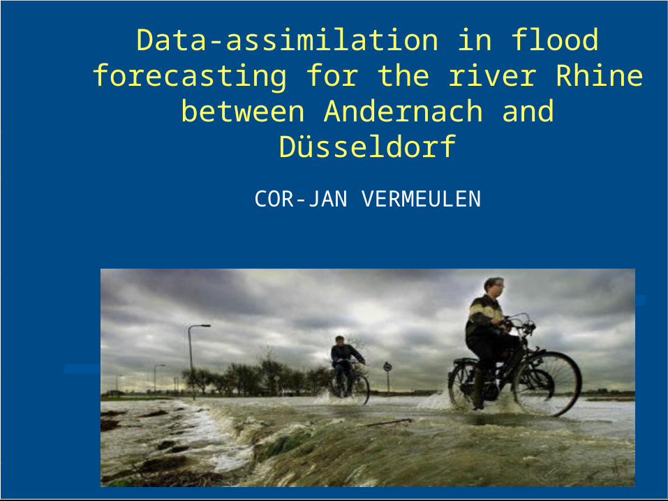
Introduction
238 recorded
floods in Europe
between
1975 and 2001
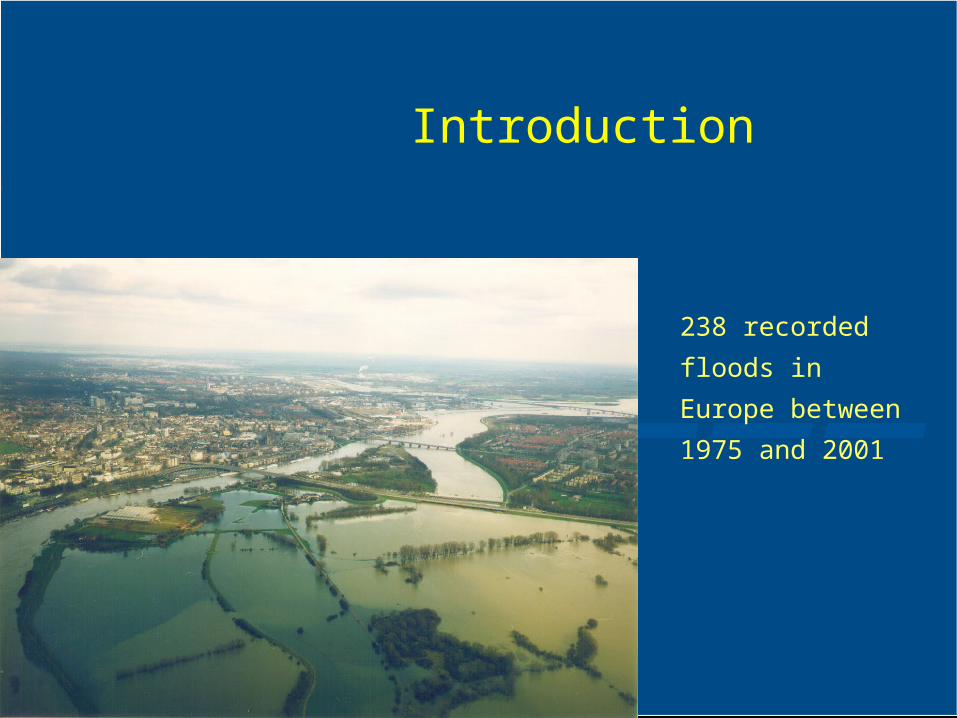
Introduction
Flood events Deaths per events
Introduction
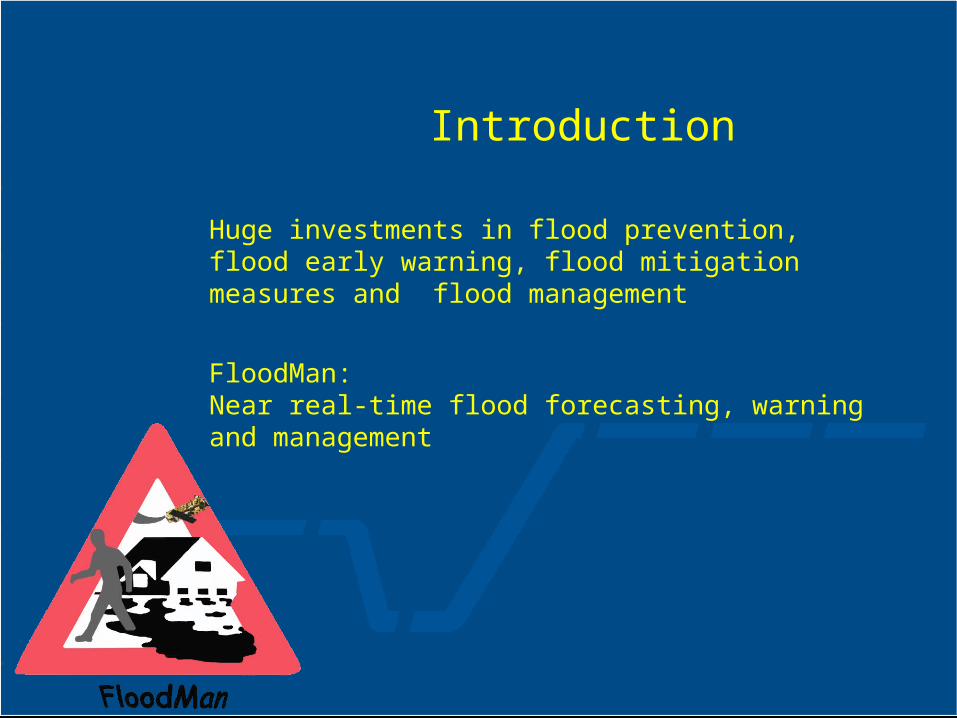
Huge investments in flood prevention, flood early warning, flood mitigation measures and flood management
FloodMan:Near real-time flood forecasting, warning and management
Introduction
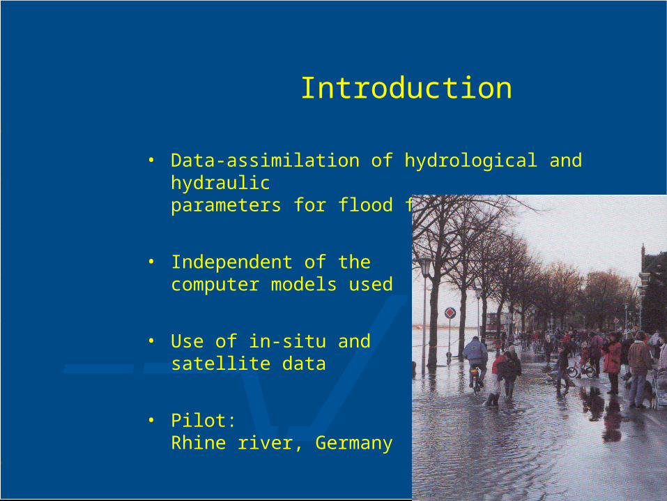
• Data-assimilation of hydrological and hydraulic
parameters for flood forecasting
• Independent of the computer models used
• Use of in-situ and satellite data
• Pilot:Rhine river, Germany
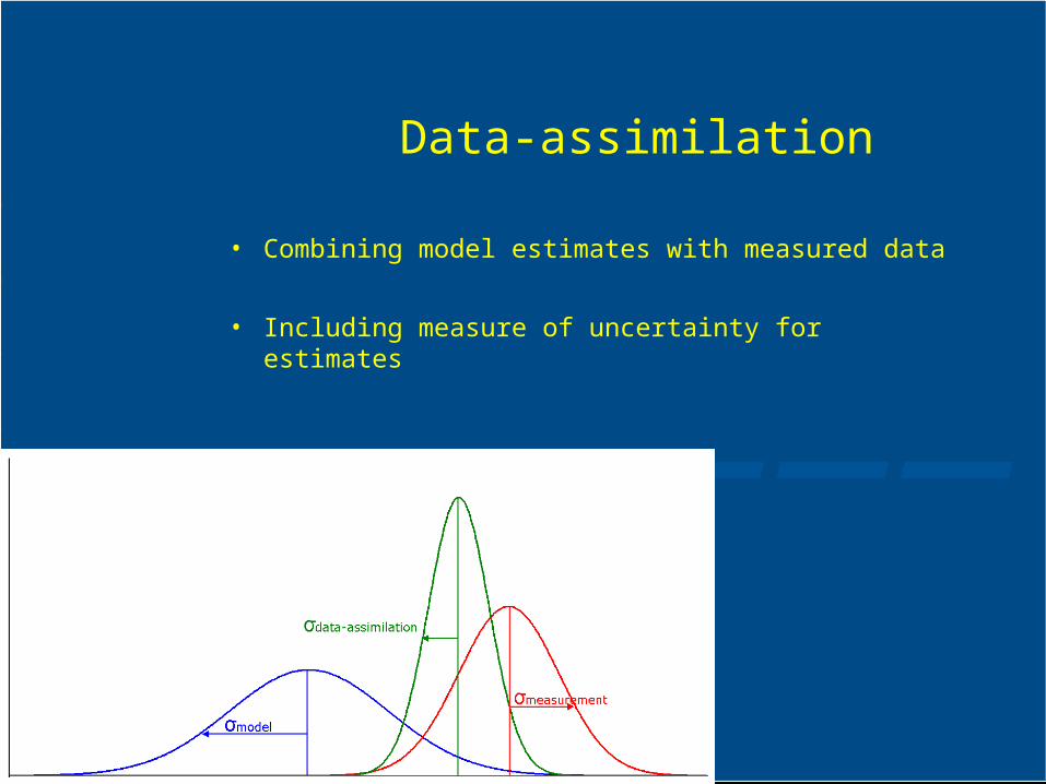
Data-assimilation
• Combining model estimates with measured data
• Including measure of uncertainty for estimates
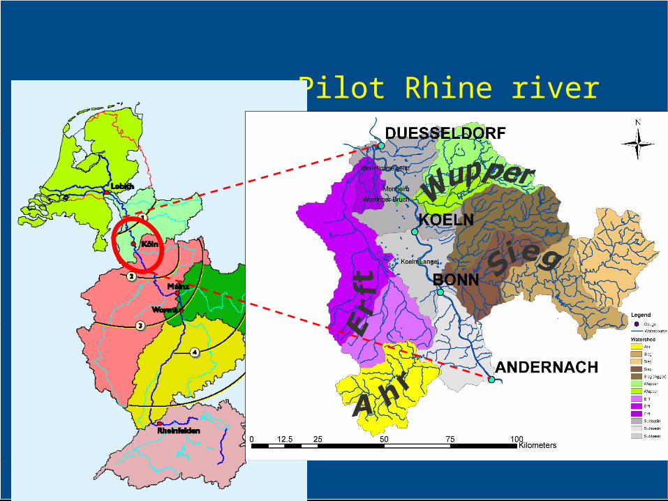
Pilot Rhine river

D ü s s e l d o r f [ 7 4 4 . 2 ]
K ö l n [ 6 8 8 . 0 ]
A n d e r n a c h [ 6 1 3 . 8 ]
B o n n [ 6 5 4 . 8 ]
A h r [ 6 2 9 . 5 4 ]
S i e g [ 6 5 9 . 4 ]
W u p p e r [ 7 0 3 . 3 ]E r f t [ 7 3 6 . 5 5 ]
K ö l n - L a n g e l [ 6 7 1 . 1 ]
W o r r i n g e r B r u c h [ 7 0 9 . 5 . 1 ]
N o d e ( G a g e )
B r a n c h ( i n f l u e n c e o f G r o u n d w a t e r )
R e t e n t i o n A r e a
T r i b u t a r y
Flood forecasting system
• Rainfall-runoff Model (HBV)
• Water Transport Model
• Hydraulic Model (Sobek)
• Data-assimilation
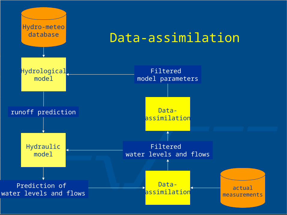
actualmeasurements
Hydrologicalmodel
Hydro-meteodatabase
runoff prediction
Data-assimilation
Filtered water levels and flows
Data-assimilation
Filtered model parameters
Hydraulicmodel
Prediction of water levels and flows
Data-assimilation
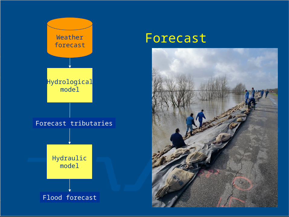
Hydrologicalmodel
Weatherforecast
Forecast tributaries
Hydraulicmodel
Flood forecast
Forecast
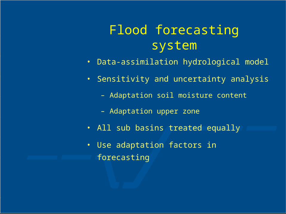
Flood forecasting system
• Data-assimilation hydrological model
• Sensitivity and uncertainty analysis
– Adaptation soil moisture content
– Adaptation upper zone
• All sub basins treated equally
• Use adaptation factors in forecasting
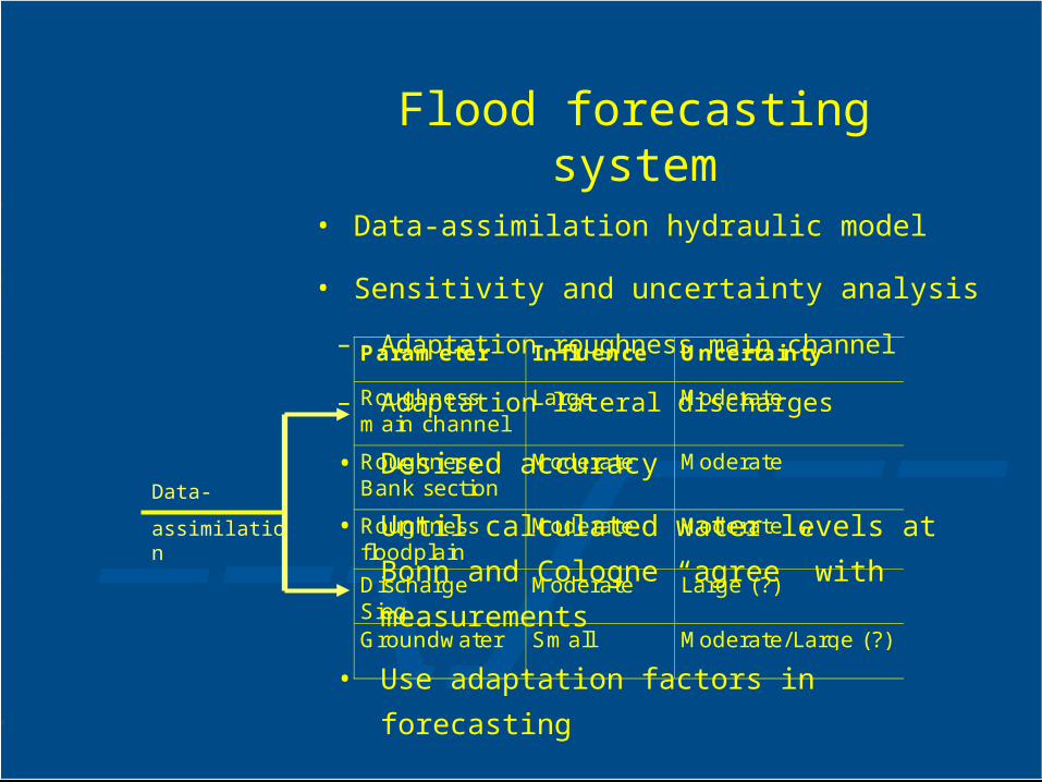
Flood forecasting system
• Data-assimilation hydraulic model
• Sensitivity and uncertainty analysis
– Adaptation roughness main channel
– Adaptation lateral discharges
• Desired accuracy
• Until calculated water levels at Bonn and
Cologne “agree” with measurements
• Use adaptation factors in forecasting
Parameter Influence Uncertainty
Roughnessmain channel
Large Moderate
RoughnessBank section
Moderate Moderate
Roughnessfloodplain
Moderate Moderate
DischargeSieg
Moderate Large (?)
Groundwater Small Moderate/Large (?)
Data-
assimilation
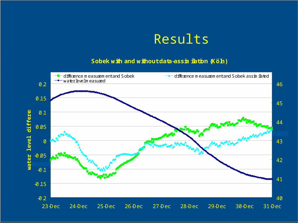
ResultsSobek with and without data-assimilation (Köln)
-0.2
-0.15
-0.1
-0.05
0
0.05
0.1
0.15
0.2
23-Dec 24-Dec 25-Dec 26-Dec 27-Dec 28-Dec 29-Dec 30-Dec 31-Dec
wa
ter
lev
el d
iffe
ren
ce
s
40
41
42
43
44
45
46
difference measurement and Sobek difference measurement and Sobek assimilatedwater level measured
Conclusions data-assimilation in-situ data
• Large calculation time (10 minutes for a day)
• Relatively small changes parameters indicating:– well calibrated hydraulic model– robust data-assimilation algorithm
• Forecast pattern remains similar
• Average accuracy around 5 cm in water levels
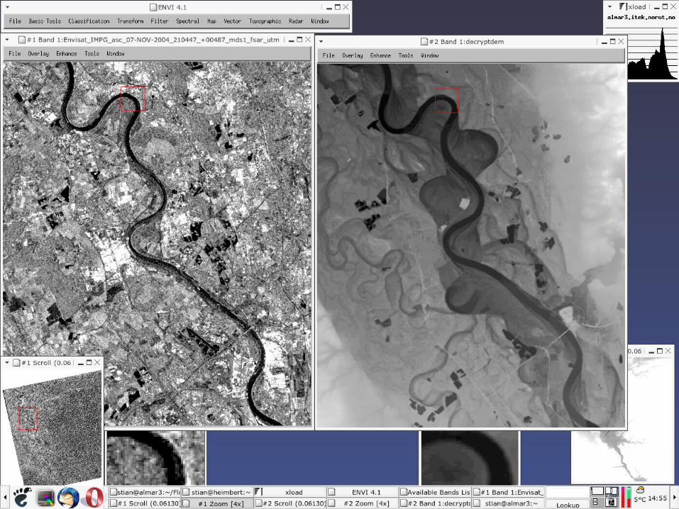
Role of satellite data
• Use of satellite data in deducing water levels
• Additional information is to be used in data-assimilation of hydraulic model
• Satellite ‘measurements’ are, compared to in-situ measurements:– less accurate, but– more detailed
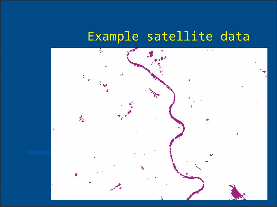
Example satellite data

Possible role of satellite data
• No real flood maps based on EO-data available for Rhine river, Germany
• Synthetic flood maps, using hydraulic model and a digital terrain model
• Introducing inaccuracies (‘noise’) by modelling errors in:- geo referencing; and - classification
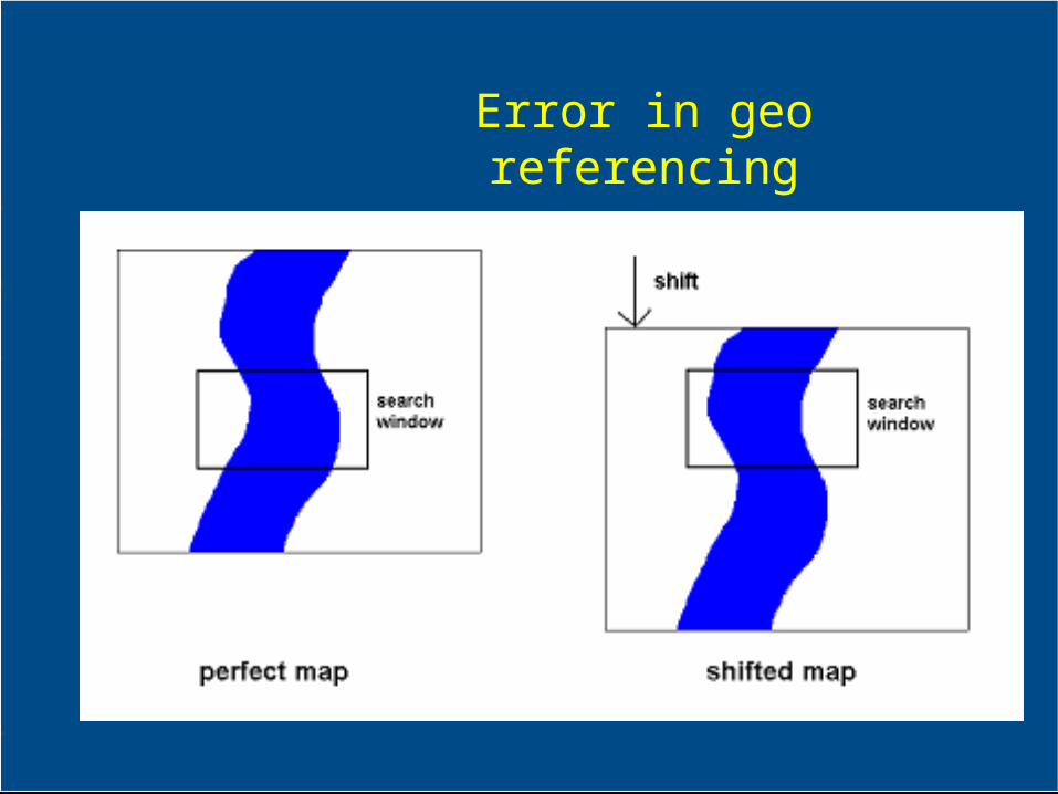
Error in geo referencing
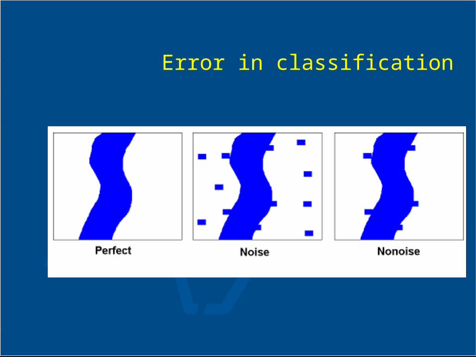
Error in classification
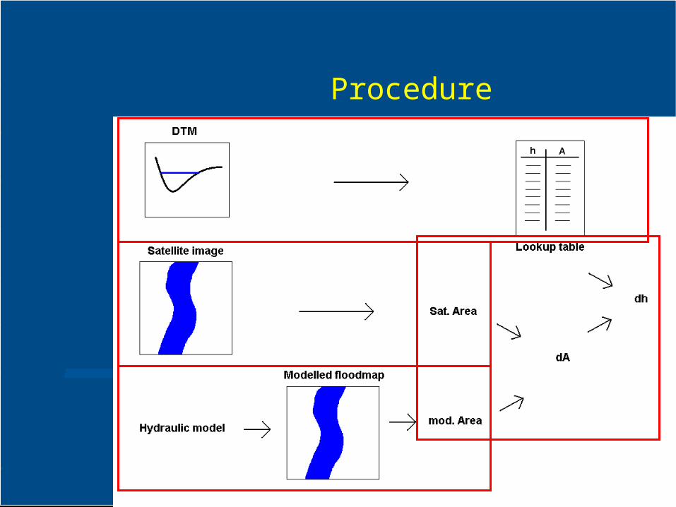
Procedure
Conclusions using flood maps
• Results depend on quality of satellite data– high resolution– low noise
• Flood maps to water levels– Area’s instead of cross-sections– stretches long enough (5 – 10 km)– straight river sections– gentle slopes, no steeps banks
• Opportunity– comparison of flood extent calculated and
satellite data.
Conclusions FloodMan
• The flood forecasting system is robust and ready to serve under operational conditions;
• In the pilot small improvement in the flood forecast accuracy;
• Forecast including measure of uncertainty: useful for decision making.
• Use of satellite data is promising, especially for river systems with few gauging stations– BUT high resolution satellite data needed
Further work
• Flood forecast systems with data-assimilation on hydrological and hydraulic model are implemented
• Different data-assimilation algorithms
• Data-assimilation to combine rainfall radar data with in-situ measurements
• Use of satellite data to determine flood extent in case of dike breach for:– estimate width and depth of dike breach– estimate discharge at dike breach
Recommended