Basic Satellite Data Products
Dave FoleyCoastWatch Coordinator
Joint Institute for Marine and Atmospheric ResearchUniversity of Hawaii
AndNOAA Southwest Fisheries Science Center,
Environmental Research Division.
CIOSS WorkshopCorvallis
September 8, 2005

Background: NOAA West Coast CoastWatch and
OceanWatch Produce satellite-based oceanic products and
distribute via Internet technology to a variety of users. Collaborate and provide training in applying satellite
remote sensing technology for fisheries and other marine science applications.
Collaborate with users in developing new satellite-derived products with emphasis on integrating data from multi-satellite sensors and platforms.
Provide near real-time satellite data support for IOOS west coast regional associations and PaCOOS.

Satellite Ocean Data and Data Products
Include those from satellite sensors that measure •SST
•Ocean color
•Ocean winds, and
•Sea surface height.

New Regional Coverage

SeaWiFS Ocean Color

Winds from QuikSCAT Scatterometer

Jason-1 and TOPEX Merged Altimetry

AVHRR .vs. GOES SST
GOES
Data AccessNear Real Time
- Live access server las.pfel.noaa.gov/oceanwatch.html
- Simple SST Browser coastwatch.pfel.noaa.gov
- New and improved browser coastwatch.pfel.noaa.gov/coastwatch/CWBrowser.jsp
Delayed science-quality data- Live access server (above)- Archive (????)

Typical OceanWatch Satellite Ocean Data Products
• Eastern North and Central Pacific Ocean area from coasts of North and Central American to the Dateline (1800W).
• Examples include satellite-derived SST, chlorophyll concentration, SSH, winds, and ocean currents.

GOES SST July 2-11, 2004

MODIS Chl a July 2-11, 2004
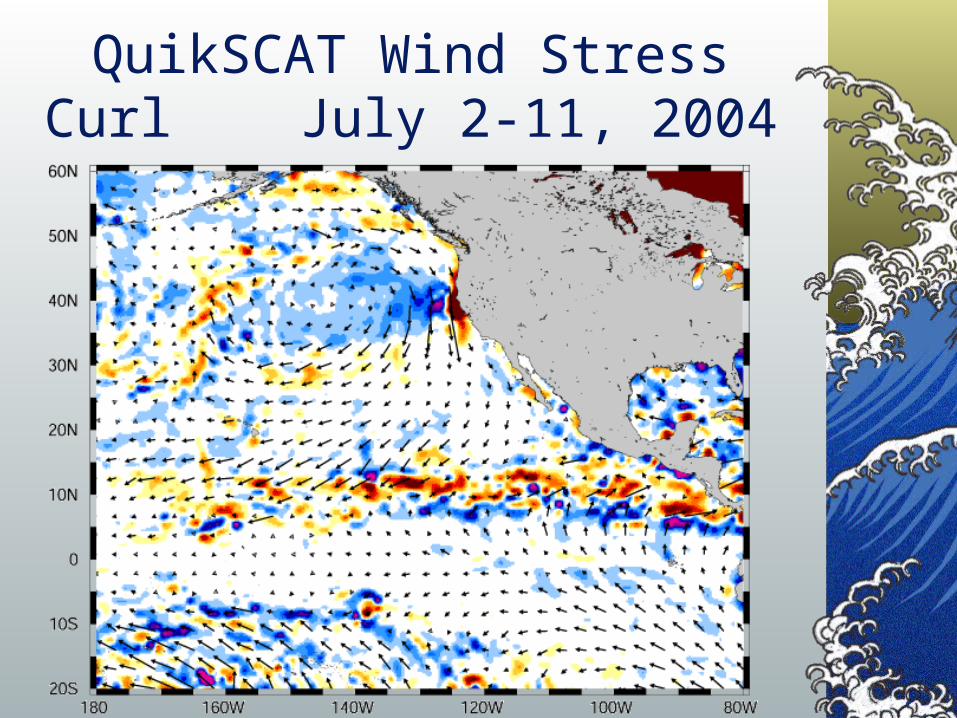
QuikSCAT Wind Stress Curl July 2-11, 2004
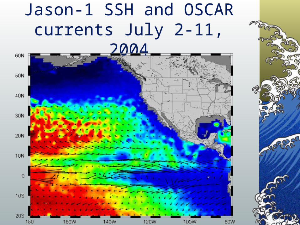
Jason-1 SSH and OSCAR currents July 2-11, 2004


Along-track data from tagAlong-track data from tag
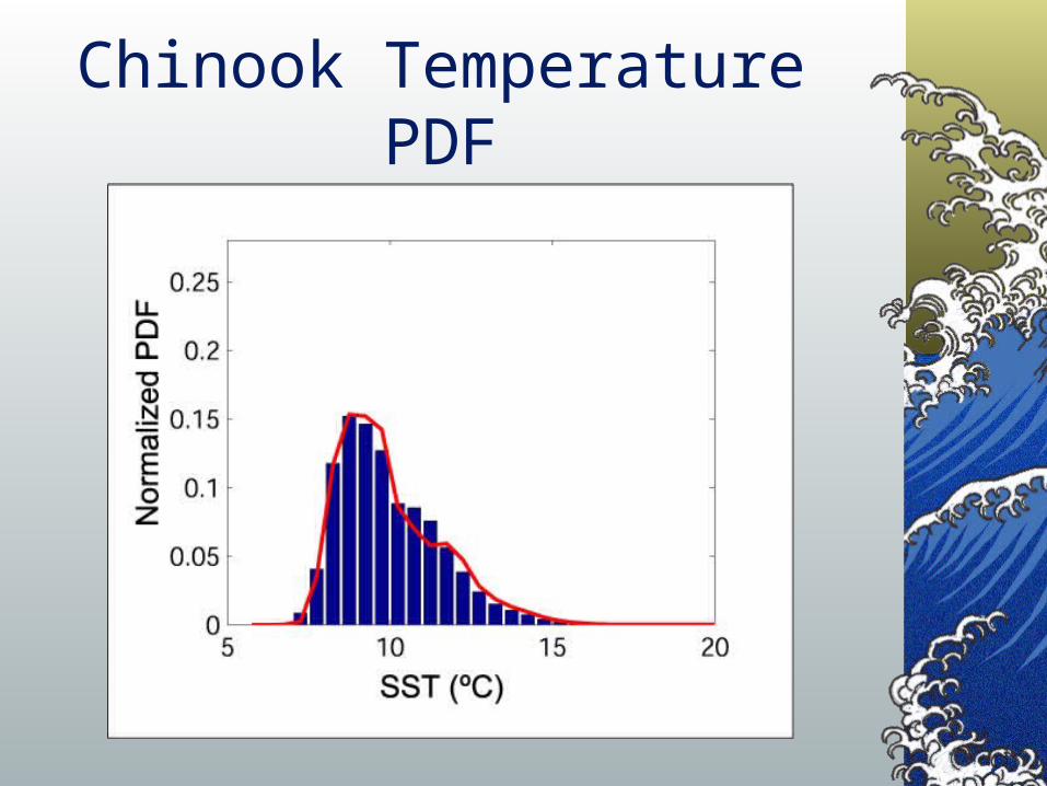
Chinook Temperature PDF

Chinook Potential Habitat (August)

Seasonal Changes (M1 Mooring)

Link to Behavioral Variations

Animal track over bathymetryAnimal track over bathymetry
Animal trackAnimal trackOver GOES SSTOver GOES SST

Leatherback Turtles
Yonat Swimmer, Lianne McNaughton and others (PIFSC).
Anders Nielson and John Sibert (PFRP).
Mike Laurs (JIMAR)

Examining Habitat Preferences
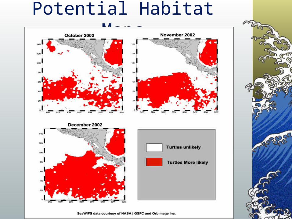
Potential Habitat Maps
Contact Information
Dave Foley
NOAA SWFSC - ERD
1352 Lighthouse Ave
Pacific Grove, CA 93950
831.648.0632
http://coastwatch.pfel.noaa.gov/
Recommended