A Review of Issues
Doswell C.A. III, 2001: Severe Convective Storms – An Overview. Severe Convective Storms, Meteor. Monogr., 28, no. 50, Amer. Meteor. Soc., 13-26
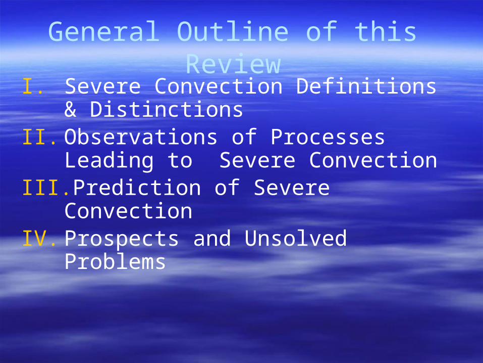
General Outline of this ReviewI. Severe Convection Definitions &
DistinctionsII. Observations of Processes Leading to
Severe ConvectionIII. Prediction of Severe ConvectionIV. Prospects and Unsolved Problems
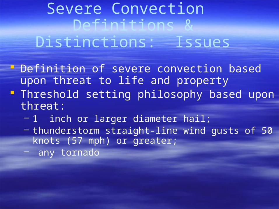
Severe Convection Definitions & Distinctions: Issues
Definition of severe convection based upon threat to life and property
Threshold setting philosophy based upon threat: – 1” inch or larger diameter hail; – thunderstorm straight-line wind gusts of 50 knots (57 mph)
or greater;– any tornado
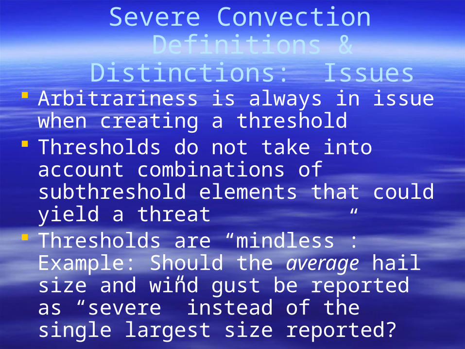
Arbitrariness is always in issue when creating a threshold
Thresholds do not take into account combinations of subthreshold elements that could yield a threat
Thresholds are “mindless”: Example: Should the average hail size and wind gust be reported as “severe” instead of the single largest size reported?
Severe Convection Definitions & Distinctions: Issues
Potentially damaging or life-threatening precipitation and lightning thresholds not defined for precipitation not officially defined because any thunderstorm can produce either
Frequent cloud-to-ground lightning (clearly related to threat to individuals and structures) not clearly related to the meteorological ingredients leading to otherwise severe thunderstorms
Severe Convection Definitions & Distinctions: Issues
Amendments to the definitions based upon threshold have been made
Hales’ “Two Tier” System…conventional thresholds AND
Second tier involving risk of EF2-EF5 tornadoes; 2” or larger diameter hail; thunderstorm wind gusts greater than 64 knots
Severe Convection Definitions & Distinctions: Issues

Focus should be on potential negative or catastrophic impacts on society
Thunderstorm forecasters should concentrate on the ingredients that distinguish between severe and non-severe forms of convection
Arguing about where the thresholds should be set distracts forecasters from this mission.
Severe Convection Definitions & Distinctions: Issues
Observations of Processes Leading to Severe Convection: Large Scale
(Synoptic Scale)
• To some extent biased by outmoded conceptual models
• Early conceptual models biased by trains of thought that focused on regional buoyancy
• Thus early conceptual models centered on the observational network that sampled regions that were subsynoptic or low end synoptic scale, including the radiosonde network
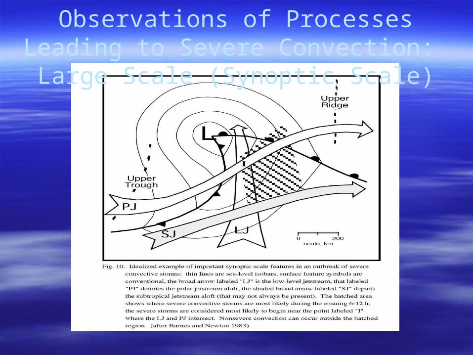
Observations of Processes Leading to Severe Convection: Large Scale
(Synoptic Scale)
Observations of Processes Leading to Severe Convection: Large Scale
(Synoptic Scale)• Early conceptual models centered on either
major severe thunderstorm outbreaks or high end events (e.g., the Wichita Falls F5 tornado)
• Early conceptual models were descriptive,based upon pattern recognition and, not surprisingly, were based upon studies of Great Plains’ prototypes.
• Such models thus could not account for the vast majority of severe weather events that are not high end, and not “synoptically-evident”
Pattern-based recognition led to inaccurate or under assessment of the potential for severe weather and led to unacceptable POD
This was especially true in other areas of the country and the world
Observations of Processes Leading to Severe Convection: Large Scale
(Synoptic Scale)
Observations of Processes Leading to Severe Convection: Large Scale
(Synoptic Scale) Although synoptic scale pattern-based recognition is still a part of severe storms forecasting, it has been replaced by more thoughtful approaches
Ingredients-based approach– Conditional instability (meaning LFC exists not
at ground– Low level moisture (meaning deep moisture
leading to wet adiabatic ascent)– Some source for parcel lifting to LFC
Observations of Processes Leading to Severe Convection: Large Scale
(Synoptic Scale) Ingredients-based approaches have been
amended to include estimates of wind shear profiles to distinguish between the various “modalities” of convection
This augmented approach allows forecasters to estimate whether convection is liable to be “common” or “severe” and the mode with which thunderstorms will take (single cell, multicell and supercell)
Observations of Processes Leading to Severe Convection: Mesoscale
Radiosonde network inadequate to account for convective storms developing at the mesoscale
Processes acting at the mesoscale (local destabilization; locally developing wind circulations impacting shear profiles; sources for parcel lift) can only be estimated by an observational network at the same or smaller scale.
Observations of Processes Leading to Severe Convection: Mesoscale
Some Issues assessed at mesoscale1. Convective initiation
I. Areas of low end mesoscale destabilization (differential heating/cooling; regional or less moisture advection etc.)
II. Areas of regional destabiliztion (layer lifting associated with synoptic-scale upper tropospheric divergence and mid tropospheric lift; regional orographic lifing; frontal lifting etc.)
III. Sources of parcel lift (outflow boundaries, turbulence, gravity waves, local topography etc.)
Observations of Processes Leading to Severe Convection: Mesoscale
Some Issues assessed at mesoscale1. Convective mode
I. Areas of wind shear augmentation and weakening (outflow boundaries/seabreeze/mountain valley circulations)
II. Areas of local effects augmenting directional shear (outflow boundaries, local topography etc.)
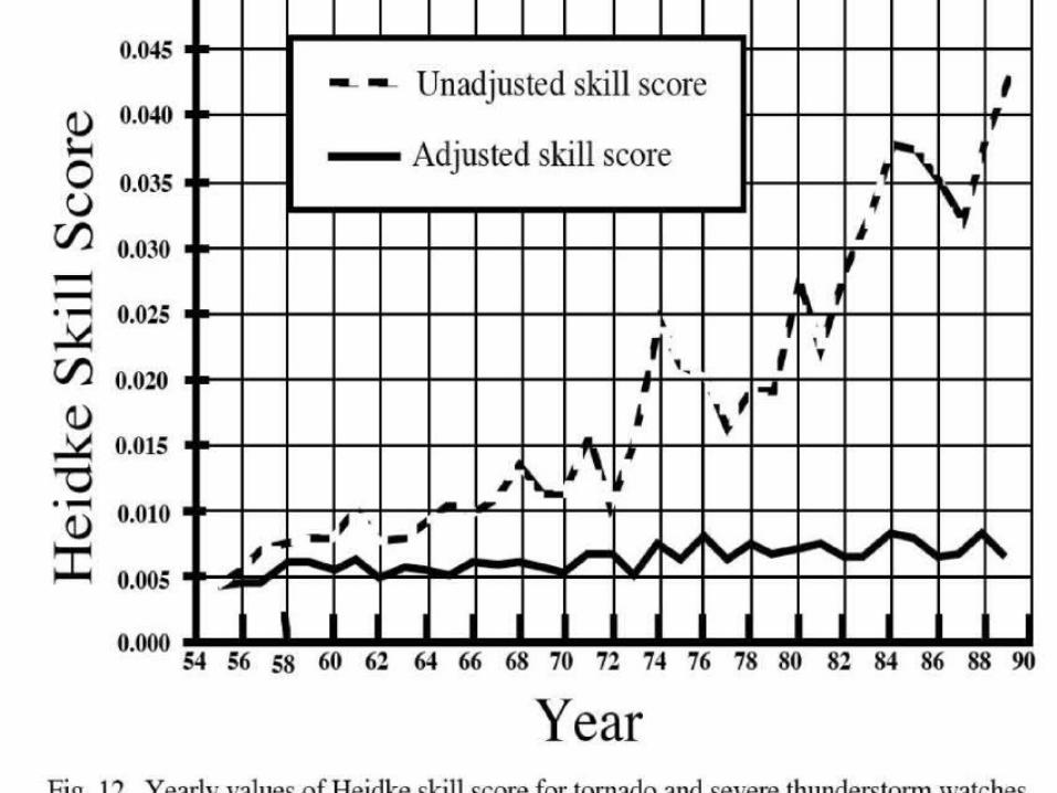
Prediction of Severe Convection~Current accuracy levels
Progress The “Infrastructure” put into place progressively since
the 1950s (observations, tools and models related to forecasting severe thunderstorms) has Increased prediction accuracy
Better public awareness and communication has contributed to more support for development of infrastructure and decreasing damage and injuries.
Prediction of Severe Convection~Current accuracy levels
Progress Lagging Not as much attention to non tornadic events Flash floods/heavy convection not offic-ally “severe” Hail formation is difficult to predict and not much can
be done to mitigate potential effects forecasts
Prediction of Severe ConvectionGlobal Issues
Awareness of risks of DMC outside of U.S. is poor– In many countries, situation is as it was in the
United States Great Plains in the 1930s and 1940s (no systematic reporting of events or underreporting) and California through the 1980s.
– Systematic should be made to have complete data bases
Prediction of Severe ConvectionGlobal Issues
Official responses are often muted because of the preconceived notion that sever DMC is rare or absent– sufficient planning must be undertaken for
possible severe events in areas where threat is rare
– Attempts to increase public awareness, and to outline appropriate reactions to severe events (Netherlands)
Prediction of Severe ConvectionGlobal Issues
Three steps in disaster mitigation related to severe DMC– Basic forecast verification and climatology– Scientific forecasting approaches– Event mitigation plans
Prospects and Unsolved Problems
Forecasting– Improvements in observing systems (ie radar)
and related forecasting systems– Difficulties/ less progress
Tornadic vs nontornadic supercell differentiation Forecasting nonsupercell tornado situations System to forecast and mitigate flash flood damage
Prospects and Unsolved Problems
Weather Modification possibilities– Public appeal– Lack of many severe convective weather
processes New Observations
– Doppler RADARs are likely only a beginning– Dual polarization observations possible and
now being implemented– Satellite remote sensor improvements
Economic Issues
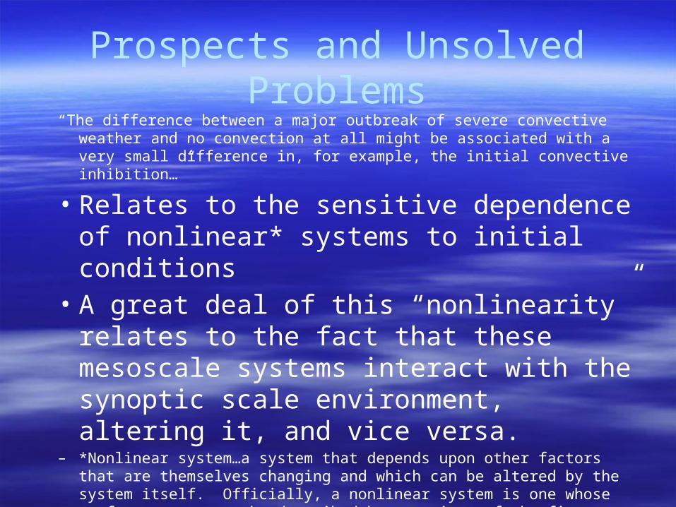
Prospects and Unsolved Problems“The difference between a major outbreak of severe convective weather and no
convection at all might be associated with a very small difference in, for example, the initial convective inhibition…”
• Relates to the sensitive dependence of nonlinear* systems to initial conditions
• A great deal of this “nonlinearity” relates to the fact that these mesoscale systems interact with the synoptic scale environment, altering it, and vice versa.
– *Nonlinear system…a system that depends upon other factors that are themselves changing and which can be altered by the system itself. Officially, a nonlinear system is one whose performance cannot be described by equations of the first degree
Prospects and Unsolved Problems“The difference between a major outbreak of severe convective weather and no
convection at all might be associated with a very small difference in, for example, the initial convective inhibition…”
In DMC, it is possible that the observational network will ever be good enough to enable correct assessment of convective initiation
Theory and modeling will never make up for lack of adequate observations
Recommended