« Just Do It »A Parcel Data
Integration Project
WLIA TeamJustin Conner, Wood County GIS Specialist
Ian Grasshoff, Waupaca County GIS Coordinator/LIOJeff DuMez, Brown County GIS Coordinator/LIO
Bill Cozzens, Waukesha County Land Information Systems Analyst

Overview
• Brief Project Summary• Project Status• Data Gathering Process• Parcel Data Integration Methods• Parcel Data Issues• What’s Next?

Project Summary
• Goal– Single goal to collect as much parcel data as possible and
assemble the data into a single parcel dataset
• Purpose– The existing reality of statewide data is not tenable
• Created 25 years ago and needs to adapt to the 21st Century• Does not support Wisconsin as well as it should
– Demonstrate to other organizations, policy-makers and legislators the future of Wisconsin geographic information
• Modern, robust, comprehensive and easily accessible


Data Gathering
AirDropper

Data Gathering
AirDropper

Data Gathering
AirDropper
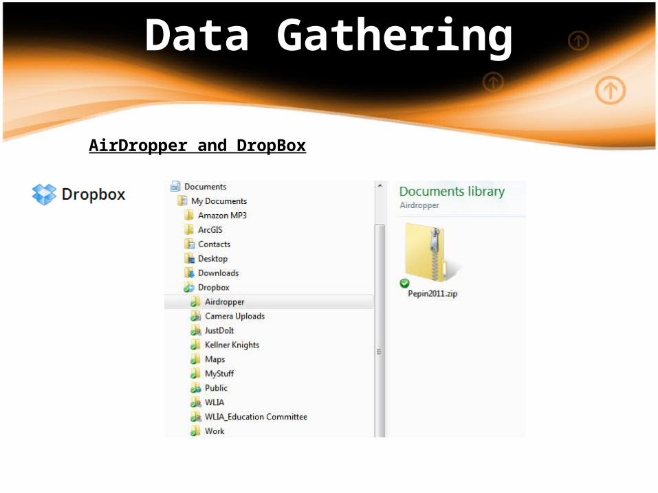
Data Gathering
AirDropper and DropBox

Project Status
• 62 of 72 counties sent data– Cities of Ashland and Eau Claire
• Of the 10 without parcels– 5 said “No thanks”– 5 were still hoping to hear from
• Aggregate Parcel Count as of 10/22/2012:
3,146,169
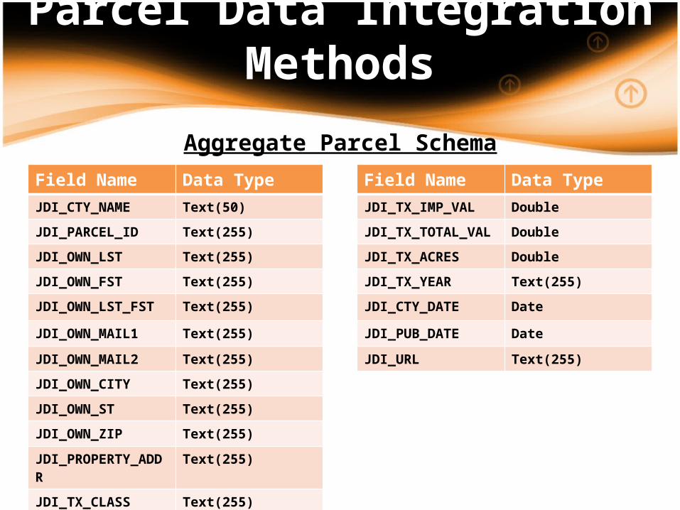
Parcel Data Integration Methods
Aggregate Parcel SchemaField Name Data Type
JDI_CTY_NAME Text(50)
JDI_PARCEL_ID Text(255)
JDI_OWN_LST Text(255)
JDI_OWN_FST Text(255)
JDI_OWN_LST_FST Text(255)
JDI_OWN_MAIL1 Text(255)
JDI_OWN_MAIL2 Text(255)
JDI_OWN_CITY Text(255)
JDI_OWN_ST Text(255)
JDI_OWN_ZIP Text(255)
JDI_PROPERTY_ADDR Text(255)
JDI_TX_CLASS Text(255)JDI_TX_LAND_VAL Double
Field Name Data Type
JDI_TX_IMP_VAL Double
JDI_TX_TOTAL_VAL Double
JDI_TX_ACRES Double
JDI_TX_YEAR Text(255)
JDI_CTY_DATE Date
JDI_PUB_DATE Date
JDI_URL Text(255)

Parcel Data Integration Methods
• Developed a python script tool to normalize and aggregate parcel data– A little additional data prep before running the tool– Python Script Tool Does the following:
• Adds the Just Do It (JDI) schema to the input parcel data• Transfers the input parcel attributes to the JDI schema• Converts input data to other data format (string -> integer etc)• Logs processing inputs and messages to an xml file• Appends the input parcel data to a Statewide parcel layer
– Very easy to repeat the process…

Parcel Data Integration Methods

Parcel Data Issues
• Attribute Issues (the major ones)– Working with “Flat Files” (data structured by line position)– Some data was all concatenated together (ex. Owner First + Owner Last). This mostly occurred with names and addresses.
– Concatenated values difficult to split out when a “space” was the only separator…
– Storing numeric data as mix of numbers and strings (ex. 40.12 acres). You can’t do mathematical operations on text data..
– Storing substrings within strings (ex. Kevin “The Bear” Smith)– Assessment Classes & values combined vs. broken out– How Condo Parcels are handled (relationship vs. stacked)

Parcel Data Issues
• Geometry Issues (the major ones)– As you would imagine…gaps and overlaps do exist
At it’s widest point, approx. a 375 ft gap
At widest point, approx. a 307 ft
gap
Recommended