Embed Size (px)
Citation preview
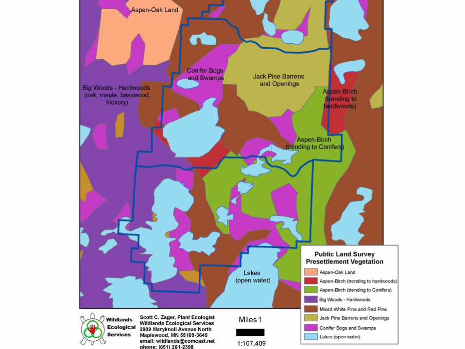
Ecological Classification System (ECS)
Developing a Land Classification Systemfor
Tamarac National Wildlife Refuge
Scott C. Zager, Plant Ecologist
Wildlands Ecological Services
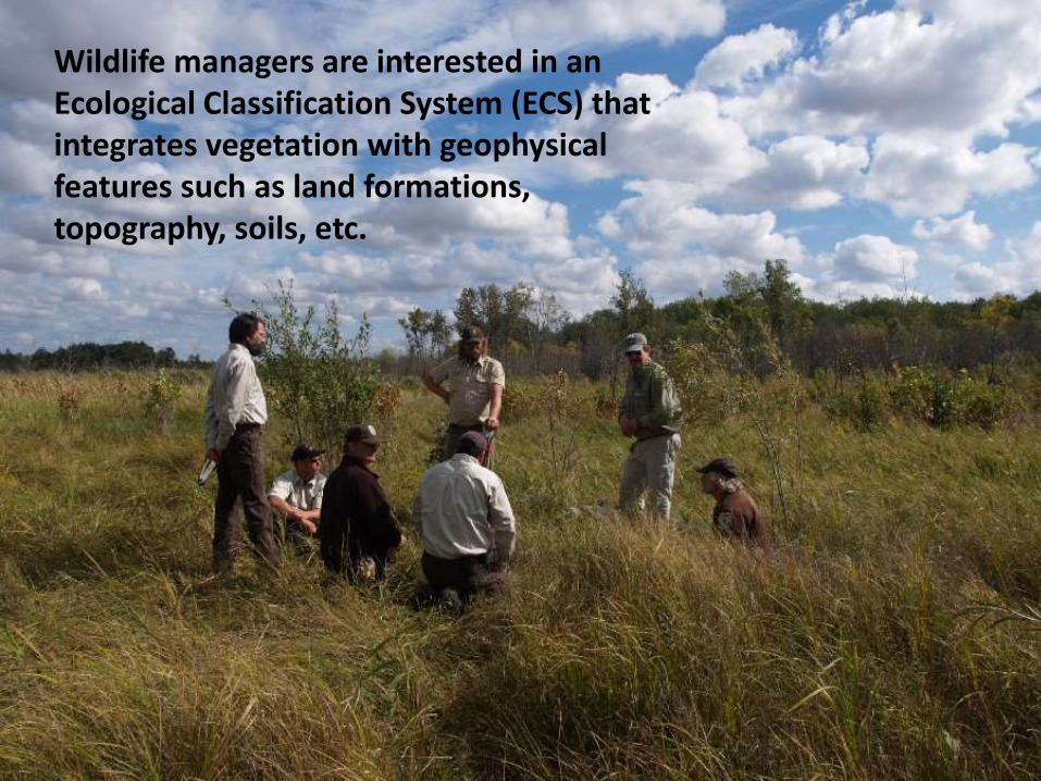
Wildlife managers are interested in an Ecological Classification System (ECS) that integrates vegetation with geophysical features such as land formations, topography, soils, etc.
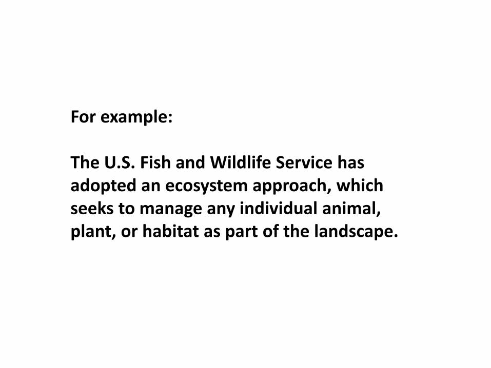
For example:
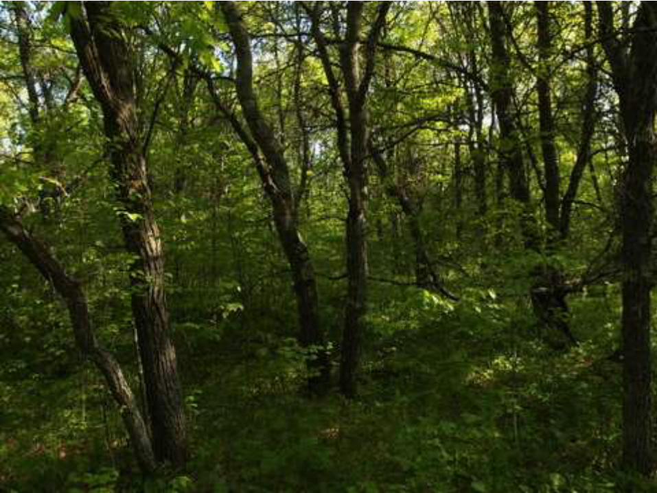
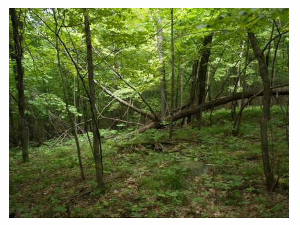
The U.S. Fish and Wildlife Service has adopted an ecosystem approach, which seeks to manage any individual animal, plant, or habitat as part of the landscape.
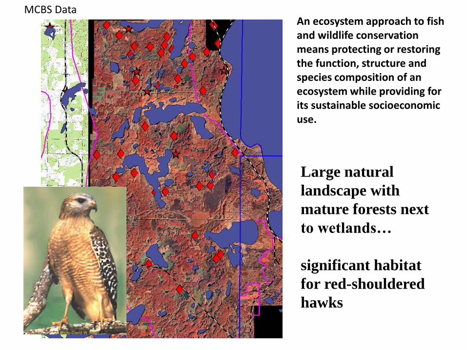
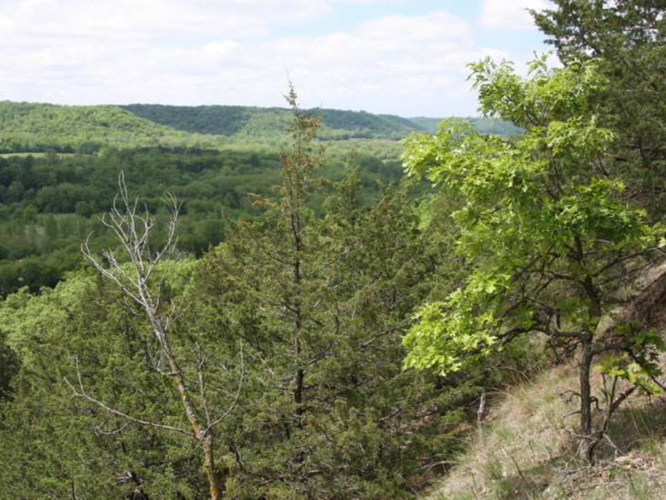
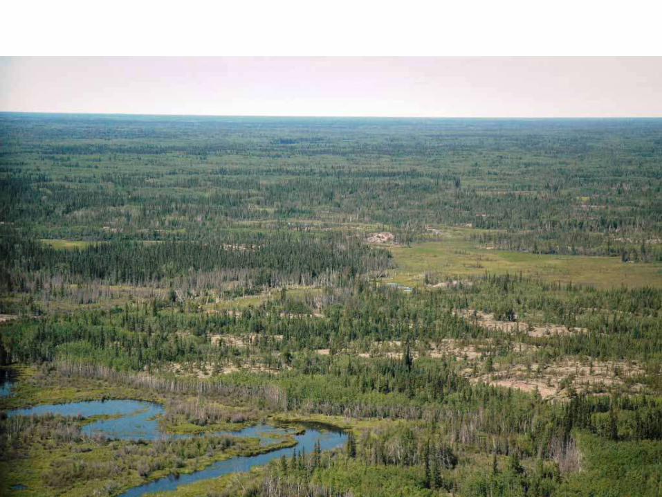
Large natural
landscape with
mature forests next
to wetlands…
significant habitat
for red-shouldered
hawks
An ecosystem approach to fish and wildlife conservation means protecting or restoring the function, structure and species composition of an ecosystem while providing for its sustainable socioeconomic use.
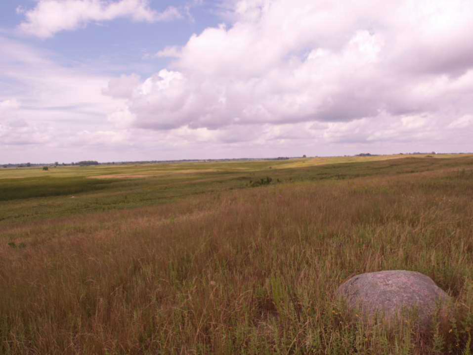
MCBS Data
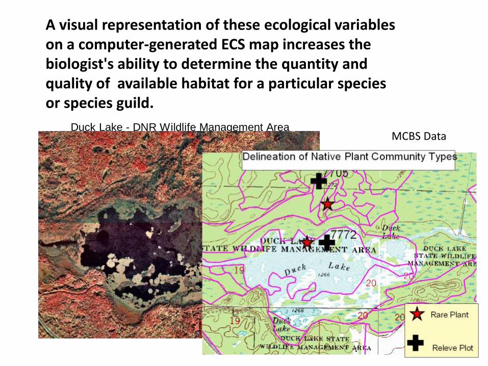
Duck Lake - DNR Wildlife Management Area
A visual representation of these ecological variables on a computer-generated ECS map increases the biologist's ability to determine the quantity and quality of available habitat for a particular species or species guild.
MCBS Data
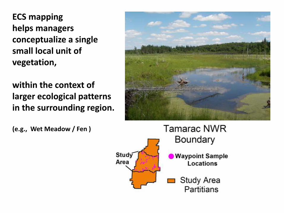
ECS mapping helps managers conceptualize a single small local unit of vegetation,
within the context of larger ecological patterns in the surrounding region.
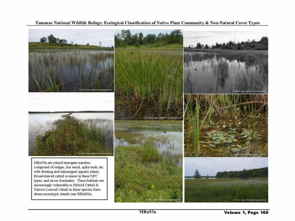
(e.g., Wet Meadow / Fen )
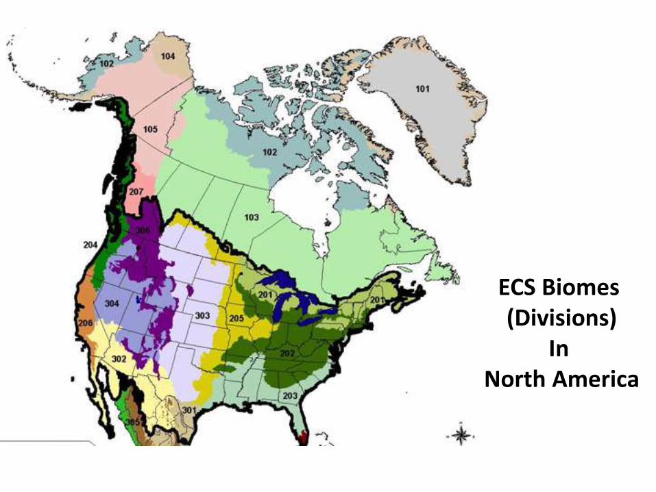
ECS Biomes (Divisions)
In North America
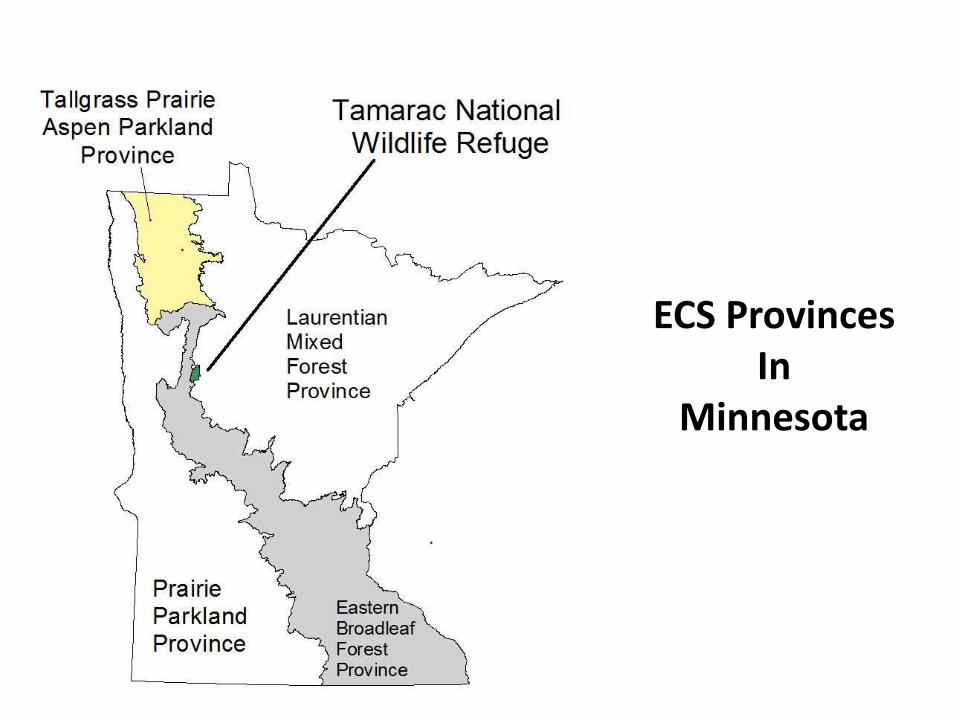
ECS ProvincesIn
Minnesota
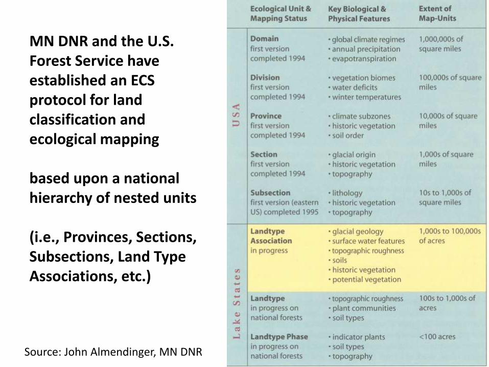
MN DNR and the U.S. Forest Service have established an ECS protocol for land classification and ecological mapping
based upon a national hierarchy of nested units
(i.e., Provinces, Sections, Subsections, Land Type Associations, etc.)
Source: John Almendinger, MN DNR
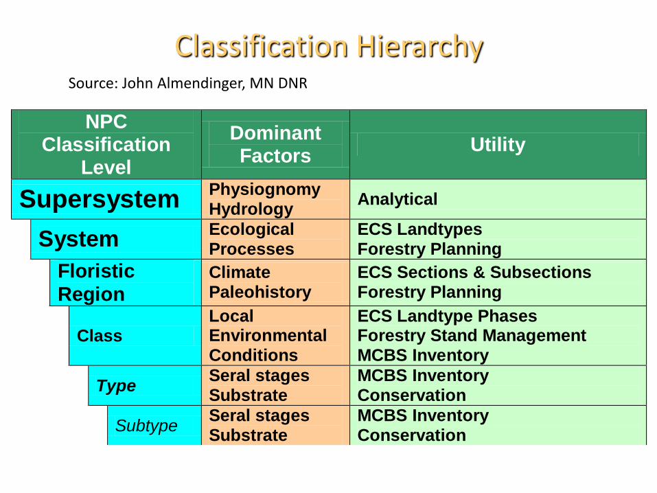
Classification Hierarchy
NPC Classification
Level
Dominant Factors
Utility
Supersystem Physiognomy Hydrology
Analytical
System Ecological Processes
ECS Landtypes Forestry Planning
Floristic Region
Climate Paleohistory
ECS Sections & Subsections Forestry Planning
Class Local Environmental Conditions
ECS Landtype Phases Forestry Stand Management MCBS Inventory
Type Seral stages Substrate
MCBS Inventory Conservation
Subtype Seral stages Substrate
MCBS Inventory Conservation
Source: John Almendinger, MN DNR
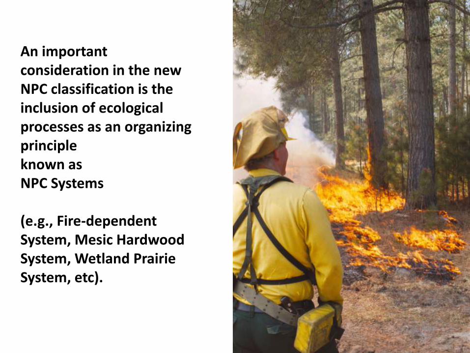
An important consideration in the new NPC classification is the inclusion of ecological processes as an organizing principle known as NPC Systems
(e.g., Fire-dependent System, Mesic Hardwood System, Wetland Prairie System, etc).
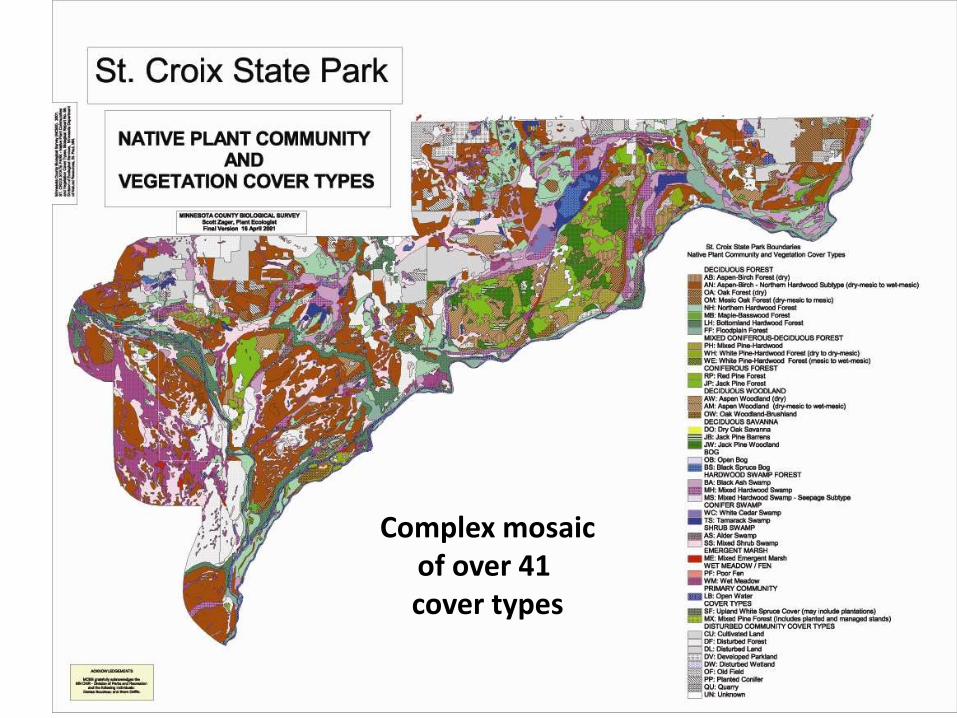
Complex mosaicof over 41 cover types
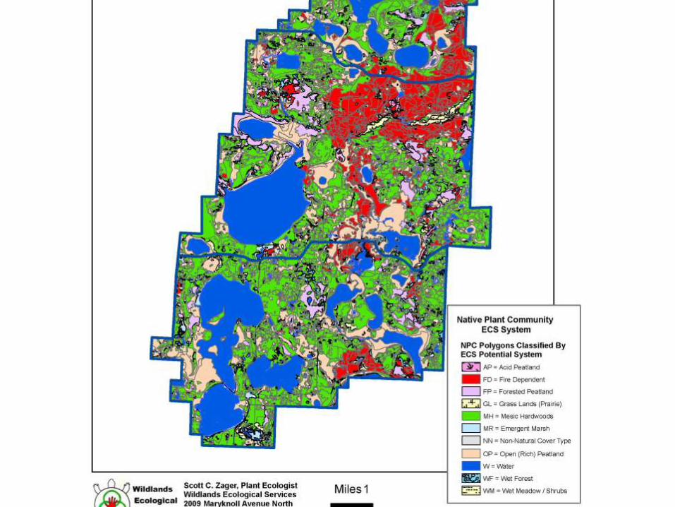
System ClassificationBy Norm Aaseng withMCBS data.
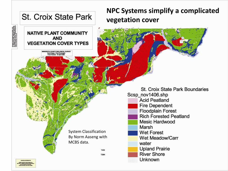
NPC Systems simplify a complicated vegetation cover
Map data byScott Zager and MCBS
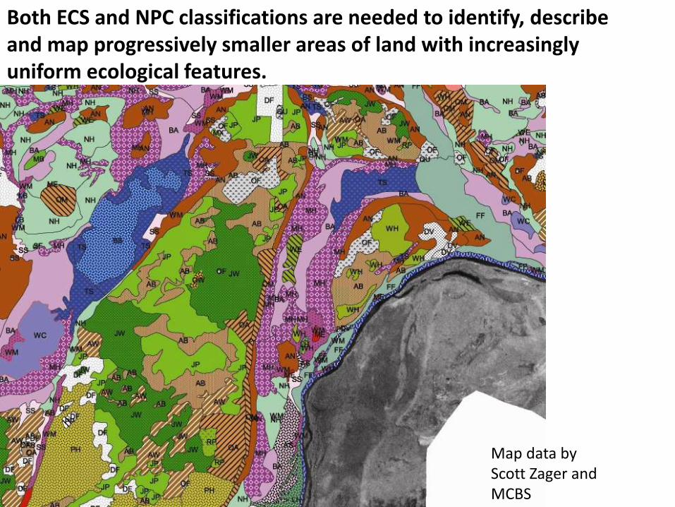
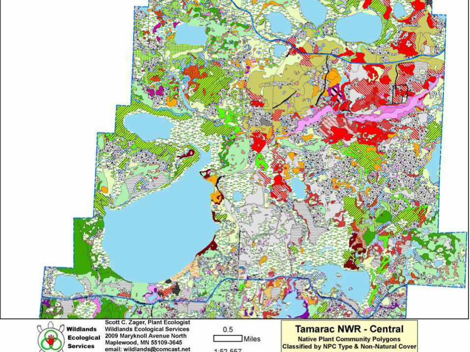
Both ECS and NPC classifications are needed to identify, describe and map progressively smaller areas of land with increasingly uniform ecological features.
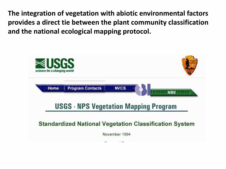
The integration of vegetation with abiotic environmental factors provides a direct tie between the plant community classification and the national ecological mapping protocol.
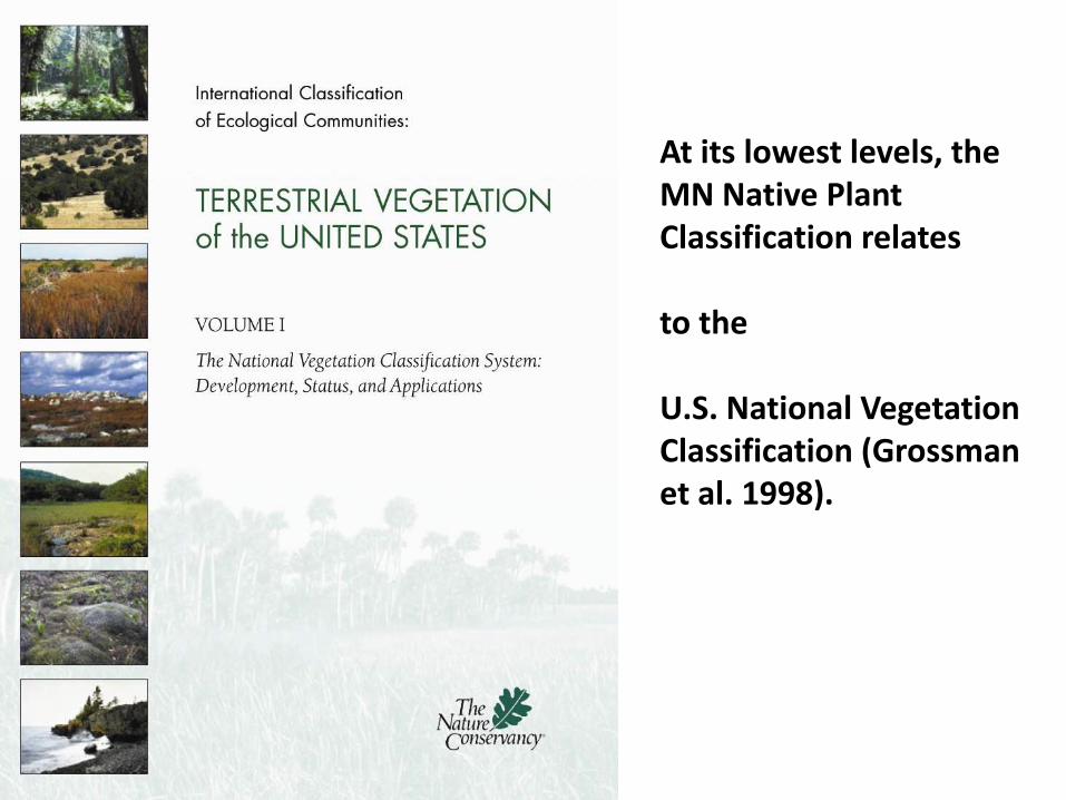
At its lowest levels, the MN Native Plant Classification relates
to the
U.S. National Vegetation Classification (Grossman et al. 1998).
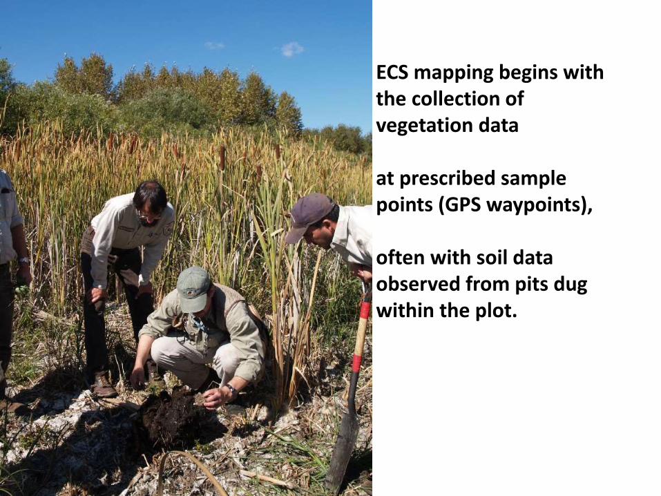
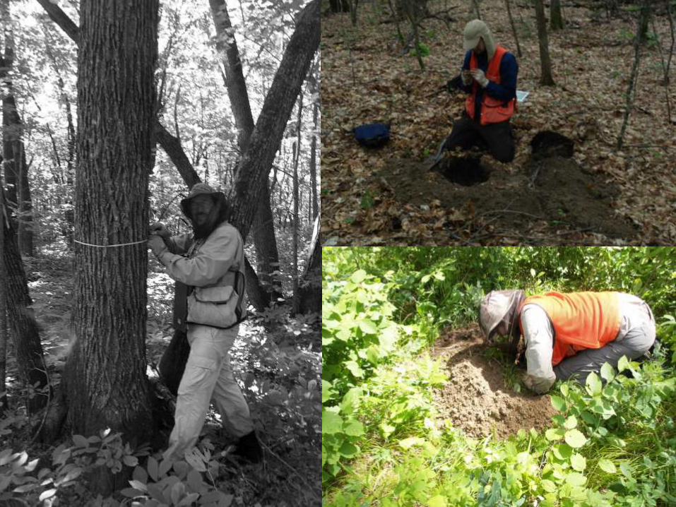
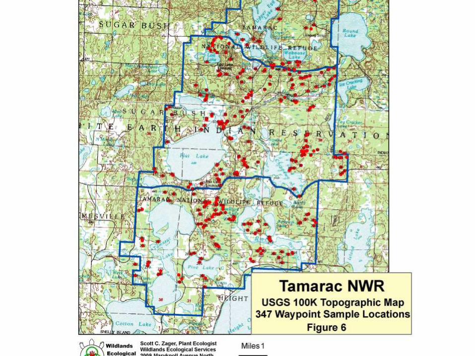
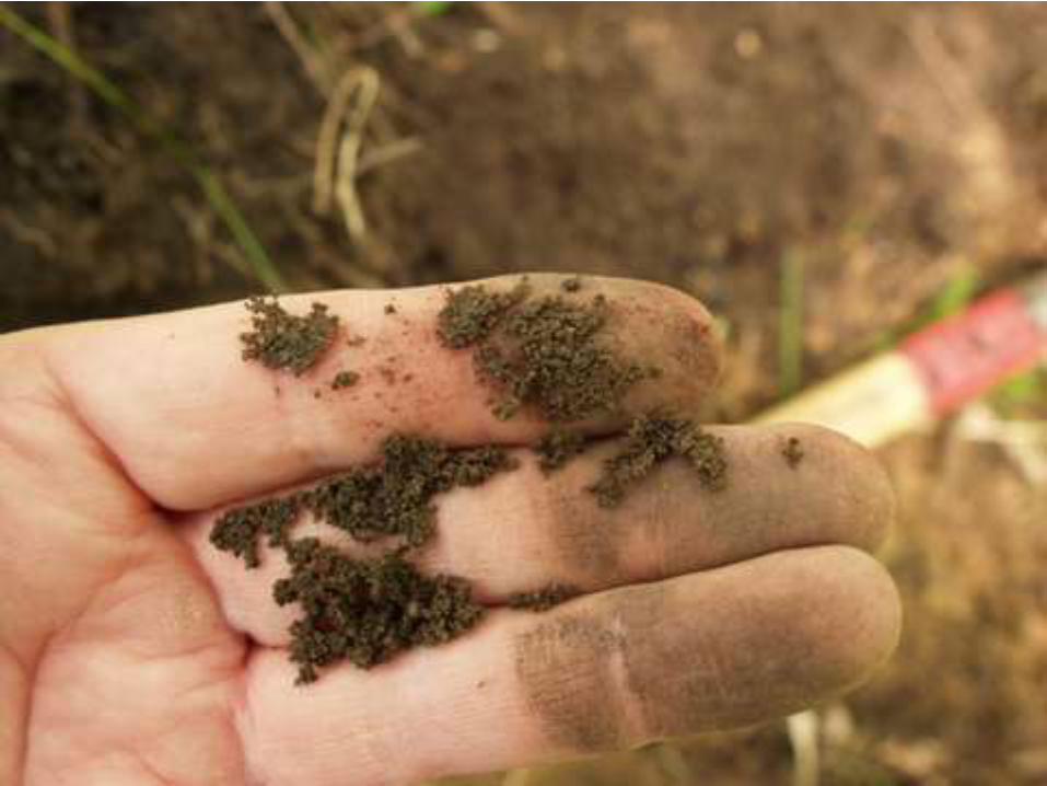
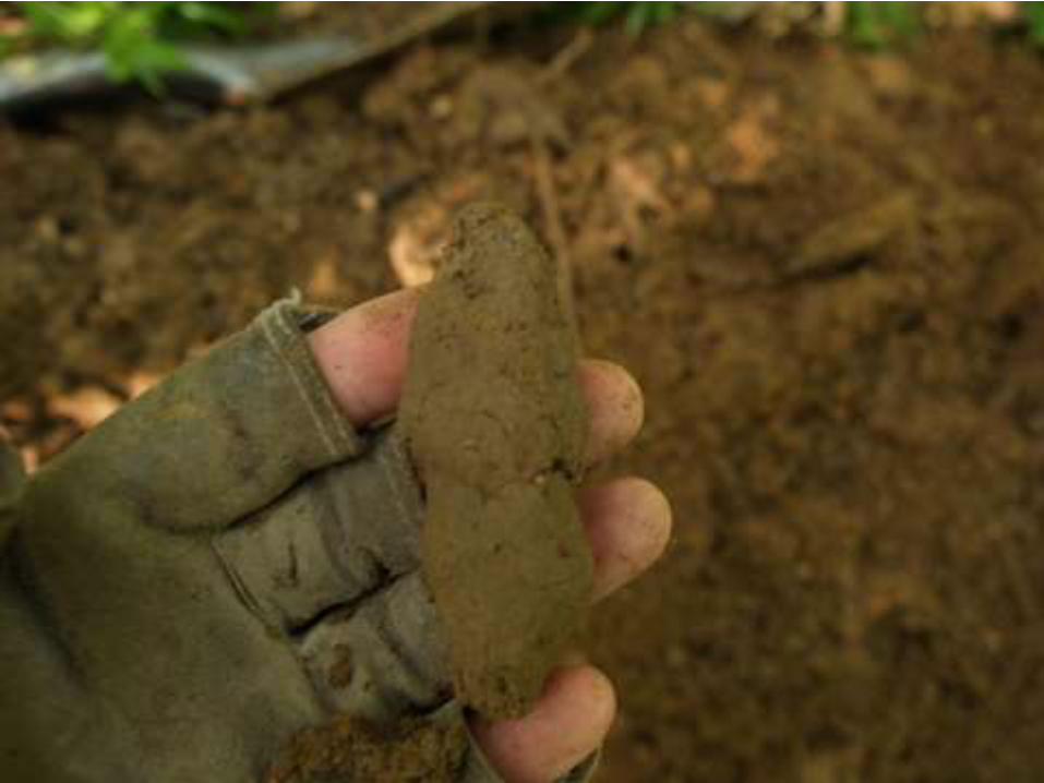
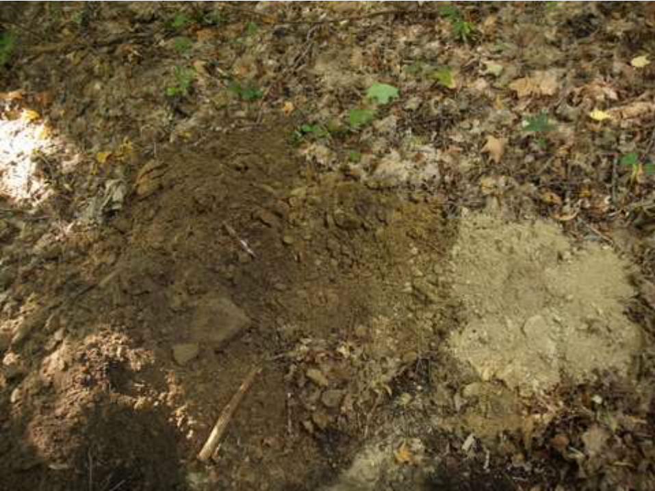
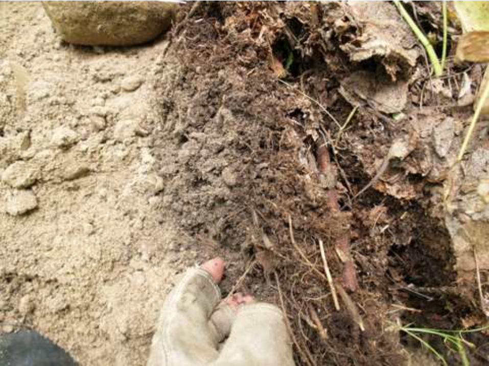
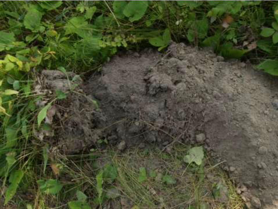
ECS mapping begins with the collection of vegetation data
at prescribed sample points (GPS waypoints),
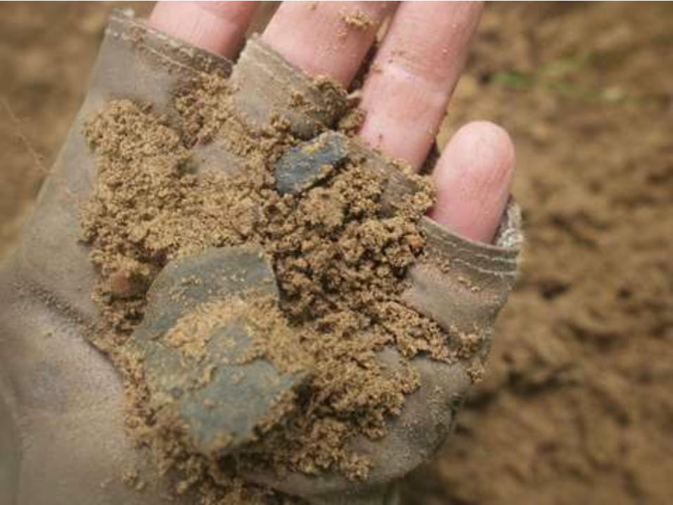
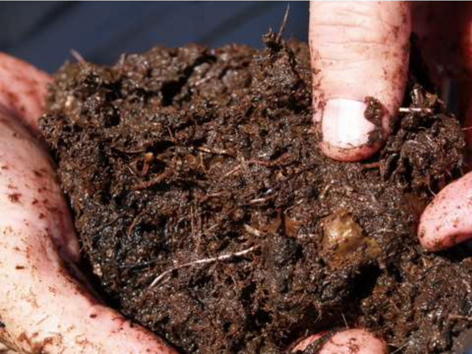
often with soil data observed from pits dug within the plot.

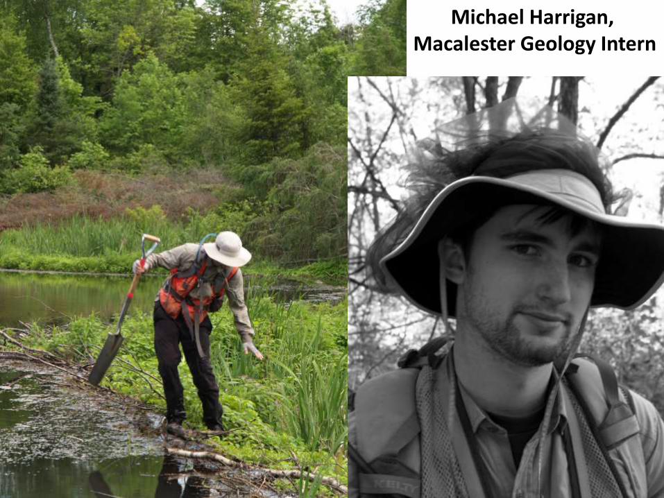
Michael Harrigan, Macalester Geology Intern
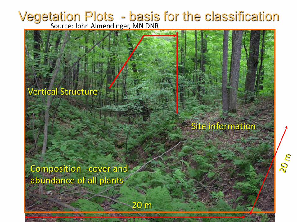
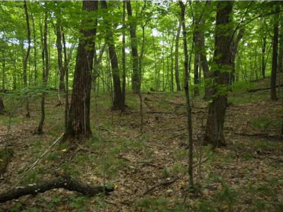
Vegetation Plots - basis for the classification
Site information
20 m
Composition -cover and abundance of all plants
Vertical Structure
Source: John Almendinger, MN DNR
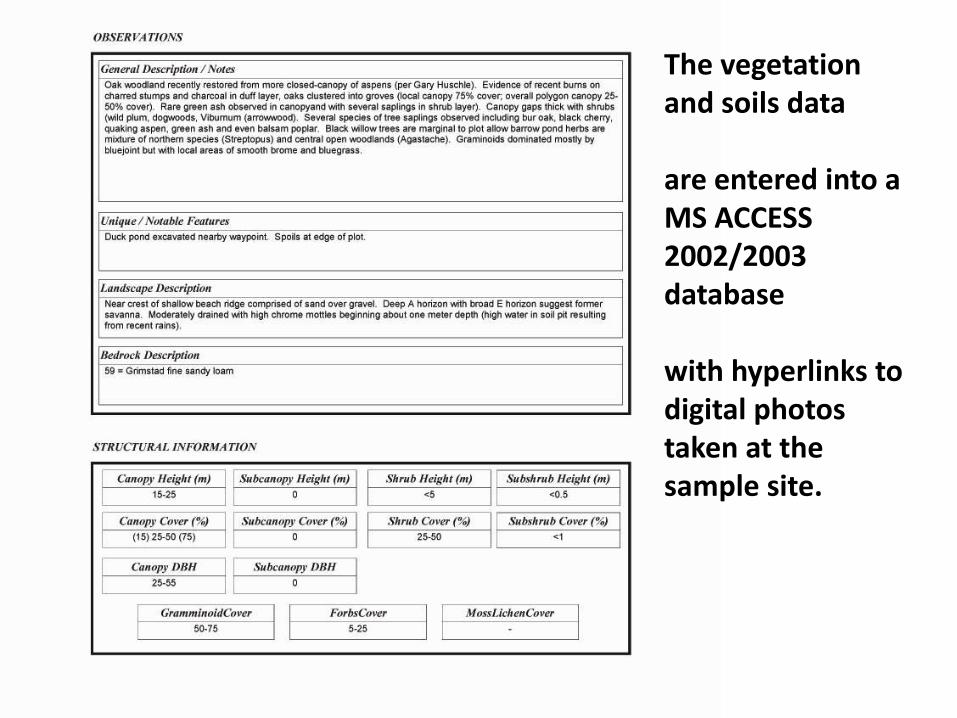
The vegetation and soils data
are entered into a MS ACCESS 2002/2003 database
with hyperlinks to digital photos taken at the sample site.
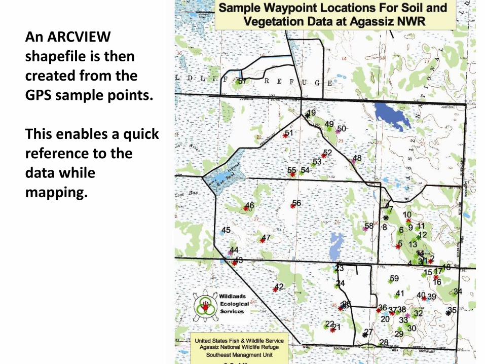
An ARCVIEW shapefile is then created from the GPS sample points.
This enables a quick reference to the data while mapping.
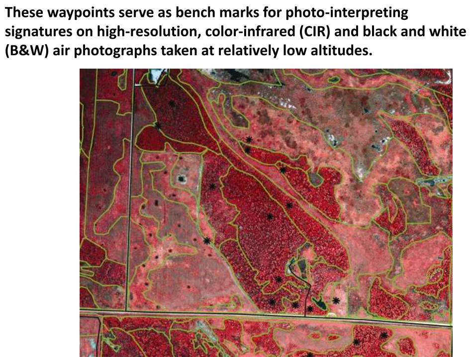
These waypoints serve as bench marks for photo-interpreting signatures on high-resolution, color-infrared (CIR) and black and white (B&W) air photographs taken at relatively low altitudes.
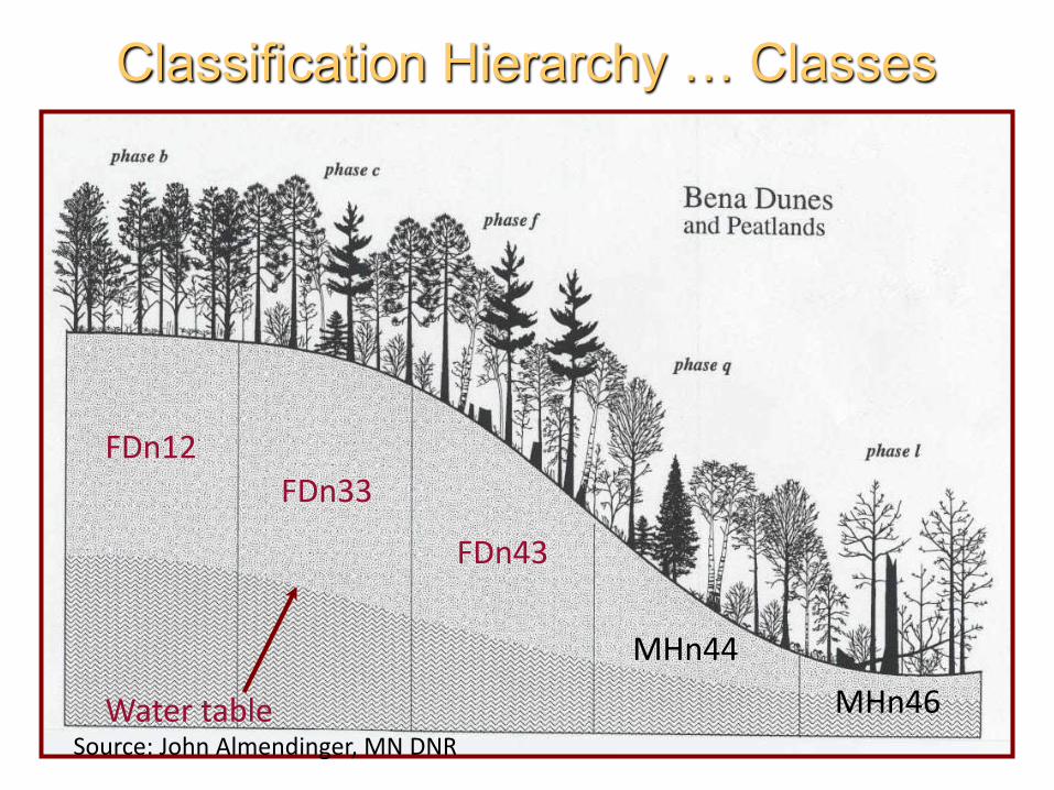
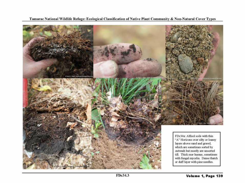
Classification Hierarchy … Classes
FDn12FDn33
FDn43
MHn44
MHn46Water tableSource: John Almendinger, MN DNR
Climate and The DistributionOf Vegetation
Source: MN DNR
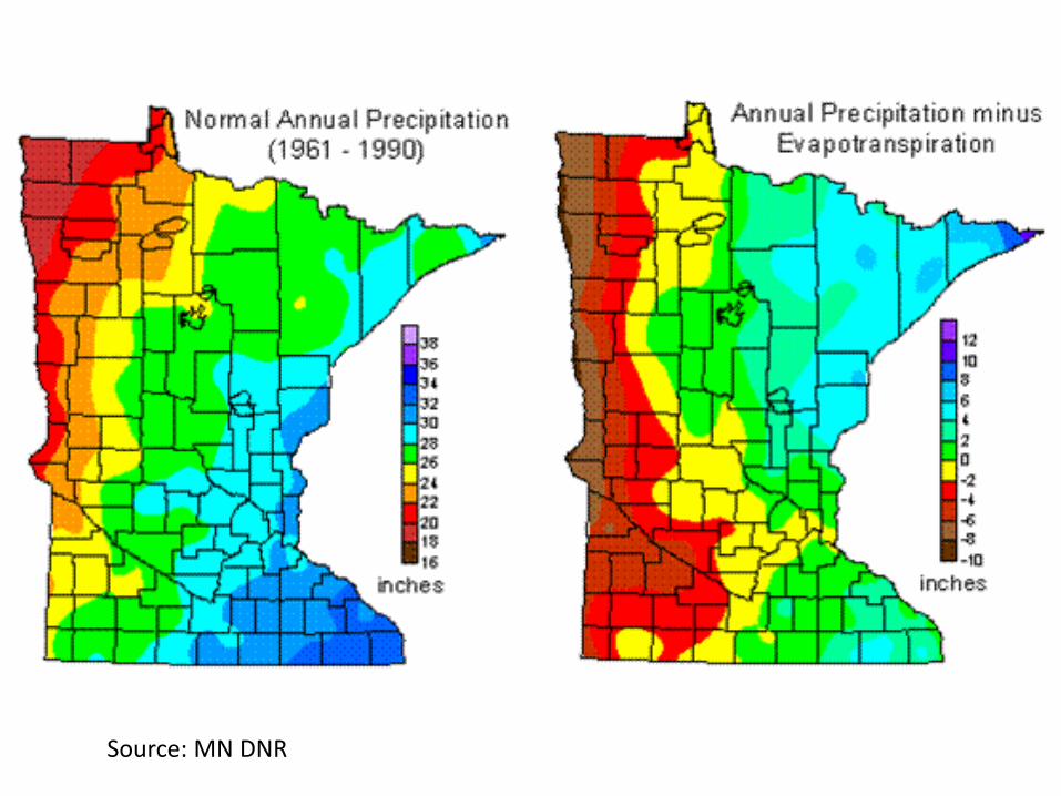
Source: MN DNR

ECS Biomes (Divisions)
In North America
From: Prior, J.C. 1991. Landforms of Iowa. University of Iowa Press, IA DNR.
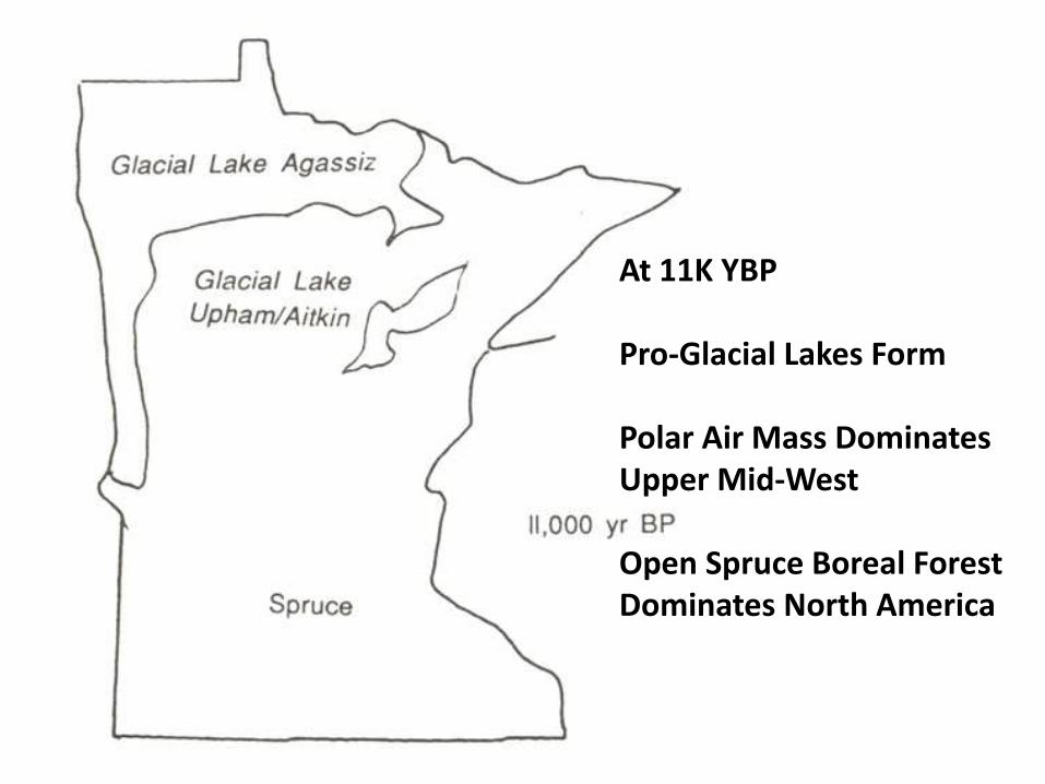
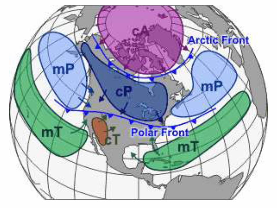
At 11K YBP
Pro-Glacial Lakes Form
Polar Air Mass DominatesUpper Mid-West
Open Spruce Boreal ForestDominates North America
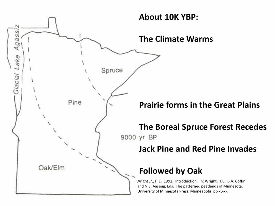
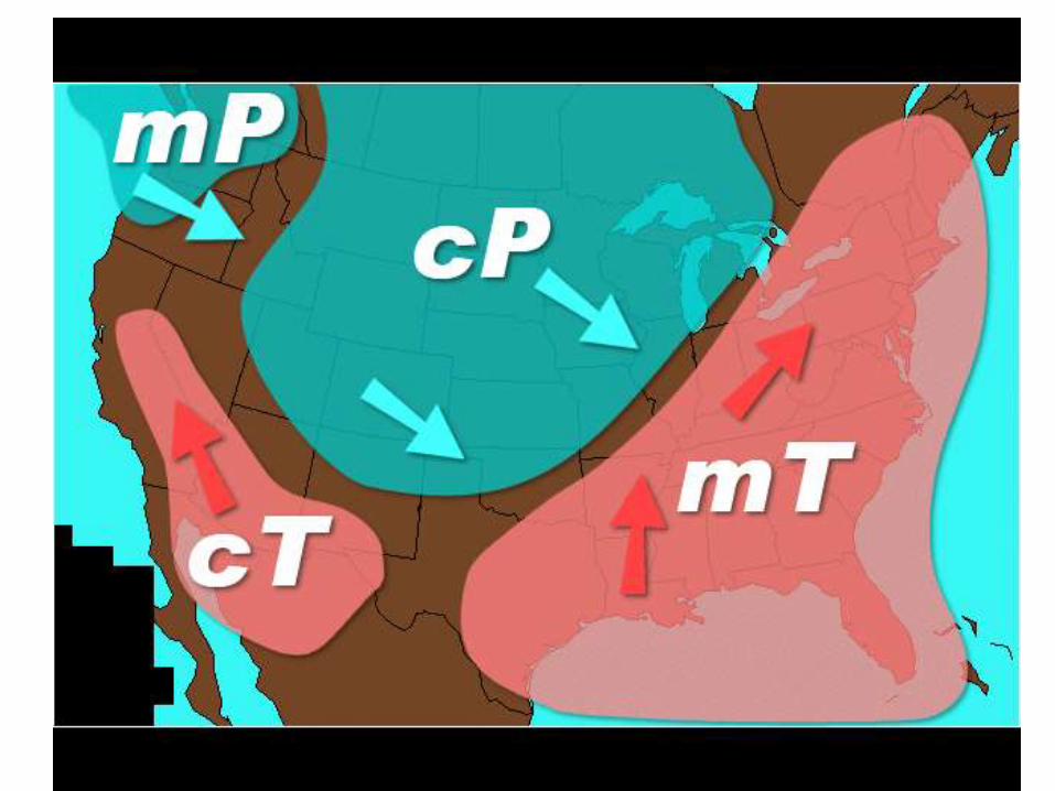
About 10K YBP:
The Climate Warms
Prairie forms in the Great Plains
The Boreal Spruce Forest Recedes
Jack Pine and Red Pine Invades
Followed by OakWright Jr., H.E. 1992. Introduction. In: Wright, H.E., B.A. Coffinand N.E. Aaseng, Eds. The patterned peatlands of Minnesota. University of Minnesota Press, Minneapolis, pp xv-xx.
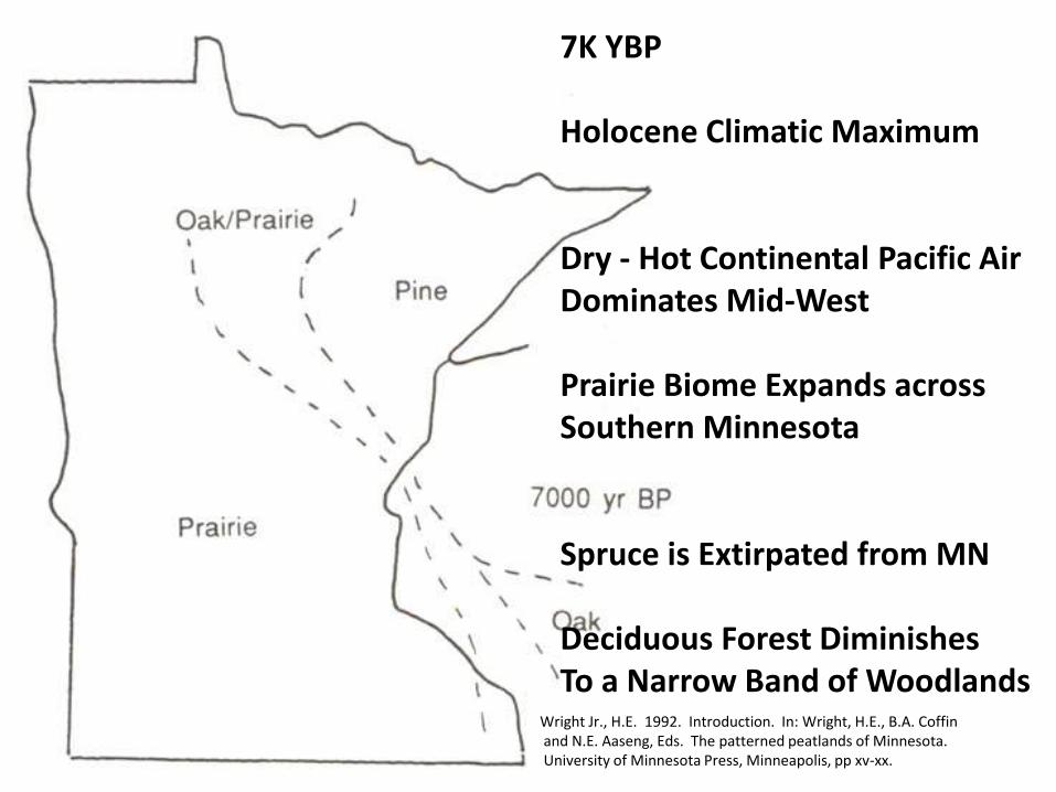
7K YBP
Holocene Climatic Maximum
Dry - Hot Continental Pacific Air Dominates Mid-West
Prairie Biome Expands acrossSouthern Minnesota
Spruce is Extirpated from MN
Deciduous Forest DiminishesTo a Narrow Band of Woodlands
Wright Jr., H.E. 1992. Introduction. In: Wright, H.E., B.A. Coffinand N.E. Aaseng, Eds. The patterned peatlands of Minnesota. University of Minnesota Press, Minneapolis, pp xv-xx.
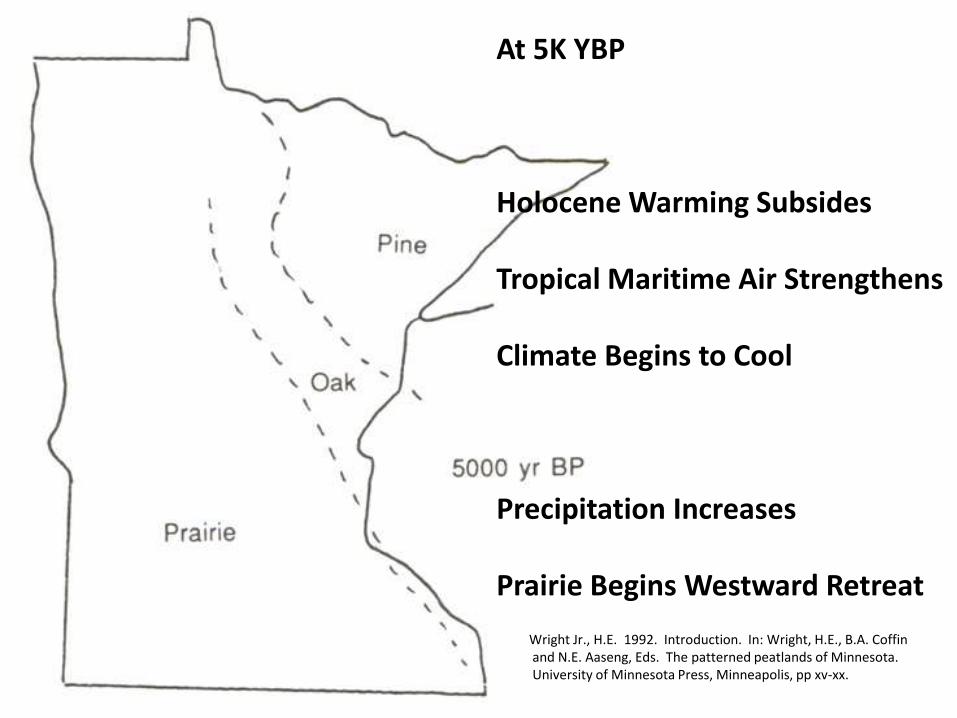
At 5K YBP
Holocene Warming Subsides
Tropical Maritime Air Strengthens
Climate Begins to Cool
Precipitation Increases
Prairie Begins Westward Retreat
Wright Jr., H.E. 1992. Introduction. In: Wright, H.E., B.A. Coffinand N.E. Aaseng, Eds. The patterned peatlands of Minnesota. University of Minnesota Press, Minneapolis, pp xv-xx.
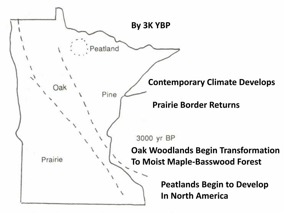
By 3K YBP
Contemporary Climate Develops
Prairie Border Returns
Oak Woodlands Begin TransformationTo Moist Maple-Basswood Forest
Peatlands Begin to DevelopIn North America
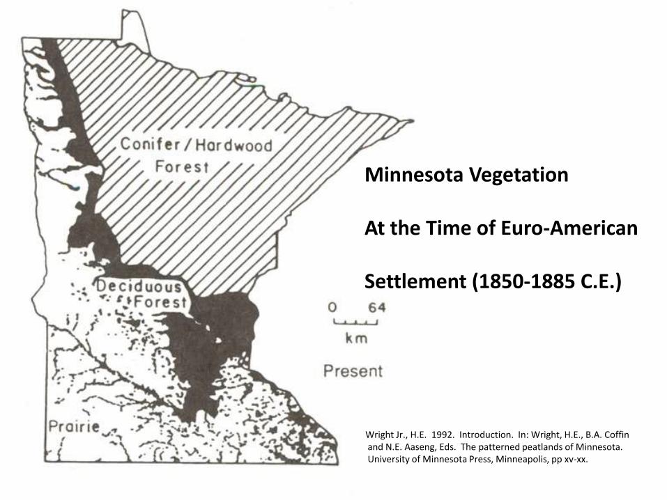
Minnesota Vegetation
At the Time of Euro-American
Settlement (1850-1885 C.E.)
Wright Jr., H.E. 1992. Introduction. In: Wright, H.E., B.A. Coffinand N.E. Aaseng, Eds. The patterned peatlands of Minnesota. University of Minnesota Press, Minneapolis, pp xv-xx.
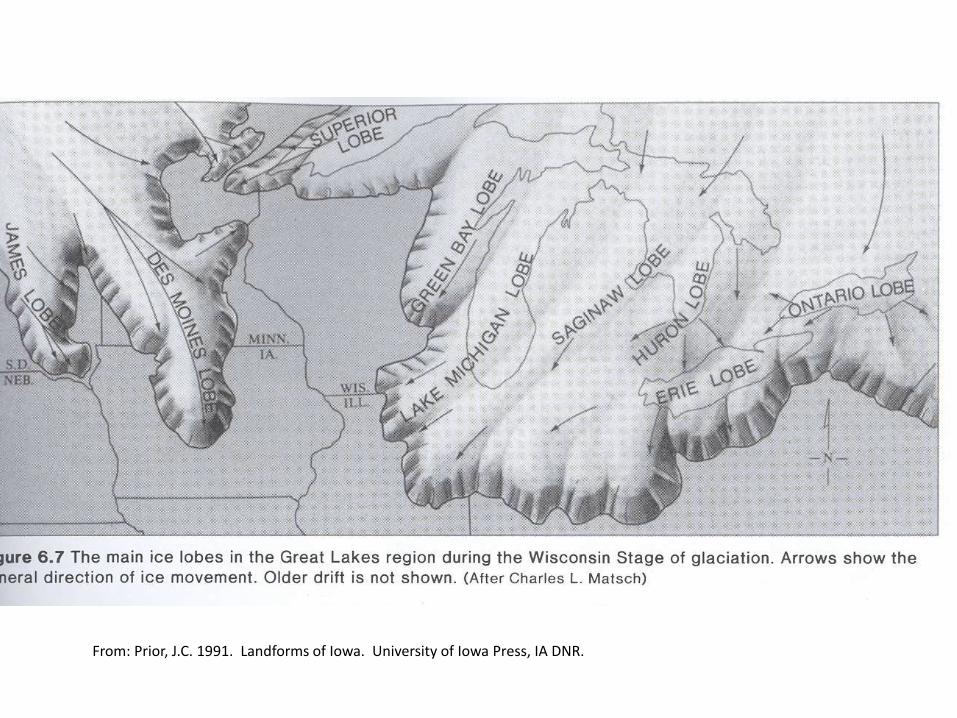
Surficial Geology &Vegetation Distribution
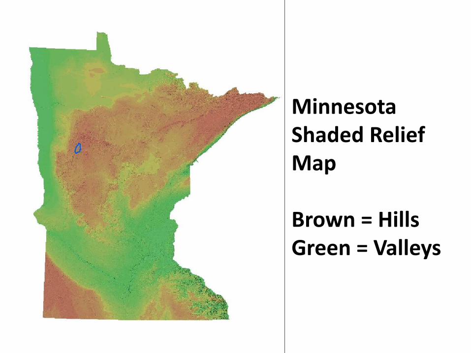
Minnesota Shaded Relief Map
Brown = HillsGreen = Valleys
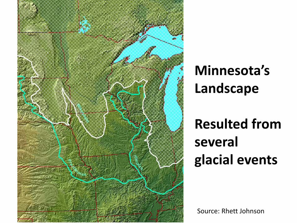
Minnesota’s Landscape
Resulted from several glacial events
Source: Rhett Johnson
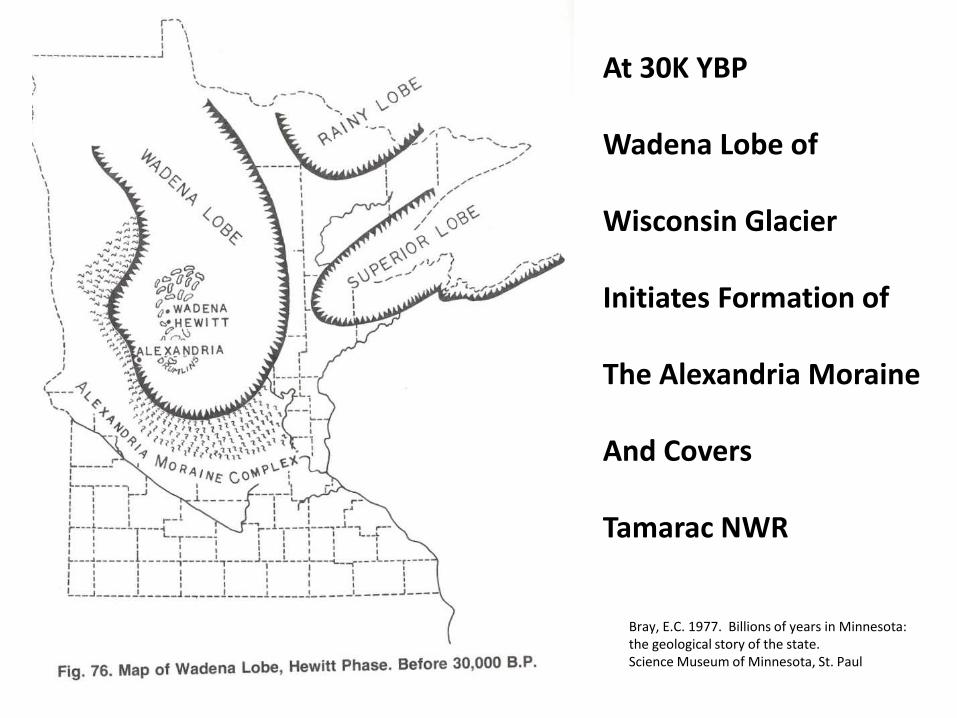
At 30K YBP
Wadena Lobe of
Wisconsin Glacier
Initiates Formation of
The Alexandria Moraine
And Covers
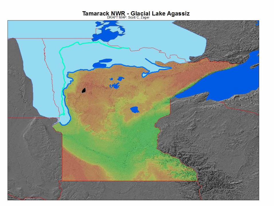
Tamarac NWR
Bray, E.C. 1977. Billions of years in Minnesota: the geological story of the state. Science Museum of Minnesota, St. Paul
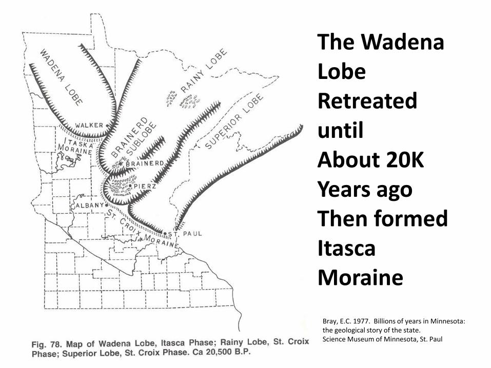
The Wadena Lobe Retreated until About 20KYears agoThen formedItasca Moraine
Bray, E.C. 1977. Billions of years in Minnesota: the geological story of the state. Science Museum of Minnesota, St. Paul
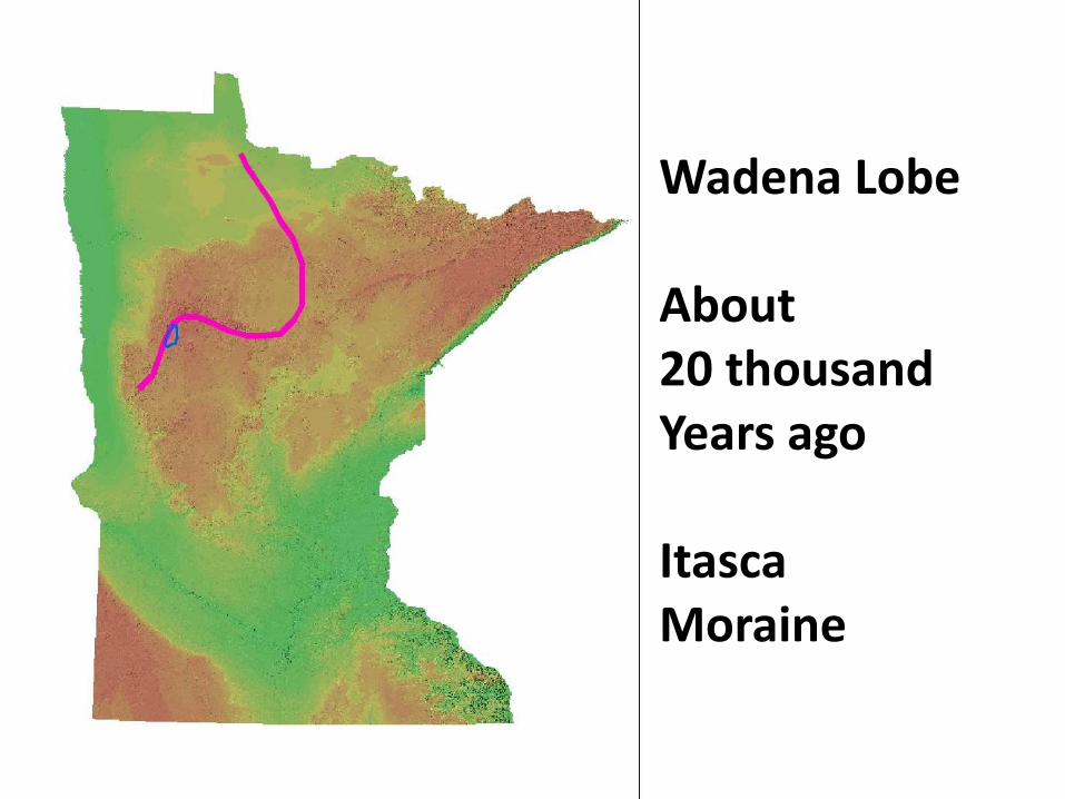
Wadena Lobe
About 20 thousandYears ago
ItascaMoraine
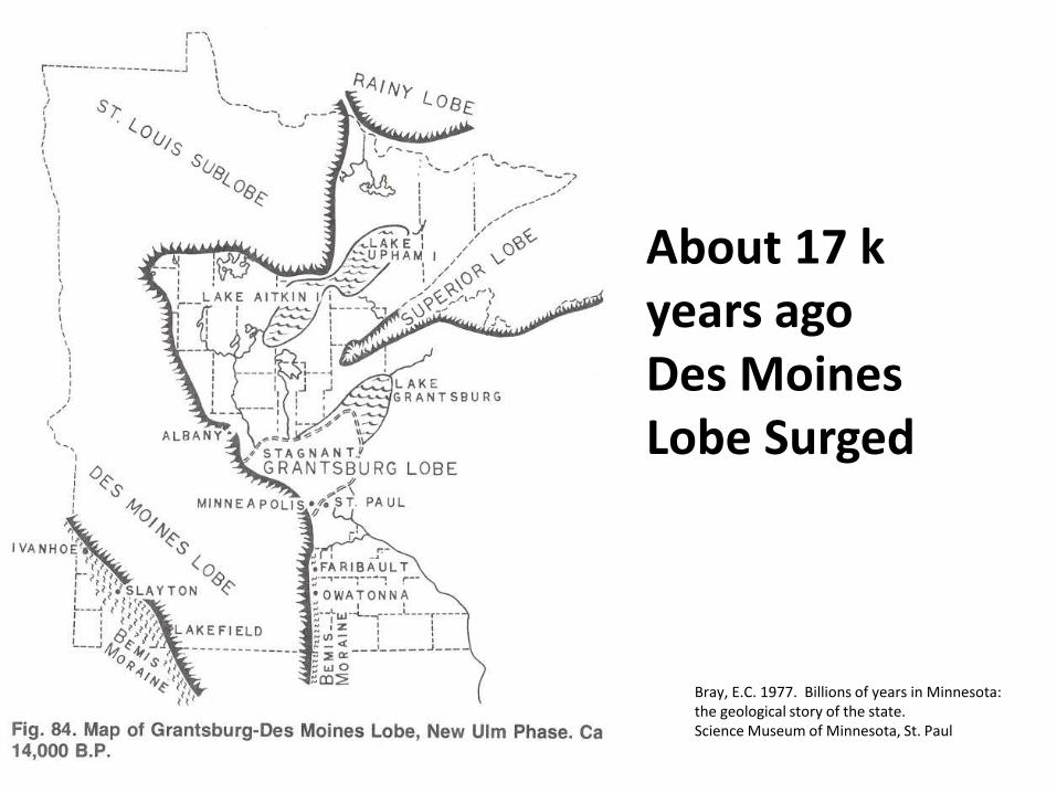
About 17 k years agoDes Moines Lobe Surged
Bray, E.C. 1977. Billions of years in Minnesota: the geological story of the state. Science Museum of Minnesota, St. Paul
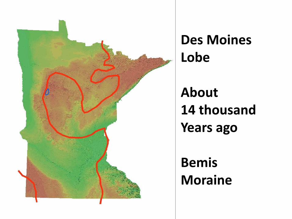
Des MoinesLobe
About 14 thousandYears ago
BemisMoraine
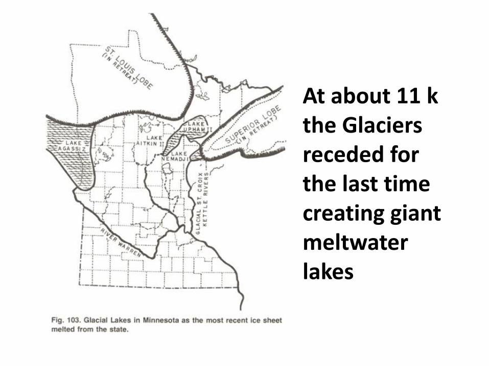
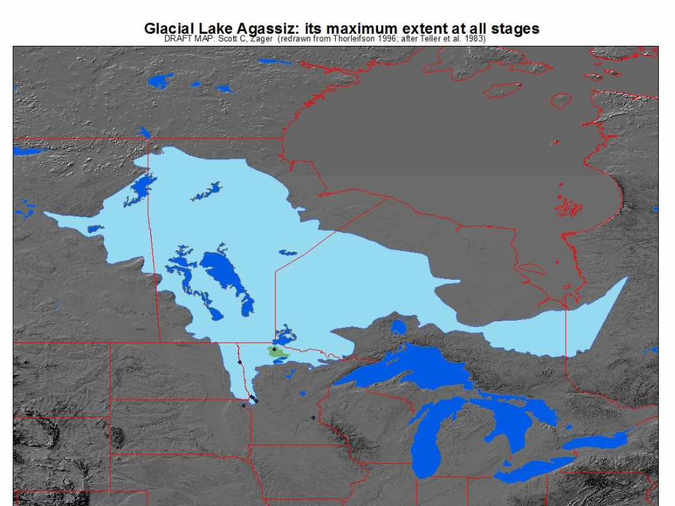
At about 11 k the Glaciers receded for the last time creating giant meltwater lakes
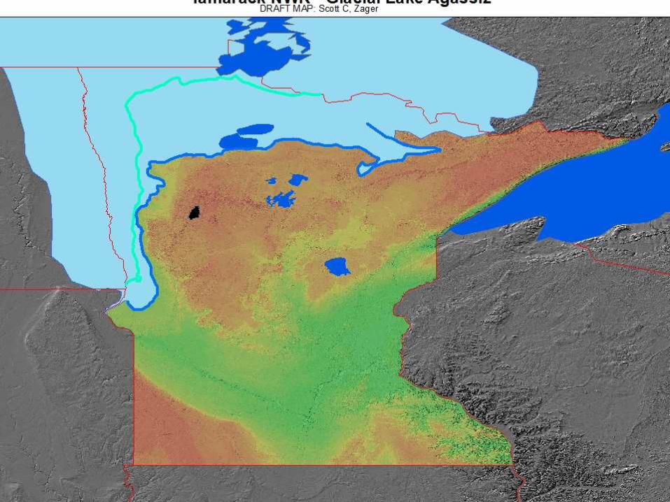
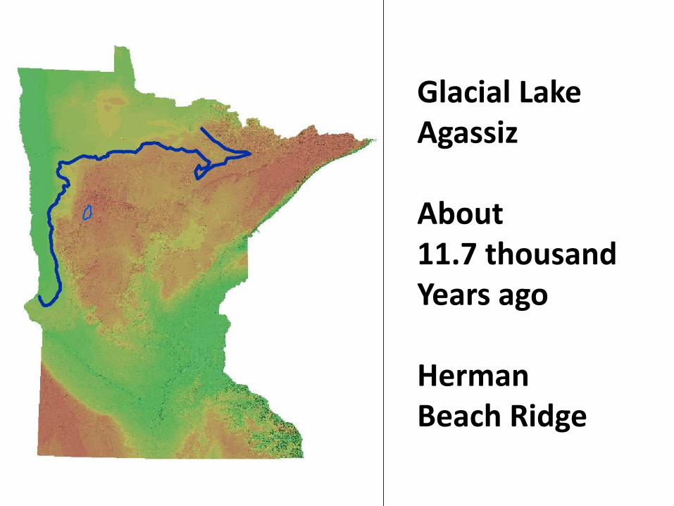
Glacial LakeAgassiz
About 11.7 thousandYears ago
HermanBeach Ridge
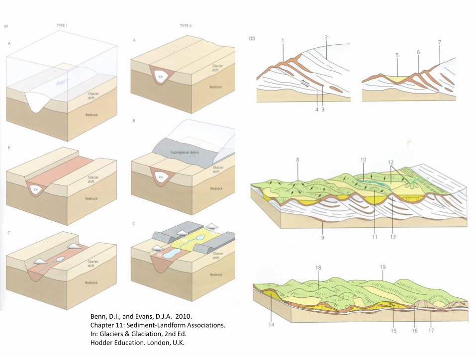
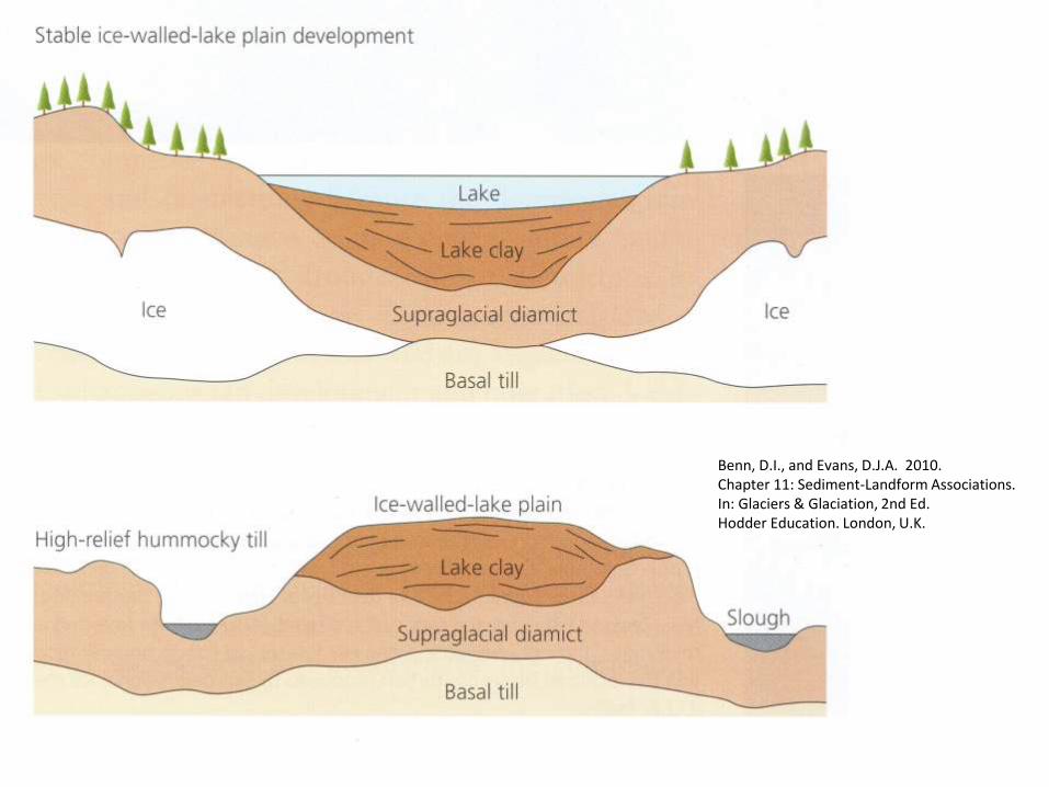
Benn, D.I., and Evans, D.J.A. 2010. Chapter 11: Sediment-Landform Associations. In: Glaciers & Glaciation, 2nd Ed. Hodder Education. London, U.K.
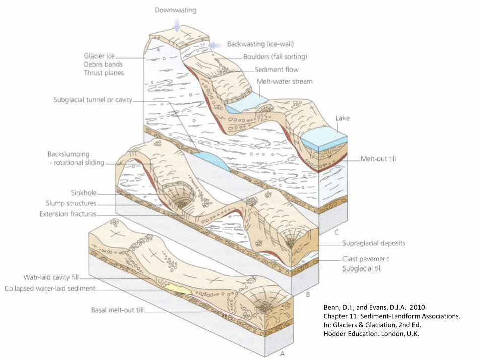
Benn, D.I., and Evans, D.J.A. 2010. Chapter 11: Sediment-Landform Associations. In: Glaciers & Glaciation, 2nd Ed. Hodder Education. London, U.K.
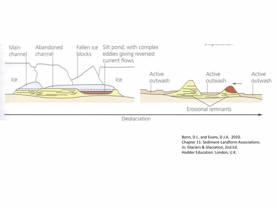
Benn, D.I., and Evans, D.J.A. 2010. Chapter 11: Sediment-Landform Associations. In: Glaciers & Glaciation, 2nd Ed. Hodder Education. London, U.K.
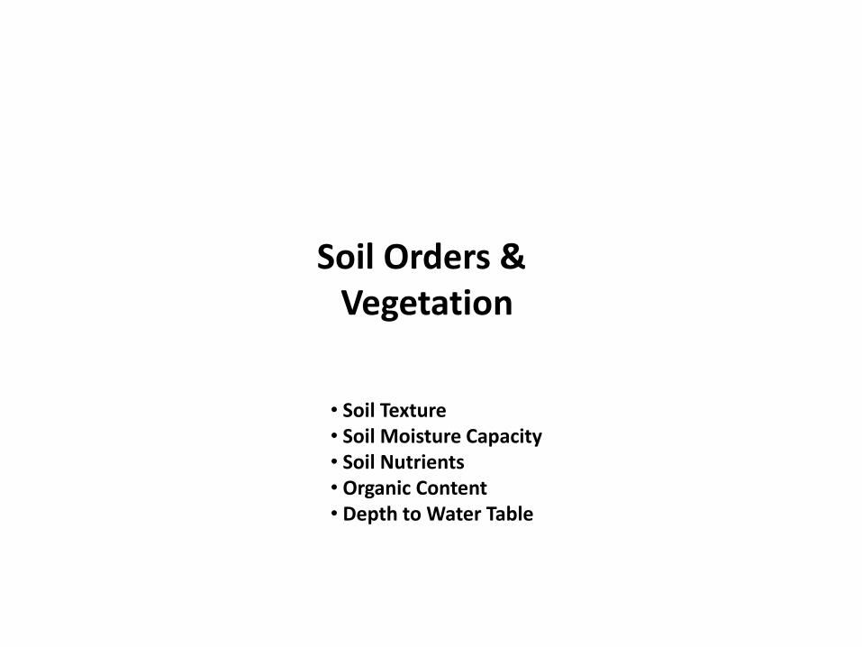
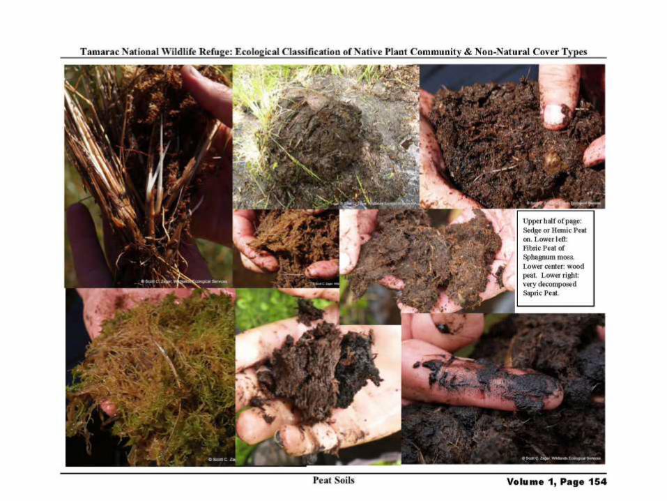
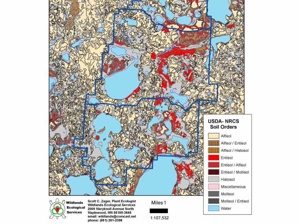
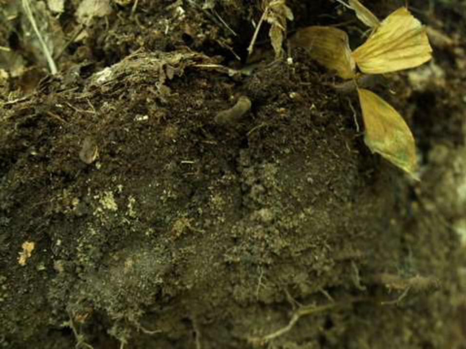
Soil Orders & Vegetation
• Soil Texture• Soil Moisture Capacity• Soil Nutrients• Organic Content• Depth to Water Table


Benn, D.I., and Evans, D.J.A. 2010. Chapter 11: Sediment-Landform Associations. In: Glaciers & Glaciation, 2nd Ed. Hodder Education. London, U.K.