Embed Size (px)
Citation preview
Orient Yourself
Youth Leadership Forum 2011Marking & Navigating
“Earth, Sea & Sky”
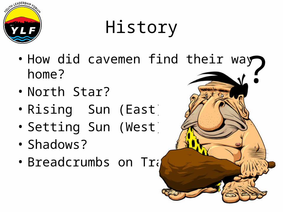
• How did cavemen find their way home?• North Star?• Rising Sun (East)• Setting Sun (West)• Shadows?• Breadcrumbs on Trail?
History
?
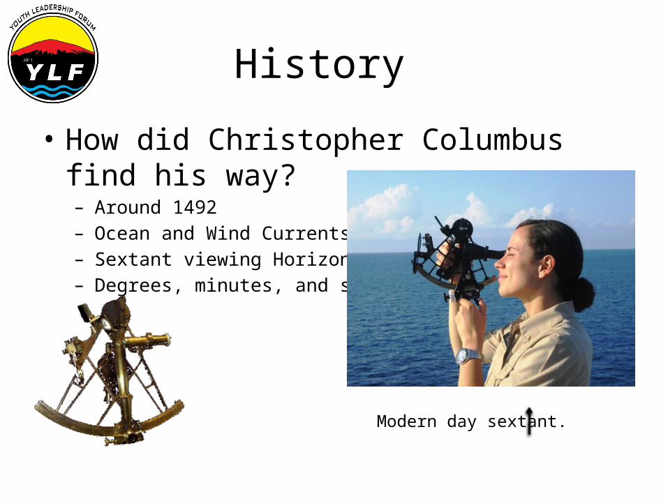
History
• How did Christopher Columbus find his way?– Around 1492 – Ocean and Wind Currents– Sextant viewing Horizon– Degrees, minutes, and seconds
Modern day sextant.
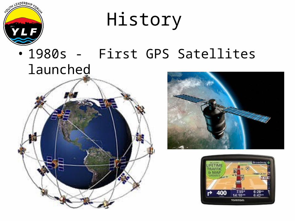
History
• 1980s - First GPS Satellites launched
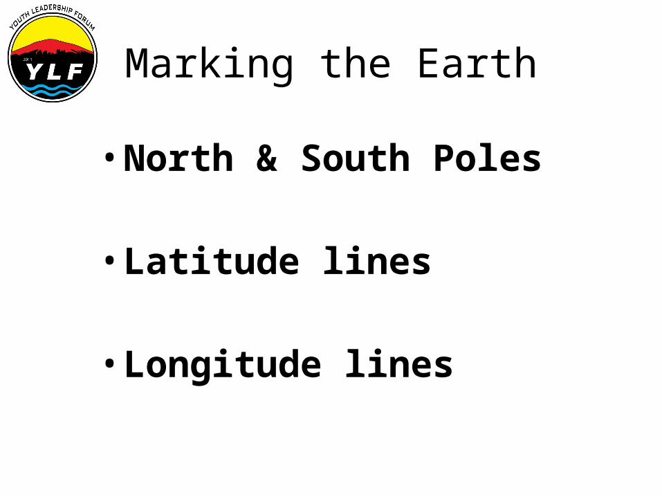
Marking the Earth
• North & South Poles • Latitude lines
• Longitude lines
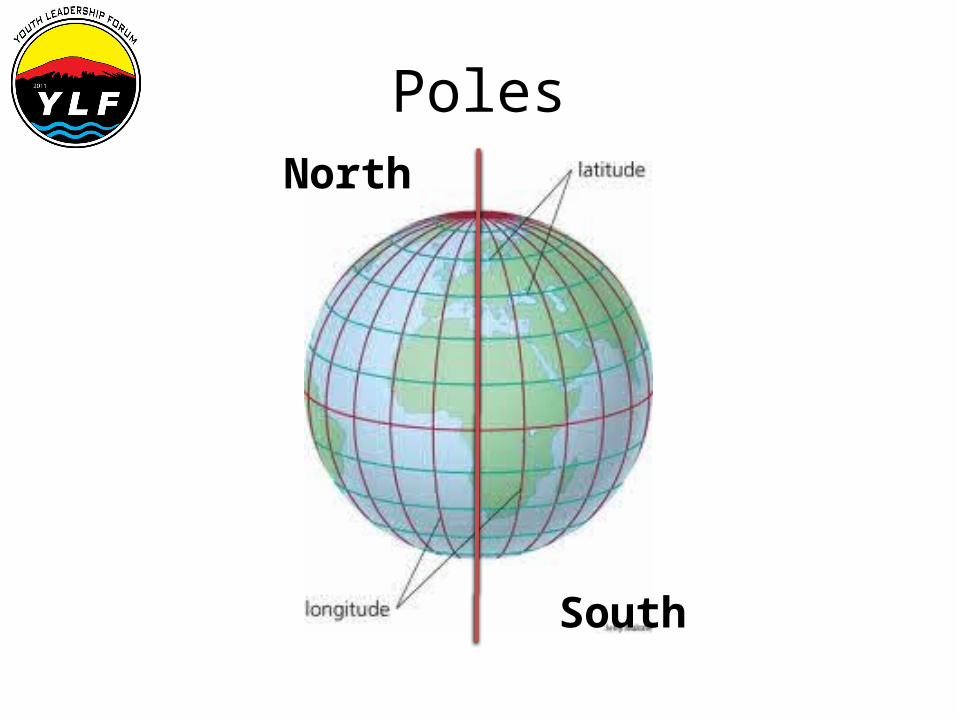
PolesNorth
South
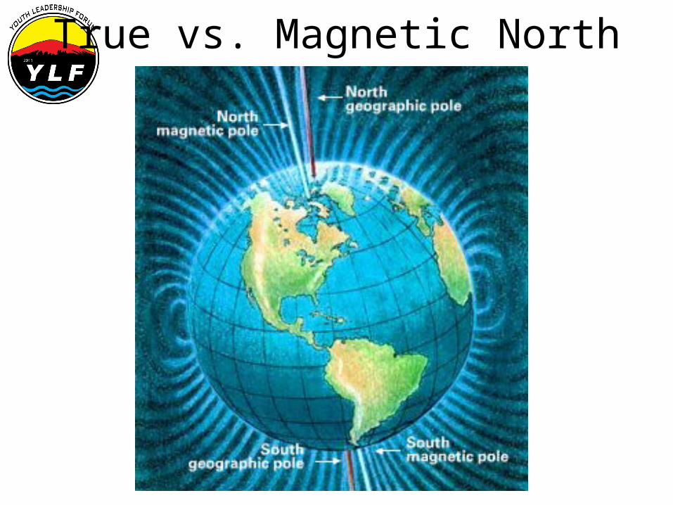
True vs. Magnetic North
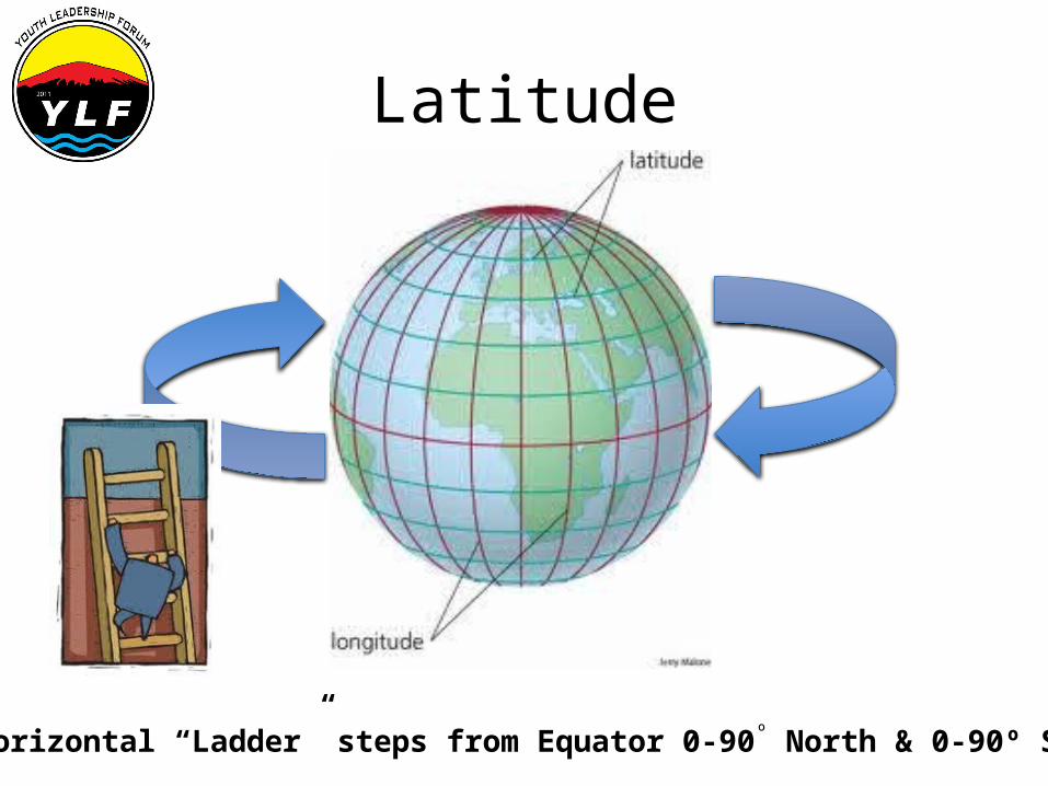
Latitude
Horizontal “Ladder” steps from Equator 0-90º North & 0-90º South
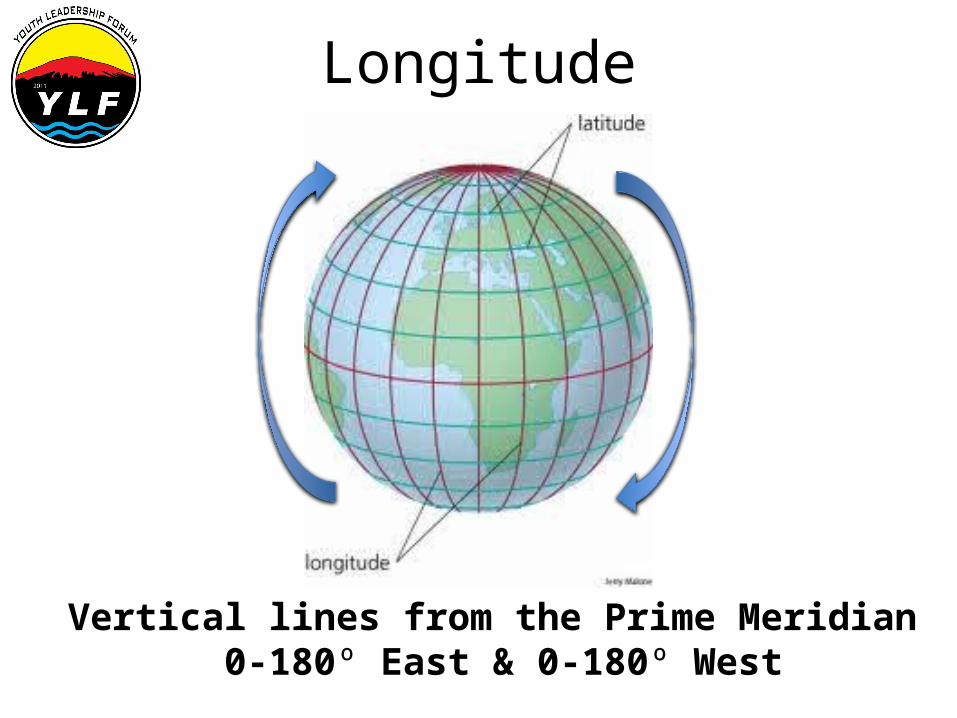
Longitude
Vertical lines from the Prime Meridian 0-180º East & 0-180º West
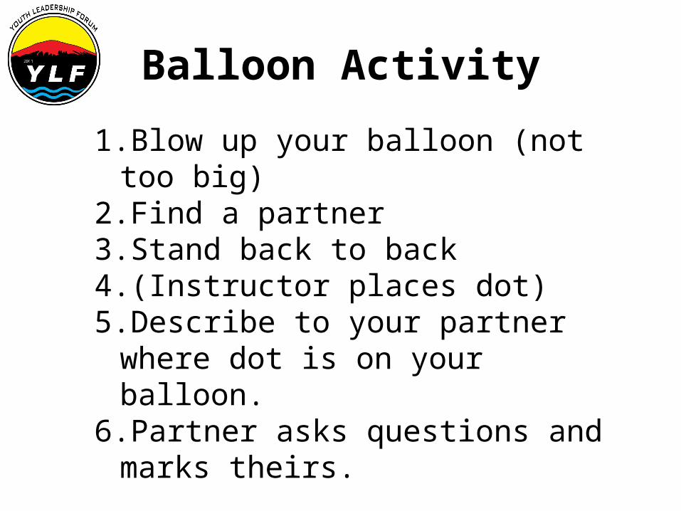
Balloon Activity
1.Blow up your balloon (not too big)2.Find a partner3.Stand back to back4.(Instructor places dot)5.Describe to your partner where dot is on
your balloon. 6.Partner asks questions and marks theirs.
What is difficult about communicating this?
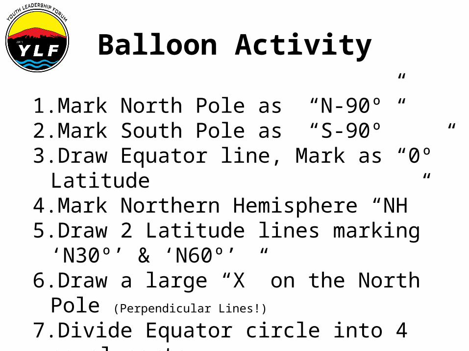
Balloon Activity
1.Mark North Pole as “N-90º”2.Mark South Pole as “S-90º”3.Draw Equator line, Mark as “0º” Latitude4.Mark Northern Hemisphere “NH”5.Draw 2 Latitude lines marking ‘N30º’ & ‘N60º’6.Draw a large “X” on the North Pole (Perpendicular Lines!)
7.Divide Equator circle into 4 equal parts. (4 Longitudinal lines: ‘0º’, ‘E90º’, ‘W90º’, ‘180º’, ) “0º” is the Prime Meridian or Greenwich Meridian “180º is International Dateline
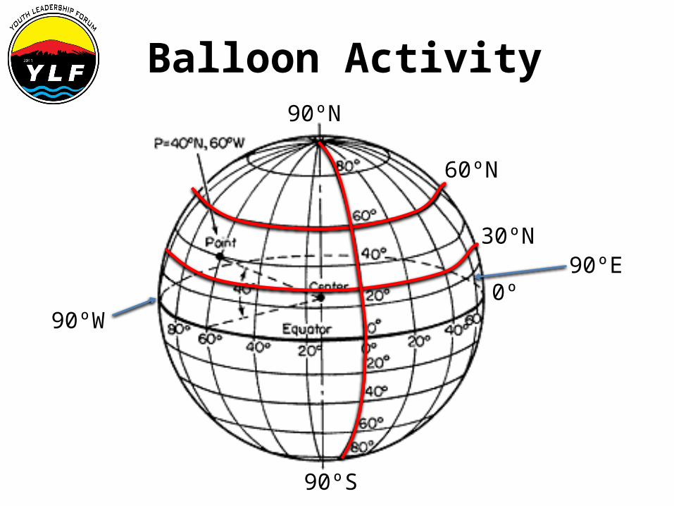
Balloon Activity
30ºN
60ºN
0º
90ºS
90ºW
90ºE
90ºN

Flat Map with Lat./ Long.
90ºE90ºW 0ºPrime Meridian
179ºE179ºW
0º
30ºN
60ºN
30ºS
60ºS
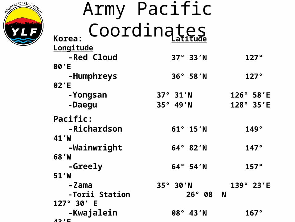
Army Pacific CoordinatesKorea: Latitude
Longitude-Red Cloud 37° 33’N
127° 00’E-Humphreys 36° 58’N
127° 02’E-Yongsan 37° 31’N
126° 58’E-Daegu 35° 49’N
128° 35’E
Pacific:-Richardson 61° 15’N
149° 41’W-Wainwright 64° 82’N
147° 68’W-Greely 64° 54’N
157° 51’W-Zama 35° 30’N
139° 23’E-Torii Station 26° 08 N
127° 30’ E-Kwajalein 08° 43’N
167° 43’E
Hawaii:-Hilo- 19° 43’N
155° 5’W-Honolulu 21° 20’N
157° 55’W-Kaneohe Bay MCAS 21° 27’N157° 46’W-Wahiawa 21° 3’N
158° 2’W