Embed Size (px)
Citation preview
Youngsville ParkwayYoungsville Parkway
Presented by
Raymond J. Reaux, PE
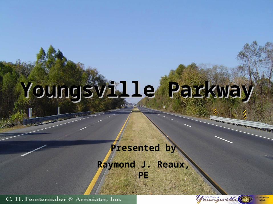
Town of Youngsville Government
Mayor
Wilson B. Viator, Jr.
Town of Youngsville Council
Jesse Vallot
Brenda Burley
Paul Huval
Huey Romero
A.J. Bernard
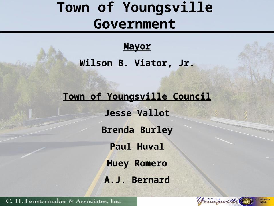
Financially Constrained Transportation Plan
N
North – South Beltway
Youngsville Parkway
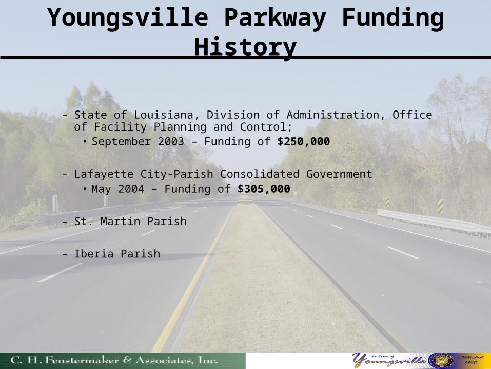
Youngsville Parkway Funding History
– State of Louisiana, Division of Administration, Office of Facility Planning and Control;
• September 2003 – Funding of $250,000
– Lafayette City-Parish Consolidated Government• May 2004 – Funding of $305,000
– St. Martin Parish
– Iberia Parish
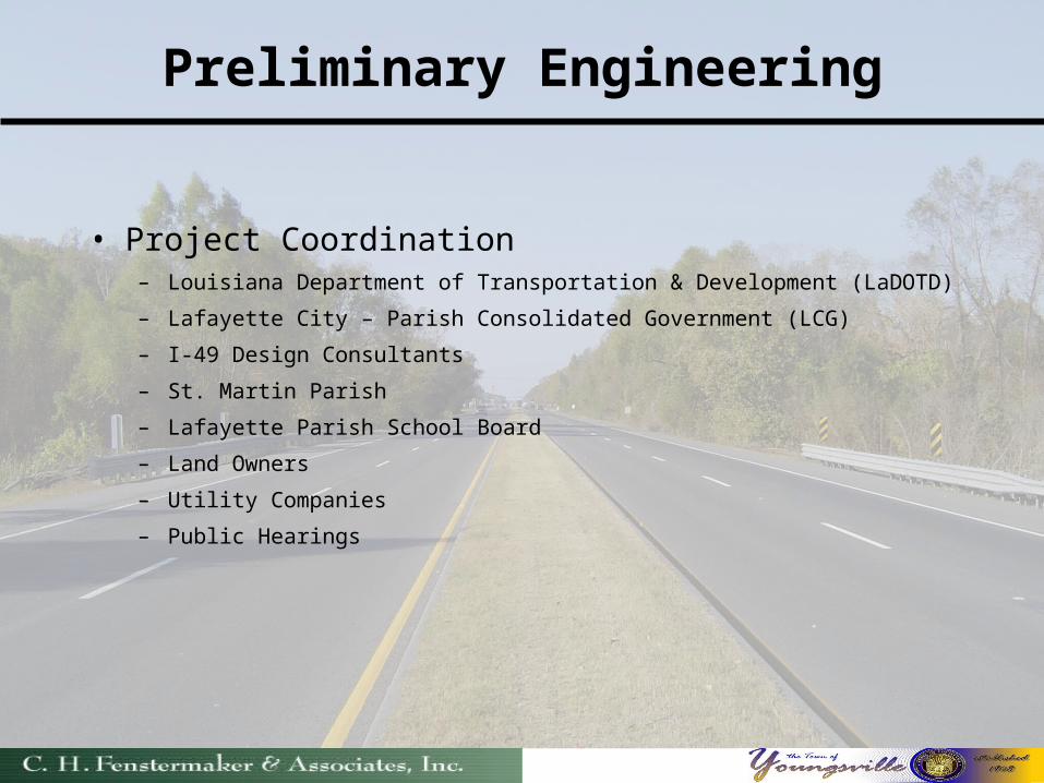
Preliminary Engineering
• Project Coordination– Louisiana Department of Transportation & Development (LaDOTD)
– Lafayette City – Parish Consolidated Government (LCG)
– I-49 Design Consultants
– St. Martin Parish
– Lafayette Parish School Board
– Land Owners
– Utility Companies
– Public Hearings
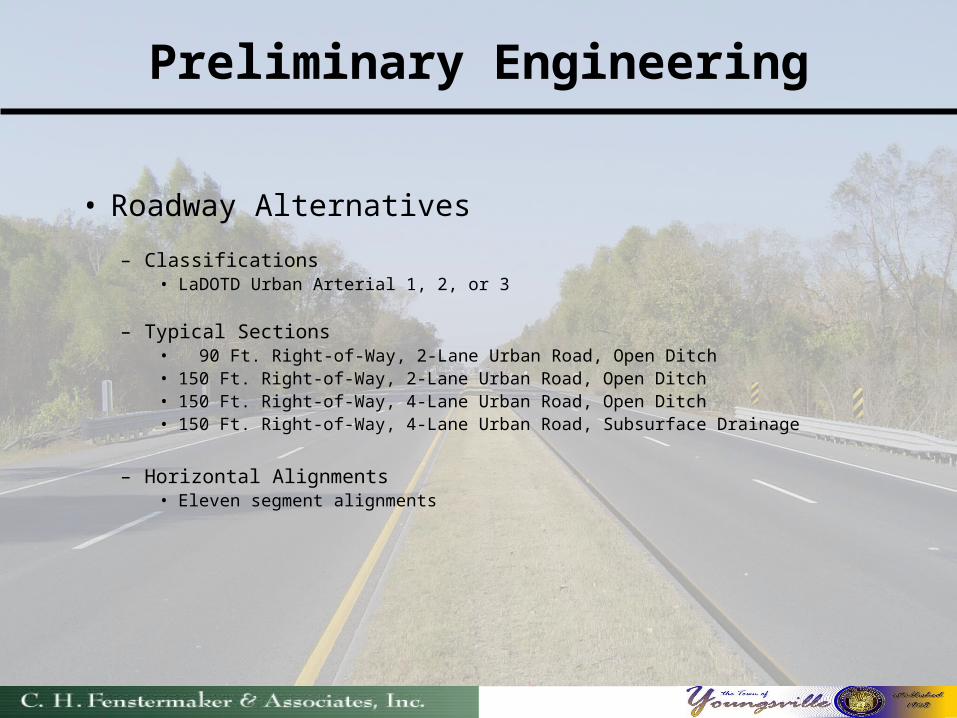
Preliminary Engineering
• Roadway Alternatives
– Classifications• LaDOTD Urban Arterial 1, 2, or 3
– Typical Sections• 90 Ft. Right-of-Way, 2-Lane Urban Road, Open Ditch • 150 Ft. Right-of-Way, 2-Lane Urban Road, Open Ditch• 150 Ft. Right-of-Way, 4-Lane Urban Road, Open Ditch• 150 Ft. Right-of-Way, 4-Lane Urban Road, Subsurface Drainage
– Horizontal Alignments• Eleven segment alignments
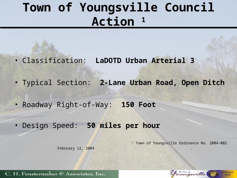
Town of Youngsville Council Action 1
• Classification: LaDOTD Urban Arterial 3
• Typical Section: 2-Lane Urban Road, Open Ditch
• Roadway Right-of-Way: 150 Foot
• Design Speed: 50 miles per hour
1 Town of Youngsville Ordinance No. 2004-002
February 12, 2004 .
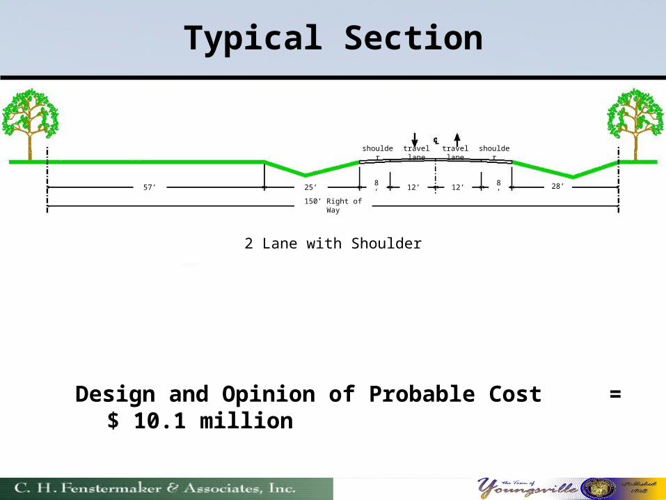
Typical Section
Design and Opinion of Probable Cost = $ 10.1 million
25’57’ 8’ 12’ 12’ 8’ 28’
150’ Right of Way
2 Lane with Shoulder
shoulder shouldertravel lane
travel lane
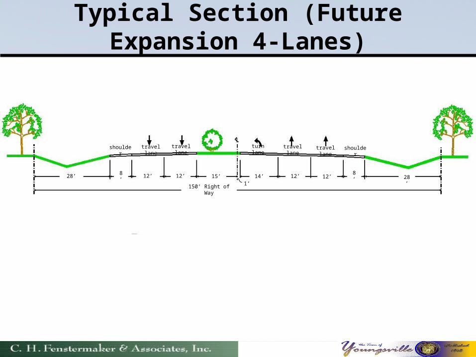
Typical Section (Future Expansion 4-Lanes)
12’28’ 8’ 12’ 15’ 8’12’
150’ Right of Way
shoulder shouldertravel lane
travel lane
12’14’1’
travel lane
travel lane
turn lane
28’
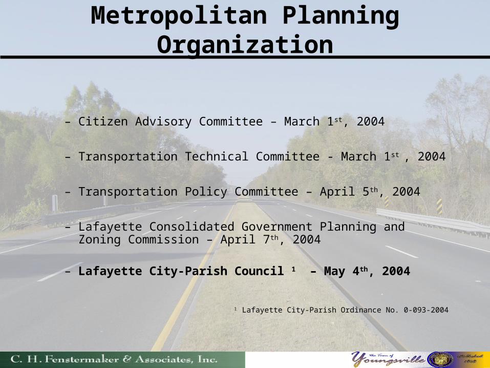
Metropolitan Planning Organization
– Citizen Advisory Committee – March 1st, 2004
– Transportation Technical Committee - March 1st , 2004
– Transportation Policy Committee – April 5th, 2004
– Lafayette Consolidated Government Planning and Zoning Commission – April 7th, 2004
– Lafayette City-Parish Council 1 – May 4th, 2004
1 Lafayette City-Parish Ordinance No. 0-093-2004
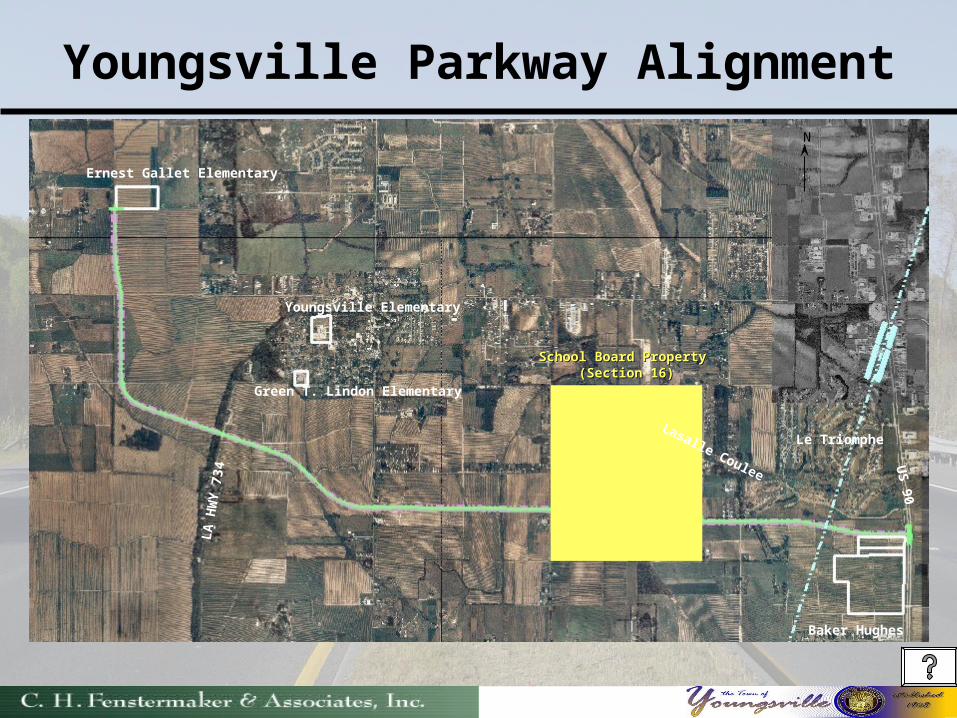
Youngsville Parkway Alignment
School Board Property School Board Property (Section 16)(Section 16)
Green T. Lindon Elementary
Ernest Gallet Elementary
Youngsville Elementary
Baker Hughes
US 90
Lasalle Coulee
LA
HW
Y 7
34
N
Le Triomphe
Fly Through…….
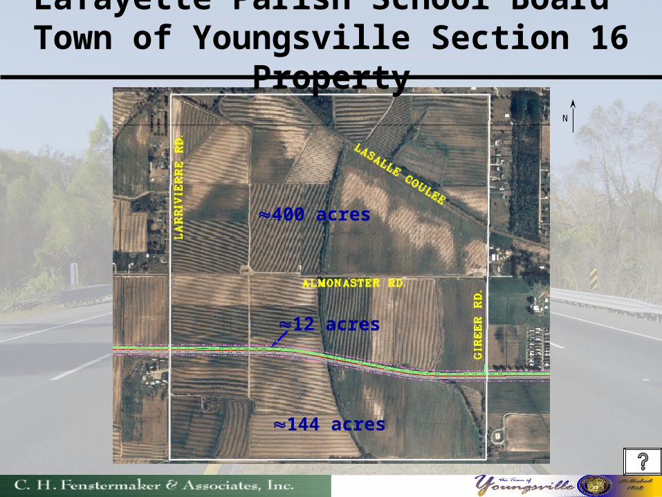
Lafayette Parish School Board Town of Youngsville Section 16 Property
12 acres
N
400 acres
144 acres
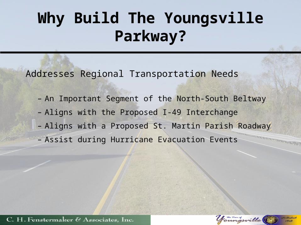
Why Build The Youngsville Parkway?
Addresses Regional Transportation Needs
– An Important Segment of the North-South Beltway
– Aligns with the Proposed I-49 Interchange
– Aligns with a Proposed St. Martin Parish Roadway
– Assist during Hurricane Evacuation Events
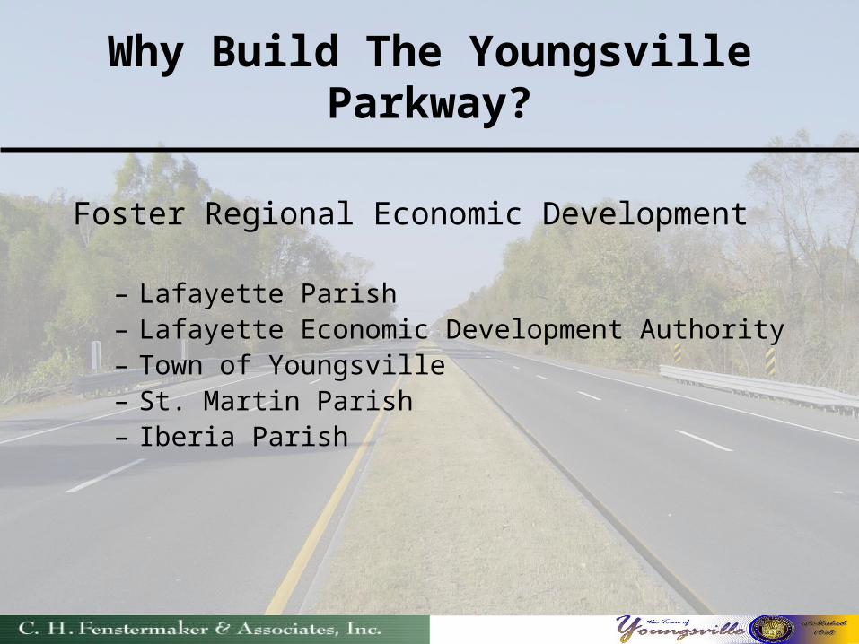
Why Build The Youngsville Parkway?
Foster Regional Economic Development
– Lafayette Parish– Lafayette Economic Development Authority– Town of Youngsville– St. Martin Parish– Iberia Parish
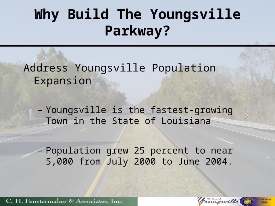
Why Build The Youngsville Parkway?
Address Youngsville Population Expansion
– Youngsville is the fastest-growing Town in the State of Louisiana
– Population grew 25 percent to near 5,000 from July 2000 to June 2004.
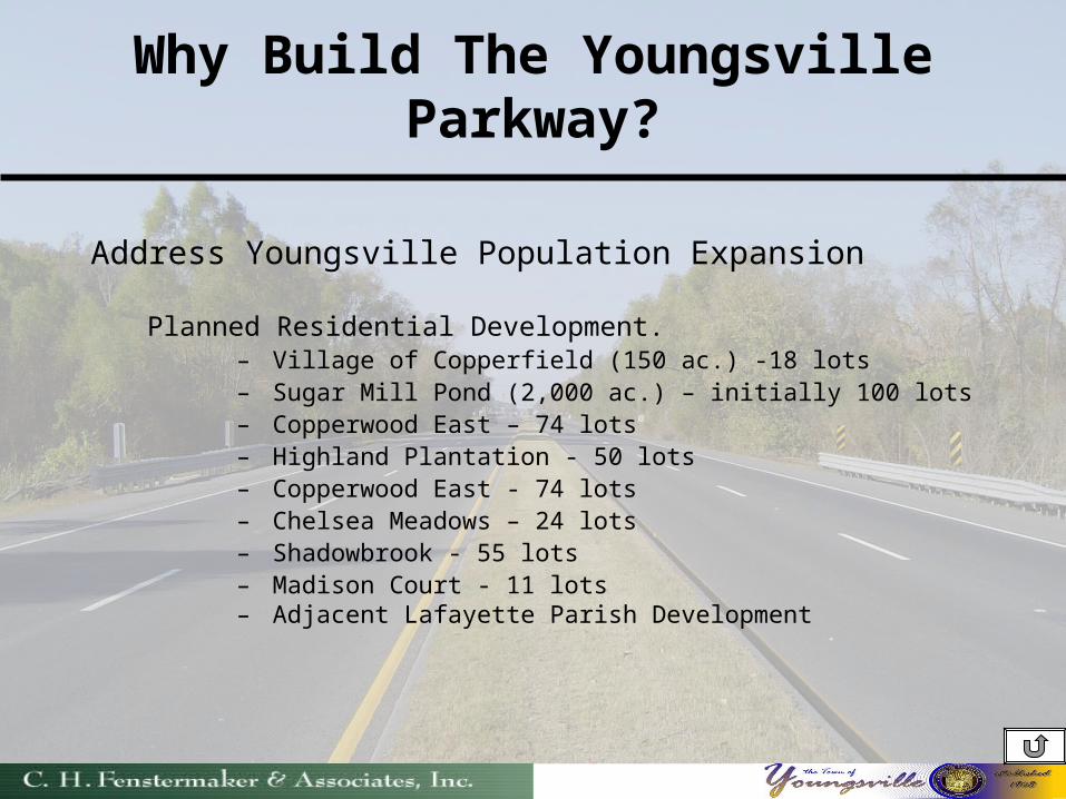
Why Build The Youngsville Parkway?
Address Youngsville Population Expansion
Planned Residential Development.– Village of Copperfield (150 ac.) -18 lots– Sugar Mill Pond (2,000 ac.) – initially 100 lots – Copperwood East – 74 lots– Highland Plantation - 50 lots– Copperwood East - 74 lots– Chelsea Meadows – 24 lots – Shadowbrook - 55 lots– Madison Court - 11 lots– Adjacent Lafayette Parish Development
QUESTIONS QUESTIONS
??????