Embed Size (px)
Citation preview
Y.J. Meijer, GECA, II GALION WS, 22-09-2010
ESA’s Generic Environment for Calibration/validation Analysis (GECA)
Yasjka Meijer et al.European Space Agency
Frascati, Italy
Y.J. Meijer, GECA, II GALION WS, 22-09-2010
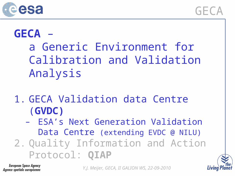
GECA
GECA – a Generic Environment for Calibration and Validation Analysis
1. GECA Validation data Centre (GVDC)– ESA’s Next Generation Validation Data
Centre (extending EVDC @ NILU)
2. Quality Information and Action Protocol: QIAP
Y.J. Meijer, GECA, II GALION WS, 22-09-2010
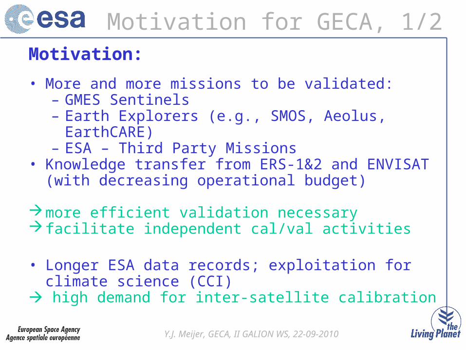
Motivation for GECA, 1/2Motivation:
• More and more missions to be validated:– GMES Sentinels– Earth Explorers (e.g., SMOS, Aeolus, EarthCARE)– ESA – Third Party Missions
• Knowledge transfer from ERS-1&2 and ENVISAT (with decreasing operational budget)
more efficient validation necessary facilitate independent cal/val activities
• Longer ESA data records; exploitation for climate science (CCI)
high demand for inter-satellite calibration
Y.J. Meijer, GECA, II GALION WS, 22-09-2010
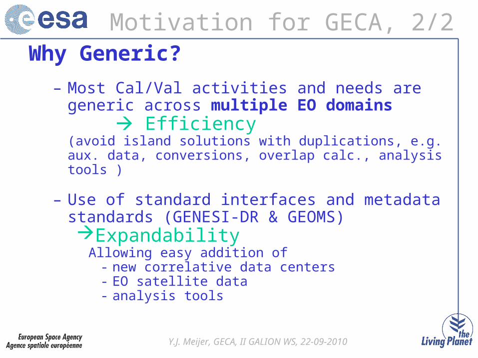
Motivation for GECA, 2/2Why Generic?
– Most Cal/Val activities and needs are generic across multiple EO domains
Efficiency (avoid island solutions with duplications, e.g. aux. data, conversions, overlap calc., analysis tools )
– Use of standard interfaces and metadata standards (GENESI-DR & GEOMS)Expandability
Allowing easy addition of - new correlative data centers- EO satellite data- analysis tools
Y.J. Meijer, GECA, II GALION WS, 22-09-2010
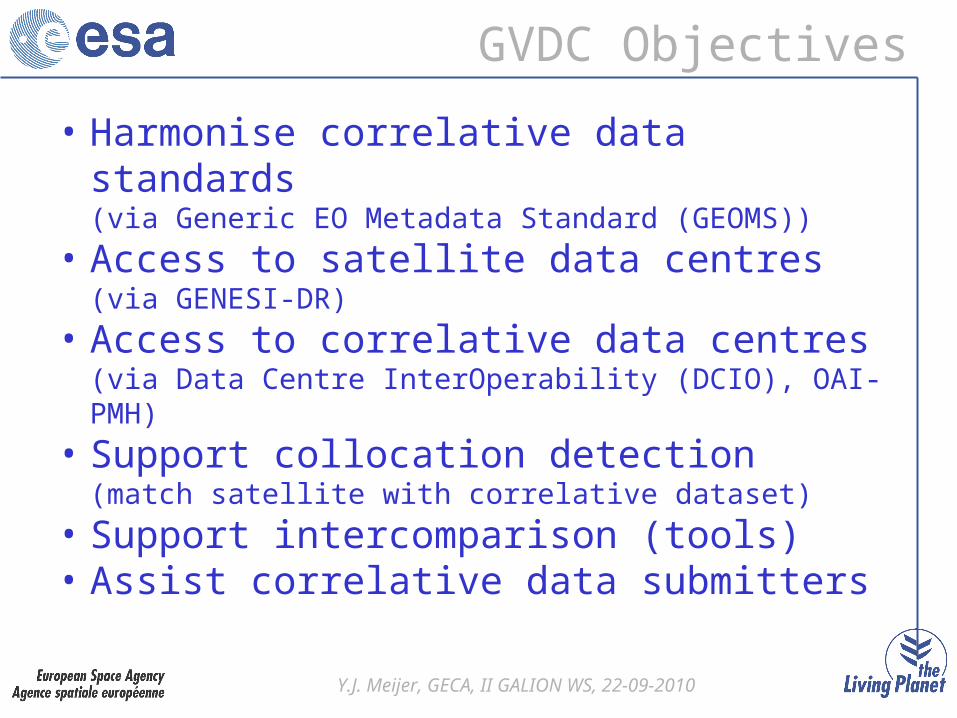
GVDC Objectives
• Harmonise correlative data standards(via Generic EO Metadata Standard (GEOMS))
• Access to satellite data centres(via GENESI-DR)
• Access to correlative data centres(via Data Centre InterOperability (DCIO), OAI-PMH)
• Support collocation detection(match satellite with correlative dataset)
• Support intercomparison (tools)• Assist correlative data submitters
Y.J. Meijer, GECA, II GALION WS, 22-09-2010
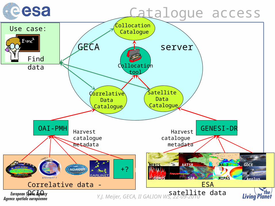
GECA server
Correlative data - DCIO
+?
OAI-PMH Harvest catalogue metadata
MERIS AATSR RA-2 GOCE
SARGOMOS MIPAS Aeolus
Correlative Data
Catalogue
GENESI-DR
Satellite Data
Catalogue
Collocationtool
Collocation CatalogueUse case:
Find data
Harvest catalogue metadata
Catalogue access
ESA satellite data
Y.J. Meijer, GECA, II GALION WS, 22-09-2010
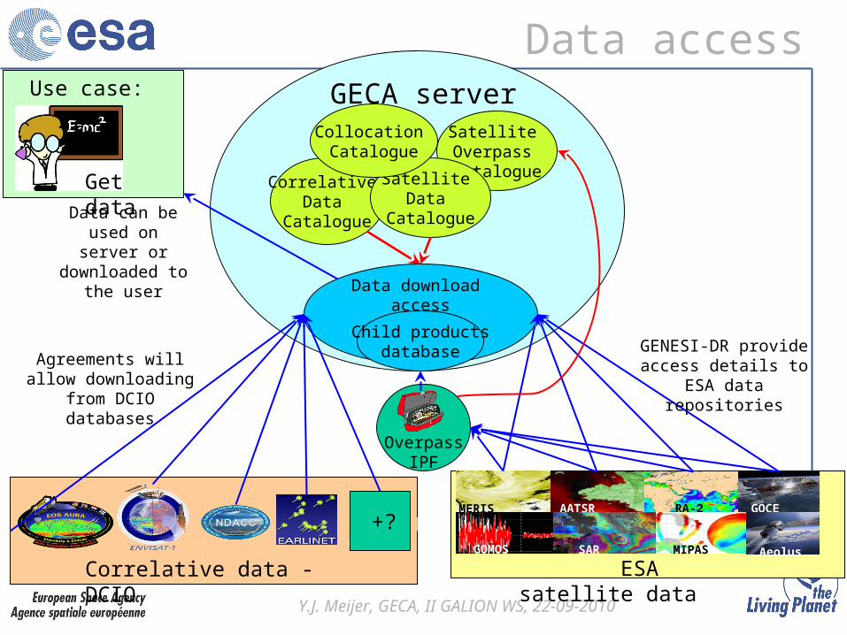
GECA server
Satellite Overpass Catalogue
OverpassIPF
Data download access
Correlative data - DCIO
+?MERIS AATSR RA-2 GOCE
SARGOMOS MIPAS Aeolus
ESA satellite data
Correlative Data
Catalogue
Satellite Data
Catalogue
Collocation Catalogue
Use case:
Get data
Agreements will allow downloading from DCIO databases
GENESI-DR provide access details to ESA
data repositories
Data can be used on server or
downloaded to the user
Child productsdatabase
Data access
Y.J. Meijer, GECA, II GALION WS, 22-09-2010
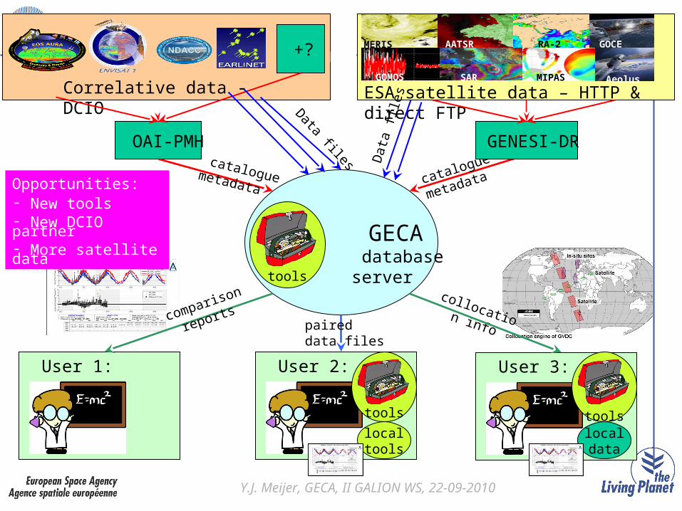
GECA database
server
Correlative data - DCIO
+?
OAI-PMH catalogue metadata
Data files
MERIS AATSR RA-2 GOCE
SARGOMOS MIPAS Aeolus
ESA satellite data – HTTP & direct FTP
catalogue
metadata
tools
Dat
a fil
es
User 1:
collocation info
User 2: User 3:
paired data files
tools
localtools
comparison
reports
toolslocaldata
GENESI-DR
Opportunities:- New tools- New DCIO partner- More satellite data
Y.J. Meijer, GECA, II GALION WS, 22-09-2010
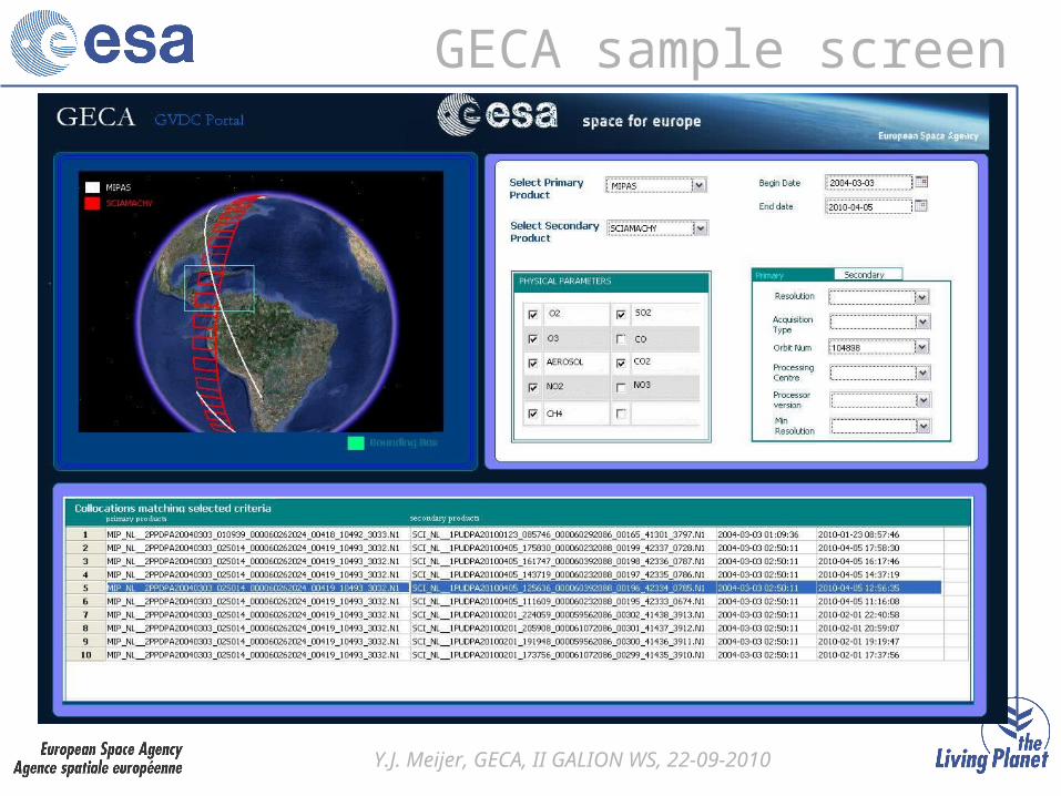
GECA sample screen
Y.J. Meijer, GECA, II GALION WS, 22-09-2010
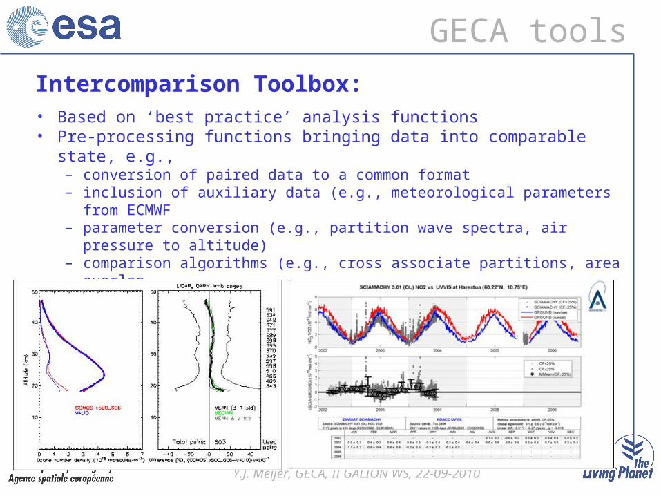
GECA tools
Intercomparison Toolbox:• Based on ‘best practice’ analysis functions• Pre-processing functions bringing data into comparable state, e.g.,
– conversion of paired data to a common format– inclusion of auxiliary data (e.g., meteorological parameters from ECMWF– parameter conversion (e.g., partition wave spectra, air pressure to
altitude)– comparison algorithms (e.g., cross associate partitions, area overlap– regridding and smoothing of data
Y.J. Meijer, GECA, II GALION WS, 22-09-2010
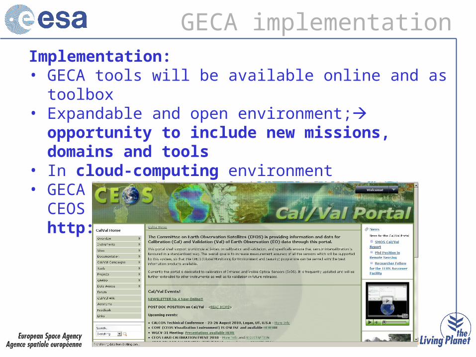
GECA implementationImplementation:• GECA tools will be available online and as toolbox• Expandable and open environment; opportunity to
include new missions, domains and tools• In cloud-computing environment • GECA is foreseen as portlets inside the CEOS Cal/Val
Portal: http://calvalportal.ceos.org/cvp/
Y.J. Meijer, GECA, II GALION WS, 22-09-2010
GECA project status
• Critical Design Review (CDR) passed– development started in April 2010
• Initial system due in Q4/2010– mainly for testing
• Full system due in first half of 2011– operational for ERS-1/-2, ENVISAT, MODIS– accessible for external users
Y.J. Meijer, GECA, II GALION WS, 22-09-2010
Conclusion
• GECA will offer a generic and comprehensive validation environment with many new functionalities supporting the process of independent validation
• Subscribe to GECA mailing list with an email to [email protected]
Y.J. Meijer, GECA, II GALION WS, 22-09-2010
Thank you!
Y.J. Meijer, GECA, II GALION WS, 22-09-2010
Backup slides
Y.J. Meijer, GECA, II GALION WS, 22-09-2010
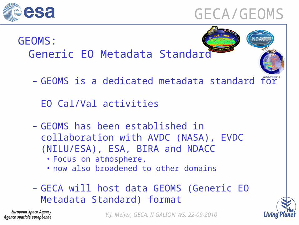
GECA/GEOMS
GEOMS:Generic EO Metadata Standard
– GEOMS is a dedicated metadata standard for EO Cal/Val activities
– GEOMS has been established in collaboration with AVDC (NASA), EVDC (NILU/ESA), ESA, BIRA and NDACC
• Focus on atmosphere, • now also broadened to other domains
– GECA will host data GEOMS (Generic EO Metadata Standard) format

Y.J. Meijer, GECA, II GALION WS, 22-09-2010
GECA/DCIO
DCIO: Data Centre Interoperability
• GECA will host correlative datasets of multiple EO domains– Requirement for interoperability between data centres
• Initiation of DCIO activity– Access to wider range of correlative datasets
• Current DCIO partners: AVDC, EVDC, NDACC and Earlinet
• Prototypes are working for exchange of catalogue meta-data
• Metadata catalogue in GECA will allow data to be visible in peer data centres
• Opportunity to join DCIO !
Y.J. Meijer, GECA, II GALION WS, 22-09-2010
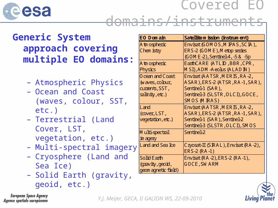
Covered EO domains/instruments
Envisat (RA-2), ERS-2 (RA-1), GOCE, SWARM
Solid Earth (gravity, geoid, geomagnetic field)
Cryosat-II (SIRAL), Envisat (RA-2), ERS-2 (RA-1)
Land and Sea Ice
Sentinel-2Multi-spectral imagery
Envisat (AATSR, MERIS, RA-2, ASAR), ERS-2 (ATSR, RA-1, SAR), Sentinel-1 (SAR), Sentinel-2Sentinel-3 (SLSTR, OLCI), SMOS
Land (cover, LST, vegetation, etc.)
Envisat (AATSR, MERIS, RA-2, ASAR), ERS-2 (ATSR, RA-1, SAR), Sentinel-1 (SAR), Sentinel-3 (SLSTR, OLCI), GOCE, SMOS (MIRAS)
Ocean and Coast (waves, colour, currents, SST, salinity, etc.)
EarthCARE (ATLID, BBR, CPR, MSI), ADM-Aeolus (ALADIN)
Atmospheric Physics
Envisat (GOMOS, MIPAS, SCIA), ERS-2 (GOME), Metop series (GOME-2), Sentinel-4, -5 & -5p
Atmospheric Chemistry
Satellite mission (instrument)EO Domain
Envisat (RA-2), ERS-2 (RA-1), GOCE, SWARM
Solid Earth (gravity, geoid, geomagnetic field)
Cryosat-II (SIRAL), Envisat (RA-2), ERS-2 (RA-1)
Land and Sea Ice
Sentinel-2Multi-spectral imagery
Envisat (AATSR, MERIS, RA-2, ASAR), ERS-2 (ATSR, RA-1, SAR), Sentinel-1 (SAR), Sentinel-2Sentinel-3 (SLSTR, OLCI), SMOS
Land (cover, LST, vegetation, etc.)
Envisat (AATSR, MERIS, RA-2, ASAR), ERS-2 (ATSR, RA-1, SAR), Sentinel-1 (SAR), Sentinel-3 (SLSTR, OLCI), GOCE, SMOS (MIRAS)
Ocean and Coast (waves, colour, currents, SST, salinity, etc.)
EarthCARE (ATLID, BBR, CPR, MSI), ADM-Aeolus (ALADIN)
Atmospheric Physics
Envisat (GOMOS, MIPAS, SCIA), ERS-2 (GOME), Metop series (GOME-2), Sentinel-4, -5 & -5p
Atmospheric Chemistry
Satellite mission (instrument)EO DomainGeneric System approach covering multiple EO domains:
– Atmospheric Physics– Ocean and Coast (waves,
colour, SST, etc.)– Terrestrial (Land Cover, LST,
vegetation, etc.)– Multi-spectral imagery– Cryosphere (Land and Sea
Ice)– Solid Earth (gravity, geoid,
etc.)