Embed Size (px)
Citation preview
www.fcx.com
Connecting the World
PT FREEPORT INDONESIA WEB GIS PT FREEPORT INDONESIA WEB GIS AND DATA INTEGRATION SYSTEM AND DATA INTEGRATION SYSTEM
IMPLEMENTATIONIMPLEMENTATION
Harman SetyadiHarman SetyadiMine Engineering Dept, Bandung Institute of Mine Engineering Dept, Bandung Institute of
TechnologyTechnologyASIA GEOSPATIAL FORUM, 17-19 October 2011, ASIA GEOSPATIAL FORUM, 17-19 October 2011,
JAKARTAJAKARTA
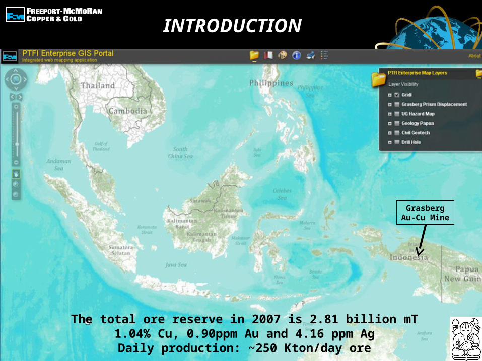
INTRODUCTION
GrasbergAu-Cu Mine
The total ore reserve in 2007 is 2.81 billion mT1.04% Cu, 0.90ppm Au and 4.16 ppm Ag
Daily production: ~250 Kton/day ore
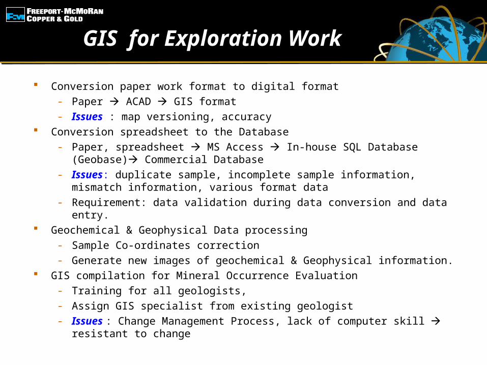
GIS for Exploration Work
Conversion paper work format to digital format- Paper ACAD GIS format- Issues : map versioning, accuracy
Conversion spreadsheet to the Database- Paper, spreadsheet MS Access In-house SQL Database
(Geobase) Commercial Database- Issues: duplicate sample, incomplete sample information, mismatch
information, various format data- Requirement: data validation during data conversion and data entry.
Geochemical & Geophysical Data processing- Sample Co-ordinates correction- Generate new images of geochemical & Geophysical information.
GIS compilation for Mineral Occurrence Evaluation- Training for all geologists,- Assign GIS specialist from existing geologist- Issues : Change Management Process, lack of computer skill
resistant to change
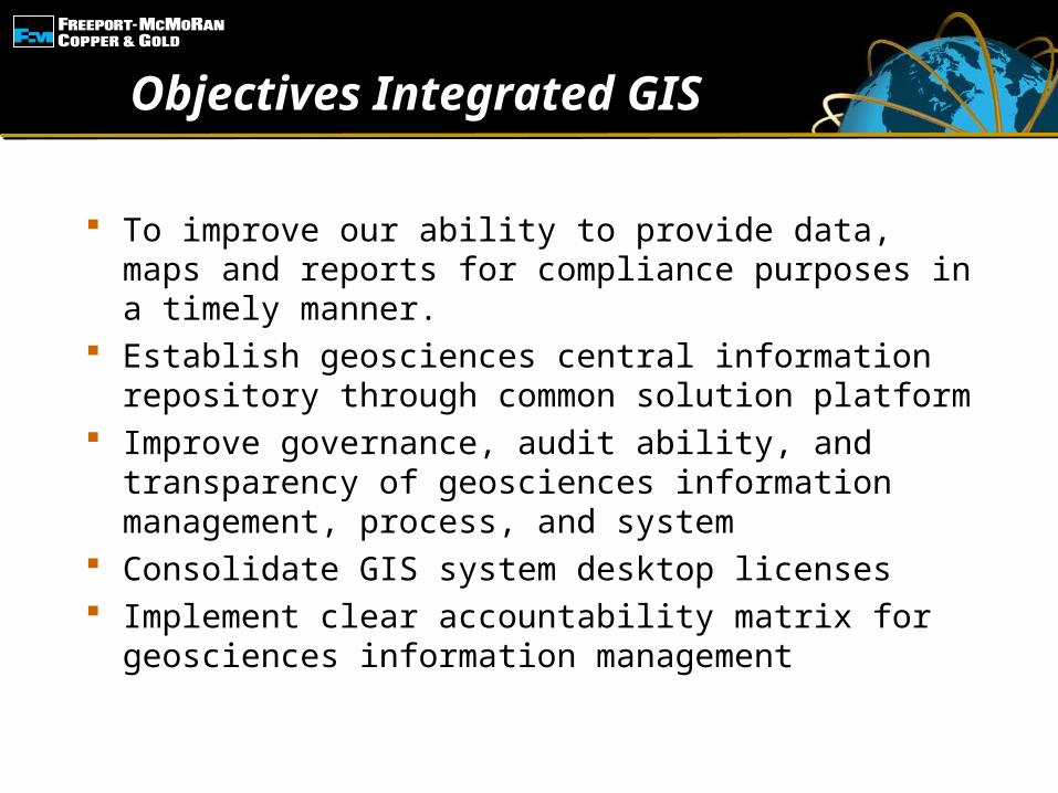
Objectives Integrated GIS
To improve our ability to provide data, maps and reports for compliance purposes in a timely manner.
Establish geosciences central information repository through common solution platform
Improve governance, audit ability, and transparency of geosciences information management, process, and system
Consolidate GIS system desktop licenses Implement clear accountability matrix for
geosciences information management
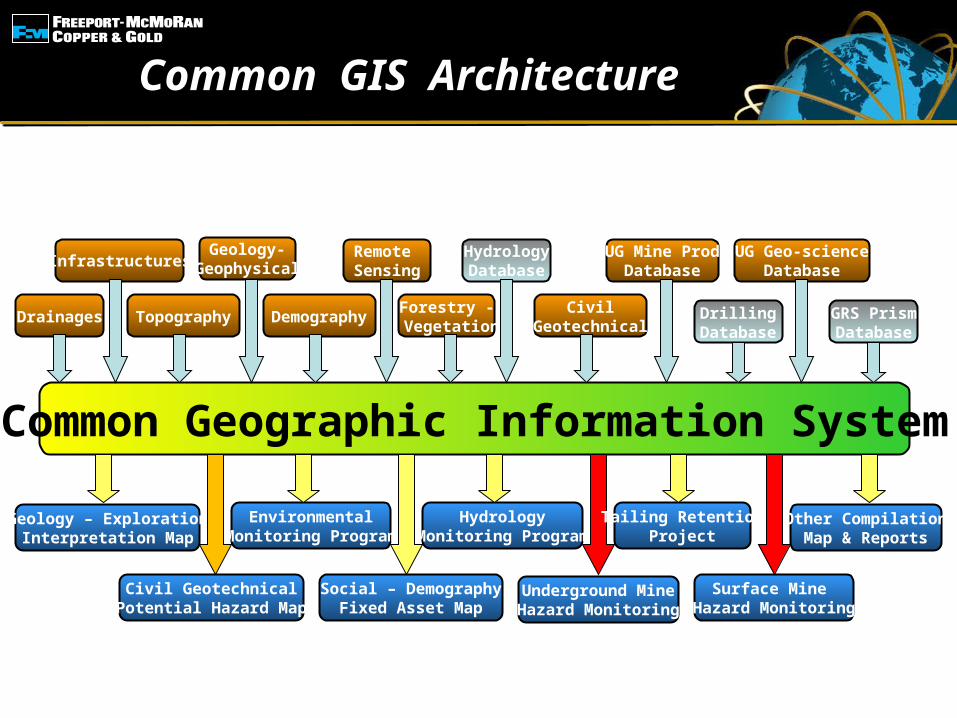
Common GIS Architecture
Geology – ExplorationInterpretation Map
Drainages
Common Geographic Information System
Infrastructures
Topography
Geology-Geophysical
Demography
Remote Sensing
Forestry - Vegetation
HydrologyDatabase
CivilGeotechnical
UG Mine ProdDatabase
DrillingDatabase
UG Geo-scienceDatabase
Civil GeotechnicalPotential Hazard Map
EnvironmentalMonitoring Program
Social – DemographyFixed Asset Map
HydrologyMonitoring Program
Underground MineHazard Monitoring
Tailing RetentionProject
Surface Mine Hazard Monitoring
Other CompilationMap & Reports
GRS PrismDatabase
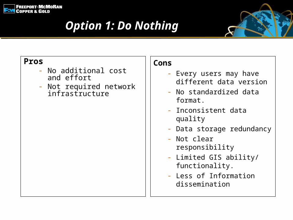
Option 1: Do Nothing
Pros- No additional cost and
effort- Not required network
infrastructure
Cons- Every users may have
different data version - No standardized data
format.- Inconsistent data quality- Data storage redundancy- Not clear responsibility- Limited GIS ability/
functionality.- Less of Information
dissemination
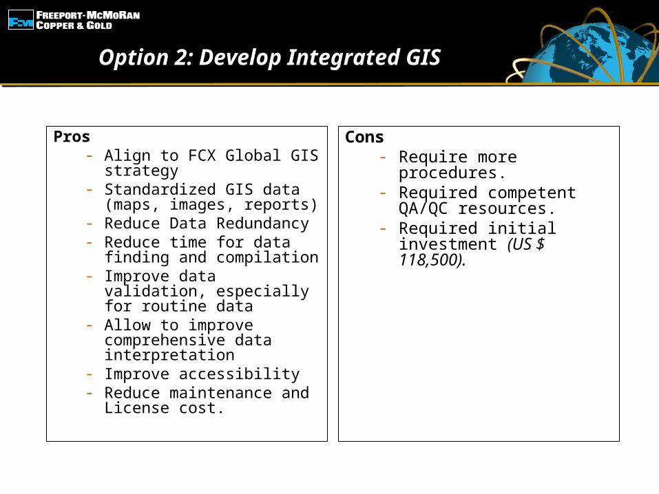
Option 2: Develop Integrated GIS
Pros- Align to FCX Global GIS
strategy- Standardized GIS data
(maps, images, reports)- Reduce Data
Redundancy- Reduce time for data
finding and compilation- Improve data validation,
especially for routine data
- Allow to improve comprehensive data interpretation
- Improve accessibility- Reduce maintenance and
License cost.
Cons- Require more
procedures.- Required competent
QA/QC resources.- Required initial
investment (US $ 118,500).
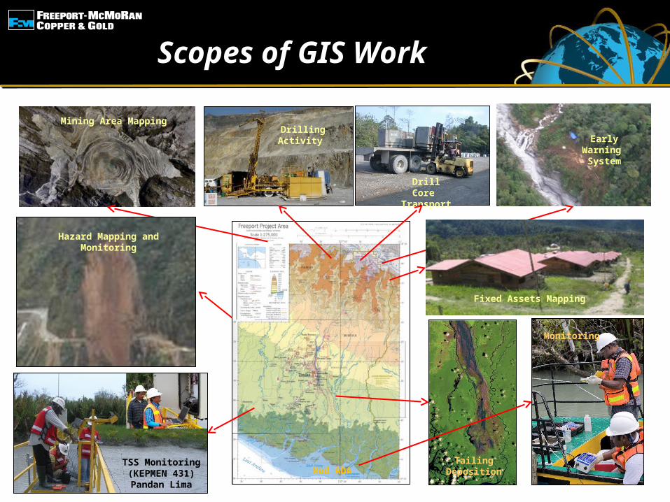
Scopes of GIS Work
Mod ADA
Drilling ActivityEarly Warning
System
Fixed Assets Mapping
Drill Core Transport
Mining Area Mapping
Hazard Mapping and Monitoring
TSS Monitoring(KEPMEN 431)Pandan Lima
Tailing Deposition
Monitoring
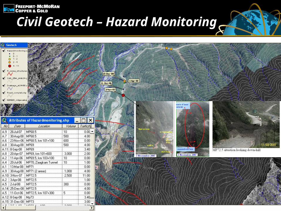
Civil Geotech – Hazard Monitoring
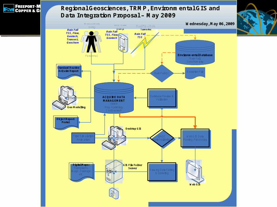
Personnel
ACQUIRE DATA MANAGEMENT
TRMPReg. HydrologyCivil Geotech
QAQCData Validation
Digital Maps: Topography,
Image, Drainage, etc.
GIS File FolderServer
Drawing Data Editing & Updating
Database Review & Validation
Desktop GIS
Web GIS Data Posting, Processing
Web GIS
Standard Routine AcQuire Report
Object Report Portal
Geo Modelling
Environmental DatabaseRain Fall,
Geochemistry
Rain Fall QC Exception File
Real Time Data Transfer
PDA Data Dump
Manual Data Entry
Wednesday, May 06, 2009
Regional Geosciences, TRMP, Environmental GIS and Data Integration Proposal – May 2009
Rain FallTSS
Rain FallTSS, Flow, Geotech
Rain FallTSS, Flow, Geotech, Transect, Geochem
Tide SimulationAnimation
The concept of proposed Web GIS Integration
Geological & Geochemical
Database
Geophysical Database
Web GIS and Geodatabase
System
Image Processing/ Geophysical
Software
Fixed Wing Airborne Geophysical Survey
Helichopter Airborne Geophysical Survey
Ground Geophysical Survey
Down Hole Geophysical Survey
SS; PC; RC,BLEG; Soil Bench, ±Geological Logging
Soil, RC, Test Pit, Auger Test, ±Geological Logging
RC, Trenching, Channel Test,±Geological Logging
Shallow Drill/ Winkie <50m±Geological Logging
Medium Drill (50m – 200m)±Geological Logging
Deep Drill (> 200m)±Geological Logging
CADMapping System
Different Scale of Geological Mapping
Different Scale of Topography/ Drainage survey/ Ifrastructures
Down Hole Survey
Image Processing/
Spatial Analysis
3D Mine Modeling Software
Remote Sensing, Airborne
PhotogrammetricSatellite Data
acquisition
Surface Mine Hazard
Database
Underground Mine Hazard
Database
Surface Mine Hazard Monitoring Data Collection
Underground Mine Hazard Monitoring Data Collection
Need Quick Respond
Hazard Warning
System & Reporting
Mine Road & Mine Town Civil Geotechnical Hazard
Monitoring
Real Time Rain Gouge Monitoring
Civil Geotechnical
Hazard Database
Rain Fall Database
Agregation
Mine Area Environmental
MonitoringEnvironmental Database
Environmental Reports
FINISH
FINISH
Hazard Warning
System & Reporting
FINISH
Exploration Reports
3D Model, Geology,
Mine
Harman Setyadi, NIM:32111001, Mine Engineering ITB
Proposed of PT Freeport Indonesia Integrated Data Related to Web GIS (Aug 2011)
ST
AR
TS
TA
RT
START
START
Data Tracking Report
FINISH
Web GIS
FINISH
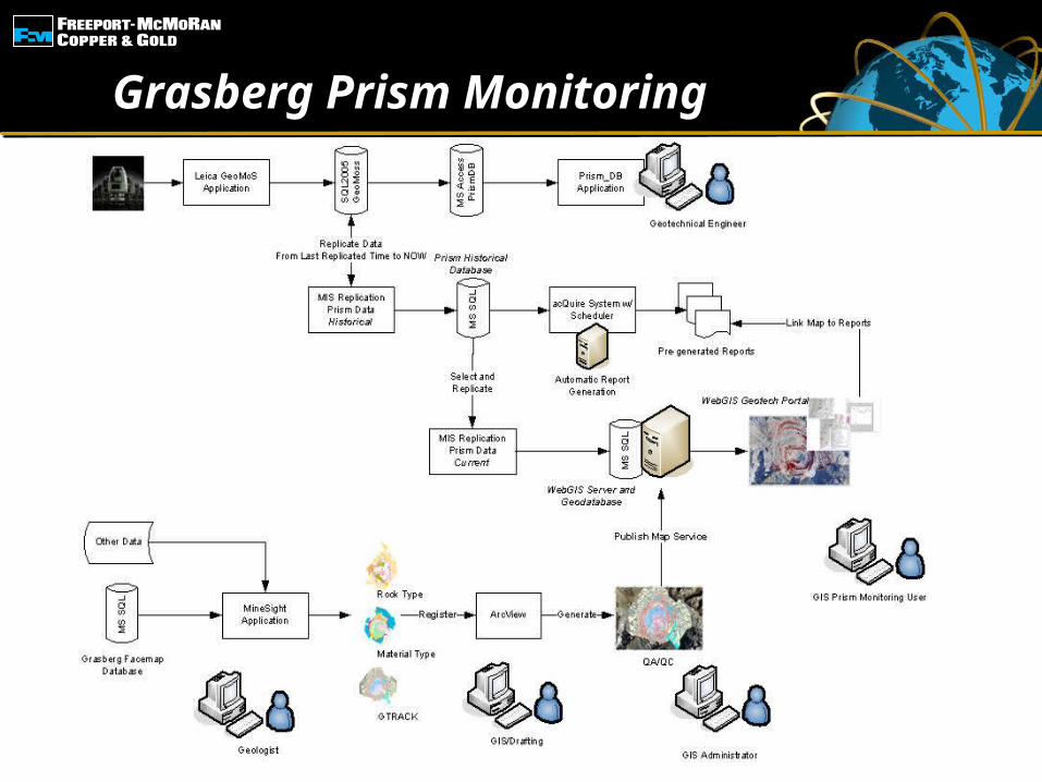
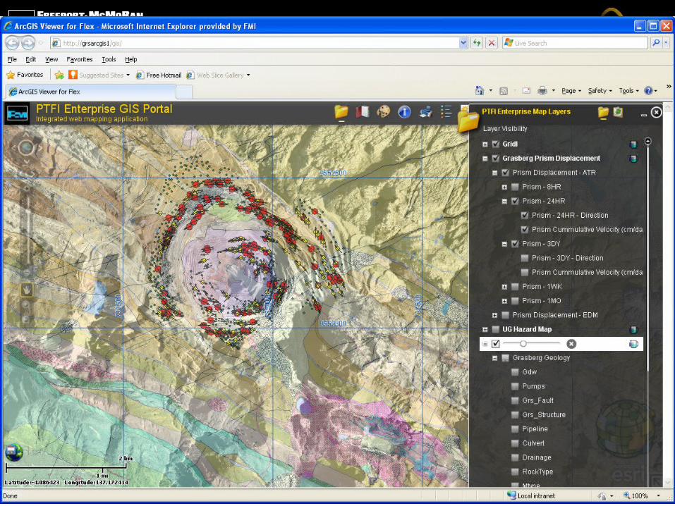
Grasberg Prism Monitoring
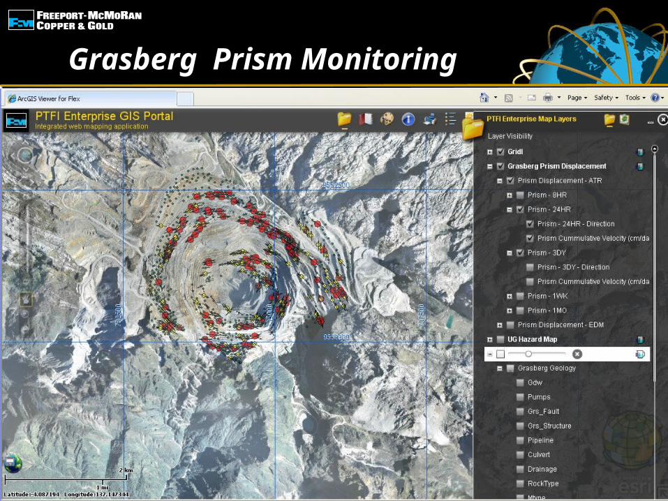
Grasberg Prism Monitoring
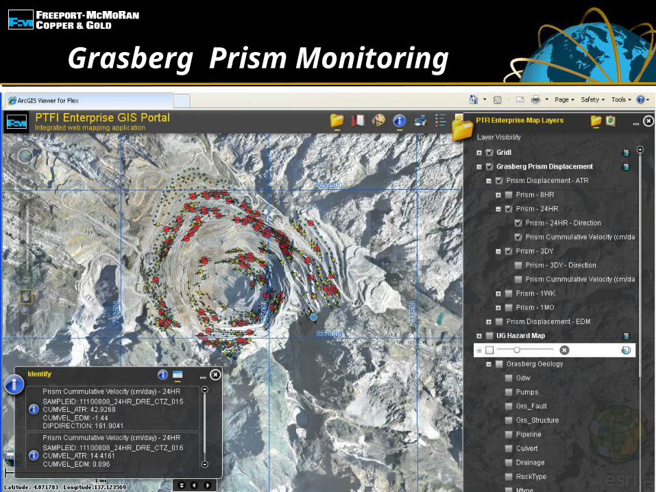
Grasberg Prism Monitoring
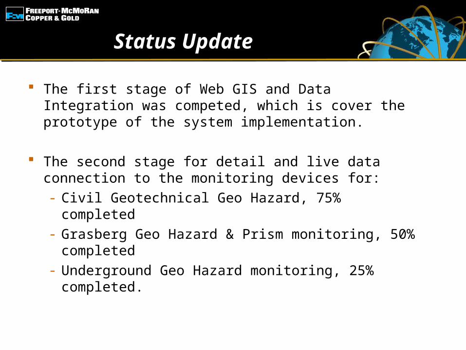
Status Update
The first stage of Web GIS and Data Integration was competed, which is cover the prototype of the system implementation.
The second stage for detail and live data connection to the monitoring devices for:- Civil Geotechnical Geo Hazard, 75% completed- Grasberg Geo Hazard & Prism monitoring, 50%
completed- Underground Geo Hazard monitoring, 25%
completed.
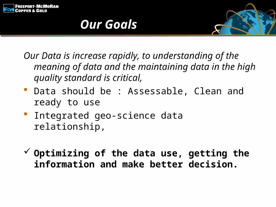
Our Goals
Our Data is increase rapidly, to understanding of the meaning of data and the maintaining data in the high quality standard is critical,
Data should be : Assessable, Clean and ready to use
Integrated geo-science data relationship,
Optimizing of the data use, getting the information and make better decision.
18
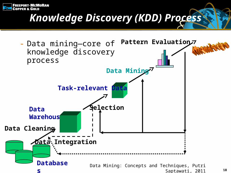
Knowledge Discovery (KDD) Process
- Data mining—core of knowledge discovery process
Data Cleaning
Data Integration
Databases
Data Warehouse
Task-relevant Data
Selection
Data Mining
Pattern Evaluation
Data Mining: Concepts and Techniques, Putri Saptawati, 2011
Data Mining: Concepts and Techniques, Putri Saptawati, 2011
19
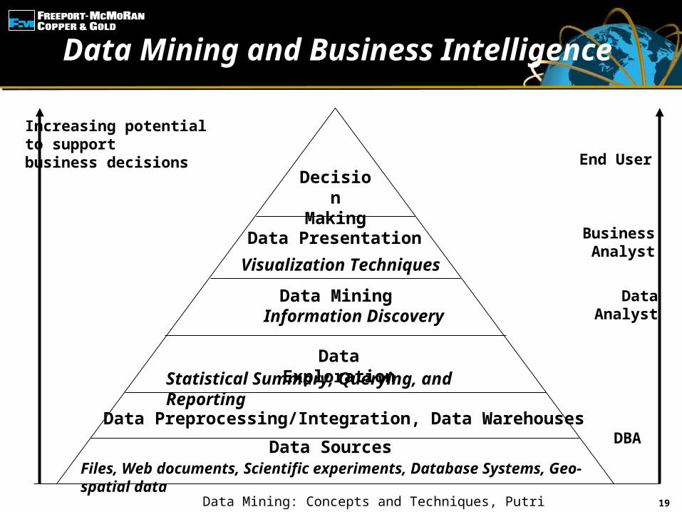
Data Mining and Business Intelligence
Increasing potentialto supportbusiness decisions End User
Business Analyst
DataAnalyst
DBA
Decision Making
Data Presentation
Visualization Techniques
Data MiningInformation Discovery
Data ExplorationStatistical Summary, Querying, and Reporting
Data Preprocessing/Integration, Data Warehouses
Data SourcesFiles, Web documents, Scientific experiments, Database Systems, Geo-spatial data
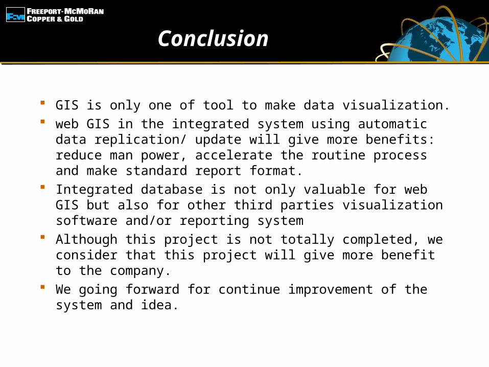
Conclusion
GIS is only one of tool to make data visualization. web GIS in the integrated system using automatic
data replication/ update will give more benefits: reduce man power, accelerate the routine process and make standard report format.
Integrated database is not only valuable for web GIS but also for other third parties visualization software and/or reporting system
Although this project is not totally completed, we consider that this project will give more benefit to the company.
We going forward for continue improvement of the system and idea.
Thank YouAmolongoAmakanie
Kaonak