Embed Size (px)
Citation preview
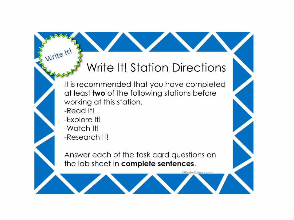
It is recommended that you have completed
at least two of the following stations before
working at this station.
-Read It!
-Explore It!
-Watch It!
-Research It!
Answer each of the task card questions on
the lab sheet in complete sentences.
Write It! Station Directions
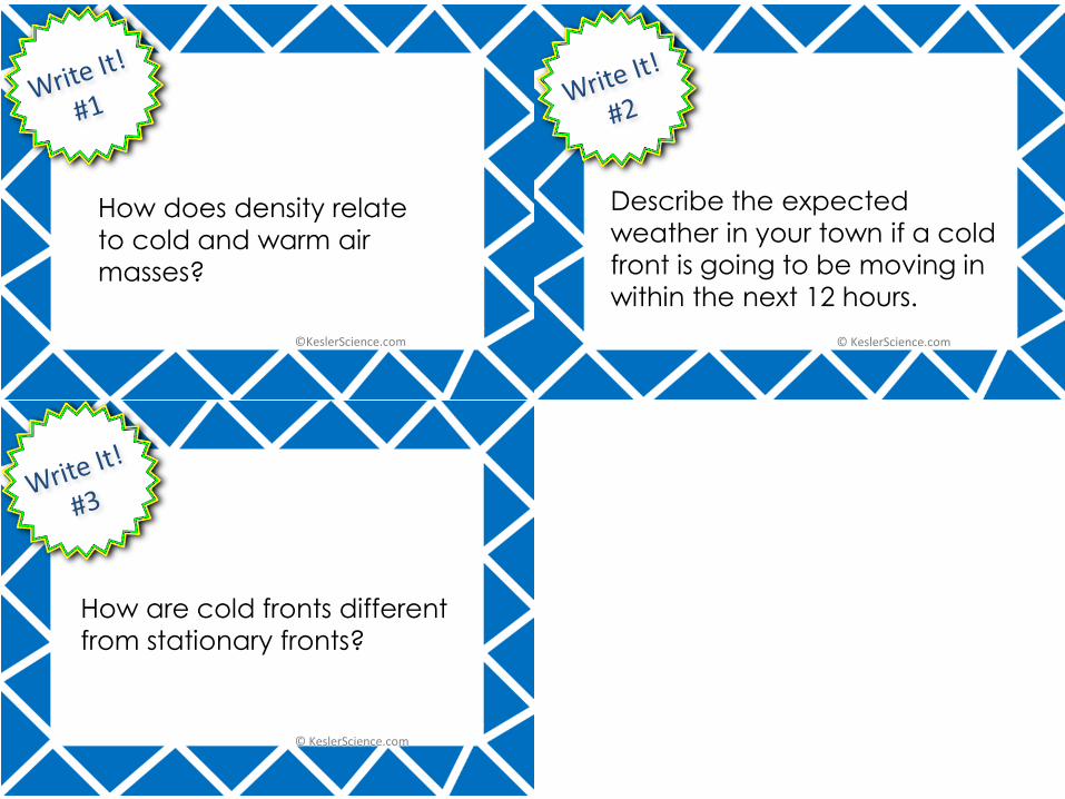
How does density relate
to cold and warm air
masses?
How are cold fronts different
from stationary fronts?
Describe the expected
weather in your town if a cold
front is going to be moving in
within the next 12 hours.
It is recommended that you have completed
at least two of the following stations before
working at this station.
-Read It!
-Explore It!
-Watch It!
-Research It!
Each member will answer the questions from
the task cards on the lab sheet in the Assess
It! section.
Assess It! Station Directions
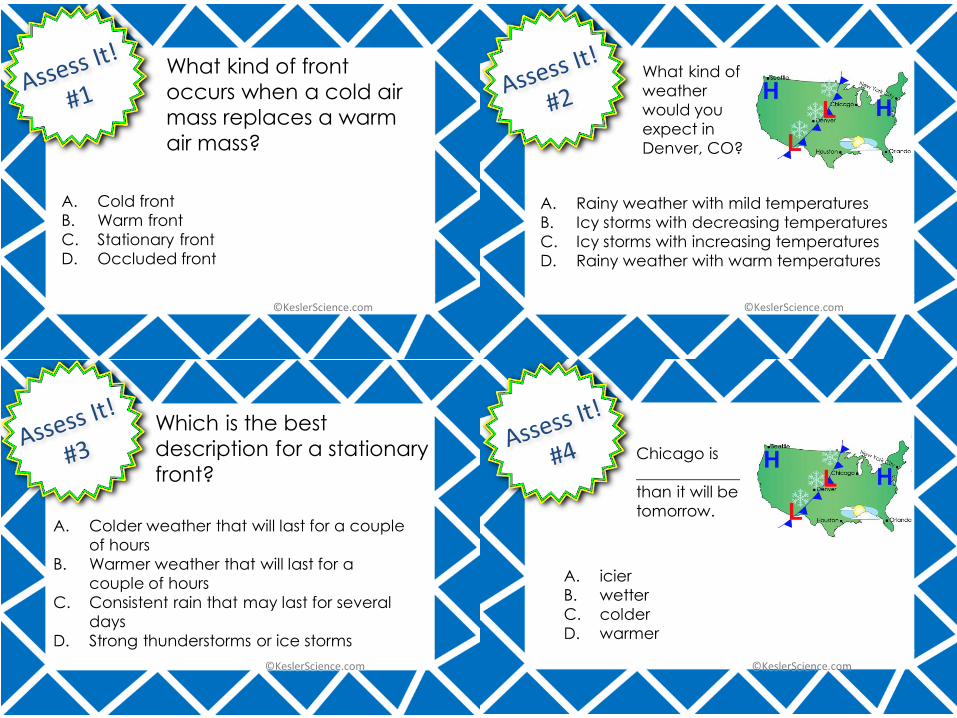
A. Cold front
B. Warm front
C. Stationary front
D. Occluded front
What kind of front
occurs when a cold air
mass replaces a warm
air mass?
A. Rainy weather with mild temperatures
B. Icy storms with decreasing temperatures
C. Icy storms with increasing temperatures
D. Rainy weather with warm temperatures
What kind of
weather
would you
expect in
Denver, CO?
A. Colder weather that will last for a couple
of hours
B. Warmer weather that will last for a
couple of hours
C. Consistent rain that may last for several
days
D. Strong thunderstorms or ice storms
Which is the best
description for a stationary
front?
A. icier
B. wetter
C. colder
D. warmer
Chicago is
_____________
than it will be
tomorrow.
Each member of the group will read the
passage and answer the questions from the
task cards on the lab sheet in the Read It!
section.
It is important to remember that the answers
will come directly from the reading passage.
Read It! Station Directions
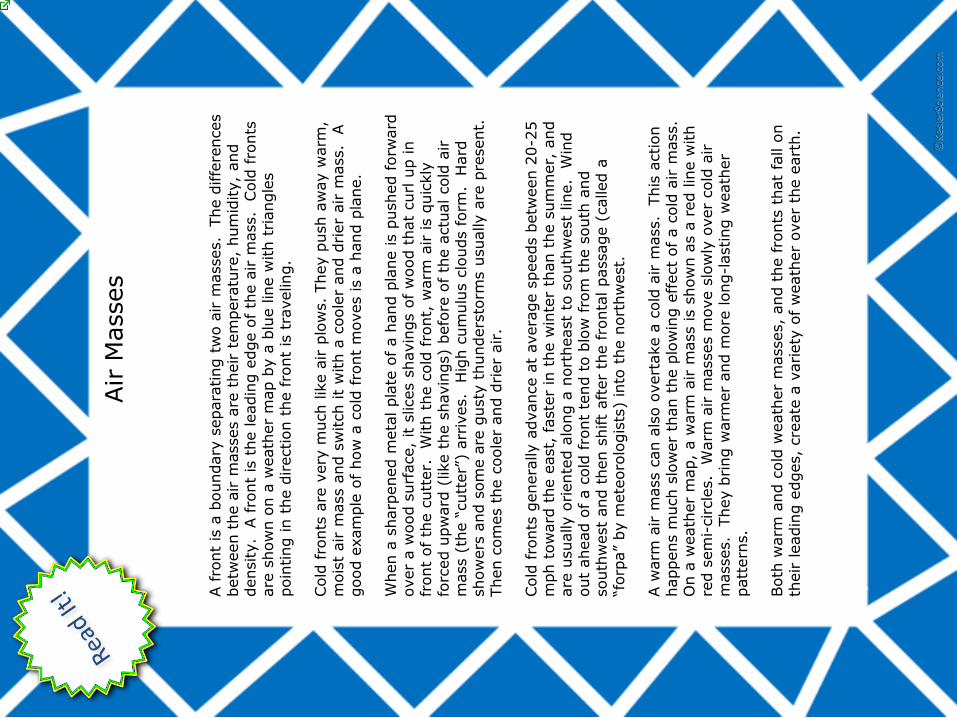
Air
Masses
A fro
nt
is a
boundary
separa
ting t
wo a
ir m
asses.
The d
iffe
rences
betw
een t
he a
ir m
asses a
re t
heir t
em
pera
ture
, hum
idity,
and
density.
A fro
nt
is t
he leadin
g e
dge o
f th
e a
ir m
ass.
Cold
fro
nts
are
show
n o
n a
weath
er
map b
y a
blu
e lin
e w
ith t
riangle
s
poin
ting in t
he d
irection t
he f
ront
is t
raveling.
Cold
fro
nts
are
very
much lik
e a
ir p
low
s.
They p
ush a
way w
arm
, m
ois
t air m
ass a
nd s
witch it
with a
coole
r and d
rier
air m
ass.
A
good e
xam
ple
of how
a c
old
fro
nt
moves is a
hand p
lane.
When a
sharp
ened m
eta
l pla
te o
f a h
and p
lane is p
ushed f
orw
ard
over
a w
ood s
urf
ace,
it s
lices s
havin
gs o
f w
ood t
hat
curl u
p in
front
of th
e c
utt
er.
W
ith t
he c
old
fro
nt,
warm
air is q
uic
kly
fo
rced u
pw
ard
(like t
he s
havin
gs)
befo
re o
f th
e a
ctu
al cold
air
mass (
the “
cutt
er”
) arr
ives.
Hig
h c
um
ulu
s c
louds f
orm
. H
ard
show
ers
and s
om
e a
re g
usty
thunders
torm
s u
sually a
re p
resent.
Then c
om
es t
he c
oole
r and d
rier
air.
Cold
fro
nts
genera
lly a
dvance a
t avera
ge s
peeds b
etw
een 2
0-2
5
mph t
ow
ard
the e
ast,
faste
r in
the w
inte
r th
an t
he s
um
mer,
and
are
usually o
riente
d a
long a
nort
heast
to s
outh
west
line.
Win
d
out
ahead o
f a c
old
fro
nt
tend t
o b
low
fro
m t
he s
outh
and
south
west
and t
hen s
hift
aft
er
the fro
nta
l passage (
called a
“f
orp
a”
by m
ete
oro
logis
ts)
into
the n
ort
hw
est.
A w
arm
air m
ass c
an a
lso o
vert
ake a
cold
air m
ass.
This
action
happens m
uch s
low
er
than t
he p
low
ing e
ffect
of a c
old
air m
ass.
O
n a
weath
er
map,
a w
arm
air m
ass is s
how
n a
s a
red lin
e w
ith
red s
em
i-circle
s.
Warm
air m
asses m
ove s
low
ly o
ver
cold
air
masses.
They b
ring w
arm
er
and m
ore
long-l
asting w
eath
er
patt
ern
s.
Both
warm
and c
old
weath
er
masses,
and t
he fro
nts
that
fall o
n
their leadin
g e
dges,
cre
ate
a v
ariety
of w
eath
er
over
the e
art
h.
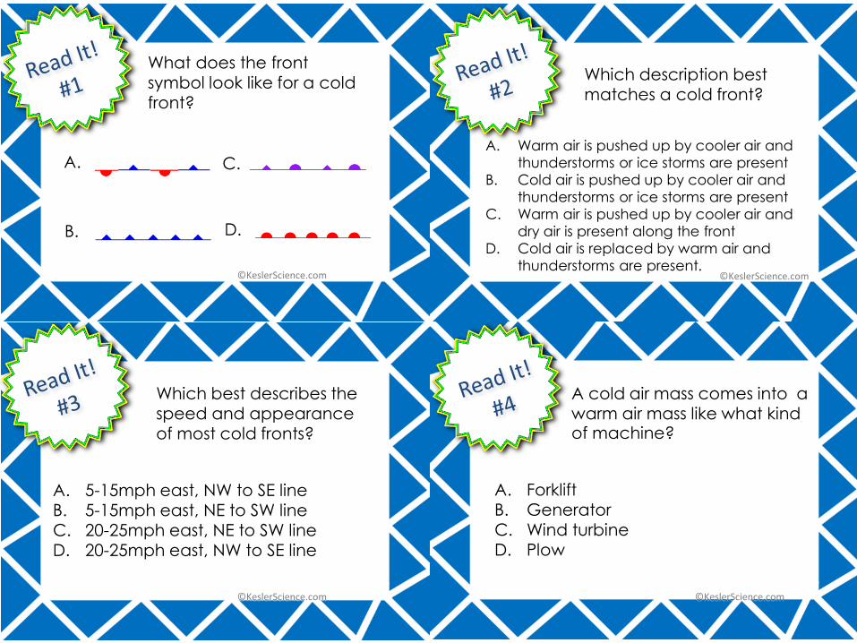
What does the front
symbol look like for a cold front?
Which description best matches a cold front?
A. Warm air is pushed up by cooler air and
thunderstorms or ice storms are present
B. Cold air is pushed up by cooler air and
thunderstorms or ice storms are present
C. Warm air is pushed up by cooler air and
dry air is present along the front
D. Cold air is replaced by warm air and
thunderstorms are present.
A cold air mass comes into a warm air mass like what kind of machine?
Which best describes the speed and appearance of most cold fronts?
A. 5-15mph east, NW to SE lineB. 5-15mph east, NE to SW lineC. 20-25mph east, NE to SW lineD. 20-25mph east, NW to SE line
A. Forklift
B. GeneratorC. Wind turbineD. Plow
A. C.
B. D.
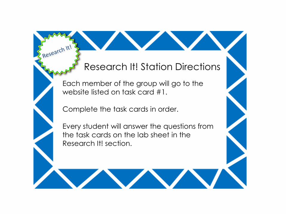
Each member of the group will go to the
website listed on task card #1.
Complete the task cards in order.
Every student will answer the questions from
the task cards on the lab sheet in the Watch
It! section of the lab sheet.
Watch It! Station Directions
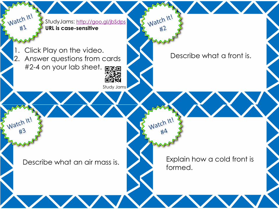
StudyJams: http://goo.gl/jbSdps
URL is case-sensitive
Describe what a front is.
Describe what an air mass is.
1. Click Play on the video.
2. Answer questions from cards
#2-4 on your lab sheet.
Study Jams
Explain how a cold front is
formed.
Each member of the group will go to the
website listed on task card #1.
Complete the task cards in order.
Every student will answer the questions from
the task cards on the lab sheet in the
Research It! section.
Research It! Station Directions
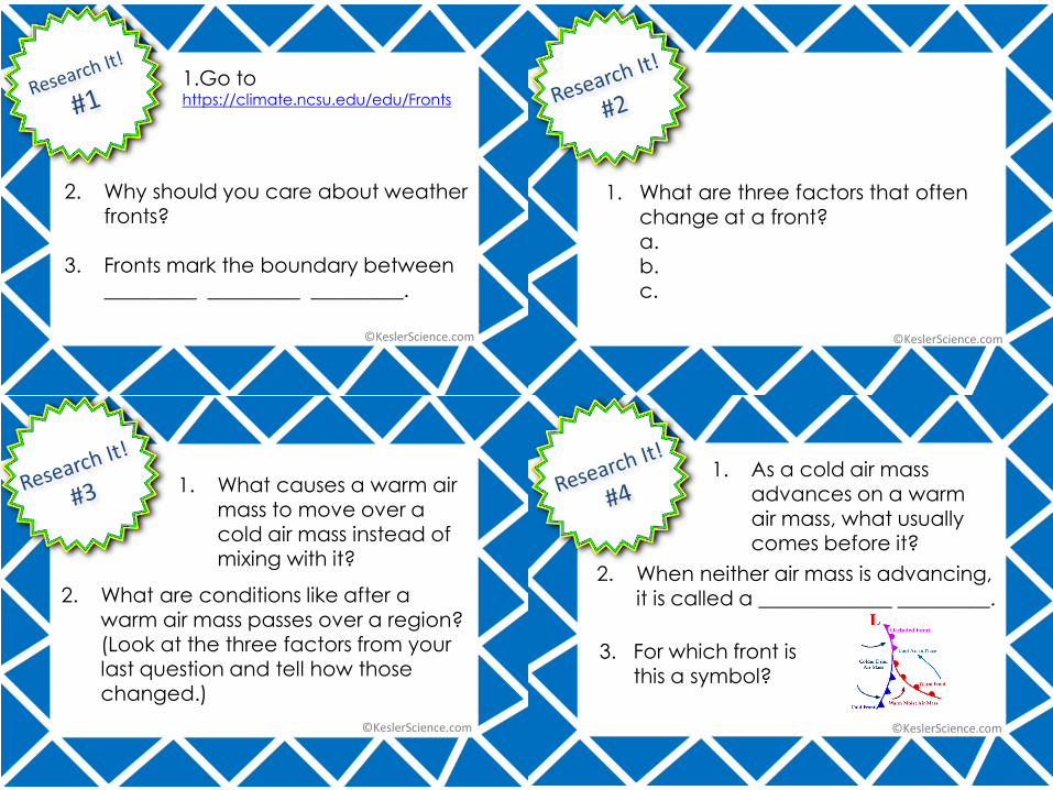
1.Go to https://climate.ncsu.edu/edu/Fronts
2. Why should you care about weather fronts?
3. Fronts mark the boundary between _________ _________ _________.
1. What are three factors that often change at a front?a.b.c.
1. What causes a warm air
mass to move over a cold air mass instead of mixing with it?
2. What are conditions like after a warm air mass passes over a region?
(Look at the three factors from your last question and tell how those changed.)
1. As a cold air mass advances on a warm
air mass, what usually comes before it?
2. When neither air mass is advancing, it is called a _____________ _________.
3. For which front is this a symbol?
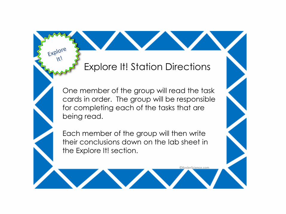
One member of the group will read the task
cards in order. The group will be responsible
for completing each of the tasks that are
being read.
Each member of the group will then write
their conclusions down on the lab sheet in
the Explore It! section.
Explore It! Station Directions
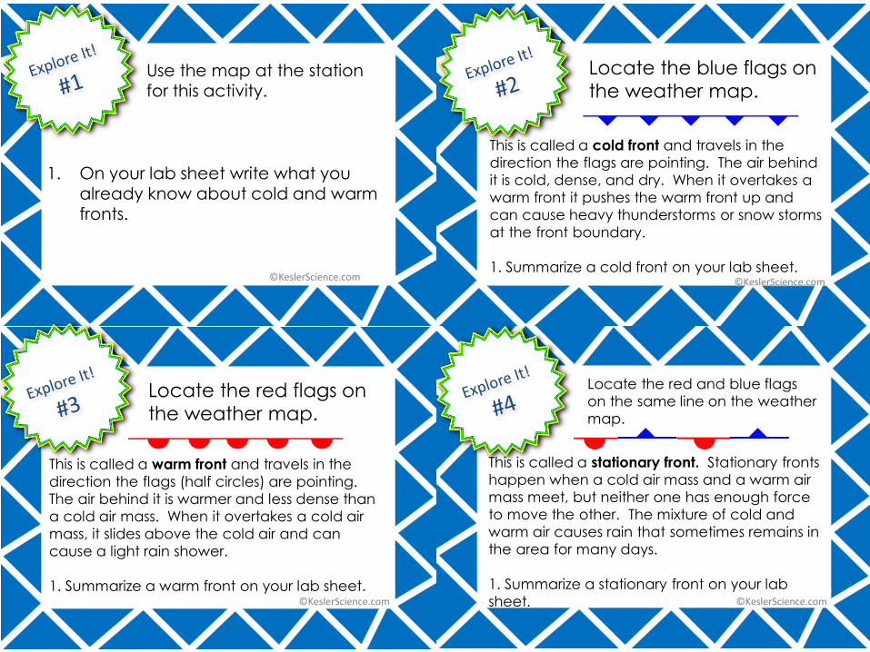
This is called a cold front and travels in the
direction the flags are pointing. The air behind
it is cold, dense, and dry. When it overtakes a
warm front it pushes the warm front up and
can cause heavy thunderstorms or snow storms
at the front boundary.
1. Summarize a cold front on your lab sheet.
1. On your lab sheet write what you already know about cold and warm fronts.
Locate the blue flags on
the weather map.Use the map at the station for this activity.
This is called a warm front and travels in the
direction the flags (half circles) are pointing.
The air behind it is warmer and less dense than
a cold air mass. When it overtakes a cold air
mass, it slides above the cold air and can
cause a light rain shower.
1. Summarize a warm front on your lab sheet.
Locate the red flags on
the weather map.
This is called a stationary front. Stationary fronts
happen when a cold air mass and a warm air
mass meet, but neither one has enough force
to move the other. The mixture of cold and
warm air causes rain that sometimes remains in
the area for many days.
1. Summarize a stationary front on your lab
sheet.
Locate the red and blue flags
on the same line on the weather
map.
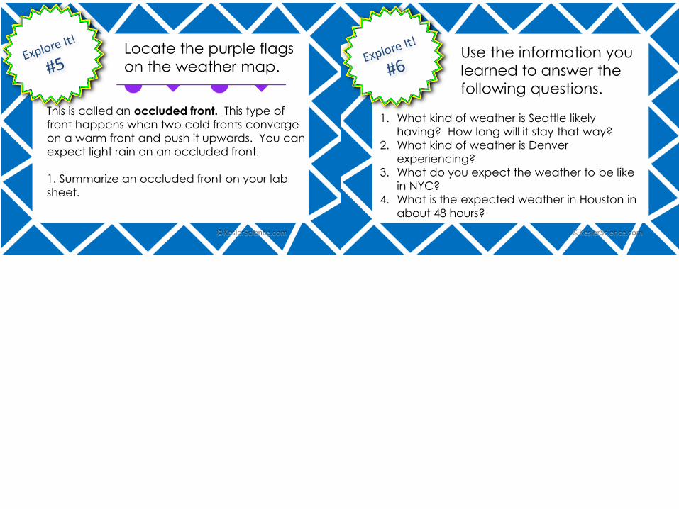
1. What kind of weather is Seattle likely
having? How long will it stay that way?
2. What kind of weather is Denver
experiencing?
3. What do you expect the weather to be like
in NYC?
4. What is the expected weather in Houston in
about 48 hours?
This is called an occluded front. This type of
front happens when two cold fronts converge
on a warm front and push it upwards. You can
expect light rain on an occluded front.
1. Summarize an occluded front on your lab
sheet.
Locate the purple flags
on the weather map.Use the information you
learned to answer the
following questions.
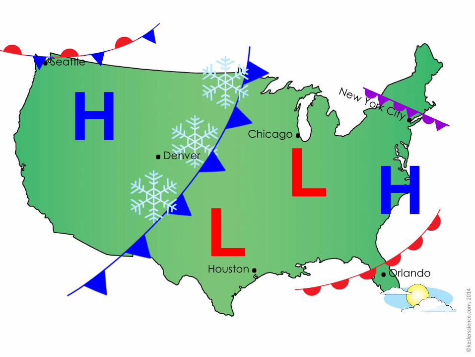
Houston.
Chicago.
.Orlando
.Seattle
.Denver
Each member of the group will draw a quick
sketch on the lab sheet that shows they
understand the concept being taught.
Use the colored pencils and markers that are
provided.
The directions for the sketch are provided on
the task card at the table.
Illustrate It! Station Directions
Use the colored pencils to draw each of the 4 types of
fronts: cold front, warm front, stationary front, occluded
front.
Label the fronts and describe the weather at each front
boundary.
You may use http://goo.gl/BxFAL2 for reference.
Illustrate It! Station Directions
It is recommended that you have completed at least twoof the following stations before working at this station.-Read It!-Explore It!-Watch It!-Research It!
Each group will organize the cards. Each of the cards will be used. Have your teacher sign off on your Organize it section after it has been checked.
Please mix up the cards again before the next group arrives at this station.
Organize It! Station Directions