Embed Size (px)
Citation preview
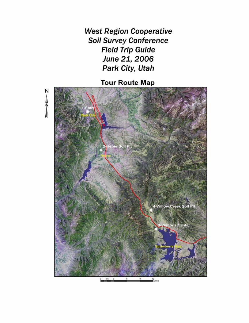
West Region Cooperative Soil Survey Conference
Field Trip Guide June 21, 2006 Park City, Utah
1
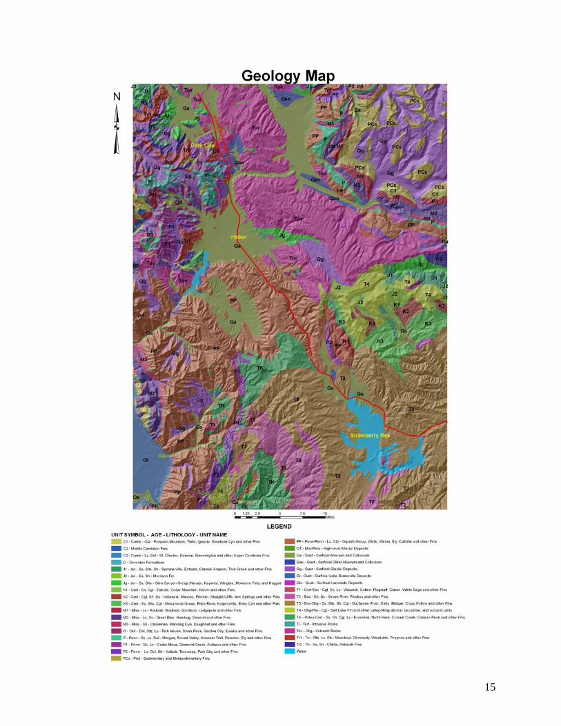
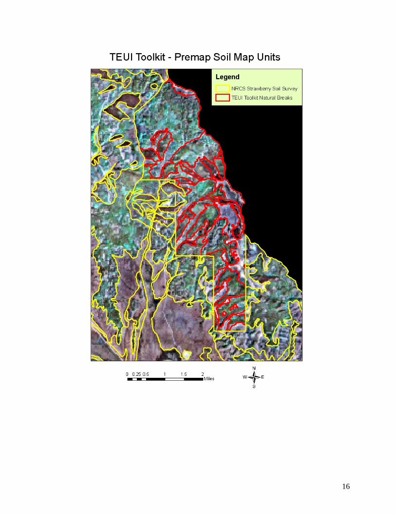
Contents Introduction & agenda………………………………………………….….2 Park City & Heber City Histories……..……………………………….….4 Heber Valley Soil Survey Map and Map Unit Description…………….…5 Description of the Strawberry Valley Management Area…………….…...7 Then and now in the Strawberry Valley – 1908 & 2002…………….……8 Then and now in the Strawberry Valley, Aerial View – 1938 & 1987…....9 Strawberry Area Soil Survey and Map Unit Descriptions………………...10 Roadside Geology…………………………………………………………14 References…………………………………………………………………14 Geology Map (1 page attachment) Terrestial Ecological Unit Inventory (TEUI) Pre-map (1 page attachment) Upper Strawberry Soil Analysis (5 page attachment)
2
Innovative Applications of Soil Survey Meeting the Changing Needs of Today’s Society
The wild west of cowboys and miners has been replaced by rapidly growing urban populations. With some difficulty a fleet and farm store can be found but there is no problem in finding a latte. The cover map shows the Jordanelle, Deer Creek and Strawberry Reservoirs that store water for a number of uses including wildlife, fisheries and irrigated agriculture. However a large portion is used for watering lawns and culinary uses along Utah’s ‘Wasatch Front’ of Salt Lake City and environs. Park City and the Heber Valley are each trying to deal with the impact of rapid change and are working to retain some of the character from the past and the natural features that make the area so attractive. The tour stops include speakers that deal with these issues everyday. The Strawberry Valley has a land use history that includes heavy grazing, the diversion of streams across watersheds, fire suppression, spraying of willows with herbicides, indiscriminate road building, logging and most significantly the building of the dams that created the Strawberry Reservoir. In the early 1990’s the Forest Service took over management of the area from a private water user’s group and began the restoration planning and implementation that will be discussed on the tour. Tour Stop 1 Prospector Square Hotel and Conference Center Park City Area Land Use Issues - Park City Mayor Dana Williams Dana Williams is a graduate California Polytechnic University. For a short period he worked on the Soil Survey of Summit County, Utah. He has been named the Summit County Farmer of the Year and has been involved with open space and responsible growth issues for many years. In 2001 he was elected mayor of Park City and was reelected in 2005. Tour Stop 2 ‘North Fields’ in Heber Valley
“Use of Soils Information in County Planning” - Al Mickelsen, Director of the Wasatch County Planning Office.
“Wasatch County Open Space” - Steve Farrell, Wasatch County Council.
“Alternative Waste Systems” - Phil Wright, Director of the Wasatch County Health Department.
“Farm & Ranchland Protection Program” - Chet Fitsgerald, District Conservationist with the Natural Resources Conservation Service, Coalville, Utah.
“Heber Valley Soils” – Randy Lewis & Ray Grow, Soil Scientists with the Natural Resources Conservation Service.
3
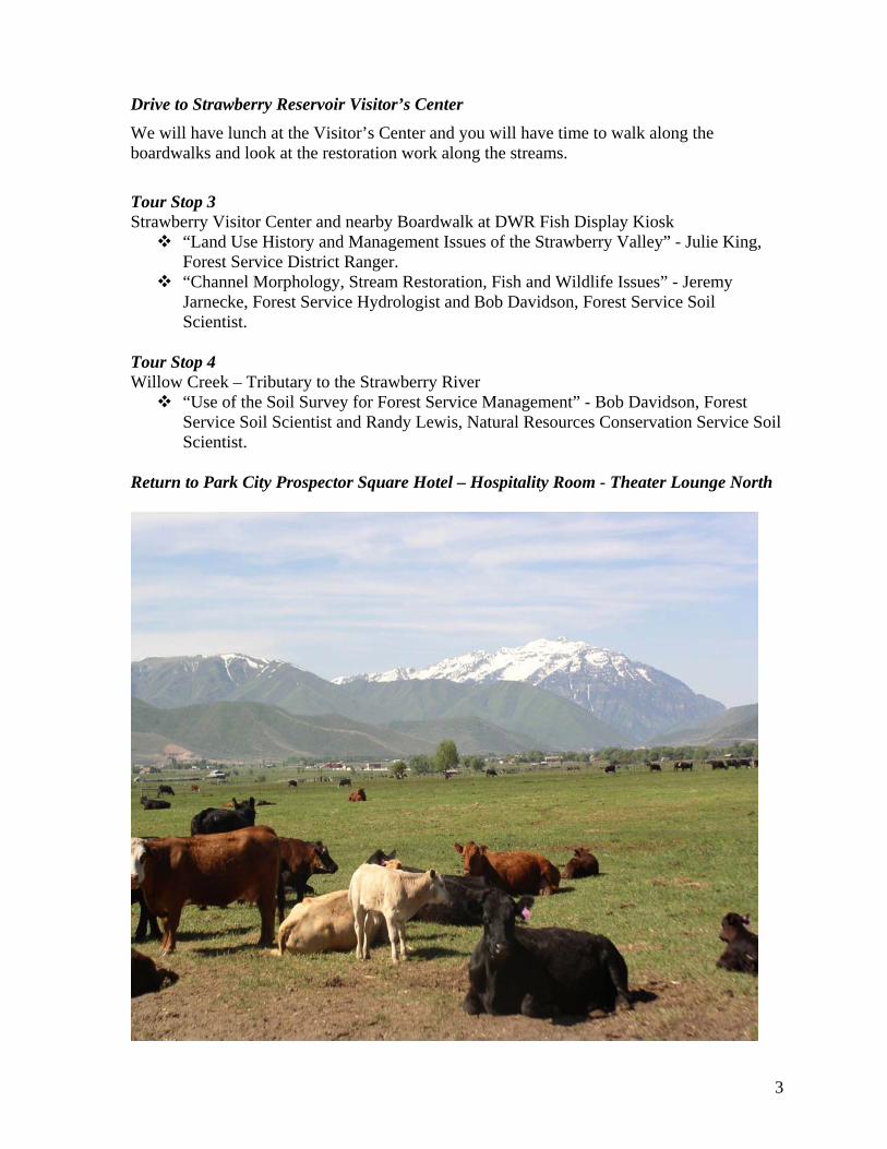
Drive to Strawberry Reservoir Visitor’s Center We will have lunch at the Visitor’s Center and you will have time to walk along the boardwalks and look at the restoration work along the streams.
Tour Stop 3 Strawberry Visitor Center and nearby Boardwalk at DWR Fish Display Kiosk
“Land Use History and Management Issues of the Strawberry Valley” - Julie King, Forest Service District Ranger.
“Channel Morphology, Stream Restoration, Fish and Wildlife Issues” - Jeremy Jarnecke, Forest Service Hydrologist and Bob Davidson, Forest Service Soil Scientist.
Tour Stop 4 Willow Creek – Tributary to the Strawberry River
“Use of the Soil Survey for Forest Service Management” - Bob Davidson, Forest Service Soil Scientist and Randy Lewis, Natural Resources Conservation Service Soil Scientist.
Return to Park City Prospector Square Hotel – Hospitality Room - Theater Lounge North
4
Park City History Prior to European settlement Native Americans traveled the high alpine valleys in search of game. By 1862 Brigham Young's "City by the Salt Lake" was booming and federal troops from California under Colonel Patrick Conner were sent to guard the U.S. Mail and watch over the "Saints", who might side with the Confederacy in the Civil War. Figuring that finding valuable ore would bring in outsiders and dilute the Mormon population, Colonel Conner sends soldiers out prospecting.
In the fall of 1868 the soldiers climbed over the mountains from Big Cottonwood Canyon to the Park City area and found silver. They marked the outcropping with a bandanna on a stick and returned in the spring. The first mine was named Flagstaff and Park City became known not only for its silver, but for lead, zinc and gold. The Flagstaff Mine was the first to ship ore from the area. In 1884 Park City was incorporated and construction of the City Hall was completed in1885.
In 1979 ‘The Miners Hospital’, threatened with demolition, was moved from its site near the base of the Park City Ski Area to the City Park for its new use as the City's public library. In 1984 there were14 lifts at Park City Ski Area and a day pass cost $26. The Park City Area now has three luxury ski resorts.
In 1995 Salt Lake City was awarded the 2002 Winter Olympic Games. More than 40% of the events were held in Park City at the Utah Olympic Park, Deer Valley, and Park City Mountain Resort.
Heber City History Before 1857, the area now known as Wasatch County, of which Heber City is a part, was the occasional abode of Indians that roamed through the territory. The first white men to traverse the county were Spanish Friars who were looking for a passageway between Santa Fe, New Mexico, and Monterey, California. Between the summer of 1776 and the beginnings of settlements in 1858, only hunters and trappers frequented the area in search of beaver and mink. Often they followed in the trails and footpaths worn into the earth by Indians.
In 1858, approximately ten years after the Mormons arrived in Salt Lake Valley, William M. Wall, George W. Bean and Aaron Daniels established ranches in Heber Valley. In that same year, J.W. Snow, a surveyor from Provo, Utah, laid a section of land north of the present city and divided it into 20 acre farmstead’s. Also, during 1858, a road was constructed through Provo Canyon, connecting Heber Valley and Utah Valley. By spring of 1860 there were over 200 people busy and working the valley and by winter 1860, eighteen farmers had decided to make Heber Valley their permanent home.
In 1889, a branch of the Denver & Rio Grand Western Railroad connecting Heber City with the "outside" world was completed and in 1909, the people of the valley completed construction of the Heber Light and Power generation system. A telephone exchange was set up in a private home in 1901 and served 12 telephones, mostly to doctors and professional men.
5
The current Heber City Office Building was formerly the Wasatch Stake Tabernacle. The building was built with donated labor and materials starting in 1887. Cost of the building was more than $30,000.
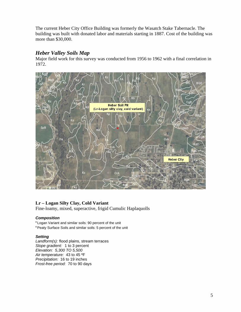
Heber Valley Soils Map Major field work for this survey was conducted from 1956 to 1962 with a final correlation in 1972.
Lr – Logan Silty Clay, Cold Variant Fine-loamy, mixed, superactive, frigid Cumulic Haplaquolls Composition ° Logan Variant and similar soils: 90 percent of the unit ° Peaty Surface Soils and similar soils: 5 percent of the unit Setting Landform(s): flood plains, stream terraces Slope gradient: 1 to 3 percent Elevation: 5,300 TO 5,500 Air temperature: 43 to 45 ºF Precipitation: 16 to 19 inches Frost-free period: 70 to 90 days
6
Characteristics of Logan Variant and similar soils Average total avail. water in top five feet (in.): 7.5 Soil loss tolerance (T factor):4 Available water capacity class: Moderate Wind erodibility group (WEG): 4 Parent material: mixed alluvium Wind erodibility index (WEI): 86 Restrictive feature(s): none Land capability class, irrigated: 3w Depth to Water table: 18 inches Land capability class, non-irrigated: 7w Drainage class: poorly drained Hydric soil: Yes Flooding hazard: none Hydrologic group: D Potential frost action: high Farm Class: Farmland of statewide importance Texture AWC (inches) pH Horizon --Depth (inches) Texture A11, A12 -- 0 to 10 Silty clay 1.5 to 1.8 7.4 to 7.8 C1k -- 10 to 16 Silty clay 0.9 to 1.1 7.4 to 8.4 C2k -- 16 to 23 Loam 0.9 to 1.1 7.4 to 7.8 C3 -- 23 to 29 Loam 0.9 to 1.1 7.4 to 7.8 C4 -- 29 to 35 Gravelly loam 0.5 to 0.8 7.4 to 7.8 C5 -- 35 to 44 Sandy loam 0.8 to 1.3 7.4 to 7.8 2C6 -- 44 to 66 Very gravelly loamy 0.7 to 1.1 7.9 to 8.4 sand Ecological class(es): NRCS Rangeland Site - Wet Fresh Meadow (Sedge)
7
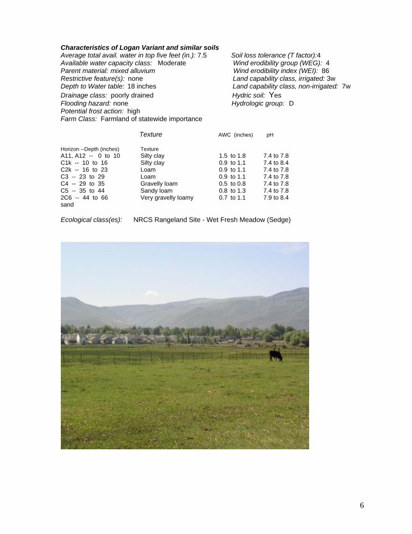
Description: Strawberry Valley Management Area The Strawberry Valley Management Area is 56,775 acres immediately surrounding
Strawberry Reservoir
These lands lie approximately 22 miles to the south of Heber City, Utah, in Wasatch County.
Reservoir elevation averages 7,600 feet with the surrounding Management Area rising to 8,000+ feet above sea level
Average precipitation in the Management Are is 20 inches annually with the majority falling during winter months as snow. A snowpack exists typically from late November to late April.
Vegetation communities on surrounding uplands are primarily comprised of aspen, populus tremeloides, and mountain big sagebrush, Artemesia tridentata var. vaseyana, community types.
Riparian communities are dominated by tall willows (Salix boothi, S. drummondiana, S. geyeriana) and sedges (Carex rostrata, C. nebrascensis, C. aquatilis, C. lanuginosa).
The Strawberry Valley has a land use history that includes heavy grazing, the diversion of streams across watersheds, fire suppression, spraying of willows with herbicides, indiscriminate road building and logging.
In 1916 the first dams were built that created the Strawberry Reservoir.
In the early 1990’s the Forest Service took over management of the area from a private water user’s group and began the restoration planning and implementation.
8
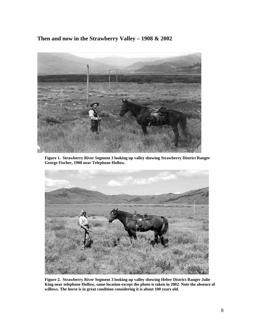
Then and now in the Strawberry Valley – 1908 & 2002
Figure 1. Strawberry River Segment 3 looking up valley showing Strawberry District Ranger George Fischer, 1908 near Telephone Hollow.
Figure 2. Strawberry River Segment 3 looking up valley showing Heber District Ranger Julie King near telephone Hollow, same location except the photo is taken in 2002. Note the absence of willows. The horse is in great condition considering it is about 100 years old.
9
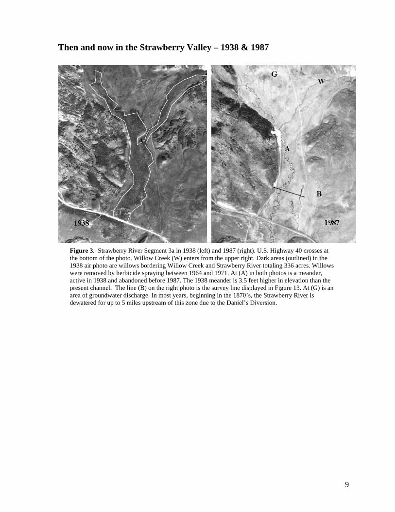
Then and now in the Strawberry Valley – 1938 & 1987
Figure 3. Strawberry River Segment 3a in 1938 (left) and 1987 (right). U.S. Highway 40 crosses at the bottom of the photo. Willow Creek (W) enters from the upper right. Dark areas (outlined) in the 1938 air photo are willows bordering Willow Creek and Strawberry River totaling 336 acres. Willows were removed by herbicide spraying between 1964 and 1971. At (A) in both photos is a meander, active in 1938 and abandoned before 1987. The 1938 meander is 3.5 feet higher in elevation than the present channel. The line (B) on the right photo is the survey line displayed in Figure 13. At (G) is an area of groundwater discharge. In most years, beginning in the 1870’s, the Strawberry River is dewatered for up to 5 miles upstream of this zone due to the Daniel’s Diversion.
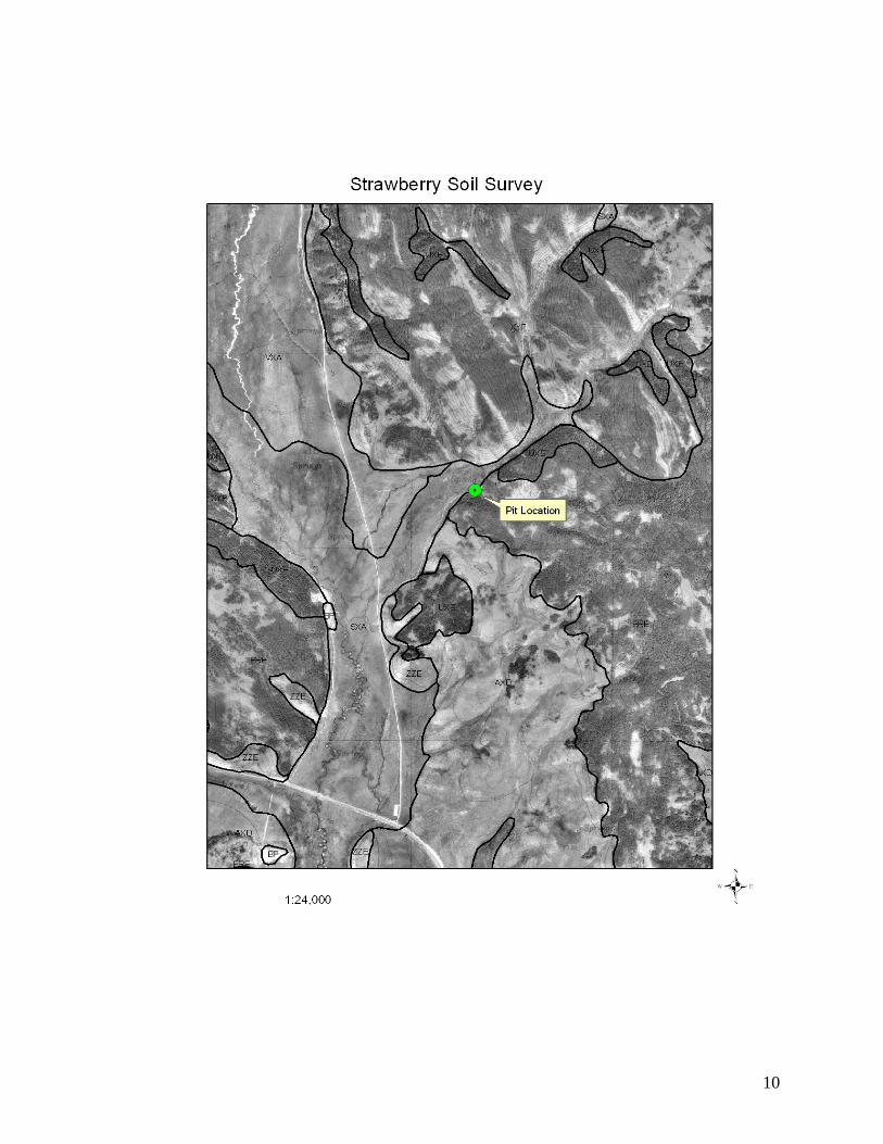
10
11
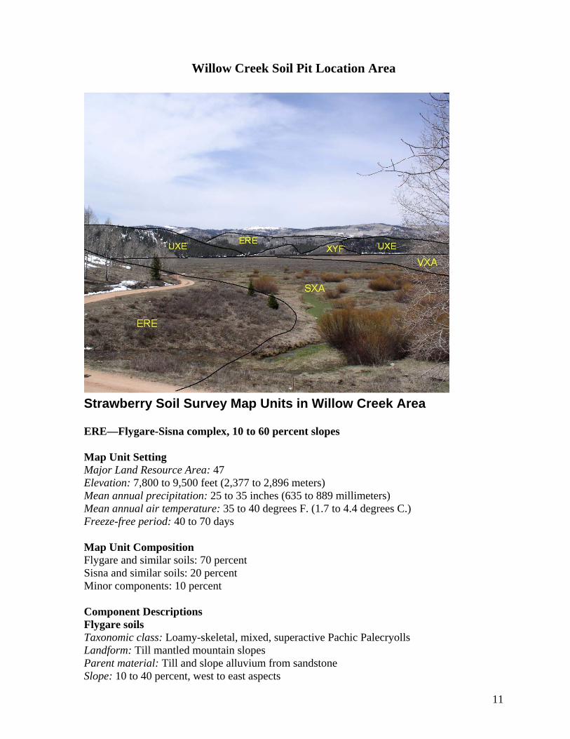
Willow Creek Soil Pit Location Area
Strawberry Soil Survey Map Units in Willow Creek Area ERE—Flygare-Sisna complex, 10 to 60 percent slopes Map Unit Setting Major Land Resource Area: 47 Elevation: 7,800 to 9,500 feet (2,377 to 2,896 meters) Mean annual precipitation: 25 to 35 inches (635 to 889 millimeters) Mean annual air temperature: 35 to 40 degrees F. (1.7 to 4.4 degrees C.) Freeze-free period: 40 to 70 days Map Unit Composition Flygare and similar soils: 70 percent Sisna and similar soils: 20 percent Minor components: 10 percent Component Descriptions Flygare soils Taxonomic class: Loamy-skeletal, mixed, superactive Pachic Palecryolls Landform: Till mantled mountain slopes Parent material: Till and slope alluvium from sandstone Slope: 10 to 40 percent, west to east aspects
12
Surface fragments: About 2 percent subrounded stones, about 5 percent subrounded cobbles, about 30 percent subrounded gravel
Drainage class: Well drained Slowest permeability: 0.2 to 0.6 in/hr (moderately slow) Available water capacity: About 3.9 inches (low) Shrink-swell potential: About 1.5 percent (low) Runoff class: Medium Present Vegetative Community: Aspen-Tall Groundsel Present Vegetation:
Common trees: quaking aspen Other plants: aspen bluebells, blue wild rye, butterweed groundsel, mountain brome,
quaking aspen, slender wheatgrass Land capability subclass (nonirrigated): 6e Typical Profile:
Oi—0 to 1 inch; slightly decomposed plant material A1—1 inch to 7 inches; very gravelly loam A2—7 to 18 inches; very cobbly loam E/Bt—18 to 33 inches; very cobbly sandy loam Bt/E—33 to 56 inches; extremely cobbly sandy clay loam Bt—56 to 71 inches; extremely cobbly clay loam
Sisna soils Taxonomic class: Loamy-skeletal, mixed, superactive Mollic Haplocryalfs Landform: Till mantled mountain slopes Parent material: Till, slope alluvium and colluvium from sandstone and shale Slope: 20 to 60 percent, northeast aspect Depth to restrictive feature: 60 to 80 inches to bedrock (lithic) Drainage class: Well drained Slowest permeability: 0.2 to 0.6 in/hr (moderately slow) Available water capacity: About 5.3 inches (low) Shrink-swell potential: About 1.5 percent (low) Runoff class: Medium Calcium carbonate maximum: About 5 percent Present Vegetative Community: Subalpine Fir-Grouse Whortleberry Present Vegetation:
Common trees: Engelmann's spruce, subalpine fir Other plants: grouse whortleberry
Land capability subclass (nonirrigated): 7e Typical Profile:
Oi—0 to 2 inches; slightly decomposed plant material A—2 to 9 inches; fine sandy loam E—9 to 15 inches; cobbly fine sandy loam E/Bt1—15 to 26 inches; cobbly fine sandy loam E/Bt2—26 to 34 inches; very cobbly sandy loam Bt—34 to 47 inches; very cobbly sandy clay loam CBk—47 to 70 inches; extremely cobbly fine sandy loam R—70 to 74 inches; bedrock
Minor Components Naphide and similar soils
Composition: About 5 percent Landform: Till mantled mountain slopes
13
Slope: 5 to 30 percent Drainage class: Well drained Present Vegetative Community: Mountain Big Sagebrush-Spike Fescue
Horrocks, very cobbly loam and similar soils
Composition: About 4 percent Landform: Till mantled mountain slopes Slope: 20 to 50 percent, south aspect Depth to restrictive feature: 40 to 60 inches to bedrock (lithic) Drainage class: Well drained Present Vegetative Community: Mountain Big Sagebrush-Mountain Snowberry-
Bluebunch Wheatgrass Calfhollow and similar soils
Composition: About 1 percent Landform: Till mantled mountain slopes Slope: 20 to 50 percent, south aspect Depth to restrictive feature: 10 to 20 inches to bedrock (lithic) Drainage class: Well drained Present Vegetative Community: Mountain Big Sagebrush-Bluebunch Wheatgrass
Adjacent Map Units
SXA—Cref-Xo complex, 0 to 2 percent slopes Elevation: 7,500 to 8,300 feet (2,286 to 2,530 meters) Mean annual precipitation: 18 to 25 inches (457 to 635 millimeters) Mean annual air temperature: 38 to 42 degrees F. (3.3 to 5.6 degrees C.) Freeze-free period: 70 to 90 days UXE—Sisna-Zalano complex, 10 to 60 percent slopes Elevation: 8,000 to 10,000 feet (2,438 to 3,048 meters) Mean annual precipitation: 25 to 35 inches (635 to 889 millimeters) Mean annual air temperature: 35 to 40 degrees F. (1.7 to 4.4 degrees C.) Freeze-free period: 40 to 70 days VXA—Snyderville-Kaputt complex, 0 to 3 percent slopes Elevation: 7,500 to 8,000 feet (2,286 to 2,438 meters) Mean annual precipitation: 18 to 25 inches (457 to 635 millimeters) Mean annual air temperature: 38 to 42 degrees F. (3.3 to 5.6 degrees C.) Freeze-free period: 70 to 90 days XYF—Zalano-Elwood-Dex complex, 5 to 60 percent slopes Elevation: 8,000 to 9,500 feet (2,438 to 2,896 meters) Mean annual precipitation: 25 to 35 inches (635 to 889 millimeters) Mean annual air temperature: 34 to 40 degrees F. (1.1 to 4.4 degrees C.) Freeze-free period: 40 to 70 days
14
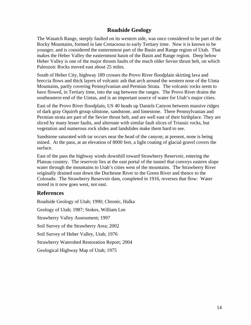
Roadside Geology The Wasatch Range, steeply faulted on its western side, was once considered to be part of the Rocky Mountains, formed in late Cretaceous to early Tertiary time. Now it is known to be younger, and is considered the easternmost part of the Basin and Range region of Utah. That makes the Heber Valley the easternmost basin of the Basin and Range region. Deep below Heber Valley is one of the major thrusts faults of the much older Sevier thrust belt, on which Paleozoic Rocks moved east about 25 miles.
South of Heber City, highway 189 crosses the Provo River floodplain skirting lava and breccia flows and thick layers of volcanic ash that arch around the western nose of the Uinta Mountains, partly covering Pennsylvanian and Permian Strata. The volcanic rocks seem to have flowed, in Tertiary time, into the sag between the ranges. The Provo River drains the southeastern end of the Uintas, and is an important source of water for Utah’s major cities.
East of the Provo River floodplain, US 40 heads up Daniels Canyon between massive ridges of dark gray Oquirrh group siltstone, sandstone, and limestone. There Pennsylvanian and Permian strata are part of the Sevier thrust belt, and are well east of their birthplace. They are sliced by many lesser faults, and alternate with similar fault slices of Triassic rocks, but vegetation and numerous rock slides and landslides make them hard to see.
Sandstone saturated with tar occurs near the head of the canyon; at present, none is being mined. At the pass, at an elevation of 8000 feet, a light coating of glacial gravel covers the surface.
East of the pass the highway winds downhill toward Strawberry Reservoir, entering the Plateau country. The reservoir lies at the east portal of the tunnel that conveys eastern slope water through the mountains to Utah’s cities west of the mountains. The Strawberry River originally drained east down the Duchesne River to the Green River and thence to the Colorado. The Strawberry Reservoir dam, completed in 1916, reverses that flow: Water stored in it now goes west, not east.
References Roadside Geology of Utah; 1990; Chronic, Halka
Geology of Utah; 1987; Stokes, William Lee
Strawberry Valley Assessment; 1997
Soil Survey of the Strawberry Area; 2002
Soil Survey of Heber Valley, Utah; 1976
Strawberry Watershed Restoration Report; 2004
Geological Highway Map of Utah; 1975
15
16
17
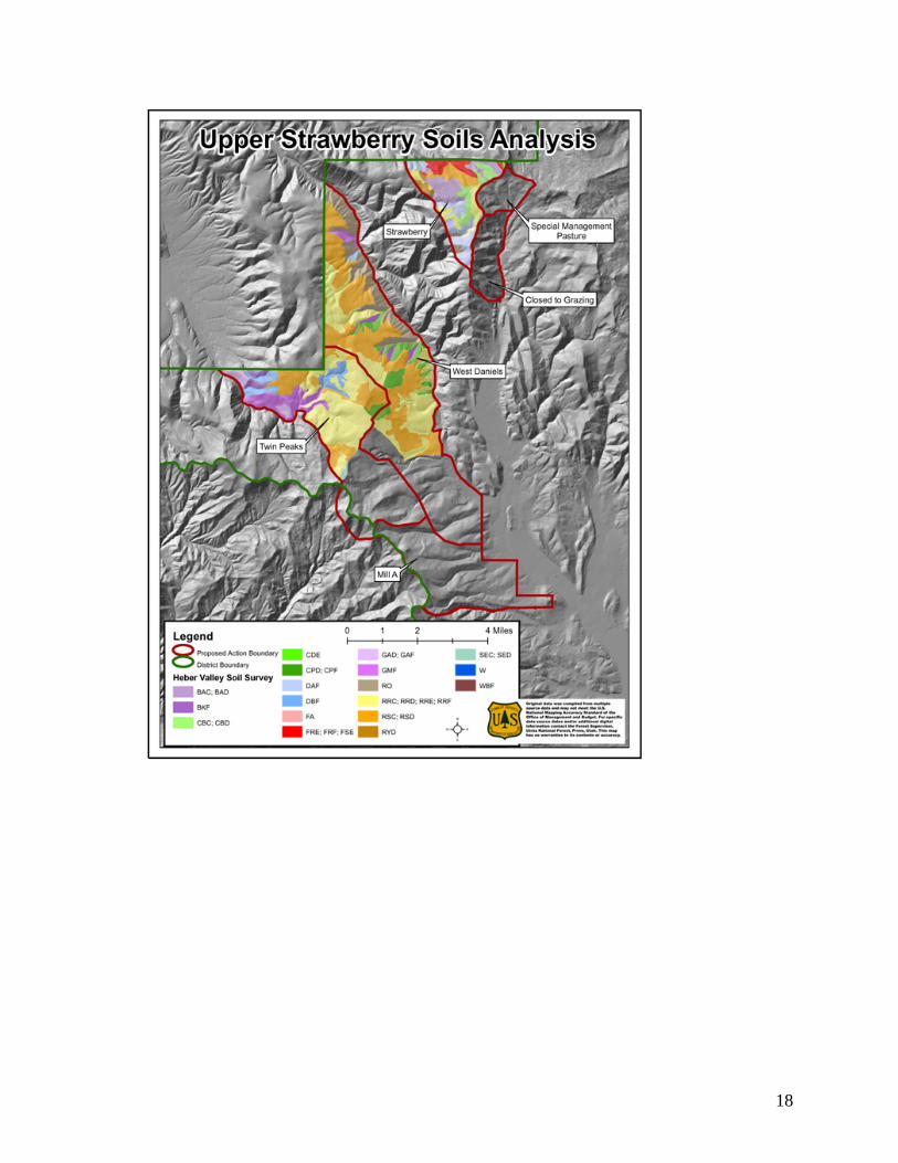
18
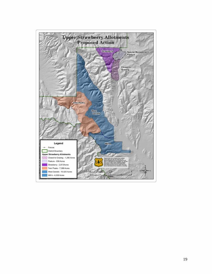
19
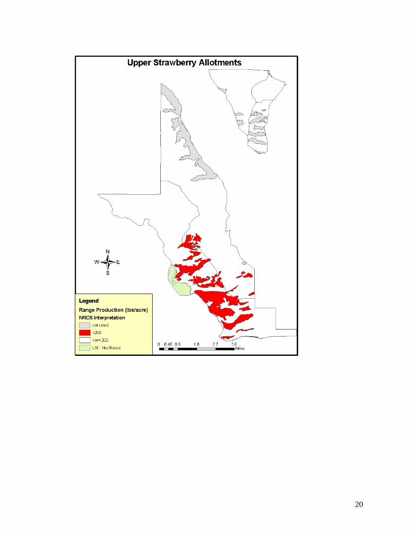
20
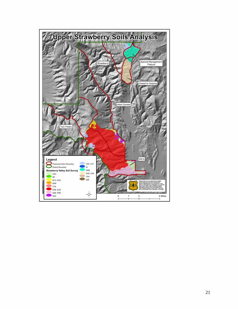
21