Embed Size (px)
Citation preview
WRCC Data and Climate Activities and
Interactions with the National Park Service
Kelly T. Redmond
Western Regional Climate Center
Desert Research Institute
Reno Nevada

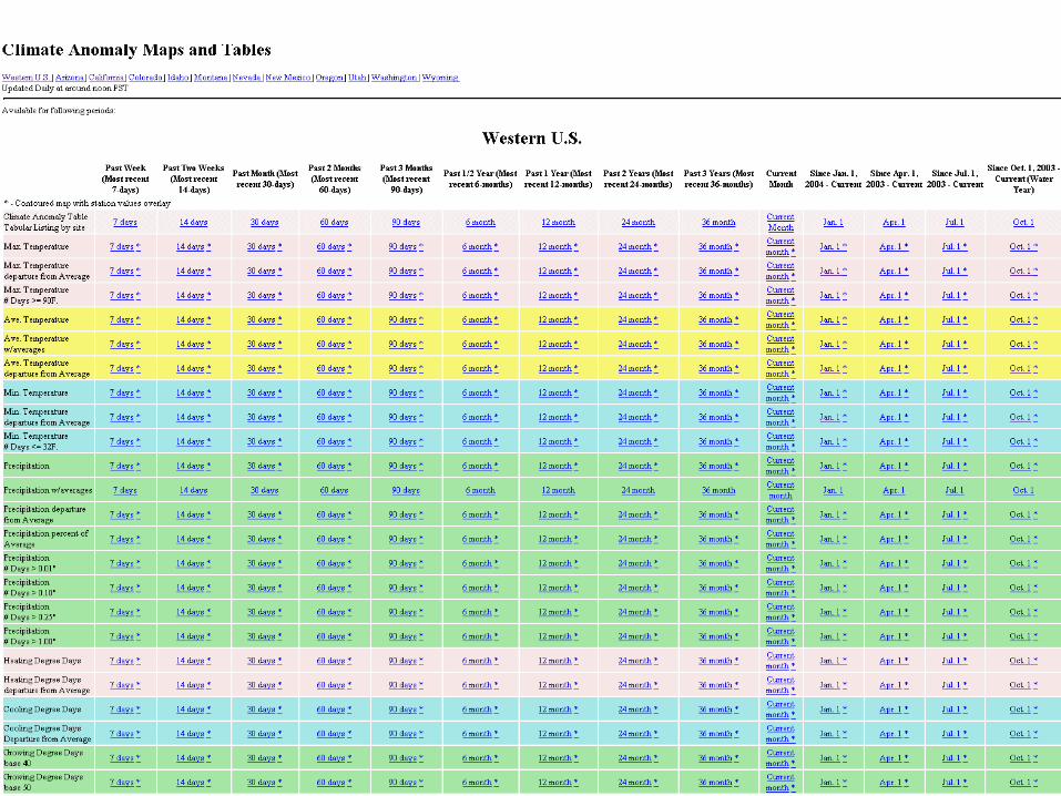
A busy web site … approximately 100,000 accesses per day, and about 100 Mb per day of data / products.

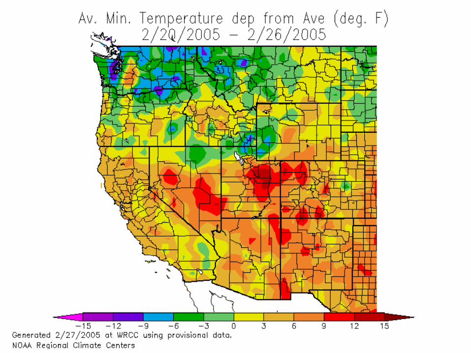
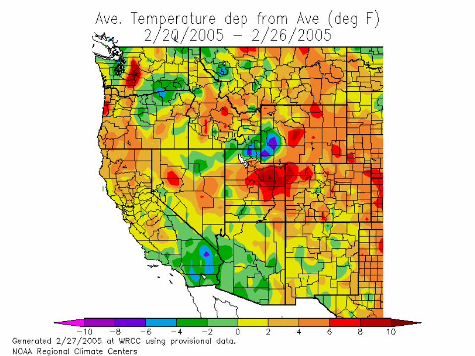
2005 Feb 27 1845 GMT

2005 Feb 27 1845 GMT

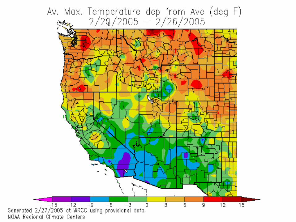
2005 Feb 27 1900 GMT


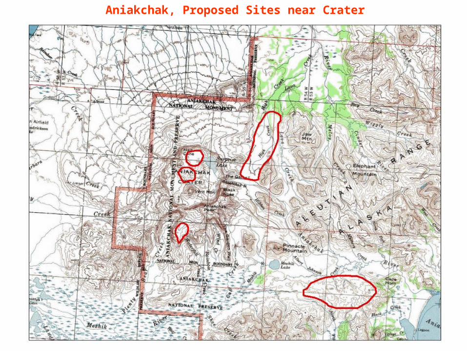
Aniakchak, Proposed Sites near Crater

ftp.wrcc.dri.edu/npsak/report/swanreportfinal.pdf
ftp.wrcc.dri.edu/npsak/photodocumentation.ppt or pdf
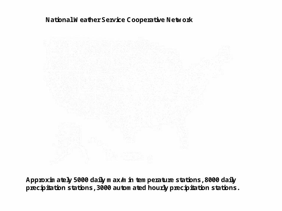
National Weather Service Cooperative Network
Approximately 5000 daily max/min temperature stations, 8000 daily precipitation stations, 3000 automated hourly precipitation stations.
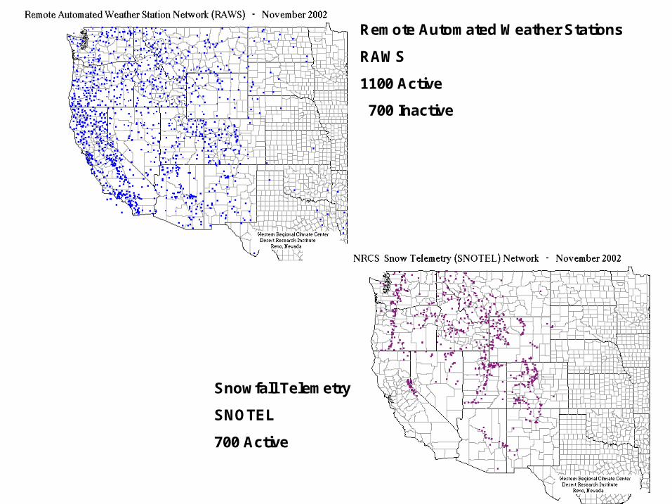
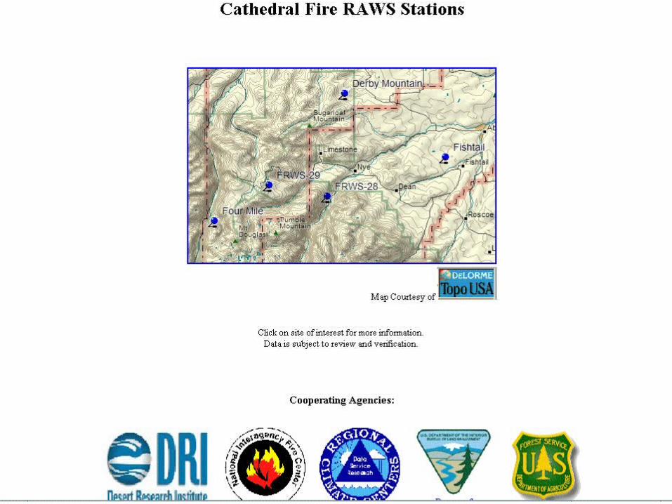
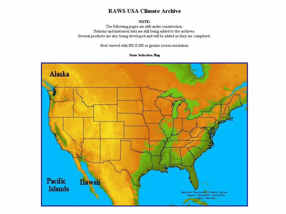
Remote Automated Weather Stations
RAWS
1100 Active
700 Inactive
Snowfall Telemetry
SNOTEL
700 Active
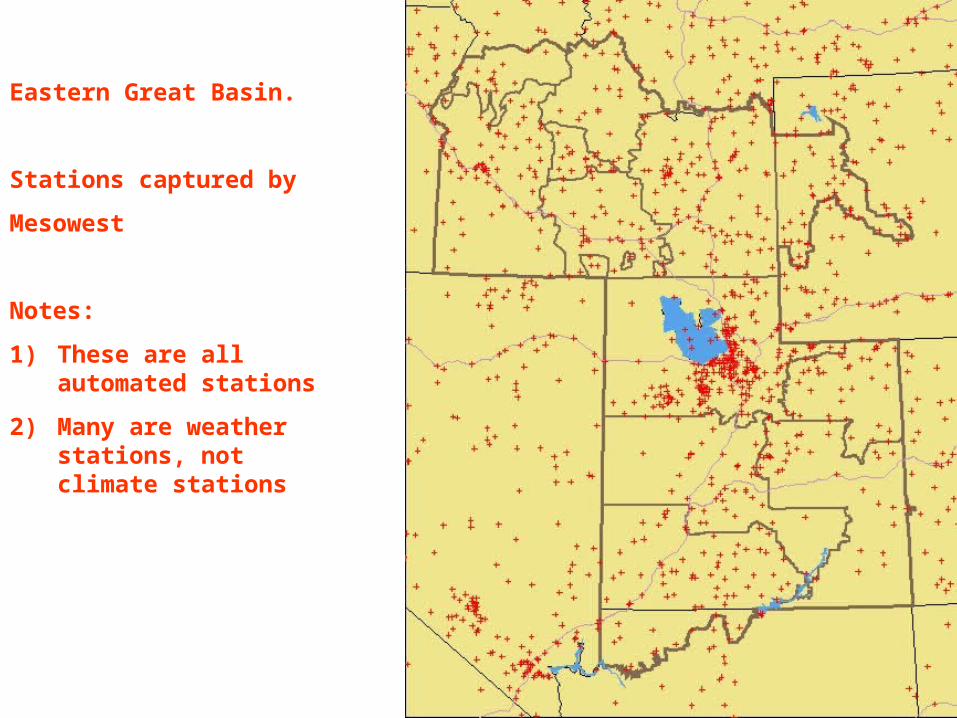
Eastern Great Basin.
Stations captured by
Mesowest
Notes:
1) These are all automated stations
2) Many are weather stations, not climate stations

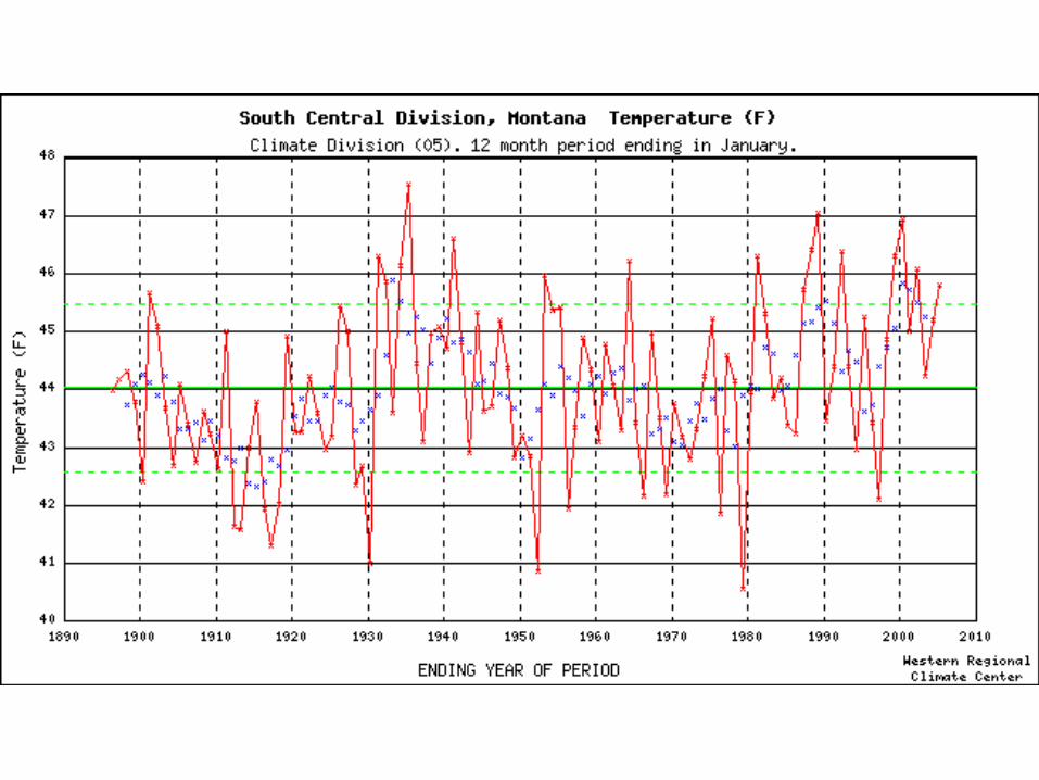
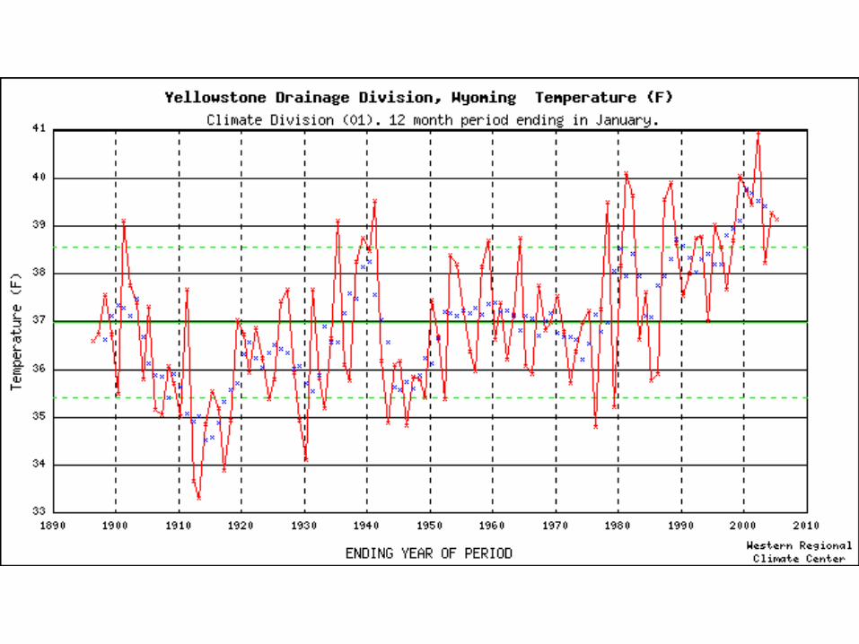
Northern Rockies.
Stations captured by
Mesowest
Notes:
1) These are all automated stations
2) Many are weather stations, not climate stations

South Central Sierra Snow Lab EastPhoto: Dave Simeral


CA Stovepipe Wells 1 SW, Death Valley National Park (Stovepipe Wells Site)CA Stovepipe Wells 1 SW, Death Valley National Park (Stovepipe Wells Site)36.6 N 117.1 W 80’
May 6, 2004


Locations of USCRN Stations in CONUS(114 stations)
NOAA funded (110)
CRN partner stations (4)
Final Configuration, USCRN in CONUS, Jan 05.ppt (mrh)
Photographic Documentation of
Long-Term Climate Stations
Draft Draft Draft
Kelly T. Redmond
Regional ClimatologistWestern Regional Climate Center
Desert Research InstituteReno Nevada 89512-1095
775-674-7011 voice775-674-7016 fax
[email protected] 20040725 [finalized later, 20040815]

X
1
2
3
4
5
6
7
8
North
East
South
West
Station in foreground.Eight pictures starting from north looking toward south, always same start and clockwise path. Why?You don’t have to remember !!!
Walk in a wide circle, about 50-150 feet away from the instrument. Show position relationships. You can always get close-ups later on.

X
12
34
567
8
North
East
South
West
Station in background, looking outward.Eight pictures starting from north looking toward south, always same start and clockwise path. Why?You don’t have to remember !!!

X
North
East
South
West
Panning. When azimuthal field of view is limited by camera.
Pan Left.Pan Right.
Allow Overlap
Initial View
Panning. From fixed vantage point, sweep to left and right to record a panorama. Keep relation of instrument to horizon constant. Swivel about a point, but don’t walk.
Panning. Retain an overlap section to be able to reconstruct direction of pan.
Panning. Can also pan up and down to show trees, mountains, surface texture.

What cameras do not record, at all or very well:
Your state of mind.
Anything outside the field of view.
What is behind, beside, above, or below you.
The full brightness range routinely discerned by the human eye.
Shadow details.
Highly contrasty situations, such as looking toward the sun.
Depth. 3 dimensions will be recorded on a 2-dimensional medium.
What happened prior to, or after, the shutter is snapped.
Shaded detail in bright sunlight, or with snow-covered ground.
Dark areas, when brighter conditions influence the light meter.
The fact that you are standing in a marsh or a mud pit or on bare rock.


March 1989-2004
Hourly Frequency Distribution of Temperature


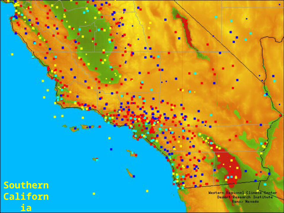
Southern California

RED = NWS COOP PURPLE = SNOTEL DARK BLUE = RAWS LIGHT BLUE = SURFACE AIRWAYS YELLOW = MISC (CURRENTLY CIMIS, CDEC, BUOYS)
Current Stations


Thank You