Embed Size (px)
Citation preview

Workshop 3 Report 1
Sustainable Grenadines Inc., Clifton, Union Island, SVG Tel: 784.485.8779 E-mail: [email protected]
Marine Multi-use Zoning Project
Workshop 3: Planning for Sustainable Development of the Marine and Coastal Resources of the Grenadines
February 16 & 17, Hillsborough, Carriacou, Grenada
Sustainable Grenadines Inc. March 2012

Workshop 3 Report 2
Sustainable Grenadines Inc., Clifton, Union Island, SVG Tel: 784.485.8779 E-mail: [email protected]
Table of Contents
1. INTRODUCTION 3 Project Objectives 3 Workshop Objectives 3 Facilitators 4
2. WORKSHOP AGENDA 5
3. PRESENTATION AND GROUP DISCUSSION SESSIONS 7
Day 1 7 3.1 Project Overview (Kim Baldwin, presenter) 7 3.2 Existing policy support (Sandy Nichols, presenter) 8 3.3 Sub-committee meeting update (Delivered by Sub-committee members) 9 3.4 Group Discussion- Review and discussion of zoning scenarios (Kim Baldwin & Ruth Blyther, facilitators) 9 3.5 Group Discussion- Zone definitions (Kim Baldwin & Ruth Blyther, facilitators) 17
Day 2 20 3.6 Zone definitions/ Case studies (Kim Baldwin, presenter/facilitator) 20 3.7 Group Discussion Highlights- Zoning definitions (Ruth Blyther, facilitator) 21 3.8 Resolving remaining policy questions (Sandra Nichols. presenter) 22 3.9 Review of the zoning scenario (Kim Baldwin, facilitator) 22 3.10 Future of the project (Martin Barriteau & Katie McLean, presenters) 22
4. POST-WORKSHOP ZONING SCENARIO 24
5. CONCLUSION & MOVING FORWARD 27
7. APPENDICES 29 The funding for this project is provided by: Cover Photo: Workshop 3 breakout group. Courtesy of Aly DeGraff (2012) Citation: Sustainable Grenadines Inc. (SusGren). 2012. Workshop Report for “Workshop 3: Planning for Sustainable Development of the Marine and Coastal Resources of the Grenadines”. 50 pp.
GEF Small Grants Program

Workshop 3 Report 3
Sustainable Grenadines Inc., Clifton, Union Island, SVG Tel: 784.485.8779 E-mail: [email protected]
1. Introduction The third in a series of three workshops supporting Sustainable Grenadines’ (SusGren) marine multi-use zoning project was held on February 16 and 17 in Hillsborough, Carriacou, Grenada. This document serves to report on the activities and outcomes of the workshop. Developing a draft marine multi-use zoning plan for the Grenadines is a regional trans-boundary initiative to promote sustainable development in the marine environment. The project involves using a participatory process to evaluate human activities and resource use in the marine environment to create a blueprint for future use. Marine spatial planning supports an integrated approach to decision-making by taking into account multiple management objectives (social, ecological and economic). The overarching project goal is to engage Grenadines marine resource users in the development of an ecosystem-based, multiple-use marine zoning plan to facilitate effective management of marine resources, reduce existing or possible conflicts between multiple marine uses/users and ensure ecological connectivity of MPAs in order to achieve the goals of sustainable development. SusGren has received has received funding to support this project from National Oceanic and Atmospheric Administration (NOAA), the Global Environment Facility Small Grants Programme (GEF SGP) and The Nature Conservancy (TNC). This workshop builds on eighteen months worth of work, which has included workshops in January and August of 2011, a marine resource sub-committee meeting in November 2011. In preparation for the workshop a draft zoning design was prepared for presentation to participants in order to solicit feedback that can be used to further refine the plan.
Project Objectives Objective 1. Develop a draft multi-use zoning design for the Grenadines using new and existing information in order to increase Grenada and Saint Vincent and the Grenadines capacity to protect, manage and sustainable use the resources of the Grenadines Objective 2. Identify and document policy and legislative gaps and draft policies for multi-use zoning collaboration and coastal zone management for the Grenadines Objective 3. Design an awareness campaign to support multi-use zone planning on the importance and economic values of the Grenadines’ coastal and marine resources to politicians, the wider public, local community, business community and resource users.
Workshop Objectives 1. To update participants on the activities and status of the project 2. To develop a potential marine zoning design 3. To discuss policy and legislative gaps, and possible ways forward 4. To discuss and identify future project needs and post-project activities

Workshop 3 Report 4
Sustainable Grenadines Inc., Clifton, Union Island, SVG Tel: 784.485.8779 E-mail: [email protected]
Facilitators Kim Baldwin, University of West Indies Ruth Blyther, The Nature Conservancy Sandy Nichols, Environmental Law Institute Martin Barriteau, Sustainable Grenadines Inc. Workshop Participants Forty-one (41) participants attended the workshop including, representatives of a variety of marine resource user (MRU) groups, various government agencies, academic institutions and SusGren staff. Marine resource user groups represented included fisherfolk, yachters/cruisers, tourism, water taxis, mariculture and divers. Government agencies from Saint Vincent and the Grenadines who were represented included the: National Trust, National Parks Authority, Ministry of Tourism, Ministry of Health and Environment, Tobago Cays Marine Park and the Fisheries Division. Government agencies from Grenada who were represented included: Fisheries Division, Ministry of Environment, Ministry of Carriacou and petite Martinique Affairs, Moliniere Beausjour MPA, and Sandy Island/ Oyster Bed MPA. A complete list of attendees can be found in Appendix 1.

Workshop 3 Report 5
Sustainable Grenadines Inc., Clifton, Union Island, SVG Tel: 784.485.8779 E-mail: [email protected]
2. Workshop Agenda Workshop Day 1 8:30-:8:45 Prayer and welcome Martin Barriteau,
Sustainable Grenadines (SuGren)
8:45-9:15 Opening remarks Davon Baker, Chair, Sandy Island/Oyster Bed Marine Protected Area Minister of Carriacou and Petit Martinique Affairs
9:15-9:30 • Housekeeping • Workshop objectives and agenda • Icebreaker
Martin Barriteau, SusGren
9:30-10:15 Project Overview •What was the goal and objective •Our vision for the Grenadine Islands •Marine use and zoning •How do we make decisions Decision support tools
Kim Baldwin, University of West Indies (UWI)
10:15-10:30 Coffee Break 10:30-11:00 What existing policy do we have to support the
implementation of a zoning plan? Sandy Nichols, Environmental Law Institute (ELI)
11:00-12:00 Sub-committee meeting update
Grenadines MRU Sub-committee members (TBD)
12:00-1:00 Lunch Break 1:00-2:00 Review zoning scenario and discussion of potential
marine zoning design Group exercise- breakout groups, based on regions Lead: Kim Baldwin (UWI) Facilitators: Pauline Beaupre, Michelle Meganetty, Katie McLean, Aly Degraff, Martin Barriteau, Ruth Blyther
2:00-2:45 Compare zoning designs and identify areas of agreement and contention
Group exercise Lead: Kim Baldwin (UWI)
2:45-3:15 Why do we really want to happen in this zone? Discussion of the objectives of each zone
Group exercise Lead: Ruth Blyther, The Nature Conservancy

Workshop 3 Report 6
Sustainable Grenadines Inc., Clifton, Union Island, SVG Tel: 784.485.8779 E-mail: [email protected]
(TNC) 3:15-:345 Share goals for each of the developed zones Group exercise
Lead: Kim Baldwin, UWI
3:45-4:00 Day 1 wrap-up Martin Barriteau, SusGren
Workshop Day 2 8:30-8:45 Prayer, welcome and housekeeping Martin Barriteau, SusGren 8:45-9:45 Zoning definition Kim Baldwin, UWI 9:45-10:15 Charting the way forward: Resolving remaining policy
questions Sandra Nichols, ELI Group exercise
10:15-10:30 Coffee Break 10:30-11:30 Review of maps/zoning 11:30-11:45 Upcoming community meetings: How do we get
support for our zoning plan? Kim Baldwin, UWI
11:45-12:00 Implementing the zoning plan – Tasks for the working group •Needs •Resources •Potential funding sources
Ruth Blyther, TNC
12:00-12:30
The future of this project: •Monitoring and Evaluation Strategy and implementation •Communications and outreach activities Government support & engagement/ Development of a government charter •Post-project committee
Martin Barriteau & Katie McLean, SusGren
12:30-1:00 Workshop wrap-up and evaluation Martin Barriteau, SusGren

Workshop 3 Report 7
Sustainable Grenadines Inc., Clifton, Union Island, SVG Tel: 784.485.8779 E-mail: [email protected]
3. Presentation and Group Discussion Sessions
Day 1
Opening The workshop was opened by Mr. Martin Barriteau, Director, Sustainable Grenadines Inc. (SusGren). He invited Mrs. Cindy Delpesche of the Union Island Tourism Bureau to start the workshop with a prayer. Mr. Barriteau warmly welcomed everyone, acknowledged the sponsors of the project; NOAA, GEF SGP and TNC and explained the purpose for the workshop. He introduced and invited the following key representatives to make some remarks. Ms. Ruth Blyther, Eastern Caribbean Country Representative, The Nature Conservancy (TNC) South Eastern Caribbean in her remarks stated that multi-use zoning planning has only been done in a few places around the world and that the Grenadines is very fortunate to have the level data being collected. She extended an invitation to the Minister of Carriacou and Petite Martinique Affairs to encourage his government to use this valuable information in their planning. In closing, an update was given on the TNC’s At The Water Edge (AWE) Climate Resilience project for Grenada and St. Vincent and the Grenadines, which is currently being implemented. Mr. Davon Baker, Chair, Sandy Island/Oyster Bed Marine Protected Area in his remarks welcomed everyone to Carriacou and gave a brief description of the status of the Sandy Island Oyster Bed MPA. He reiterated the importance for effective management of the coastal areas and support for the Mulit-use Zoning plan. Senator George Prime, Minister of Carriacou and Petite Martinique Affairs in his remarks extended a warm welcome to all the participants to Carriacou and invited them to take some time learn about Carriacou’s rich culture and partake in some carnival activities whilst on Carriacou. Senator Prime said that his government has been a strong supporter for conserving the environment and they were responsible for declaring the Sandy Island Oyster Bed area as an MPA. He explained that Carriacou and Petite Martinique have been clamoring for a long time for their names to be written into state of Grenada and suggested new state of Grenada be called Grenada and the Grenadines. He complimented SusGren for the work it has been doing; finally he wished the participants a successful workshop and gave the support of his ministry to the process.
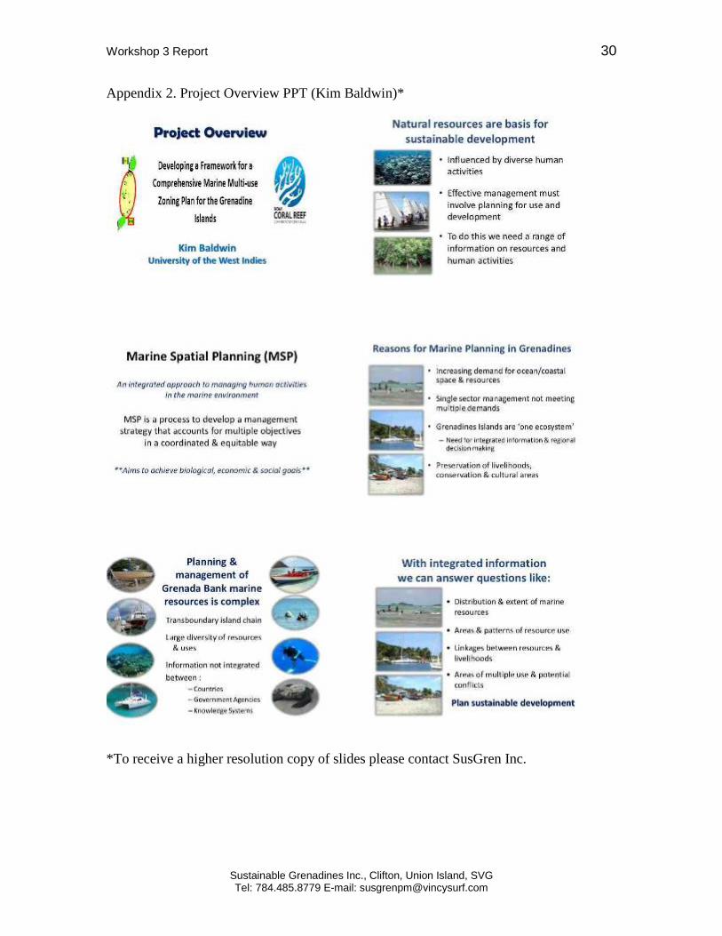
3.1 Project Overview (Kim Baldwin, presenter) Slides, Appendix 2 Key background information was provided to ensure that all participants understood the history of the project and the work that has been completed thus far. The use of an integrated approach to management is a driving principle behind the project. An integrated approach involves multiple sectors in management decisions, and all key

Workshop 3 Report 8
Sustainable Grenadines Inc., Clifton, Union Island, SVG Tel: 784.485.8779 E-mail: [email protected]
stakeholders involved in the process. The ecosystem based approach is another key principle, with the whole Grenada Bank ecosystem acting as the planning region. This project can be seen as an attempt to promote marine spatial planning (MSP), a technical term that describes an integrated approach to managing human activities in the marine environment. MSP is a strategy that can be used to account for multiple objectives in a coordinated and equitable manor, balancing biological, economic and social goals. An eight-step MSP decision-making process, which has been utilized during the implementation of the Multiuse Zoning Project, was introduced. Each of the steps was described in reference to this project, to provide participants with the essential details of the decision making process that has been used during the course of the project. Marxan with zones, a decision support tool that produces zoning scenarios based on multiple data sets has been used to generate the initial draft zoning design. A majority of the data required by Marxan is housed in the MarSIS database, a transboundary marine resource and space use information system. MarSIS includes information on: marine habitats, infrastructure, marine resources users, marine space-uses, sensitive biological and heritage areas, and areas of threat. The purpose of the project is not to rely solely on Marxan to generate a zoning design, rather it is a support tool that can be used to produce an initial design which stakeholders can work collaboratively refine.
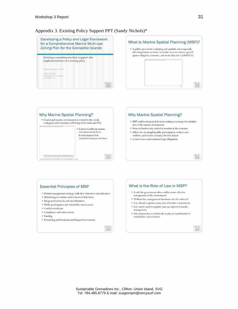
3.2 Existing policy support (Sandy Nichols, presenter) Slides, Appendix 3 The session began with a review of the key concepts and principles behind MSP and an argument as to why MSP is an appropriate and strategic approach to take in the Grenadines. Marine spatial planning is a public process for evaluation and spatially and temporally allocating human activities in marine areas to achieve agreed upon ecological, economic and social objectives. Ms. Nichols of the Environmental Law Institute (ELI), who has been contracted as the legal expert for the project explained the role of the law in MSP and the importance of government involvement for effective management. Factors for successful implementation of the zoning plan include legal measures to allow for enforcement, and planning to ensure that existing laws and regulations that govern the marine environment are respected and leveraged where possible. In order to implement MSP in the Grenadines a legal framework will need to be developed. Currently marine spaces are governed by a patchwork of laws, making it difficult to plan and manage in an integrated fashion. This framework should make provisions for collaborative management, public and stakeholder involvement and enforcement among other things. The Vincentian and Grenadian have already made some international commitments that compel them to adhere to the principles of MSP. Such agreements include the Cartegena Convention, the Convention on Biological Diversity and the St. George’s Declaration.

Workshop 3 Report 9
Sustainable Grenadines Inc., Clifton, Union Island, SVG Tel: 784.485.8779 E-mail: [email protected]
Existing legal authroty in GR and SVG were reviewed. These existing laws, regulations and legislation in part dictate what is feasible to achieve with a marine zoning plan, and act as a starting point for reforming or developing new laws/policies. Examples of relevant acts the Fisheries Act, Physical Planning and Development Act.
3.3 Sub-committee meeting update (Delivered by Sub-committee members) Slides, Appendix 4 The objective of this session was to inform workshop participants of the activities and outcomes of the November 2011 Marine Resource User Sub-committee meeting as held in Mayreau, This committee consists of marine resource user representatives from each of the inhabited Grenadine islands. The main objectives of the meeting was to gain a better understanding of Marxan as a decision support tool, to decide if it is an appropriate tool to use in Multiuse Zoning Project, and to provide input on marine resource use in order to generate a feasible zoning scenario. The group worked to prepare a zoning design by hand, using first hand knowledge of marine space and resource use. A zoning design was also produced using Marxan. After comparing hand drawn zones to Marxan generated design, and noting the high degree of similarity, the committee decided that Marxan was a useful tool that generated logical results, and should be used for the project. A zoning scenario was developed, which will be presented at Workshop 3. This scenario acted as a starting place for further revisions and refinement to the zones (which took place in later sessions of Workshop 3).
3.4 Group Discussion- Review and discussion of zoning scenarios (Kim Baldwin & Ruth Blyther, facilitators) An initial draft zoning design was created using Marxan, and refined during the MRU Sub-committee meeting. Additionally, information was gathered in two other workshops and a series of community meetings, and incorporated into this design, making the draft zoning design a culmination of the all the information gathered to date. This draft served as a starting point for further revisions to the zoning boundaries at this workshop. The group was introduced to the map, and group activity instructions were given. The larger group was broken into four breakout groups based on participants’ island of residence or expertise, these groups were the northern Grenadines, central Grenadines, and two groups from the southern Grenadines. Each group received several printouts of the zoning scenario, including copies zoomed in on their focus area (south, central or northern). Groups were instructed to spend 45 minutes examining the map, and spend 45 minutes discussing the draft zoning design, such as changes they would like to see made, information that they believe has been overlooked or zones that they strongly agree with. After about 45 minutes of discussion the facilitator’s checked in with the group as a whole, to answer any questions that may have arisen. Groups were then instructed to begin revising the zones by marking on the map using coloured markers. Each group was

Workshop 3 Report 10
Sustainable Grenadines Inc., Clifton, Union Island, SVG Tel: 784.485.8779 E-mail: [email protected]
given the opportunity to present their revised zoning deign at the end of the session. Notes were taken during the session to capture the specific issues brought up by each breakout group. Maps were collected at the end of the session, so that the suggested revisions can be incorporated into future iterations of the zoning scenario. Key points from each group discussion are included in Table 1.

Workshop 3 Report 11
Sustainable Grenadines Inc., Clifton, Union Island, SVG Tel: 784.485.8779 E-mail: [email protected]
Table 1. Breakout Group Review of Zoning Scenario Key Points G
roup
Isla
nd Zone
Fishing Tourism Mariculture Industrial Conservation
Nor
ther
n
Beq
uia - fishing areas not
happening on north east, most fishing occurs on south -zones not fair to fishing, it is underrepresented on the map - Bequia fishing on south eastern side, between Mustique and Bequia, some fishing on northern section - The white spot should be included as fishing zone -some fishing occurring around Isle de Cait -more fishing needs to be accommodated on south side; tourism will cause conflict for fishing
-Tourism seems over-represented. On the south side there is not much tourism, as the map would indicate. The Moon Hole development has also expressed interest in establishing areas for conservation and anchoring -There is no area designated for anchoring around Moon Hole -Would like to see a fishing zone included on the south side -Bait fishing should be permitted in tourism zones
-turtle areas should be conserved -important reef area off Friendship that should be conserved

Workshop 3 Report 12
Sustainable Grenadines Inc., Clifton, Union Island, SVG Tel: 784.485.8779 E-mail: [email protected]
Mus
tique
and
Cay
s -current conflict caused by seine fishery (see conservation notes) -cays an important fishing area -bait fishing currently occurs in conservation area
-leeward side important for tourism -Cays are zoned as tourism, possibly because they have many dive sites, but this is also an important fishing area -not much conflict between tourism and fishing currently -diving does not have the same impact as other tourism activities, and should be considered separately- need to clearly differentiate between development and low-impact tourism -could use high vs. low impact tourism zones
-already set aside as a reserve, but not formally monitored -people still fish within 1000 yard boundary -current conflict due to seine fishing in conservation area; fisheries has been asked to intervene
Bal
icea
ux a
nd B
attie
ou -important fishing area
that is heavily harvested, which will lead to resistance against complete conservation -used by fishers from other Grenadines, such as Union, for spear fishing
-important dive sites -may need different types of tourism zones to separate different types of tourism
-good location for conservation

Workshop 3 Report 13
Sustainable Grenadines Inc., Clifton, Union Island, SVG Tel: 784.485.8779 E-mail: [email protected]
Cen
tral
Can
ouan
-one of the best locations for bait fishing -moorings for tourism could cause conflict (gear not compatible) -unique in terms of the species landed around the island
-ok with draft zones -very little occurring -should connect existing zone so that it connects with shore -could be some conflict with yachts
-general agreement that ferries are a necessity and should be accommodated in the zoning design -would like to see oil spill and dumping of waste better managed -wastewater from the desalinization plant is an important problem that should be addressed -run-off from gold course is also a major problem dredging poses threats to environment, could use conservation zones or regulations to limit dredging activity
-backside of island is a good fishing location with is currently used -need to address lack of enforcement of existing fisheries laws/regulations -may have some conflict between diving and fishing, because fishing is removing large individuals coral reefs around Canouan are important for conservation

Workshop 3 Report 14
Sustainable Grenadines Inc., Clifton, Union Island, SVG Tel: 784.485.8779 E-mail: [email protected]
May
reau
-highly contentious issue -fisher folk feel that the current fisheries restrictions are unfair and not justified, would like to see more area open to fishing
-potential for tourism around entire island, this is not reflected -likely compatible with other types of use/zones
-current site needs to be added
See above -fisher folk feel that there is already too much conservation around Mayreau -most of the area around Mayreau is a no fishing area, but this is not enforced -to reduce conflict with fishing, conservation zones could be placed only around critical habitat -access to fishing vs. conservation is a highly contentious issue

Workshop 3 Report 15
Sustainable Grenadines Inc., Clifton, Union Island, SVG Tel: 784.485.8779 E-mail: [email protected]
Uni
on -no issues with zones
in scenario -great deal of discussion regarding Chatham Bay. Interest in seeing it zoned to manage tourism and fishing -do not want to see large amounts of development to Chatham Bay -Chatham is a good side for jack fishery -if Chatham anchoring happened on opposite side of bay to where it currently is this would allow for fishing
-Richmond and Campbell are good locations to add mariculture zones -agreement with existing zones
-anchoring on seagrass beds in Chatham Bay is causing environmental damage, interest in seeing this prevented through zoning -could make regulations against anchoring on seagrass, install moorings, etc.
-draft design was generally well received -interest in seeing reef and mangroves protected -reefs need to be restored because of the storm protection function they provide -Bloody Bay should be conserved for sea turtles
Sout
hern
Petit
M
artin
ique
-The fishers on PM depend a lot on spear fishing and some consideration should be given to that.
The tourism zone in Petite Martinique is not accurate. Too much tourism is represented on the map which does not exist in reality.
- The stealing of seamoss on PM is a limiting factor to farming.
-add a new shipping lane from windward Carriacou to meet the one goes from PM to Hillsborough
The area around petite Dominique is a potential conservation area

Workshop 3 Report 16
Sustainable Grenadines Inc., Clifton, Union Island, SVG Tel: 784.485.8779 E-mail: [email protected]
Car
riac
ou -Gun point could be a
fishing area, not conservation - The east to the Southern Eastern end of Carriacou is currently used a lot for spearing fishing and other fishing. However some level of protection should be given to that barrier reef - The region off Gun Point should be a fishing zone and not conservation
-tourism is very significant around Hillsborough - Sandy Island is also significant for tourism -Windward is represented by too much tourism - From Hillsborough to Paradise Beach could be made into a tourism zone
- Two new areas were added for mariculture around Carriacou (Cassada Bay and St. Louis bay)
-not enough representation of shipping between Hillsborough and Harvey Vale - A shipping lane from Hillsborough to Windward could be added
-some forms of tourism may be compatible with conservation zone - The area around saline and white islands to the immediate south of Carriacou should be a conservation zone - Petite Careenage area could be a conservation zone -The barrier reef from the east to the southeast of Carriacou should have some conservation areas established -The Isle de Rhonde should be a conservation area with control / managed fishing

Workshop 3 Report 17
Sustainable Grenadines Inc., Clifton, Union Island, SVG Tel: 784.485.8779 E-mail: [email protected]
3.5 Group Discussion- Zone definitions (Kim Baldwin & Ruth Blyther, facilitators) In order to ensure that the most appropriate zoning designations are applied requires a common understanding of what is meant by each zoning category; essentially a clear definition is required for each zone. The categories used in the zoning design scenario included: conservation, fishing, mariculture, tourism, and industrial/transportation. At previous workshops and meetings a set of goals for each of these zones has been developed (Table 2 Proposed Zone Goals). These goals acted as a starting point for the discussion of how participants would like to see each zone defined. Table 2. Proposed Zone Goals Proposed Zone Goals Fishing -Manage Grenada Bank as one area (harmonized regulations
across the bank) -Maintain access to landing facilities for fishers -Managed access to baitfish and coastal pelagic fish -Ensure undersized fish are not caught and nursery areas are protected Multiuse zoning areas to include closed areas, open access and other areas where selected hear or access restrictions apply
Tourism/ Recreation
-Healthy coastal and submerged ecosystems, clean water and beaches for swimming, sailing, diving, snorkeling, etc. -Adequate areas for swimming and other activities -Areas designated for future sustainable tourism infrastructure -Ample facilities for recreational boating (Beach and pier access, moorings) -Free access for all beaches for locals/ tourists
Transportation/ Industrial
-Distinct identification and demarcation of ferry and shipping lanes -Marina development plan- identify locations where seaports and marinas may be developed in the future (for both commercial, local/tourism purposes)
Conservation -Identify and protect submerged marine resources (critical habitats and species, nursery areas and breeding grounds) -Identify and protect coastal resources (beaches, mangroves, salt-ponds, whelks, oysters, seabird and turtle nesting) -Identify and protect culturally important marine areas -Provide healthy natural resources for everyone -Integrated land and sea management -Building resilience to natural and man-made disasters
Mariculture -Identify areas of current and potential for mariculture activities -Well managed environmentally sound mariculture industry livelihoods

Workshop 3 Report 18
Sustainable Grenadines Inc., Clifton, Union Island, SVG Tel: 784.485.8779 E-mail: [email protected]
Breakout groups were asked to discuss how they believe each zone should be defined. Discussion included the activities that should be permitted or restricted, the types of management measures that might take place, and the goals/objectives of each zone. At the end of the breakout session each breakout group presented the highlight of their discussion, summarized in Table 3 Tourism Definition Group Discussion Highlights. A decision was made by the group to revisit these definitions early on day 2.
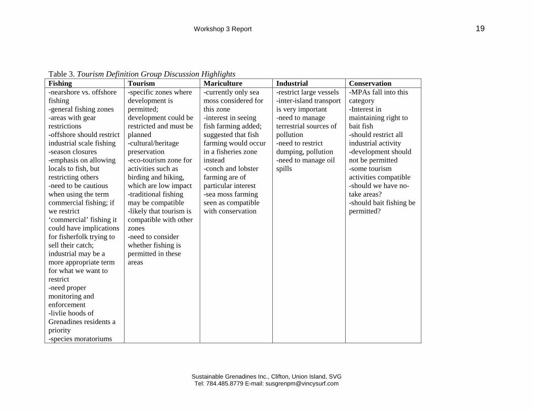
Workshop 3 Report 19
Sustainable Grenadines Inc., Clifton, Union Island, SVG Tel: 784.485.8779 E-mail: [email protected]
Table 3. Tourism Definition Group Discussion Highlights Fishing Tourism Mariculture Industrial Conservation -nearshore vs. offshore fishing -general fishing zones -areas with gear restrictions -offshore should restrict industrial scale fishing -season closures -emphasis on allowing locals to fish, but restricting others -need to be cautious when using the term commercial fishing; if we restrict ‘commercial’ fishing it could have implications for fisherfolk trying to sell their catch; industrial may be a more appropriate term for what we want to restrict -need proper monitoring and enforcement -livlie hoods of Grenadines residents a priority -species moratoriums
-specific zones where development is permitted; development could be restricted and must be planned -cultural/heritage preservation -eco-tourism zone for activities such as birding and hiking, which are low impact -traditional fishing may be compatible -likely that tourism is compatible with other zones -need to consider whether fishing is permitted in these areas
-currently only sea moss considered for this zone -interest in seeing fish farming added; suggested that fish farming would occur in a fisheries zone instead -conch and lobster farming are of particular interest -sea moss farming seen as compatible with conservation
-restrict large vessels -inter-island transport is very important -need to manage terrestrial sources of pollution -need to restrict dumping, pollution -need to manage oil spills
-MPAs fall into this category -Interest in maintaining right to bait fish -should restrict all industrial activity -development should not be permitted -some tourism activities compatible -should we have no-take areas? -should bait fishing be permitted?

Workshop 3 Report 20
Sustainable Grenadines Inc., Clifton, Union Island, SVG Tel: 784.485.8779 E-mail: [email protected]
Day 2
3.6 Zone definitions/ Case studies (Kim Baldwin, presenter/facilitator) Slides, Appendix 5 At the end of the Zone Definition group discussion held at the end of Day 1, it was decided that the issue warranted further discussion. Case studies were reviewed to provide insight into marine zoning schemes. Three MPAs were examined: Seaflower MPA, Colombia, The Great Barrier Reef MPA, Australia, and the South Water Caye Marine Reserve, Belize. Zone categories for each of these MPAs is as follows: Seaflower MPA, 5 zones
• no-entry • no-take • artisanal fishing • special use • general use.
The Great Barrier Reef MPA, 7 zones:
• general use • habitat protection • conservation park • buffer • scientific research • marine national park zone • preservation zone
South Water Caye Marine Reserve, 3 zones • general use zone • conservation zone • preservation zone
The Grenadines zoning project is different from these case studies in several significant ways, foremost the Grenada Bank includes territory belonging to two individual states. These case studies also focus on sub-sets of domestic waters that have been designated as marine protected areas or marine reserves. The Multiuse Zoning Project for the Grenadines does not focus on establishing a zoned reserve, rather it aims to implement marine spatial planning. Based on the discussion from Day 1 information and feedback was synthesized to create the following descriptions for each zone:
• Conservation: Marine Protected Areas- mostly non-extractive uses • Fishing:

Workshop 3 Report 21
Sustainable Grenadines Inc., Clifton, Union Island, SVG Tel: 784.485.8779 E-mail: [email protected]
o Offshore: No industrial fishing, for use by local fishers only o Nearshore: fisheries management area: for example some gear restrictions
and seasonal closures • General use: planned development with limited restrictions • Low-impact/Ecotourism: no/very limited land development, recreational uses and
local fishing is allowed • Transportation: shipping lanes, seaports, landing sites • Mariculture: seamoss farming (no fish farming)
Breakout groups reformed to further discuss zoning definitions, bearing in mind the case studies that were presented and the zone descriptions provided above. Breakout groups reconvened to share the highlights of their discussion, summarized as follows:
3.7 Group Discussion Highlights- Zoning definitions (Ruth Blyther, facilitator) • Group 1
o Should have a conservation zone that is no-take, in addition to other levels of conservation zones
o 2 types of tourism zones: one for cultural heritage preservation and ecotourism and one for more developed tourism
o do not want to see large ships permitted in the zoning area o 2 types of fishing zones, nearshore and offshore o there is a need to address terrestrial impacts through more integrated
management • Group 2
o General use zone on the outer banks o Fishing zone with no commercial fishing (large-scale industrial) o Tourism does not need to be its own zone, because it is compatible with many
of the other zones. Instead could address specific activities when defining management of other zones
o Could simplify zoning into 3 categories, 1-3, which range on a spectrum of highly restricted to more general use
• Group 3 o Discussion focused on whether they agreed with the proposed zones of each
goal, based on the handout provided (see Appendix ) o Conservation is a difficult zone to define, and will require careful
consideration • Group 4
o Mariculture- further discussion is needed about whether we want to see fish farming happen in these zones. Species such as conch and lobster are of particular interest
o Fishing zones 1 open fishing area/multiuse areas set aside for traditional/artisanal fishing

Workshop 3 Report 22
Sustainable Grenadines Inc., Clifton, Union Island, SVG Tel: 784.485.8779 E-mail: [email protected]
could use management tools such as rotational closures- priority areas include spawning aggregations
there are existing laws that support fisheries management measures, we might want to leverage this
o do not want to see a lot of area tied up as conservation areas o recognition that nearshore is particularly sensitive and needs to be managed as
such
3.8 Resolving remaining policy questions (Sandra Nichols. presenter) Slides, Appendix 6 This session focused on the law and policy aspects of operationalizing MSP in the Grenadines. One option includes new legislation. Considerations that must be made in regards to the development of new legislation include identification of the appropriate institutions to involve, identification of the institutions with the legal authority required to develop or implement the necessary management strategy. It would also be necessary to establish, monitor and evaluate objectives. Additionally mechanisms for public engagement, education and participation, compliance and enforcement, and collaborative management must be established. Achieving successful MSP in the Grenadine islands will require transboundary implementation. To support this some type of mandate could be agreed to, to ensure cooperation. Another options is the use of a legally-established international body, or coordination through and existing body to ensure cooperation and collaboration between the governments of Grenada and Saint Vincent and the Grenadines.
3.9 Review of the zoning scenario (Kim Baldwin, facilitator) Breakout groups were given a final opportunity to meet and discuss the zoning design. Maps from Day 1 were redistributed, to allow for further changes to be made to zoning boundaries. This session allowed participants to consider the lengthy discussion surrounding zone definitions when making proposed revisions. Maps were collected, so that revisions can be incorporated in future iterations of the zoning design.
3.10 Future of the project (Martin Barriteau & Katie McLean, presenters) Slides, Appendix 7 A monitoring and evaluation strategy has been developed by SusGren staff. This Strategy is based on two levels of monitoring: (1) project level monitoring, and (2) community level monitoring. Project level monitoring will focus on ensuring that project deliverables are completed, based on the NOAA and GEF grant requirements. Community level monitoring will focus on the effectiveness of project activities.

Workshop 3 Report 23
Sustainable Grenadines Inc., Clifton, Union Island, SVG Tel: 784.485.8779 E-mail: [email protected]
Community level monitoring will be led by an independent consultant. Maria Pena of the University of West Indies has been contracted to fill this position. Implementation of the community monitoring program will involve a team of Grenadine residents to assist with survey distribution and collection. A Communications Strategy has been developed to ensure that outreach and education activities are implemented. Communication mediums will include print media, a video documentary, a project webpage, and the use of social media. A media consultant has been contracted to produce the video documentary; during the workshop she took the opportunity to begin interviewing different stakeholders who have been involved in the project. One of the project deliverables, as stated in the GEF grant proposal, is the development of a Charter to be presented to government, with the hopes of ratification. The Charter is meant to garner government support to the implementation of the zoning plan and MSP more generally. The Charter is also seen as beneficial to future endeavours, such as obtaining UNESCO World Heritage Site designation. While the structure and content of the Charter have yet to be defined, it will generally seek to promote a transboundary, integrated approach to marine resource management. Proposed sections include (1) Issue Statement, (2) Vision, (3) Guiding Principles and (4) Commitments. In order to see the final zoning plan implemented work will need to continue beyond the dates of the projects supporting grants (grant related activities are scheduled to end by July 2012). In order to see that this work is carried on, SusGren has proposed the formation post-project committee. In the upcoming months SusGren will communicate with participants to determine the best approach to the formation of this committee.
Workshop 3 Report 24
Sustainable Grenadines Inc., Clifton, Union Island, SVG Tel: 784.485.8779 E-mail: [email protected]
4. Post-Workshop Zoning Scenario Based on the feedback provided over the course of the workshop a revised zoning design was created. This map will be presented to stakeholders from across the Grenadines at a series of community meetings, scheduled between February 10 and March 4. Meetings will be held on the following Grenadine Islands: Carriacou, Petit Martinique, Union, Mayreau, Canouan, Mustique and Bequia. Feedback and input from these community meetings will be incorporated into future iterations of the zoning design. It is important to rnote that this revised scenario is still only a draft, and considerable work needs to be completed before a proposed zoning plan is created. Proposed Marine Zones
Conservation: Marine Protected Areas (MPAs), (no-take) non-extractive uses. e.g. Tobago Cays Marine Park, Sandy Island & Oyster Bed MPA. General Use: Planned development with limited restrictions. e.g. Clifton, Hillsborough, etc. Low impact/ Ecotourism: Very limited land development, recreational uses and local fishing allowed. e.g. Balliceaux, Petit Canouan. Nearshore Fishing: Fisheries management area. Some gear restrictions and other fisheries management tools TBD. Offshore Fishing : For use by local fishers only.. No commercial fishing, no dredging. Transportation: Shipping lanes, seaports, landing sites, marinas. Mariculture: Seamoss farming (no fish farming).

Workshop 3 Report 25
Sustainable Grenadines Inc., Clifton, Union Island, SVG Tel: 784.485.8779 E-mail: [email protected]

Workshop 3 Report 26
Sustainable Grenadines Inc., Clifton, Union Island, SVG Tel: 784.485.8779 E-mail: [email protected]

Workshop 3 Report 27
Sustainable Grenadines Inc., Clifton, Union Island, SVG Tel: 784.485.8779 E-mail: [email protected]
5. Workshop Evaluation & Lessons Learned Upon completion of the workshop, participants were asked to complete an evaluation form. This evaluation served to gather information regarding participant satisfaction with implementation and outcomes of the workshop, the perceived usefulness of topics covered, and recommendations for improvement. Overall participants reported that the workshop was of benefit to them, and the majority of participants indicated that they felt the overall quality of the workshop was either good or excellent. The most prevalent recommendation was to improve time management. While some participants felt that too much time was spent reviewing and reiterating the same topics, many others felt that more time was needed for these same discussions. This comment pertained to the review of the zoning design sessions in particular. Other recommendations included:
• Do not invite as many participants who have not previously attended workshops • More involvement from fisherfolk and relevant NGOs • Greater emphasis placed on information from local sources- less opinions from
facilitators • Ensure that follow up happens • Consider a co-management plan • Have a facilitator with expertise on ICZM and MPA management • Give out hard copies of presentation slides • Better briefing on travel arrangement to help with travel time (e.g. details for
customs form) • E-mail key information prior to workshop
Based on the feedback provided it also appears that the effectiveness of workshop sessions could be improved by ensuring that all participants understand why the topic being discussed is relevant and important to the larger project. Increased clarity on the purpose, objectives and method for group activities would also help to improve the quality information gained during breakout group sessions.

Workshop 3 Report 28
Sustainable Grenadines Inc., Clifton, Union Island, SVG Tel: 784.485.8779 E-mail: [email protected]
6. Conclusion & Moving Forward Over the course of the workshop participants provided a great deal of information that can be utilized in order to move forward on this project. Based on the feedback provided by the group, including the hardcopy maps that breakout groups used to propose zoning revisions, a revised digital zoning design has been produced (see section 4). This new proposed zoning design will be presented to community members across the Grenadines at a series of Community Meetings, scheduled to be held on each of the Grenadine islands between February 20 and March 4. Feedback from the Community Meetings will be used to create further iterations of the zoning design, with the objective of creating a final zoning plan that is equitable and based on the interests and values of the Grenadines people. This approach should increase the level of community support for future implementation of the zoning plan. The project granting agencies require that several activities take place, including the implementation of the Communications Strategy, the Monitoring and Evaluation Strategy and the requisite project reporting. SusGren will also engage in outreach and educational activities to help raise awareness and support for this project. The funding period for this project formally ends in June of 2012, however in order for the marine zoning plan to reach the implementation stage work will need to carry on past this date. In order to support this work a post-project committee will be formed; the process of committee formation and the role of this committee has yet to be defined. Participants felt that a large group should be kept informed on the process, and called upon to support future initiatives. SusGren will look for opportunities to create spin-off projects to continue work on the marine zoning project, and actively seek out new funding opportunities.

Workshop 3 Report 29
Sustainable Grenadines Inc., Clifton, Union Island, SVG Tel: 784.485.8779 E-mail: [email protected]
7. Appendices Appendix 1. Participant List
Workshop 3 Report 30
Sustainable Grenadines Inc., Clifton, Union Island, SVG Tel: 784.485.8779 E-mail: [email protected]
Appendix 2. Project Overview PPT (Kim Baldwin)*
*To receive a higher resolution copy of slides please contact SusGren Inc.
Workshop 3 Report 31
Sustainable Grenadines Inc., Clifton, Union Island, SVG Tel: 784.485.8779 E-mail: [email protected]
Appendix 3. Existing Policy Support PPT (Sandy Nichols)*

Workshop 3 Report 32
Sustainable Grenadines Inc., Clifton, Union Island, SVG Tel: 784.485.8779 E-mail: [email protected]
*To receive a higher resolution copy of slides please contact SusGren Inc.

Workshop 3 Report 33
Sustainable Grenadines Inc., Clifton, Union Island, SVG Tel: 784.485.8779 E-mail: [email protected]

Workshop 3 Report 34
Sustainable Grenadines Inc., Clifton, Union Island, SVG Tel: 784.485.8779 E-mail: [email protected]

Workshop 3 Report 35
Sustainable Grenadines Inc., Clifton, Union Island, SVG Tel: 784.485.8779 E-mail: [email protected]
Appendix 4. Sub-committee Update PPT*
*To receive a higher resolution copy of slides please contact SusGren Inc.

Workshop 3 Report 36
Sustainable Grenadines Inc., Clifton, Union Island, SVG Tel: 784.485.8779 E-mail: [email protected]

Workshop 3 Report 37
Sustainable Grenadines Inc., Clifton, Union Island, SVG Tel: 784.485.8779 E-mail: [email protected]

Workshop 3 Report 38
Sustainable Grenadines Inc., Clifton, Union Island, SVG Tel: 784.485.8779 E-mail: [email protected]
Appendix 5. Zone Definition/Case Studies PPT (Kim Baldwin)*

Workshop 3 Report 39
Sustainable Grenadines Inc., Clifton, Union Island, SVG Tel: 784.485.8779 E-mail: [email protected]
Appendix 6. Zone Case Studies- Supplementary information
Seaflower Marine Protected Area (MPA) The multiple-use MPA includes complete coastal and marine ecosystems zoned for management levels ranging from total conservation to controlled commercial fishing. It covers 65,000 km2 and is divided into 3 administrative sections: Northern 37,522 km2, Central 12,716 km2, and Southern 14,780 km2. In keeping with objectives, the MPA is zoned for in-situ conservation and sustainable use. Zoning supports diverse aims like protecting ecologically critical sites and entire ecosystems, controlling access, reducing conflicts between user groups, maintaining and recovering fisheries, promoting tourism and education, and improving research and monitoring. There are five zone types: 1) no-entry, with use restricted to research and monitoring (1.16 km2); 2) no- take, allowing a variety of non-extractive uses (2,214 km2); 3) artisanal fishing, for use by traditional fishers only (2,015 km2); 4) special use, for specific uses like shipping lanes, large- vessel anchorage, ports, and marinas or uses with the potential to generate conflict like heavily used water sports areas (68 km2); 5) general use, where minimal restrictions apply to preserve MPA integrity and promote marine conservation (68,587 km2).

Workshop 3 Report 40
Sustainable Grenadines Inc., Clifton, Union Island, SVG Tel: 784.485.8779 E-mail: [email protected]
Great Barrier Reef Zones

Workshop 3 Report 41
Sustainable Grenadines Inc., Clifton, Union Island, SVG Tel: 784.485.8779 E-mail: [email protected]
Designated Areas • Shipping Areas are intended to facilitate passage through the
Marine Park by ships, subject to any limitations prescribed in the Regulations.
• Special Management Areas are parts of the zoned areas where specific management measures are necessary — for example, to regulate access or activities in heavily used areas, to protect resources, to allow for the replenishment of resource stocks, or to ensure public safety. The Special Management Areas may be applied on a temporary, seasonal or permanent basis. Special Management Areas can also be used to deal with situations requiring immediate management action.
• Fisheries Experimental Areas provide for the continuation of scientific research into the effects of line fishing on the fish stocks and ecosystems of the Great Barrier Reef through the Effects of Line Fishing Experiment.
Permits The use of permits helps the Great Barrier Reef Marine Park Authority (GBRMPA) and the Queensland Parks and Wildlife Service (QPWS) ensure the conservation of the Great Barrier Reef’s state and commonwealth Marine Parks. Permits allow these organisations to:
• Reduce impacts on high-use and sensitive areas • Separate potentially conflicting activities • Encourage responsible behaviour in all Marine Parks users • Collect data for planning of Marine Parks • Monitor activities which may become damaging to the
Marine Parks.

Workshop 3 Report 42
Sustainable Grenadines Inc., Clifton, Union Island, SVG Tel: 784.485.8779 E-mail: [email protected]
Belize - South Water Caye Marine Reserve Zones General Use Zone
• The General Use Zone is restricted to fishing by licensed fisherman in accordance with these Regulations.
• Residents of South Water Caye Marine Reserve who have special licenses to fish may fish solely for subsistence purposes, and such fishing shall be determined by the terms and conditions of each resident's license.
• No person is permitted to use long lines, spear–guns or gill nets in the Reserve unless authorized by the Fisheries Administrator.
• Sport Fishing is allowed in the General Use Zone only in accordance with the following
o spear fishing is not permitted; o catch and release fishing tours can only remove fish for
subsistence purposes during the tour. • No person shall, within the General Use Zone, cast or drag
any anchor in any manner which may damage coral.
Conservation Zone
• There shall be only non–extractive recreational activities • No person shall engage in commercial, sport or subsistence
fishing within the Conservation 1 Zone. • No person shall secure a boat to the sea bed of the
Conservation 1 Zone except by means of a mooring • Every diver in the conservational 1 Zone shall adhere to the
following rules o divers shall register with the Reserve Manager prior to
entering the Conservational 1 Zone; o charter dives shall first obtain a license in accordance
with these Regulations, before operating in the

Workshop 3 Report 43
Sustainable Grenadines Inc., Clifton, Union Island, SVG Tel: 784.485.8779 E-mail: [email protected]
Conservation 1 Zone and all dive boats shall fly the "divers down flag" when they have divers in the water;
o only certified scuba divers, or divers undergoing a training course conducted by a recognized instructor, are allowed to use scuba equipment in the Reserve;
o dive guides are required to explain the rules of the Reserve to a diver within the Reserve;
o every boat owner desirous of operating a boat in this Zone, shall first register his boat with the Fisheries Administrator in accordance with these Regulations;
o every operator of a motor boat shall observe the low wake Zone boat way when approaching snorkelers or divers;
o for Scuba tours, a maximum of eight divers per licensed dive master is permitted;
o for snorkel tours, a maximum of eight snorkelers per licensed tour guide is permitted;
o no person shall harass or in any way tamper with the any fauna within the Conservation 1 Zone.
• No person shall engage in water–skiing or jet skiing within the conservation Zone
Preservation Zone
• No fishing, sport fishing, diving or any other water activity shall be permitted within the Preservation Zone
• No person shall operate a motor boat within the Preservation Zone except in cases of emergency

Workshop 3 Report 44
Sustainable Grenadines Inc., Clifton, Union Island, SVG Tel: 784.485.8779 E-mail: [email protected]
Appendix 7. Zone Resolving Policy Issues PPT (Sandy Nichols)

Workshop 3 Report 45
Sustainable Grenadines Inc., Clifton, Union Island, SVG Tel: 784.485.8779 E-mail: [email protected]

Workshop 3 Report 46
Sustainable Grenadines Inc., Clifton, Union Island, SVG Tel: 784.485.8779 E-mail: [email protected]

Workshop 3 Report 47
Sustainable Grenadines Inc., Clifton, Union Island, SVG Tel: 784.485.8779 E-mail: [email protected]
Appendix 8, Project Future (SusGren Inc.)*

Workshop 3 Report 48
Sustainable Grenadines Inc., Clifton, Union Island, SVG Tel: 784.485.8779 E-mail: [email protected]

Workshop 3 Report 49
Sustainable Grenadines Inc., Clifton, Union Island, SVG Tel: 784.485.8779 E-mail: [email protected]
*To receive a higher resolution copy of slides please contact SusGren Inc