Embed Size (px)
Citation preview
Working with Global Topography Data and the King Map Overview
I apologize for how poorly last week’s class went… I should have re-familiarized myself with the Geologic Map of the U.S. With this lesson, I hope to get back on track with a look at how to work with the wonderful global datasets that have become available recently as well as start working with geologic maps.
Global Topography Some fascinating global topography data has recently become available. Much
of it was originally compiled by the Defense Mapping Agency and was classified. In the past, the best data was a raster with 5 arc-minute spacing. Now there is a more accurate dataset with a spacing of 30 arc seconds. Not only is the elevation data more accurate but the topography of the ocean basins is included.
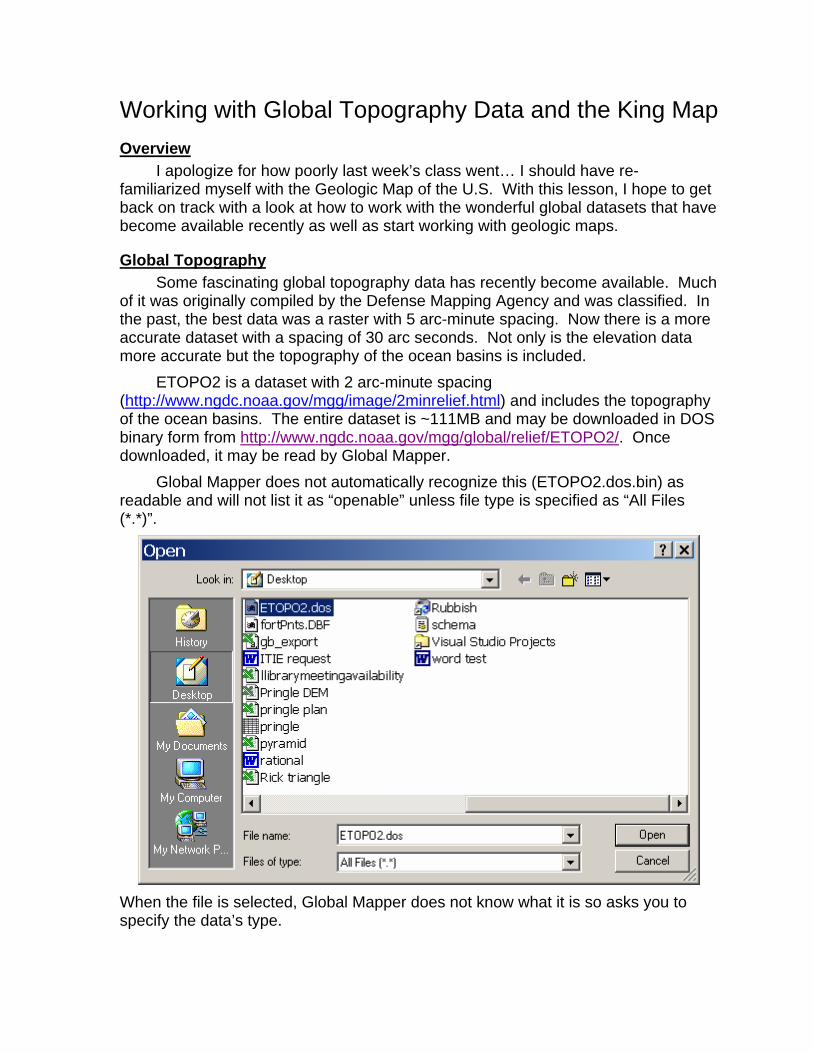
ETOPO2 is a dataset with 2 arc-minute spacing (http://www.ngdc.noaa.gov/mgg/image/2minrelief.html) and includes the topography of the ocean basins. The entire dataset is ~111MB and may be downloaded in DOS binary form from http://www.ngdc.noaa.gov/mgg/global/relief/ETOPO2/. Once downloaded, it may be read by Global Mapper.
Global Mapper does not automatically recognize this (ETOPO2.dos.bin) as readable and will not list it as “openable” unless file type is specified as “All Files (*.*)”.
When the file is selected, Global Mapper does not know what it is so asks you to specify the data’s type.
Global Topography Data and the King Map page 2
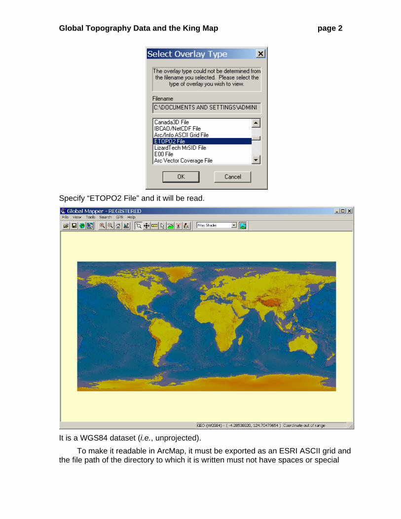
Specify “ETOPO2 File” and it will be read.
It is a WGS84 dataset (i.e., unprojected).
To make it readable in ArcMap, it must be exported as an ESRI ASCII grid and the file path of the directory to which it is written must not have spaces or special
Global Topography Data and the King Map page 3
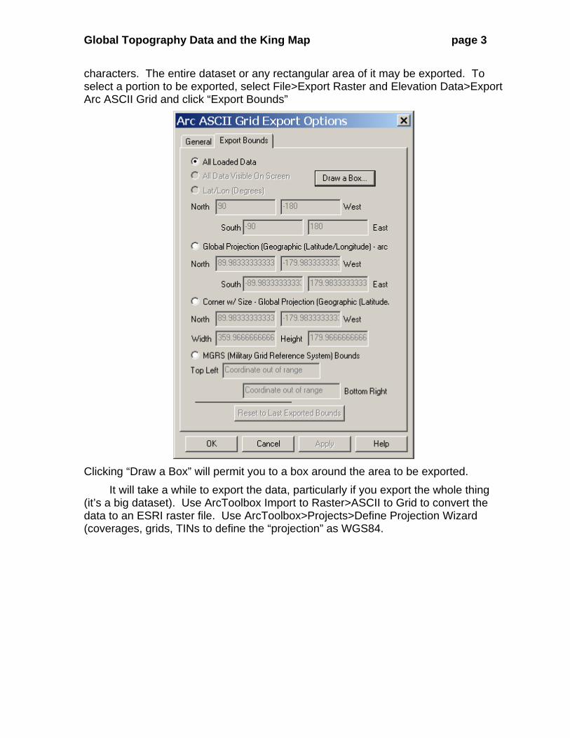
characters. The entire dataset or any rectangular area of it may be exported. To select a portion to be exported, select File>Export Raster and Elevation Data>Export Arc ASCII Grid and click “Export Bounds”
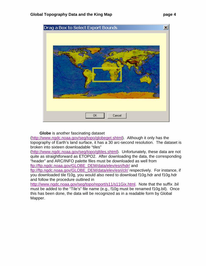
Clicking “Draw a Box” will permit you to a box around the area to be exported.
It will take a while to export the data, particularly if you export the whole thing (it’s a big dataset). Use ArcToolbox Import to Raster>ASCII to Grid to convert the data to an ESRI raster file. Use ArcToolbox>Projects>Define Projection Wizard (coverages, grids, TINs to define the “projection” as WGS84.
Global Topography Data and the King Map page 4
Globe is another fascinating dataset
(http://www.ngdc.noaa.gov/seg/topo/globeget.shtml). Although it only has the topography of Earth’s land surface, it has a 30 arc-second resolution. The dataset is broken into sixteen downloadable “tiles” (http://www.ngdc.noaa.gov/seg/topo/gltiles.shtml). Unfortunately, these data are not quite as straightforward as ETOPO2. After downloading the data, the corresponding “header” and ARC/INFO palette files must be downloaded as well from ftp://ftp.ngdc.noaa.gov/GLOBE_DEM/data/elev/esri/hdr/ and ftp://ftp.ngdc.noaa.gov/GLOBE_DEM/data/elev/esri/clr/ respectively. For instance, if you downloaded tile f10g, you would also need to download f10g.hdr and f10g.hdr and follow the procedure outlined in http://www.ngdc.noaa.gov/seg/topo/report/s11/s11Gix.html. Note that the suffix .bil must be added to the “Tile’s” file name (e.g., f10g must be renamed f10g.bil). Once this has been done, the data will be recognized as in a readable form by Global Mapper.
Global Topography Data and the King Map page 5
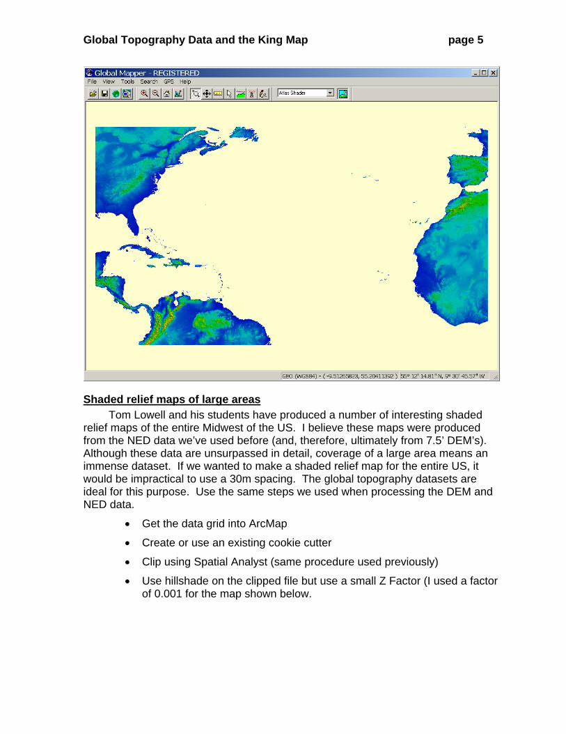
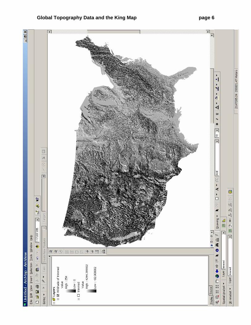
Shaded relief maps of large areas Tom Lowell and his students have produced a number of interesting shaded
relief maps of the entire Midwest of the US. I believe these maps were produced from the NED data we’ve used before (and, therefore, ultimately from 7.5’ DEM’s). Although these data are unsurpassed in detail, coverage of a large area means an immense dataset. If we wanted to make a shaded relief map for the entire US, it would be impractical to use a 30m spacing. The global topography datasets are ideal for this purpose. Use the same steps we used when processing the DEM and NED data.
• Get the data grid into ArcMap
• Create or use an existing cookie cutter
• Clip using Spatial Analyst (same procedure used previously)
• Use hillshade on the clipped file but use a small Z Factor (I used a factor of 0.001 for the map shown below.
Global Topography Data and the King Map page 6
Global Topography Data and the King Map page 7
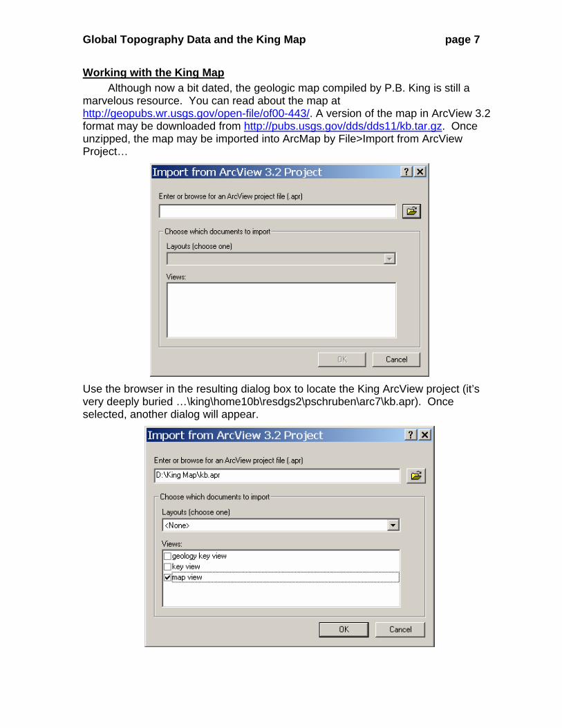
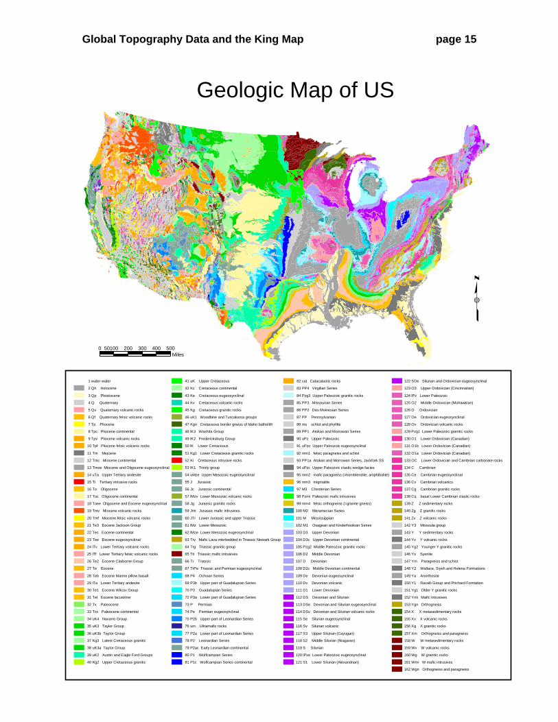
Working with the King Map Although now a bit dated, the geologic map compiled by P.B. King is still a
marvelous resource. You can read about the map at http://geopubs.wr.usgs.gov/open-file/of00-443/. A version of the map in ArcView 3.2 format may be downloaded from http://pubs.usgs.gov/dds/dds11/kb.tar.gz. Once unzipped, the map may be imported into ArcMap by File>Import from ArcView Project…
Use the browser in the resulting dialog box to locate the King ArcView project (it’s very deeply buried …\king\home10b\resdgs2\pschruben\arc7\kb.apr). Once selected, another dialog will appear.
Global Topography Data and the King Map page 8
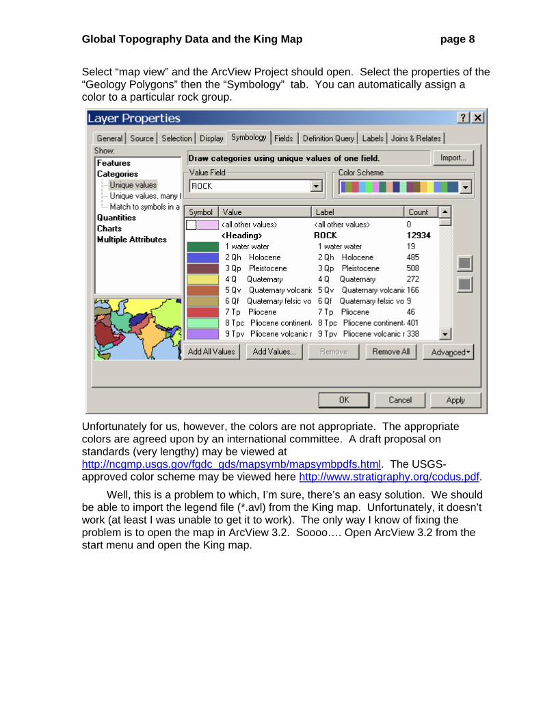
Select “map view” and the ArcView Project should open. Select the properties of the “Geology Polygons” then the “Symbology” tab. You can automatically assign a color to a particular rock group.
Unfortunately for us, however, the colors are not appropriate. The appropriate colors are agreed upon by an international committee. A draft proposal on standards (very lengthy) may be viewed at http://ncgmp.usgs.gov/fgdc_gds/mapsymb/mapsymbpdfs.html. The USGS-approved color scheme may be viewed here http://www.stratigraphy.org/codus.pdf.
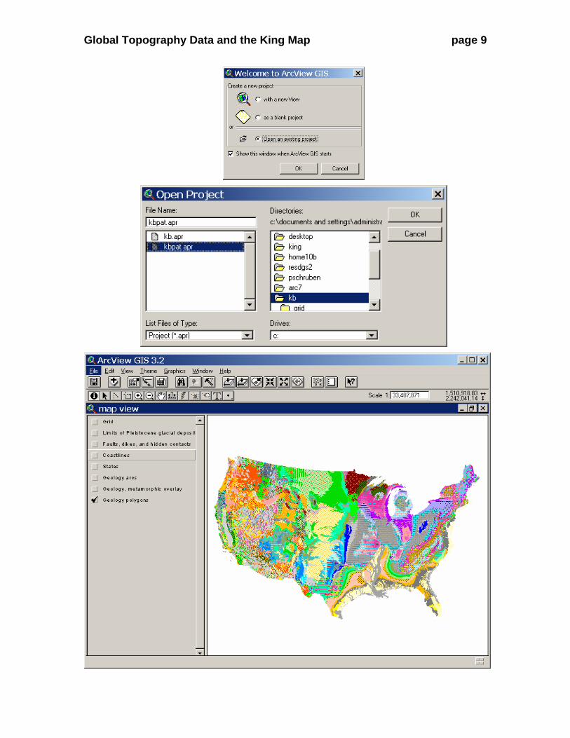
Well, this is a problem to which, I’m sure, there’s an easy solution. We should be able to import the legend file (*.avl) from the King map. Unfortunately, it doesn’t work (at least I was unable to get it to work). The only way I know of fixing the problem is to open the map in ArcView 3.2. Soooo…. Open ArcView 3.2 from the start menu and open the King map.
Global Topography Data and the King Map page 9
Global Topography Data and the King Map page 10
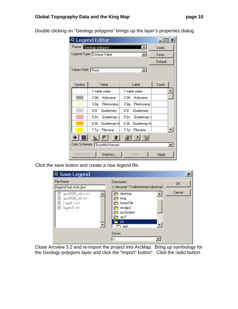
Double clicking on “Geology polygons” brings up the layer’s properties dialog.
Click the save button and create a new legend file.
Close Arcview 3.2 and re-import the project into ArcMap. Bring up symbology for the Geology polygons layer and click the “Import” button”. Click the radio button
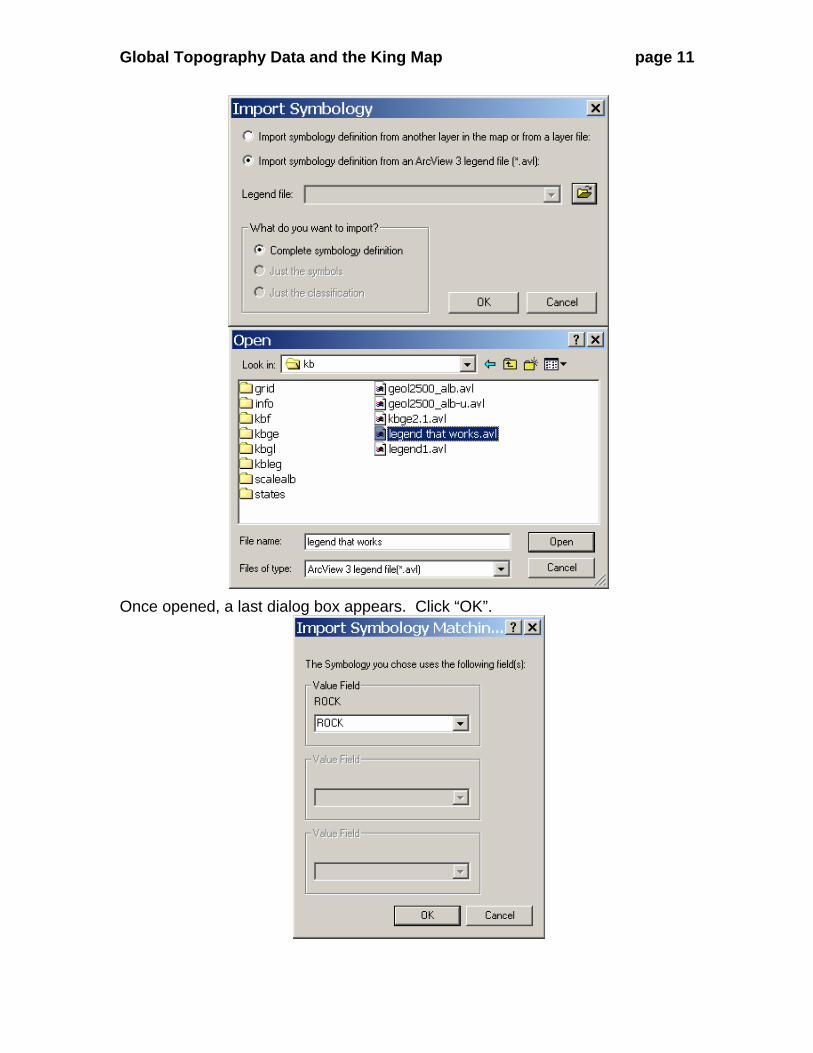
Global Topography Data and the King Map page 11
Once opened, a last dialog box appears. Click “OK”.
Global Topography Data and the King Map page 12
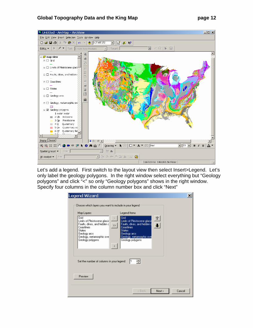
Let’s add a legend. First switch to the layout view then select Insert>Legend. Let’s only label the geology polygons. In the right window select everything but “Geology polygons” and click “<” so only “Geology polygons” shows in the right window. Specify four columns in the column number box and click “Next”
Global Topography Data and the King Map page 13
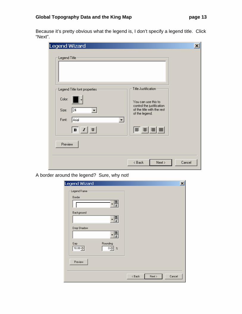
Because it’s pretty obvious what the legend is, I don’t specify a legend title. Click “Next”.
A border around the legend? Sure, why not!
Global Topography Data and the King Map page 14
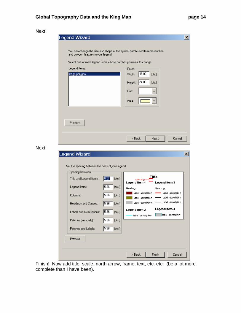
Next!
Next!
Finish! Now add title, scale, north arrow, frame, text, etc. etc. (be a lot more complete than I have been).
Global Topography Data and the King Map page 15
1 water water
2 Qh Holocene
3 Qp Pleistocene
4 Q Quaternary
5 Qv Quaternary volcanic rocks
6 Qf Quaternary felsic volcanic rocks
7 Tp Pliocene
8 Tpc Pliocene continental
9 Tpv Pliocene volcanic rocks
10 Tpf Pliocene felsic volcanic rocks
11 Tm Miocene
12 Tmc Miocene continental
13 Tmoe Miocene and Oligocene eugeosynclinal
14 uTa Upper Tertiary andesite
15 Ti Tertiary intrusive rocks
16 To Oligocene
17 Toc Oligocene continental
18 Toee Oligocene and Eocene eugeosynclinal
19 Tmv Miocene volcanic rocks
20 Tmf Miocene felsic volcanic rocks
21 Te3 Eocene Jackson Group
22 Tec Eocene continental
23 Tee Eocene eugeosynclinal
24 lTv Lower Tertiary volcanic rocks
25 lTf Lower Tertiary felsic volcanic rocks
26 Te2 Eocene Claiborne Group
27 Te Eocene
28 Teb Eocene Marine pillow basalt
29 lTa Lower Tertiary andesite
30 Te1 Eocene Wilcox Group
31 Tel Eocene lacustrine
32 Tx Paleocene
33 Txc Paleocene continental
34 uK4 Navarro Group
35 uK3 Taylor Group
36 uK3b Taylor Group
37 Kg3 Latest Cretaceous granitic
38 uK3a Taylor Group
39 uK2 Austin and Eagle Ford Groups
40 Kg2 Upper Cretaceous granitic
41 uK Upper Cretaceous
42 Kc Cretaceous continental
43 Ke Cretaceous eugeosynclinal
44 Kv Cretaceous volcanic rocks
45 Kg Cretaceous granitic rocks
46 uK1 Woodbine and Tuscaloosa groups
47 Kgn Cretaceous border gneiss of Idaho batholith
48 lK3 Washita Group
49 lK2 Fredericksburg Group
50 lK Lower Cretaceous
51 Kg1 Lower Cretaceous granitic rocks
52 Ki Cretaceous intrusive rocks
53 lK1 Trinity group
54 uMze Upper Mesozoic eugeosynclinal
55 J Jurassic
56 Jc Jurassic continental
57 lMzv Lower Mesozoic volcanic rocks
58 Jg Jurassic granitic rocks
59 Jmi Jurassic mafic intrusives
60 JTr Lower Jurassic and upper Triassic
61 lMz Lower Mesozoic
62 lMze Lower Mesozoic eugeosynclinal
63 Trv Mafic Lava interbedded in Triassic Newark Group
64 Trg Triassic granitic group
65 Tri Triassic mafic intrusives
66 Tr Triassic
67 TrPe Triassic and Permian eugeosynclinal
68 P4 Ochoan Series
69 P3b Upper part of Guadalupian Series
70 P3 Guadalupian Series
72 P3a Lower part of Guadalupian Series
73 P Permian
74 Pe Permian eugeosynclinal
75 P2b Upper part of Leonardian Series
76 um Ultramafic rocks
77 P2a Lower part of Leonardian Series
78 P2 Leonardian Series
79 P2ac Early Leonardian continental
80 P1 Wolfcampian Series
81 P1c Wolfcampian Series continental
82 cat Catacalastic rocks
83 PP4 Virgilian Series
84 Pzg3 Upper Paleozoic granitic rocks
85 PP3 Missourian Series
86 PP2 Des Moinesian Series
87 PP Pennsylvanian
88 ms schist and phyllite
89 PP1 Atokan and Morrowan Series
90 uPz Upper Paleozoic
91 uPze Upper Paleozoic eugeosynclinal
92 mm1 felsic paragneiss and schist
93 PP1a Atokan and Morrowan Series, Jackfork SS
94 uPzc Upper Paleozoic clastic wedge facies
95 mm2 mafic paragneiss (=hornblendite, amphibolite)
96 mm3 migmatite
97 M3 Chesterian Series
98 Pzmi Paleozoic mafic intrusives
99 mm4 felsic orthogneiss (=granite gneiss)
100 M2 Meramecian Series
101 M Mississippian
102 M1 Osagean and Kinderhookian Series
103 D3 Upper Devonian
104 D3c Upper Devonian continental
105 Pzg2 Middle Paleozoic granitic rocks
106 D2 Middle Devonian
107 D Devonian
108 D2c Middle Devonian continental
109 De Devonian eugeosynclinal
110 Dv Devonian volcanic
111 D1 Lower Devonian
112 DS Devonian and Silurian
113 DSe Devonian and Silurian eugeosynclinal
114 DSv Devonian and Silurian volcanic rocks
115 Se Silurian eugeosynclinal
116 Sv Silurian volcanic
117 S3 Upper Silurian (Cayugan)
118 S2 Middle Silurian (Niagaran)
119 S Silurian
120 lPze Lower Paleozoic eugeosynclinal
121 S1 Lower Silurian (Alexandrian)
122 SOe Silurian and Ordovician eugeosynclinal
123 O3 Upper Ordovician (Cincinnatian)
124 lPz Lower Paleozoic
125 O2 Middle Ordovician (Mohawkian)
126 O Ordovician
127 Oe Ordovician eugeosynclinal
128 Ov Ordovician volcanic rocks
129 Pzg1 Lower Paleozoic granitic rocks
130 O1 Lower Ordovician (Canadian)
131 O1b Lower Ordovician (Canadian)
132 O1a Lower Ordovician (Canadian)
133 OC Lower Ordovician and Cambrian carbonate rocks
134 C Cambrian
135 Ce Cambrian eugeosynclinal
136 Cv Cambrian volcanics
137 Cg Cambrian granitic rocks
138 Cq basal Lower Cambrian clastic rocks
139 Z Z sedimentary rocks
140 Zg Z granitic rocks
141 Zv Z volcanic rocks
142 Y3 Missoula group
143 Y Y sedimentary rocks
144 Yv Y volcanic rocks
145 Yg2 Younger Y granitic rocks
146 Ys Syenite
147 Ym Paragneiss and schist
148 Y2 Wallace, Siyeh and Helena Formations
149 Ya Anorthosite
150 Y1 Ravalli Group and Prichard Formation
151 Yg1 Older Y granitic rocks
152 Ymi Mafic intrusives
153 Ygn Orthogneiss
154 X X metasedimentary rocks
155 Xv X volcanic rocks
156 Xg X granitic rocks
157 Xm Orthogneiss and paragneiss
158 W W metasedimentary rocks
159 Wv W volcanic rocks
160 Wg W granitic rocks
161 Wmi W mafic intrusives
162 Wgn Orthogneiss and paragneiss
Geologic Map of US
0 100 200 300 400 50050Miles
r

Global Topography Data and the King Map page 16