Embed Size (px)
Citation preview

Working with Working with ArcGISArcGIS Server Web Services Server Web Services ggUsing the SOAP APIUsing the SOAP API
John HauckJohn HauckJian HuangJian Huang

IntroductionsIntroductions
• Who are we?–Jian Huang–John Hauck
• Who are you?Who are you?
• We will answer questions at the end
Please complete the session survey!Please complete the session survey!

AgendaAgenda
•• Brief overview of ArcGIS Server Web ServicesBrief overview of ArcGIS Server Web Services––WhatWhat
WhyWhy––WhyWhy
•• SOAP API Walkthrough :SOAP API Walkthrough :SOAP API Walkthrough :SOAP API Walkthrough :––Functional capabilities of each GIS web serviceFunctional capabilities of each GIS web service––The SOAP API for the serviceThe SOAP API for the service
Sample applications that cons me the ser icesSample applications that cons me the ser ices––Sample applications that consume the servicesSample applications that consume the services
•• Patterns, tips and tricks Patterns, tips and tricks pp––Asynch SOAP requestAsynch SOAP request––SecuritySecurity
ImplementationImplementation–– ImplementationImplementation

ArcGISArcGIS Server Web Services Server Web Services -- Overview Overview
•• ArcGIS Server has a rich set of GIS Web ServicesArcGIS Server has a rich set of GIS Web Services
•• You can work with Web Services using the following You can work with Web Services using the following api’s / interfaces :api’s / interfaces :––SOAPSOAP––RESTRESTRESTREST––OGCOGC

Clients for ArcGIS Server Web ServicesClients for ArcGIS Server Web Services
FocusFocus

SOAP Web Services SOAP Web Services -- AdvantagesAdvantages WhyWhy
• easily accessible from .Net, Java, C++, Python, et aleasily accessible from .Net, Java, C , Python, et al
• cross-platform support, Windows, Linux, Solaris
• lends itself to standard OO programming
• lets you take advantage of compile time type checking
• fully integrated into IDE’s –Class documentation, Full intellisense,

Working with a SOAP serviceWorking with a SOAP service WhatWhat
•• Generated on the client using a SOAP ToolkitGenerated on the client using a SOAP Toolkit•• Proxy ObjectProxy Object
–– Communicate with server end pointsCommunicate with server end points–– Call methods on the proxy to execute serverCall methods on the proxy to execute server--side logicside logic
•• Value objectsValue objectsjj–– Native types designed to support input and output from proxyNative types designed to support input and output from proxy
Client ApplicationClient Application ServerServer
WSDLWSDLGet WSDLGet WSDL
SOAPSOAPToolkitToolkit
serviceservice
Proxy objectProxy object
WSDLWSDL
End Point End Point GenerateGenerate
Value objectValue objectValue objectValue object
Value objectValue objectProvide Inputs ResponseResponse
Request
Receive Outputs
ResponseResponse
SOAP Web ServicesSOAP Web Services
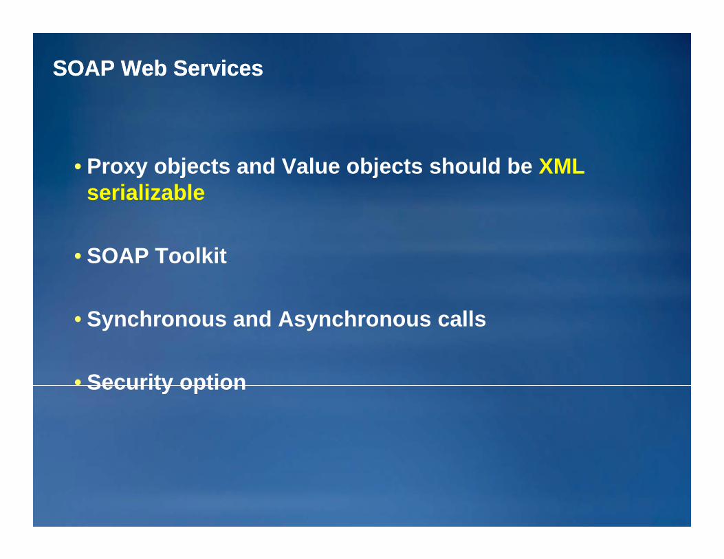
• Proxy objects and Value objects should be XMLy j jserializable
• SOAP Toolkit
S nchrono s and As nchrono s calls• Synchronous and Asynchronous calls
• Security optionSecurity option

ArcGIS Server : SOAP Web Service URLsArcGIS Server : SOAP Web Service URLs
•• A standard scheme for all SOAP web service URLSA standard scheme for all SOAP web service URLS ::
••http://<hostname>/<arcgis_instance>/services/<folder>/ http://<hostname>/<arcgis_instance>/services/<folder>/ <servicename>/<servicetype><servicename>/<servicetype>
•• To get the wsdl :To get the wsdl :•• To get the wsdl :To get the wsdl :••http://gis.mybiz.com/arcgis/services/usa/mapserver?wsdlhttp://gis.mybiz.com/arcgis/services/usa/mapserver?wsdl
Client ApplicationClient Application ServerServer
WSDLWSDLGet WSDLGet WSDL
GenerateGenerateV l bj tV l bj t
SOAPSOAPToolkitToolkit
Proxy objectProxy objectEnd Point End Point Value objectValue object
Value objectValue objectValue objectValue object
Provide Inputs ResponseResponse
Request
ArcGISArcGISServerServer
Receive Outputs

The The ArcGISArcGIS Server SOAP APIServer SOAP API
•• Coarse GrainedCoarse Grained
•• StatelessStateless
V l Obj t b d i ti ll k A Obj tV l Obj t b d i ti ll k A Obj t•• Value Objects are based on existing well known ArcObjects Value Objects are based on existing well known ArcObjects typestypes
––Eg Color, Symbol, Graphic Element, Geometries, DataElementsEg Color, Symbol, Graphic Element, Geometries, DataElementsg , y , p , ,g , y , p , ,
•• Application you can buildApplication you can buildD ktD kt––Desktop appDesktop app
––Web appWeb app––Web serviceWeb service

SOAP Web ServicesSOAP Web Services
•• Service Catalog ServiceService Catalog Service
•• Map ServiceMap Service
•• Geocoding ServiceGeocoding Service
G t S iG t S i•• Geometry Service Geometry Service
•• Network Analysis ServiceNetwork Analysis Service
•• Image ServiceImage Service
•• Geoprocessing ServiceGeoprocessing Servicep gp g
•• Geodata ServiceGeodata Service
M bil S i ( d i th M bil ADF li t)M bil S i ( d i th M bil ADF li t)•• Mobile Service (accessed using the Mobile ADF client)Mobile Service (accessed using the Mobile ADF client)•• Globe Service (accessed using the ArcGIS Engine client)Globe Service (accessed using the ArcGIS Engine client)

Service Catalog ServiceService Catalog Service
•Every ArcGIS Server has a Service Catalog Web Service••http://<web server hostname>/<arcgis instance>/services?wsdlhttp://<web server hostname>/<arcgis instance>/services?wsdl
••What Services do you have?What Services do you have?<xs:element name="GetServiceDescriptions"><xs:complexType/>
</xs:element>
Method
Response
WSDL
<xs:element name="GetServiceDescriptionsResponse"> <xs:complexType> <xs:sequence> <xs:element name="ServiceDescriptions"
type="ArrayOfServiceDescription"/> </xs:sequence>
/ l T
Response
ServiceCatalogServiceCatalog </xs:complexType></xs:element>
<xs:complexType name="ArrayOfServiceDescription"> <xs:sequence> <xs:element name="ServiceDescription"
type="ServiceDescription"
Value Object
S C gS C gGetServiceDescriptionsGetServiceDescriptions
yp pmaxOccurs="unbounded"/>
</xs:sequence></xs:complexType>
<xs:complexType name="ServiceDescription"> <xs:sequence> <xs:element name="Name" type="xs:string"/>
Value ObjectServiceDescriptionServiceDescription
Name Type URLName Type URL <xs:element name= Name type= xs:string /> <xs:element name="Type" type="xs:string"/> <xs:element name="Url" type="xs:string"/> </xs:sequence></xs:complexType>
Name, Type, URLName, Type, URL
Map ServiceMap Service
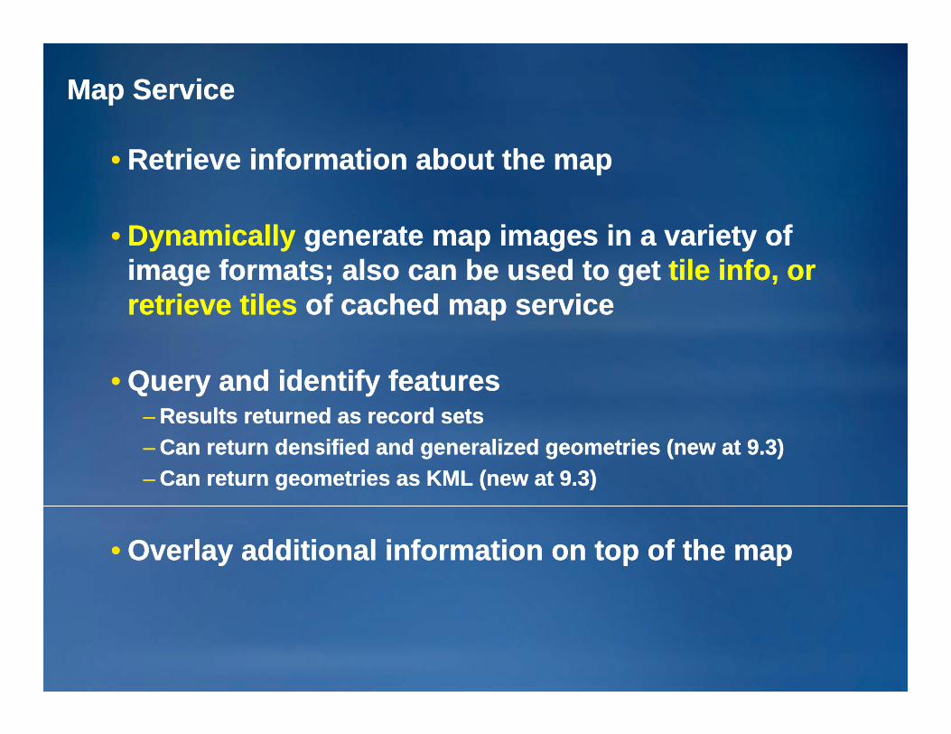
•• Retrieve information about the mapRetrieve information about the map
D i llD i ll tt i i i t fi i i t f•• DynamicallyDynamically generate mapgenerate map images in a variety of images in a variety of image formats; also can be used to get image formats; also can be used to get tile info, or tile info, or retrieve tilesretrieve tiles of cached map serviceof cached map service
•• Query and identify featuresQuery and identify featuresResults returned as record setsResults returned as record sets–– Results returned as record setsResults returned as record sets
–– Can return densified and generalized geometries (new at 9.3)Can return densified and generalized geometries (new at 9.3)–– Can return geometries as KML (new at 9.3)Can return geometries as KML (new at 9.3)
•• Overlay additional information on top of the mapOverlay additional information on top of the map

Map Server Map Server –– Key MethodsKey Methods

Map Service Object Model Map Service Object Model –– Output Map ImageOutput Map Image
MapServerInfoMapServerInfo MapLayerInfoMapLayerInfo
Proxy Value objectValue object Value objectValue object
MapServerProxyMapServerProxy MapDescriptionMapDescription LayerDescriptionLayerDescription
Value objectValue object Value objectValue object
ImageDescriptionImageDescription
ImageDisplayImageDisplayValue objectValue object
ImageTypeImageTypeValue objectValue object
Value objectValue object

MapDescription and LayerDescriptionMapDescription and LayerDescription
•MapDescription value object•Properties to control the drawing of the map
•LayerDescription value object•Properties to control the drawing of a layer
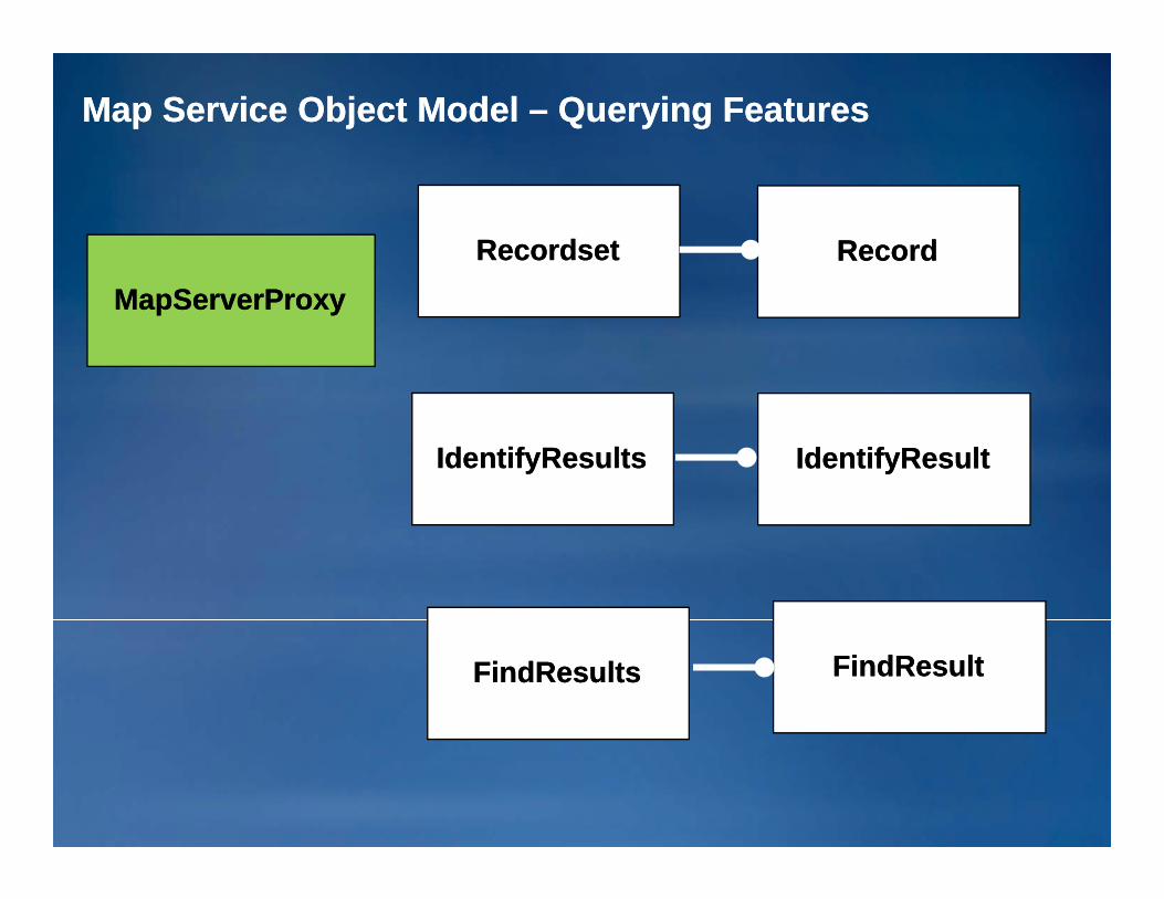
Map Service Object Model Map Service Object Model –– Querying FeaturesQuerying Features
RecordsetRecordset RecordRecordMapServerProxyMapServerProxy
IdentifyResultsIdentifyResults IdentifyResultIdentifyResult
FindResultsFindResults FindResultFindResult

Map Service DemoMap Service Demo
MapImage
MapDescription
LayerDescription
MapServerProxy
ExportMapImage()y p
ImageDescription
ExportMapImage()

AsyncAsync Calls for SOAP Web ServiceCalls for SOAP Web Service
Client ApplicationClient Application ServerServer
Proxy objectProxy object End Point End Point
ResponseResponse
RequestClient ApplicationClient Application ServerServer
Proxy objectProxy objectClient ApplicationClient ApplicationServerServer
AsyncEnd Point End Point
ResponseResponse
RequestThreadThread
Completed
ESRI Developer Summit 2008ESRI Developer Summit 2008 1919
ResponseResponse

Geometry ServiceGeometry Service
•• A computational service, not bound to any data on A computational service, not bound to any data on the serverthe server
•• Cannot change the nameCannot change the name
•• An ArcGIS Server can host one Geometry ServiceAn ArcGIS Server can host one Geometry ServiceNumber of instances can be increased as neededNumber of instances can be increased as needed––Number of instances can be increased as neededNumber of instances can be increased as needed
•• Provides basic geometric operations for use by Provides basic geometric operations for use by web service clientsweb service clients
––Get area and lengthGet area and length––Simplify geometrySimplify geometrySimplify geometrySimplify geometry

Geometry Service Geometry Service -- Key MethodsKey Methods

Geometry Service Geometry Service –– Object ModelObject Model
GeometryServerProxyGeometryServerProxy GeometryArrayGeometryArray GeometryGeometryGeometryServerProxyGeometryServerProxy y yy y yy
SpatialReferenceSpatialReference
UnitUnit
TransformationTransformation

Geocode ServiceGeocode Service
•• Based on a Locator stored in the file system or in a Based on a Locator stored in the file system or in a GeodatabaseGeodatabaseGeodatabaseGeodatabase
•• Key Methods to performKey Methods to performKey Methods to performKey Methods to perform
GeocodeAddress Geocode single address
GeocodeAddresses Batch geocoding
ReverseGeocode Generates an address for a point

DemoDemo•• Integrated application using Map, Geocode andIntegrated application using Map, Geocode andIntegrated application using Map, Geocode and Integrated application using Map, Geocode and
Geometry ServicesGeometry Services
•• Shared value objects crossing difference servicesShared value objects crossing difference servicesShared value objects crossing difference servicesShared value objects crossing difference services
Network Analysis ServiceNetwork Analysis Service
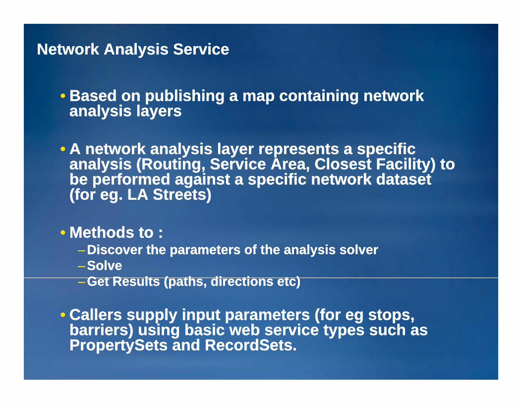
•• Based on publishing a map containing network Based on publishing a map containing network analysis layersanalysis layers
•• A network analysis layer represents a specific A network analysis layer represents a specific analysis (Routing, Service Area, Closest Facility) to analysis (Routing, Service Area, Closest Facility) to be performed against a specific net ork datasetbe performed against a specific net ork datasetbe performed against a specific network dataset be performed against a specific network dataset (for eg. LA Streets)(for eg. LA Streets)
M th d tM th d t•• Methods to :Methods to :––Discover the parameters of the analysis solverDiscover the parameters of the analysis solver––SolveSolve
G t R lt ( th di ti t )G t R lt ( th di ti t )––Get Results (paths, directions etc)Get Results (paths, directions etc)
•• Callers supply input parameters (for eg stops, Callers supply input parameters (for eg stops, barriers) using basic web service types such asbarriers) using basic web service types such asbarriers) using basic web service types such as barriers) using basic web service types such as PropertySets and RecordSets.PropertySets and RecordSets.

Network Analysis Service Network Analysis Service –– Object ModelObject Model
NAServerProxyNAServerProxySolverParamsSolverParams SolverResultsSolverResults
ClosestFacilityParamsClosestFacilityParams
RouteParamsRouteParams
Cl tF ilit R ltCl tF ilit R lt
RouteResultsRouteResults
ServiceAreaParamsServiceAreaParamsClosestFacilityParamsClosestFacilityParams
ServiceAreaResultsServiceAreaResultsClosestFacilityResultsClosestFacilityResults
NAServerLocationsNAServerLocations
NAServerPropertySetsNAServerPropertySets

NetworkAnalysisNetworkAnalysis Server Server –– Key MethodsKey Methods
GetNALayerNames Array of Network Analysis Layers of a particular type
GetNetworkDescription Returns the Network Dataset Data Element for the specifiedGetNetworkDescription Returns the Network Dataset Data Element for the specified layer
GetSolverParameters Default Solver Parameters for the specified Network Analysis Layery
Solve Perform Network Analysis based on the specified solver parameters
•• Finding a Route :Finding a Route :–– Get Route Network Analysis LayerGet Route Network Analysis Layer
Get Default Route Solver ParametersGet Default Route Solver Parameters–– Get Default Route Solver ParametersGet Default Route Solver Parameters–– Specify Desired Route Solver ParametersSpecify Desired Route Solver Parameters
•• Barriers, Stops, FindBestSequence, UseTimeWindows, …Barriers, Stops, FindBestSequence, UseTimeWindows, …SolveSolve–– SolveSolve
–– Parse ResultsParse Results

PrePre--generated ADF Proxy/Value objects generated ADF Proxy/Value objects
Proxy/Value objects generated by a SOAP ToolkitProxy/Value objects generated by a SOAP Toolkit•• Proxy/Value objects generated by a SOAP ToolkitProxy/Value objects generated by a SOAP Toolkit––Cross platforms, languagesCross platforms, languages––No ESRI components requiredNo ESRI components required––Rely on toolkitRely on toolkit––Shared namespace using wsdl.exe toolShared namespace using wsdl.exe tool––No utilitiesNo utilitiesNo utilitiesNo utilities
•• PrePre--generated Web ADF Proxy/Value Objectsgenerated Web ADF Proxy/Value Objects–– .NET and Java.NET and Java––All value objects are in the same namespaceAll value objects are in the same namespace––Support DCOM connectionSupport DCOM connection––Easy to convert value objects toEasy to convert value objects to
•• Web ADFWeb ADF•• ArcObjectsArcObjectsArcObjectsArcObjects
––Works with Web ADF ControlsWorks with Web ADF Controls––ADF install requiredADF install required

Working with SOAP requests over the LANWorking with SOAP requests over the LAN
•• Web ADF includes both a Web proxy as well as a LAN proxyWeb ADF includes both a Web proxy as well as a LAN proxy•• Web service proxy generated from WSDL Web service proxy generated from WSDL -- MapServerProxyMapServerProxy
–– Used for SOAP / HTTPUsed for SOAP / HTTP•• LAN proxy is also included LAN proxy is also included -- MapServerDCOMProxyMapServerDCOMProxy
–– Used for SOAP / LANUsed for SOAP / LAN–– Uses the IRequestHandler interface to submit SOAP requests directly Uses the IRequestHandler interface to submit SOAP requests directly
to the server objectto the server object
SoapSoapWeb ServiceWeb Service
ArcGIS ServerArcGIS ServerClient ApplicationClient Application
SOM/SOCSOM/SOC
Web ServiceWeb Serviceend pointend point
Web ServerWeb Server
objectobjectobjectobject
Value objectValue objectValue objectValue object
Value objectValue object
ProxyProxy end pointend point
Server objectServer object(end point)(end point)
SoapSoapLANLANPP
objectobject
IRequestHandlerIRequestHandler
(end point)(end point)ProxyProxy

Geocoding and Network Analysis Service demo Geocoding and Network Analysis Service demo -- routingrouting
GIS ServerGIS Server
NANA
MXDMXD MapSMapSNDND
GIS ServerGIS Server
NANA WebWebServerServer WebAppWebApp
LocatorLocator GeocodeSGeocodeSLocatorLocator GeocodeSGeocodeS

Image ServiceImage Service
•• Allows you to serve imagery and raster data :Allows you to serve imagery and raster data :––Raster Datasets Raster Datasets
SS•• egeg large mosaics in SDElarge mosaics in SDE––Raster LayersRaster Layers
•• With rendering set up on the serverWith rendering set up on the server–– Image Service Definitions Image Service Definitions
•• Catalogs of file based imagery that can be Catalogs of file based imagery that can be mosaicedmosaiced and and processed on the flyprocessed on the fly
•• Uses a back end Uses a back end ArcGISArcGIS Image ServerImage Server
•• Clients can controlClients can control––Returned image format, mime orReturned image format, mime or urlurlReturned image format, mime or Returned image format, mime or urlurl––band selection, compression, projection, interpolationband selection, compression, projection, interpolation

Image Server Image Server -- Key MethodsKey Methods
ExportImage Returns the requested image using a well known image format
GetImage Returns the requested image as a byte stream
GetServiceInfo Returns the properties of the image service‐ numBands, pixelType, statistics etc

Image Service Image Service –– Object ModelObject Model
ImageServiceInfoImageServiceInfo
I S PI S PGeoImageGeoImage
ImageServerProxyImageServerProxyDescriptionDescription
ImageTypeImageType
ImageResultImageResult

Image Service demoImage Service demo

GeodataGeodata ServicesServices
•• Geodata Services allow you to publish a geodatabaseGeodata Services allow you to publish a geodatabase•• Geodata Services allow you to publish a geodatabase Geodata Services allow you to publish a geodatabase so that it can be accessed remotely over the Webso that it can be accessed remotely over the Web
•• Query datasetQuery dataset
•• ArcGIS Desktop can be used as a client with both ArcGIS Desktop can be used as a client with both local and remote geodatabases in order tolocal and remote geodatabases in order to
––Extract dataExtract dataExtract data Extract data ––Create replicasCreate replicas––Synchronize replicasSynchronize replicas

GeodataGeodata ServiceService
•• Methods to performMethods to performTableSearch Returns the records satisfying the specified query
ExtractData Extract Data
CreateReplica Creating check‐out replicas that can be down loaded and edited
ImportReplicaDataChanges Import the data changes for a replica

Geodata Service Geodata Service –– Object ModelObject Model
G d t SG d t SGeodataServerGeodataServer
GPReplicaDescriptionGPReplicaDescription GPReplicaDatasetGPReplicaDataset
GDSExportOptionsGDSExportOptions GDSDataGDSData

GeodataGeodata Service Use Case Service Use Case –– Disconnected EditDisconnected Edit

GeoprocessingGeoprocessing ServiceService
•• Allows organizations to centralize both data and Allows organizations to centralize both data and processing on the serverprocessing on the serverprocessing on the serverprocessing on the server
•• Allows organizations with spatial data to exposeAllows organizations with spatial data to exposeAllows organizations with spatial data to expose Allows organizations with spatial data to expose spatial analysis functionality against that data as easy spatial analysis functionality against that data as easy to use tasks that can be invoked by less experienced to use tasks that can be invoked by less experienced usersusersusersusers
•• Allows GIS Analysts to easily author and publishAllows GIS Analysts to easily author and publishAllows GIS Analysts to easily author and publish Allows GIS Analysts to easily author and publish geoprocessing models geoprocessing models

Geoprocessing ServiceGeoprocessing Service
•• You publish either a geoprocessing Toolbox You publish either a geoprocessing Toolbox
•• Or a Map containing GP Tool Layers, meaning a GP Or a Map containing GP Tool Layers, meaning a GP Service may be associated with a map service Service may be associated with a map service
th t b d t d lt t d thth t b d t d lt t d th–– that can be used to render results created on the serverthat can be used to render results created on the server––Useful for large datasets as the model results stay on the Useful for large datasets as the model results stay on the
serverserver––Provides access to results that are not supported by a client, Provides access to results that are not supported by a client,
for example rasters and TINsfor example rasters and TINs––Can use layers in the map document as input to the model Can use layers in the map document as input to the model

GeoprocessingGeoprocessing Service Service –– Object ModelObject Model
GPToolInfoGPToolInfo GPParameterInfoGPParameterInfoGPServerGPServer
GPResultOptionsGPResultOptions GPResultGPResult
JobMessageJobMessageJobMessageJobMessage

GeoprocessingGeoprocessing Service Service -- ParametersParameters
•• Supported parameter typesSupported parameter typesStringString––StringString
–– LongLong–– DoubleDouble–– BooleanBoolean–– DateDate–– Linear unitLinear unit–– Feature SetFeature Set–– Record SetRecord Set
RasterRaster–– RasterRaster

GeoprocessingGeoprocessing Service PropertiesService Properties
•• Execution Mode :Execution Mode :
––SynchronousSynchronous•• Results calculated and returned immediately by valueResults calculated and returned immediately by value•• Appropriate for fast tools with small resultsAppropriate for fast tools with small results
––AsynchronousAsynchronousyy•• Allows client to submit a job and come back later to fetch or draw Allows client to submit a job and come back later to fetch or draw
resultsresults•• Results are saved on the serverResults are saved on the server•• large results are best left on the serverlarge results are best left on the server•• Job message is used to track the statusJob message is used to track the status

Geoprocessing Service Geoprocessing Service –– Key MethodsKey Methods
GetToolInfo Returns the signature and default parameter values for a tool
GetExecutionType Return the type of execution: synchronous or asynchronousGetExecutionType Return the type of execution: synchronous or asynchronous
Execute Execute a synchronous geoprocessing tool
SubmitJob Execute an asynchronous geoprocessing toolSubmitJob Execute an asynchronous geoprocessing tool
GetJobStatus Return the current status of a geoprocessing job
GetJobResults Return the results of a geoprocessing job that has completedGetJobResults Return the results of a geoprocessing job that has completed successfully

GeoprocessingGeoprocessing DemoDemo
GIS ServerGIS Server
Map SvcMap SvcWebWeb
ServerServer clientclientMXDMXDToolBoxToolBox
GP SvcGP SvcClipClip
Ad d Lo ca tionsSe rv iceAre a (2)
Inp utFa c ilitie
P
DriveT ime
P
So lveSe rv iceAre a (3) Se le c t Da ta Po lyg ons
P
Ma ke Se rv iceAre a La ye r
Se rv iceAre a
Stre e ts_ND
( ) ( )

Security for GIS ServicesSecurity for GIS Services
•• Supports multiple authentication methodsSupports multiple authentication methods•• Supports multiple authentication methodsSupports multiple authentication methods––Token BasedToken Based––HTTP/windows authenticationHTTP/windows authentication
MapServerProxy msProxy = new MapServerProxy();msProxy.Url ="http://MyWebServer/arcgis/services/MyMapServiceName/MapServer?to
•• Supports a role based security modelSupports a role based security model
http://MyWebServer/arcgis/services/MyMapServiceName/MapServer?token=" + myToken;
pp ypp y
•• Supports permissions on folders and individual Supports permissions on folders and individual servicesservices

ArcGISArcGIS Server Web Services Server Web Services –– Under the HoodUnder the Hood
•• SOAP requests received by the web server are SOAP requests received by the web server are handled by a custom HTTP handler [.Net] / Servlet handled by a custom HTTP handler [.Net] / Servlet y [ ]y [ ][Java] and forwarded to the corresponding server [Java] and forwarded to the corresponding server object in the GIS Server for processing.object in the GIS Server for processing.
A GIS i l d it SOAP t k d XMLA GIS i l d it SOAP t k d XML•• ArcGIS includes its own SOAP stack and XML ArcGIS includes its own SOAP stack and XML serialization framework for ArcObjectsserialization framework for ArcObjects
•• All parameter objects implement IXMLSerializeAll parameter objects implement IXMLSerialize•• All parameter objects implement IXMLSerializeAll parameter objects implement IXMLSerialize
•• SOAP requests [the SOAP body] is deserialized SOAP requests [the SOAP body] is deserialized and processed by the server objectand processed by the server objectand processed by the server objectand processed by the server object
•• Results are serialized into the corresponding Results are serialized into the corresponding SOAP responseSOAP responsepp

ArcGISArcGIS Server Web Services Server Web Services –– Under the HoodUnder the Hood
ESRI Developer Summit 2008ESRI Developer Summit 2008 4848

Summary
• ArcGIS Server has a rich set of GIS Web Services
• You can work with services using the SOAP API–Proxies generated by SOAP Toolkit
P t d i i W b ADF–Pre-generated proxies in Web ADF
• The SOAP API isThe SOAP API is –easily accessible from .Net, Java and other language– has a well described contract
i f ll i t t d i t IDE’– is fully integrated into IDE’s– lets you take advantage of compile time type checking
• Backward compatibility

Additional ResourcesAdditional ResourcesQuestions, answers and information…Questions, answers and information…
•• Tech Talk Tech Talk –– Outside this room right now!Outside this room right now!
•• ESRI Resource CentersESRI Resource Centers–– PPTs, code and videoPPTs, code and video
•• Meet the Team Meet the Team resources.esri.comresources.esri.com–– Tech Support IslandTech Support Island
•• Other sessionsOther sessions•• Social NetworkingSocial Networking
Other sessionsOther sessions–– Implementing Security for Implementing Security for
ArcGIS Server .NET ArcGIS Server .NET Solutions(1:00PM)Solutions(1:00PM)
www.twitter.com/www.twitter.com/ESRIDevSummitESRIDevSummit( )( )
–– Distributed Geodatabase Distributed Geodatabase Development(2:45PM)Development(2:45PM)
–– Using the ArcGIS Server REST Using the ArcGIS Server REST tinyurl.com/tinyurl.com/
ESRIDevSummitFBESRIDevSummitFBAPIAPI

Want to Learn More?Want to Learn More?ESRI Training and Education ResourcesESRI Training and Education Resources
•• InstructorInstructor--Led TrainingLed Training–– Introduction to ArcGIS ServerIntroduction to ArcGIS Server–– Introduction to ArcGIS ServerIntroduction to ArcGIS Server
•• Free Web Training SeminarsFree Web Training Seminars––Authoring and Publishing Optimized Map ServicesAuthoring and Publishing Optimized Map Services––Authoring and Publishing Geoprocessing ServicesAuthoring and Publishing Geoprocessing Services––Using ArcGIS Server Geoprocessing ServicesUsing ArcGIS Server Geoprocessing ServicesUsing ArcGIS Server Geoprocessing ServicesUsing ArcGIS Server Geoprocessing Services
http://www.esri.com/traininghttp://www.esri.com/training