Embed Size (px)
Citation preview

Enbridge Line 6B MP 608 Pipeline Release
Marshall, Michigan
Supplement to the Sampling and Analysis Plan
Referred to as
Work Plan for Evaluating the Potential Impact of
Released Oil on Groundwater used for Drinking Water
Prepared: September 27, 2010
Revised: October 7, 2010

i
Enbridge Line 6B MP 608 Pipeline Release Marshall, Michigan
Supplement to the Sampling and Analysis Plan Referred to as Work Plan for Evaluating the Potential Impact of
Released Oil on Groundwater used for Drinking Water
Revised October 7, 2010
Table of Contents
1.0 Introduction ........................................................................................................................................... 1
2.0 Goals ..................................................................................................................................................... 3
3.0 Work to be Performed .......................................................................................................................... 4
3.1 Evaluation of Accessible Public Information ........................................................................ 4
3.2 Direct Samples of Potable Water Wells ................................................................................. 5
3.3 Focused Hydrogeologic Investigation of Target Areas ......................................................... 6
3.3.1 Target Areas ............................................................................................................. 6
3.3.2 Monitor Well Installations....................................................................................... 9
3.3.3 Water-Level Measurements .................................................................................. 10
3.3.4 Slug-Testing ........................................................................................................... 10
3.3.5 Water Sample Collection and Analysis ................................................................ 10
3.3.6 Sampling and Analysis Plan .................................................................................. 11
3.4 Evaluation of Production Wells ........................................................................................... 11
3.5 Data Evaluation and Reporting ............................................................................................ 11
4.0 Schedule .............................................................................................................................................. 13
5.0 References ........................................................................................................................................... 14
ii
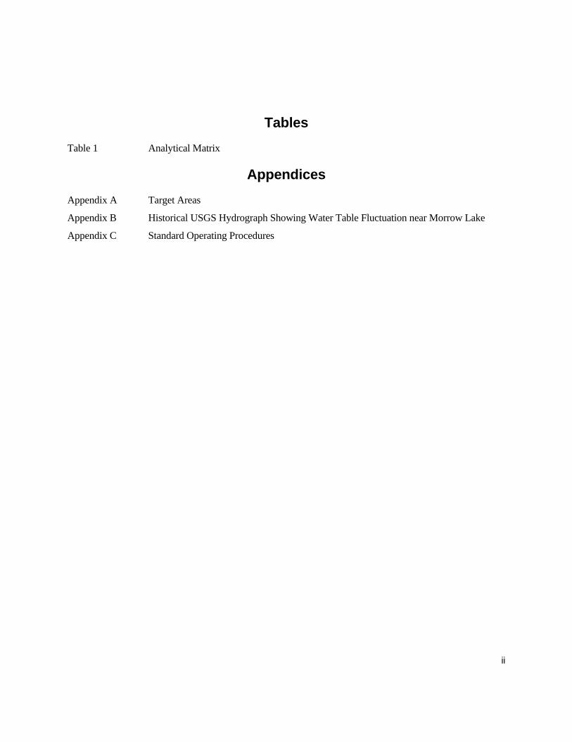
Tables Table 1 Analytical Matrix
Appendices Appendix A Target Areas
Appendix B Historical USGS Hydrograph Showing Water Table Fluctuation near Morrow Lake
Appendix C Standard Operating Procedures
iii
List of Acronyms Company – Enbridge Energy, Limited Partnership
HSP – Health and Safety Plan
MDNRE – Michigan Department of Natural Resources and Environment
PAH – Polynuclear Aromatic Hydrocarbons
QAPP – Quality Assurance Project Plan
Response – The initial response to remove oil affected-media and/or sheen affecting and/or posing a risk to navigable water bodies
SAP – Sampling and Analysis Plan
SARCR – Source Area Response Completion Report
SCAT – Shoreline Clean-up Assessment Technique
TDL – Target Detection Limit
U.S. EPA – Unites States Environmental Protection Agency
U.S. FWS – United States Fish and Wildlife Service
USGS – United States Geological Survey

1
1.0 Introduction
The work proposed is related to Enbridge Energy, Limited Partnership’s (the Company’s) Line 6B
MP 608 spill site in Marshall, Michigan. This work plan is a supplement to the Sampling and
Analysis Plan (SAP) revised August 17, 2010 for the Enbridge Line 6B MP 608 Pipeline Release.
The purpose of the work is to evaluate the potential short-term and long-term impacts of the released
oil on groundwater that has the potential to be a source of drinking water. The work will begin upon
submittal of this work plan on September 27, 2010 and will be performed over 35 days as required by
the Supplement to Order for Compliance under Section 311(c) of the Clean Water Act signed on
September 23, 2010 (September 23, 2010 Supplement to the Order). A report on the work will be
submitted on October 31, 2010. The evaluation will generate and utilize information from new
groundwater monitoring wells, and will integrate monitoring data that the Company has been
collecting. This information includes efforts to identify potable water wells, results from sampling
activities that are being performed under the Sampling and Analysis Plan (as amended), the Shoreline
Clean-up Assessment Technique (SCAT) process, and characterization and remediation activities for
submerged oil.
After the spill, oil migrated down the Kalamazoo River and impacted the shoreline, bank areas, and
some overbank upstream of the Morrow Lake Dam. In addition, submerged oil settled in portions of
the river bottom upstream from the Morrow Lake Dam. Evaluations performed through the SCAT
and through evaluations of river sediments documented the conditions along the river. Oil and oiled
material was removed from the system where appropriate under the direction of the U.S. EPA.
An initial conceptual site model has been developed based upon general hydrogeologic principals,
well logs available from Michigan’s Welllogic database (http://www.michigan.gov/deq/0,1607,7-135-
6132_6828-16124--,00.html), and field observations. Along the Kalamazoo River, there is expected
to be a layer of glacial drift with permeable sands and gravels that also contains some clay units. This
glacial drift unit is underlain by bedrock that includes Marshall Sandstone in the Marshall Formation
(Michigan Department of Environmental Quality, Geological Survey Division, 1987). Groundwater

2
is present in the glacial drift and the underlying bedrock. Many residential wells are screened in the
bedrock, while others are screened in the permeable sands and gravels above the bedrock.
The Kalamazoo River’s role in the water cycle is that of a conduit through which surface water and
groundwater drain to Lake Michigan. Precipitation recharges the groundwater; then groundwater and
surface drainage near the river are dominantly expected to flow toward the river. Available regional
groundwater flow data (derived primarily from the United States Geological Survey – USGS) along
the Kalamazoo River supports the preliminary conclusion that the river is dominantly a gaining river
(http://gwmap.rsgis.msu.edu/viewer.htm). However, certain constraints may cause water from the
Kalamazoo River to flow into the surrounding sands. Three examples of such constraints are: (1)
abrupt increases in the water level of the river during floods which will cause a temporary reversal of
the flow, though the annual flow of water would still be toward the river overall; (2) abrupt drops in
water levels in the river across dams which can cause localized areas where surface waters flow
through the ground around a dam; and (3) high pumping wells located adjacent to the river. The work
defined below is designed to evaluate and further develop this initial conceptual site model to address
the goals of the work.
3
2.0 Goals
The goal of this work is to evaluate the potential short- and long-term impacts of the released oil on
groundwater with the potential to be a source of drinking water. Potable wells have been identified
adjacent to the Kalamazoo River, and groundwater adjacent to the Kalamazoo River has the potential
to be used as a source of drinking water. This work will take into account both current and future
hydrogeological conditions within the Kalamazoo River, including flooding of the Kalamazoo River.
Due to the short duration of the study period as required by the September 23, 2010 Supplement to the
Order, this study will develop information related to these conditions that can be directly used in the
evaluation of flood conditions. The study will not include direct field readings over periods of
flooding from spring melts or targeted high precipitation periods.
This goal will be accomplished through the collection and evaluation of three main categories of
activities described further under Work to be Performed:
• Compile and evaluate publically available information;
• Collect and analyze water samples from existing potable water supplies, and
• Collect and evaluate field measurements and laboratory samples from monitoring wells.

4
3.0 Work to be Performed
The Company will collect additional information to integrate with information from existing and
ongoing activities to accomplish the goals of this work plan. The activities to be performed during
this work are listed below and detailed in this section.
• Evaluation of publically available information;
• Samples and analysis of water samples from potable water wells;
• Focused hydrogeologic investigation of target areas;
• Evaluation of production wells, and
• Data evaluation and reporting.
The work will be performed using procedures defined by the Sampling and Analysis Plan (SAP) with
the supplements that include this document and the standard operating procedures included in
Appendix C and the procedures in the Quality Assurance Plan (QAP).
3.1 Evaluation of Accessible Public Information The Company will compile, evaluate, and utilize the significant historic data that is available on the
hydrology of the Kalamazoo River watershed to assist in the evaluation. Several historical
investigations have been performed on the Kalamazoo River watershed, including hydrogeological
investigations, stream-channel assessments, and water quality assessments. The reports identified at
this time include:
• Historical and Simulated Changes in Channel Characteristics of the Kalamazoo River,
Plainwell to Otsego, Michigan, C.M. Rachol, F. A. Fitzpatrick, and T. Rossi, USGS, 2005.
• Kalamazoo River Watershed Hydrologic Study, D. Fongers, Hydrologic Studies Unit,
MDEQ, 2008.
• Kalamazoo River Assessment, J.K. Wesley, MDNR Fisheries Div., Special Report
Publication 35, 2005
5
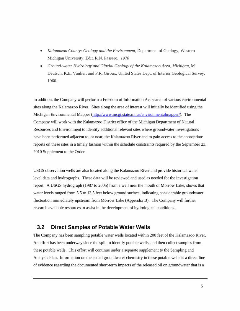
• Kalamazoo County: Geology and the Environment, Department of Geology, Western
Michigan University, Edit. R.N. Passero., 1978
• Ground-water Hydrology and Glacial Geology of the Kalamazoo Area, Michigan, M.
Deutsch, K.E. Vanlier, and P.R. Giroux, United States Dept. of Interior Geological Survey,
1960.
In addition, the Company will perform a Freedom of Information Act search of various environmental
sites along the Kalamazoo River. Sites along the area of interest will initially be identified using the
Michigan Environmental Mapper (http://www.mcgi.state.mi.us/environmentalmapper/). The
Company will work with the Kalamazoo District office of the Michigan Department of Natural
Resources and Environment to identify additional relevant sites where groundwater investigations
have been performed adjacent to, or near, the Kalamazoo River and to gain access to the appropriate
reports on these sites in a timely fashion within the schedule constraints required by the September 23,
2010 Supplement to the Order.
USGS observation wells are also located along the Kalamazoo River and provide historical water
level data and hydrographs. These data will be reviewed and used as needed for the investigation
report. A USGS hydrograph (1987 to 2005) from a well near the mouth of Morrow Lake, shows that
water levels ranged from 5.5 to 13.5 feet below ground surface, indicating considerable groundwater
fluctuation immediately upstream from Morrow Lake (Appendix B). The Company will further
research available resources to assist in the development of hydrological conditions.
3.2 Direct Samples of Potable Water Wells The Company has been sampling potable water wells located within 200 feet of the Kalamazoo River.
An effort has been underway since the spill to identify potable wells, and then collect samples from
these potable wells. This effort will continue under a separate supplement to the Sampling and
Analysis Plan. Information on the actual groundwater chemistry in these potable wells is a direct line
of evidence regarding the documented short-term impacts of the released oil on groundwater that is a

6
source of drinking water near the Kalamazoo River, and the results from the potable well sampling
will be incorporated into this evaluation.
3.3 Focused Hydrogeologic Investigation of Target Areas A hydrogeologic evaluation will be performed at target areas along the Kalamazoo River to provide
direct measurements to test the conceptual site model and evaluate groundwater flow along the
Kalamazoo River. The target areas have been selected based on river conditions, hydrogeologic
principals, and the distribution of oils observed during the SCAT process and submerged oil
investigations. The investigations in each target area are designed to accomplish the following goals:
• Determine if the Kalamazoo River is gaining or loosing at each target area;
• Determine if the quality of groundwater that may act as a source of drinking water is impacted
by released oil;
• Generate information on the hydrogeologic conditions along the Kalamazoo River such as the
direction of hydraulic gradients and the permeability of the aquifer at the river;
• Provide monitoring wells for water quality sampling and for measurement of hydraulic
gradients that can be used for longer term monitoring, and
• Provide direct measurements on typical areas and areas with certain features that will generate
data representative of broader sections of the river.
This section describes the selected target areas and then the hydrogeologic investigations that will be
performed.
3.3.1 Target Areas Target areas have been identified for focused hydrologic evaluations using the following criteria:
1. Identified presence of pooled or submerged oil;

7
2. Locations identified as being potentially losing stream areas along the Kalamazoo
River due to changes in hydraulic head (such as at the Ceresco Dam);
3. Locations identified where gaining conditions may be less pronounced associated
with tighter meanders in the river, and
4. Additional areas to further refine the conceptual site model.
Four target areas were selected where submerged oil has been identified along sections of the
Kalamazoo River where it is expected to be a gaining river. In these areas, the focused investigations
will both refine the general conceptual site model of groundwater discharging to the river and also
provide direct analysis of groundwater samples to document potential impact on the groundwater from
the submerged oil.
The Ceresco Dam area is an individual target area due to the change in the water level across the face
of the dam and the potential for this abrupt change in hydraulic head along the river to cause
groundwater to flow around the dam. With the dam structure present, there is a potential for
groundwater to flow around the edges of the dam a short distance away from the river before re-
entering the river below the dam.
One additional target area is provided away from any submerged oil to further test the conceptual site
model near the confluence of Talmadge Creek with the Kalamazoo River.
Finally, two target areas are located on tight meanders within the Kalamazoo River. Inside these tight
meanders, groundwater is still expected to rise up from lower formations, but shallow groundwater
flow may be more parallel to the overall direction of the river flow and may undercut the meanders.
The target areas are shown in Appendix A and are presented below. Each area is defined as a reach of
the river, and the actual location of the transects will be selected based upon site conditions and ability
to access the appropriate drilling locations in the field.

8
Target Area
Mile Post Range
Purpose Wells
1 2.5 to 3.25 Confirm conceptual site model (south side) 3 2 5.5 to 6 Evaluate flow at Ceresco Dam on both sides of river
and confirm conceptual site model on both sides of the river
9
3 15 to 15.5 Confirm conceptual site model (east side) and evaluate submerged oil
3
4 22.5 to 23 Confirm conceptual site model (north side) and evaluate submerged oil
3
5 26.5 to 27.25 Evaluate bend 3 6 34.25 to 34.75 Evaluate bend 3 7 36 to 36.25 Confirm conceptual site model (south side) and
evaluate submerged oil3
8 36.75 to 37.25 Confirm conceptual site model (south side) and evaluate submerged oil
3
At each area designed to confirm the conceptual site model, a three-well monitoring system will be
installed that will document the vertical and horizontal gradient near the edge of the river. Two
monitoring wells will be installed into the glacial drift at nearly the same elevation in a line extending
away from the edge of the river. The difference in the elevation of the groundwater between these
two monitoring wells will be used to document whether the hydraulic gradient has a horizontal
component going toward or away from the Kalamazoo River. The third well at each location will be
installed at least 15 feet below one of these drift wells, herein after referred to as a “deep monitoring
well”. This third well will be used to document whether the hydraulic gradient has an upward or
downward component at the well cluster.
At the Ceresco Dam, two sets of the three-well monitoring systems will be installed to document
groundwater flow near the dam and an additional three drift wells will also be installed to further
refine the groundwater flow path near the dam (nine wells total).
To evaluate bends in the river at the target areas, one three-well monitoring system will be installed
within the bend to document the vertical gradient and to document groundwater chemistry within the
bend.

9
3.3.2 Monitor Well Installations Sonic drilling technologies will be used to install the deep monitoring wells as resources allow. Sonic
drilling allows for continuous observation of soil cores, a reduced volume of soil cuttings, and the
ability to penetrate into the bedrock if it is reached. Soils will be logged by a trained technician,
geologist, scientist or engineer using the Unified Soil Classification System. The locations of the
wells will be selected to document the hydraulic gradient adjacent to the Kalamazoo River, to provide
water samples representative of the groundwater that may be used as a source of drinking water
adjacent to the Kalamazoo River, to accommodate site access constraints which include site features
and land owner requirements and preferences, and to allow for the future access to the wells for
monitoring.
The shallow monitoring wells will be installed using sonic, hollow stem auger, or direct push
technologies. Screened intervals will be selected to access groundwater from permeable sections of
the formations that are logged in the field. The five-foot long screens in the shallow monitoring wells
will be set within the ground water table, approximately 1 to 5 feet below the groundwater table
surface. This will be done in order to prevent the well screens from drying out during low water table
conditions. If a confining layer is encountered, the well screen will not penetrate this layer, and the
upper portion of the screen may be above the water table. Deep monitoring wells will be installed
with the top of the lower screen at least 15 feet below the bottom of the upper screen. If a confining
unit is encountered, an attempt will be made to set the lower screen below the aquitard with the
annular space in the aquitard completely grouted and the upper screen set above the aquitard.
The monitoring wells will be constructed of 2-inch diameter, five-foot long, schedule 40 PVC, with
factory-slotted (10-slot) screen. The wells will be installed with an annular sand pack and grout
surface seal. All monitoring wells will be developed to remove fines from the screen interval. All
wells will be located by GPS or surveyed to an established site benchmark, and top of casing elevation
determined through survey to the nearest 0.01 foot.

10
3.3.3 Water-Level Measurements Water level measurements will be taken from each set of monitoring wells and the surface water on at
least three separate days. To achieve the required schedule for this order, water level measurements
are not expected to occur during significant precipitation events or during spring snow melts.
3.3.4 Slug-Testing Slug-testing will be performed on one shallow and one deep monitoring well in each of the target
areas. These slug tests are intended to provide further information in support of the conceptual site
model for future work, and will be performed according to SOP GW5 in Appendix C. Slug-testing
data will be recorded using in-situ pressure transducers and recorded on a data logger. Data will be
analyzed using commercially-available curve matching software and applicable hydrogeological
solutions (Bouwer and Rice, 1976; or other).
3.3.5 Water Sample Collection and Analysis Groundwater samples will be collected using Low-Flow Minimum Drawdown techniques as
described by Puls & Barcelona (1996) as defined in the Sampling and Analysis Plan. Groundwater
samples will be collected in sampling vessels and analyzed as described in the Sampling and Analysis
Plan (SAP). Groundwater samples will be collected a minimum of three days after well development.
Groundwater samples will be analyzed for the parameters in Table 1.
One surface water sample will be collected in each target area. Surface water samples will be collected
adjacent to the river bank, near the monitoring wells in each target area using a peristaltic pump and
disposable tubing. Surface water samples will be placed directly into analytical sample bottles. These
samples e analyzed for the following parameters: calcium, magnesium, sodium (major cations), and
chloride, sulfate, and bicarbonate (major anions), as well as the water quality parameters temperature,
specific conductivity, turbidity, pH and oxidation-reduction potential. Surface water sampling will be
conducted in accordance with SOP 2010-4 of the SAP.
These surface water sample collection locations will be surveyed for x and y position using the GPS
system, in the same coordinate system as the monitoring well locations as is discussed in section
3.3.2..

11
This water sample collection and analysis is recommended to further evaluate potential zones where
surface water is venting to groundwater (James, 2002). The major element analyses will be used to
construct stiff diagrams, tri-linear diagrams or simpler x-y graphs that show relationships between the
chemistry of the river water and the groundwater. To support this analysis, samples of the river water
will be collected and analyzed for major element chemistry.
The scheduled analyses of water samples are summarized in Table 1. Due to the limited duration of
this study, only one round of groundwater samples will be collected from the monitoring wells as a
part of this work plan.
3.3.6 Sampling and Analysis Plan A SAP has been developed that presents the methods and operating procedures that will be used for
all investigations at the site. The plan documents procedures such as sampling, analytical methods,
decontamination, sample preservation and shipping, chain of custody, field documentation, instrument
calibration, management of investigation derived waste, etc.
3.4 Evaluation of Production Wells The Company will identify production wells which have the potential to create more drawdown and
affect groundwater flow near the river. This list will be generated by reviewing the location database
obtained as part of the ongoing potable water well evaluation described in Section 3.2. Municipal
well fields will be addressed by contacting the individual municipalities along the study area. If
industrial high production wells are identified, pumping from these wells will also be researched. The
report will include a presentation of the wells identified and the potential impact on groundwater flow
patterns and recommendations.
3.5 Data Evaluation and Reporting Data will be added to an EPA SCRIBE database routinely and updated as samples are collected and
validated data is received. The local project will be uploaded to scribe.net. The results of the work
specified in this work plan will be presented in a written report. The report will include an
introduction, objectives, methods, data evaluation, sample location map, cross sections with water
levels, data tables, sample location coordinates, data interpretation, and a summary. Deviations from

12
the work plan will be identified and reasons for the deviations will be presented. For example, well
locations may need to be adjusted based on field conditions. Cross sections at key locations will be
included to illustrate stratigraphy, permeable zones and groundwater potentiometric information.

13
4.0 Schedule
Performance of this work plan began on September 27 concurrent with submittal of the work plan.
Procurement and scheduling of vendors such as drillers is the first task, and the actual schedule will
need to be adjusted based upon availability of equipment such as drill rigs to perform the work. To
meet the schedule requirements mandated in the September 23, 2010 Supplement to the Order, the
schedule for this project will overlap tasks and run multiple tasks in parallel schedules. As drilling is
complete on a set of wells, groundwater sampling will be scheduled to begin rapidly following the
required rest time for the wells after development.
Collection and interpretation of publically available information
27-Sep through 26-Oct
Potable well sampling On-going Procurement and planning / mobilize drilling equipment 27-Sep through 3-Oct Access agreements and utility clearance 27-Sep through 15-Oct Drilling, monitoring well installation and development 4-Oct through 19-Oct Well sampling 8-Oct through 22-Oct Laboratory analysis of water samples 9-Oct through 26-Oct Survey well locations 11-Oct through 24-Oct Water level measurements and recording 11-Oct through 26-Oct Data interpretation 6-Oct through 29-Oct Report preparation 10-Oct through 31-Oct Submit final report 31-Oct

14
5.0 References
Bouwer, H. and R.C. Rice, 1976. “A slug test method for determining hydraulic conductivity of
unconfined aquifers with completely or partially penetrating wells.” Water Resources Research, vol.
12, no. 3, pp. 423-428.
Rachol, C.M, F. A. Fitzpatrick, and T. Rossi, 2005, Historical and Simulated Changes in Channel
Characteristics of the Kalamazoo River, Plainwell to Otsego, Michigan, USGS.
Fongers, D. 2008, Kalamazoo River Watershed Hydrologic Study, Hydrologic Studies Unit, MDEQ.
Drever, James I. The Geochemistry of Natural Waters, Surface and Groundwater Environments, Third
Edition. Upper Saddle River, NJ: Prentice Hall, 2002.
Deutsch, M., K.E. Vanlier, and P.R. Giroux, 1960. Ground-water Hydrology and Glacial Geology
of the Kalamazoo Area, Michigan, United States Dept. of Interior Geological Survey.
Enbridge, 2010a. Enbridge Line 6B MP 608 Pipeline Release Marshal, Michigan Source Area
Response Completion Report. (August 31, 2010 revision).
Michigan Department of Environmental Quality, Geological Survey Division, 1987. “1987 Bedrock
Geology of Michigan”
http://www.michigan.gov/documents/deq/1987_Bedrock_Geology_Map_301466_7.pdf
Puls, R.W. and M.J. Barcelona, 1996, Low-Flow (Minimal Drawdown) Ground-Water Sampling
Procedure, EPA/540/S-95/504, 12 pp. (http://www.epa.gov/tio/tsp/download/lwflw2a.pdf)
Wesley, J.K., 2005, Kalamazoo River Assessment, MDNR Fisheries Div., Special Report
Publication 35.

Appendix A
Target Areas

Appendix B
Historical USGS Hydrograph
Showing Water Table Fluctuation Near Morrow Lake

Appendix C
Standard Operating Procedures

Table