Embed Size (px)
Citation preview
1
St Louis and Lower Nemadji River Watershed
Wisconsin Watersheds2010 Water Quality Management Plan UpdateLake Superior Basin Wisconsin
The St Louis River the largest US tributary to Lake Superior drains 3634 square miles entering the southwestern corner of the lake between Duluth Minnesota and Superior Wisconsin The river flows 179 miles through three distinct areas coarse soils glacial till and outwash deposits at its headwaters a deep narrow gorge at Jay Cooke State Park in Minnesota and red clay deposits in its lower reaches As the St Louis River approaches Duluth and Superior the river takes on the characteristics of a 12000 acre freshwater estuary The upper estuary has some wilderness-like areas while the lower estuary is character-ized by urban development an industrial harbor and a major port The lower estuary includes St Louis Bay Superior Bay Allouez Bay Kimballrsquos Bay Pokegama Bay Howardrsquos Bay and the lower Nemadji River
Watershed Details
Population and Land Use
The watershed is dominated by forests (65) agriculture (9) followed closely by open water and open space (8) (Figure 1)
In 1987 the International Joint Commission an advisory com-mission on US-Canadian border water issues designated the lower St Louis River as one of 43 Great Lakes Areas of Concern (AOCs) because of concerns over environmental quality in the area Industrial activity such as steel mills oil refining coal tar and coking operations paper mills and other wood products manufacturing as well as the shipping of coal grain iron ore and taco-nite significantly contributed to the contamination of the St Louis River Area of Concern Two Superfund sites US Steel and St Louis River-Interlake Duluth Tar sites on the Minnesota shore of the river are polluted with toxic organic chemicals and metals Toxic contamination has impaired several uses the St Louis River and its watershed includ-ing degradation of bottom-feeding invertebrate communities increased incidence of fish tumors and other abnormalities fish consumption advisories and restrictions on dredging Some sediment-derived contaminants also appear to be carried by the water
Contents
Watershed Details 1Population and Land Use 1Ecological Landscapes 3Other Details 3Invasive Species 3Historical Note 4
Watershed Condition 4Priority Issues 4Water Quality Goals 4Overall Condition 4Point and Nonpoint Sources 5Fish Consumption Advice 5River and Stream Condition 5Lakes and Embayments 16Wetlands 17Waters of Note 22
Watershed Actions 23Partnership Activities 23 Grants 24 Monitoring 24 Contributors 26
Appendices 27Watershed Map 27Dams and Outfalls 28ORWERW and Impaired Waters 29Land Use 30Potentially Restorable Wetlands 31
August 2010
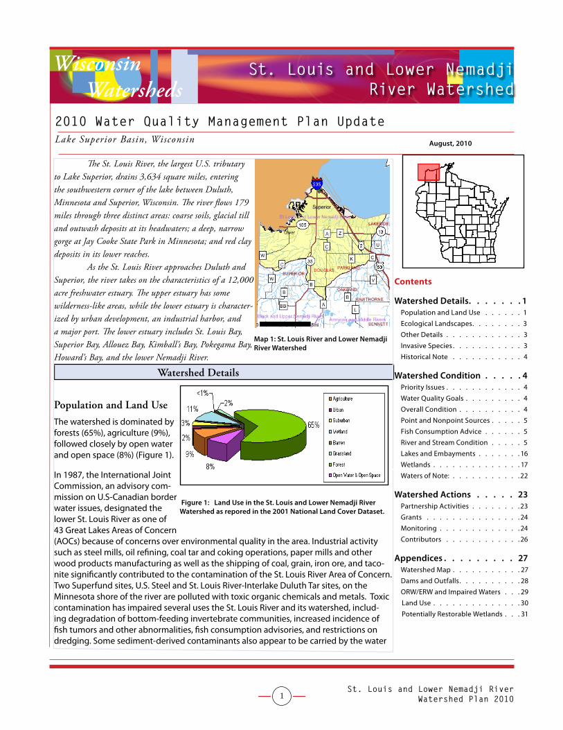
Map 1 St Louis River and Lower Nemadji River Watershed
Figure 1 Land Use in the St Louis and Lower Nemadji River Watershed as repored in the 2001 National Land Cover Dataset
St Louis and Lower Nemadji River Watershed Plan 2010
2
column to Lake Superior Additionally human activities in the estuary from the last couple of hundred years have had a significant negative impact on fish and wildlife habitatmdashapproximately 3000 acres of marsh and open water were filled and roughly 4000 acres of river bottom dredged Exotic invaders such as purple loosestrife and additional human development of the estuary continue to pose threats to habitat
The St Louis River System AOC (orange colored area on the figure to the right) is the area being addressed by the St Louis River System Remedial Action Plan (RAP) The RAP focuses primarily on the 39 miles of the St Louis River below Cloquet Minnesota The RAP began in 1989 as a collaborative effort between the Minnesota Pollution Control Agency (MPCA) and the Wisconsin Depart-ment of Natural Resources (WDNR) While system-wide in its approach the St Louis River AOC focuses primarily on the lower 39 river miles and the entire 360 square mile Nemadji River watershed The Nemadji River is split almost equally between Minnesota and Wisconsin and discharges into the Duluth-Superior Harbor near the natural outlet of the St Louis River The Nemadji River contrib-utes a large load (nearly 33000 tons per year) into Lake Superior Consequently there have been studies and plans developed that outline actions that should reduce the sediment load from the Nemadji River
In 2008 as part of the Remedial Action process the states of Minnesota and Wisconsin developed planning goals with other local stakeholders to assist in the delisting of the St Louis River as an Area of Concern
In 2010 the Wisconsin portion of the St Louis River will be designated as the second freshwater National Estuarine Research Reserve (NERR) It is anticipated that the NERR will provide additional educational and research assistance for activities on the St Louis River
Development in city of Superior The city of Superiorrsquos location on the St Louis estu-ary harbor and Lake Superior influenced its history and development By the mid to late 1800s the cityrsquos waterfront supported a variety of industries shipping and a population that was served by surrounding farms Early city leaders envisioned a city on par with Chicago in terms of industrial importance Today the city has a population of roughly 30000 people It is an important shipping port located along the shores of Lake Superior and is also a hub for other industries including petroleum pipelines and oil refining rail and trucking Several harbor and industrial expansion and upgrade projects have taken place since 2008 The total area of the city is very large compared to the population The city also includes a large municipal forest on the St Louis River
HydrologyThe St Louis River System area of concern drains an area of 3634 square miles in northern Minnesota and Wisconsin forming a large fresh water estuary at its mouth The lake actually drowns a portion of the lower river valley and its seiche effect influences river levels in the estuary The 12000 acre estuary includes forest industrial and urban areas and open lands within the twin ports of Superior and Duluth
St Louis River Area of Concern
Aerial photo of the city of Duluth-Superior port
St Louis and Lower Nemadji River Watershed Plan 2010
3
Ecological Landscapes
The Superior Coastal Plain is Wisconsinrsquos northernmost Ecological Landscape bordered on the north by southwestern Lake Superior and on the south by the Northwest Sands the Northwest Lowlands and the North Central Forest The climate is strongly influenced by Lake Superior resulting in cooler sum-mers warmer winters and greater precipitation compared to more inland locations Exposed coastal areas are subject to significant disturbance from windstorms waves ice currents and periodic water level fluctuations These disturbance regimes play a significant role in determining both the landform and vegetation characteristics of the shoreline ecosystems The major land-form in this Ecological Landscape is a nearly level plain of lacustrine clays that slopes gently northward toward Lake Superior The clay plain is separated into two disjunct segments by the comparatively rugged Bayfield Peninsula An archipelago of sandstone-cored islands the Apostles occurs in Lake Supe-rior just north and east of the Bayfield Peninsula Wave carved sandstone cliffs bracket stretches of the Peninsula and also occur along the margins of several of the islands Sand spits are a striking feature of the Lake Superior shoreline typically separating the waters of the lake from inland lagoons and wetlands The spits support rare and highly threatened natural communities such as beaches dunes interdunal wetlands and pine barrens and these in turn are inhabited by specially adapted plants and animals The mouths of many of the streams entering Lake Superior are submerged creating freshwater estuaries A ridge of volcanic igneous rock primarily basalt forms the southern boundary of portions of this Ecological Landscape
Historically the Superior Coastal Plain was almost entirely forested A distinctive mixture of white pine white spruce balsam fir paper birch balsam poplar trembling aspen and white cedar occurred on the lacustrine clays White pine was strongly domi-nant in some areas according to mid-nineteenth century notes left by surveyors of the US General Land Office Mesic to dry-me-sic forests of northern hardwoods or hemlock hardwoods were more prevalent on the glacial tills of the Bayfield Peninsula and throughout the Apostle Islands Large peatlands occurred along the Lake Superior shoreline often associated with drowned river mouths and well-developed sand spits The most extensive of these wetland complexes were on the Bad and St Louis rivers A few large peatlands also occurred at inland sites such as Bibon Swamp in the upper White River drainage and Sultz Swamp on the northern Bayfield Peninsula The present clay plain forest has been fragmented by agricultural use and today approximately one-third of this landscape is non-forested Most of the open land is in grass cover having been cleared and then subsequently pastured or plowed Aspen and birch forests occupy about 40 of the total land area having increased in prominence over the boreal conifers On the Bayfield Peninsula second-growth northern hardwood forests are interspersed among extensive early successional aspen stands Older forest successional stages are now rare throughout the Superior Clay Plain
Other Details
Invasive Species
Terrestrial and aquatic invasive plants and animals are present in and adjacent to the watershed The Duluth-Superior Harbor is the busiest harbor in the Great Lakes It has been the port of entry for several aquatic invasive species travel-ing via ballast water Lake Superior and the St Louis estuary harbor a wide range of aquatic invasive species such as Eurasian ruffe zebra mussels round goby quagga mussels and the spiny water flea The microscopic fish disease Viral Hemorrhagic Septicemia (VHS) was detected in Lake Superior in 2010 The states including Wisconsin have been working on ballast water regulations in the absence of federal regulations Wisconsin is trying to keep aquatic invasive species found in the Great Lakes from spreading to inland waters The Lake Superior Binational Program has developed a ldquototal prevention planrdquo for aquatic invasive species httpwwwepagovgrtlakeslakesuperiorais_drafthtml
There is also a potential for terrestrial invasive species such as buckthorn Asian honeysuckle loosestrife or others to be transported from established patches along transportation and recreation corridors or nearby urban landscapes Efforts to build volunteer support for monitoring are encouraged through the Sea Grant Program Wisconsin River Alli-
Map 3 Ecological Landscapes of the Galena Watershed
St Louis and Lower Nemadji River Watershed Plan 2010
4
ancersquos Project RED (Riverine Early Detectors) and programs like UW-Stevens Pointrsquos Clean BoatsClean Waters and Citizen Lake Monitoring Network The Northwoods Invasive Species Cooperative also acts as an inter-agencycitizen team work-ing to increase awareness and reduce transmission of invasive species across the Lake Superior watershed
Historical Note
The City of Superior is situated on the south side of a superb natural harbor at the west end of Lake Superior across from Duluth Minnesota in the St Louis and Nemadji River watershed A trading post was established in the area around 1679 by a Frenchman Daniel Greysolon Sieur du Lhut A North West Fur Company post established around 1787 was replaced in 1816 by one of the American Fur Company
As a result of a government survey in 1852 a syndicate bought up land and platted a town which they named Su-perior The village government was established in 1887 and Superior received a city charter in 1889 Its population included large numbers of Finns and Scandinavians
Superior developed economically primarily as a result of its excellent port It has some of the largest facilities in the world for the shipping of ore and grains It was from Superior that the ore vessel Edmund Fitzgerald sailed to meet its destruction in a terrible storm on the morning of November 10 1975 with the loss of all 29 men on ship The event was immortalized by folk singer Gordon Lightfoot
Superior Wisconsin has the distinction of being the home of the oldest of the sixty-three Carnegie libraries built in Wisconsin and the home of the last Carnegie library building built in Wis-consin The former main library building of the Superior Public Library is the oldest Carnegie library building in Wisconsin It was designed in the Neoclassical Revival style by local archi-tect Carl Wirth and completed in 1902 The former East branch library building is the newest Carnegie in Wisconsin and is now a private residence Both buildings have been determined to be potentially eligible for listing on the National Register of Histori-cal Places by the Wisconsin Historical Society
Watershed Condition
Priority Issues
bull Delist the Area of Concernbull Remove contaminated sedimentsbull Restore Hog Island Inletbull Support projects that reduce sediment loadingbull Promote projects that protect and restore wetlands in the watershedbull Promote projects that maintain oligotrophic status of Lake Superior
Water Quality Goals
Reduction of contaminant loads from various sources to help restore area waters to healthy ecological state Investiga-tion of new techniques and practices to resolve inplace contaminant issues High level partnership with local regional and international partners to collaborate on successful restoration projects
Overall Condition
The St Louis River and Lower Nemadji Watershed is dominated by the 12000 acre St Louis River estuary The estuary includes the Duluth-Superior Harbor which ships the most cargo of any Great Lakes port The estuary supports a mix of extensive public land and good habitat with the working harbor and old industrial sites The estuary still suffers from leg-acy contaminated sediments in several locations With the recent increased emphasis on Great Lakes Areas of Concern
The former main library building of the Superior Public Library is the oldest Carnegie library building in Wisconsin (photo by BobakUSC and Google Earth)
St Louis and Lower Nemadji River Watershed Plan 2010
5
at a federal level the states have been able to pursue several projects to clean up contaminated sediments and to evaluate the extent of contaminants in bottom sediments The estuary supports a good and diverse fishery The Nemadji River watershed is typical of many of Wisconsinrsquos Lake Superior watersheds in the clay plain Flows fluctuate greatly because water runs off the clay soils quickly This results in streambank erosion and bluff slumping The Nemadji carries a signifi-cant sediment load To some extent the turbidity and sediment load are a natu-ral condition because of the geologically young watershed However past land use practices accelerated the rates of water runoff from the watershed which accelerates streambank erosion The Nemadji and several of its tributaries in the upper parts of this watershed are cut into deep valleys The river valley flattens out and is flanked by wetlands in the lower part as it approaches Superior Bay
Point and Nonpoint Sources
Water quality in the St Louis River estuary has improved significantly in the estu-ary from the 1970rsquos because of advances in wastewater collection and treatment The two major point sources in Wisconsin are the City of Superior wastewater treatment plant which has three discharge locations Superior Bay the St Louis River and the Nemadji River and the Murphy Oil USA refinery which discharges to Newton Creek Newton Creek flows into Hog Island Inlet of Superior Bay These point sources are in good compliance status with their WPDES permits In
Minnesota the point source discharges to the St Louis estuary are all collected and treated by the Western Lake Superior Sanitary District with one discharge location to St Louis Bay
The cities in the Duluth-Superior metropolitan area are all required to have stormwater management permits (MS4 com-munities) and stormwater management programs In Wisconsin these communities are the city of Superior Village of Superior and Village of Oliver The Wisconsin and Minnesota communities all work together in the Regional Stormwater Protection Team
There is a small amount of agriculture in this watershed mostly hay and livestock rather than row crops Agriculture is not considered to be a major contributor to nonpoint sources in this watershed in Wisconsin The turbidity and sediment car-ried by the Nemadji and tributaries has been exacerbated by historical land use practices including the logging and fires in the 1800rsquos and wetland loss Strategic forest management and protection of wetlands are the approaches favored for long term management
Fish Consumption Advice
In addition to the state-wide mercury fish consumption advisory in this watershed the St Louis River and Lake Superior have specific advisories for mercury and PCBrsquos Many sport fish species in the St Louis River also spend time in Lake Superior
River and Stream Condition
St Louis River and TributariesThe St Louis River system has consistently exceeded several water quality criteria including wildlife and human threshold and human cancer for several pollutants sampled in the water column over a number of years (MPCA ldquoLake SuperiorDuluth-Superior Harbor Toxics Loading Studyrdquo 1998) Additionally there are specific Mercury (Hg) and PCB fish consump-tion advisories for the St Louis River Several studies of contaminated sediment in the St Louis River have provided data
Aerial photo of the St Louis River estuary
St LouisNemadji River Watershed At-a-Glance
Stream miles 433 Wetland acres 26946 OutstandingExceptional waters 77 miles Trout Streams 101 mi Impaired waters 491 mi 60615 acres Many active partnerships including
newly designated National Estuarine Research Reserve
12000 acre estuary includes largest Great Lakes Port abundant wetland types are nationally significant
Upper reaches of the watershed have deeply incised streams steep ravines formed by runoff streambank and bluff erosion significant
Area of Concern (AOC) - Contaminated sediments from past industrial sites are the focus of clean-up
St Louis and Lower Nemadji River Watershed Plan 2010
6
on toxins in the sediment Throughout the harbor there are intermediate levels of several different toxics including mercury PBCs and PAHs There are also several known hotspots in various stages of remediation including Hog Island Howardrsquos Bay and the Kopperrsquos wood treatment site
In 2010 the impaired waters listing for the St Louis River was updated in anticipation of a toxins Total Maximum Daily Load (TMDL) study that began in 2010 The TMDL should aid in better understanding how these widespread interme-diate levels of contamination affect the health of organisms that live in the water and sediments
Recommendationsbull Contaminated sediment data collected in 2007 should be analyzed and used in future impaired waters evalua-
tionsbull Develop and implement the St Louis River Comprehensive Delisting Framework The Delisting Framework is a
project that will allow the state to outline its priority actions to make progress in delisting the AOCbull Remediate contaminated sediment hotspots The state should continue negotiating with applicable responsible
parties for Howardrsquos Bay and Kopperrsquos a former wood treating facility that drains into a tributary of Crawford Creek and where practical pursue opportunities for restoration of these areas
bull Continue water chemistry monitoring for St Louis River and Lake Superiorbull Assess levels of contaminants of emerging concern in the St Louis Riverbull Inventory assessment and analyze habitat enhancementrehabilitation opportunities in the St Louis River and
Lower Nemadji watershedbull Implement actions that will help in attaining the AOC Delisting Targets (see Appendix 1 St Louis River Area of
Concern Delisting Targets)
Pokegama and Little Pokegama RiverThe Pokegama River originates just across the WisconsinMinnesota border near Jay Cooke State Park in Minnesota and flows in an eastern direction before turning north near Wisconsin State Hwy 35 The Pokegama River is nearly twenty-six miles in length while the Little Pokegama River is only about eight-miles long and flows just north and west of the Pokegama River and is also tributary to the St Louis River with its confluence located at the upstream end of Spirit Lake The headwater areas of the Pokegama and Little Pokegama River are associated with the Pokegama-Carnegie wetlands which have been identified by the Wisconsin Department of Natural Resources (WDNR) Bureau of Endan-gered Resources as a Lake Superior Basin Priority Site This high quality wetland is an extensive area of poorly drained red clay flats comprised of shrub swamp sedge meadow emergent marsh small ponds and is punctuated with tiny upland ldquoisletsrdquo consisting of white spruce white and red pine balsam poplar and trembling aspen (Lake Superior Basin Water Quality Management Plan WDNR 1999) This mosaic of wetlands in turn supports many populations of rare plants a wide variety of emergent and submergent vegetation and abundant and diverse wildlife
After turning north the Pokegama River enters the Village of Superior before flowing through the Superior Municipal Forest and emptying into Pokegama Bay of the St Louis River A significant portion of the 4000 acre city forest was designated as a State Natural Area in 1996 which also borders the St Louis River Estuary This unique natural area site is highlighted by a sizable stand of relatively unfragmented boreal forest which gives it regional conservation significance As the river enters the St Louis River Estuary extensive areas of emergent marsh border the each side of Pokegama Bay This sheltered bay and others in the estuary include some the highest-quality remaining wetlands and areas of emergent vegetation are interspersed with areas of submergent vegetation and open water between 3 and 5 feet deep The health of these bays varies from one location to another some have been impacted by input from excessive sediment and some exhibit lower than expected species diversity andor invasion by exotic species Purple loosestrife and other undesirable exotic plant species have become established in a number of sheltered bays (St Louis River Habitat Plan) The City of Superior began a purple loosestrife control program in 2002 using Galerucella beetles Although beetles have been fairly effective in controlling purple loosestrife it has not been eradicated
In tributaries and downstream areas of its drainage the Pokegama River is similar to other flashy red-clay influenced streams of this watershed displaying steeply cut clay banks and a scoured sometimes deeply cut channel Red clay erosion here contributes to large amounts of sediment and turbidity in the river The suspended clay limits the abun-dance of submerged vegetation and consequently can also limit fish abundance An unnamed tributary to the Poke-gama also receives the discharge from the Duluth Winnipeg and Pacific Railway Switching Yards industrial and sanitary
St Louis and Lower Nemadji River Watershed Plan 2010
7
wastewater treatment system For further description see the Lake Superior Basin Wa-ter Quality Management Plan (WDNR 1999) The Pokegama River was recommended for inclusion in the revision of NR104 (1977) as a limited aquatic life water or limited forage fishery (LFF) from its mouth at the St Louis River in Pokegama Bay to upstream where the outfall of the Village of Supe-riorrsquos wastewater treatment plant enters the Pokegama through a diffuse surface drainage However Pratt (1996) notes that the river is an important spawning area for walleye northern pike longnose and white suckers burbot and other members of a diverse fishery Water quality is very important for successful reproduction for these species Based on a diverse fishery with gamefish present this LFF designation does not appear appropriate rather it would appear the Pokegama should be designated as a warmwater sport fishery (WWSF) from its mouth up to approximately river mile 40 at Hwy 105 or possibly further upstream at which point it probably changes to a warm-water forage fishery (WWFF)
The Little Pokegama River had a baseline monitoring survey conducted at State Hwy 105 in 2006 which suggest the current use of the Little Pokegama could be as WWFF Given habitat and water quality present the best attainable use designation for the Little Pokegama may be as a WWFF also presently its current and attainable use is listed as ldquoun-knownrdquo
Unnamed tributary (WBIC-2844200) to the Pokegama River - T48N R14W S04 NESW This unnamed tributary flows into the Pokegama River just to the north of State Hwy 105 and receives the discharge from the Duluth Winnipeg and Pacific Railway Switching Yards industrial and sanitary wastewater treatment system The plant outfall discharges to the upper end of a spill containment impoundment that also receives runoff from the rail yard and wetland drainage From the mouth of the tributary to the outfall at T48N R14W S17 was previously included in NR104 as a limited forage fishery (LFF) For further description see the Lake Superior Basin Water Quality Management Plan (WDNR 1999)
RecommendationsCondition monitoring and evaluation of the Pokegama River Little Pokegama River and tributary streams for most appropriate current attainable and designated use categories throughout both stream watersheds is recommended
Red RiverThe Red River is an approximately 74 mile stream that originates at springs in Jay Cooke State Park in Minnesota flow-ing northeasterly in Wisconsin Red clay soils and steep topography with sharply rolling hills and some bank slippage and erosion characterize areas in this watershed The deeply eroded clay river valley exhibits relief approaching 300 feet in places Due to common flow extremes the streamrsquos unstable sand gravel and clay bottom is susceptible to disturbance and bottom scouring Cedar spruce and upland hardwoods dominate the watershed
The stream flows into the St Louis River west of Oliver through a large tract of land previously purchased by WDNR for the purpose of protecting the fishery of the St Louis River More than 5000 acres of the watershed were obtained from a single owner to become part of the St Louis River Streambank Protection Project The Lake Superior Binational Pro-gram identified this watershed as important to the integrity of the Lake Superior ecosystem for coastal wetlands and contribution to ecosystem integrity
Pokegama River after sunset
St Louis and Lower Nemadji River Watershed Plan 2010
8
The Red Riverrsquos attainable use designation and fisheries classification is as a Class I trout stream Current use designation is listed as a Class III trout stream showing poor use support In addition to brook trout other species known to inhabit the river have included northern pike rock bass white sucker burbot creek chubs and sculpin However baseline fishery surveys performed in 2006 and 2008 (including a survey on unnamed tributary WBIC-5000984) did not result in sampling trout further suggesting poor support of the current use designation Historical surveys indicate brook trout were collected in 1972 but were not in 1964 Although 63 miles of the Red River in Wisconsin is listed as an Exceptional Resource Water (ERW) survey work appears to indicate water quality could be potentially declining based on lower cold-water fish IBI scores and habitat ratings As part of coastal wetlands evaluation Epstein (1997) found moderate richness of invertebrate taxa present but noted significant turbidity iron bacteria marl sludge low flows and bank erosion
RecommendationsFuture 303(d) assessment and monitoring of the Red River and several tributaries is recommended to determine cur-rent status of streamwatershed condition and to confirm brook trout presenceabsence
Nemadji RiverThe Nemadji River drains approximately 433 square miles of land in Minnesota and Wisconsin before entering the Dulu-th-Superior Harbor in Superior Bay near the Burlington Northern Ore Docks in the City of Superior High turbidity values in the water column mainly from high sediment loads may be impairing in-stream physical habitat in the Nemadji River as well as some of its tributaries The watershedrsquos soils are composed of highly erodible sand and clay that contribute approximately 33000 tons of sediment annually to Superior Bay In many parts of the Lake Superior Basin where these red clay soils are found past land use practices have further added to the problem because during rainfall events Be-cause the soils contain high amounts of clay there is little infiltration of precipitation which leads to increased speeds of water movement across the surface of the land This problem has been compounded by land use practices which have reduced the amount of vegetation to intercept or slow down water running off the land meaning that the velocity at which the water was moving across the land was greater than it would be with more vegetation As a consequence during large precipitation events or during snowmelt a greater volume of water reaches streams in much shorter amounts of time Erosion occurs in these streambanks because of the increased volume and velocity of the water as it moves over the landrsquos surface
In December 2003 the Nemadji River from its headwaters down to the Minnesota-Wisconsin state line was listed by Minnesota on the Federal Clean Water Actrsquos 303(d) list of impaired waters for turbidity exceeding the Minnesota state standard of 10 NTU for Class 2A waters Documentation of the systemrsquos sedimentation and turbidity issues during the Nemadji River Basin Project is what led to the listing in Minnesota In 2008 ongoing monitoring work began between the Minnesota Pollution Control Agency and the Carleton County soil and Water District to carry out a TMDL (Total Maximum Load Study) to identify (among other things) sediment sources quantify sediment load from potential sources and potential ways to reduce the sediment load
In 2009 WDNR implemented a water resources spe-cial project in order to evaluate the Nemadji River for turbiditysediment impairments similar to Minnesota and to consider it for 303(d) listing in Wisconsin also The project also aimed to meet the goal of doing at least a minimal amount of concurrent monitoring of parameters also being sampled for in Minnesota on the Nemadji This special project included 1) water chem-istry monitoring at three sites on the Nemadji River in addition to sampling on several Nemadji River tributar-ies 2) conducting sampling for fish and macroinverte-brate IBI assessment 3) quantitative habitat evaluation at selected sampling sites and 4) a review of all relevant
Nemadji River near MN state line ndash kayakers enjoy the river slumping banks behind evidence of sediment loading
St Louis and Lower Nemadji River Watershed Plan 2010
9
data from sampling conducted on the Nemadji within approximately the last five years by the WDNR Water chemistry sampling conducted in 2009 was for turbidity and total suspended solids (TSS) nutrients and various field parameters including transparency (T-tube) water temperature pH and dissolved oxygen Using data gathered from sampling in 2009 in addition to review of previous data collected from sampling on the Nemadji WDNR proposed addition of the Nemadji River to the 303(d) list for degraded habitat impairment and excessive sediment (in addition to several other pollutants ndash see next paragraph) The proposed 303(d) listings for the Nemadji should become official additions to the 303(d) list around September 2010
High turbidity values in the water column mainly from high sediment loads may be impairing physical habitat The Nemadji River watershed soils are composed of highly erodible sand and clay that contributes a large load (~33000 tons annually) to Lake Superior Bay In many parts of the Lake Superior Basin where these red clay soils are found past land use practices have further added to the problem because during rainfall events Because the soils contain high amounts of clay there is little infiltration of precipitation which leads to increased speeds of water movement across the surface of the land This problem has been compounded by land use practices which have reduced the amount of vegetation to intercept or slow down water running off the land meaning that the velocity at which the water was moving across the land was greater than it would be with more vegetation As a consequence during large precipita-tion events or during snowmelt a greater volume of water reaches streams in much shorter amounts of time Erosion occurs in these streambanks because of the increased volume and velocity of the water as it moves over the landrsquos surface
The Nemadji consistently exceeded several water quality criteria from 1995-1998 This data was taken from a report entitled Lake SuperiorDuluth-Superior Harbor Toxics Load-ing Study by Patti King of the Minnesota Pollution Control Agency The study is dated Sept 1999 and data from the study was collected from the years 1994-1998 This data has not been previously used by WDNR in its assessment of impaired waters Specifically Hg exceeded the wildlife standard in 78 percent of the samples and exceeded the human threshold standard in 67 percent of the samples Dieldrin exceeded the human threshold and human cancer criteria 143 and 100 percent of the time respectively 100 percent of the samples collected exceeded the wildlife threshold standard for DDT Total PCB levels exceeded the human cancer and wildlife standards in all samples Levels of 2378-TCDD a dioxin exceeded the wildlife and human cancer standards in 83 and 67 percent of the samples
Fish tissue data have been analyzed by Candy Schrank for the St Louis River (of which the Nemadji River is a part) and the St Louis River has a fish consumption advisory for mercury and PCBs We do not however have any recent fish tis-sue data for the Nemadji River itself
Recommendationsbull Support Minnesota in their TMDL study for the Nemadji River and support implementation actions to reduce
sediment loads in the Nemadji Riverbull Determine if a specific fish consumption advisory is needed for the Nemadji River by collecting fish tissue data
The adjacent St Louis River has a fish consumption advisory for mercury and PCBs Fish tissue data on the Nem-adji however has not been obtained since the 1980s and data were only obtained at the mouth of the river Ad-ditionally contaminants have been found in water column data for the Nemadji River that exceed several water quality standards Suspected contaminants include mercury PCBs dieldrin DDT and 2378-TCDD Kopperrsquos Creek is a known upstream contaminant source for PAHs and dioxin (including 2378-TCDD) This data will help to determine if a specific fish consumption advisory should be issued for the Nemadji River
bull Continue monitoring for sediment and phosphorus in the Nemadji River and its tributaries
Nemadji River at Finn Road further downstream ndash sediments are deposited lower in the watershed as flows slow down
St Louis and Lower Nemadji River Watershed Plan 2010
10
Copper CreekCopper Creek is an approximately 112 mile tributary that flows north off of the Superior escarpment The stream pass-es through the northern end of Pattison State Park on its way to the Nemadji River This stream has been assumed to support a balanced fishery and its current and attainable uses are listed as a Class II trout stream although it is unclear whether or not it supports that listing in all reaches The reach of Copper Creek beginning at the confluence with an unnamed warmwater tributary (WBICndash2836600) at ~river mile 72 and extending upstream about two miles to Leggate Road in section 25-26 T47N R14W is reported to support brook trout A baseline fish survey conducted at Baumgartner Road (~river mile 55) in 2006 in the reach downstream of this section did not result in sampling any brook trout Over-all very little biological assessment has been performed on Copper Creek
Unnamed tributary (WBIC-2836700) to Copper Creek ndash T47N R14W S22 An unnamed tributary flowing north to Copper Creek in section 22 T27N R14W is classified as supporting a Class I reproducing brook trout population and is listed as an exceptional resource water This tributary has an extremely high gradient of 145 feet per mile but has a relatively small base flow The bottom is mostly unstable sand with small amounts of gravel Precipitated iron deposits cover most of the stream substrate at the headwaters About an eighth of a mile of the stream flows within Pattison State Park Both Copper Creek and this short unnamed tributary are consid-ered flashy based on in-stream debris and eroded banksUnnamed tributary (WBIC-3000143) to Copper Creek ndash T47N R14W S23 SWNEThis unnamed intermittent tributary flows about 2000 feet to this stream from the outfall of Superior Treatment Plant Wastewater Treatment Plant for Four Corners School This tributary was recommended for inclusion in NR 104 as a lim-ited forage fishery It was previously reported as supporting limited aquatic life Previous professional judgment has suggested this stream should be listed at a higher level (Lake Superior Basin Water Quality Management Plan WDNR 1999) Although invertebrate sampling was conducted in 2006 further monitoring may need to be necessary in order to make the appropriate determination
RecommendationsSampling of the fish community and habitat evaluation of Copper Creek is recommended to more appropriately identify current and potential trout stream reaches (presenceabsence) in Copper Creek and how to best designate non-trout water Assessment for potential impacts of beaver to the Copper Creek fishery could also be considered Evaluate unnamed tributary WBIC 2836600 for most appropriate use designations Collect additional data on the unnamed tributary from the Four Corners School WPDES outfall to determine most appropriate use designation and for potential 303(d) listing
Crawford CreekCrawford Creek is a warmwater tributary to the Nemadji River located just south of Superior Wisconsin It is primarily a runoff stream with a turbid water supply due to mucky clay substrates and highly eroded clay banks It is flashy in na-ture characterized with low flows (it can be intermittent or dry in its upper portions) and having very high flows during storm or runoff events Evidence of high flow or flooding events is common throughout with banks five to six feet high and eroding into the creek and log or brush jams common (Johnson 1964 - fisheries file) In 1998 Crawford Creek was listed on the 303(d) impaired waters list for chronic aquatic toxicity with the pollutant changed to creosote under 2006 303(d) list PAHrsquos are also listed as a pollutant with sources being contaminated sedi-ment and also industrial point source discharge from Kopperrsquos Industries a wood treatment facility near Superior In 2009 Crawford Creek was included in special project monitoring for evaluation of the Nemadji River and selected tributaries for potential impairment of habitat or turbiditysedimentation Water chemistry parameters were sampled on six occasions during 2009 between June and November Preliminary results for turbidity total suspended solids and transparency tube readings were high for Crawford Creek with an average of 626 NTU for turbidity results sug-gest Crawford is possibly impaired for turbidity as well habitat Johnson (1964) wrote that cattle graze along the banks and frequently in the stream also in portions of the creek Further monitoringevaluation in regards to other impair-ments are recommended when the future TMDL work is done on Crawford Creek
St Louis and Lower Nemadji River Watershed Plan 2010
11
The current use condition of Crawford Creek is probably partially supporting that of a warmwater forage fishery Base-line monitoring was conducted in 2006 at Hammond and Kronberg Road Results from ldquoIntermittent fish IBIrsquosrdquo were ldquofairrdquo (Hammond-40) and ldquopoorrdquo (Kronberg-10) However the fish IBI conducted at Hammond Avenue in 2006 noted ldquovery inefficient shockingrdquo Further IBI evaluations for fish and invertebrates are recommended to confirm the condi-tion and the appropriate attainable use category for Crawford Creek This work could possibly wait until BMPs are implemented and then re-evaluate One item of note is that the species list from a 1999 consultant study (in fisheries file) shows more species (14) than 2006 data (6) but this could have been dependent on where sampling occurred Crawford Creek is currently on the impaired waters list because of contamination from the Kopperrsquos former wood treating facility
RecommendationsA future TMDL study on Crawford Creek is to occur with monitoring in regards to current listings In addition evalu-ating Crawford Creek for other potential impairment (habitat turbiditysediment and flow) is recommended - pos-sibly at the time of the TMDL study Further IBI evaluations of fish and invertebrate communities are recommended to confirm the present condition and most appropriate attainable use category for Crawford Creek This work could possibly wait until BMPs are implemented and then re-evaluate See also the Lake Superior Basin plan in regards to recommendations for Kopperrsquos Natural community (baseline) monitoring is planned for one site in 2010
Rocky RunRocky Run is a small intermittent drainage feeder to Copper Creek with unpredictable seasonal flows A baseline survey conducted upstream of East Twin Creek Road in 2006 lends support to a current use designation of WWFF with six fish species found during sampling at that site However Epstein (1997) noted significant problems (streambank erosion barnyards livestock croplands impoundment and tile and minor contributions from septic systems leading to significant turbidity and to a lesser extent silt) which were identified during survey work conducted as part of the coastal wetlands evaluation During this evaluation only moderate invertebrate taxa richness was found and no rare species
RecommendationsFuture condition monitoring or preliminary 303(d) assessment of Rocky Run is recommended to evaluate it for pos-sible impairments Monitoring should include fish and invertebrate community sampling in addition to habitat assessment to verify its current use and overall stream condition
Stony BrookStony Brook is a four-mile long intermittent drainage stream that originates just outside of Pattison State Park and is a tributary to Copper Creek Although it was sampled as part of the coastal wetlands evaluation (Epstein 1997) itrsquos ex-isting and potential biological uses are listed as ldquounknownrdquo Agricultural runoff from barnyards livestock and cropland streambank erosion and to a lesser degree septic systems all potentially contribute to significant turbidity and flashy or low flows
RecommendationsFuture condition monitoring or preliminary 303(d) assessment of Stony Brook is recommended to evaluate it for existing and potential biological uses and for potential impairment Monitoring should include fish and invertebrate sampling in addition to habitat assessment to confirm current use and overall stream condition as well as to verify the appropriate attainable use designation
Bear Creek Bear Creek is a small tributary to Allouez Bay of Lake Superior (or St Louis River) Located on the southeast side of Superior it has variable and seasonal flow levels with its upper reaches being potentially intermittent at times It had previously been classified as a limited forage fishery (LFF) however the mouth of Bear Creek is an important spawn-ing area for northern pike and many other warm water species (Pratt 1996) so a more appropriate classification of Bear Creek from its mouth upstream to US Hwy 253 (river mile 13) would probably be as a warmwater sport fishery (WWSF) From US Hwy 253 upstream its current and attainable use would be most appropriately classified as a warmwater forage fish (WWFF) community An unnamed tributary (WBIC 2834800) to Bear Creek that enters from the
St Louis and Lower Nemadji River Watershed Plan 2010
12
west side downstream of County Hwy Z would most appropriately be classified a LFF
Preliminary results from 303(d) assessment in the Bear Creek watershed in 2009 suggest it could be impaired for de-graded habitat as well as high turbidity Limited water chemistry sampling also showed high phosphorous levels that exceeded 010 mgl Future monitoring is a priority Bear Creek does receive a discharge from the Chicago and North-western Transport Co Itasca Yard via a drainage ditch (Lake Superior Basin Water Quality Management Plan WDNR 1999)
RecommendationsFurther monitoring is recommended to conclusively determine the status of Bear Creek with regard to whether it is meeting appropriate fish and aquatic life uses and whether Bear Creek should be included on the 303(d) list Moni-toring is currently planned for 2010-11 with sampling efforts to include monitoring for potential habitat and turbidity (sedimentationTSS) impairments and also phosphorus levels
Bluff CreekBluff Creek is an approximately 182 mile red-clay tributary of Lake Superior which flows into Allouez Bay on the south-east side of the City of Superior Primarily a warm-water runoff stream it is flashy in nature during high-water storm events or runoff periods with seasonal low flow conditions Koshere (1981) stated that evidence of frequent flood events was common
Based on an older classification memo (Koshere 1981) a one-mile stretch of Bluff Creek was listed as a limited forage fishery (LFF) However results from 303d evaluation in 2009 suggest the most appropriate current and attainable use designation from the mouth of Bluff Creek upstream to at least County Hwy Z at river mile 58 would be as a warmwater sport fishery (WWSF) This conclusion is based on fish community surveys performed as part of 303d monitoring which found northern pike and walleye present in the lower reaches of the stream In addition Pratt (1996) noted that the mouth of Bluff Creek is an important spawning area for northern pike and other warm-water species From Hwy Z and continuing upstream fish surveys and habitat present suggest that the most appropriate current and attainable use designations of this segment of the stream should be as a warmwater forage fishery (WWFF) community The upper reaches of Bluff Creek and unnamed tributaries above County Hwy Z have even lower flows (tributaries can be intermit-tent) and a limited amount of suitable habitat that would be required by gamefish species IBI results in 2009 using either a warmwater or smallintermittent stream fish IBI calculator resulted primarily in fair to poor scores depending on sampling locations and fish IBI used
A large portion of the upper reaches of the Bluff Creek watershed is open fields and agricultural land While perform-ing survey work for coastal wetlands evaluation Epstein (1997) documented significant sources of pollutants including barnyards livestock cropland and erodible stream banks with point source and septic contributions present Impacts to Bluff Creek noted from surveys conducted in 1997 and also impaired waters assessment in 2009 include significant turbidity silt or sedimentation and low flow conditions It has also been noted that runoff from Burlington Northern rail-yards and engine house reaches the stream (Lake Superior Basin Water Quality Management Plan WDNR 1999)
Limited nutrient sampling (n=8) in 2009 in the Bluff Creek water-shed also documented fairly high phosphorus levels with some exceedances of state phosphorus criteria (range = 007 to 020 mgl mean = 013 mgl)
Sampling for invertebrates in 2009 resulted in fair to fairly poor HBI scores (n = 8 range = 56 ndash 70) from spring 2009 sampling provide mostly ldquofairrdquo HBI scores but ldquoexcellentrdquo M-IBI scores Epstein (1997) found moderate richness of macroinvertebrate taxa and one rare macroinvertebrate at his study site Interpretation of invertebrate sampling will be analyzed more closely once all results are com-plete with more sampling done if necessary Presently Bluff Creek has been placed under ldquoHigh Watch-Waterrdquo status Further moni-toring is planned to determine the most appropriate classification and official status of Bluff Creek to determine whether or not it is
Erosion on Bluff Creek ndash unstable side slopes can not with-stand erosive flashy runoff events
St Louis and Lower Nemadji River Watershed Plan 2010
13
impaired and if placement on the impaired waters list is appropriate
RecommendationsFurther monitoring to the status of Bluff Creek (and unnamed tributaries WBICs - 2833400 2833500 2833900) to conclusively determine if it is meeting appropriate fish and aquatic life uses and if it should be included on 303(d) list Effort should include monitoring for potential habitat turbidity (sedimentationTSS) and phosphorus impairments
Dutchmen Creek Dutchmen Creek is an approximately nine-mile long tributary to Lake Superior located on the eastern border of the City of Superior On its way to Lake Superior Dutchmen Creek flows near the cityrsquos municipal landfill and can be af-fected by trash or litter at times that get into the water ndash by either recreationists who leave litter on its banks at the mouth or trash left by people when the landfill is closed Dutchmen Creek is very turbid and although its riparian area is relatively undeveloped it does receive some stormwa-ter input from private landowner residences Its principle water source is spring runoff and rain events A 1964 fisheries survey of Dutchmen Creek describes it as a typical runoff-minnow stream that is limited by poor water quality warm water temperatures erosion and turbidity and low or intermittent flow During low flows the river mouth can be dis-connected to Lake Superior where it cuts through sand beaches before reaching the lake The Lake Superior Binational Program has identified small estuaries like that of the river mouth area of Dutchmen Creek as providing important habitat for coastal wetlands
It is possible that the stream has improved somewhat since 1964 The 1964 survey at Hwy 13 resulted in collecting low numbers of only five fish species whereas a 2006 baseline survey also at Hwy 13 resulted in sampling eight fish species at somewhat higher densities Furthermore a 2004 survey close to the mouth Dutchmen Creek found 20 species total Presently Dutchmen Creekrsquos current and attainable uses are listed as ldquounknownrdquo however based on the above surveys conducted in 2004 and 2006 it appears the most appropriate designation for Dutchmen Creek would be as a warmwa-ter forage fish community Work is planned on Dutchmen Creek in 2010 for comprehensive stream survey(s) similar to baseline-reference stream monitoring that could confirm appropriate current use designation
RecommendationsComplete future condition monitoring and determine appropriate use designations for Dutchmen Creek
Faxon (Central Park) CreekFaxon Creek which is also known locally as Central Park Creek is lsquoofficiallyrsquo an unnamed tributary to Superior Bay (Lake Superior) The entire stream is within the City of Superior Douglas County From its mouth at Superior Bay and head-ing upstream it flows for about its last 04 miles underground passing under approximately six roads highways or RR crossings Another 01 ndash 02 miles is channelized in this section leading upstream into Central Park In Central Park it starts to have a more ldquonaturalrdquo channel near its confluence with an unnamed 1st order tributary (WBIC 5000527) Proceeding upstream from Central Park it passes under Hill Avenue a RR track system 21st street Catlin Avenue and 28th Street Along the way it passes through YMCA WITC Superior Senior High and UWS campusesgrounds most of which have very poor buffer zones with large lawn areas almost down to the creek in areas In this section a 2nd order unnamed tributary (WBIC 5000547) joins Faxon Creek At this confluence Faxon Creek becomes a 3rd order stream Directly upstream of 28th Street Faxon Creek has one more 1st order unnamed tributary (WBIC 5000563) From this confluence downstream Faxon Creek appears to be perennial even if at very low flows during certain time periods Upstream of this confluence where it is a 1st order stream it can be intermittent or dry Headwater areas as you go further upstream in the watershed towards Tower Avenue (WI Hwy 35) Wal-Mart and other shopping areas are now home to parking lots and other impervious surface areas where there probably had once been wetlands that provided the original headwater areas From 28th Street upstream Faxon Creek appears to be a runoff stream - as opposed to the unnamed tributaries mentioned above which at least partially drain some wetland areas and may contain some groundwater flow also which appear to keep Faxon Creek perennial in nature from the point where it becomes either a 2nd or 3rd order stream downstream of confluences with tributaries
Initial evaluation of Faxon Creek for potential inclusion on the 303d list occurred during 2008 Sampling for fish macroinvertebrates and qualitative habitat ratings was conducted at three sites 1) in Central Park 2) upstream of 21st
St Louis and Lower Nemadji River Watershed Plan 2010
14
Street and 3) downstream of 28th Street Overall results or trends of fish and invertebrate IBIrsquos appear to support the addition of this stream to the impaired waters list Biological condition (IBIrsquos) ranged from very poor to fair primarily (with two exceptions for M-IBI) with most scoresratings equal to poor or fairly poor Although several IBI results appear to some-what contradict each other professional judgment of the status of Faxon by local biologists is that this stream is impaired for degraded habitat at least Pro-fessional judgment is this stream could support more diverse fish and macroinvertebrate communities with more species present that are less tolerant of pollution Sampling in 2008 did not find any fish species present that were not pollution intolerant (fish species present included creek chub white sucker fathead minnow and brook stickleback) and only seven invertebrate taxa total were collected that are indicators of good water quality
Results were analyzed using both the Lake Superior Warmwater Fish IBI and also the Small or Intermittent Stream Fish IBI in regards to biotic integrity of the fish community The most appropriate fish IBI to use will be evaluated further but we reason that poorer results from the Lake Superior Warm-water Fish IBI are most appropriate for evaluation of Faxon Creek for two reasons First although Faxon Creek is a small headwater stream and intermittent upstream of 28th Street and unnamed tributary - 5000563 it is a perennial stream below 28th Street where all three of my sampling stations occurred and secondly the connection of this stream as a direct tributary to Lake Superior and evidence of migratory runs of white suckers (as seen in a fairly abundant population of juvenile white suckers) from Lake Superior would seem to support using the Lake Superior Warmwater IBI results This also supports listing Faxon Creekrsquos attainable FAL use as a warmwater forage fishery
Since only very limited water chemistry sampling was done the impairment could not be attributed directly to any one pollutant positively at this time However evidence from run-off events (from streets and poorly buffered lawnsgrounds) appears to indicate excessive flow during events and litter to be a problem for this stream HBI results also indicate possible organic pollution based on low scores from sample results no organisms were present that are com-pletely intolerant of organic pollution and only several taxa were sampled that were tolerant to only a small degree of organic pollution invertebrates sampled were dominated by those tolerant of significant organic pollution Further water chemistry samplingmonitoring could also potentially prove the stream is impaired for excessive sedimentation suspended solidsturbidity or other potential impairments or contaminants At the present time Faxon Creek has been placed under ldquoHigh Watch-Waterrdquo status until future monitoring and analyses occurs
RecommendationsContinued biological sampling and monitoring for pollutantscontaminants of Faxon Creek and unnamed tributar-ies should be a high priority to verify its condition and to determine whether it should be added to the 303(d) list Monitoring should include sampling for turbidity TSS nutrients (phosphorus) and sediment contamination (PAHrsquos and metals) Work is tentatively planned in 2010 depending on special project funding
Morrison CreekMorrison Creek is an approximately eight-mile long red-clay tributary to Lake Superior Located east of the City of Su-perior it essentially parallels Dutchmen Creek which is just to its west and has similar characteristics There is not much information on Morrison Creek historic fishery file data states Morrison Creek is also a low-flow and otherwise flashy warmwater minnow and stickleback stream Current and attainable use designations are presently listed as ldquounknownrdquo but older fish data suggests a warmwater forage fishery would be the most appropriate use designation
Faxon (Central Park) Creek ndash channelization
St Louis and Lower Nemadji River Watershed Plan 2010
15
RecommendationsFuture condition monitoring is recommended to evaluate it for existing and potential biological uses Monitoring should include fish and invertebrate sampling in addition to habitat assessment to confirm current use and overall stream condition as well as to verify the appropriate attainable use designation
Newton Creek and Hog Island Inlet (see also Lakes amp Embayments)Newton Creek is an approximately 18 mile long stream located within the City of Superior It is a tributary to Hog Island Inlet on the southeastern end of Superior Bay Newton Creek drains a wetland area just west of the Murphy Oil refin-ery in Superior Wisconsin and flows through industrial and residential areas before emptying into the approximately 17-acre inlet While the wetland area contributes to baseflow without discharge from Murphy Oil as its primary source water Newton Creek would otherwise be intermittent at times In 1990 Newton Creek was recommended for classifica-tion as limited forage fishery (LFF) (Newton CreekHog Island Inlet Douglas County Murphy Oil WWTP Use Designation Bub) based primarily on low and potentially intermittent natural flows Hog Island Inlet was recommended to be classi-fied for fish and aquatic life uses consistent with great lakes communities
Newton Creek and Hog Island Inlet were both added to the federal 303(d) list of impaired waters for chronic aquatic toxicity in April 1998 Prior to remediation efforts Newton Creek contained only limited aquatic life due to severe pollu-tion with contamination from Murphy Oil into Newton Creek and Hog Island Inlet well documented (see Lake Superior Basin Water Quality Management Plan WDNR 1999 Construction Documentation and Post-Remediation Monitoring Report WDNR and SEH 2007) During studies of the two waters WDNR had determined that exposure to PAH-contam-inated sediments and suspended sediments in the water column posed unacceptable risks to human health and the environment In addition to PAHrsquos pollutants of concern included diesel range organics metals and high phosphorus levels among other sub-stances resulting in acute and chronic toxicity to aquatic life as well as dis-solved oxygen levels in some reaches that sometimes were below 5 mgl
The WDNR divided Newton Creek into 12 segments (A through L) in 1994 in order to organize cleanup efforts Reclamation Segment A an impoundment area at Murphy Oil was done by Murphy Oil under WDNR supervision in 1997 This was followed by cleanup of Segments B through K in the summer of 2003 The final phase occurred between July to No-vember 2005 with the removal of contaminated sediment from 15 acres of Hog Island Inlet and also Segment L of Newton Creek using funds from the Great Lakes Legacy Act Wisconsin DNR partnered with the EPArsquos Great lakes National Program Office to complete this portion of the project In all nearly 55000 tons of contaminated sediment was removed from Newton Creek and Hog Island Inlet
Post-remediation monitoring and sampling was conducted in Newton Creek and Hog Island Inlet following cleanup efforts PAH contamination levels in the sediment did not appear to pose unac-ceptable risks to human health or the environment and results from macroinvertebrate sampling in 2006 indicated some positive steps toward recovery and potential future delisting However it was clear that recovery of aquatic life and complete biological re-colonization of Newton Creek and Hog Island Inlet to levels appro-priate to use designations assigned for each waterbody respec-tively would take more time after reclamation efforts (Schmude 2006) In addition to acceptable levels of cleanup of pollutants and contaminated sediment it was determined that biological re-covery would need to take place before de-listing could take place
In 2008 a three-year special project was proposed that is currently ongoing (2008-2011) to assess the continued biological recovery
Map of Newton Creek in proximity to Hog Island Inlet
Closeup view of the contaminated sediments being removed from Hog Island Inlet
St Louis and Lower Nemadji River Watershed Plan 2010
16
of Newton Creek and Hog Island Inlet after remedia-tionrestoration efforts Preliminary findings in 2008-09 indicate at least some improvement in the biologi-cal diversity from 2006 levels Biological monitoring should continue through 2010 Results obtained during all years of this monitoring will determine if either waterbody can be delisted from the 303d list of impaired waters Additionally a plan was developed in 2007 for habitat restoration of Hog Island Inlet Douglas County has adopted some of the actions in the plan and has been implementing those actions with funding from the National Oceanic and Atmospheric Adminis-tration in 2009 and 2010 and will continue work at the site in 2011
Recommendationsbull Conduct sediment monitoring on Newton Creek to determine if original impairments still existbull Continue post-remediation water quality sampling and biological monitoring on Newton Creek and Hog Island
Inlet to determine if these waters can be removed from the 303(d) listbull Support Douglas County in its restoration activities in the inlet and at Hog Islandbull Support USGS in their tree swallow sampling to determine post-remediation contaminant levels in biota
Lakes and Embayments
There are very few lakes in the watershed those present are very small unnamed oxbow lakes Little is known about the fish and aquatic life in these oxbow lakes
Allouez BayAllouez Bay is part of the St Louis River which has specific fish consumption advisories for mercury and PCBs Our sediment data evaluation does not support a specific listing for Allouez Bay on the basis of contaminated sediment but sediment contamination is a source of impairment for the St Louis River
In the 2010 impaired waters assessment the listing for the St Louis River was broadened to include Allouez Bay and St Louis Bay The separate listings for Allouez Bay and St Louis Bay were added in the past based on best professional judgment with little or no data to confirm or support those listings In the 2010 assessment contaminated sediment data was evaluated which included several stations in Allouez Bay Contaminants in the sediment do not exceed prob-able effect concentrations which means that the sediments are not likely toxic to the benthic community in Allouez Bay Fish tissue data however confirms the presence of toxins in the St Louis River system (of which Allouez Bay is a part) and there are specific mercury and PCB fish consumption advisories for the St Louis River In light of this informa-tion the specific listing for Allouez Bay has been modified and the listing for the St Louis River Area of Concern has been broadened to include Allouez Bay
Recommendationsbull Further monitoring for sedimentationsediment loading and phosphorus in the baybull Evaluate the 2007 contaminated sediment data that was unavailable for the 2010 assessment
Hog Island Inlet (see also Newton Creek)
Hog Island was contaminated with metals and PAHs from activities associated with the Murphy Oil Refinery in Superior In 2005 and 2006 the area was remediated using funds from the Great Lake Legacy Act and from Murphy Oil In 2007 a plan was developed to restore habitat at the site Douglas County has adopted some of the actions in the plan and has been implementing those actions with funding from the National Oceanic and Atmospheric Administration in 2009 and 2010 and will continue work at the site in 2011
Hog Island Inlet
St Louis and Lower Nemadji River Watershed Plan 2010
17
Recommendationsbull Support Douglas County in its restoration activities in the inlet and at Hog Islandbull Conduct post-remediation water quality sampling at the sitesbull Support USGS in their tree swallow sampling to determine post-remediation contaminant levels in biota
Howardrsquos BayHowardrsquos Bay has elevated levels of lead in sediment with 15 of the 36 samples in the Phase IV St Louis River Contami-nated Sediment Database above the probable effect concentration level for lead This means that at these concen-trations for this chemical harmful effects on sediment-dwelling organisms are likely to be observed Because these elevated levels of lead are only found in Howardrsquos Bay Howardrsquos Bay was listed separately in 2010 for metals in the Bay in addition to the general and broader listing for the St Louis River Area of Concern which includes a specific mercury and PCB advisory Additionally several pesticides in the sediments including DDT and dieldrin have been detected in Howardrsquos Bay al-though these chemicals are not present in concentrations where they are exceeding probable effects concentrations for toxicity on sediment-dwelling organisms
Recommendationsbull Conduct sediment sampling to determine the extent of contamination in the Baybull Continue actions to advance remediation of contaminated sediment in the Bay
Wetlands
The 12000 acre St Louis River estuary is a drowned river mouth resulting from tilting of the Lake Superior basin to the southwest following retreat of the last glaciers (differential isostatic rebound) The St Louis estuary supports an impor-tant complex of coastal wetlands on Lake Superior and was nominated in 2008 by the state of Wisconsin as a National Estuarine Research Reserve (NERR) under the National Oceanic and Atmospheric Administration The management plan is under development with an expected date of late 2010 for the Lake Superior NERR to be in place The Lower St Louis estuary is also the Duluth-Superior Harbor supporting a busy port and many industrial and commercial uses The upper estuary particularly in Wisconsin supports extensive wetlands and undeveloped shoreline In the early 1990s the state of Wisconsin with encouragement from the County and local citizens purchased over 5000 acres of shoreline and adjacent land on the upper St Louis River estuary This property is known as the Red River ndash St Louis River Stream Bank Protection area The purpose was to protect this shoreline which is highly susceptible to erosion and thereby protect the St Louis River spawning areas The St Louis River is the second largest tributary to Lake Superior It supports a significant fishery The upper estuary and river below the Fond du Lac dam provide spawning habitat for most of the walleye in the western arm of Lake Superior Lake sturgeon restoration efforts in the St Louis estuary began in the 1980s Once this population reaches maturity the upper estuary will also serve as sturgeon spawning habitat
Lake Superior is the largest freshwater body in the world (third by volume) The St Louis River draining approxi-mately 3634 square miles of northeastern Minnesota and northwestern Wisconsin is the major US tributary to Lake Superior The lower 21 river miles of the St Louis River in-clude a 12000 acre freshwater estuary that supports unique ecosystems as well as the largest harbor and international port on the Great LakesThe combination of ecosystems within the Lower St Louis River areamdashestuarine wetland and aquatic habitats baymouth bar complex and surrounding upland forestmdashare very unusual in Lake Superior the Upper Midwest the Great Lakes region and the world Great Lakes wetland systems are unique from a global perspective and the St Louis River wetlands are the largest such complex on the Lake Superior shore representing a significant source of productivity for the entire Lake Superior ecosystem The estuary and its tribu-
The city of Superiorrsquos area is about 23600 acres of which 8000 acres are wetlands 85 of undeveloped land in the city is wet land
St Louis and Lower Nemadji River Watershed Plan 2010
18
taries are unusual in having such a variety of habitat types sup-porting a large and diverse assemblage of native fish species Wetlands are still locally abundant in this area but wetland im-pacts have occurred since European settlement Since the time of European settlement the city of Superior grew up within the historically abundant wetlands of the St Louis River estuary and the surrounding clay plain in Wisconsin
Surveys from the mid 1990s by DNR Bureau of Endangered Re-sources evaluated priority wetland communities in the Lake Su-perior basin One focus was the vicinity of the city of Superior where shrub- and sedge- dominated wetlands are concentrated on the nearly level poorly drained red clay Communities sur-veyed were alder thicket shub-carr northern sedge meadow and emergent aquatic Priority sites surveyed were Pokegama-Carnegie wetlands Red River Breaks and Superior Airport Hill Avenue Wetlands South Superior Triangle ldquoThese sites are most notable for their concentrations of rare plants some of which occur nowhere else in the drainage basin or staterdquo (Epstein et al 1997) The report summarizes threats to these communities as disruption of hydrology increased development invasive species pollution and suppression of natural disturbance regimes
Functions and Values of the Wetlands in the St Louis River ndash Lower Nemadji River Watershed
A Floral Diversity Most of Douglas Countyrsquos wetlands are considered to have medium to high floristic diversity Many invasive species are becoming established mainly in disturbed wetlands and wetlands that are impacted by surrounding land use Douglas Countyrsquos wetlands support a number of Threatened and Endangered and Special Concern plant species some of which depend on land disturbance
B Fish and Wildlife Habitat Douglas Countyrsquos clay plain wetlands and the St Louis River estuary draining to Lake Superior provide a major migration ldquofunnelrdquo for birds and mammals Migrating birds will concentrate in the St Louis River estuary and surrounding areas as they avoid flying over the expanse of Lake Superior Migratory stopovers just before birds reach breeding grounds may play a critical role in fledgling success Studies show that areas within one half mile of river mouths are very important stopover areas for migrating birds The area south and west of Superior support a concentration of boreal species that have limited range
C Flood Protection and Downstream ImpactsWetlands provide an important flood protection function In the Lake Superior clay plain the clay ranges in depth from a few feet along the Douglas in Fault (in central Douglas County) to over 300 feet on the north end of Superior The clay has low permeability causing many of the wetlands to be topography-dependent and highly interspersed on the land-scape Wetlands hold water on the landscape which slows the rate of water runoff to the streams Streams in the clay plain tend to have habitat impacts from streambank erosion due to excess water runoff from the landscape Additional wetland loss within the water-shed would be expected to exacerbate erosion impacts to streams Streams and drainages in the clay plain tend to be deeply incised making them highly susceptible to erosion
D Water Quality and Shoreline ProtectionMany streams in the Lake Superior clay plain have ldquoflashyrdquo flow regimes water levels rise rap-idly in response to precipitation because of the impermeable soils in the watershed Sand layers within the soils of the clay plain can create unstable bluffs along streambanks and roadsides The power from high and rapidly changing flows carves at streambanks and leads to slumping of sand and clay into the stream Streams in the Lake Superior clay plain
Lake Superior
Arrowhead sweet coltrsquos foot a state threatened wet-land plant Photo by June Dobberpuhl
St Louis and Lower Nemadji River Watershed Plan 2010
19
are often turbid with suspended clay particles which remain in suspension and often forms plumes into Lake Superior The Nemadji River is particularly noted for clay plumes in the Lake Sand deposited in streams covers fish spawning habitat and can be carried as bed load to downstream locations The Nemadji is responsible for significant sand de-position in Superior Bay Superior entry necessitating periodic navigation dredging Maintenance of forest cover and wetlands within the watershed help to ameliorate rapid runoff from the watershed and reduce stream flashiness that leads to stream bank erosion and subsequent aquatic habitat degradation
City of Superior Special Area Management PlanMore than 85 of the undeveloped land in the City of Superior consists of wetlands presenting a challenge to find available upland locations on which to build or expand In the mid-1990rsquos the City in conjunction with the US EPA US Army Corps of Engineers and the Wisconsin Department of Natural Resources adopted a Special Area Management Plan (SAMP) that allowed the City to lead the processing of wetland permit applications to fill pre-identified low to medium quality wetland areas within the City The intent of the SAMP was to minimize impacts to high quality wetlands and guide new development to less sensitive ar-eas in the city of Superior Permittees purchase credits for wetland compensatory mitigation from city operated wetland mitiga-tion banks The second SAMP was adopted by the agencies in November 2008 SAMP II provided assessment of 5579 acres of wetland throughout the city In SAMP I 143 total acres of wetland fill could be permitted through 2007 In SAMP II 140 acres of wetland fill can be permitted through 2017 SAMP permits are only available for wetlands which are not identi-fied as high quality and for projects requiring no more than 10 acres of wetland fill
Summary of acreages of wetland filled over the last ten years in three major political jurisdictions in the watershed bull The City of Superior is approximately 23616 acres in size of which about 8000 acres are wetland The Village of
Superior is 770 acres in size of which 110 acres are wetland The Town of Superior is 67968 acres in size of which approximately 30000 acres are wetland Data from 1998 ndash 2008 show permitted wetland fills within the Town of Superior Village of Superior and City of Superior exceeded 211 acres In addition in 2009 permits were granted for expansion of the Enbridge Energy pipeline across 13 miles of Douglas County in this watershed and for the expand-ed tank farm in the city of Superior The Department conducted an Environmental Assessment that documents the alternatives analysis avoidance and minimization alternatives for the project The total impacted acreage for the project is about 115 acres In addition to the wetland fill noted above the watershed also contains several wetland mitigation sites required to off-set wetland impacts from the above projects
bull Because of the relative abundance and widespread nature of wetlands in this region development projects often involve proposals that include wetland impacts
bull In addition to the direct wetland losses that have and are continuing to occur indirect and secondary impacts also occur When wetlands are filled remaining wetlands may be degraded through changes in hydrology which may increase or decrease runoff to wetlands habitat fragmentation and isolation and the acceleration of invasive species expansion Wetland filling is especially significant in the Superior area wetlands which are unique and sup-port many rare plant species The wetlands in Douglas County serve many valuable functions but it is difficult to determine when impacts become sufficiently widespread that functional values are impacted on a regional scale As development increases in and around wetlands there will be a continued loss of rare plant species and critical habitat decreased water quality diminished cultural uses and natural scenic beauty and increased flooding
Project to Obtain Quantitative Information on Cumulative Impacts of Wetland Alteration and Loss bull There is little information to quantitatively assess changes caused by wetland alterations over the years in this
region Wetland fills permitted through the Cityrsquos SAMP process plus other infrastructure upgrade projects such as pipelines transmission lines tank storage facilities and refineries if approved could impact many acres of wetlands In 2009 - 2010 the Wisconsin Coastal Management Program and the Department of Natural Resources Wisconsin Great Lakes Protection Fund funded a project to analyze the cumulative impacts of past wetlands losses and poten-tial future wetland losses on the important benefits and functions wetlands provide in the City of Superior
Bluff Creek ndash flashy flows characteristic of the Lake Superior Basin destabilize adjacent woodlands
St Louis and Lower Nemadji River Watershed Plan 2010
20
bull This Wetland Evaluation Project includes modeling the floodstormwater attenuation ability of wetlands within the City of Superior and assessing targeted wetland functional values specifically floristic quality that could be signifi-cantly impacted as additional wetlands are lost The results of the floodstormwater modeling and floristic quality assessment will allow for more informed decisions by regulatory agencies for future wetland permit applications as well as data for land use and watershed planning by the City
bull This project consists of two components to evaluate historical and potential future changes in wetland functional values in the City of Superior due to wetland loss cumulative impacts The components are 1) to model flood stormwater attenuation function scenarios for wetlands in selected subwatersheds in the city of Superior and 2) evaluate whether changes in functional values have occurred in wetlands in the City using floristic quality as the primary assessment for this phase of the project The floristic quality evaluation will also occur in selected subwa-tersheds This project will evaluate the role that wetlands play in water management in Superior which grew up in an area that is predominantly wetland on the Lake Superior clay plain Projected industrial and transportation infrastructure projects could results in significant changes in land use patterns wetland loss and alteration of water holding capacities requiring advanced planning This project will provide information to address the following questions (1) What effects do wetlands have on flood storage or stormwater attenuation in selected subwatersheds in the city of Superior and (2) Can changes in functional values (using floristic quality for this project application) be observed in wetlands for which we have data from 20 years ago These are important questions to address the question of cumulative impacts of wetland loss given likely future development pressures in the City The first phase of the project will be completed in early 2011
RecommendationsThe WDNR University of Wisconsin and city of Superior should pursue funding for the second phase of the wetlands cumulative impacts project to expand modeling of wetland role in hydrological management in the city and continue floristic quality evaluations
More info on the habitat value of the St Louis River estuary
Aquatichabitat - Approximately 45 native fish species have been documented in the Lower St Louis River Forage spe-cies such as emerald shiner spottail shiner loghead perch and fathead minnow inhabit the estuary along with piscivo-rous species such as smallmouth bass channel catfish muskellunge walleye and northern pike A range of habitats and an adequate food supply are necessary to maintain this diversity It is worth noting that even frequently disturbed aquatic habitats such as the industrial slips are commonly used by numerous native species The productivity of the estuarine wetlands is the basis of the food supply for fish birds and other wildlife Native fish populations have re-bounded since water quality in the estuary began to improve in the late 1970rsquos with improvements in wastewater treat-ment Some fish species that had disappeared from the estuary due to water quality problems were able to re-establish reproducing populations Although water quality has improved dramatically there are still concerns due to sewage overflows contaminated sediments and other factors In addition native populations face competition from numerous undesirable exotic species including the Eurasian ruffe rainbow smelt and several other species Native mussels are an important and vulnerable part of the ecosystem of the Lower St Louis River
Birds - The Lower St Louis River and its environs are home to a diverse array of native bird species Over 230 species have been documented in the Lower St Louis River This area is both an important breeding area and a critical migra-tory stopover location Common terns and other colonial nesting birds use sandy beaches and other sparsely vegetated areas in the estuary Piping plovers once nested on the beaches as well but they are not known to have nested in the Lower St Louis River area since 1985 A wide range of species nest in the emergent marshes including sedge wren marsh wren Virginia rail and sora rail although several marsh-nesting species appear to have disappeared from the es-tuary over the last 30 or so years Black tern colonies were historically present in the marshes but they are not known to have nested there in recent years Some of these bird species are easily disturbed by human recreational activities which may be the reason they are no longer breeding in the area
The estuary supports a rich variety of plants insects mollusks crustaceans fish and other food sources for birds that
St Louis and Lower Nemadji River Watershed Plan 2010
21
breed in or around the estuary The diversity of habitat and extent of wetland and shoreline habitats make the Lower St Louis River ideal for migrating birds as well In addition to songbirds high numbers of raptors shorebirds water-birds gulls and terns migrate through the area each spring and fall Several factors make the Lower St Louis River an important stopover site In addition to the abundance of food and shelter in the estuary many migrants avoid flying over large bodies of water In the spring birds migrating north from across the central United States encounter the south shore of Lake Superior and travel westward until they reach the estuary In the fall birds migrating south are ef-fectively channeled along the western edge of Lake Superior through the area of the estuary During migration waterfowl raptors gulls terms shorebirds and waders are concentrated in a relatively small area Some years observers have reported seeing tens of thousands of birds In 1998 98 bird species were ob-served migrating through the Minnesota Point area during the spring and 77 species passed through on the fall migra-tion The estuary still contains relatively large expanses of wetlands which provide an important source of food for both migrant and resident bird species The productivity of the wetlands forms the basis of the food supply Many species feed on tubers seeds and other plant parts while other birds feed on fish or invertebrates that rely on wetland produc-tivity Because sandy beach habitats are far from common in the Upper Midwest the Lower St Louis River is one of the few desirable places for shorebirds to stop during their migrations The estuary is especially important during the spring migration because it is often the only place with open water early in the season This combination of diverse habitatsmdash open water beaches and a wide variety of wetland and forest communitiesmdashin close proximity to each other makes the Lower St Louis River a truly unique and important area for birds
Wild Rice - Wild rice (Zizania aquatica) is an important species in wetland plant communities of the Upper Midwest and a vital food resource for migratory waterfowl Although this species is not rare it has experienced long-term declines in abundance in most wetlands where it occurs and it has disappeared from some wetlands altogether Wild rice was historically very abun-dant in the Lower St Louis River (and through-out the Upper Midwest) in sheltered bays and along shallow river flats Optimal habitat for wild rice is clear shallow water (15 - 3 feet deep) with a low velocity current over a silty or mucky sub-strate It is vulnerable to wave action and other disturbances at certain growth stages Wild rice changes have been affected by differential iso-static rebound which has caused the acreage of
shallow water to decrease and thus the drowning of the original habitat for emergents Emergent reduction increased the wind fetch The combination of these two natural (not human caused) changes has also reduced the extent of wild rice in addition to human induced reasons Increased sedimentation and turbidity in wetlands have contributed to its range-wide decline This species has also been severely impacted by contaminants introduced species such as carp Canada geese and purple loosestrife and hydrologic modifications resulting from dams and dredgingWaters of Note
Outstanding and Exceptional Resource WatersThere are two exceptional resource waters in the watershed Below is a list of these waterbodies showing the Red River and an unnamed tributary to Copper Creek designated as Exceptional Resource Waters
Official Waterbody Name ORWERW Start Mile End MileRed River ERW 0 63Unnamed Trib To Copper Creek ERW 0 137
Common tern photo by Len Blumin
The St Louis River Esturary is an extremely important staging area for migrating birds Photo by www songbirdgarden com
St Louis and Lower Nemadji River Watershed Plan 2010
22
Trout Waters
Copper Creek in addition to the streams listed above are considered Official Trout Streams under Wisconsinrsquos DNR Water Divisionrsquos Fisheries Management Program (table below) Class I streams are those that are solely naturally repro-ducing and Class II are streams that have some propagation but which also support natural reproduction Evaluation of streams for trout reproduction occurs throughout the state on an ongoing basis as resources allow
Official Waterbody Name Start Mile End Mile Trout ClassCopper Creek 718 958 CLASS IIRed River 0 63 CLASS IUnnamed Trib To Copper Creek 0 137 CLASS I
Impaired Waters
There are five impaired waters in the watershed The table below gives the pollutants impairments and sources of impairment for each of the impaired waters
Stream Name Start Mile End Mile Pollutants Impairments SourcesLake Superior 0 048 E coli Recreational Restrictions
- PathogensNA
Superior Bay 0 1851 FoamFlocsScumOil Slicks PAHs Unspeci-fied Metals
Chronic Aquatic Toxicity Contaminated Sediments
Crawford Creek
0 912 Creosote PAHs Chronic Aquatic Toxicity Contaminated Sediments Industrial Point Source Discharge
Newton Creek 0 176 FoamFlocsScumOil Slicks PAHs Unspeci-fied Metals
Chronic Aquatic Toxicity Contaminated Sediments Petroleumnatural Gas Production Activities (Per-mitted)
Saint Louis River
0 590236 PCBs 2378-Tet-rachlorodibenzo-p-dioxin (only) Dieldrin PAHs DDT Unspecified Metals Mercury Lead
Contaminated Fish Tis-sue Chronic Aquatic Toxicity Contaminated Sediment
Contaminated Sediments Source Unknown Atmo-spheric Deposition - Tox-ics Historic Point Sources - Legacy Pollutants
Watershed Actions
Partnership Activities
Extensive webs of partnerships support the work on the St Louis River Nemadji Rivers and Lake Superior Lake Superior
bull Planning and coordinated management for Lake Superior and its watershed takes place within the Lake Superior Binational Program between the US and Canadian federal governments the states of Wisconsin Minnesota and Michigan and tribal governments around the lake The Binational Program prepares the Lakewide Management Plan for Lake Superior httpwwwepagovglnpolakesuperior
bull Great Lakes Fishery Commission is composed of states federal agencies and tribal agencies working together to manage the fisheries of Lake Superior and its tributaries (including the St Louis Nemadji) httpwwwglfcorglakecomlsclschomephp
bull Wisconsinrsquos Great Lakes - The Wisconsin Great Lakes strategy can be found at wwwdnrwigovorgwatergreat-lakeswistrategy
St Louis and Lower Nemadji River Watershed Plan 2010
23
St Louis River Area of Concern bull The Wisconsin DNR and Minnesota Pollution Control Agency began working together to develop a Remedial
Action Plan for the St Louis River Area of Concern in 1989 The Citizens Advisory Committee for the process later became an independent citizen organization with nonprofit status the St Louis River Citizens Action Committee The organization is now known as the St Louis River Alliance Many of the Remedial Action Plan documents are available on the St Louis River Alliancersquos website httpwwwstlouisriverorg
bull The St Louis River Alliance Habitat Committee brings government agency natural resource managers together to implement the Lower St Louis River Habitat Plan httpwwwstlouisriverorghabitatplanhabitatplanhtml
St Louis River Estuary bull Lake Superior National Estuary Research Reserve - Wisconsin nominated the St Louis River estuary to be a Na-
tional Estuarine Research Reserve in 2008 The management plan is under review with expected designation by the National Oceanic and Atmospheric Administration (NOAA) in late 2010 Numerous partners have contributed in the process httpfreshwaterestuaryuwexeduprojectsnerrhtml
bull Regional Stormwater Protection Team - The municipalities with stormwater permit requirements researchers and educational organizations work together on stormwater management in the area httpwwwlakesuperior-streamsorgstormwaterrspthtml
Duluth Superior Harborbull Harbor Technical Advisory Committee of the Metropolitan Interstate Committee includes representatives from
the states cities US Army Corps of Engineers educational institutions citizen organizations recreation and commercial shipping interests The group shares information and makes recommendations regarding issues of concern to port operation including navigational dredging httpwwwdsmicorgDefaultaspPageID=190
Nemadji River Watershedbull In the 1993-1994 the Natural Resource Conservation Service
(NRCS) along with Minnesota and Wisconsin and the counties worked together on the Nemadji River Basin Project NRCS in Minnesota funded a project in 2010 through the Great Lakes Restoration Initiative Implementation funds in Wisconsin have not been available to date Minnesota is developing a TMDL for turbidity Wisconsin participates as a partner httpwwwpcastatemnusindexphpwaterwater-types-and-programsminnesota-s-impaired-waters-and-tmdlstmdl-projectslake-superior-basin-tmdl-projectsunderway-tmdl-nemadji-river-turbidityhtml
bull httpwwwcisuperiorwiusindexaspxNID=365
Grants
Federal grants are a major source of funding for environmental cleanup and restoration projects in this basin Some key projects are listed below
bull The Great Lakes Restoration Initiative announced in 2009 will be a major funding source for projects especially those aimed at restoring beneficial uses in the ldquoArea of Concernrdquo
bull In 2010 the University of Wisconsin ndash Lake Superior Research Institute was funded to begin implementation of Wisconsinrsquos Nearshore Lake Superior Monitoring Plan This work will focus on monitoring Lake Superior estuaries including the St Louis River estuary and on Lake Superior tributaries
bull The Wisconsin Coastal Management Program and the Wisconsin state-share of the Great Lakes Protection Fund have funded several key projects in this watershed Among them are
bull Development of the Phase IV sediment database between Wisconsin and Minnesota in 2006 which provides an
The sign at the entrance to the Newton CreekHog Island Inlet Great Lakes Legacy Act Cleanup Photo by USEPA
St Louis and Lower Nemadji River Watershed Plan 2010
24
overview of contaminated sediment information as of that date An overview brochure is available at wwwpcastatemnuspublicationstdr-fg-04pdf
bull Another key project is the city of Superior wetlands evaluation project of 2009-2010 aimed at evaluating cumu-lative impacts of wetland loss
bull The US EPA Great Lakes Legacy Act was a primary funder of the Hog Island Inlet remediation in 2005 Funds from the Legacy Act are the funding source for the sediment evaluation work on the Wisconsin side of the estu-ary in 2007 and 2010
bull The US EPA is also funding the Comprehensive Delisting Framework project for the St Louis Area of Concern to evaluate contaminated sediment information in the context of habitat information in a GIS format This project will support development of a strategy between the states and citizens for continued progress on sediment remediation and habitat rehabilitation
Monitoring
Monitoring projects in this watershed include citizen based stream monitoring various fisheries ldquobaselinerdquo monitor-ing and targeted fieldwork to gain specific knowledge related to Wisconsinrsquos fish communities aquatic invasive species monitoring in cooperation with UW-Extension and Wisconsin Sea Grant Specific monitoring projects are as follows bull 303(d) Listing Evaluation and Post-Monitoring for Biological Recovery of Newton Creek (2843650) and Hog
Island Inlet (2751220) after Remediation bull 303(d) Listing Evaluation Data Compilation and Analyses of the St Louis River AOC (2843800) Lake Superior
(2751220) and its Tributaries bull Beneficial Use Studies-Areas of Concern bull General project for beneficial use impairment evaluations bull Great Lakes Beaches - 2002 Pilot Project (Complete) bull Monitoring for pathogens at Great Lakes to help assessment beach quality under the statersquos Recreational Use
Designation bull NOR - Natural Community Stream Reference Sites 05012008 Active This study involves reference site selection and monitoring using the 2008 Streams Natural Communities dataset which was based on stream flow and temperature modeled by WDNR Integrated Science Services and USGS Region V States This study evaluates highest quality streams representative of each of the eleven proposed natural commu-nities The purpose of the study is to provide the range of biological and ecological conditions for specific communi-ties through determining the ldquopotential biological userdquo of each and to gather information that will provide insight into the value of the 11 distinct natural communities for state assessment and water quality standards work bull NOR 303(d) Monitoring Project for selected streams in the Headwaters and Lake Superior Basin 07012008 This project will evaluate streams in the Headwaters Basin and Lake Superior Basins for inclusion on the states 303(d) list Professional judgement and past monitoring indicate possible impairments The streams included in this propos-al are the Copper River (1494700) New Wood River (1497900) Devil Creek (1493800 Unnamed Creek 30 (1480500) Unnamed Creek 11-15 (1475100) Central Park Creek (2843700 Bluff Creek (2833200 3 unnamed tributaries to Bluff Creek (2833500 2833300 2833900) Bear Creek (2834600) and an unnamed tributary to Bear Creek (2834800) Fish habitat macroinvertebrates and chemistry samples will be collected using baseline monitoring protocols from up to three sites on each stream bull NOR 8_11 - Evaluation of Faxon (Central Park) Creek for inclusion on the 303(d) Impaired Waters list 07012010 Present biological data from preliminary 303d assessment of Faxon Creek (WBIC-2843700) in 2008 suggested that it is impaired That study resulted in placing it under ldquoHigh Watchrdquo status because insufficient water chemistry data (only 1 sample event -2 sites) did not definitively identify the pollutant(s) Faxon Creek drains an urban watershed developed as residential and retailcommercial Loss of wetlands and appropriate riparian buffer zones due to large
St Louis and Lower Nemadji River Watershed Plan 2010
25
paved parking lots lawn areas and residential commercial roads cause flash flows of runoff into Faxon Creek (and other City of Superior streams) Professional judgment suggests that habitat is degraded due to flows or event flows Evaluation of Faxon Creek in this project will also be used as a companion monitoring site with Newton Creek for flow and sediment quality There is historical data comparing Faxon and Newton Creeks from the Newton CreekHog Island restoration project bull NOR_18_10 303d Evaluation and Monitoring for Biological Recovery of Newton Creek (2843650) and Hog Island
Inlet (2751220) after Remediation Action 07012009 This project is continued monitoring for a 3-year project of which this upcoming fiscal year would be year-2 of the project Last year it was NOR1_09 This project involves evaluating 303d waters including Newton Creek and Hog Island Inlet which is required for proposing removal of waters from the statersquos impaired waters list To complete nec-essary monitoring as required by EPA bull NOR_19_10 303(d) Evaluation of the Nemadji River watershed and Bluff and Bear Creeks in the Lake Superior
Basin Douglas County Wisconsin 07012009 This project will evaluate Lake Superior Basin streams located in Douglas County for inclusion on the states 303(d) list Professional judgement and past monitoring indicate possible impairments The streams included in this pro-posal are the Nemadji River (WBIC 2835300) and following tributaries to the Nemadji Balsam Creek (WBIC 2841400) Black River (3836900) Mud Creek (WBIC 2843000) and Clear Creek (WBIC 2842800) Also included are Bluff Creek (WBIC-2833200) and two unnamed tributaries (WBICs-2833900 2833500) and Bear Creek (WBIC-2834600) and one unnamed tributary to Bear Creek (WBIC-2834800) Fish habitat macroinvertebrates and chemistry samples will be collected using baseline monitoring protocols for up to a total of 14 sites bull St Louis River Estuary of Lake Superior (WBIC-2751220)Aquatic Vegetation Restoration Assessment 07012008 Survey the St Louis River Lake Superior estuary at two sites to assess status of existing aquatic vegetation Survey one additional Lake Superior tributary mouth embayment for the same vegetation related parameters The sampling goal is to learn and better understand the current status of aquatic vegetation and understand and identify poten-tial limiting factors to the growth of submersed emergent and floating leaf aquatic vegetation During peak growth season of aquatic plants conduct a point intercept macrophyte survey using standardized plant sampling protocols developed for Lakes Program grants Conduct a fish seining and or electro-shocking survey of fish species present at several habitat sites to collect data on habitat use Macroinvertebrate sampling will assess presence of Aquatic Invasive Species (AIS) and contribute to community habitat value assessment The project study sites include Allouez Bay and Pokegama Bay within the St Louis River Estuary and the embayment at the mouth of the Amnicon River
St Louis and Lower Nemadji River Watershed Plan 2010
Recreational on Wisconsin Point Photo credit Frank Koshere WDNR
26
Contributors
bull Nancy Larson Lake Superior Watershed Supervisorbull Cordell Manz Water Quality Biologistbull Megan OrsquoShea Remedial Action Plan Coordinatorbull Dennis Pratt Fisheries Biologistbull Diane Dalton UW Extension Outreach Specialistbull Steve LaValley Water Regulation and Zoning Specialistbull Mandie Lederer Water Resources Specialistbull Lisa Helmuth Water Resources Specialistbull Mark Binder GIS AnalystMappingbull Matt Rehwald GIS AnalystMapping
Wisconsin Department of Natural ResourcesBox 7921Madison WI 53707-7921
Equal Opportunity EmployerThe Wisconsin Department of Natural Resources provides equal opportunity in its employmentprograms services and functions under an Affi rmative Action Plan If you have any questions please write to Equal Opportunity Offi ce Department of Interior Washington DC 20240
Americans with Disabilities Act StatementThis publication is available in alternative format (large print Braille audio tape etc)upon request Please call (608) 267-7694 for more information
Wisconsin DNR lsquos mission involves preserving protecting and restoring natural resources Watershed Planning provides a strategic review of water condition to enhance awareness partnership outreach and the quality of natural resource management
St Louis and Lower Nemadji River Watershed
935
Arrowhead sweet coltrsquos foot a state threatened wetland plant Photo credit Steve LaValley WDNR
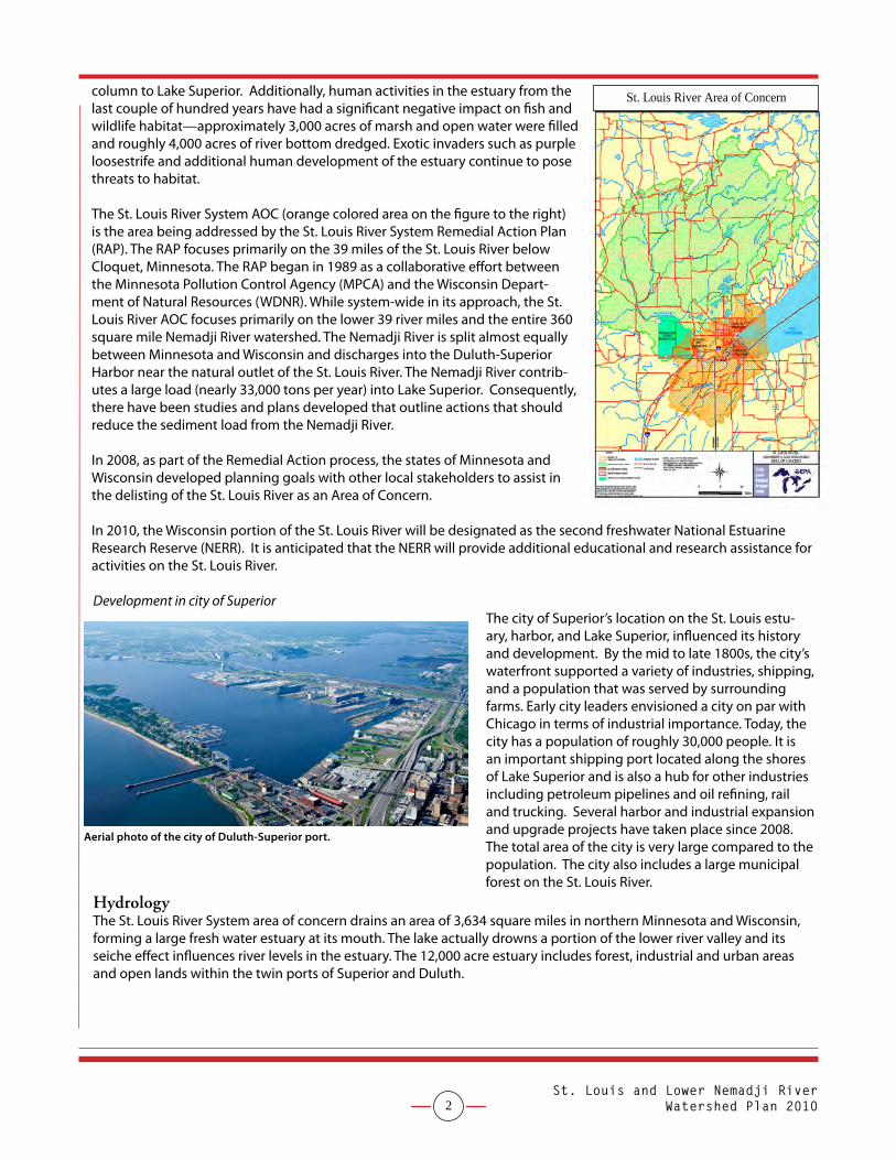
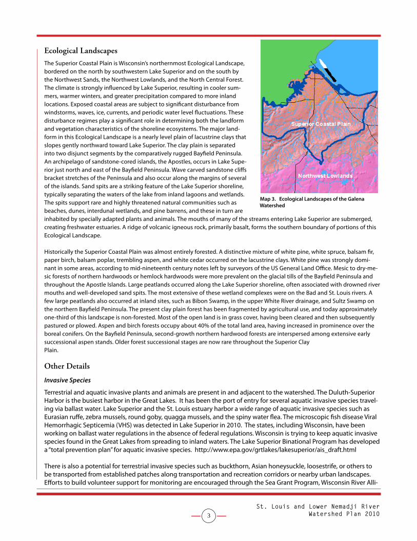
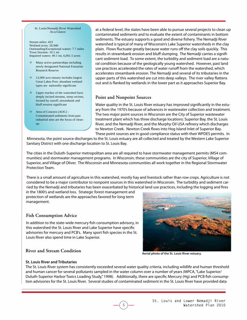
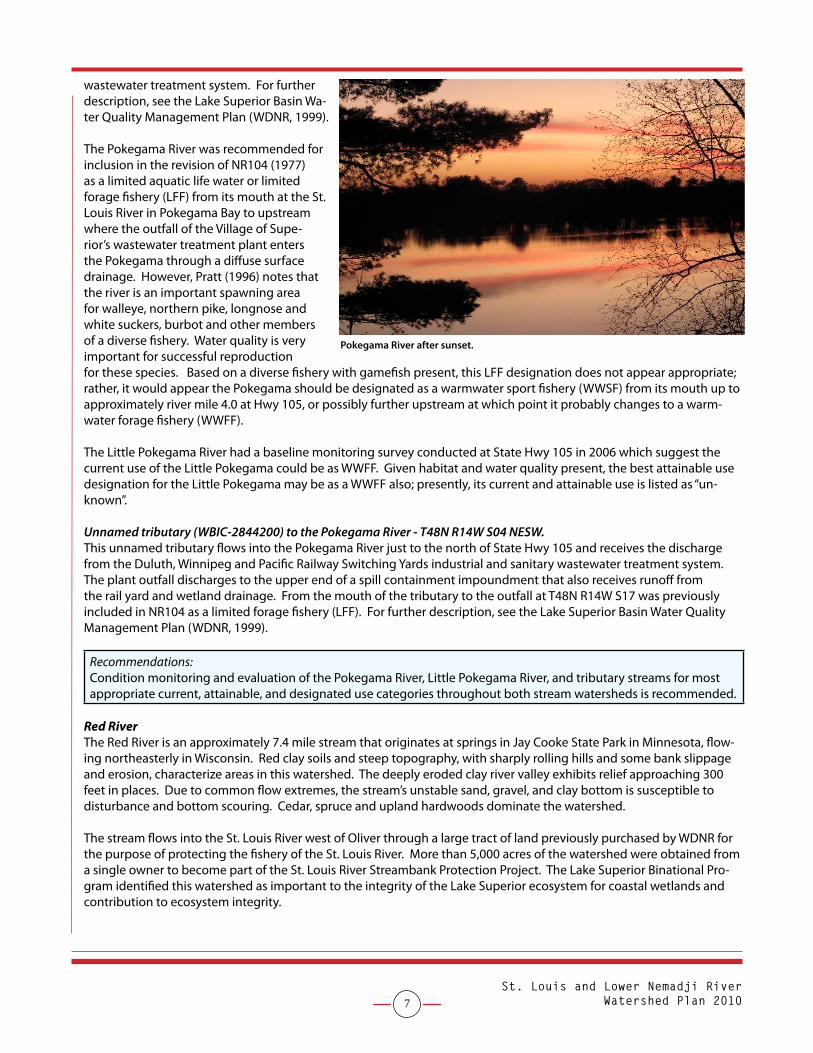
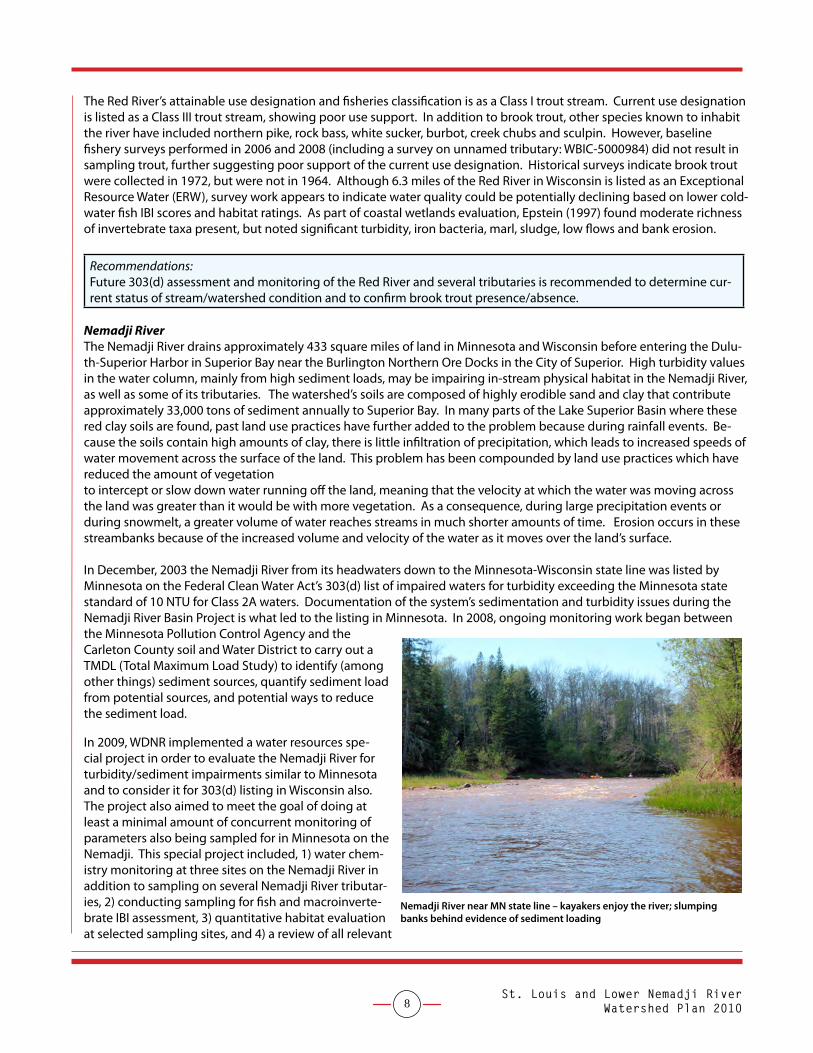
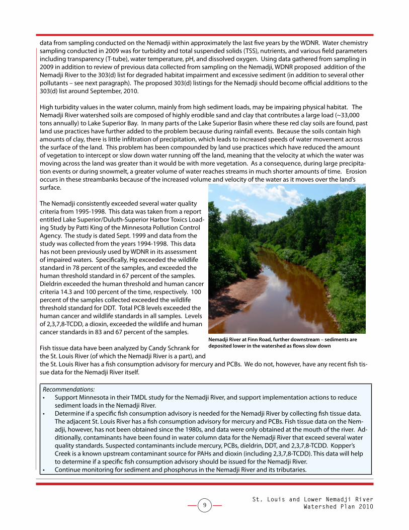
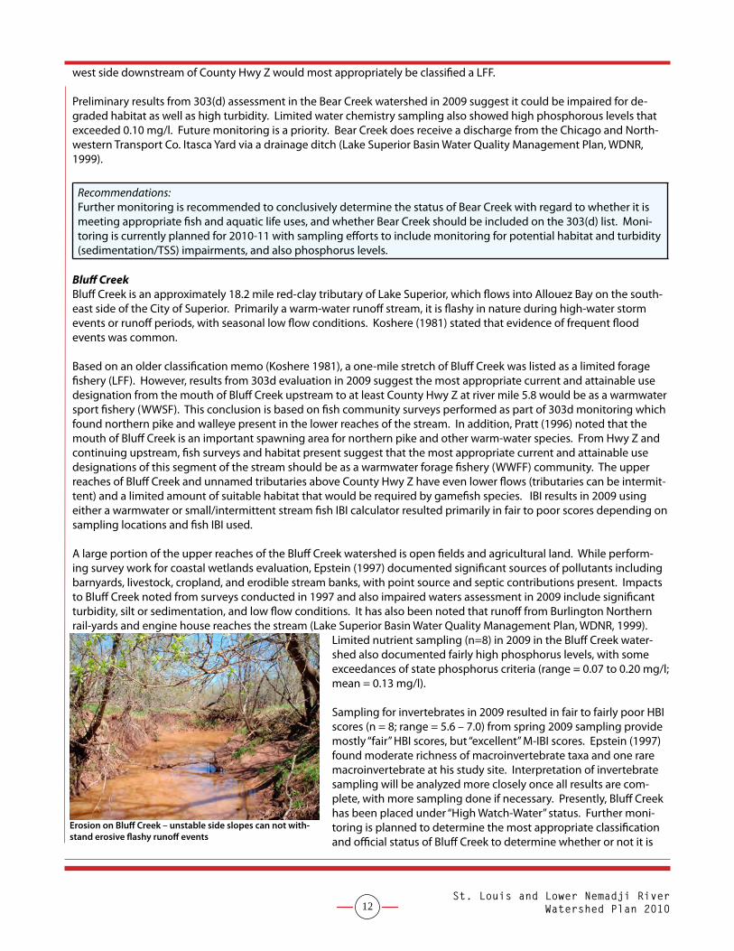
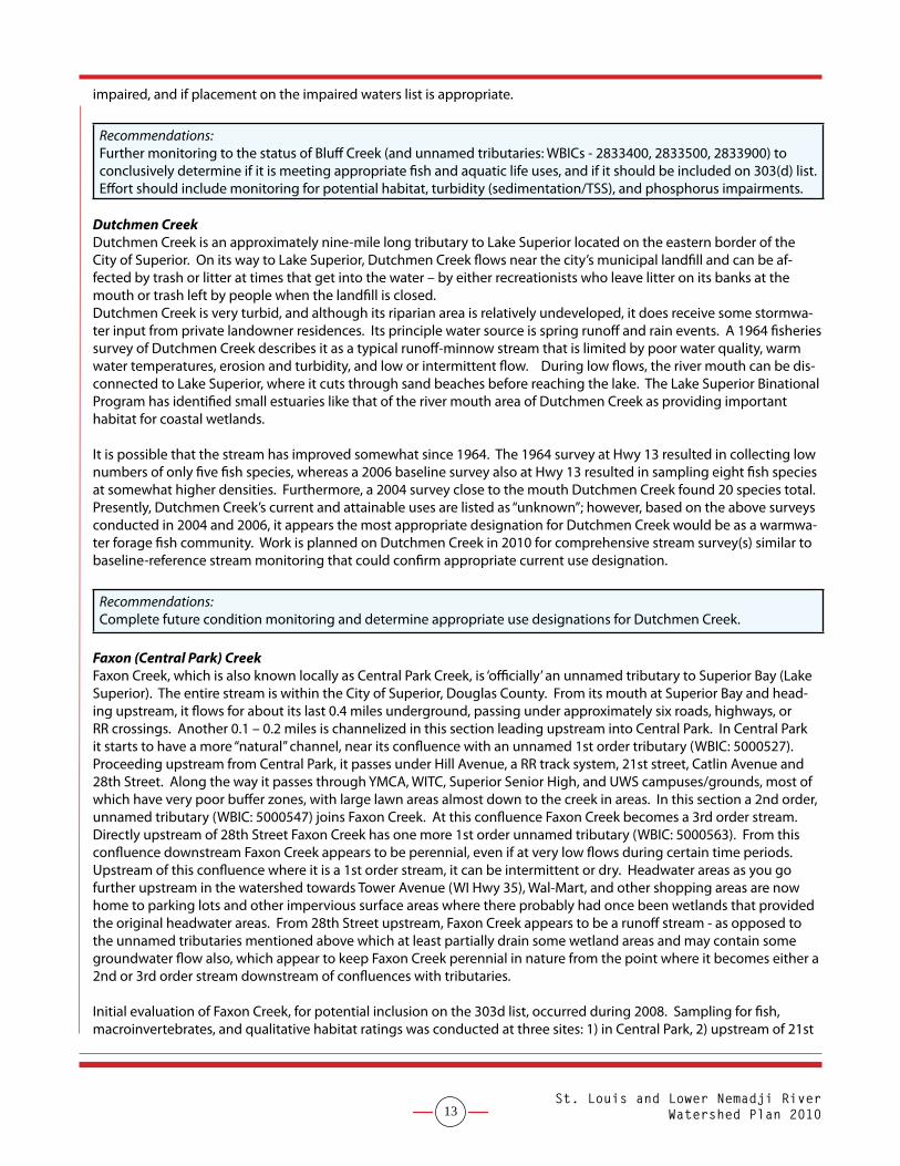
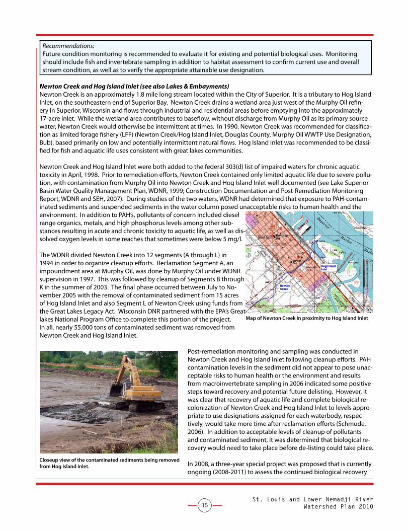
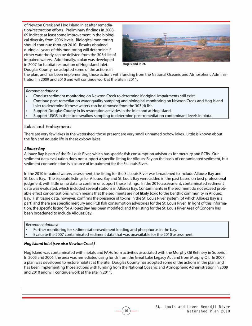
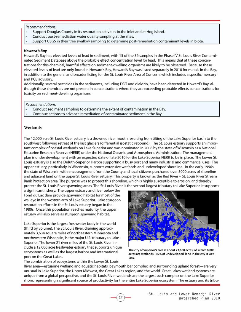
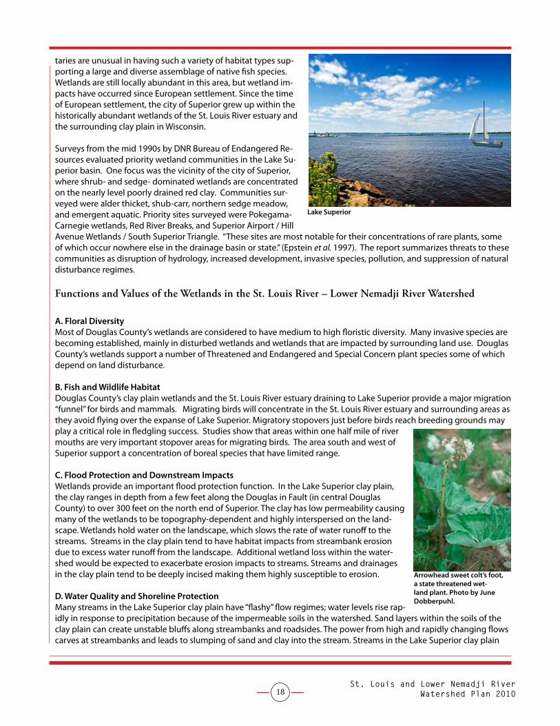
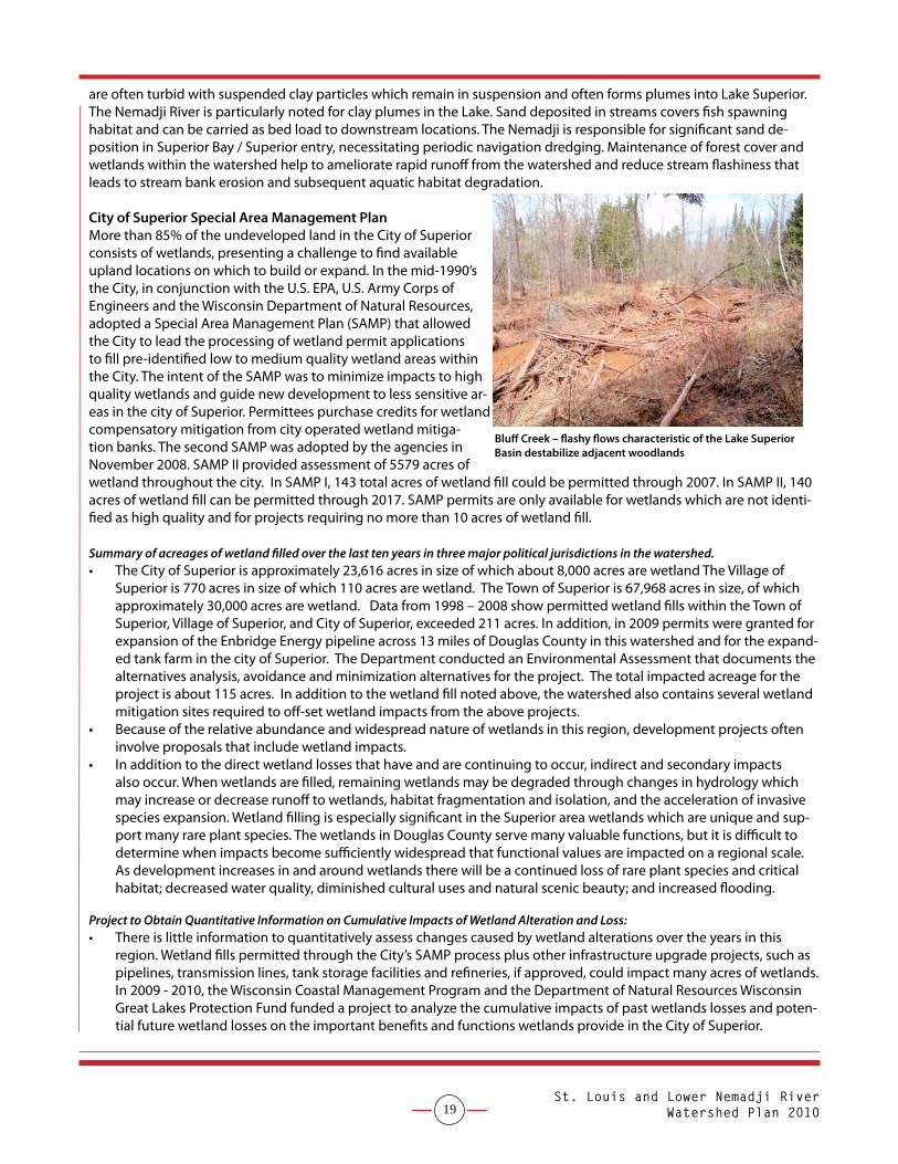
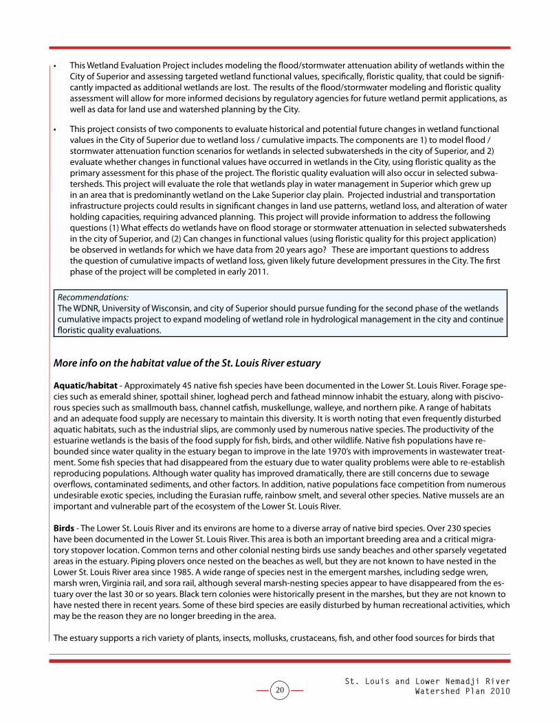
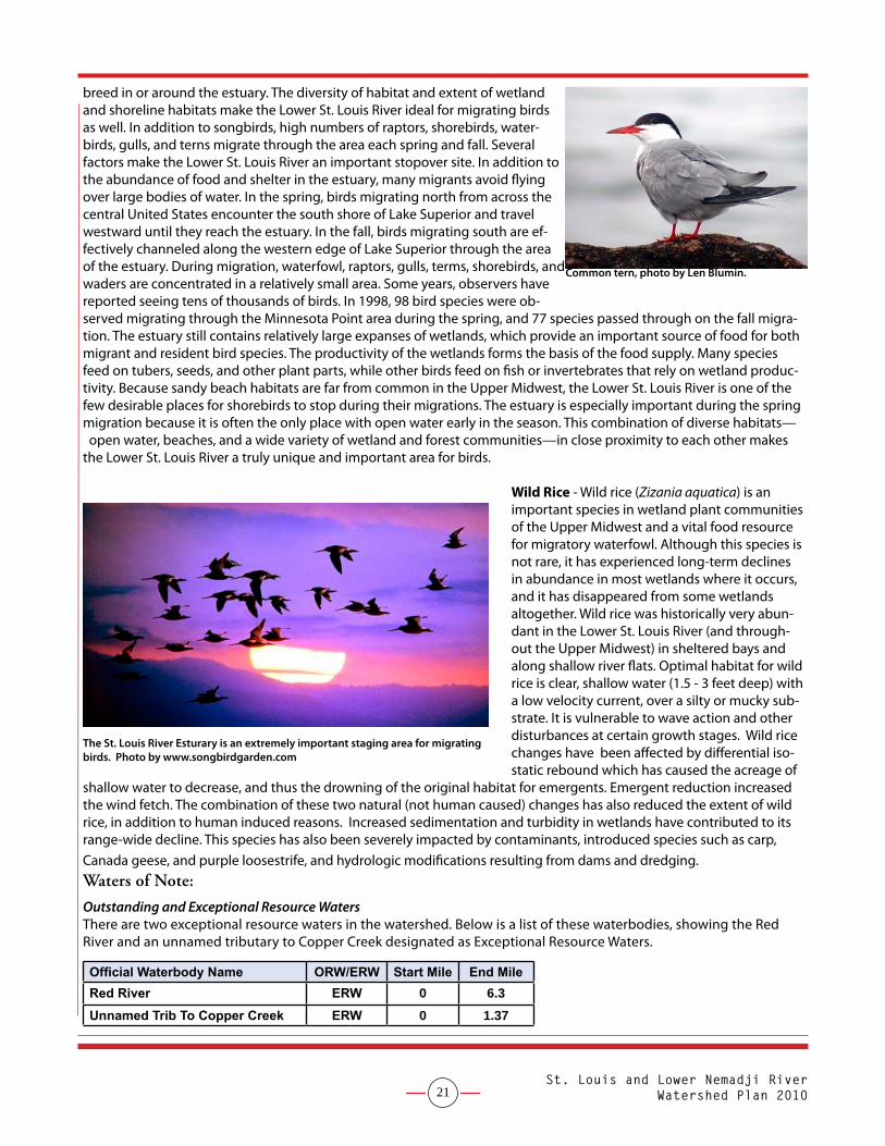
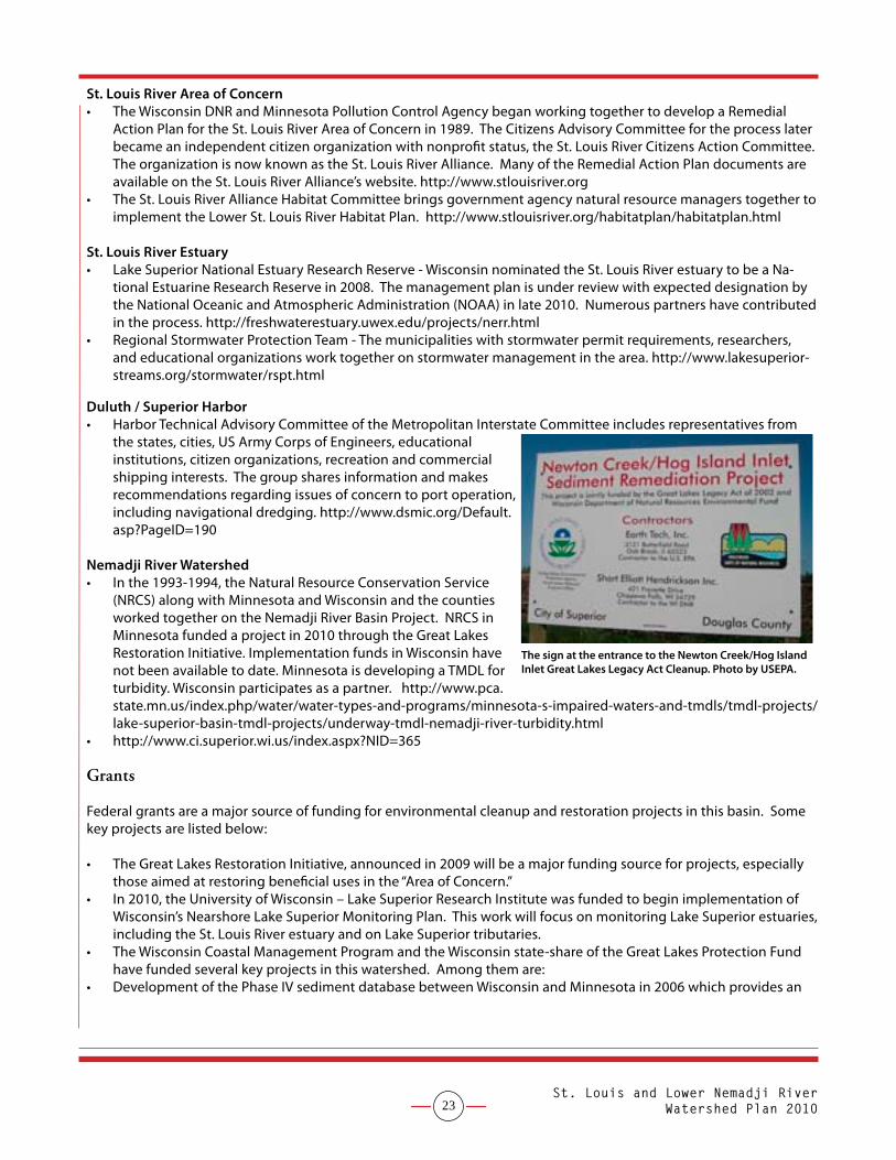
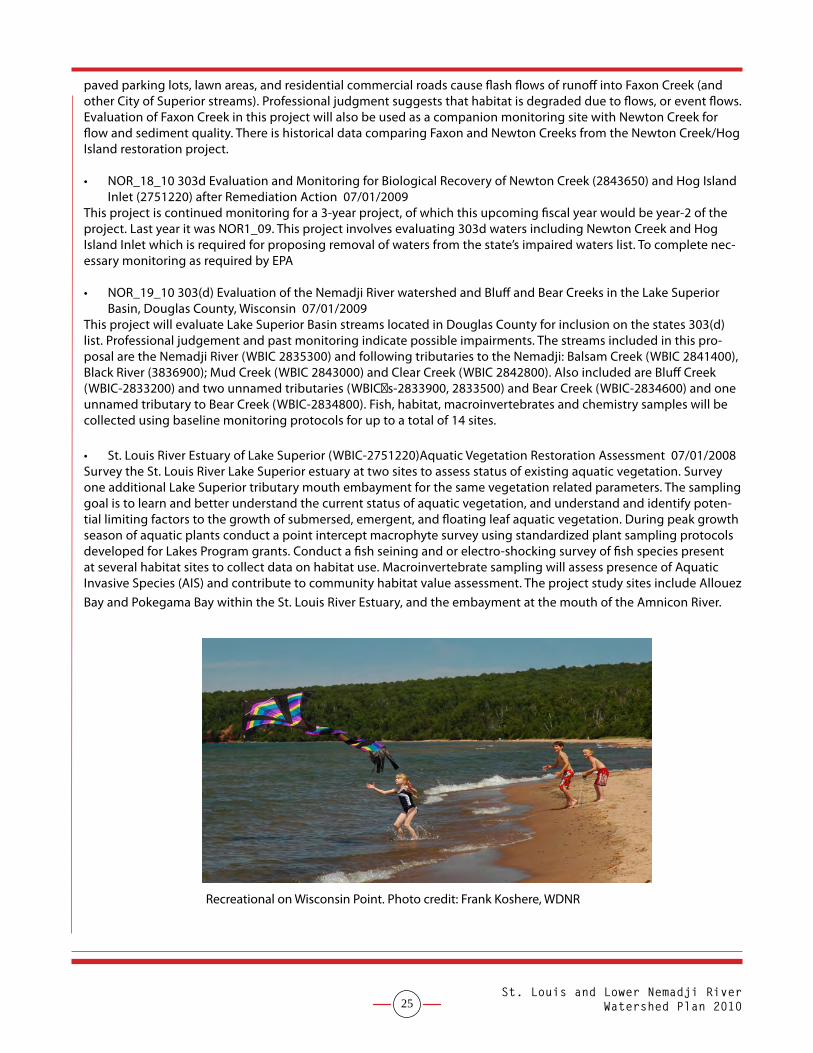
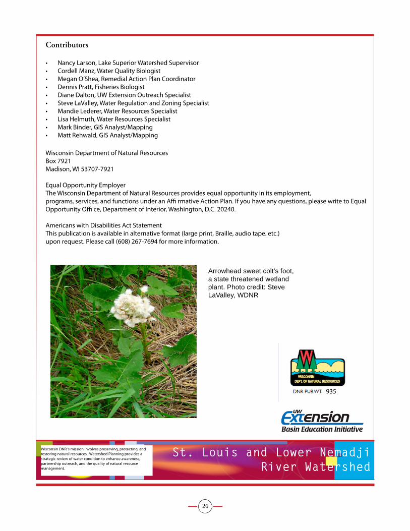