Embed Size (px)
Citation preview
Wind Resource Mapping in Vietnam
PHASE 2 IMPLEMENTATION PLAN SEPTEMBER 2015
Pub
lic D
iscl
osur
e A
utho
rized
Pub
lic D
iscl
osur
e A
utho
rized
Pub
lic D
iscl
osur
e A
utho
rized
Pub
lic D
iscl
osur
e A
utho
rized
This report was prepared by DTU Vindenergi, under contract to The World Bank.
It is one of several outputs from the wind Resource Mapping and Geospatial Planning Vietnam [Project ID: P145513]. This activity is funded and supported by the Energy Sector Management Assistance Program (ESMAP), a multi-donor trust fund administered by The World Bank, under a global initiative on Renewable Energy Resource Mapping. Further details on the initiative can be obtained from the ESMAP website. This document is an interim output from the above-mentioned project. Users are strongly advised to exercise caution when utilizing the information and data contained, as this has not been subject to full peer review. The final, validated, peer reviewed output from this project will be the Vietnam Wind Atlas, which will be published once the project is completed.
Copyright © 2015 International Bank for Reconstruction and Development / THE WORLD BANK Washington DC 20433 Telephone: +1-202-473-1000 Internet: www.worldbank.org
This work is a product of the consultants listed, and not of World Bank staff. The findings, interpretations, and conclusions expressed in this work do not necessarily reflect the views of The World Bank, its Board of Executive Directors, or the governments they represent.
The World Bank does not guarantee the accuracy of the data included in this work and accept no responsibility for any consequence of their use. The boundaries, colors, denominations, and other information shown on any map in this work do not imply any judgment on the part of The World Bank concerning the legal status of any territory or the endorsement or acceptance of such boundaries.
The material in this work is subject to copyright. Because The World Bank encourages dissemination of its knowledge, this work may be reproduced, in whole or in part, for non-commercial purposes as long as full attribution to this work is given. Any queries on rights and licenses, including subsidiary rights, should be addressed to World Bank Publications, The World Bank Group, 1818 H Street NW, Washington, DC 20433, USA; fax: +1-202-522-2625; e-mail: [email protected]. Furthermore, the ESMAP Program Manager would appreciate receiving a copy of the publication that uses this publication for its source sent in care of the address above, or to [email protected].
Renewable Energy Resource Mapping and Geospatial
Analysis: Wind- Vietnam
Phase 2 Implementation Plan
Project ID: P145513
Selection: #1172940
Công ty CP.TVXDĐ 3 1
CONTENT
Trang
1. INTRODUCTION .......................................................................................... 2
2. SITE SELECTION ......................................................................................... 3
2.1. Site selection criteria ........................................................................................ 4
2.2. Site selection process ....................................................................................... 4
3. DESIGN OF WIND MASTS AND CIVIL WORKS ................................... 12
4. PROPOSALS FOR SELECTION AND PROCUREMENT OF THE WIND
MEASUREMENT EQUIPMENT AND SUB-CONTRACTORS ............................ 13
5. PROCEDURE FOR OBTAINING PERMITS AND LOCAL PERMISSION
....................................................................................................................... 14
6. PROPOSED CAPACITY BUILDING AND TRAINING MEASURES FOR
LOCAL PARTNER(S) AND SUB-CONTRACTORS(S) ........................................ 14
Renewable Energy Resource Mapping and Geospatial
Analysis: Wind- Vietnam
Phase 2 Implementation Plan
Project ID: P145513
Selection: #1172940
Công ty CP.TVXDĐ 3 2
2
1. INTRODUCTION
The World Bank (WB) in partnership with the General Department of energy (GDE)
under the Ministry of Industry and Trade (MoIT) is implementing an activity titled
“Renewable Energy Resource Mapping and Geospatial Analysis:Vietnam”, which
includes assessment and mapping of wind resource. The objective of the activity,
which is funded by the Energy Sector Management Assisstance Program (ESMAP)
under their global initiative on Renewable Energy Resource Mapping, is to improve the
awareness of the government and the private sector of the resource potential of wind
and provide the government with a geospatial planning framework to guide
commercial investment in the sector. The initiative supports five phases of resource
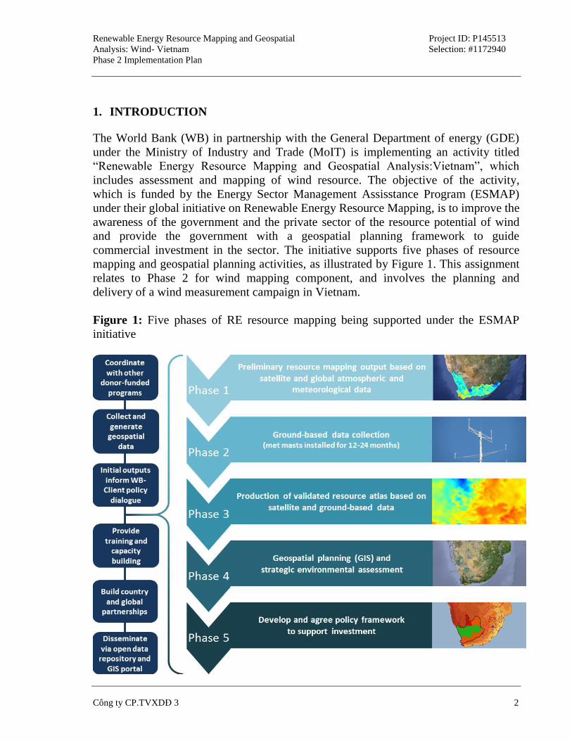
mapping and geospatial planning activities, as illustrated by Figure 1. This assignment
relates to Phase 2 for wind mapping component, and involves the planning and
delivery of a wind measurement campaign in Vietnam.
Figure 1: Five phases of RE resource mapping being supported under the ESMAP
initiative
Renewable Energy Resource Mapping and Geospatial
Analysis: Wind- Vietnam
Phase 2 Implementation Plan
Project ID: P145513
Selection: #1172940
Công ty CP.TVXDĐ 3 3
3
In Phase 1, the Denmark Technical University’s Wind Energy Department (DTU
Wind) delivered their interim outputs for the mesoscale wind modeling in June 2014.
DTU Wind recommended installing six additional wind masts in various locations, and
undertaking complementary LIDAR measurements to better understand the low-level
jets that may exist in several locations.
The objective of this project is to support the development of the Vietnam Wind Atlas
by planning and delivering a wind measurement campaign in Vietnam consisting of six
mast sites and one LIDAR unit over a period of 24 months at locations to be jointly
agreed with the WB and DTU Wind.
2. SITE SELECTION
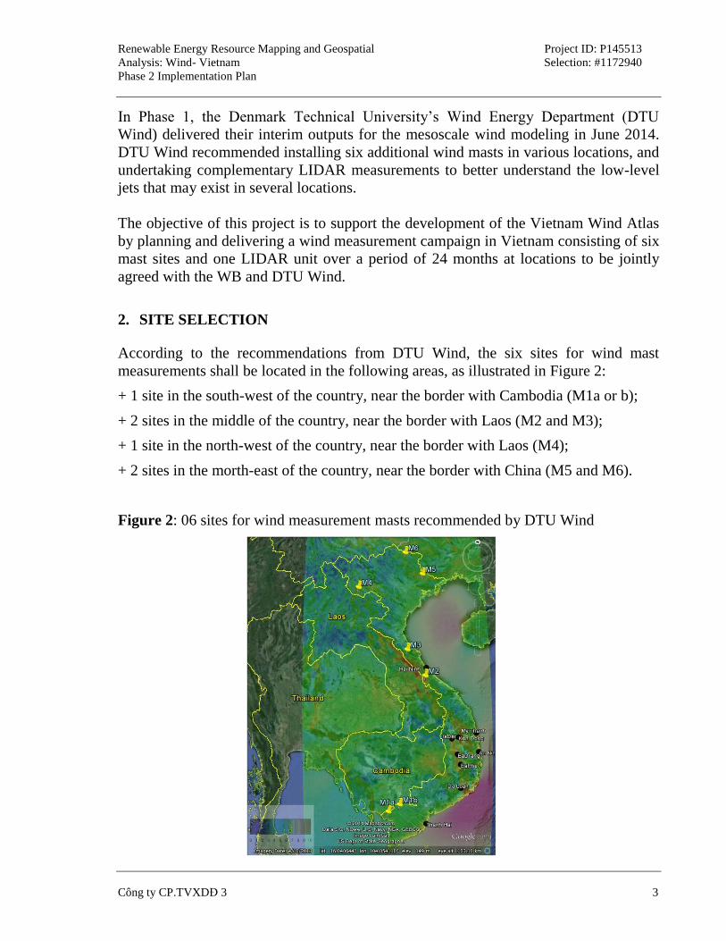
According to the recommendations from DTU Wind, the six sites for wind mast
measurements shall be located in the following areas, as illustrated in Figure 2:
+ 1 site in the south-west of the country, near the border with Cambodia (M1a or b);
+ 2 sites in the middle of the country, near the border with Laos (M2 and M3);
+ 1 site in the north-west of the country, near the border with Laos (M4);
+ 2 sites in the morth-east of the country, near the border with China (M5 and M6).
Figure 2: 06 sites for wind measurement masts recommended by DTU Wind
Renewable Energy Resource Mapping and Geospatial
Analysis: Wind- Vietnam
Phase 2 Implementation Plan
Project ID: P145513
Selection: #1172940
Công ty CP.TVXDĐ 3 4
4
PECC3 has conducted surveying 06 locations proposed to erect wind measurement
mast. General comments, except to locations M1 in the Mekong Delta region with the
terrain is relatively clear and simple, the remaining positions are located in hilly areas,
remote location, difficult terrain, difficult to access, sparsely population, that difficult
choice appropriate location.
2.1. Site selection criteria
The criteria used to select mast location as follows:
+ From 5 to 10 km distance to areas with complex terrain (ground slope greater than
30°);
+ Far 5-7km away from the coast;
+ Relatively homogeneous area of roughness;
+ Near residential areas to ensure security;
+ The area near roads to ensure the transportation of materials, construction equipment;
+ Contains phone signal is relatively good;
+ The land is relatively wide enough to lay mast foundation and the anchor
foundations;
+ Agricultural land, private ownership to easily negotiate the lease with reasonable
costs.
In addition, in case of M2 and M3 positions, we also have to select the location for
LIDAR equipment installation with the following additional criteria:
+ Next to the houses, with people often present in the house and agreed to lease land
and protection equipment;
+ Distance related to the wind measurement mast is not greater than 100m.
2.2. Site selection process
Given the above selection criteria, the site selection process has been designed as
consisting of 3 sequential steps as follows:
Step 1: Gather information about current traffic conditions, access capability to the
proposed location, planned some appropriate position with the selection criteria.
This step is done in the office, using supported tools like Google Map, Google Earth;
Step 2: Schedule field trip. Based on information about weather forecasts, information
on the types of vehicles available and their schedules, plan field trips suitable and
Renewable Energy Resource Mapping and Geospatial
Analysis: Wind- Vietnam
Phase 2 Implementation Plan
Project ID: P145513
Selection: #1172940
Công ty CP.TVXDĐ 3 5
5
effective. The information is accessible from the internet and telephone exchange.
Step 3: Carry out site visit to candidate sites, gather appropriate data. As the above
steps are essentially desk study. An actual site visit would help gather actual and
reliable data, which again could refine the evaluation.
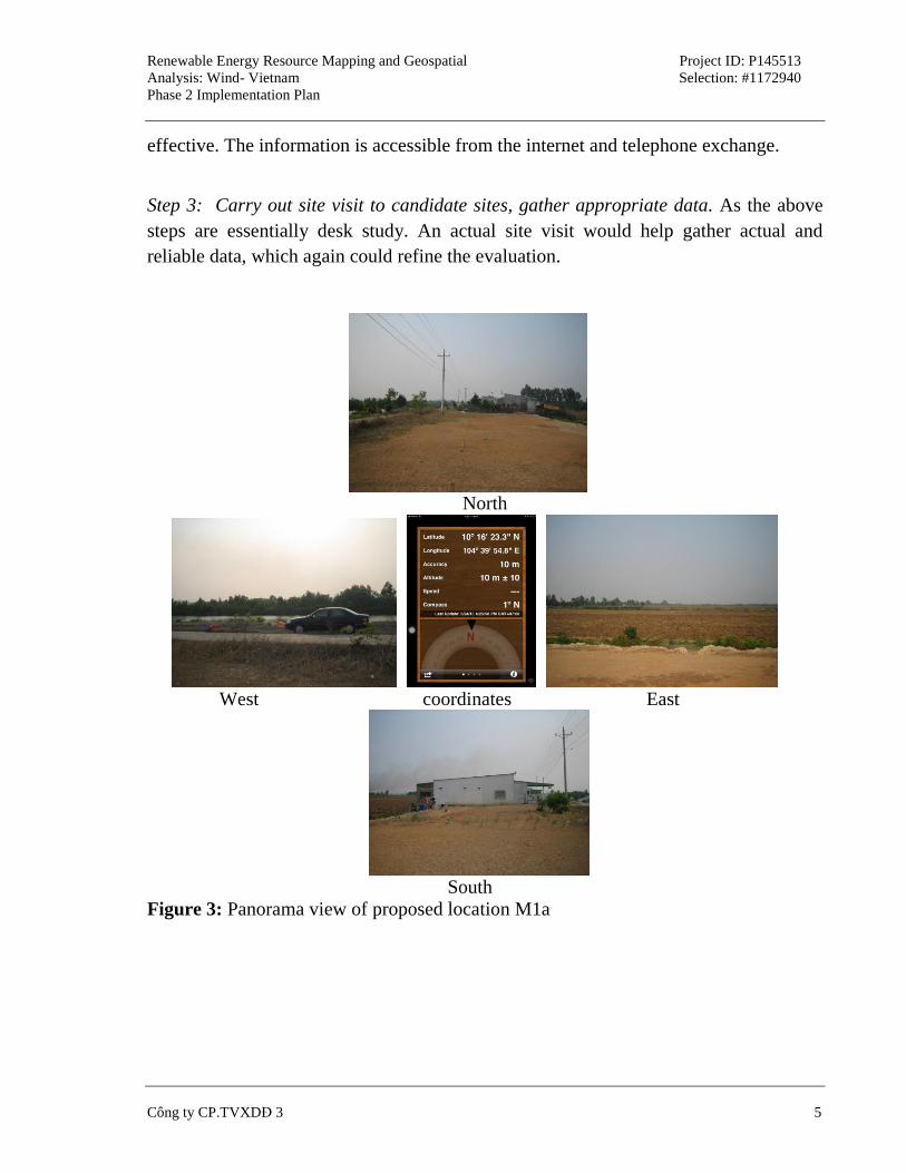
North
West coordinates East
South
Figure 3: Panorama view of proposed location M1a
Renewable Energy Resource Mapping and Geospatial
Analysis: Wind- Vietnam
Phase 2 Implementation Plan
Project ID: P145513
Selection: #1172940
Công ty CP.TVXDĐ 3 6
6
North
West coordinates East
South
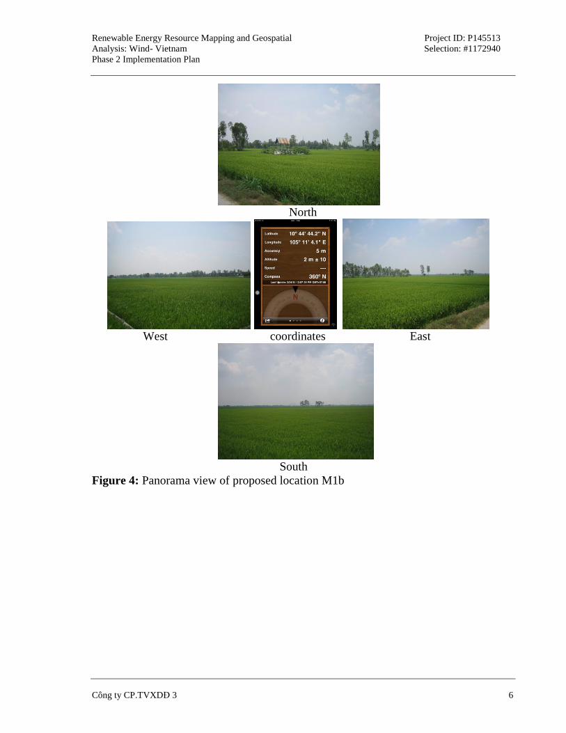
Figure 4: Panorama view of proposed location M1b
Renewable Energy Resource Mapping and Geospatial
Analysis: Wind- Vietnam
Phase 2 Implementation Plan
Project ID: P145513
Selection: #1172940
Công ty CP.TVXDĐ 3 7
7
North
West coordinates East
South
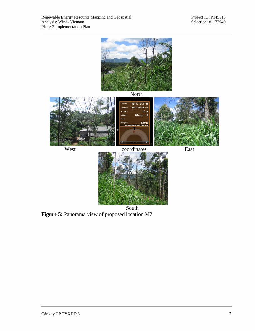
Figure 5: Panorama view of proposed location M2
Renewable Energy Resource Mapping and Geospatial
Analysis: Wind- Vietnam
Phase 2 Implementation Plan
Project ID: P145513
Selection: #1172940
Công ty CP.TVXDĐ 3 8
8
North
West coordinates East
South
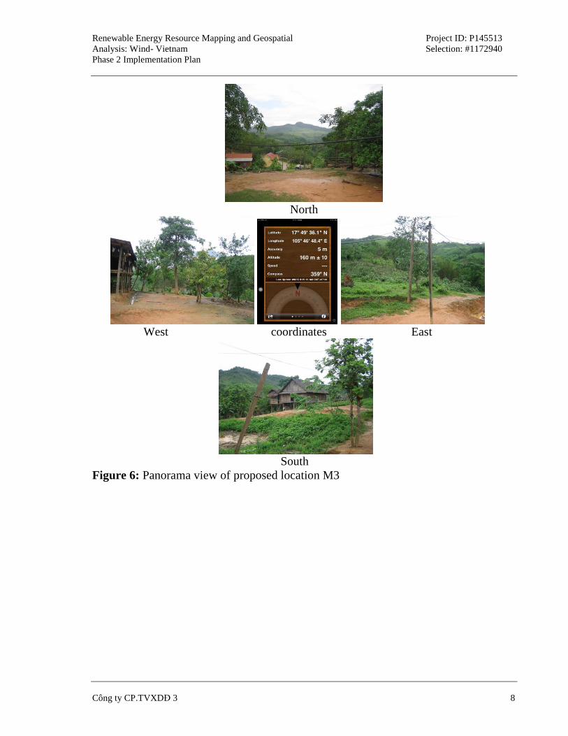
Figure 6: Panorama view of proposed location M3
Renewable Energy Resource Mapping and Geospatial
Analysis: Wind- Vietnam
Phase 2 Implementation Plan
Project ID: P145513
Selection: #1172940
Công ty CP.TVXDĐ 3 9
9
North
West coordinates East
South
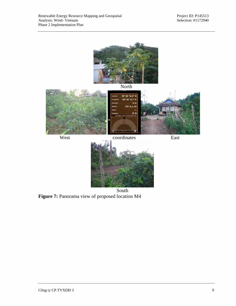
Figure 7: Panorama view of proposed location M4
Renewable Energy Resource Mapping and Geospatial
Analysis: Wind- Vietnam
Phase 2 Implementation Plan
Project ID: P145513
Selection: #1172940
Công ty CP.TVXDĐ 3 10
10
North
West coordinates East
South
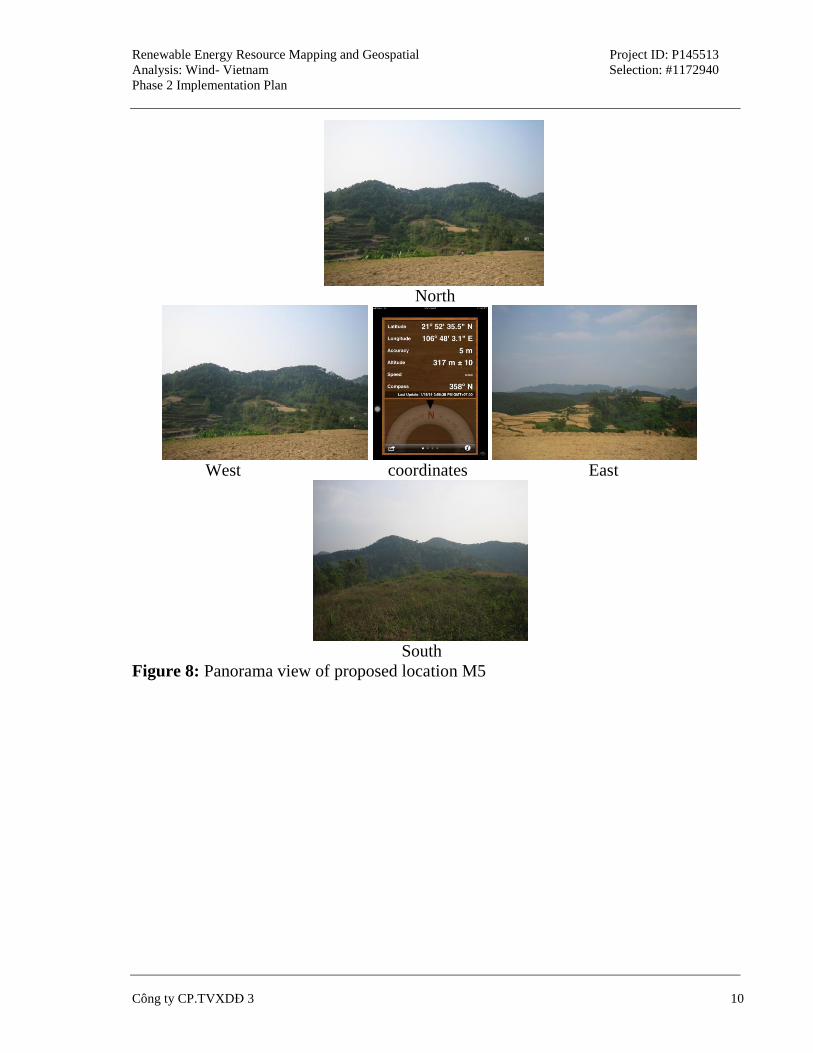
Figure 8: Panorama view of proposed location M5
Renewable Energy Resource Mapping and Geospatial
Analysis: Wind- Vietnam
Phase 2 Implementation Plan
Project ID: P145513
Selection: #1172940
Công ty CP.TVXDĐ 3 11
11
North
West coordinates East
South
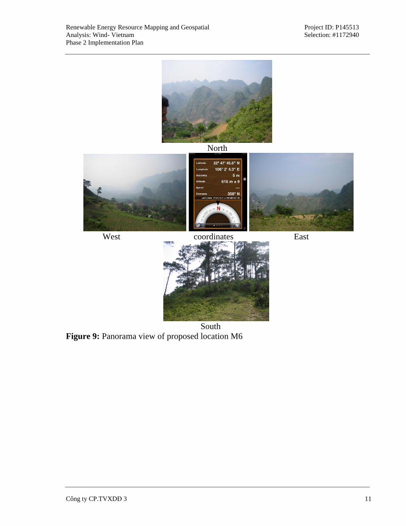
Figure 9: Panorama view of proposed location M6
Renewable Energy Resource Mapping and Geospatial
Analysis: Wind- Vietnam
Phase 2 Implementation Plan
Project ID: P145513
Selection: #1172940
Công ty CP.TVXDĐ 3 12
12
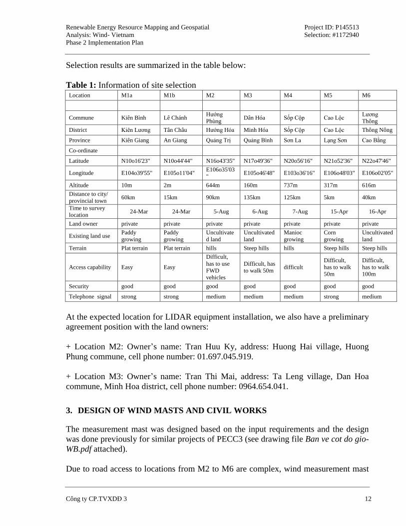
Selection results are summarized in the table below:
Table 1: Information of site selection Location M1a M1b M2 M3 M4 M5 M6
Commune Kiên Bình Lê Chánh Hướng
Phùng Dân Hóa Sốp Cộp Cao Lộc
Lương
Thông
District Kiên Lương Tân Châu Hướng Hóa Minh Hóa Sốp Cộp Cao Lộc Thông Nông
Province Kiên Giang An Giang Quảng Trị Quảng Bình Sơn La Lạng Sơn Cao Bằng
Co-ordinate
Latitude N10o16'23" N10o44'44" N16o43'35" N17o49'36" N20o56'16" N21o52'36" N22o47'46"
Longitude E104o39'55" E105o11'04" E106o35'03
" E105o46'48" E103o36'16" E106o48'03" E106o02'05"
Altitude 10m 2m 644m 160m 737m 317m 616m
Distance to city/
provincial town 60km 15km 90km 135km 125km 5km 40km
Time to survey
location 24-Mar 24-Mar 5-Aug 6-Aug 7-Aug 15-Apr 16-Apr
Land owner private private private private private private private
Existing land use Paddy
growing
Paddy
growing
Uncultivate
d land
Uncultivated
land
Manioc
growing
Corn
growing
Uncultivated
land
Terrain Plat terrain Plat terrain hills Steep hills hills Steep hills Steep hills
Access capability Easy Easy
Difficult,
has to use
FWD
vehicles
Difficult, has
to walk 50m difficult
Difficult,
has to walk
50m
Difficult,
has to walk
100m
Security good good good good good good good
Telephone signal strong strong medium medium medium strong medium
At the expected location for LIDAR equipment installation, we also have a preliminary
agreement position with the land owners:
+ Location M2: Owner’s name: Tran Huu Ky, address: Huong Hai village, Huong
Phung commune, cell phone number: 01.697.045.919.
+ Location M3: Owner’s name: Tran Thi Mai, address: Ta Leng village, Dan Hoa
commune, Minh Hoa district, cell phone number: 0964.654.041.
3. DESIGN OF WIND MASTS AND CIVIL WORKS
The measurement mast was designed based on the input requirements and the design
was done previously for similar projects of PECC3 (see drawing file Ban ve cot do gio-
WB.pdf attached).
Due to road access to locations from M2 to M6 are complex, wind measurement mast
Renewable Energy Resource Mapping and Geospatial
Analysis: Wind- Vietnam
Phase 2 Implementation Plan
Project ID: P145513
Selection: #1172940
Công ty CP.TVXDĐ 3 13
13
will use the sections 3m to erect, for M1 position, may use 6m-sections to save time
and cost.
4. PROPOSALS FOR SELECTION AND PROCUREMENT OF THE WIND
MEASUREMENT EQUIPMENT AND SUB-CONTRACTORS
+ Choosing construction contractor(s):
Due to work requires experienced contractors, done in a short time, we propose to
select contractors according Sample_RFQ_for_national_shopping similar the
procedure was done for Wind Resource Assessment Project (performing 2008, also
financed by the WB). Bidding documents include:
- Request for quotation;
- Technical requirement;
- Technical drawings of wind mast.
(See draft attachments).
A list of the construction contractors will be selected to send invitations by PECC3 (at
least 03 contractors).
+ Procurement of equipment:
In recent years, over 50 wind measurement masts were erected in Vietnam, most of the
sensors are from 02 suppliers/ producers is: NRG (USA) and Ammonit (Germany).
Wind Resource Assessment Project Project has also used the sensors of NRG. The
project's 10 wind measurement mast of GIZ (Germany) chose Ammonit sensors.
Expert of PECC3 also has extensive experience in the installation, operation and
troubleshooting of the measuring equipment of 2 this suppliers. Recently, PECC3 sent
a letter proposed a full set of equipment bids for wind measurement campaign this
time. The companies also sent quotation feedback (see the attached file
equipment_offer ...). Preliminary quotation results for the 06 sets of measuring
equipment, do not take into account the backup, as follows:
- The NRG: 1,818,432,000 VND, which is the cost delivery to the headquarter
of PECC3 because the company has the exclusive agent in Vietnam;
- The Ammonit: having to 02 options: (1) Good offer: 78,485.59 Euro; (2)
Renewable Energy Resource Mapping and Geospatial
Analysis: Wind- Vietnam
Phase 2 Implementation Plan
Project ID: P145513
Selection: #1172940
Công ty CP.TVXDĐ 3 14
14
Luxury offer: 86.730 Euro. This offer quotation includes shipping costs to
Vietnam. However, to ship to the headquarter of PECC3, have incurred
expenses include: (1) import duty of 5% of shipments; (2) 10% VAT; customs
fees, service and transportation from the airport to about 2%.
Thus, if we compare the cost of procurement to headquarter of the clients, applicable
exchange rates 24,000 VND/Euro, the more expensive price Ammonit equipment from
22% (in case of selecting Good offer) to 35% (in case of selecting the Luxury offer).
Recommend to select the NRG’s equipment for this campaign because of lower costs.
Procurement contracts may be signed directly between PECC3 and NRG or between
contruction contractor and NRG (i.e. construction contractor is a general contractor for
construction and procurement, the Request for Quotation was drafted according to this
plan).
5. PROCEDURE FOR OBTAINING PERMITS AND LOCAL PERMISSION
Following to the Construction Law, the wind measurement mast works exempt from
construction permits (works under construction investment projects are decided
investment by Ministers, heads of ministerial-level agencies, the presidents of the
people at all levels; temporary works; technical infratructure works in the rural areas,
..).
In preparation for the construction, the GDE will notify the relevant local authorities
(commune, district and province) of wind measurement program and offered assistance
when needed. PECC3 will draft the written form and sent to the WB to request the
GDE for issueing.
During the construction phase, the construction contractor will liaise with local
authorities to introduce and recommend support, help complete the work if necessary.
In addition, PECC3 and construction contractor coordinated choose exactly location to
place wind measurement mast, negotiating land lease and security contract with the
land owners or local authorities.
6. PROPOSED CAPACITY BUILDING AND TRAINING MEASURES FOR
LOCAL PARTNER(S) AND SUB-CONTRACTORS(S)
+ Improve capacity for local consultants:
During this time of the wind measurement campaign, have used a new device to the
Vietnam market, LIDAR equipment. The instructions for proper installation, operation
Renewable Energy Resource Mapping and Geospatial
Analysis: Wind- Vietnam
Phase 2 Implementation Plan
Project ID: P145513
Selection: #1172940
Công ty CP.TVXDĐ 3 15
15
and maintenance is essential. The guide is definitely foreign experts (possibly an expert
from the DTU Wind), and to work effectively guide and replication capabilities in the
future, should hold a minimum participants enrollment (about 06 people).
The venue may be at PECC3’s headquarter or in the field (location M2) if possible.
Time organization: even after the device is transferred to Vietnam and assembly
locations in M2 was ready.
+ Training installing equipment to subcontractors:
In the case of the construction contractor is unfamiliar with measurement equipment,
PECC3 will organize to guide on site for employees of contractors. The installation of
equipment on each mast will be monitored continuously by specialists of PECC3.
When completed the installation, specialist of PECC3 will complate the installation
reports with the assistance of installation personnel.


![Biomass Resource Mapping in Vietnam - World Bankpubdocs.worldbank.org/en/614621471599383264/Vietnam-Biomass.… · Renewable Energy Resource Mapping: Biomass [Phases 1-3] - Vietnam](https://img.pdfslide.us/doc/110x75/5fbf87f5067094074e1e6152/biomass-resource-mapping-in-vietnam-world-renewable-energy-resource-mapping-biomass.jpg)

![Biomass Resource Mapping in Vietnam - World Bankpubdocs.worldbank.org/en/392111471599393578/Vietnam... · Page 3 RENEWABLE ENERGY RESOURCE MAPPING: BIOMASS [PHASES 1-3] - VIETNAM](https://img.pdfslide.us/doc/110x75/5f47e004ae255d69cd310b9d/biomass-resource-mapping-in-vietnam-world-page-3-renewable-energy-resource-mapping.jpg)