Embed Size (px)
Citation preview

William A. McEllhiney Distinguished Lecturer Series
Well Technology
William A. McEllhiney Distinguished Lecturer Series
Well TechnologyMade possible by a grant from Franklin Electric Company to the National Ground Water Research and Educational Foundation
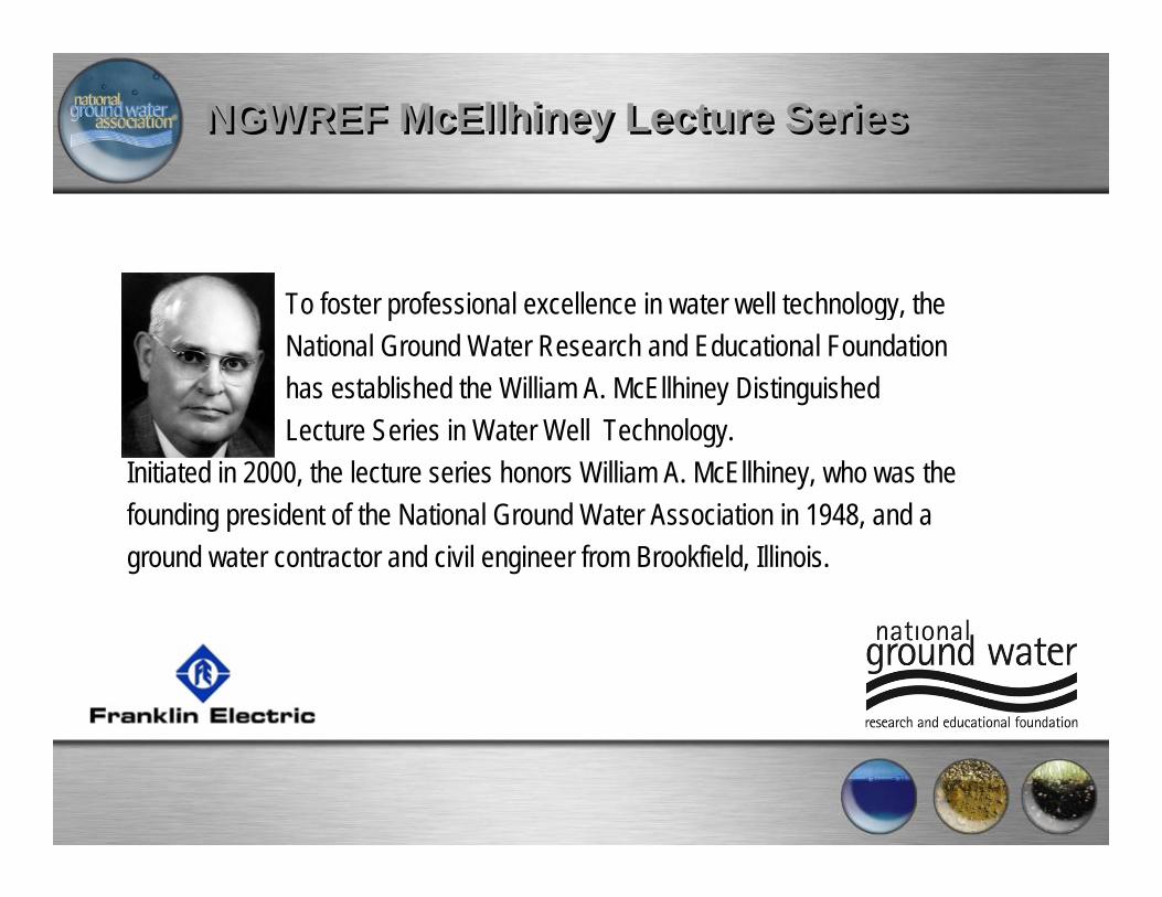
NGWREF McEllhiney Lecture SeriesNGWREF McEllhiney Lecture Series
To foster professional excellence in water well technology, the National Ground Water Research and Educational Foundation has established the William A. McEllhiney Distinguished Lecture Series in Water Well Technology.
Initiated in 2000, the lecture series honors William A. McEllhiney, who was the founding president of the National Ground Water Association in 1948, and a ground water contractor and civil engineer from Brookfield, Illinois.
NGWREF McEllhiney Lecture SeriesNGWREF McEllhiney Lecture Series
"McEllhiney and the other founders of the Association saw several primary functions for the new national group," explains Foundation Executive Director Kevin McCray, "including serving as a clearinghouse for information and its dissemination, serving as an intermediary in coordinating advances occurring in different parts of the country, and serving as a place to bring contractors together so that they might have a working knowledge of contracting from all parts of the nation. NGWREF's McEllhiney Lecture series promotes and perpetuates those original aims."
NGWREF McEllhiney Lecture SeriesNGWREF McEllhiney Lecture Series
Annually, a panel of ground water contractors invites an outstanding ground water contracting professional to share his or her work with the industry. Individuals may nominate themselves or others they believe to be qualified to serve as the NGWA McEllhiney distinguished lecturer.
NGWREF McEllhiney Lecture SeriesNGWREF McEllhiney Lecture Series
Effective May 2005, Franklin Electric Co., the world's largest manufacturer of submersible electric motors, has agreed to underwrite the next three years of this lecture series for presentations to organized groups of contractors and other qualified and interested parties. Meetings and conventions of state and regional associations are eligible. Foreign associations of ground water contractors, academic institutions teaching water well technology, gatherings of water well regulators, and other bodies with a direct and identifiable interest in water well design and construction are eligible as well.

NGWREF McEllhiney Lecture SeriesNGWREF McEllhiney Lecture Series
2009 Lecturer
W. Richard Laton, Ph.D., PGAssociate Professor of HydrogeologyCalifornia State University, FullertonDepartment of Geological Sciences

NGWREF McEllhiney Lecture SeriesNGWREF McEllhiney Lecture Series
Boring Logs—What’s Important and What’s Not: A Scientific Viewpoint
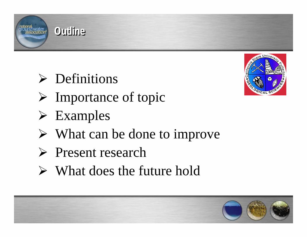
DefinitionsImportance of topicExamplesWhat can be done to improvePresent researchWhat does the future hold
OutlineOutline
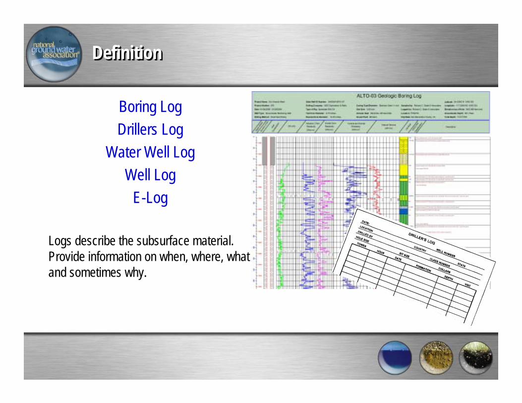
DefinitionDefinition
Boring LogDrillers Log
Water Well LogWell Log
E-Log
Logs describe the subsurface material. Provide information on when, where, what and sometimes why.
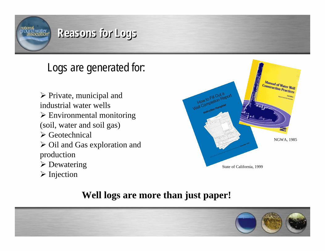
Reasons for LogsReasons for Logs
Logs are generated for:
Private, municipal and industrial water wells
Environmental monitoring (soil, water and soil gas)
GeotechnicalOil and Gas exploration and
productionDewateringInjection
State of California, 1999
NGWA, 1985
Well logs are more than just paper!
Definition – Traditional InformationDefinition – Traditional Information

ImportanceImportance
Why should anybody care!
You only get one chance to collect the data.
Data will outlive the well/boring.
Future decisions will be based on this data.
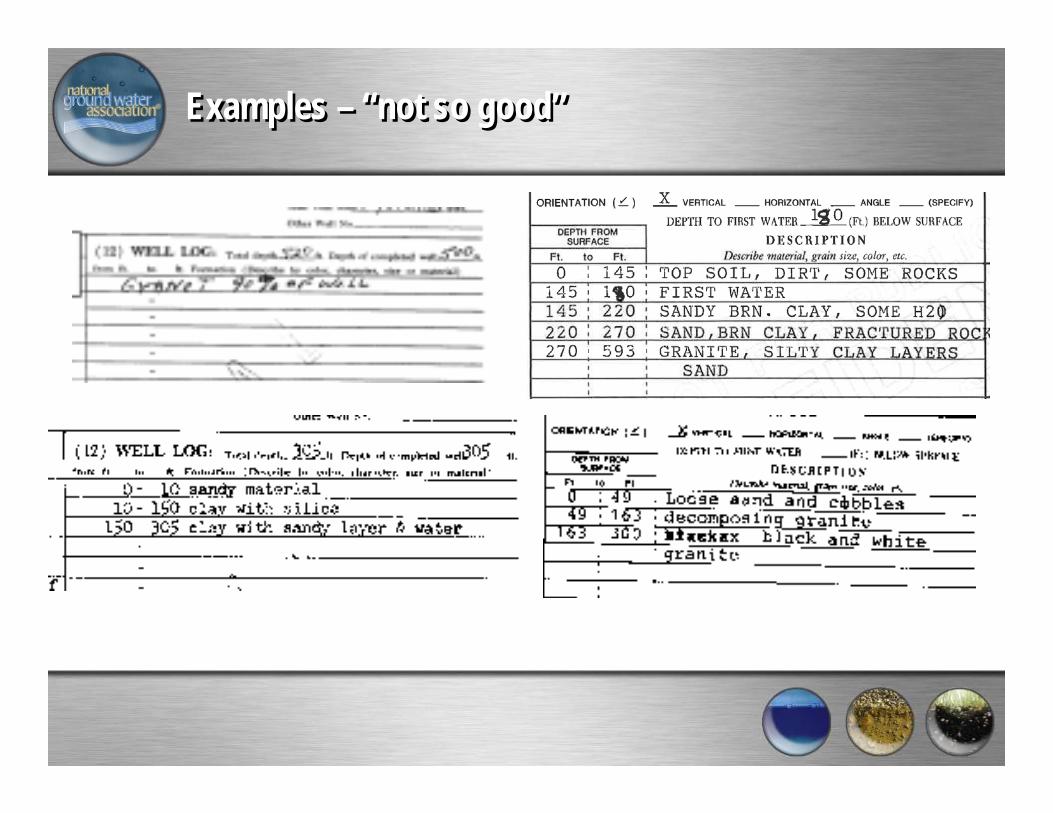
Examples – “not so good”Examples – “not so good”
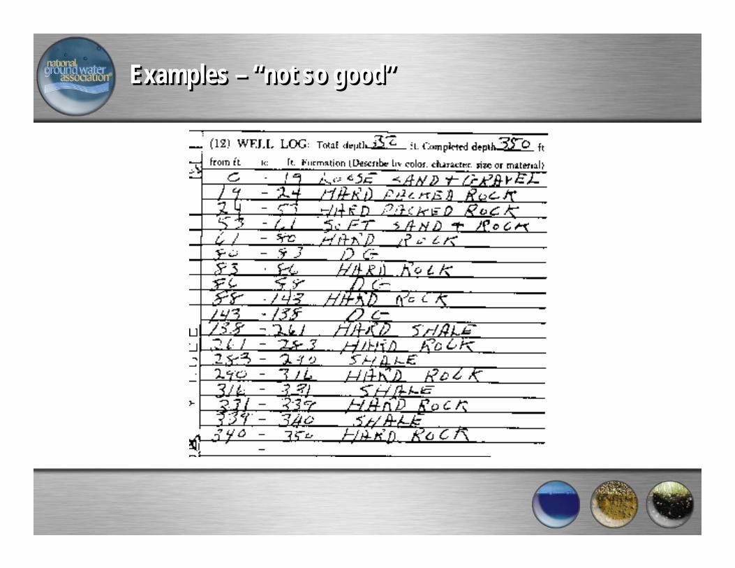
Examples – “not so good”Examples – “not so good”

Examples – “Better to Good”Examples – “Better to Good”
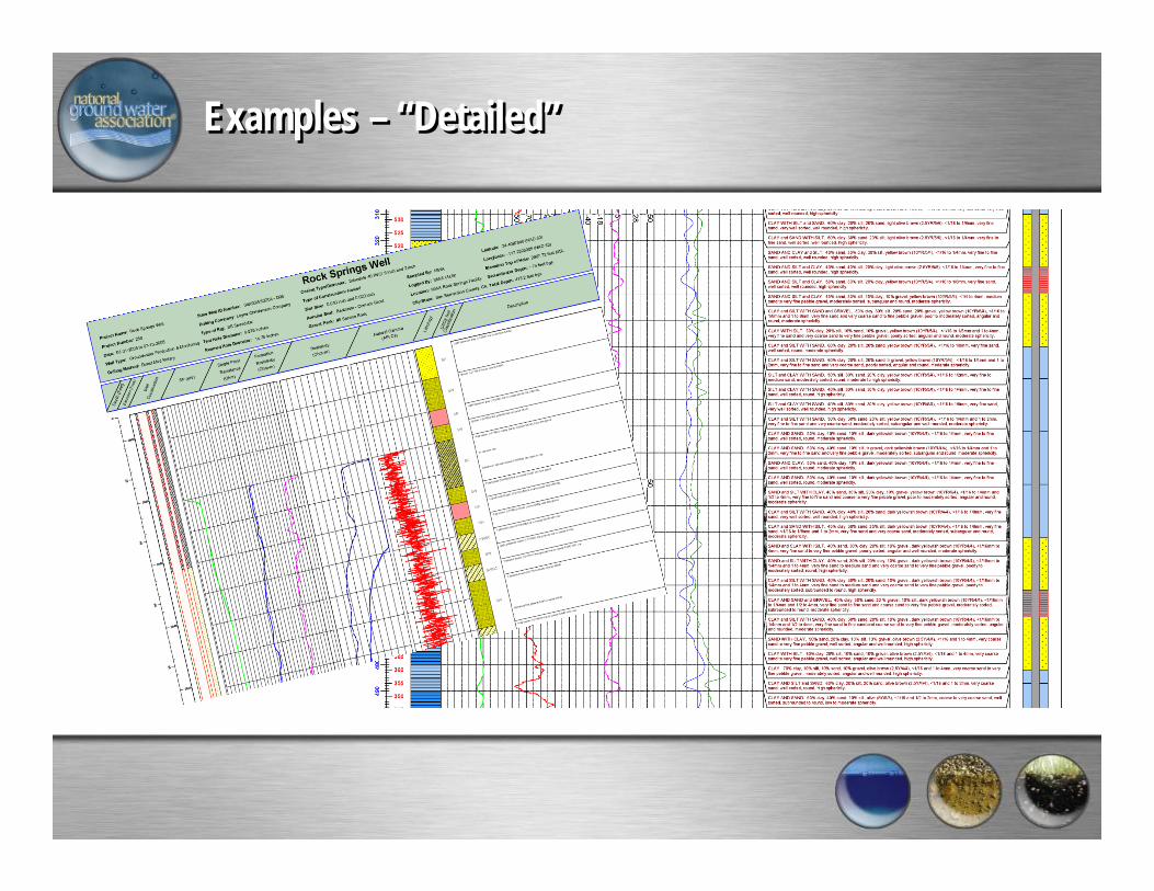
Examples – “Detailed”Examples – “Detailed”

Software for LogsSoftware for Logs
•LogPlot by Rockware•Excel by Microsoft•Borehole Mapper by MapInfo•Strater by Scientific Software•gInt by gInt Software•Target by GeoSoft•Petra by INH
Great software does not substitute for detailed notes in the field!
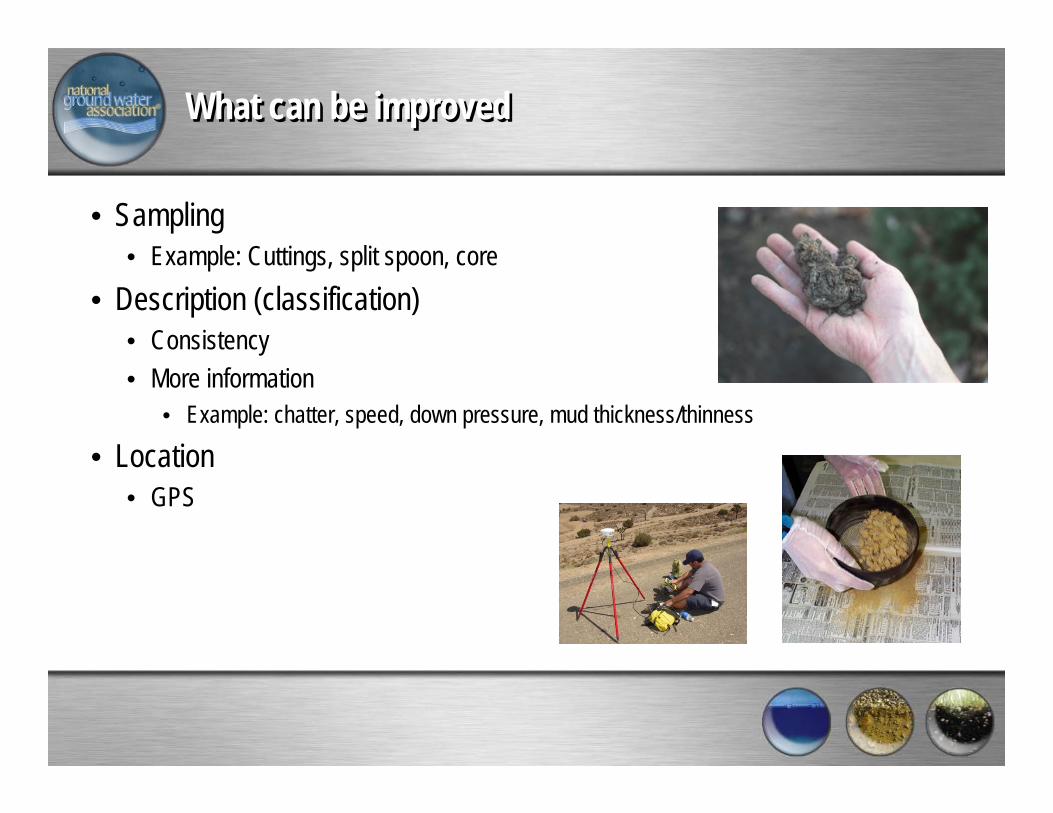
What can be improvedWhat can be improved
• Sampling• Example: Cuttings, split spoon, core
• Description (classification)• Consistency• More information
• Example: chatter, speed, down pressure, mud thickness/thinness
• Location• GPS
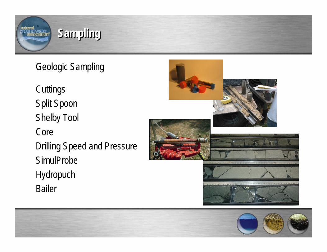
Sampling Sampling
Geologic Sampling
CuttingsSplit SpoonShelby ToolCoreDrilling Speed and PressureSimulProbeHydropuchBailer
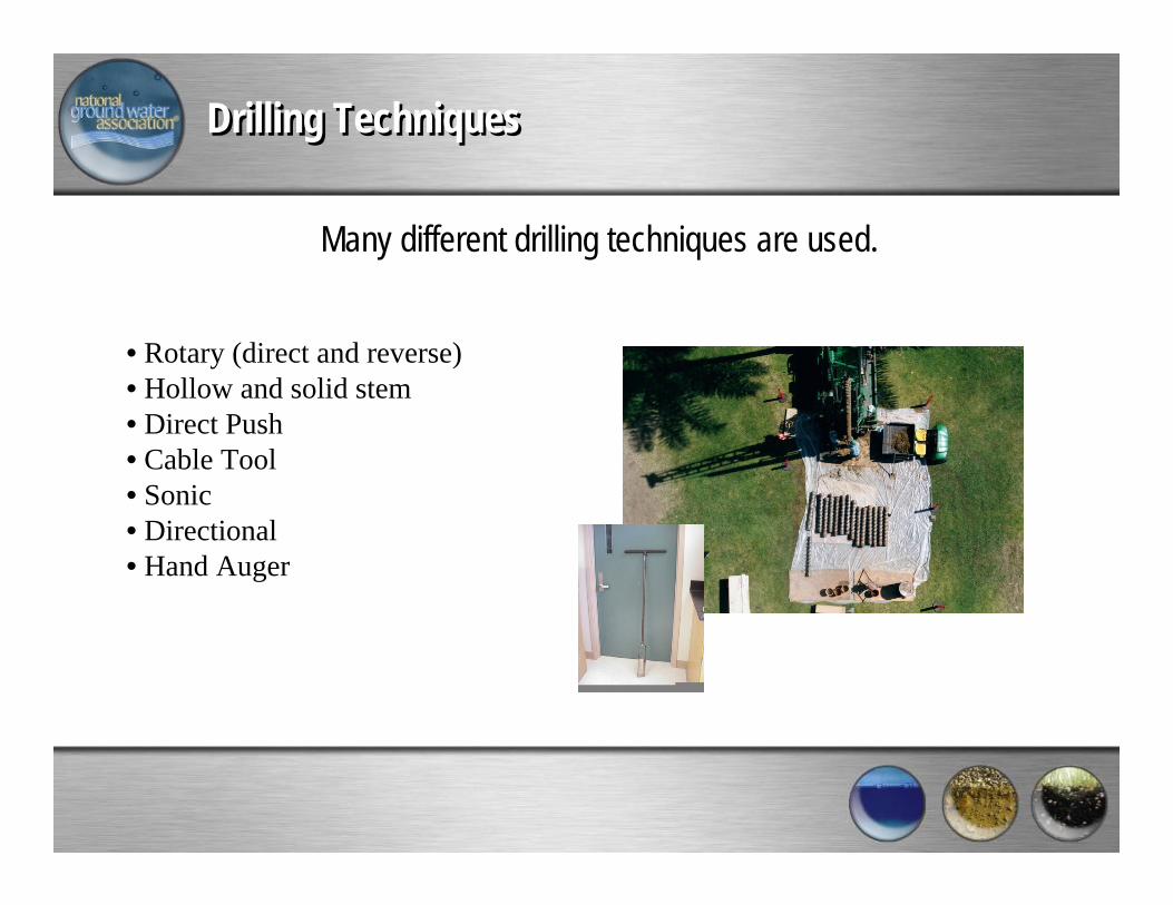
Drilling TechniquesDrilling Techniques
Many different drilling techniques are used.
• Rotary (direct and reverse)• Hollow and solid stem• Direct Push• Cable Tool• Sonic• Directional• Hand Auger
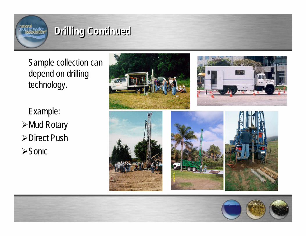
Drilling ContinuedDrilling Continued
Sample collection can depend on drilling technology.
Example:Mud RotaryDirect PushSonic
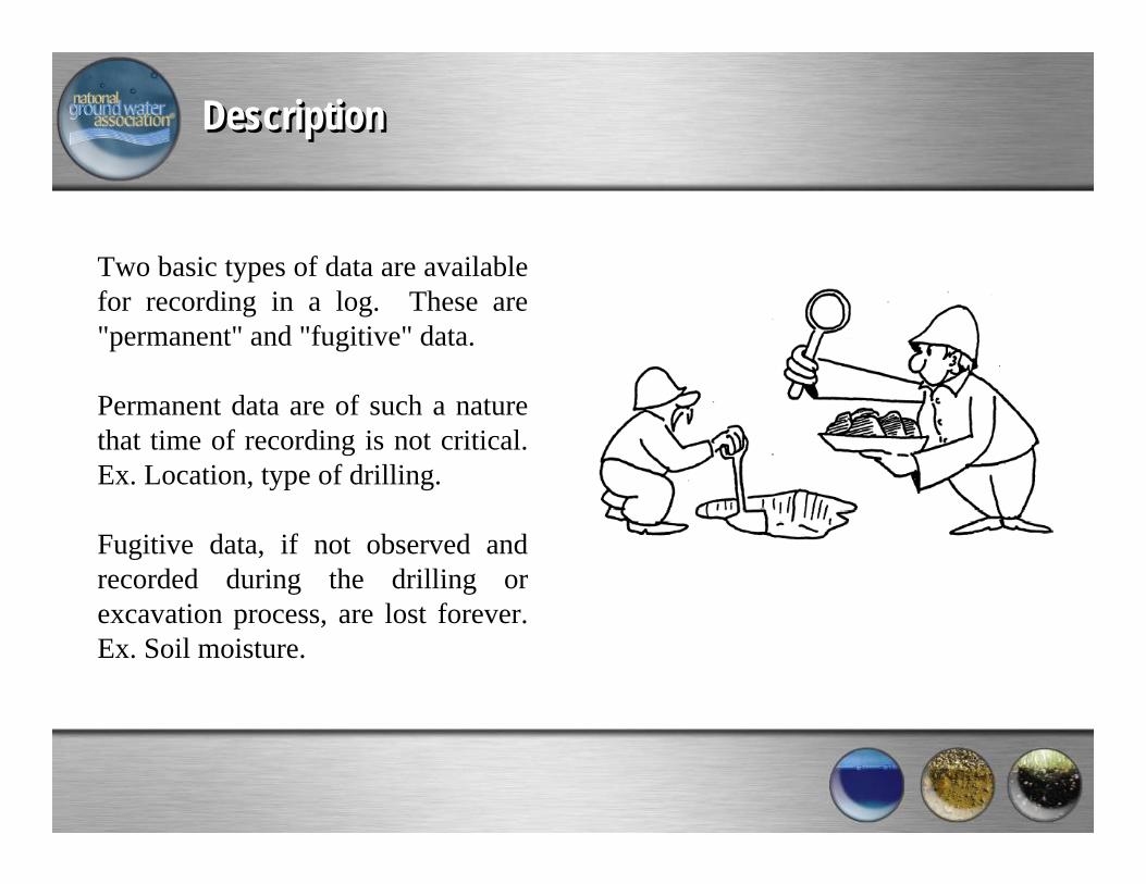
Description Description
Two basic types of data are available for recording in a log. These are "permanent" and "fugitive" data.
Permanent data are of such a nature that time of recording is not critical. Ex. Location, type of drilling.
Fugitive data, if not observed and recorded during the drilling or excavation process, are lost forever. Ex. Soil moisture.
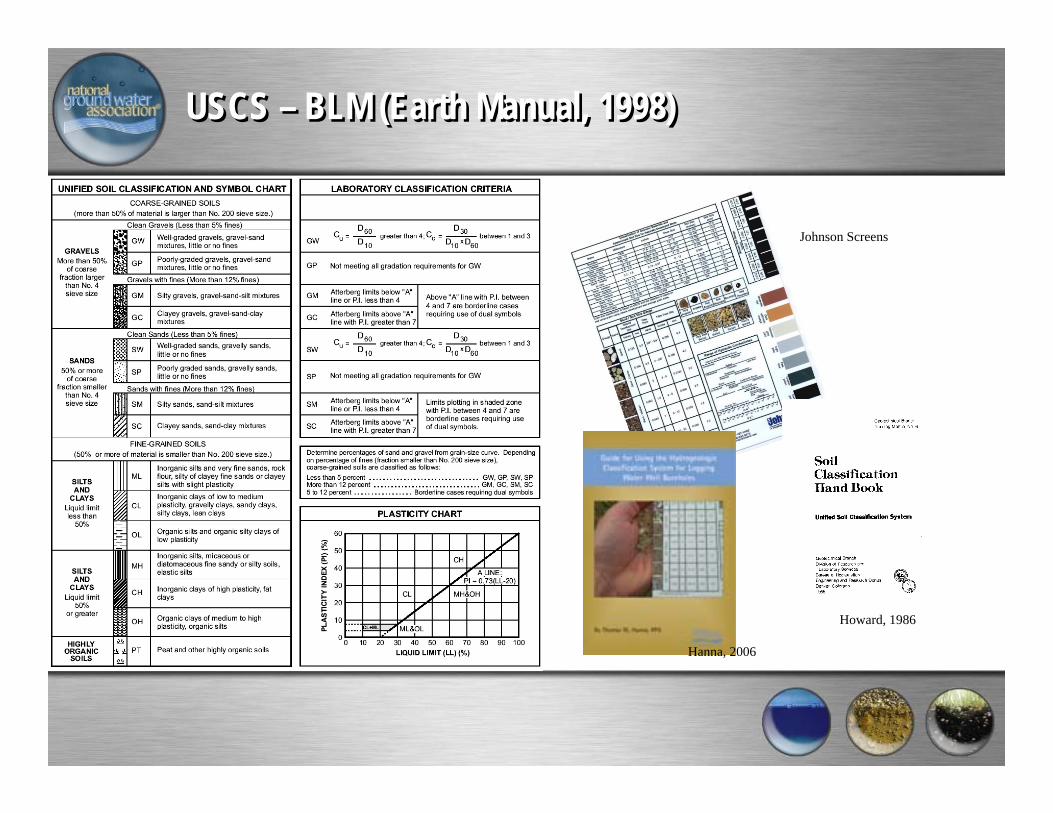
USCS – BLM (Earth Manual, 1998)USCS – BLM (Earth Manual, 1998)
Johnson Screens
Howard, 1986
Hanna, 2006
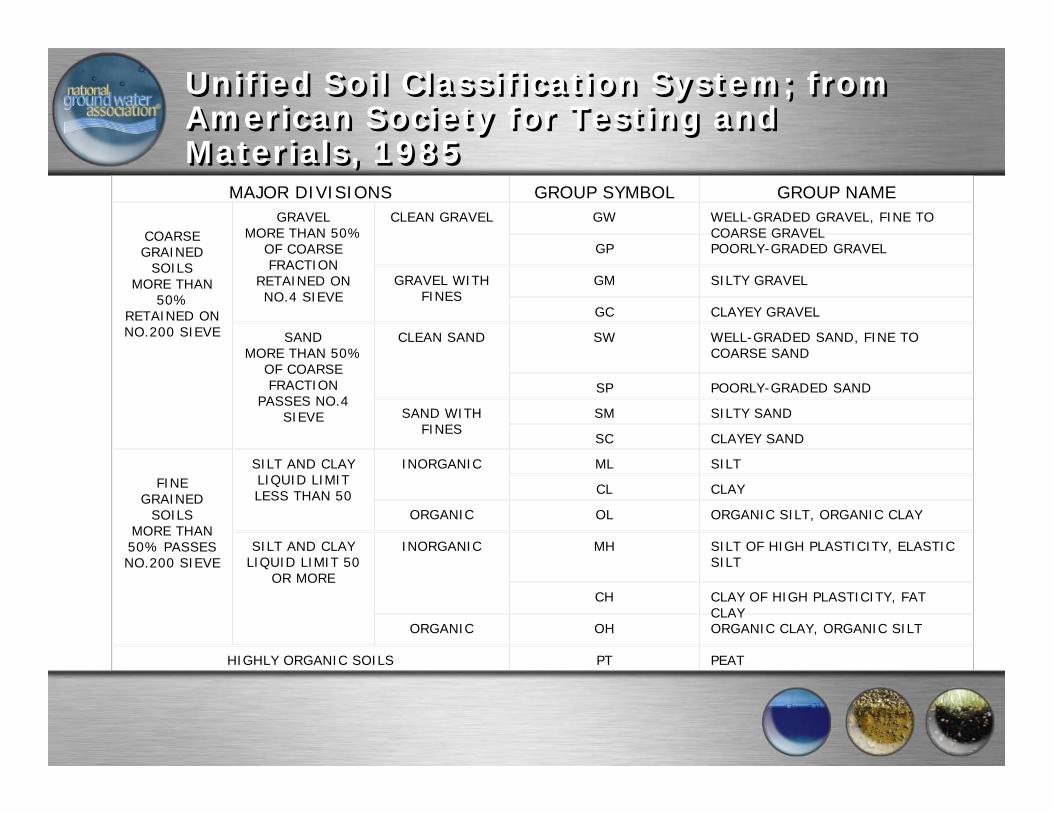
Unified Soil Classification System; from American Society for Testing and Materials, 1985
Unified Soil Classification System; from American Society for Testing and Materials, 1985
MAJOR DIVISIONS GROUP SYMBOL GROUP NAME
COARSE GRAINED
SOILSMORE THAN
50% RETAINED ON NO.200 SIEVE
GRAVELMORE THAN 50%
OF COARSE FRACTION
RETAINED ON NO.4 SIEVE
CLEAN GRAVEL GW WELL-GRADED GRAVEL, FINE TO COARSE GRAVEL
GP POORLY-GRADED GRAVEL
GRAVEL WITH FINES
GM SILTY GRAVEL
GC CLAYEY GRAVEL
SANDMORE THAN 50%
OF COARSE FRACTION
PASSES NO.4 SIEVE
CLEAN SAND SW WELL-GRADED SAND, FINE TO COARSE SAND
SP POORLY-GRADED SAND
SAND WITH FINES
SM SILTY SAND
SC CLAYEY SAND
FINE GRAINED
SOILSMORE THAN 50% PASSES NO.200 SIEVE
SILT AND CLAYLIQUID LIMIT LESS THAN 50
INORGANIC ML SILT
CL CLAY
ORGANIC OL ORGANIC SILT, ORGANIC CLAY
SILT AND CLAYLIQUID LIMIT 50
OR MORE
INORGANIC MH SILT OF HIGH PLASTICITY, ELASTIC SILT
CH CLAY OF HIGH PLASTICITY, FAT CLAY
ORGANIC OH ORGANIC CLAY, ORGANIC SILT
HIGHLY ORGANIC SOILS PT PEAT
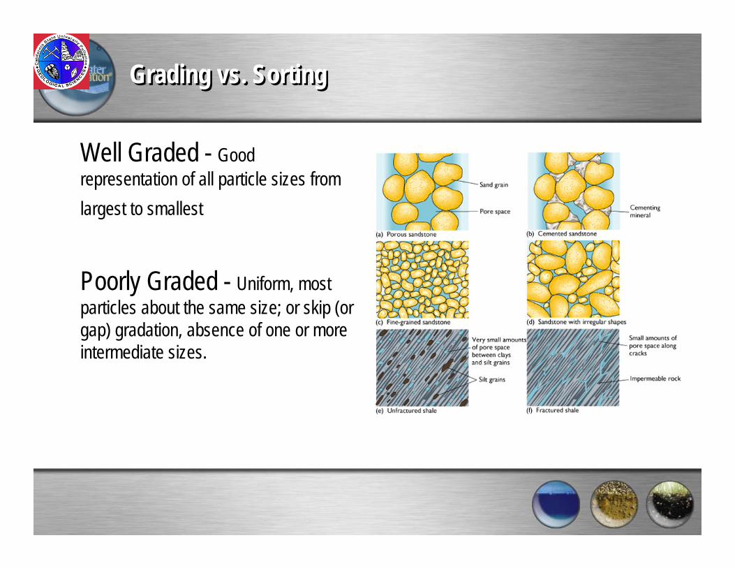
Grading vs. SortingGrading vs. Sorting
Well Graded - Good representation of all particle sizes from largest to smallest
Poorly Graded - Uniform, most particles about the same size; or skip (or gap) gradation, absence of one or more intermediate sizes.

Steps for Soil ClassificationSteps for Soil Classification
In making the soil description, the following outline should be followed where applicable.
1. Soil classification.2. Color, based on GSA or Munsell color charts.3. Clay and silt.
a. Approximate percentage of fines in the total sample.b. Plasticity, based on results of field identification tests.c. Results of field identification tests:
DilatancyDry strengthToughness
4. Sand and gravel.a. Approximate percentages of sand and gravel in the total sample.b. Grading of sand and gravel.c. Describe hardness, breakdown into smaller sizes, shape, composition, and
surface coatings.

Steps for Soil ClassificationSteps for Soil Classification
5. Oversize material (plus 3 inch).a. Maximum size, size range, and approximate percentages of cobbles and
boulders in the total material.b. Describe hardness, shape, lithology, surface coatings, weathering, and
breakdown into smaller sizes.6. Cementation type and degree.7. Organic content.8. Structure (in-place condition).9. Drainage characteristics - describe perviousness.10. Consistency (clay) or degree of compactness (silt or sand).11. In-place water content.
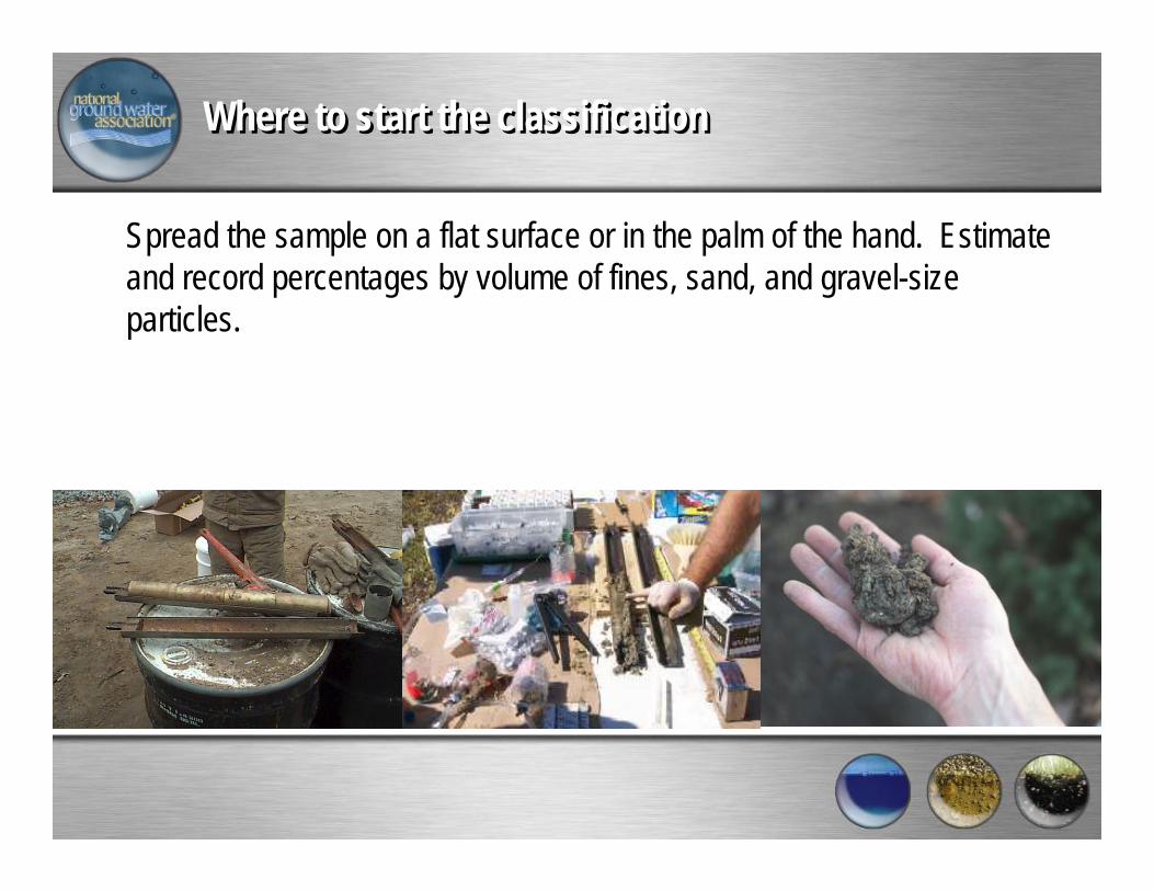
Where to start the classificationWhere to start the classification
Spread the sample on a flat surface or in the palm of the hand. Estimate and record percentages by volume of fines, sand, and gravel-size particles.

Unified Soil Classification System; from American Society for Testing and Materials, 1985
Unified Soil Classification System; from American Society for Testing and Materials, 1985
MAJOR DIVISIONS GROUP SYMBOL GROUP NAME
COARSE GRAINED
SOILSMORE THAN
50% RETAINED ON NO.200 SIEVE
GRAVELMORE THAN 50%
OF COARSE FRACTION
RETAINED ON NO.4 SIEVE
CLEAN GRAVEL GW WELL-GRADED GRAVEL, FINE TO COARSE GRAVEL
GP POORLY-GRADED GRAVEL
GRAVEL WITH FINES
GM SILTY GRAVEL
GC CLAYEY GRAVEL
SANDMORE THAN 50%
OF COARSE FRACTION
PASSES NO.4 SIEVE
CLEAN SAND SW WELL-GRADED SAND, FINE TO COARSE SAND
SP POORLY-GRADED SAND
SAND WITH FINES
SM SILTY SAND
SC CLAYEY SAND
FINE GRAINED
SOILSMORE THAN 50% PASSES NO.200 SIEVE
SILT AND CLAYLIQUID LIMIT LESS THAN 50
INORGANIC ML SILT
CL CLAY
ORGANIC OL ORGANIC SILT, ORGANIC CLAY
SILT AND CLAYLIQUID LIMIT 50
OR MORE
INORGANIC MH SILT OF HIGH PLASTICITY, ELASTIC SILT
CH CLAY OF HIGH PLASTICITY, FAT CLAY
ORGANIC OH ORGANIC CLAY, ORGANIC SILT
HIGHLY ORGANIC SOILS PT PEAT
GEOLOGISTs!GEOLOGISTs!
WARNING
Do not forget the big picture!
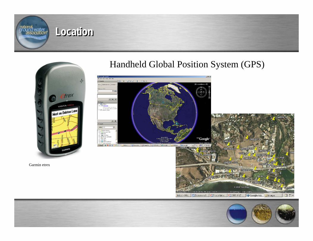
LocationLocation
Garmin etrex
Handheld Global Position System (GPS)
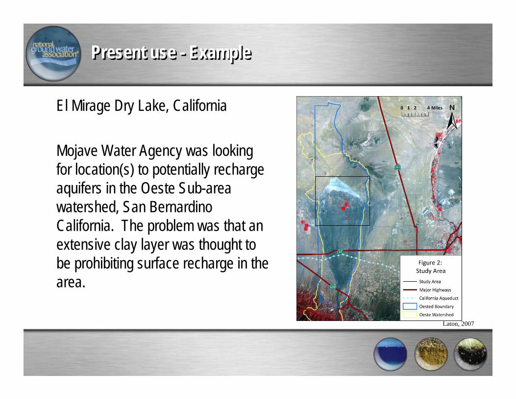
Present use - ExamplePresent use - Example
El Mirage Dry Lake, California
Mojave Water Agency was looking for location(s) to potentially recharge aquifers in the Oeste Sub-area watershed, San Bernardino California. The problem was that an extensive clay layer was thought to be prohibiting surface recharge in the area.
Laton, 2007
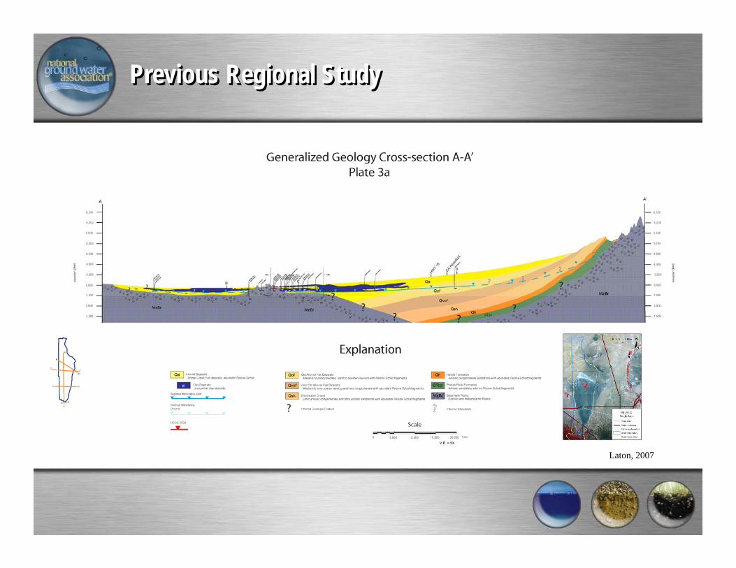
Previous Regional StudyPrevious Regional Study
Laton, 2007
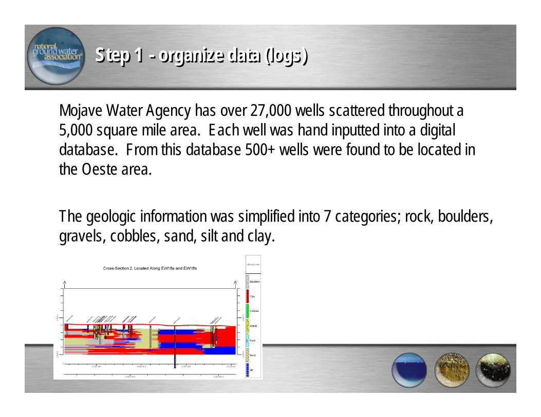
Step 1 - organize data (logs)Step 1 - organize data (logs)
Mojave Water Agency has over 27,000 wells scattered throughout a5,000 square mile area. Each well was hand inputted into a digital database. From this database 500+ wells were found to be located in the Oeste area.
The geologic information was simplified into 7 categories; rock, boulders, gravels, cobbles, sand, silt and clay.

Step 2 – Plot wells and create cross-sections Step 2 – Plot wells and create cross-sections
100+ cross-sections were created across the study area. Each cross-section was interpreted by hand.Water levels were used to identify clay lens (perched groundwater)
Dailey, 2008
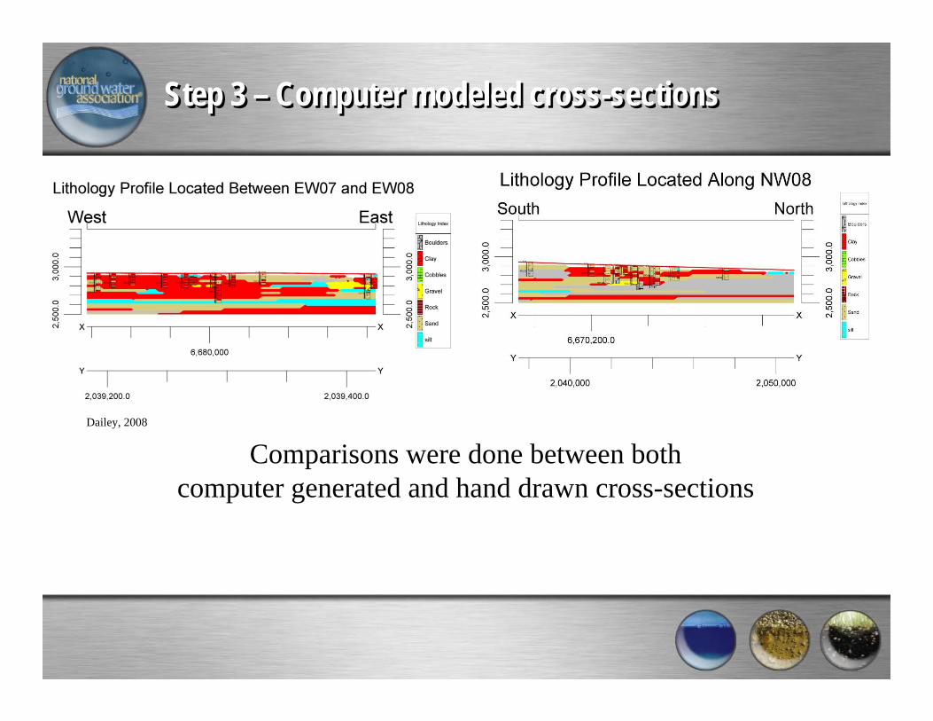
Step 3 – Computer modeled cross-sectionsStep 3 – Computer modeled cross-sections
Dailey, 2008
Comparisons were done between bothcomputer generated and hand drawn cross-sections
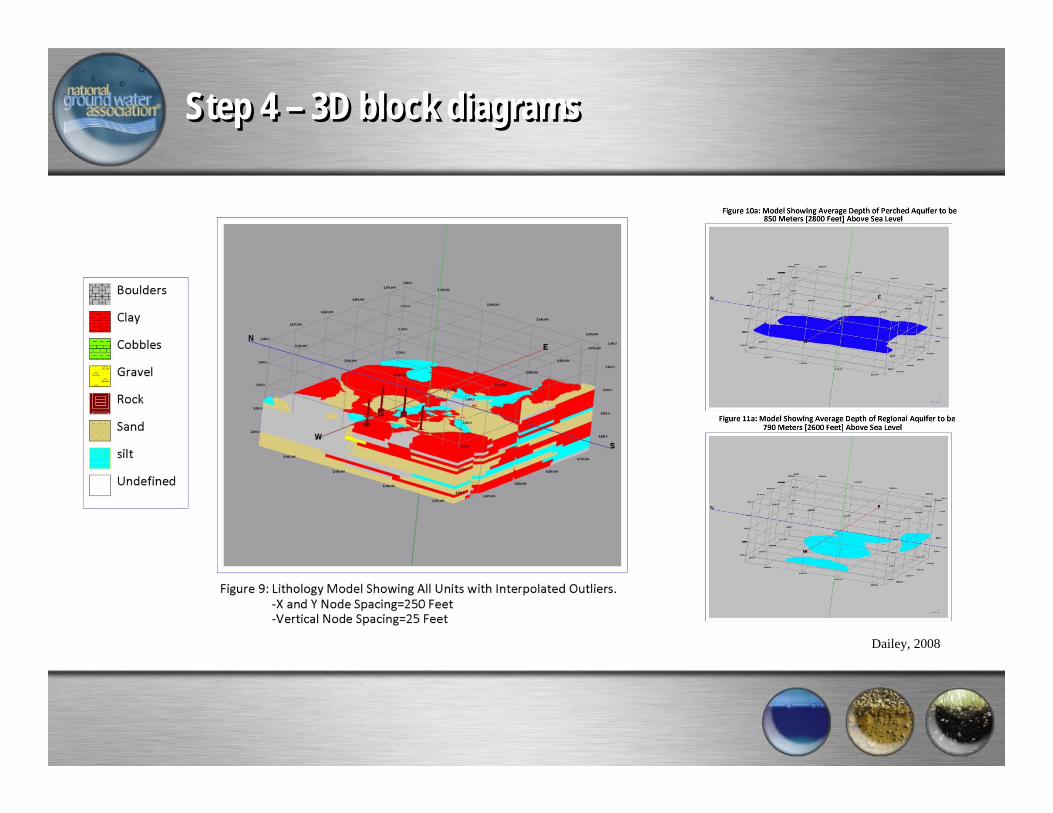
Step 4 – 3D block diagramsStep 4 – 3D block diagrams
Dailey, 2008
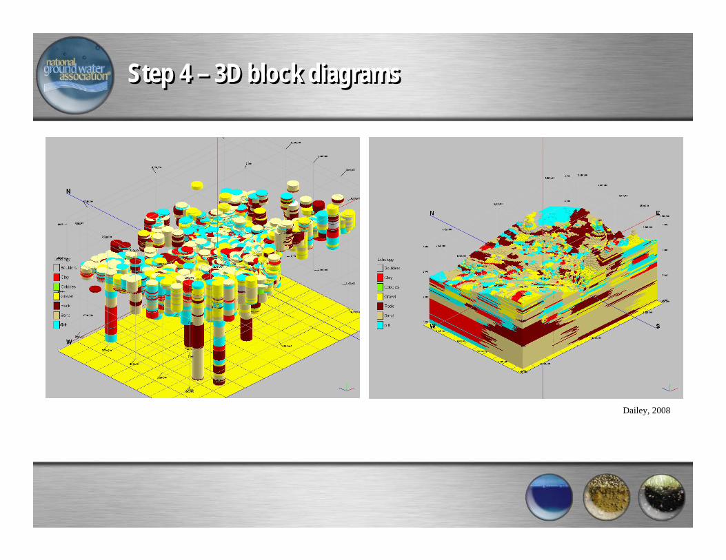
Step 4 – 3D block diagramsStep 4 – 3D block diagrams
Dailey, 2008

Results and Conclusions from StudyResults and Conclusions from Study
4 areas were identified for potential surface rechargeUnderstanding the geology critical to studyTrusting the well logs difficultComputer interpolation did a reasonable job
Dailey, 2008
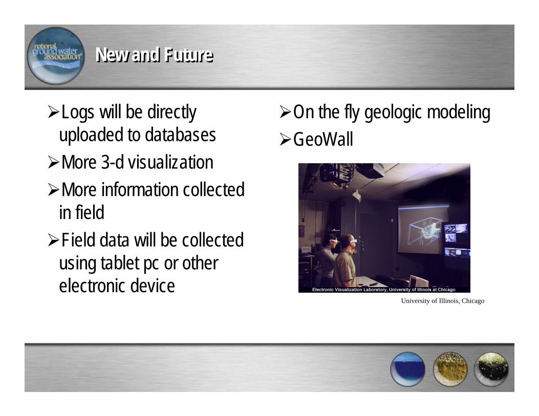
New and FutureNew and Future
Logs will be directly uploaded to databasesMore 3-d visualizationMore information collected in fieldField data will be collected using tablet pc or other electronic device
On the fly geologic modelingGeoWall
University of Illinois, Chicago
Thank youThank you
California State University Fullerton, Department of Geological SciencesNational Ground Water AssociationAssociation of Ground Water Scientists and Engineers
Franklin Electric
National Ground Water Research and Educational Foundation
National Ground Water Research and Educational Foundation
Your vital and integral resource for ground water's future
Established in 1994, the National Ground Water Research and Educational Foundation is operated by the National Ground Water Association as a 501(c)(3) public foundation and is
focused on conducting educational, research, and other charitable activities related to a broader public understanding of ground water.
The Foundation is an arm of NGWA that is focused on activities related to a broader understanding of ground water.

National Ground Water Research and Educational Foundation
National Ground Water Research and Educational Foundation
Your vital and integral resource for ground water's future
For more information visit us on the web at www.ngwa.orgor write us at the below address.
NGWREF601 Dempsey Road
Westerville, OH 43081Phone/ 614-898-7791
Fax/ 614-898-7786
Email/ [email protected]