Embed Size (px)
Citation preview
WHI.1 Historical and Geographical Skills
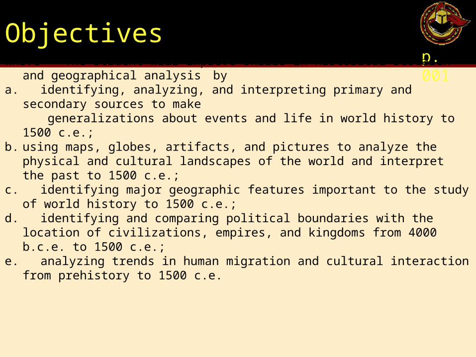
Objectivesp. 001
WHI.1 The student will improve skills in historical research and geographical analysis by
a. identifying, analyzing, and interpreting primary and secondary sources to make generalizations about events and life in world history to 1500 c.e.;b. using maps, globes, artifacts, and pictures to analyze the physical and cultural
landscapes of the world and interpret the past to 1500 c.e.;c. identifying major geographic features important to the study of world history to 1500
c.e.;d. identifying and comparing political boundaries with the location of civilizations,
empires, and kingdoms from 4000 b.c.e. to 1500 c.e.;e. analyzing trends in human migration and cultural interaction from prehistory to 1500
c.e.
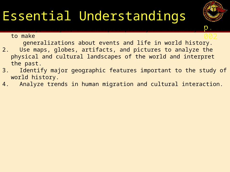
Essential Understandingsp. 002
1. Identify, analyze, and interpret primary and secondary sources to make generalizations about events and life in world history. 2. Use maps, globes, artifacts, and pictures to analyze the physical and cultural
landscapes of the world and interpret the past.3. Identify major geographic features important to the study of world history.4. Analyze trends in human migration and cultural interaction.
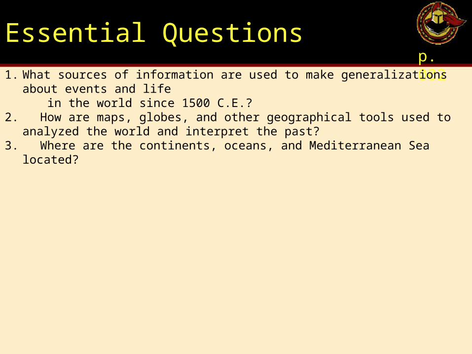
Essential Questionsp. 002
1. What sources of information are used to make generalizations about events and life in the world since 1500 C.E.?2. How are maps, globes, and other geographical tools used to analyzed the world and
interpret the past?3. Where are the continents, oceans, and Mediterranean Sea located?
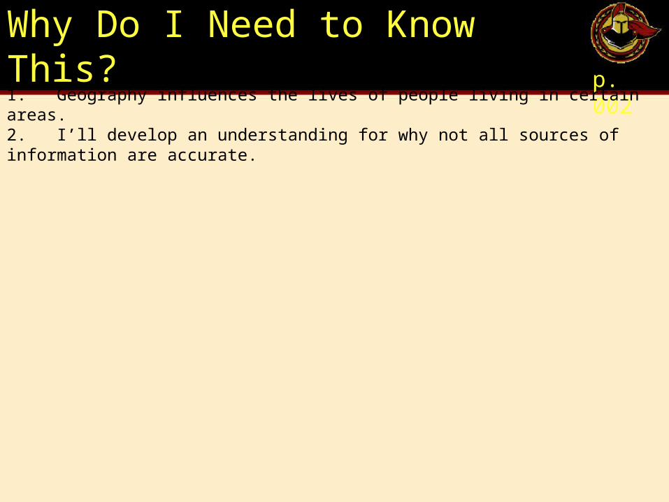
Why Do I Need to Know This?p. 002
1. Geography influences the lives of people living in certain areas.2. I’ll develop an understanding for why not all sources of information are accurate.
Geographical Skills
p. 003
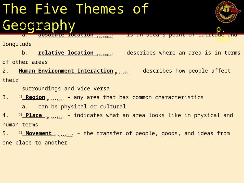
The Five Themes of Geographyp. 003
1. Location(p.xxxii) – tells us where in the world a certain area is
a. absolute location (p.xxxii) – is an area’s point of latitude and longitude
b. relative location (p.xxxii) – describes where an area is in terms of other areas
2. Human Environment Interaction(p.xxxii) – describes how people affect their
surroundings and vice versa
3. 5) Region(p.xxxiii) – any area that has common characteristics
a. can be physical or cultural
4. 6) Place (p.xxxiii) – indicates what an area looks like in physical and human terms
5. 7) Movement (p.xxxiii) – the transfer of people, goods, and ideas from one place to another
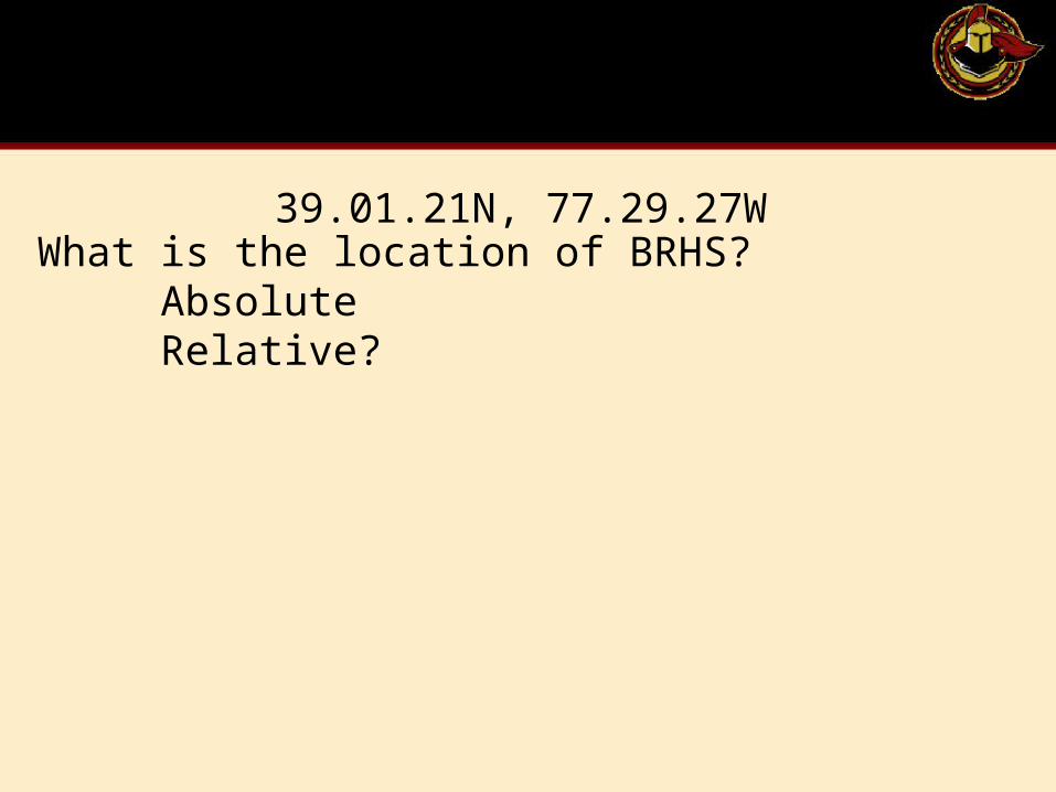
What is the location of BRHS? Absolute Relative?
39.01.21N, 77.29.27W
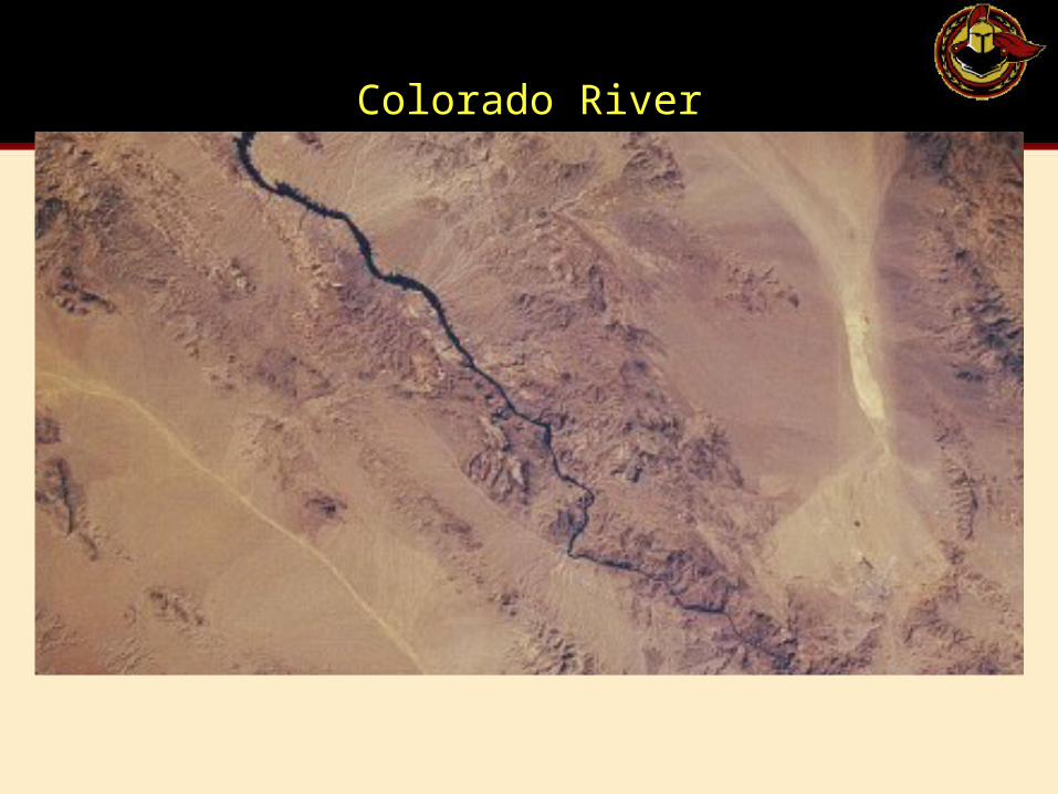
Colorado River
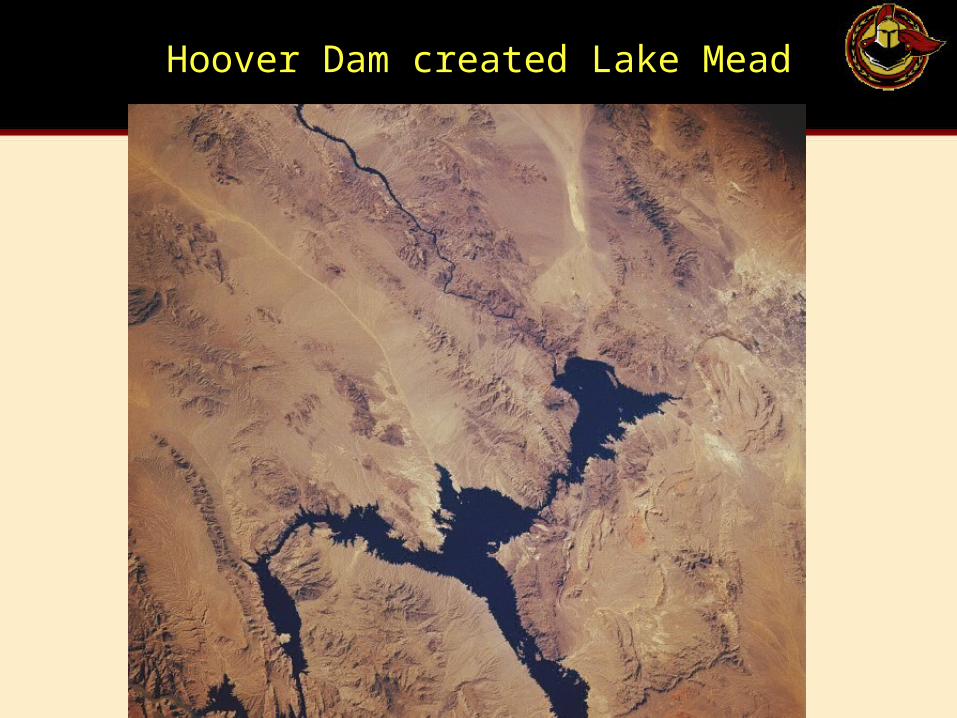
Hoover Dam created Lake Mead
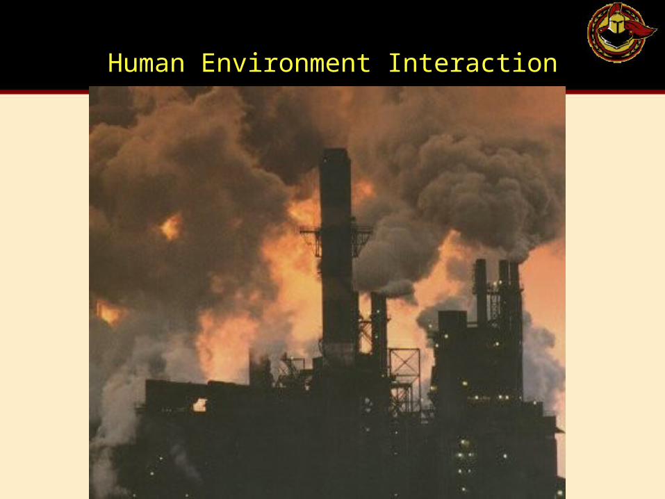
Human Environment Interaction
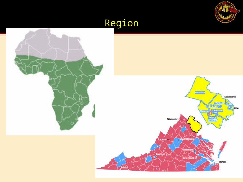
Region
Common Geographic Termsp. 003
1. 8) equator (p.xxxv) – the line of latitude midway between the North and South poles
2. 9) latitude (p.xxxv) – imaginary lines that circle the globe from east to west, measuring an area’s
distance north and south of the equator (always comes first when giving directions)
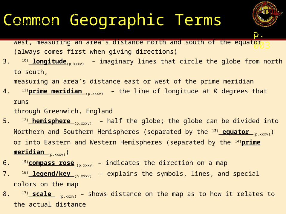
3. 10) longitude(p.xxxv) – imaginary lines that circle the globe from north to south,
measuring an area’s distance east or west of the prime meridian
4. 11)prime meridian (p.xxxv) – the line of longitude at 0 degrees that runs
through Greenwich, England
5. 12) hemisphere (p.xxxv) – half the globe; the globe can be divided into Northern and Southern
Hemispheres (separated by the 13) equator (p.xxxv)) or into Eastern and Western Hemispheres
(separated by the 14)prime meridian (p.xxxv))
6. 15)compass rose (p.xxxv) – indicates the direction on a map
7. 16) legend/key (p.xxxv) – explains the symbols, lines, and special colors on the map
8. 17) scale (p.xxxv) – shows distance on the map as to how it relates to the actual distance
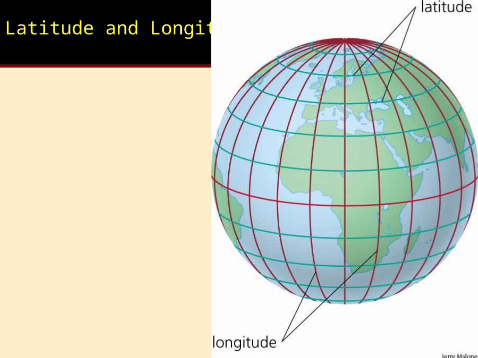
Latitude and Longitude
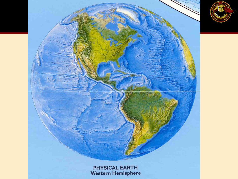
Western Hemisphere
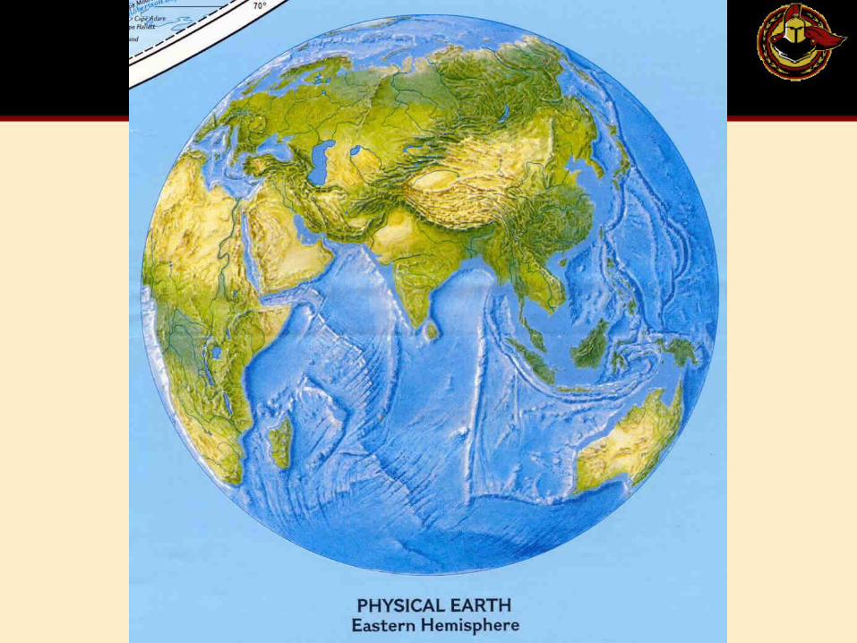
Eastern Hemisphere
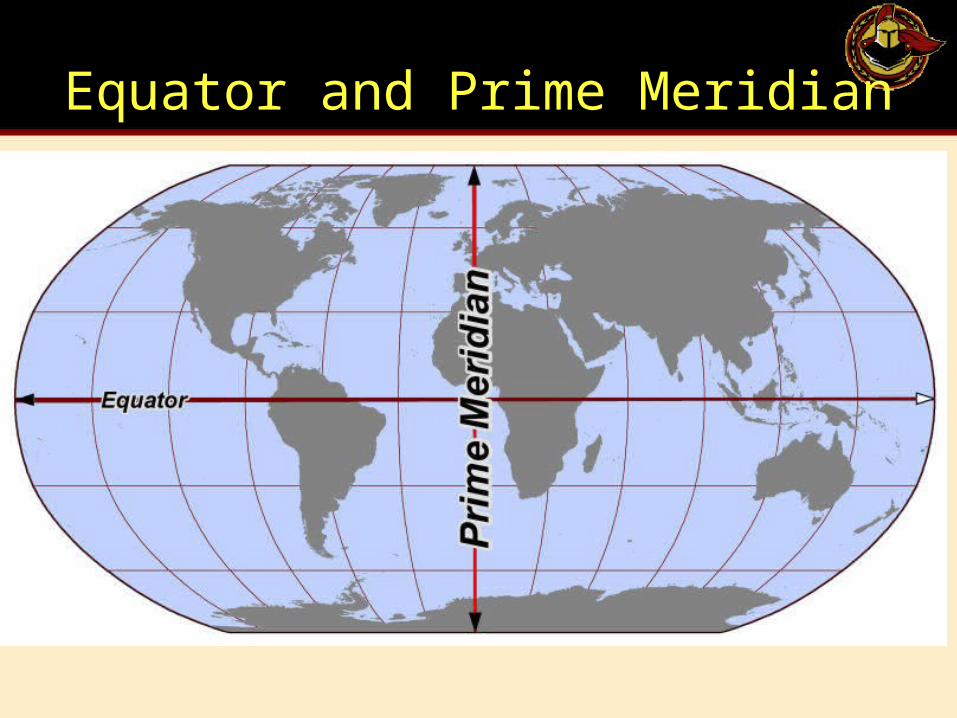
Equator and Prime Meridian
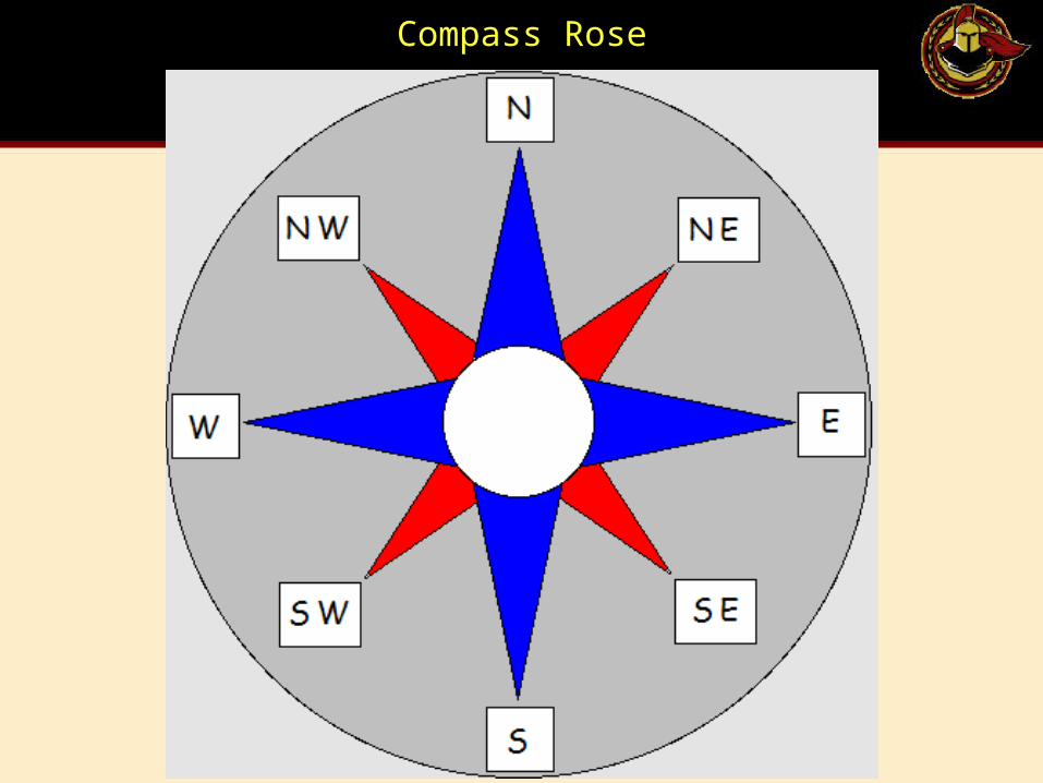
Compass Rose
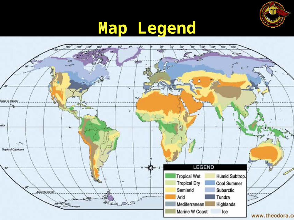
Map Legend
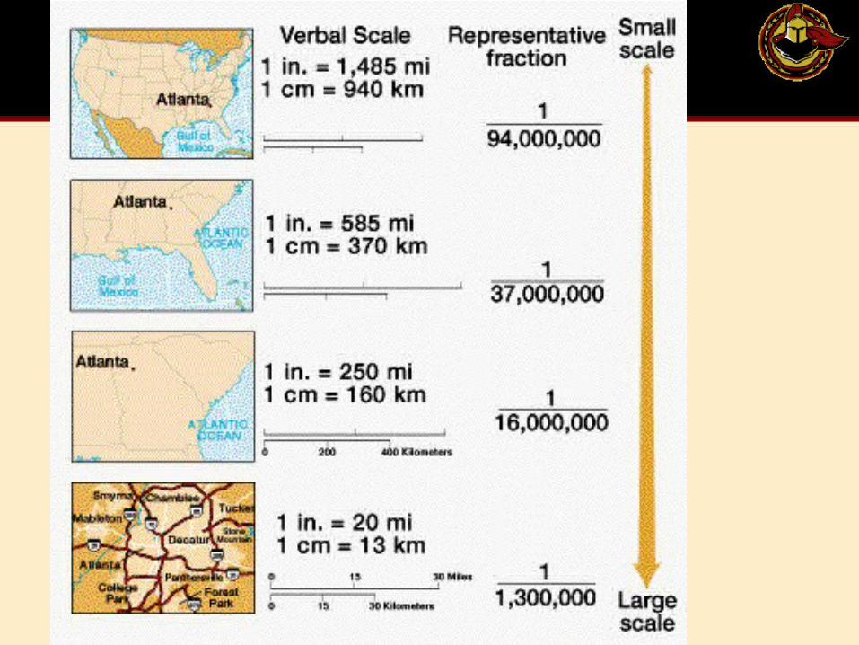
Map Scale
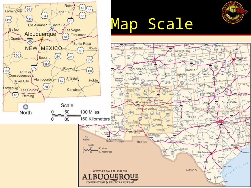
Map Scale
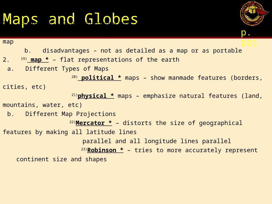
Maps and Globes p. 005
1. 18)globe * – 3-D representations of the earth
a. advantages - shaped like the Earth and not as distorted as a map
b. disadvantages – not as detailed as a map or as portable
2. 19) map * – flat representations of the earth
a. Different Types of Maps 20) political * maps – show manmade features (borders, cities, etc) 21)physical * maps – emphasize natural features (land, mountains, water, etc)
b. Different Map Projections 22)Mercator * – distorts the size of geographical features by making all latitude lines
parallel and all longitude lines parallel 23)Robinson * – tries to more accurately represent continent size and shapes
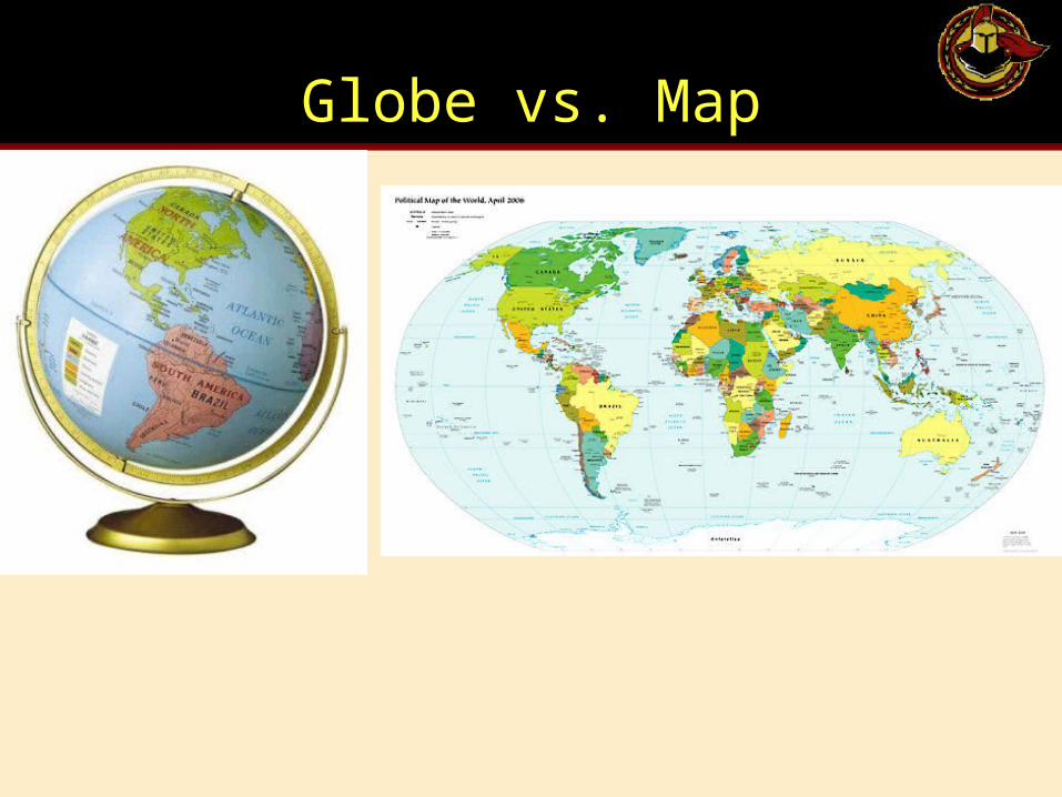
Globe vs. Map
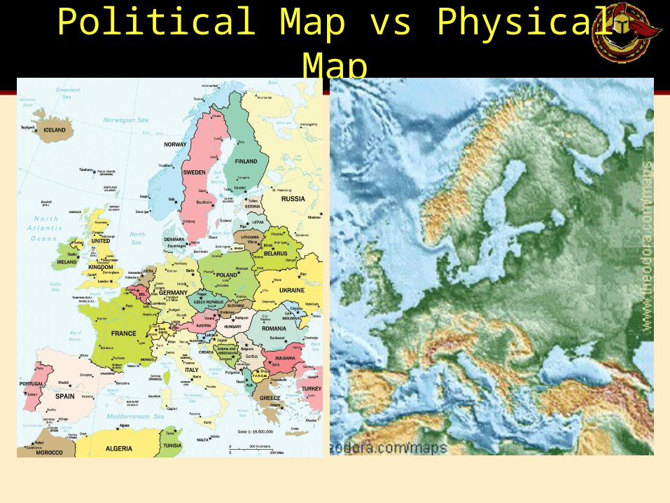
Political Map vs Physical Map
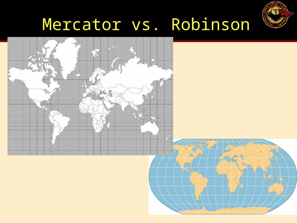
Mercator vs. Robinson
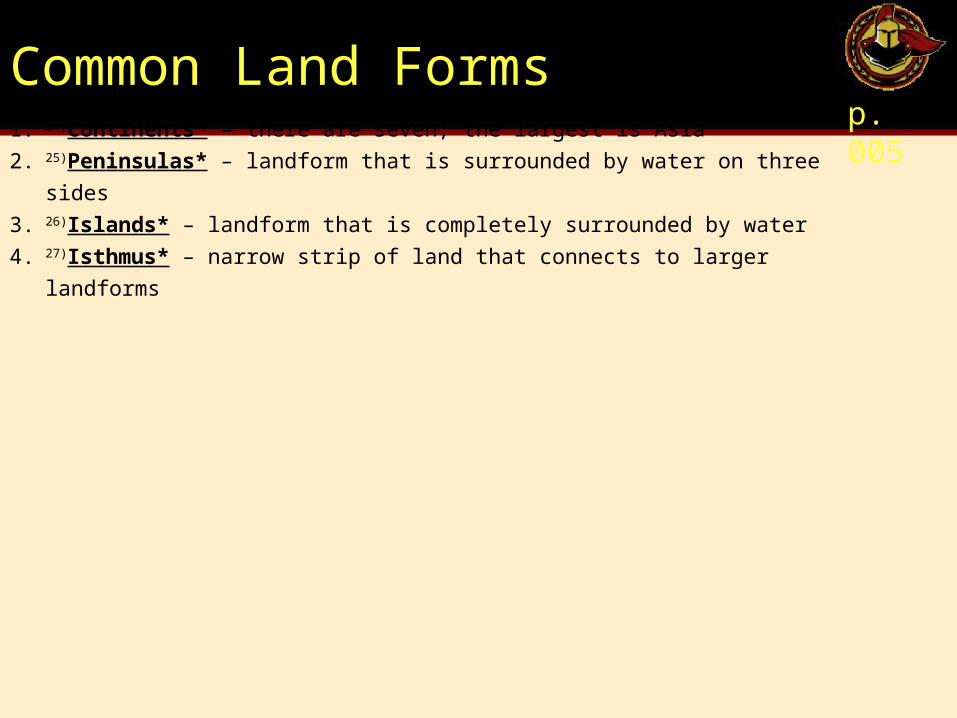
Common Land Formsp. 005
1. 24)Continents* – there are seven; the largest is Asia
2. 25)Peninsulas* – landform that is surrounded by water on three sides
3. 26)Islands* – landform that is completely surrounded by water
4. 27)Isthmus* – narrow strip of land that connects to larger landforms
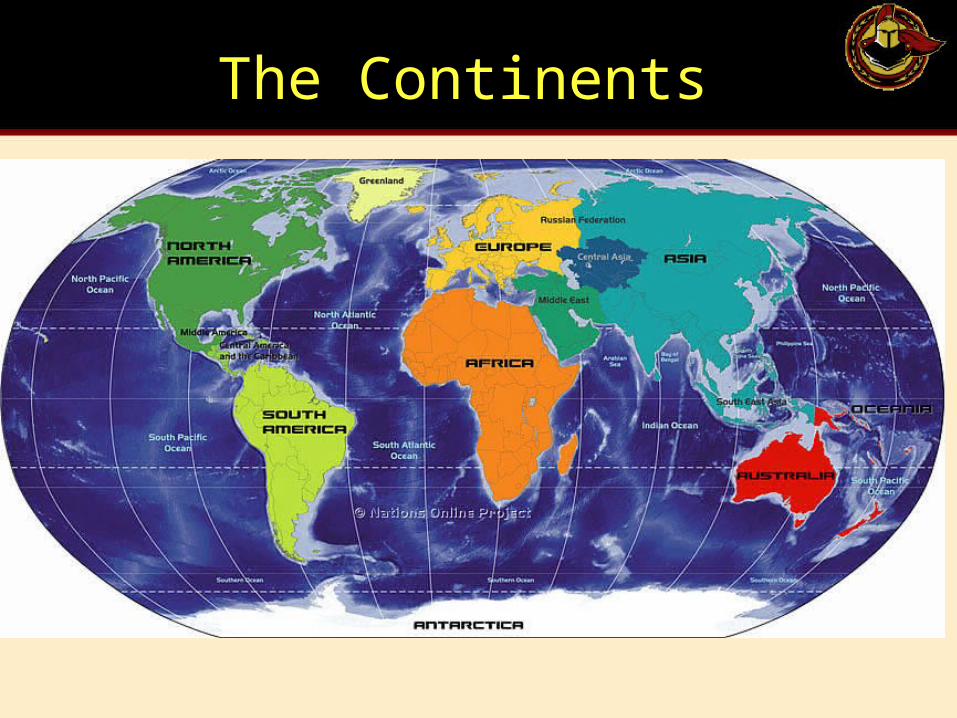
The Continents
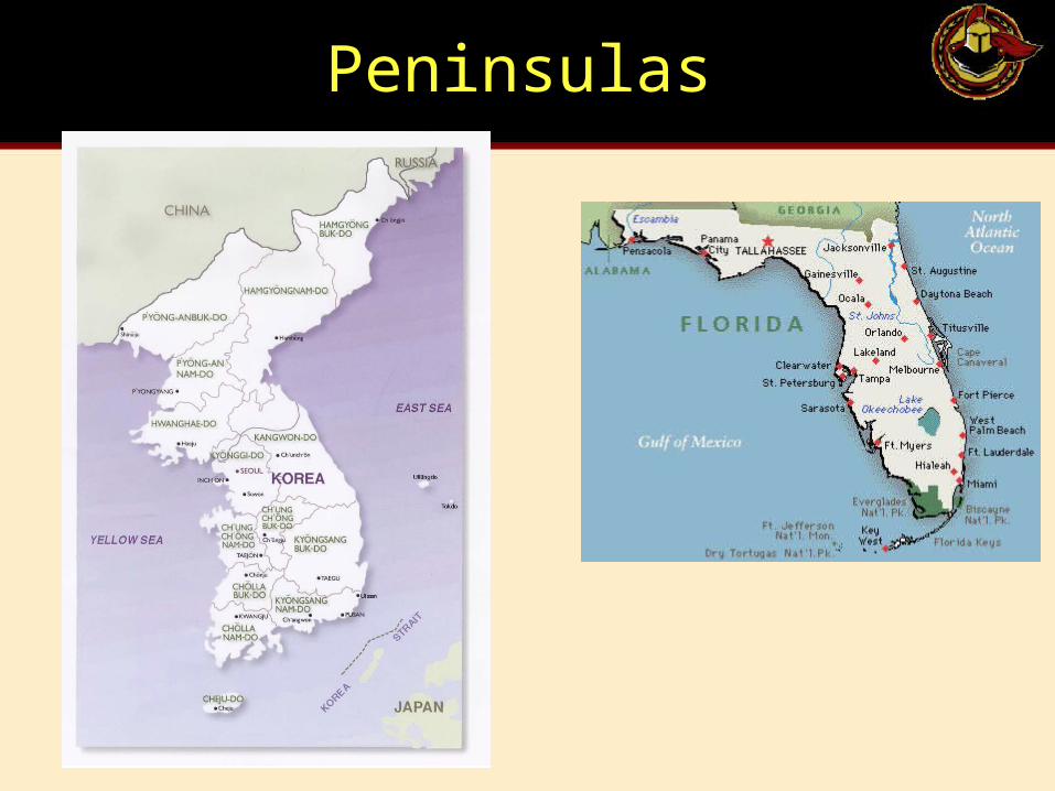
Peninsulas
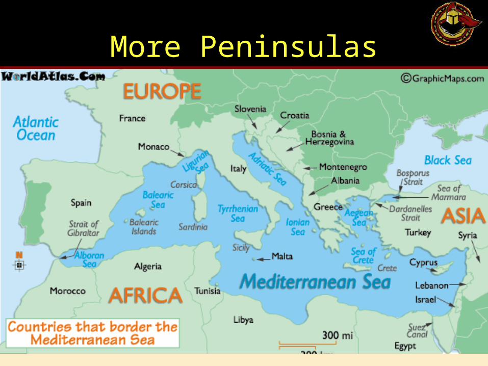
More Peninsulas
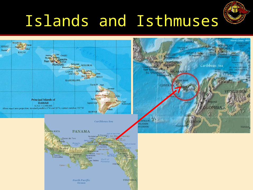
Islands and Isthmuses
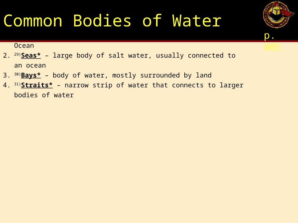
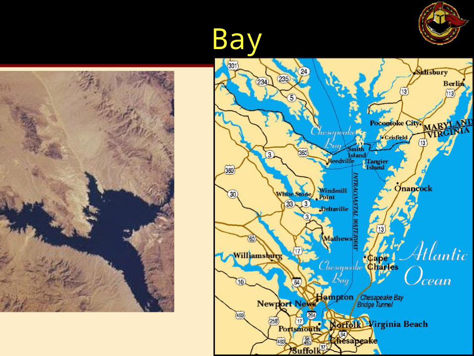
Common Bodies of Waterp. 005
1. 28)Oceans* – there are five; the largest is the Pacific Ocean
2. 29)Seas* – large body of salt water, usually connected to an ocean
3. 30)Bays* – body of water, mostly surrounded by land
4. 31)Straits* – narrow strip of water that connects to larger bodies of water
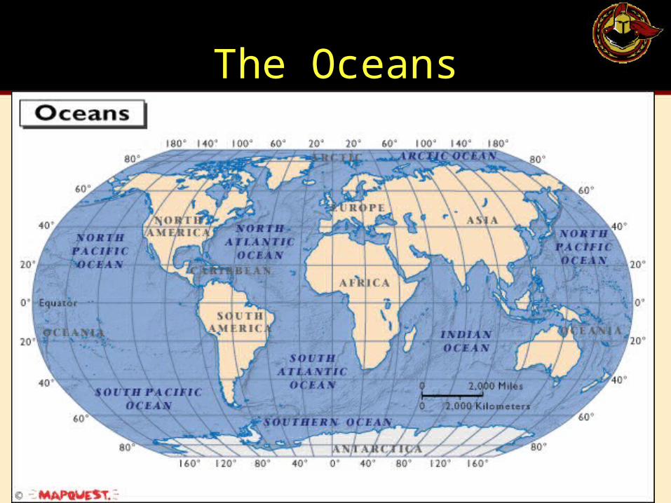
The Oceans

Seas
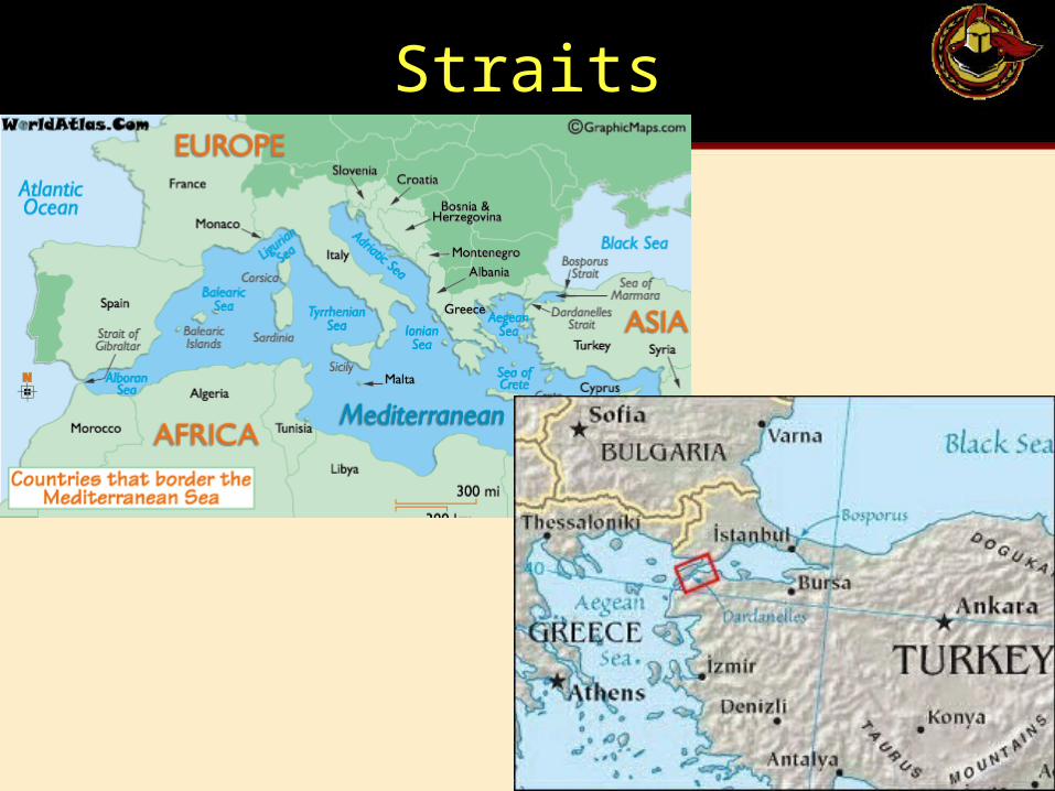
Straits
Historical Skills
p. 007
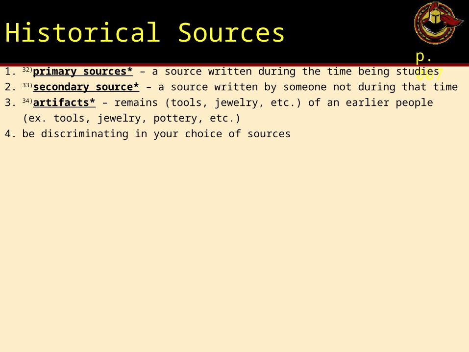
Historical Sourcesp. 007
1. 32)primary sources* – a source written during the time being studies
2. 33)secondary source* – a source written by someone not during that time
3. 34)artifacts* – remains (tools, jewelry, etc.) of an earlier people (ex. tools, jewelry, pottery, etc.)
4. be discriminating in your choice of sources
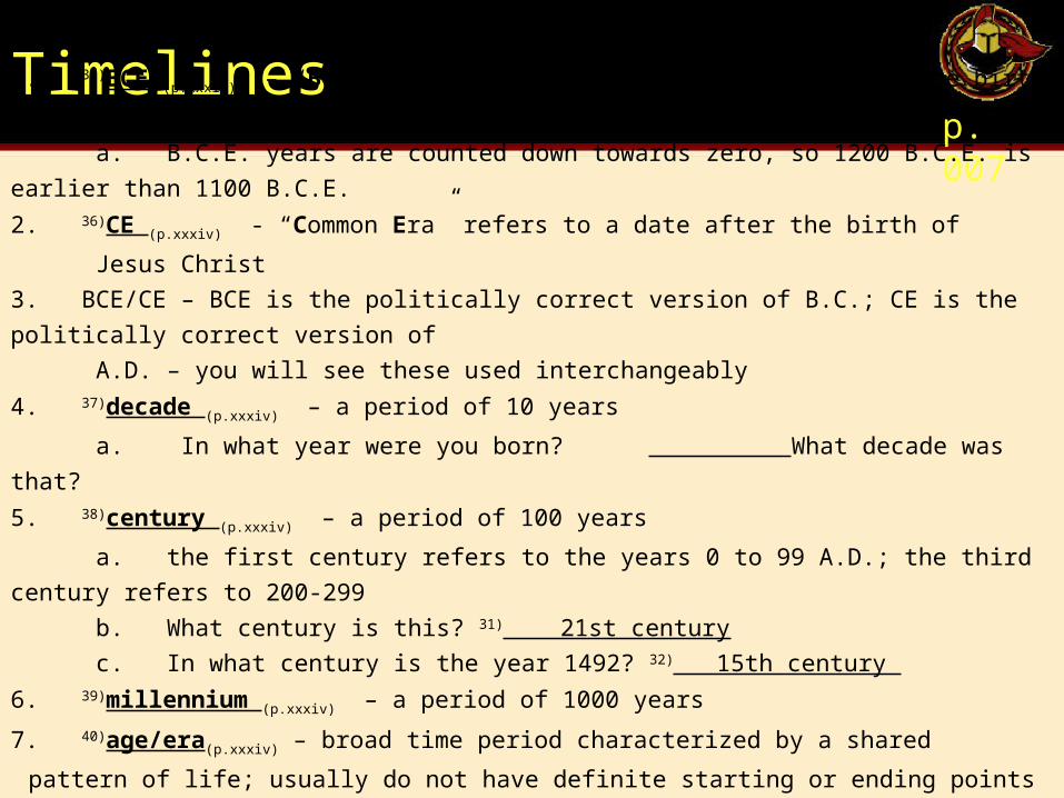
Timelinesp. 007
1. 35)BCE (p.xxxiv) – “Before Common Era” refers to a date before the birth of Jesus Christ
a. B.C.E. years are counted down towards zero, so 1200 B.C.E. is earlier than 1100 B.C.E.
2. 36)CE (p.xxxiv) - “Common Era” refers to a date after the birth of
Jesus Christ
3. BCE/CE – BCE is the politically correct version of B.C.; CE is the politically correct version of
A.D. – you will see these used interchangeably
4. 37)decade (p.xxxiv) – a period of 10 years
a. In what year were you born? What decade was that?
5. 38)century (p.xxxiv) – a period of 100 years
a. the first century refers to the years 0 to 99 A.D.; the third century refers to 200-299
b. What century is this? 31) 21st century
c. In what century is the year 1492? 32) 15th century
6. 39)millennium (p.xxxiv) – a period of 1000 years
7. 40)age/era(p.xxxiv) – broad time period characterized by a shared
pattern of life; usually do not have definite starting or ending points
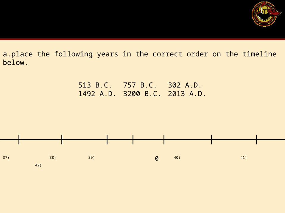
p. 07
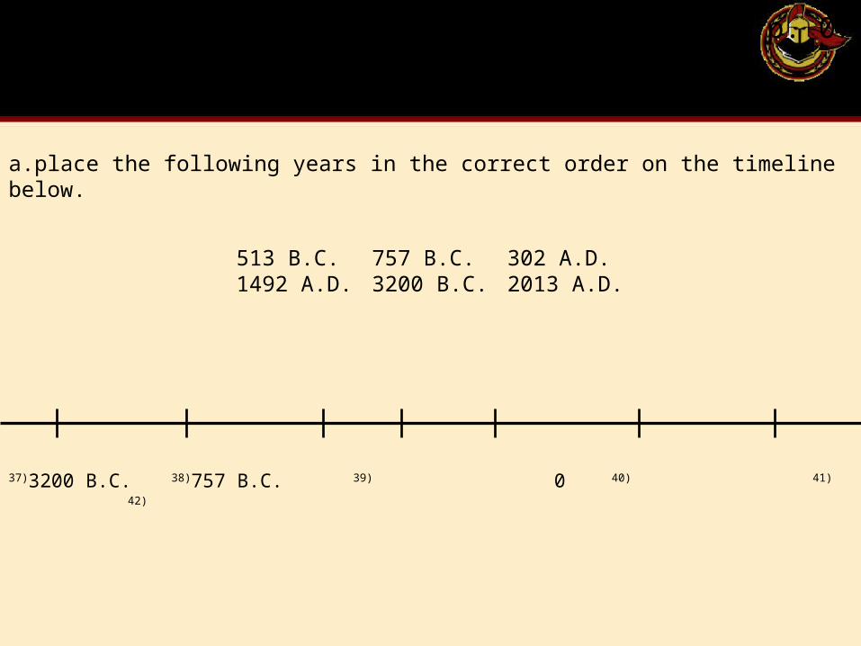
513 B.C. 757 B.C. 302 A.D.1492 A.D. 3200 B.C. 2013 A.D.
a.place the following years in the correct order on the timeline below.
37) 38) 39) 0 40) 41) 42)
p. 07
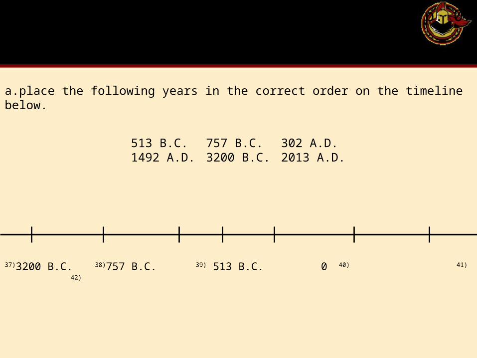
513 B.C. 757 B.C. 302 A.D.1492 A.D. 3200 B.C. 2013 A.D.
a.place the following years in the correct order on the timeline below.
37)3200 B.C. 38) 39) 0 40) 41) 42)
p. 07
513 B.C. 757 B.C. 302 A.D.1492 A.D. 3200 B.C. 2013 A.D.
a.place the following years in the correct order on the timeline below.
37)3200 B.C. 38)757 B.C. 39) 0 40) 41) 42)
p. 07
513 B.C. 757 B.C. 302 A.D.1492 A.D. 3200 B.C. 2013 A.D.
a.place the following years in the correct order on the timeline below.
37)3200 B.C. 38)757 B.C. 39) 513 B.C. 040) 41) 42)
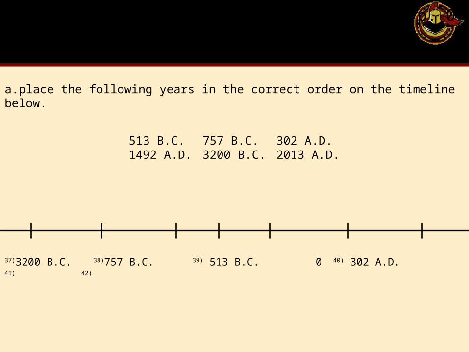
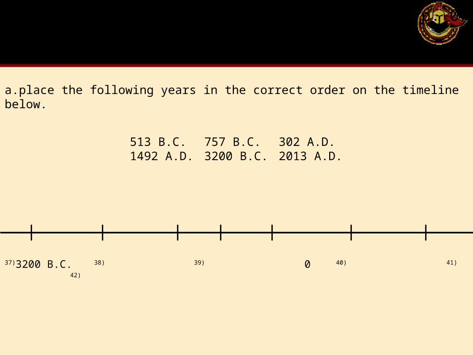
p. 07
513 B.C. 757 B.C. 302 A.D.1492 A.D. 3200 B.C. 2013 A.D.
a.place the following years in the correct order on the timeline below.
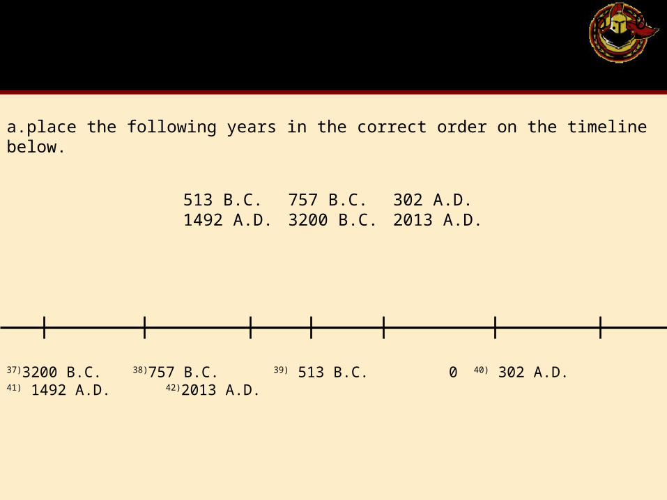
37)3200 B.C. 38)757 B.C. 39) 513 B.C. 040) 302 A.D. 41) 42)
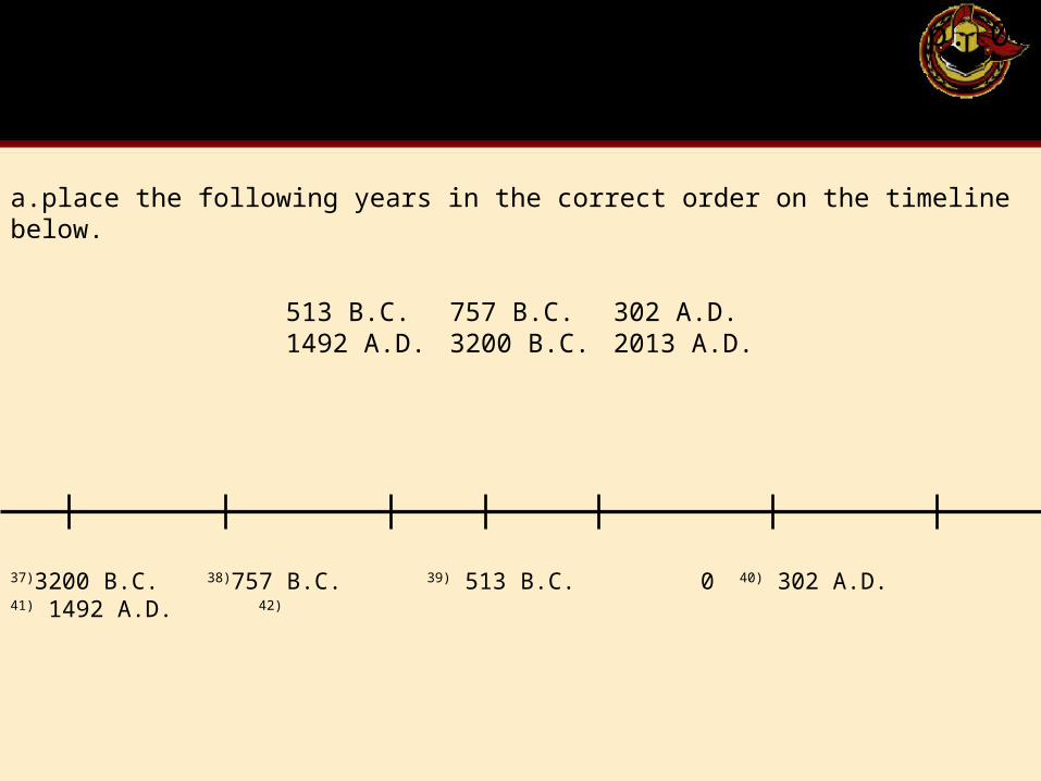
p. 07
513 B.C. 757 B.C. 302 A.D.1492 A.D. 3200 B.C. 2013 A.D.
a.place the following years in the correct order on the timeline below.
37)3200 B.C. 38)757 B.C. 39) 513 B.C. 040) 302 A.D. 41) 1492 A.D. 42)
p. 07
513 B.C. 757 B.C. 302 A.D.1492 A.D. 3200 B.C. 2013 A.D.
a.place the following years in the correct order on the timeline below.
37)3200 B.C. 38)757 B.C. 39) 513 B.C. 040) 302 A.D. 41) 1492 A.D. 42)2013 A.D.