Embed Size (px)
Citation preview
Weyerhaeuser Company
Weyerhaeuser Company:Soil Monitoring Methods for Western
Timberlands
By: Ron Heninger and Alex Dobkowski
Weyerhaeuser Company, Western Timberlands Research
Weyerhaeuser Company
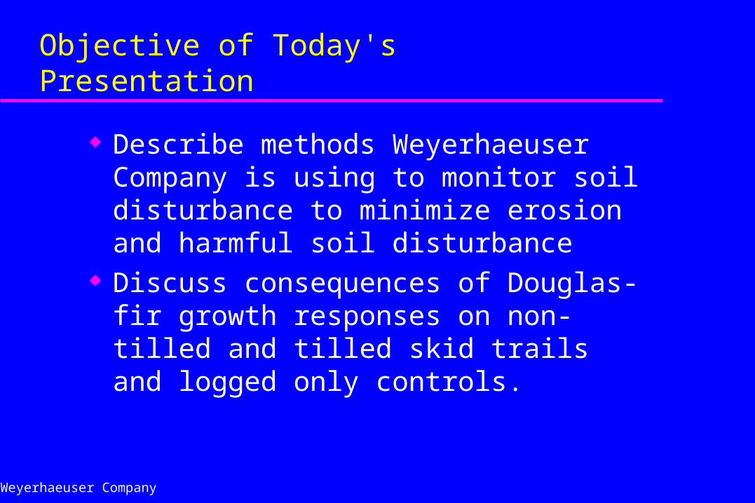
Objective of Today's Presentation
Describe methods Weyerhaeuser Company is using to monitor soil disturbance to minimize erosion and harmful soil disturbance
Discuss consequences of Douglas-fir growth responses on non-tilled and tilled skid trails and logged only controls.
Weyerhaeuser Company
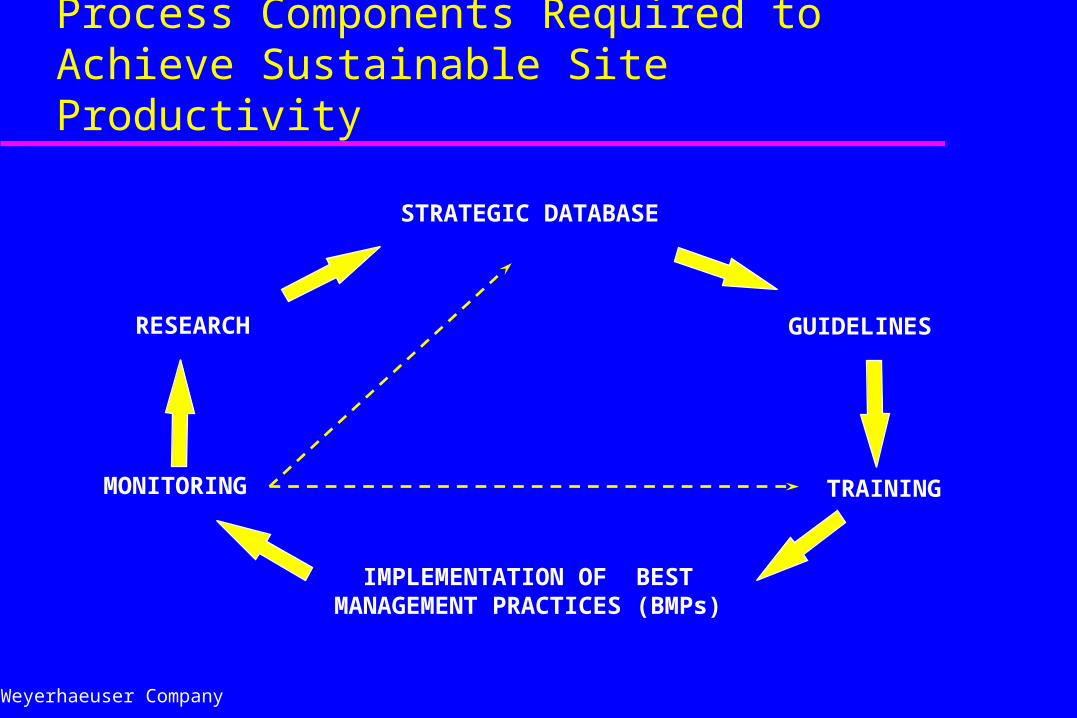
Process Components Required to Achieve Sustainable Site Productivity
STRATEGIC DATABASE
IMPLEMENTATION OF BEST MANAGEMENT PRACTICES (BMPs)
RESEARCH
MONITORING
GUIDELINES
TRAINING
Weyerhaeuser Company
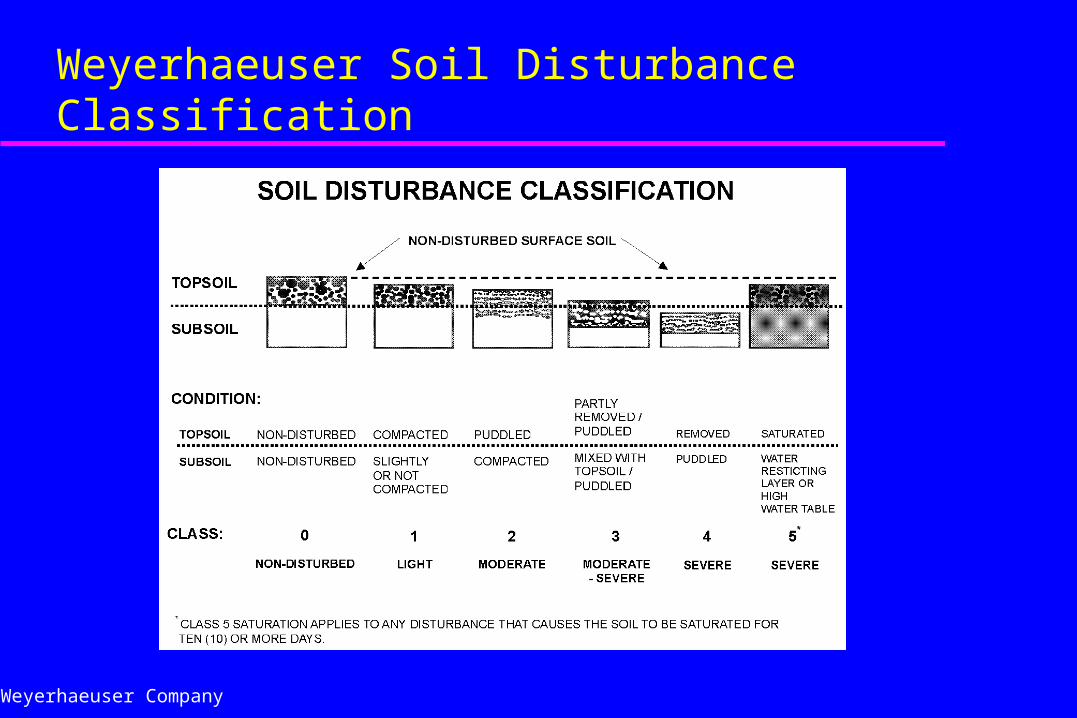
Weyerhaeuser Soil Disturbance Classification
Weyerhaeuser Company
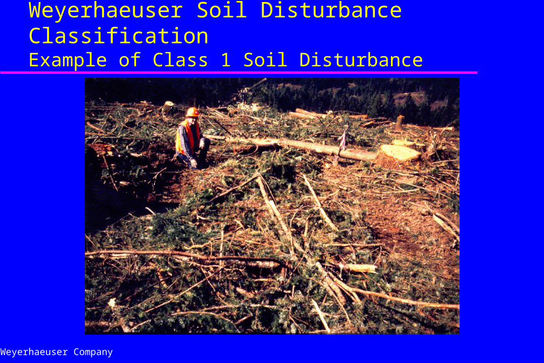
Weyerhaeuser Soil Disturbance ClassificationExample of Class 1 Soil Disturbance
Weyerhaeuser Company
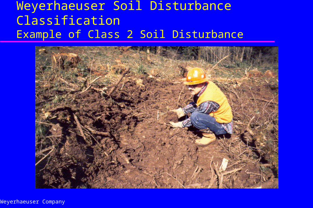
Weyerhaeuser Soil Disturbance ClassificationExample of Class 2 Soil Disturbance
Weyerhaeuser Company
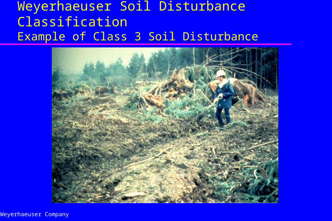
Weyerhaeuser Soil Disturbance ClassificationExample of Class 3 Soil Disturbance
Weyerhaeuser Company
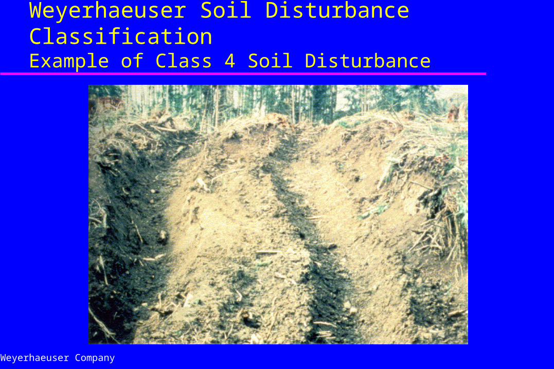
Weyerhaeuser Soil Disturbance ClassificationExample of Class 4 Soil Disturbance
Weyerhaeuser Company
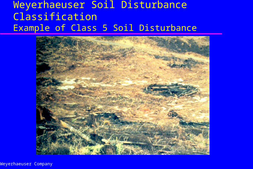
Weyerhaeuser Soil Disturbance ClassificationExample of Class 5 Soil Disturbance
Weyerhaeuser Company
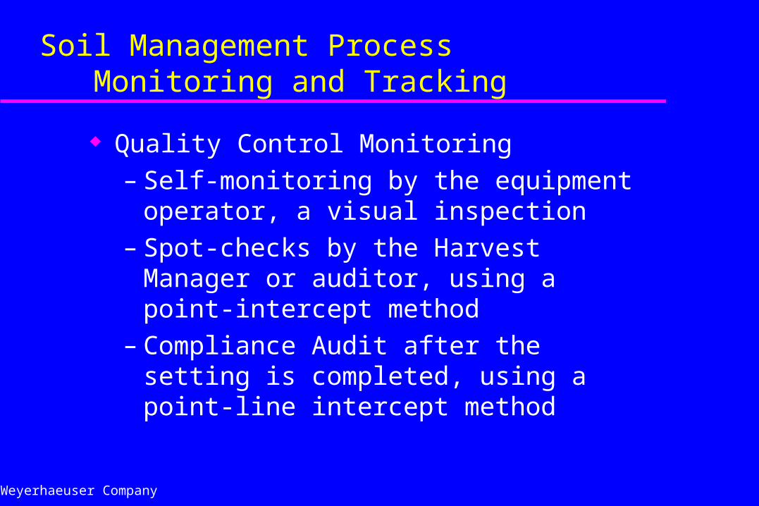
Soil Management Process Monitoring and Tracking
Quality Control Monitoring– Self-monitoring by the equipment operator, a
visual inspection– Spot-checks by the Harvest Manager or
auditor, using a point-intercept method– Compliance Audit after the setting is
completed, using a point-line intercept method
Weyerhaeuser Company
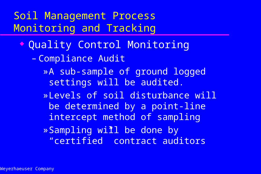
Soil Management ProcessMonitoring and Tracking
Quality Control Monitoring– Compliance Audit
» A sub-sample of ground logged settings will be audited.
» Levels of soil disturbance will be determined by a point-line intercept method of sampling
» Sampling will be done by “certified” contract auditors
Weyerhaeuser Company
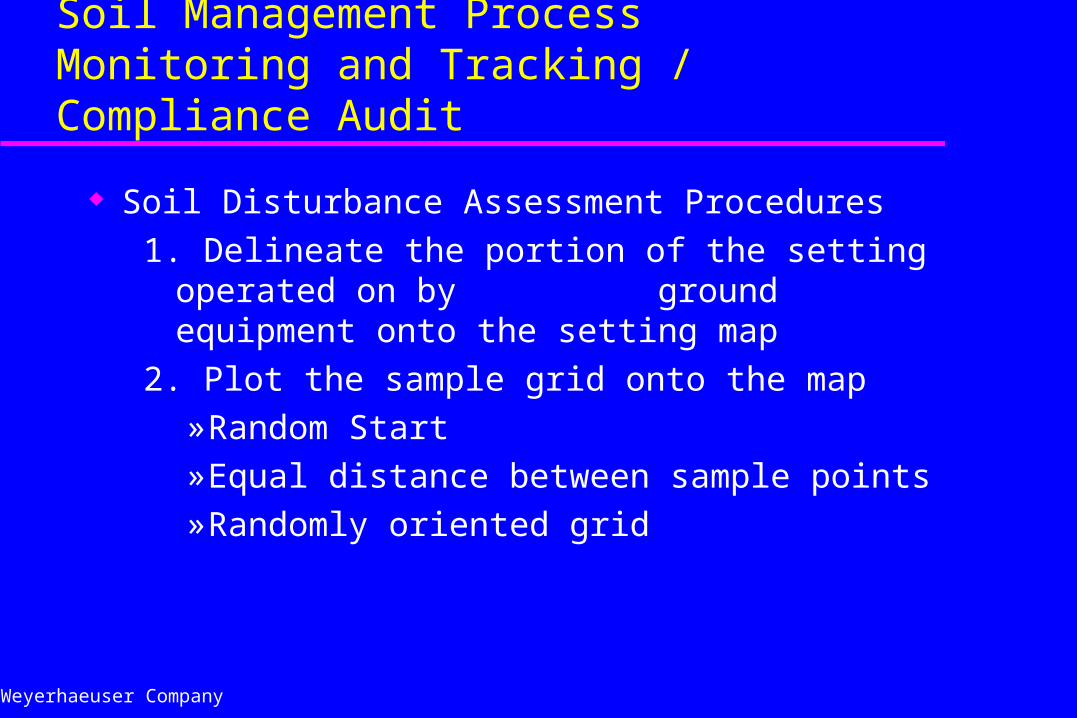
Soil Management ProcessMonitoring and Tracking / Compliance Audit
Soil Disturbance Assessment Procedures
1. Delineate the portion of the setting operated on by ground equipment onto the setting map
2. Plot the sample grid onto the map» Random Start» Equal distance between sample points» Randomly oriented grid
Weyerhaeuser Company
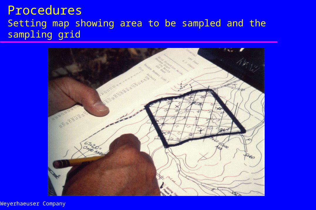
Soil Disturbance Assessment ProceduresSetting map showing area to be sampled and the sampling grid
Weyerhaeuser Company
Soil Management ProcessMonitoring and Tracking / Compliance Audit Soil Disturbance Assessment Procedures
3. Become familiar with the undisturbed soil profile» Weyerhaeuser Soil Survey or NRCS County Survey» Dig a small soil pit or view a road cut bank» Be able to distinguish the differences between topsoil
and subsoil» Develop an association between depth of disturbance
and the different soil disturbance classes
Weyerhaeuser Company
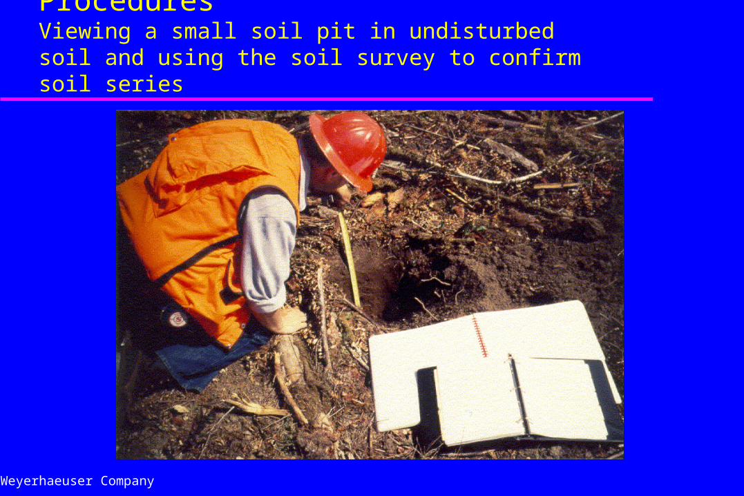
Soil Disturbance Assessment ProceduresViewing a small soil pit in undisturbed soil and using the soil survey to confirm soil series
Weyerhaeuser Company
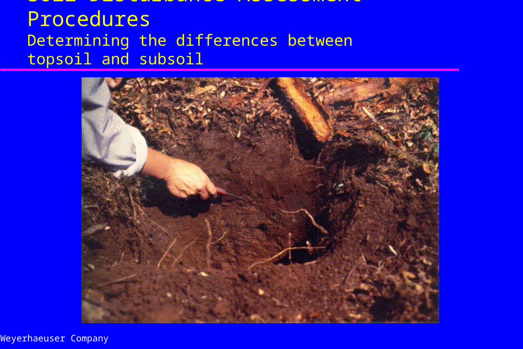
Soil Disturbance Assessment Procedures Determining the differences between topsoil and subsoil
Weyerhaeuser Company
Soil Management ProcessMonitoring and Tracking / Compliance Audit
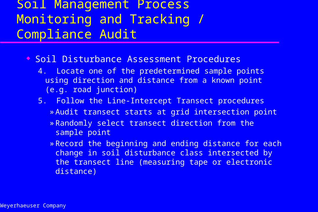
Soil Disturbance Assessment Procedures4. Locate one of the predetermined sample points using
direction and distance from a known point (e.g. road junction)
5. Follow the Line-Intercept Transect procedures
» Audit transect starts at grid intersection point
» Randomly select transect direction from the sample point
» Record the beginning and ending distance for each change in soil disturbance class intersected by the transect line (measuring tape or electronic distance)
Weyerhaeuser Company
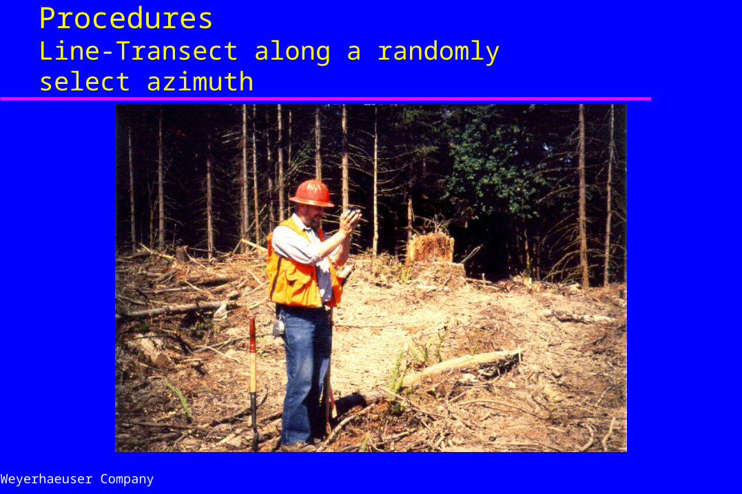
Soil Disturbance Assessment ProceduresLine-Transect along a randomly select azimuth
Weyerhaeuser Company
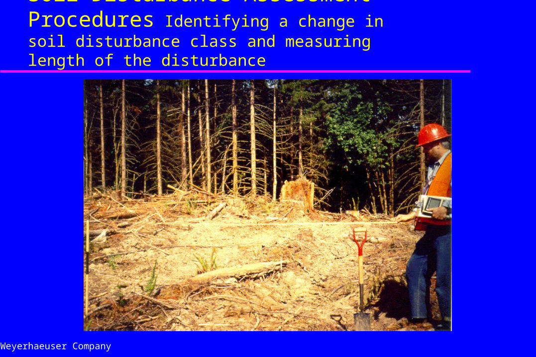
Soil Disturbance Assessment Procedures Identifying a change in soil disturbance class and measuring length of the disturbance
Weyerhaeuser Company
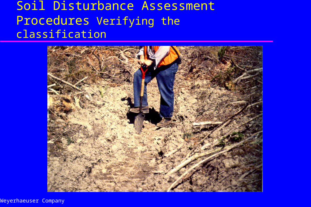
Soil Disturbance Assessment Procedures Verifying the classification
Weyerhaeuser Company
Soil Management ProcessMonitoring and Tracking / Compliance Audit
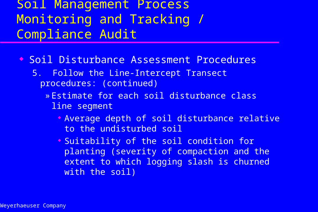
Soil Disturbance Assessment Procedures5. Follow the Line-Intercept Transect procedures: (continued)
» Estimate for each soil disturbance class line segment Average depth of soil disturbance relative to the
undisturbed soil Suitability of the soil condition for planting (severity of
compaction and the extent to which logging slash is churned with the soil)
Weyerhaeuser Company
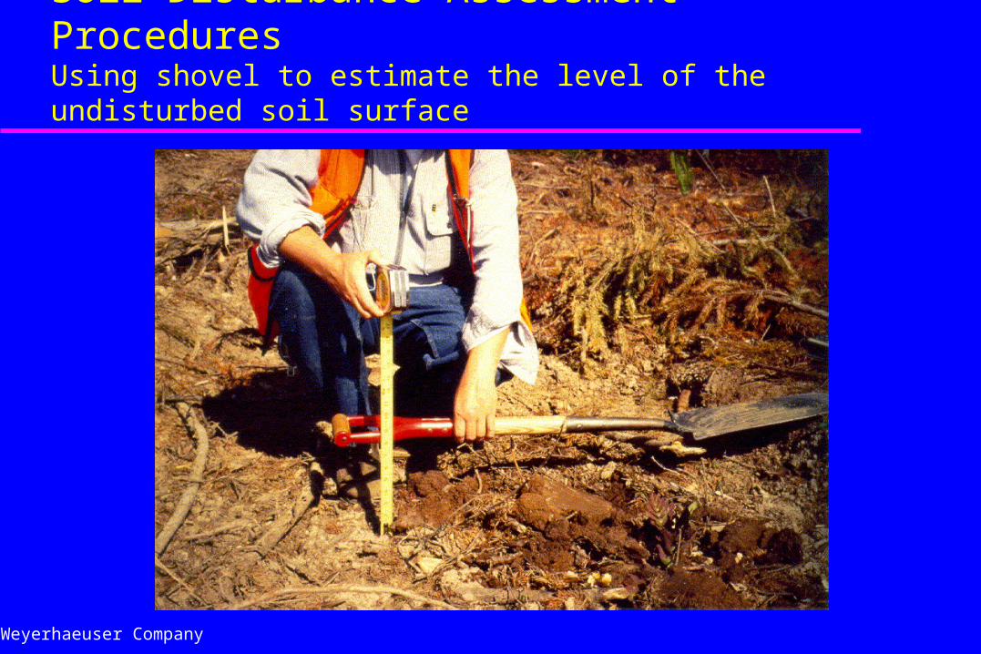
Soil Disturbance Assessment ProceduresUsing shovel to estimate the level of the undisturbed soil surface
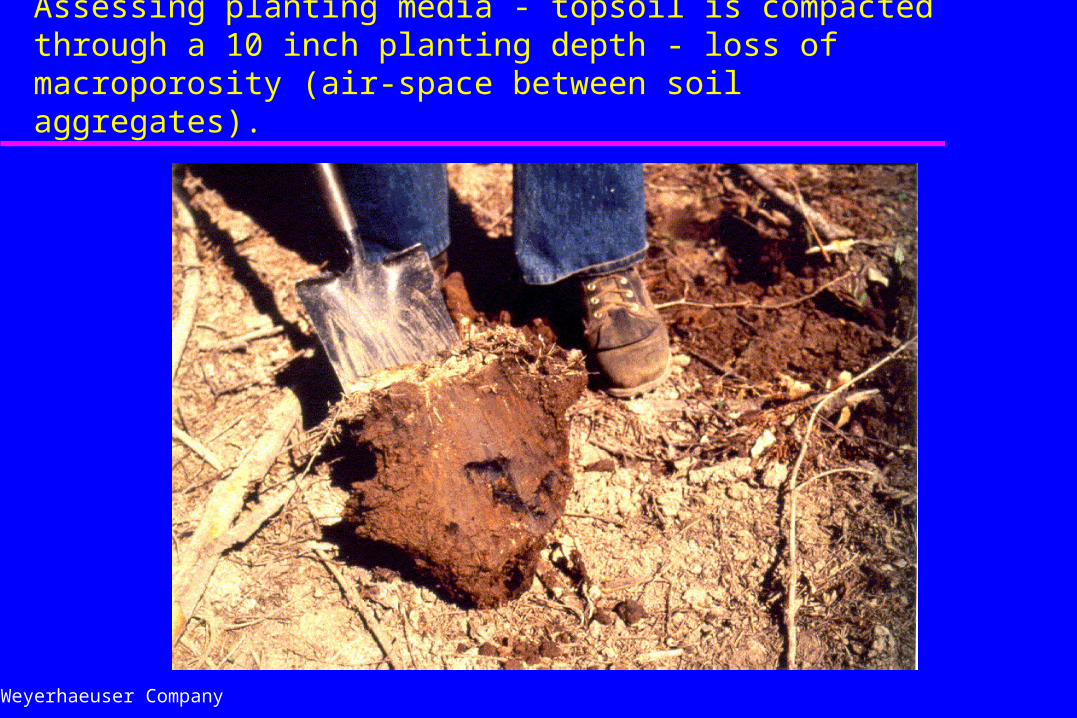
Weyerhaeuser Company
Soil Disturbance Assessment ProceduresAssessing planting media - topsoil is compacted through a 10 inch planting depth - loss of macroporosity (air-space between soil aggregates).
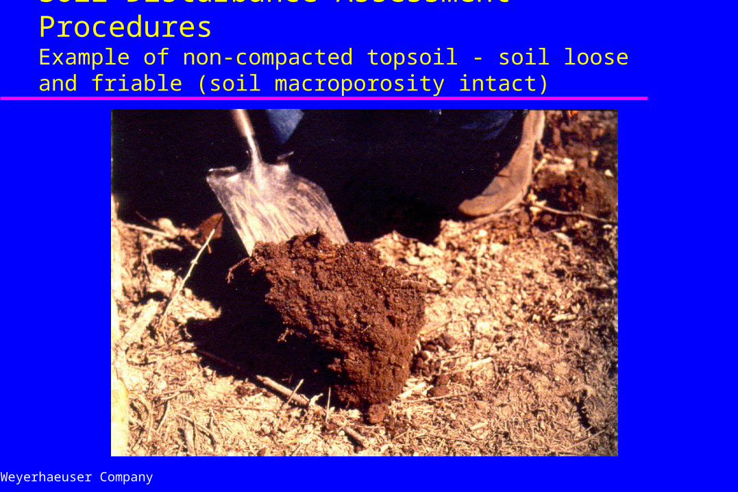
Weyerhaeuser Company
Soil Disturbance Assessment ProceduresExample of non-compacted topsoil - soil loose and friable (soil macroporosity intact)
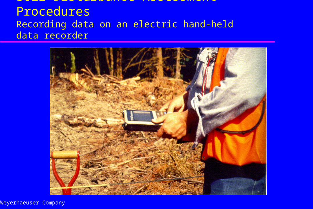
Weyerhaeuser Company
Soil Disturbance Assessment ProceduresRecording data on an electric hand-held data recorder
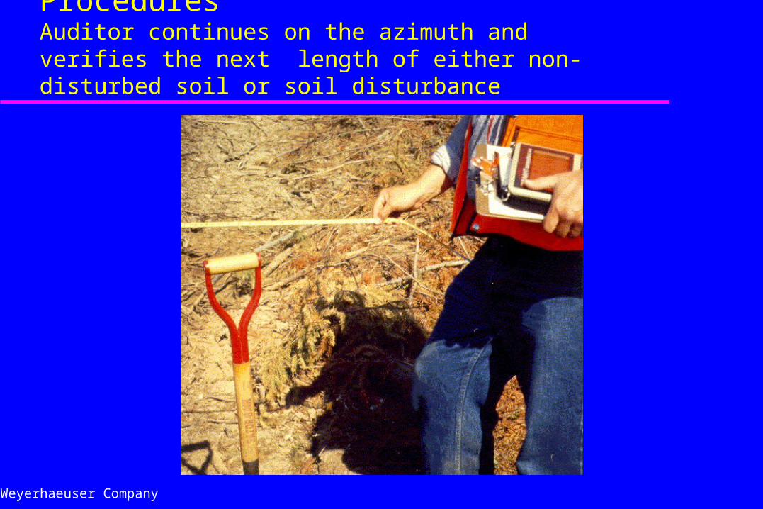
Weyerhaeuser Company
Soil Disturbance Assessment ProceduresAuditor continues on the azimuth and verifies the next length of either non-disturbed soil or soil disturbance
Weyerhaeuser Company
Soil Management Process Monitoring and Tracking / Compliance Audit
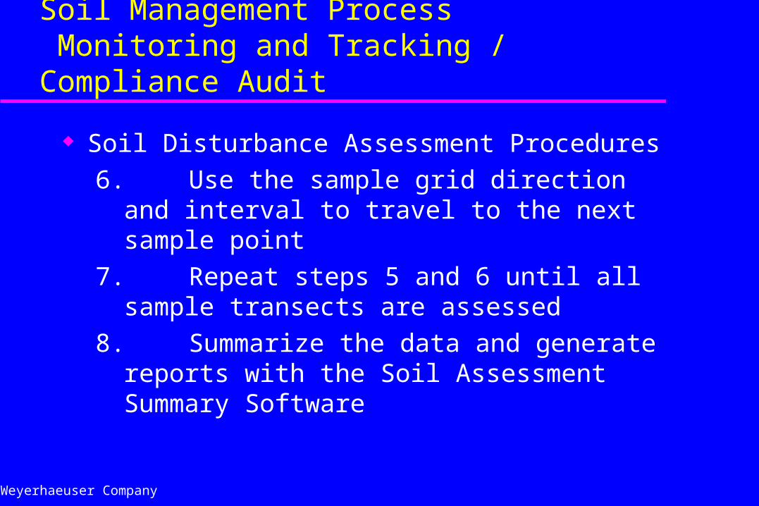
Soil Disturbance Assessment Procedures
6. Use the sample grid direction and interval to travel to the next sample point
7. Repeat steps 5 and 6 until all sample transects are assessed
8. Summarize the data and generate reports with the Soil Assessment Summary Software
Weyerhaeuser Company
Soil Management ProcessMonitoring and Tracking
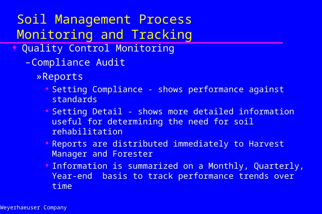
Quality Control Monitoring– Compliance Audit
»Reports Setting Compliance - shows performance against standards Setting Detail - shows more detailed information useful for
determining the need for soil rehabilitation Reports are distributed immediately to Harvest Manager and
Forester Information is summarized on a Monthly, Quarterly, Year-end
basis to track performance trends over time
Weyerhaeuser Company
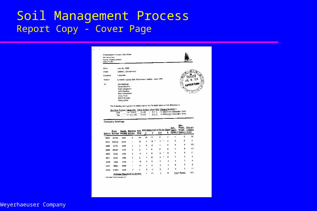
Soil Management ProcessReport Copy - Cover Page
Weyerhaeuser Company
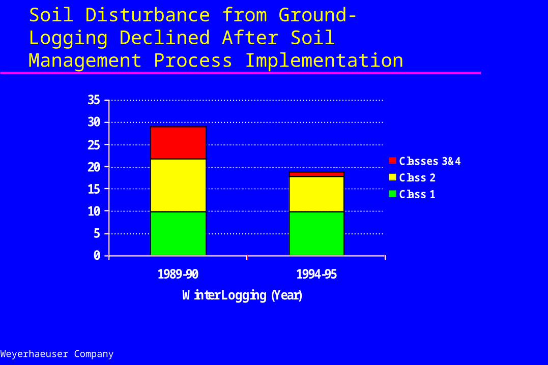
Soil Disturbance from Ground-Logging Declined After Soil Management Process Implementation
0
5
10
15
20
25
30
35
1989-90 1994-95
Winter Logging (Year)
Soil Disturbance (%)
Classes 3&4
Class 2
Class 1
Weyerhaeuser Company
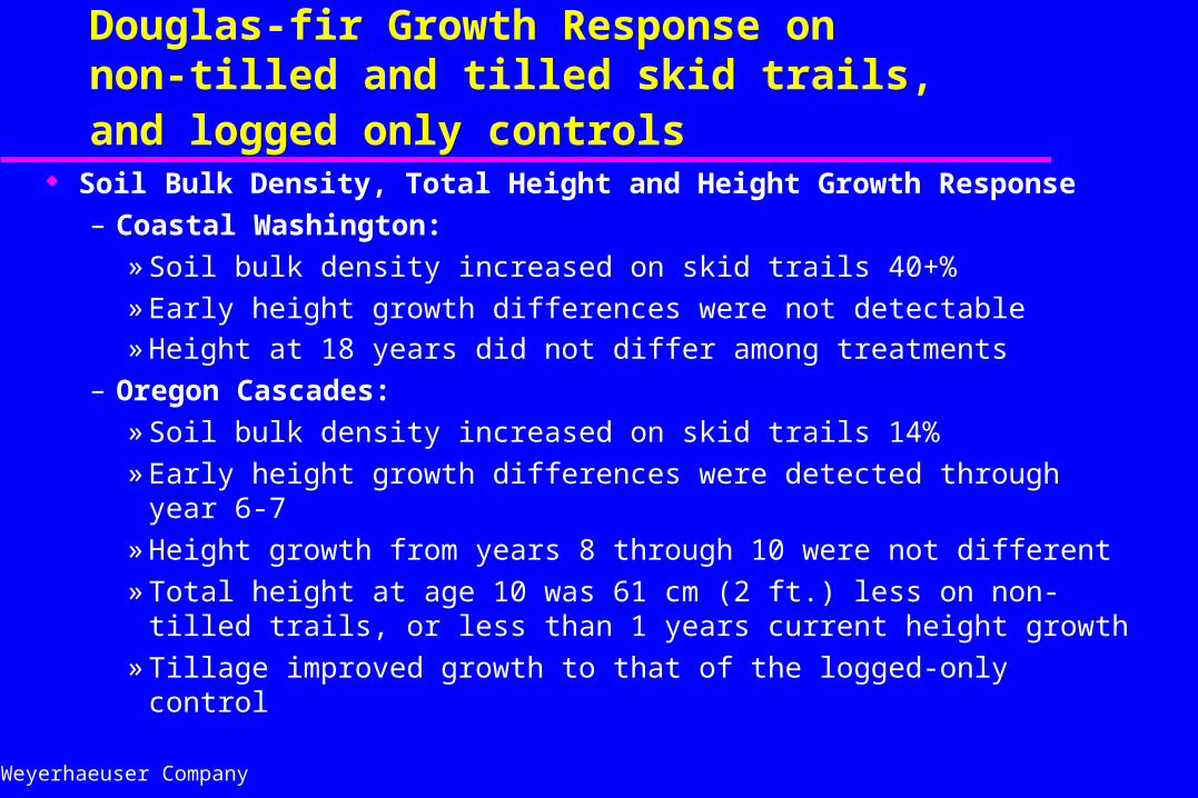
Soil Management ProcessDouglas-fir Growth Response on non-tilled and tilled skid trails, and logged only controls
Soil Bulk Density, Total Height and Height Growth Response
– Coastal Washington:
» Soil bulk density increased on skid trails 40+%
» Early height growth differences were not detectable» Height at 18 years did not differ among treatments
– Oregon Cascades:
» Soil bulk density increased on skid trails 14%
» Early height growth differences were detected through year 6-7
» Height growth from years 8 through 10 were not different
» Total height at age 10 was 61 cm (2 ft.) less on non-tilled trails, or less than 1 years current height growth
» Tillage improved growth to that of the logged-only control
Weyerhaeuser Company
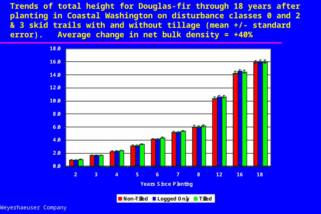
Trends of total height for Douglas-fir through 18 years after planting in Coastal Washington on disturbance classes 0 and 2 & 3 skid trails with and without tillage (mean +/- standard error). Average change in net bulk density = +40%
0.0
2.0
4.0
6.0
8.0
10.0
12.0
14.0
16.0
18.0
2 3 4 5 6 7 8 12 16 18
Years Since Planting
Mean Total Height (M)
Non-Tilled Logged Only Tilled
Weyerhaeuser Company
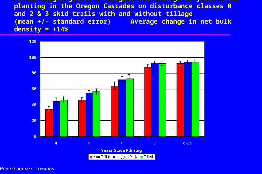
Annual height growth of Douglas-fir through 10 years after planting in the Oregon Cascades on disturbance classes 0 and 2 & 3 skid trails with and without tillage (mean +/- standard error) Average change in net bulk density = +14%
0
20
40
60
80
100
120
4 5 6 7 8-10
Years Since Planting
Height Growth (cm)
Non-Tilled Logged Only Tilled
Weyerhaeuser Company
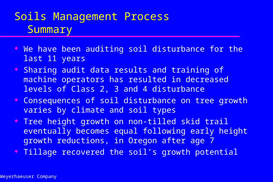
Soils Management Process Summary
We have been auditing soil disturbance for the last 11 years Sharing audit data results and training of machine operators has
resulted in decreased levels of Class 2, 3 and 4 disturbance Consequences of soil disturbance on tree growth varies by climate
and soil types Tree height growth on non-tilled skid trail eventually becomes equal
following early height growth reductions, in Oregon after age 7 Tillage recovered the soil’s growth potential


![[S. K. Heninger] Touches of Sweet Harmony Pythago(BookFi.org)](https://img.pdfslide.us/doc/110x75/55cf98c8550346d03399a52f/s-k-heninger-touches-of-sweet-harmony-pythagobookfiorg.jpg)