Embed Size (px)
DESCRIPTION
Wetland Types, Functions, and DCM’s GIS Wetland Data North Carolina Department of Environment and Natural Resources Division of Coastal Management. DCM GIS Wetland Data:. Wetland Type Data Wetland Functional Significance Data Potential Wetland Restoration and Enhancement Site Data - PowerPoint PPT Presentation
Citation preview
January 2002
Wetland Types, Functions, and DCM’s GIS
Wetland Data
North Carolina Department of Environment and Natural Resources
Division of Coastal Management
January 2002
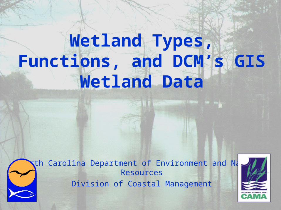
DCM GIS Wetland Data:• Wetland Type Data
• Wetland Functional Significance Data
• Potential Wetland Restoration and Enhancement Site Data
• Wetland Restoration Site Functional Significance Data (in progress)
January 2002
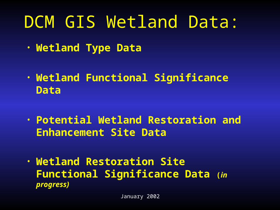
• WetlandsWetlands• Wetland FunctionsWetland Functions• Wetland TypesWetland Types• GIS Wetland DataGIS Wetland Data• NC-CREWS DataNC-CREWS Data• Getting DCM’s DataGetting DCM’s Data
Topics
January 2002
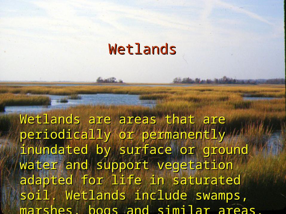
Wetlands Wetlands
Wetlands are areas that are Wetlands are areas that are periodically or permanently inundated periodically or permanently inundated by surface or ground water and by surface or ground water and support vegetation adapted for life in support vegetation adapted for life in saturated soil. Wetlands include saturated soil. Wetlands include swamps, marshes, bogs and similar swamps, marshes, bogs and similar areas.areas.
January 2002
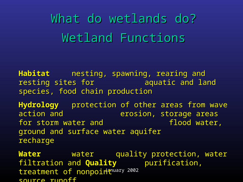
What do wetlands do?What do wetlands do?
Wetland FunctionsWetland Functions
HabitatHabitat nesting, spawning, rearing and resting nesting, spawning, rearing and resting sites for sites for aquatic and land species, food aquatic and land species, food chain productionchain production
HydrologyHydrology protection of other areas from wave protection of other areas from wave action and action and erosion, storage areas for storm erosion, storage areas for storm water and water and flood water, ground and flood water, ground and surface water aquifer surface water aquifer recharge recharge
Water Water water water quality protection, water quality protection, water filtration and filtration and QualityQuality purification, treatment of purification, treatment of nonpoint nonpoint source runoff source runoff
January 2002
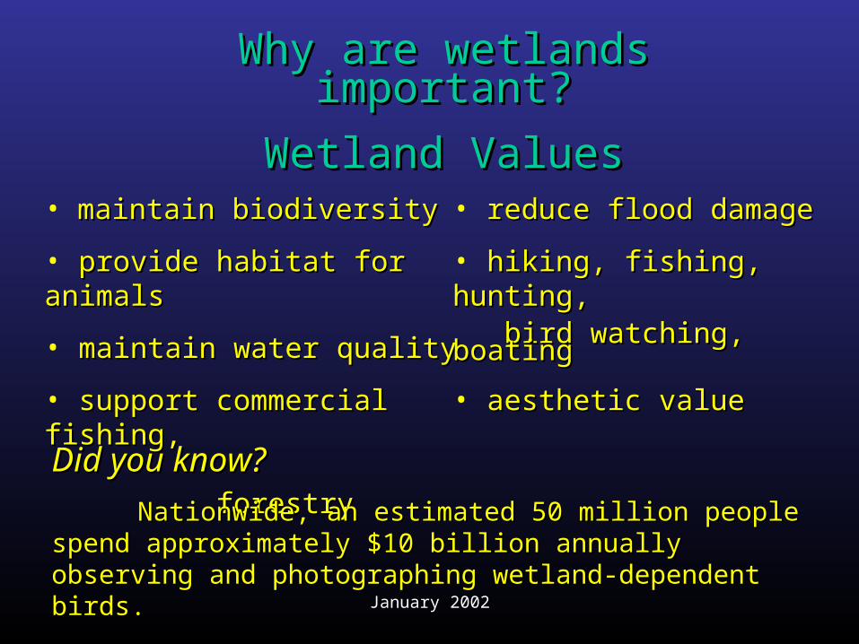
• maintain biodiversitymaintain biodiversity
• provide habitat for animals provide habitat for animals
• maintain water qualitymaintain water quality
• support commercial support commercial fishing, fishing, forestryforestry
• reduce flood damage reduce flood damage
• hiking, fishing, hunting, hiking, fishing, hunting, bird watching, boatingbird watching, boating
• aesthetic valueaesthetic value
Why are wetlands Why are wetlands important?important?
Wetland ValuesWetland Values
Did you know?Did you know?
Nationwide, an estimated 50 million people spend Nationwide, an estimated 50 million people spend approximately $10 billion annually observing and approximately $10 billion annually observing and photographing wetland-dependent birds.photographing wetland-dependent birds.
January 2002
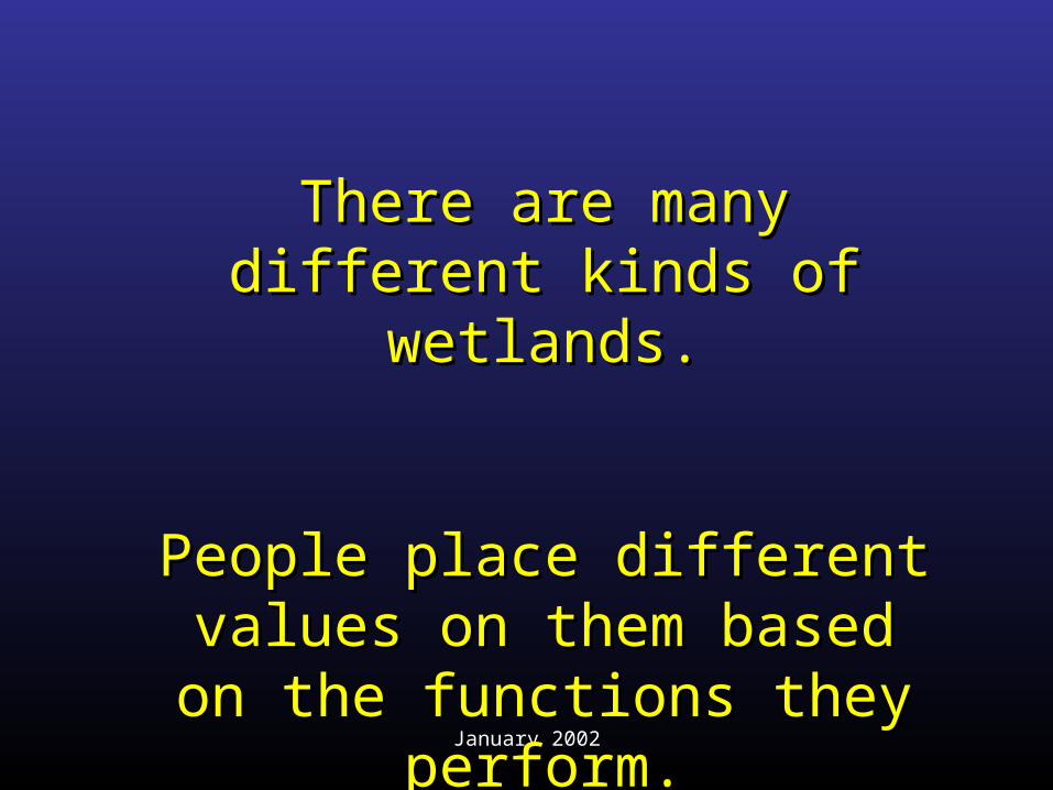
There are many different There are many different kinds of wetlands.kinds of wetlands.
People place different People place different values on them based on values on them based on
the functions they the functions they perform.perform.
January 2002
Where are wetlands located?Where are wetlands located?
• Wetlands are located throughout NC Wetlands are located throughout NC
• There are two kinds of maps in NC There are two kinds of maps in NC that show the locations and types of that show the locations and types of wetlands:wetlands:
1.1. National Wetland Inventory (NWI) MapsNational Wetland Inventory (NWI) Maps
2.2. DCM Wetland Type MapsDCM Wetland Type Maps
January 2002
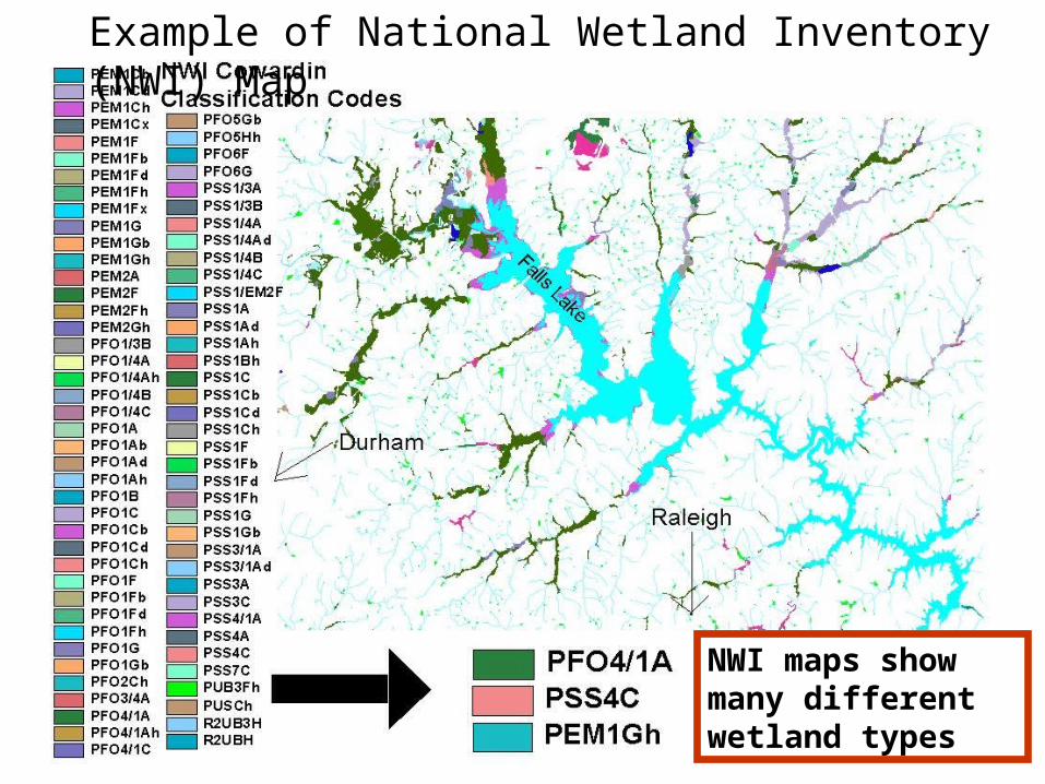
Example of National Wetland Inventory (NWI) Map
NWI maps show many different wetland types
January 2002
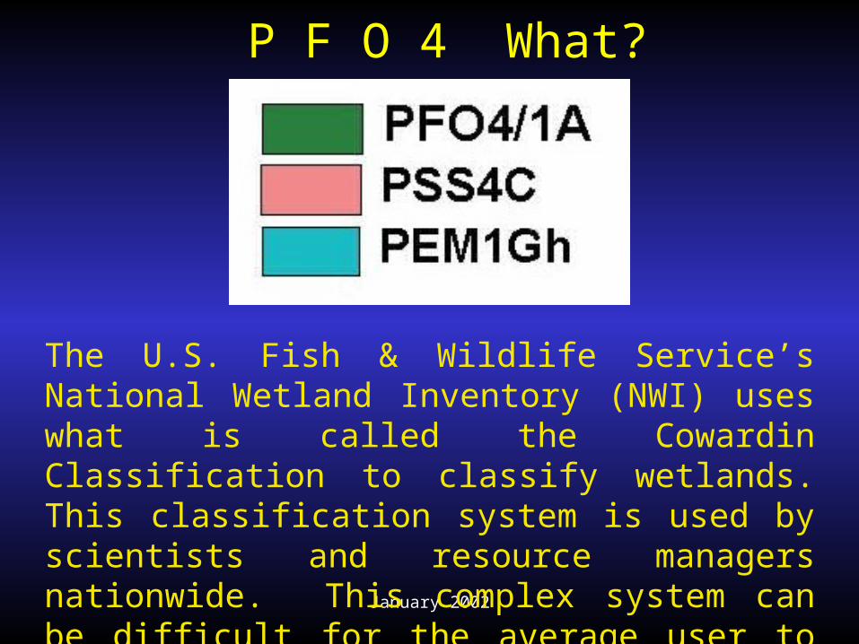
P F O 4 What?
The U.S. Fish & Wildlife Service’s National Wetland Inventory (NWI) uses what is called the Cowardin Classification to classify wetlands. This classification system is used by scientists and resource managers nationwide. This complex system can be difficult for the average user to interpret.
January 2002
DCM’s wetland maps are easy to understand
because wetlands are grouped into well-known
categories.
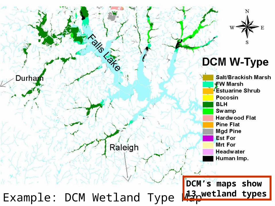
January 2002Example: DCM Wetland Type Map
DCM’s maps show 13 wetland types
January 2002
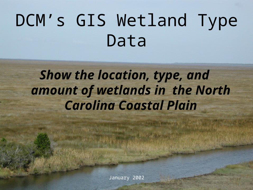
DCM’s GIS Wetland Type Data
Show the location, type, and amount of wetlands in the North Carolina Coastal Plain
January 2002
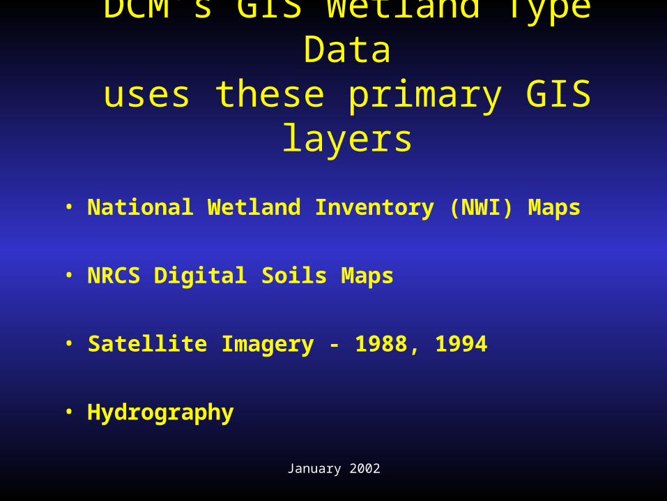
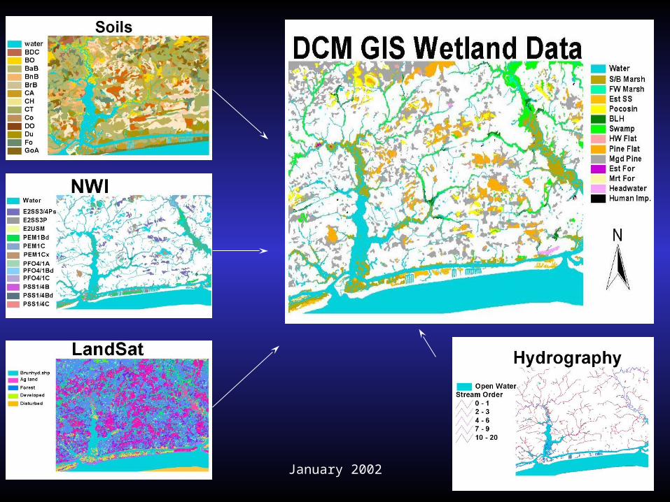
DCM’s GIS Wetland Type Datauses these primary GIS layers
• National Wetland Inventory (NWI) Maps
• NRCS Digital Soils Maps
• Satellite Imagery - 1988, 1994
• Hydrography
January 2002
January 2002
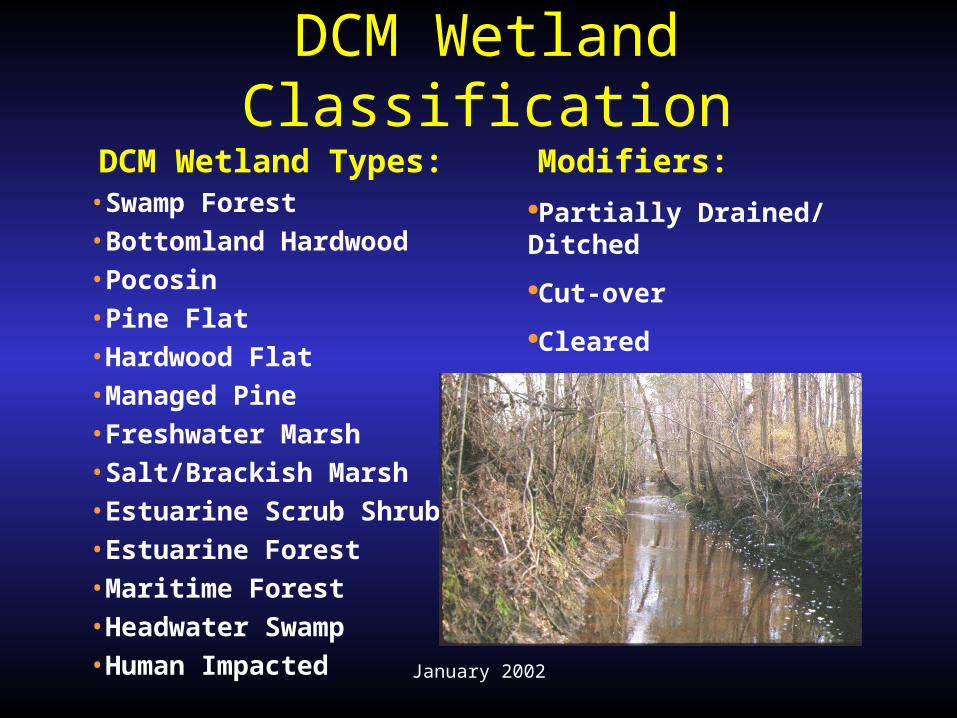
DCM Wetland Classification
DCM Wetland Types:•Swamp Forest•Bottomland Hardwood•Pocosin•Pine Flat•Hardwood Flat•Managed Pine•Freshwater Marsh•Salt/Brackish Marsh•Estuarine Scrub Shrub•Estuarine Forest•Maritime Forest•Headwater Swamp•Human Impacted
Modifiers:Partially Drained/ Ditched
Cut-over
Cleared
January 2002
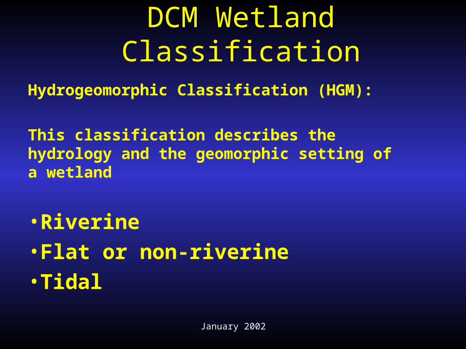
DCM Wetland Classification
Hydrogeomorphic Classification (HGM):
This classification describes the hydrology and the geomorphic setting of a wetland
•Riverine•Flat or non-riverine•Tidal
January 2002
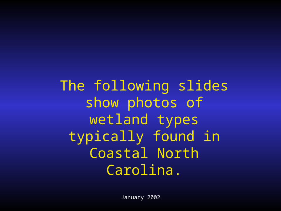
The following slides show photos of wetland types typically found in Coastal
North Carolina.
January 2002
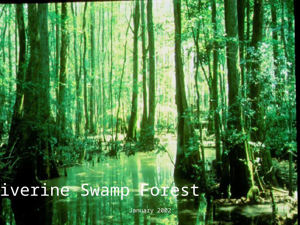
Riverine Swamp Forest
January 2002
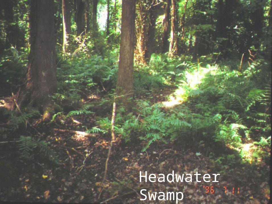
Headwater Swamp
January 2002
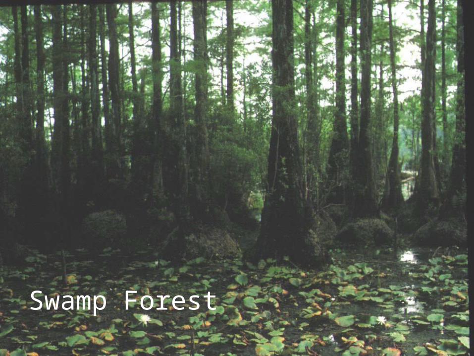
Swamp Forest
January 2002
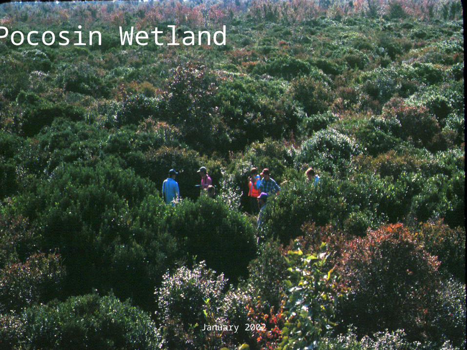
Pocosin Wetland
January 2002
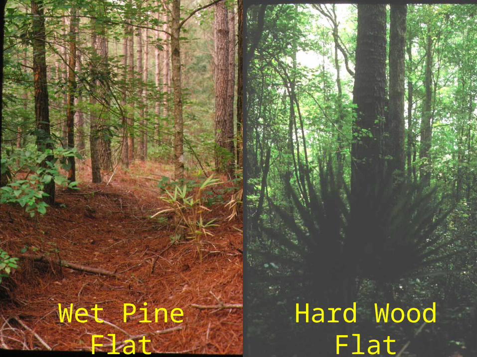
Hard Wood Flat
Wet Pine Flat
January 2002
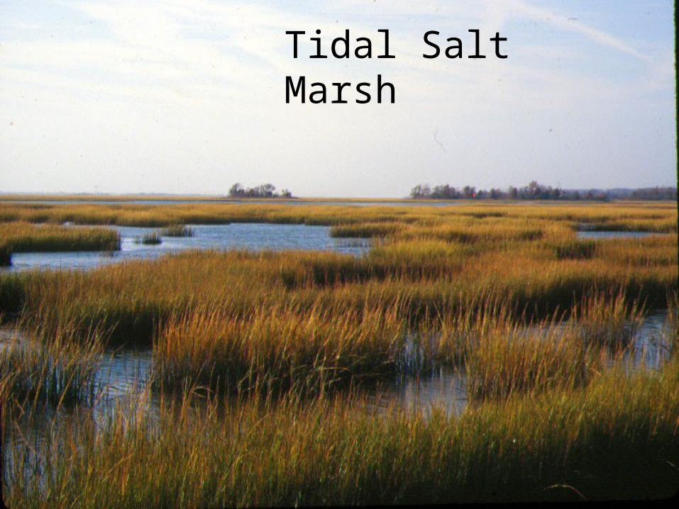
Tidal Salt Marsh
January 2002
Are DCM’s GIS Wetland Maps Accurate?
January 2002
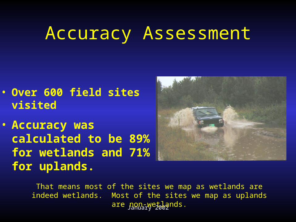
Accuracy Assessment
• Accuracy was calculated to be 89% for wetlands and 71% for uplands.
• Over 600 field sites visited
That means most of the sites we map as wetlands are indeed wetlands. Most of the sites we map as uplands are non-wetlands.
January 2002
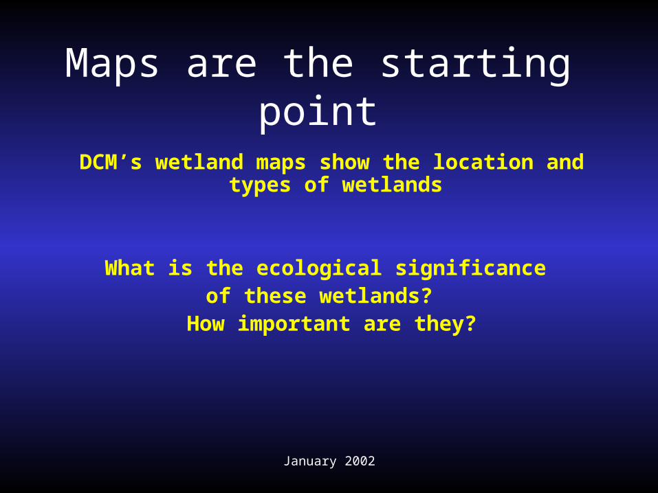
Maps are the starting point
DCM’s wetland maps show the location and types of wetlands
What is the ecological significance of these wetlands?
How important are they?
January 2002
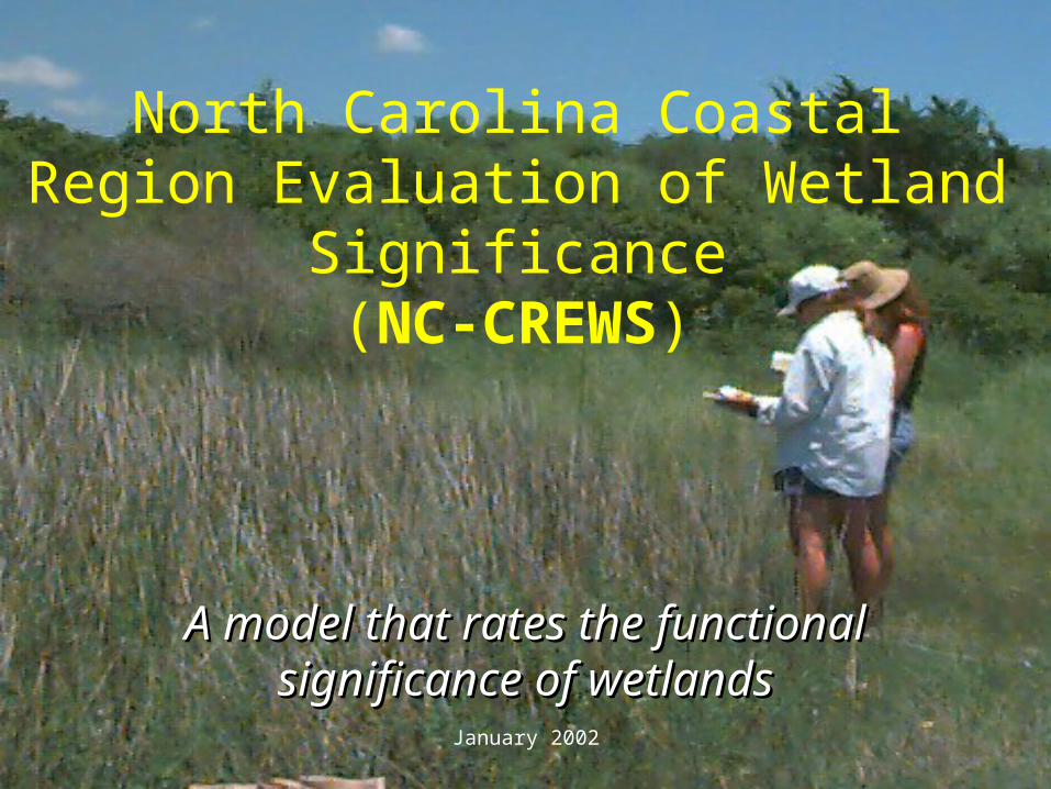
North Carolina Coastal Region Evaluation of Wetland
Significance(NC-CREWS)
A model that rates the A model that rates the functional significance of functional significance of
wetlandswetlands
January 2002
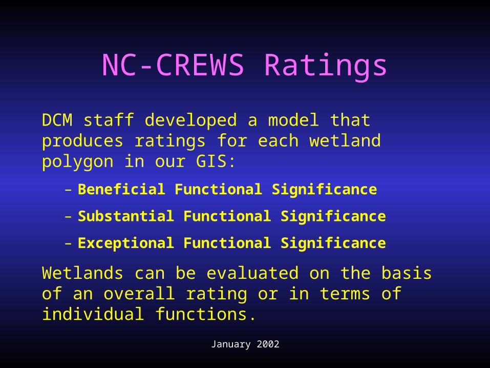
NC-CREWS Ratings
DCM staff developed a model that produces ratings for each wetland polygon in our GIS:
– Beneficial Functional Significance
– Substantial Functional Significance
– Exceptional Functional Significance
Wetlands can be evaluated on the basis of an overall rating or in terms of individual functions.
January 2002
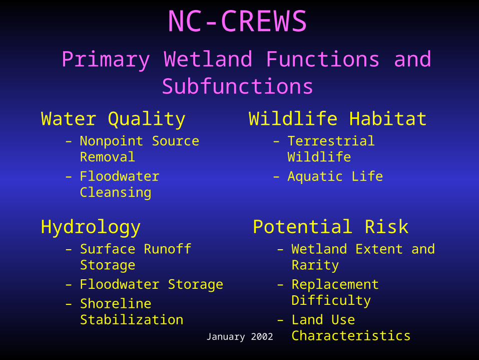
NC-CREWS Primary Wetland Functions and
Subfunctions
Water Quality– Nonpoint Source
Removal– Floodwater Cleansing
Wildlife Habitat– Terrestrial Wildlife– Aquatic Life
Hydrology– Surface Runoff
Storage– Floodwater Storage– Shoreline Stabilization
Potential Risk– Wetland Extent and
Rarity– Replacement Difficulty– Land Use Characteristics
January 2002
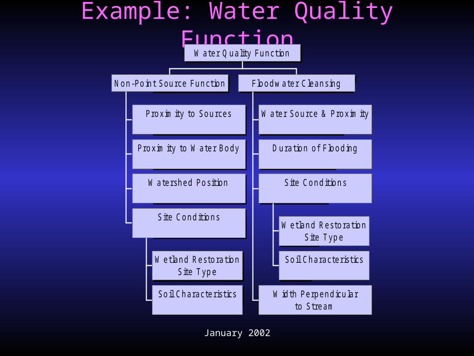
Example: Water Quality Function
P roxim ity to Sources
P roxim ity to W ater Body
W atershed P osition
W etland Resto rationS ite T yp e
So il Characteristics
S ite Cond itio ns
N on-P o int Source Function
W ater Source & P roxim ity
D uratio n of F lo od ing
W etland Resto rationS ite T yp e
So il Characteristics
S ite Cond itio ns
W idth P erpend icu larto Stream
F lo odw ater C leansing
W ater Q uality Function
January 2002
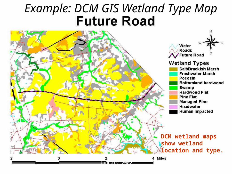
Example: DCM GIS Wetland Type Map
DCM wetland maps show wetland location and type.
January 2002
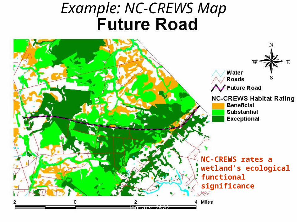
Example: NC-CREWS Map
NC-CREWS rates a wetland’s ecological functional significance
January 2002
January 2002
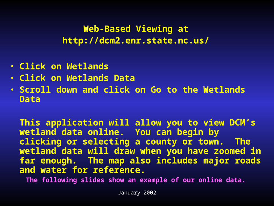
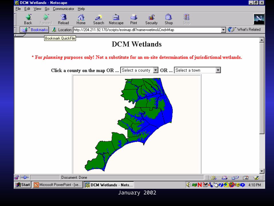
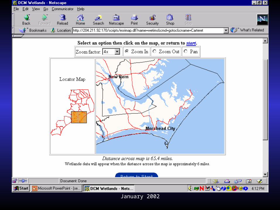
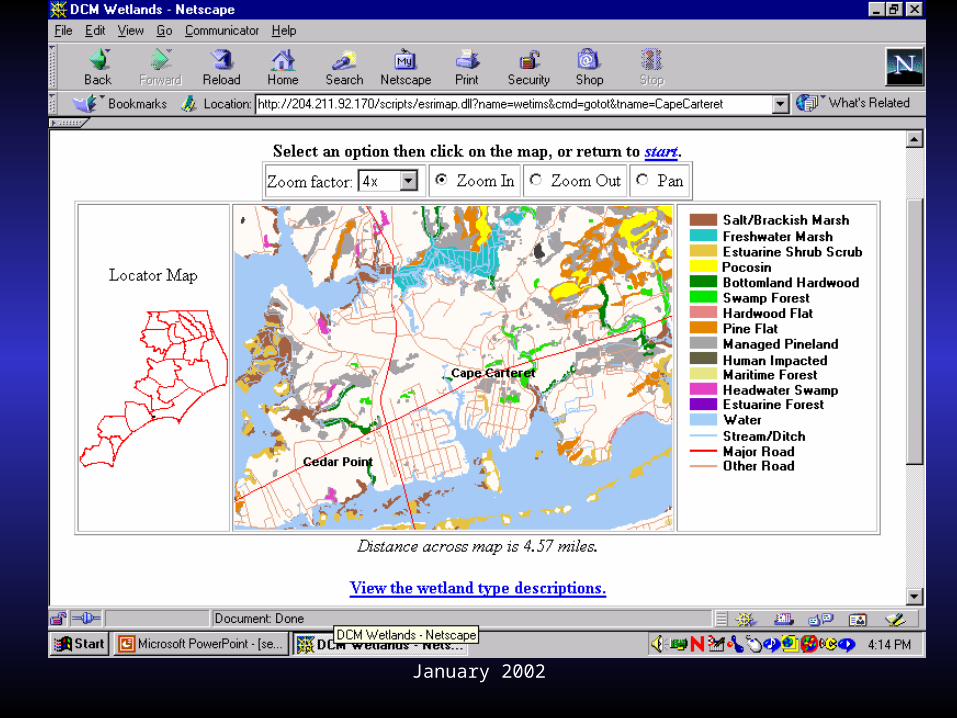
Web-Based Viewing athttp://dcm2.enr.state.nc.us/
• Click on Wetlands • Click on Wetlands Data• Scroll down and click on Go to the Wetlands
Data
This application will allow you to view DCM’s wetland data online. You can begin by clicking or selecting a county or town. The wetland data will draw when you have zoomed in far enough. The map also includes major roads and water for reference.
The following slides show an example of our online data.
January 2002
January 2002
January 2002
January 2002
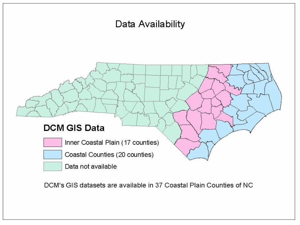
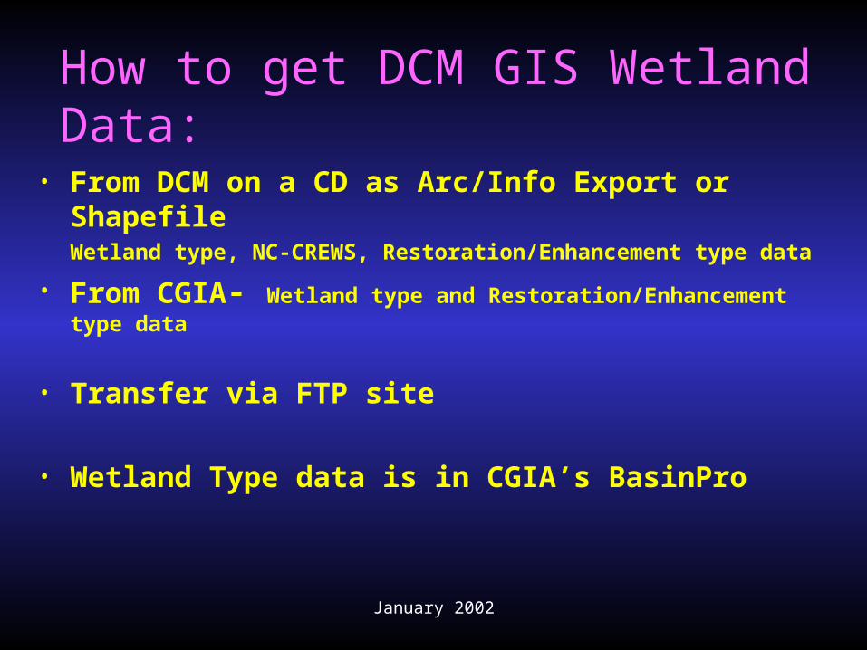
How to get DCM GIS Wetland Data:
• From DCM on a CD as Arc/Info Export or ShapefileWetland type, NC-CREWS, Restoration/Enhancement type data
• From CGIA- Wetland type and Restoration/Enhancement type data
• Transfer via FTP site
• Wetland Type data is in CGIA’s BasinPro