Embed Size (px)
Citation preview
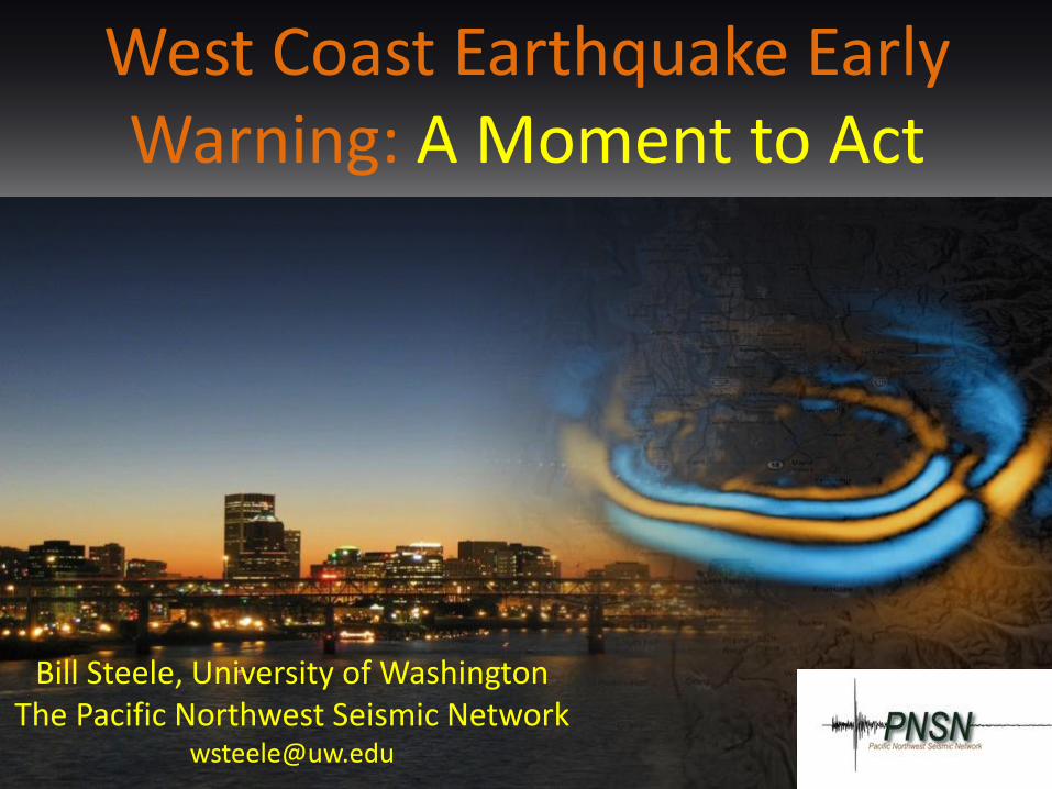
West Coast Earthquake Early Warning: A Moment to Act
Bill Steele, University of Washington The Pacific Northwest Seismic Network
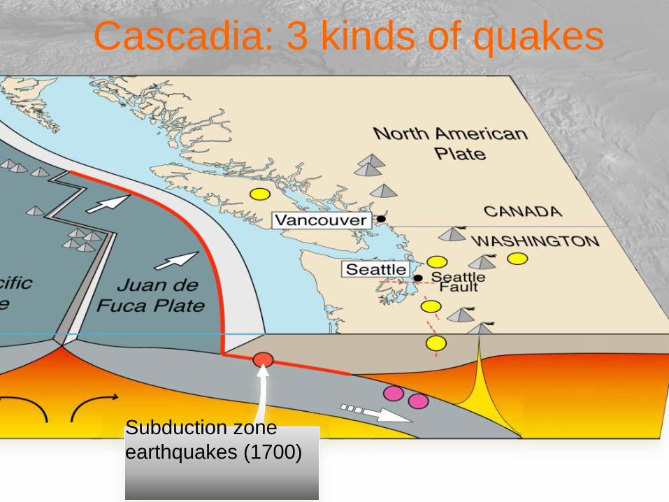
Cascadia: 3 kinds of quakes
Subduction zone
earthquakes (1700)
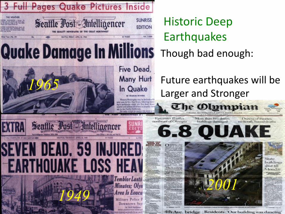
1949 2001
1965
Though bad enough: Future earthquakes will be Larger and Stronger
Historic Deep Earthquakes
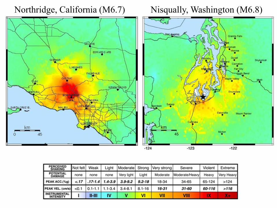
Northridge, California (M6.7) Nisqually, Washington (M6.8)
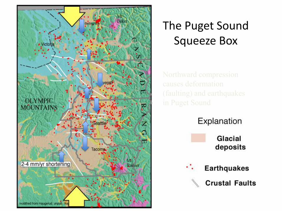
The Puget Sound Squeeze Box
Northward compression
causes deformation
(faulting) and earthquakes
in Puget Sound
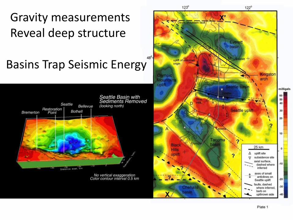
Gravity measurements Reveal deep structure
Basins Trap Seismic Energy
8
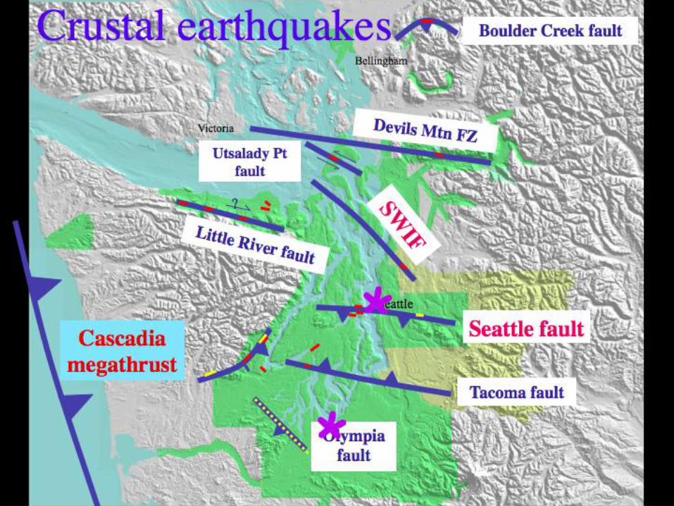
Crustal faults, not dealt with yet
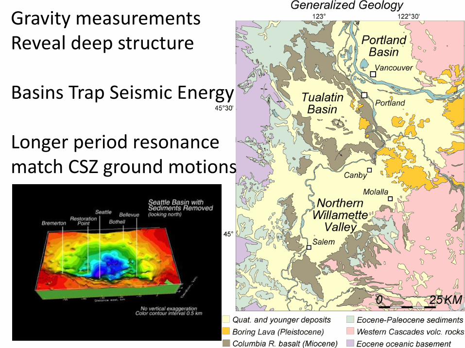
Gravity measurements Reveal deep structure Basins Trap Seismic Energy Longer period resonance match CSZ ground motions
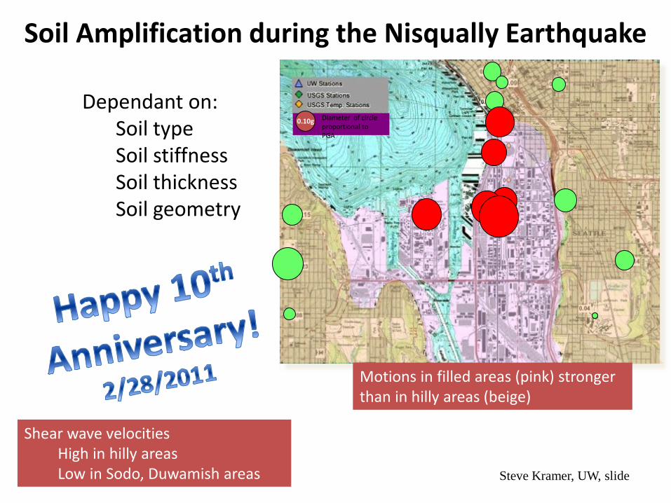
Soil Amplification during the Nisqually Earthquake
Dependant on: Soil type Soil stiffness Soil thickness Soil geometry
Shear wave velocities High in hilly areas Low in Sodo, Duwamish areas
0.10g Diameter of circle proportional to PGA
Motions in filled areas (pink) stronger than in hilly areas (beige)
Steve Kramer, UW, slide
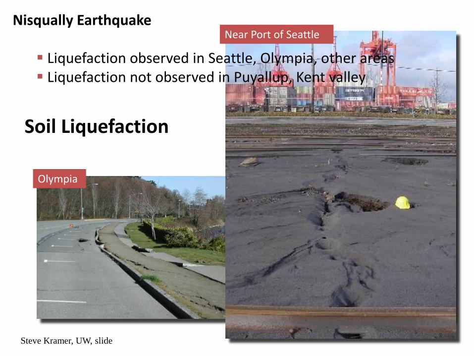
Soil Liquefaction
Olympia Olympia
Near Port of Seattle
Steve Kramer, UW, slide
Nisqually Earthquake
Liquefaction observed in Seattle, Olympia, other areas Liquefaction not observed in Puyallup, Kent valley
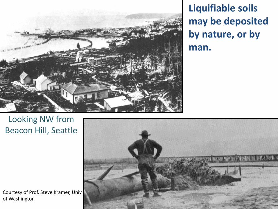
Looking NW from Beacon Hill, Seattle
Liquifiable soils may be deposited by nature, or by man.
Courtesy of Prof. Steve Kramer, Univ. of Washington
Tideflats, 1896
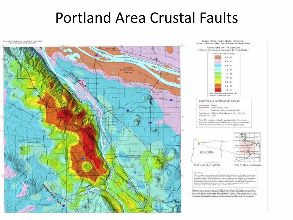
Portland Area Crustal Faults
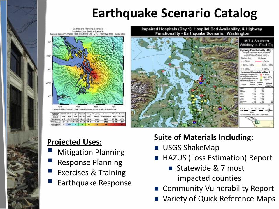
Earthquake Scenario Catalog
Projected Uses: Mitigation Planning Response Planning Exercises & Training Earthquake Response
Suite of Materials Including: USGS ShakeMap HAZUS (Loss Estimation) Report
Statewide & 7 most impacted counties
Community Vulnerability Report Variety of Quick Reference Maps
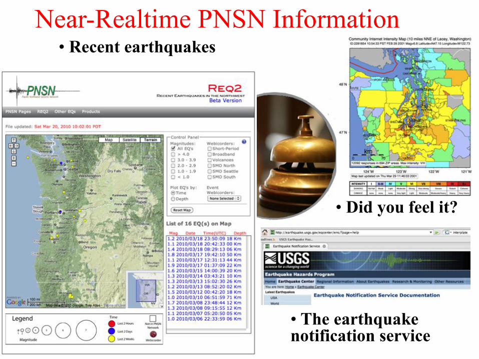
Near-Realtime PNSN Information
• Did you feel it?
• The earthquake notification service
• Recent earthquakes
17 17
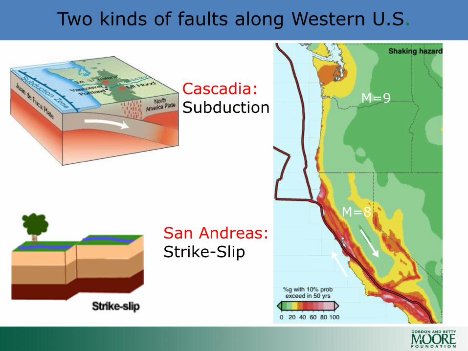
Two kinds of faults along Western U.S.
M=9
M=8
Cascadia: Subduction
San Andreas: Strike-Slip
40ºN
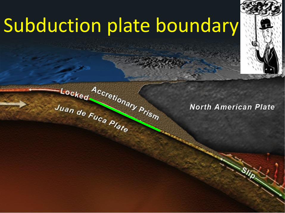
Subduction plate boundary
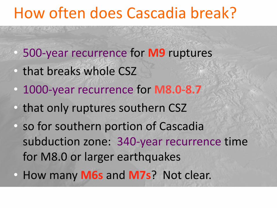
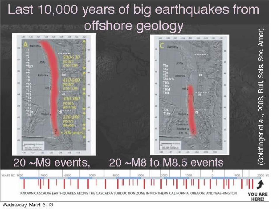
How often does Cascadia break?
• 500-year recurrence for M9 ruptures
• that breaks whole CSZ
• 1000-year recurrence for M8.0-8.7
• that only ruptures southern CSZ
• so for southern portion of Cascadia subduction zone: 340-year recurrence time for M8.0 or larger earthquakes
• How many M6s and M7s? Not clear.
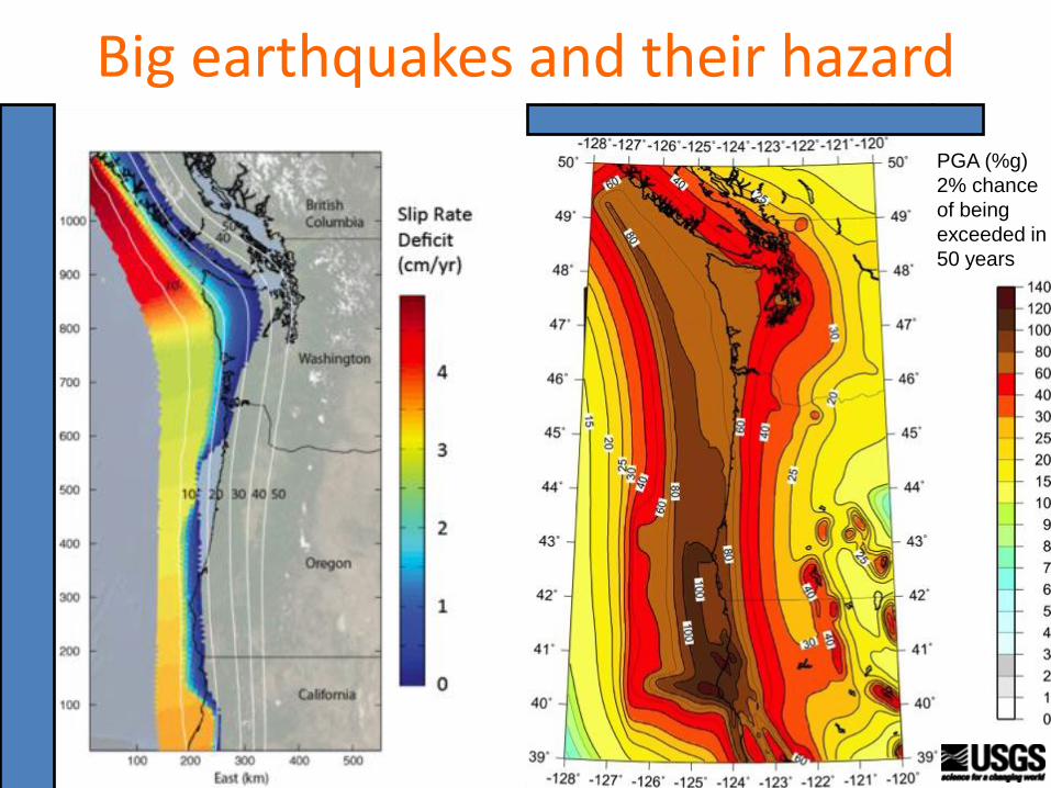
Big earthquakes and their hazard
PGA (%g)
2% chance
of being
exceeded in
50 years
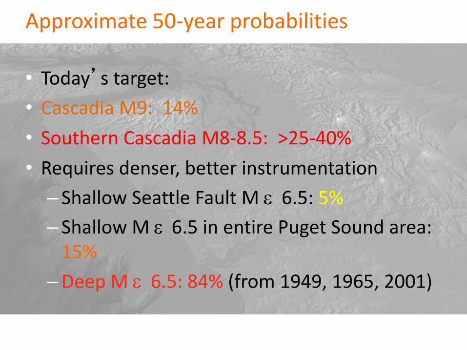
Approximate 50-year probabilities
• Today’s target:
• Cascadia M9: 14%
• Southern Cascadia M8-8.5: >25-40%
• Requires denser, better instrumentation
– Shallow Seattle Fault M 6.5: 5%
– Shallow M 6.5 in entire Puget Sound area: 15%
–Deep M 6.5: 84% (from 1949, 1965, 2001)
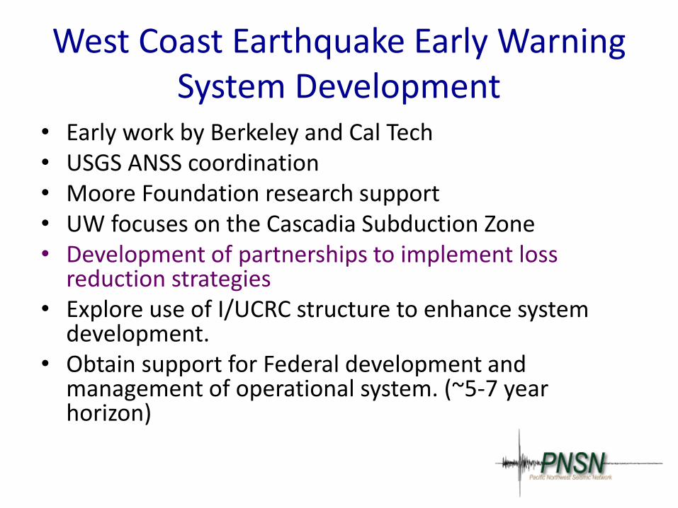
West Coast Earthquake Early Warning System Development
• Early work by Berkeley and Cal Tech • USGS ANSS coordination • Moore Foundation research support • UW focuses on the Cascadia Subduction Zone • Development of partnerships to implement loss
reduction strategies • Explore use of I/UCRC structure to enhance system
development. • Obtain support for Federal development and
management of operational system. (~5-7 year horizon)
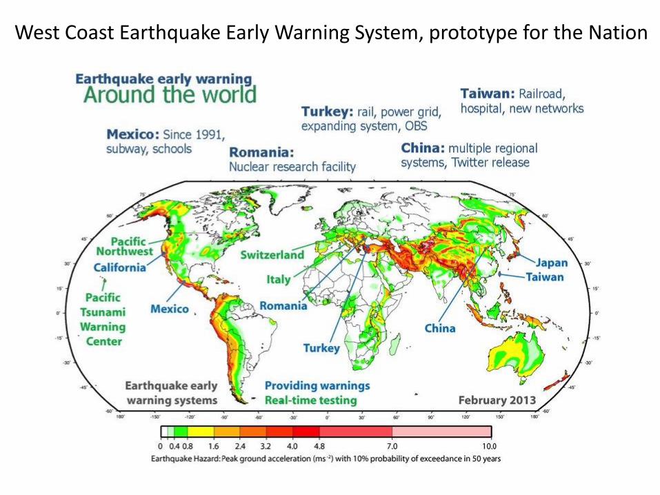
West Coast Earthquake Early Warning System, prototype for the Nation
“Early Warning” documentary by Mahesh Punyamurthula

Earthquake Warning
Earthquake Early Warning Saved Lives
Earthquake Early Warning: Loma Prieta
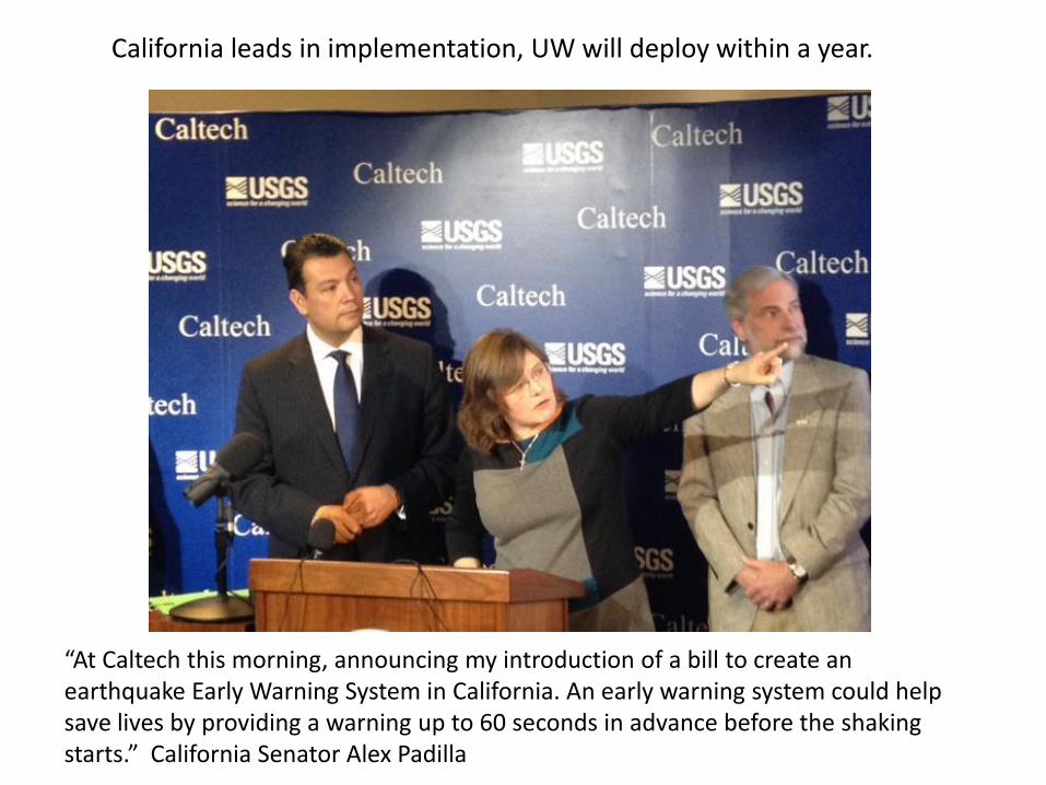
“At Caltech this morning, announcing my introduction of a bill to create an earthquake Early Warning System in California. An early warning system could help save lives by providing a warning up to 60 seconds in advance before the shaking starts.” California Senator Alex Padilla
California leads in implementation, UW will deploy within a year.
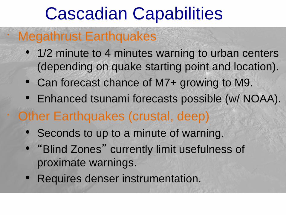
Cascadian Capabilities
Megathrust Earthquakes
• 1/2 minute to 4 minutes warning to urban centers
(depending on quake starting point and location).
• Can forecast chance of M7+ growing to M9.
• Enhanced tsunami forecasts possible (w/ NOAA).
Other Earthquakes (crustal, deep)
• Seconds to up to a minute of warning.
• “Blind Zones” currently limit usefulness of
proximate warnings.
• Requires denser instrumentation.
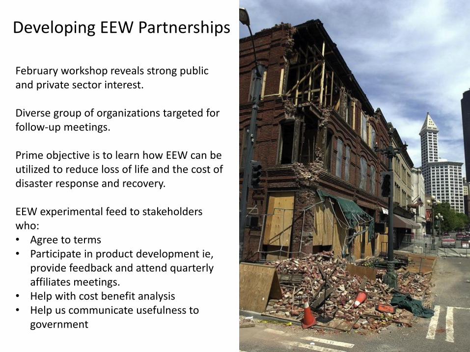
February workshop reveals strong public and private sector interest. Diverse group of organizations targeted for follow-up meetings. Prime objective is to learn how EEW can be utilized to reduce loss of life and the cost of disaster response and recovery. EEW experimental feed to stakeholders who: • Agree to terms • Participate in product development ie,
provide feedback and attend quarterly affiliates meetings.
• Help with cost benefit analysis • Help us communicate usefulness to
government
Developing EEW Partnerships
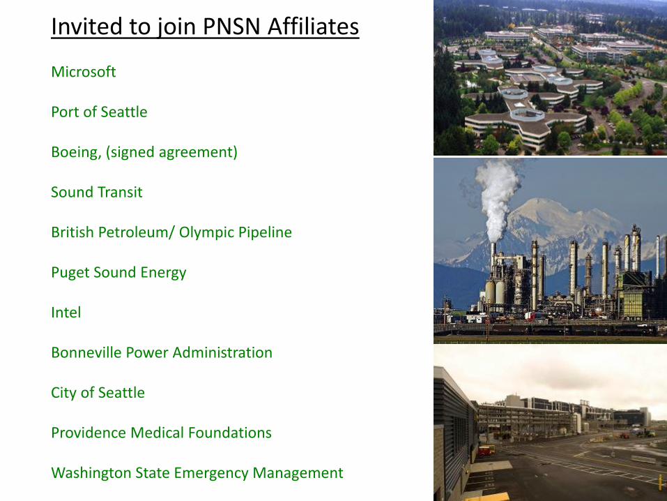
Invited to join PNSN Affiliates Microsoft Port of Seattle Boeing, (signed agreement) Sound Transit British Petroleum/ Olympic Pipeline Puget Sound Energy Intel Bonneville Power Administration City of Seattle Providence Medical Foundations Washington State Emergency Management
Next Steps: • Establish PNSN Research Affiliates: Identify a small, diverse
group companies and agencies to participate In system development and testing and to provide feedback
• Hold Workshop with California and PNW affiliates and the National Science Foundation to explore the establishment of a I/UCRC (Industry/ University Cooperative Research Center.
• Quarterly Affiliates meetings this year as demonstration
warning system is rolled out.
• Partner agreement, on use of this “experimental system”
PNW System Roll out:
• Fall 2013 PNSN ShakeAlert messaging for > M 3 eqs
• Spring 2014, CSZ earthquake alerts integrating real-time GPS Data
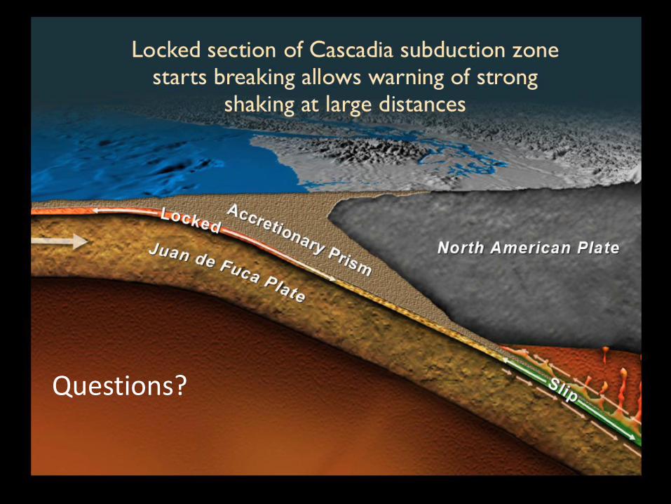
Questions?