Embed Size (px)
Citation preview
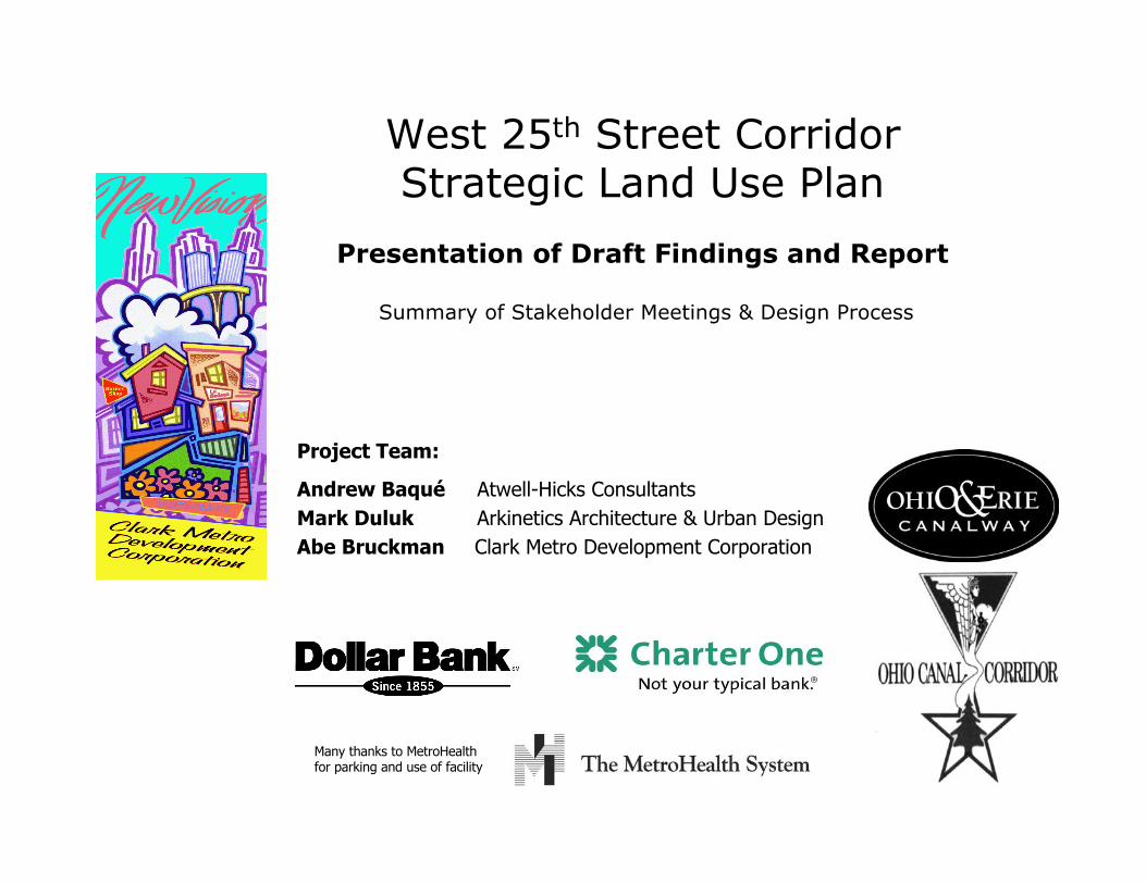
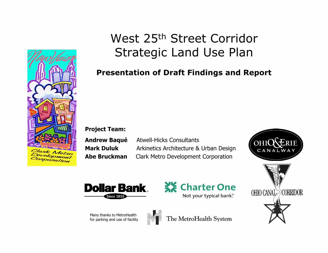
West 25th Street CorridorStrategic Land Use Plan
Presentation of Draft Findings and Report
Summary of Stakeholder Meetings & Design Process
Project Team:
Andrew Baqué Atwell-Hicks Consultants
Mark Duluk Arkinetics Architecture & Urban Design
Abe Bruckman Clark Metro Development Corporation
Many thanks to MetroHealthfor parking and use of facility
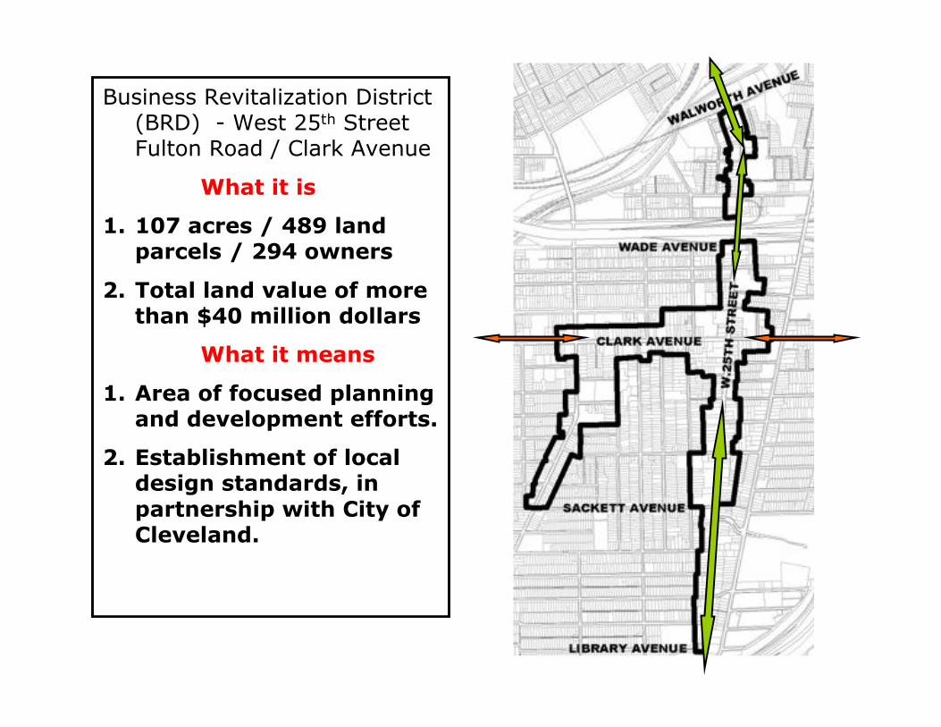
Business Revitalization District(BRD) - West 25th StreetFulton Road / Clark Avenue
What it is
1. 107 acres / 489 landparcels / 294 owners
2. Total land value of morethan $40 million dollars
What it means
1. Area of focused planningand development efforts.
2. Establishment of localdesign standards, inpartnership with City ofCleveland.
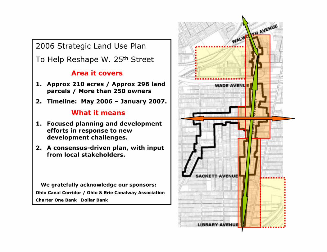
2006 Strategic Land Use Plan
To Help Reshape W. 25th Street
Area it covers
1. Approx 210 acres / Approx 296 landparcels / More than 250 owners
2. Timeline: May 2006 – January 2007.
What it means
1. Focused planning and developmentefforts in response to newdevelopment challenges.
2. A consensus-driven plan, with inputfrom local stakeholders.
We gratefully acknowledge our sponsors:
Ohio Canal Corridor / Ohio & Erie Canalway Association
Charter One Bank Dollar Bank
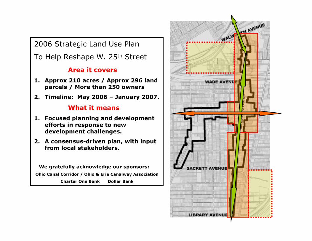
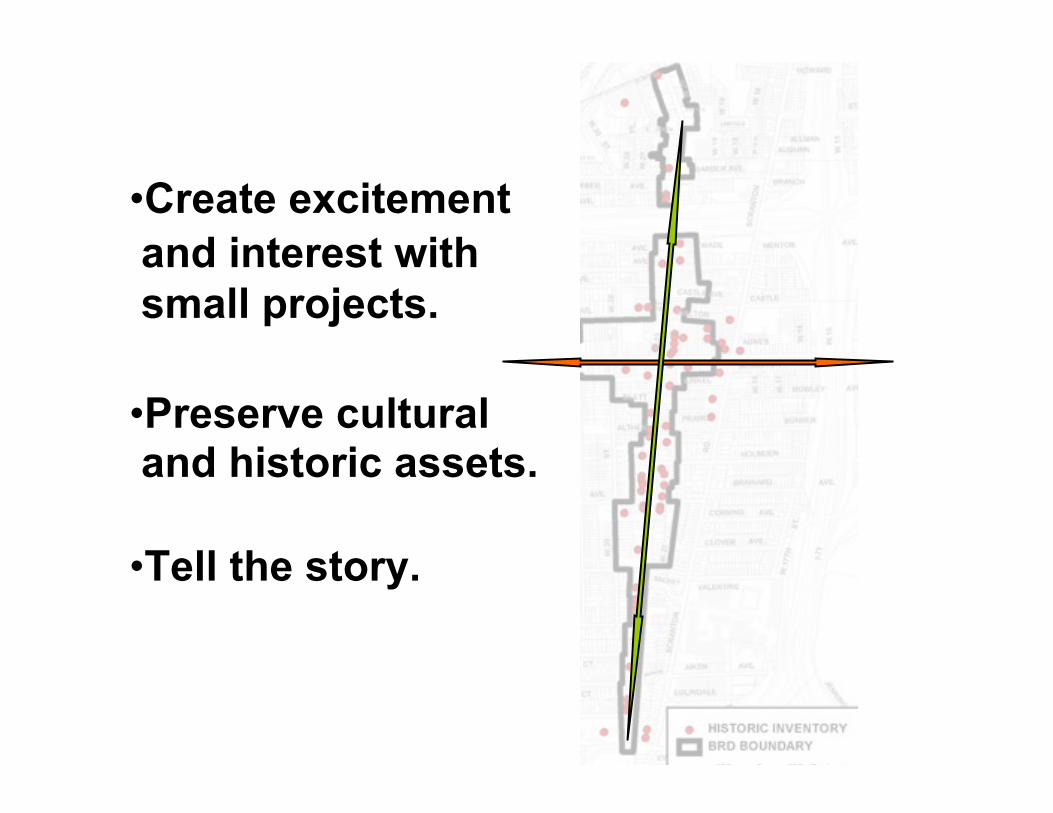
•Create excitement
and interest with
small projects.
•Preserve cultural and historic assets.
•Tell the story.
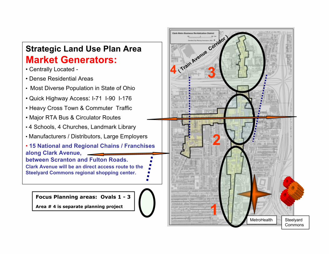
Focus Planning areas: Ovals 1 - 3
Area # 4 is separate planning project
3
1
2
4
Strategic Land Use Plan Area
Market Generators:• Centrally Located -
• Dense Residential Areas
• Most Diverse Population in State of Ohio
• Quick Highway Access: I-71 I-90 I-176
• Heavy Cross Town & Commuter Traffic
• Major RTA Bus & Circulator Routes
• 4 Schools, 4 Churches, Landmark Library
• Manufacturers / Distributors, Large Employers
• 15 National and Regional Chains / Franchises
along Clark Avenue,
between Scranton and Fulton Roads.Clark Avenue will be an direct access route to the
Steelyard Commons regional shopping center.
( Tra
in A
venue Corri
dor )
SteelyardCommons
MetroHealth
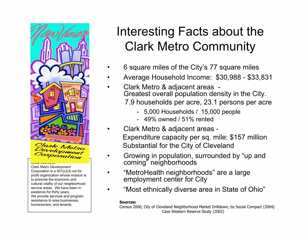
Who We Are:Clark Metro DevelopmentCorporation is a 501(c)(3) not forprofit organization whose mission isto promote the economic andcultural vitality of our neighborhoodservice areas. We have been inexistence for thirty years.We provide services and programassistance to area businesses,homeowners, and tenants.
Interesting Facts about theClark Metro Community
• 6 square miles of the City’s 77 square miles
• Average Household Income: $30,988 - $33,831
• Clark Metro & adjacent areas -Greatest overall population density in the City.
7.9 households per acre, 23.1 persons per acre
- 5,000 Households / 15,000 people - 49% owned / 51% rented
• Clark Metro & adjacent areas - Expenditure capacity per sq. mile: $157 million Substantial for the City of Cleveland
• Growing in population, surrounded by “up andcoming” neighborhoods
• “MetroHealth neighborhoods” are a largeemployment center for City
• “Most ethnically diverse area in State of Ohio”
Sources:Census 2000, City of Cleveland Neighborhood Market Drilldown, by Social Compact (2004) Case Western Reserve Study (2002)
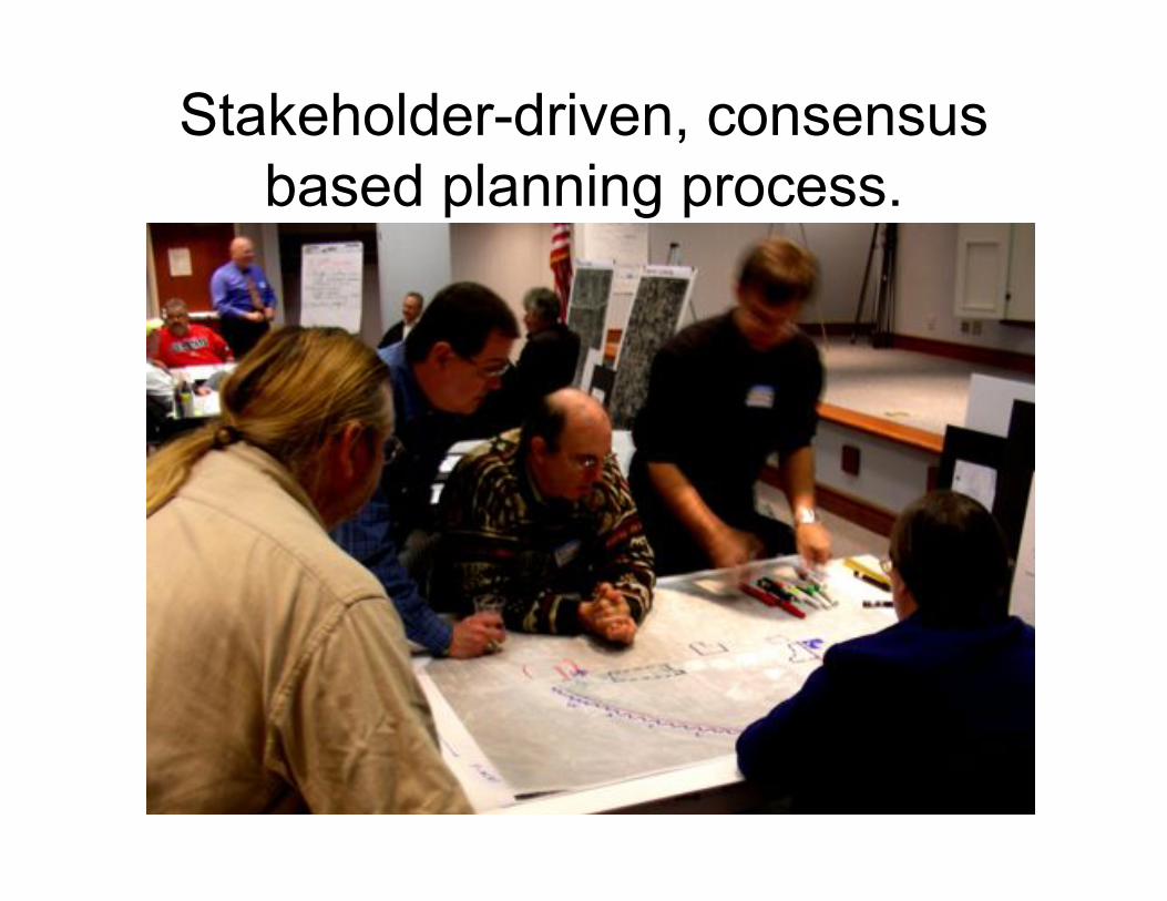
Stakeholder-driven, consensusbased planning process.
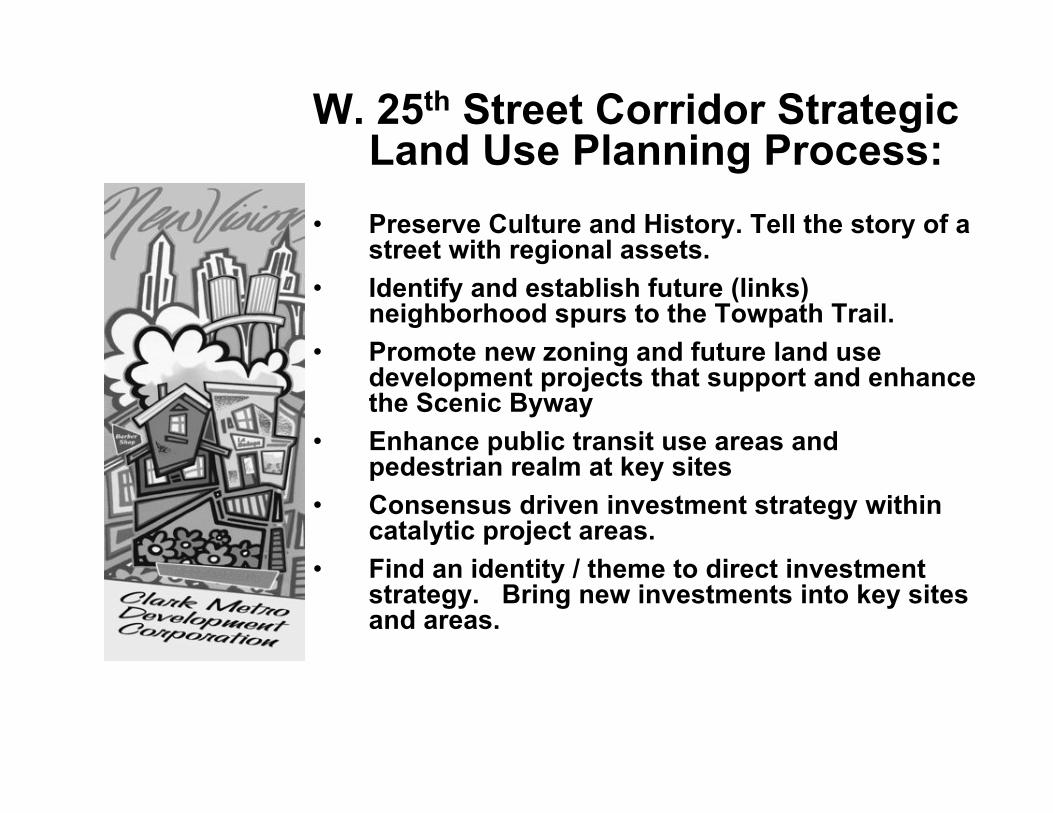
W. 25th Street Corridor StrategicLand Use Planning Process:
• Preserve Culture and History. Tell the story of astreet with regional assets.
• Identify and establish future (links)neighborhood spurs to the Towpath Trail.
• Promote new zoning and future land usedevelopment projects that support and enhancethe Scenic Byway
• Enhance public transit use areas andpedestrian realm at key sites
• Consensus driven investment strategy withincatalytic project areas.
• Find an identity / theme to direct investmentstrategy. Bring new investments into key sitesand areas.
• Plan will present and suggest an array ofaction steps, as part of larger investmentstrategy.
• The action steps will range in size andscale.
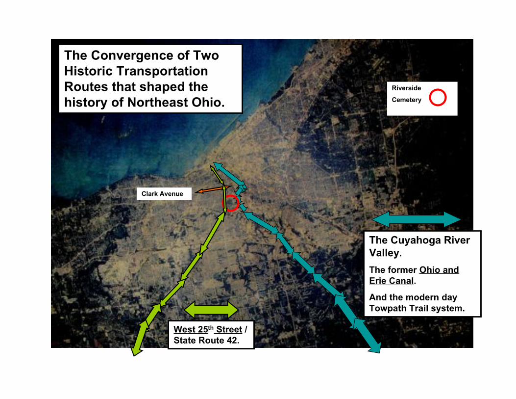
West 25th Street /
State Route 42.
The Cuyahoga River
Valley.
The former Ohio and
Erie Canal.
And the modern day
Towpath Trail system.
The Convergence of Two
Historic Transportation
Routes that shaped the
history of Northeast Ohio.
Clark Avenue
Riverside
Cemetery
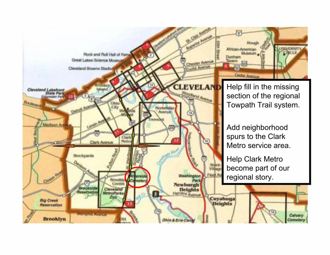
Help fill in the missingsection of the regionalTowpath Trail system.
Add neighborhoodspurs to the ClarkMetro service area.
Help Clark Metrobecome part of ourregional story.
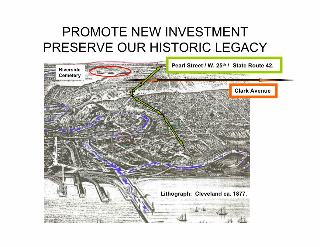
PROMOTE NEW INVESTMENTPRESERVE OUR HISTORIC LEGACY
Clark Avenue
Pearl Street / W. 25th / State Route 42.
Lithograph: Cleveland ca. 1877.
Riverside
Cemetery
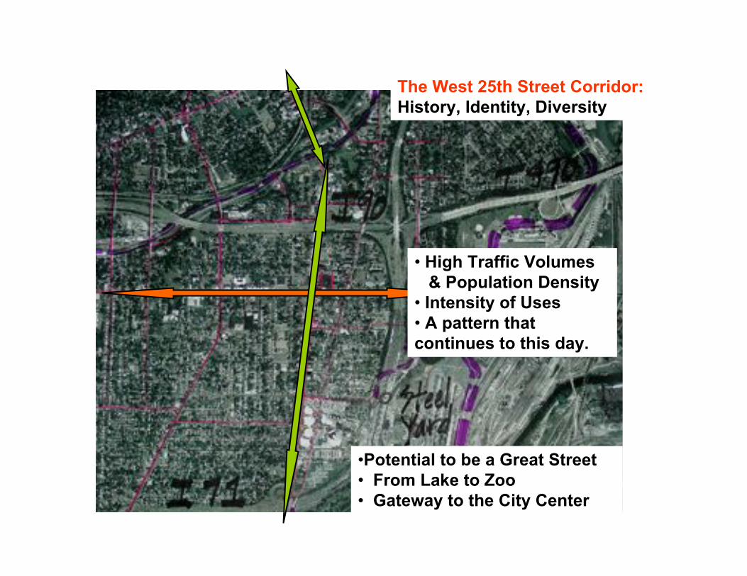
• High Traffic Volumes
& Population Density
• Intensity of Uses
• A pattern that
continues to this day.
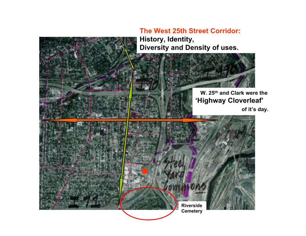
The West 25th Street Corridor:
History, Identity, Diversity
•Potential to be a Great Street
• From Lake to Zoo
• Gateway to the City Center
!
The West 25th Street Corridor:
History, Identity,
Diversity and Density of uses.
W. 25th and Clark were the
‘Highway Cloverleaf’
of it’s day.
x
Riverside
Cemetery
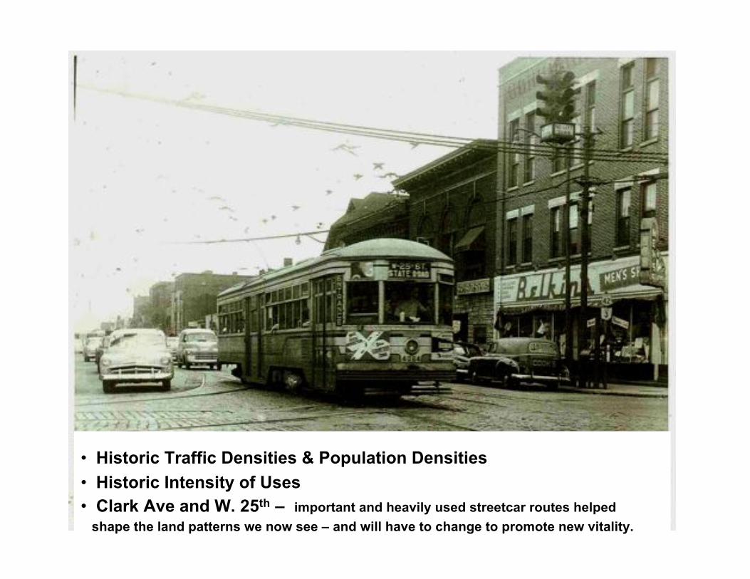
• Historic Traffic Densities & Population Densities
• Historic Intensity of Uses
• Clark Ave and W. 25th – important and heavily used streetcar routes helped
shape the land patterns we now see – and will have to change to promote new vitality.
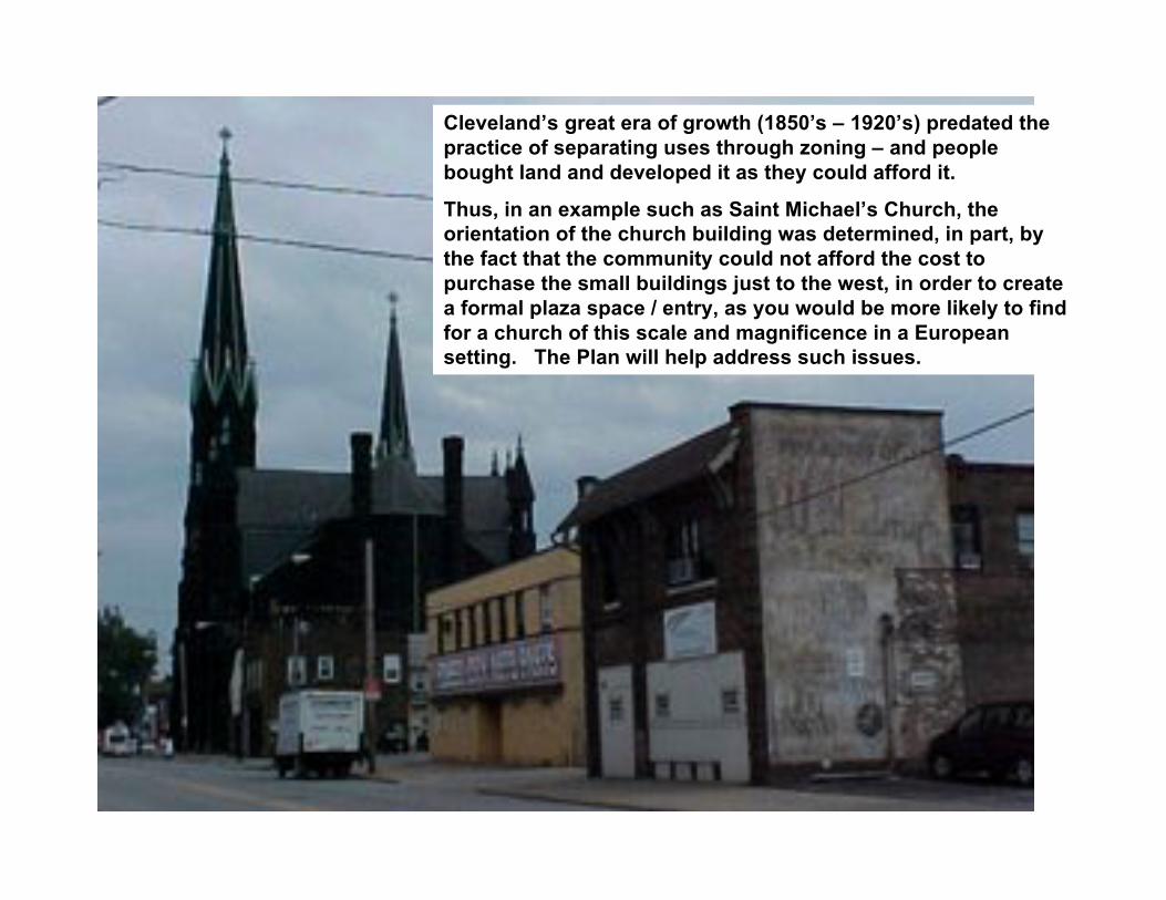
Cleveland’s great era of growth (1850’s – 1920’s) predated the
practice of separating uses through zoning – and people
bought land and developed it as they could afford it.
Thus, in an example such as Saint Michael’s Church, the
orientation of the church building was determined, in part, by
the fact that the community could not afford the cost to
purchase the small buildings just to the west, in order to create
a formal plaza space / entry, as you would be more likely to find
for a church of this scale and magnificence in a European
setting. The Plan will help address such issues.

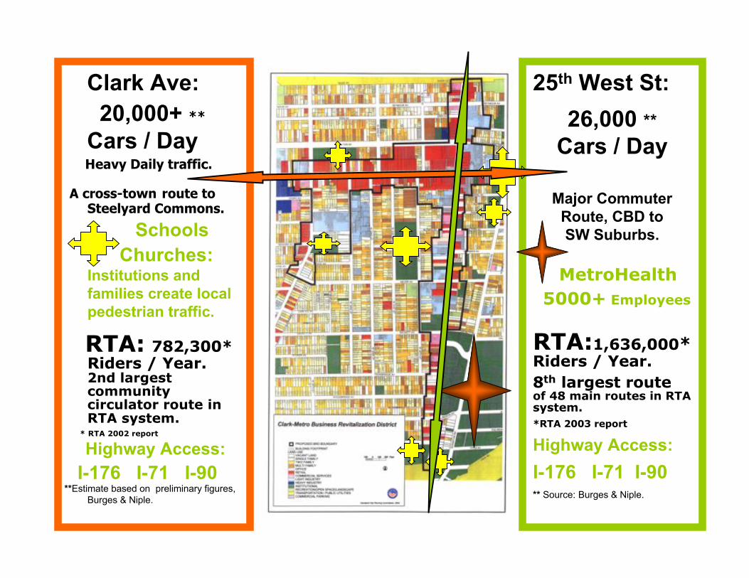
Clark Ave:
20,000+ **
Cars / Day Heavy Daily traffic.
A cross-town route toSteelyard Commons.
Schools
Churches:Institutions and
families create local
pedestrian traffic.
RTA: 782,300*Riders / Year.2nd largestcommunitycirculator route inRTA system.
* RTA 2002 report
Highway Access:
I-176 I-71 I-90 **Estimate based on preliminary figures,
Burges & Niple.
25th West St:
26,000 **
Cars / Day
Major Commuter
Route, CBD to
SW Suburbs.
MetroHealth
5000+ Employees
RTA:1,636,000*Riders / Year.
8th largest routeof 48 main routes in RTAsystem.
*RTA 2003 report
Highway Access:
I-176 I-71 I-90** Source: Burges & Niple.
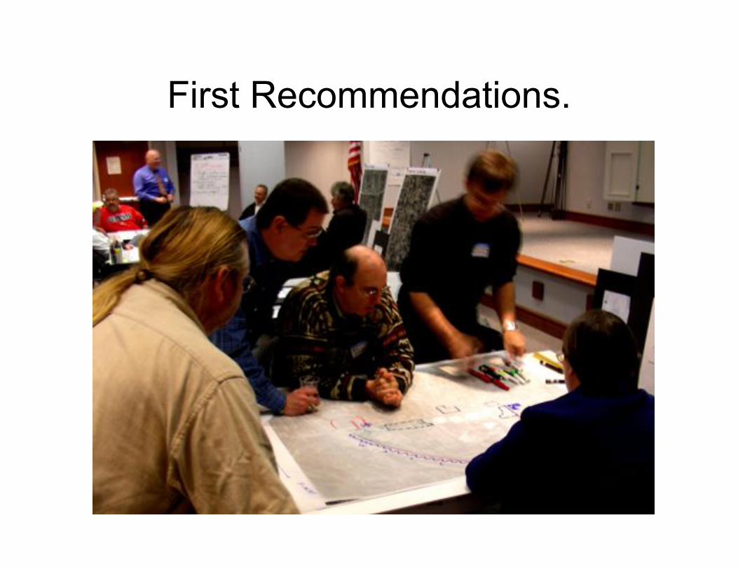
First Recommendations.

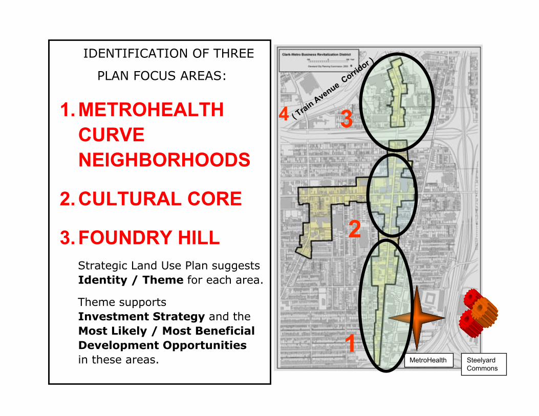
IDENTIFICATION OF THREE
PLAN FOCUS AREAS:
1.METROHEALTH
CURVE
NEIGHBORHOODS
2.CULTURAL CORE
3.FOUNDRY HILL
Strategic Land Use Plan suggests
Identity / Theme for each area.
Theme supports
Investment Strategy and the
Most Likely / Most Beneficial
Development Opportunities
in these areas.
3
1
2
4 ( Tra
in A
venue Corri
dor )
SteelyardCommons
MetroHealth
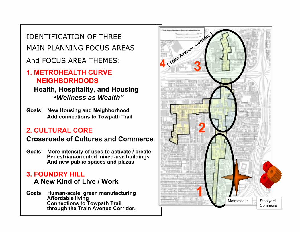
IDENTIFICATION OF THREE
MAIN PLANNING FOCUS AREAS
And FOCUS AREA THEMES:
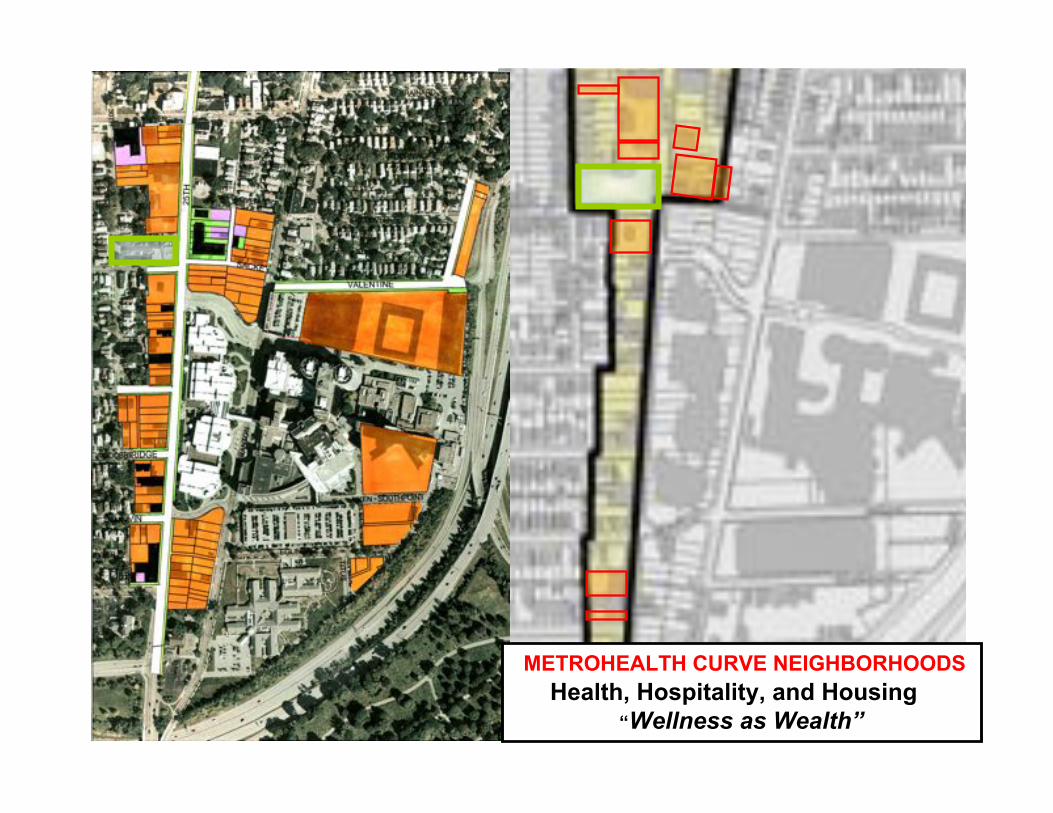
1. METROHEALTH CURVE
NEIGHBORHOODS
Health, Hospitality, and Housing
“Wellness as Wealth”
Goals: New Housing and Neighborhood
Add connections to Towpath Trail
2. CULTURAL CORE
Crossroads of Cultures and Commerce
Goals: More intensity of uses to activate / create Pedestrian-oriented mixed-use buildings And new public spaces and plazas
3. FOUNDRY HILL A New Kind of Live / Work
Goals: Human-scale, green manufacturing Affordable living
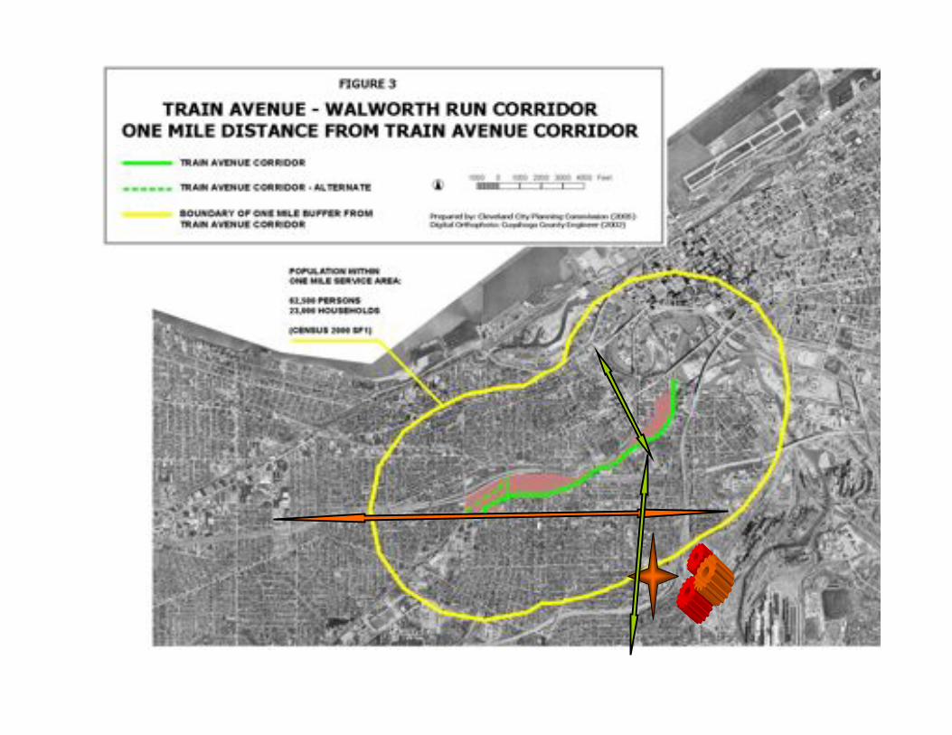
Connections to Towpath Trail through the Train Avenue Corridor.
3
1
2
( Tra
in A
venue Corri
dor )
4
SteelyardCommons
MetroHealth
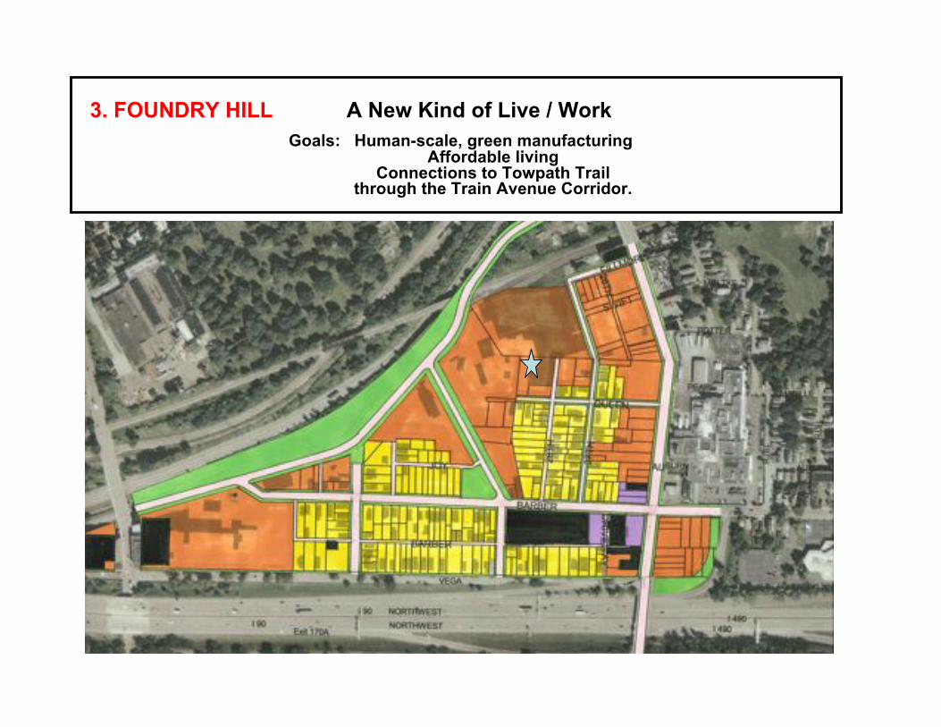
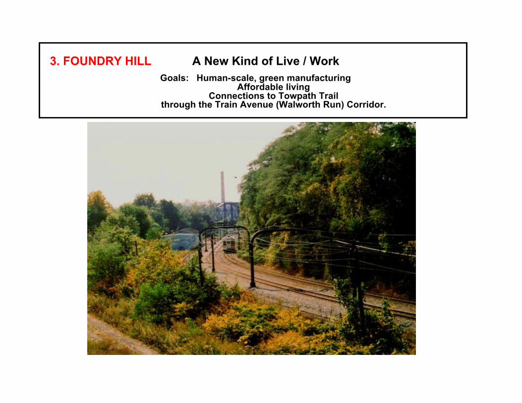
3. FOUNDRY HILL A New Kind of Live / Work
Goals: Human-scale, green manufacturing Affordable living
Connections to Towpath Trail through the Train Avenue Corridor.
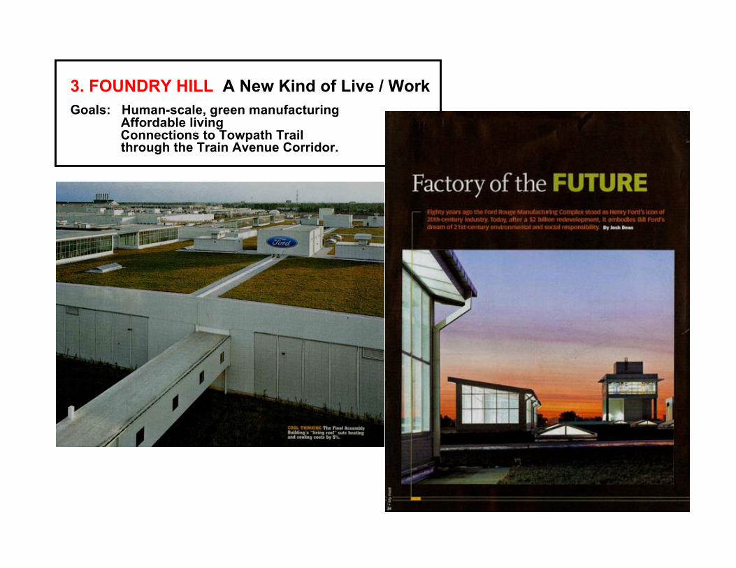
3. FOUNDRY HILL A New Kind of Live / Work
Goals: Human-scale, green manufacturing Affordable living
Connections to Towpath Trail through the Train Avenue Corridor.
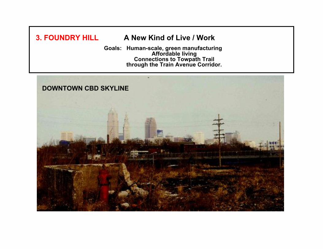
DOWNTOWN CBD SKYLINE
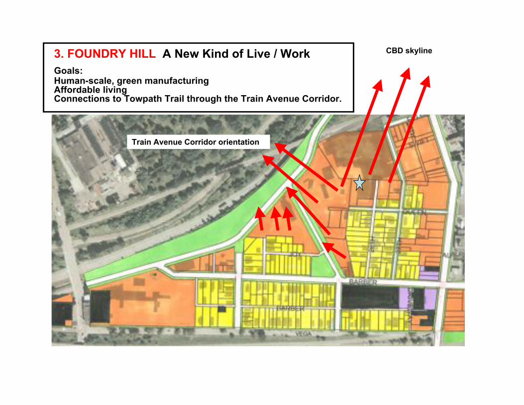
3. FOUNDRY HILL A New Kind of Live / Work
Goals:Human-scale, green manufacturingAffordable livingConnections to Towpath Trail through the Train Avenue Corridor.
CBD skyline
Train Avenue Corridor orientation
3. FOUNDRY HILL A New Kind of Live / Work
Goals: Human-scale, green manufacturing Affordable living
Connections to Towpath Trail through the Train Avenue (Walworth Run) Corridor.
3. FOUNDRY HILL A New Kind of Live / Work
Goals: Human-scale, green manufacturing Affordable living
Connections to Towpath Trail through the Train Avenue Corridor.
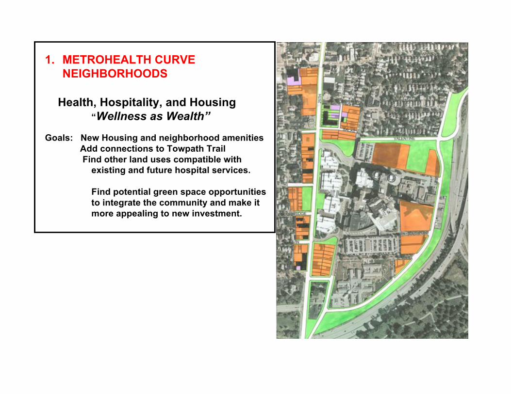
1. METROHEALTH CURVE
NEIGHBORHOODS
Health, Hospitality, and Housing
“Wellness as Wealth”
Goals: New Housing and neighborhood amenities
Add connections to Towpath Trail
Find other land uses compatible with
existing and future hospital services.
Find potential green space opportunities
to integrate the community and make it
more appealing to new investment.
METROHEALTH CURVE NEIGHBORHOODS
Health, Hospitality, and Housing
“Wellness as Wealth”
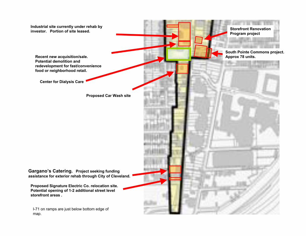
Gargano’s Catering. Project seeking funding
assistance for exterior rehab through City of Cleveland.
Proposed Signature Electric Co. relocation site.
Potential opening of 1-2 additional street level
storefront areas .
Proposed Car Wash site
I-71 on ramps are just below bottom edge ofmap.
Industrial site currently under rehab by
investor. Portion of site leased.
Recent new acquisition/sale.
Potential demolition and
redevelopment for fast/convenience
food or neighborhood retail.
Center for Dialysis Care
Storefront Renovation
Program project
South Pointe Commons project.
Approx 78 units.
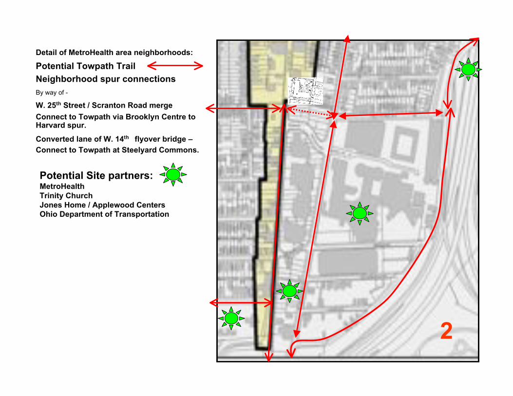
Detail of MetroHealth area neighborhoods:
Potential Towpath Trail
Neighborhood spur connections
By way of -
W. 25th Street / Scranton Road merge
Connect to Towpath via Brooklyn Centre toHarvard spur.
Converted lane of W. 14th flyover bridge –
Connect to Towpath at Steelyard Commons.
2
Potential Site partners:MetroHealth
Trinity Church
Jones Home / Applewood Centers
Ohio Department of Transportation
IDENTIFICATION OF THREE
PLAN FOCUS AREAS:
1.METROHEALTH
CURVE
NEIGHBORHOODS
2.CULTURAL CORE
3.FOUNDRY HILL
Strategic Land Use Plan suggests
Identity / Theme for each area.
Theme supports
Investment Strategy and the
Most Likely / Most Beneficial
Development Opportunities
in these areas.
3
1
2
4 ( Tra
in A
venue Corri
dor )
SteelyardCommons
MetroHealth
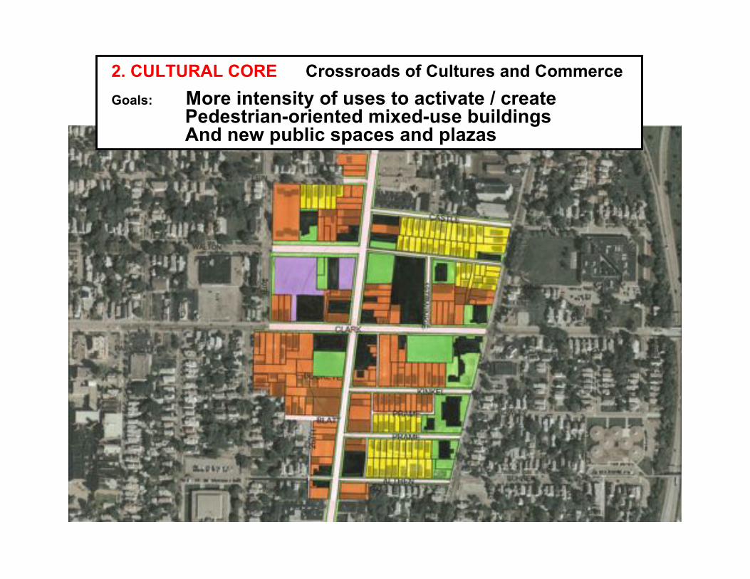
2. CULTURAL CORE Crossroads of Cultures and Commerce
Goals: More intensity of uses to activate / create Pedestrian-oriented mixed-use buildings And new public spaces and plazas

Clark Ave:
20,000+ **
Cars / Day Heavy Daily traffic.
A cross-town route toSteelyard Commons.
Schools
Churches:Institutions and
families create local
pedestrian traffic.
RTA: 782,300*Riders / Year.2nd largestcommunitycirculator route inRTA system.
* RTA 2002 report
Highway Access:
I-176 I-71 I-90 **Estimate based on preliminary figures,
Burges & Niple.
25th West St:
26,000 **
Cars / Day
Major Commuter
Route, CBD to
SW Suburbs.
MetroHealth
5000+ Employees
RTA:1,636,000*Riders / Year.
8th largest routeof 48 main routes in RTAsystem.
*RTA 2003 report
Highway Access:
I-176 I-71 I-90** Source: Burges & Niple.
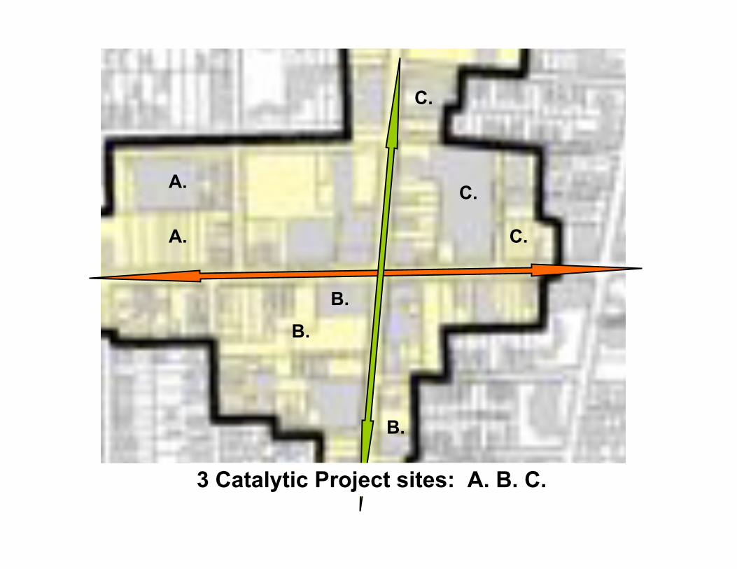
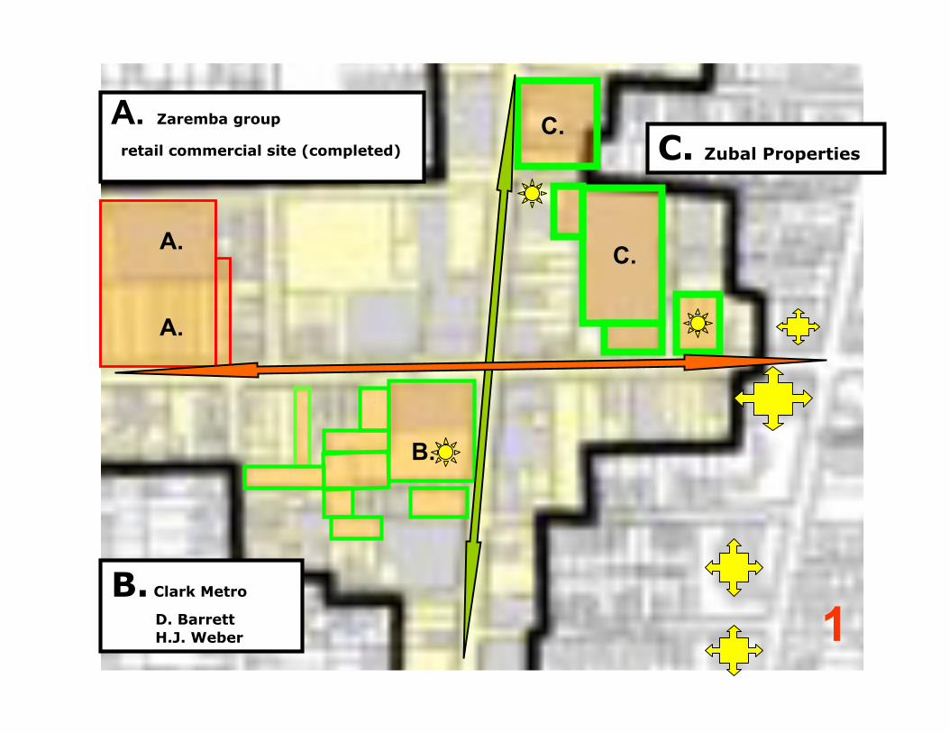
B.
C.
B.
C.
A. C.
A.
B.
3 Catalytic Project sites: A. B. C.
1
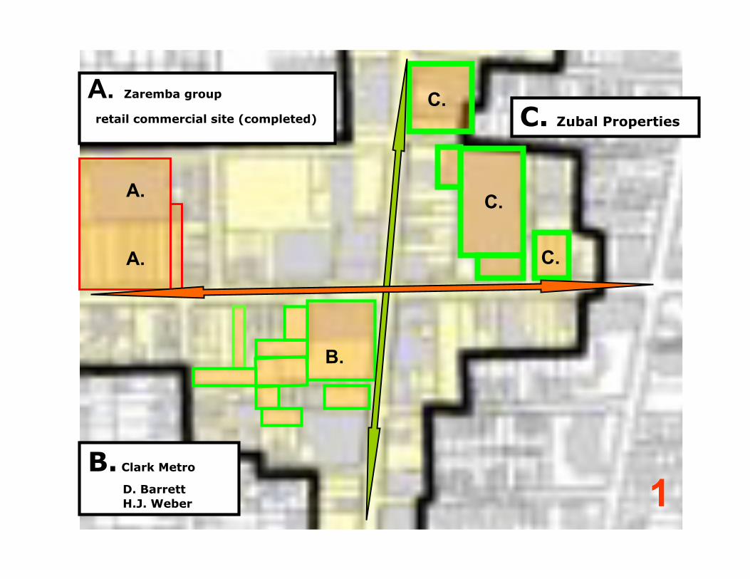
C.
B.
C.
C.A.
B. Clark Metro
D. Barrett
H.J. Weber
A. Zaremba group
retail commercial site (completed) C. Zubal Properties
A.
1
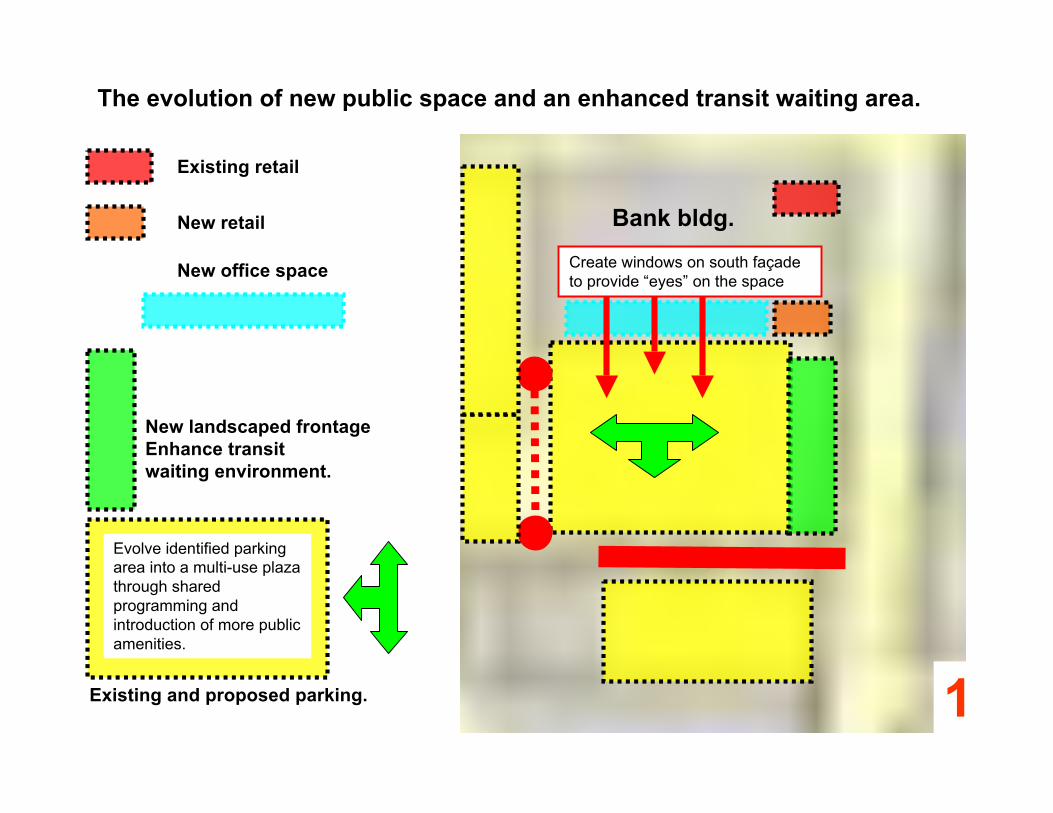
New landscaped frontage
Enhance transit
waiting environment.
Bank bldg.
Existing and proposed parking.
Evolve identified parkingarea into a multi-use plazathrough sharedprogramming andintroduction of more publicamenities.
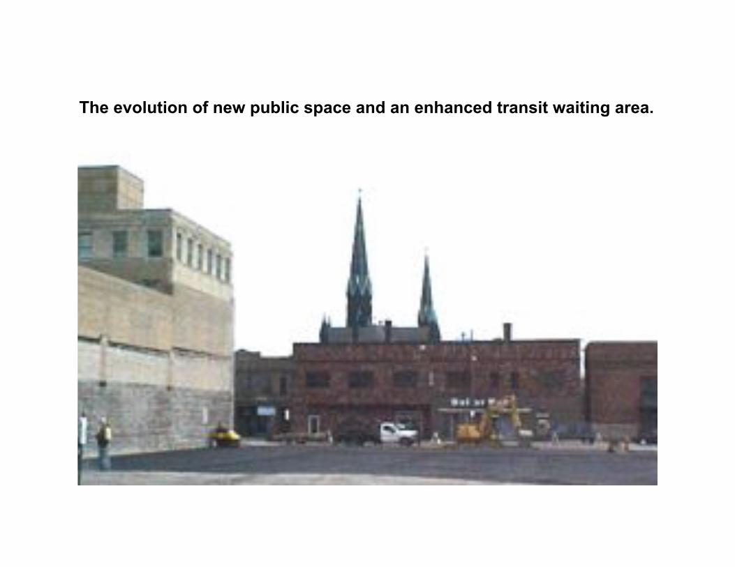
The evolution of new public space and an enhanced transit waiting area.
Create windows on south façadeto provide “eyes” on the space
Existing retail
New retail
New office space
The evolution of new public space and an enhanced transit waiting area.
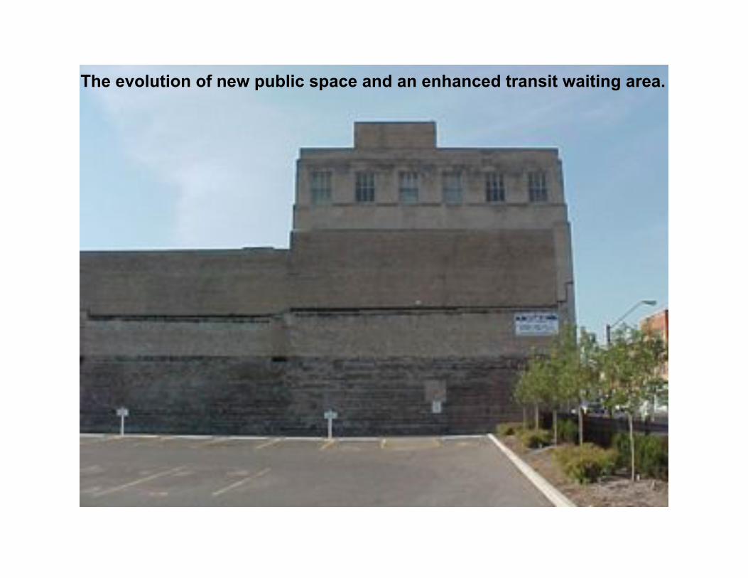
The evolution of new public space and an enhanced transit waiting area.
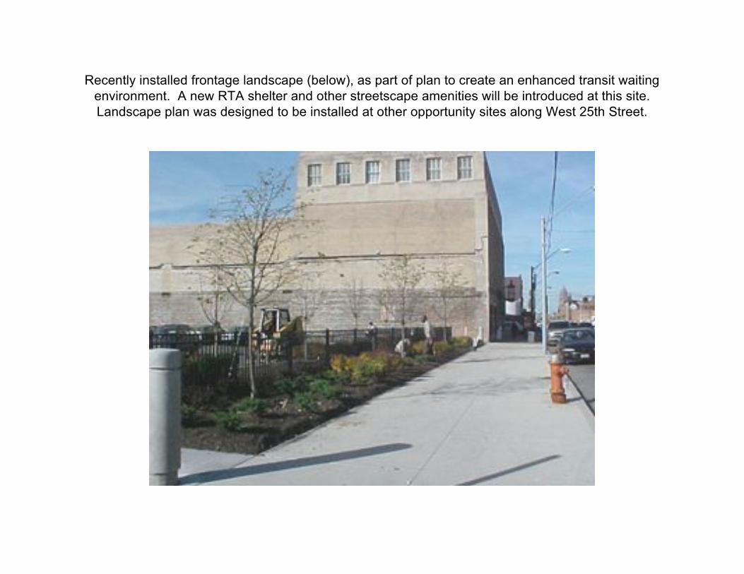
Recently installed frontage landscape (below), as part of plan to create an enhanced transit waitingenvironment. A new RTA shelter and other streetscape amenities will be introduced at this site.Landscape plan was designed to be installed at other opportunity sites along West 25th Street.
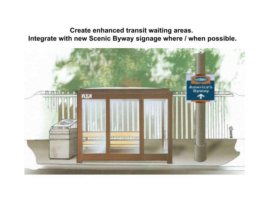
Create enhanced transit waiting areas.
Integrate with new Scenic Byway signage where / when possible.
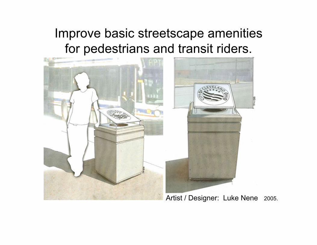
Improve basic streetscape amenitiesfor pedestrians and transit riders.
Artist / Designer: Luke Nene 2005.
Clark Ave:
20,000+ **
Cars / Day Heavy Daily traffic.
A cross-town route toSteelyard Commons.
Schools
Churches:Institutions and
families create local
pedestrian traffic.
RTA: 782,300*Riders / Year.2nd largestcommunitycirculator route inRTA system.
* RTA 2002 report
Highway Access:
I-176 I-71 I-90 **Estimate based on preliminary figures,
Burges & Niple.
25th West St:
26,000 **
Cars / Day
Major Commuter
Route, CBD to
SW Suburbs.
MetroHealth
5000+ Employees
RTA:1,636,000*Riders / Year.
8th largest routeof 48 main routes in RTAsystem.
*RTA 2003 report
Highway Access:
I-176 I-71 I-90** Source: Burges & Niple.
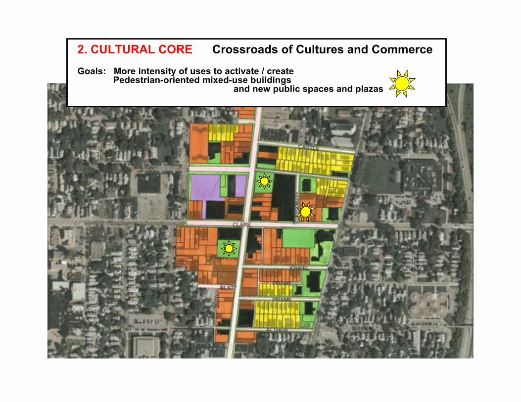
2. CULTURAL CORE Crossroads of Cultures and Commerce
Goals: More intensity of uses to activate / create Pedestrian-oriented mixed-use buildings and new public spaces and plazas
1
C.
B.
C.
A.
B. Clark Metro
D. Barrett
H.J. Weber
A. Zaremba group
retail commercial site (completed) C. Zubal Properties
A.
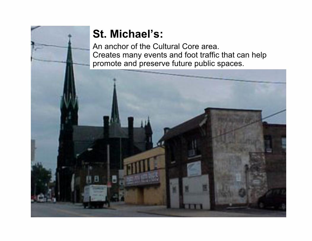
St. Michael’s:An anchor of the Cultural Core area.Creates many events and foot traffic that can helppromote and preserve future public spaces.
A.
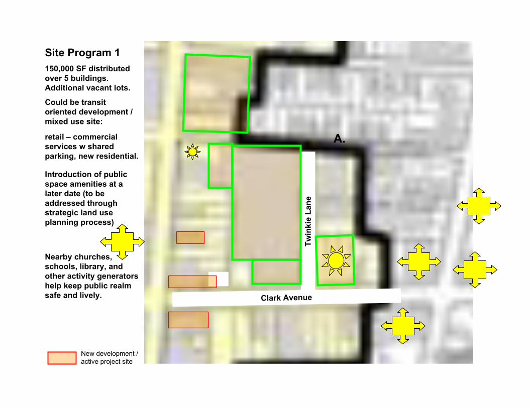
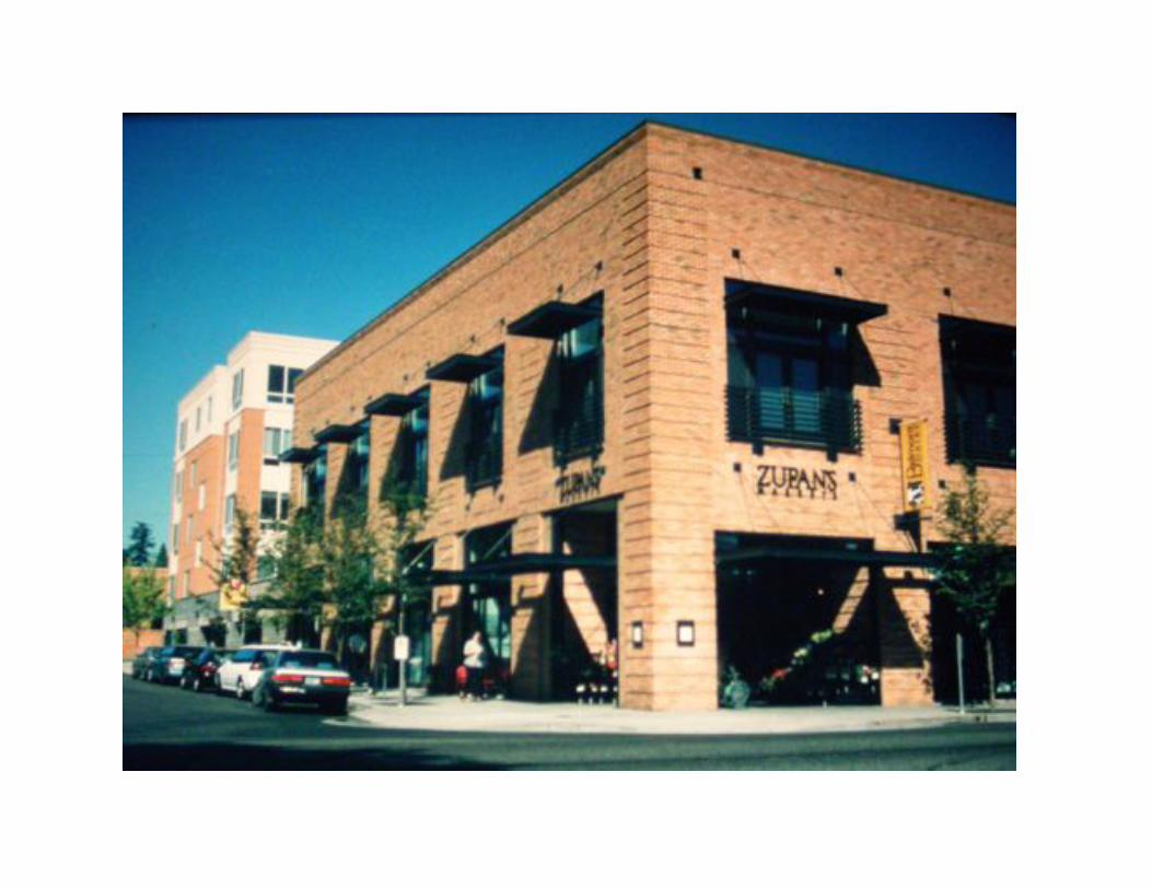
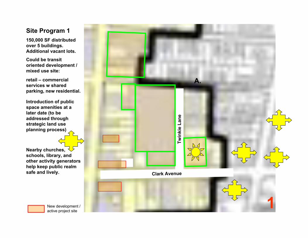
Site Program 1
150,000 SF distributed
over 5 buildings.
Additional vacant lots.
Could be transit
oriented development /
mixed use site:
retail – commercial
services w shared
parking, new residential.
Introduction of public
space amenities at a
later date (to be
addressed through
strategic land use
planning process)
Nearby churches,
schools, library, and
other activity generators
help keep public realm
safe and lively.
Tw
inkie
La
ne
Clark Avenue
xx
New development /active project site
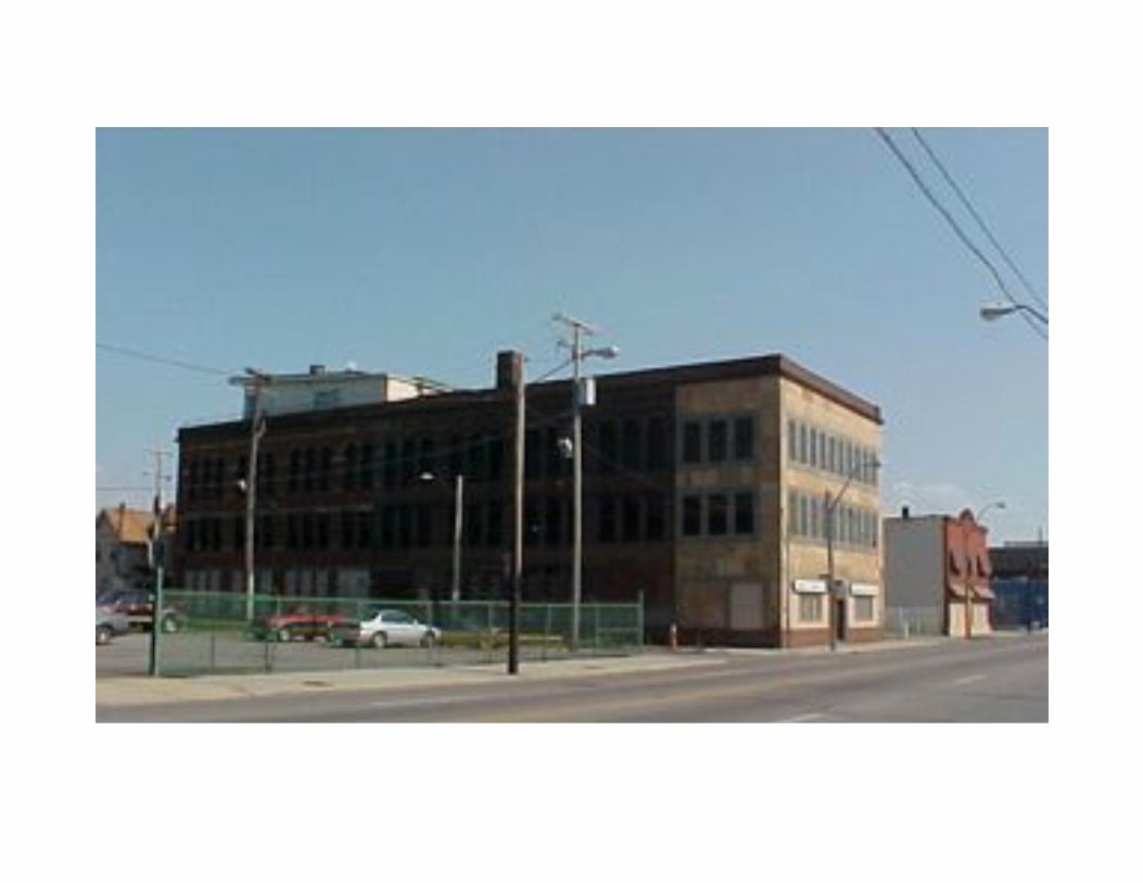
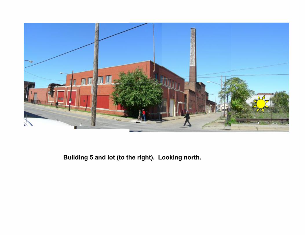
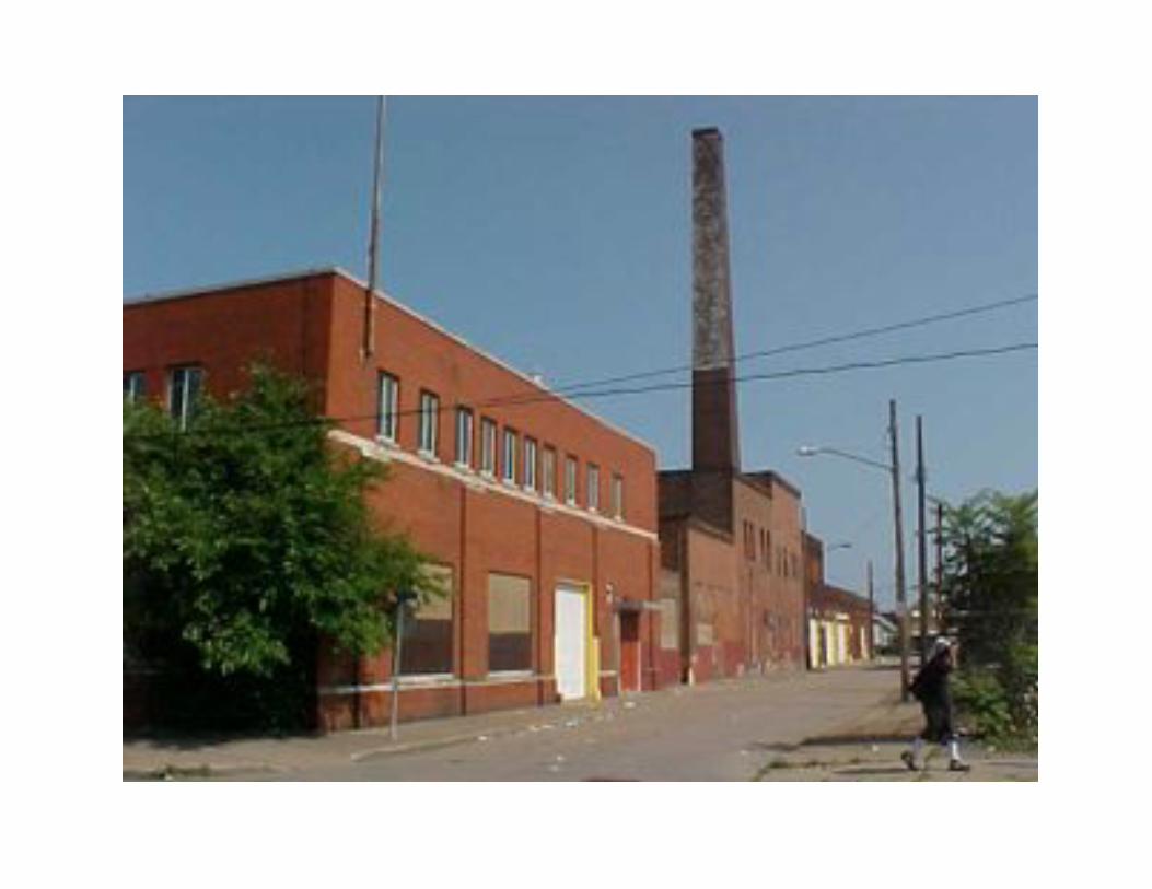
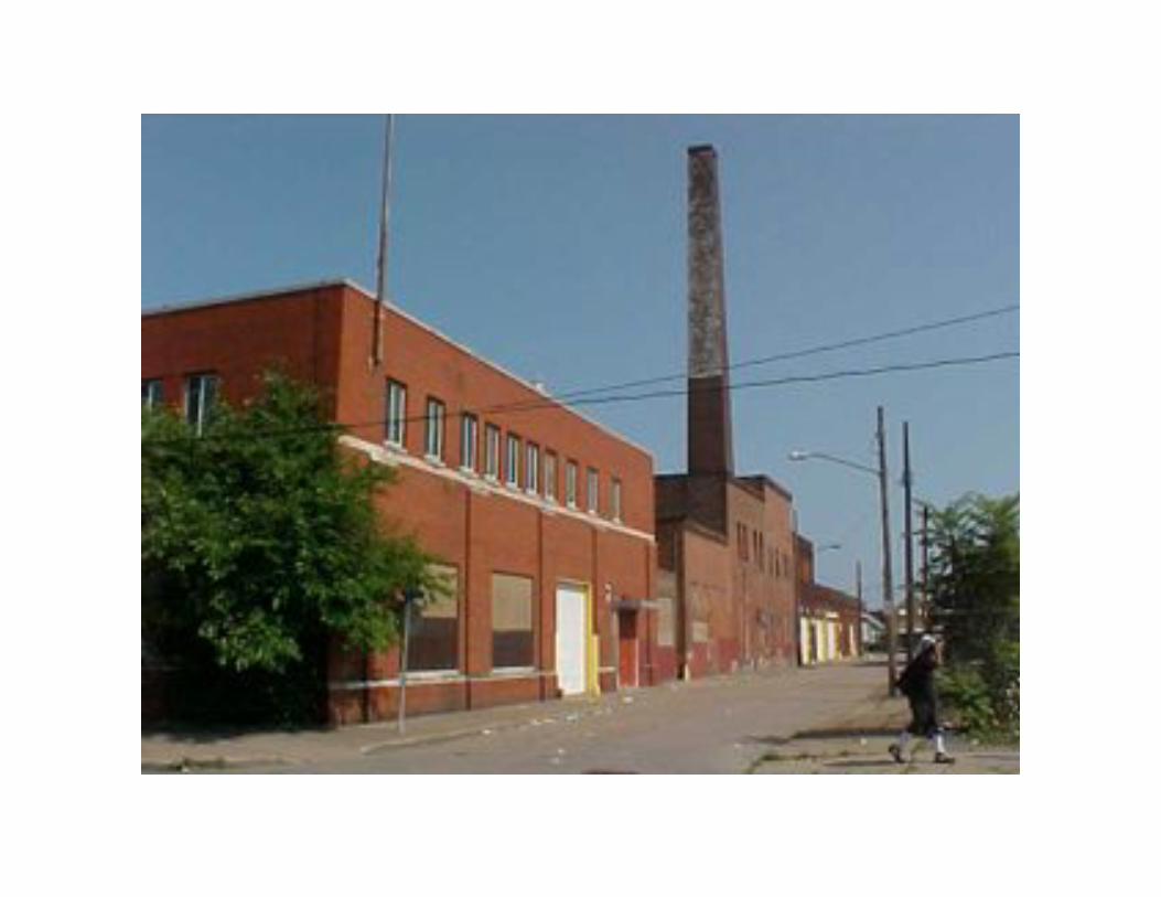
Building 5 and lot (to the right). Looking north.
1
A.
Site Program 1
150,000 SF distributed
over 5 buildings.
Additional vacant lots.
Could be transit
oriented development /
mixed use site:
retail – commercial
services w shared
parking, new residential.
Introduction of public
space amenities at a
later date (to be
addressed through
strategic land use
planning process)
Nearby churches,
schools, library, and
other activity generators
help keep public realm
safe and lively.
Tw
inkie
La
ne
Clark Avenue
xx
New development /active project site
West 25th Street CorridorStrategic Land Use Plan
Presentation of Draft Findings and Report
Project Team:
Andrew Baqué Atwell-Hicks Consultants
Mark Duluk Arkinetics Architecture & Urban Design
Abe Bruckman Clark Metro Development Corporation
Many thanks to MetroHealthfor parking and use of facility