Embed Size (px)
Citation preview
Web$based(Geographic(Informa5on(System((WebGIS)(Using(FOSS((
and(OGC(Standards(
Geological)Survey)of)Japan)(GSJ)))Na6onal)Ins6tute)of)Advanced)Industrial)Science)
and)Technology)(AIST))
AIST=Innova6on)
Joel)Calupas)Bandibas)
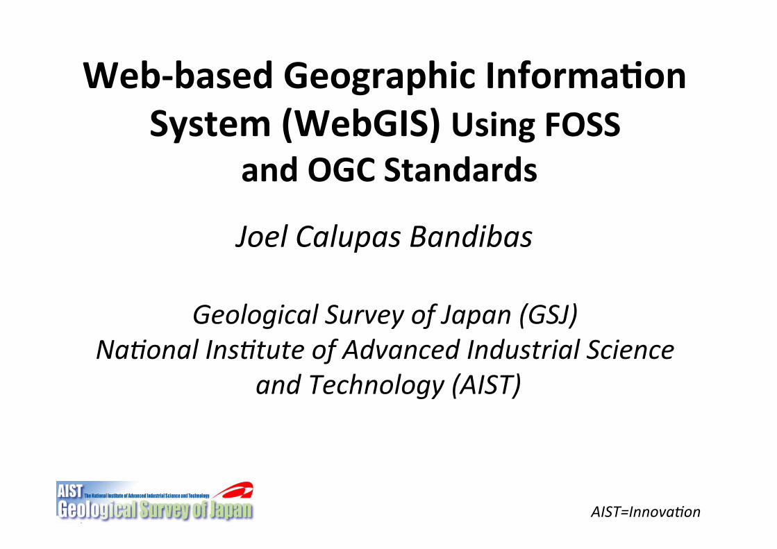
Presenta5on(Outline(
!""Open"Geospa+al"Consor+um"(OGC)"
!""OGC"Based"Web"Services"!""Web"Map"Service"(WMS)"
!""AIST’s"Current"Web!based"Informa+on"System"using"FOSS"and"OGC"
AIST=Innova6on)
!""WMS"Clients"
!""Free"and"Open"Source"SoEware"(FOSS)"!""WebGIS"and"its"Major"Components"
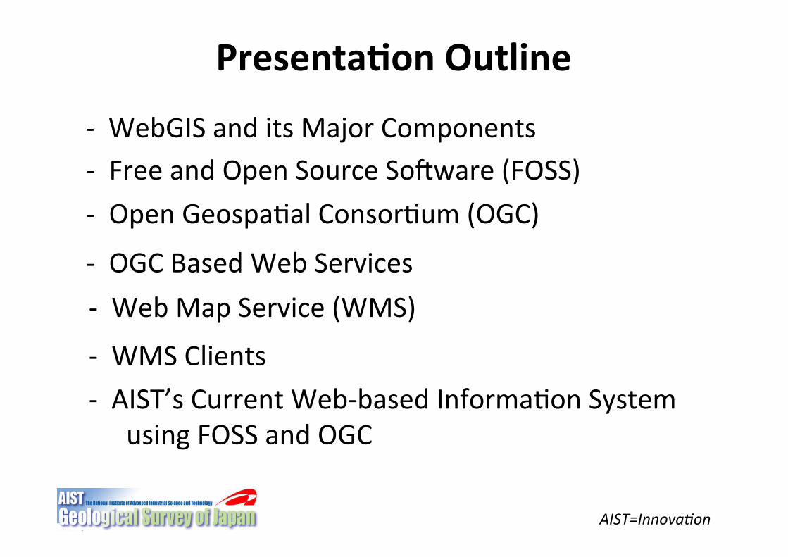
WEBGIS(
Informa5on( System( that( allows( users(to( view,( edit( and( manipulate( spa5al(data(over(the(WEB.( (Most(WebGIS( (are(powered( by( Web( Processing( Service((WPS)(and(Web(Map(Service((WMS).((((
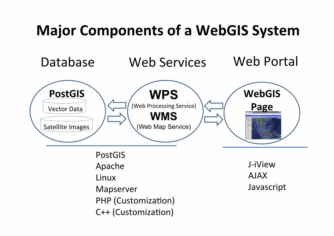
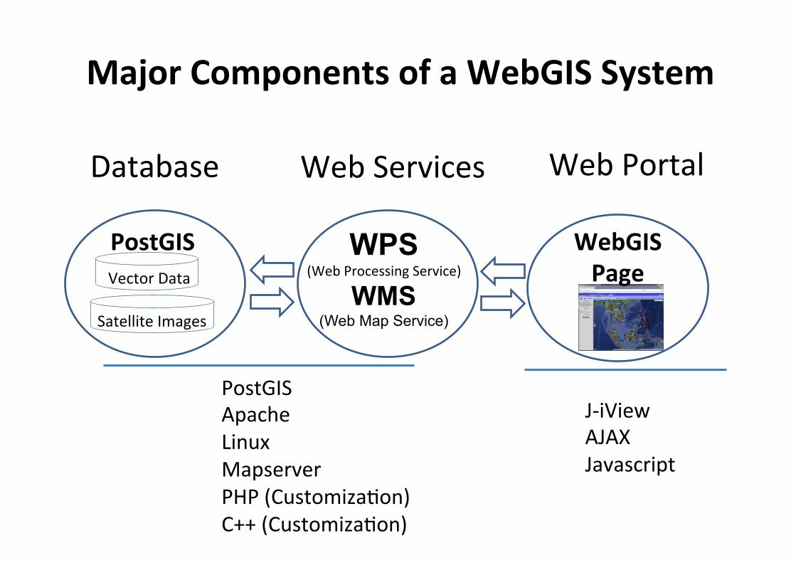
Web"Services�
PostGIS""Apache"Linux"Mapserver"PHP"(Customiza+on)"C++"(Customiza+on)�
WPS (Web"Processing"Service)"
WMS�(Web Map Service)
PostGIS�
Web"Portal�
Vector"Data�
Satellite"Images�
WebGIS(Page(�
Major(Components(of(a(WebGIS(System(
J!iView"AJAX"Javascript�
Database�
AIST=Innova6on)
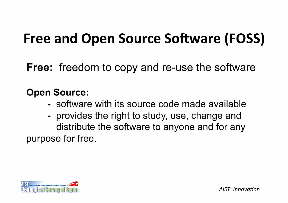
Free(and(Open(Source(SoJware((FOSS)"
Free: freedom to copy and re-use the software Open Source: - software with its source code made available - provides the right to study, use, change and
distribute the software to anyone and for any purpose for free.
AIST=Innova6on)
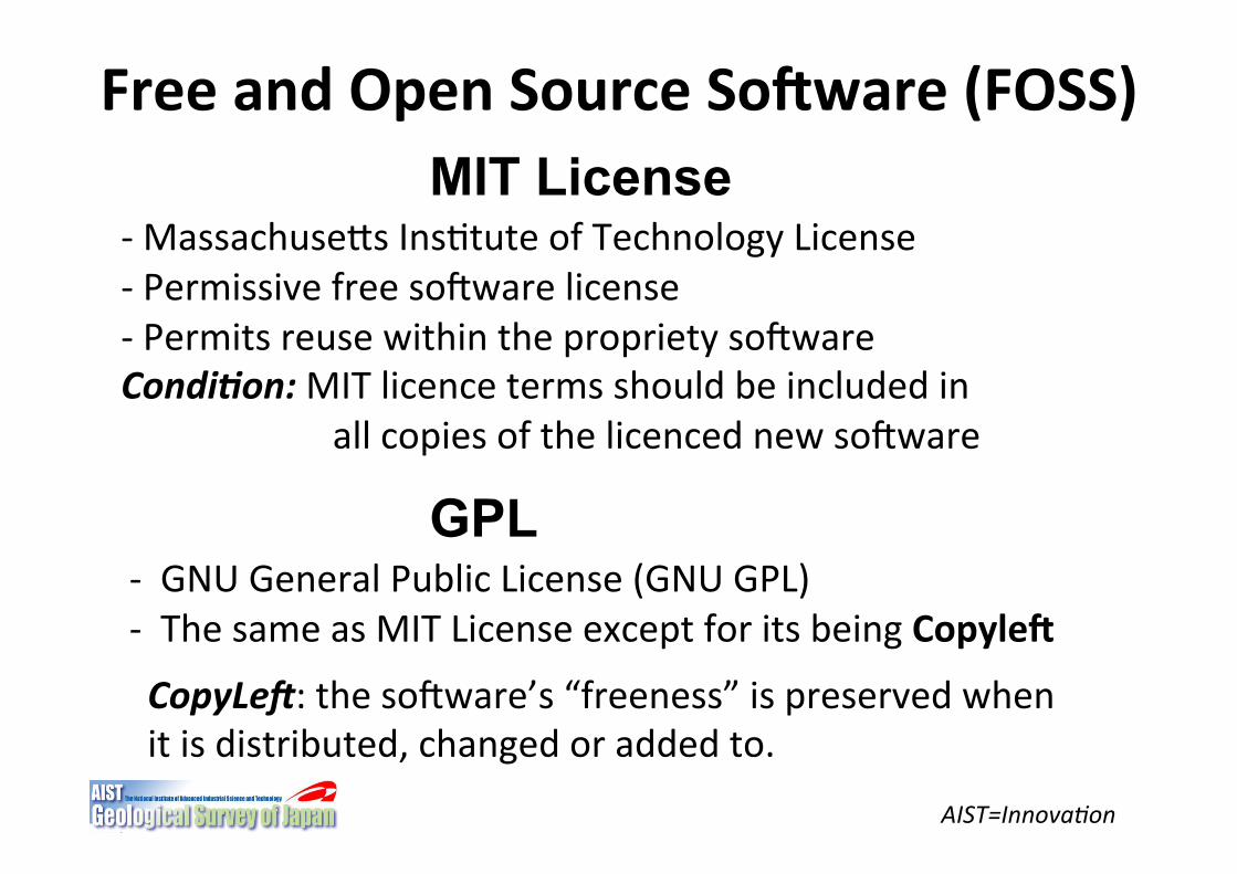
Free(and(Open(Source(SoJware((FOSS)"MIT License
!"MassachuseSs"Ins+tute"of"Technology"License"!"Permissive"free"soEware"license"! "Permits"reuse"within"the"propriety"soEware"""Condi&on:(MIT"licence"terms"should"be"included"in""
" "all"copies"of"the"licenced"new"soEware"
GPL !""GNU"General"Public"License"(GNU"GPL)"!""The"same"as"MIT"License"except"for"its"being"CopyleJ(
CopyLe,:"the"soEware’s"“freeness”"is"preserved"when"it"is"distributed,"changed"or"added"to."
AIST=Innova6on)
Free(and(Open(Source(SoJware((FOSS)"
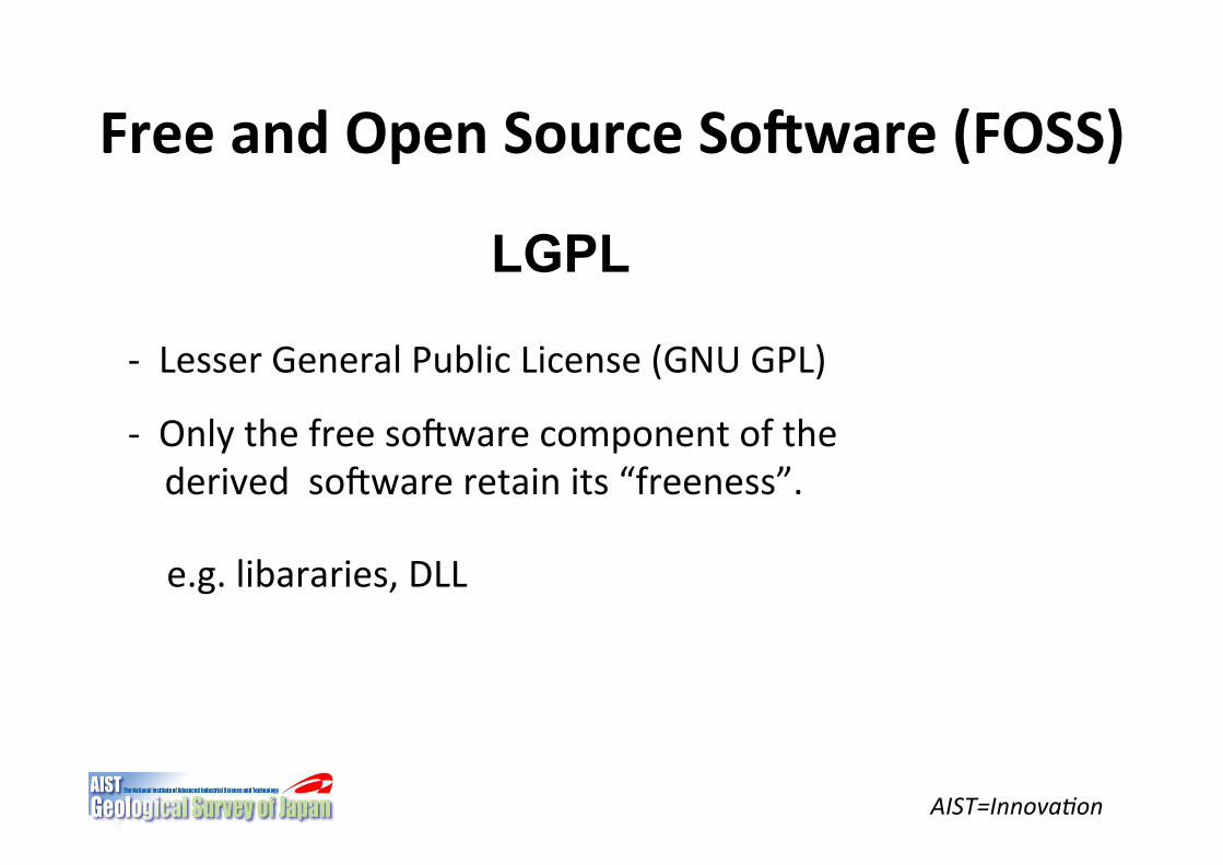
LGPL
!""Lesser"General"Public"License"(GNU"GPL)"
!""Only"the"free"soEware"component"of"the""""""derived""soEware"retain"its"“freeness”."(
e.g."libararies,"DLL"
AIST=Innova6on)
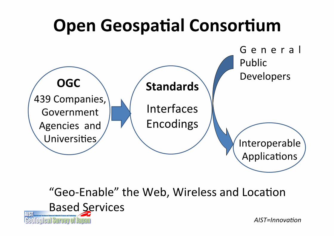
Open(Geospa5al(Consor5um"
OGC"439"Companies,""Government""Agencies""and""Universi+es�
Interfaces"Encodings"
G e n e r a l"Public"Developers"
Interoperable"Applica+ons�
“Geo!Enable”"the"Web,"Wireless"and"Loca+on""Based"Services�
Standards�
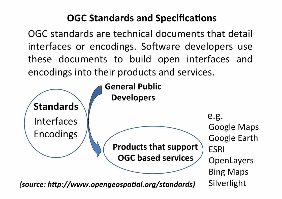
OGC(Standards(and(Specifica5ons(
(source:2h4p://www.opengeospa&al.org/standards)2
Interfaces"Encodings"
General(Public(Developers(
Standards�
Products(that(support((OGC(based(services�
Google"Maps"Google"Earth"ESRI"OpenLayers"Bing"Maps"Silverlight�
e.g.�
OGC"standards"are"technical"documents"that"detail"interfaces" or" encodings." SoEware" developers" use"these" documents" to" build" open" interfaces" and"encodings"into"their"products"and"services."
AIST=Innova6on)
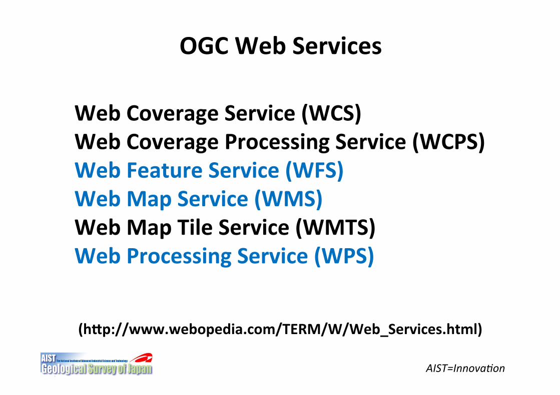
OGC(Web(Services((((
Web(Coverage(Service((WCS)(Web(Coverage(Processing(Service((WCPS)(Web(Feature(Service((WFS)(Web(Map(Service((WMS)(Web(Map(Tile(Service((WMTS)(Web(Processing(Service((WPS)(
(hNp://www.webopedia.com/TERM/W/Web_Services.html)((
AIST=Innovation for Society
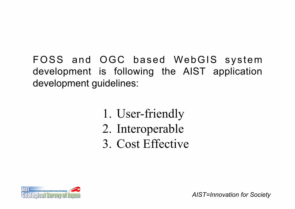
1. User-friendly 2. Interoperable 3. Cost Effective
FOSS and OGC based WebGIS sys tem development is following the AIST application development guidelines:
Web(Map(Service((WMS)(
AIST=Innova6on)
A" Web( Map( Service" (WMS)" is" a" standard"protocol" for" serving" georeferenced" map"images" over" the" Internet" that" are" generated"by" a" map" server" using" data" from" a" GIS"database""(Wikipidia)."
It" provides" a" simple" HTTP" interface" for"reques+ng" geo!registered" map" images" from"one"or"more"distributed"geospa+al"databases""(OGC).""
AIST=Innova6on)
Web"Map"Service"(WMS)"
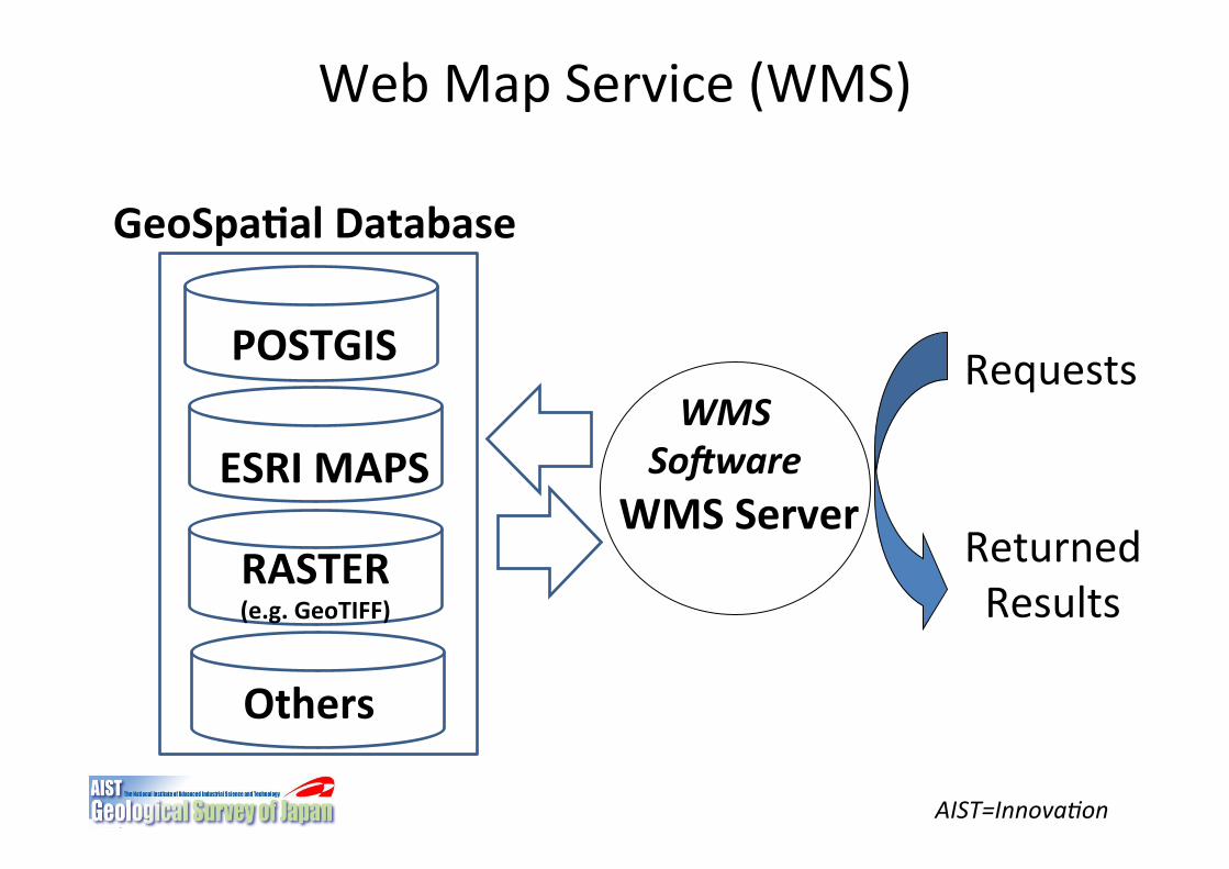
POSTGIS(
ESRI(MAPS(
RASTER((e.g.(GeoTIFF)(
Others(
GeoSpa5al(Database(
Requests"
Returned""Results"
WMS(Server(
WMS22So,ware2
Web"Map"Service"(WMS)"
AIST=Innovation
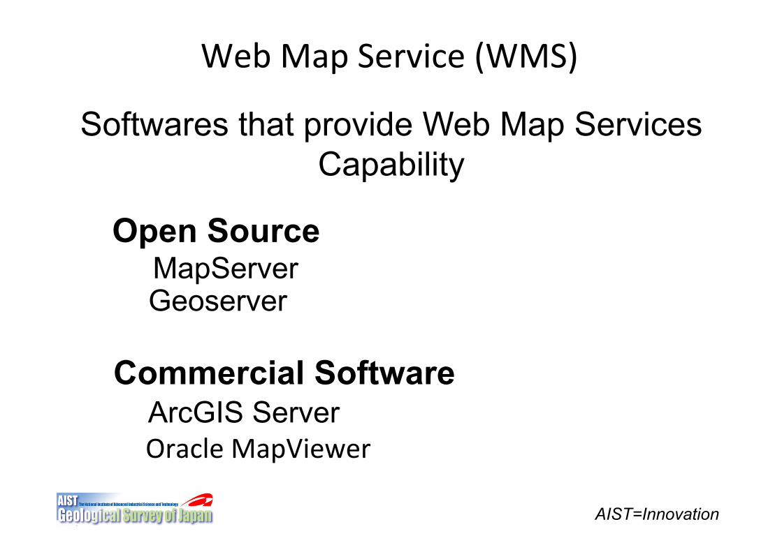
Softwares that provide Web Map Services Capability
Open Source MapServer Geoserver
Commercial Software ArcGIS Server Oracle"MapViewer"
Web"Map"Service"(WMS)"Requests"
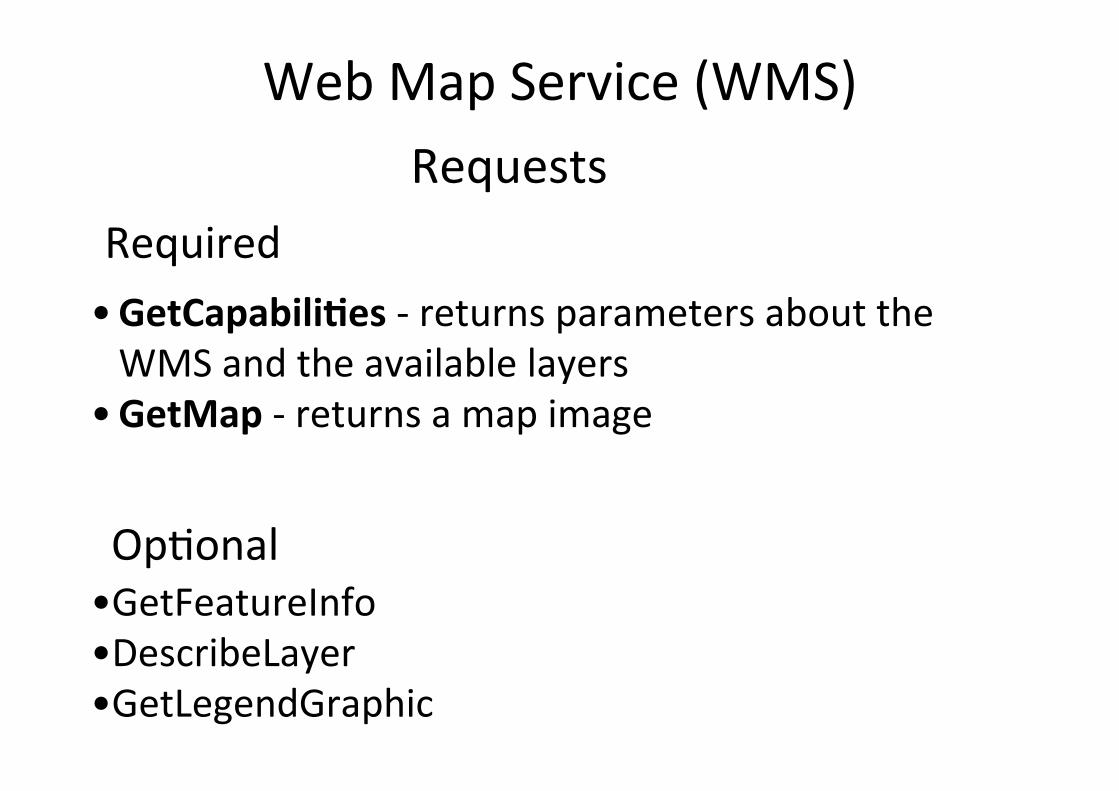
Required"• GetCapabili5es"!"returns"parameters"about"the"WMS"and"the"available"layers"
• GetMap"!"returns"a"map"image"
Op+onal"• GetFeatureInfo"• DescribeLayer"• GetLegendGraphic"
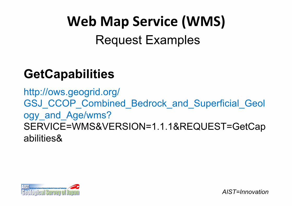
Web(Map(Service((WMS)(
AIST=Innovation
Request Examples
GetCapabilities http://ows.geogrid.org/GSJ_CCOP_Combined_Bedrock_and_Superficial_Geology_and_Age/wms? SERVICE=WMS&VERSION=1.1.1&REQUEST=GetCapabilities&
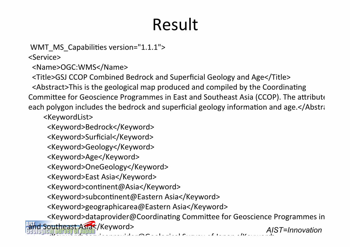
Result"
AIST=Innovation
"WMT_MS_Capabili+es"version="1.1.1">"<Service>"""<Name>OGC:WMS</Name>"""<Title>GSJ"CCOP"Combined"Bedrock"and"Superficial"Geology"and"Age</Title>"""<Abstract>This"is"the"geological"map"produced"and"compiled"by"the"Coordina+ng"CommiSee"for"Geoscience"Programmes"in"East"and"Southeast"Asia"(CCOP)."The"aSribute"of"each"polygon"includes"the"bedrock"and"superficial"geology"informa+on"and"age.</Abstract>"""""""""<KeywordList>"""""""""""<Keyword>Bedrock</Keyword>"""""""""""<Keyword>Surficial</Keyword>"""""""""""<Keyword>Geology</Keyword>"""""""""""<Keyword>Age</Keyword>"""""""""""<Keyword>OneGeology</Keyword>"""""""""""<Keyword>East"Asia</Keyword>"""""""""""<Keyword>con+nent@Asia</Keyword>"""""""""""<Keyword>subcon+nent@Eastern"Asia</Keyword>"""""""""""<Keyword>geographicarea@Eastern"Asia</Keyword>"""""""""""<Keyword>dataprovider@Coordina+ng"CommiSee"for"Geoscience"Programmes"in"East"and"Southeast"Asia</Keyword>"""""""""""<Keyword>serviceprovider@Geological"Survey"of"Japan</Keyword>"""""""""</KeywordList>"""<OnlineResource"xmlns:xlink="hSp://www.w3.org/1999/xlink""xlink:href="hSp://www.ccop.or.th/"/>"
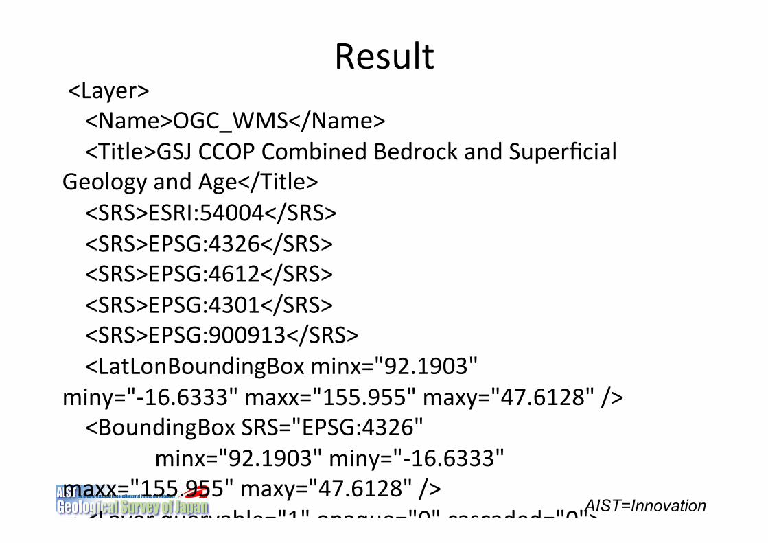
AIST=Innovation
"<Layer>"""""<Name>OGC_WMS</Name>"""""<Title>GSJ"CCOP"Combined"Bedrock"and"Superficial"Geology"and"Age</Title>"""""<SRS>ESRI:54004</SRS>"""""<SRS>EPSG:4326</SRS>"""""<SRS>EPSG:4612</SRS>"""""<SRS>EPSG:4301</SRS>"""""<SRS>EPSG:900913</SRS>"""""<LatLonBoundingBox"minx="92.1903""miny="!16.6333""maxx="155.955""maxy="47.6128""/>"""""<BoundingBox"SRS="EPSG:4326""""""""""""""""""minx="92.1903""miny="!16.6333""maxx="155.955""maxy="47.6128""/>"""""<Layer"queryable="1""opaque="0""cascaded="0">"""""""""<Name>EASIA_CCOP_2M_Combined_BLT_SLT_BA</Name>"""""""""<Title>EASIA"CCOP"1:2M"Combined"Bedrock"and"Superficial"Geology"and"Age</Title>"""""""""<Abstract>Coordina+ng"CommiSee"for"Geoscience"Programmes"in"East"and"Southeast"Asia"(CCOP)"1:2M"scale"map"containing"the"combined"bedrock"and"superficial"geology"and"age"informa+on"covering"the"East"and"Southeast"Asian"countries.</Abstract>"""""""""<KeywordList>"""""""""""<Keyword>Bedrock</Keyword>"""""""""""<Keyword>Surficial</Keyword>"""""""""""<Keyword>Geology</Keyword>"""""""""""<Keyword>Age</Keyword>"""""""""""<Keyword>OneGeology</Keyword>"""""""""""<Keyword>East"Asia</Keyword>"""""""""""<Keyword>con+nent@Asia</Keyword>"""""""""""<Keyword>subcon+nent@Eastern"Asia</Keyword>"""""""""""<Keyword>geographicarea@Eastern"Asia</Keyword>"""""""""""<Keyword>dataprovider@Coordina+ng"CommiSee"for"Geoscience"Programmes"in"East"and"Southeast"Asia</Keyword>"""""""""""<Keyword>serviceprovider@Geological"Survey"of"Japan</Keyword>"""""""""</KeywordList>"""""""""<SRS>ESRI:54004</SRS>"""""""""<SRS>EPSG:4326</SRS>"""""""""<SRS>EPSG:4612</SRS>"""""""""<SRS>EPSG:4301</SRS>"""""""""<SRS>EPSG:900913</SRS>"
Result"
Web"Map"Service"(WMS)"
AIST=Innovation
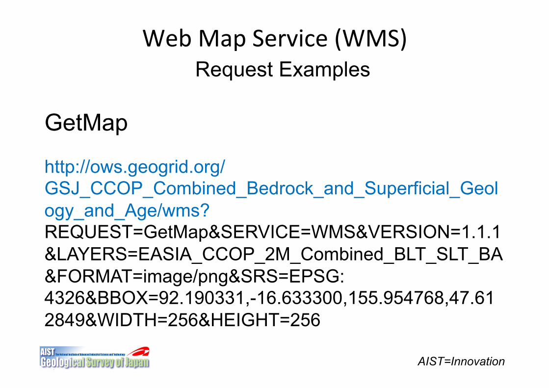
Request Examples
GetMap
http://ows.geogrid.org/GSJ_CCOP_Combined_Bedrock_and_Superficial_Geology_and_Age/wms?REQUEST=GetMap&SERVICE=WMS&VERSION=1.1.1&LAYERS=EASIA_CCOP_2M_Combined_BLT_SLT_BA&FORMAT=image/png&SRS=EPSG:4326&BBOX=92.190331,-16.633300,155.954768,47.612849&WIDTH=256&HEIGHT=256
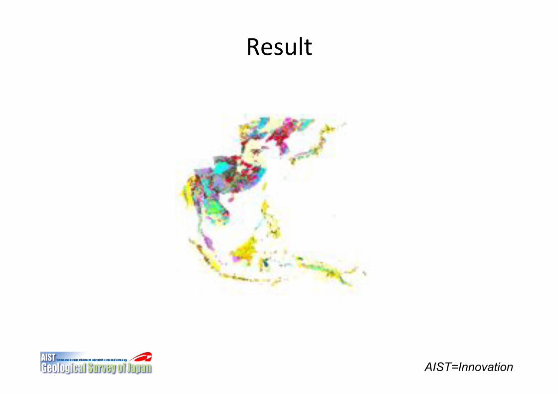
Result"
AIST=Innovation
AIST=Innovation
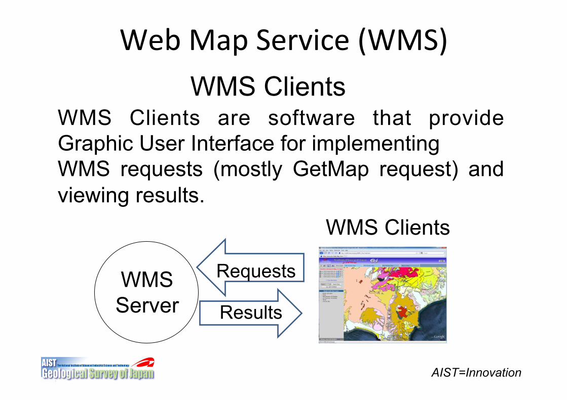
Web"Map"Service"(WMS)"WMS Clients
WMS Clients are software that provide Graphic User Interface for implementing WMS requests (mostly GetMap request) and viewing results.
WMS Server
Requests
Results
WMS Clients
AIST=Innovation
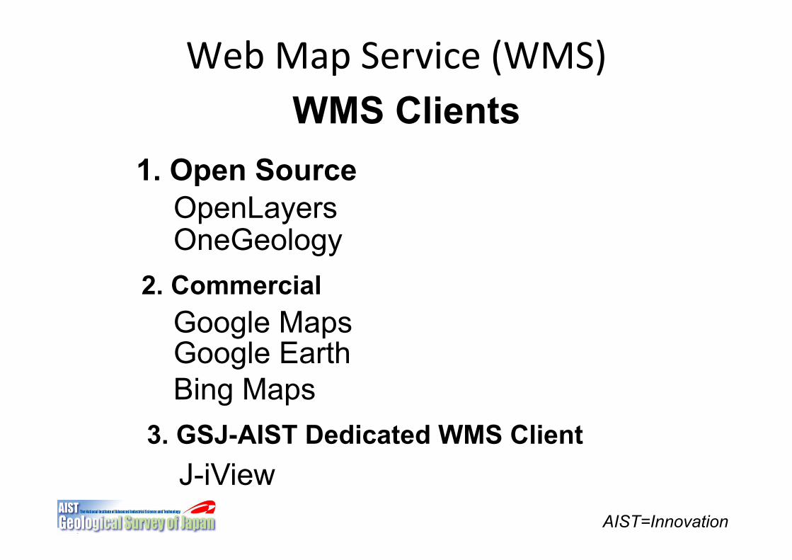
Web"Map"Service"(WMS)"WMS Clients
1. Open Source OpenLayers OneGeology
2. Commercial Google Maps Google Earth Bing Maps
3. GSJ-AIST Dedicated WMS Client J-iView
AIST=Innovation
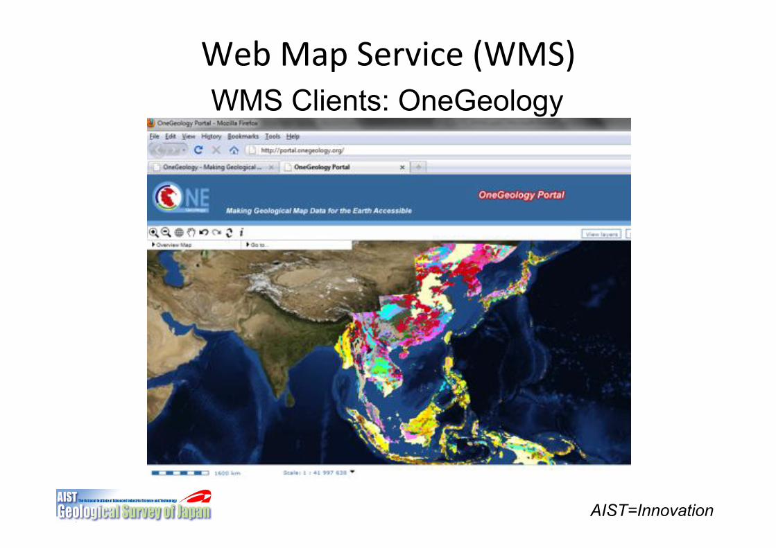
Web"Map"Service"(WMS)"WMS Clients: OneGeology
OneGeology Secretariat
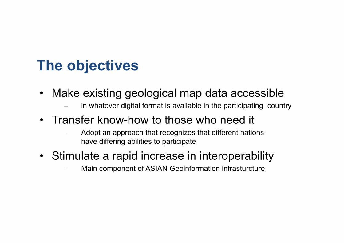
The objectives
• Make existing geological map data accessible – in whatever digital format is available in the participating country
• Transfer know-how to those who need it – Adopt an approach that recognizes that different nations
have differing abilities to participate
• Stimulate a rapid increase in interoperability – Main component of ASIAN Geoinformation infrasturcture
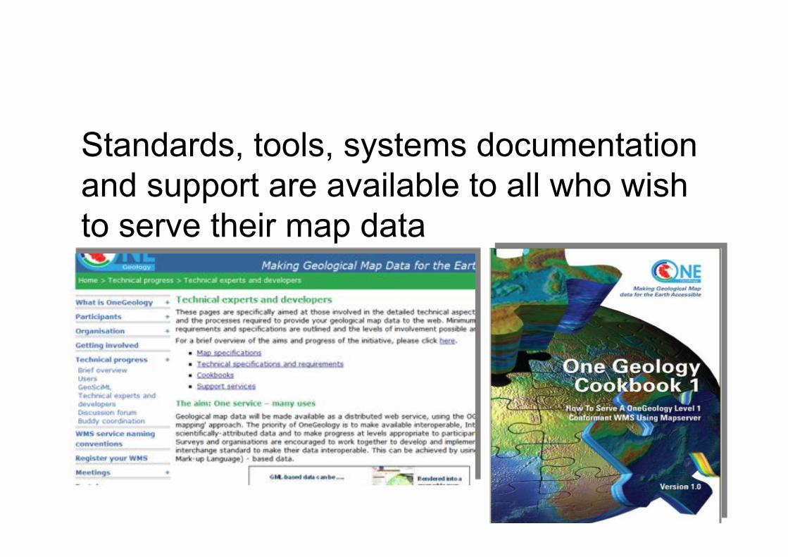
Standards, tools, systems documentation and support are available to all who wish to serve their map data
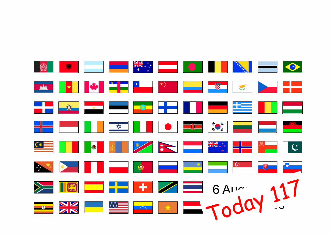
6 August 2008 81 countries Today 117
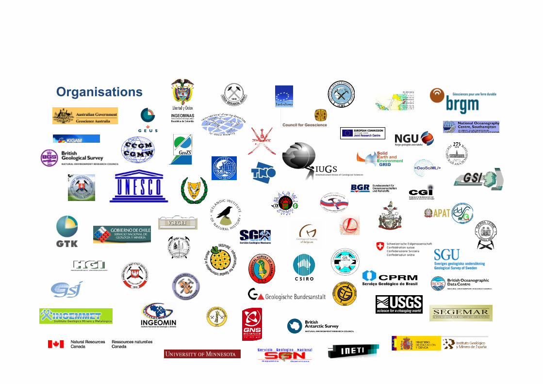
Organisations

AIST=Innovation
Web"Map"Service"(WMS)"WMS Clients: Google Maps (Google Maps API)
AIST=Innovation
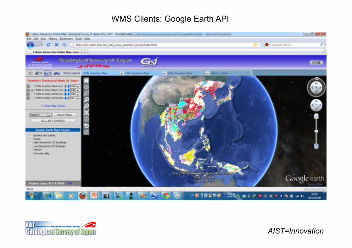
WMS Clients: Google Earth API
AIST=Innovation
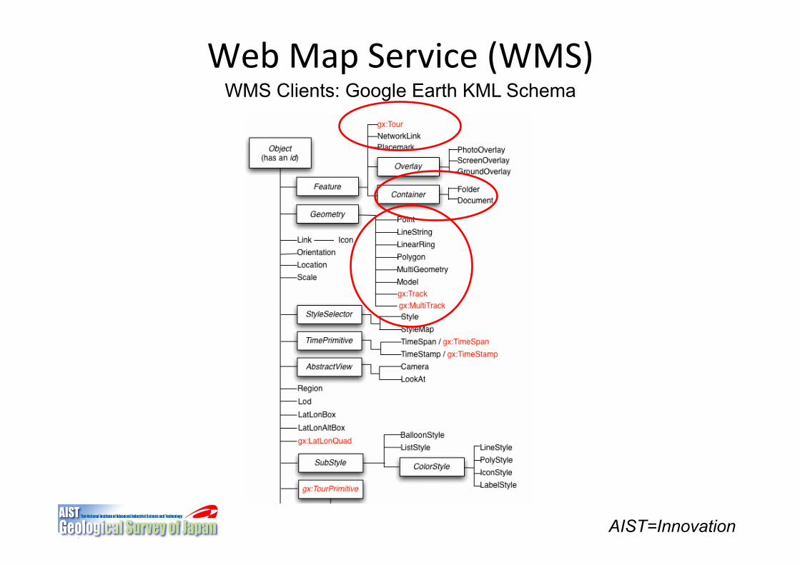
Web"Map"Service"(WMS)"WMS Clients: Google Earth KML Schema
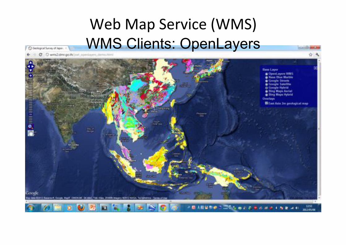
Web"Map"Service"(WMS)"WMS Clients: OpenLayers
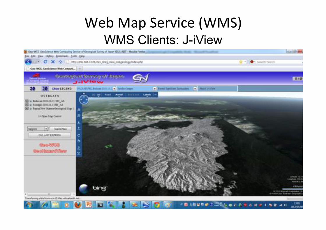
Web"Map"Service"(WMS)"WMS Clients: J-iView
AIST=Innovation
Web"Map"Service"(WMS)"
Aspect
Vegetation
Geology Slope
WMS Server
WMS Server
GSJ
NIED
NASA
CLIENT Overlays
WMS Server
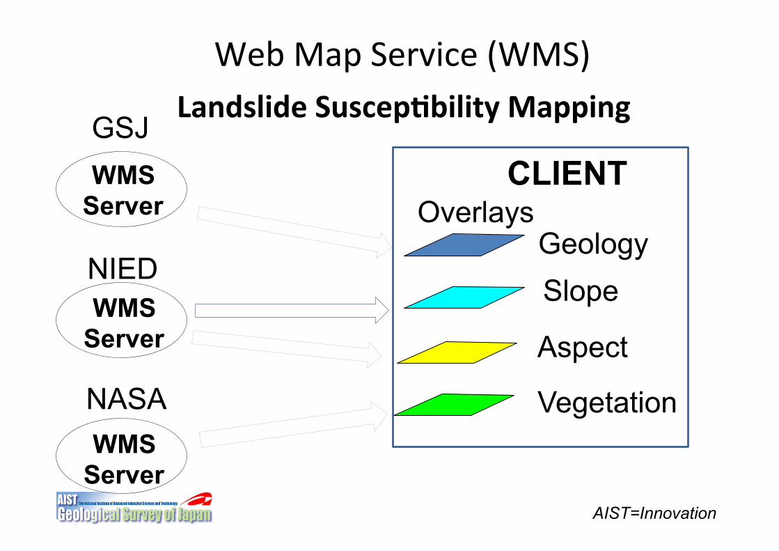
Landslide(Suscep5bility(Mapping(
Web"Services�
PostGIS""Apache"Linux"Mapserver"PHP"(Customiza+on)"C++"(Customiza+on)�
WPS (Web"Processing"Service)"
WMS�(Web Map Service)
PostGIS�
Web"Portal�
Vector"Data�
Satellite"Images�
WebGIS(Page(�
Major(Components(of(a(WebGIS(System(
J!iView"AJAX"Javascript�
Database�
FOSS(and(OGC(Based(WebGIS(System(Currently(Developed(for(CCOP(Region(
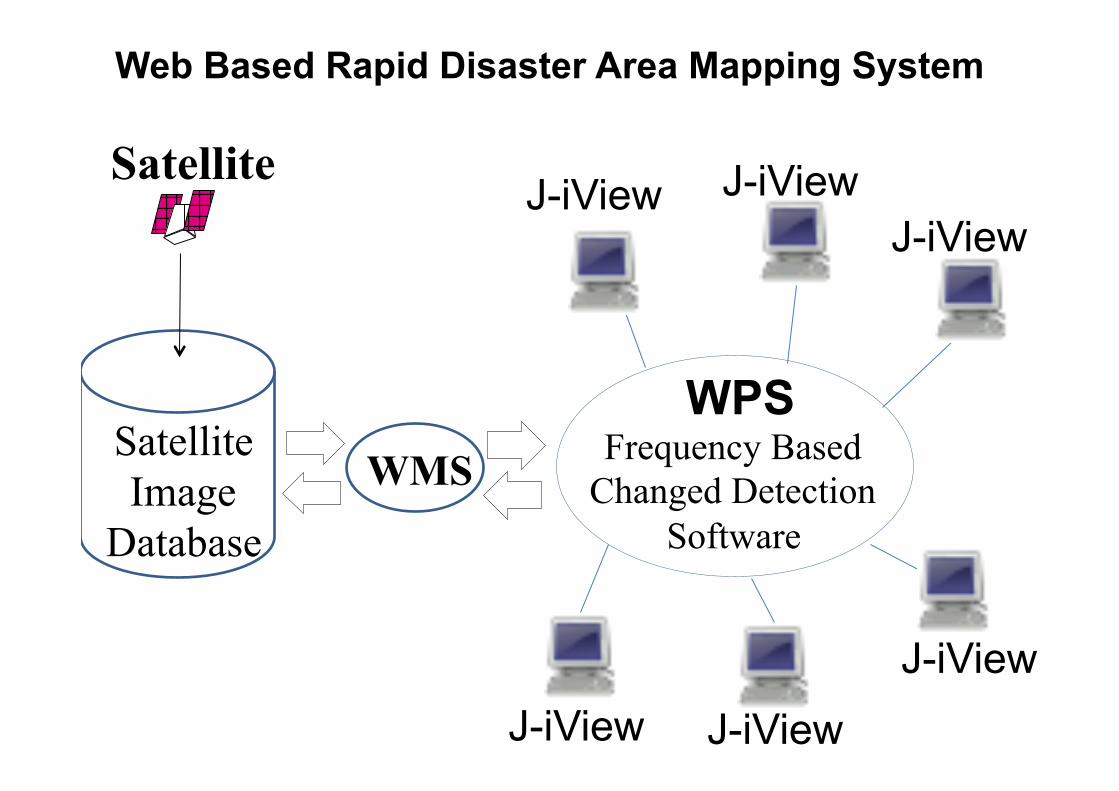
Frequency Based Changed Detection
Software
WMS"Satellite Image
Database
WMS WPS
J-iView
J-iView
J-iView J-iView J-iView
J-iView
Satellite
Web Based Rapid Disaster Area Mapping System
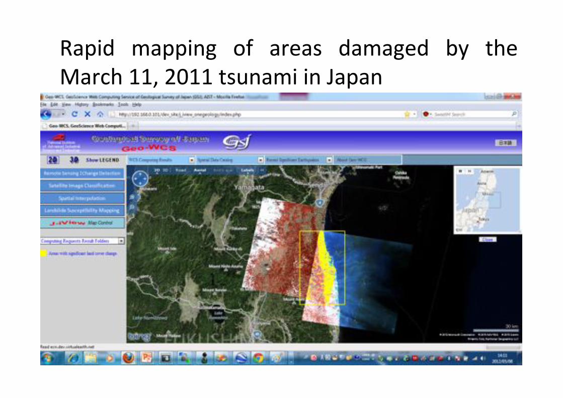
Rapid" mapping" of" areas" damaged" by" the"March"11,"2011"tsunami"in"Japan"
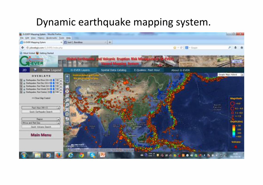
Dynamic"earthquake"mapping"system."
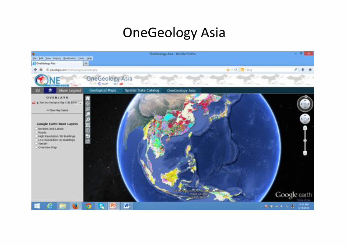
OneGeology"Asia"

AIST=Innovation
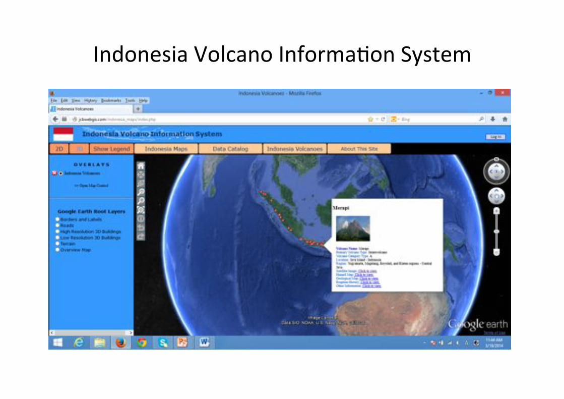
Indonesia"Volcano"Informa+on"System"
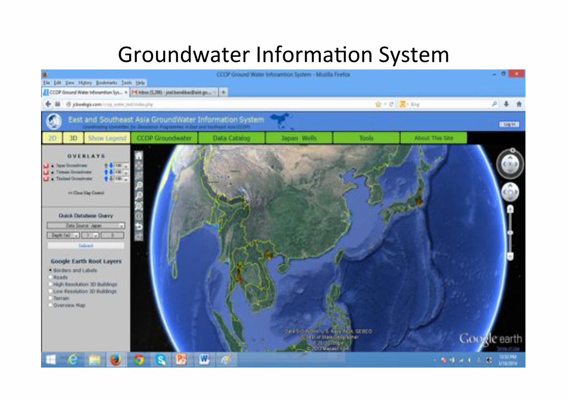
Groundwater"Informa+on"System"
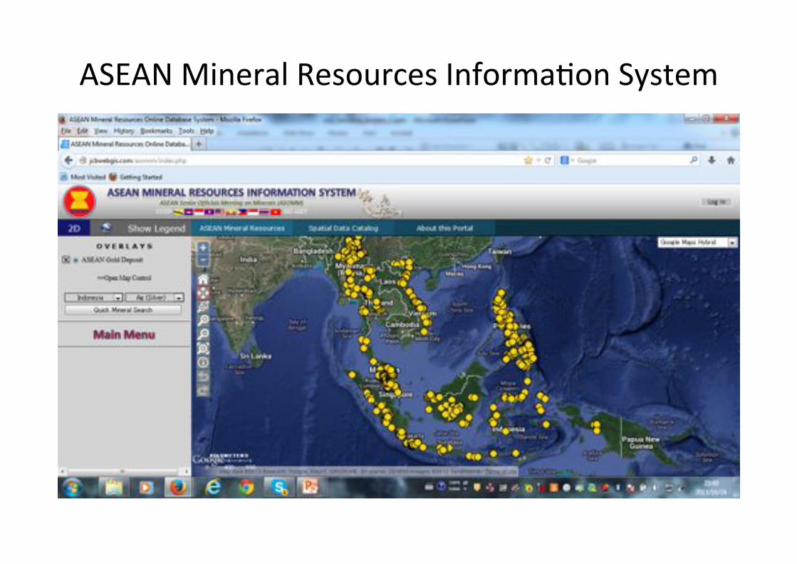
ASEAN"Mineral"Resources"Informa+on"System"
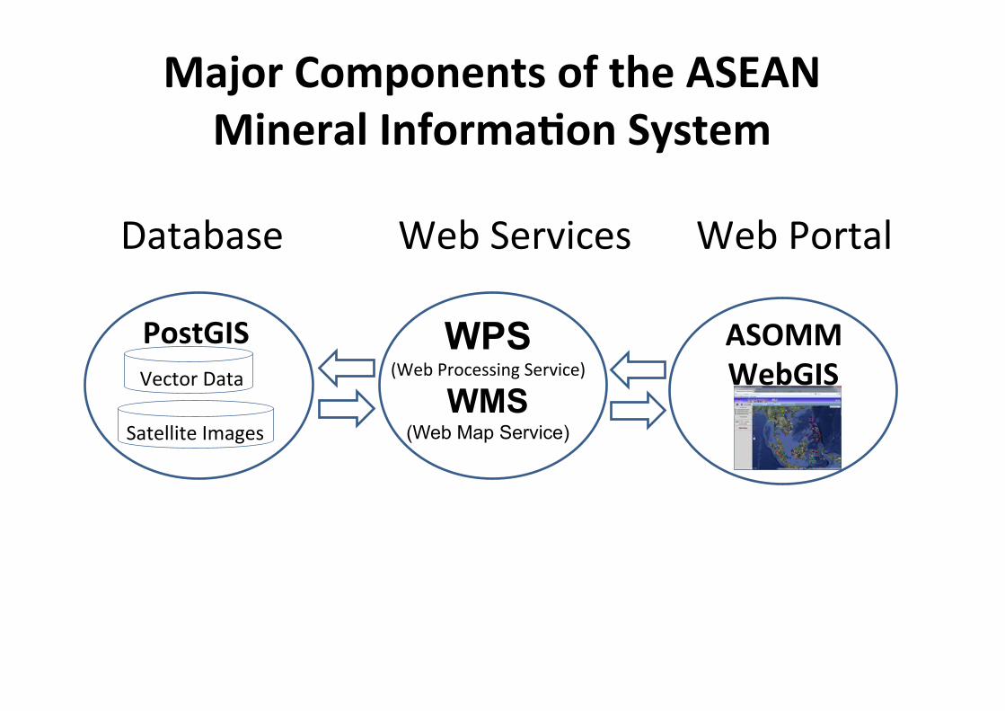
Web"Services�Database�
WPS (Web"Processing"Service)"
WMS�(Web Map Service)
PostGIS�
Web"Portal�
Vector"Data�
Satellite"Images�
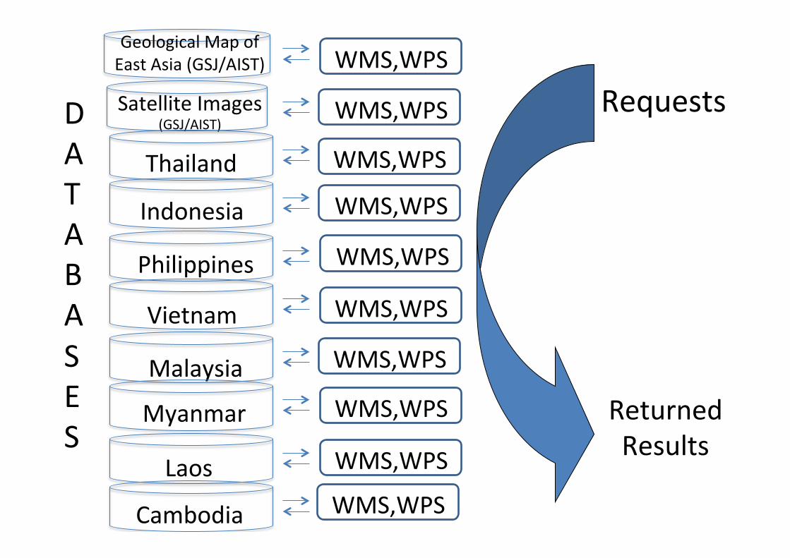
ASOMM((WebGIS(�
Major(Components(of(the(ASEAN((Mineral(Informa5on(System(
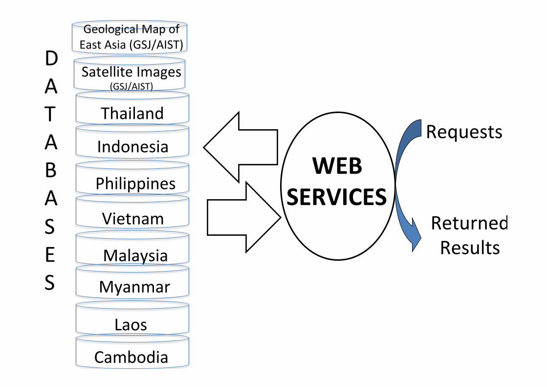
Geological"Map"of""East"Asia"(GSJ/AIST)"
Satellite"Images"(GSJ/AIST)"
Thailand"
Indonesia"
Philippines"
Vietnam"
Malaysia"
Myanmar"
Laos"
Cambodia"
D"A"T"A"B"A"S"E"S"
WEB(SERVICES(
Requests"
Returned""Results"
Requests"
Returned""Results"
Geological"Map"of""East"Asia"(GSJ/AIST)"
Satellite"Images"(GSJ/AIST)"
Thailand"
Indonesia"
Philippines"
Vietnam"
Malaysia"
Myanmar"
Laos"
Cambodia"
D"A"T"A"B"A"S"E"S"
WMS,WPS"
WMS,WPS"
WMS,WPS"
WMS,WPS"
WMS,WPS"
WMS,WPS"
WMS,WPS"
WMS,WPS"
WMS,WPS"
WMS,WPS"
AIST=Innova6on)
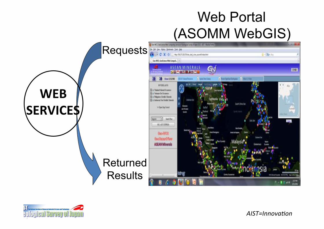
Requests
Returned Results
WEB(SERVICES(
Web Portal (ASOMM WebGIS)�
AIST=Innova6on)
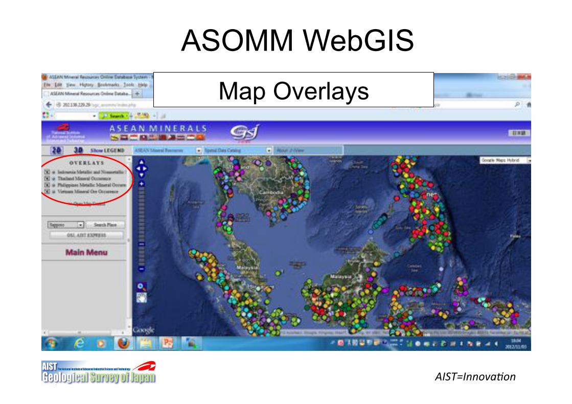
ASOMM WebGIS�Map Overlays�
AIST=Innova6on)
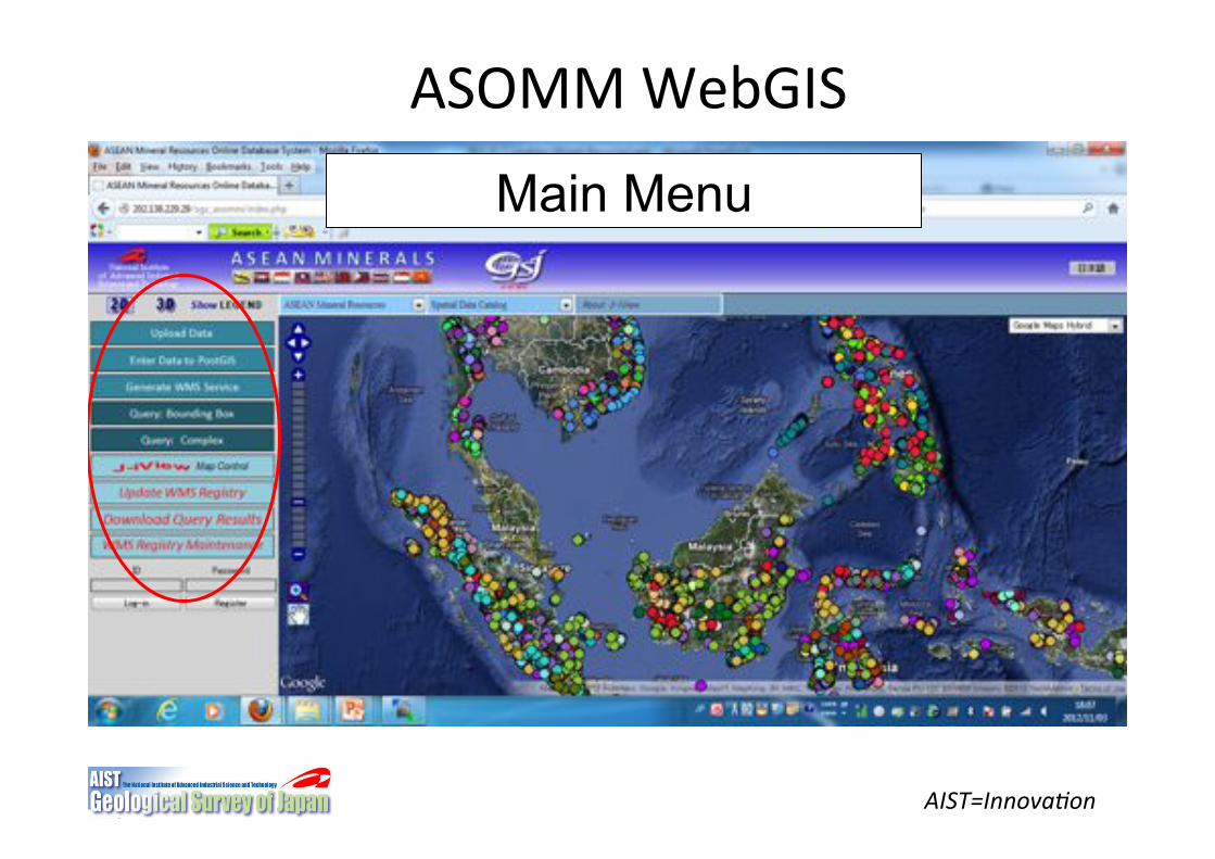
ASOMM"WebGIS�
Main Menu�
AIST=Innova6on)
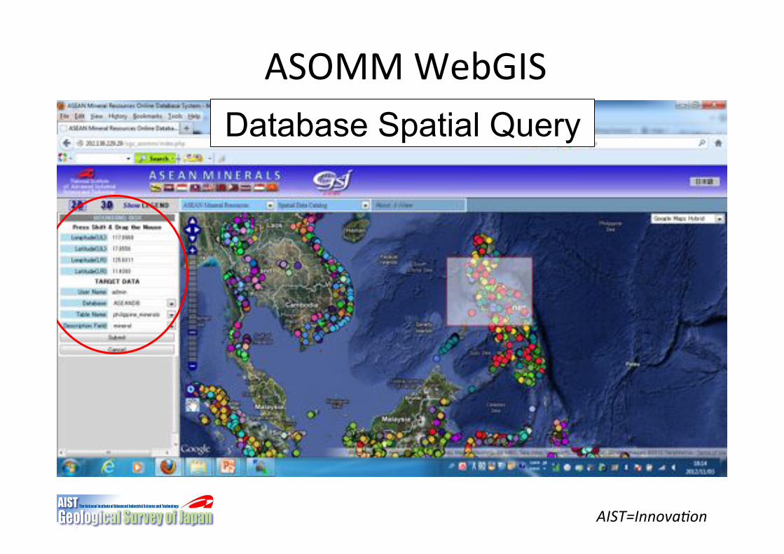
ASOMM"WebGIS�Database Spatial Query�
AIST=Innova6on)
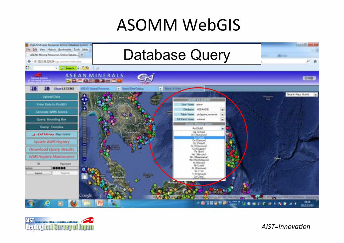
ASOMM"WebGIS�
Database Query�
AIST=Innova6on)
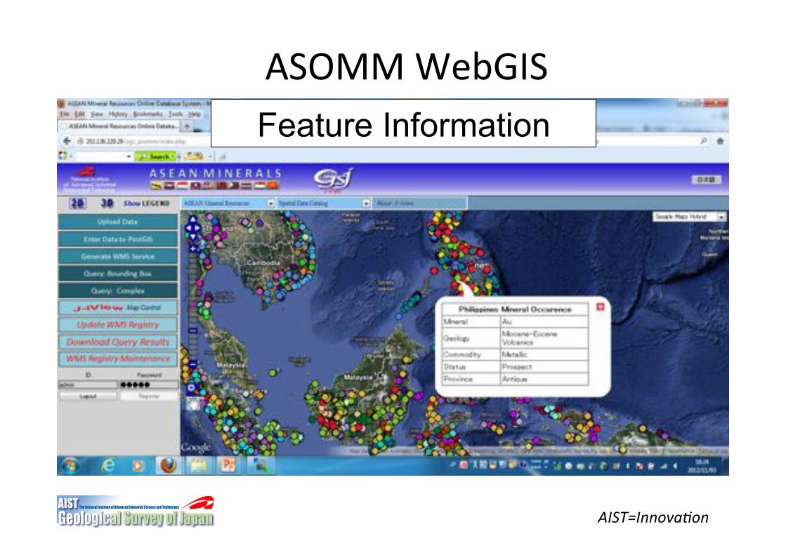
ASOMM"WebGIS�Feature Information�
AIST=Innova6on)
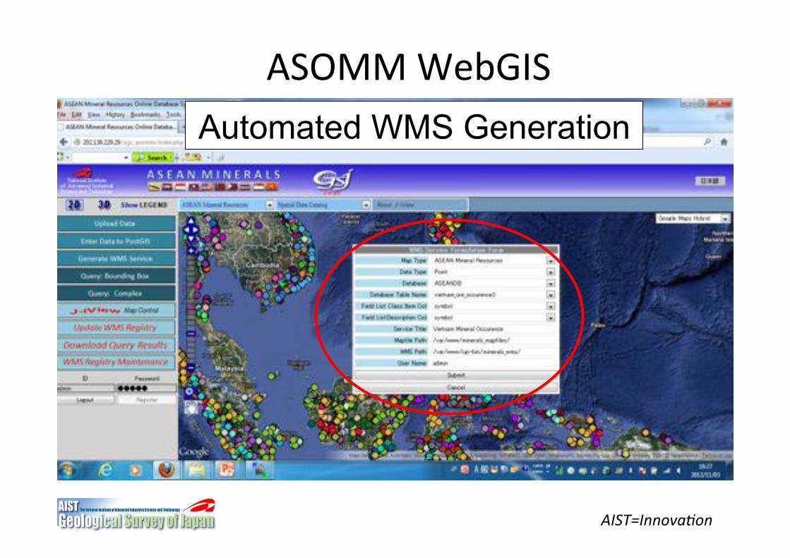
ASOMM"WebGIS�Automated WMS Generation�
AIST=Innova6on)
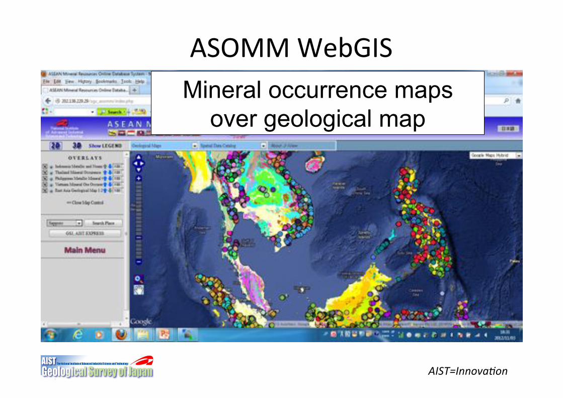
ASOMM"WebGIS�Mineral occurrence maps
over geological map�
AIST=Innova6on)
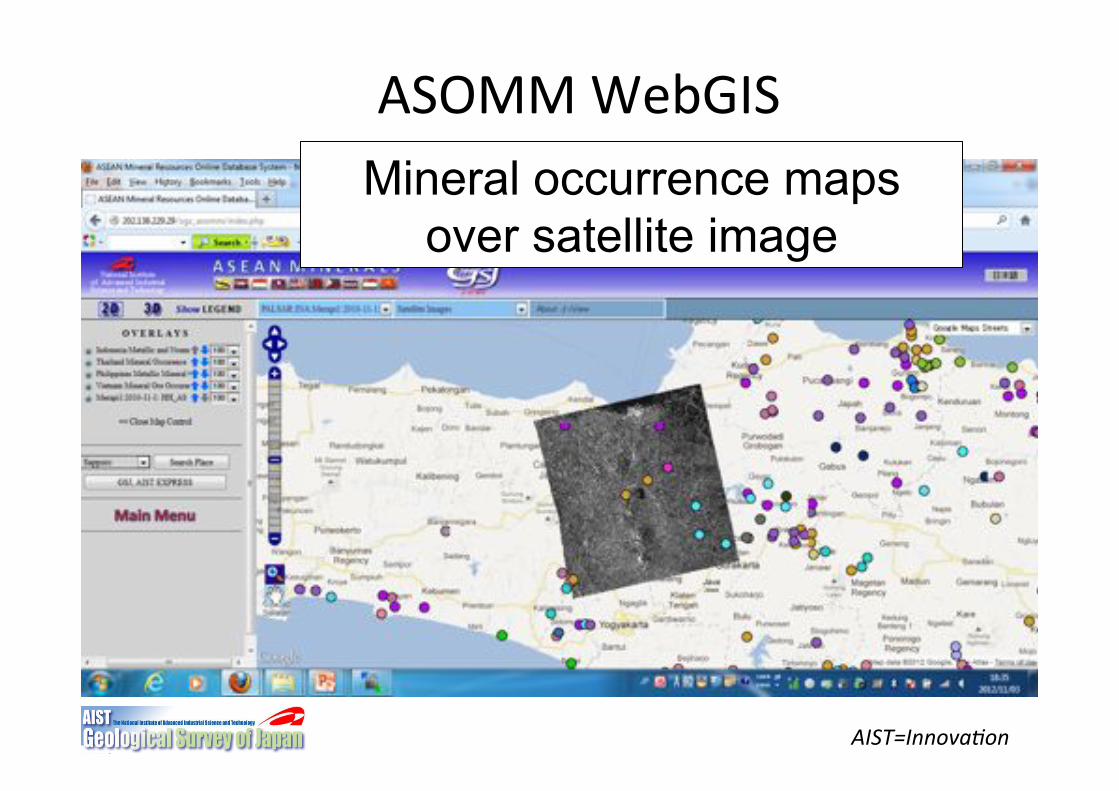
ASOMM"WebGIS�Mineral occurrence maps
over satellite image�
AIST=Innova6on)
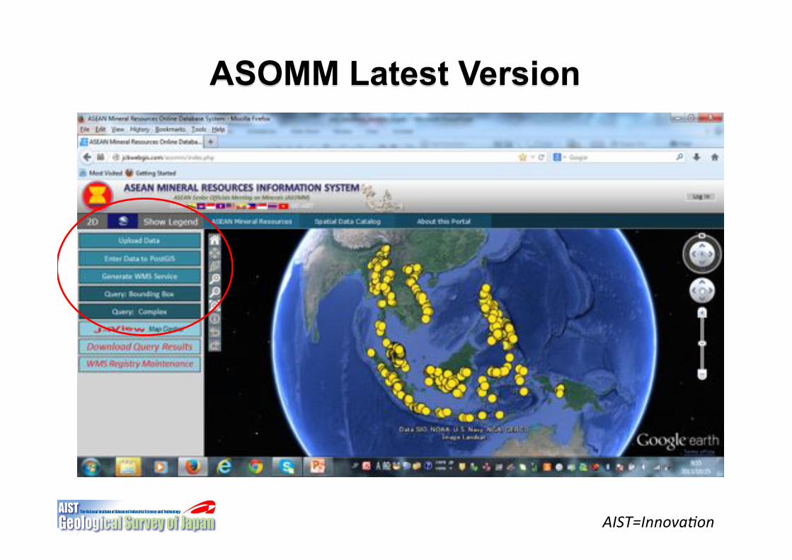
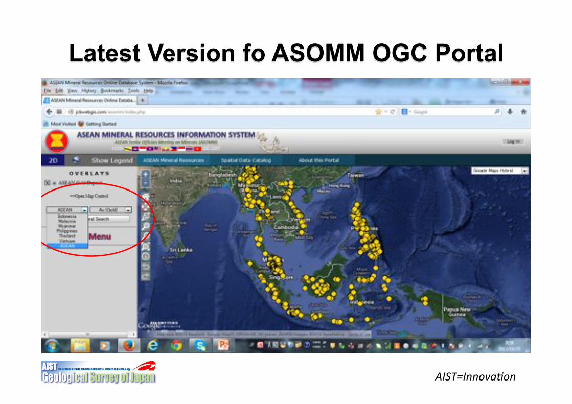
ASOMM Latest Version
AIST=Innova6on)
Latest Version fo ASOMM OGC Portal
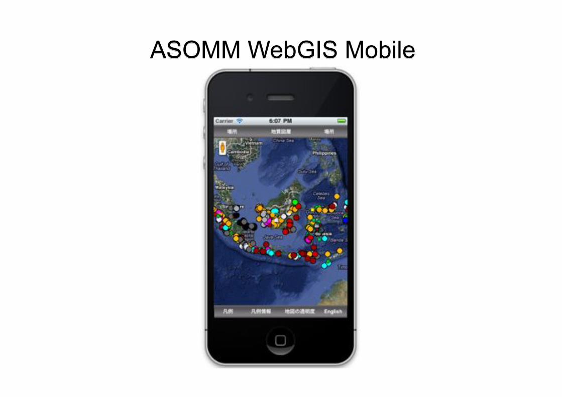
ASOMM WebGIS Mobile
SERVER(
Internet(Connec5on(
Any(PC(that(could(boot(
Requirements(to(serve/share(data(to(ASEAN(Web$based(Informa5on(System(
Web(Browser(
All(needed(soJware(could(be(downloaded(for(free.(
Thank(You(Very(Much(
AIST=Innova6on)