Embed Size (px)
Citation preview

Oceania 2 Maps/ Boltss These letters stand for the wordsBorderOrientation (direction)Legend (key)TitleScaleSource
BORDER (Activity)
1. looking at the BLACK and White A3 Maps of “The Pacific” colour in the BORDERS around Fiji, Tonga, Cook Islands , French Polynesia e and The Solomon Islands.(use a different colour for each border.
2. Why are the borders surrounding the Oceans and not just the land ?
3. Give 3 reasons for these types of Borders in the “Pacific Region”?
Orientation (DIRECTION)

In 4s Look carefully at the aerial photograph (ABOVE). This is a plan view of camels crossing the desert taken late afternoon. What colour are the camels? In which direction are they heading ?
(BEFORE YOU ANSWER REMEMBER “THE SUN RISES EAST SETS WEST”) SO THE SHADOW IS IN WHICH DIRECTION ?

Uluru (Famous Oceania Tourist Destinations)
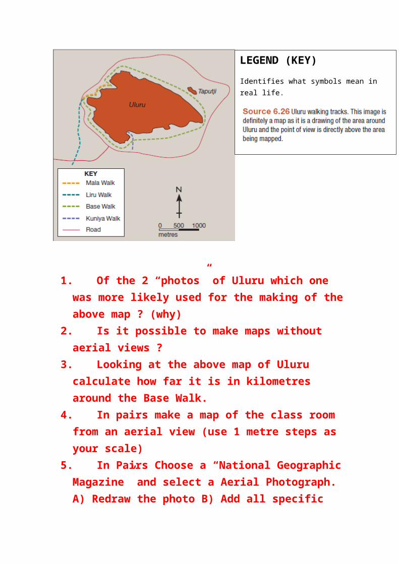
1. Of the 2 “photos” of Uluru which one was more likely used for the making of the above map ? (why)
2. Is it possible to make maps without aerial views ?3. Looking at the above map of Uluru calculate how far it is in
kilometres around the Base Walk.4. In pairs make a map of the class room from an aerial view (use
1 metre steps as your scale)5. In Pairs Choose a “National Geographic Magazine” and select
a Aerial Photograph. A) Redraw the photo B) Add all specific objects (include a Legend to explain what land marks are in the photo) c) Include a scale (Approximate) d) Border e)Orientation if possible
6. In pairs present your photo and picture explain to the class your understanding of the process.
LEGEND (KEY)
Identifies what symbols mean in real life.