Embed Size (px)
Citation preview
Web-GIS and interactive systems
Web-GIS and interactive systems
Hugo AhleniusUNEP/GRID-Arendal
About...
• UNEP centre based in Arendal, Norway (Ottawa, Geneva, Stockholm)
• UNEP key polar centre• Founded 1989
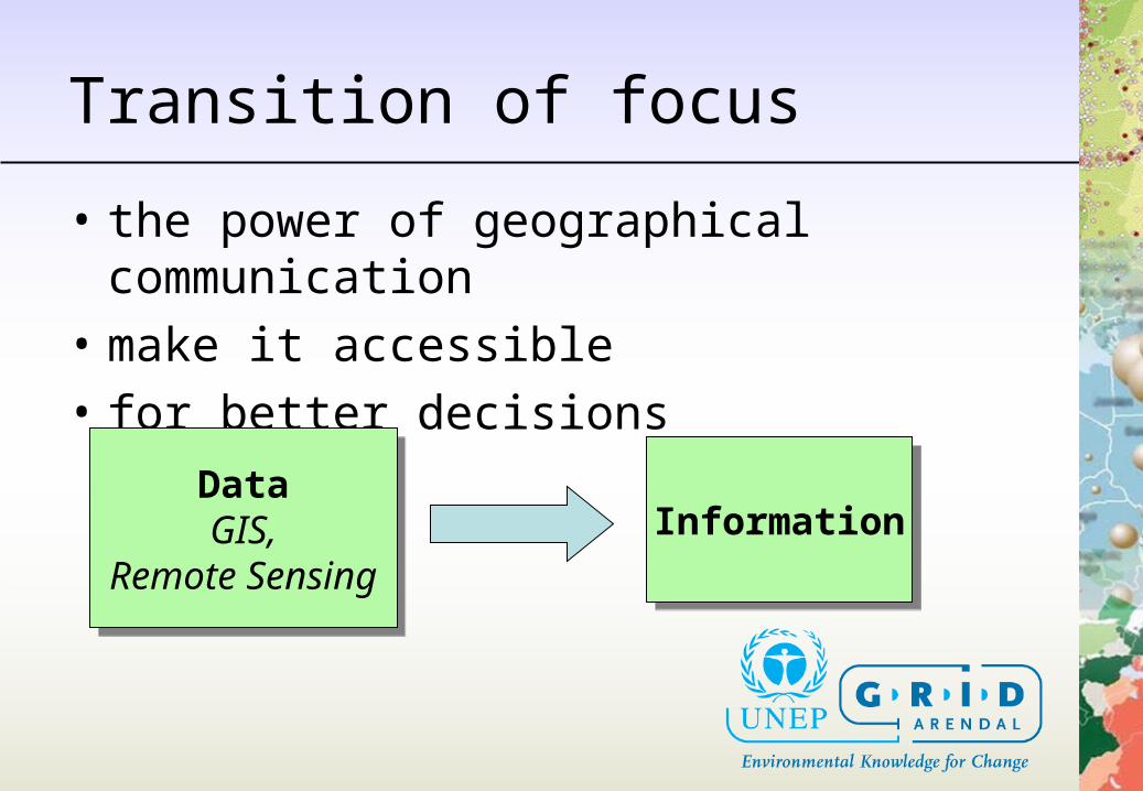
Transition of focus
• the power of geographical communication
• make it accessible• for better decisions
DataGIS,
Remote Sensing
DataGIS,
Remote SensingInformationInformation
Technology
• Geographical Data & Information for the Internet:– Software– Standards– Catalogue services (metadata)
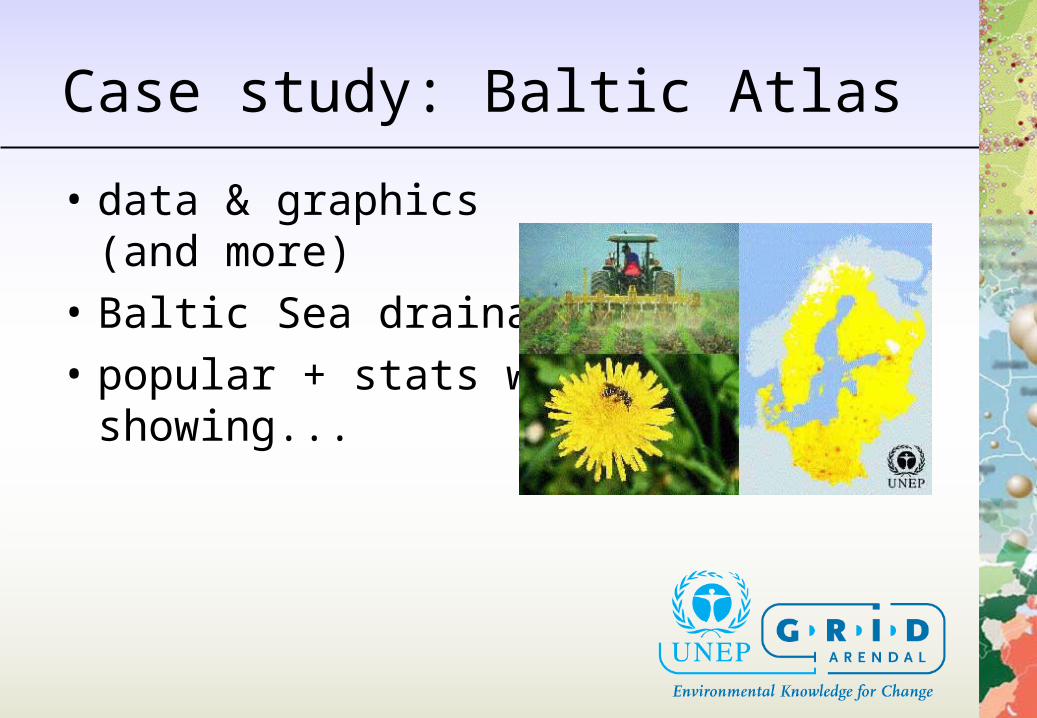
Case study: Baltic Atlas
• data & graphics(and more)
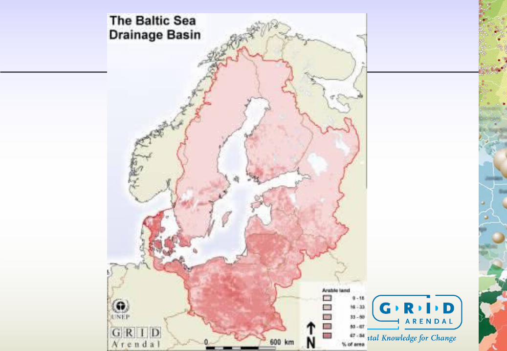
• Baltic Sea drainage basin• popular + stats where
showing...
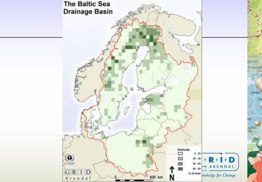

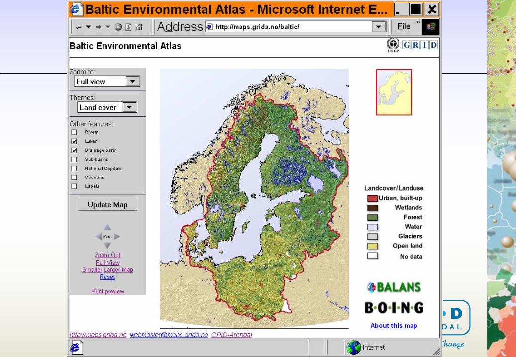
Baltic Atlas
• Interactive map• Implemented using ESRI ArcSDE +
ArcIMS• Functionality• Popular!
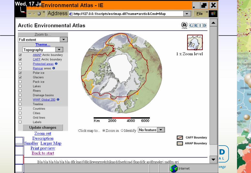
Other examples
• Arctic Environmental Atlas• Globalis
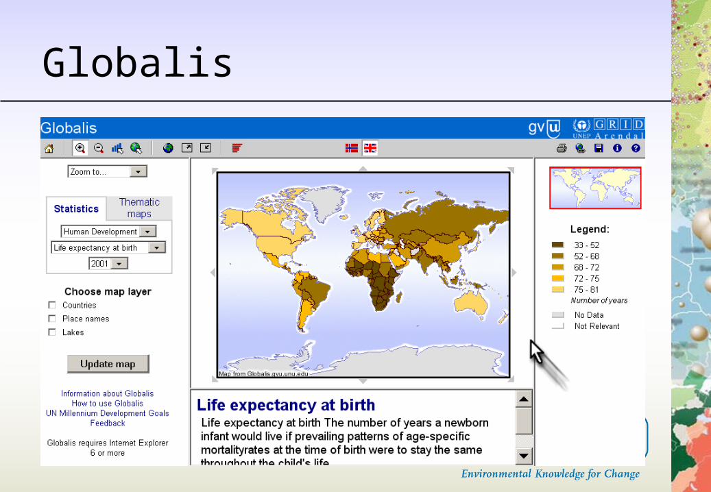
Globalis
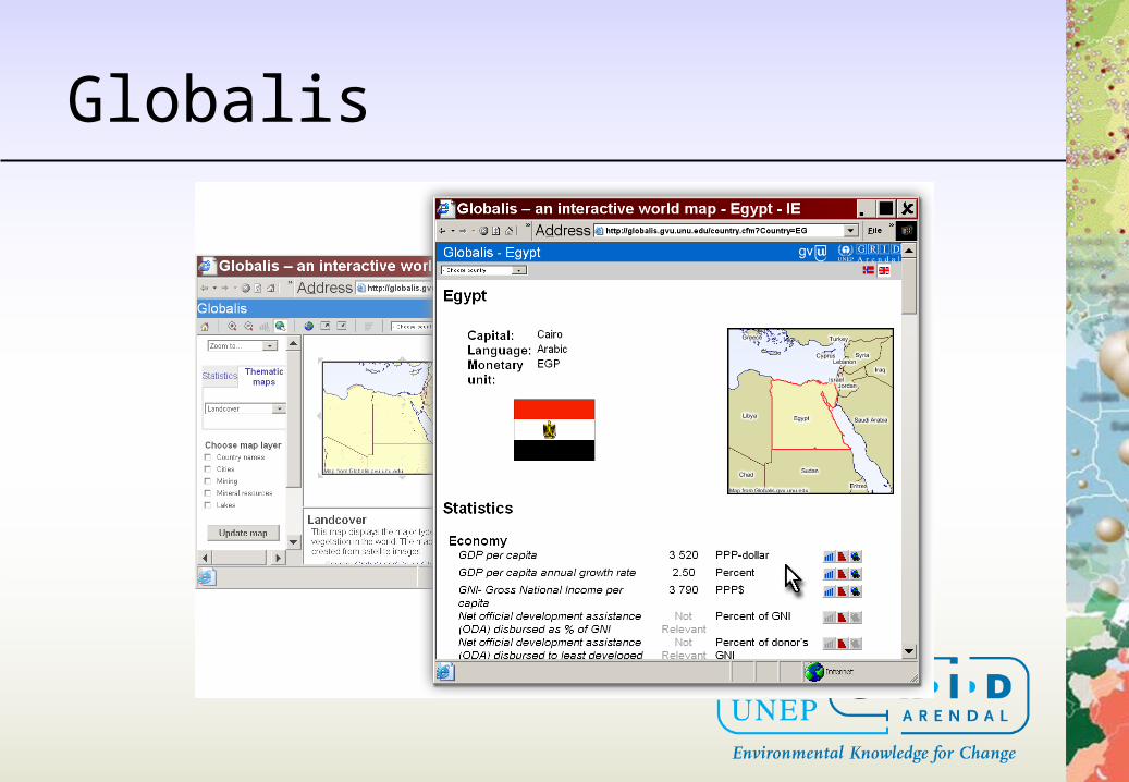
Globalis
More... + the future
• web data access– download– integrate
• web integration
Conclusion + relevance
• Access• Progress• Communication• Use• Just a tool, not the means in itself