Embed Size (px)
DESCRIPTION
2005 ESRI Education User Conference July 24, 2005 8:30-10:00am. Web-based and Mobile GIS for High School GIS Career Awareness. by Dr. Ming-Hsiang (Ming) Tsou E-mail: [email protected] Phone: 619-5940205 Fax: 619-5944938. The Department of Geography, San Diego State University. - PowerPoint PPT Presentation
Citation preview
Web-basedWeb-based and and Mobile GISMobile GIS for for High School GIS Career AwarenessHigh School GIS Career Awareness
by Dr. Ming-Hsiang (Ming) Tsou
E-mail: [email protected]: 619-5940205
Fax: 619-5944938
The Department of Geography, San Diego State University
2005 ESRI Education User Conference2005 ESRI Education User ConferenceJuly 24, 2005 8:30-10:00am.July 24, 2005 8:30-10:00am.
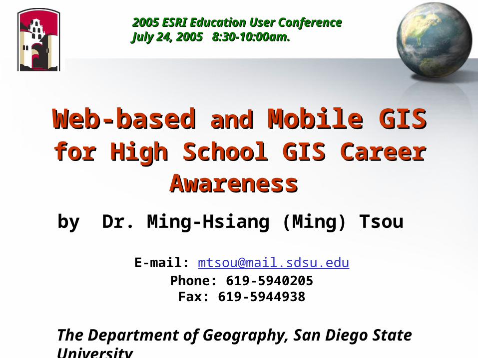
Web-based GIS Web-based GIS (Internet GIS)(Internet GIS)
San Diego State University
InternetMap
Server
(ArcIMS)
WebServer
(map.sdsu.edu
Internet
Client (Web browser)+ Java applets
Client (Web browser)+ IMS Viewer
Client (Web browser)
RegionalDatabase(GIS)
Server Client
The Network is the ComputerThe Internet is Your GIS.
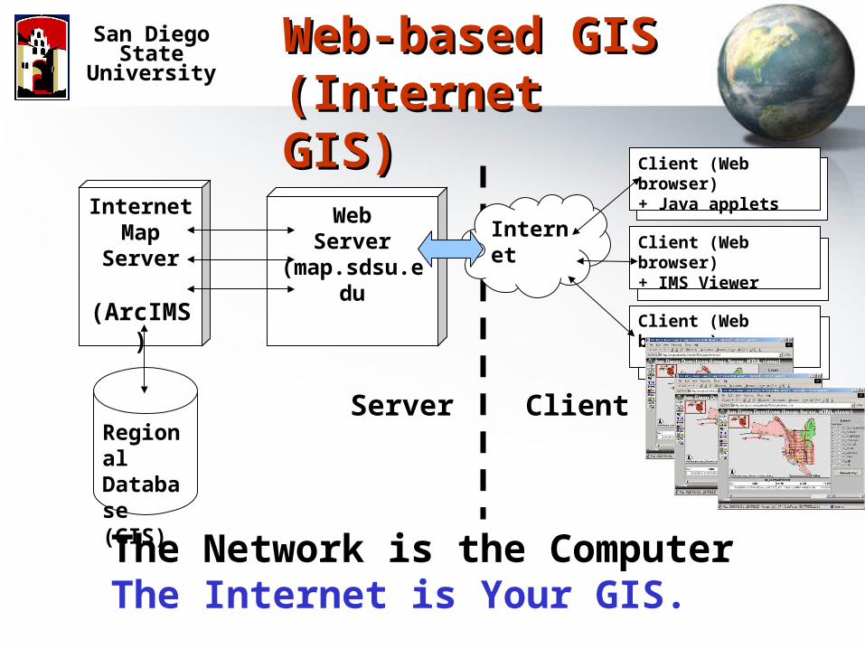
Sharing Data, Information, and Sharing Data, Information, and KnowledgeKnowledge
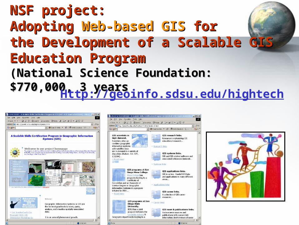
NSF project: NSF project: Adopting Adopting Web-based GISWeb-based GIS for for the Development of a Scalable GIS the Development of a Scalable GIS Education Program Education Program (National Science Foundation: $770,000, 3 years(National Science Foundation: $770,000, 3 years
Http://geoinfo.sdsu.edu/hightech
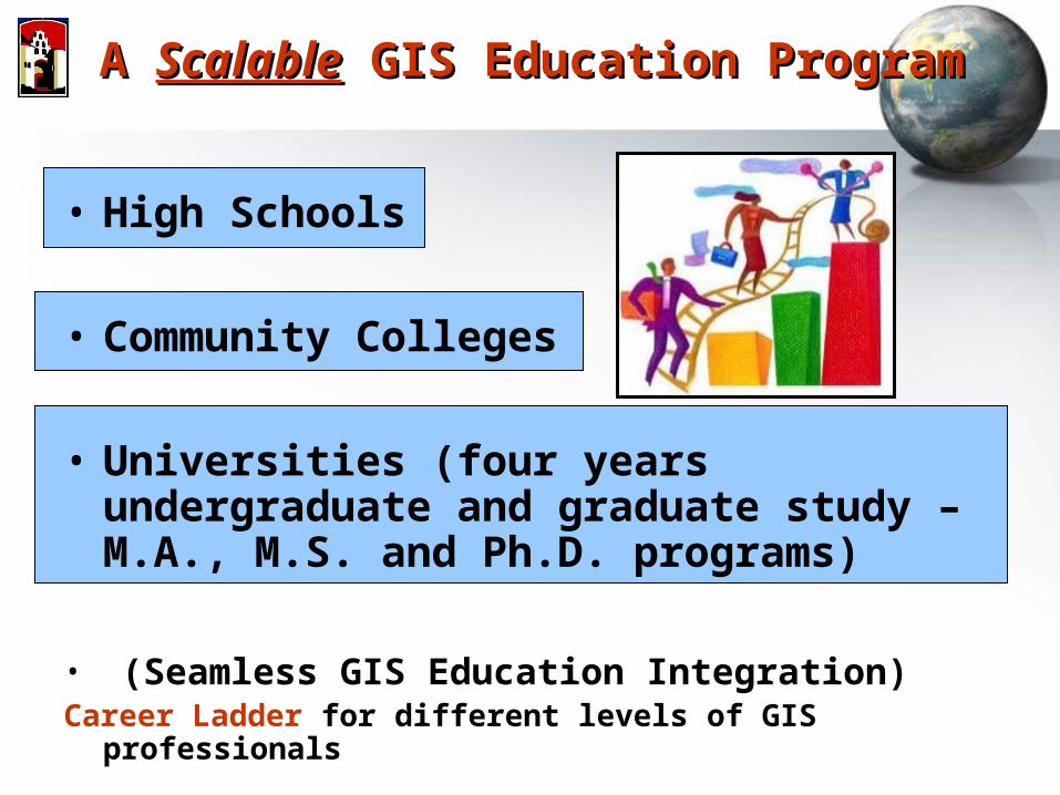
A A ScalableScalable GIS Education Program GIS Education Program
• High Schools
• Community Colleges
• Universities (four years undergraduate and graduate study – M.A., M.S. and Ph.D. programs)
• (Seamless GIS Education Integration)Career Ladder for different levels of GIS professionals
ProblemsProblems
• Different school levels have different resources and GIS lab setting. (High school: no GIS software/hardware, community college: small GIS labs, few instructors, etc.)
• Lack of entry-level GIS courses for curriculum articulation (GIS courses in Community colleges (techniques-oriented) are quite different from Universities (theories and research-oriented).
• Need a Web portal for sharing research findings and publications to the GIS education community (K-12, community colleges, and Universities).
San Diego State University
Solution: Web-based GIS
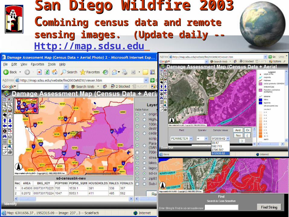
San Diego Wildfire 2003San Diego Wildfire 2003CCombining census data and remote sensing ombining census data and remote sensing images. (Update daily -- images. (Update daily -- Http://map.sdsu.edu
Web-based GIS AdvantagesWeb-based GIS Advantagesfor high school teachers and students
• Avoid the complicated (and often expensive) software installation in traditional GIS.
• Students can utilize a Web browser to access maps and GIS from anywhere (schools, homes, or libraries).
• Combine with Multimedia (sounds, animation, and 3D) in an integrated Web environment.
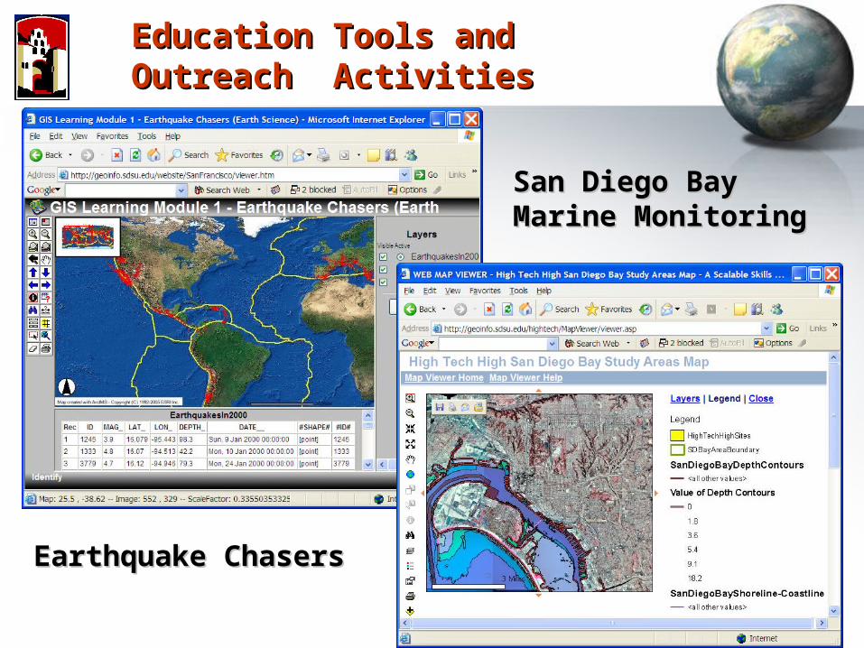
Education Tools and Outreach Education Tools and Outreach ActivitiesActivities
Earthquake ChasersEarthquake Chasers
San Diego Bay San Diego Bay Marine MonitoringMarine Monitoring
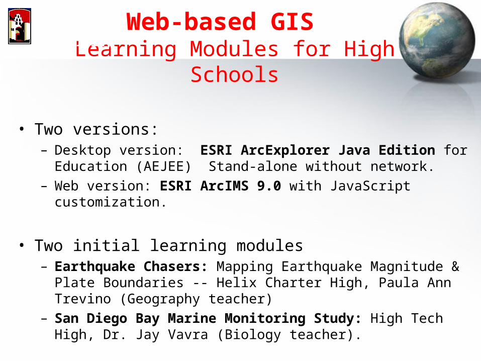
Web-based GIS Learning Modules for High Schools
• Two versions:– Desktop version: ESRI ArcExplorer Java Edition for Education
(AEJEE) Stand-alone without network.– Web version: ESRI ArcIMS 9.0 with JavaScript customization.
• Two initial learning modules– Earthquake Chasers: Mapping Earthquake Magnitude & Plate
Boundaries -- Helix Charter High, Paula Ann Trevino (Geography teacher)
– San Diego Bay Marine Monitoring Study: High Tech High, Dr. Jay Vavra (Biology teacher).
San Diego State University
Student Field Work (Boat Channel Study: HTH Biotech Website)
Student Field Work (Boat Channel Study: HTH Biotech Website)
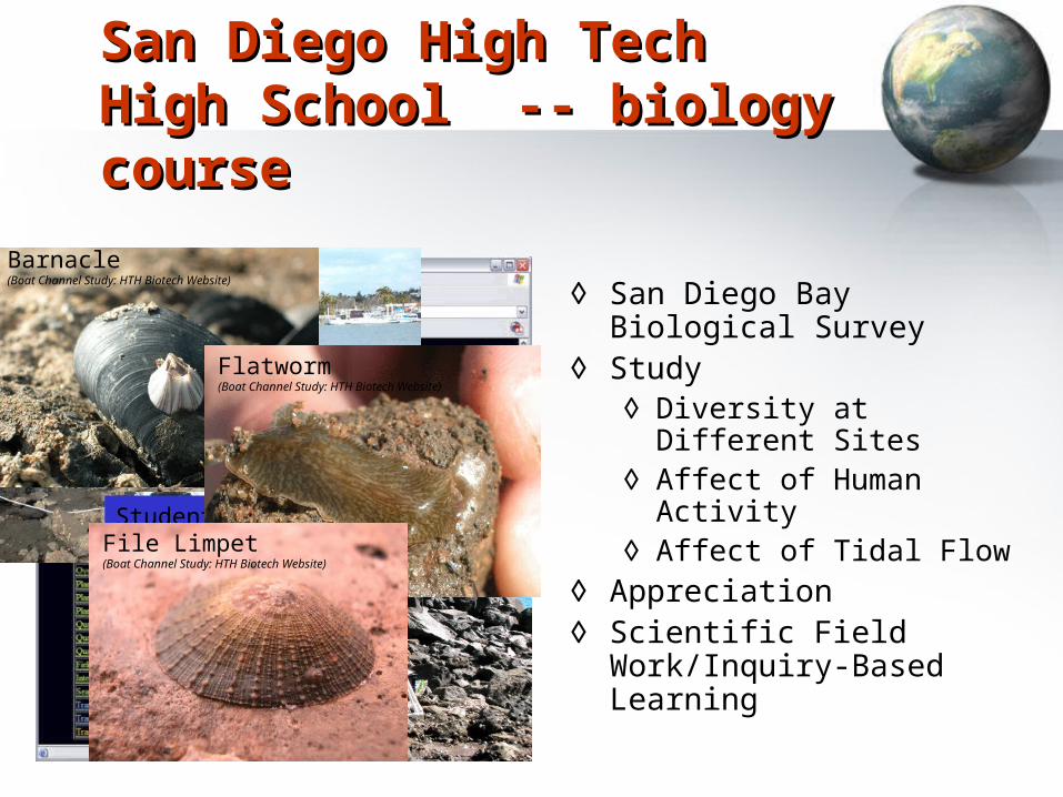
◊ San Diego Bay Biological Survey
◊ Study◊ Diversity at Different Sites◊ Affect of Human Activity◊ Affect of Tidal Flow
◊ Appreciation◊ Scientific Field Work/Inquiry-
Based Learning
Barnacle (Boat Channel Study: HTH Biotech Website)
Flatworm (Boat Channel Study: HTH Biotech Website)
File Limpet(Boat Channel Study: HTH Biotech Website)
San Diego High Tech High San Diego High Tech High School -- biology courseSchool -- biology course
Web-based GIS Learning Modules for High Schools
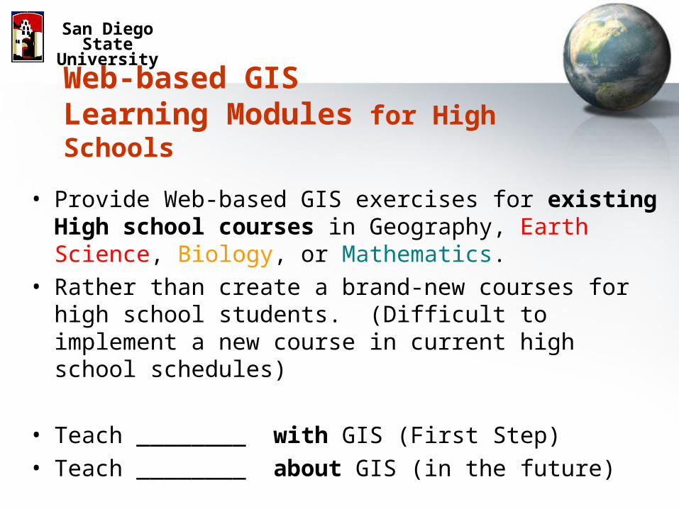
• Provide Web-based GIS exercises for existing High school courses in Geography, Earth Science, Biology, or Mathematics.
• Rather than create a brand-new courses for high school students. (Difficult to implement a new course in current high school schedules)
• Teach ________ with GIS (First Step) • Teach ________ about GIS (in the future)
San Diego State University
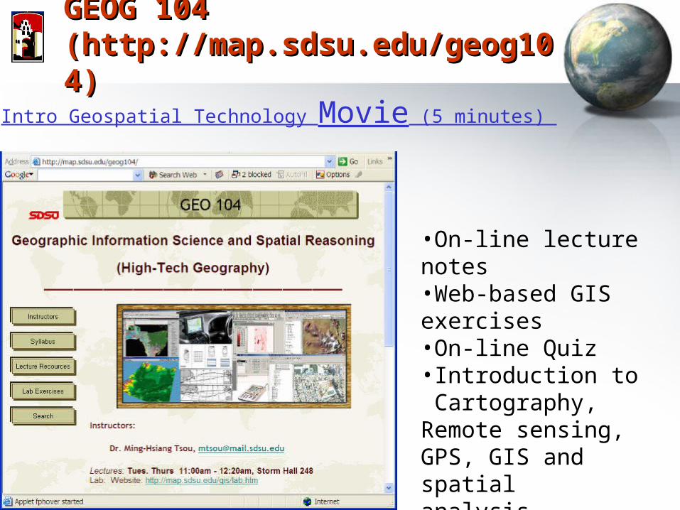
GEOG 104GEOG 104(http://map.sdsu.edu/geog104)(http://map.sdsu.edu/geog104)
•On-line lecture notes•Web-based GIS exercises•On-line Quiz•Introduction to Cartography, Remote sensing, GPS, GIS and spatial analysis.
Intro Geospatial Technology Movie (5 minutes)
GEOG 104 (at San Diego State Unversity)Geographic Information Science and Spatial Reasoning
1.1. Fundamental core course in the Fundamental core course in the new B.S Degreenew B.S Degree in Geography in Geography Department with Emphasis in Department with Emphasis in Geographic Information ScienceGeographic Information Science. (Major . (Major code: 22061).code: 22061).
2.2. Can be used for the Can be used for the Geographic Information Science CertificateGeographic Information Science Certificate program program (as parts of 27 required units). (as parts of 27 required units).
Promising Career Pathways in GISPromising Career Pathways in GIS
The U.S. Department of Labor and the U.S. Department of Education Career The U.S. Department of Labor and the U.S. Department of Education Career Voyages Web site identify the Voyages Web site identify the geospatial industrygeospatial industry as one of the key emerging as one of the key emerging and evolving industries, along with and evolving industries, along with nanotechnologynanotechnology and and biotechnologybiotechnology. .
Current Job Listing Examples (searched via Web on April-22-2005).Current Job Listing Examples (searched via Web on April-22-2005).
Salary: $47,164.00-$73,103.68 annuallySalary: $47,164.00-$73,103.68 annually. GIS Analyst II, Clark County Department of Aviation, Las . GIS Analyst II, Clark County Department of Aviation, Las Vegas, Nevada, US #05-0019Vegas, Nevada, US #05-0019
Salary: $60,000.00 to $ 80,000.00 per yearSalary: $60,000.00 to $ 80,000.00 per year. US-FL-Orlando-GIS Analyst, Hudson Engineering, . US-FL-Orlando-GIS Analyst, Hudson Engineering, Operations, and Aerospace.Operations, and Aerospace.
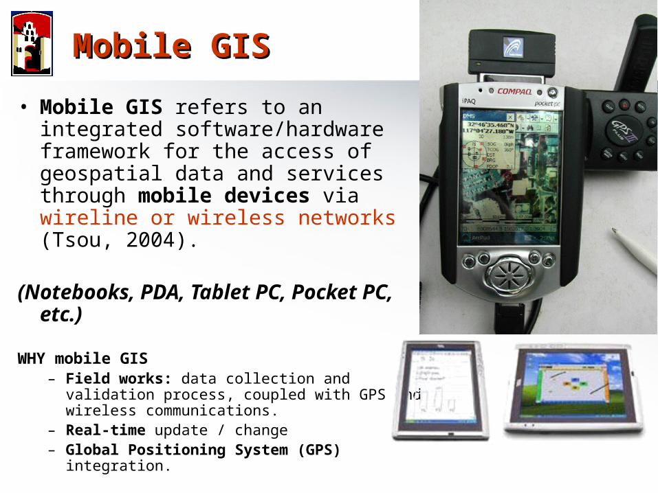
• Mobile GIS refers to an integrated software/hardware framework for the access of geospatial data and services through mobile devices via wireline or wireless networks (Tsou, 2004).
(Notebooks, PDA, Tablet PC, Pocket PC, etc.)
WHY mobile GIS – Field works: data collection and validation
process, coupled with GPS and wireless communications.
– Real-time update / change– Global Positioning System (GPS) integration.
Mobile GISMobile GIS
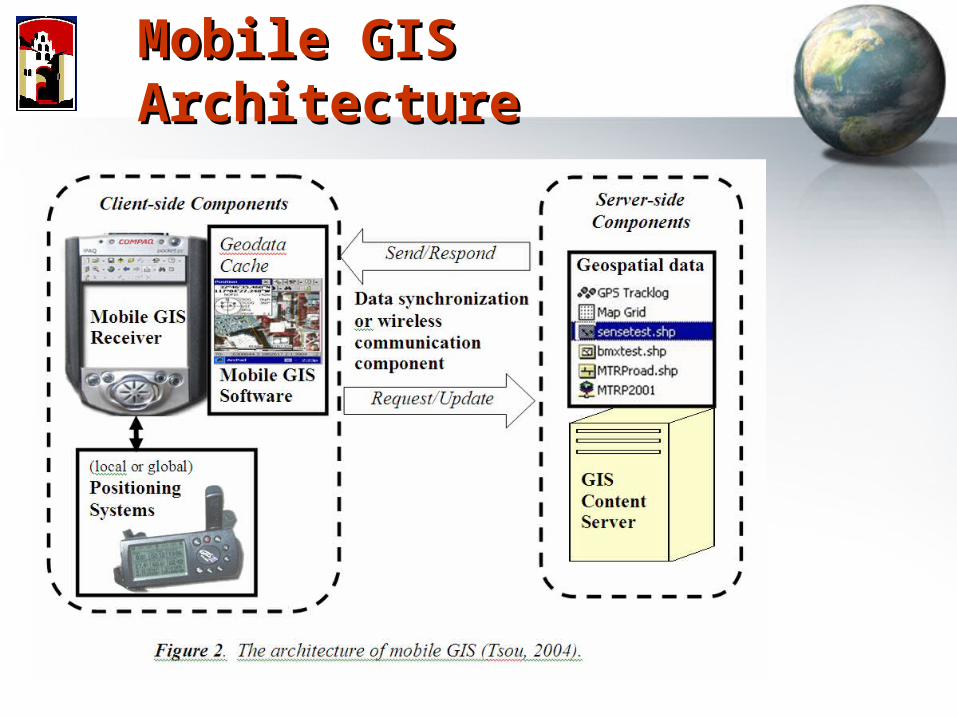
Mobile GIS ArchitectureMobile GIS Architecture
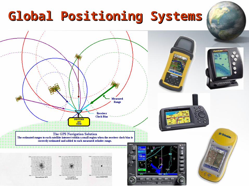
Global Positioning SystemsGlobal Positioning Systems
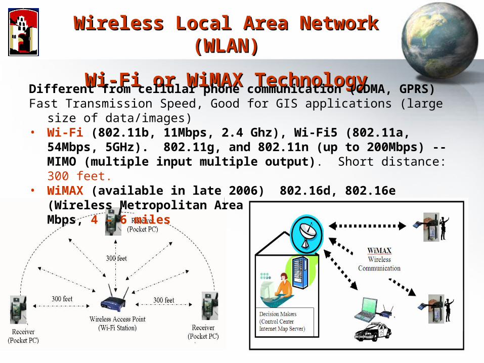
Wireless Local Area Network (WLAN)Wireless Local Area Network (WLAN)
Wi-Fi or WiMAX TechnologyWi-Fi or WiMAX Technology
Different from cellular phone communication (CDMA, GPRS) Fast Transmission Speed, Good for GIS applications (large size of data/images)• Wi-Fi (802.11b, 11Mbps, 2.4 Ghz), Wi-Fi5 (802.11a, 54Mbps, 5GHz).
802.11g, and 802.11n (up to 200Mbps) -- MIMO (multiple input multiple output). Short distance: 300 feet.
• WiMAX (available in late 2006) 802.16d, 802.16e (Wireless Metropolitan Area Network (WMAN). 30 – 75 Mbps, 4 – 6 miles
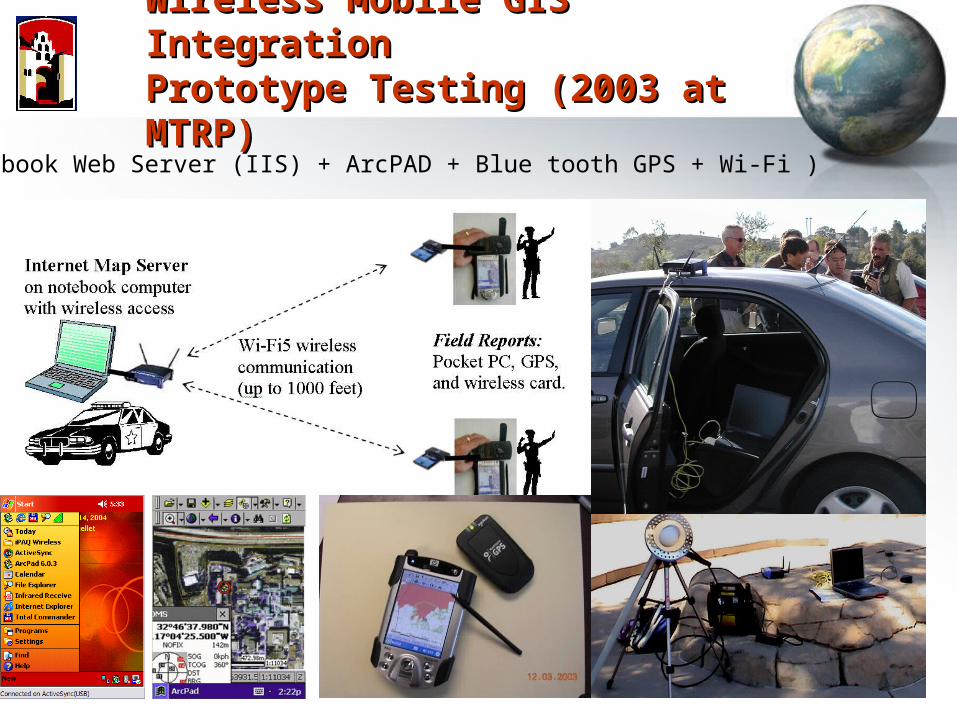
Wireless Mobile GIS IntegrationWireless Mobile GIS IntegrationPrototype Testing (2003 at MTRP)Prototype Testing (2003 at MTRP)
(Notebook Web Server (IIS) + ArcPAD + Blue tooth GPS + Wi-Fi )
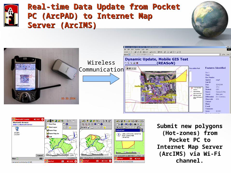
Real-time Data Update from Pocket PC Real-time Data Update from Pocket PC (ArcPAD) to Internet Map Server (ArcIMS)(ArcPAD) to Internet Map Server (ArcIMS)
Submit new polygons (Hot-zones) from Pocket
PC to Internet Map Server (ArcIMS) via Wi-Fi
channel.
WirelessCommunication
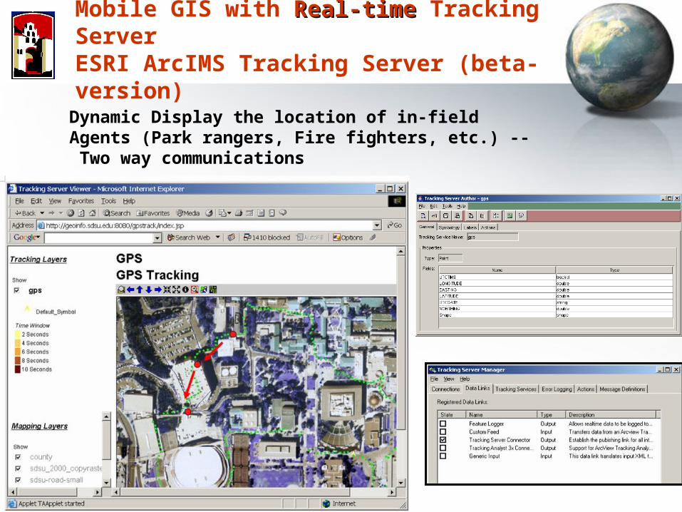
Mobile GIS with Real-timeReal-time Tracking ServerESRI ArcIMS Tracking Server (beta-version)
Dynamic Display the location of in-field Agents (Park rangers, Fire fighters, etc.) -- Two way communications
ChallengesChallenges
• Need to develop evaluation methods for Web-based GIS educations and Modules(How effective?)
• Cope with technology changes (Web technology changes every month). How to migrate from old technologies to new tools?
• Supports from administrative level.
San Diego State University
Future: Web services? Semantic Webs? Grid computing?
Related Links and Related Links and ReferencesReferences
Thank You
Q & A
• Http://map.sdsu.edu • Http://map.sdsu.edu/mobilegis• Http://www.sdbay.sdsu.edu• Http://geoinfo.sdsu.edu/reason
Books & Papers (PDF available upon request)
Internet GIS (book) – (Chapter 9. mobile GIS)http://map.sdsu.edu/gisbook
Tsou, M.H. (2004). Integrated Mobile GIS and Wireless Internet Map Servers for Environmental Monitoring and Management, Cartography and Geographic Information Science. 31(3), pp. 153-165. Tsou, M.H. (2004). Integrating Web-based GIS and On-line Remote Sensing Facilities for Environmental Monitoring and Management. The Journal of Geographical Systems, No. 6: 1-20.