Embed Size (px)
DESCRIPTION
Weathering the Storm 2016 is an in-depth look at the extremes of Oklahoma Weather and how to prepare for impact when these weather phenomena occur. The publication is a production of Oklahoma CNHI News Service, with member publications contributing content.
Citation preview
C
MY
K
C
MY
K
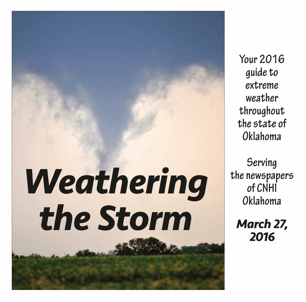
Your 2016 guide to extreme weather
throughout the state of
Oklahoma
Servingthe newspapers
of CNHIOklahoma
March 27, 2016
Weatheringthe Storm
STORM1
C
MY
K
C
MY
K
Page 2 Sunday, March 27, 2016 Weathering the Storm
STORM2
C
MY
K
C
MY
K
Weathering the Storm Sunday, March 27, 2016 Page 3
Weathering the Storm 2016: Your guide to extreme weather in Oklahoma
Front cover: A severe thunderstorm spawns a funnel four miles south of Carrier and north of U.S. 412 northwest of Enid, May 6, 2015. (Bonnie Vculek / Enid News & Eagle) Joe Malan / Enid News & Eagle
Another year has gone by in Oklahoma, and with it, more severe weather to behold.
We had ice storms, we had floods, we had hail ... pretty much anything weather-related you can think of, 2015 had it.
Oh yes ... and earthquakes. We had some of those. Although not really weather-related, many Oklahomans across the state were affected by temblors in 2015, and we’ll cover those, as well.
So with all that in mind, this year’s edition of Weathering the Storm is designed to wrap up all that happened in 2015. It will show you the best photos of severe weather that Oklahoma had to offer, and it will also offer some tips on how to deal with adverse con-ditions.
The Ada NewsThe (Chickasha)
Express-StarThe (Claremore) Daily
ProgressThe Duncan Banner
The Edmond SunEnid News & Eagle
McAlester News-CapitalMoore American
Muskogee PhoenixThe Norman TranscriptPauls Valley Democrat
Pryor Daily TimesStillwater News Press
Stilwell Democrat-Journal
Tahlequah Daily PressThe Woodward News
Weather never stops.
Section designed by:
CNHI Oklahoma:
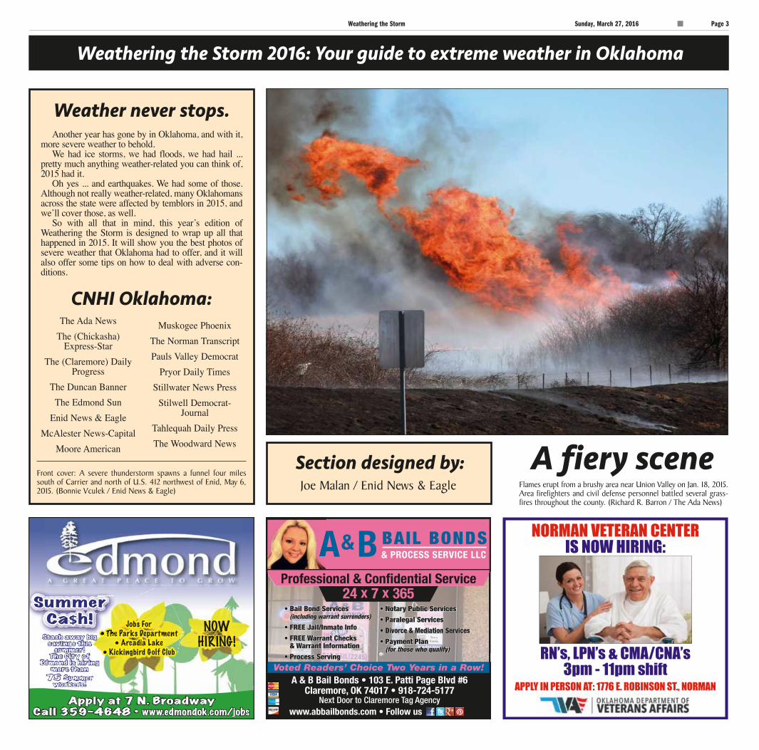
A fiery sceneFlames erupt from a brushy area near Union Valley on Jan. 18, 2015. Area firefighters and civil defense personnel battled several grass-fires throughout the county. (Richard R. Barron / The Ada News)
STORM3
C
MY
K
C
MY
K
Page 4 Sunday, March 27, 2016 Weathering the Storm
Weathering the Storm 2016: Your guide to extreme weather in Oklahoma
Call Today: 405.230.9270
9600 Broadway Ext | Oklahoma City
Our focus is quality.
McBride Orthopedic Hospital has along history of achieving exceptional results for our patients. To learn more
about our award-winning care,visit www.mcboh.com.
It’s Your Choice#1 in the State for Patient Safety
100% Physic ian O wned
2016 CareChex® Patient Safety Award Recipientfor Major Orthopedic Surgery
Anything and everything
Oklahoma is notorious for unpre-dictable and extreme weather, and 2015 was no exception.
The state saw everything from flooding to ice, and a wildfire thrown
in for good measure.A good portion of southern
Oklahoma was under water in the spring, and McAlester broke its annual rainfall record in early December with 68.15 inches total,
By Sally Asher Enid News & Eagle
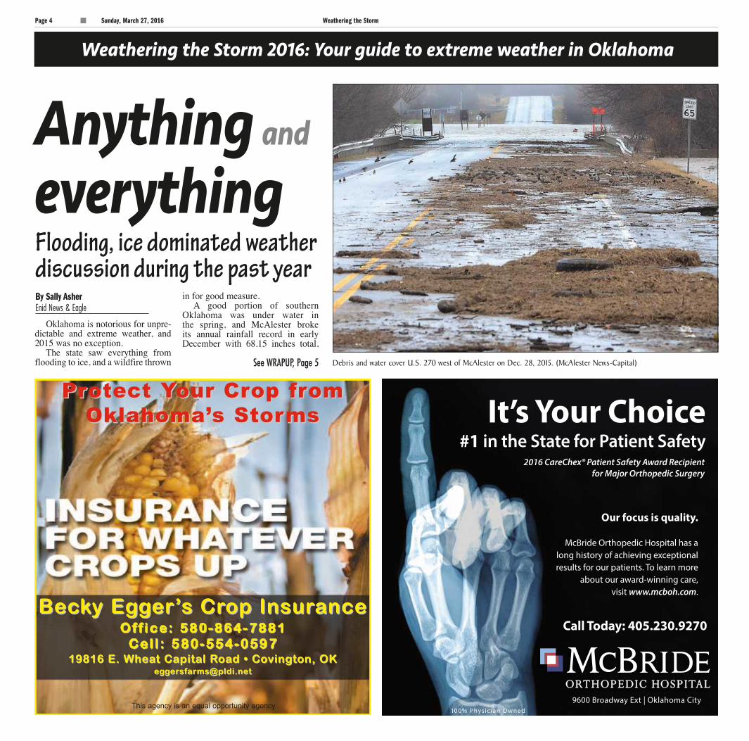
Debris and water cover U.S. 270 west of McAlester on Dec. 28, 2015. (McAlester News-Capital)
Flooding, ice dominated weather discussion during the past year
See WRAPUP, Page 5
STORM4
PrProtect otect YYour Crour Crop frop fromomOklahoma’Oklahoma’s Stors Stormsms
BecBeckky Egy Eggger’er’s Crs Crop Insurop InsuranceanceO f f i c e : 5 8 0 - 8 6 4 - 7 8 8 1O f f i c e : 5 8 0 - 8 6 4 - 7 8 8 1
C e l l : 5 8 0 - 5 5 4 - 0 5 9 7C e l l : 5 8 0 - 5 5 4 - 0 5 9 719816 E. Whea19816 E. Wheat Cat Capital Rpital Road • Cooad • Covington, OKvington, OK
[email protected]@pldi.net
This agency is an equal opportunity agency
Enid News & Eagle Sunday, March 27, 2016 Page sp5
C
MY
K
C
MY
K
Weathering the Storm Sunday, March 27, 2016 Page 5
Weathering the Storm 2016: Your guide to extreme weather in Oklahoma
and almost 20 inches in May alone, accord-ing to the McAlester News-Capital.
National Weather Service of Tulsa Meteorologist Pete Snyder told the News-Capital in December that McAlester had one of the rainiest seasons on records.
“We are exceeding rainfall records by a lot in many locations across the state,” he said.
Lake Tenkiller, near Tahlequah, and Fort Gibson Lake hit high marks in December after an “unprecedented amount of rain” over the holiday break, according to the Tahlequah Daily Press.
Lake Tenkiller rose 24 feet from its nor-mal level of 632 feet by Dec. 29, according to the Daily Press, and Fort Gibson Lake rose early 20 feet above its normal level to 573.1 feet.
The Daily Press also reported the Illinois River crested at 30.7 feet, the highest ever recorded, and Cherokee County 911
Coordinator Marty Kimble said the call vol-ume for rescues was “unbelievable.”
“It’s been overwhelming, really,” Kimble said in the Dec. 29 article. “People were clinging to trees.”
Torrential May rain led Muskogee County officials to declare the county a disaster area, according to the Muskogee Phoenix.
“It is no secret that much of the county has washed away,” District 1 Commissioner Ken Doke said during an emergency meeting convened immediately after commissioners adjourned their regular meeting, accord-ing to a May 27 article in the Muskogee Phoenix. “We have major problems with bridges and roads, we’ve got cities without water, and we are dealing with all kinds of other problems.”
Stephens County officials reported
WRAPUPContinued from Page 4
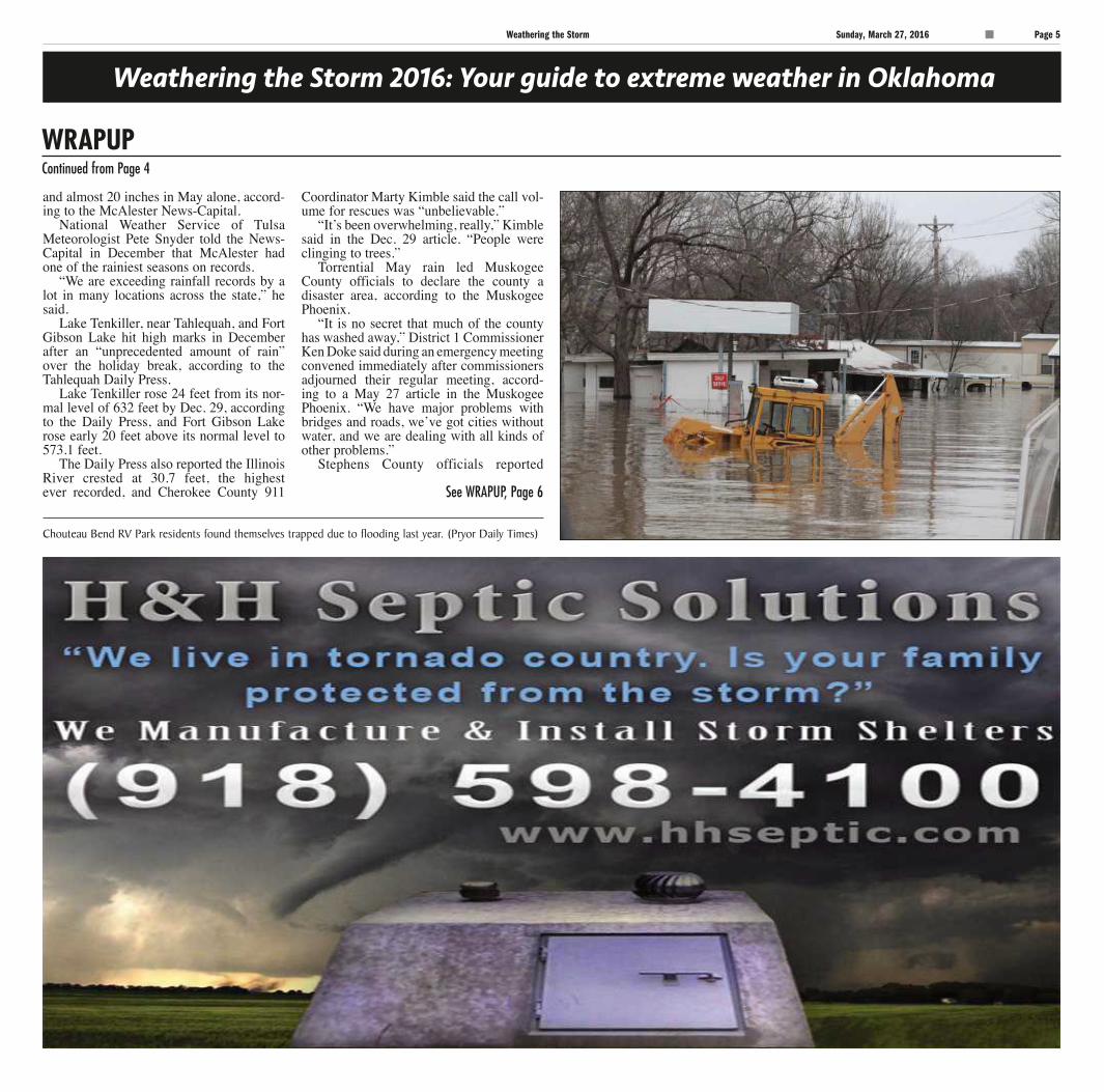
Chouteau Bend RV Park residents found themselves trapped due to flooding last year. (Pryor Daily Times)
See WRAPUP, Page 6
STORM5

C
MY
K
C
MY
K
Page 6 Sunday, March 27, 2016 Weathering the Storm
Weathering the Storm 2016: Your guide to extreme weather in Oklahoma
numerous closed washed-out roads and downed trees in May due to intense rains and flooding, the Duncan Banner reported, and tree and vehicle damage from winter storms in December.
Not to be outdone by the rain, winter weather brought snow and ice to much of state early last year and over the Thanksgiving and Christmas holidays, downing trees and power lines.
In Stillwater, two teenage girls built an 8-foot-by-1-inch snowwoman in February, which took several hours, according to the Stillwater News Press.
Katie Hill and Isabel Lynch built the larger-than-life snowperson, complete with carrot nose, button eyes and a hat.
“I’ve always wanted to build a really big snowman, and I finally go the oppor-tunity to,” Hill told the News Press. “I was just really happy it snowed.”
The Christmas storms brought downed trees and power lines to Enid, leaving thousands without power for several days.
The Woodward News reported a wildfire raging out of control for two days over 22,300 acres in Woodward County in March, resulting in an esti-mated $1.1 million in damage, not including cattle, fencing or other sur-face damage.
Hay losses at present are around $174,000 and vehicles and trailers make up about $75,000 of that fig-ure, Woodward County Emergency Manager Matt Lehenbauer said in the Woodward News article.
That total figure also includes the 25 structures damaged and destroyed in the blaze. Of those, seven were homes people lived in, he said.
WRAPUPContinued from Page 5
Icicles hang from a sign at the intersection of Broadway and 16th on Dec. 28, 2015, in Enid. (Billy Hefton / Enid News & Eagle)
STORM6
NEW 100% corrosion resistant product with High-Density Polyethylene
www.flatsafe.com866-520-FLAT
Visit our Yukon Showroom
at 1200 Industrial Drive
or call (405)609-1509
C
MY
K
C
MY
K
Weathering the Storm Sunday, March 27, 2016 Page 7
Weathering the Storm 2016: Your guide to extreme weather in Oklahoma
What’s ina name?Tornado Alley runs right through Oklahoma ... so what does that mean?
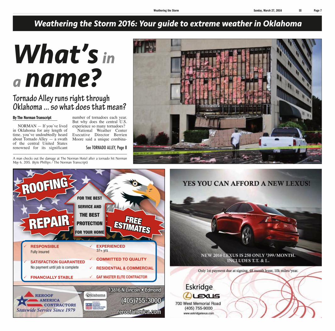
A man checks out the damage at The Norman Hotel after a tornado hit Norman May 6, 2015. (Kyle Phillips / The Norman Transcript)
NORMAN — If you’ve lived in Oklahoma for any length of time, you’ve undoubtedly heard about Tornado Alley — a swath of the central United States renowned for its significant
number of tornadoes each year. But why does the central U.S. experience so many tornadoes?
National Weather Center Executive Director Berrien Moore said a unique combina-
By The Norman Transcript
See TORNADO ALLEY, Page 8
STORM7
C
MY
K
C
MY
K
Page 8 Sunday, March 27, 2016 Weathering the Storm
Weathering the Storm 2016: Your guide to extreme weather in Oklahoma
tion of conditions in the region makes it a suitable spawning ground for tornadoes, but tornadoes are not unique to Tornado Alley.
“The reason we have tornadic condi-tions in the United States — around the world you don’t see it that much — but in the United States we have a source of moist, warm air to the south of us, namely the Gulf of Mexico, and we have cold, dry air to the north of us, namely Canada,” Moore said. “And those two air masses converge in the Great Plains. If you look around the world, you don’t find many other places that have a very cold area to the north and a very warm, moist area to the south. So, that’s what really leads to the conditions in the Great Plains, and you could also see that it wouldn’t require much of a shift to bring the southeast and Gulf states into play.”
Tornado Alley has traditionally includ-ed Texas, Oklahoma, Kansas, Arkansas, Missouri, Nebraska and even parts of Illinois and Indiana. Now, Moore said
there is a developing tornadic trend in the Southeastern U.S., an area referred to as “Dixie Alley.”
“You actually see it extending up into Illinois and Indiana, kind of an expanded definition of the Midwest,” he said. “Now, the data seems to show a second area of activity that we call “Dixie Alley.”
Moore said the conditions in Dixie Alley are fostered by the same conditions responsi-ble for tornadoes in Tornado Alley. In a way, Moore said that though tornadoes tend to cluster in the Midwest and now the southeast, tornadoes can occur anywhere. The conditions aren’t limited to a region, and Moore said nick-names and state lines don’t mean anything to a tornado.
“We saw tornadic outbreaks last year
in California,” Moore said. “Two years ago, I was in New England and I was driving down to Princeton, N.J. As I came
around 495, my cellphone started going off with a tor-nadic alert. I pulled over and just to the west of me in Massachusetts, there was a tornado. So, here I was visiting New England from Oklahoma, and I was about to get mowed down by a tornado.”
Oklahoma experienc-es more than 50 torna-does a year, according to the National Oceanic and Atmospheric Administration, although preliminary reports from last year indicate the number was closer to 100 in 2015. The busiest month
of the year for tornadoes? That would be May.
TORNADO ALLEYContinued from Page 7
“ If you look around the world, you don’t find many other places that have a very cold area to the north and a very warm, moist area to the south.”
~ Berrien Moore, National Weather
Center executive director
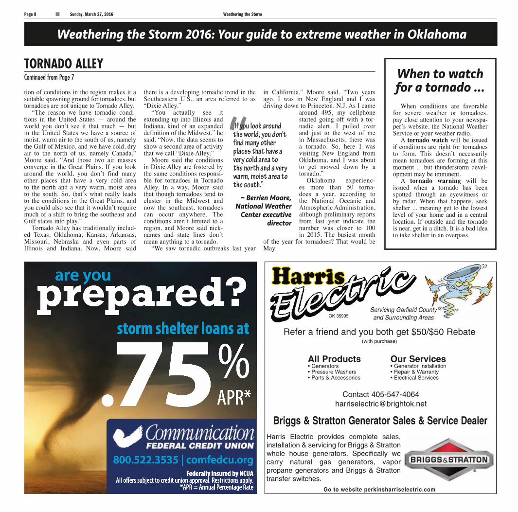
When to watch for a tornado ...
When conditions are favorable for severe weather or tornadoes, pay close attention to your newspa-per’s website, the National Weather Service or your weather radio.
A tornado watch will be issued if conditions are right for tornadoes to form. This doesn’t necessarily mean tornadoes are forming at this moment ... but thunderstorm devel-opment may be imminent.
A tornado warning will be issued when a tornado has been spotted through an eyewitness or by radar. When that happens, seek shelter ... meaning get to the lowest level of your home and in a central location. If outside and the tornado is near, get in a ditch. It is a bad idea to take shelter in an overpass.
STORM8
Servicing Garfield County and Surrounding Areas
Briggs & Stratton Generator Sales & Service Dealer
Go to website perkinsharriselectric.com
Harris Electric provides complete sales,installation & servicing for Briggs & Strattonwhole house generators. Specifically wecarry natural gas generators, vaporpropane generators and Briggs & Strattontransfer switches.
OK 35905
All Products• Generators• Pressure Washers• Parts & Accessories
Our Services• Generator Installation• Repair & Warranty• Electrical Services
Refer a friend and you both get $50/$50 Rebate(with purchase)
Contact [email protected]
Federally insured by NCUAAll offers subject to credit union approval. Restrictions apply.
*APR = Annual Percentage Rate
800.522.3535 | comfedcu.org
.75%APR*
storm shelter loans at
prepared?are you
C
MY
K
C
MY
K
Weathering the Storm Sunday, March 27, 2016 Page 9
Weathering the Storm 2016: Your guide to extreme weather in Oklahoma
Signs of atornado
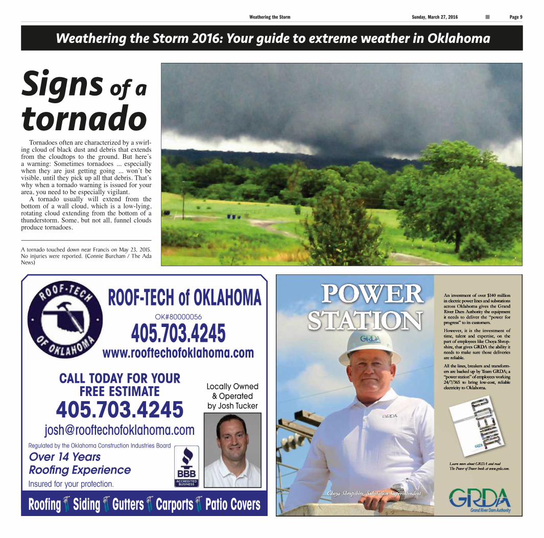
A tornado touched down near Francis on May 23, 2015. No injuries were reported. (Connie Burcham / The Ada News)
Tornadoes often are characterized by a swirl-ing cloud of black dust and debris that extends from the cloudtops to the ground. But here’s a warning: Sometimes tornadoes ... especially when they are just getting going ... won’t be visible, until they pick up all that debris. That’s why when a tornado warning is issued for your area, you need to be especially vigilant.
A tornado usually will extend from the bottom of a wall cloud, which is a low-lying, rotating cloud extending from the bottom of a thunderstorm. Some, but not all, funnel clouds produce tornadoes.
STORM9
POWERSTATION
Choya Shropshire, Substation Superintendent
An investment of over $140 million in electric power lines and substations across Oklahoma gives the Grand River Dam Authority the equipment it needs to deliver the “power for progress” to its customers.
HHowever, it is the investment of time, talent and expertise, on the part of employees like Choya Shrop-shire, that gives GRDA the ability it needs to make sure those deliveries are reliable.
All the lines, breakers and transform-ers are backed up by Team GRDA; a “power station” of employees working 24/7/365 to bring low-cost, reliable electricity to Oklahoma.
Learn more about GRDA and read The Power of Power book at www.grda.com.
C
MY
K
C
MY
K
Page 10 Sunday, March 27, 2016 Weathering the Storm
Weathering the Storm 2016: Your guide to extreme weather in Oklahoma
Center of
attention
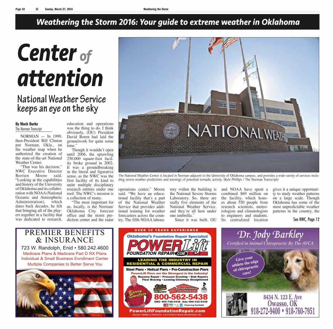
NORMAN — In 1999, then-President Bill Clinton put Norman, Okla., on the weather map when he authorized the creation of the state-of-the-art National Weather Center.
“That was his decision,” NWC Executive Director Berrien Moore said. “Looking at the capabilities and history of the University of Oklahoma and its collabo-ration with NOAA (National Oceanic and Atmospheric Administration), which dates back decades, he felt that bringing all of the play-ers together in a facility that was dedicated to research,
education and operations was the thing to do. I think obviously, (OU) President David Boren had laid the groundwork for quite some time.”
Though it wouldn’t open until 2006, the sprawling 250,000 square-foot facil-ity broke ground in 2002. It was a groundbreaking in the literal and figurative sense, as the NWC was the first facility of its kind to unite multiple disciplinary research entities under one roof. The NWC’s mission is a collection of many.
“The most important for us, locally, is the Norman/Oklahoma City forecast office and the storm pre-diction center and the radar
operations center,” Moore said. “We have an educa-tional facility that’s a part of the National Weather Service that provides addi-tional training for weather forecasters across the coun-try. The fifth NOAA labora-
tory within the building is the National Severe Storms Laboratory. So, there are really five elements of the National Weather Service, and they’re all here under one umbrella.”
Since it was built, OU
and NOAA have spent a combined $69 million on the facility, which hous-es about 550 people from research scientists, meteo-rologists and climatologists to engineers and students. Its centralized location
gives it a unique opportuni-ty to study weather patterns on a large scale. Though Oklahoma has some of the most unpredictable weather patterns in the country, the
By Mack BurkeThe Norman Transcript
The National Weather Center is located in Norman adjacent to the University of Oklahoma campus, and provides a wide variety of services including severe weather predictions and warnings of potential tornadic activity. (Kyle Phillips / The Norman Transcript)
National Weather Service keeps an eye on the sky
See NWC, Page 12
STORM10
PREMIER BENEFITSPREMIER BENEFITS& INSURANCE& INSURANCE
723 W. Randolph, Enid • 580.242.4600Medicare Plans & Medicare Part D RX Plans
Individual & Small Business Enrollment CenterMultiple Companies to Better Serve You

C
MY
K
C
MY
K
Weathering the Storm Sunday, March 27, 2016 Page 11
STORM11
SEE THE OZ SAFEROOM AT THREE LOCATIONS IN OKLAHOMAFACTORY & SHOWROOM: 3216 SE 30TH STREET, DEL CITY, OK 73115 • 405-672-8400
SOUTH OFFICE: 1200 OAK DRIVE, BLANCHARD, OK 73010 • 405-485-3767NORTH SHOWROOM: 12648 W. CO. RD. 70, CRESCENT, OK 73028 • 405-642-7653
WWW.OZSAFEROOMS.COM • 405-672-8400
FINANCINGAVAILABLE AT
STRONGER THAN18” CEILING
8” to 10” WALLSMONOLITHICCONCRETE
This pay app will give you tornado & hail warnings and sighting map over your smartphone. Sightings are filtered through state-of-the art AccuSpy™ technology to prevent false alerts and only send you the most accurate sightings.
Download the app:
TornadoSpy+
Also available: TornadoSpyLite, the FREE app
WILL YOU BE READY?NO HEAVY EQUIPMENT NEEDED, THE OZ IS FORMED AND POURED ON YOUR LOT
THE ONLY ABOVE GROUND TORNADO SHELTER PROVEN TO TAKE A DIRECT HIT AND SAVE LIVES.
Visit one of our 3 locations to sign up to win a $1000 discount on any OZ saferoomSee sign up locations below. One winner per location. Offer available through May 2016.
C
MY
K
C
MY
K
Page 12 Sunday, March 27, 2016 Weathering the Storm
Weathering the Storm 2016: Your guide to extreme weather in Oklahoma
NWC’s radar often is affixed to severe storms far outside its bor-ders.
“Certainly, the geographic location gives us an operation-al platform where we can have access to the entire Great Plains area,” Moore said. “What you do have, historically, is part of what we all live with, which is severe weather and tornadic activity. But, as we know, it’s not just Tornado Alley, it’s now Dixie Alley. It’s Alabama, Tennessee, Mississippi. They really have seen an enormous increase in tornadic activity. So, many times, our radars are deployed to Alabama to collect data to provide forecast capability and to advance science there as well as here.”
That approach has helped save lives and property all over
the U.S. In 2013, the Storm Prediction Center at the NWC was able to provide tornado warnings four days in advance for areas in Illinois and Indiana. When the tornadoes came, those areas were well prepared.
Not a single life was lost. “Just think about that,” Moore
said. “Four days in advance, in the middle of November out in the Indiana area … You don’t look locally to make that kind of prediction. You really have to look globally.”
The NWC isn’t limited to forecasts, or even severe weath-er. Moore himself focuses pri-marily on climate change. The NWC is a one-of-a-kind facil-ity at the forefront of weather research, a cathedral of sorts for future storm chasers, climatolo-gists and meteorologists.
When visitors come to the NWC, Moore said they can visit
the research labs and see the lat-est research models and exercis-
es currently under way. “The other thing they can see
is the Storm Prediction Center,” Moore said. “It provides infor-mation on severe weather across the United States … It really is the centerpiece. People can real-ly see how weather forecasting is done at the highest levels, the most sophisticated levels in the United States. You get a feel-ing for the level of investment the United States has made and the enormous capability we have now.”
Free tours of the NWC are available with a reservation. The NWC advises making reserva-tions two weeks in advance. For more information, or to schedule a tour, email [email protected].
Burke is news editor for The Norman Transcript.
NWCContinued from Page 10
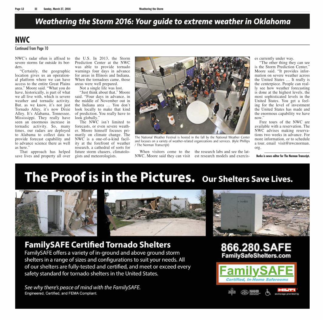
The National Weather Festival is hosted in the fall by the National Weather Center and focuses on a variety of weather-related organizations and services. (Kyle Phillips / The Norman Transcript)
STORM12
C
MY
K
C
MY
K
Weathering the Storm Sunday, March 27, 2016 Page 13
Weathering the Storm 2016
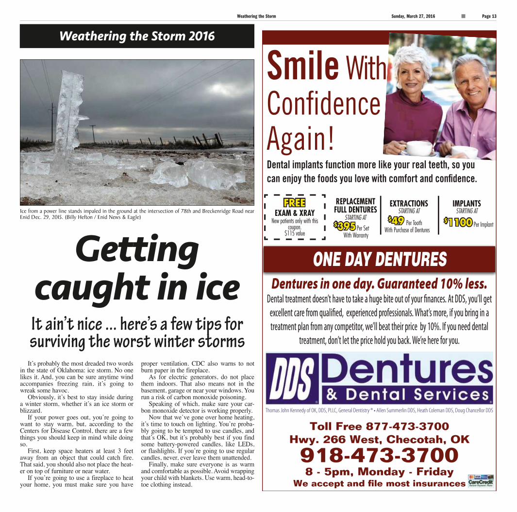
Ice from a power line stands impaled in the ground at the intersection of 78th and Breckenridge Road near Enid Dec. 29, 2015. (Billy Hefton / Enid News & Eagle)
Getting caught in ice
It’s probably the most dreaded two words in the state of Oklahoma: ice storm. No one likes it. And, you can be sure anytime wind accompanies freezing rain, it’s going to wreak some havoc.
Obviously, it’s best to stay inside during a winter storm, whether it’s an ice storm or blizzard.
If your power goes out, you’re going to want to stay warm, but, according to the Centers for Disease Control, there are a few things you should keep in mind while doing so.
First, keep space heaters at least 3 feet away from an object that could catch fire. That said, you should also not place the heat-er on top of furniture or near water.
If you’re going to use a fireplace to heat your home, you must make sure you have
proper ventilation. CDC also warns to not burn paper in the fireplace.
As for electric generators, do not place them indoors. That also means not in the basement, garage or near your windows. You run a risk of carbon monoxide poisoning.
Speaking of which, make sure your car-bon monoxide detector is working properly.
Now that we’ve gone over home heating, it’s time to touch on lighting. You’re proba-bly going to be tempted to use candles, and that’s OK, but it’s probably best if you find some battery-powered candles, like LEDs, or flashlights. If you’re going to use regular candles, never, ever leave them unattended.
Finally, make sure everyone is as warm and comfortable as possible. Avoid wrapping your child with blankets. Use warm, head-to-toe clothing instead.
It ain’t nice ... here’s a few tips for surviving the worst winter storms
STORM13
C
MY
K
C
MY
K
Page 14 Sunday, March 27, 2016 Weathering the Storm
Weathering the Storm 2016: Your guide to extreme weather in Oklahoma
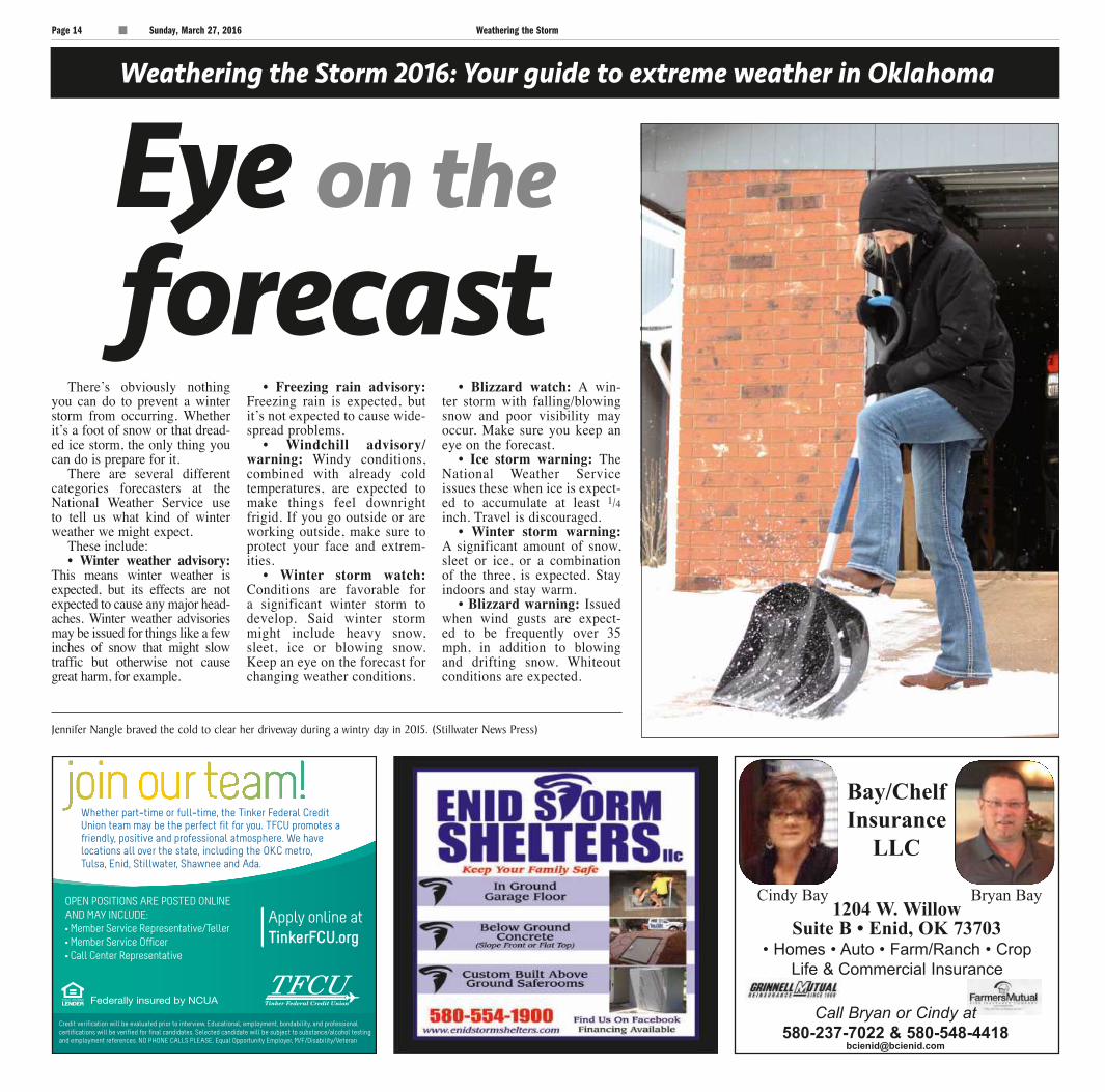
Jennifer Nangle braved the cold to clear her driveway during a wintry day in 2015. (Stillwater News Press)
Eye on theforecast
There’s obviously nothing you can do to prevent a winter storm from occurring. Whether it’s a foot of snow or that dread-ed ice storm, the only thing you can do is prepare for it.
There are several different categories forecasters at the National Weather Service use to tell us what kind of winter weather we might expect.
These include:• Winter weather advisory:
This means winter weather is expected, but its effects are not expected to cause any major head-aches. Winter weather advisories may be issued for things like a few inches of snow that might slow traffic but otherwise not cause great harm, for example.
• Freezing rain advisory: Freezing rain is expected, but it’s not expected to cause wide-spread problems.
• Windchill advisory/warning: Windy conditions, combined with already cold temperatures, are expected to make things feel downright frigid. If you go outside or are working outside, make sure to protect your face and extrem-ities.
• Winter storm watch: Conditions are favorable for a significant winter storm to develop. Said winter storm might include heavy snow, sleet, ice or blowing snow. Keep an eye on the forecast for changing weather conditions.
• Blizzard watch: A win-ter storm with falling/blowing snow and poor visibility may occur. Make sure you keep an eye on the forecast.
• Ice storm warning: The National Weather Service issues these when ice is expect-ed to accumulate at least 1/4 inch. Travel is discouraged.
• Winter storm warning: A significant amount of snow, sleet or ice, or a combination of the three, is expected. Stay indoors and stay warm.
• Blizzard warning: Issued when wind gusts are expect-ed to be frequently over 35 mph, in addition to blowing and drifting snow. Whiteout conditions are expected.
STORM14
Bryan BayCindy Bay
Bay/ChelfInsurance
LLC
1204 W. WillowSuite B • Enid, OK 73703
• Homes • Auto • Farm/Ranch • CropLife & Commercial Insurance
Call Bryan or Cindy at580-237-7022 & 580-548-4418
C
MY
K
C
MY
K
Weathering the Storm Sunday, March 27, 2016 Page 15
Weathering the Storm 2016: Your guide to extreme weather in Oklahoma
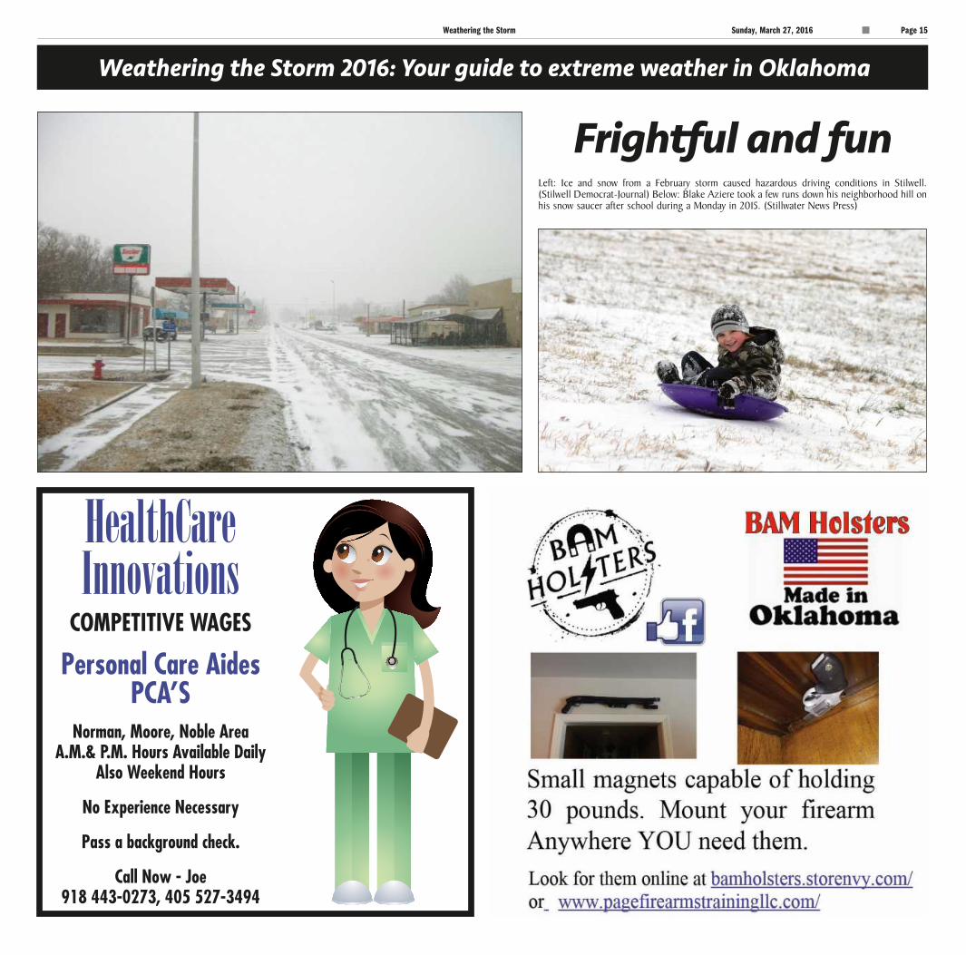
Frightful and funLeft: Ice and snow from a February storm caused hazardous driving conditions in Stilwell. (Stilwell Democrat-Journal) Below: Blake Aziere took a few runs down his neighborhood hill on his snow saucer after school during a Monday in 2015. (Stillwater News Press)
STORM15
C
MY
K
C
MY
K
Page 16 Sunday, March 27, 2016 Weathering the Storm
Weathering the Storm 2016: Your guide to extreme weather in Oklahoma
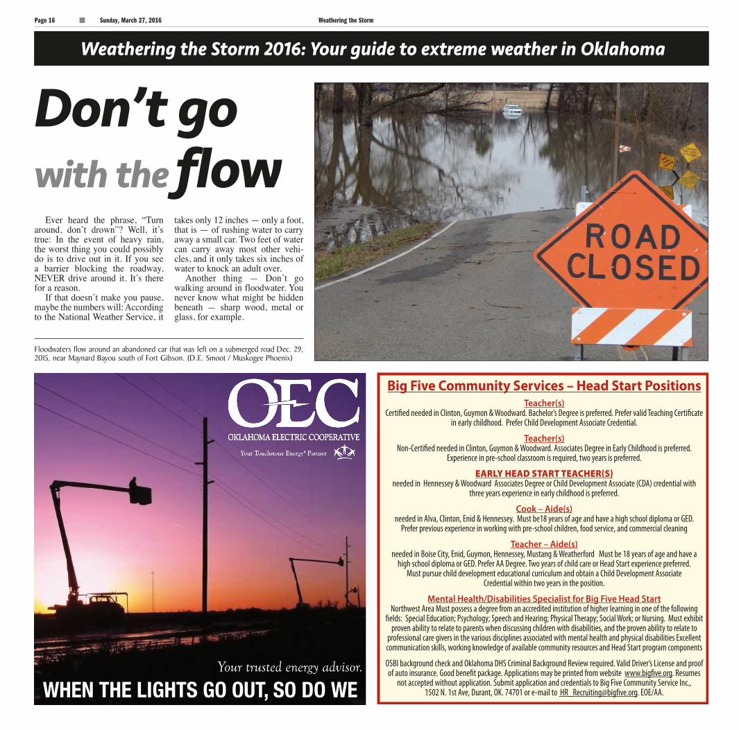
Floodwaters flow around an abandoned car that was left on a submerged road Dec. 29, 2015, near Maynard Bayou south of Fort Gibson. (D.E. Smoot / Muskogee Phoenix)
Don’t go with the flow
Ever heard the phrase, “Turn around, don’t drown”? Well, it’s true: In the event of heavy rain, the worst thing you could possibly do is to drive out in it. If you see a barrier blocking the roadway, NEVER drive around it. It’s there for a reason.
If that doesn’t make you pause, maybe the numbers will: According to the National Weather Service, it
takes only 12 inches — only a foot, that is — of rushing water to carry away a small car. Two feet of water can carry away most other vehi-cles, and it only takes six inches of water to knock an adult over.
Another thing — Don’t go walking around in floodwater. You never know what might be hidden beneath — sharp wood, metal or glass, for example.
STORM16
Your trusted energy advisor.
WHEN THE LIGHTS GO OUT, SO DO WE

C
MY
K
C
MY
K
Weathering the Storm Sunday, March 27, 2016 Page 17
STORM17
C
MY
K
C
MY
K
Page 18 Sunday, March 27, 2016 Weathering the Storm
Weathering the Storm 2016: Your guide to extreme weather in Oklahoma
Flood safety ... time to plan ahead
In Oklahoma, once it starts raining, it can pour ... and pour ... and pour. It can rain so much that flooding can occur in the matter of hours, or even minutes.
A situation such as this is called a flash flood, and in the event a flash flood warning or even watch is issued, you need to be immedi-ately ready for whatever Mother Nature may be about to throw your way.
The National Weather Service suggests one way of doing this is assembling an emergency kit. What does a flood emergency kit include? Things like food, water and medicine, plus batteries, blankets and flashlights are all essential. You should also plan on including a first-aid kit, rub-ber boots, rubber gloves and bat-tery-operated radio.
NWS also suggests creating a communications plan where everyone will know what to do or where to go in case a natural disas-ter like a flood hits.
Other things to do before a
flood hits includes preparing your home and protecting your pets. If you have sandbags ready to go, you can use those to protect your property. If you think you may be evacuated from your home, make sure items essential for pet care are packed ahead of time so there are no last-minute hassles.
Finally, make sure all your cell-phone — and any other electronics you deem necessities — are fully charged before the floodwaters come.
Once there is a flood, and if authorities tell you to evacuate, you should do so immediately, and head to higher ground. Don’t wait around to make a decision ... every second counts in a flood, as waters can get much higher very quickly.
Once the flood is over, it may not be immediately safe to return to your property. It is essential you wait for guidance from authorities before returning.
Do not touch electrical outlets, especially ones that are still sub-merged. If you hear a crackling,
buzzing or popping sound, that’s a particularly significant clue that the area is not safe and that elec-trocution is a risk.
As with vehicle-floodwater
safety, never wade into an area with deep water, especially if you don’t know how deep the water is, or what objects may be lurking below.
Keep your radio — a weath-er radio, especially — handy at all times, as these can give out important information for your area.
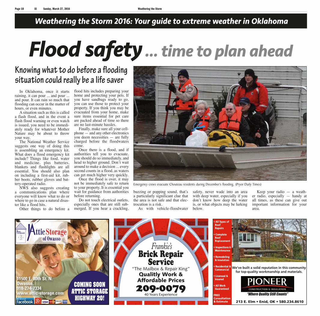
Emergency crews evacuate Chouteau residents during December’s flooding. (Pryor Daily Times)
Knowing what to do before a flooding situation could really be a life saver
STORM18
213 E. Elm • Enid, OK • 580.234.8610
“Where Quality Still Counts”
We’ve built a solid reputation in this communityfor top-quality workmanship and materials.
• All Types ofRoofRepairs
• CompleteRoofReplacement
• Inspections &Maintenance
• Remodeling& Insulation
• Residential &Commercial
• Licensed &Insured
• All Work Guaranteed
FREEConsultation& Estimate

C
MY
K
C
MY
K
CNHI Oklahoma Sunday, March 27, 2016 Page 19
Weathering the Storm 2016: Your guide to extreme weather in Oklahoma
Flooding in EnidLeft: Rain continues to fall as debris floats by at Meadowlake Park May 24, 2015. Below: A city crew moves back the barricade at the intersection of 3rd and Walnut as water in the flooded intersection rises May 24, 2015. (Billy Hefton / Enid News & Eagle)
STORM19
C
MY
K
C
MY
K
Page 20 Sunday, March 27, 2016 Weathering the Storm
Weathering the Storm 2016: Your guide to extreme weather in Oklahoma
A word on wildfires
Heat is on: Summers get hot in Okla.
At almost any time during the year in Oklahoma, wildfires can ignite after just a simple spark.
Here are some things to keep in mind regarding wildfire preven-tion, courtesy of smokybear.com:
• After cooking out, before dis-posing of charcoal briquettes and ash, douse them with plenty of water, stir them and soak them again. Always make sure they are cold before leaving the area.
• Lawnmowers and other heavy equipment should be maintained adequately, as a spark from one of these machines could turn into an unwanted conflagration. Be espe-cially vigilant of equipment safety on hot, dry days.
• Metal parts or chains hanging
off your vehicle can start fires, too. Also, be careful when driv-ing through or parking in grass. Exhaust from a vehicle can start a fire. Metal-on-metal from worn out brake pads, and driving on tire rims, can also cause an unwanted spark.
If you smoke, make sure your cigarette or cigar is out before leaving the area. If smoking out-side, you want to maintain a 3-foot clearance around the area. When grinding out your cigarette, do it in the dirt, not brush, wood, or somewhere else where a spark can easily turn into fire.
For other safety tips, such as campfire safety, go online to smokybear.com.
No matter where you live in Oklahoma, it’s bound to get hot at some point during the summer. And when that heat kicks in, it can be difficult to stay cool.
National Weather Service in Norman has six basic things every-one should keep in mind when the temperatures climb up the scale.
First, and this is the most sim-ple tip, if you can avoid the heat in any way, do so. Stay indoors and in air conditioning. If you do not have air conditioning at home or if there is an issue with it, go to your local shopping mall or anoth-er place where you can cool down for at least several hours at a time.
If you can’t avoid the heat, or you work outside, the National Weather Service’s second tip is to dress for the occasion. This means
wearing loose-fitting clothes that cover up as much of your skin as possible. Try to avoid dark cloth-ing and wear lighter-colored cloth-ing, too. A hat is also a good idea to shade your face from the sun.
And, for those days when the sun is just really beating down, put on some sunscreen with a high SPF.
The third tip is to pay atten-tion to what you drink. Obviously, water is the right way to go, but you should also keep in mind what you should not be drinking.
Alcoholic beverages, or drinks high in caffeine, such as coffee, tea and soda, all should be avoid-ed.
If you’re thirsty, that means you’re dehydrated. If you’re working outside on a hot day, it’s
important to have a steady stream of fluids going into your body so that your body can maintain prop-er function.
Along with paying attention to what you drink, you should also pay attention to what you eat. NWS says that when it’s hot out you should eat more often, and eat smaller meals. Foods high in protein, or salt tablets, should be avoided — the latter the case unless directed to do so by a phy-sician.
If you’re planning on doing some physical activity, such as running or biking, try to do it ear-lier on, or later, in the day, when it is slightly cooler and the sun isn’t directly overhead. Make sure you have plenty of water to cool your-self down.
Finally, it is imperative to know the symptoms of heat-related health problems, and even better if you know first aid.
As far as heat-related illnesses go ...
• Sunburns are the easiest and most obvious condition to spot due to redness present on the skin from sun and heat overexposure. But sunburns can also cause fever and headaches.
• Heat cramps can occur in the form of spasms, usually in the leg or abdominal area. Heavy sweat-ing can be accompanied by this condition. If heat cramps occur, apply firm pressure or gentle mas-sage, and give sips of water, if needed.
• Heat exhaustion is danger-ous, and signs can include heavy sweating; cold, pale and clammy skin; and weak pulse. The patient also may feel like fainting or vom-iting. In this case, get the person affected somewhere cool, loosen clothing and apply damp cloths. Give the victim plenty of water. If vomiting occurs, immediate medi-cal attention is necessary.
• Heat stroke is perhaps the most dangerous of all heat-relat-ed illnesses, and is signaled with
a very high body temperature, usually 106 or above. Instead of cold and clammy, the skin will be hot and dry, and the pulse will be quick. If you or someone else is exhibiting the signs of heat stroke, get the victim to the hospi-tal immediately, or call 911. In the meantime, the victim needs to be moved to a cooler place and cloth-ing should be removed. Try cool-ing the person down with a cool bath to reduce body temperature.
A few more important things to remember ...
• Don’t ever leave children in a closed vehicle ... not even if you plan on coming back in a few minutes. According to NWS, a closed vehicle can reach 140-190 degrees within half an hour on a hot, sunny day.
• The same goes for pets: Do not leave them in a hot vehicle; your pet will get hot, like you do. Outside, make sure pets have plenty of shade and water to keep them healthy.
Here are a few tips on how to keep cool in hot months ahead
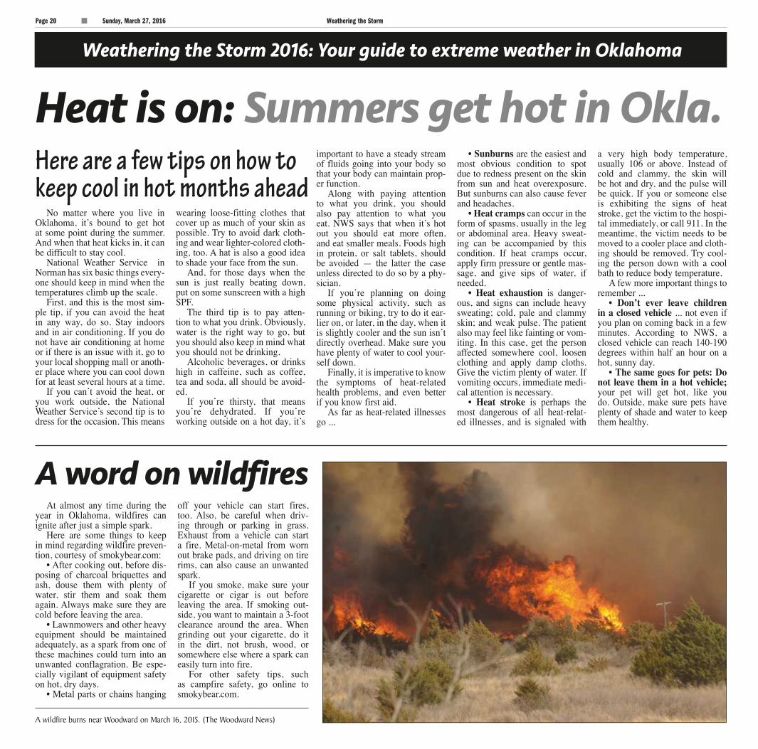
A wildfire burns near Woodward on March 16, 2015. (The Woodward News)
STORM20
C
MY
K
C
MY
K
Weathering the Storm Sunday, March 27, 2016 Page 21
Weathering the Storm 2016: Your guide to extreme weather in Oklahoma
UPShaking things
Though not weather, earthquakes are a force of nature that affected many
people across the state in 2015
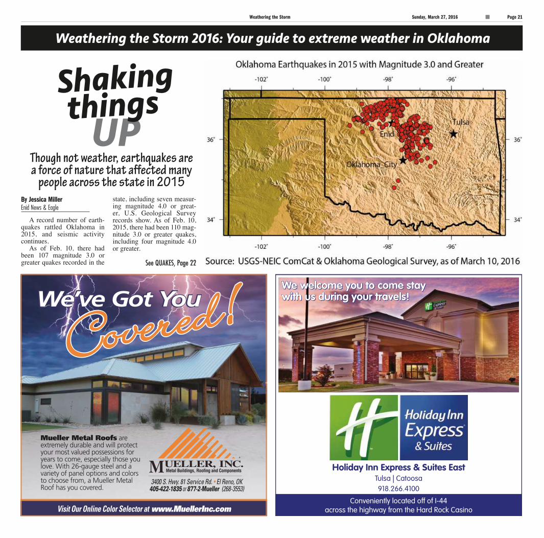
A record number of earth-quakes rattled Oklahoma in 2015, and seismic activity continues.
As of Feb. 10, there had been 107 magnitude 3.0 or greater quakes recorded in the
state, including seven measur-ing magnitude 4.0 or great-er, U.S. Geological Survey records show. As of Feb. 10, 2015, there had been 110 mag-nitude 3.0 or greater quakes, including four magnitude 4.0 or greater.
By Jessica MillerEnid News & Eagle
See QUAKES, Page 22
STORM21
Page sp22 Sunday, March 27, 2016 Enid News & Eagle
C
MY
K
C
MY
K
Page 22 Sunday, March 27, 2016 Weathering the Storm
Weathering the Storm 2016: Your guide to extreme weather in Oklahoma
In all of 2015, there were 907 magnitude 3.0 or greater tem-blors, according to the Oklahoma Geological Survey.
Between 1978 and 1998, Oklahoma averaged fewer than two earthquakes a year. The fol-lowing decade, fewer than three magnitude 3.0 or greater earth-quakes were recorded each year, until numbers climbed signifi-cantly in 2009, USGS records show. There were 585 magnitude 3.0 or greater quakes recorded in 2014, 109 in 2013, 35 in 2012, 65 in 2011, 43 in 2010 and 20 in 2009.
“You had a sort of slow rise up to say 100 earthquakes a year in 2009 (2010, 2011 and 2012), and then suddenly it just took off in 2014 and (2015),” OGS Director Jeremy Boak said. “I think I can say it has plateaued in the last six to seven months, and I have to
say that that could just be a lull.”When Boak looks at a 180-
day running average, it has been “ticking downward fairly steadi-ly with some bursts of earthquakes along the way,” he said.
“When I do a 30-day average, I see all these little spikes. When I do a 180-day average, it looks like a slow decline,” Boak said. “I think we’re begin-ning to get the data from the (Oklahoma) Corporation Com-mission that indi-cates there’s sub-stantially less (wastewater) injec-tion during 2015.”
In addition, OGS officials are seeing a shift in earthquake loca-
tions, he said.“In the first half of last year,
the majority of the earthquakes were in the central area —
Edmond, Cushing, that sort of area, and the smaller fraction were up in the northern part. In the second half it reversed, and the northern half had more earthquakes, and there was a fairly substantial drop in the central area,” Boak said. “Then, of course, at the end of the year, we had a burst of large earthquakes.”
In looking back at actions taken by the OCC, the first actions were in the central portion of the state. Action in
the northwest part of the state really began in November and December 2015, he noted.
“You would expect a lag there. And that’s sort of what we’re seeing, is a decrease in earth-quakes in one area, and contin-ued sort of slow rise in the other area,” Boak said.
In November, OCC spokes-man Matt Skinner said Oklahoma was the No. 1 earthquake area in the world.
“We’ve got an earthquake issue,” he said. “Oklahoma is absolutely unique in terms of the number of earthquakes we’ve had.”
OCC Director of Public Information and Manager of Consumer Education Jim Palmer said Oklahoma is unique in North America. He said there are other parts of the world experiencing enormous numbers
of earthquakes.“In North America, Oklahoma
is very unique, and unique in the world, in the sense that it’s concentrated so much in just one area,” Palmer said.
There is a tendency to make it an oil and gas versus earthquakes versus “whatever issue,” Skinner said.
“This is an Oklahoma issue that is an earthquake issue. It is nothing more and it’s noth-ing less,” Skinner said. “For us, it’s an oil and gas issue as well, because that’s what we have jurisdiction over that the seis-mologists say pertains to earth-quakes.”
The seismic surge triggered a flood of data and coopera-tion from the oil and gas indus-try. The information, in turn, has been used as the OCC regulates wastewater injection wells.
QUAKESContinued from Page 21
“You had a sort of slow rise up to say 100 earthquakes a year in 2009 (2010, 2011 and 2012), and then suddenly it just took off in 2014 and (2015).”
~ Jeremy Boak,OGS director
STORM22
580-540-8948
Ready for thenext storm?
StandardSolutions
StandardProblems
C
MY
K
C
MY
K
Weathering the Storm Sunday, March 27, 2016 Page 23
Weathering the Storm 2016: Your guide to extreme weather in Oklahoma
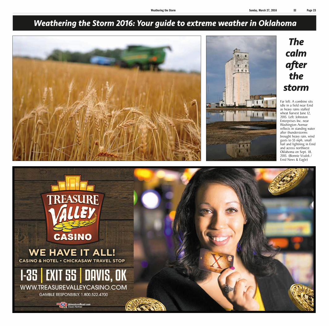
Far left: A combine sits idle in a field near Enid as heavy rains stalled wheat harvest June 12, 2015. Left: Johnston Enterprises Inc. near Washington Avenue reflects in standing water after thunderstorms brought heavy rain, wind gusts to 55 mph, small hail and lightning in Enid and across northwest Oklahoma on Sept. 18, 2015. (Bonnie Vculek / Enid News & Eagle)
Thecalm after the
storm
STORM23

C
MY
K
C
MY
K
Page 24 Sunday, March 27, 2016 Weathering the Storm
STORM24