Embed Size (px)
Citation preview

Weather Tactics
Weath
er, A
TC, a
nd Y
ou
2
ForewordThe following pages will take you on “Operation Rain Check” tours of Washington
Dulles International Airport (KIAD), the Washington Air Route Traffic Control Center
(ZDC), and the Leesburg (Virginia) Flight Service Station. These facilities provide
information that can help you make decisions critical to your success in avoiding
hazardous weather. We’ll focus on weather flying tactics—ways to utilize the
weather resources available through air traffic control (ATC) and flight service while
flying through areas of actual or forecast adverse weather. You’ll learn how to get
information on convective activity, as well as other atmospheric hazards such as
icing, turbulence, or encountering IFR conditions during a VFR flight. Dealing with
enroute weather involves tactical planning and response. Because conditions change
rapidly, pilots must be prepared for quick decision making and immediate action. In
these situations, ATC can provide invaluable assistance. To make optimal use of
ATC’s assistance, pilots must be aware of the abilities and limitations of both air
traffic controllers and their equipment.
Washington Air Route Traffic Control Center
Dealing with Enroute Weather—Tactics IFR or VFR?
Once the “go” decision has been made, it’s time to
consider the tactics you’ll use to complete the flight
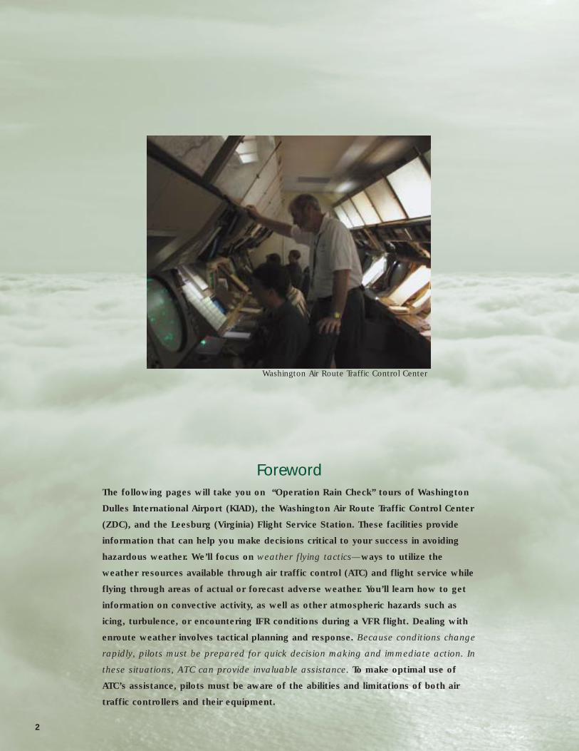
in safety and reasonable comfort. If the route takes
you through areas of possible adverse weather, the
first major issue is whether to go IFR or VFR.
If you’re a VFR pilot, the decision is already made.
You must remain VFR. Air route traffic control
centers (ARTCCs) will probably not have much
information on enroute ceiling and visibilities, but
terminal approach controllers can often provide
useful information on conditions near the airport.
Flight service and automated weather equipment
can provide information for selected points.
If you’re instrument rated, you have a choice, and
the conservative approach might suggest flying
IFR; after all, continued flight from VFR into IFR
conditions remains one of the most often cited
accident factors in general aviation. But flying VFR
could be more prudent in some cases. For
example, if afternoon thunderstorms are a
possibility, going VFR, and maintaining visual
separation from buildups, can be a better option
than being stuck in the clouds on an IFR flight
plan. Enroute altitude is another important
consideration; 2,000 vertical feet can make all the
difference between being in the clouds and being
above them. The part of the country over which
you’ll be flying makes a difference, too. Kansas
thunderstorms are often easy to spot and avoid;
not so with embedded TRW along the East Coast.
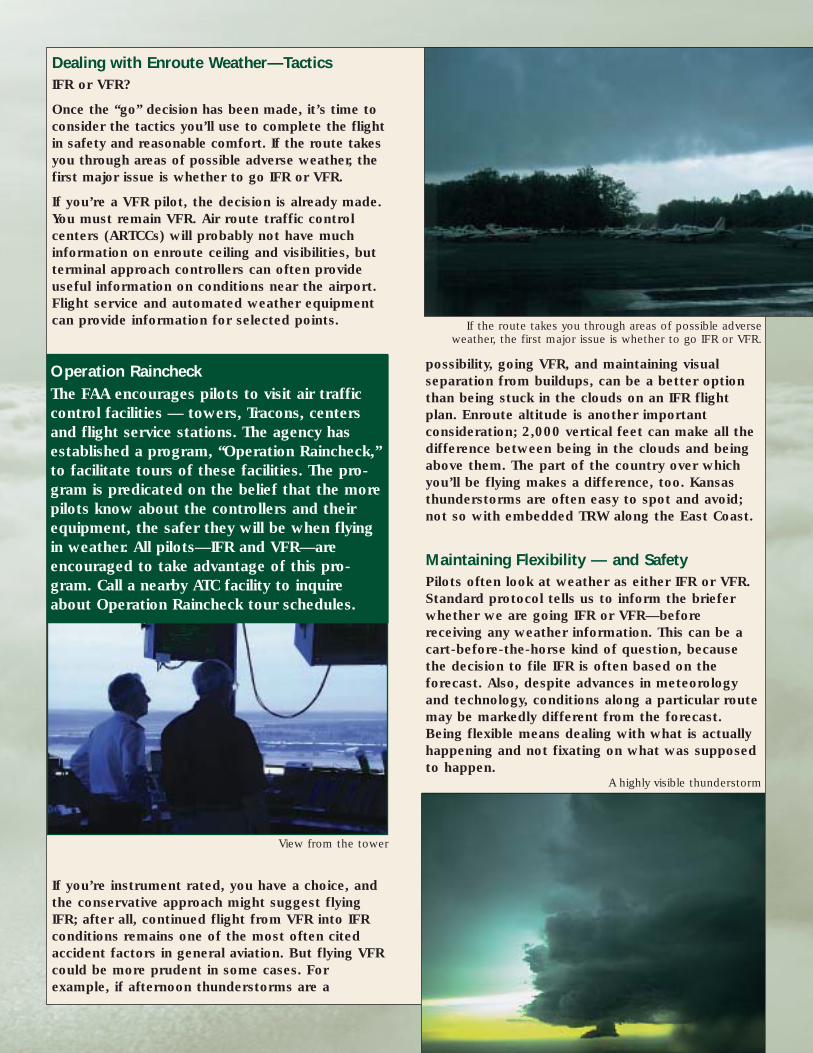
Maintaining Flexibility — and SafetyPilots often look at weather as either IFR or VFR.
Standard protocol tells us to inform the briefer
whether we are going IFR or VFR—before
receiving any weather information. This can be a
cart-before-the-horse kind of question, because
the decision to file IFR is often based on the
forecast. Also, despite advances in meteorology
and technology, conditions along a particular route
may be markedly different from the forecast.
Being flexible means dealing with what is actually
happening and not fixating on what was supposed
to happen.
If the route takes you through areas of possible adverseweather, the first major issue is whether to go IFR or VFR.
A highly visible thunderstorm
Operation Raincheck The FAA encourages pilots to visit air traffic
control facilities — towers, Tracons, centers
and flight service stations. The agency has
established a program, “Operation Raincheck,”
to facilitate tours of these facilities. The pro-
gram is predicated on the belief that the more
pilots know about the controllers and their
equipment, the safer they will be when flying
in weather. All pilots—IFR and VFR—are
encouraged to take advantage of this pro-
gram. Call a nearby ATC facility to inquire
about Operation Raincheck tour schedules.
View from the tower
4
Another way to be flexible is to realize there are
many gradations of IFR conditions. Pilots talk of
“hard IFR” and “solid IFR,” signifying conditions
of continual low visibility, possibly with ceilings
low enough to require instrument approaches
down to minimums.
IFR conditions along a route may be only
sporadic or only affect a narrow range of
altitudes. IFR flights may be conducted in clear
skies or in weather that only occasionally puts
the aircraft in instrument meteorological
conditions (IMC). VFR conditions also come in
many shades, from ceiling and visibility unlimited
(CAVU) to deteriorating visibility or low ceilings in
which VFR flight, although legal, may not be
safe. As stated above, actual and forecast
conditions can differ markedly. In some cases, an
IFR flight plan may not be needed; in others, one
may have to be filed at the last minute.
Filing in the Air Sometimes the need for IFR flight only becomes
apparent when airborne. In these cases, there are
several ways of getting “into the system.”
• If you know or strongly suspect you’ll need to go
IFR at some point in your flight, you can file a
composite flight plan in which you designate the
point where you wish to switch from VFR to IFR.
At that point, you can contact flight service or, in
some cases, ATC, to pick up your IFR clearance.
Getting the clearance from ATC will be easier if
you’re already on flight following.
• It’s possible to request an IFR clearance from
ATC without having a previously filed IFR flight
plan. Controllers will often accommodate such
requests if they’re not too busy. Pilots must
realize, however, that ATC’s main responsibility is
separating traffic—everything else is secondary.
• A surefire way to file in the air is to contact
flight service. File an IFR flight plan to be
activated over a designated point. Obviously, you
can’t wait until you’re in IMC to ask for a
clearance—that requires exercising the least
attractive option.
• Declaring an emergency is another way to get
IFR service in flight. Both VFR and IFR pilots
should never hesitate to use their PIC authority to
cope with emergency situations. It’s difficult to
understand how a prudent aviator could
inadvertently stray very far from VMC into IMC,
but it happens all too frequently with fatal results.
The Eyes Have It Pilots’ vision has always been the best system for
hazardous weather avoidance. If you can see theThe eyes are the best means to avoid the weather.
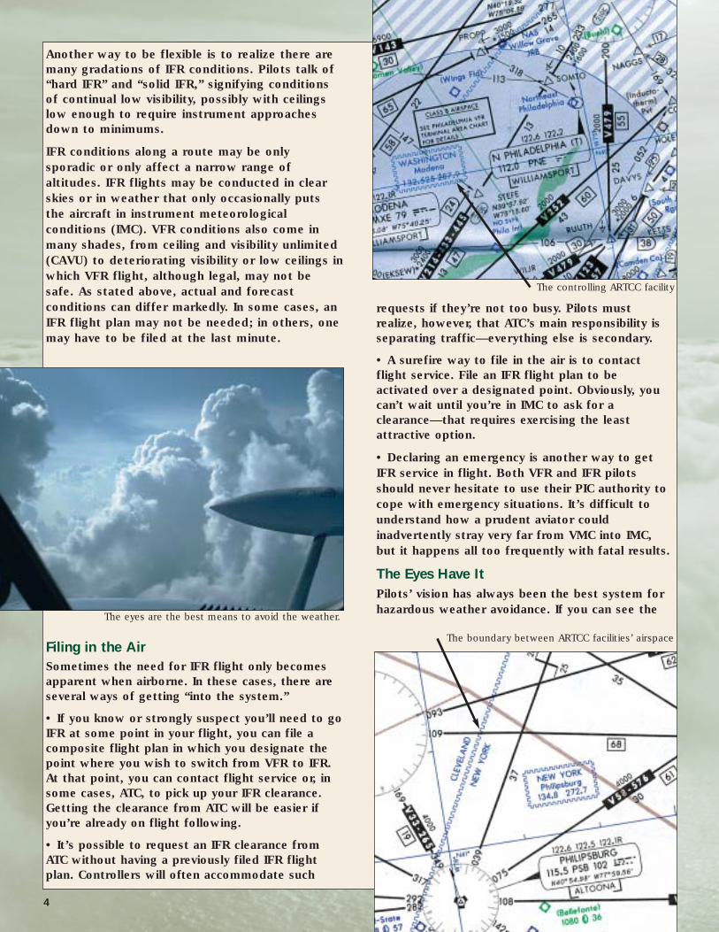
The controlling ARTCC facility
The boundary between ARTCC facilities’ airspace
clouds, you can avoid them, so pilots should plan
all flights to give the best opportunity of seeing
the weather. That naturally means adjusting
cruising altitude as required, but it may also mean
delaying departure or leaving earlier.
Here are some tactics to improve the view:
• Try to get on top of the weather.
• Obviously you won’t be able to top thunderstorms,
but it’s often possible to top the veiling clouds that
obscure your view of the nasty stuff.
• IFR pilots should request VFR-on-top
clearances. They accord considerable latitude in
weather avoidance.
• ATC is less likely to approve VFR-on-top in
crowded airspace. Here pilots should request
cruising altitudes that will allow them to see
what’s ahead at least part of the time.
• VFR-on-top is legal for VFR pilots too, but
you’ve obviously traded one problem for a bigger
one if you have to declare an emergency to
descend through the clouds.
During IFR flights in actual instrument conditions, our
ability to monitor weather visually is significantly
restricted. We can’t see weather beyond the horizon
that may be affecting our destination or peer through
a solid cloud deck to know if there is ice, turbulence,
or heavy rain ahead. During trying times like these,
ATC may be able to provide some answers.
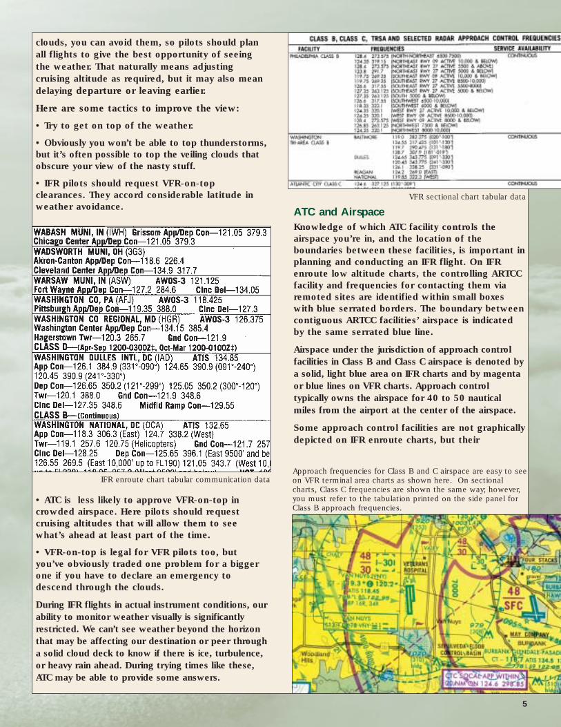
ATC and AirspaceKnowledge of which ATC facility controls the
airspace you’re in, and the location of the
boundaries between these facilities, is important in
planning and conducting an IFR flight. On IFR
enroute low altitude charts, the controlling ARTCC
facility and frequencies for contacting them via
remoted sites are identified within small boxes
with blue serrated borders. The boundary between
contiguous ARTCC facilities’ airspace is indicated
by the same serrated blue line.
Airspace under the jurisdiction of approach control
facilities in Class B and Class C airspace is denoted by
a solid, light blue area on IFR charts and by magenta
or blue lines on VFR charts. Approach control
typically owns the airspace for 40 to 50 nautical
miles from the airport at the center of the airspace.
Some approach control facilities are not graphically
depicted on IFR enroute charts, but their
IFR enroute chart tabular communication dataApproach frequencies for Class B and C airspace are easy to seeon VFR terminal area charts as shown here. On sectionalcharts, Class C frequencies are shown the same way; however,you must refer to the tabulation printed on the side panel forClass B approach frequencies.
5
VFR sectional chart tabular data
communication frequencies are found in the
tabular data on VFR and IFR charts.
If you’re on an IFR flight plan or have requested
VFR flight following, you’re already talking with
controllers who can either provide weather
updates or refer you to a frequency where you can
get them.
Knowing who controls the airspace and where
boundaries are can be helpful to VFR pilots, as well.
For example: You’re flying VFR at 4,500 feet. The
forecast calls for a 40 percent probability of
thunderstorms for later in the afternoon, and
there’s a buildup on the horizon. Has the convective
activity started ahead of schedule? If you know
whose airspace you’re in and the frequency to use,
you can call Center or Approach and ask about the
presence of convective weather along your route.
Knowing the airspace boundaries is important
because radar coverage tends to be at its weakest
along the border areas. If you need help from ATC
to avoid the heavy weather, these areas of fringe
coverage aren’t the best place to get it.
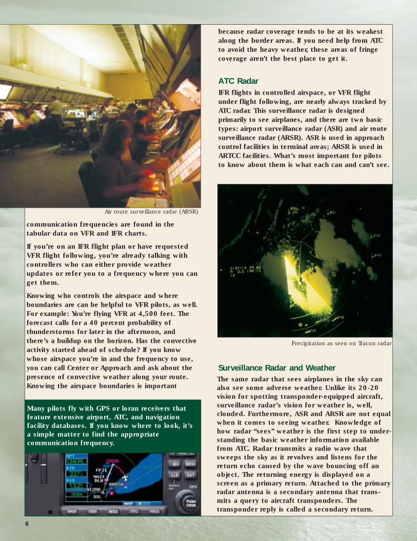
ATC RadarIFR flights in controlled airspace, or VFR flight
under flight following, are nearly always tracked by
ATC radar. This surveillance radar is designed
primarily to see airplanes, and there are two basic
types: airport surveillance radar (ASR) and air route
surveillance radar (ARSR). ASR is used in approach
control facilities in terminal areas; ARSR is used in
ARTCC facilities. What’s most important for pilots
to know about them is what each can and can’t see.
Surveillance Radar and Weather The same radar that sees airplanes in the sky can
also see some adverse weather. Unlike its 20-20
vision for spotting transponder-equipped aircraft,
surveillance radar’s vision for weather is, well,
clouded. Furthermore, ASR and ARSR are not equal
when it comes to seeing weather. Knowledge of
how radar “sees” weather is the first step to under-
standing the basic weather information available
from ATC. Radar transmits a radio wave that
sweeps the sky as it revolves and listens for the
return echo caused by the wave bouncing off an
object. The returning energy is displayed on a
screen as a primary return. Attached to the primary
radar antenna is a secondary antenna that trans-
mits a query to aircraft transponders. The
transponder reply is called a secondary return.
Air route surveillance radar (ARSR)
Precipitation as seen on Tracon radar
Many pilots fly with GPS or loran receivers that
feature extensive airport, ATC, and navigation
facility databases. If you know where to look, it’s
a simple matter to find the appropriate
communication frequency.
6

Primary radar senses not only airplanes, but also
terrain and weather. Radar energy is reflected by
water in the form of rain. The more water, the
stronger the return. The faster the radar turns, the
greater the number of returns and the more com-
prehensive the picture of the echoes it “paints.”
However, as the speed of the sweeping radar
increases, its range decreases. Hail and snow are
poor reflectors of radar waves; thus, ATC radar is
more limited in its ability to see them.
All radar is prone to certain errors. Radar waves
can be bent and reflected by atmospheric
phenomena besides rain. Temperature inversions,
for example can create radar returns that look
like precipitation. Controllers learn how to
interpret most false returns, and they become
familiar with errors that are common in particular
areas due to surrounding topography or recurring
atmospheric conditions.
Levels of Storm Intensity
For aviation, precipitation is measured in levels of
intensity. Level one and level two may not make
hearts flutter, but a level three activity ahead
should command our undivided attention. The
intensity levels are determined by the amount of
water the radar detects, which is correlated to
amounts of rainfall as follows:
Turbulence
How well does radar imagery of precipitation
correlate with turbulence?
Doppler radar—the kind you see on television
weather programs—can show air movement
throughout and around thunderstorms. Provided
this imagery is interpreted correctly, it can
accurately show areas of turbulence.
Unfortunately doppler radar isn’t found in many
cockpits, nor is it available to individual controllers
so, for the present, we can only see precipitation.
High altitude studies conducted by NOAA and the
U.S. Air Force1 showed that significant turbulence
does occur outside of the thunderstorm proper.
How far the turbulence extends is hard to say, but
pilots should avoid any convective activity by at
least 20 miles. Even at that range, there’s no
guarantee you will avoid all the turbulence.11973-1977 Rough Rider Turbulence-Radar Intensity Study. J.T. Lee, D.
Carpenter; National Severe Storms Laboratory, Environmental Research
Laboratories, National Oceanic and Atmospheric Administration.
Turbulence Tips • How clouds look can tell you a lot about the ride
you’ll get as you fly through them.
• Flat stratus clouds form in a stable atmosphere
and will yield little or no turbulence.
• Cumulus clouds form in unstable conditions and
will give you a rougher ride.
• Look at the shape of cumulus clouds.
If the contours are rounded and pillow-like,
the turbulence will most likely be manageable—hard
angular contours indicate more turbulent conditions.
• Shredded clouds, torn apart by wind, usually
predict turbulence.
• Lenticular clouds that form in mountain wave
conditions have particularly well defined edges,
and not surprisingly, they can be associated with
extreme turbulence particularly below the cloud.
• Slow down well before entering the cloud or
suspected turbulence area. This means
maneuvering speed or less.
7
Levels of Storm Intensity
Level Intensity Rainfall per Hour
1 Very light Trace to .02”
2 Light to moderate Up to .09”
3 Strong Up to .48”
4 Very strong Up to 2.5”
5 Intense Up to 5.7”
6 Extreme Up to 13”
Line of clouds seen from 68,000 feet

• Remember that maneuvering speed (Va)
decreases as the aircraft weight decreases; i.e., a
lightly loaded airplane with one pilot must be flown
more slowly than one with all the seats filled.
• Don’t chase the airspeed, but try to keep it
within 10 knots of maneuvering speed.
• Lowering the landing gear can help to stabilize
the aircraft, and the increased drag will help to
keep you from overspeeding in the case of a
momentary upset.
• Do not lower the flaps. The aircraft is strongest
with flaps up.
• Fly attitude – not altitude.
• Concentrate on keeping the wings level. Turning
imposes greater stress on the aircraft.
• The shortest way through the turbulence is
usually a straight line.
• It’s very difficult to maintain altitude in
moderate or greater turbulence, so request a block
altitude from ATC.
• Don’t make radical pitch changes.
• If you’re using an autopilot, turn off altitude hold.
• Hail is another hazard that’s often present in
thunderstorms.
Terminal Radar In airspace around major airports, ATC radar
service is provided by Tracon—terminal radar
control. The various forms of ASR found in these
facilities are more accurate but have less range
capability than the ARSR systems employed at
center (ARTCC) facilities. Typically, ASRs have a
range of 50 to 60 miles, but the practical limit is
about 40 miles from the site.
The radar, together with software and hardware such
as the controllers’ display screens, comprise an
automated radar terminal system (ARTS). The radar
screen controllers look at, called the plan view display,
or PVD, can show returns from both primary and
secondary radar. Returns from the secondary radar—
the transponder responses—are much stronger and
easier to see, and the Mode C returns report aircraft
altitude. That’s why aircraft without Mode C
transponders are excluded from within 30 miles of the
primary airport in Class B airspace, the Mode-C veil.
Terminal radars rotate every four to five seconds,
compared to the 12-second sweep of ARSR
systems. They are more accurate in showing
Slow down well before entering the cloudor suspected turbulence area.
These clouds must be avoided.
8
Tracon radar display
9
both aircraft and rain than ARSR systems, but
their range is considerably shorter. This accuracydifferential means that aircraft under terminal
radar control radar need only three miles of
separation, while those under center’s radar
require a five-mile separation. Accuracy
decreases as range increases, so aircraft more
than 40 miles from the terminal radar site must
also be separated by five miles. At the limits of
its range, surveillance radar can’t distinguish
between an aircraft and other objects in the
atmosphere such as a large balloon, a flock of
birds, or atmospheric phenomena such as a
temperature inversion.
Older models of terminal radar (ASRs-4, -7 and -
8), though still in operation, are being replaced or
have been replaced at larger facilities by ASR-9
and ASR-11 systems. These newer systems have
dedicated weather radar that works in conjunction
with the surveillance radar. Computers process the
weather radar data to create digitized composite
weather images that are displayed on the
controllers’ PVDs.
With their dedicated weather radar antennas, ASR-
9 and -11 systems display weather in six levels,
corresponding to the six levels of precipitation
intensity. To reduce visual clutter, the computer
eliminates most indistinct returns from the screen.
Controllers can select any two of the six levels for
display on their PVDs.
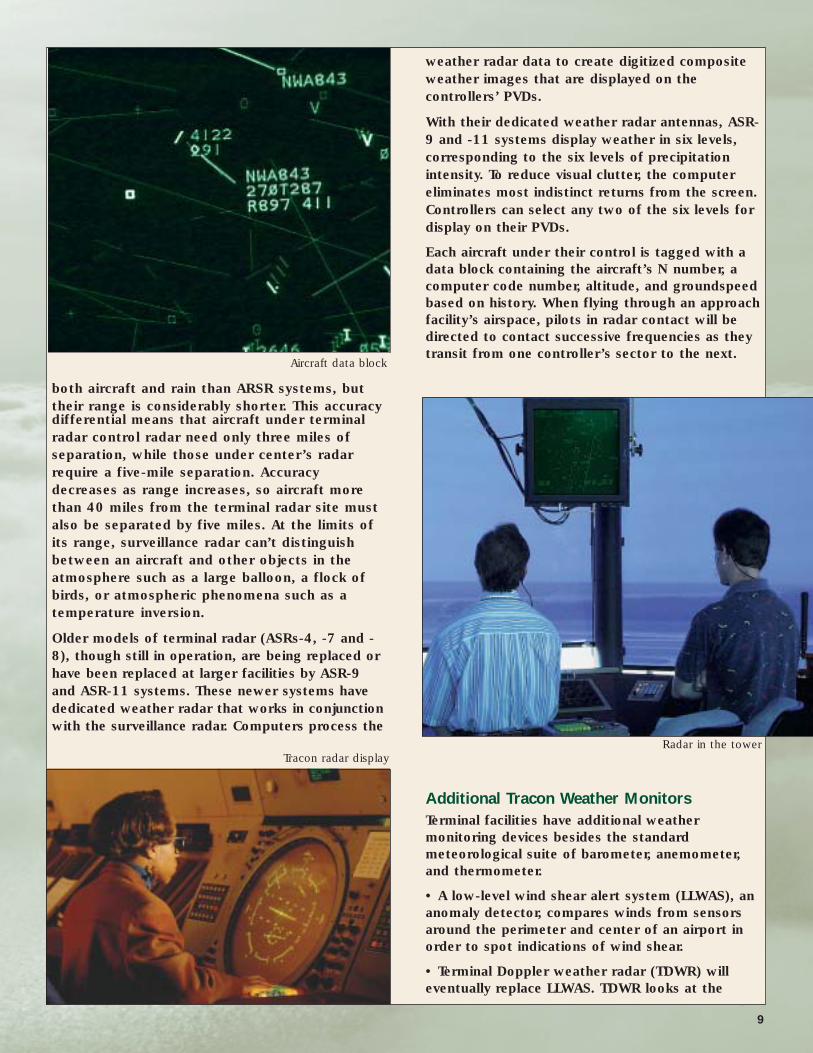
Each aircraft under their control is tagged with a
data block containing the aircraft’s N number, a
computer code number, altitude, and groundspeed
based on history. When flying through an approach
facility’s airspace, pilots in radar contact will be
directed to contact successive frequencies as they
transit from one controller’s sector to the next.
Additional Tracon Weather Monitors Terminal facilities have additional weather
monitoring devices besides the standard
meteorological suite of barometer, anemometer,
and thermometer.
• A low-level wind shear alert system (LLWAS), an
anomaly detector, compares winds from sensors
around the perimeter and center of an airport in
order to spot indications of wind shear.
• Terminal Doppler weather radar (TDWR) will
eventually replace LLWAS. TDWR looks at the
Tracon radar display
Aircraft data block
Radar in the tower
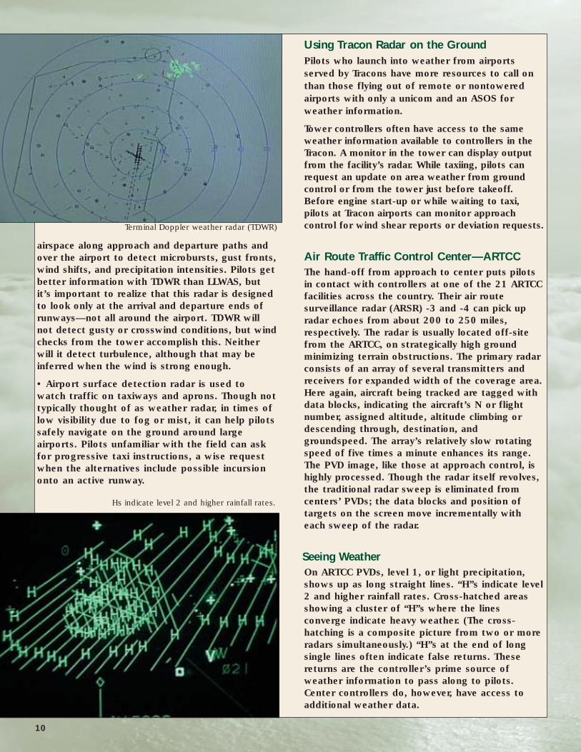
airspace along approach and departure paths and
over the airport to detect microbursts, gust fronts,
wind shifts, and precipitation intensities. Pilots get
better information with TDWR than LLWAS, but
it’s important to realize that this radar is designed
to look only at the arrival and departure ends of
runways—not all around the airport. TDWR will
not detect gusty or crosswind conditions, but wind
checks from the tower accomplish this. Neither
will it detect turbulence, although that may be
inferred when the wind is strong enough.
• Airport surface detection radar is used to
watch traffic on taxiways and aprons. Though not
typically thought of as weather radar, in times of
low visibility due to fog or mist, it can help pilots
safely navigate on the ground around large
airports. Pilots unfamiliar with the field can ask
for progressive taxi instructions, a wise request
when the alternatives include possible incursion
onto an active runway.
Using Tracon Radar on the GroundPilots who launch into weather from airports
served by Tracons have more resources to call on
than those flying out of remote or nontowered
airports with only a unicom and an ASOS for
weather information.
Tower controllers often have access to the same
weather information available to controllers in the
Tracon. A monitor in the tower can display output
from the facility’s radar. While taxiing, pilots can
request an update on area weather from ground
control or from the tower just before takeoff.
Before engine start-up or while waiting to taxi,
pilots at Tracon airports can monitor approach
control for wind shear reports or deviation requests.
Air Route Traffic Control Center—ARTCCThe hand-off from approach to center puts pilots
in contact with controllers at one of the 21 ARTCC
facilities across the country. Their air route
surveillance radar (ARSR) -3 and -4 can pick up
radar echoes from about 200 to 250 miles,
respectively. The radar is usually located off-site
from the ARTCC, on strategically high ground
minimizing terrain obstructions. The primary radar
consists of an array of several transmitters and
receivers for expanded width of the coverage area.
Here again, aircraft being tracked are tagged with
data blocks, indicating the aircraft’s N or flight
number, assigned altitude, altitude climbing or
descending through, destination, and
groundspeed. The array’s relatively slow rotating
speed of five times a minute enhances its range.
The PVD image, like those at approach control, is
highly processed. Though the radar itself revolves,
the traditional radar sweep is eliminated from
centers’ PVDs; the data blocks and position of
targets on the screen move incrementally with
each sweep of the radar.
Seeing Weather On ARTCC PVDs, level 1, or light precipitation,
shows up as long straight lines. “H”s indicate level
2 and higher rainfall rates. Cross-hatched areas
showing a cluster of “H”s where the lines
converge indicate heavy weather. (The cross-
hatching is a composite picture from two or more
radars simultaneously.) “H”s at the end of long
single lines often indicate false returns. These
returns are the controller’s prime source of
weather information to pass along to pilots.
Center controllers do, however, have access to
additional weather data.
Terminal Doppler weather radar (TDWR)
Hs indicate level 2 and higher rainfall rates.
10

The CWSU Every ARTCC has a Center Weather Service Unit, or
CWSU, staffed by a National Weather Service
meteorologist. The meteorologist meets with the
center’s supervisor twice a day to review the
weather and possible problems it may cause. The
position of the jet stream and areas of rain, snow,
icing, turbulence and thunderstorms are discussed.
If the weather is expected to interfere with normal
flight operations, controllers are informed.
Cloud-to-Ground Lightning MonitorThe cloud-to-ground lightning monitor is a
graphic representation of thunderstorm activity
across the United States. The color shows the
activity’s history. Cyan represents the first 55
seconds of lightning activity. After 55 seconds,
the color goes to green, and to red after 5
minutes, enabling the screen to display where the
storms are most violent.
The CWSU includes displays of weather sensors
that may, in the not-too-distant future, be fed
directly into cockpits in real time, vastly enhancing
the safety of weather flying. For example, the
national Doppler radar weather summary shows
the echoes from Doppler radars all across the
country, and the display (referred to as Nexrad)
can be overlaid on airways to get a better glimpse
of how and where the convective weather might
affect flights. A nationwide network of cloud-to-
ground lightning monitors likewise indicates
thunderstorms and convective activity across the
country in real time.
In addition to the briefing material, each
supervisor’s position has a dedicated weather
briefing terminal that can display the same data
available in the CWSU: radar maps, satellite data,
text messages regarding significant weather—the
works. Yet most of this information is rarely
available to pilots via the controllers. Why? The
controllers’ primary responsibility is traffic
separation, and in times when this information is
most valuable—that is, in conditions of
deteriorating weather—controller work loads are
at their peak. Aircraft may request deviations,
aircraft that might otherwise be flying VFR instead
are IFR, and some traffic might require vectoring
around the weather. This doesn’t leave time for
turning away from the PVD to consult the weather
briefing terminal. In addition to work load
constraints, controllers are not trained as
meteorologists, and some are, naturally, reluctant
to take on that role.
What Are Your Intentions?
Despite not being trained as meteorologists,
controllers may advise pilots if they are on a
collision course with hazardous weather.
Controllers can make suggestions for storm
avoidance, but they can’t tell pilots what to do.
They may simply advise of convective activity
ahead, or less often, they may suggest a heading
for a deviation. Why don’t they tell pilots what to
do about avoiding weather? First, they don’t know
the limitations or abilities of a given pilot or his
aircraft. One pilot may have no problem coping
with level 2 precipitation, whereas another will
want to stay well clear. As we’ve already shown,
radar—particularly center radar—does not show all
the weather. Finally, there is a liability issue. If an
accident occurs following the issuance and
acceptance of such instructions, the FAA could find
itself in court.
Lighting Detection Network
11
Nexrad overlaid on airways

Often getting the information you need is simply a
matter of asking the right questions:
• Are you showing any weather along my route?
• Is it showing as light or heavy?
• Has anyone flown through that area recently, at
or near my altitude?
• How was their ride?
• If pilots are avoiding that area, in which direction
are they deviating?
• Can you give me a heading to follow the
successful deviators?
The same line of questioning can be used
regarding icing or turbulence, although these do
not show on radar. The controller will be relying on
pilot reports. ATC will supply you with weather
information and suggestions to the extent
possible, but the resulting decisions, and the
consequences, are all yours.
Sometimes it may take a few moments to digest
the information and decide what to do about it.
Of course, controllers want to know your course
of action immediately; they have to separate you
from airplanes. If you don’t have a quick answer,
the controller may ask, “What are your
intentions?” If you’re not sure, you can ask for
more help; for example, request vectors for
getting around a cell. You need to be aware of the
options available to you. It could be a change of
altitude to get over or under the weather or a
deviation to the right or left. It’s up to you as pilot
in command to know the tactics at your disposal
and make the right decision.
Deviations ATC will let aircraft deviate as long as they don’t
constitute a collision hazard. Deviation is as much
art as it is science. Here are a few tactics:
• Try to deviate north of convective activity; usually
the south side contains the water that’s fueling
the storms.
• Give a wide berth to the downwind side—the
direction the storm is moving—as turbulence may
extend far into clear air. Because storms often
move from southwest to northeast, this
suggestion might seem to conflict with the one
above. Tornadoes most often form on the
southwest side of storms, though, so you’re
usually better off with northerly deviations.
• Don’t fly under anvils and overhangs. That’s
where your chance of hail encounters is greatest.
• Come no closer than 20 miles to the weather
you’re deviating around.
• If a deviation is required, ask for it as soon as
possible. This will give the controllers time to
coordinate with other traffic.
• Try to deviate 45 degrees or less from course.
Controllers don’t like to process requests for
90-degree deviations because they greatly
Once in the air, deal with what is actually happening—not what was supposed to happen.
12
Time OutLet’s take a moment to put things in perspective.
This publication deals with tactics for flying in or
around weather, but pilots must realize that there
are some weather situations that no airplane/pilot
combination is capable of handling. In other words,
all the technology in the world will not make
unflyable weather flyable.
The pilot in command is responsible for knowing
when to press on and when to call it a day. We
must regularly evaluate the weather and our
airplane’s capability and our own as each flight
progresses. If the weather is more than we can
handle, we’re responsible for the decision to
divert, land, and wait for conditions to improve,
or turn back and try it another day. The pressure
of this decision is greater when we have a
schedule to keep or passengers to impress, but
the decision must be made solely on the safety
of flight. Unless your passengers are also
qualified crew members, it’s best to make the
decision without their input.

complicate the separation task and the need for
coordination with other control sectors is likely.
• If you want to climb over some clouds but don’t
want to request and remain at a designated
altitude, ask for a block altitude. This request will
more likely be granted when traffic density is light.
• When requesting a deviation, keep the routing as
simple as possible. Remember, if the weather is
affecting you, it’s probably affecting lots of other
pilots too, and the simpler you can keep the request,
the more likely you are to get what you ask for.
• If your request is met with an “unable” at a
critical juncture and you’re worried about flying
into dangerous weather, you can invoke your rights
as pilot in command to deviate in accordance with
FARs 91.3 and 91.123. However, if you’re paying
attention and working with ATC properly, it
shouldn’t come to this.
Additional Enroute Weather SourcesGetting enroute updates can reduce the stress of
cross-country flying in challenging weather. Pilots
on VFR cross-country flights should also use these
resources, due to the ever-present possibility of
deteriorating conditions that lurks in even the
most optimistic forecast.
Flight Service Stations (FSSs) Flight service stations remain a mainstay of
aviation weather resources. Enroute, their
primary contact frequency is 122.2. The same
information is available in telephone briefings,
and pilots are encouraged to use the phone
whenever possible to avoid frequency congestion.
FSS communicates with pilots through remote
transmitters, so replies are only heard by radios
in the appropriate area. Thus, it’s important to
state the aircraft’s position when contacting
flight service. The name of the controlling facility
is helpful, too, but as long as you tell them your
position and frequency—“Leesburg Radio, this is
Debonair One-Five-Eight-Eight Sierra, fifteen
south of the Philipsburg VOR, 122.2”—if they
hear you, they will respond.
Flight WatchFlight Watch, also known as the Enroute Flight
Advisory Service, or EFAS, is designed to
provide information on weather affecting your
route of flight, as the name implies. It’s
available on frequency 122.0 from 6 a.m. to 10
p.m. daily, at altitudes from 5,000 to 17,500
feet and on selected frequencies for high-
altitude flights. Provided through selected
FSSs, it’s not meant to provide detailed
briefings like FSS or for filing flight plans.
When you need quick, concise information
about actual or suspected adverse enroute
conditions, this is the frequency to use.
Controllers can make suggestions for storm avoidance, but they can’t tell pilots what to do.
Often getting the information you need is simply a matter of asking the right questions.
13
14
Again, it’s imperative to state your position in
your initial report, so that briefers know which
remote transmitter to use.
Flight Watch briefers are specially trained to
provide the real-time weather information pilots
need to make in-flight decisions. They have the
latest Nexrad Doppler radar image composites on
a monitor at the briefing console. They also have
pireps and surface observations. Flight Watch
blurs the line between strategic and tactical
planning. In one sense, if you’re in the air, all your
decisions are tactical, but pilots have to keep in
mind the age of the information they’ve received.
Pireps can age quickly in fast-developing weather
situations, and even Nexrad images may be up to
15 minutes old. Add to that the difficulty of
relating your position to the weather described
by the briefer, and you can see that the earlier
you talk to Flight Watch, the more time you’ll
have to deviate well clear of the hazards.
The same questioning routine you use with ATC
controllers will work with Flight Watch.
• Where is the weather?
• What are the pilots saying about it?
• What’s the best way to turn?
• Where are the successful deviators going?
You can also learn a lot about developing weather
by simply listening to Flight Watch. When things
are popping, you can usually hear a lot of
weather information requests on 122.0.
Monitoring the frequency for a few minutes
before contacting the briefer can save time when
it’s your turn to ask the questions.
Automatic Terminal Information Service (ATIS) These hourly updates on airport weather,
broadcast at many towered airports, are a
valuable enroute tool. Monitor ATIS reports from
nearby airports. Though the weather may be up
to an hour old, any significant changes will be
marked by a special observation, an easy
giveaway about trends. You don’t even have to
leave the frequency to do it (assuming you have
two radios—always a good idea when flying
IFR). Just monitor the ATIS frequency on your
second radio.
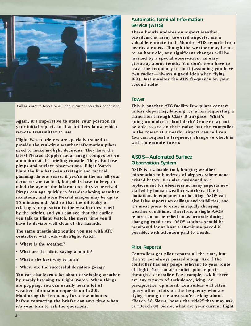
Tower This is another ATC facility few pilots contact
unless departing, landing, or when requesting a
transition through Class D airspace. What’s
going on under a cloud deck? Center may not
be able to see on their radar, but the controller
in the tower at a nearby airport can tell you.
You can request a frequency change to check in
with an enroute tower.
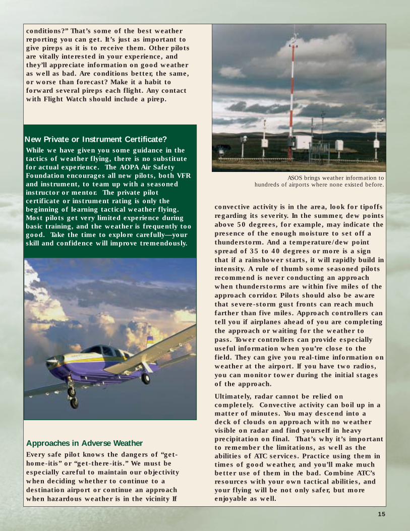
ASOS—Automated Surface Observation SystemASOS is a valuable tool, bringing weather
information to hundreds of airports where none
existed before. It is also envisioned as a
replacement for observers at many airports now
staffed by human weather watchers. Due to
limitations in equipment or in siting, ASOS can
give false reports on ceilings and visibilities, and
it’s most prone to error in rapidly changing
weather conditions. Therefore, a single ASOS
report cannot be relied on as accurate during
changing conditions. ASOS stations should be
monitored for at least a 10-minute period if
possible, with attention paid to trends.
Pilot Reports Controllers get pilot reports all the time, but
they’re not always passed along. Ask if the
controller has any pireps relevant to your route
of flight. You can also solicit pilot reports
through a controller. For example, ask if there
are any reports of turbulence, icing, or
precipitation up ahead. Controllers will often
query other pilots on the frequency who are
flying through the area you’re asking about.
“Beech 88 Sierra, how’s the ride?” they may ask,
or “Beech 88 Sierra, what are your current flight
Call an enroute tower to ask about current weather conditions.
conditions?” That’s some of the best weather
reporting you can get. It’s just as important to
give pireps as it is to receive them. Other pilots
are vitally interested in your experience, and
they’ll appreciate information on good weather
as well as bad. Are conditions better, the same,
or worse than forecast? Make it a habit to
forward several pireps each flight. Any contact
with Flight Watch should include a pirep.
Approaches in Adverse Weather Every safe pilot knows the dangers of “get-
home-itis” or “get-there-itis.” We must be
especially careful to maintain our objectivity
when deciding whether to continue to a
destination airport or continue an approach
when hazardous weather is in the vicinity If
convective activity is in the area, look for tipoffs
regarding its severity. In the summer, dew points
above 50 degrees, for example, may indicate the
presence of the enough moisture to set off a
thunderstorm. And a temperature/dew point
spread of 35 to 40 degrees or more is a sign
that if a rainshower starts, it will rapidly build in
intensity. A rule of thumb some seasoned pilots
recommend is never conducting an approach
when thunderstorms are within five miles of the
approach corridor. Pilots should also be aware
that severe-storm gust fronts can reach much
farther than five miles. Approach controllers can
tell you if airplanes ahead of you are completing
the approach or waiting for the weather to
pass. Tower controllers can provide especially
useful information when you’re close to the
field. They can give you real-time information on
weather at the airport. If you have two radios,
you can monitor tower during the initial stages
of the approach.
Ultimately, radar cannot be relied on
completely. Convective activity can boil up in a
matter of minutes. You may descend into a
deck of clouds on approach with no weather
visible on radar and find yourself in heavy
precipitation on final. That’s why it’s important
to remember the limitations, as well as the
abilities of ATC services. Practice using them in
times of good weather, and you’ll make much
better use of them in the bad. Combine ATC’s
resources with your own tactical abilities, and
your flying will be not only safer, but more
enjoyable as well.
New Private or Instrument Certificate?While we have given you some guidance in the
tactics of weather flying, there is no substitute
for actual experience. The AOPA Air Safety
Foundation encourages all new pilots, both VFR
and instrument, to team up with a seasoned
instructor or mentor. The private pilot
certificate or instrument rating is only the
beginning of learning tactical weather flying.
Most pilots get very limited experience during
basic training, and the weather is frequently too
good. Take the time to explore carefully—your
skill and confidence will improve tremendously.
ASOS brings weather information to hundreds of airports where none existed before.
15

Copyright 2003, AOPA Air Safety Foundation421 Aviation Way, Frederick, MD, 21701
Phone: (800) 638-3101Internet: www.asf.orgE-mail: [email protected]
Publisher: Bruce LandsbergWriter: James Wynbrandt
Editors: John Steuernagle, Kathy Dondzila
EXPLORE ASF’S SAFETY PRODUCTS
EXPLORE ASF’S SAFETY PRODUCTS
Safety Advisors • Safety Highlights • Nall Report Videos • Seminar-in-a-Box® Program
421 Aviation Way • Frederick, MD 21701 • 800/638-3101 • www.asf.org • [email protected] ASF products were made possible through contributions from pilots like you.
and many more...
Seminar-in-a-Box® ProgramIf it’s not convenient for you to attend the Air Safety Foundation’s free safety seminars, why not have one in your own community?
It’s easier than you think!Topics include:• Ups and Downs of Takeoffs and Landings• Collision Avoidance• Spatial Disorientation• and many more
View ASF’s web site for more information: www.aopa.org/asf/schedules/sib.html
SA13-04/03