Embed Size (px)
Citation preview
WEATHER PROOFING:
MANAGING WATER WITH
ROADS
FRANK VAN STEENBERGEN
CERTIFIED IRF WORKSHOP 18 SEPTEMBER 2015
Program
1. Introduction
2. Discussion on designs and guidelines for road
water management
3. Discussion on governance
4. Ways forward
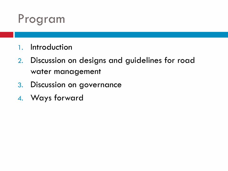
Opportunity
To have roads for systematically used for water
management, in different economic and
environmental settings
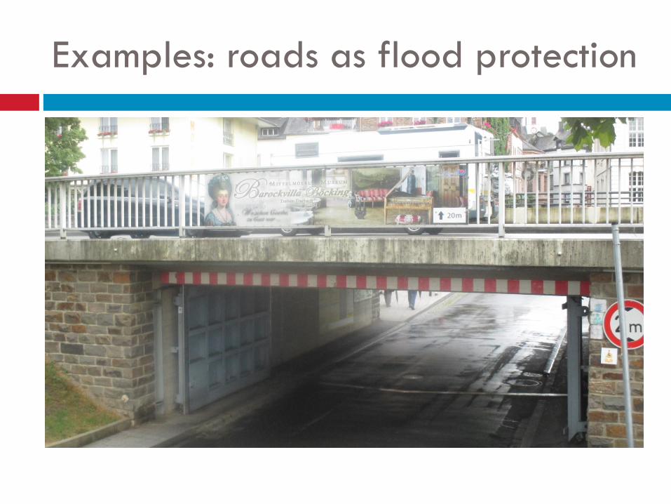
Examples: roads as flood protection
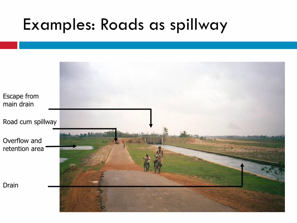
Escape from main drain
Overflow and retention area
Drain
Road cum spillway
Examples: Roads as spillway
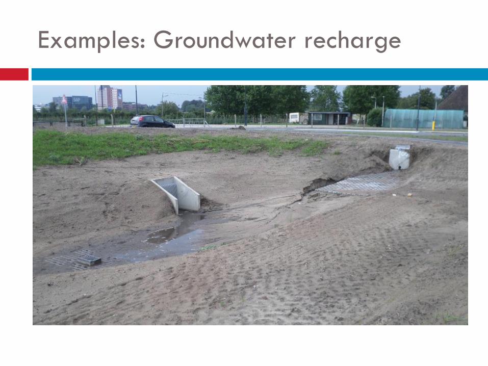
Examples: Groundwater recharge
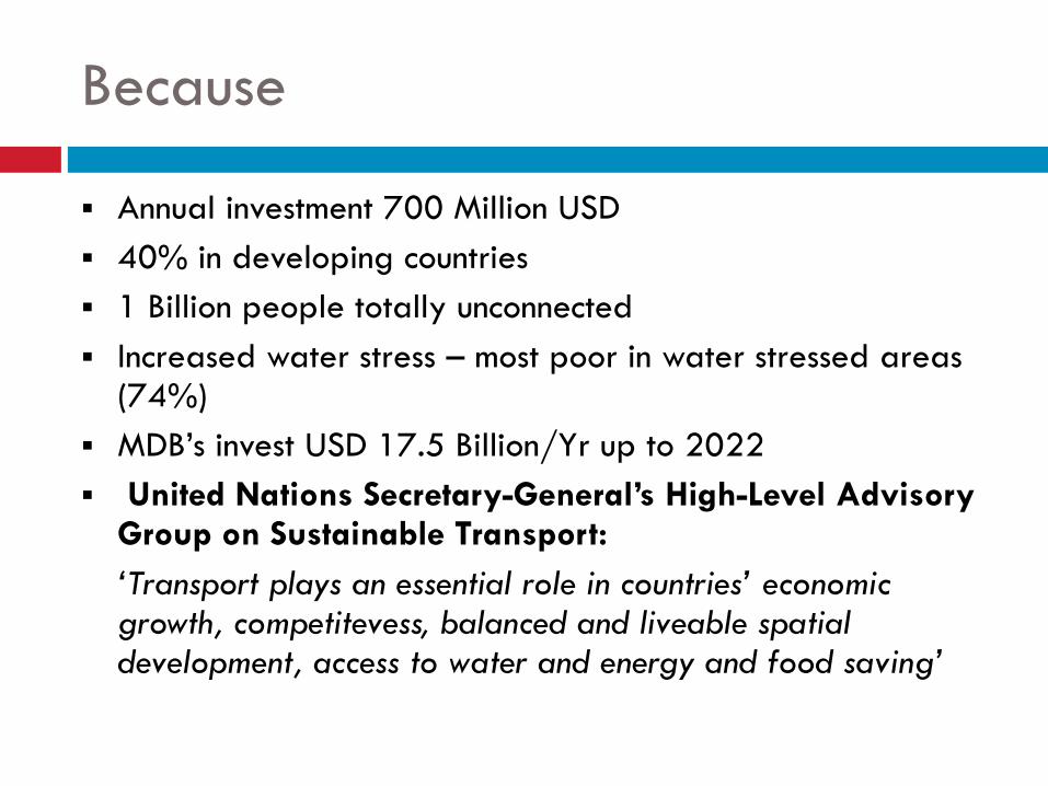
Because
Annual investment 700 Million USD
40% in developing countries
1 Billion people totally unconnected
Increased water stress – most poor in water stressed areas (74%)
MDB’s invest USD 17.5 Billion/Yr up to 2022
United Nations Secretary-General’s High-Level Advisory Group on Sustainable Transport:
‘Transport plays an essential role in countries’ economic growth, competitevess, balanced and liveable spatial development, access to water and energy and food saving’
8
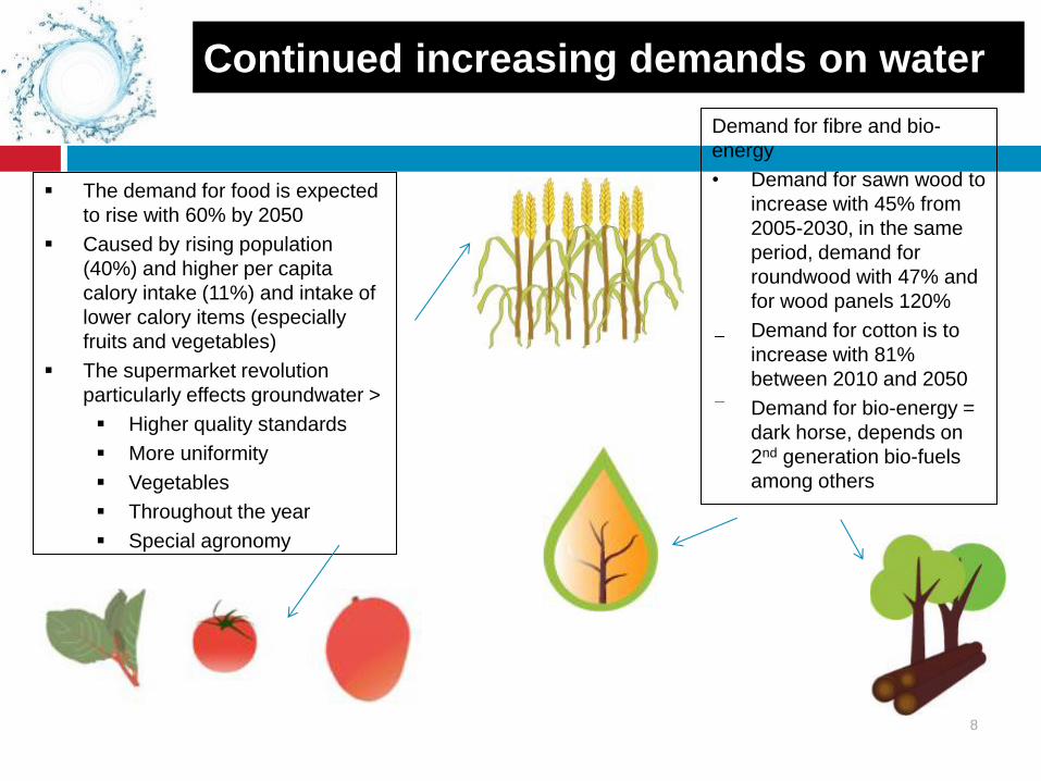
Continued increasing demands on water
The demand for food is expected
to rise with 60% by 2050
Caused by rising population
(40%) and higher per capita
calory intake (11%) and intake of
lower calory items (especially
fruits and vegetables)
The supermarket revolution
particularly effects groundwater >
Higher quality standards
More uniformity
Vegetables
Throughout the year
Special agronomy
Demand for fibre and bio-
energy
• Demand for sawn wood to
increase with 45% from
2005-2030, in the same
period, demand for
roundwood with 47% and
for wood panels 120%
Demand for cotton is to
increase with 81%
between 2010 and 2050
Demand for bio-energy =
dark horse, depends on
2nd generation bio-fuels
among others
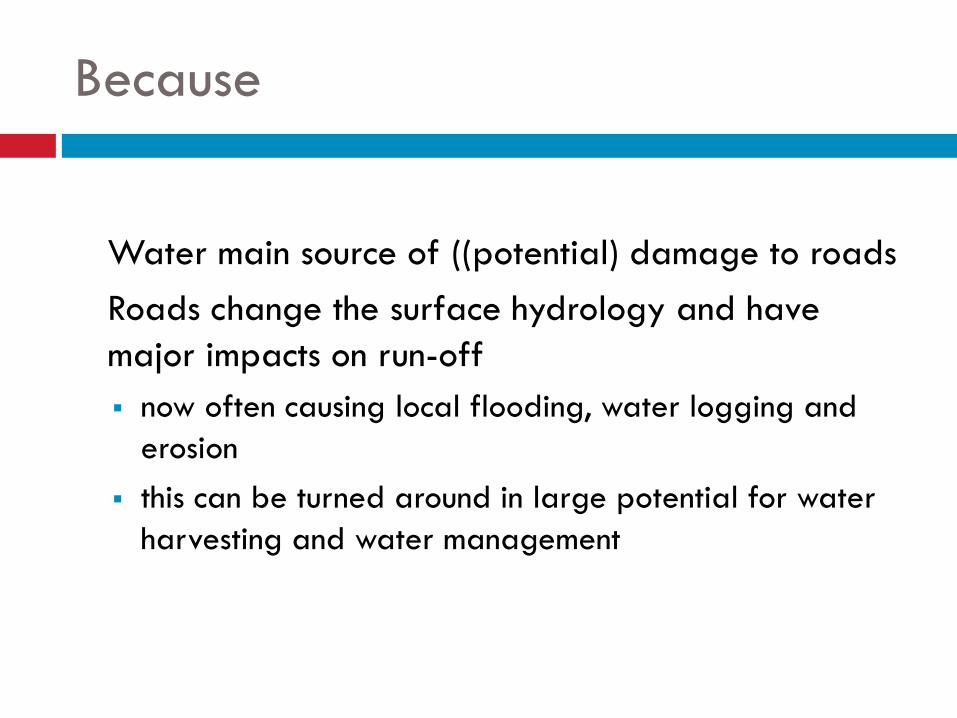
Because
Water main source of ((potential) damage to roads
Roads change the surface hydrology and have
major impacts on run-off
now often causing local flooding, water logging and
erosion
this can be turned around in large potential for water
harvesting and water management
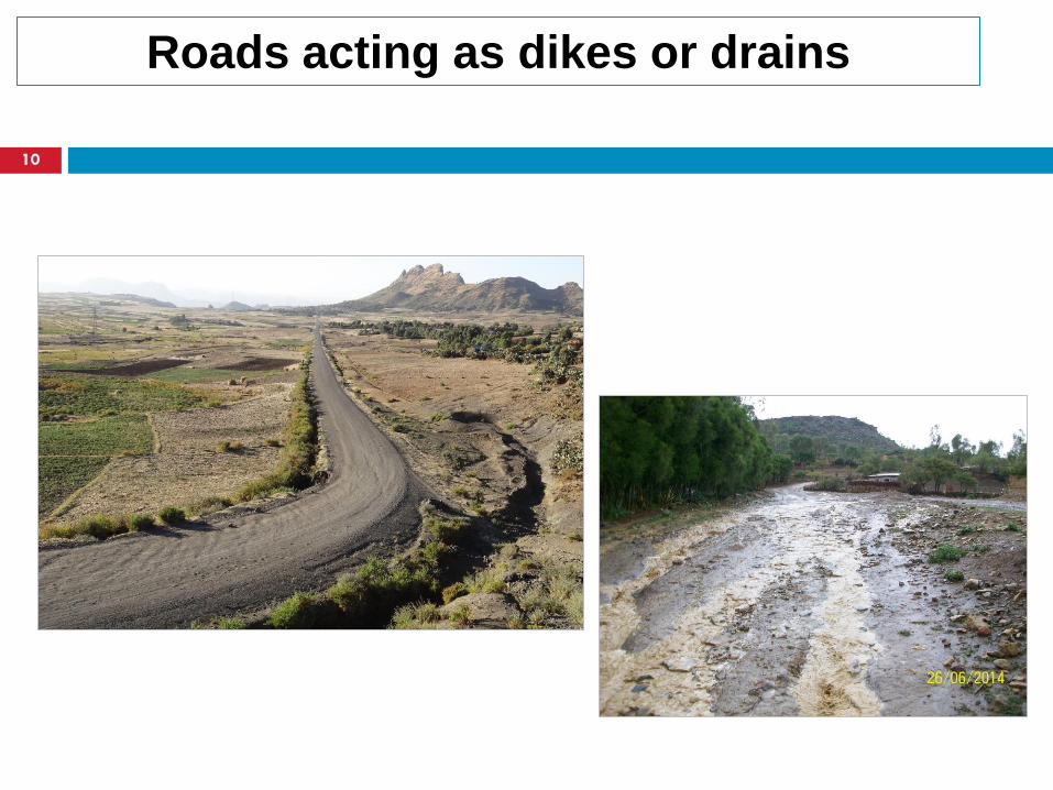
Roads acting as dikes or drains
10
Example current situation ‘roads and water as
enemies’
On average in 10 kilometer (research in Tigray, Ethiopia on highways) Erosion and sedimentation: 7.5 locations
Flooding of houses and land: 2 locations
Persistent waterlogging: 4 location
Lost opportunity to capture water 4 M m3
Unpaved roads main source of sedimenation (>10%)
Deficiencies in governance process Missing from guidelines
No coordination
No interaction with road-side stakeholders
Current situation ‘insensitive roads’
Social impacts Damage to land and property
Dust: health and loss of production
Missed opportunity
Impact on roads
Direct damage due to water
Added to this: water-related landslides
Feeder roads: huge maintenance costs due to inadequate drainage/ water management
Common cause of delay are drainage Issues (ERA)
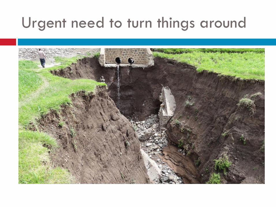
Urgent need to turn things around
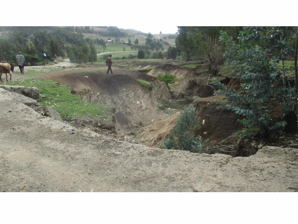
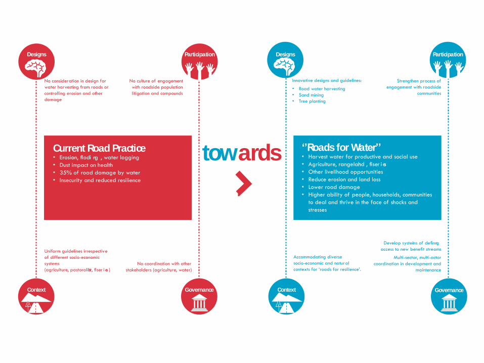
No consideration in design for
water harvesting from roads or
controlling erosion and other
damage
Innovative designs and guidelines:
•Road water harvesting
•Sand mining
•Tree planting
Current Road Practice•Erosion,floo di ng ,waterlogging
•Dust impact on health
•35% of road damage by water
•Insecurity and reduced resilience
‘’Roads for Water’’•Harvest water for productive and social use
•Agriculture,rangeland,fish er ies
•Other livelihood opportunities
•Reduce erosion and land loss
•Lower road damage
•Higher ability of people, households, communities
to deal and thrive in the face of shocks and
stresses
Uniform guidelines irrespective
of different socio-economic
systems
(agriculture,pastoralist,fish er ies )
Accommodating diverse
socio-economic and natural
contexts for ‘roads for resilience’.No coordination with other
stakeholders(agriculture,water)
Developsystemsofdefini ng
accesstonewbenefitstreams
Multi-sector, multi-actor
coordination in development and
maintenance
Governance Governance
Designs DesignsParticipation Participation
No culture of engagement
with roadside population
litigation and compounds
Strengthen process of
engagement with roadside
communities
towards
ContextContext
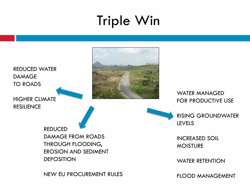
Triple Win
REDUCED WATER
DAMAGE
TO ROADS
HIGHER CLIMATE
RESILIENCE
WATER MANAGED
FOR PRODUCTIVE USE
RISING GROUNDWATER
LEVELS
INCREASED SOIL
MOISTURE
WATER RETENTION
FLOOD MANAGEMENT
REDUCED
DAMAGE FROM ROADS
THROUGH FLOODING,
EROSION AND SEDIMENT
DEPOSITION
NEW EU PROCUREMENT RULES
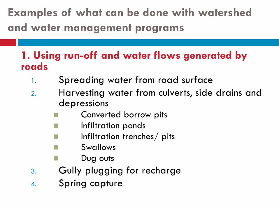
Examples of what can be done with watershed
and water management programs
1. Using run-off and water flows generated by roads
1. Spreading water from road surface
2. Harvesting water from culverts, side drains and depressions
Converted borrow pits
Infiltration ponds
Infiltration trenches/ pits
Swallows
Dug outs
3. Gully plugging for recharge
4. Spring capture
Examples of what can be done with watershed
and water management programs
2. Managing water flows with roads Water management in polders with controlled culverts
Steering fish movement
Roads doubling up as riveraine/ coastal flood embankment – synchronized
use
Flood compartimentalization
Other opportunities – by changing road
designs
3. Improving road design for multiple
functions
1 Irish bridges/ fords:
for flood water spreading
for river bed stabilization
acting as sand dams
2 Changing road alignment to recharge areas
3 Change culvert location
4 Permeable road foundations
Many other opportunities
to better use of roads for water!
4. Additional 1. Road side tree
planting
2. Reuse excavated bed material from roads for soil improvement
3. Sand harvesting along roads
4. Controlling rodents
5. Avoiding sand dune movement
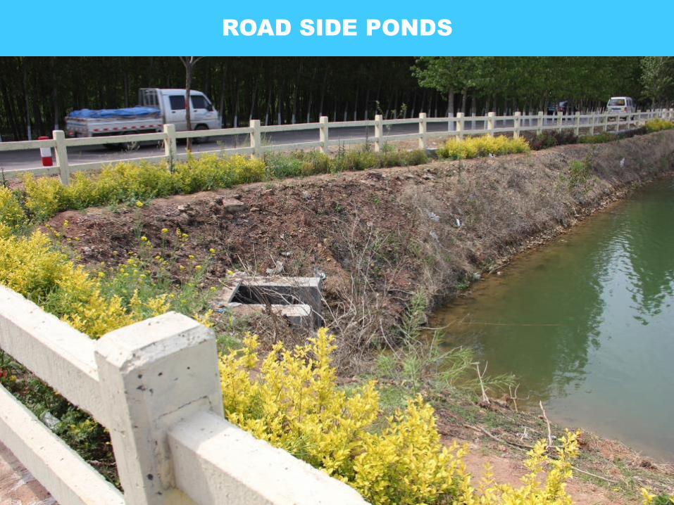
ROAD SIDE PONDS
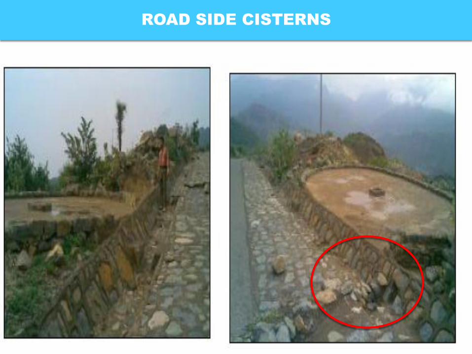
ROAD SIDE CISTERNS
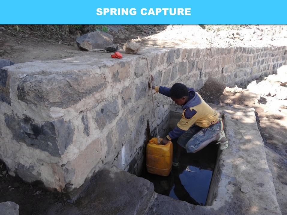
SPRING CAPTURE
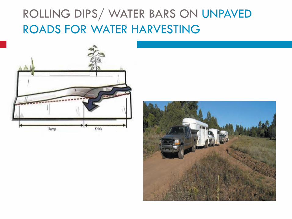
ROLLING DIPS/ WATER BARS ON UNPAVED
ROADS FOR WATER HARVESTING
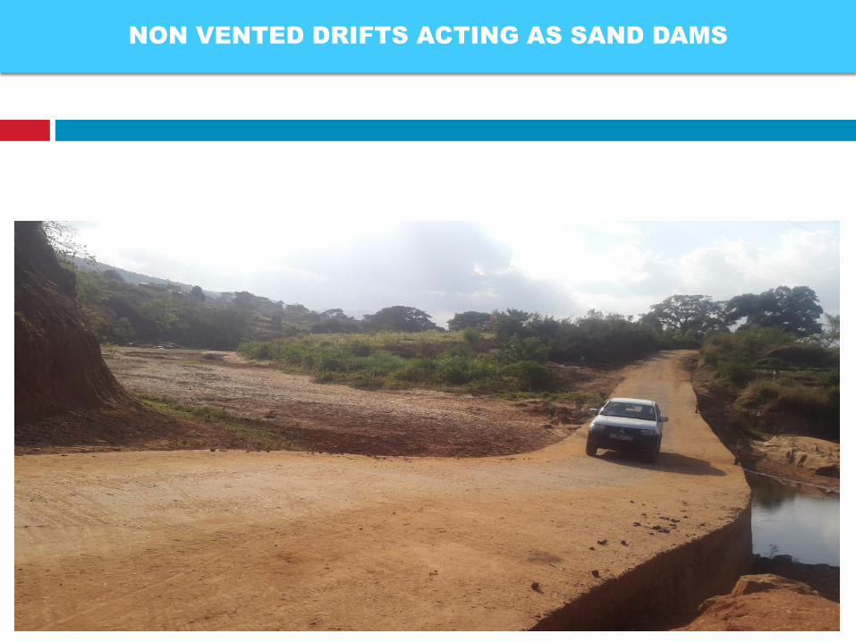
NON VENTED DRIFTS ACTING AS SAND DAMS
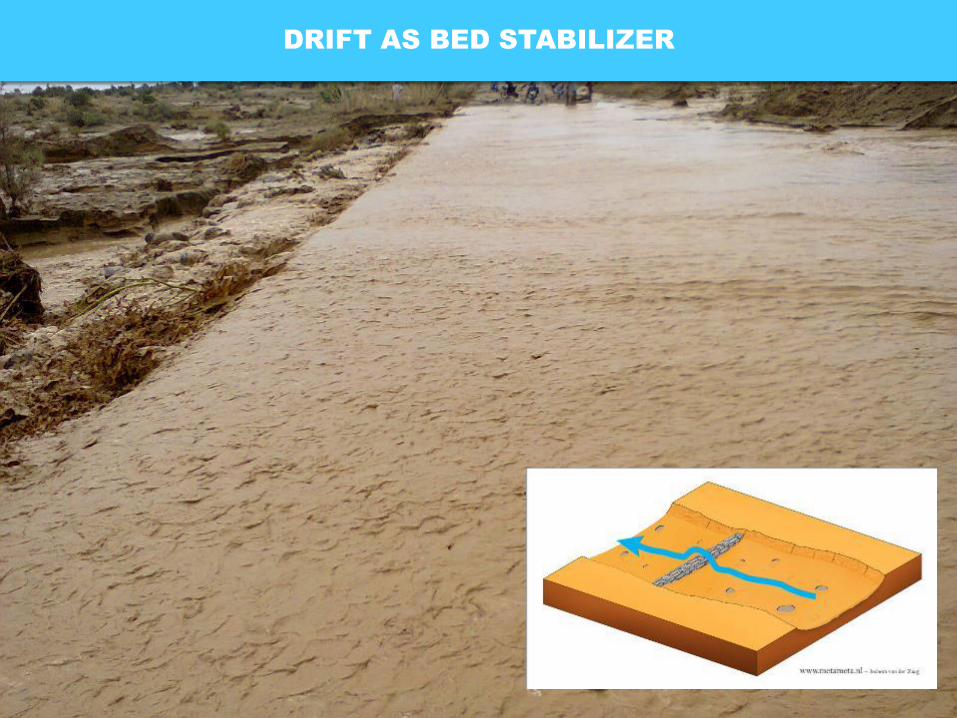
DRIFT AS BED STABILIZER
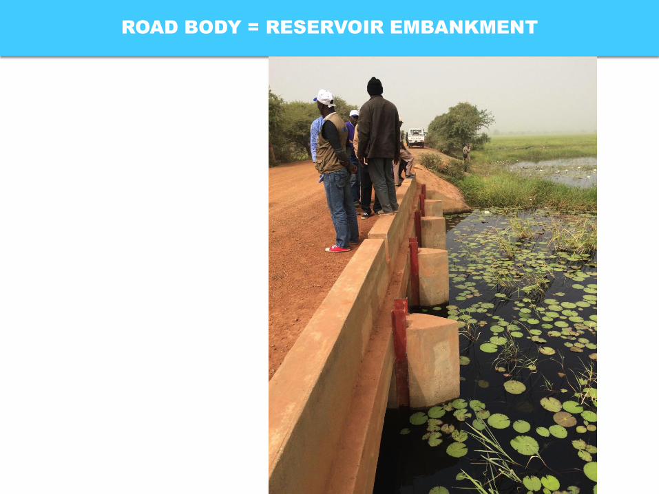
ROAD BODY = RESERVOIR EMBANKMENT
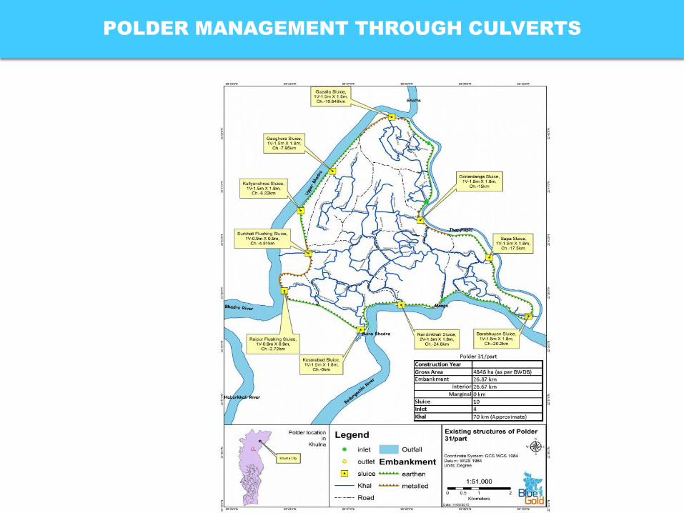
POLDER MANAGEMENT THROUGH CULVERTS
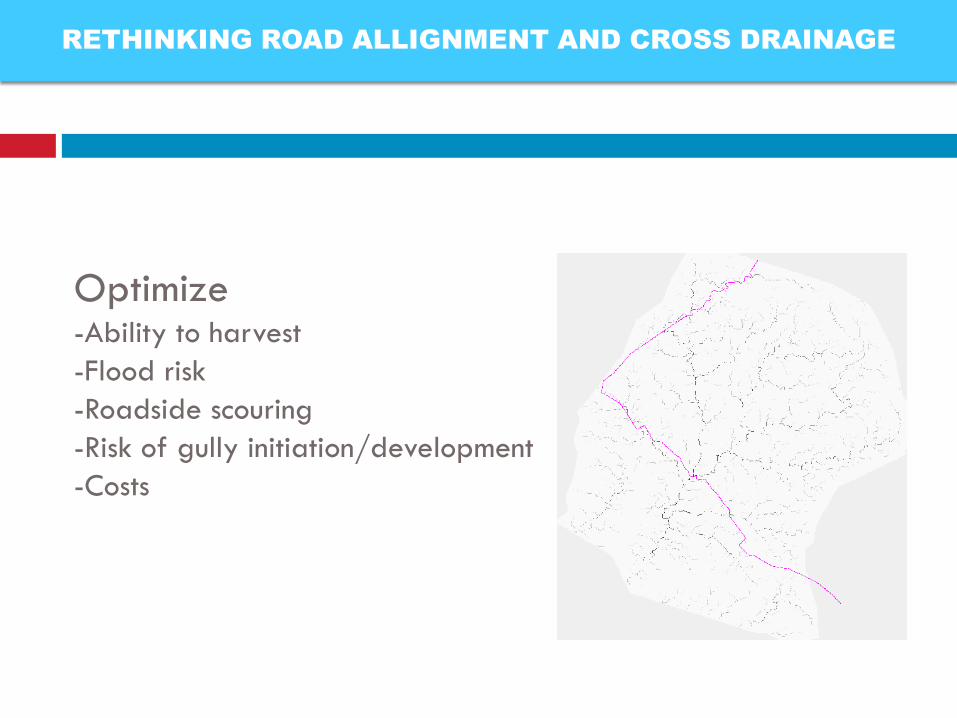
Optimize -Ability to harvest
-Flood risk
-Roadside scouring
-Risk of gully initiation/development
-Costs
RETHINKING ROAD ALLIGNMENT AND CROSS DRAINAGE
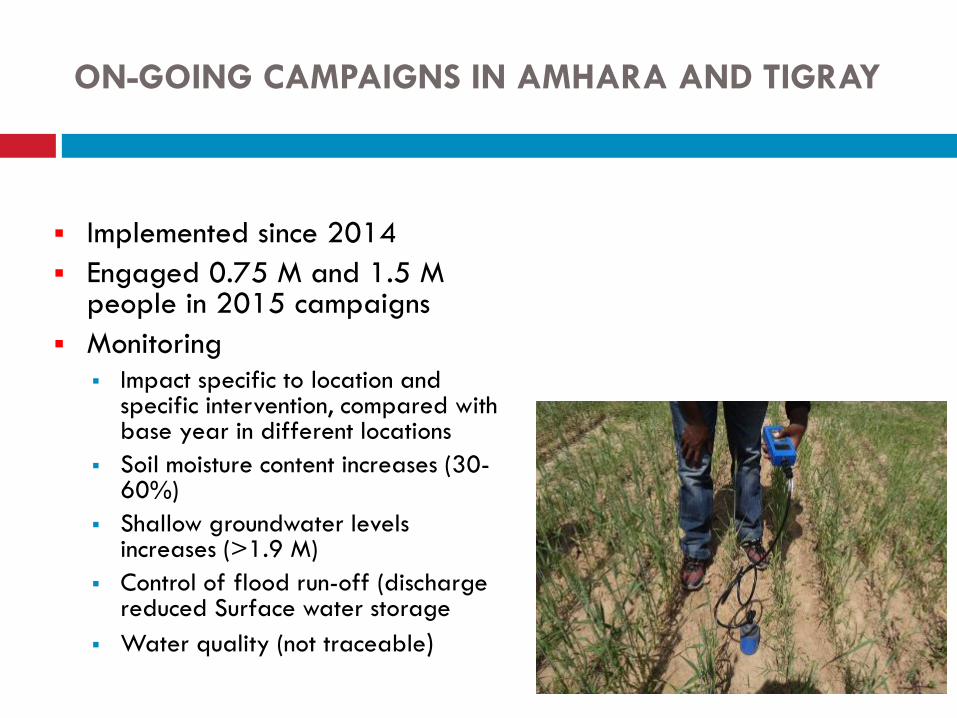
ON-GOING CAMPAIGNS IN AMHARA AND TIGRAY
Implemented since 2014
Engaged 0.75 M and 1.5 M people in 2015 campaigns
Monitoring Impact specific to location and
specific intervention, compared with base year in different locations
Soil moisture content increases (30-60%)
Shallow groundwater levels increases (>1.9 M)
Control of flood run-off (discharge reduced Surface water storage
Water quality (not traceable)
33
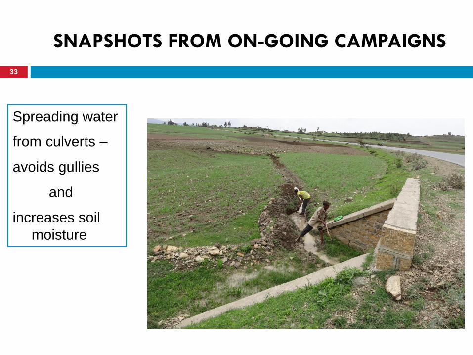
SNAPSHOTS FROM ON-GOING CAMPAIGNS
Spreading water
from culverts –
avoids gullies
and
increases soil
moisture
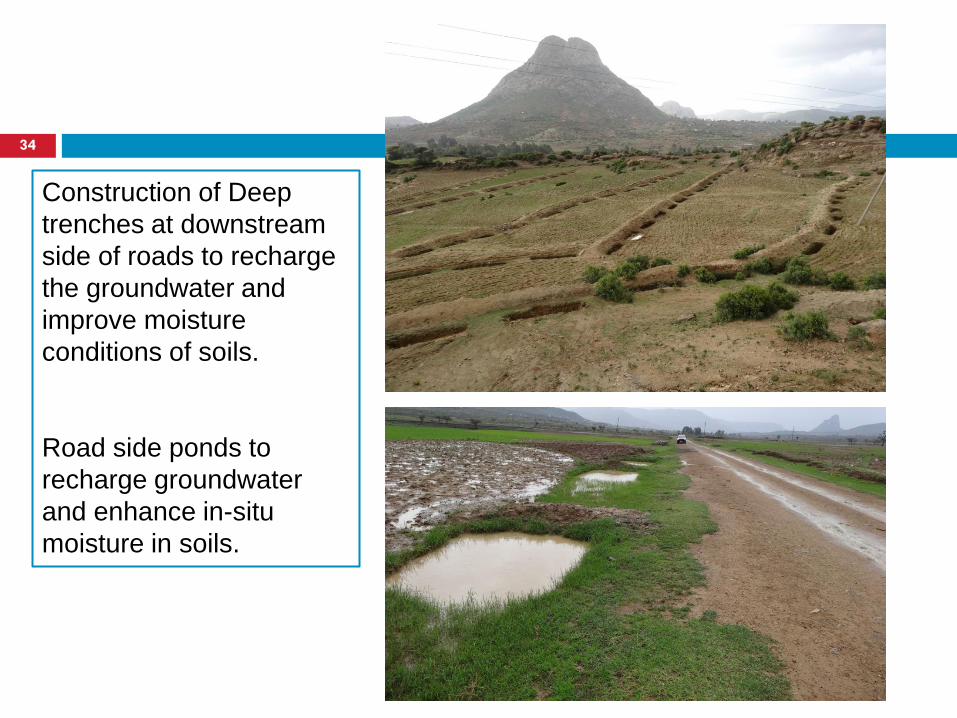
Construction of Deep
trenches at downstream
side of roads to recharge
the groundwater and
improve moisture
conditions of soils.
Road side ponds to
recharge groundwater
and enhance in-situ
moisture in soils.
34
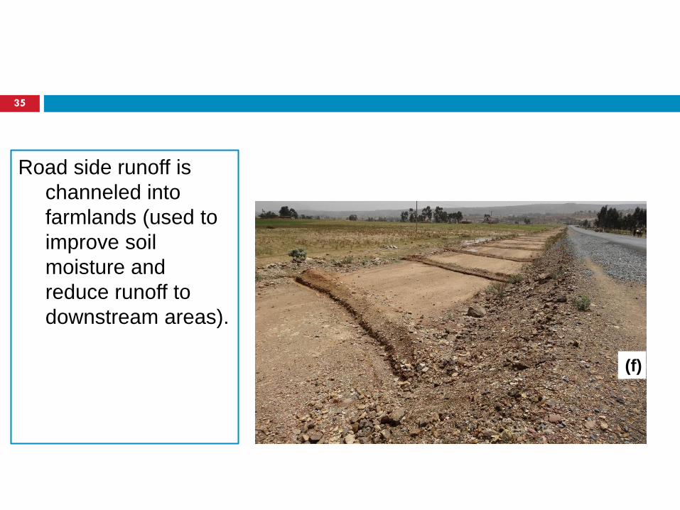
Road side runoff is
channeled into
farmlands (used to
improve soil
moisture and
reduce runoff to
downstream areas).
35
(f)
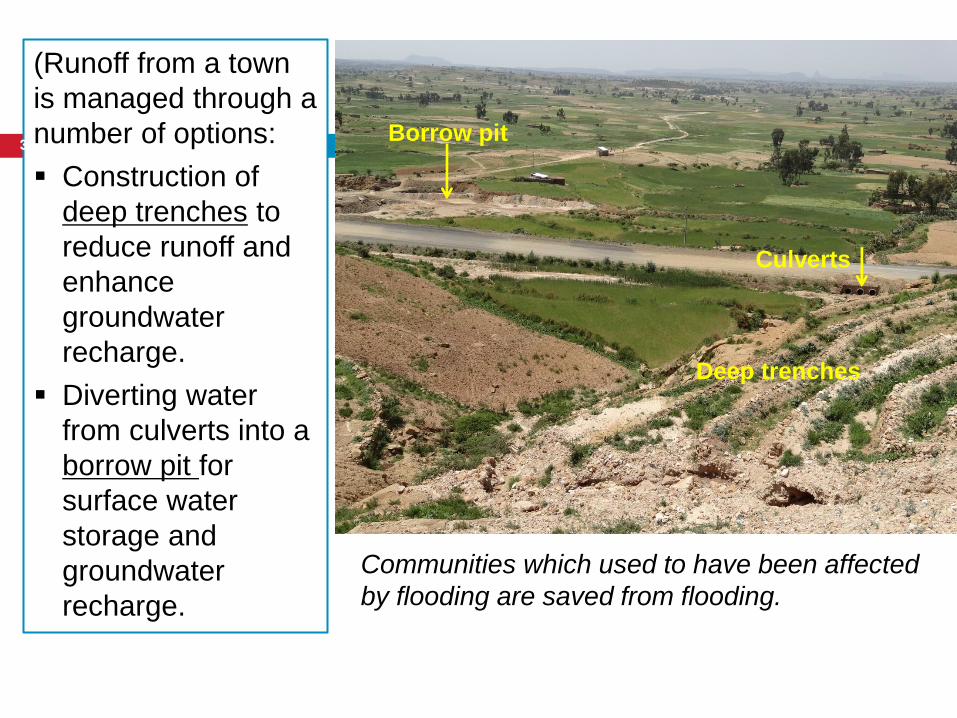
Deep trenches
Culverts
Borrow pit
(Runoff from a town
is managed through a
number of options:
Construction of
deep trenches to
reduce runoff and
enhance
groundwater
recharge.
Diverting water
from culverts into a
borrow pit for
surface water
storage and
groundwater
recharge.
Communities which used to have been affected
by flooding are saved from flooding.
36
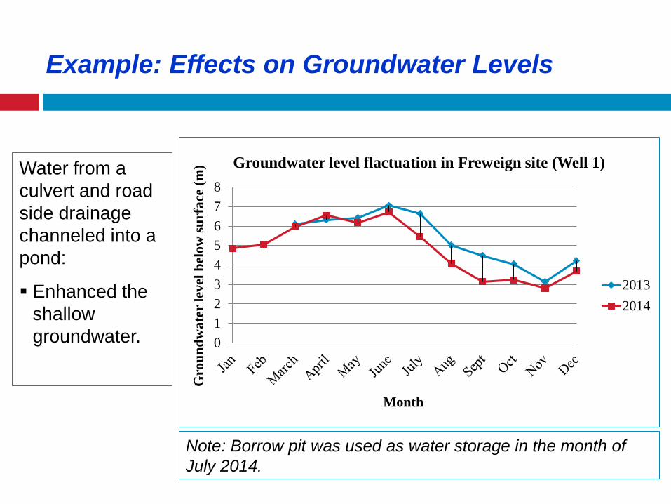
Note: Borrow pit was used as water storage in the month of
July 2014.
Water from a
culvert and road
side drainage
channeled into a
pond:
Enhanced the
shallow
groundwater.
0
1
2
3
4
5
6
7
8G
rou
nd
wate
r le
vel
bel
ow
su
rfa
ce (
m)
Month
Groundwater level flactuation in Freweign site (Well 1)
2013
2014
Example: Effects on Groundwater Levels
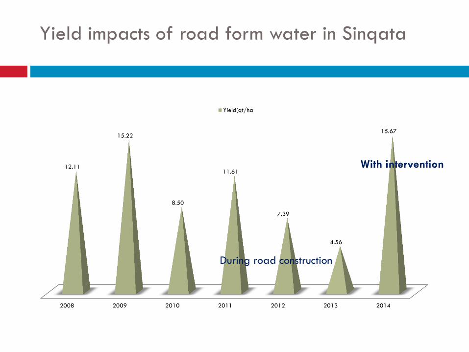
Yield impacts of road form water in Sinqata
2008 2009 2010 2011 2012 2013 2014
12.11
15.22
8.50
11.61
7.39
4.56
15.67
With intervention
Yield(qt/ha
During road construction
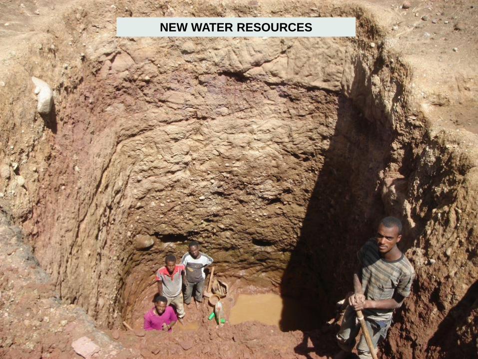
NEW WATER RESOURCES
Climate resilient roads should not only mean making more
costly and weather-proof roads, but (at zero net cost) make the
entire area resilient
Institutionally there is often no link among water, road and land
sectors but this should change
In modified guidelines and designs
In budget procedures
In capacity building and governance
• Need to create in different condition close linkages – requires
different techniques
40
Observations
41
www.metameta.nl
Need to balance
Road costs
Road functionality
Road safety
Reduced/ zero damage to surrounding area
Optimized water use around roads (depending on
the area)
Drainage design and road surfaces
Location of drains
Length of drains
Sand harvesting from drains
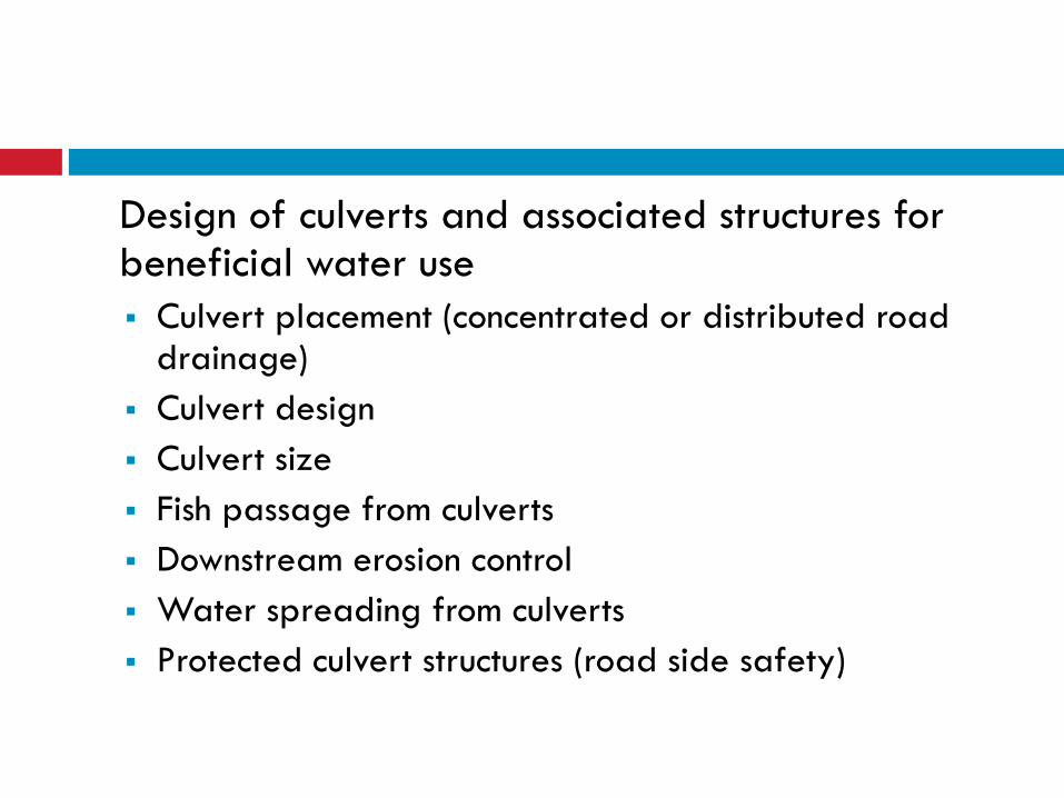
Design of culverts and associated structures for beneficial water use
Culvert placement (concentrated or distributed road drainage)
Culvert design
Culvert size
Fish passage from culverts
Downstream erosion control
Water spreading from culverts
Protected culvert structures (road side safety)
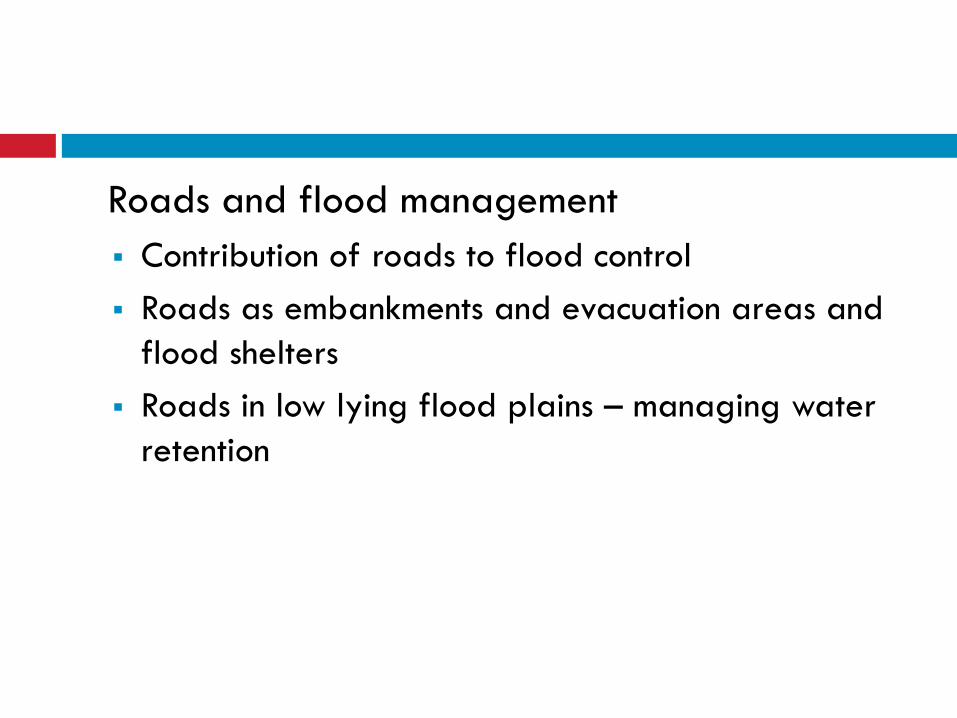
Roads and flood management
Contribution of roads to flood control
Roads as embankments and evacuation areas and
flood shelters
Roads in low lying flood plains – managing water
retention
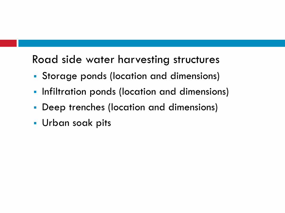
Road side water harvesting structures
Storage ponds (location and dimensions)
Infiltration ponds (location and dimensions)
Deep trenches (location and dimensions)
Urban soak pits
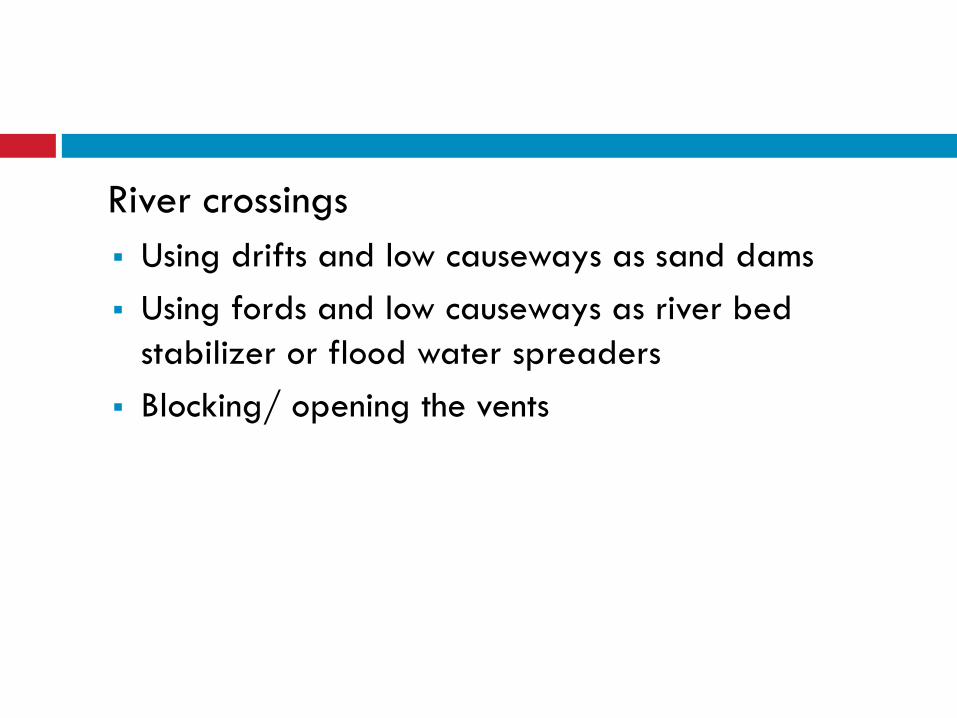
River crossings
Using drifts and low causeways as sand dams
Using fords and low causeways as river bed
stabilizer or flood water spreaders
Blocking/ opening the vents
Spring capture and protection
Spring protection
Safe channeling
Reusing borrow pits and quarries for water
storage
Location of borrow pits
Landscaping and protection of borrow pits
Use of spill ways
Borrow pits in high water table areas
Landscape management around roads
Erosion and run-off control
Avoiding and preventing landslides
Avoiding sand dune movement
Using borrow material
Managing road side vegetation
Dust capture and sediment control by trees and
grasses
Ensuring visibility for road users
Distance from roads and bends (road safety)
Selection of trees
Selection of grasses and other vegetation
Management of road side tree plantation
Do’s and dont’s
Reviewing designs
Ensuring road stability and road safety
Avoiding damage to surrounding areas
Optimizing beneficial use of water
Finding the opportunities:
Roads for harvesting water
Roads for flood protection
Roads for controlled drainage and water table
control
Roadside vegetatation
Governance and management
How to integrate?
In modified guidelines and designs
In planning and budget procedures
In capacity building and training

Ideas and experiences?
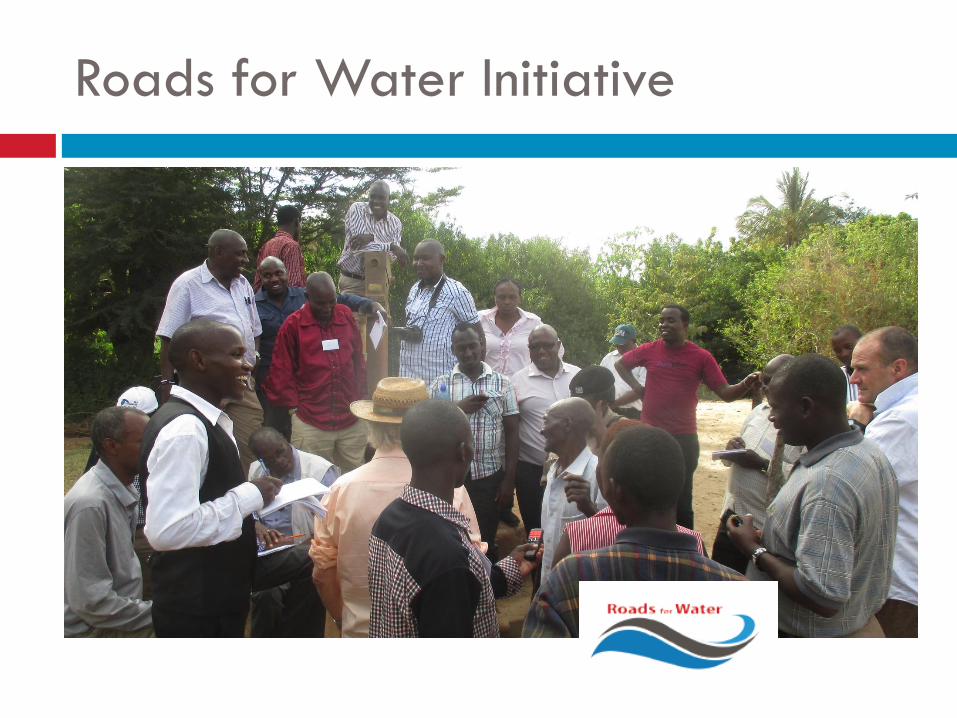
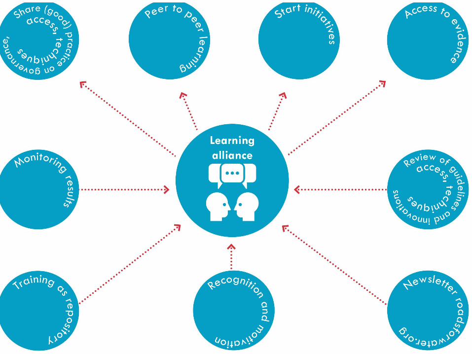
Roads for Water Initiative
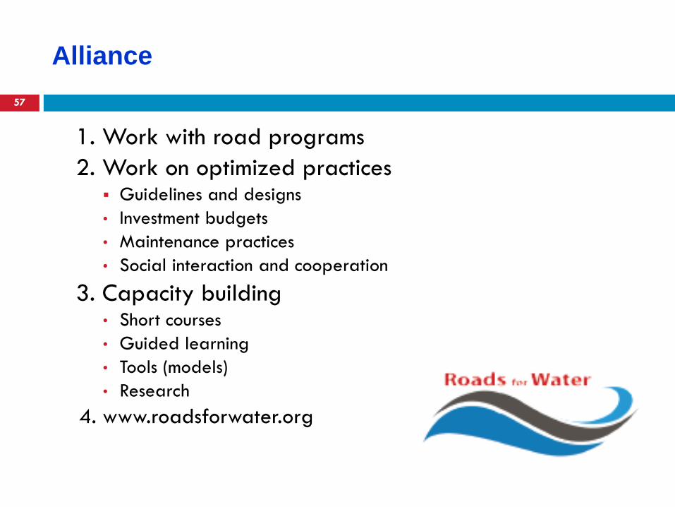
Alliance
57
1. Work with road programs
2. Work on optimized practices Guidelines and designs
• Investment budgets
• Maintenance practices
• Social interaction and cooperation
3. Capacity building • Short courses
• Guided learning
• Tools (models)
• Research
4. www.roadsforwater.org