Embed Size (px)
Citation preview
WEATHER PATTERNS AND SEVERE STORMS (CHAPTER 19)
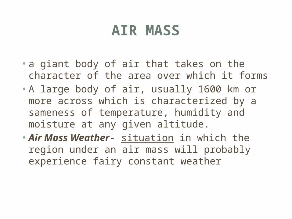
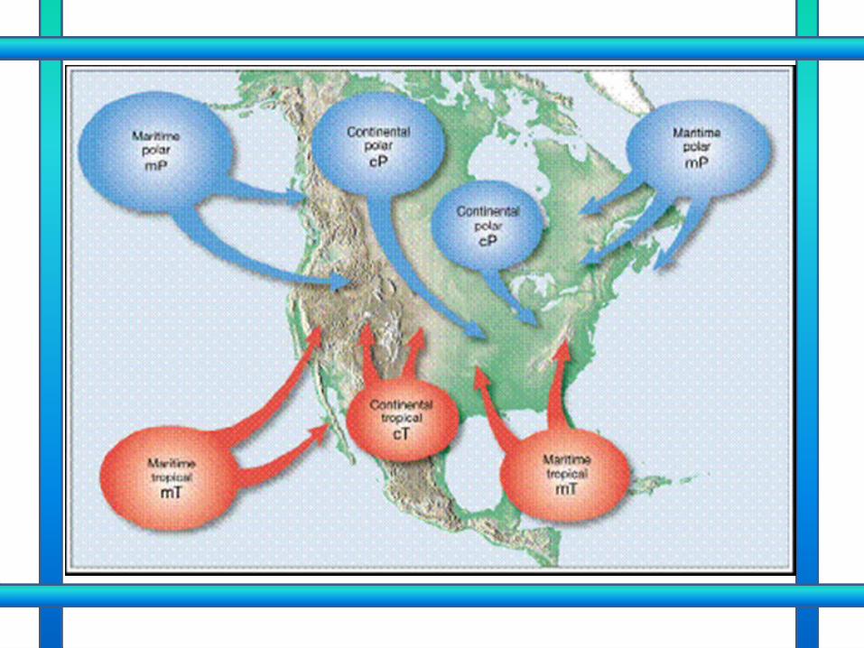
AIR MASS
• a giant body of air that takes on the character of the area over which it forms• A large body of air, usually 1600 km or more
across which is characterized by a sameness of temperature, humidity and moisture at any given altitude.• Air Mass Weather- situation in which the region
under an air mass will probably experience fairy constant weather
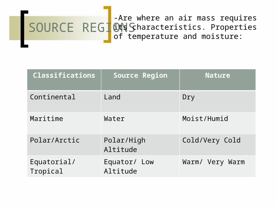
SOURCE REGIONS
Classifications Source Region Nature
Continental Land Dry
Maritime Water Moist/Humid
Polar/Arctic Polar/High Altitude Cold/Very Cold
Equatorial/Tropical Equator/ Low Altitude
Warm/ Very Warm
-Are where an air mass requires its characteristics. Properties of temperature and moisture:
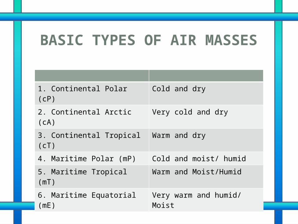
BASIC TYPES OF AIR MASSES
1. Continental Polar (cP) Cold and dry
2. Continental Arctic (cA) Very cold and dry
3. Continental Tropical (cT) Warm and dry
4. Maritime Polar (mP) Cold and moist/ humid
5. Maritime Tropical (mT) Warm and Moist/Humid
6. Maritime Equatorial (mE) Very warm and humid/ Moist
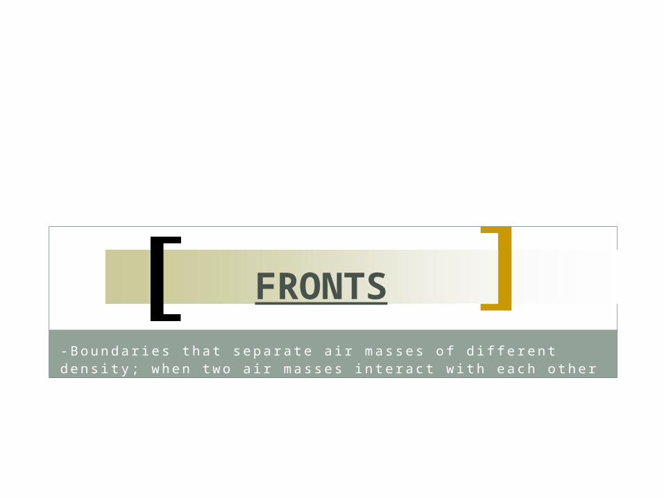
-Boundar ies tha t sepa ra te a i r masses o f d iff e rent dens i ty ; when two a i r masses in te rac t w i th each o the r
FRONTS
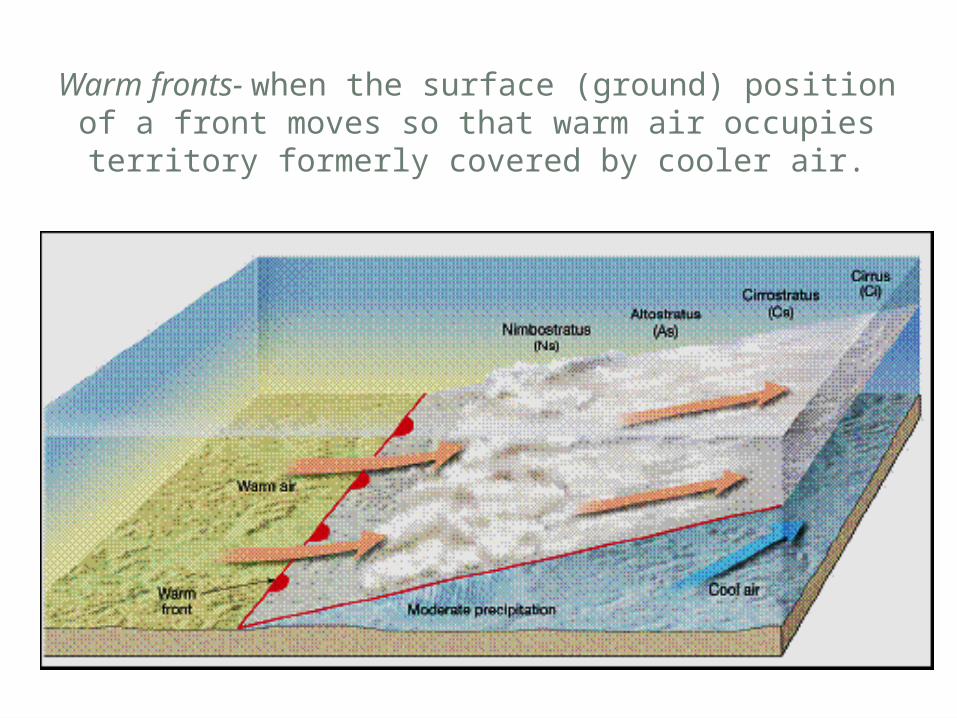
Warm fronts- when the surface (ground) position of a front moves so that warm air occupies
territory formerly covered by cooler air.
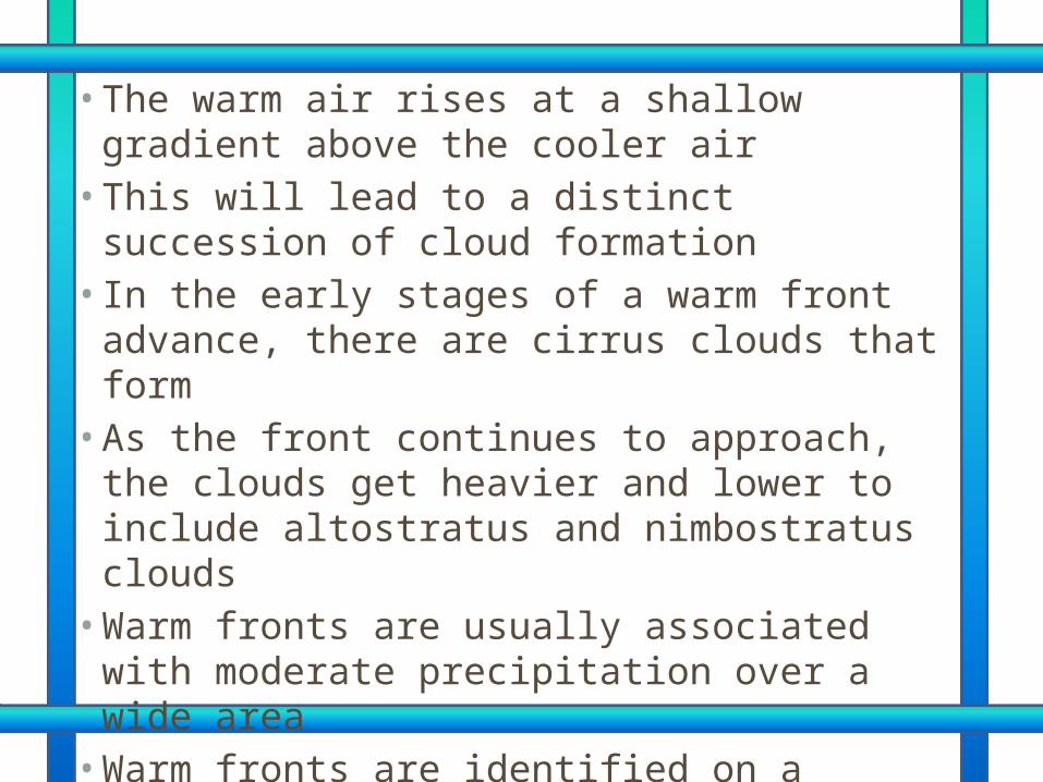
• The warm air rises at a shallow gradient above the cooler air • This will lead to a distinct succession of
cloud formation • In the early stages of a warm front advance,
there are cirrus clouds that form • As the front continues to approach, the
clouds get heavier and lower to include altostratus and nimbostratus clouds • Warm fronts are usually associated with
moderate precipitation over a wide area • Warm fronts are identified on a weather map
by a line with semicircles on it
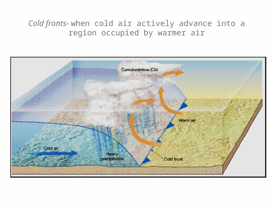
Cold fronts- when cold air actively advance into a region occupied by warmer air
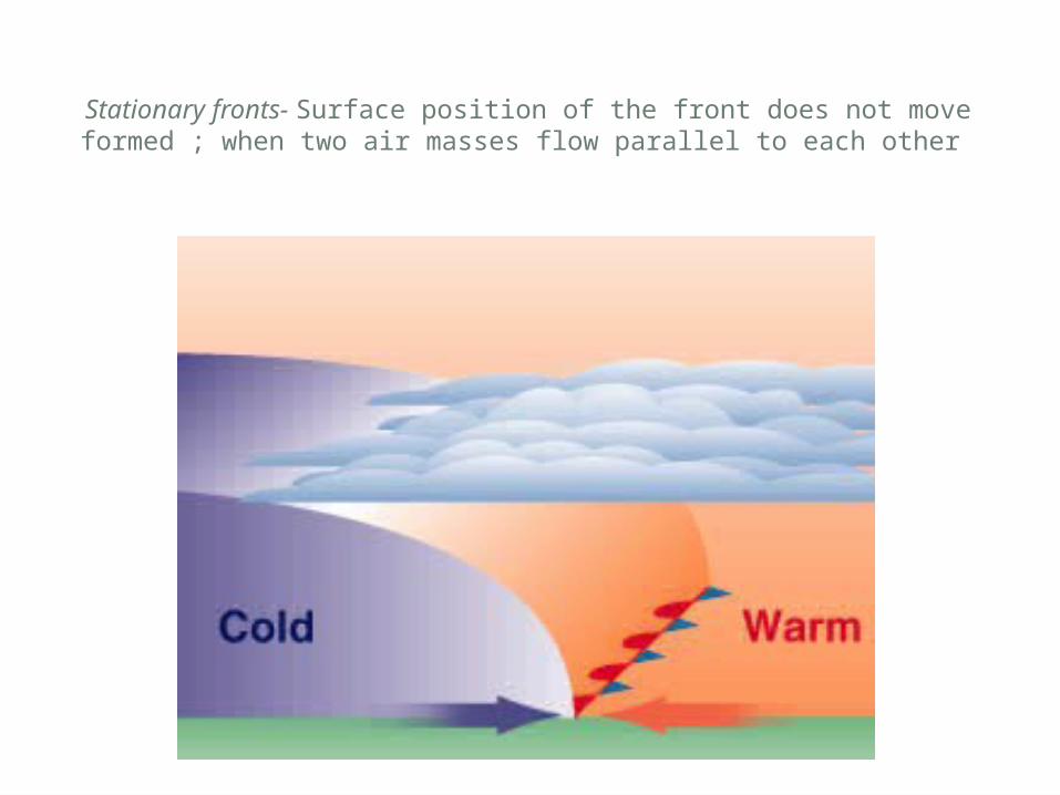
Stationary fronts- Surface position of the front does not move formed ; when two air masses flow parallel to each other
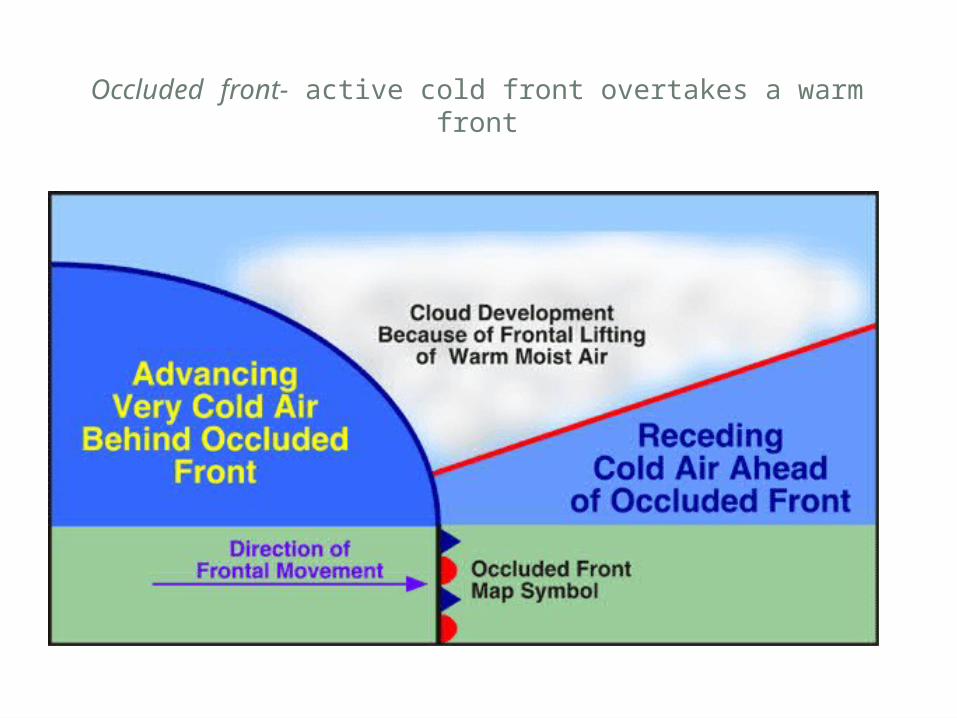
Occluded front- active cold front overtakes a warm front
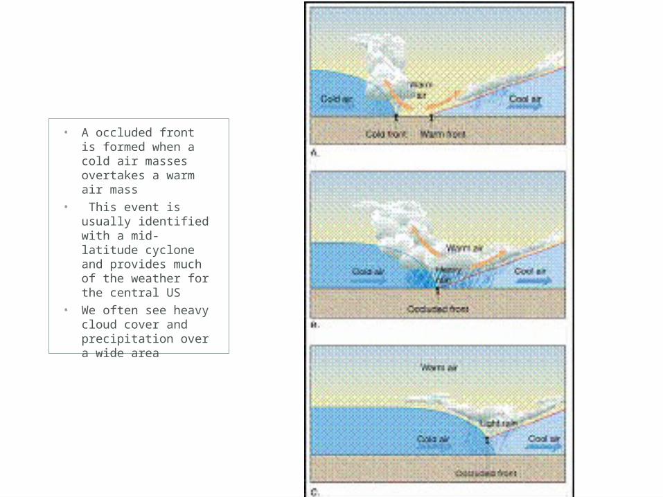
• A occluded front is formed when a cold air masses overtakes a warm air mass
• This event is usually identified with a mid-latitude cyclone and provides much of the weather for the central US
• We often see heavy cloud cover and precipitation over a wide area
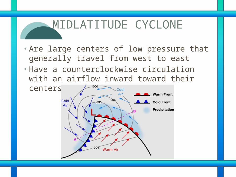
MIDLATITUDE CYCLONE
• Are large centers of low pressure that generally travel from west to east• Have a counterclockwise circulation with an
airflow inward toward their centers
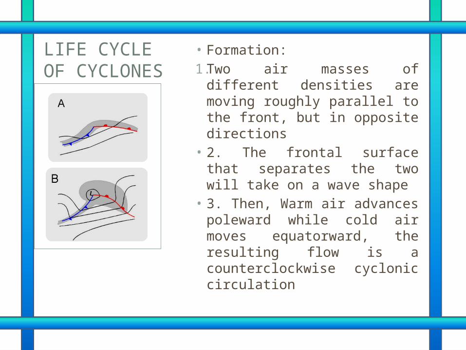
• Formation:1.Two air masses of different
densities are moving roughly parallel to the front, but in opposite directions
• 2. The frontal surface that separates the two will take on a wave shape
• 3. Then, Warm air advances poleward while cold air moves equatorward, the resulting flow is a counterclockwise cyclonic circulation
LIFE CYCLE OF CYCLONES
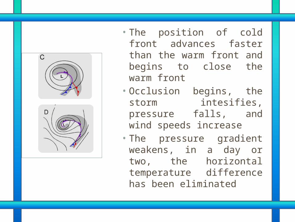
• The position of cold front advances faster than the warm front and begins to close the warm front
• Occlusion begins, the storm intesifies, pressure falls, and wind speeds increase
• The pressure gradient weakens, in a day or two, the horizontal temperature difference has been eliminated
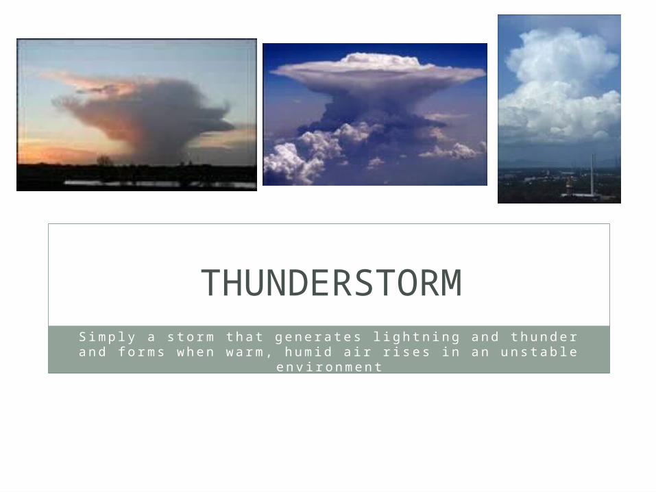
THUNDERSTORM
S i m p l y a s t o rm t h a t g e n e r a t e s l i g h t n i n g a n d t h u n d e r a n d f o rm s w h e n w a rm , h u m i d a i r r i s e s i n a n u n s t a b l e e n v i ro n m e n t
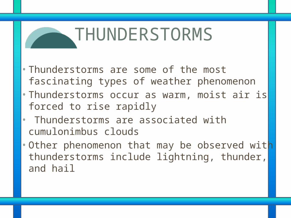
THUNDERSTORMS
• Thunderstorms are some of the most fascinating types of weather phenomenon • Thunderstorms occur as warm, moist air is forced
to rise rapidly• Thunderstorms are associated with
cumulonimbus clouds • Other phenomenon that may be observed with
thunderstorms include lightning, thunder, and hail
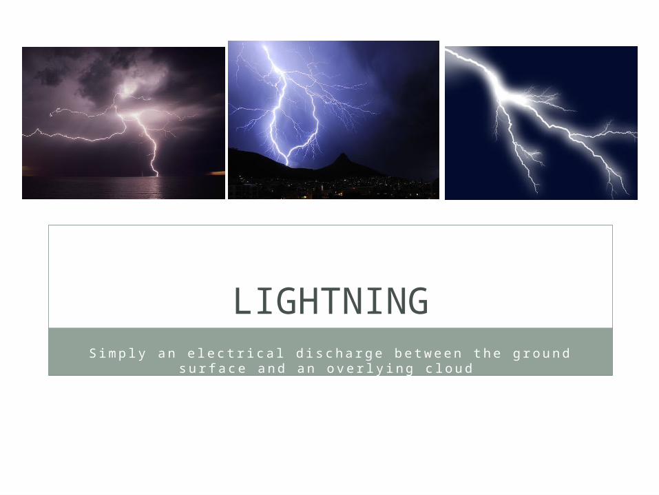
LIGHTNINGS i m p l y a n e l e c t r i c a l d i s c h a rg e b e t w e e n t h e g ro u n d s u r f a c e
a n d a n o v e r l y i n g c l o u d
LIGHTNING• a cumulonimbus clouds drifts over the
earth’s surface, positively charged ions migrate to the top of the cloud while negatively charged ions migrate to the bottom• The earth has an overall positive electrical
charge • If the charge imbalance between the
bottom of the cloud and the ground surface is great enough, an electrical current is produced
THUNDER
• When a lightning strike occurs, it heats the air up to 50,000 degrees! • Thus rapid heating causes the air to
expand outward, producing a sound wave • –The wave propagates through the
compressions and expansion of the air • –Similar to a primary (P) seismic wave
TORNADOES
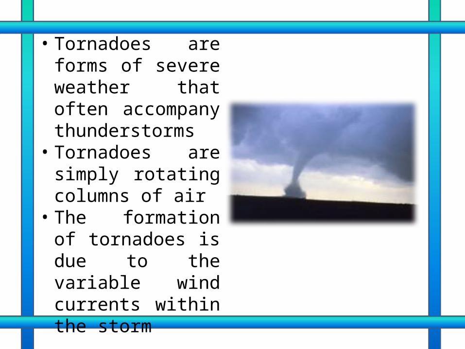
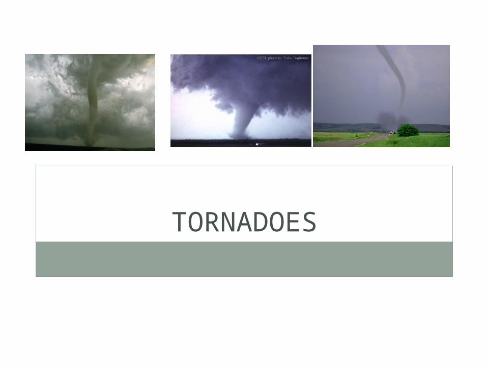
• Tornadoes are forms of severe weather that often accompany thunderstorms
• Tornadoes are simply rotating columns of air
• The formation of tornadoes is due to the variable wind currents within the storm
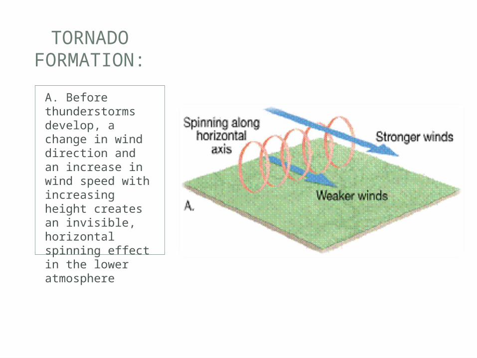
A. Before thunderstorms develop, a change in wind direction and an increase in wind speed with increasing height creates an invisible, horizontal spinning effect in the lower atmosphere
TORNADO FORMATION:
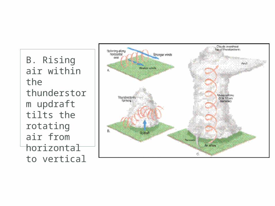
B. Rising air within the thunderstorm updraft tilts the rotating air from horizontal to vertical
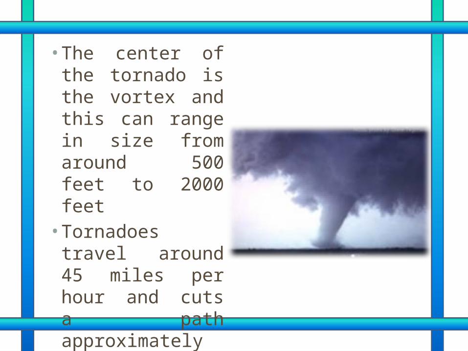
• The center of the tornado is the vortex and this can range in size from around 500 feet to 2000 feet • Tornadoes travel
around 45 miles per hour and cuts a path approximately 6 miles in length
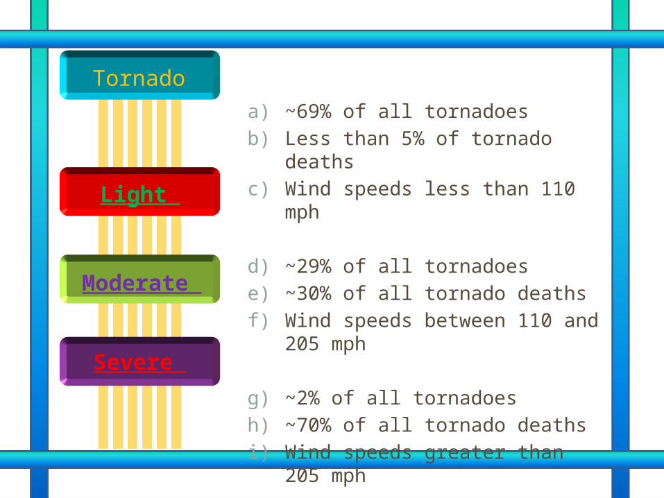
a) ~69% of all tornadoes b) Less than 5% of tornado deaths c) Wind speeds less than 110 mph
d) ~29% of all tornadoes e) ~30% of all tornado deaths f) Wind speeds between 110 and
205 mph
g) ~2% of all tornadoes h) ~70% of all tornado deaths i) Wind speeds greater than 205
mph
Light
Moderate
Severe
Tornado
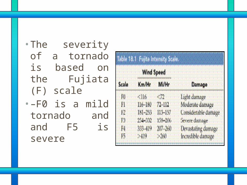
• The severity of a tornado is based on the Fujiata (F) scale • –F0 is a mild
tornado and and F5 is severe
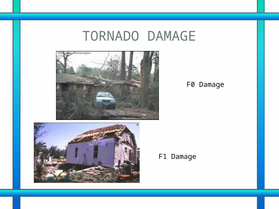
TORNADO DAMAGE
F0 Damage
F1 Damage
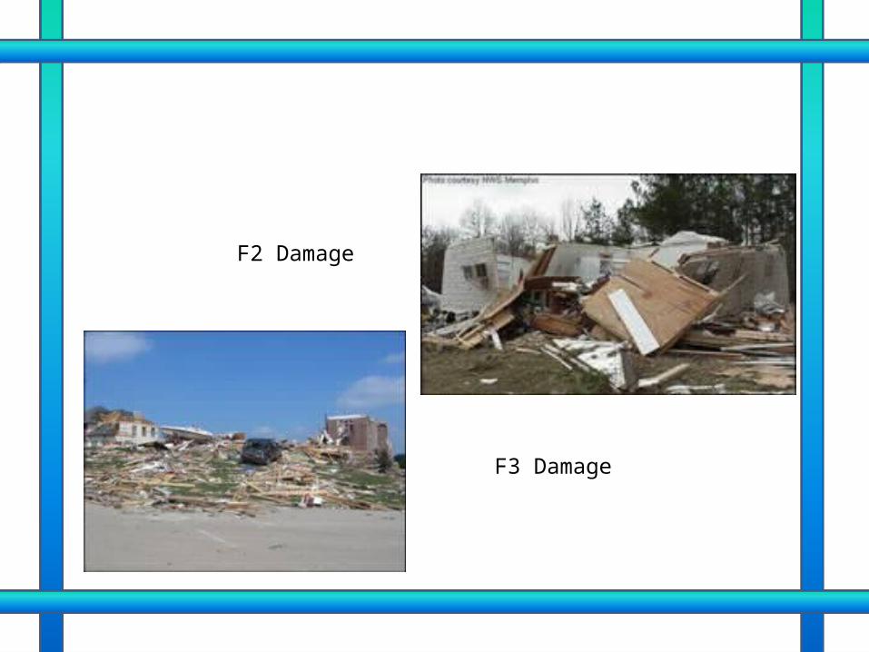
F2 Damage
F3 Damage
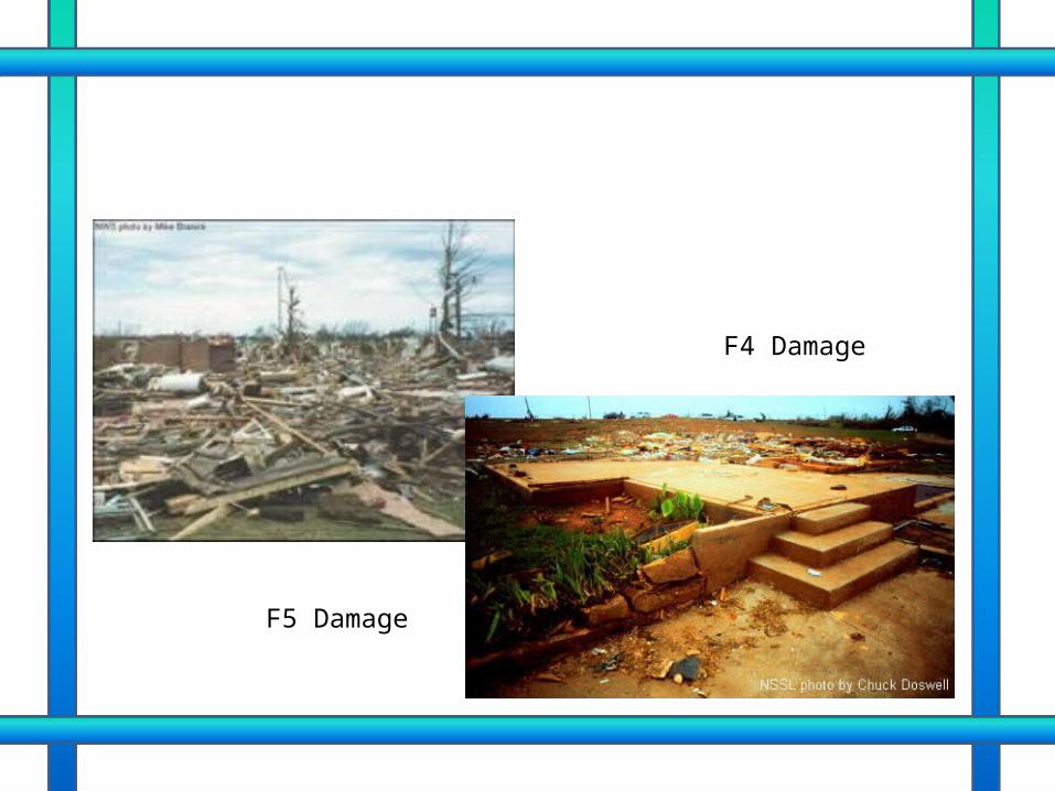
F4 Damage
F5 Damage
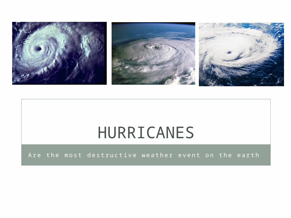
HURRICANESAre the mos t des t ruc t i ve weathe r event on the ea r th
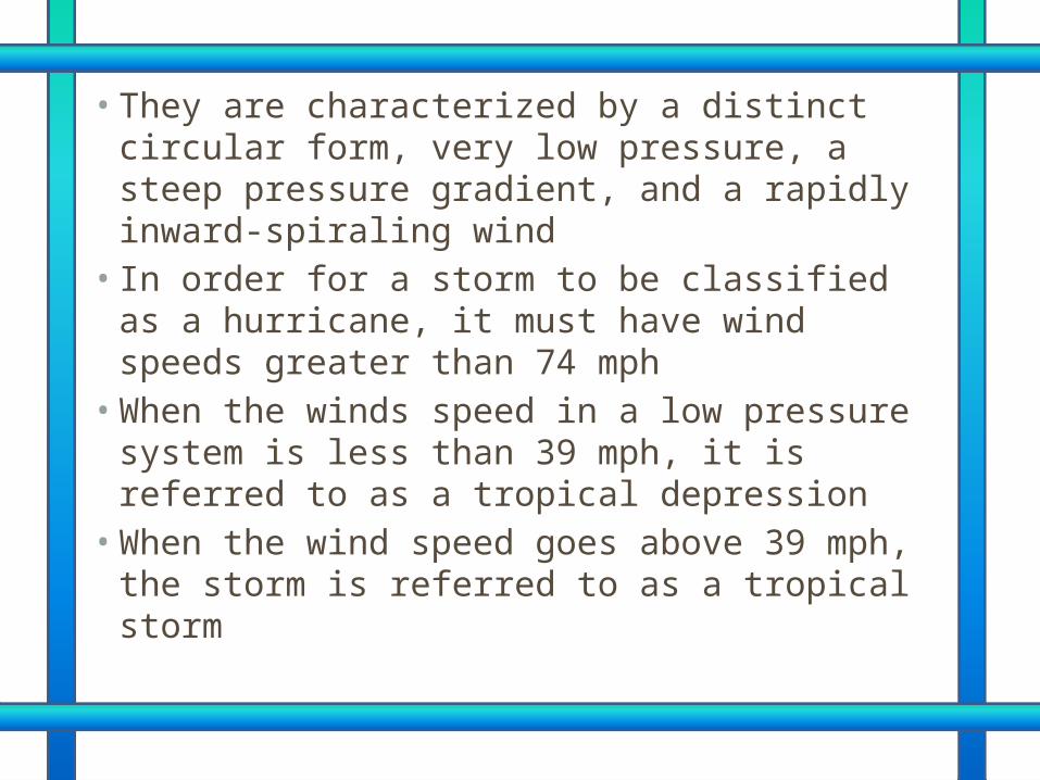
• They are characterized by a distinct circular form, very low pressure, a steep pressure gradient, and a rapidly inward-spiraling wind • In order for a storm to be classified as a
hurricane, it must have wind speeds greater than 74 mph • When the winds speed in a low pressure
system is less than 39 mph, it is referred to as a tropical depression • When the wind speed goes above 39 mph, the
storm is referred to as a tropical storm
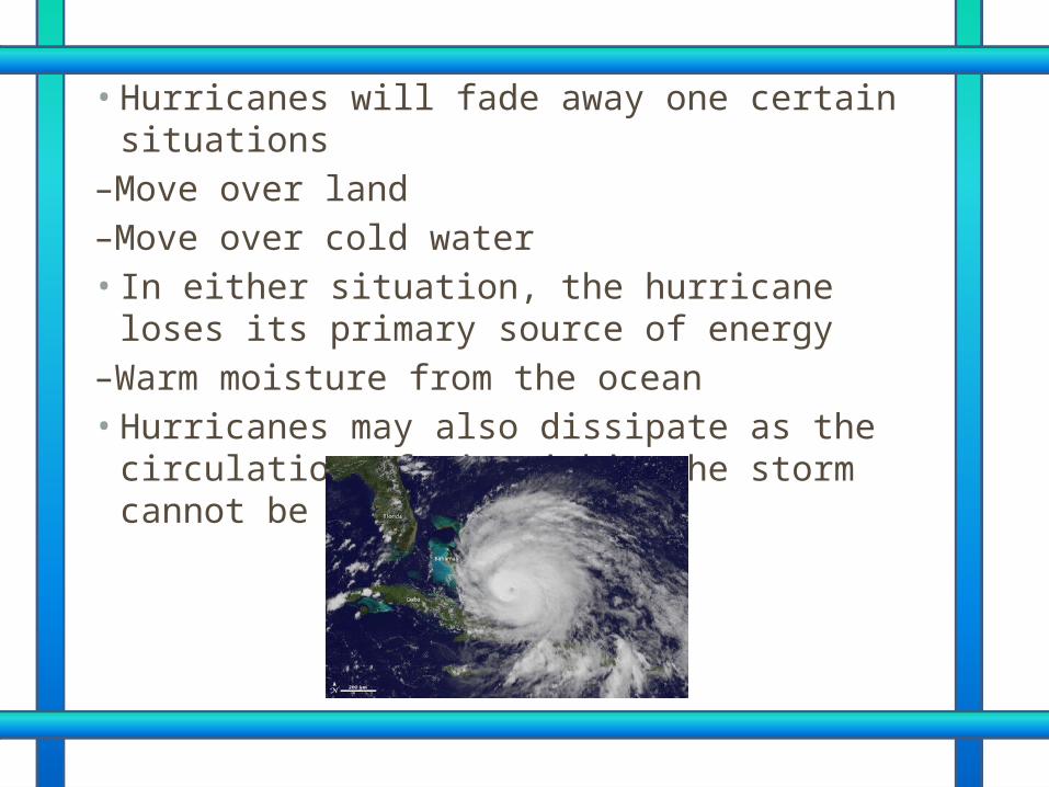
• Hurricanes will fade away one certain situations
–Move over land –Move over cold water • In either situation, the hurricane loses its
primary source of energy –Warm moisture from the ocean • Hurricanes may also dissipate as the
circulation of air within the storm cannot be maintained
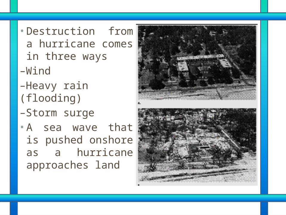
• Destruction from a hurricane comes in three ways
–Wind –Heavy rain (flooding) –Storm surge • A sea wave that is
pushed onshore as a hurricane approaches land
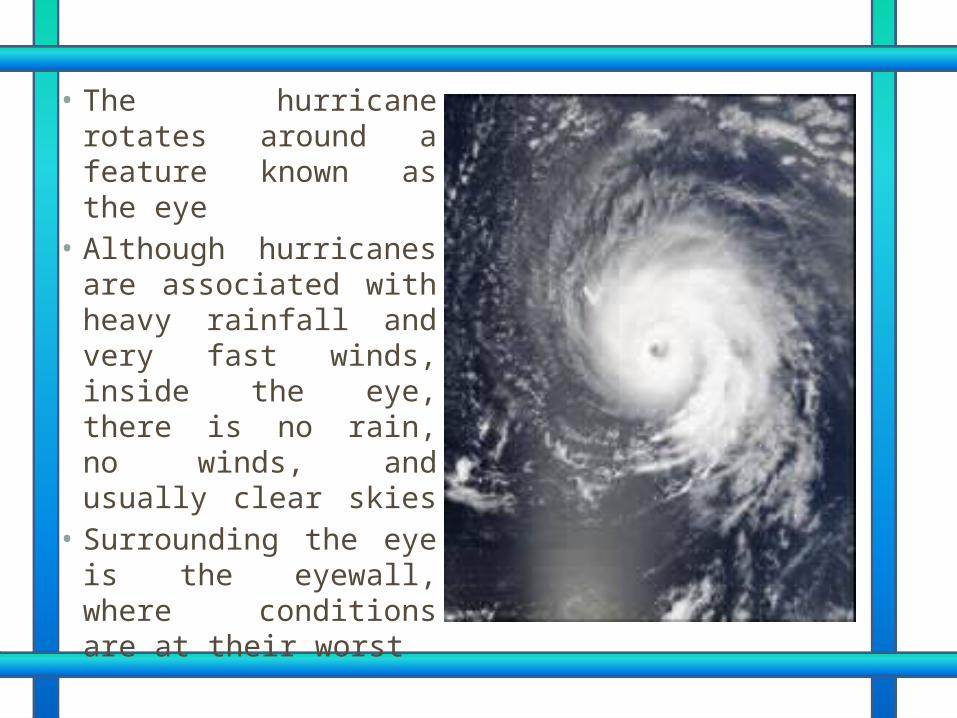
• The hurricane rotates around a feature known as the eye• Although hurricanes
are associated with heavy rainfall and very fast winds, inside the eye, there is no rain, no winds, and usually clear skies • Surrounding the eye
is the eyewall, where conditions are at their worst
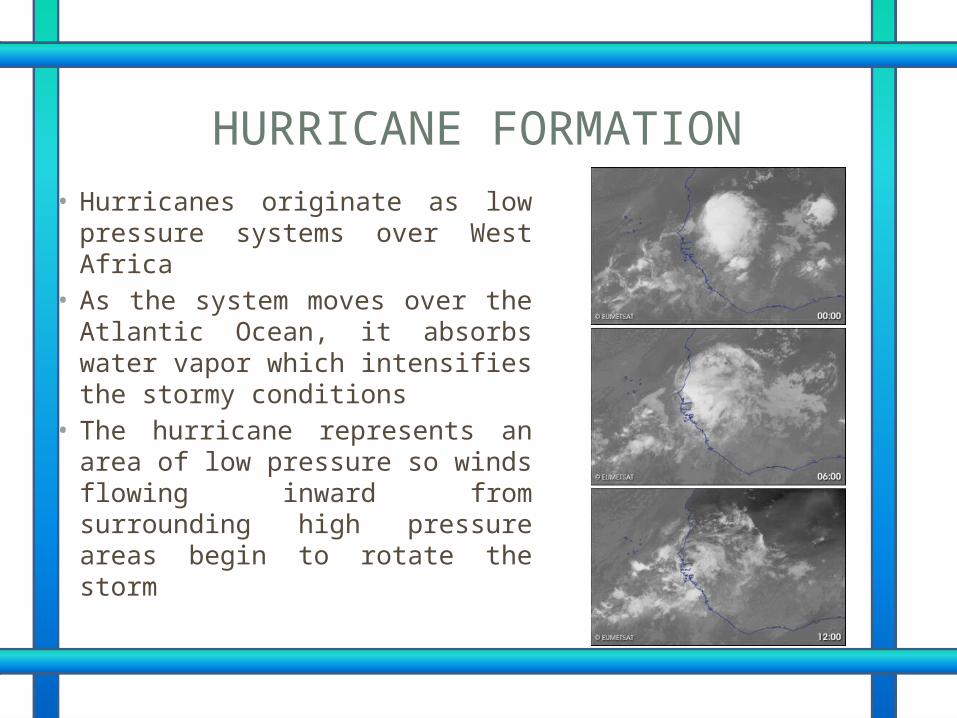
HURRICANE FORMATION• Hurricanes originate as low
pressure systems over West Africa
• As the system moves over the Atlantic Ocean, it absorbs water vapor which intensifies the stormy conditions
• The hurricane represents an area of low pressure so winds flowing inward from surrounding high pressure areas begin to rotate the storm

NOW THAT’S THE END OF THE SHOW.
Thanks for watching..GROUP 4• Janine C. Santos• Marion Lei Muyot• Gladys Navallo• Carmelita Jane Cruz• Michaella Emily Cruz• Joana Marie Perez• Sharaine Reyes• Stefanny Santiago
• Abegail Decano• Maria Sophia Trinidad