Embed Size (px)
Citation preview

WEATHER
Here, There and Everywhere
Images courtesy of Carl Posey’s Living Earth Book of Wind & Weather andJohn Farndon’s Dictionary of the Earth
Weather? What is it?"All life, as far as anyone has been able to discover, occurs in the lower depths of an invisible ocean of air and in the denser sea of water it
enfolds." pg 6 The Living Earth Book of Wind & Weather by Carl Posey 1994
The of atmosphere (700 km ) is made up of six layers. As temperature changes with height, the composition of the gases in the atmosphere changes. The layer closest to the earth’s surface, where weather occurs, is the troposphere.
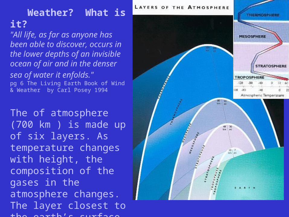
How do we know?From box-kites to balloons...
Wartime air craft carried equipment to measure atmospheric conditions; planes flew into the hearts of storms to pick up data.
Radar: the ability to detect distance of moving elements.

...to radar via satellite images.
Infrared sensors record the movements of this cold front. The red areas are the highest and coldest cloud types - the centres of maximum storm intensity.
NASA’s GOES satellite -1978

Weather describes local temperature and precipitation conditions, and the factors that affect them.
The world’s weather stations are all linked by the GTS - Global telecommunications System, which supplies data from sources such as balloons, radar, and weather satellites.
What DO we know?• Temperature is affected by the earth’s surface and the air
above it. Nearness to water moderates temperature variation.
• Differences in atmospheric pressure creates the movement of air we know as wind. The greater the pressure gradient, the stronger the wind.
• Precipitation depends on nearness to water and temperature.
• The local circulation of air and water is similar to global circulation patterns i.e. based on convection currents: - the rise of warm particles of air to cooler surroundings
• Physical barriers, natural and man-made, such as mountains and skyscrapers, affect the rise and fall of air and moisture.
• Weather can be predicted …forecasted.

Synoptic Charts a.k.a. Weather Maps - plotted information recorded at weather stations “seen together” at a given time.Each weather station includes temperature, barometric pressure, wind speed and direction, cloud cover, sky cover, dew point.
Isobars are lines connecting places of equal atmospheric pressure. (like contour lines) The closer together they are, means that pressure is changing over a small distance ;
A front is the leading edge of an air mass; the direction of their movement helps forecast the weather.Cold Front Warm Front Occluded Front
How are these fronts marked on a weather map?
Look at the next slide: What are the major factors affecting weather according to this map?

low pressure cell
cold front
warm front
S. Ontario
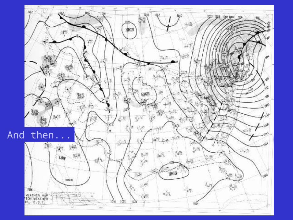
And then...

Storms: Why? How? Where?
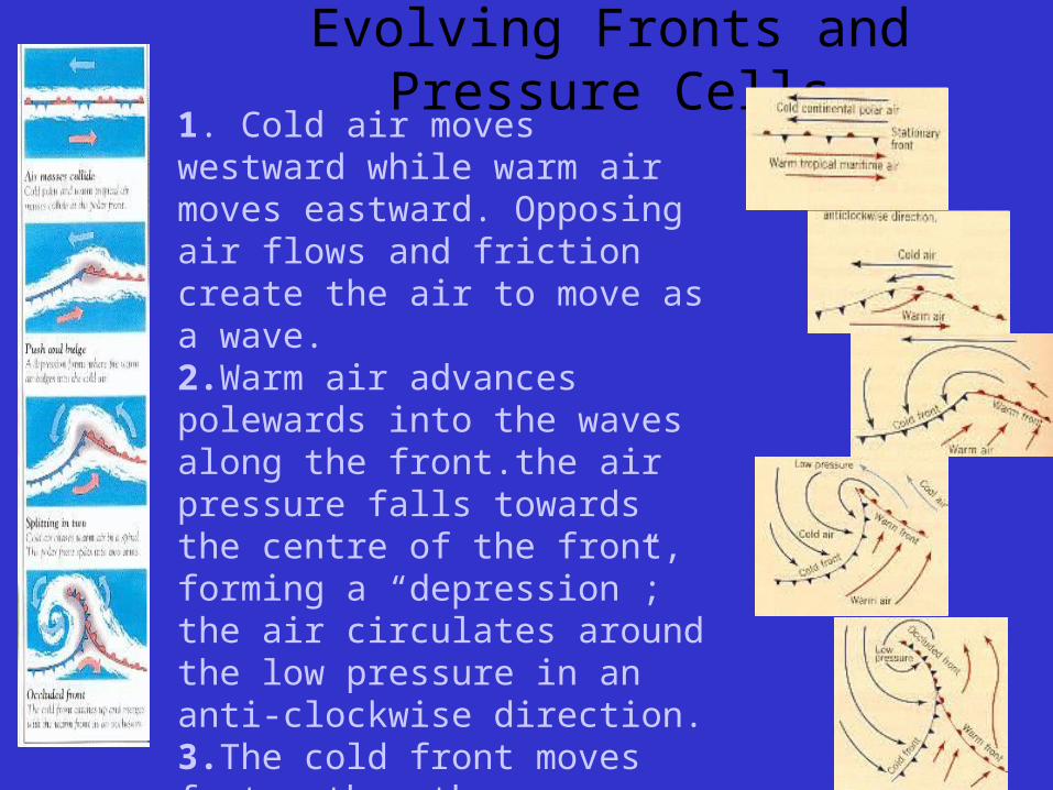
Evolving Fronts and Pressure Cells1. Cold air moves westward while warm air moves eastward. Opposing air flows and friction create the air to move as a wave.2.Warm air advances polewards into the waves along the front.the air pressure falls towards the centre of the front, forming a “depression”; the air circulates around the low pressure in an anti-clockwise direction.3.The cold front moves faster than the warm front, eventually replacing the warm air at the earth’s surface.The depression is at its maximum intensity.
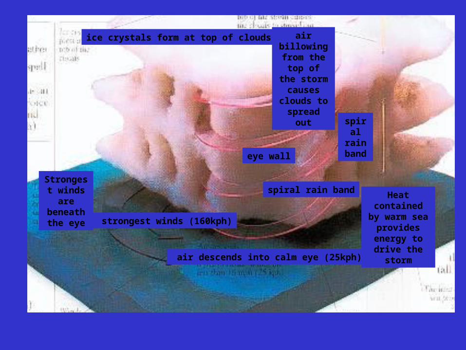
Strongest winds are beneath the eye
ice crystals form at top of clouds
air descends into calm eye (25kph)
eye wall
spiral rain band
spiral rain bandHeat contained
by warm sea provides energy
to drive the storm
air billowing from the top of the storm
causes clouds to spread out
strongest winds (160kph)

Ocean Currents and Surface Temperatures
Warm water flows away from the equator and cold water flows towards the equator

Weather Phenomena•Jet Streams
•Storms•El Nino
Global Connections
•Albedo•Temperatures
•Climate Change
Human Interaction•the atmosphere
•the land•the water
Weather and Climate

Jet Streams: high velocity winds in the upper atmosphere that carry equatorial air masses poleward.
This is a satellite image of a jet stream going over the Nile River in Egypt.
What impact does that have on weather conditions? … On seasonal variations?
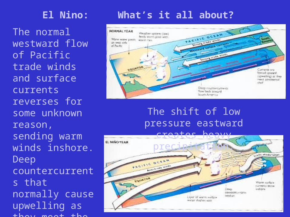
El Nino: What’s it all about?
The normal westward flow of Pacific trade winds and surface currents reverses for some unknown reason, sending warm winds inshore. Deep countercurrents that normally cause upwelling as they meet the continental shelf and send the flow westward are weakened.
The shift of low pressure eastward creates heavy precipitation.
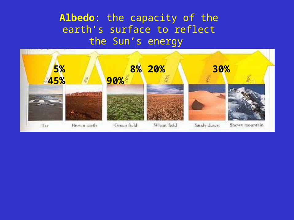
Albedo: the capacity of the earth’s surface to reflect the Sun’s energy
5% 8% 20% 30% 45% 90%

Global Temperatures - factors affecting weather ...around the globe
Global surface temperature map: blue indicates cold southern winter
Where’s the heat? Why?
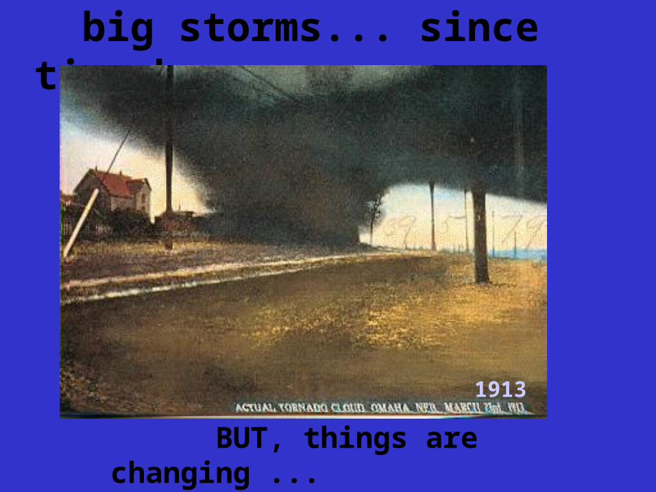
big storms... since time began
1913
BUT, things are changing ...