Embed Size (px)
Citation preview
“Waters of the U.S.” in New York Farmland
Maps by GeosyntecAnalysis by American Farm Bureau Federation
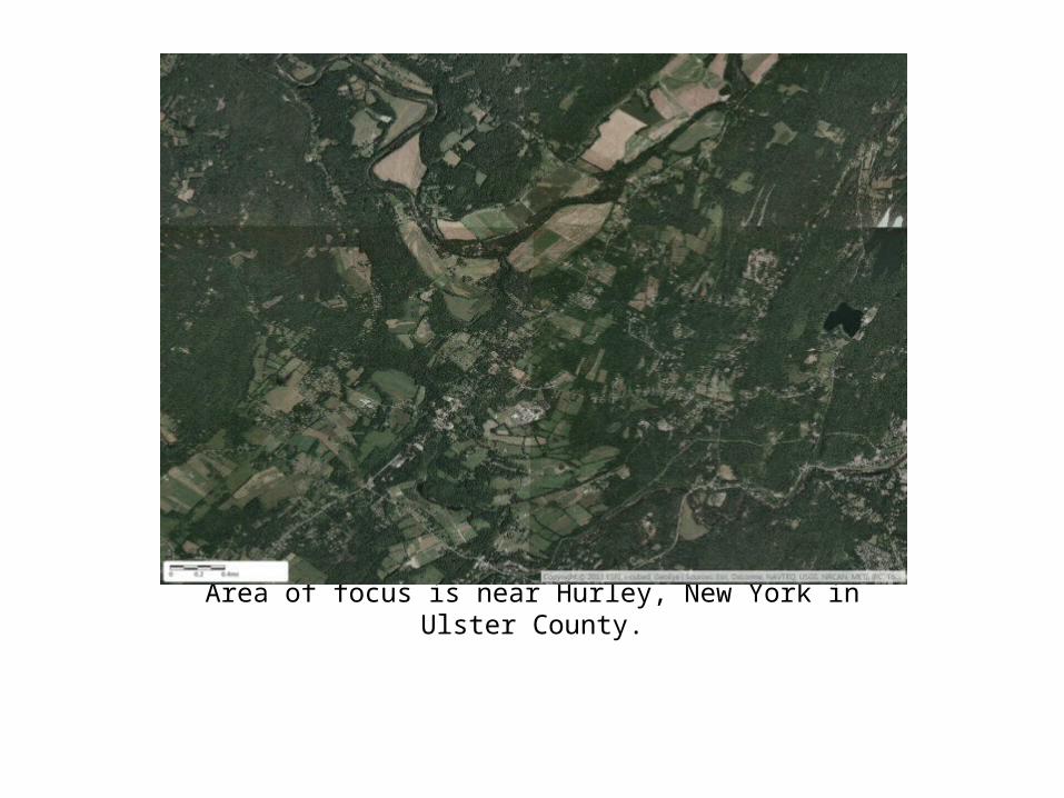
Area of focus is near Hurley, New York in Ulster County.
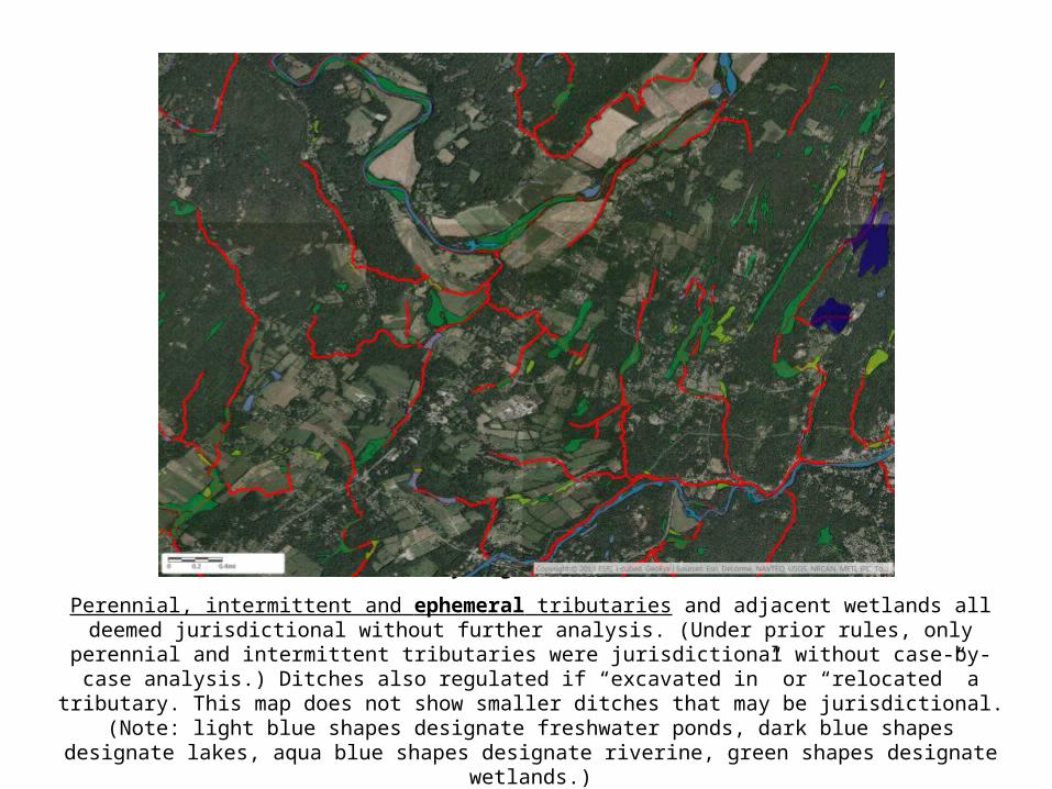
Automatically Regulated “Tributaries”
Perennial, intermittent and ephemeral tributaries and adjacent wetlands all deemed jurisdictional without further analysis. (Under prior rules, only perennial and intermittent tributaries were jurisdictional without case-by-case
analysis.) Ditches also regulated if “excavated in” or “relocated” a tributary. This map does not show smaller ditches that may be jurisdictional. (Note: light blue shapes designate freshwater ponds, dark blue shapes designate lakes,
aqua blue shapes designate riverine, green shapes designate wetlands.)
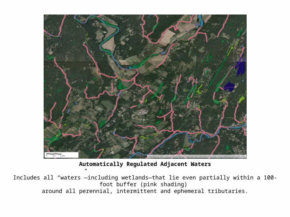
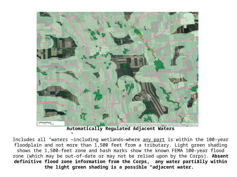
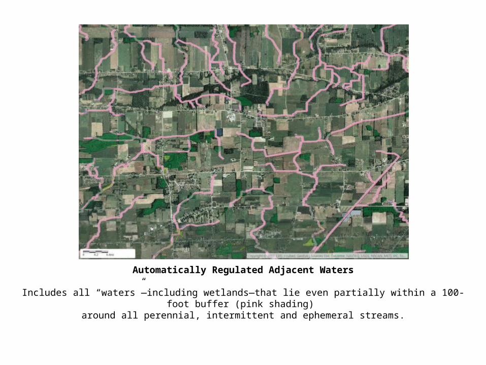
Automatically Regulated Adjacent Waters
Includes all “waters”—including wetlands—that lie even partially within a 100-foot buffer (pink shading) around all perennial, intermittent and ephemeral tributaries.
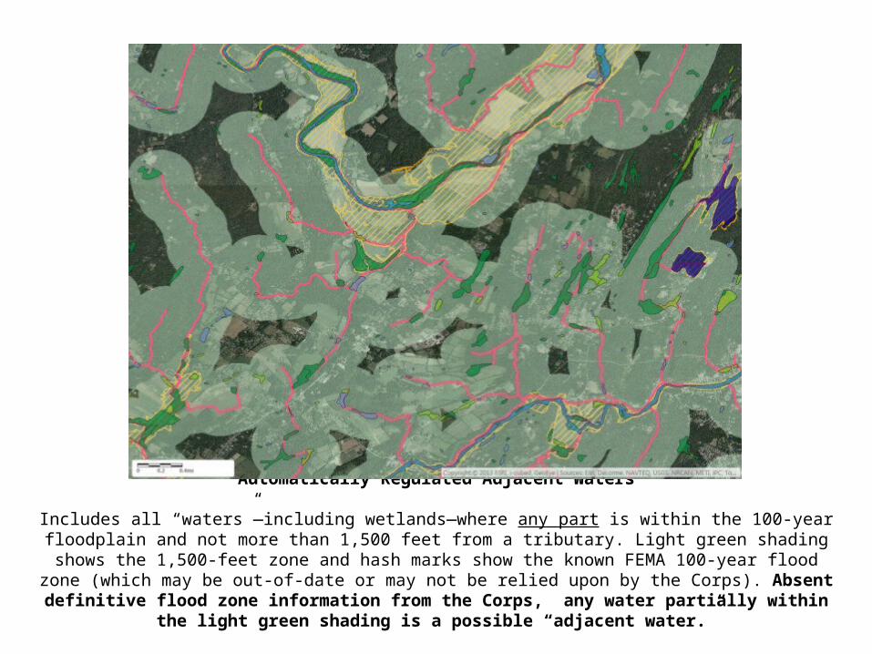
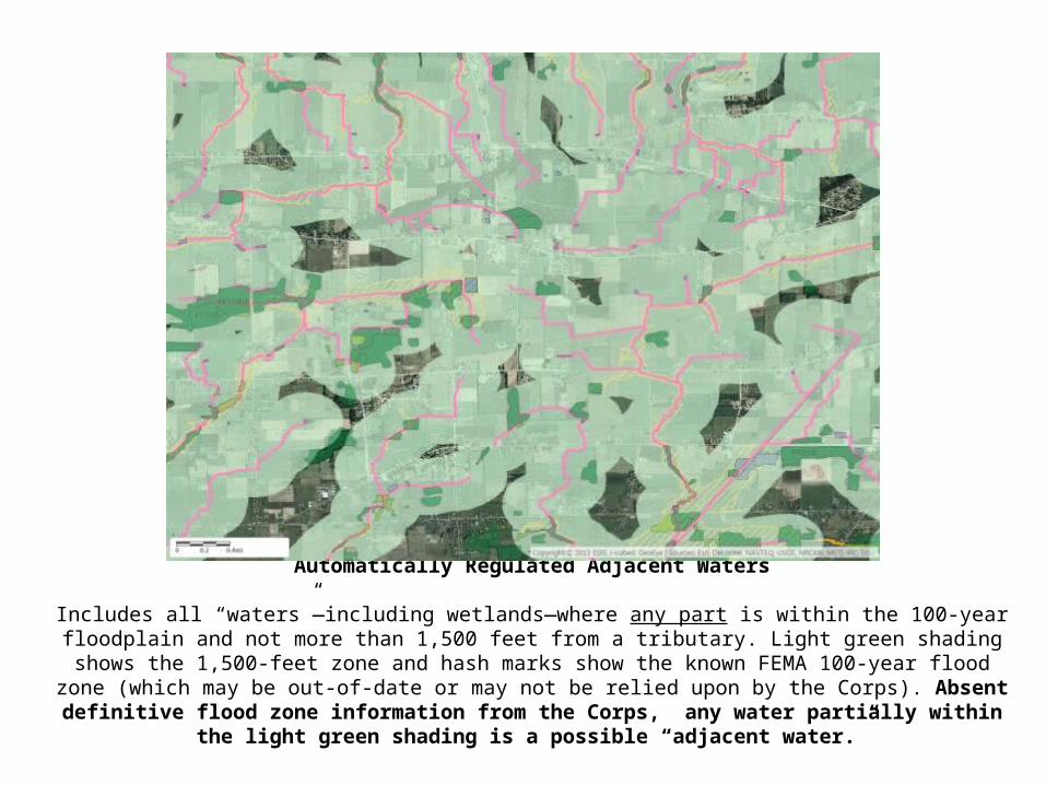
Automatically Regulated Adjacent Waters
Includes all “waters”—including wetlands—where any part is within the 100-year floodplain and not more than 1,500 feet from a tributary. Light green shading shows the 1,500-feet zone and hash marks show the known FEMA 100-year
flood zone (which may be out-of-date or may not be relied upon by the Corps). Absent definitive flood zone information from the Corps, any water partially within the light green shading is a possible “adjacent water.”
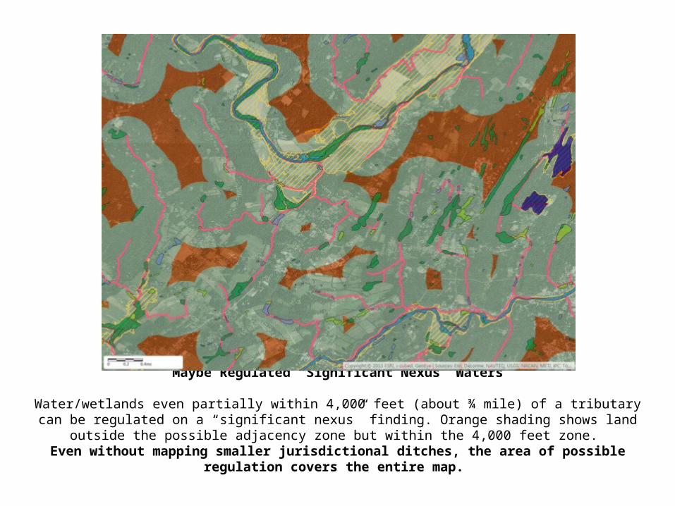
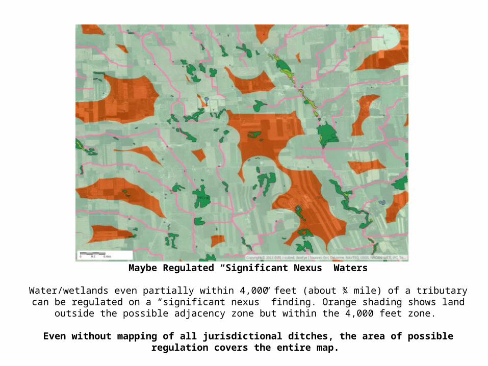
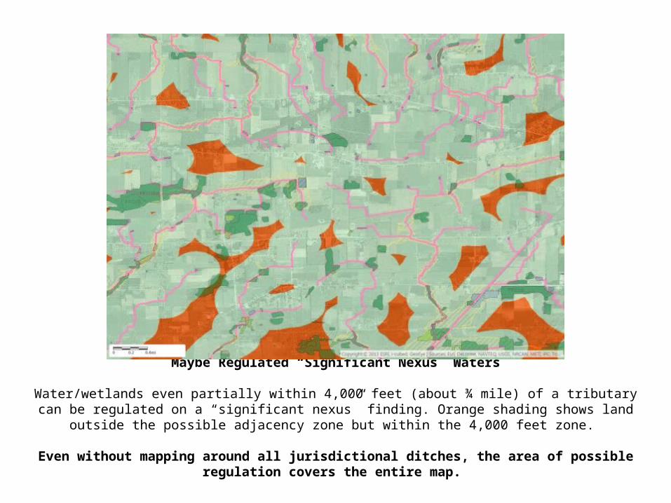
Maybe Regulated “Significant Nexus” Waters
Water/wetlands even partially within 4,000 feet (about ¾ mile) of a tributary can be regulated on a “significant nexus” finding. Orange shading shows land outside the possible adjacency zone but within the 4,000 feet zone.
Even without mapping smaller jurisdictional ditches, the area of possible regulation covers the entire map.
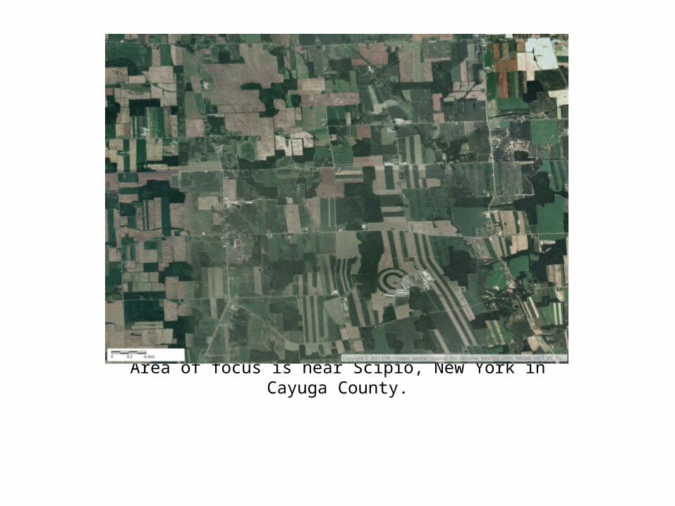
Area of focus is near Scipio, New York in Cayuga County.
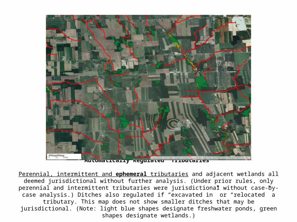
Automatically Regulated “Tributaries”
Perennial, intermittent and ephemeral tributaries and adjacent wetlands all deemed jurisdictional without further analysis. (Under prior rules, only perennial and intermittent tributaries were jurisdictional without case-
by-case analysis.) Ditches also regulated if “excavated in” or “relocated” a tributary. This map does not show smaller ditches that may be jurisdictional. (Note: light blue shapes designate freshwater ponds, green shapes
designate wetlands.)
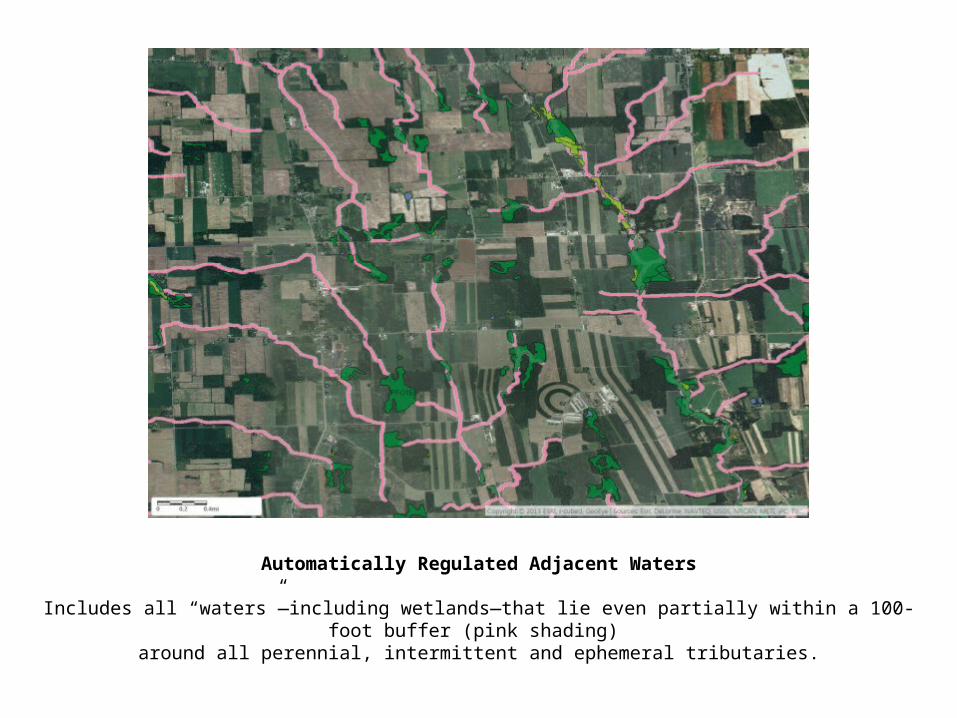
Automatically Regulated Adjacent Waters
Includes all “waters”—including wetlands—that lie even partially within a 100-foot buffer (pink shading) around all perennial, intermittent and ephemeral tributaries.
Automatically Regulated Adjacent Waters
Includes all “waters”—including wetlands—where any part is within the 100-year floodplain and not more than 1,500 feet from a tributary. Light green shading shows the 1,500-feet zone and hash marks show the known FEMA 100-year
flood zone (which may be out-of-date or may not be relied upon by the Corps). Absent definitive flood zone information from the Corps, any water partially within the light green shading is a possible “adjacent water.”
Maybe Regulated “Significant Nexus” Waters
Water/wetlands even partially within 4,000 feet (about ¾ mile) of a tributary can be regulated on a “significant nexus” finding. Orange shading shows land outside the possible adjacency zone but within the 4,000 feet zone.
Even without mapping of all jurisdictional ditches, the area of possible regulation covers the entire map.
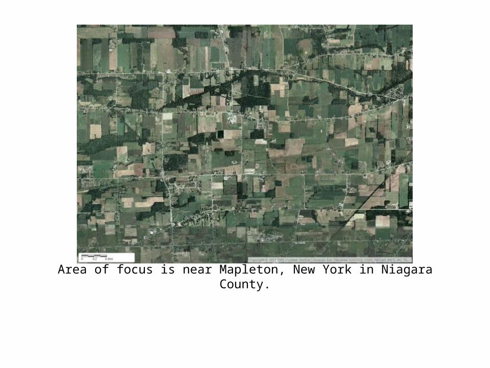
Area of focus is near Mapleton, New York in Niagara County.
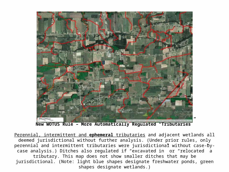
New WOTUS Rule – More Automatically Regulated “Tributaries”
Perennial, intermittent and ephemeral tributaries and adjacent wetlands all deemed jurisdictional without further analysis. (Under prior rules, only perennial and intermittent tributaries were jurisdictional without case-
by-case analysis.) Ditches also regulated if “excavated in” or “relocated” a tributary. This map does not show smaller ditches that may be jurisdictional. (Note: light blue shapes designate freshwater ponds, green shapes
designate wetlands.)
Automatically Regulated Adjacent Waters
Includes all “waters”—including wetlands—that lie even partially within a 100-foot buffer (pink shading) around all perennial, intermittent and ephemeral streams.
Automatically Regulated Adjacent Waters
Includes all “waters”—including wetlands—where any part is within the 100-year floodplain and not more than 1,500 feet from a tributary. Light green shading shows the 1,500-feet zone and hash marks show the known FEMA 100-year
flood zone (which may be out-of-date or may not be relied upon by the Corps). Absent definitive flood zone information from the Corps, any water partially within the light green shading is a possible “adjacent water.”
Maybe Regulated “Significant Nexus” Waters
Water/wetlands even partially within 4,000 feet (about ¾ mile) of a tributary can be regulated on a “significant nexus” finding. Orange shading shows land outside the possible adjacency zone but within the 4,000 feet zone.
Even without mapping around all jurisdictional ditches, the area of possible regulation covers the entire map.
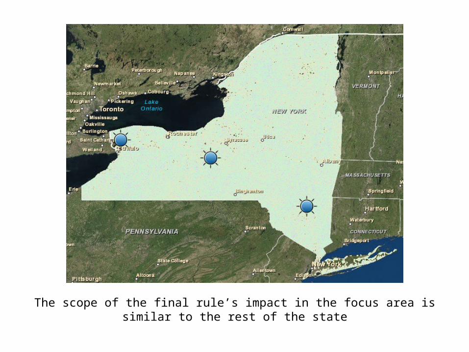
The scope of the final rule’s impact in the focus area is similar to the rest of the state
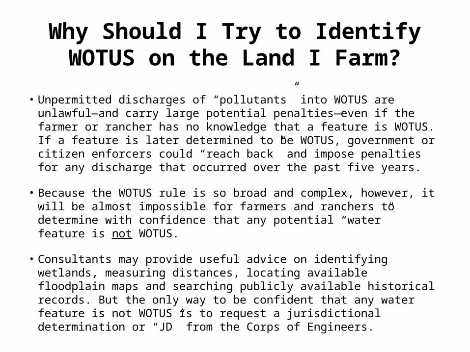
Why Should I Try to Identify WOTUS on the Land I Farm?
• Unpermitted discharges of “pollutants” into WOTUS are unlawful—and carry large potential penalties—even if the farmer or rancher has no knowledge that a feature is WOTUS. If a feature is later determined to be WOTUS, government or citizen enforcers could “reach back” and impose penalties for any discharge that occurred over the past five years.
• Because the WOTUS rule is so broad and complex, however, it will be almost impossible for farmers and ranchers to determine with confidence that any potential “water” feature is not WOTUS.
• Consultants may provide useful advice on identifying wetlands, measuring distances, locating available floodplain maps and searching publicly available historical records. But the only way to be confident that any water feature is not WOTUS is to request a jurisdictional determination or “JD” from the Corps of Engineers.
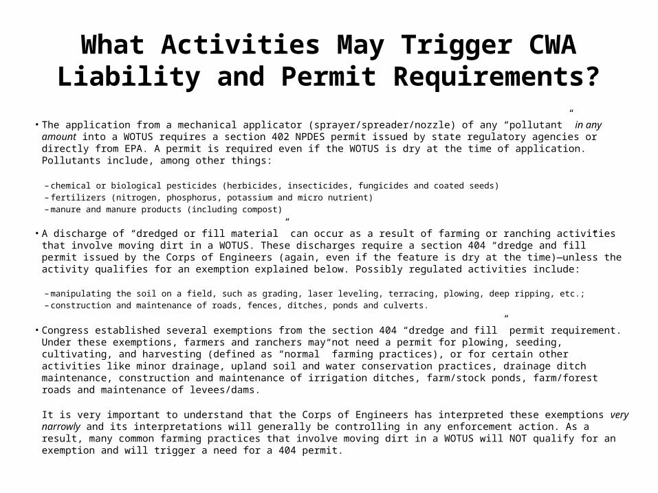
What Activities May Trigger CWA Liability and Permit Requirements?
• The application from a mechanical applicator (sprayer/spreader/nozzle) of any “pollutant” in any amount into a WOTUS requires a section 402 NPDES permit issued by state regulatory agencies or directly from EPA. A permit is required even if the WOTUS is dry at the time of application. Pollutants include, among other things:
– chemical or biological pesticides (herbicides, insecticides, fungicides and coated seeds) – fertilizers (nitrogen, phosphorus, potassium and micro nutrient) – manure and manure products (including compost)
• A discharge of “dredged or fill material” can occur as a result of farming or ranching activities that involve moving dirt in a WOTUS. These discharges require a section 404 “dredge and fill” permit issued by the Corps of Engineers (again, even if the feature is dry at the time)—unless the activity qualifies for an exemption explained below. Possibly regulated activities include:
– manipulating the soil on a field, such as grading, laser leveling, terracing, plowing, deep ripping, etc.;– construction and maintenance of roads, fences, ditches, ponds and culverts.
• Congress established several exemptions from the section 404 “dredge and fill” permit requirement. Under these exemptions, farmers and ranchers may not need a permit for plowing, seeding, cultivating, and harvesting (defined as “normal” farming practices), or for certain other activities like minor drainage, upland soil and water conservation practices, drainage ditch maintenance, construction and maintenance of irrigation ditches, farm/stock ponds, farm/forest roads and maintenance of levees/dams.
It is very important to understand that the Corps of Engineers has interpreted these exemptions very narrowly and its interpretations will generally be controlling in any enforcement action. As a result, many common farming practices that involve moving dirt in a WOTUS will NOT qualify for an exemption and will trigger a need for a 404 permit.
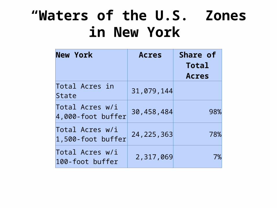
“Waters of the U.S.” Zonesin New York
New York Acres Share of Total Acres
Total Acres in State 31,079,144
Total Acres w/i 4,000-foot buffer 30,458,484 98%
Total Acres w/i 1,500-foot buffer 24,225,363 78%
Total Acres w/i100-foot buffer 2,317,069 7%


![Sediment Management - Geosyntec · Sediment Management 4UBUFNFOUPG2VBMJmDBUJPOT] About Geosyntec Section 1 About Geosyntec Technical Excellence, Teamwork and A Generous Spirit Recognized](https://img.pdfslide.us/doc/110x75/5d5dcc7788c993a30e8b8011/sediment-management-sediment-management-4ubufnfoupg2vbmjmdbujpot-about-geosyntec.jpg)