Embed Size (px)
Citation preview

Water Information Research and Development Alliance
ANNUAL REPORT 2014–15

2 Water Information Research and Development Alliance
© 2015 Bureau of Meteorology and CSIRO. To the extent permitted by law, all rights are reserved and no part of this publication
covered by copyright may be reproduced or copied in any form or by any means except with the written permission of Bureau
of Meteorology and CSIRO.
Bureau of Meteorology and CSIRO advise that the information contained in this publication comprises general statements
based on scientific research. The reader is advised and needs to be aware that such information may be incomplete or unable
to be used in any specific situation. No reliance or actions must therefore be made on that information without seeking prior
expert professional, scientific and technical advice. To the extent permitted by law, Bureau of Meteorology and CSIRO, including
each of its employees and consultants, excludes all liability to any person for any consequences, including but not limited to all
losses, damages, costs, expenses and any other compensation, arising directly or indirectly from using this publication (in part
or in whole) and any information or material contained in it.
Cover photograph: zetter (iStockPhoto)
www.bom.gov.au/water
www.csiro.au/en/Research/LWF/Areas/Water-resources

3Annual Report 2014–15
Executive summary .................................... 4
Message from the chair .............................. 6
WIRADA successes ..................................... 8
Let’s talk about water— standards for data exchange ................... 10
Connecting water data using Linked Data ............................................... 12
Flood and short-term streamflow forecasting ............................ 14
Seasonal streamflow forecasting ............ 16
Integrated modelling system for water resource assessments and accounts ...... 18
About the Water Information Research and Development Alliance ....................... 21
Performance report ................................... 22
WIRADA report card 2014–15 ................... 23
CONTENTS

4 Water Information Research and Development Alliance
Our research portfolio included four projects across our
three research themes: water informatics, water balance
modelling and streamflow forecasting.
HIGHLIGHTS OF 2014–15
Informatics—data services
Our informatics research focused on two primary
topics—international standards development and
Linked Data. The standards work delivered three
proposed international water data markup language
standards to the Open Geospatial Consortium, being
GroundwaterML2.0, WaterML2.0 part 2 (covering ratings,
gaugings and sections), and TimeseriesML. These are
being adopted internationally by water information
agencies such as the Bureau of Meteorology, and provide
a foundation for effective and efficient exchange of water
data and information.
Linked Data standards and technologies are the
foundation of future web-based data services, as we
move away from HTML-linked documents to a web
of linked data. WIRADA research used Linked Data
technologies to publish current water observations and
link these with previously unconnected web-based
data sources. The Bureau was also provided with base
technologies to manage terminology and definitions of
water-related concepts to increase interoperability, and
overcome the heterogeneity challenges, of Australian
water information systems.
Flow forecasting
Significant scientific advances were made in both
short-term and seasonal forecasting areas. Short-term
forecasting improvements included increased accuracy
of rainfall forecasts as an input to hydrological models;
improved estimates of rainfall uncertainty; a better
understanding of relative performance of alternative
rainfall-runoff models; improved estimation of hydrological
model errors; and a more functional and effective version
of the model suite used for short-term forecasting—
Short-term Water Information and Forecasting Tools v2
(SWIFT2).
Seasonal flow forecasting research focused on the
science needed to increase accuracy, extend lead time,
distribute forecasts into shorter time periods, and expand
the number of sites across Australia for which reliable
seasonal forecasts can be made. Achievements this year
included further development of the Forecast Guided
Stochastic Scenarios (FoGSS) model and significant
improvements in merging statistical and dynamical
forecasts, offering the Bureau a forecast product that is
better and easier to interpret and communicate.
Australian Water Resources Assessment
modelling system
An improved landscape component of the Australia
Water Resources Assessment (AWRA) modelling system
was implemented across continental Australia. It was
tested against peer models and performed better than
other continental-scale models and similar to or better
than individually calibrated lumped conceptual models,
supporting more timely and efficient catchment-scale
rainfall-runoff modelling for all of Australia.
The AWRA river system component was implemented
across the Murray–Darling Basin and other National Water
Account regions. The model takes account of the fluxes
and stores associated with regulated and unregulated
river systems, and includes surface and groundwater
interactions. Although calibrated regionally rather
EXECUTIVE SUMMARY
This year we built upon our previous scientific achievements and
operational outcomes, and delivered research and development
results that have advanced the quality, breadth, timeliness and
utility of Bureau water information products and services.

5Annual Report 2014–15
than at river-reach scale, performance within various
Murray–Darling Basin catchments was found to be
comparable to that of the models used for
Murray–Darling Basin planning.
WIRADA MANAGEMENT
The year ran well and efficiently, due in large part
to the foundation guidance set in place in 2013–14
through our new science plan, and implementation and
communication strategies. There were also no personnel
changes in either the Management Committee or the
WIRADA director position.
COMMUNICATION FOCUS
This year we increased focus on communication—from
scientific publications to workshops with end users on
the operational outcomes of WIRADA research. In line
with the WIRADA communication strategy all major
activities were planned with consideration of activity,
objective, audience, key messages, timing and method.
Notable achievements included research papers
in hydrology and Earth system sciences and water
resources research. Stakeholder meetings were held with
Seqwater, Goulburn–Murray Water, the Goulburn–Broken
and North Central Catchment Management Authorities,
the State Water Corporation of New South Wales and the
Coleambally Irrigation Cooperative Limited.
Overseas engagement included a seminar to the Nanjing
Hydraulic Research Institute on the FoGSS model (see
page 16). I was also invited to present to Californian
environmental managers on water modelling and
environmental intelligence.
THE YEAR AHEAD
Our focus for next year is to wrap up current research
activities and ensure the legacy of WIRADA is preserved
and available for the future. This includes the scientific
and operational achievements of the past eight years
of WIRADA, and the knowledge of how to create,
maintain, manage and deliver a successful research and
development partnership.
I congratulate all WIRADA people on this year’s
achievements, and look forward to a great year ahead.
Dr Robert Argent
WIRADA Director

6 Water Information Research and Development Alliance
Innovation is central to the success
of the Bureau’s Water Information
Programme. Our seven-year
research and development
partnership with CSIRO has helped
us to develop information products,
services and infrastructure that
deliver real value to Australia.
Recent severe rainfall deficiencies and the 2015 El Niño
again stress the importance of government working
together to support policy and decision-making in many
industries and sectors.
As chair of the Management Committee, I recognise the
value in bringing together the research and operational
expertise of both organisations. Seven years into an
impressive programme of work, our researchers continue
to deliver valuable innovation to support the nation in
managing its precious water resources.
An exciting year is also ahead as WIRADA continues to
deliver research of direct and immediate application to
the Bureau’s operational systems and services.
Streamflow forecasting continues to expand to more
sites across Australia, with the public gaining access
to a new short-term forecast service in the near future.
WIRADA research continues to help the Bureau to refine
its forecasts into a nationwide service that extends from
flood warnings to streamflow outlooks three months
ahead. Research continues to develop seasonal forecasts
beyond three months.
This June the Bureau began to share AWRA modelling
system data with State and Australian Government
agencies. A new website will be developed to provide
public users with daily estimates of water movement
through the landscape and across the continent.
In December 2015, a special WIRADA-themed session
is planned for the international Hydrology and Water
Resources Symposium, in Hobart. This will be an
opportunity to showcase to industry the Bureau’s key
water information services and the world-class research
behind them.
I thank all those involved in WIRADA for their effort during
the year. The Management Committee looks forward to
successful completion of the current phase of WIRADA
next year.
Graham Hawke
Deputy Director, Environment and Research
MESSAGE FROM THE CHAIR

7Annual Report 2014–15
Water resources are one
of the bigger challenges
and opportunities the
nation faces—whether in
the extremes of drought
or flood, or managing
for social, economic and
environment outcomes.
Through our strategic collaboration with
the Bureau, we are proud to be delivering
science solutions that will inform a more
secure water future.
WIRADA continues to provide high-value
research that makes a real difference to
Australia. The quality research that underpins
these successes has the recognition of our
international collaborators confirmed by their
desire to apply these novel methods.
In 2014–15 we have seen our long-term
investment deliver new and refined forecasting
and water balance modelling capabilities.
Through collaboration, we have also seen wider
international uptake of our standards work—
including in domains other than water—this
is an area where Australia can proudly claim
international leadership.
WIRADA is a team effort. I congratulate the
CSIRO and Bureau teams on their achievements
of the past year and look forward to continued
success and impact.
Warwick McDonald
Research Director,
Water Resource Management, CSIRO

8 Water Information Research and Development Alliance
WIRADA SUCCESSES
Water resources and aquatic ecosystems
Data ingestion and storage
Climate and water monitoring and data collection
COLLECT DISCOVER INGEST ASSEMBLE POLISH
Water balance analysis
International data standards that
incorporate WIRADA research reduce
errors and help us to share and understand
Australia’s national water data.
Our standardised water balance analysis
methods increase Australia’s capacity to explain
and understand of our past use of water.
The increased detail we provide in analysis helps
to identify areas where water management
could be improved to deliver societal benefits.
Our contributions to standards for river gaugings
and ratings data increase the opportunity to share
information between users.
Our research on standard and persistent
identification of monitoring points reduces errors in
collecting and sharing monitoring data.
WIRADA developed an authoritative national
information system of water features that helps
to standardise water resources information for
sharing and reporting.
Explore the Australian Hydrological Geospatial Fabric
Understand the Water Data Transfer Format
The Australian Water Resources Information System underpins collection, management and
reporting of water data
The Australian Water Resources Assessment modelling system provides continental-scale
analysis of key water balance terms
Understand the international WaterML standard

9Annual Report 2014–15
POLISH AUGMENT SHARE ANALYSE PREDICT REPORT
Water data services
Streamflow forecasts and flood warnings
National water resources reporting
WIRADA research contributes to increases in the
quality and standard of analysis and reporting,
providing better water information services.
Our research supports easier and broader
access to Australia’s water data.
Seasonal streamflow forecasts based on
WIRADA research support water management
decisions across more than 100 sites in
six States and Territories.
Our outputs provide emergency services with
improved warnings of extreme events.
National water reports use WIRADA research
to give Australians greater insight into the
nature of our national water resources
and how they are used.
Access high-quality data for hydrologic reference sites
Compare water market information
Access water data online
View short-term streamflow forecasts (registered user access)
View seasonal streamflow forecasts
Read the Australian Water Resources Assessments
Read the National Water Account

10 Water Information Research and Development Alliance
LET’S TALK ABOUT WATER STANDARDS FOR DATA EXCHANGE
BUREAU SPONSOR Tony Boston
COLLABORATORS U.S. Geological Survey; Aquatic Informatics; Open Geospatial Consortium;
World Meteorological Organization; KISTERS; UK Centre for Ecology and Hydrology;
Geological Survey of Canada; European Commission, Directorate General–
Joint Research Centre; Federation University Australia; Geological Surveys of
Germany; British Geological Survey; Bureau de Recherche Géologiques et Minières;
International Groundwater Resources Assessment Centre; UNESCO; Salzburg
University; Polish Geological Institute
PROJECT LEADER Peter Taylor
Objective: To improve access to hydrological data within Australia through new internationally recognised exchange standards and services.
‘Development of the WaterML2 Part 2 standard
will help improve interoperability between
systems and support greater water data
sharing in Australia and internationally.’
MARTIN READ, Manager of Water Assessment Branch, Department of Primary Industries, Parks,
Water and Environment, Tasmania
CHALLENGE
To understand freshwater resources at a national
level requires integration of data from many diverse
stakeholders. Much of these hydrological data are stored
within systems that have unique structures, definitions
and means of access. For example, one water agency
may measure water in an aquifer using a method that
varies considerably from that used by another.
To compare and integrate such data across Australia
is a huge challenge.
Having technical experts manually convert data for
analysis or reporting wastes time and resources.
Computer software can assist by automating processes
of data exchange. However, this requires a common
language, or data exchange standard, in which data may
be transmitted and more easily understood.
A common language with agreed definitions for concepts
and terminology supports the combination of data from
disparate sources, valid comparisons and hydrological
analyses. Development of such standards requires
understanding of each specific hydrological data type:
groundwater features, such as aquifers and boreholes;
observation processes; surface water measurements,
such as river rating tables; continuous observations of
stream sections; storage calculations; and so on.
SOLUTION
We are developing data exchange standards in three
important areas of hydrology: groundwater features
and observations, river and storage calculations, and
continuous time-series observations.
Developing exchange standards requires expression of
real work concepts in a way a computer can understand.
For example, how do you tell a computer that someone
waded into a river, held onto a flow meter and measured
the velocity of the water at a specific location? This must
be done in a way that is consistent across practices
in different countries. To do this, we bring together
international experts in computer science, geospatial
information systems and hydrology. Together we capture
and harmonise our definitions of these concepts and
express them in a way computers can understand.

11Annual Report 2014–15
Through international collaboration this activity is driving
long-term change in how countries around the world
exchange hydrological data.
ACHIEVEMENTS
In collaboration with our international partners, we have
developed three proposed international standards:
• GroundwaterML2.0 is a standard for exchange of
groundwater features (aquifers, boreholes, wells,
construction components etc.) and observations.
The draft is undergoing testing, with submission to
the Open Geospatial Consortium (OGC) expected
in 2016. This project has developed software to
deliver data from Australia’s National Groundwater
Information System using this standard.
• WaterML2.0 part 2 is a standard to exchange rating
tables, river gauging observations and cross-sections.
We have progressed to the final stage of adoption,
with a final OGC vote to conclude in two months.
• TimeseriesML builds on previous work in WaterML2.0
part 1, by developing a standard for time-series data
exchange that is not specific to hydrology. It has
recently been submitted to the OGC as a ‘Request
for Comment’. Following consideration of comments
from the broader public, it will be proposed as a
standard in early 2016.
Our standards are being adopted by the Bureau and
water agencies around the world. This provides the
Bureau, and Australian water agencies, with a solid
foundation to automate the exchange of data and improve
understanding of our precious water resources.
NEXT STEPS
Next year will see the adoption of WaterML2.0 part 2
and TimeseriesML as standards. We will also finalise
drafting of the GroundwaterML2.0 standard and submit it
for adoption.
From WIRADA to the world
Most environmental monitoring programs
undertake continuous observations that produce
time-series data. WaterML2.0 part 1, developed
within WIRADA, defined an exchange format
for hydrological time-series data. It has been
identified as a potential solution to time-series
exchange within and across other science
domains, such as oceanography, air quality
monitoring and meteorology.
The World Meteorological Organization (WMO)
saw this potential. It moved to establish the
Open Geospatial Consortium TimeseriesML
working group, led by WIRADA Informatics,
with the aim to standardise the time-series
parts of WaterML2.0 part 1. We anticipate that
the WMO Commission for Basic Systems will
endorse TimeseriesML as a WMO standard for
data encoding at the CBS-16 meeting in 2016.
WaterML2.0 part 1 has been adopted by key
organisations including the USGS1 and has
been endorsed by the United States National
Strategy for Civil Earth Observations2, the
Federal Geographic Data Committee3 and
for cross-domain exchange by the European
Union’s large-scale data exchange initiative—
INSPIRE (Infrastructure for Spatial Information
in Europe).
WIRADA work that was initially focused
on hydrological data is now being applied
in a much broader area of application—
worldwide monitoring and management of
our environment.
1. http://help.waterdata.usgs.gov/news/april-10-20142. www.opengeospatial.org/pressroom/pressreleases/18313. www.fgdc.gov/standards/news/WaterML

12 Water Information Research and Development Alliance
BUREAU SPONSOR Tony Boston
COLLABORATORS World Meteorological Organization
PROJECT LEADER Peter Taylor
Objective: Improve understanding of water resources by connecting hydrological data to relevant context and definitions.
CONNECTING WATER DATA USING LINKED DATA
A national platform to define environmental terms used online
The Linked Data Registry tool is used at the
Bureau to help it manage a range of water-
related terminology, or vocabularies. Work has
also progressed with using the environment.
data.gov.au web domain to identify and discover
data assets. Together, these two technologies
offer a national platform for online publication
of environmental data and definitions. This
will improve publication and interpretation of
environmental data within Australia.
CHALLENGE
Water observation data published or exchanged without
sufficient context can be difficult or even impossible to
interpret. For example, ‘the river is flowing at 3 cumecs’.
Which river? How much is 3 ‘cumecs’ and how accurate
is the value? Is that high or low? How does that relate to
expected flow?
As the volume of data on the internet grows, it
is increasingly important that data we publish are
sufficiently described. Data that lack description and
context are hard to reuse, and can mislead. However,
when we publish and exchange data there is a delicate
balance between simplicity and complexity. The public
and decision-makers require information that is simple,
but also contextually meaningful and accurate.
For the Bureau to integrate and publish water data, it
must understand the terminology used by different
water agencies as well as manage its own, harmonised
definitions. Additionally, these definitions must be
consistent and transparent.
SOLUTION
To tackle this problem we:
• Used ‘Linked Data’ to publish data with relevant
context to aid interpretation, in a way that is
machine-readable.
• Developed tools and techniques to allow the Bureau
to manage and publish definitions of key terms and
concepts online in a well-controlled manner. For
example, by publishing formal definitions of units of
measure, measured properties, instrument types,
and datums.
Linked Data offers a means to distribute data on the
internet with links to other related data that can help with
interpretation. It uses foundational concepts that make
web pages work, but extends them to work with data.
We are using Linked Data to publish hydro-meteorological
observational data with links to context around long-
term averages and relevant spatial relationships. This has
involved developing a trial data service that publishes
current weather observations with links to long-term
averages from Bureau data products. This provides
useful context observations—how hot is it today
compared to normal? Is today’s normal different from the
normal 50 years ago?

13Annual Report 2014–15
While these are simple examples, the underlying
concepts are changing the way in which data are used on
the internet.
We are using Linked Data approaches to publish the
definitions of concepts online, which allows both humans
and computers to understand exactly what is described
within data. To do this we use a software product called
the Linked Data Registry, which has been pioneered by
the World Meteorological Organization (WMO) through
development of the WMO Codes Registry.
ACHIEVEMENTS
Through WIRADA Informatics we have developed services
to publish current weather observations using Linked
Data, bringing together previously unconnected data.
Context is now available with these observations that
provide opportunities for new applications and services.
This research positions the Bureau to use these
approaches to bring together many of its data publishing
platforms, resulting in an improved user experience and
new opportunities for using its data.
Software to allow the Bureau to manage its terminology
and definitions of water-related concepts has also
been delivered. The Linked Data Registry has been
tested and customised to give the Bureau a platform to
consistently manage and publish terminology. This will
assist Australian water information systems to be more
interoperable by ensuring everyone understands when
they are talking about the same thing.
NEXT STEPS
We will extend the current prototype data services to
include water level and storage information and other
hydrological data products, such as the Geofabric.
This will allow navigation between these data products,
and build awareness of other Bureau data products.
Linked Data provides users with access to related information, delivering additional context and increasing efficiencies through data reuse. For example, how do this month’s current weather observations compare to the long-term average in the ACORN-SAT climate record?
ACORN-SAT historic climate record
HOW DO CURRENT OBSERVATIONS COMPARE TO THE HISTORIC RECORD?
Current weather observations
STATIONS
STATIONS
STATISTICS
LOCATION
NAME
RAINFALL DISTRICT
TEMPERATURE
RAINFALL
OBSERVATION
14 Water Information Research and Development Alliance
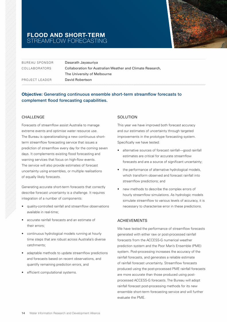
BUREAU SPONSOR Dasarath Jayasuriya
COLLABORATORS Collaboration for Australian Weather and Climate Research,
The University of Melbourne
PROJECT LEADER David Robertson
Objective: Generating continuous ensemble short-term streamflow forecasts to complement flood forecasting capabilities.
CHALLENGE
Forecasts of streamflow assist Australia to manage
extreme events and optimise water resource use.
The Bureau is operationalising a new continuous short-
term streamflow forecasting service that issues a
prediction of streamflow every day for the coming seven
days. It complements existing flood forecasting and
warning services that focus on high-flow events.
The service will also provide estimates of forecast
uncertainty using ensembles, or multiple realisations
of equally likely forecasts.
Generating accurate short-term forecasts that correctly
describe forecast uncertainty is a challenge. It requires
integration of a number of components:
• quality-controlled rainfall and streamflow observations
available in real-time;
• accurate rainfall forecasts and an estimate of
their errors;
• continuous hydrological models running at hourly
time steps that are robust across Australia’s diverse
catchments;
• adaptable methods to update streamflow predictions
and forecasts based on recent observations, and
quantify remaining prediction errors, and
• efficient computational systems.
SOLUTION
This year we have improved both forecast accuracy
and our estimates of uncertainty through targeted
improvements in the prototype forecasting system.
Specifically we have tested:
• alternative sources of forecast rainfall—good rainfall
estimates are critical for accurate streamflow
forecasts and are a source of significant uncertainty;
• the performance of alternative hydrological models,
which transform observed and forecast rainfall into
streamflow predictions; and
• new methods to describe the complex errors of
hourly streamflow simulations. As hydrologic models
simulate streamflow to various levels of accuracy, it is
necessary to characterise error in these predictions.
ACHIEVEMENTS
We have tested the performance of streamflow forecasts
generated with either raw or post-processed rainfall
forecasts from the ACCESS-G numerical weather
prediction system and the Poor Man’s Ensemble (PME)
system. Post-processing increases the accuracy of the
rainfall forecasts, and generates a reliable estimate
of rainfall forecast uncertainty. Streamflow forecasts
produced using the post-processed PME rainfall forecasts
are more accurate than those produced using post-
processed ACCESS-G forecasts. The Bureau will adopt
rainfall forecast post-processing methods for its new
ensemble short-term forecasting service and will further
evaluate the PME.
FLOOD AND SHORT-TERM STREAMFLOW FORECASTING

15Annual Report 2014–15
The performance of the hydrological model used in
the current forecasting system (GR4H) was compared
to a suite of alternatives using operational model
configurations. While GR4H produces the best
independent simulations for the majority of catchments,
alternative models do better for some catchments and
streamflow hydrograph components.
A staged error-modelling approach has been developed to
incrementally characterise features of hydrological model
errors. This approach corrects long-term biases, updates
model forecasts using recent prediction errors and
describes the distribution of residual errors. The Bureau is
adopting this error-modelling approach as it transitions the
service to produce ensemble forecasts.
We have also delivered the Short-term Water Information
and Forecasting Tools version 2 (SWIFT2). This is a
redesigned forecasting software package that improves
computational efficiency and functionality.
NEXT STEPS
Work in the next year will:
• extend the rainfall post-processing approach to deal
with rainfall forecasts from ensemble numerical
weather prediction models;
• refine and evaluate the performance of the staged
error-modelling approach for ephemeral and
intermittent catchments that periodically cease to
flow; and
• transition SWIFT2 into the operational environment.
A national short-term streamflow forecast service
During the last year, the Bureau has
expanded its prototype deterministic short-
term streamflow service to an additional 51
catchments across Australia. It now includes
114 forecast locations in 62 catchments spread
throughout all States and Territories. The
current service is available to 150 registered
users for testing and will be available to the
public in mid-2015.
In future we will:
• expand the service to additional
catchments and extend the modelling
capability of the existing SWIFT2 software;
• develop probabilistic short-term
streamflow forecasts that are based on
ensemble rainfall forcing. These will
provide users with estimates of forecast
uncertainty; and
• enhance the experience of forecast
users with improved web interfaces that
also incorporate the new probabilistic
streamflow forecasts.

16 Water Information Research and Development Alliance
BUREAU SPONSOR Dasarath Jayasuriya
COLLABORATORS Collaboration for Australian Weather and Climate Research
PROJECT LEADER Q. J. Wang
Objective: To increase forecast accuracy, extend lead time and provide easy-to-use forecast products for water managers.
SEASONAL STREAMFLOW FORECASTING
‘Seasonal streamflow forecast information
gives us confidence that we are making the
best decisions possible to efficiently manage
our water.’
KATHERINE LARKINGS, Water Strategic Planning Engineer, Icon Water, ACT
CHALLENGE
The Bureau now has seasonal streamflow forecasts for
more than 100 locations across major storages and river
systems in Australia available to the public. Forecasts
are issued at the start of each month and provide the
likelihood for a given volume of water flowing in the next
three months.
Feedback from water managers shows that the service
already supports water-resource planning and operational
decisions. However, users have identified a number of
required improvements, setting a clear path for research:
• expand the number of forecast sites;
• improve forecast performance;
• extend forecasts out to 12 months; and
• provide forecasts in monthly volumes, rather than just
seasonal totals.
SOLUTION
The Bureau has two models that produce seasonal
streamflow forecasts. Current public forecasts use
a statistical approach, which captures relationships
shown in the past between climate and catchment
conditions and observed streamflows. A prototype
dynamical model—which simulates processes of climate
and hydrological systems—also provides forecasts to
registered users at nearly 100 sites across Australia. Last
year we developed a quantile model averaging (QMA)
method to merge the forecasts from these two models.
Merging allows us to take advantage of the different
strengths of the statistical and dynamical approaches.
This year we rigorously tested how effective the QMA
method is to ensure it is robust to use within the
Bureau’s streamflow forecast service.
It is a major task to develop a service that extends
streamflow forecasts out to 12 months and provides
monthly volumes. Last year we developed the Forecast
Guided Stochastic Scenarios (FoGSS) model. This model
uses outputs from seasonal climate models to generate
monthly rainfall forecasts, which feed into a monthly
water balance model. A further algorithm allows us to
correct for error and quantify uncertainty. This year we
continued to develop and test the FoGSS model in a
wider range of catchments typical for Australia.
ACHIEVEMENTS
We tested the ability for the QMA method to merge
forecasts from statistical and dynamical models in a
further 40 sites. These included a variety of geographic
and climatic regions. The QMA merged forecasts were
17Annual Report 2014–15
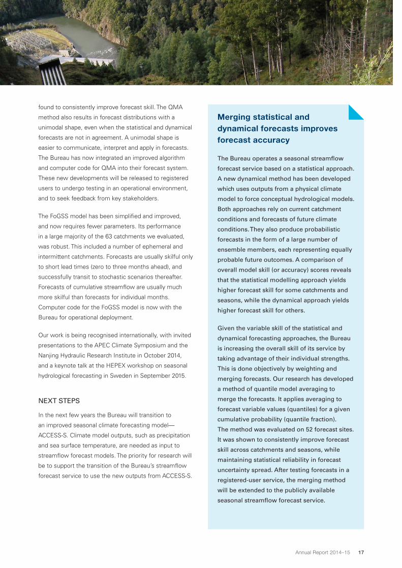
found to consistently improve forecast skill. The QMA
method also results in forecast distributions with a
unimodal shape, even when the statistical and dynamical
forecasts are not in agreement. A unimodal shape is
easier to communicate, interpret and apply in forecasts.
The Bureau has now integrated an improved algorithm
and computer code for QMA into their forecast system.
These new developments will be released to registered
users to undergo testing in an operational environment,
and to seek feedback from key stakeholders.
The FoGSS model has been simplified and improved,
and now requires fewer parameters. Its performance
in a large majority of the 63 catchments we evaluated,
was robust. This included a number of ephemeral and
intermittent catchments. Forecasts are usually skilful only
to short lead times (zero to three months ahead), and
successfully transit to stochastic scenarios thereafter.
Forecasts of cumulative streamflow are usually much
more skilful than forecasts for individual months.
Computer code for the FoGSS model is now with the
Bureau for operational deployment.
Our work is being recognised internationally, with invited
presentations to the APEC Climate Symposium and the
Nanjing Hydraulic Research Institute in October 2014,
and a keynote talk at the HEPEX workshop on seasonal
hydrological forecasting in Sweden in September 2015.
NEXT STEPS
In the next few years the Bureau will transition to
an improved seasonal climate forecasting model—
ACCESS-S. Climate model outputs, such as precipitation
and sea surface temperature, are needed as input to
streamflow forecast models. The priority for research will
be to support the transition of the Bureau’s streamflow
forecast service to use the new outputs from ACCESS-S.
Merging statistical and dynamical forecasts improves forecast accuracy
The Bureau operates a seasonal streamflow
forecast service based on a statistical approach.
A new dynamical method has been developed
which uses outputs from a physical climate
model to force conceptual hydrological models.
Both approaches rely on current catchment
conditions and forecasts of future climate
conditions. They also produce probabilistic
forecasts in the form of a large number of
ensemble members, each representing equally
probable future outcomes. A comparison of
overall model skill (or accuracy) scores reveals
that the statistical modelling approach yields
higher forecast skill for some catchments and
seasons, while the dynamical approach yields
higher forecast skill for others.
Given the variable skill of the statistical and
dynamical forecasting approaches, the Bureau
is increasing the overall skill of its service by
taking advantage of their individual strengths.
This is done objectively by weighting and
merging forecasts. Our research has developed
a method of quantile model averaging to
merge the forecasts. It applies averaging to
forecast variable values (quantiles) for a given
cumulative probability (quantile fraction).
The method was evaluated on 52 forecast sites.
It was shown to consistently improve forecast
skill across catchments and seasons, while
maintaining statistical reliability in forecast
uncertainty spread. After testing forecasts in a
registered-user service, the merging method
will be extended to the publicly available
seasonal streamflow forecast service.

18 Water Information Research and Development Alliance
BUREAU SPONSOR Ian Prosser
COLLABORATORS Monash University, The University of Melbourne, University of New South Wales,
University of Newcastle, NSW Office of Water, NSW Office of Environment and
Heritage, NSW State Water
PROJECT LEADER: Jai Vaze
Objective: Underpinning Australian Water Resources Assessments, the National Water Account, and sub-annual water resources situation reports with an integrated hydrological modelling system.
INTEGRATED MODELLING SYSTEM FOR WATER RESOURCE ASSESSMENTS AND ACCOUNTS
The Australian Water Resources Assessment modelling system has two key components—a landscape model (AWRA-L) and a river model (AWRA-R). A calibration and validation test bed is used to ensure that the system matches reported/available data. Benchmarking ensures that the system improves estimates after comparing with the real-world observed data across Australia. The Bureau runs an operational system to provide input to Water Resources Assessments and annual National Water Accounts.
Bureau data External data
AWRA-L Landscape
AWRA-R River
AWRA-L AWRA-R
CALIBRATION AND VALIDATION TEST BED
BENCHMARKING
OPERATIONALISATION
Water Resources Assessments
Annual National Water Accounts
CHALLENGE
To support water assessments and accounting for water
resource policy and planning at catchment, regional
and continental scales, Australia needs comprehensive,
consistent and robust information on water generation,
distribution, storage, availability, and use. This information
needs to be produced using all the available data in a
robust, transparent and repeatable manner, to minimise
inconsistency across different scales.
SOLUTION
The Australian Water Resources Assessment (AWRA)
modelling system has been developed with state-of-
the-art hydrological science and computing technology.
It can quantify water flux and storage terms and their
respective uncertainties using a combination of in-situ
and remotely sensed observations, and model outputs.
The AWRA system is applicable across the continent
and flexible enough to be able to use all available data
sources. It uses novel modelling techniques and tools
to provide nationally consistent and robust estimates of
water fluxes and stores at a 5 km spatial resolution and
daily time-step.

19Annual Report 2014–15
For the first time we have a tool that can account for
important aspects of water resources for all areas
in Australia. The estimates for soil water storage,
streamflow, groundwater recharge and vegetation water
use from the operational system in the Bureau inform
the National Water Accounts and the upcoming Water
in Australia reports. These Bureau products provide a
national water perspective and help Australia understand
the present state of water resources across the continent
and its variation over the last century.
ACHIEVEMENTS
The landscape component of AWRA has been improved
and implemented across continental Australia and tested
against peer models. Our results show that the model
performs better than other continental models and similar
to or better than time-consuming individual lumped
conceptual rainfall-runoff models.
The river system component of AWRA has been
implemented in the entire Murray–Darling Basin and
several other regions. It produces fluxes and stores
associated with different components of regulated and
unregulated river systems and includes surface and
groundwater interactions. Although requiring much less
development effort, model performance was found to be
comparable to the models used by the Murray–Darling
Basin Authority for basin planning in various Murray–
Darling catchments.
We have developed a new version (v5.0) of the AWRA
modelling system that successfully couples the
landscape and river modelling components. The Bureau
is currently implementing the models operationally into a
unified system based on the Python language.
‘We will continue to use evaporative loss
estimates provided by the Australian
Water Resources Assessments in future
hydrodynamic and water-quality modelling
projects.’
CHRIS O’NEILL, Operations Manager and Water Resources Engineer,
HydroNumerics
All components of the system continue to be improved
through calibration and evaluation against a range of
surface and satellite observations. These observations
include in-situ measurements such as river gauges,
irrigation diversion metering, vegetation water-use, flux
towers and soil moisture sensors. Observations also
include satellite measurements of vegetation cover, soil
moisture, and evapotranspiration.
The major achievements for this year include:
• improvements to the vadose zone conceptualisation
in the landscape modelling component and
implementation across the continent;
• preliminary experiments to constrain landscape model
calibration against multiple data sources, rather than
just unregulated river gauges;
• an extended river model that can calculate fluxes and
stores in catchment headwaters; and
• a new conceptual approach for a system calibration
of the river model. This has been implemented
across the Murray–Darling Basin and enables system-
wide optimisation of model parameters to reduce
unaccounted differences.

20 Water Information Research and Development Alliance
The Bureau’s operational AWRA modelling system for water assessment and accounts
In the past year the Bureau has implemented an
operational AWRA modelling system (AWRA MS)
that is platform-independent, efficient, functional,
and easy to maintain. The project will conclude
in June 2015 with operational AWRA MS v5.0
functionality in the Python language.
The AWRA MS can now run in three
primary modes:
• interactive: allows simulation, plotting and
benchmarking over arbitrary areas and time
periods from the past century to today;
• calibration: using specified observations,
statistics, time periods and areas; and
• scheduled run: providing automatic updates of
model output with live data feeds.
The AWRA MS underpins Bureau water
information services, which are mandated through
the Water Act 2007, and includes the National
Water Account. It also sets a strong foundation
for the Bureau to develop further enhanced water
information products and services such as the
Water in Australia situation report.
External clients are routinely using outputs from
the AWRA-L (landscape) model component via
a registered user service. The Bureau team is
also working with several State and Australian
Government water and agriculture agencies on
how to best use the model outputs. For example,
AWRA-L-based soil moisture (shallow layer—top
1 m) output is used by the Victorian Government
to summarise climatic conditions and seasonal
climate updates for the State.
The scheduled run lends itself to automatically
updated data services and a website of the
AWRA model inputs and outputs. Outputs from
the AWRA-L model will be available to the wider
community in late 2015 via a new interactive
Bureau website.
NEXT STEPS
Next year we will finalise development for AWRA and
complete the transition of research to the Bureau.
Our priorities are to:
• move to a single code base across CSIRO and
the Bureau to streamline future development and
applications;
• develop case studies that demonstrate the
adoption and value of AWRA for different users and
stakeholders; and
• develop a reliable groundwater recharge database for
AWRA benchmarking.

21Annual Report 2014–15
Through the Water Act 2007, the Bureau of Meteorology has responsibility to compile and deliver
comprehensive information on national water resources in Australia.
Severe droughts and recent extreme climate events in
Australia show the major challenges we face in managing
our water resources. The need to accurately monitor,
assess and forecast the availability, condition and use of
these resources is an ongoing national priority.
To this end more than 200 organisations across Australia
provide data to the Bureau for use in a range of new
services. Vital information on the nation’s water resources
is now integrated, accessible and easy to use. This is
helping policy, infrastructure and operational decision-
makers to respond more quickly and confidently to water
management challenges.
Improving water information outcomes continues to
require substantial innovation. This is achieved through
a world-class alliance between the Bureau and CSIRO:
the Water Information Research and Development
Alliance (WIRADA). WIRADA brings together CSIRO’s
leading expertise in water and information sciences and
the Bureau’s operational role in hydrological analysis
and prediction to deliver value-added water information
products and tools.
WIRADA is transforming how Australia manages its
water resources. Over the five years from 2008 to 2013,
WIRADA delivered much of the scientific and research
innovation required by the Bureau to fulfil its national
water information mandate. Further investment in
WIRADA over the three years from 2013 to 2016 will
allow earlier successful research to be refined, expanded
and delivered to operation. Current research themes
focus on water information systems, water accounting
and assessment, and water forecasting and prediction.
ABOUT THE WATER INFORMATION RESEARCH AND DEVELOPMENT ALLIANCE
GOVERNANCE
WIRADA is established under an umbrella
agreement and is governed by a management
committee. Research is guided by a science plan,
which outlines the scope and themes of research,
and an implementation strategy, which describes
the approaches used to ensure the success of
research, development and implementation.
MANAGEMENT COMMITTEE
The management committee’s key role is to set the
strategic direction for WIRADA. It also approves
the annual research programme and budget, and
oversees the effective delivery of the research.
The committee is comprised of two executive
representatives from the Bureau and two from
CSIRO. The members of the committee in
2014–15 were:
Bureau of Meteorology
Graham Hawke (Committee Chair), Deputy
Director Environment and Research
Dr Dasarath Jayasuriya, Assistant Director, Flood
Forecasting and Warning
CSIRO
Warwick McDonald, Research Director, Water
Resource Management
Dr Francis Chiew, Group Leader, Water Resources
Assessment and Prediction
The committee meets at least quarterly and met
on 25 July 2014, 24 October 2014, 5 February 2015,
23 April 2015 and 18 June 2015.

22 Water Information Research and Development Alliance
PERFORMANCE REPORT
FINANCE AND RESOURCES
The 2014–15 investment of $5 million was allocated
to water informatics (10 per cent); water resource
assessment modelling (42 per cent); streamflow
forecasting (42 per cent); and management and
communication (6 per cent). The end-of-year financial
position for WIRADA was an over-expenditure of
$0.016 million.
WIRADA BUDGET PERFORMANCE
The WIRADA budget plan for 2014–15 proposed 16.88
full-time equivalents to be allocated to the four research
projects. Total expended effort for the programme was
16.84 full-time equivalents. In addition, the Bureau
contributed 6.45 full-time equivalents in kind.
DELIVERY AND PRODUCTIVITY
WIRADA had 64 deliverables across five projects
scheduled for completion in 2014–15. Two deliverables
were stopped, based upon changes agreed with project
sponsors. At year’s end, all deliverables had been
submitted, with 59 (95 per cent) of those accepted, and
three under review. All remaining deliverables were due
for completion in July 2015.
Over 2014–15 WIRADA produced:
• 11 journal papers published;
• 1 journal paper in press;
• 27 conference papers; and
• 21 technical reports.
Water informatics
Water resource assessment modelling
Streamflow forecasting
Management and communication
Inve
stm
ent (
$’00
0)
2007–082008–09
2009–102010–11
2011–122012–13
2013–142014–15
0
2000
4000
6000
8000
10 000
12 000
Financial year
Budget Bureau expenditureCSIRO expenditure
Total WIRADA output since 2008 is summarised in the table below.
WIRADA outputs 08–09 09–10 10–11 11–12 12–13 13–144 14–154 TOTAL
Journal papers published 17 13 11 19 12 15 11 98
Journal papers in press 0 0 0 0 0 0 1 1
Books 1 0 0 1 0 5 0 7
Conference papers 45 32 84 79 30 50 27 347
Published reports 41 26 16 7 10 14 10 124
Unpublished reports 21 41 4 7 1 10 11 95
Total 125 112 115 113 53 94 60
4. The decrease in total outputs for the 2013–16 phase of WIRADA reflects a reduced investment.

23Annual Report 2014–15
STRATEGY KEY PERFORMANCE MEASURE ACHIEVEMENT
1. TARGETED RESEARCH Goal: Design an integrated and coordinated research portfolio that targets
medium to longer-term end-user needs.
1.1 Define research
direction
OBJECTIVE 1: Design a coordinated research portfolio that delivers knowledge,
information and tools to vastly improve water data integration, water resource
assessments, national water accounts, flood forecasts and water availability outlooks.
Confirmation by the Bureau that WIRADA
outputs meet their and their user needs.
ACHIEVED: Over 95 per cent of
WIRADA deliverables have been
accepted by the Bureau.
WIRADA project agreements
refreshed and approved annually by the
management committee.
ACHIEVED: New project agreements
for 2015–16 were all approved by the
Management Committee.
WIRADA communication plan aligned
with Bureau’s product adoption plans.
ACHIEVED: WIRADA communication
activities are a subset of the Bureau’s
broader product adoption.
1.2 Align research
for impact
OBJECTIVE 2: Determine the priority between research investments and develop
path to impact.
WIRADA research transition plans
developed for all projects.
WIRADA communication plan developed,
reviewed quarterly and progressively
being implemented.
ACHIEVED: Research transition plans
embedded in all individual project plans
for 2014–15.
ACHIEVED: The 2014–15 communication
implementation plan was approved in
July 2014, and implementation was
reviewed quarterly.
2. QUALITY
RELATIONSHIPS AND
COLLABORATION
Goal: Develop quality relationships and harness added value from related
research investments, particularly across the CSIRO Land and Water portfolio,
and build enduring partnerships with supporting initiatives.
2.1 Develop relationships OBJECTIVE 1: Define and develop relationships to enhance delivery of the WIRADA
programme and establish the necessary governance arrangements.
WIRADA REPORT CARD 2014–15

24 Water Information Research and Development Alliance
WIRADA REPORT CARD 2014–15
STRATEGY KEY PERFORMANCE MEASURE ACHIEVEMENT
Processes for Bureau engagement in
project design, development and delivery
defined, agreed and implemented—
i.e. project sponsor, business lead,
implementation lead, Bureau research
team members.
ACHIEVED: Roles defined and
implemented through project planning
templates and guidance, progress
reporting and review, and deliverable
submission and approval workflows.
Bureau staff actively engaged in the
research design and development. CSIRO
researchers actively participating in R&D
transition processes to operations.
ACHIEVED: Joint project governance
arrangements operate for all research
projects. Dedicated project activities exist
to transfer research to Bureau operations
and information technology systems.
Outcomes specified and monitored
for collaboration with CAWCR, eWater,
and GA.
NOT APPLICABLE: No formal
collaborations in place in 2014–15.
Outcomes specified and monitored for
collaboration with international initiatives
including CUAHSI, OGC and WMO.
ACHIEVED: WIRADA leadership
and milestone completion in
GroundwaterML2.0, WaterML2.0 part 2,
and TimeseriesML international standards
development.
No skills gaps or shortage of capabilities
to meet demand.
ACHIEVED IN PART: Changes to staff
availability affected scope and timing
of deliverables within the Informatics
project.
2.2 Harness collaboration OBJECTIVE 2: Harness and value-add from relevant research investment.
Action plans for research collaboration
implemented with particular regard
to eWater, CAWCR, GA, CUAHSI and
relevant CSIRO Land and Water themes.
ACHIEVED: Water data exchange
standards development centre in
partnership with CUASHI, USGS,
CEH, Kisters, Aquatic Informatics and
Australian research partners.

25Annual Report 2014–15
STRATEGY KEY PERFORMANCE MEASURE ACHIEVEMENT
Jurisdictional and industry participation in
WIRADA research projects and pathways
for adoption specified (including training).
ACHIEVED IN PART: WIRADA scientific
progress presented to influential
end users through meetings of the
Jurisdictional Reference Group on Water
Information. Adoption-related briefings
include the monthly National Climate and
Water Briefing, and water information
stakeholder briefings.
WIRADA research project participation
and leadership in communities of
practice.
ACHIEVED: WIRADA research project
members are active within research
community groups including the OGC
Hydro Domain Working Group, HEPEX1
and OzEWEX2.
Note: 1. Hydrological Ensemble Prediction Experiment. 2. Australian Energy and Water Exchange research initiative.
3. QUALITY DELIVERY
AND IMPACT
Goal: Deliver quality science with real-world impact and positive peer
recognition.
3.1 Manage science quality OBJECTIVE 1: Ensure sound science quality management practices maintained.
More than 80 per cent of the WIRADA
deliverables achieved and accepted
to time and budget, with the delayed
deliverables completed within 30 days.
ACHIEVED: All WIRADA deliverables
achieved and 95 per cent accepted for
the full year, with remaining deliverables
due for completion early in the following
quarter.
The majority of WIRADA research
outputs embedded in, or influential on
the implementation of Bureau operational
systems.
ACHIEVED: Short-term water forecasts
released to registered users; Seasonal
streamflow forecasting service
expanding; AWRA version 5 transferred
to the Bureau for use with National Water
Account and Australian Water Resources
Assessment.

26 Water Information Research and Development Alliance
STRATEGY KEY PERFORMANCE MEASURE ACHIEVEMENT
WIRADA portfolio subject to periodic
independent peer review and aligned
with formal reviews of the Improving
Water Information Programme and
CSIRO Land and Water.
NOT APPLICABLE: No formal
independent reviews held in 2014–15.
Scientific publication productivity and
citation index at or above the CSIRO
benchmark (two journal papers per
research scientist).
NOT ACHIEVED: WIRADA included 12.3
research scientist equivalents in 2014–15
while 11 journal papers were published.
3.2 Champion, evaluate
and feedback
OBJECTIVE 2: Champion the research outcomes, assess impact and adapt the
WIRADA research programme.
WIRADA research outcomes reported
in media coverage, participation in key
jurisdictional and industry forums and
contribution to international initiatives.
ACHIEVED: 27 conference papers
at 11 key national and international
conferences.
Research impact assessment undertaken
and reported in the WIRADA Annual
Research Report.
ACHIEVED: 2014–15 Annual Report
drafted for approval by the Management
Committee.
A rolling implementation strategy and
investment profile agreed by Bureau
and CSIRO through the WIRADA
management committee.
ACHIEVED: 2015–16 investment
approved in June 2015.
Note: OGC (Open Geospatial Consortium), CUASHI (Consortium of Universities for the Advancement of Hydrologic
Science, Inc), WMO (World Meteorological Organization), USGS (U.S. Geological Survey), CEH (UK Centre for Ecology &
Hyrdrology), CAWCR (Collaboration for Australian Weather and Climate Research)
WIRADA REPORT CARD 2014–15

150429-2

28 Water Information Research and Development Alliance