Embed Size (px)
Citation preview
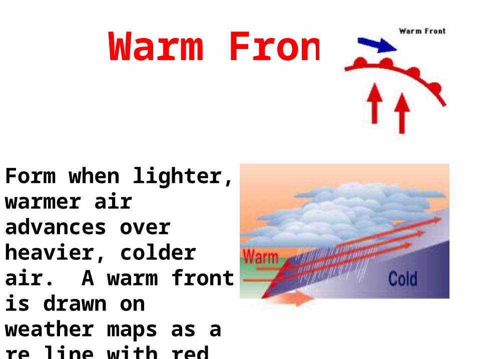
Warm Front
Form when lighter, warmer air advances over heavier, colder air. A warm front is drawn on weather maps as a re line with red semicircles.

Cold Front
• a blue line with triangles, occurs when colder air advances toward warm air and forces the warm air out of the area.
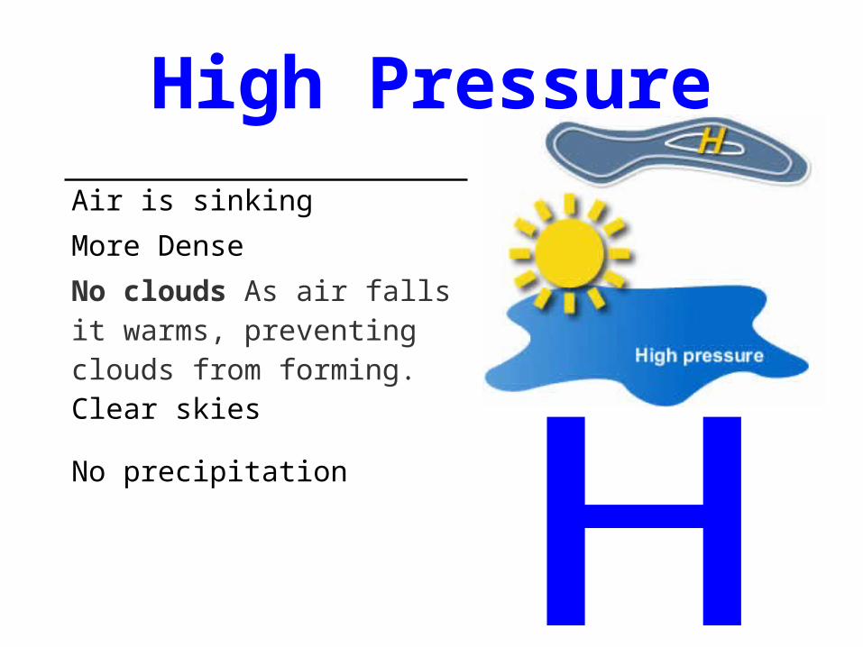
High PressureAir is sinking
More Dense
No clouds As air falls it warms, preventing clouds from forming. Clear skies
No precipitation

Low Pressure
Air RisingLess DenseForming clouds: As air rises it cools. As the air cools, the humidity in it begins to condense into tiny drops of water,Precipitation is presentAssociated with cold Fronts

Sea BreezeAs the air over the land heats up the cold air over the water moves in under it.

Land BreezeThe land cools off quicker than the water. As the air above the water moves up the air from the land moves under and over the water.

Air Masses
Cool and damp, bringing cloudy weather.
Continental Arctic: Very cold and dry.
Continental polar: Cold and dry, forming further south than Arctic air masses.
Continental tropical: Very hot and dry, forming over Mexico and the Southwest.
Maritime tropical: Warm and very humid, forming over the Gulf of Mexico.
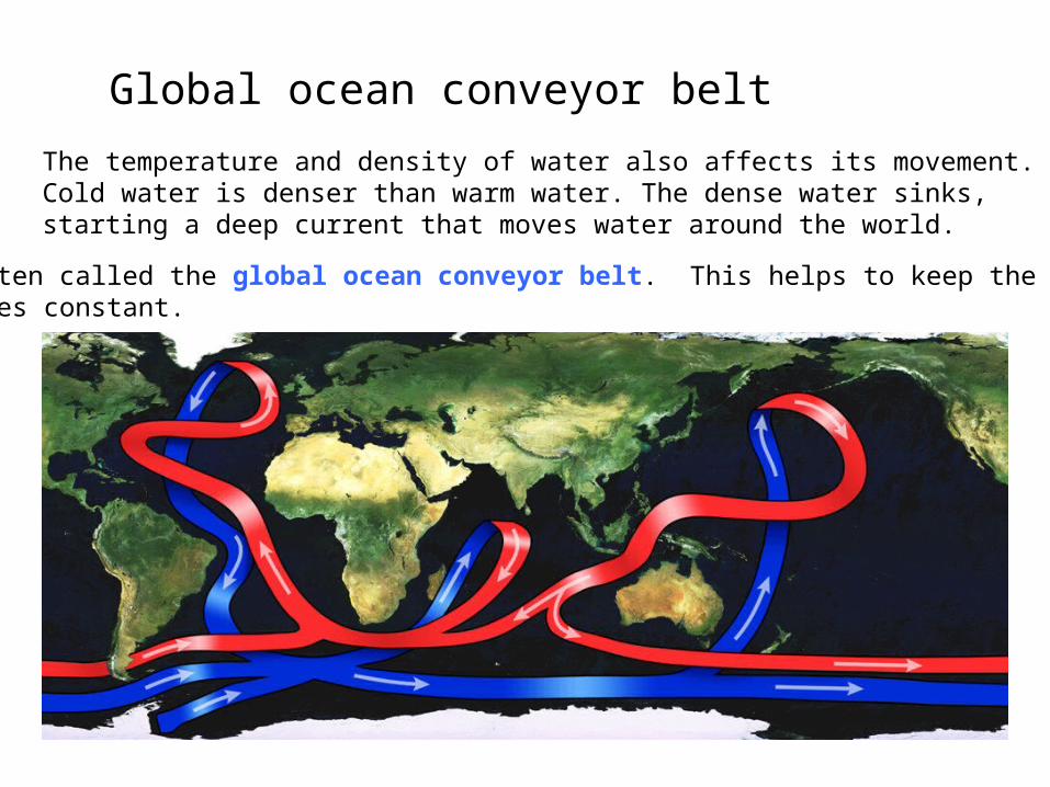
Global ocean conveyor beltThe temperature and density of water also affects its movement. Cold water is denser than warm water. The dense water sinks, starting a deep current that moves water around the world.
This is often called the global ocean conveyor belt. This helps to keep the earth’stemperatures constant.

AtmosphereThe gases that surround the Earth. Divided into layers based on temperature change.