Embed Size (px)
Citation preview
WILliAM P. TAYMAN
Member Emeritus, ASPRSPrepared by Frank C. Riley
Wallace SidneyPark
Memorial Address"
I am honored to have been asked to present this memorialtribute to Sidney Park, who was one of the pioneers in aerial
photography and one of the founding members of the AmericanSociety of Photogrammetry. He served as the Society's twentyfirst president in 1955, was the recipient of the Honorary MemberAward in 1969 and was also a Certified Photogrammetrist.
Sid was a sincere man with a friendliness and warmth that wasfelt by all who knew him. He was a leader who always receivedrespect and loyalty, he was trusted by all and held a deep regardfor everyone in his company.
Sid, as he was universally known, was born in Louisville inMay, 1898. As a young man he was always interested in flyingand had a boyish ambition to become a pilot in World War I. Sidlearned to fly as a Cadet in the Army Air Corps. Upon completinghis flying instructions, he was commissioned a Second Lieutenant.While he was too young to have flown in the war, he did someaerial photography work in the Army Air Corps immediatelyafter the war. It was then that he became increasingly interestedin combining this avocation with his vocation of flying. Not toomany years ago Sid was asked if he ever ''barn-stormed'': "Sure,"he replied, "1 started out barnstorming; I got into this business in1921, when I was 22 years old, and you had to barnstorm if youwanted food in your mouth."
BOWMAN PARK-AERO COMPANYIn 1920, Mr. Abram H. Bowman, a Louisville business man, be
came interested in commercial aviation and he and a World War Iveteran of the Royal Flying Corps, a pilot named Robert H. Gast,formed a company called Bowman-Gast Aero Company. Gastsoon left the company as his enthusiasm for aviation could not besatisfied by flying around the Louisville area, so he set out on hisown, although often returning to the city.
In the early 1920s, interest in commercial aviation appeared tobe waning and there was a chance that Louisville's airport, whereAbe Bowman had set up a flying operation, would close likehundreds of other airports around the country. During this timeSid returned home to Louisville, after having worked a short timewith the Glenn L. Martin Company. In 1921 Sid Park and AbeBowman entered into a joint business venture that put Sid's pilottraining to use in the Louisville area. They signed a contract withthe Louisville Gas and Electric Company which was building anew plant and wanted progress photos of the plant construction,right-of-ways for utility lines, subdivisions, etc. The first airplaneSid used was a Canadian Jennie and the camera was hand-held
*Presented at the Annual Convention of the American Society forPhotogrammetry and Remote Sensing, Baltimore, Maryland, 4 April1989.
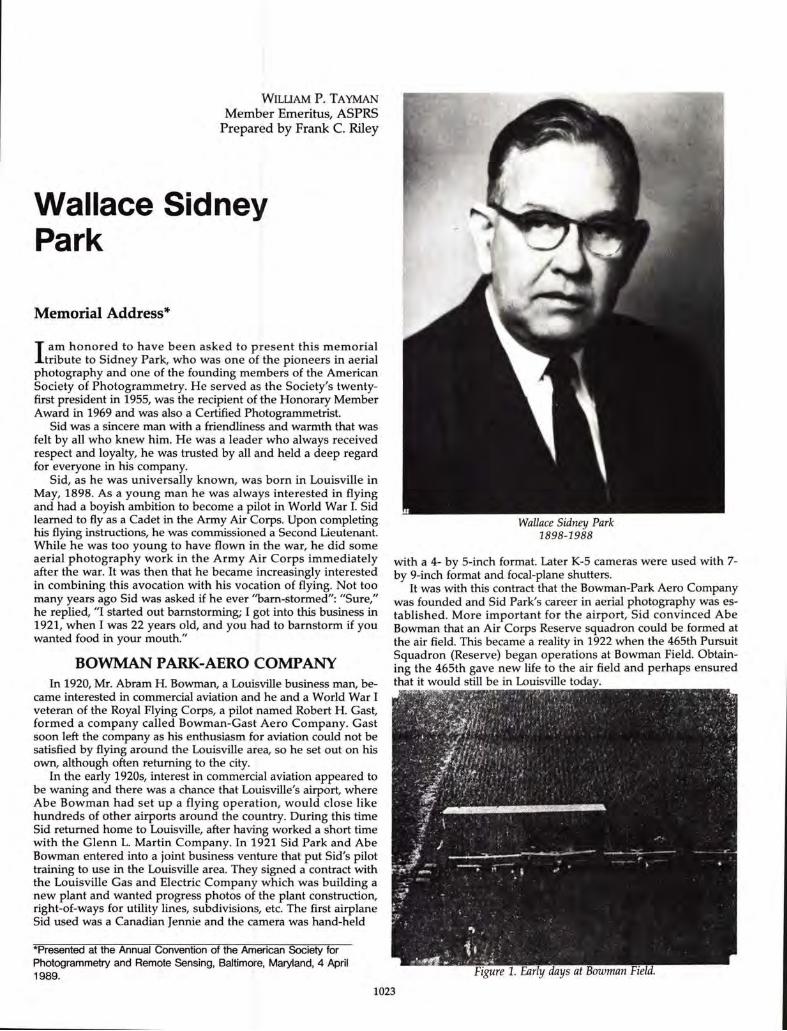
Wallace Sidney Park1898-1988
with a 4- by 5-inch format. Later K-5 cameras were used with 7by 9-inch format and focal-plane shutters.
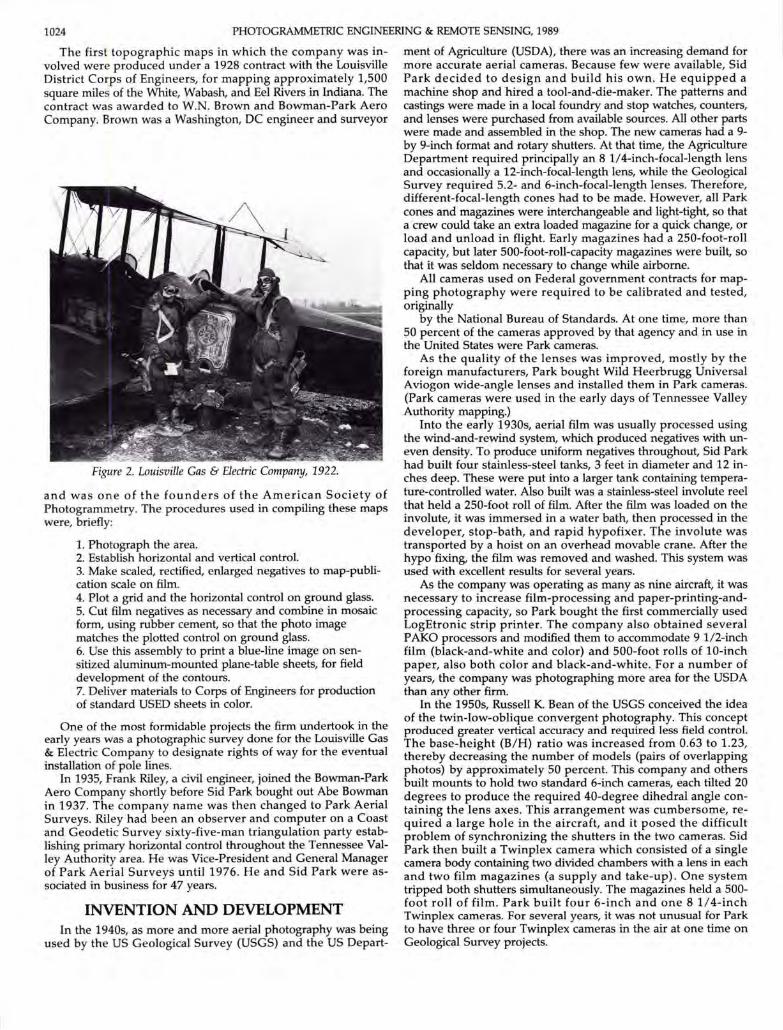
It was with this contract that the Bowman-Park Aero Companywas founded and Sid Park's career in aerial photography was established. More important for the airport, Sid convinced AbeBowman that an Air Corps Reserve squadron could be formed atthe air field. This became a reality in 1922 when the 465th PursuitSquadron (Reserve) began operations at Bowman Field. Obtaining the 465th gave new life to the air field and perhaps ensuredthat it would still be in Louisville today.
1023
1024 PHOTOGRAMMETRIC ENGINEERING & REMOTE SENSING, 1989
The first topographic maps in which the company was involved were produced under a 1928 contract with the LouisvilleDistrict Corps of Engineers, for mapping approximately 1,500square miles of the White, Wabash, and Eel Rivers in Indiana. Thecontract was awarded to W.N. Brown and Bowman-Park AeroCompany. Brown was a Washington, DC engineer and surveyor
Figure 2. Louisville Gas & Electric Company, 1922.
and was one of the founders of the American Society ofPhotogrammetry. The procedures used in compiling these mapswere, briefly:
1. Photograph the area.2. Establish horizontal and vertical control.3. Make scaled, rectified, enlarged negatives to map-publication scale on film.4. Plot a grid and the horizontal control on ground glass.5. Cut film negatives as necessary and combine in mosaicform, using rubber cement, so that the photo imagematches the plotted control on ground glass.6. Use this assembly to print a blue-line image on sensitized aluminum-mounted plane-table sheets, for fielddevelopment of the contours.7. Deliver materials to Corps of Engineers for productionof standard USED sheets in color.
One of the most formidable projects the firm undertook in theearly years was a photographic survey done for the Louisville Gas& Electric Company to designate rights of way for the eventualinstallation of pole lines.
In 1935, Frank Riley, a civil engineer, joined the Bowman-ParkAero Company shortly before Sid Park bought out Abe Bowmanin 1937. The company name was then changed to Park AerialSurveys. Riley had been an observer and computer on a Coastand Geodetic Survey sixty-five-man triangulation party establishing primary horizontal control throughout the Tennessee Valley Authority area. He was Vice-President and General Managerof Park Aerial Surveys until 1976. He and Sid Park were associated in business for 47 years.
INVENTION AND DEVELOPMENTIn the 1940s, as more and more aerial photography was being
used by the US Geological Survey (USGS) and the US Depart-
ment of Agriculture (USDA), there was an increasing demand formore accurate aerial cameras. Because few were available, SidPark decided to design and build his own. He equipped amachine shop and hired a tool-and-die-maker. The patterns andcastings were made in a local foundry and stop watches, counters,and lenses were purchased from available sources. All other partswere made and assembled in the shop. The new cameras had a 9by 9-inch format and rotary shutters. At that time, the AgricultureDepartment required principally an 8 1/4-inch-focal-length lensand occasionally a 12-inch-focal-length lens, while the GeologicalSurvey required 5.2- and 6-inch-focal-length lenses. Therefore,different-focal-length cones had to be made. However, all Parkcones and magazines were interchangeable and light-tight, so thata crew could take an extra loaded magazine for a quick change, orload and unload in flight. Early magazines had a 250-foot-rollcapacity, but later 500-foot-roll-capacity magazines were built, sothat it was seldom necessary to change while airborne.
All cameras used on Federal government contracts for mapping photography were required to be calibrated and tested,originally
by the National Bureau of Standards. At one time, more than50 percent of the cameras approved by that agency and in use inthe United States were Park cameras.
As the quality of the lenses was improved, mostly by theforeign manufacturers, Park bought Wild Heerbrugg UniversalAviogon wide-angle lenses and installed them in Park cameras.(Park cameras were used in the early days of Tennessee ValleyAuthority mapping.)
Into the early 1930s, aerial film was usually processed usingthe wind-and-rewind system, which produced negatives with uneven density. To produce uniform negatives throughout, Sid Parkhad built four stainless-steel tanks, 3 feet in diameter and 12 inches deep. These were put into a larger tank containing temperature-controlled water. Also built was a stainless-steel involute reelthat held a 250-foot roll of film. After the film was loaded on theinvolute, it was immersed in a water bath, then processed in thedeveloper, stop-bath, and rapid hypofixer. The involute wastransported by a hoist on an overhead movable crane. After thehypo fixing, the film was removed and washed. This system wasused with excellent results for several years.
As the company was operating as many as nine aircraft, it wasnecessary to increase film-processing and paper-printing-andprocessing capacity, so Park bought the first commercially usedLogEtronic strip printer. The company also obtained severalPAKa processors and modified them to accommodate 9 l/2-inchfilm (black-and-white and color) and 500-foot rolls of 10-inchpaper, also both color and black-and-white. For a number ofyears, the company was photographing more area for the USDAthan any other firm.
In the 1950s, Russell K. Bean of the USGS conceived the ideaof the twin-low-oblique convergent photography. This conceptproduced greater vertical accuracy and required less field control.The base-height (B/H) ratio was increased from 0.63 to 1.23,thereby decreasing the number of models (pairs of overlappingphotos) by approximately 50 percent. This company and othersbuilt mounts to hold two standard 6-inch cameras, each tilted 20degrees to produce the required 40-degree dihedral angle containing the lens axes. This arrangement was cumbersome, required a large hole in the aircraft, and it posed the difficultproblem of synchronizing the shutters in the two cameras. SidPark then built a Twinplex camera which consisted of a singlecamera body containing two divided chambers with a lens in eachand two film magazines (a supply and take-up). One systemtripped both shutters simultaneously. The magazines held a 500foot roll of film. Park built four 6-inch and one 8 1/4-inchTwinplex cameras. For several years, it was not unusual for Parkto have three or four Twinplex cameras in the air at one time onGeological Survey projects.
MEMORIAL ADDRESSES 1025
In the 30s and 40s, only a small part of the US was adequatelymapped at 1:24,000 or 1:62,500 scales. These were the best available flight maps. Sid decided that something should be doneabout providing flight maps for areas not adequately mapped. Hebuilt a tri-lens camera using three short-focal-length lenses - onevertical and two obliques. The tri-lens photography was enlargedseveral times and the flight lines drawn on these photo-maps.This made it possible to have 5 or 6 flight lines drawn on one trilens flight, and resulted in better flight plans and a minimumnumber of reflights.
THE WORLD WAR II PERIODJust before World War II when the Army was training a great
many men and women as aerial photographers, they required thetrainees to be taken up in aircraft. To speed the job of training andsave the cost of flying, Sid built a photo trainer. 1t consisted of acabin which held the trainee, a camera magazine, and a viewfinder. Under the cabin was a piece of exposed film of an aerialnegative which traveled and gave the trainee a ground imagethrough the view finder. Also, a recording device would print animage representing a photograph. The trainee could then betaught to correct for crab, tilt and overlap. Five of the trainerswere sold to the Air Force.
When Wild Heerbrugg build the RC-9 super-wide-angle 3 1/2inch (88mm)-focal-length camera, the USGS bought two camerasof this type for use on some of its projects. After one or moreprivate companies bought this type camera, the Geological Survey advertised their two cameras for sale. Park Aerial Surveyswas the highest bidder, and these cameras were used extensivelyon Geological Survey and private contracts.
Over the years, Park operated various types of aircraft. BeforeWorld War II, the company had a Canadian Jennie, Uncoln Standard, Curtiss Robin, Cessna J6-7, and six Cessna Airmasters. Afterthe war, the company used whatever it could find such as an oldAirmaster and several AT 6s. Later, when the Cessna 195 wasbuilt, Park Aerial Surveys began using it and had as many as nineof these aircraft at one time. In order to get greater altitude andspeed, Park modified four 195's by removing the Jacobs enginesand replacing them with Pratt and Whitney 450 hp engines. Afterthe 1960s, Park started using six Piper Twin Comanches. 1n spiteof the many planes used and the thousands of hours flown, thecompany never had a fatality nor serious injury to its personnel,although it did lose two planes.
Park Aerial Surveys, Inc. was closed from 1942 through 1945.Sid Park had been ordered to active duty as a Colonel in theArmy Air Corps (he served as an intelligence officer in England
on the General Staff of the European Theater of Operations).Meanwhile, Frank Riley joined the Marine Corps.
When Park closed in 1942, the armed forces bought theairplanes and cameras. One of the Park pilots, who was called toAir Corps duty, flew for the military the same airplane that he hadflown for Park Aerial Surveys.
BUSY YEARS FOR PARK AERIAL SURVEYSThe company reopened after the War and began using hus
band-and-wife (pilot-photographer) photo crews. This proved tobe very satisfactory with people like the Tolers, Blantons, Sauers,and others, who produced outstanding work. These husband-wifeteams were sent out across the country for as long as five to sixmonths at a stretch. That was one of the reasons Park Aerial Surveys preferred husband-wife crews. Not only did it keep familiesclose, but added stability to the working conditions. The combination led to virtually "zero" employee turnover. Sid once explained, "We use the gals whenever we can, they do this type ofwork much better than men."
Before the advent of the Interstate Highway system, a numberof consulting engineering firms, realizing the great value of accurate photogrammetric maps, started buying equipment anddoing their mapping in-house. Park Aerial Surveys had been inthe consulting engineering and photogrammetric mapping business for several years and they had experience and know-how inboth engineering design and mapping.
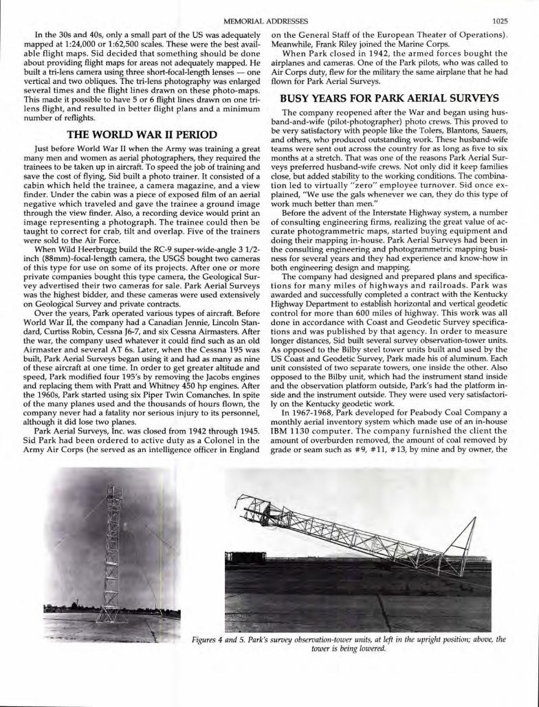
The company had designed and prepared plans and specifications for many miles of highways and railroads. Park wasawarded and successfu1]y completed a contract with the KentuckyHighway Department to establish horizontal and vertical geodeticcontrol for more than 600 miles of highway. This work was aUdone in accordance with Coast and Geodetic Survey specifications and was published by that agency. In order to measurelonger distances, Sid built several survey observation-tower units.As opposed to the Bilby steel tower units built and used by theUS Coast and Geodetic Survey, Park made his of aluminum. Eachunit consisted of two separate towers, one inside the other. Alsoopposed to the Bilby unit, which had the instrument stand insideand the observation platform outside, Park's had the platform inside and the instrument outside. They were used very satisfactorilyon the Kentucky geodetic work.
1n 1967-1968, Park developed for Peabody Coal Company amonthly aerial inventory system which made use of an in-houseIBM 1130 computer. The company furnished the client theamount of overburden removed, the amount of coal removed bygrade or seam such as #9, #11, #13, by mine and by owner, the
Figures 4 and 5. Park's survey observation-tower units, at left in the upright position; above, thetower is being lowered.
1026 PHOTOGRAMMETRIC ENGINEERING & REMOTE SENSING, 1989
area reclaimed, new haul roads, and other information. It required a year to develop the program. Park would start flying onthe last day of each month and all work had to be delivered notlater than the fifth of the next month, six days. At times, twophoto crews were used as the area involved approximately 35 pitsin six states. The process required seven plotting instruments,operated 24 hours per day. In a 13-year period, Park failed tocomplete the monthly work only two or three times, and that wasdue to adverse weather conditions. This was the most comprehensive mine production inventory program in use at thattime.
During the many years when Park Aerial Surveys was doing alarge amount of aerial photography for various United StatesGovernment agencies, it was the custom of the USGS and the USForest Service to make inspection of aerial photographs and otherproducts in the contractors' plants. I would be remiss if I did notpay tribute to their representatives, who would come to our plantand spend many hours in the photo-laboratory at night, on Saturdays and Sundays, inspecting the work to ensure timely completion.
Park was very fortunate in having an excellent group ofemployees. There was a very small turnover and many of theseemployees had more than 25 years of service with Park AerialSurveys.
Park's area of operation was throughout the continental UnitedStates and Alaska. The company did only a small amount offoreign work, but did have contracts in the Bahamas and Vietnam.
Park Aerial Surveys, Inc. was sold to J. Edwin Rankin in 1973.
LOOKING BACKW. Sidney Park was Bowman's second business partner in
aviation. Perhaps the most pragmatic of Louisville's trio of aviation pioneers, Park readily admitted that the airplane had servedas a fine tool in his business of many decades - aerial photography.
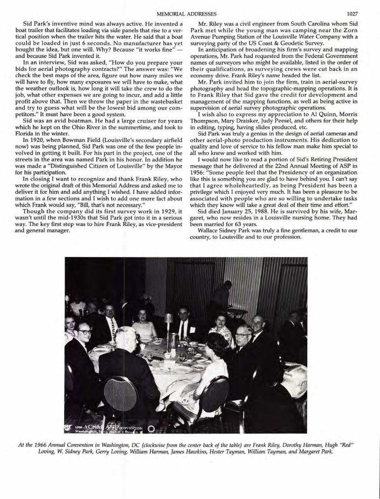
Figure 6. Bowman Field historic plaque.
Over the years the company was eminently successful. Itemployed approximately 100 people and owned 8 airplanes.After selling his interest in Park Aerial Surveys, Sid became apartner in Riley, Park, Hayden & Associates, a firm engaged indesign, survey and construction supervision operations.
Park was one of the founders of the Aero Club of Louisville. In1925, he married the former Margaret C. Joseph, of Louisville. Hesaid, "She was the Secretary of the Aero Club for 8 years, and didall the work, while I got all the credit."
Park never took an active interest in student training and hesaid"Addison Lee (Chairman of the Air Board for its first 20years) was my only student who eventually soloed." He notedthat Bowman never learned to fly and that he took a back seateven in the early days of the business.
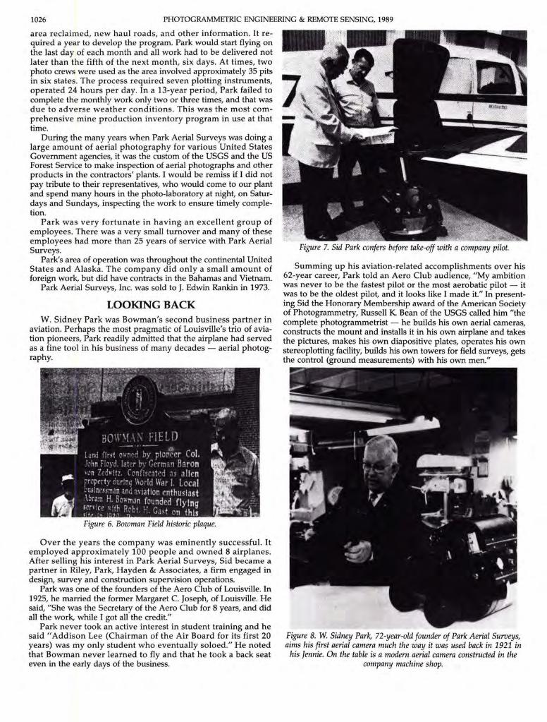
Figure 7. Sid Park confers before take-off with a company pilot.
Summing up his aviation-related accomplishments over his62-year career, Park told an Aero Club audience, "My ambitionwas never to be the fastest pilot or the most aerobatic pilot - itwas to be the oldest pilot, and it looks like I made it." In presenting Sid the Honorary Membership award of the American Societyof Photogrammetry, Russell K Bean of the USGS called him "thecomplete photogrammetrist - he builds his own aerial cameras,constructs the mount and installs it in his own airplane and takesthe pictures, makes his own diapositive plates, operates his ownstereoplotting facility, builds his own towers for field surveys, getsthe control (ground measurements) with his own men."
Figure 8. W. Sidney Park, 72-year-old founder of Park Aerial Surveys,aims his first aerial camera much the way it was used back in 1921 in
his Jennie. On the table is a modern aerial camera constructed in thecompany machine shop.
MEMORIAL ADDRESSES 1027
Sid Park's inventive mind was always active. He invented aboat trailer that facilitates loading via side panels that rise to a vertical position when the trailer hits the water. He said that a boatcould be loaded in just 6 seconds. No manufacturer has yetbought the idea, but one will. Why? Because "it works fine" and because Sid Park invented it.
In an interview, Sid was asked, "How do you prepare yourbids for aerial photography contracts?" The answer was: "Wecheck the best maps of the area, figure out how many miles wewill have to fly, how many exposures we will have to make, whatthe weather outlook is, how long it will take the crew to do thejob, what other expenses we are going to incur, and add a littleprofit above that. Then we throw the paper in the wastebasketand try to guess what will be the lowest bid among our competitors." It must have been a good system.
Sid was an avid boatman. He had a large cruiser for yearswhich he kept on the Ohio River in the summertime, and took toFlorida in the winter.
In 1920, when Bowman Field (Louisville's secondary airfieldnow) was being planned, Sid Park was one of the few people involved in getting it built. For his part in the project, one of thestreets in the area was named Park in his honor. In addition hewas made a "Distinguished Citizen of Louisville" by the Mayorfor his participation.
In closing I want to recognize and thank Frank Riley, whowrote the original draft of this Memorial Address and asked me todeliver it for him and add anything I wished. I have added information in a few sections and I wish to add one more fact aboutwhich Frank would say, "Bill, that's not necessary."
Though the company did its first survey work in 1929, itwasn't until the mid-1930s that Sid Park got into it in a seriousway. The key first step was to hire Frank Riley, as vice-presidentand general manager.
Mr. Riley was a civil engineer from South Carolina whom SidPark met while the young man was camping near the ZornAvenue Pumping Station of the Louisville Water Company with asurveying party of the US Coast & Geodetic Survey.
In anticipation of broadening his firm's survey and mappingoperations, Mr. Park had requested from the Federal Governmentnames of surveyors who might be available, listed in the order oftheir qualifications, as surveying crews were cut back in aneconomy drive. Frank Riley's name headed the list.
Mr. Park invited him to join the firm, train in aerial-surveyphotography and head the topographic-mapping operations. It isto Frank Riley that Sid gave the credit for development andmanagement of the mapping functions, as well as being active insupervision of aerial survey photographic operations.
I wish also to express my appreciation to Al Quinn, MorrisThompson, Mary Draisker, Judy Peesel, and others for their helpin editing, typing, having slides produced, etc.
Sid Park was truly a genius in the design of aerial cameras andother aerial-photo production instruments. His dedication toquality and love of service to his fellow man make him special toall who knew and worked with him.
I would now like to read a portion of Sid's Retiring Presidentmessage that he delivered at the 22nd Annual Meeting of ASP in1956: "Some people feel that the Presidency of an organizationlike this is something you are glad to have behind you. I can't saythat I agree wholeheartedly, as being President has been aprivilege which I enjoyed very much. It has been a pleasure to beassociated with people who are so willing to undertake taskswhich they know will take a great deal of their time and effort."
Sid died January 25, 1988. He is survived by his wife, Margaret, who now resides in a Louisville nursing home. They hadbeen married for 63 years.
Wallace Sidney Park was truly a fine gentleman, a credit to ourcountry, to Louisville and to our profession.
At the 1966 Annual Convention in Washington, DC (clockwise from the center back of the table) are Frank Riley, Dorothy Harman, Hugh "Red"Loving, W. Sidney Park, Gerry Loving, William Harman, James Hawkins, Hester Tayman, William Tayman, and Margaret Park.


![The Sidney herald (Sidney, Mont.), 1955-11-17, [p 20]](https://img.pdfslide.us/doc/110x75/619b7c35ab34023d1f563fab/the-sidney-herald-sidney-mont-1955-11-17-p-20.jpg)