Embed Size (px)
Citation preview

Waipiata Community Plan
April 2008

Waipiata Community Plan
Executive Summary Process This Community Plan has emerged from a consultative process designed to encourage community participation. Emphasis has been placed on obtaining community views regarding the Waipiata area, identifying its points of difference and determining what opportunities there might be to ensure that it remains an attractive and desirable place in which to live, work and play. This Plan has distilled the individual opinions into a collective community vision and proposes a number of key recommendations that will assist in the development of Waipiata as a sustainable community. While the Plan has no legal status, it does provide an important insight on the direction the community would like to head for many of the organisations involved or identified in it. To this end having a community group to oversee the aims of this Plan, on behalf of the community, will be important and help to drive many of its recommendations. It should be noted that there are community plans for the Maniototo, Naseby and Patearoa and Upper Taieri which need to be considered in conjunction with this Plan when looking at the Maniototo as a whole. In defining the Waipiata community, the Plan also acknowledges that there is a wider community including both private individuals and national organisations which for historical, ancestral and heritage reasons consider themselves to hold an interest in the future of this area. This plan provides a framework from which further activities and actions can be developed and this may see a possible broadening of the scope of the plan in the future. Community Plan Process The outline planning process and time frame is as follows: Community Workshop – held October 2007 Draft Plan developed – December 2007
Draft Plan – Available for community comment – December/January 2008 Submissions – reviewed by Working Party – mid February 2008 Changes made to Plan – 1st week in March 2008 Community Plan – sign off – April 2008 Implementation – April 2008 onwards

Table of Contents. Map of Area 4 Waipiata 4 Waipiata and surrounding area 5 Vision 6 Community Profile 7 Location 7 History 7 Economy 8
Environment 8 Lifestyle 8 Social infrastructure 9
Specific Features of the Area 10 Discussion Points 12
Product Development 12 Heritage 12 Cycling and Walkways 14 Events 15
Community Development 16 Community 16 Recreation 17
Physical Infrastructure 19 Water and Wastewater 19
Roading 20 Refuse 20
Planning 22
Economy Tourism 23 Business 24 Accommodation 24
What is important to the community? 26

4
Waipiata Area

5
Waipiata and Surrounding Area

6
Vision
WE VALUE Our Environment
• Its panoramic vistas • Its mountain ranges, wetland, geological rock formations, volcanic history
rivers and streams
Our History
• Historic buildings • Its goldfields history • Its historic “Green” Bridge
Our Community
• Small, friendly and welcoming • Rich diversity that both resident and holiday home owners bring • Motivated, independent and self reliant • Its peace and quiet where a relaxed lifestyle can be enjoyed
Recreation
• Diverse opportunities • Recreational and community facilities in the area including the domain,
tennis courts and bowling green • Otago Central Rail Trail
Should all or any of these values we consider important be diminished or lost, the area will no longer be a “special place”.

7
Community Profile
Location This community plan includes the Waipiata township formally known as Komako and surrounding areas including Hamiltons Diggings to the south. Spectacular panoramic views of the Maniototo plain, Mt Ida to the north, Rough Ridge range to the west, Rock and Pillar range to the southeast and Kakanuis to the northeast gives both locals and visitors a true visual delight. The old Taieri Lake bed can be viewed from the Waipiata - Kyeburn and Waipiata - Kokonga Roads. The Otago Central Rail Trail runs around the edge of the old lake bed. Waipiata, situated 10 kilometres from Ranfurly is a small village with distinctive heritage, historical buildings and sites. History Hamiltons was the site of a gold rush in 1863 and once had 4,000 miners engaged in the alluring quest for gold. The diggings and Hamiltons Cemetery is a poignant reminder of the past. Also the original Hamiltions Union Church (1865-1917) bell was also used at the Waipiata School from 1921 to 1987 after the church closure. The bell now has pride of place at the Waipiata Bowling Club. The first school was built in 1891 followed by the Green Bridge in 1896 which spans the Taieri River at Waipiata. The railway bridge is 96 metres long and is situated down stream from the Green Bridge, the first train crossed the bridge to the village in 1898. By 1900 Waipiata had a school, post office, sale yards, hall, hotel, shops and several small business including a blacksmith. The post office also ran a mail cart to surrounding settlements which also catered for passengers. A rabbit processing factory owned by Davy Jones employed as many as 100 people from 1919 until 1921, when the prices slumped and the operation finally ceased in the 1930’s. “The Orangapai Sanatorium” a private hospital operated by Dr Byres for the treatment of tuberculosis patients opened in 1914 above the hills of Waipiata. Orangapai means “restoration to health” but the sanatorium was commonly known as the Waipiata Sanatorium. At the height of operations approximately 112 patients were at the Sanatorium. In 1923 the Maniototo Hospital Board took over its management, and in 1961 the site and facilities became a corrective and training centre for the Justice Department until 1979. It is now privately owned and called En Hakkore – “a place of refreshment”.
Waipiata had two churches – St Clement’s Anglican which closed in 1995 and the Presbyterian church which closed in 1980. Both the church buildings are now used as holiday homes. (The Cyclopaedia of Otago and Southland Vol 2 Edited by Paul Sorrell Published 1999).
8
Economy
Central Otago has experienced rapid economic development during the past four years. The Maniototo has experienced the effects of this growth with the price of land and houses increasing from the lows experienced in the late ‘90’s. The local Waipiata economy is primarily based on agriculture and sheep farming in particular; however, in recent times dairy farming, horticulture and visitors on the Otago Central Rail Trail which passes through the village have diversified the local economy. With this reliance on agriculture, the local economy is inextricably linked to external factors such as the value of the New Zealand dollar and demand for farming produce over which there is little local control. The Waipiata area with its low rainfall is very reliant on irrigation for the land to be productive.
Environment
Waipiata’s distinctive landscape, heritage aspects and access to recreational
opportunities in and around the area are widely considered to contribute to the
perception of it being a ‘special place’.
The Central Otago District Plan schedule 19.4 Register of Heritage Buildings,
Places, Sites and Objects identifies the War Memorial, the Green Bridge, the former
Waipiata Sanatorium and Hamiltons Cemetery. The community needs to further
identify in detail those landscapes and heritage items it values before they come
under development pressure.
The area also has unique features with the Taieri River, Hogburn Creek, the old
Taieri Lake bed, wetlands, volcanic rock formations and surrounding mountain
areas. The vent of the old St Pauls volcano can be seen in the sky line above
Kokonga with a solitary pine tree marking the site. Volcanic rock was used in the
construction of the Dunedin Railway Station; this rock was quarried from above the
Taieri Lake siding. George Ellis of Ellis Transport operates a mining licence to mine
volcanic paving rock. For these areas to be recognised the community must raise
awareness and provide education for all visitors.
The demand for development in and around Waipiata is likely to increase as more
people discover the recreational opportunities that Waipiata has to offer and more so
if the re-establishment of the Taieri Lake was to come to fruition. This will ultimately
put pressure on the current water supply and sewage disposal systems.
Infrastructure may ultimately be required to supply water, a sewerage system,
rubbish collection and improvements to roading, footpaths and street lighting which
all need to be planned for, should Waipiata wish to grow.
Lifestyle
Waipiata village has a permanent population of 24 with holiday home owners
boosting this number to 51. The population for the greater Waipiata area including

9
those living at En Hakkore numbers approximately a further 53 permanent residents.
The Waipiata area is essentially populated by families with a strong sense of
connection to the area either by the goldrush, railway station, rabbit factory, past
business/employment connections or through farming. For holiday home owners the
sense of tranquillity and security that the village offers makes it a home away from
home to be treasured and protected.
For younger people, the area will always be home, but they have a tendency to leave
the area to find a wider range of employment and/or educational opportunities. In
recent times this trend has changed with increasing numbers of apprenticeships in
all trades helping to keep some youth in the wider Maniototo area.
Social Infrastructure
Maniototo has a wide range of social infrastructure available including health
services via Maniototo Health Services, the Chalet Rest Home, a volunteer
ambulance service, two volunteer fire brigade groups, doctor, a visiting dentist and
optometrist. There are also several churches representing a number of different
denominations, pre school facilities, two primary schools, an area school and a
covered swimming pool. A local radio station broadcasts from Ranfurly owned by a
charitable trust and run by a committed group of volunteers. Waipiata village has a
hall, tennis courts and domain area with toilets, a bowling club, library and local
hotel.

10
Specific Features of the Area
Population The Waipiata community numbers approximately 77. During the
summer months the population rises with holiday makers staying in
the area.
Population - 2001 Maniototo - 945 Ranfurly - 732 Naseby - 99 Population - 2006 Maniototo – 1,035 Ranfurly – 711 Naseby - 114 People 2001 figures: 20.6% of the wider Maniototo population are aged
under 15 (19.9% for Central Otago)
2006 figures: 20% of the wider population Maniototo are aged under 15, (18% for Central Otago)
2001 figures: 71.2% of the wider Maniototo population are aged 25-64 (53.2% for Central Otago).
2006 figures: 51% of the wider Maniototo population are aged 25-64 (54% for Central Otago)
2001 figures: 8.2% of the wider Maniototo population are aged over 65 (17.7% for Central Otago and 12.1% for NZ)
2006 figures: 21% of the wider Maniototo population are aged over 65, (17% for Central Otago)
Climate Continental. The average rainfall is approximately 350mm. There
are on average 70 wet days per year. There is a marked variation in winter (down to -15 degrees C) and summer temperatures (up to 38 degrees C).
Features The Mountain ranges include Rock and Pillar, Rough Ridge,
Kakanuis and Mt Ida Taieri River is New Zealand’s third longest river at 318km Hogburn Creek Volcanic rock formation
Wetlands Regular Events Waipiata Ute Muster Dirty Dozen Pest Shoot
Dog Bark Competition Waipiata Darts Competition – winter months

11
Bowling Tournaments Tennis Club competition
Industries Pastoralism, horticulture, tourism and hospitality industry

12
Discussion Points
Product Development
Heritage Waipiata and the surrounding area has a proud heritage associated with its mining, railway and agricultural past. Hamiltons Cemetery is a key heritage site identified in the Central Otago District Plan. The Central Otago Heritage Project will get underway in 2008. This project proposes to identify heritage areas throughout the district by developing a heritage data base. Not only will this project identify those heritage items most at risk, most important and most representative, it will also identify sustainable development projects that may involve private public partnerships to enable these to be achieved. Elements of heritage in the area are likely to be highlighted by this project. Other parties included in the project are Department of Conservation (DOC) and the Historic Places Trust (HPT) who have an interest in preserving and maintaining the heritage aspects of the area. Community involvement is essential to the long term success of the project with the community able to add heritage items onto the data base.
Heritage was identified as being very important to the Waipiata community. To retain its ambience full consideration should be given to existing heritage. Whether it is its farming heritage, mining history, railway history or the old buildings, there is a wide range of history to be appreciated. Plaques identifying the historical significance of the various buildings and sites in the village would give visitors a better idea of how interesting the settlement is. This information could also be available for inclusion in brochures associated with the area. In January 2000 a heritage tour was held in conjunction with Otago Goldfields Trust through the area. As this was very successful it may set the scene for further tours as many sites such as the historic buildings in the Waipiata village, the Green Bridge, Hamiltons mining site, Hamiltons cemetery and En Hakkore were identified. These tours could be adjuncts to activities associated with the Otago Central Rail Trail with the express aim of trying to get visitors to stay an extra night in Waipiata. Interpretation of the heritage, through better signage, would be required to help tell the story of the area to visitors. Opportunities were also identified with the possible restoration and relocation of the Railway Station building. A further opportunity was also identified to collate information and stories on the area as the basis of a book on Waipiata’s history.

13
Objective Enhance the heritage character of the Waipiata area for the appreciation of locals and visitors alike. Recommendations for action:
• Develop heritage trails, interpretation and brochure • Develop and collate information and stories for the basis of a book

14
Cycle and Walkways See Recreation section for Otago Central Rail Trail page 16. The Central Otago District Council (CODC) is developing an Outdoor Recreation Product Development Strategy which will help identify opportunities for the area. Public cycleways and walkways along the surrounding Taieri River and through the surrounding hills were identified as an opportunity and need to be identified and developed. It was proposed that a “Waipiata Village Walk” be developed including plaques with a history of the various buildings and sites in the village. Objective Create cycleways and walkways to showcase the landscape and heritage. Recommendations for action:
• Create local cycleways and walkways to appropriate track standards with signage and interpretation and in keeping with new regional identity guidelines
• Develop a “Waipiata Village Walk” including plaques with a history of the various buildings and sites in the village

15
Events Community events of note are the Waipiata Ute Muster which has run successfully for the last three years and is well supported from people beyond the district. The community, however, would like to see an increased focus on family oriented activities. Other events are associated with the Waipiata Bowling Club, the tennis courts and the Waipiata Hall. The Waipiata Bowling green is a focus for the area and offers a well cared for quality green. There is an opportunity for further development and promotion of seasonal events which could include mountain biking, kayaking, hunting and fishing. Organising any new event would require volunteers and the shortage of helpers in the community must be taken into account before any new event is considered. Objective Continue current and further develop quality events for the area. Recommendation for action:
• Develop an increased focus on family oriented activities and events • Assess the opportunities for other events in the area
16
Community Development
Community The Waipiata community have strongly indicated they treasure the heritage of the area, their sense of being a small village community, the surrounding landscape and recreational opportunities that are available. It is these qualities that make Waipiata a great place in which to live, work and play. The people of Waipiata want to retain their strong sense of community, friendliness and “can do” attitude born out of necessity. This has resulted in an independent and self reliant community. The community have indicated they actively want to encourage visitors to the area but is aware there needs to be development of existing facilities, restoration of the Railway Station building, documented information of the rich treasure trove of heritage sites and recreational activities available. This will need to be carefully planned and implemented so as not to give the appearance of being disjointed. The Waipiata community consists of distinct interest groups including permanent residents, business interests, holiday home owners, a Christian community and farmers. An interdenominational church service at En Hakkore is held every Sunday morning and a warm welcome is extended to all. The community has many active committees including the Waipiata Development Committee, the Waipiata Hall Committee, Waipiata Darts Club, the Waipiata Ute Muster Committee and the Taieri Lake Recreation Reserve Committee. The community has acknowledged the valuable work done by all these committees which is reliant on volunteers. Volunteerism is the key resource behind the many community projects and activities which enhance the village. As most groups rely on this goodwill to run many of the activities and projects, concern was expressed that with a decline in volunteerism, due to busier lifestyles (whether this be work or other recreational activities) and with members of the local community aging, these activities and events run the risk of decline. With many active community groups it was noted there was hardly enough people to do all the work and it is difficult for people to keep track of all the things happening locally. It was suggested that greater co-ordination, information sharing and better communication between groups in the local community could be met by a newsletter or a notice board placed within the township. Another big challenge for the local community is funding the various initiatives identified in this Plan. This will require some prioritisation of work and a planned approach of how to fund these.

17
Objective A community that is friendly, tranquil, and accommodating to visitors, where people desire to live and be a part of the shared vision for Waipiata. The retention and further development of local facilities and services. Recommendations for action:
• Develop a newsletter to update the community on current projects and activities
• Encourage co-operation and communication between existing groups and committees
Recreation The surrounding mountains and rivers provide recreational opportunities for hunting, fishing, tramping, mountain biking, walking, independent camping and family picnics. There is also a bowling green and a tennis court in the village. The Hogburn Creek runs through the village, although the creek bed needs to be cleared out to assist water flow. Broom and gorse needs to be sprayed or removed to improve access to the creek. Continue beautification and tree planting around the village. The Otago Central Rail Trail travels through the Waipiata village and as such makes the town a convenient place for cyclists and visitors to stop and take a rest. The community identified issues including, the lack of public toilets, access to drinking water, picnic tables, rubbish bins and historical information which, if provided would encourage cyclists/visitors to stop. To encourage visitors to discover more about the area, a heritage trail or interpretation panel could be developed to promote further exploration of the area. Any such trail should link in with proposed trails in Patearoa. Should the Railway Station be relocated back to its original site, it could provide an ideal place where public toilets, access to drinking water, picnic tables, rubbish bins and historical information could be located. The original site of the Railway Station is on Department of Conservation land which runs through Waipiata however; the site requires vegetation control.
Identification of the appropriate location for public toilets needs to be undertaken. The toilets in the Waipiata Town Hall with modification to allow external access should also be considered as an option for public toilets. For locals and visitors to the area the Waipiata hotel is within walking distance and provides a cold beer, food and accommodation at the end of a long hot day. The hotel is a meeting place for locals and visitors and therefore an important, integral part of the village. There are also several accommodation providers in Waipiata and surrounds for visitors who would like to stay a while. The community indicated they would like to see more use of the Waipiata Hall and library. To assist this, the hall could be included in any future marketing of Waipiata.

18
The hall has excellent musical acoustics, a sprung dance floor, a stage area, kitchen and supper room. The Hall is managed by the local hall committee on behalf of Council. The community voiced strong support for the re-establishment of the Taieri Lake with the proviso that it be a suitable depth to ensure clarity of the water. However the community acknowledged that while this would bring many recreational and economic benefits to Waipiata and the wider Maniototo area, it would have the potential to change the village atmosphere of Waipiata. The community saw Waipiata as being a link with other tourism attractions within the Maniototo, and as such would like to see tours developed that would not only focus on Waipiata but other attractions in the Maniototo. Objectives: Development of recreation facilities and identification of future opportunities. Recommendations for action:
• Relocate and restore the Railway Station building • Identify appropriate location for public toilets • Provide drinking water for visitors • Erect signage for historical/trails information • Site picnic tables around the village • Assess the need for litter bins • Hogburn Creek cleared to assist water flow • Broom and gorse sprayed or removed to improve access to the Hogburn
Creek
• Continue beautification and tree planting around the village • Encourage use of the Waipiata Town Hall • Encourage and support the re-establishment of Taieri Lake • Investigate opportunities for tours around the Maniototo

19
Physical Infrastructure
Infrastructure is critically important for all communities. The Waipiata community needs to clearly identify what it wants for the future. If it is to capitalise on those wanting to live in Central Otago, the growing number of visitors to Central Otago, the desire for people to have second homes, then it must put in place appropriate supporting infrastructure. However, such development is likely to place a financial burden on what is essentially a small ratepayer base in terms of rates required. A key will be to provide services to the public at a level that the community can afford. A major issue for small towns during the summer period when the population increases, is the significant extra requirements on infrastructure and the demand on water supply, roading and other services. Water and Wastewater Maniototo has a dry semi arid climate with free draining soils and an annual rainfall of around 350mm a year. Due to the dry climate this adds additional pressure on water demand. Waipiata village has artesian bores and wells, all of which are privately owned - one is on DOC land. Due to the high water table it is believed that the bores will not run dry if sustainable management is continued to be practiced. The bores do have the potential to supply more connections than they currently supply. Some holiday homes rely on tank water which is not an ideal potable water supply. The nearby Taieri River could be utilised as water supply service should residential development in Waipiata village exceed the capabilities of the bores. However this would not be without significant cost to the small rate payer base when treatment costs and infrastructure costs would have to be considered. Septic tanks provide for waste water disposal in the village, however if Waipiata is to grow in the future, then an alternate means of waste disposal may need to be considered. With no waste water system in place at present, the community needs to assess the potential need of a scheme. Objective Water supply that meets the needs of the community. Waste water disposal that meets the needs of the community. Recommendations for actions
• Monitor water supply requirements based on growth of the village • Continue to encourage improvement of river quality in the area • Monitor the need for a sewerage scheme based on growth • Explore water supply options for the village

20
Roading Roading is an integral part of any rural community, the ability to travel safely with ease is important. Because tourism is of increasing importance, the standard of roads becomes an issue and many visitors are not used to driving in New Zealand conditions. Visitors to the area are easily confused with the road naming signs that are not intended to be directional signs. It is important that appropriate signage sites be identified and then directional signage erected. Concerns were expressed at the safety of the gravel roads surrounding the village due to the increase in heavy vehicle and general traffic movements. The community would like to see the Kyeburn - Waipiata and the Waipiata - Kokonga roads assessed for widening and sealing. It should be noted that Council roading works is done on a district wide basis and conforms with land Transport New Zealand policies. The roading programme is assessed on a yearly basis and any proposed roading work would need to be considered against other proposals. Community Boards fund carparks, foothpaths, kerb and channel work and any proposed works on these would be forwarded to the Board. Objective Have a roading network that meets the need of the community. Recommendations for action:
• Appropriate directional signage be erected • Advocate for widening and sealing the Kyeburn - Waipiata and Waipiata
- Kokonga roads
• Advocate for sealing a section of Factory Road from opposite the old rabbit factory to Komako Road
Refuse Currently there are no refuse services at Waipiata. Residents and holiday home owners have to transport material to the nearest transfer station, recycling station and greenwaste site which is located at Ranfurly. The community have expressed an interest in a recycling station located at an appropriate site in the village. As there is no refuse collection service at present there are no street rubbish bins in the village. Objective Identify and develop a refuse collection network/system that meets the needs of the community

21
Recommendations for action:
• Assess the need for a rubbish collection service and litter bins for Waipiata
• Investigate the possibility of a recycling station

22
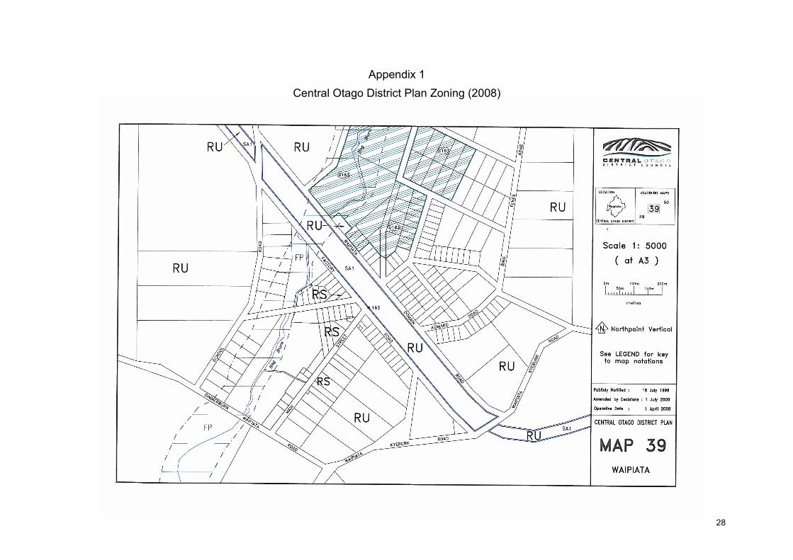
Planning
In the Central Otago District Plan, the Waipiata town ship has a “Rural Settlements” resource area zoning. The surrounds are zoned “Rural” resource area. See appendix 1 and 2 attached. The Maniototo area has been involved in significant work on planning in recent times. Of note has been the Rural Study project looking at unique landscapes and areas for development in the district. It has been identified that people in the Waipiata area love the unique landscape, the views, shadows and colours of the landscape, the surrounding rugged hills and mountains (Rock and Pillars, Rough Ridge, Mt Ida and Kakanuis) while being traversed by waterways such as the Hogburn and Taieri. The Rural Study, which addresses rural development issues, is likely to contribute ideas as to how future development and building might be sympathetically integrated within the existing environment and landscapes. While there was a call to promote planning rules that encourage development these were tempered by concerns over preserving the landscape and ensuring that development be balanced. Thus controlled development was suggested as appropriate for Waipiata. Having a plan of how the village will grow by identifying where development is appropriate and maintaining its character is important to the community. Objective Manage growth to preserve the special character of the area. Recommendations for action:
• Create a plan which clearly identifies areas suitable for development and areas that should be protected

23
Economy
Tourism
Each year Central Otago attracts an increased number of domestic and international visitors. The following visitor trends in Central Otago have been noted and may be significant in regard to the future of Maniototo: • Commercial Accommodation Monitor (CAM) records show 331,000 guest nights
and nearly 150,000 guest arrivals in Central Otago during 2007 (to Sept 2007, includes both domestic and international visitors, based on GST registered accommodation).
• The average length of stay for 2007 was on average 2.2 nights (paid accommodation). By comparison the average stay in 1998 was 6 nights. The reason for the decline is the transition from Central Otago being a domestic holiday destination to one which attracts international visitors who, due to travel constraints, stay for shorter periods.
• Otago Central Rail Trail – in 2006 it is estimated that 14,000+ persons completed the whole Trail. The daily spend was estimated at $125 over an average duration of five days.
Adverse factors which may affect the visitor industry (especially the international market but also the domestic market) include increasing fuel prices and the volatile exchange rate. CODC is now embracing a destination management approach to tourism which focuses on sustaining the attractions which make Central a desirable place to visit. The development of the Central Otago regional identity has been an important project undertaken by the community. Its purpose is to identify those things which are special to us, ensure a unified understanding of them, and to consistently project these values to those outside the region. In defining our regional identity, we are creating the vision for the way we want to work, live and play, here, now and for the years to come. The creation of a unique brand for Central Otago “Central Otago – A World of Difference” provides opportunities for Waipiata. The values that underpin the brand: “making a difference, respecting others, embracing diversity, adding value, having integrity, learning from the past, making a sustainable difference, protecting our rich heritage and meeting obligations” are many of the values that have been expressed by the people of Waipiata. As the profile of Central Otago increases, so is the likelihood of an increasing number of visitors seeking to visit and stay in Waipiata. It has been identified that there is a need for innovative marketing of the area and promoting Waipiata’s points of difference. Waipiata could present a counterpoint to the bustle of city life and being only one and a half hours from Dunedin ensures that the area is readily accessible for those wanting to get away from it all. With its distinct microclimate the
24
area is well positioned to attract holiday makers. Visitors to the area travelling along State Highway 87 near Kokonga or the Otago Central Rail Trail from Kokonga enter the eastern “gateway” to the Maniototo. It is from this direction that travellers see a vista of the Maniototo plains and surrounding mountain ranges. Tourism will offer Waipiata opportunities in the future with the continuing development of the Otago Centre Rail Trail, heritage and recreational opportunities.
Business
For any area to have a thriving community a variety of businesses is important. The community expressed that it is important to look at business opportunities for the area. The community would like to see the establishment of a shop and café in the village – this presents an ideal commercial opportunity. The unique micro climate also brings about opportunities for other horticultural crops with research into late flowering/developing crops such as arnica and peonies. The biggest opportunity will present itself should the Taieri Lake be re-established. The Waipiata sale yards were identified as a community asset which currently holds two or three stock sales a year. A previously mined but not exhausted lignite coal seam is located on Kokonga Road opposite the old dump site. In encouraging further business into the area, poor telecommunications and broadband services would be an issue. With the nature of business now and the opportunity to operate businesses remotely service providers may need to be actively lobbied to achieve an improvement in services. Accommodation It is a popular holiday spot for visitors from Otago, Southland and Canterbury. People will happily stay at Waipiata with its range of recreational opportunities and it being a quiet and safe location. The aim is to appeal to those that come to the Maniototo and encourage them to extend their stay. A proposal to increase the camping accommodation in the area was suggested. At present only those with self sufficient camper vans can camp at the Domain. To develop the facilities at the Domain the existing toilet facilities would need upgrading, showers, a kitchen and power sites would need to be installed. A range of commercial accommodation including backpacker, homestay, guest house and hotel accommodation is available in the area.

25
Objective Have appropriate accommodation to meet identified needs in the area. Identify opportunities for other businesses in the area. Recommendations for action:
• Identify Waipiata’s points of difference and promote the area based on these
• Assess opportunities for growing other crops in the area • Explore options to develop the Waipiata Domain as a camping ground • Lobby for better telecommunications and broadband access for the area

26
What is important to the Community?
From the community workshop the working party have attempted to identify which recommendations are a priority for the community. From these priorities, timelines for working on these recommendations can be developed. The working party would appreciate comments on these priorities. Pg No
Recommendations Priority
Develop heritage trails, interpretation and brochures
Medium
Develop and collate information and stories for the basis of a book
Medium
Create local cycleways and walkways to appropriate track standards with signage and interpretation and in keeping with new regional identity guidelines
Medium
Develop a “Waipiata Village Walk” including plaques with a history of the various buildings and sites in the village.
Medium
Develop an increased focus on family oriented activities and events
Medium
Assess the opportunities for other events in the area
Low
Develop a newsletter to update the community on current projects and activities
High
Encourage co-operation and communication between existing groups and committees
High
Relocate and restore the Railway Station building
Medium
Identify appropriate location for public toilets
High
Provide drinking water for visitors
Medium
Erect signage for historical/trails information
High
Site picnic tables around the village
Medium
Assess the need for litter bins
Medium
Hogburn Creek cleared assist water flow
High
Broom and gorse sprayed or removed to improve access to the Hogburn Creek
High
Continue beautification and tree planting around the village Medium

27
Encourage local use of the Waipiata Town Hall
Medium
Encourage and support the re-establishment of Taieri Lake
High
Investigate opportunities for tours around the Maniototo
Low
Monitor water supply requirements based on growth of the village
Medium
Continue to encourage improvement of river quality in the area
High
Monitor the need for a sewerage scheme based on growth
Low
Explore water supply options for the village
High
Appropriate directional signage be erected
High
Advocate for widening and sealing the Kyeburn - Waipiata, and Kyeburn - Kokonga roads
High
Advocate for sealing section of Factory Road from opposite the old rabbit factory to Komako Road
High
Assess the need for a rubbish collection service and litter bins for Waipiata
Low
Investigate the possibility of a recycling station
Low
Create a plan which clearly identifies areas suitable for development and areas that should be protected
Medium
Identify Waipiata’s point of difference and promote the area based on these
Medium
Assess opportunities for growing other crops in the area
Low
Explore options to develop the Waipiata Domain as a camping ground
Medium
Lobby for better telecommunications and broadband access for the area
High
28
Appendix 1
Central Otago District Plan Zoning (2008)

29
Appendix 2