Embed Size (px)
Citation preview
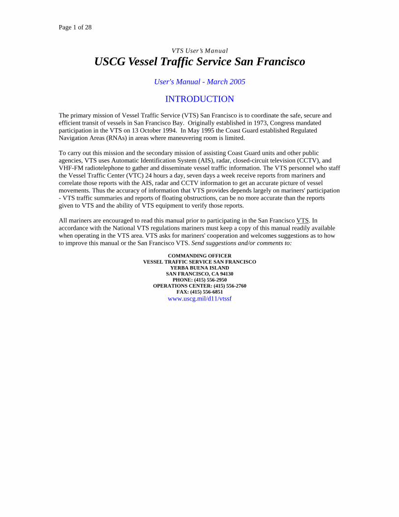
Page 1 of 28
VTS User’s Manual
USCG Vessel Traffic Service San Francisco User's Manual - March 2005
INTRODUCTION
The primary mission of Vessel Traffic Service (VTS) San Francisco is to coordinate the safe, secure and efficient transit of vessels in San Francisco Bay. Originally established in 1973, Congress mandated participation in the VTS on 13 October 1994. In May 1995 the Coast Guard established Regulated Navigation Areas (RNAs) in areas where maneuvering room is limited. To carry out this mission and the secondary mission of assisting Coast Guard units and other public agencies, VTS uses Automatic Identification System (AIS), radar, closed-circuit television (CCTV), and VHF-FM radiotelephone to gather and disseminate vessel traffic information. The VTS personnel who staff the Vessel Traffic Center (VTC) 24 hours a day, seven days a week receive reports from mariners and correlate those reports with the AIS, radar and CCTV information to get an accurate picture of vessel movements. Thus the accuracy of information that VTS provides depends largely on mariners' participation - VTS traffic summaries and reports of floating obstructions, can be no more accurate than the reports given to VTS and the ability of VTS equipment to verify those reports. All mariners are encouraged to read this manual prior to participating in the San Francisco VTS. In accordance with the National VTS regulations mariners must keep a copy of this manual readily available when operating in the VTS area. VTS asks for mariners' cooperation and welcomes suggestions as to how to improve this manual or the San Francisco VTS. Send suggestions and/or comments to:
COMMANDING OFFICER
VESSEL TRAFFIC SERVICE SAN FRANCISCO YERBA BUENA ISLAND
SAN FRANCISCO, CA 94130 PHONE: (415) 556-2950
OPERATIONS CENTER: (415) 556-2760 FAX: (415) 556-6851
www.uscg.mil/d11/vtssf
Page 2 of 28
CONCEPT OF OPERATIONS
The primary function of VTS San Francisco is to facilitate good order and predictability on a waterway by coordinating vessel movements through the collection, verification, organization, and dissemination of information. To accomplish this, VTS San Francisco uses the concept of a "continuum of traffic management". This continuum consists of the following levels of control: Monitor, Inform, Recommend, and Direct.
(1) Monitor: Using AIS, radar, CCTV, and radiotelephone equipment, VTS monitors vessel traffic in the VTS Area. VTS also receives information from various sources on predicted vessel movements, hazards to navigation, aids to navigation discrepancies, and other information of interest to VTS users. Monitoring vessel traffic allows us to ensure that vessels are navigating safely and efficiently in accordance with applicable regulations and Navigation rules.
(2) Inform: VTS analyses the information gathered then informs participants as applicable. This is done at the user's request, when it appears necessary to VTS personnel, or at regular intervals. The purpose of informing participants is to give them timely information to allow them to make decisions concerning the navigation of their vessels.
(3) Recommend: Almost all of VTS San Francisco operations are conducted at the monitor and inform levels. However, at certain times the VTS will recommend action be taken by a participant to prevent a potentially dangerous situation. Such recommendations are offered to assist the participant in avoiding hazardous situations early on. Recommendations are made on the pretence that there is information available to VTS of which the participant may not be aware.
(4) Direct: On rare occasions (and during heightened security conditions) VTS will direct movement or actions of a participant. Direction would be given in cases when the VTC observes obvious violations of regulations or an obvious and immediately dangerous condition of which the participant is not or does not seem to be aware. Directions will normally be in the form of a general objective such as staying out of a certain area or coming no closer than a certain distance from a vessel or facility. The ultimate responsibility for safe navigation of a vessel remains with the master or person in charge. Each of these actions, monitor, inform, recommend and direct are independent of each other and one action does not necessarily proceed the other. For instance, VTS may not issue a recommendation prior to issuing a direction. When performing the functions discussed here, VTS is not relieving the master or person in charge of his or her responsibility to control vessel movement. At no time is that person relieved by the VTC of responsibilities assigned by the applicable Navigation Rules and other pertinent laws or regulations. Fishing vessels and recreational vessels, although generally not required to participate in the VTS, are encouraged to monitor the VTS radio channels, as needed, to gather traffic movement information. VTS maintains a continuous radiotelephone watch on VHF-FM channels 12 (156.60 MHz), 13 (156.65 MHz), 14 (156.70 MHz) and 16 (156.80 MHz). The call sign is "SAN FRANCISCO TRAFFIC." Once communications are established, the abbreviated call sign "TRAFFIC" may be used. If communications on Ch. 12, Ch. 13 or Ch. 14 are lost, call TRAFFIC on Ch. 16 and be prepared to shift to another frequency. All reports should be in English and use the 24-hour clock system. The VTS Area is separated into two sectors with a separate dedicated operating frequency for each sector. These two sectors are labeled Inshore Sector and Offshore Sector. Use channel 14 when transiting in the Inshore Sector; use channel 12 when transiting in the Offshore Sector. Participation procedures for each of these sectors are outlined in the Inshore Sector Reporting Procedures and the Offshore Sector Reporting Procedures section of this Users Manual. (The Inshore Sector begins at the boundary of the Offshore Precautionary Area.)

Page 3 of 28
In addition to monitoring the VTS dedicated frequency for the sector in which the vessel is operating, vessels that are required to participate in the Vessel Traffic Service must maintain a listening watch on channel 13. A listening watch on channel 16 is not required on vessels subject to the Vessel Bridge-to-Bridge Radiotelephone Act who are also participating in a Vessel Traffic Service system when the watch is maintained on both the vessel bridge-to-bridge frequency and a designated VTS frequency (47 CFR 80.148 (b)).
Page 4 of 28
SECTOR PROCEDURES
For purposes of traffic management throughout the VTS area, VTS San Francisco is divided into two Sectors - Offshore and Inshore. The boundary between the offshore and inshore sector occurs at the western side of the precautionary area. OFFSHORE SECTOR PROCEDURES Initial Check-in and Sailing Plan Report The Offshore Sector area is formally defined as the ocean waters within a 38 nautical mile radius of Mount Tamalpais (37°55.8'N 122°34.6'W) excluding the San Francisco Offshore Precautionary Area. (The San Francisco Offshore Precautionary Area is the the area within a six mile radius of the San Francisco Sea Buoy.) This translates roughly to an arc starting at the shoreline near Bodega head, crossing Cordell Bank, then circling southward to pass about 30 nautical miles west of the San Francisco Sea Buoy, and curving eastward to the shoreline near Pescadero Point. This arc is shown on charts 18640 and 18680. The eastern boundary of the Offshore Sector is a line from Duxbury Point due south to the boundary of the San Francisco Offshore Precautionary area, then following the boundary of the Precautionary Area past the “N” “W” and “S” buoys, and then due east to Mussel Rock. When approaching from sea, check in with VTS 15 minutes from the outer boundary on channel 12 and report your Sailing Plan. Sailing Plan Give the following information in your Sailing Plan. - Vessel name - Vessel type - Position latitude and longitude (if unable to provide coordinates then provide your bearing and range from the SFSB) - ETA (estimated time of arrival) at next reporting point - ETA at the SFSB (if inbound) or the outermost reporting point on your route (if outbound or transiting across the Offshore Sector) Sailing Plan Amplification Reports When your vessel is at the next reporting point, Call VTS. Give the following information: - Vessel name and position (that is, the Offshore reporting point you are passing) - Vessel’s course and speed - Estimated time of arrival (ETA) at the San Francisco Sea Buoy (SFSB) if you are inbound - ETA to the outermost reporting point if you are outbound Other Reports When conducting research, engaged in naval exercises, or conducting other special operations in the Offshore Sector, report your Sailing Plan to VTS and include the nature of your operation. Report any emergency on board your vessel or other vessels to VTS immediately. When you are engaged in fishing you may report this fact to VTS. However, you are not required to do so unless your vessels fits into one of the categories described in 33 CFR § 161.2. defined as follows: Vessel Movement Reporting System (VMRS) User means a vessel, or an owner, operator, charterer, Master, or
Page 5 of 28
person directing the movement of a vessel that is required to participate in a VMRS. Towing Vessel means any commercial vessel engaged in towing another vessel astern, alongside, or by pushing ahead. TRANSITING ACROSS THE OFFSHORE SECTOR When you are transiting across the Offshore Sector and will not enter the San Francisco Offshore precautionary Area, call VTS on channel 12 and report your Sailing Plan when you reach the first Offshore sector reporting point on your route. (See below list of reporting points in the Offshore Sector). OFFSHORE VESSEL TRAFFIC ADVISORIES
VTS broadcasts the positions, courses, speeds, and estimated times of arrivals at reporting points of all VTS users who have reported to VTS in the Offshore Sector. VTS makes these advisories at minute 15 and minute 45 each hour. VTS strongly recommends that vessels in the area of the Offshore sector listen to these broadcasts. OFFSHORE Reporting Points North Bodega head or Cordell Bank; Point Reyes (or entering the Traffic Separation Scheme); “N” Buoy or Duxbury Reef Buoy. West Approximately 30 nautical miles from the SFSB or at longitude 123° 20’ W; Southeast Farallon Island (entering the TSS) “W” Buoy. South Pescadero Point or approximately 30 nautical miles from the SFSB or at latitude 37° 15’N; Pillar Point (entering the TSS) “S” Buoy or Mussel Rocks. NOTE: The outer boundary of the Offshore Sector is approximately 30 nautical miles from the SF Sea Buoy. INSHORE SECTOR The Inshore Sector consists of the waters of the San Francisco Offshore Precautionary Area eastward to San Francisco Bay and its tributaries extending inland to the ports of Stockton, Sacramento, and Redwood City. Active participation by vessels that fall under the Vessel Movement Report System (33CFR161.16) is characterized by the use of three reports. The procedure for each report is as follows. 1. Sailing Plan. A vessel shall provide a sailing plan to the VTS on channel 14 at least 15 minutes prior to getting underway from a berth or anchorage in the Inshore Sector. The Sailing Plan should contain the following information. a. For power-driven vessels 40 Meters (approx 131 ft) or more in length or when operating instructions require participation: - Pilot - Vessel name
Page 6 of 28
- Position - Destination - Draft - Route (see section on route intentions below) - Tug frequency b. For a towing vessel 8 meters (approx 26 ft) or more in length if towing astern/alongside or pushing ahead: - Vessel name - Position - Destination - Towing/pushing/alongside - Barge over/under 1600 gross tons - Draft c. For a vessel certificated to carry 50 or more passengers for hire, engaged in trade report: - Vessel name - Position - Destination - Route The passenger vessel may also request or decline a traffic report. If a request or decline of the report is not stated the VTS controller will provide a traffic report. Note: For passenger vessels on a scheduled or published route as defined in 33CFR 161.23, the sailing plan time requirement is at least 5 minutes before entering the VTS area.
2. Position Reports (a lat/long, bearing & range from a specific point, or description of vessel’s position in relation to a know geographic point) shall be made: - Once a vessel is actually underway or upon entry into a VTS area; - When passing a reporting point (see below list of reporting points); - After pilot change, departure of pilot, or other change in person directing the movement of the vessel. - Ferry and tour boats are required to call at least every 30 minutes. 3. Final Report. Report to VTS upon docking, anchoring, mooring or departing the VTS Area as applicable. Inshore Sector Reporting Points
The recent implementation of AIS has eliminated the need for voice position reports at designated points for all vessels with a properly installed and operating AIS unit. For those vessels without installed AIS, VMRS Users are directed to contact VTS at the following listed reporting points. Pilot Area/Point of Entry into VTS Area San Mateo Bridge Redwood Creek Entrance Light 2 Dumbarton Bridge Richmond-San Rafael Bridge ‘E’ Buoy San Pablo Strait Channel Petaluma Channel Daybeacon 19 Mare Island Strait Light 1
Page 7 of 28
Mare Island Causeway bridge (when inbound/outbound Mare Island Strait)
Carquinez Bridge Military Oceans Terminals Concord (MOTCO) New York Point Antioch Bridge Prisoners Point Rio Vista Bridge Sacramento Deep Water Channel Light 51 & Light 65 Note: Additional reporting points may be required due to vessel impairments, meteorological conditions, or VTS equipment outages. For a Marine Event comprised of committee boat, race deck, or event organizer, report to VTS the following information: - Committee boat name - Event name, sponsor name, & permit # - Number & type of vessels - Event location - Radio guard channel - Start & stop time
Page 8 of 28
ROUTE INTENTIONS
All vessels shall be aware of and follow the San Francisco Bay traffic routing system. This system consists of a Traffic Separation Scheme (TSS) offshore and Regulated Navigational Areas (RNAs) in the Inshore Sector (see pages 7 & 8). Any decision to deviate from the TSS or RNA must be made by the master or person in charge of the vessel. You shall notify the VTS prior to deviating from TSS or RNA. The traffic lanes radiating seaward from the offshore precautionary area centered on the San Francisco Sea Buoy constitute a Traffic Separation Scheme (TSS) adopted by the International Maritime Organization (IMO). COLREGS Rule 10 applies to vessels in or near this TSS. The geographic constraints of San Francisco Bay make implementation of a TSS impractical and unnecessarily restrictive on recreational and harbour tour boats. Instead, traffic flow within the Bay is guided by a series of RNAs. Participants unable to follow the traffic lanes or VTS procedures due to an emergency should manoeuvre as required to minimize the emergency and notify VTS as soon as possible. The recreational boating public have a legitimate expectation that ships will adhere to the traffic routing system. Therefore, particularly in central San Francisco Bay (where many boats are often present), the hazards of deviating from the routing system are very pronounced. VTS will only concur with a proposed deviation when a safety related reason is provided, and it affords a level of safety greater than that provided by adherence to the established traffic scheme. When a deviation does occur, VTS may make a safety broadcast on channels 14 and 16 VHF-FM to warn the boating public. Charted recreation areas within the VTS Area shall be avoided by commercial vessels. Excursion boats, ferries, and tour boats should comply with the traffic lanes as closely as their routes allow. PROVIDING ROUTE INTENTIONS (when outbound for sea or transiting intrabay) Vessels are required to provide a Sailing Plan in accordance with 33 CFR 161.19. Included in the Sailing Plan is the intended route. In the San Francisco VTS area there are often several traffic lane or bridge span choices along a route to a give destination. Therefore, it is often difficult to specify an exact route upon initial check-in. Vessels required to use the traffic lanes shall normally provide traffic lane or bridge span intentions along the route as follows:
Offshore Traffic Separation Scheme
Provide intentions when outbound prior to passing Point Bonita. The usual outbound options are (see figure 6, pg 9): Northern Traffic Lane, Western Traffic Lane, Southern Traffic Lane, or Bonita Channel.
Central Bay Traffic Lanes
There are three lane options: The Deep Water Traffic Lane; Westbound Lane 9south of Harding Rock); Eastbound Lane (or south of Alcatraz). Provide intentions when approaching these lanes prior to passing points: Point Diablo, Point Blunt, Bay Bridge.
Page 9 of 28
Oakland Bay Bridge (West of Yerba Buena Island)
When approaching from the North, provide bridge span intentions prior to passing Blossom Rock buoy. When approaching from the south, provide span intentions prior to entering the precautionary area. There are situations when a vessel will require more time to determine the best lane or span selection due to other vessels navigating in the area. In these cases, the vessel shall state that more time is required and then, as soon as practicable, provide intentions. For examples of Sailing Plan Reports, refer to the VTS website on VTS communications: http://www.vtssf.uscg.mil/
Page 10 of 28
REGULATED NAVIGATION AREAS
The Coast Guard has established regulated navigation areas (RNAs) within the San Francisco Bay region to reduce vessel congestion where maneuvering room is limited. These RNAs increase navigational safety by organizing traffic flow patterns; reducing meeting, crossing, and overtaking situations between large vessels in constricted channels; and limiting vessel speed. The RNAs apply to all LARGE VESSELS (defined as: any power-driven vessels of 1600 or more gross tons, or tugs with a tow of 1600 or more gross tons). When navigating within the RNAs, LARGE VESSELS shall: - Not exceed a speed of 15 knots through the water - Have engine(s) ready for immediate maneuver and operate engines in a control mode and on fuel that allows for an immediate response to any engine order.
San Francisco Bay RNA LARGE VESSELS shall use the indicated direction of travel within a given lane. Eastbound travel is permitted in the Eastbound lane, westbound travel is permitted in the Westbound lane, and east or westbound travel is permitted in the Deep Water Traffic Lane (DWTL). LARGE VESSELS shall use the DWTL if eastbound with a draft of 45 feet or greater or westbound with a draft of 28 feet or greater. A LARGE VESSEL shall not meet, cross, or overtake another LARGE VESSEL within the DWTL when either vessel is a tank vessel in ballast, carrying certain dangerous cargoes, or bulk petroleum products (33 CFR 160.203).
Southampton Shoal/Richmond Harbor RNA A LARGE VESSEL shall not meet, cross, or overtake another LARGE VESSEL within this RNA.
Oakland Harbor RNA A LARGE VESSEL shall not meet, cross, or overtake another LARGE VESSEL within this RNA. All vessels operating within these RNAs are reminded of their responsibility to comply with Rule 9 of the Inland Navigation Rules.
Pinole Shoal Channel RNA The Pinole Shoal Channel RNA is reserved for navigation of LARGE VESSELS (this includes tugs w/tows of 1600 GT or greater) Vessels less then 1600GT are not permitted within this RNA. A LARGE VESSEL shall not enter Pinole Shoal Channel RNA, if such entry would result in meeting, crossing, or overtaking another LARGE VESSEL, when either vessel is a tank vessel in ballast, carrying certain dangerous cargoes, or bulk petroleum products.
Benicia-Martinez Railroad Bridge RNA (This RNA applies during periods of reduced visibility)
Eastbound
Eastbound LARGE VESSELS shall not transit through this RNA when visibility is less than 1000 yards.
Westbound Westbound LARGE VESSELS shall check visibility conditions within the RNA immediately prior to passing New York Point, and not proceed past Mallard Island until visibility improves to greater than 1000 yards within the RNA. If the visibility drops below 1000 yards during the transit, the vessel may proceed

Page 11 of 28
but must obtain permission to deviate from this RNA. Visibility is considered to be 1000 yards or greater when both the Port of Benicia Pier and the Shell Martinez Pier can be seen from the Union Pacific Railroad Bridge. Refer to the VTS website for more amplifying info on RNAs at http://www.vtssf.uscg.mil/
Page 12 of 28
CAPTAIN OF THE PORT ADVISORIES (Current as of 31 Mar 05)
COTP Advisory # 05-095 (4 May 1995): ENFORCEMENT OF NAVIGATION RULES IN SAN FRANCISCO BAY This advisory provides a listing of the major deep draft channels in San Francisco Bay and adjacent waters which the Captain of the Port considers to be "narrow channels or fairways" within the meaning of the International and Inland Rules of the Road. Rule 9, in both the International and Inland Rules of the Road, provide requirements for vessels navigating in the vicinity of narrow channels or fairways. Vessels and powerboats less than 20 meters (approximately 65 feet), all sailboats and vessels engaged in fishing shall not impede the passage of a vessel that can safely navigate only within a narrow channel or fairway. Additionally, a vessel shall not cross a narrow channel or fairway if such crossing impedes the passage of a vessel that can safely navigate only within that channel or fairway. The term "shall not impede" means a small craft must keep well clear and not hinder or interfere with the transit of larger vessels. Small craft and fishing vessels shall not anchor or fish in narrow channels if large vessels or barges being towed are transiting. Coast Guard enforcement efforts, combined with a public education and information program, are further intended to draw public attention to the serious hazards created when smaller vessels impede large vessels. This effort should result in an improved level of navigational safety and reduce the risk of collisions, groundings and their potential consequences. The Captain of the Port considers the following areas to be "narrow channels or fairways" for the purpose of enforcing the International and Inland Rules of the Road. This list is not all-inclusive, but identifies areas where deep draft commercial and public vessels routinely operate. Included in this list and marked by an asterisk (*) are the Regulated Navigation Areas (RNAs) in San Francisco Bay, which were designated in 33 CFR 162 and 165. [May 1995] a. All traffic lanes and precautionary areas in the San Francisco Bay eastward of the San Francisco Approach Lighted Horn Buoy SF (LLNR 360) to the San Francisco - Oakland Bay Bridge and the Richmond - San Rafael Bridge to include: *1. Golden Gate Traffic Lanes which include the Westbound and Eastbound Lanes west of the Golden Gate Precautionary Area. *2. Golden Gate Precautionary Area. *3. Central Bay Traffic Lanes, which include the Deep Water Traffic Lane, The Eastbound Lane (south of Alcatraz Island), and the Westbound Lane (south of Harding Rock). *4. Central Bay Precautionary Area. *5. North Ship Channel between North Channel Lighted Buoy "A" and the Richmond - San Rafael Bridge. *6. Southampton Shoal Channel including the Richmond Long Wharf maneuvering area. *7. Richmond Harbor Entrance Channel and the Point Potrero Reach ending at Point Potrero Turn and including the Turn Basin at Point Richmond. 8. Point Potrero Turn. 9. Richmond Harbor Channel in its entirety. 10. Santa Fe Channel in its entirety. *b. Oakland Harbor Bar Channel including the Outer Harbor Entrance Channel and the Inner Harbor Entrance Channel. c. Oakland Outer Harbor. d. Oakland Inner Harbor from Inner Harbor Channel Light "5" (LLNR 4670) to, and including, the Brooklyn Basin South Channel. e. Alameda Naval Air Station Channel in its entirety. f. South San Francisco Bay Channels between the central Bay Precautionary Area and Redwood Creek Entrance Light "2" (LLNR 5180). g. Redwood Creek between Redwood Creek Entrance Light "2" (LLNR 5180) and Redwood Creek Daybeacon "21 " (LLNR 5265). *h. San Pablo Straight Channel from the Richmond-San Rafael Bridge to San Pablo Bay Channel Light "7" (LLNR 5900).
Page 13 of 28
*i. Pinole Shoal Channel in San Pablo Bay between San Pablo Bay Channel Light "7" (LLNR 5900) and San Pablo Bay Channel Light "14" (LLNR 5935). j. Carquinez Strait between San Pablo Bay Channel Light "14'.' (LLNR 5935) and the Benicia-Martinez Highway Bridge. k. Mare Island Strait between Mare Island Strait Light "2" (LLNR 6095) and Mare Island Causeway Bridge. l. Suisun Bay Channels between the Benicia-Martinez Highway Bridge and Suisun Bay Light "34" (LLNR 6655). m. New York Slough between Suisun Bay Light "30" (LLNR 6585) and San Joaquin River Light "2" (LLNR 6670). n. Sacramento River Deep Water Ship Channel from Suisun Bay Light "34" (LLNR 6655) to the Port of Sacramento. o. San Joaquin River from San Joaquin River Light "2" (LLNR 6670) to the port of Stockton. Rules of the Road Enforcement: Timely reporting and enforcement of Rules of the Road infractions promotes safer navigation. Vessel masters, pilots, and operators are encouraged to report incidents, which merit investigation. Reports will be fully investigated and may result in license suspension or revocation proceedings or the assessment of civil penalties.
COTP Advisory # 05-094 (4 May 1995): POLLUTION PREVENTION REGULATIONS This notice addresses the application of the Pollution Prevention regulations in Title 33 Code of Federal Regulations (CFR) Parts 154, 155, and 156 to vessels and facilities operating in the Captain of the Port (COTP) San Francisco Bay zone. The Pollution Prevention regulations apply to waterfront facilities and vessels that conduct bulk oil or hazardous material transfers. Sections of the applicable regulations give the COTP discretionary authority to impose additional requirements or modify certain requirements depending on port-specific needs. a. Advance notice of oil and hazardous material transfers (33 CFR 156.118) Vessels or mobile facilities conducting transfers, bunkering, or lightering must notify the COTP of the time and place of each transfer operation at least 4 hours before the transfer begins. Fixed facilities are not required to provide the COTP with transfer notifications, unless specifically required to do so in an alternative procedure or other COTP instruction. Provide all transfer notifications to the MSO San Francisco Bay watch office by calling (510) 437-3073 (24-hour number) or by FAX at (510) 437-3072. The 4-hour advance notice must include the following information:
• The scheduled start date and time of the transfer • The estimated duration of the transfer • The specific location of the transfer • The type of transfer (mobile, bunkering, or lightering) • The names of vessels and mobile facilities involved in the transfer • The name and contact phone number of the qualified individual • The name, company affiliation, and contact number for the reporting person • The amount and type or product for transfer
If the time of a transfer changes by one hour or more, or if a transfer is canceled, the Person in Charge of the truck or vessel shall notify the MSO watch office as soon as possible. The COTP recognizes that certain situations arise when it is not possible to provide a full 4-hour transfer notification. In these situations, facility or vessel operators should contact the MSO watch office and request permission to conduct the transfer. The COTP will grant such permission on a case-by-case basis. b. Loading over the top (33 CFR 156.120(g))
Page 14 of 28
Vessels or tank cleaning facilities sometimes transfer cargo into or from deep tanks or remove settled petroleum products from cargo tanks through an open hatch. Due to the static electricity combustion hazards and the amount of hazardous fumes generated by free-falling petroleum products, operators who regularly conduct these transfers should comply with the fixed connection requirements of 33 CFR 156.120(g). For those situations when compliance with the fixed connection requirement is impracticable, operators shall request an alternative from the COTP. Requests for alternatives should include proposed procedures that provide an equivalent level of safety and environmental protection. Depending on the type of operation involved. The COTP may grant a long-term alternative or require case-by-case alternatives. c. Plugging drains and scuppers prior to transfer (33 CFR 156.120(o)) Before conducting transfer operations, tank vessel operators must close all scuppers and drains within a containment area using suitable mechanical means. Wooden or similar plugs are acceptable provided that cement is applied uniformly around the plug to prevent spilled oil from leaking through. Do not use rags or other easily permeated material. d. Person in Charge of transfer operation (33 CFR 156.120(t)(1)) Persons in Charge of oil or hazardous material transfers must be present at the site of a transfer and be immediately available to the transfer personnel during all evolutions. A Person in Charge is "present at the site" if he or she is:
• Within line of sight of the transfer operation; and • In constant communication with the other Person in Charge (vessel or facility).
When Coast Guard inspectors board a tank vessel or arrive at a transfer facility during a transfer operation and do not see a Person in Charge monitoring the operation, they will wait for 3 minutes. If the appropriate Person in Charge is not seen within 3 minutes, the inspectors will deem the Person in Charge not present at the site of the transfer operation. In such a case, the inspectors may shut down the transfer operation and process a civil penalty recommendation. All Persons in Charge must be present at the site of a transfer and must be fully aware of all aspects of a transfer operation from start to finish. e. Bunkering of vessels at anchorage Due to numerous environmentally sensitive areas, bunkering of vessels at anchorage within San Francisco Bay is permitted only in Anchorage 9. Because of its size and location, Anchorage 9 affords the best opportunity for containment and recovery in the event of an oil spill. The COTP will consider requests to bunker at other anchorages on a case-by-case basis. Submit such requests to the COTP in writing no later than 24 hours prior to the estimated start time. f. Lightering zones and advance notice of lightering (33 CFR 156.215) The master, owner, or agent of each vessel to be lightered must give at least 24 hours advance notice to the COTP prior to arrival in the lightering location or zone. Advance notice must include the following information:
• The vessel's name, call sign or official number, and registry • The cargo type (if oil) or shipping name (if hazardous material) and the approximate amount on
board • The number of transfers expected and the amount of cargo expected to be transferred
Page 15 of 28
• The lightering location • The estimated time of arrival in the lightering location • The estimated duration of the transfer operation • The name and destination of service vessels
If the estimated time of arrival in the lightering location changes by more than 6 hours, the master, owner, or agent must advise the COTP of this change as soon as possible.
If a vessel must conduct an "immediate" lightering due to unforeseen circumstances, the vessel operator should contact the MSO watch office and request permission to conduct the lightering. The COTP will grant approval on a case-by-case basis. Due to numerous environmentally sensitive areas, lightering within San Francisco Bay is permitted only in Anchorage 9. Because of its size and location, Anchorage 9 affords the best opportunity for containment and recovery in the event of an oil spill. The COTP will consider requests to lighter at other anchorages on a case-by-case basis. Submit such requests to the COTP in writing no later than 24 hours prior to the estimated start time. g. Vessel mooring during transfer operations (33 CFR 156.120(a)) During transfer operations, a transferring vessel's moorings must be strong enough to hold during all expected conditions of surge, current, and weather and must be long enough to allow adjustment for changes in draft, drift, and tide during a transfer operation. Many of the bulk oil facilities located along the Carquinez Strait are subject to very high velocity currents during the Spring runoff season (January through May). In some cases, strong currents have caused tank vessels to break their mooring lines or drift several feet away from berth during transfer operations. Facility and vessel operators should be aware of environmental conditions that affect vessel mooring, and should take appropriate precautions to ensure secure moorings. Depending on environmental conditions at a particular facility, precautions may include using wire mooring lines, having tugs on scene, installing current flow and current direction meters, installing pelican hook moorings with tension gauges, and conducting a comprehensive mooring analysis to better understand forces exerted on a ship at various depths and at various tidal cycles. h. Mobile facility pollution response equipment requirements (33 CFR 154.1040(d)) Mobile facility operators must have at least 200 feet of containment boom and the means of deploying and anchoring the boom available at a spill site within 1 hour of the detection of a spill. In addition, there must be adequate absorbent material on scene within 1 hour for an initial response to an average most probable discharge. The intent of this requirement is to ensure facility operators can initiate an effective immediate response in accordance with procedures listed in their facility response plans. To assess operator preparedness to respond to an average most probable discharge, the Coast Guard conducted a series of unannounced exercises involving mobile facilities during the summer of 1996. The Coast Guard found that facility operators who carried a small inventory of response equipment (absorbent boom and pads) with them to all transfer locations were the most prepared to meet the one hour response requirement. Facilities that relied exclusively on an oil spill removal organization (OSRO) or facility-owned equipment stored at a central location were generally less prepared to meet the response requirement, depending on the transfer location and the proximity of that location to the response equipment warehouse or yard.
Facility operators should assess their initial response capabilities for all transfer locations to ensure equipment availability and response time requirements are met. When evaluating initial response

Page 16 of 28
capabilities, operators should consider such factors as distance, heavy traffic, and other possible delays. Operators should reevaluate this assessment during the annual response plan review process.
Compliance with the Pollution Prevention Regulations and this Advisory will reduce the risk of pollution incidents during transfer operations and mitigate the potential environmental damage should incidents occur.
Page 17 of 28
ANCHORAGES A. VTS San Francisco administers the anchorages in the VTS area for the COTP. Anchorage regulations for the service area are found in Title 33 CFR § 110.224. These regulations describe the boundaries of designated anchorage areas, impose certain restrictions on anchoring, and require various reports from vessels anchoring both in and outside of the designated anchorages. Vessels that have notified the Vessel Traffic Center (VTC) of their actions will be considered in compliance with the reporting requirements of 33 CFR § 110.224. B. VTS administration of the anchorages includes ensuring proper separation of anchored vessels to prevent their swinging or drifting into each other. The COTP has established a mandatory separation of 750 yards around anchored vessels over 300 gross tons. Vessels anchoring within 750 yards, or which “settle out” within 750 yards of another vessel will be directed by the VTS to re-anchor at a greater distance. The vessel that was the last to arrive will normally be the one required to move. C. Any vessel anchoring outside of established anchorages should notify VTS immediately. Anchoring offshore is strictly forbidden. Exceptions may be made for vessel engine casualties or severe weather preventing transit into port on a case-by-case basis, notification to the VTS is required prior to anchoring offshore. A vessel anchoring outside an established anchorage area should be positioned outside the vessel traffic lanes or ship channel insofar as practicable. If necessary to anchor within a traffic lane or channel, the vessel should be positioned as near the edge of the lane or channel as practicable. D. When the wind is above 25 knots all vessels over 300 gross tons anchored in the San Francisco Bay must maintain a continuous radiotelephone watch of VHF-FM ch. 13 and ch. 14. E. Vessels anchoring in any anchorage are required to reserve the deeper portions of the anchorage for vessels of deeper draft. This becomes particularly important in Anchorage 9, since tankers with drafts up to 50 feet often anchor there to conduct lightering. Therefore, the VTS advises vessels anchoring in Anchorage 9 to anchor as far east or south as safety will allow. This will ensure that the deeper western side of the anchorage will be available for those deep draft vessels needing it. Shallow-draft vessels may be required to move if they are in which they are anchored is needed by a vessel of deeper draft. F. No vessel may anchor in a “dead ship” status (propulsion or control unavailable for normal operation) at any anchorage other than Anchorage 9 without the prior approval of the Captain of the Port. Any vessel anchoring in a “dead ship” status shall have one assist tug of adequate bollard pull on standby and immediately available (maximum of 15 minute response time) to provide emergency maneuvering. When the sustained winds are 20 knots or greater, of when the wind gusts are 25 knots or greater, the tug must be alongside. NOTES: a. When sustained winds are in excess of 25 knots each vessel greater than 300 gross tons using this anchorage shall maintain on continuous radio watch VHF channel 14 and channel 13. A person who fluently speaks the English language must maintain this radio watch. b. Each vessel using this anchorage may not project into adjacent channels or fairways. c. This anchorage is primarily for use by vessels requiring a temporary anchorage waiting to proceed to pier facilities or anchorage grounds. d. Each vessel using this anchorage may not remain for more than 12 hours unless authorized by the COTP. e. Each vessel using this anchorage shall be prepared to move within 1-hour notification by the COTP. f. The maximum total quantity of explosives that may be on board a vessel using this anchorage shall be limited to 3,000 tons unless otherwise authorized with the written permission of the COTP. g. The maximum total quantity of explosives that may be on board a vessel using this anchorage shall be limited to 50 tons except that, with the written permission of the COTP, each vessel in transit, loaded with explosives in excess of 50 tons, may anchor temporarily in this anchorage provided that the hatches to the folds containing explosives are not opened. h. Each vessel using this anchorage will be assigned a berth by the COTP on the basis of the maximum quantity of explosives that will be on bard the vessel. j. Each vessel using this anchorage shall promptly notify the COTP upon anchoring and upon departure. k. Restricted areas in the vicinity of the Maritime Administration Reserve Fleet.

Page 18 of 28
l. Vessel using this anchorage must exceed 15 feet draft, have engines on standby, and have a pilot on board. m. Any vessel anchoring in a “dead ship” status shall have one assist tug of adequate bollard pull on standby and immediately available (maximum of 15 response time) to provide emergency maneuvering. When the sustained winds are 20 knots or greater, or when the wind gusts are 25 knots or greater, the tug must be alongside.
Page 19 of 28
FEDERAL REGULATIONS DEPARTMENT OF TRANSPORTATION Excerpts from Coast Guard 33 CFR Parts 1, 26, 160, 161, 162, and 165 PART 1--GENERAL PROVISIONS 1. The authority citation for part 1 continues to read as follows: Authority: 14 U.S.C. 663; Sec. 6097(d), Pub. L. 100-690, 102 Stat. 4181; 49 CFR 1.45(b), 1.46; section 1.01-70 also issued under the authority of E.O. 12316, 46 CFR 42237. 2. In 1.01-30, paragraph (b) is added to read as follows: §1.01-30 Captains of the Port. ****** (a) Captains of the Port and their representatives enforce within their respective areas port safety and security and marine environmental protection regulations, including, without limitation, regulations for the protection and security of vessels, harbors, and waterfront facilities; anchorages; security zones; safety zones; regulated navigation areas; deepwater ports; water pollution; and ports and waterways safety. (b) Subject to the supervision of the cognizant Captain of the Port and District Commander, Commanding officers, Vessel Traffic Services, are delegated authority under the Ports and Waterways Safety Act to discharge the duties of the Captain of the Port that involve directing the operation, movement, and anchoring of vessels within a Vessel Traffic Service area, including management of vessel traffic within anchorages, regulated navigation areas and safety zones, and to enforce Vessel Traffic Service and ports and waterways safety regulations. This authority may be re-delegated. (c) Under authority conferred by 14 U.S.C. 89, any commissioned, warrant or petty officer of the United States Coast Guard may assist in discharging the duties of the Captain of the Port in any port or adjacent navigable waters of the United States. They will do so under the supervision of the cognizant Captain of the Port, or representative of the Captain of the Port, if there be one fort the locality involved. PART 26--VESSEL BRIDGE-TO-BRIDGE RADIOTELEPHONE REGULATIONS § 26.01 Purpose. (a) The purpose of this part is to implement the provisions of the Vessel Bridge-to-Bridge Radiotelephone Act. This part: (1) Requires the use of the vessel bridge-to-bridge radiotelephone; (2) Provides the Coast Guard's interpretation of the meaning of important terms in the Act; (3) Prescribes the procedures for applying for an exemption from the Act and the regulations issued under the Act and a listing of exemptions. (b) Nothing in this part relieves any person from he obligation of complying with the rules of the road and the applicable pilot rules. § 26.02 Definitions. For the purpose of this part and interpreting the Act: Secretary means the Secretary of the Department in which the Coast Guard is operating; Act means the ``Vessel Bridge-to-Bridge Radiotelephone Act'', 33 U.S.C. sections 1201-1208; Length is measured from end to end over the deck excluding sheer; Power-driven vessel means any vessel propelled by machinery; Towing vessel means any commercial vessel engaged in towing another vessel astern, alongside, or by pushing ahead. Vessel Traffic Services (VTS) means a service implemented under Part 161 of this chapter by the United States Coast Guard designed to improve the safety and efficiency of vessel traffic and to protect the environment. The VTS has the capability to interact with marine traffic and respond to traffic situations developing in the VTS area. Vessel Traffic Service Area or VTS Area means the geographical area encompassing a specific VTS area of service as described in Part 161 of this chapter. This area of service may be subdivided into sectors for the purpose of allocating responsibility to individual Vessel Traffic Centers or to identify different operating requirements.

Page 20 of 28
Note: Although regulatory jurisdiction is limited to the navigable waters of the United States, certain vessels will be encouraged or may be required, as a condition of port entry, to report beyond this area to facilitate traffic management within the VTS area. § 26.03 Radiotelephone required. ******* (a) Unless an exemption is granted under Sec. 26.09 and except as provided in paragraph (a)(4) of this section, this part applies to: (1) Every power-driven vessel of 20 meters or over in length while navigating; (2) Every vessel of 100 gross tons and upward carrying one or more passengers for hire while navigating; (3) Every towing vessel of 26 feet or over in length while navigating; and (4) Every dredge and floating plant engaged in or near a channel or fairway in operations likely to restrict or affect navigation of other vessels except for an unmanned or intermittently manned floating plant under the control of a dredge. (b) Every vessel, dredge, or floating plant described in paragraph (a) of this section must have a radiotelephone on board capable of operation from its navigational bridge, or in the case of a dredge, from its main control station, and capable of transmitting and receiving on the frequency or frequencies within the 156-162 Mega-Hertz band using the classes of emissions designated by the Federal Communications Commission for the exchange of navigational information. (c) The radiotelephone required by paragraph (b) of this section must be carried on board the described vessels, dredges, and floating plants upon the navigable waters of the United States. (d) The radiotelephone required by paragraph (b) of this section must be capable of transmitting and receiving on VHF FM channel 22A (157.1 MHz). (e) ********* (f) In addition to the radiotelephone required by paragraph (b) of this section, each vessel described in paragraph (a) of this section while transiting any waters within a Vessel Traffic Service Area, must have on board a radiotelephone capable of transmitting and receiving on the VTS designated frequency in Table 26.03(f) (VTS Call Signs, Designated Frequencies, and Monitoring Areas). Note: A single VHF-FM radio capable of scanning or sequential monitoring (often referred to as ``dual watch'' capability) will not meet the requirements for two radios. § 26.04 Use of the designated frequency (a) No person may use the frequency designated by the Federal Communication Commission under section 8 of the Act. 33 USC 1207 (a), to transmit any information other than information necessary for the safe navigation of vessels or necessary tests. (b) Each person who is required to maintain a listeining watcher under section 5 of this Act shall, when necessary, transmit and confirm, on the designated frequency, the intentions of this vessel and other information necessary for the safe navigation of vessels. (c) Nothing in these reuglation may be const4rued as prohibiting the use of the disignated frequency to communicate with shore stations to obtain or furnish information necessary for the safe navigation of vessels. (d) On the navigatable waters of the United States within a VTS area, the disignated VTS frequency is an additional deisgnated frequency required to be monitored in accordance with §26.05. Note: As stated in 47 CFR 8-.148(b), a VHF watch on Channel 16 (156.800 MHz) is not required on vessels subject to the Vessel Bridge-to-Bridge Radiothelphone Act and participating in a Vessel Traffic Service (VTS) system when the watch is maintained on both the vessel bridge-to-bridge frequency and a designated VTS frequency. § 26.05 Use of radiotelephone Section 5 of the Act states: (a) The radiotelephone required by this Act is for the exclusive use of the master or person in charge of the vessel, or the person designated by the master or person in charge to pilot or direct the movement of the vessel, who shall maintain a listening watch on the designated frequency. Nothing contained herein shall be interpreted as precluding the use of portable radiotelephone equipment to satisfy the requirements of this act. § 26.06 Maintenance of radiotelephone; failure of radiotelephone Section 6 of the Act states: (a) Whenever radiotelephone capability is required by this Act, a vessel's raiotelephone equipment shall be maintained in effective operating condition. If the radiotelephone equipment carried aboard a vessel ceases to operate the master shall exercise due diligence to restore it or cause is to be restored to effective operating condition at the earliest practicable time. The failure of a vessel's readiotelephone equipment
Page 21 of 28
shall not, in itself, constitute a violation of this Act, nor shall it obligate the master of any vessel to moor or anchor his vessel; however, the loss of radiotelephone capbility shally be given consideration in the navigation of the vessel. § 26.07 Communications. No person may use the services of, and no person may serve as, a person required to maintain a listening watch under section 5 of this Act, 33 U.S.C. 1204, unless the person can communicate in the English lanquage. § Exemption procedures (a) Any person may petition for an exemption from any provision of the Act or this part; (b) Each petition must be submitted in writing to U.S. Coast Guard, Marine Safety and Environmental Protection, 2100 Second Street S Washington, DC 20593-0001, and must state; (1) The provision of the Act or this part from which an exemption is requested; and (2) The reasons why marine navigation will not be adversely affected if the exemption is granted and if the exemption relates to a local communications system how that system would fully comply with the intent of the concept of the Act but would not conform in detail if the exemption is granted § 26.09 List of exemptions. ********************* PART 160 PORTS AND WATERWAYS SAFETY: GENERAL The authority citation for part 160 continues to read as follows: Authority: 33 U.S.C. 1231: 49 CFR 1.46.9 Section 160.3 is revised to read as follows: § 160.3 Definitions. For the purposes of this subchapter: Bulk means material in any quantity that is shipped, stored, or handled without the benefit of package, label, mark or count and carried in integral or fixed independent tanks. Captain of the Port means the Coast Guard officer designated by the Commandant to command a Captain of the Port Zone as described in part 3 of this chapter. Commandant means the Commandant of the United States Coast Guard. Commanding Officer, Vessel Traffic Services means the Coast Guard officer designated by the Commandant to command a Vessel Traffic Service (VTS) as described in part 161 of this chapter. Deviation means any departure from any rule in this subchapter. District Commander means the Coast Guard officer designated by the Commandant to command a Coast Guard District as described in part 3 of this chapter. ETA means estimated time of arrival. Length of Tow means, when towing with a hawser, the length in feet from the stern of the towing vessel to the stern of the last vessel in tow. When pushing ahead or towing alongside, length of tow means the tandem length in feet of the vessels in tow excluding the length of the towing vessel. Person means an individual, firm, corporation, association, partnership, or governmental entity. State means each of the several States of the United States, the District of Columbia, the Commonwealth of Puerto Rico, Guam, American Samoa, the United States Virgin Islands, the Trust Territories of the Pacific Islands, the Commonwealth of the Northern Marianas Islands, and any other commonwealth, territory, or possession of the United States. Tanker means a self-propelled tank vessel constructed or adapted primarily to carry oil or hazardous materials in bulk in the cargo spaces. Tank Vessel means a vessel that is constructed or adapted to carry, or that carries, oil or hazardous material in bulk as cargo or cargo residue. Vehicle means every type of conveyance capable of being used as a means of transportation on land. Vessel means every description of watercraft or other artificial contrivance used, or capable of being used, as a means of transportation on water. Vessel Traffic Services (VTS) means a service implemented under Part 161 of this chapter by the United
Page 22 of 28
States Coast Guard designed to improve the safety and efficiency of vessel traffic and to protect the environment. The VTS has the capability to interact with marine traffic and respond to traffic situations developing in the VTS area. Vessel Traffic Service Area or VTS Area means the geographical area encompassing a specific VTS area of service as described in Part 161 of this chapter. This area of service may be subdivided into sectors for the purpose of allocating responsibility to individual Vessel Traffic Centers or to identify different operating requirements. Note: Although regulatory jurisdiction is limited to the navigable waters of the United States, certain vessels will be encouraged or may be required, as a condition of port entry, to report beyond this area to facilitate traffic management within the VTS area. VTS Special Area means a waterway within a VTS area in which special operating requirements apply. PART 161 VESSEL TRAFFIC MANAGEMENT REGULATIONS: Subpart A_Vessel Traffic Services General Rules 161.1 Purpose and Intent. 161.2 Definitions. 161.3 Applicability. 161.4 Requirement to carry the rules. 161.5 Deviations from the rules. Services, VTS Measures, and Operating Requirements 161.10 Services. 161.11 VTS measures. 161.12 Vessel operating requirements. 161.13 VTS Special Area operating requirements. Subpart B_Vessel Movement Reporting System 161.15 Purpose and intent. 161.16 Applicability. 161.17 Definitions. 161.18 Reporting requirements. 161.19 Sailing Plan (SP). 161.20 Position Report (PR). 161.21 Automated reporting. 161.22 Final Report (FR). 161.23 Reporting exemptions. Subpart C_Vessel Traffic Service and Vessel Movement Reporting System Areas and Reporting Points 161.50 Vessel Traffic Service San Francisco. Authority: 33 U.S.C. 1223, 1231; 46 U.S.C. 70114, 70117; Pub. L. 107-295, 116 Stat. 2064; Department of Homeland Security Delegation No. 0170.1. General Rules (a) The purpose of this part is to promulgate regulations implementing and enforcing certain sections of the Ports and Waterways Safety Act (PWSA) setting up a national system of Vessel Traffic Services that will enhance navigation, vessel safety, and marine environmental protection, and promote safe vessel movement by reducing the potential for collisions, rammings, and groundings, and the loss of lives and property associated with these incidents within VTS areas established hereunder. (b) Vessel Traffic Services provide the mariner with information related to the safe navigation of a waterway. This information, coupled with the mariner's compliance with the provisions set forth in this
Page 23 of 28
part, enhances the safe routing of vessels through congested waterways or waterways of particular hazard. Under certain circumstances, a VTS may issue directions to control the movement of vessels in order to minimize the risk of collision between vessels, or damage to property or the environment. (c) The owner, operator, charterer, master, or person directing the movement of a vessel remains at all times responsible for the manner in which the vessel is operated and maneuvered, and is responsible for the safe navigation of the vessel under all circumstances. Compliance with these rules or with a direction of the VTS is at all times contingent upon the exigencies of safe navigation. (d) Nothing in this part is intended to relieve any vessel, owner, operator, charterer, master, or person directing the movement of a vessel from the consequences of any neglect to comply with this part or any other applicable law or regulation (e.g., the International Regulations for Prevention of Collisions at Sea, 1972 (72 COLREGS) or the Inland Navigation Rules) or of the neglect of any precaution which may be required by the ordinary practice of seamen, or by the special circumstances of the case. Sec. 161.2 Definitions. For the purposes of this part: Cooperative Vessel Traffic Services (CVTS) means the system of vessel traffic management established and jointly operated by the United States and Canada within adjoining waters. In addition, CVTS facilitates traffic movement and anchorages, avoids jurisdictional disputes, and renders assistance in emergencies in adjoining United States and Canadian waters. Hazardous Vessel Operating Condition means any condition related to a vessel's ability to safely navigate or maneuver, and includes, but is not limited to: (1) The absence or malfunction of vessel operating equipment, such as propulsion machinery, steering gear, radar system, gyrocompass, depth sounding device, automatic radar plotting aid (ARPA), radiotelephone, Automatic Identification System equipment, navigational lighting, sound signaling devices or similar equipment. (2) Any condition on board the vessel likely to impair navigation, such as lack of current nautical charts and publications, personnel shortage, or similar condition. (3) Vessel characteristics that affect or restrict maneuverability, such as cargo arrangement, trim, loaded condition, underkeel clearance, speed, or similar characteristics. Navigable waters means all navigable waters of the United States including the territorial sea of the United States, extending to 12 nautical miles from United States baselines, as described in Presidential Proclamation No. 5928 of December 27, 1988. Precautionary Area means a routing measure comprising an area within defined limits where vessels must navigate with particular caution and within which the direction of traffic may be recommended. Towing Vessel means any commercial vessel engaged in towing another vessel astern, alongside, or by pushing ahead. Vessel Movement Center (VMC) means the shore-based facility that operates the vessel tracking system for a Vessel Movement Reporting System (VMRS) area or sector within such an area. The VMC does not necessarily have the capability or qualified personnel to interact with marine traffic, nor does it necessarily respond to traffic situations developing in the area, as does a Vessel Traffic Service (VTS). Vessel Movement Reporting System (VMRS) means a mandatory reporting system used to monitor and track vessel movements. This is accomplished by a vessel providing information under established procedures as set forth in this part in the areas defined in Table 161.12(c) (VTS and VMRS Centers, Call Signs/MMSI, Designated Frequencies, and Monitoring Areas). Vessel Movement Reporting System (VMRS) User means a vessel, or an owner, operator, charterer, Master, or person directing the movement of a vessel that is required to participate in a VMRS. Vessel Traffic Center (VTC) means the shore-based facility that operates the vessel traffic service for the Vessel Traffic Service area or sector within such an area. Vessel Traffic Services (VTS) means a service implemented by the United States Coast Guard designed to improve the safety and efficiency of vessel traffic and to protect the environment. The VTS has the capability to interact with marine traffic and respond to traffic situations developing in the VTS area. Vessel Traffic Service Area or VTS Area means the geographical area encompassing a specific VTS area of service. This area of service may be subdivided into sectors for the purpose of allocating responsibility to individual Vessel Traffic Centers or to identify different operating requirements. Note: Although regulatory jurisdiction is limited to the navigable waters of the United States, certain vessels will be encouraged or may be required, as a condition of port entry, to report beyond this area to
Page 24 of 28
facilitate traffic management within the VTS area. VTS Special Area means a waterway within a VTS area in which special operating requirements apply. VTS User means a vessel, or an owner, operator, charterer, master, or person directing the movement of a vessel, that is: (a) Subject to the Vessel Bridge-to-Bridge Radiotelephone Act; or (b) Required to participate in a VMRS within a VTS area (VMRS User). VTS User's Manual means the manual established and distributed by the VTS to provide the mariner with a description of the services offered and rules in force for that VTS. Additionally, the manual may include chartlets showing the area and sector boundaries, general navigational information about the area, and procedures, radio frequencies, reporting provisions and other information, which may assist the mariner while in the VTS area. Sec. 161.3 Applicability. The provisions of this subpart shall apply to each VTS User and may also apply to any vessel while underway or at anchor on the navigable waters of the United States within a VTS area, to the extent the VTS considers necessary. Sec. 161.4 Requirement to carry the rules. Each VTS User shall carry on board and maintain for ready reference a copy of these rules. Note: These rules are contained in the applicable U.S. Coast Pilot, the VTS User's Manual that may be obtained by contacting the appropriate VTS, and periodically published in the Local Notice to Mariners. The VTS User's Manual and the World VTS Guide, an International Maritime Organization (IMO) recognized publication, contain additional information, which may assist the prudent mariner while in the appropriate VTS area. Sec. 161.5 Deviations from the rules. (a) Requests to deviate from any provision in this part, either for an extended period of time or if anticipated before the start of a transit, must be submitted in writing to the appropriate District Commander. Upon receipt of the written request, the District Commander may authorize a deviation if it is determined that such a deviation provides a level of safety equivalent to that provided by the required measure or is a maneuver considered necessary for safe navigation under the circumstances. An application for an authorized deviation must state the need and fully describe the proposed alternative to the required measure. (b) Requests to deviate from any provision in this part due to circumstances that develop during a transit or immediately preceding a transit may be made verbally to the appropriate VTS Commanding Officer. Requests to deviate shall be made as far in advance as practicable. Upon receipt of the request, the VTS Commanding Officer may authorize a deviation if it is determined that, based on vessel handling characteristics, traffic density, radar contacts, environmental conditions and other relevant information, such a deviation provides a level of safety equivalent to that provided by the required measure or is a maneuver considered necessary for safe navigation under the circumstances. Services, VTS Measures, and Operating Requirements Sec. 161.10 Services. To enhance navigation and vessel safety, and to protect the marine environment, a VTS may issue advisories, or respond to vessel requests for information, on reported conditions within the VTS area, such as: (a) Hazardous conditions or circumstances; (b) Vessel congestion; (c) Traffic density; (d) Environmental conditions; (e) Aids to navigation status; (f) Anticipated vessel encounters; (g) Another vessel's name, type, position, hazardous vessel operating conditions, if applicable, and intended navigation movements, as reported;
Page 25 of 28
(h) Temporary measures in effect; (i) A description of local harbor operations and conditions, such as ferry routes, dredging, and so forth; (j) Anchorage availability; or (k) Other information or special circumstances. Sec. 161.11 VTS measures. (a) A VTS may issue measures or directions to enhance navigation and vessel safety and to protect the marine environment, such as, but not limited to: (1) Designating temporary reporting points and procedures; (2) Imposing vessel operating requirements; or (3) Establishing vessel traffic routing schemes. (b) During conditions of vessel congestion, restricted visibility, adverse weather, or other hazardous circumstances, a VTS may control, supervise, or otherwise manage traffic, by specifying times of entry, movement, or departure to, from, or within a VTS area. Sec. 161.12 Vessel operating requirements. (a) Subject to the exigencies of safe navigation, a VTS User shall comply with all measures established or directions issued by a VTS. (b) If, in a specific circumstance, a VTS User is unable to safely comply with a measure or direction issued by the VTS, the VTS User may deviate only to the extent necessary to avoid endangering persons, property or the environment. The deviation shall be reported to the VTS as soon as is practicable. (c) When not exchanging voice communications, a VTS User must maintain a listening watch as required by Sec. 26.04(e) of this chapter on the VTS frequency designated in Table 161.12(c) (VTS and VMRS Centers, Call Signs/MMSI, Designated Frequencies, and Monitoring Areas). In addition, the VTS User must respond promptly when hailed and communicate in the English language. Note to Sec. 161.12(c): As stated in 47 CFR 80.148(b), a very high frequency watch on Channel 16 (156.800 MHz) is not required on vessels subject to the Vessel Bridge-to-Bridge Radiotelephone Act and participating in a Vessel Traffic Service (VTS) system when the watch is maintained on both the vessel bridge-to-bridge frequency and a designated VTS frequency.
Table 161.12(c).--VTS and VMRS Centers, Call Signs/MMSI, Designated Frequencies, and Monitoring Areas
----------------------------------------------------------------------------------------------------------------
Designated frequency (Channel
Center MMSI 1 Call Sign designation)--purpose 2 Monitoring area 3 4
----------------------------------------------------------------------------------------------------------------
San Francisco--003669956 .................................
San Francisco Traffic.................... 156.700 MHz (Ch. 14).............. The navigable waters of the SanFrancisco Offshore Precautionary Area, the navigable waters shoreward of the San Francisco Offshore Precautionary Area east of 122[deg]42.0[min] W. and north of 37[deg]40.0[min] N. extending eastward through the Golden Gate, and the navigable waters of San Francisco Bay and as far east as the port of Stockton on the San Joaquin River, as far north as the port of Sacramento on the Sacramento River.
San Francisco Traffic.................... 156.600 MHz (Ch. 12).............. The navigable waters within a 38 nautical mile radius of Mount Tamalpais (37[deg]55.8[min] N., 122[deg]34.6[min] W.) west of 122[deg]42.0[min] W. and south of 37[deg]40.0[min] N and excluding the San Francisco Offshore Precautionary Area.
Page 26 of 28
----------------------------------------------------------------------------------------------------------------
Notes:
1 Maritime Mobile Service Identifier (MMSI) is a unique nine-digit number assigned that identifies ship stations, ship earth stations, coast stations, coast earth stations, and group calls for use by a digital selective calling (DSC) radio, an INMARSAT ship earth station or AIS. AIS requirements are set forth in Sec. Sec. 161.21 and 164.46 of this subchapter. The requirements set forth in Sec. Sec. 161.21 and 164.46 of this subchapter apply in those areas denoted with a MMSI number.
2 In the event of a communication failure, difficulties or other safety factors, the Center may direct or permit a user to monitor and report on any other designated monitoring frequency or the bridge-to-bridge navigational frequency, 156.650 MHz (Channel 13) or 156.375 MHz (Ch. 67), to the extent that doing so provides a level of safety beyond that provided by other means. The bridge-to-bridge navigational frequency, 156.650 MHz (Ch. 13), is used in certain monitoring areas where the level of reporting does not warrant a designated frequency.
3 All geographic coordinates (latitude and longitude) are expressed in North American Datum of 1983 (NAD 83).
4 Some monitoring areas extend beyond navigable waters. Although not required, users are strongly encouraged to maintain a listening watch on the designated monitoring frequency in these areas. Otherwise, they are required to maintain watch as stated in 47 CFR 80.148.
5 Until rules regarding VTS Lower Mississippi River and VTS Port Arthur are published, vessels are exempted of all VTS and VMRS requirements set forth in 33 CFR part 161, except those set forth in Sec. Sec. 161.21 and 164.46 of this subchapter.
6 A Cooperative Vessel Traffic Service was established by the United States and Canada within adjoining waters. The appropriate Center administers the rules issued by both nations; however, enforces only its own set of rules within its jurisdiction. Note, the bridge-to-bridge navigational frequency, 156.650 MHz (Ch. 13), is not so designated in Canadian waters, therefore users are encouraged and permitted to make passing arrangements on the designated monitoring frequencies.
(d) As soon as is practicable, a VTS User shall notify the VTS of any of the following: (1) A marine casualty as defined in 46 CFR 4.05-1; (2) Involvement in the ramming of a fixed or floating object; (3) A pollution incident as defined in Sec. 151.15 of this chapter; (4) A defect or discrepancy in an aid to navigation; (5) A hazardous condition as defined in Sec. 160.203 of this chapter; (6) Improper operation of vessel equipment required by Part 164 of this chapter; (7) A situation involving hazardous materials for which a report is required by 49 CFR 176.48; and (8) A hazardous vessel operating condition as defined in Sec. 161.2. Sec. 161.13 VTS Special Area operating requirements. The following operating requirements apply within a VTS Special Area: (a) A VTS User shall, if towing astern, do so with as short a hawser as safety and good seamanship permits. (b) A VMRS User shall: (1) Not enter or get underway in the area without prior approval of the VTS; (2) Not enter a VTS Special Area if a hazardous vessel operating condition or circumstance exists;
Page 27 of 28
(3) Not meet, cross, or overtake any other VMRS User in the area without prior approval of the VTS; and (4) Before meeting, crossing, or overtaking any other VMRS User in the area, communicate on the designated vessel bridge-to-bridge radiotelephone frequency, intended navigation movements, and any other information necessary in order to make safe passing arrangements. This requirement does not relieve a vessel of any duty prescribed by the International Regulations for Prevention of Collisions at Sea, 1972 (72 COLREGS) or the Inland Navigation Rules. Subpart B_Vessel Movement Reporting System Sec. 161.15 Purpose and intent. (a) A Vessel Movement Reporting System (VMRS) is a system used to monitor and track vessel movements VTS or VMRS area. This is accomplished by requiring that vessels provide information under established procedures as set forth in this part, or as directed by the Center. (b) To avoid imposing an undue reporting burden or unduly congesting radiotelephone frequencies, reports shall be limited to information which is essential to achieve the objectives of the VMRS. These reports are consolidated into three reports (sailing plan, position, and final). Sec. 161.16 Applicability. Unless otherwise stated, the provisions of this subpart apply to the following vessels and VMRS Users: (a) Every power-driven vessel of 40 meters (approximately 131 feet) or more in length, while navigating; (b) Every towing vessel of 8 meters (approximately 26 feet) or more in length, while navigating; or (c) Every vessel certificated to carry 50 or more passengers for hire, when engaged in trade. Sec. 161.17 Definitions. As used in this subpart: Center means a Vessel Traffic Center or Vessel Movement Center. Published means available in a widely-distributed and publicly available medium (e.g., VTS User's Manual, ferry schedule, Notice to Mariners). Sec. 161.18 Reporting requirements. (a) A Center may: (1) Direct a vessel to provide any of the information set forth in Table 161.18(a) (IMO Standard Ship Reporting System); ------------------------------------------------------------------------ (2) Establish other means of reporting for those vessels unable to report on the designated frequency; or (3) Require reports from a vessel in sufficient time to allow advance vessel traffic planning. (b) All reports required by this part shall be made as soon as is practicable on the frequency designated in Table 161.12(c) (VTS and VMRS Centers, Call Signs/MMSI, Designated Frequencies, and Monitoring Areas). (c) When not exchanging communications, a VMRS User must maintain a listening watch as described in Sec. 26.04(e) of this chapter on the frequency designated in Table 161.12(c) (VTS and VMRS Centers, Call Signs/MMSI, Designated Frequencies, and Monitoring Areas). In addition, the VMRS User must respond promptly when hailed and communicate in the English language. Note: As stated in 47 CFR 80.148(b), a VHF watch on Channel 16 (156.800 MHz) is not required on vessels subject to the Vessel Bridge-to-Bridge Radiotelephone Act and participating in a Vessel Traffic Service (VTS) system when the watch is maintained on both the vessel bridge-to-bridge frequency and a designated VTS frequency. (d) A vessel must report: (1) Any significant deviation from its Sailing Plan, as defined in Sec. 161.19, or from previously reported information; or (2) Any intention to deviate from a VTS issued measure or vessel traffic routing system. (e) When reports required by this part include time information, such information shall be given using the local time zone in effect and the 24-hour military clock system.
Page 28 of 28
Sec. 161.19 Sailing Plan (SP). Unless otherwise stated, at least 15 minutes before navigating a VTS area, a vessel must report the: (a) Vessel name and type; (b) Position; (c) Destination and ETA; (d) Intended route; (e) Time and point of entry; and (f) Dangerous cargo on board or in its tow, as defined in Sec. 160.203 of this chapter, and other required information as set out in Sec. 160.211 and Sec. 160.213 of this chapter, if applicable. Sec. 161.20 Position Report (PR). A vessel must report its name and position: (a) Upon point of entry into a VMRS area; (b) At designated reporting points as set forth in subpart C; or (c) When directed by the Center. Sec. 161.21 Automated reporting. (a) Unless otherwise directed, vessels equipped with an Automatic Identification System (AIS) are required to make continuous, all stations, AIS broadcasts, in lieu of voice Position Reports, to those Centers denoted in Table 161.12(c) of this part. (b) Should an AIS become non-operational, while or prior to navigating a VMRS area, it should be restored to operating condition as soon as possible, and, until restored a vessel must: (1) Notify the Center; (2) Make voice radio Position Reports at designated reporting points as required by Sec. 161.20(b) of this part; and (3) Make any other reports as directed by the Center. Sec. 161.22 Final Report (FR). A vessel must report its name and position: (a) On arrival at its destination; or (b) When leaving a VTS area. Sec. 161.23 Reporting exemptions. (a) Unless otherwise directed, the following vessels are exempted from providing Position and Final Reports due to the nature of their operation: (1) Vessels on a published schedule and route; (2) Vessels operating within an area of a radius of three nautical miles or less; or (3) Vessels escorting another vessel or assisting another vessel in maneuvering procedures. (b) A vessel described in paragraph (a) of this section must: (1) Provide a Sailing Plan at least 5 minutes but not more than 15 minutes before navigating within the VMRS area; and (2) If it departs from its promulgated schedule by more than 15 minutes or changes its limited operating area, make the established VMRS reports, or report as directed. Subpart C_Vessel Traffic Service and Vessel Movement Reporting System Areas and Reporting Points Sec. 161.50 Vessel Traffic Service San Francisco. The VTS area consists of all the navigable waters of San Francisco Bay Region south of the Mare Island Causeway Bridge and the Petaluma River Entrance Channel Daybeacon 19 and Petaluma River Entrance Channel Light 20 and north of the Dumbarton Bridge; its seaward approaches within a 38 nautical mile radius of Mount Tamalpais (37-55.8[min] N., 122-34.6[min] W.); and its navigable tributaries as far east as the port of Stockton on the San Joaquin River, as far north as the port of Sacramento on the Sacramento River.