Embed Size (px)
Citation preview
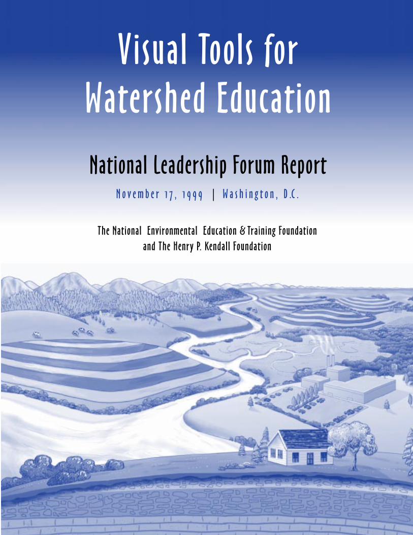
Visual Tools forWatershed Education
N o v e m b e r 1 7 , 1 9 9 9 | W a s h i n g t o n , D .C .
The National Environmental Education & Training Foundation
and The Henry P. Kendall Foundation
National Leadership Forum Report
Credits:Page 1: watershed drawing courtesy of River Network and Sarah Lauterbach.Page 2: Upper Rio Grande tributaries, map by Diane Sylvain.Page 5: drawing courtesy of CTIC, Purdue University.Page 6: John Wesley Powell, photo courtesy of Smithsonian Institution.Page 7: hydrologic map, The Greeninfo Network (www.greeninfo.org).Page 8: Surf Your Watershed Website, U.S. Environmental Protection Agency (www.epa.gov/surf3/locate).Page 9: drawing courtesy of River Network and Sarah Lauterbach.Page 10: Gros Ventre River, photo by Tim Palmer.Page 12: sewage symbol, Environmental Services, City of Portland.Page 13: Chesapeake Bay Watershed, photo courtesy of Chesapeake Bay Commission.Page 14: weathernet4 regional radar, courtesy of weathernet4 WRC-TV NBC-4, Washington, DC.Page 16: Junior Rain Drop, courtesy of USDA Forest Service.Page 17: graphic from Surf Your Watershed Website, U.S. EPA (www.epa.gov/surf).Page 18: Surf Your WatershedWebsite, U.S. EPA.Page 19: map courtesy of Cook Inlet Keeper.Page 21: photo by Tim Palmer.
Watershed: a defined land area that captures rainfall and other
precipitation and funnels it to a particular river, lake or stream.
Visual Tools forWatershed Education
National Leadership Forum Report
S P O N S O R E D B Y :
The National Environmental Education & Training Foundationand
The Henry P. Kendall Foundation
N o v e m b e r 1 7 , 1 9 9 9 | W a s h i n g t o n , D .C .

The National Environmental Education & Training Foundation gratefully acknowledges generoussupport from The Henry P. Kendall Foundation for the National Leadership Forum on Visual Toolsfor Watershed Education.

Table of Contents
Foreword: Watersheds — An Important But Often “Impenetrable” Idea ..................................... 1Kevin J. Coyle, President, The National Environmental Education and Training Foundation
“Home Watresheds”: A Sense of Place and a Sense of Self ........................................................... 2
Setting the Stage for the Forum .................................................................................................... 3Deborah Sliter, Vice-President for Programs, NEETF
Special Report: Forum Follow-up Actions ................................................................................... 4
Background: A Picture (of a Watershed) Is Worth a Thousand Words ......................................... 5
Summary of Presentations:
Keynote Address: “An Idea Whose Time Has Come” .................................................................. 8Louise Wise, Staff Director of Policy and Communication,Office of Wetlands, Oceans & Watersheds, U.S. EPA
The Educator’s Insight… Make a “Sign” and Learn the Power of Visual Tools ............................ 9Dr. Jean Gardner, Graduate Department of Architecture andEnvironmental Design, Parsons School of Design
Using Visual Tools to Connect Community and Local Watershed Opportunities ....................... 10Meg Maguire, President, Scenic America
A Press Perspective…Public Education About Watersheds ......................................................... 11Peter Eisler, Reporter, USA Today; Paul Dolan, Director, International andSpecial Services, ABC NewsOne; Deborah Potter, Executive Director, NewsLab
Symbols, Examples and Repetition…A Watershed Communications Primer .............................. 13Gibby Waitzin, Principal, Gibson Creative
Critical Lessons From Meteorology…Eyes on the Weather ........................................................ 14David Jones, Meteorologist and Principal Investigator, WRC-TV NBC-4
“Junior Rain Drop”…High Crimes and Misdemeanors in the Watershed .................................. 16USDA Forest Service Film (1948)
Putting the Rain Drop “Into Reverse” ....................................................................................... 16Glenn Patterson, Hydrologist, Office of Water Quality, United States Geological Survey
Finding Our Ecological Address Through the “Power of Ten” .................................................. 17Linda Lilienfeld, Film and Picture Researcher
Cyber-Surfing Your Watershed…Accessing Your Own “Ecological Address” ............................ 18Karen Klima, Internet Team, Office of Wetlands, Oceans & Watersheds, U.S. EPA
An Ecological Address to the North…Cook Inlet, Alaska .......................................................... 19Robert Shavelson, Executive Director, Cook Inlet Keeper
Applications of Watershed Education... Illinois, Massachusetts, & Washington, DC ................. 19Liz Raisbeck, Watershed Program Manager, River Network
Conclusion: From Words …To Pictures…To Watershed Awareness ........................................... 20
Addenda:
Test Your Own Professional Watershed IQ ................................................................................ 23
Watershed Resources on the Internet ......................................................................................... 25
Forum Participants .................................................................................................................... 27
Visual Tools for Watershed Education
1
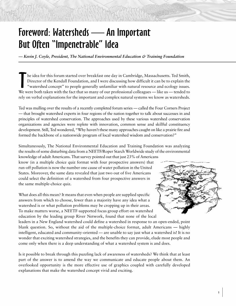
Foreword: Watersheds — An ImportantBut Often “Impenetrable” Idea— Kevin J. Coyle, President, The National Environmental Education & Training Foundation
The idea for this forum started over breakfast one day in Cambridge, Massachusetts. Ted Smith,Director of the Kendall Foundation, and I were discussing how difficult it can be to explain the“watershed concept” to people generally unfamiliar with natural resource and ecology issues.
We were both taken with the fact that so many of our professional colleagues — like us — tended torely on verbal explanations for the important and complex natural systems we know as watersheds.
Ted was mulling over the results of a recently completed forum series — called the Four Corners Project— that brought watershed experts in four regions of the nation together to talk about successes in andprinciples of watershed conservation. The approaches used by these various watershed conservationorganizations and agencies were replete with innovation, common sense and skillful constituencydevelopment. Still, Ted wondered, “Why haven’t these many approaches caught on like a prairie fire andformed the backbone of a nationwide program of local watershed wisdom and conservation?”
Simultaneously, The National Environmental Education and Training Foundation was analyzingthe results of some disturbing data from a NEETF/Roper Starch Worldwide study of the environmentalknowledge of adult Americans. That survey pointed out that just 23% of Americansknow (in a multiple choice quiz format with four prospective answers) thatrun-off pollution is now the number one cause of water pollution in the UnitedStates. Moreover, the same data revealed that just two out of five Americanscould select the definition of a watershed from four prospective answers inthe same multiple-choice quiz.
What does all this mean? It means that even when people are supplied specificanswers from which to choose, fewer than a majority have any idea what awatershed is or what pollution problems may be cropping up in their areas.To make matters worse, a NEETF-supported focus group effort on watershededucation by the leading group River Network, found that none of the localleaders in a New England watershed could define a watershed in response to an open-ended, pointblank question. So, without the aid of the multiple-choice format, adult Americans — highlyintelligent, educated and community-oriented — are unable to say just what a watershed is! It is nowonder that exciting watershed strategies, and the benefits they can provide, elude most people andcome only when there is a deep understanding of what a watershed system is and does.
Is it possible to break through this puzzling lack of awareness of watersheds? We think that at leastpart of the answer is to amend the way we communicate and educate people about them. Anoverlooked opportunity is the more effective use of graphics coupled with carefully developedexplanations that make the watershed concept vivid and exciting.
Visual Tools for Watershed Education
2
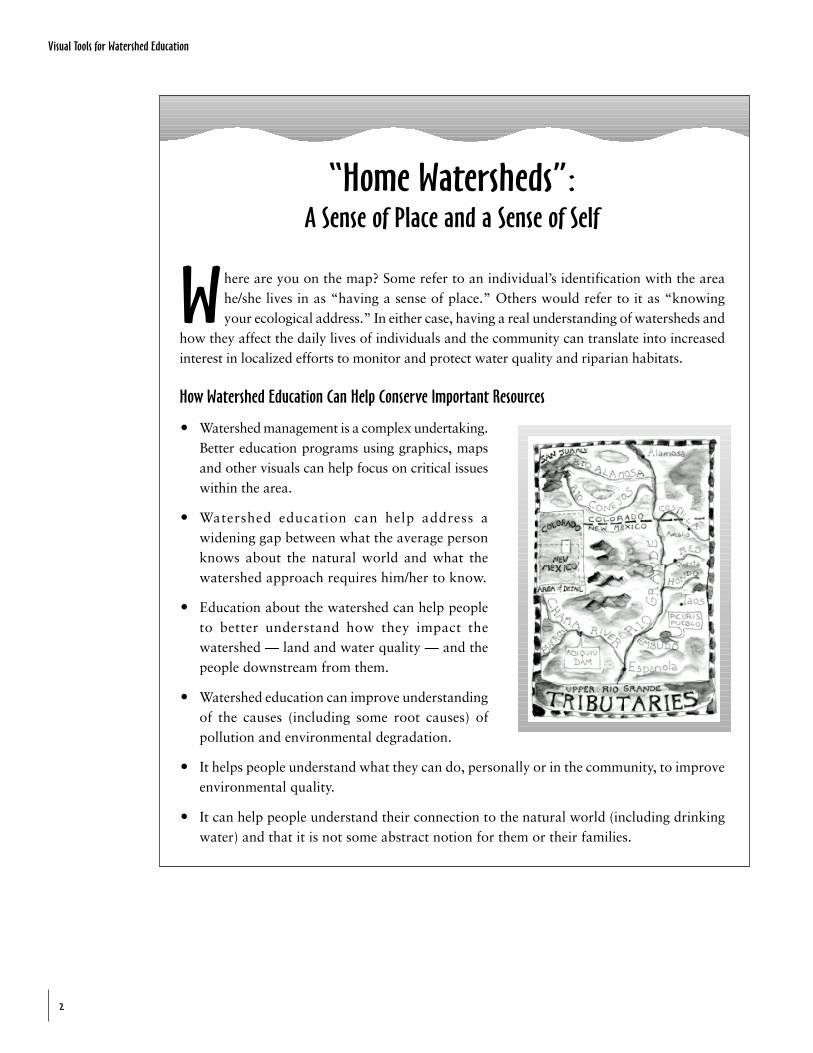
“Home Watersheds”:A Sense of Place and a Sense of Self
Where are you on the map? Some refer to an individual’s identification with the areahe/she lives in as “having a sense of place.” Others would refer to it as “knowingyour ecological address.” In either case, having a real understanding of watersheds and
how they affect the daily lives of individuals and the community can translate into increasedinterest in localized efforts to monitor and protect water quality and riparian habitats.
How Watershed Education Can Help Conserve Important Resources
O Watershed management is a complex undertaking.Better education programs using graphics, mapsand other visuals can help focus on critical issueswithin the area.
O Watershed education can help address awidening gap between what the average personknows about the natural world and what thewatershed approach requires him/her to know.
O Education about the watershed can help peopleto better understand how they impact thewatershed — land and water quality — and thepeople downstream from them.
O Watershed education can improve understandingof the causes (including some root causes) ofpollution and environmental degradation.
O It helps people understand what they can do, personally or in the community, to improveenvironmental quality.
O It can help people understand their connection to the natural world (including drinkingwater) and that it is not some abstract notion for them or their families.
Visual Tools for Watershed Education
3
This national forum was developed in response to a number of questions about how effectiveeducators and conservation leaders are in communicating about watersheds. And, becausewatershed systems are so complex, we believe that the use of graphics and visual tools would
help to improve watershed education efforts.
What we discovered, and what you will see from the presentations in this report, is that there aremany useful approaches to the use of visuals in communicating about watersheds and that they havebeen successful where verbal-only approaches have not been.
The forum also demonstrates that there are important principles about how people learn that areoften overlooked by those who work in the professions associated with watersheds. Ironically, manyof those most concerned about local leaders and the public adopting watershed conservation strategiestend to vastly overestimate what people know about watersheds asnatural systems and as organizing concepts for the conservation of ourfuture resources.
Our premises at the outset
O Complex watershed conservation concepts are too oftencommunicated to the public verbally without the assistance of visualtools and associated examples.
O When graphics of varying kinds have been used to communicatewatershed concepts they have been highly successful in buildingknowledge and support.
O Expertise exists in visual communication and distribution mechanisms— including TV, newspapers, computer and mapping programs,videos and more — which can increase the effective use of graphicsin the depiction of watershed concepts and programs.
O There are many agencies, organizations, leaders and corporationsinterested in, and capable of, joining in a significant watershededucation program.
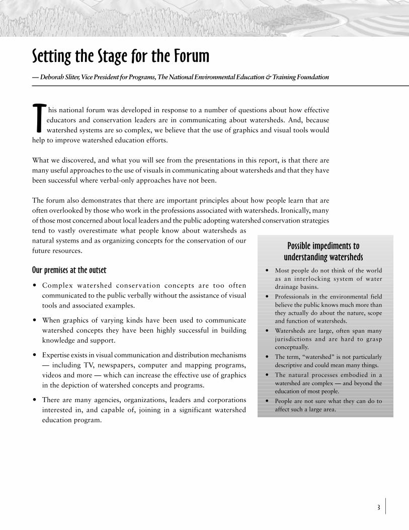
Possible impediments tounderstanding watersheds
O Most people do not think of the worldas an interlocking system of waterdrainage basins.
O Professionals in the environmental fieldbelieve the public knows much more thanthey actually do about the nature, scopeand function of watersheds.
O Watersheds are large, often span manyjurisdictions and are hard to graspconceptually.
O The term, “watershed” is not particularlydescriptive and could mean many things.
O The natural processes embodied in awatershed are complex — and beyond theeducation of most people.
O People are not sure what they can do toaffect such a large area.
Setting the Stage for the Forum—␣ Deborah Sliter, Vice President for Programs, The National Environmental Education & Training Foundation
Visual Tools for Watershed Education
4
Special Report:Forum Follow-up Actions
Not every forum can report on successes less than a year later, but two significant projects havegrown out of the November 1999 National Leadership Forum.
NBC-TV/NEETF Weather and Watershed News InitiativeAs part of our watershed education forum, we learned, through David Jones, meteorologist withWRC-TV NBC-4, about a golden opportunity to advance watershed awareness through theregular weather reports. NBC-4 in Washington, DC has agreed that it will make a school-basedand citizen group-based watershed monitoring program a part of its “Weather Watcher” Programand weather reporting.
Starting with the 13 NBC-owned stations (DC, New York, Philadelphia, Los Angeles, etc.), theycan potentially put a program in place that: a) periodically shows three dimensional watershedmaps on the air with information on pollution spills, flooding, drought, etc.; b) posts (for eachmetro area) a corresponding Internet Web site tied to the existing Weather Report site that willhave click-on maps and real time data; and c) lets designated “watershed watchers” post theirobservations on the local NBC-TV Web site.
Such public interest organizations as River Network and Earth Force, which now runs the GlobalRivers Environmental Education Network, are on-board to help with implementation. Moreover,the EPA watershed divisions will help to tie this effort to their own Web mapping programs suchas Surf Your Watershed. Assuming that this project works with the “test bed” of 13 NBC stations,it can be rolled out to several hundred affiliated stations.
National Forest System as Water Supplier…Explaining it to the PublicThe USDA Forest Service also came out of the forum highly supportive of watershed educationand has asked NEETF to help it with a new public information education program on the nationalforests as sources of drinking water.
A recent study shows that the National Forest System is the drinking source for some 66million Americans! Indeed, the national forests are the headwaters for the drinking suppliesand reservoirs of many major cities providing $ billions worth of water. This, in essence, makesthe Forest Service the largest single “water company” in the nation. The USDA Forest Serviceand NEETF are working on a joint project to implement a one-year public information andeducation strategy to tell this important story to the public. We can also tie this effort to theNBC-TV initiative and establish some of the communities in and around the national forests aswatershed watchers for local TV stations.
Visual Tools for Watershed Education
5
Background:A Picture (of a Watershed) Is Worth A Thousand Words
On November 17, 1999 some 120 education, environmental and communication leaders fromacross the nation assembled at the headquarters of the Academy for Educational Developmentin Washington, DC to take part in a forum that focused directly on how visual tools — maps,
graphics, models and stories (mental pictures) —␣ could help policyleaders, teachers, the media, and others to communicate meaningfullyon the concept of watersheds.
The modern need for addressing environmental and natural resourceissues more systemically has given rise to greater emphasis on“watershed” approaches in planning, resource assessment and evenpolitical activism. It is rare in this day and age to have a discussion ofwater resources, fish and wildlife conservation, pollution control, flooding, weather, forestry,even land use management without making a mention of watersheds. Many public agencies andprivate land managers are fully and officially engaged in watershed management approaches.Even major new legislative initiatives discuss watersheds.
Very encouraging news, but…Policy makers, environmental advocates, educators, the media and others who communicate withthe public on watershed conservation issues are not as effective as they could be. First, they assumeeveryone knows what a watershed is! This is not a reasonable assumption because survey researchshows that only two of five adult Americans can define a watershed if the definition is given to themas part of a multiple choice quiz and only a small percent can say what a watershed is if they areasked point blank without the aid of the multiple choice format. Simply stated, the majority ofAmericans do not understand the first thing about watersheds — their nature and form or why theywould be a useful focus for conservation programs and activity.
A second issue is that watersheds, which are as complex as anynatural system or living organism, are usually only describedthrough written and verbal descriptions. This is like trying todescribe a computer program without actually looking at it orusing it.
If watershed conservation is ever to be addressed or publiclydiscussed, the concept must be made vivid to the public. Thegraphic presentation of watershed concepts and programs tothe public can address this need.
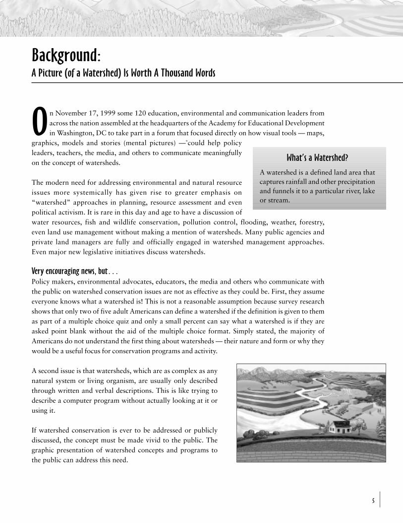
What’s a Watershed?
A watershed is a defined land area thatcaptures rainfall and other precipitationand funnels it to a particular river, lakeor stream.
Visual Tools for Watershed Education
6
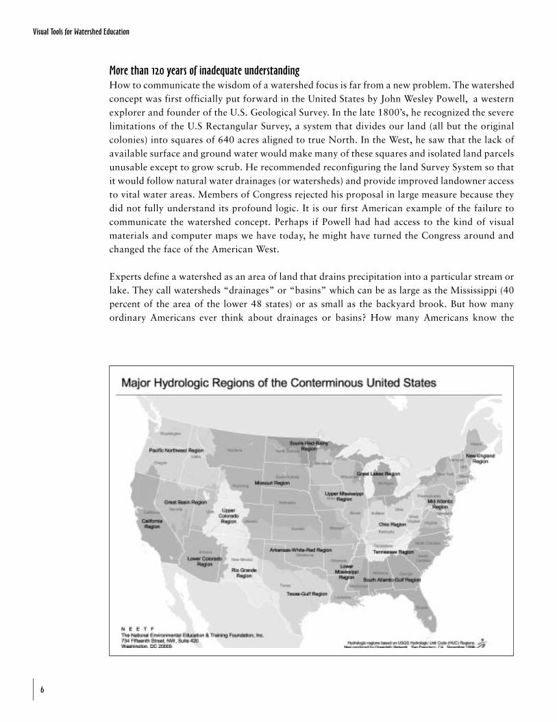
More than 120 years of inadequate understandingHow to communicate the wisdom of a watershed focus is far from a new problem. The watershedconcept was first officially put forward in the United States by John Wesley Powell, a westernexplorer and founder of the U.S. Geological Survey. In the late 1800’s, he recognized the severelimitations of the U.S Rectangular Survey, a system that divides our land (all but the originalcolonies) into squares of 640 acres aligned to true North. In the West, he saw that the lack ofavailable surface and ground water would make many of these squares and isolated land parcelsunusable except to grow scrub. He recommended reconfiguring the land Survey System so thatit would follow natural water drainages (or watersheds) and provide improved landowner accessto vital water areas. Members of Congress rejected his proposal in large measure because theydid not fully understand its profound logic. It is our first American example of the failure tocommunicate the watershed concept. Perhaps if Powell had had access to the kind of visualmaterials and computer maps we have today, he might have turned the Congress around andchanged the face of the American West.
Experts define a watershed as an area of land that drains precipitation into a particular stream orlake. They call watersheds “drainages” or “basins” which can be as large as the Mississippi (40percent of the area of the lower 48 states) or as small as the backyard brook. But how manyordinary Americans ever think about drainages or basins? How many Americans know the
Visual Tools for Watershed Education
7
American landscape is divided into an intricate patchwork of land areas draining this way andthat into rivers, lakes, bays and aquifers each time it rains or snows? Research says almost none!
When a group of national and New England-based conservation groups took the question to afocus group of educated citizens in the region not one of the group participants was able toactually say what a watershed was. New England is known in the conservation field as the heartlandof watershed local activism. And, when NEETF contracted with Roper Starch Worldwide to assesshow accurately adult Americans would respond if given a choice of various definitions of awatershed we found that 2 out of 5 Americans were unable to givethe correct answer even when it is evident to 100 percent of thoseeducated on the subject. In short, even though public policy ismore-and-more geared to watershed approaches, only a smallfraction of the public has any idea what those policies are addressingand so constituency and public support is not only lost but neverreally rallied.
Indeed, the highly complex geographic nature of watersheds — theircontours, their large size, and their non-adherence to traditionalpolitical boundaries — makes them inherently difficult tocomprehend. They are hard to visualize even by those few Americansfamiliar with contour maps and physiographic features and theyare nearly impossible to grasp by those who never see a contourmap or ever think about how the land is formed or configured.
For the watershed conservation advocate, the basic inability ofAmericans to “see” a watershed in the mind’s eye presents aserious barrier to obtaining support. For the teacher in school or for the student, this inabilityis a serious educational challenge. And, for policy makers, it creates a conceptual black holethat can’t be filled with a thousand words defining rules and regulations of conduct.
Is there a way to overcome the inability of most Americans to easily grasp the watershed concept? Alarge part of the answer lies with how the concept is presented.
Common goals ofwatershed conservation
O Protect water quality and the qualityof drinking water.
O Protect and conserve wildlife speciesand their critical habitats.
O Maintain sustainable farmingpractices and soil health.
O Promote smart growth and soundeconomic development.
O Preserve history, landscape and asense of place.
Visual Tools for Watershed Education
8
Taking the Pulse
of Am
eric
a’s
Wa
tersheds
Louise Wise, Policy and Communications Staff Director in EPA’s Office of Wetlands, Oceansand Watersheds, strongly supports the use of watershed approaches in national and stateenvironmental issues. Ms. Wise set the stage for the forum on how to best communicate watersheds.
She opened by noting that watershed management is “an idea whose time has come” andcommented on the numerous national programs based on watershed management as a key concept.These include: drinking water and source water protection programs, wildlife and ecologicalprotection programs, and more.
Ms. Wise stressed the importance of designing environmental programs and appropriate remedialprograms that address watersheds, and noted how watershed efforts have grown in acceptance.Public policy reflects this. She pointed out that the U.S. EPA, in its water protection programs, hasbeen moving steadily toward incorporating watershed policy into its water-related programs. Thishas helped the Agency to keep up with many of the complex issues arising with respect to waterpollution control, wetland restoration, river management and other subjects. She also pointed outhow EPA itself has made more of a commitment in recent years to using the Internet — postingmaps and graphics — as a tool in public information and communication. A prime example of thisnew commitment is the EPA “Surf Your Watershed” program which provides local computer mapsand supports data to members of the public via the Internet.
Ms. Wise agreed with the premises of the forum and noted, “that the public may not have much ofan understanding of watersheds and may actually end up on the outside of many important publicdiscussions of our environmental future.” The solution: more emphasis on understanding how tocommunicate and educate about watersheds with much more focus on the creative use of visualtools such as maps, graphics and schematics.
Keynote Address: “An Idea Whose Time Has Come”— Louise Wise, Esq., Staff Director of Policy and Communication,
Office of Wetlands, Oceans & Watersheds, U.S. EPA
Visual Tools for Watershed Education
9
The Educator’s Insight…Make A “Sign” and Learn the Power of Visual Tools
— Dr. Jean Gardner, Graduate Department of Architecture &Environmental Design, Parsons School of Design
Dr. Jean Gardner, on the Senior Faculty of the Graduate Department of Architecture andEnvironmental Design, Parsons School of Design, is a leading educator on how peoplelearn and the role of visuals in that learning process. She challenged forum participants to think about
how we not only fail to communicate about water and natural systems using anything more than words butalso how, in an urban setting, many of these resources — particularly water — are hidden from view.
Dr. Gardner offered an organizational construct about how people learn. She noted that, as a culture,we substitute the ear for the eye and thereby limit learning. Specifically, she noted, people in westernsociety are taught from an early age to hear things described rather than to actually see them.American schools move students toward auditory learning rather than visual organization andlearning. Over time we lose our ability to understand entire parts of the world because we think inword outlines instead of flow charts and visual representations. Her overall message — directlyapplicable to the watershed subject — was that “we think through our displays, and our ability toorganize information visually improves our ability to think.”
By “display,” she means any graphic representation of thought, called“iconic” by academics, as opposed to “indexal” (or written) organizationof information.
Dr. Gardner suggests that any visual organization, whether a politicalstatement or a discussion of watersheds, can follow certain rules of visualorganization.
O First, “make a sign of something” — a map of a watershed or adrawing of a river valley. The representation or “sign” shouldencompass all the features that will be needed for the remaining steps.
O Second, the sign should be “about something,” — for example, therelationship of rainfall to flooding, or how land use activities withinthe watershed can produce pollution in a river or stream.
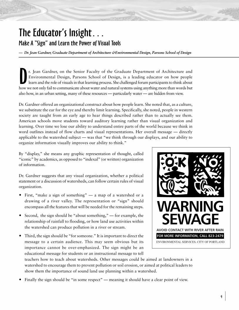
O Third, the sign should be “for someone.” It is important to direct themessage to a certain audience. This may seem obvious but itsimportance cannot be over-emphasized. The sign might be aneducational message for students or an instructional message to tellteachers how to teach about watersheds. Other messages could be aimed at landowners in awatershed to encourage them to prevent pollution or soil erosion, or aimed at political leaders toshow them the importance of sound land use planning within a watershed.
O Finally the sign should be “in some respect” — meaning it should have a clear point of view.
Visual Tools for Watershed Education
10
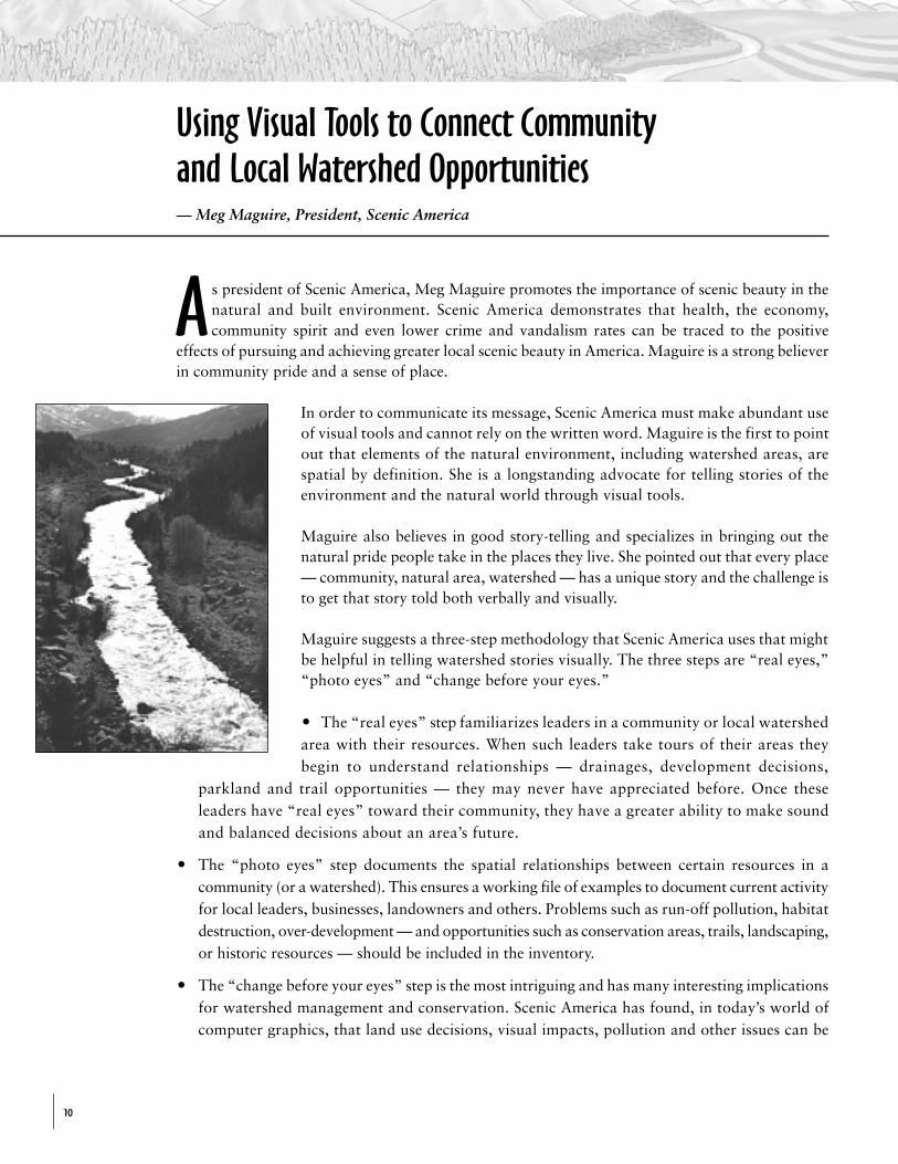
As president of Scenic America, Meg Maguire promotes the importance of scenic beauty in thenatural and built environment. Scenic America demonstrates that health, the economy,community spirit and even lower crime and vandalism rates can be traced to the positive
effects of pursuing and achieving greater local scenic beauty in America. Maguire is a strong believerin community pride and a sense of place.
In order to communicate its message, Scenic America must make abundant useof visual tools and cannot rely on the written word. Maguire is the first to pointout that elements of the natural environment, including watershed areas, arespatial by definition. She is a longstanding advocate for telling stories of theenvironment and the natural world through visual tools.
Maguire also believes in good story-telling and specializes in bringing out thenatural pride people take in the places they live. She pointed out that every place— community, natural area, watershed — has a unique story and the challenge isto get that story told both verbally and visually.
Maguire suggests a three-step methodology that Scenic America uses that mightbe helpful in telling watershed stories visually. The three steps are “real eyes,”“photo eyes” and “change before your eyes.”
O The “real eyes” step familiarizes leaders in a community or local watershedarea with their resources. When such leaders take tours of their areas theybegin to understand relationships — drainages, development decisions,
parkland and trail opportunities — they may never have appreciated before. Once theseleaders have “real eyes” toward their community, they have a greater ability to make soundand balanced decisions about an area’s future.
O The “photo eyes” step documents the spatial relationships between certain resources in acommunity (or a watershed). This ensures a working file of examples to document current activityfor local leaders, businesses, landowners and others. Problems such as run-off pollution, habitatdestruction, over-development — and opportunities such as conservation areas, trails, landscaping,or historic resources — should be included in the inventory.
O The “change before your eyes” step is the most intriguing and has many interesting implicationsfor watershed management and conservation. Scenic America has found, in today’s world ofcomputer graphics, that land use decisions, visual impacts, pollution and other issues can be
Using Visual Tools to Connect Communityand Local Watershed Opportunities— Meg Maguire, President, Scenic America
Visual Tools for Watershed Education
11
depicted through overlay simulations before they occur. Using acomputer, virtually any community or watershed area can changebefore your eyes for a futuristic view.
What Maguire likes most about the three-step process is that each step hasindependent value and can be highly technical and sophisticated or quitesimple. Visual tools as simple as a drawn sketch can be highly effective.
Other names for a “watershed”
(Even if a picture is worth a thousand wordssometimes it helps to know some goodwords too!)O A river or lake basinO A “drainage”O A “catchment area”O A greater (river) valleyO The headwaters area (for upper watershed)O A river and its tributaries
Survey research shows that adult Americans get most of their information on the environmentfrom newspapers, radio and television. The media is the top source of environmentalinformation for Americans of all ages.
As Executive Director of NewsLab, Deborah Potter, a former CBS and CNN correspondent, leads anorganization dedicated to producing strong television news programming. She focused discussion onthe media’s role in communicating watershed conservation and education.
Peter EislerPotter started by asking reporter Peter Eisler of USA Today about a recent article he wrote on drinkingwater quality. USA Today is renowned for its effective use of graphics in getting the message across tothe public. Deborah asked Peter if he felt he had missed an opportunity by not including watershedmaps or drawings in his article which suggested that as many as 80% of all pollution level violationsin drinking water supplies went unreported.
Eisler acknowledged that his treatment of water pollution issues, particularly such complex issues asrun-off water pollution and stream sampling, would benefit from skillful use of maps and graphicsincluding instructional depictions of watersheds. He feels many reporters should address the same need.
Potter described the enormous opportunities available to reporters, due to government programsdesigned to inform the public about the quality and safety of drinking water. More than 200 millionpeople will receive annual reports from 55,000 water companies and other suppliers on pollution or
A Press Perspective… Public Education about Watersheds— Peter Eisler, USA Today; Paul Dolan, Director of International and Special Services,
ABC News One; moderated by Deborah Potter, Executive Director, NewsLab
Visual Tools for Watershed Education
12
impurities in tap water. The press has an unprecedented opportunity to employ graphic tools whenwriting about these reports.
Eisler pointed out that pictures are best used in conjunction with a compelling story.
Paul DolanABC News Editor and Producer Paul Dolan agreed with Peter Eisler on the importance of having agood story and suggested that many people who report on environmental topics should refine theirstory-telling skills and make use of visual tools. He suggested that some environmentally-basedstories lend themselves to human interest, in addition to scientific concerns. Paul suggested thatwatershed advocates look for a “deep hook” and he used an example from his own experienceworking in the Sterling Forest Area in New York. He pointed out that the need to protect New YorkCity’s water supply by protecting Sterling Forest became much more interesting to the public whenit was revealed that a local official appeared to be engaged in some illegal dealings regarding landuse development in the area. Dolan made the critical point that people can often relate best to anenvironmental story when it is tied to a subject they already understand — local political corruptionin this case.
Deborah Potter referred to this as the “Velcro” method of reporting complex issues. If you can‘stick’ a story to something already in the head (a kind of experiential Velcro), the story will havesomething to stick to and therefore be better understood and remembered.
All members of the panel agreed that conservation organizations and advocates need to becomebetter communicators by using graphics more effectively and translating issues into more “digestible”stories. But the media representatives cautioned advocacy organizations to recognize the duty ofreporters to use objective sources and suggested that universities, science institutes and similarorganizations having no axe to grind are best suited for supplying underlying data.
Other tips include: slowly orienting reporters on watershed-related subjects but holding off until themost compelling stories are ready to be told; placing much more emphasis on educating editors onthe issues in the watershed; and understanding how watershed management affects local communitiesand public health.
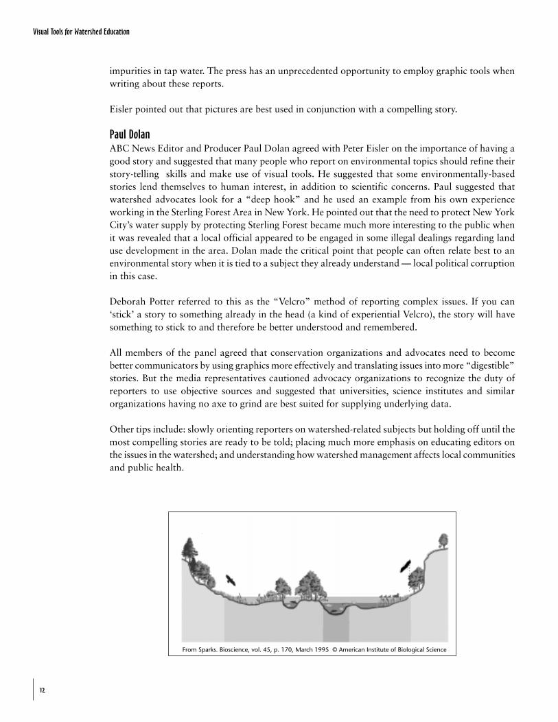
From Sparks. Bioscience, vol. 45, p. 170, March 1995 © American Institute of Biological Science
Visual Tools for Watershed Education
13
Gibby Waitzkin, an expert in public relations and communications and Principal of GibsonCreative, pointed out that there is a discipline and art to good public communication. Thisis particularly true when it comes to complex concepts such as watershed management and
conservation. She provided attendees with a highly useful “communications 101” review that couldbe employed by the media, public agencies, public interest organizations and others.
Waitzkin noted one of the most useful (and telling) initial techniques: conducting acommunications “audit.” This can help an organization look at overall capabilities and practicesin the public communications area, and provides a useful checklist of tools and approachesbefore making improvements. These range from simple steps such as actually sending outinformation to more sophisticated measures such as looking at sources of public opinion researchand developing clear, concise, compelling messages, easily digestible by the public who hungerfor education and information.
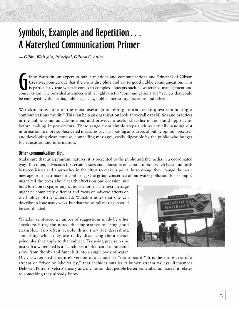
Other communications tips:Make sure that as a program matures, it is presented to the public and the media in a coordinatedway. Too often, advocates for certain issues and educators on certain topics switch back and forthbetween issues and approaches in the effort to make a point. In so doing, they change the basicmessage or at least make it confusing. One group concerned about water pollution, for example,might tell the press about health effects on one occasion andhold forth on taxpayer implications another. The next messagemight be completely different and focus on adverse affects onthe biology of the watershed. Waitzkin notes that one candescribe an issue many ways, but that the overall message shouldbe coordinated.
Waitzkin reinforced a number of suggestions made by otherspeakers: First, she noted the importance of using goodexamples. Too often people think they are describingsomething when they are really discussing the abstractprinciples that apply to that subject. Try using precise termsinstead: a watershed is a “catch basin” that catches rain andsnow from the sky and funnels it into a single body of water.Or… a watershed is nature’s version of an immense “drain board.” It is the entire area of astream or “river or lake valley,” that includes smaller tributary stream valleys. RememberDeborah Potter’s ‘velcro’ theory and the notion that people better remember an issue if it relatesto something they already know.
Symbols, Examples and Repetition…A Watershed Communications Primer—␣ Gibby Waitzkin, Principal, Gibson Creative
Visual Tools for Watershed Education
14
Symbols can also be important: logos of a three-dimensional stream valley; a schematic picture of awatershed area; a basin and drain; or a slogan like “nature’s drainage system.”
When it comes to describing the need to address environmental issues occurring in the watershed,Waitzkin, like those before her, suggested the use of before-and-after scenarios. These can rangefrom pictures or descriptions of water quality to maps showing land use and transportation patterns.
A final note of importance: a good communications strategy repeats the message several times. Forobvious reasons, repetition makes a huge difference in the success of a communications program.
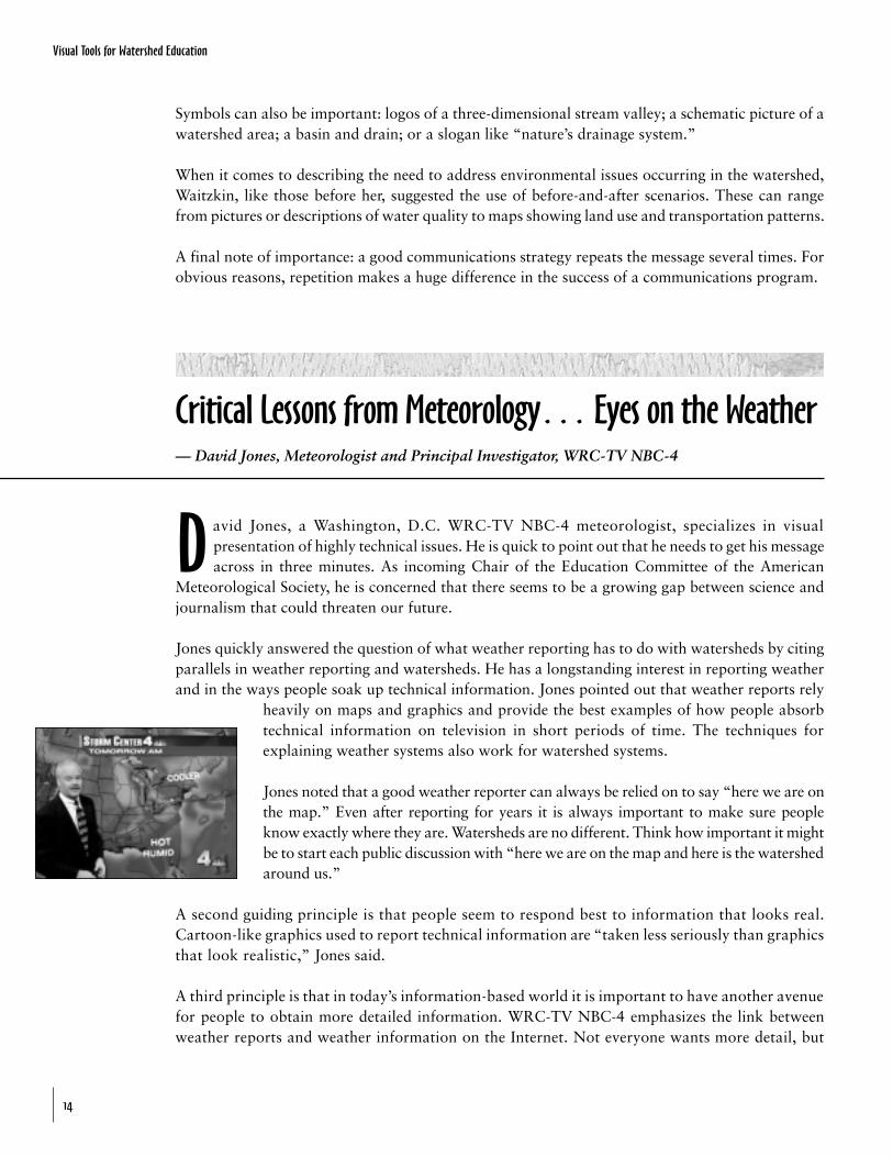
David Jones, a Washington, D.C. WRC-TV NBC-4 meteorologist, specializes in visualpresentation of highly technical issues. He is quick to point out that he needs to get his messageacross in three minutes. As incoming Chair of the Education Committee of the American
Meteorological Society, he is concerned that there seems to be a growing gap between science andjournalism that could threaten our future.
Jones quickly answered the question of what weather reporting has to do with watersheds by citingparallels in weather reporting and watersheds. He has a longstanding interest in reporting weatherand in the ways people soak up technical information. Jones pointed out that weather reports rely
heavily on maps and graphics and provide the best examples of how people absorbtechnical information on television in short periods of time. The techniques forexplaining weather systems also work for watershed systems.
Jones noted that a good weather reporter can always be relied on to say “here we are onthe map.” Even after reporting for years it is always important to make sure peopleknow exactly where they are. Watersheds are no different. Think how important it mightbe to start each public discussion with “here we are on the map and here is the watershedaround us.”
A second guiding principle is that people seem to respond best to information that looks real.Cartoon-like graphics used to report technical information are “taken less seriously than graphicsthat look realistic,” Jones said.
A third principle is that in today’s information-based world it is important to have another avenuefor people to obtain more detailed information. WRC-TV NBC-4 emphasizes the link betweenweather reports and weather information on the Internet. Not everyone wants more detail, but
Critical Lessons from Meteorology… Eyes on the Weather— David Jones, Meteorologist and Principal Investigator, WRC-TV NBC-4
Visual Tools for Watershed Education
15
for those who do, it is readily accessible. NBC-4 uses a “Weather Watcher” network to createdetailed weather information on certain locales. There are three hundred individuals and schoolsin the Greater Washington, DC region that regularly supply the station with weather data such ashigh and low temperature readings, precipitation measurements and more. This network givesNBC-4 “real time” information on what is happening in metro Washington areas.
Television viewers are often advised about the Weather Watcher findings and can log on to thecorresponding Website by clicking on a map of their county. This gives them a display of weatherdata from the “watchers” in their immediate vicinity.
Jones feels it is not too much of a leap from weather-watching to watershed watching and he debuteda new computer graphics program that could build the cornerstone of a new watershed-watcherprogram. Realistic-looking, three-dimensional maps show the Washington region and its manywatersheds, sub-basins and smaller drainages. The new program was initially designed with NASAdata to be used (in part) as a flood predictor in cooperation with the Federal Emergency ManagementAgency (FEMA). Three-dimensional maps can show, for example, that when there is a downpour inone part of the region there could be flooding farther down in the watershed.
Jones indicated a desire to work with NEETF and other public interest organizations and agencies tofurther develop this mapping program and use it on the air. Events such as oil and chemical spills,pollution run-off problems, floods, droughts, water supply issues and much more could be shown ontelevision as part of the local weather report. This could become a national delivery system. What weinitially thought would be a discussion of parallels between reporting complex weather information onTV ended up being a specific road map (with a realistic, three-dimensional mapping appearance) forconnecting weather watching with watershed monitoring.
Visual Tools for Watershed Education
16
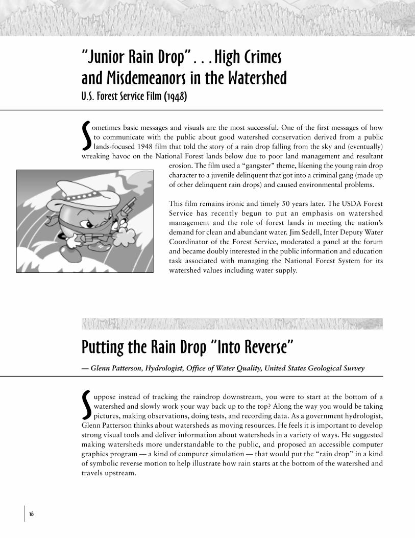
Sometimes basic messages and visuals are the most successful. One of the first messages of howto communicate with the public about good watershed conservation derived from a publiclands-focused 1948 film that told the story of a rain drop falling from the sky and (eventually)
wreaking havoc on the National Forest lands below due to poor land management and resultanterosion. The film used a “gangster” theme, likening the young rain dropcharacter to a juvenile delinquent that got into a criminal gang (made upof other delinquent rain drops) and caused environmental problems.
This film remains ironic and timely 50 years later. The USDA ForestService has recently begun to put an emphasis on watershedmanagement and the role of forest lands in meeting the nation’sdemand for clean and abundant water. Jim Sedell, Inter Deputy WaterCoordinator of the Forest Service, moderated a panel at the forumand became doubly interested in the public information and educationtask associated with managing the National Forest System for itswatershed values including water supply.
”Junior Rain Drop”…High Crimesand Misdemeanors in the WatershedU.S. Forest Service Film (1948)
Putting the Rain Drop ”Into Reverse”— Glenn Patterson, Hydrologist, Office of Water Quality, United States Geological Survey
Suppose instead of tracking the raindrop downstream, you were to start at the bottom of awatershed and slowly work your way back up to the top? Along the way you would be takingpictures, making observations, doing tests, and recording data. As a government hydrologist,
Glenn Patterson thinks about watersheds as moving resources. He feels it is important to developstrong visual tools and deliver information about watersheds in a variety of ways. He suggestedmaking watersheds more understandable to the public, and proposed an accessible computergraphics program — a kind of computer simulation — that would put the “rain drop” in a kindof symbolic reverse motion to help illustrate how rain starts at the bottom of the watershed andtravels upstream.
Visual Tools for Watershed Education
17
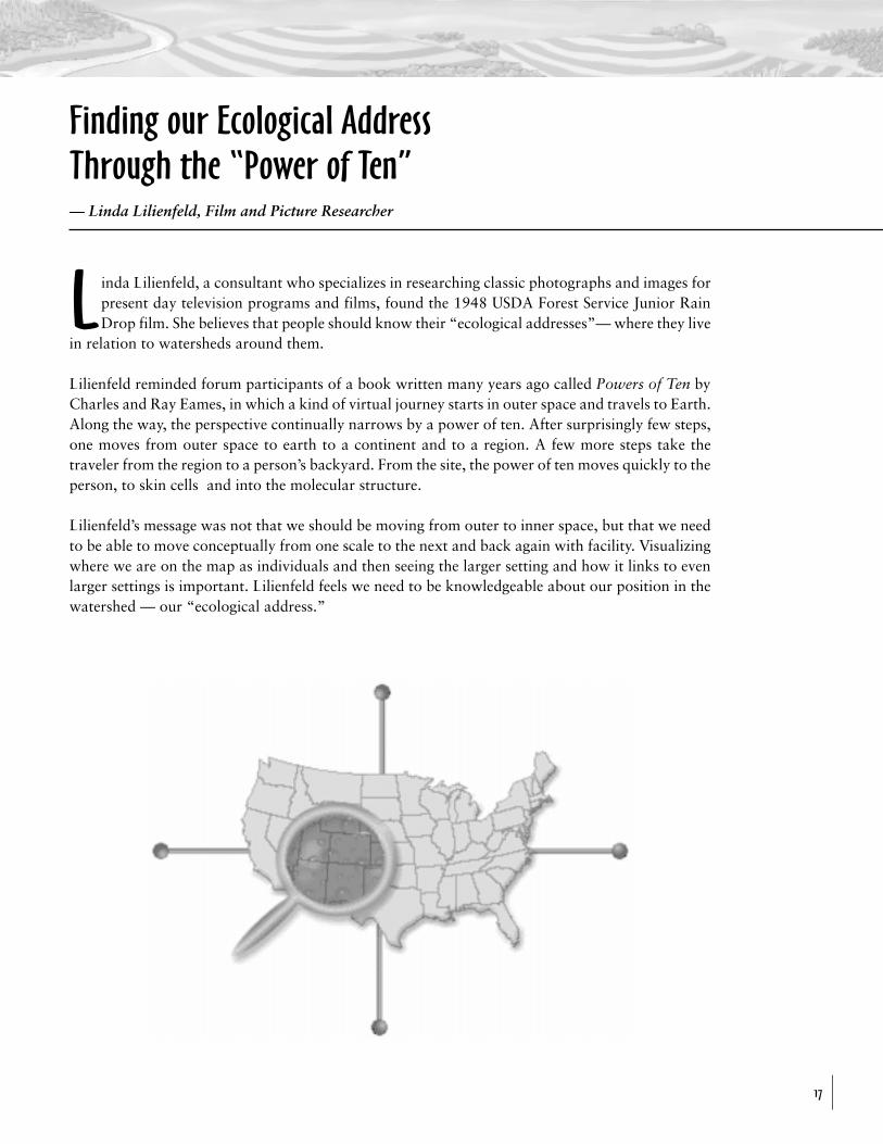
Linda Lilienfeld, a consultant who specializes in researching classic photographs and images forpresent day television programs and films, found the 1948 USDA Forest Service Junior RainDrop film. She believes that people should know their “ecological addresses”— where they live
in relation to watersheds around them.
Lilienfeld reminded forum participants of a book written many years ago called Powers of Ten byCharles and Ray Eames, in which a kind of virtual journey starts in outer space and travels to Earth.Along the way, the perspective continually narrows by a power of ten. After surprisingly few steps,one moves from outer space to earth to a continent and to a region. A few more steps take thetraveler from the region to a person’s backyard. From the site, the power of ten moves quickly to theperson, to skin cells and into the molecular structure.
Lilienfeld’s message was not that we should be moving from outer to inner space, but that we needto be able to move conceptually from one scale to the next and back again with facility. Visualizingwhere we are on the map as individuals and then seeing the larger setting and how it links to evenlarger settings is important. Lilienfeld feels we need to be knowledgeable about our position in thewatershed — our “ecological address.”
Finding our Ecological AddressThrough the “Power of Ten”— Linda Lilienfeld, Film and Picture Researcher
Visual Tools for Watershed Education
18
Cyber-Surfing Your Watershed….Accessing Your Own ‘Ecological Address’— Karen Klima, Internet Team, Office of Wetlands, Oceans & Watersheds, U.S. EPA
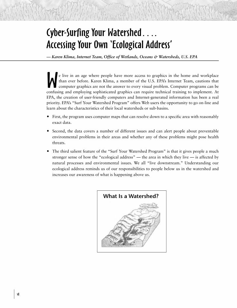
We live in an age where people have more access to graphics in the home and workplacethan ever before. Karen Klima, a member of the U.S. EPA’s Internet Team, cautions thatcomputer graphics are not the answer to every visual problem. Computer programs can be
confusing and employing sophisticated graphics can require technical training to implement. AtEPA, the creation of user-friendly computers and Internet-generated information has been a realpriority. EPA’s “Surf Your Watershed Program” offers Web users the opportunity to go on-line andlearn about the characteristics of their local watersheds or sub-basins.
O First, the program uses computer maps that can resolve down to a specific area with reasonablyexact data.
O Second, the data covers a number of different issues and can alert people about preventableenvironmental problems in their areas and whether any of these problems might pose healththreats.
O The third salient feature of the “Surf Your Watershed Program” is that it gives people a muchstronger sense of how the “ecological address” — the area in which they live — is affected bynatural processes and environmental issues. We all “live downstream.” Understanding ourecological address reminds us of our responsibilities to people below us in the watershed andincreases our awareness of what is happening above us.
What Is a Watershed?
Visual Tools for Watershed Education
19
Applying Visuals on the Ground
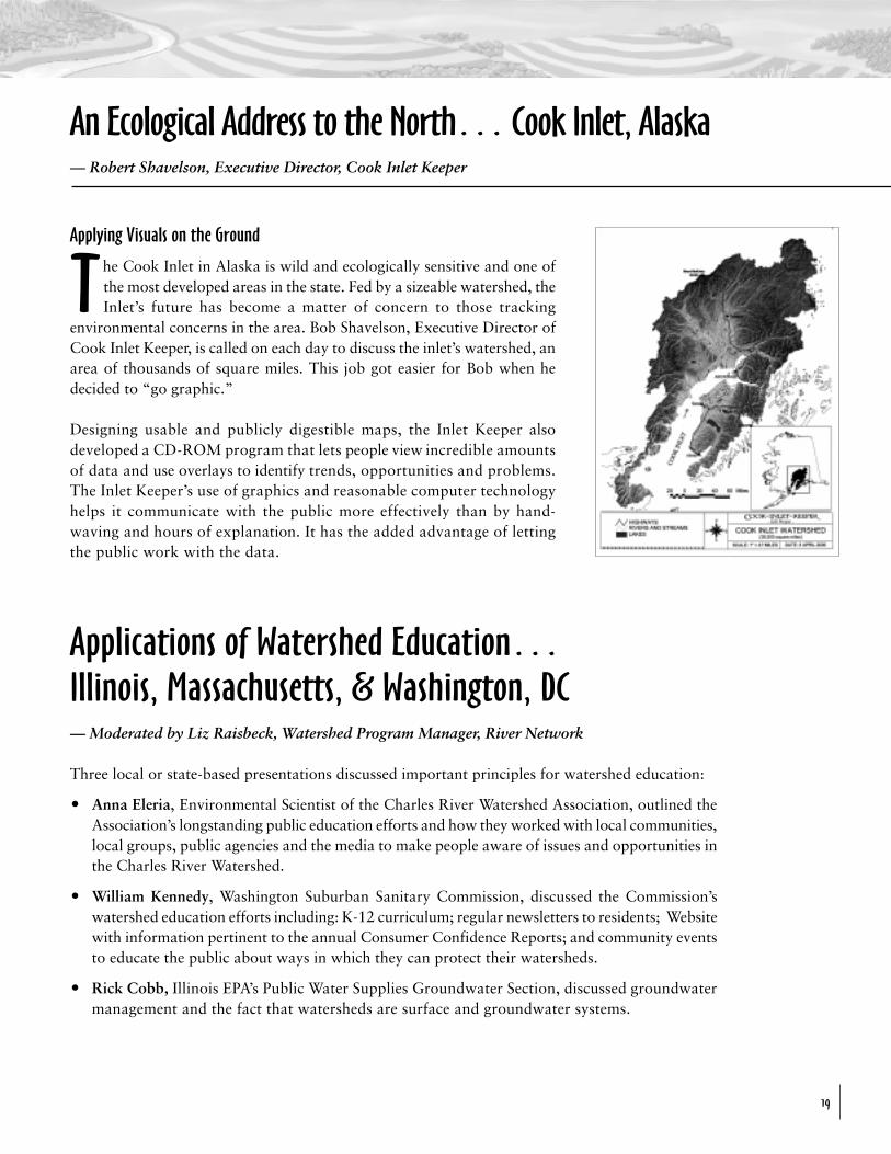
The Cook Inlet in Alaska is wild and ecologically sensitive and one ofthe most developed areas in the state. Fed by a sizeable watershed, theInlet’s future has become a matter of concern to those tracking
environmental concerns in the area. Bob Shavelson, Executive Director ofCook Inlet Keeper, is called on each day to discuss the inlet’s watershed, anarea of thousands of square miles. This job got easier for Bob when hedecided to “go graphic.”
Designing usable and publicly digestible maps, the Inlet Keeper alsodeveloped a CD-ROM program that lets people view incredible amountsof data and use overlays to identify trends, opportunities and problems.The Inlet Keeper’s use of graphics and reasonable computer technologyhelps it communicate with the public more effectively than by hand-waving and hours of explanation. It has the added advantage of lettingthe public work with the data.
Applications of Watershed Education…Illinois, Massachusetts, & Washington, DC— Moderated by Liz Raisbeck, Watershed Program Manager, River Network
Three local or state-based presentations discussed important principles for watershed education:
O Anna Eleria, Environmental Scientist of the Charles River Watershed Association, outlined theAssociation’s longstanding public education efforts and how they worked with local communities,local groups, public agencies and the media to make people aware of issues and opportunities inthe Charles River Watershed.
O William Kennedy, Washington Suburban Sanitary Commission, discussed the Commission’swatershed education efforts including: K-12 curriculum; regular newsletters to residents; Websitewith information pertinent to the annual Consumer Confidence Reports; and community eventsto educate the public about ways in which they can protect their watersheds.
O Rick Cobb, Illinois EPA’s Public Water Supplies Groundwater Section, discussed groundwatermanagement and the fact that watersheds are surface and groundwater systems.
An Ecological Address to the North… Cook Inlet, Alaska— Robert Shavelson, Executive Director, Cook Inlet Keeper
Visual Tools for Watershed Education
20
○ ○ ○ ○ ○
Graphic programs that emerge from this effort must not be overly computerized or technical.The use of Geographic Information Systems will be essential for communicating with certainkey audiences, such as policy leaders or land use decision-makers at the local and state level.
But depictions and distribution approaches must also be understood by educators and the generalpublic. Maps, drawings, computer graphics and other modes of presentation at the simplest levelwill be key to this effort’s success.
Conclusion:From Words …To Pictures…To Watershed Awareness
Recommendations:
1 Use better graphics more frequently — don’ttry to explain complex ideas and systemswithout them.
2 Target strategic audiences that need tounderstand watersheds — segment the marketand don’t try to cover everyone with a one-size-fits-all approach. Tailor the customizedgraphics for members of the general public,community leaders, and others.
3 Use natural phenomena such as floods,droughts, and major storms to help make thepublic aware of watersheds.
4 Use the Web as an access tool for maps, graphicsand information on local watersheds.
5 Recognize the scattered nature of existing visualresources and integrate where possible —overlays, atlases, etc.
6 Use graphic “templates” that convey basicwatershed concepts, made available on the Web.
7 Raise watershed awareness through events thatpromote ecological address identification andunderstanding, and help place people in theirlocal environments.
8 Use series of learning concepts (“signs”) to facilitatewatershed learning that do not rely on graphicsalone. Learning concepts should consider:
Learning “Signs:
1 highly familiar analogies to describe watershedcomponents and systems — inkblots, veins andarteries, corridors, etc.
2 “reverse flow” graphics, such as videos that takepeople up river.
3 simple, user-friendly maps, and diagrams andgraphics to convey watershed ideas.
4 appropriate scale of watershed programs andgraphics — the more community-focused the better.
5 “journey” stories or watershed quests as a way toconvey complex watershed concepts and programs.
6 stories that fit journalistic needs — hooks, localangles and accessible maps and descriptive graphics.
7 watershed graphics and associated concepts thatcan help teachers meet national science, math andsocial studies standards.
8 hands-on devices — stencils, models, demon-
strations, etc.
○
○
○
○
○
○
○
○
○
○
○
○
○
○
○
○
○
○
○
○
○
○
○
○
○
○
○
○
○
○
○
○
○
○
○
○
○
○
○
○
○
D
○ ○ ○ ○ ○ ○ ○ ○ ○ ○ ○ ○ ○ ○ ○ ○ ○ ○ ○○
○
○
○
○
Visual Tools for Watershed Education
21
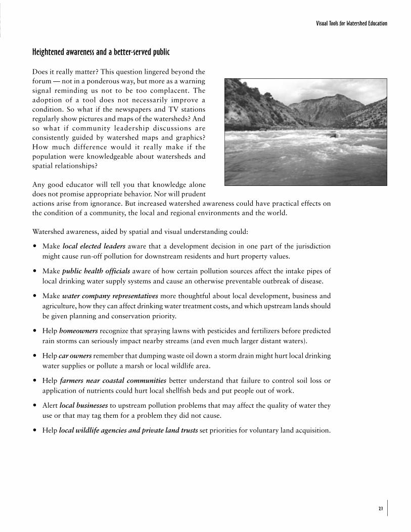
Heightened awareness and a better-served public
Does it really matter? This question lingered beyond theforum — not in a ponderous way, but more as a warningsignal reminding us not to be too complacent. Theadoption of a tool does not necessarily improve acondition. So what if the newspapers and TV stationsregularly show pictures and maps of the watersheds? Andso what if community leadership discussions areconsistently guided by watershed maps and graphics?How much difference would it really make if thepopulation were knowledgeable about watersheds andspatial relationships?
Any good educator will tell you that knowledge alonedoes not promise appropriate behavior. Nor will prudentactions arise from ignorance. But increased watershed awareness could have practical effects onthe condition of a community, the local and regional environments and the world.
Watershed awareness, aided by spatial and visual understanding could:
O Make local elected leaders aware that a development decision in one part of the jurisdictionmight cause run-off pollution for downstream residents and hurt property values.
O Make public health officials aware of how certain pollution sources affect the intake pipes oflocal drinking water supply systems and cause an otherwise preventable outbreak of disease.
O Make water company representatives more thoughtful about local development, business andagriculture, how they can affect drinking water treatment costs, and which upstream lands shouldbe given planning and conservation priority.
O Help homeowners recognize that spraying lawns with pesticides and fertilizers before predictedrain storms can seriously impact nearby streams (and even much larger distant waters).
O Help car owners remember that dumping waste oil down a storm drain might hurt local drinkingwater supplies or pollute a marsh or local wildlife area.
O Help farmers near coastal communities better understand that failure to control soil loss orapplication of nutrients could hurt local shellfish beds and put people out of work.
O Alert local businesses to upstream pollution problems that may affect the quality of water theyuse or that may tag them for a problem they did not cause.
O Help local wildlife agencies and private land trusts set priorities for voluntary land acquisition.
Visual Tools for Watershed Education
22
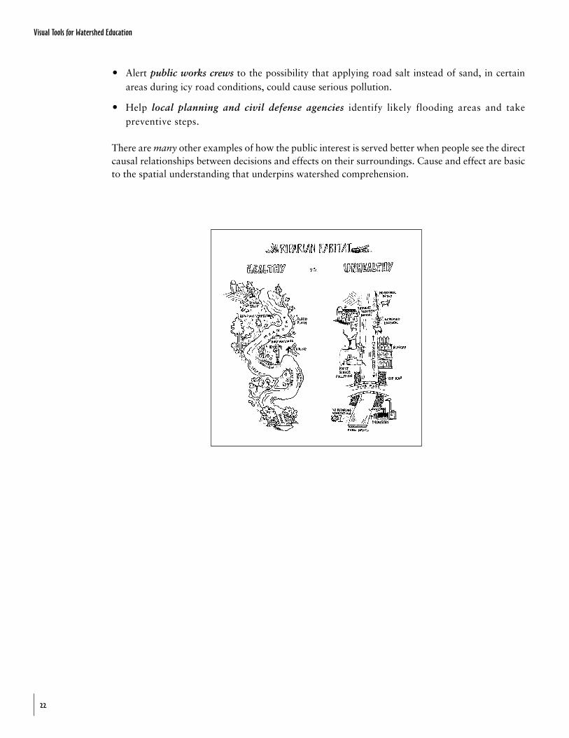
O Alert public works crews to the possibility that applying road salt instead of sand, in certainareas during icy road conditions, could cause serious pollution.
O Help local planning and civil defense agencies identify likely flooding areas and takepreventive steps.
There are many other examples of how the public interest is served better when people see the directcausal relationships between decisions and effects on their surroundings. Cause and effect are basicto the spatial understanding that underpins watershed comprehension.
Visual Tools for Watershed Education
23
1. Define a watershed:____________________________________________________________________________________________________________________________________________________________________________________________________________________________________________________________________________________________________________________________________________
2. Provide three synonyms for a watershed:____________________________________________________________________________________________________________________________________________________________________________________________________________________________________________________________________________________________________________________________________________
3. How many large (100,000 acre average) watersheds, according to the U.S. Geological Survey,exist in the United States?
a) 123 [ ] b) 1012 [ ] c) 2149 [ ] d) 3412 [ ]
4. The Mississippi covers what percentage of the lower 48 states?
a) 10% [ ] b) 25% [ ] c) 40% [ ] d) 65% [ ]
5. What percentage of the United States land area does NOT fall in a watershed?
a) 4% [ ] b) 12% [ ] c) 23% [ ] d) none of these choices [ ]
6. What percentage of U.S. drinking water comes from surface water?
a) 33% [ ] b) 50% [ ] c) 67% [ ] d) none of these choices [ ]
7. What percentage of U.S. water companies and supply agencies must provide annual reports ontheir local watershed’s (or aquifer’s) tap water?
a) 10% [ ] b) 50% [ ] c) 100% [ ] d) none of these choices [ ]
8. What percentage of human body weight comes directly from a watershed? (trick question!)
a) 50% [ ] b) 70% [ ] c) 80% [ ] d) 100% [ ]
9. Name two major American cities NOT located next to a river or freshwater lake:_________________________________________________________________________________________________________________________________________________________________________________________________________________________________________________________
10. Watersheds include groundwater — True or False?
T [ ] F [ ] Usually [ ]
Test Your Own Professional Watershed IQ
Visual Tools for Watershed Education
24
11. The Great Lakes are in a single watershed — True or False?
T [ ] F [ ]
12. What percentage of the American people live in a watershed? (not a trick question!)
a) 100% b) 100% c) 100% d) all of these choices
13. Which of the following federal agencies does NOT use a watershed-based strategy in implementingits programs?
Forest Service Bureau of Land Management Park ServiceCoast Guard Fish and Wildlife Service NASACommerce EPA DefensePost Office Natural Resources Conservation Service White House
14. How many states currently undertake statewide watershed or drinking water source assessments?
a) 10 [ ] b) 20 [ ] c) 30 [ ] d) 50 [ ]
Correct Answers: 1. For example: “The region draining into a river, river system, or body of water.”; 2.drainage, basin, catchment; 3. c) 2149; 4. c) 40%; 5. d) none of these choices; 6. b) 50%; 7.c) 100%; 8. d)100%; 9. Tucson, AZ; Las Vegas, NV; 10. True; 11. True; 12. c) 100%; 13. Post Office; 14. d) 50
Visual Tools for Watershed Education
25
Watershed Resources on the Internet
American Heritage Rivershttp://www.epa.gov/owow/heritage/rivers.html
America’s Water Resourceshttp://www.epa/gov/watrhome/resources/index/html
Center for Watershed Protectionhttp://www.cwp.org/
Chesapeake Bay Home Pagewww.dep.state.pa.us/Chesapeake/
Clean Water Actionhttp://www.cleanwateraction.org/
EcoNetwww.igs.org/igc/econet/index.html
EcoNet’s Wate, Seas, Oceans,and Rivers Resourceswww.igc.apc.org/igs/www.water.html
Envirolink Librarywww.envirolink.org/EnviroLink_Library/Water
Environmental Systems Research Institute, Inc.http://www.esri.com/
EPA Spatial Data Sourceswww.epa.gov/nsdi/pages/nonother.html
EPA’s Surf Your Watershedhttp://www.epa.gov/surfnewi/text.html
Global Rivers EnvironmentalEducation Networkhttp://www.igc.apc.org/green/resources.html
Heritage Conservancywww.heritageconservancy.org
Know Your Watershedhttp://www.ctic.purdue.edu/KYW/wspartners/natlpartners.html
Michigan State University(Institute of water Research)www.iwr.msu.edu
Minnesota Association of Watershed Districtshttp://www.mnwatershed.org/
MIT & Mass GIS Digital Orthophoto Projecthttp://ortho.mit.edu/
National Drinking Water Clearinghouse:West Virginia Universitywww.ndwc.wvu.udu
National Wildlife Federation: Wetlandshttp://www.nwf.org/water
Office of Ground Water and Drinking Waterwww.wpa.gov/safewater/consumer/itsyours/html
Planet Neighborhoodhttp://planetneighborhood.org/
Potomac Adventurewww.potomacadventure.org
Public Broadcasting Service “Taking Action”www.pbs.org/weta/planet/TakingAction/
Purdue University “Wht is a Watershed?”www.ctic.purdue./whatisaws.htm
Visual Tools for Watershed Education
26
Region 3, Chesapeake Baywww.epa.gov/r3chespk/
River Network Onlinewww.rivernetwork.org/
Southwest Watershed Research Centerhttp://www.tucson.ars.ag.gov/
Surf Your Watershedwww.epa.gov/surf/
The Clean Water Networkhttp://www.cwn.org/
The Connecticut River Education Initiativewww.wgby.org/crei
The Environmental Information Centerwww.igc.apc.org/eic
The National Institure for Water Resourceshttp://wrri.nmsu.edu/niwr/
The Watershed Management Councilhttp://watershed.org/wmchome/
United States Geological SurveyNational Mapping Informationhttp://mapping.usgs/gov/index.html
United States Geological SurveyNational Water Conditionshttp://h2o.usgs.gov/nwc/
United States Geological Survey Thematic Mapshttp://greenwood.cr.usgs.gov/thmaps.html
United States Geological Survey WaterEducation Resourceshttp://water.usgs.gov/public/education.html
United States Geological Survey WaterResources Information Home Pagehttp://h2o.usgs.gov
United States Geological Survey Water Use Datahttp://h20.usgs.gov/public/wid/indexlist.html
University of Minnesota “Watershed Game”www.umn.edu/bellmuse/mnideals
Waternethttp://waternet.com
Watershed Index Networkwww.win.org
Visual Tools for Watershed Education
27
Dorcas AdkinsExecutive Program AssociateNEETF1707 H Street, NWWashington, DC 20006Tel: 202-833-2933/Fax: [email protected]
Daina Dravnieks AppleNatural Resources EconomistUSDA Forest ServiceP.O. Box 96090Washington, DC 96090Tel: 202-205-1365/Fax: 202-205-1075dapple/wo@fs/fed.us
Tom BenjaminExecutive DirectorEnvironmental Alliance for Senior Involvement8733 Old Dumfries RoadCatlett, VA 20119Tel: 540-788-3274/Fax: [email protected]
Norm BergSenior AdvisorAmerican Farmland Trust1920 N Street, NW #400Washington, DC 20036Tel: 202-331-7300/Fax: [email protected]
Robert BlancoAssociation of State Drinking Water Administrators1120 Connecticut Avenue, NW #1060Washington, DC 20036Tel: 202-293-7655/Fax: [email protected]
Nancy BlattDirector of Public InformationWater Environment Federation601 Wythe StreetAlexandria, VA 22314Tel: 703-684-2456/Fax: [email protected]
Samantha BlodgettProject AssociateNEETF1707 H Street, NWWashington, DC 20006Tel: 202-833-2933/Fax: [email protected]
Bonnie BurgessLeague of Womens Voters Education Fund1730 M Street, NW #1000Washington, DC 20036Tel: 202-263-1344/Fax: [email protected]
Rick CobbManager, Groundwater Section of Public WaterIllinois Evironmental Protection Agency1021 N. Grant Avenue, PO Box 19276Springfield, VA 72794Tel: 217-785-4787/Fax: [email protected]
George ConstantzCannan Valley InstitutePO Box 673Davis, WV 26260Tel: 304-866-4739 x47/Fax: 304-866-4759
Alison CookSpecial Projects CoordinatorRiver Network4000 Albemarle Street, NW #303Washington, DC 20016Tel: 202-364-2550/Fax: [email protected]
Kevin CoylePresidentNEETF1707 H Street, NWWashington, DC 20006Tel: 202-833-2933/Fax: [email protected]
Forum Participants
Visual Tools for Watershed Education
28
George DaBaiSr. Physical ScientistUSDOI, Bureau of Land Management1849 C Street, NW MS50LSWashington, DCTel: 202-452-0354/Fax: [email protected]
Curtis DalpraPublic Information OfficerInterstate Commission on the Potomac River BasinICRB 6110 Executive BlvdRockville, MD 20852301-984-1908
Paul DolanDirectorInternational and Special ServicesABC NewsOne47 West 66th StreetNew York, NY 10023Tel: 212-456-2238/Fax: [email protected]
Susan DuncanCommunicationsPNW Research Stations5790 SW West Hills RoadCorvallis, OR 97333Tel: 541-754-8320/Fax: 541-754-0340
Peter EislerReporter, USA Today1000 Wilson BlvdArlington, VA [email protected]
Anna EleriaEnvrionmental ScientistCharles River Watershed Association2341 Commonwealth Ave.Auburndale, MA 02466Tel: 617-965-5975/Fax: [email protected]
Erin FosterThe Terrene Institute4 Herbert StreetAlexandria, VA 22305Tel: 703-548-5473/Fax: 703-548-6299
Richard FoxNational Director, Trees, Water, People633 S. College Ave.Ft. Collins, CO 80524Tel: 970-484-3678/Fax: [email protected]
Stuart FreudbergMetropolitian Washington Council of GovtsDepartment of Environmental Programs777 North Capital Street, NE #300Washington, DC 20002Tel: 202-962-3357/Fax: [email protected]
Jack FrostWatersheds & Wetlands Division, USDAPO Box 2890Washington, DC 20013202-720-9483
Jean GardnerGraduate Department of Architectureand Environmental DesignParsons School of Design924 West End Avenue #42New York, NY 10025Tel: 212-662-8516/Fax: [email protected]
Ralph GoodnoPresidentMerrimack River Council56 Island StreetLawrence, MA 01842Tel: 978-681-5777/Fax: 978-681-9637
Edward GrahamMetropolitan Washington Council of GovernmentsWater Resources Program Director777 N. Capital Street, NE 300Washington, DC 20002Tel: 202-962-3352/Fax: [email protected]
Judy Guse-NoritakeNational Policy DirectorPacific Rivers Council605 Prince StreetAlexandria, VA 22314Tel: 703-836-3420/Fax: [email protected]
Visual Tools for Watershed Education
29
Mark HaddonDirector of EducationSmithsonian Environmental Research Center647 Contees Wharf RoadEdgewater, MD 21037Tel: 301-261-4190 x218/Fax: [email protected]
Robb HamptonProgram AssistantNEETF1707 H Street, NWWashington, DC 20006Tel: 202-833-2933/Fax: [email protected]
Heather HollandCommunications/Outreach SpecialistCenter for Watershed Protection8391 Main StreetEllicott City, MD 21043Tel: 410-461-8323/Fax: [email protected]
Denver JamesProgram Manager, Corporate CommunicationsUS Forest Service, USDA201 14th Street, SW 1SEWashington, DC 20090Tel: 202-205-1781/Fax: 202-690-5658
Bob JohnsonVice President of ProgramsWildlife Habitat Council1010 Wayne Ave. #920Silver Spring, MD 20910Tel: 301-588-8994/Fax: [email protected]
Dave JonesMeteorologist & Principal Investigator, NBC4 WRC-TV4001 Nebraska Avenue, NWWashington, DC 20016Tel: 202-885-4111/Fax: [email protected]
Lisa KahnOffice of Ground Water & Drinking Water, US EPA401 M Street, SW (4606)Washington, DC 20460Tel: 202-260-4545/Fax: [email protected]
Jamie KaminAssociation of State & InterstateWater Pollution Control AdministratorsConference Coordinator750 1st Street, NE #1010Washington, DC 20002Tel: 202-898-0905/Fax: [email protected]
William KennedyWashington Suburban Sanitary Commission101 Swietzer LaneLaurel, MD 27070Tel: 301-206-8081/Fax: 301-206-8867
Karen KlimaInternet TeamU.S. EPA—Office of Wetlands,Oceans & Watersheds401 M Street, SW 4503FWashington, DC 20460Tel: 202-260-7087/Fax: 202-260-1977
Christina KotlerArt Director, Chesapeake Bay Foundation9 State CircleAnnapolis, MD 21401Tel: 410-268-7742/Fax: [email protected]
Thomas W. LevermanHead, Education and PublicationsNatural Resources Conservation ServicePO Box 2890Washington, DC 20013Tel: 202-720-2536/Fax: [email protected]
Linda LilienfieldFreelance Film and Picture Research2231 California St., NWWashington, DC 20008202-234-1948
Glen LocascioGIS SpecialistSouthern Appalachian Forest Coalition46 Hayward St. # 323Asheville, NC 28801Tel: 828-252-9223/Fax: [email protected]
Visual Tools for Watershed Education
30
Lorraine LokenManager of Public EducationWater Environment Federation601 Wythe StreetAlexandria, VA 22311Tel: 703-684-2487/Fax: [email protected]
Meg MaguirePresident, Scenic America801 Pennsylvania Avenue, SE #420Washington, DC 20003Tel: 202-543-6200/Fax: [email protected]
Brian MarcusVice President for External AffairsNEETF1707 H Street, NWWashington, DC 20006Tel: 202-833-2933/Fax: [email protected]
Betty McQuaidSoil Ecologist, USDA National ResourcesConservation Service, Watershed ScienceDept Box 7619Raleigh, NC 27695Tel: 919-513-1418/Fax: [email protected]
Julie MiddletonDirector, Izaak Walton League, Save our Streams707 Conservation LaneGaithersburg, MD 20878Tel: 301-548-0140/Fax: [email protected]
Christine OlseniusSoutheast Watershed Forum535 Powell DriveAnnapolis, MD 21401Tel: 410-849-2975/Fax: 410-849-2979
Glenn PattersonHydrologist, Office of Water Quality,United States Geological Survey12201 Sunrise Valley Drive MS412Reston, VA 20192Tel: 703-648-6876/Fax: 703-648-5722
Deborah PotterExecutive Director, NewsLab1150 18th Street, NW #775Washington, DC 20036Tel: 202-969-2536/Fax: 202-969-2543
Lanny ProfferExecutive DirectorNational Geographic Society Education Foundation1145 17th Street, NWWashington, DC 20036Tel: 202-828-6689/Fax: 202-429-5701
Liz RaisbeckWatershed Program ManagerRiver Network4000 Ablemarle Street, NWWashington, DC 20016Tel: 202-364-2550/Fax: [email protected]
Sanjay SaxenaVice PresidentNational Drinking Water ClearinghouseWest Virginia University PO Box 6064Morgantown, WV 26506-6064Tel: 800-624-8301/Fax: 304-293-3161www.ndwc.wvu.udu
Jim SedellInter-Deputy Water DirectorUSDA Forest Service201 14th Street, SW PO Box 96090Washington, DC 20090Tel: 202-205-1038/Fax: 202-205-1174
Dawn C. ShankPR SpecialistVirginia Department of Conservation & Recreation203 Governor StreetRichmond, VA 23219Tel: 804-692-0903/Fax: [email protected]
Bob ShavelsonExecutive DirectorCook Inlet KeeperPO Box 3269Homer, AK 99603Tel: 907-235-4068/Fax: 907-235-4069
Visual Tools for Watershed Education
31
John ShepardAssistant DirectorCenter for Global Environmental Education,Hamline University1536 Hewitt Ave.St. Paul, MN 55104Tel: 651-523-2855/Fax: [email protected]
Roy SimonSource Water Assessment Program,US EPA401 M Street, SW E1139AWashington, DC202-260-7777
Anna SlaferExecutive DirectorRenew America1200 18th Street, NW #1100Washington, DC 20036Tel: 202-721-1545/Fax: 202-467-5780
Deborah SliterVice President for ProgramsNEETF1707 H Street, NWWashington, DC 20006Tel: 202-833-2933/Fax: [email protected]
Ted SmithPresidentThe Henry P. Kendall Foundation176 Federal StreetBoston, MA 02110Tel: 617-951-2525/Fax: [email protected]
Kim StokelyExecutive Director, Adopt-A-Watershed98B Clinic AvenueHayfork, CA 96041Tel: 530-628-5334/Fax: [email protected]
Amanda SwhweglerWeb Producer, American Rivers1025 Vermont Ave., NWWashington, DC 20005Tel: 202-347-7550/Fax: [email protected]
Mary TisdaleDirector of Environmental Education & VolunteersBureau of Land Management, Office of EEV1620 L Street, NW #406Washington, DC 20036202-452-0300
Josh UngerProgram ManagerAnacostia Watershed Society4302 Baltimore Ave.Bladensburg, MD 20710Tel: 301-699-6204/Fax: [email protected]
Gibby WaitzkinGibson Creative1232 31st Street, NWWashington, DC [email protected]
Don WellsWater Quality SpecialistNational Association of Conservation Districts8036 Dunwoody RoadMechanicsville, VA 23111Tel: 804-746-0148/Fax: [email protected]
Louise WiseStaff Director of Policy and CommunicationOffice of Wetlands, Oceans & Watersheds, US EPA401 M Street, SWWashington, DCTel: 202-260-9108/Fax: [email protected]
Derek YoungExternal Affairs ManagerNEETF1707 H Street, NWWashington, DC 20006Tel: 202-833-2933/Fax: [email protected]
Karen ZillManager of Educational Services and OutreachWETA2775 South Quincy StreetArlington, VA 22206Tel: 703-998-2459/Fax: 703-578-3378
The National Environmental Education & Training Foundation
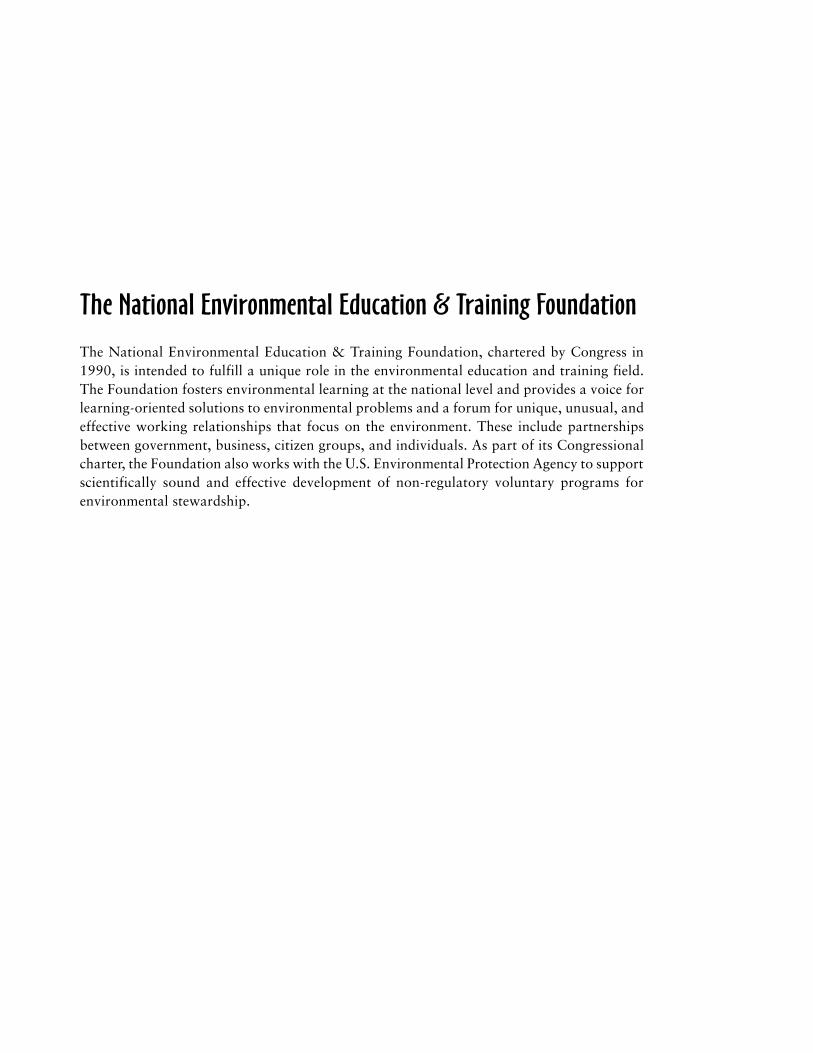
The National Environmental Education & Training Foundation, chartered by Congress in1990, is intended to fulfill a unique role in the environmental education and training field.The Foundation fosters environmental learning at the national level and provides a voice forlearning-oriented solutions to environmental problems and a forum for unique, unusual, andeffective working relationships that focus on the environment. These include partnershipsbetween government, business, citizen groups, and individuals. As part of its Congressionalcharter, the Foundation also works with the U.S. Environmental Protection Agency to supportscientifically sound and effective development of non-regulatory voluntary programs forenvironmental stewardship.


The National Environmental
Education & Training Foundation1707 H Street NW, Suite 900Washington, DC 20006Tel: (202) 833-2933 O Fax: (202) [email protected] O www.neetf.org