Embed Size (px)
Citation preview
VISIT TO THE MACH LOOP Mon 22nd April – Frid 26th April
GETTING THERE BY TRAIN
The nearest train station from the Mach Loop is Machynlleth Station. Below is From the station to the
Loop it is approx 8.3 miles.
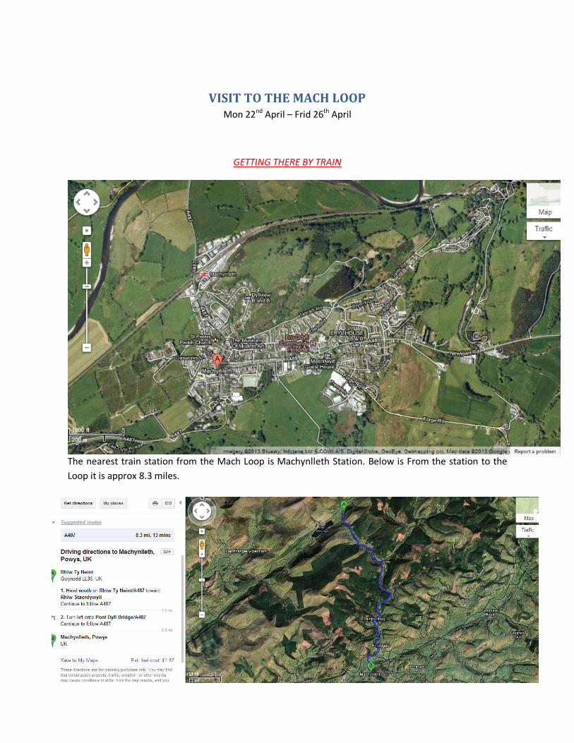
Now accommodation from the station to the bunkhouse is 15 miles away,
From the bunkhouse to the start of the loop (CAD WEST) its only 6.7 miles away so all pretty close in a
radius.
Accommodation
I have found accommodation for us which is shown on the map above. The name of where we will
be staying is called Torrent Walk Campsite. New toilet block with facilities for disabled etc hair
dryers washing machines drying facilities fridge opening in March.
There are electric hook up points, power washers for cleaning bikes and equipment. The town of
Dolgellau is only one and a half miles away and has a full range of shops. There is also a shop and
cafe within a pleasant 5 minute walk
Rates are £7.00 per person £3 for Children under 12 £2 For Dogs and £3.00 for Electric Hook up.
We now also have winter storage please contact us for details. Our Shower facilities are included in
the price.
Cheap place but has got what we need. -
http://www.ukcampsite.co.uk/sites/details.asp?revid=5203
THE MACH LOOP AREAS
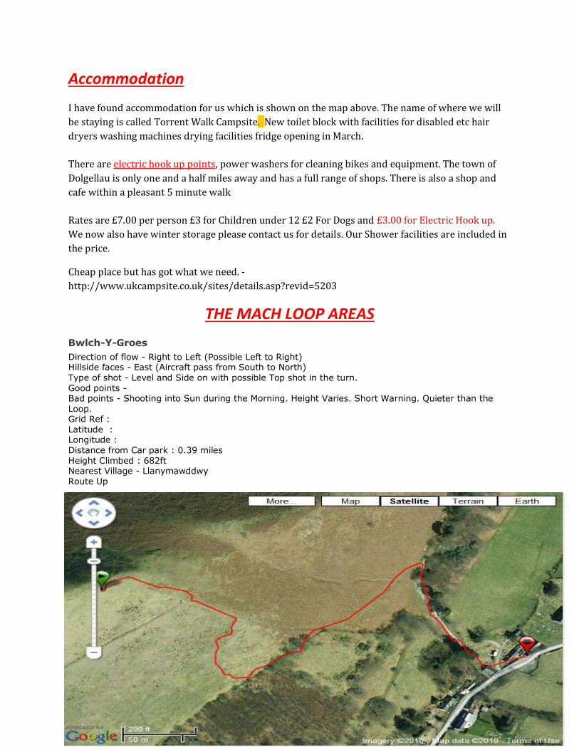
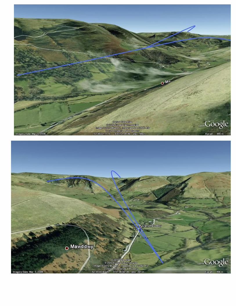
Bwlch-Y-Groes
Direction of flow - Right to Left (Possible Left to Right) Hillside faces - East (Aircraft pass from South to North) Type of shot - Level and Side on with possible Top shot in the turn. Good points - Bad points - Shooting into Sun during the Morning. Height Varies. Short Warning. Quieter than the Loop. Grid Ref : Latitude : Longitude : Distance from Car park : 0.39 miles Height Climbed : 682ft Nearest Village - Llanymawddwy Route Up
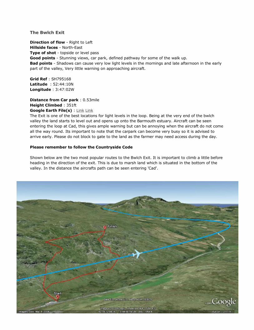
The Bwlch Exit
Direction of flow - Right to Left
Hillside faces - North-East
Type of shot - topside or level pass
Good points - Stunning views, car park, defined pathway for some of the walk up.
Bad points - Shadows can cause very low light levels in the mornings and late afternoon in the early
part of the valley, Very little warning on approaching aircraft.
Grid Ref : SH795168
Latitude : 52:44:10N
Longitude : 3:47:02W
Distance from Car park : 0.53mile
Height Climbed : 351ft
Google Earth File(s) : Link Link
The Exit is one of the best locations for light levels in the loop. Being at the very end of the bwlch
valley the land starts to level out and opens up onto the Barmouth estuary. Aircraft can be seen
entering the loop at Cad, this gives ample warning but can be annoying when the aircraft do not come
all the way round. Its important to note that the carpark can become very busy so it is advised to
arrive early. Please do not block to gate to the land as the farmer may need access during the day.
Please remember to follow the Countryside Code
Shown below are the two most popular routes to the Bwlch Exit. It is important to climb a little before
heading in the direction of the exit. This is due to marsh land which is situated in the bottom of the
valley. In the distance the aircrafts path can be seen entering 'Cad'.
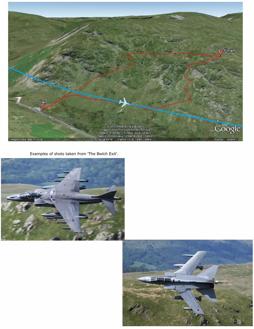
Examples of shots taken from 'The Bwlch Exit'.
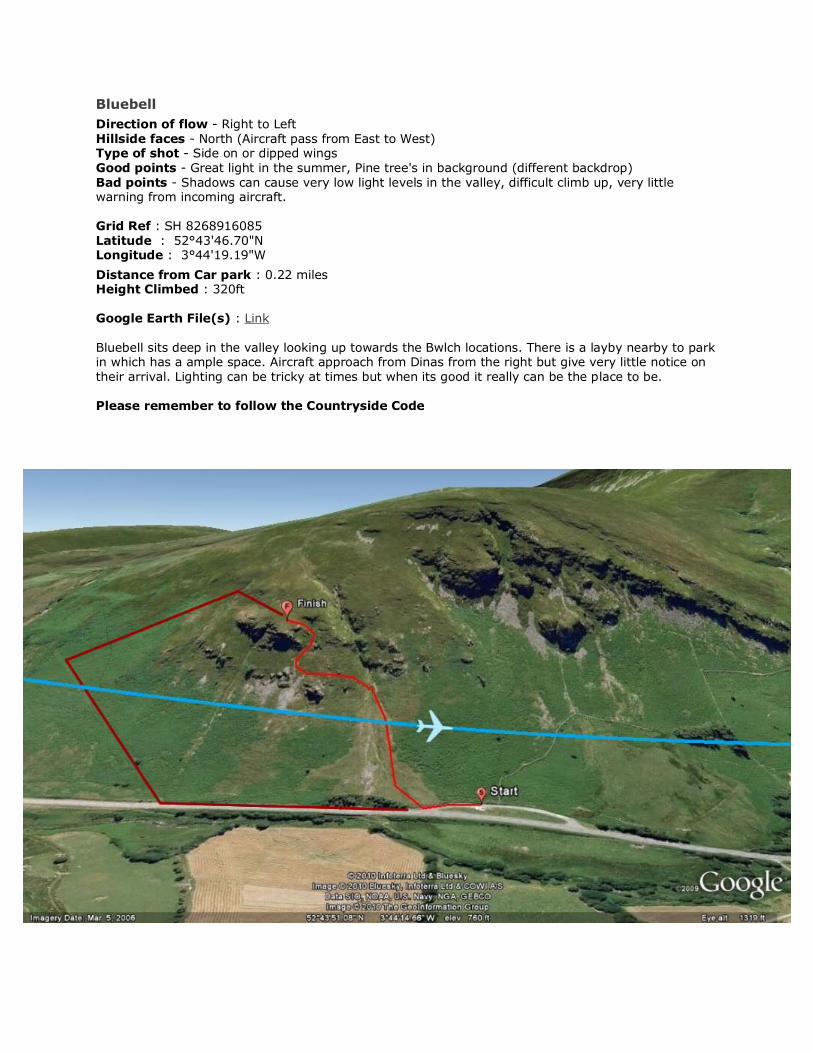
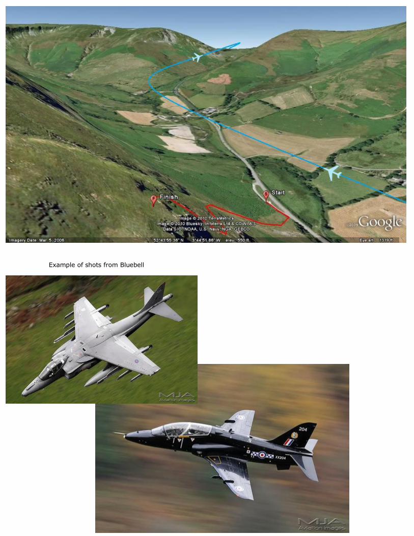
Bluebell
Direction of flow - Right to Left Hillside faces - North (Aircraft pass from East to West) Type of shot - Side on or dipped wings Good points - Great light in the summer, Pine tree's in background (different backdrop) Bad points - Shadows can cause very low light levels in the valley, difficult climb up, very little warning from incoming aircraft. Grid Ref : SH 8268916085 Latitude : 52°43'46.70"N Longitude : 3°44'19.19"W
Distance from Car park : 0.22 miles Height Climbed : 320ft Google Earth File(s) : Link Bluebell sits deep in the valley looking up towards the Bwlch locations. There is a layby nearby to park in which has a ample space. Aircraft approach from Dinas from the right but give very little notice on their arrival. Lighting can be tricky at times but when its good it really can be the place to be. Please remember to follow the Countryside Code
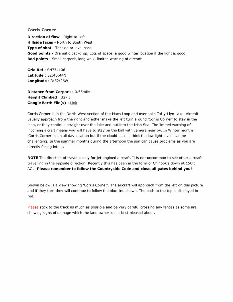
Example of shots from Bluebell
Corris Corner
Direction of flow - Right to Left
Hillside faces - North to South West
Type of shot - Topside or level pass
Good points - Dramatic backdrop, Lots of space, a good winter location if the light is good.
Bad points - Small carpark, long walk, limited warning of aircraft
Grid Ref : SH734106
Latitude : 52:40:44N
Longitude : 3:52:26W
Distance from Carpark : 0.55mile
Height Climbed : 327ft
Google Earth File(s) : Link
Corris Corner is in the North West section of the Mach Loop and overlooks Tal-y-Llyn Lake. Aircraft
usually approach from the right and either make the left turn around 'Corris Corner' to stay in the
loop, or they continue straight over the lake and out into the Irish Sea. The limited warning of
incoming aicraft means you will have to stay on the ball with camera near by. In Winter months
'Corris Corner' is an all day location but if the clould base is thick the low light levels can be
challenging. In the summer months during the afternoon the sun can cause problems as you are
directly facing into it.
NOTE The direction of travel is only for jet engined aircraft. It is not uncommon to see other aircraft
travelling in the oppisite direction. Recently this has been in the form of Chinook's down at 150ft
AGL! Please remember to follow the Countryside Code and close all gates behind you!
Shown below is a view showing 'Corris Corner'. The aircraft will approach from the left on this picture
and if they turn they will continue to follow the blue line shown. The path to the top is displayed in
red.
Please stick to the track as much as possible and be very careful crossing any fences as some are
showing signs of damage which the land owner is not best pleased about.

This is the view looking West from 'Corris Corner'. The aircraft will usually follow the line marked in
blue and head south. The lighter blue line indicated the other route that is sometimes taken that
directs the aircraft out into the Irish Sea.
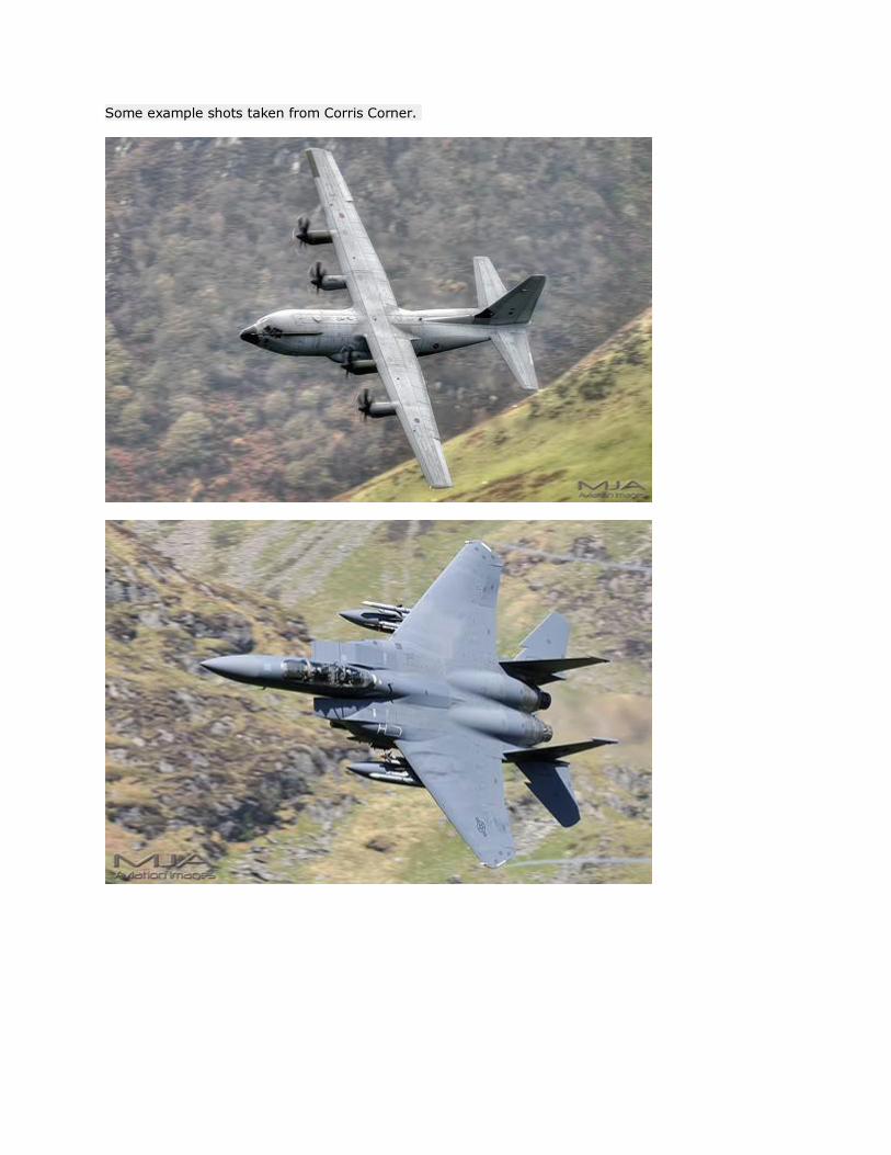
Some example shots taken from Corris Corner.
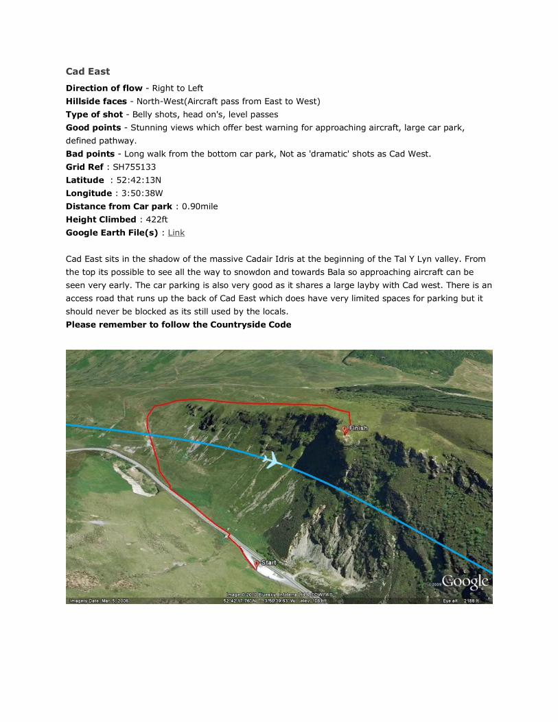
Cad East
Direction of flow - Right to Left
Hillside faces - North-West(Aircraft pass from East to West)
Type of shot - Belly shots, head on's, level passes
Good points - Stunning views which offer best warning for approaching aircraft, large car park,
defined pathway.
Bad points - Long walk from the bottom car park, Not as 'dramatic' shots as Cad West.
Grid Ref : SH755133
Latitude : 52:42:13N
Longitude : 3:50:38W
Distance from Car park : 0.90mile
Height Climbed : 422ft
Google Earth File(s) : Link
Cad East sits in the shadow of the massive Cadair Idris at the beginning of the Tal Y Lyn valley. From
the top its possible to see all the way to snowdon and towards Bala so approaching aircraft can be
seen very early. The car parking is also very good as it shares a large layby with Cad west. There is an
access road that runs up the back of Cad East which does have very limited spaces for parking but it
should never be blocked as its still used by the locals.
Please remember to follow the Countryside Code
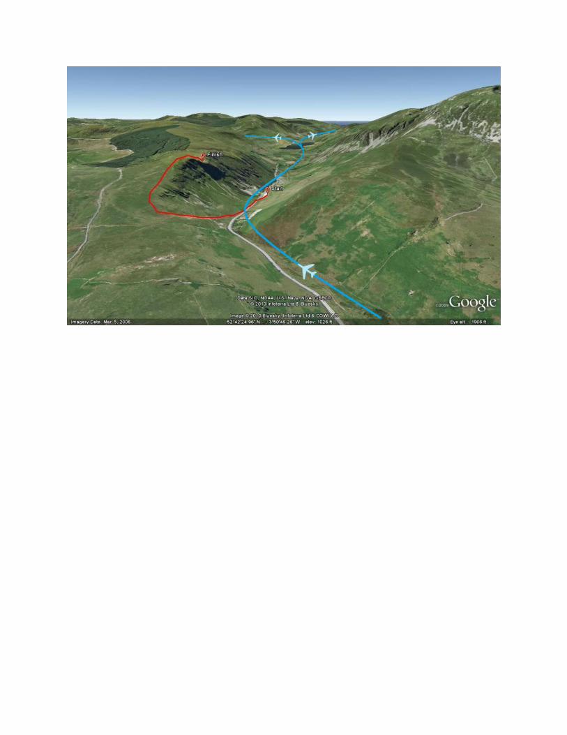
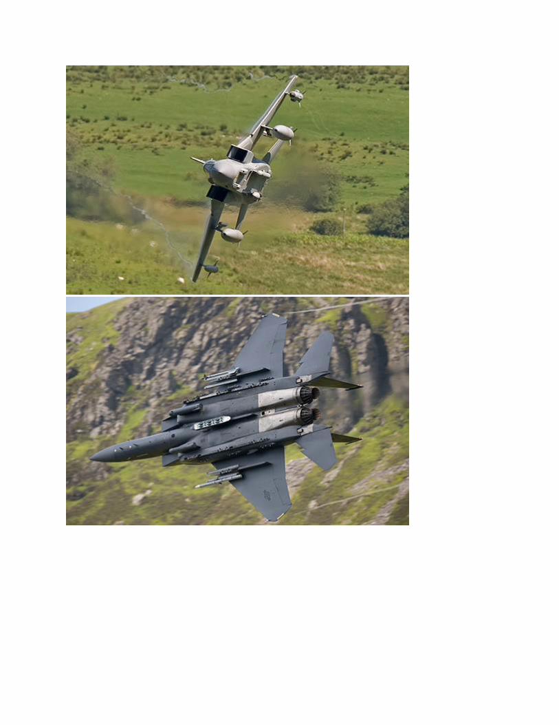
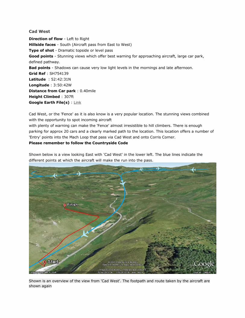
Cad West
Direction of flow - Left to Right
Hillside faces - South (Aircraft pass from East to West)
Type of shot - Dramatic topside or level pass
Good points - Stunning views which offer best warning for approaching aircraft, large car park,
defined pathway.
Bad points - Shadows can cause very low light levels in the mornings and late afternoon.
Grid Ref : SH754139
Latitude : 52:42:31N
Longitude : 3:50:42W
Distance from Car park : 0.40mile
Height Climbed : 307ft
Google Earth File(s) : Link
Cad West, or the 'Fence' as it is also know is a very popular location. The stunning views combined
with the opportunity to spot incoming aircraft
with plenty of warning can make the 'Fence' almost irresistible to hill climbers. There is enough
parking for approx 20 cars and a clearly marked path to the location. This location offers a number of
'Entry' points into the Mach Loop that pass via Cad West and onto Corris Corner.
Please remember to follow the Countryside Code
Shown below is a view looking East with 'Cad West' in the lower left. The blue lines indicate the
different points at which the aircraft will make the run into the pass.
Shown is an overview of the view from 'Cad West'. The footpath and route taken by the aircraft are
shown again
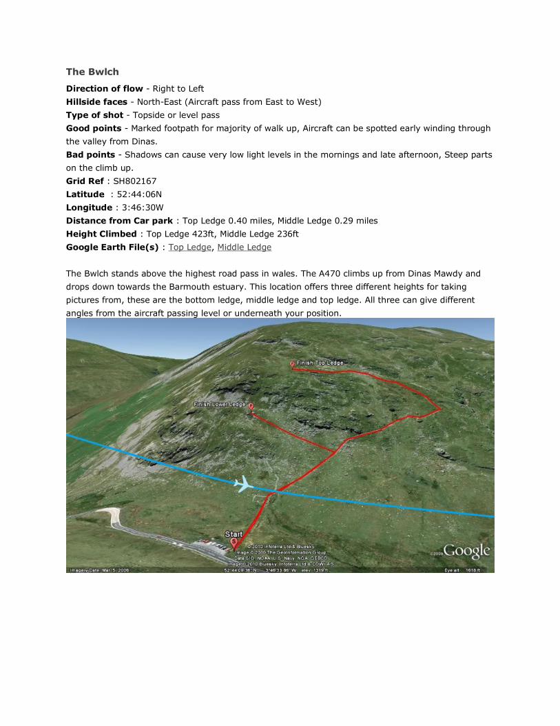
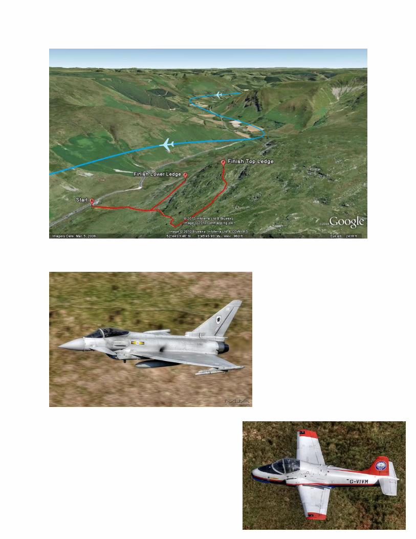
The Bwlch
Direction of flow - Right to Left
Hillside faces - North-East (Aircraft pass from East to West)
Type of shot - Topside or level pass
Good points - Marked footpath for majority of walk up, Aircraft can be spotted early winding through
the valley from Dinas.
Bad points - Shadows can cause very low light levels in the mornings and late afternoon, Steep parts
on the climb up.
Grid Ref : SH802167
Latitude : 52:44:06N
Longitude : 3:46:30W
Distance from Car park : Top Ledge 0.40 miles, Middle Ledge 0.29 miles
Height Climbed : Top Ledge 423ft, Middle Ledge 236ft
Google Earth File(s) : Top Ledge, Middle Ledge
The Bwlch stands above the highest road pass in wales. The A470 climbs up from Dinas Mawdy and
drops down towards the Barmouth estuary. This location offers three different heights for taking
pictures from, these are the bottom ledge, middle ledge and top ledge. All three can give different
angles from the aircraft passing level or underneath your position.
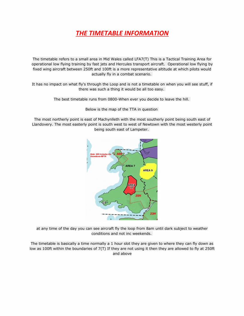
THE TIMETABLE INFORMATION
The timetable refers to a small area in Mid Wales called LFA7(T) This is a Tactical Training Area for
operational low flying training by fast jets and Hercules transport aircraft. Operational low flying by
fixed wing aircraft between 250ft and 100ft is a more representative altitude at which pilots would
actually fly in a combat scenario.
It has no impact on what fly's through the Loop and is not a timetable on when you will see stuff, if
there was such a thing it would be all too easy.
The best timetable runs from 0800-When ever you decide to leave the hill.
Below is the map of the TTA in question
The most northerly point is east of Machynlleth with the most southerly point being south east of
Llandovery. The most easterly point is south west to west of Newtown with the most westerly point
being south east of Lampeter.
at any time of the day you can see aircraft fly the loop from 8am until dark subject to weather
conditions and not inc weekends.
The timetable is basically a time normally a 1 hour slot they are given to where they can fly down as
low as 100ft within the boundaries of 7(T) If they are not using it then they are allowed to fly at 250ft
and above


![Mach number P w,test [bar] P model [bar] 1.8 -0.45 -0.20 0 ...ae342/18/lab2/lab2data.pdf · Mach 2.0 Snapshot . Mach 1.8 Snapshot . Mach 2.3 Snapshot Mach 2.2 Snapshot . P w,test](https://img.pdfslide.us/doc/110x75/5fb4e5220b26be1bae0aea08/mach-number-p-wtest-bar-p-model-bar-18-045-020-0-ae34218lab2-.jpg)